454 lecture 13 TECTONIC LANDFORMS Tectonic scarp: steep, abrupt slope or cliff along margin of topographic bench such as plateau or terrace, results from differential movement of Earth’s surface Fault scarp: fault displaces ground surface so that one side is higher or lower; usually at the angle of repose (25°-40°) Lineament: linear feature in the landscape that is produced by a fault scarp Triangular facets: planar surfaces with bases aligned or parallel to the fault trace Sag ponds: closed basins at the foot of recent fault scarps

Welcome message from author
This document is posted to help you gain knowledge. Please leave a comment to let me know what you think about it! Share it to your friends and learn new things together.
Transcript

454 lecture 13
TECTONIC LANDFORMS
Tectonic scarp: steep, abrupt slope or cliff along margin of
topographic bench such as plateau or terrace, results from
differential movement of Earth’s surface
Fault scarp: fault displaces ground surface so that one side is
higher or lower; usually at the angle of repose (25°-40°)
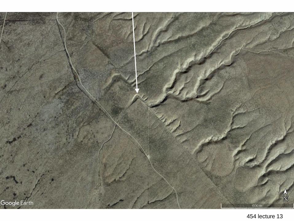
Lineament: linear feature in the landscape that is produced by
a fault scarp
Triangular facets: planar surfaces with bases aligned or parallel
to the fault trace
Sag ponds: closed basins at the foot of recent fault scarps
454 lecture 13lineament, San Andreas Fault, CA
454 lecture 13triangular facets near Spanish Fork, Utah
454 lecture 13
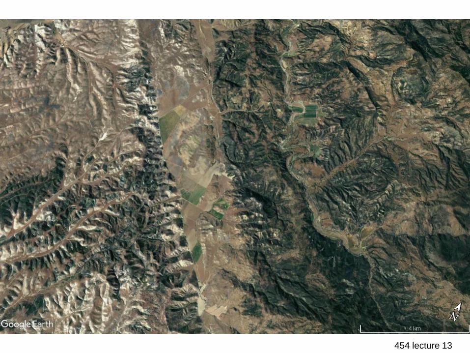
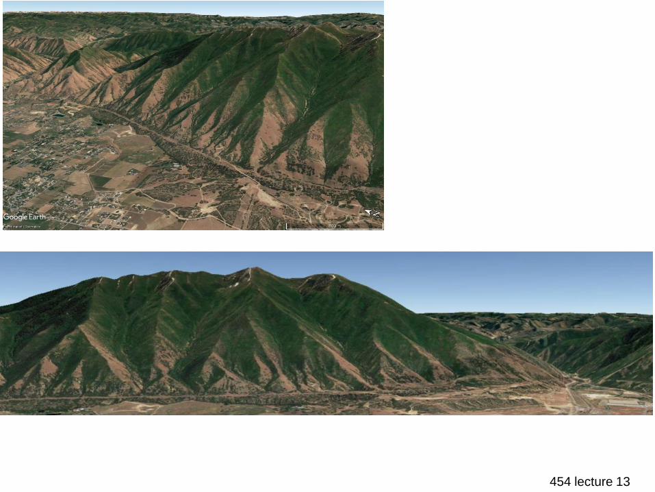
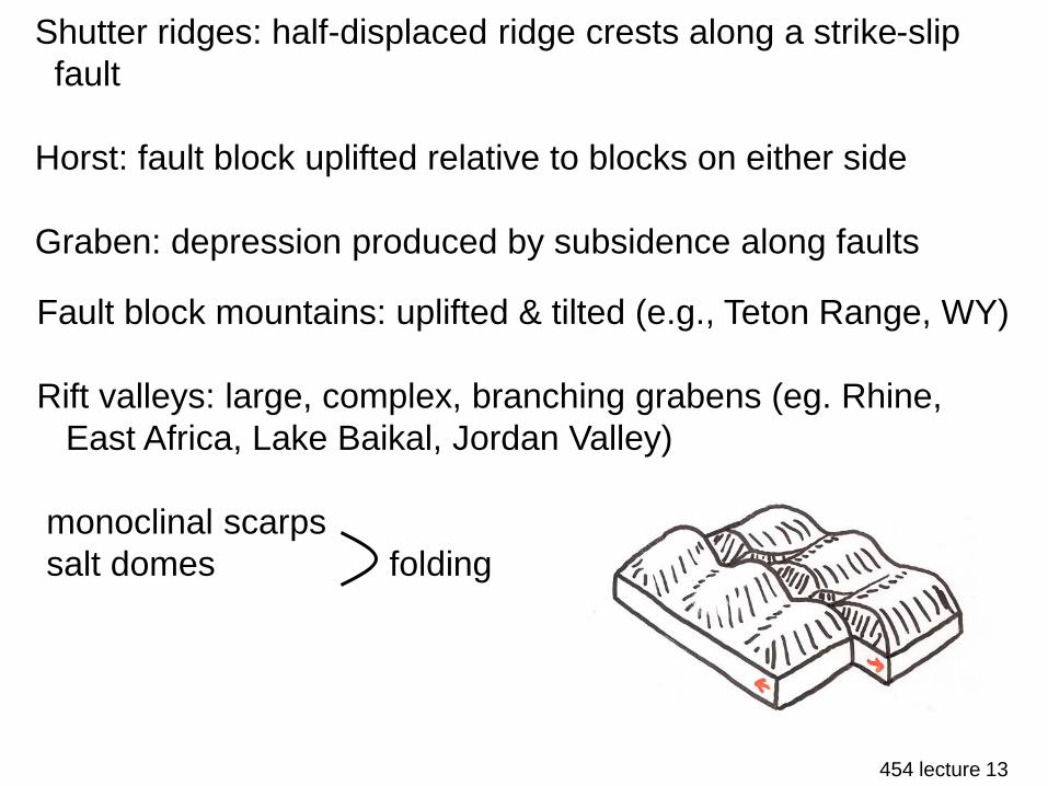
Shutter ridges: half-displaced ridge crests along a strike-slip
fault
Horst: fault block uplifted relative to blocks on either side
Graben: depression produced by subsidence along faults
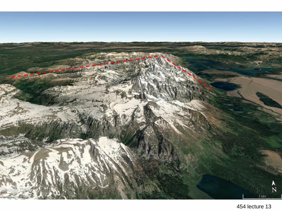
Fault block mountains: uplifted & tilted (e.g., Teton Range, WY)
Rift valleys: large, complex, branching grabens (eg. Rhine,
East Africa, Lake Baikal, Jordan Valley)
monoclinal scarps
salt domes folding
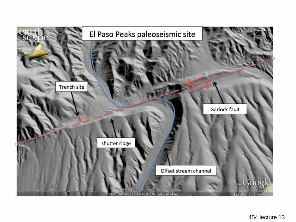
454 lecture 13shutter ridges & offset channel
454 lecture 13
Wallace Creek, Carrizo Plain, CA

454 lecture 13Teton Range, WY
454 lecture 13Teton Range, WY
454 lecture 13
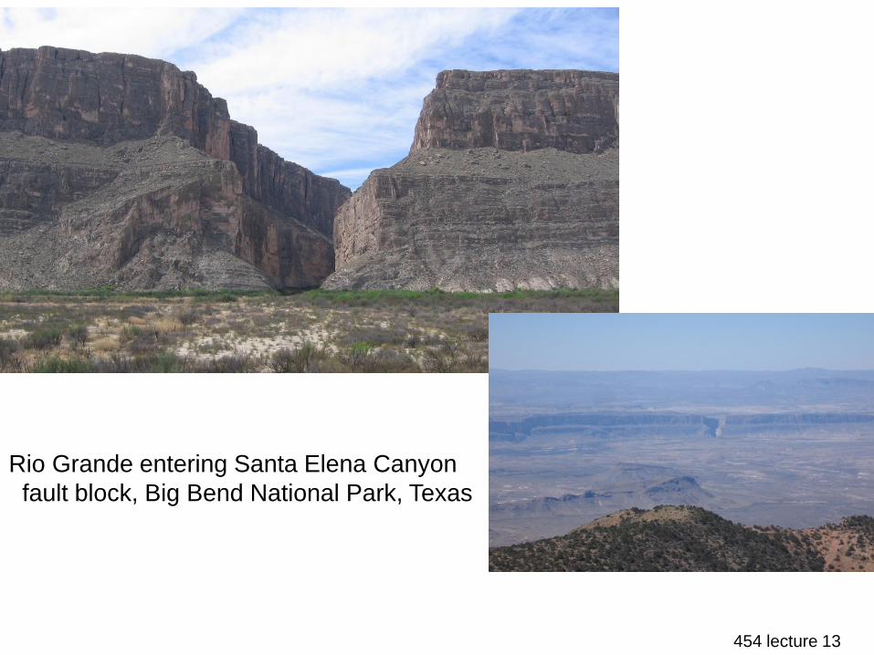
Rio Grande entering Santa Elena Canyon
fault block, Big Bend National Park, Texas
454 lecture 13
ARID, SEMIARID, & SAVANNA LANDSCAPES
Dry region: where seasonal/annual precipitation is insufficient to
maintain vegetative cover & perennial streams; single largest
identifiable morphogenetic region on Earth (& growing)
There are various definitions for this category, but essentially
¼ to 1/3 of Earth is dry
Two belts of aridity in the low latitudes coincide with the
subtropical anticyclonic belts of high atmospheric pressure at
15°-30° N & S of the equator – these are fringed by semiarid
zones
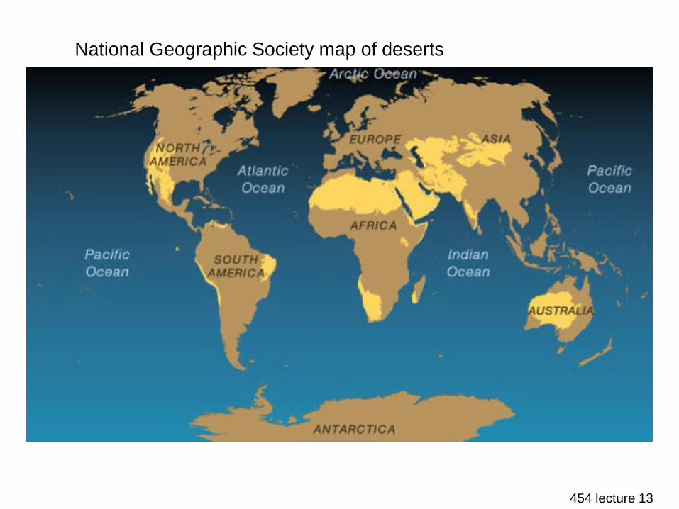
454 lecture 13
National Geographic Society map of deserts
454 lecture 13
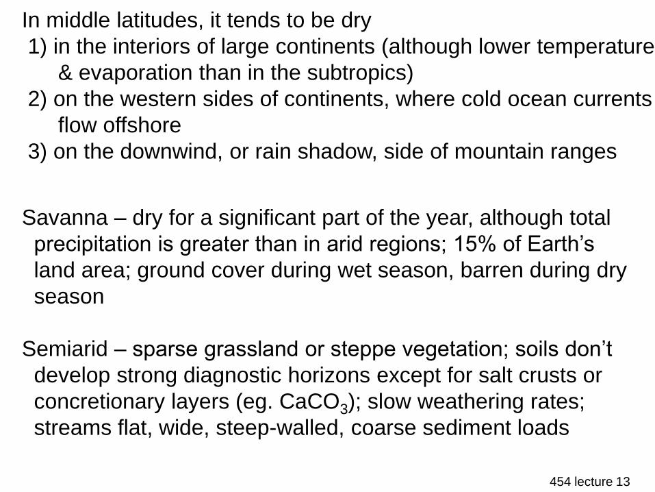
In middle latitudes, it tends to be dry
1) in the interiors of large continents (although lower temperature
& evaporation than in the subtropics)
2) on the western sides of continents, where cold ocean currents
flow offshore
3) on the downwind, or rain shadow, side of mountain ranges
Savanna – dry for a significant part of the year, although total
precipitation is greater than in arid regions; 15% of Earth’s
land area; ground cover during wet season, barren during dry
season
Semiarid – sparse grassland or steppe vegetation; soils don’t
develop strong diagnostic horizons except for salt crusts or
concretionary layers (eg. CaCO3); slow weathering rates;
streams flat, wide, steep-walled, coarse sediment loads
454 lecture 13
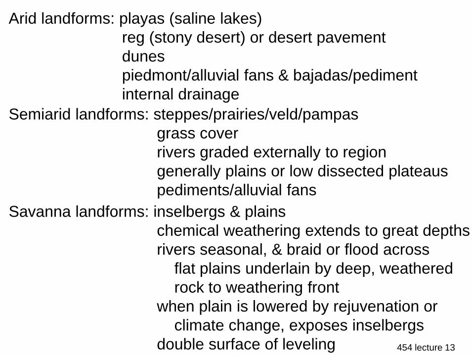
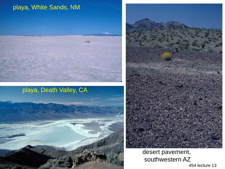
Arid landforms: playas (saline lakes)
reg (stony desert) or desert pavement
dunes
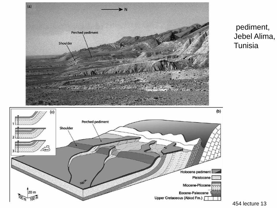
piedmont/alluvial fans & bajadas/pediment
internal drainage
Semiarid landforms: steppes/prairies/veld/pampas
grass cover
rivers graded externally to region
generally plains or low dissected plateaus
pediments/alluvial fans
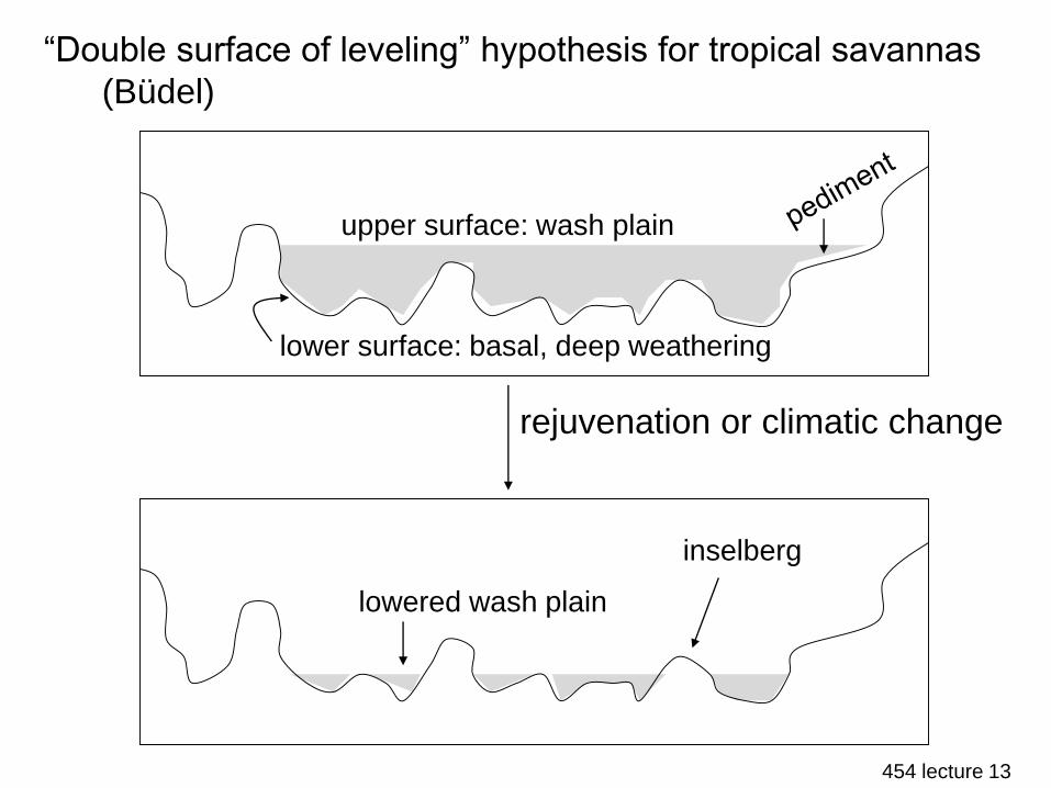
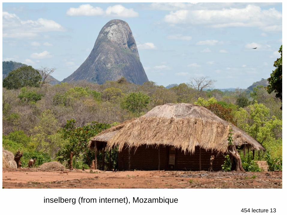
Savanna landforms: inselbergs & plains
chemical weathering extends to great depths
rivers seasonal, & braid or flood across
flat plains underlain by deep, weathered
rock to weathering front
when plain is lowered by rejuvenation or
climate change, exposes inselbergs
double surface of leveling

454 lecture 13
desert varnish, Grand Canyon,
AZ
desert varnish,
central AZ
454 lecture 13
desert pavement,
southwestern AZ
playa, White Sands, NM
playa, Death Valley, CA

454 lecture 13
pediment, Mojave Desert, CA
454 lecture 13
pediment,
Jebel Alima,
Tunisia
454 lecture 13
“Double surface of leveling” hypothesis for tropical savannas
(Büdel)
rejuvenation or climatic change
upper surface: wash plain
lower surface: basal, deep weathering
lowered wash plain
inselberg
454 lecture 13
inselberg (from internet), Mozambique
Related Documents


![Landforms Mady By Wind [Desert Landforms]](https://static.cupdf.com/doc/110x72/56813971550346895da1066c/landforms-mady-by-wind-desert-landforms.jpg)