Top Banner
Teaching with GIS Aaron Addison, Director of Data and GIS Services Jennifer Moore, GIS/Anthropology Librarian gis.wustl.edu | [email protected]
16

Teaching with GIS · Teaching with GIS . Aaron Addison, Director of Data and GIS Services . Jennifer Moore, ... OpenStreetMaps on campus and beyond Scripting and GIS . Thank you!

May 08, 2018

Download

Documents

doanliem
Welcome message from author
This document is posted to help you gain knowledge. Please leave a comment to let me know what you think about it! Share it to your friends and learn new things together.
Transcript
Page 1: Teaching with GIS · Teaching with GIS . Aaron Addison, Director of Data and GIS Services . Jennifer Moore, ... OpenStreetMaps on campus and beyond Scripting and GIS . Thank you!

Teaching with GIS

Aaron Addison, Director of Data and GIS Services

Jennifer Moore, GIS/Anthropology Librarian

gis.wustl.edu | [email protected]

Page 2: Teaching with GIS · Teaching with GIS . Aaron Addison, Director of Data and GIS Services . Jennifer Moore, ... OpenStreetMaps on campus and beyond Scripting and GIS . Thank you!

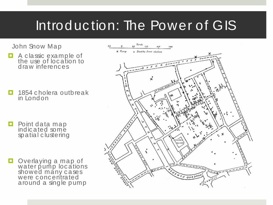
Introduction: The Power of GIS John Snow Map A classic example of

the use of location to draw inferences

1854 cholera outbreak in London

Point data map indicated some spatial clustering

Overlaying a map of water pump locations showed many cases were concentrated around a single pump

Page 3: Teaching with GIS · Teaching with GIS . Aaron Addison, Director of Data and GIS Services . Jennifer Moore, ... OpenStreetMaps on campus and beyond Scripting and GIS . Thank you!

Teaching Spatial Thinking w/ Technology

“Combinatory play seems to be the essential feature in productive thought." — Albert Einstein

Page 4: Teaching with GIS · Teaching with GIS . Aaron Addison, Director of Data and GIS Services . Jennifer Moore, ... OpenStreetMaps on campus and beyond Scripting and GIS . Thank you!

GIS technology in the Curriculum: a case study in International Area Studies

Long-term goal

Building toward a program specific course to Prepare students before they go abroad to collect and analyze data Support students in developing meaningful projects

Steps toward goal

1. Help faculty gain basic understanding of GIS to support students and enrich research

2. Offer classroom experiences that are relevant to the topic being explored

3. Offer students opportunities to begin building skills that complement their trajectory

Page 5: Teaching with GIS · Teaching with GIS . Aaron Addison, Director of Data and GIS Services . Jennifer Moore, ... OpenStreetMaps on campus and beyond Scripting and GIS . Thank you!

Preparing IAS Faculty

Step 1. Prepare faculty with basic understanding of GIS practices to support students and enrich research:

Faculty brown bags – conceptual discussions Power of GIS Applications Examples Their work

Faculty workshops 3 days – 3.5 hour – hands-on

workshop Data analysis and visualization Combining geospatial data

with digitized maps

Page 6: Teaching with GIS · Teaching with GIS . Aaron Addison, Director of Data and GIS Services . Jennifer Moore, ... OpenStreetMaps on campus and beyond Scripting and GIS . Thank you!

Applied to the IAS classroom

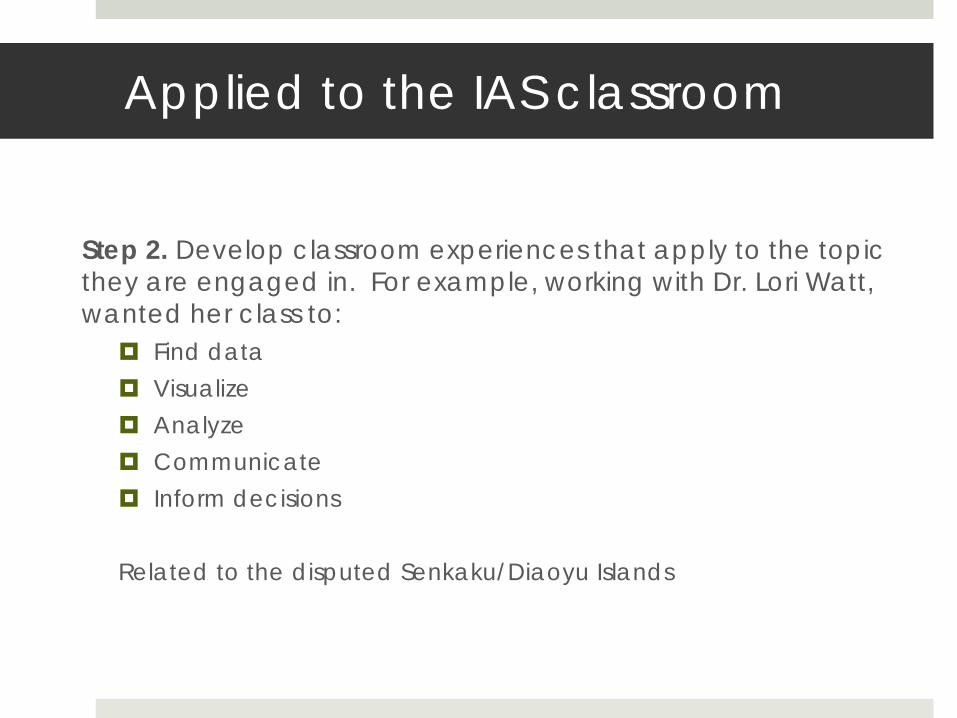
Step 2. Develop classroom experiences that apply to the topic they are engaged in. For example, working with Dr. Lori Watt, wanted her class to:

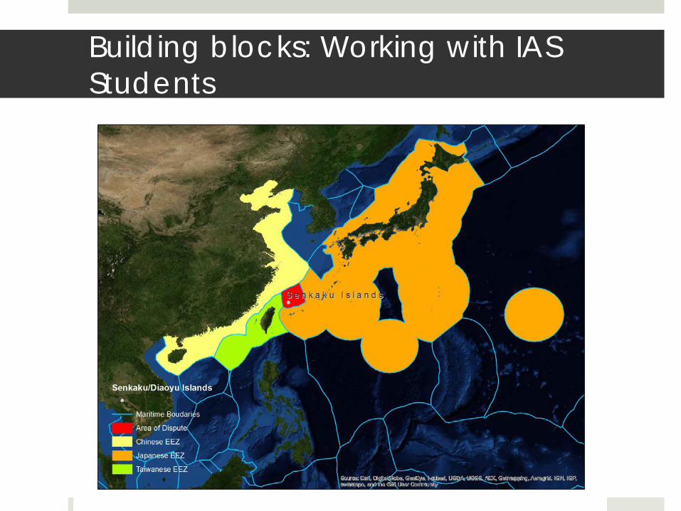
Find data Visualize Analyze Communicate Inform decisions Related to the disputed Senkaku/Diaoyu Islands

Page 7: Teaching with GIS · Teaching with GIS . Aaron Addison, Director of Data and GIS Services . Jennifer Moore, ... OpenStreetMaps on campus and beyond Scripting and GIS . Thank you!

The Senkaku / Diaoyu Islands – tiny little islands under dispute

Page 8: Teaching with GIS · Teaching with GIS . Aaron Addison, Director of Data and GIS Services . Jennifer Moore, ... OpenStreetMaps on campus and beyond Scripting and GIS . Thank you!

Building blocks: Working with IAS Students

Page 9: Teaching with GIS · Teaching with GIS . Aaron Addison, Director of Data and GIS Services . Jennifer Moore, ... OpenStreetMaps on campus and beyond Scripting and GIS . Thank you!

WUSTL Schools incorporating GIS

From Dr. Watt –

Maps make arguments. Using GIS opens a whole world of knowledge to students and the process of making maps helped them think about place. After the class exercise half of the students developed mapping projects of their own…

Page 10: Teaching with GIS · Teaching with GIS . Aaron Addison, Director of Data and GIS Services . Jennifer Moore, ... OpenStreetMaps on campus and beyond Scripting and GIS . Thank you!

Skill-building Opportunities

Step 3: Offer students opportunities to begin building skills that complement their trajectory

Brown bag – conceptual introduction

Workshop series – 3 days – 2 hours – hands-on

St. Louis OSM editathon

IAS Ethnic restaurant editathon Data collection Sharing Editing

Page 11: Teaching with GIS · Teaching with GIS . Aaron Addison, Director of Data and GIS Services . Jennifer Moore, ... OpenStreetMaps on campus and beyond Scripting and GIS . Thank you!

Example: Brown School

Page 12: Teaching with GIS · Teaching with GIS . Aaron Addison, Director of Data and GIS Services . Jennifer Moore, ... OpenStreetMaps on campus and beyond Scripting and GIS . Thank you!

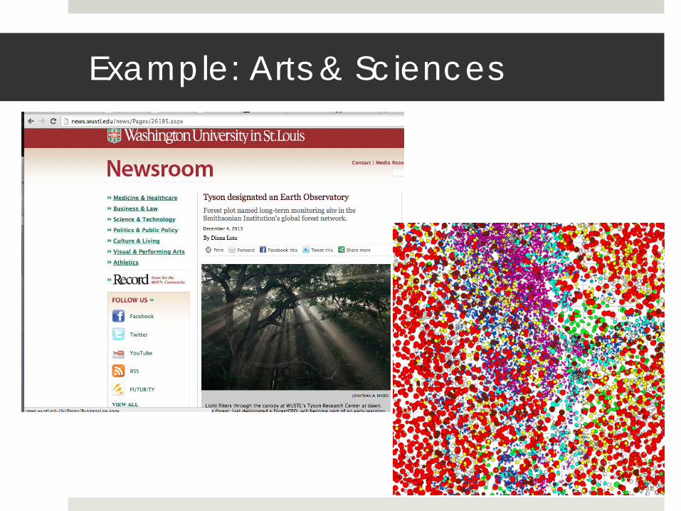
Example: Arts & Sciences
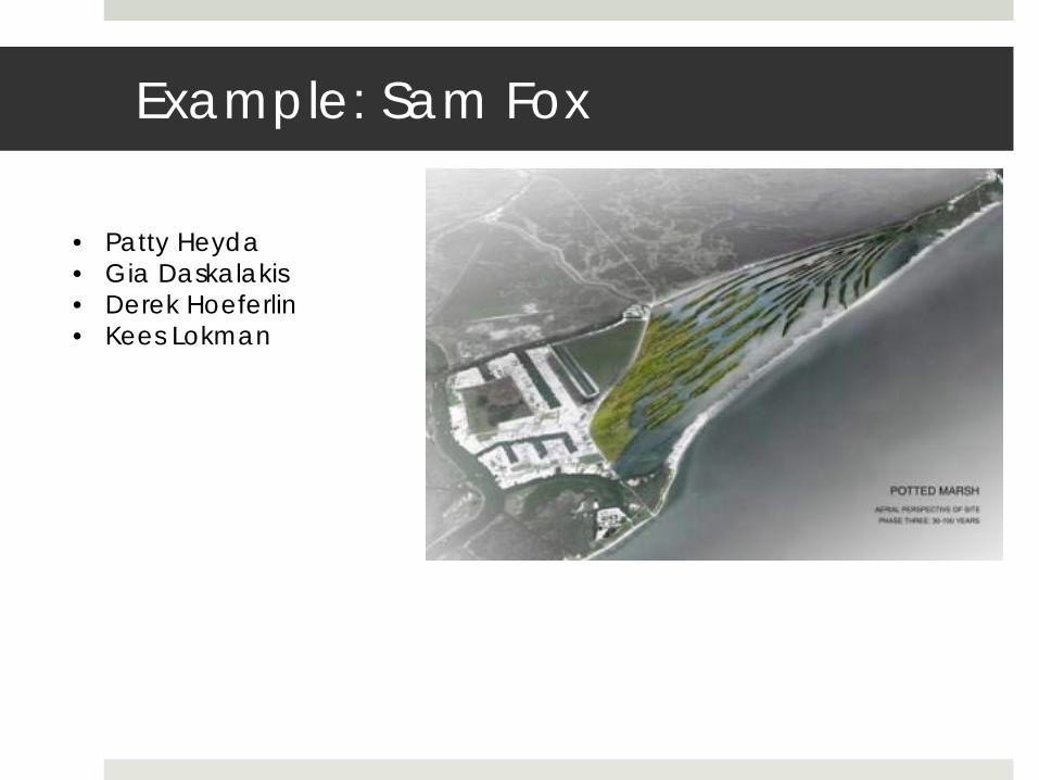
Page 13: Teaching with GIS · Teaching with GIS . Aaron Addison, Director of Data and GIS Services . Jennifer Moore, ... OpenStreetMaps on campus and beyond Scripting and GIS . Thank you!

Example: Sam Fox

• Patty Heyda • Gia Daskalakis • Derek Hoeferlin • Kees Lokman

Page 14: Teaching with GIS · Teaching with GIS . Aaron Addison, Director of Data and GIS Services . Jennifer Moore, ... OpenStreetMaps on campus and beyond Scripting and GIS . Thank you!

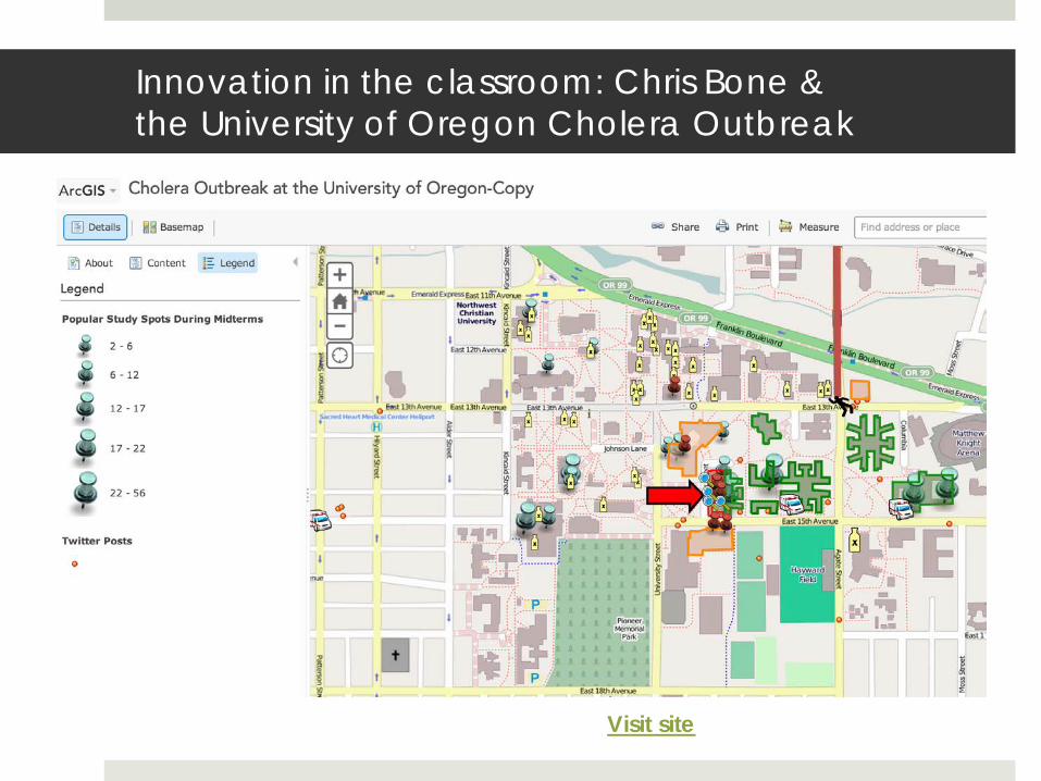
Innovation in the classroom: Chris Bone & the University of Oregon Cholera Outbreak

Visit site

Page 15: Teaching with GIS · Teaching with GIS . Aaron Addison, Director of Data and GIS Services . Jennifer Moore, ... OpenStreetMaps on campus and beyond Scripting and GIS . Thank you!

GIS at WUSTL in 2014

ArcGIS Online being tested at WUSTL

OpenStreetMaps on campus and beyond

Scripting and GIS

Page 16: Teaching with GIS · Teaching with GIS . Aaron Addison, Director of Data and GIS Services . Jennifer Moore, ... OpenStreetMaps on campus and beyond Scripting and GIS . Thank you!

Thank you! Thank you! Thank you!

Aaron Addison [email protected]

Jennifer Moore [email protected]