Tampa Bypass Canal Trail Concept and Master Plan Feasibility Study January 30, 2013 601 E. Kennedy Boulevard, 18th floor Tampa, FL 33601 813/272-5940 www.hillsboroughmpo.org

Welcome message from author
This document is posted to help you gain knowledge. Please leave a comment to let me know what you think about it! Share it to your friends and learn new things together.
Transcript
Tampa Bypass Canal Trail
Concept and Master Plan Feasibility Study
January 30, 2013
601 E. Kennedy Boulevard, 18th floorTampa, FL 33601813/272-5940
www.hillsboroughmpo.org

Tampa Bypass Canal Multi-Use Trail Concept Master Plan and Feasibility Study 2
DRAFT
The MPO would like to acknowledge the input of the stakeholders on this project:
Hillsborough Bicycle and Pedestrian Action CommitteeHillsborough County Parks, Recreation and Conservation DepartmentSouthwest Florida Water Management DistrictTampa Aviation AuthorityTampa-Hillsborough County Expressway AuthorityCity of TampaCity of Temple TerraceCSXTampa Electric Company

3Tampa Bypass Canal Multi-Use Trail Concept Master Plan and Feasibility Study
DRAFT
EXECUTIVE SUMMARY
The Tampa Bypass Canal, a flood control waterway east of Tampa and Temple Terrace, could become a major recreation corridor that will allow families, friends and visitors to enjoy scenic vistas, active recreation and possibly encounter wildlife close to the city.
The MPO has hired a Consultant to assess the feasibility of developing the Tampa Bypass Canal multi-use trail. The trail is part of a planned county-wide network of trails and greenway identified in the 2035 Long Range Transportation Plan and also is included in the Hillsborough County Greenways Master Plan.
VISIONThe proposed concept consists of a multi-use trail running along the west side of the Tampa Bypass Canal. The vision is to connect the Flatwoods Park in New Tampa through Wilderness and Trout Creek Parks and run south to the McKay Bay Trail, the Selmon Greenway and the South County Trail. This 13-mile multi-use trail will provide tremendous recreational and social opportunities for residents and visitors, connecting the communities of New Tampa, Temple Terrace, East Lake/
Orient Park and Palm River along the trail to each other as well as to the resources in north and south Tampa and Hillsborough County. Opportunities abound along this trail enjoy open space and view wildlife. From its beautiful, relaxing vistas to its uninterrupted, people–powered recreation and commuting opportunities, the Bypass Canal Trail has the potential to become a major resource for residents and visitors to Hillsborough County.
The greatest challenge to this concept is the major roadways that must be crossed along the proposed trail. These roadways include Interstate-75, US 301, Interstate-4, Fletcher and Fowler Avenues, Harney Road and Adamo Drive. In addition to providing a conceptual alignment for this multi-use trail, a primary component of this study is to recommend the best trail crossing options at each of these roadways.

Tampa Bypass Canal Multi-Use Trail Concept Master Plan and Feasibility Study 4
DRAFT
Management District. Southwest Florida Water Management District (SWFWMD). The canal’s purpose is to redirect flood waters arising from heavy rainfall from the Hillsborough River and into Mckay Bay and eventually Tampa Bay preventing homes and businesses in Temple Terrace and Tampa from flooding.
While the Hillsborough River is the focus of the flood control, the Bypass Canal was created by incorporating the Six Mile Creek and Palm River. Thom Foley, in his article “The Taming of the Hillsborough River, How Tampa Gained a Moat, destroyed a Creek and Forgot a River” reminds us of the importance of the river system to the settlement of early Hillsborough County.
Within a half dozen years after the 1824 establishment of Fort Brooke on the eastern bank of the mouth of the Hillsborough River, settlers had found their way to Six Mile Creek. The accurately named stream flows six miles northeast of the nascent military fort, on the direct path that would take one to what is now Plant City and points inland. The creek drained from a forest of oak, pine, and palm, past the properties of the Collar and Dixon families, who in 1828 had transferred their homesteads from the Hillsborough River’s
INTRODUCTIONFacilities exclusively designed for bicycling and walking are an important component of a multi-modal transportation system. These facilities promote and enhance bicycling and walking as viable transportation and recreation options, bringing to our community health, environmental, energy, economic, quality of life and social justice benefits. The favorable year-round weather conditions we experience in the Tampa Bay area help to promote the use of these facilities for walking, bicycling and even skating. These are means of transportation that can be used for short trips and promote healthy citizens.
COUNTYWIDE COMPREHENSIVE BICYCLE PLANHillsborough County supports a vision for a safe and accessible bicycle and pedestrian network. In 1995 Hillsborough County Board of County Commissioners approved the Hillsborough Trails Master Plan, providing a vision for an extensive network of urban and rural greenway corridors connecting residential neighborhoods and activity centers. The MPO board adopted the current Bicycle Plan in 2008. In 2009 the Hillsborough County MPO board also adopted the Long Range Transportation Plan 2035 including a greenways and trails component. The Tampa Bypass Canal trail is included as a planned greenway in these documents. The purpose of this study is to provide a planning and feasibility study for implementing the Trails Master Plan.
OVERVIEWThe Tampa Bypass Canal, a flood control waterway east of Tampa and Temple Terrace, starting at Trout Creek and ending at the mouth of McKay Bay. The 12 mile canal was constructed in the 1970’s and operated by the South Florida Water
5Tampa Bypass Canal Multi-Use Trail Concept Master Plan and Feasibility Study
DRAFT
Transportation Plan 2035, and also is included in the Hillsborough Greenways Master Plan, adopted in 1995 by the Board of County Commissioners. Based on this storied history and recent interest in developing a long-distance uninterrupted trail in eastern Hillsborough County, the Hillsborough MPO hired a consultant to develop a concept master plan and assess the feasibility of developing the Tampa Bypass Canal Multi-Use Trail.
The proposed concept is for an asphalt multi-use trail running along the west berm of the Tampa Bypass Canal. This trail, which connects to Trout Creek and Wilderness Parks in the north and the McKay Bay trail in the south, will provide important metropolitan transportation functions as well as enable tremendous recreational and social opportunities for residents and visitors, connecting communities along its route as well as to the abundance of natural resources in north and central Hillsborough County. Opportunities abound along this trail route for people to exercise and to enjoy open space and view wildlife. From its beautiful, relaxing vistas to its uninterrupted, people–powered recreation and commuting opportunities, the Tampa Bypass Canal Trail has the potential to become a major resource for residents and visitors to Hillsborough County.
The Southwest Florida Water Management District owns and maintains the Tampa Bypass Canal. Right of way has been reserved for maintenance purposes, including shell paved maintenance roads.
In addition to this shared-use path providing an uninterrupted route for bicycle and pedestrian travel, this trail, when complete, will become one of the largest parks and “outdoor classrooms” in the County
western bank to the relative seclusion of Six Mile Creek. The stream meandered gently south into what would one day be called Palm River, then flowed west into the waters of today’s McKay Bay. Seven years later, in December 1835, as tensions between settlers and Seminoles escalated rapidly toward war, the early settlers along Six Mile Creek barely escaped an avenging war party of Seminoles—by poling their boats down the creek. The hapless Dixon and Collar families survived to watch from a distance as the Indians set fire to their homes. (Tampa Bay History, Volume 21, December 2007).
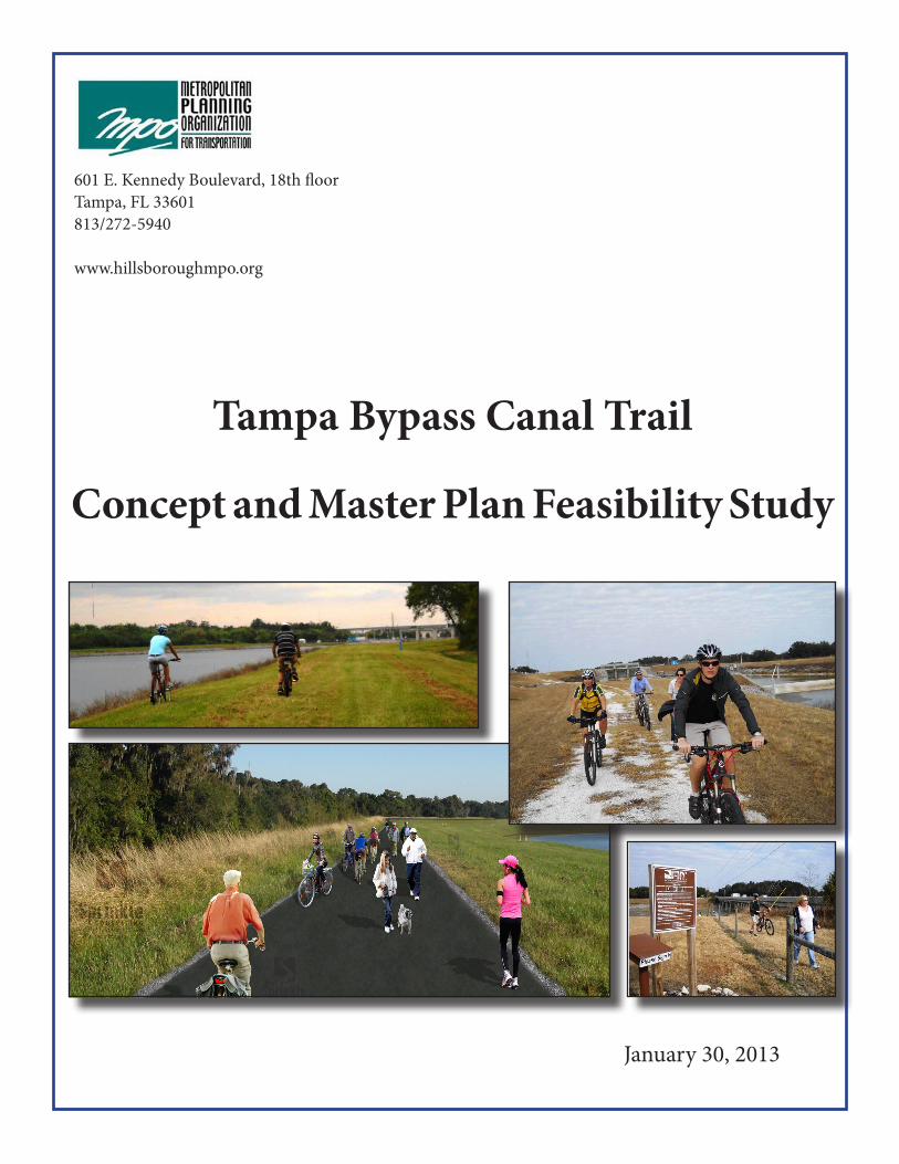
The Historic Fort King Trail- an old military road connecting Fort Brooke (downtown Tampa) to Ocala as well as the Ft. Brooke to Ft. Sullivan (Plant City) and Ft. Kissimmee Roads probably took the soldiers marching this 100 mile journey along the banks of the 6 Mile creek.
A TRAIL ALONG THE BYPASS CANAL Interest in developing this trail began over 20 years ago and was first was formalized in 2000 with a trails analysis and Concept Summary developed by Hillsborough Trails, Inc. The trail concept is now part of a planned county wide network of trails and greenways identified in the Long Range

Tampa Bypass Canal Multi-Use Trail Concept Master Plan and Feasibility Study 6
DRAFT
Hillsborough Parks, Recreation and Conservation and a variety of other agency stakeholders, identified four principles that guided the development of this Master Plan and Feasibility Study. These principles formed the genesis of the project’s concept, and along with stakeholder and public are a combination of current County shared-use path design protocol and long-term vision for this County resource.
The project principles are as follows:
• Safe and Comfortable Crossings of Roadways The primary focus of this study is the trail crossings of the roadways and bridges that intersect the Bypass Canal Trail. There are three potential ways to cross at each intersection: overpass, underpass and/or roadway. Each roadway was analyzed to identify which crossing method was optimal.
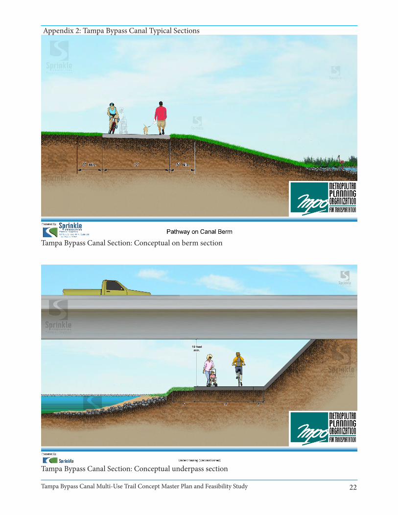
• Available for All Non-Motorized Transportation UsersLike many of the trails in the County, this one is intended for non-motorized transportation and pedestrian use and as such, should ultimately be developed as a 12 foot wide asphalt trail, allowing enjoyment by the widest range of users.
• West Side Alignment Preferred The west side of the canal was identified by the County as the preferred location for the trail for a number of reasons including better access and availability of uninterrupted land.
• Regional Amenity, Local Access This trail is identified as an important part of the Hillsborough
connecting several already developed parks along the Canal. The area’s natural beauty, recreational opportunities and accessibility will allow it to become not only a well-used active transportation facility but a linear park. This “outdoor classroom” is bookended by two Great Florida Birding Trail West locations: the McKay Bay Nature Park to the south and the Lower Hillsborough Wilderness Park at Trout Creek Park. Connecting these locations also increases the opportunities for wildlife viewing and the enjoyment of Hillsborough County’s natural resources. Opportunities abound for educational signage and increasing the community connection to the natural surroundings.
The greatest challenge of this concept plan is the major roadways that must be crossed by the trail. These roadways include Fletcher Ave, Fowler Avenue, US 301, Harney Road, Interstate-75, Interstate-4, E. Broadway Avenue and E. Adamo Drive. In addition to providing a conceptual alignment for this multi-use trail, a primary goal of this feasibility study is to recommend the optimal trail crossing options at each of these, and many other roadways.
PROJECT GUIDING PRINCIPLESThe project team, including MPO staff,

7Tampa Bypass Canal Multi-Use Trail Concept Master Plan and Feasibility Study
DRAFT
This study examines the planning and feasibility of providing pedestrian and bicycling access from neighborhoods and parks. Other issues to address include identifying intersection treatments at several major intersections, identifying trailheads locations, developing a conceptual plan consistent with SWFWMD’s permitted uses and Hillsborough County’s implementation process.
Figure 1 is an aerial overview of the study corridor, illustrating the strategic opportunity and importance of the study segment to connecting other greenways trails with parks and residential neighborhoods.
INTERGOVERNMENTAL COORDINATION
PUBLIC/AGENCY INPUTThis concept plan was developed with input from both agency stakeholders and the public. The following agencies have been included in the process: FDOT, South West Florida Water Management District (SWFWMD), CSX, the City of Tampa, the City of Temple Terrace, Hillsborough County, Tampa Electric Company(TECO), Tampa-Hillsborough Expressway Authority (THEA), and the Hillsborough Aviation Authority. This concept plan was developed with input from both agency stakeholders and the public. The following agencies have been included in the process: FDOT, SWFWMD, CSX, the City of Tampa, the City of Temple Terrace, Hillsborough County, TECO, THEA, and the Hillsborough Aviation Authority. While the majority of the trail is proposed in SWFWMD right-of-way, agreements for use of right-of-way will be required with a number of agencies. The following is a brief discussion of the feedback received from the included agencies.
County Greenways regional trail system, connecting north and south Hillsborough County. It also connects many local parks and open spaces allowing it serve both the transportation and the recreational user.
• Phasing Because much of the land on which the trail is proposed is public land, there may be opportunities to develop segments of this trail in phases, making it possible to open it to increased public use prior to achieving its final vision.
THE STUDY CORRIDORThe Tampa Bypass Canal Trail is critical to the creation of a greenway trail system in Hillsborough County as it connects Flatwoods trail, the Trout Creek and Wilderness Parks, Harney Park, Temple Terrace Dog Park, Veterans Park, city of Tampa’s planned 50th to 34th street trail, the South County and McKay Bay trails- also supporting the vision of a Bicycle Area Mobility (BAM) Network for Hillsborough county.

Tampa Bypass Canal Multi-Use Trail Concept Master Plan and Feasibility Study 8
DRAFT
Figure 1: Proposed Concept Plan
9Tampa Bypass Canal Multi-Use Trail Concept Master Plan and Feasibility Study
DRAFT
tracks and specific requirements to safely do so can be expected.
City of TampaThe City of Tampa staff has been included in the stakeholder meetings and support thisproject. They encourage the trail’s connection to City of Tampa projects, supporting the goal of the City of Tampa Greenways and Trails plan to develop an area-wide network.
City of Temple TerraceStaff from the City of Temple Terrace participated in the stakeholder meetings and they support the project.
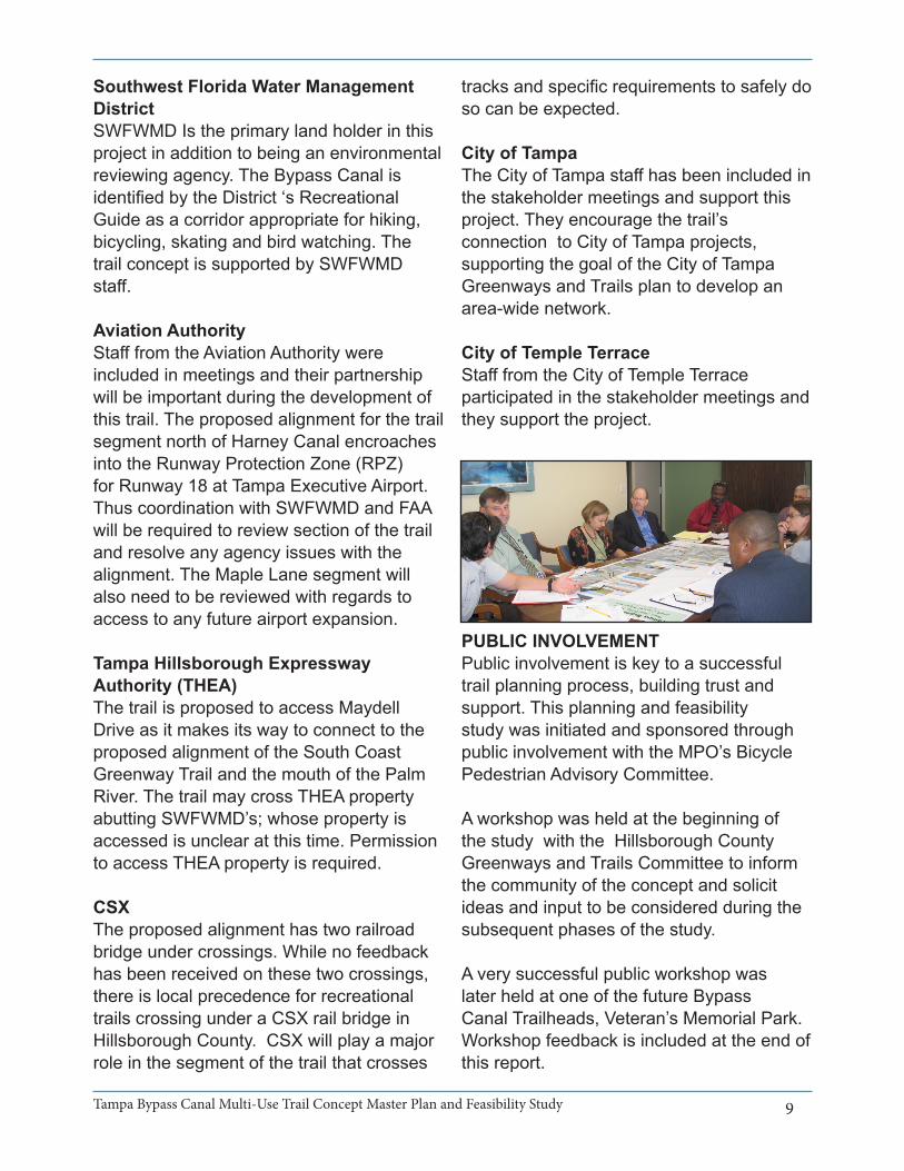
PUBLIC INVOLVEMENT Public involvement is key to a successful trail planning process, building trust and support. This planning and feasibility study was initiated and sponsored through public involvement with the MPO’s Bicycle Pedestrian Advisory Committee.
A workshop was held at the beginning of the study with the Hillsborough County Greenways and Trails Committee to inform the community of the concept and solicit ideas and input to be considered during the subsequent phases of the study.
A very successful public workshop was later held at one of the future Bypass Canal Trailheads, Veteran’s Memorial Park. Workshop feedback is included at the end of this report.
Southwest Florida Water Management District SWFWMD Is the primary land holder in this project in addition to being an environmental reviewing agency. The Bypass Canal is identified by the District ‘s Recreational Guide as a corridor appropriate for hiking, bicycling, skating and bird watching. The trail concept is supported by SWFWMD staff.
Aviation AuthorityStaff from the Aviation Authority were included in meetings and their partnership will be important during the development of this trail. The proposed alignment for the trail segment north of Harney Canal encroaches into the Runway Protection Zone (RPZ) for Runway 18 at Tampa Executive Airport. Thus coordination with SWFWMD and FAA will be required to review section of the trail and resolve any agency issues with the alignment. The Maple Lane segment will also need to be reviewed with regards to access to any future airport expansion.
Tampa Hillsborough Expressway Authority (THEA)The trail is proposed to access Maydell Drive as it makes its way to connect to the proposed alignment of the South Coast Greenway Trail and the mouth of the Palm River. The trail may cross THEA property abutting SWFWMD’s; whose property is accessed is unclear at this time. Permission to access THEA property is required.
CSXThe proposed alignment has two railroad bridge under crossings. While no feedback has been received on these two crossings, there is local precedence for recreational trails crossing under a CSX rail bridge in Hillsborough County. CSX will play a major role in the segment of the trail that crosses

Tampa Bypass Canal Multi-Use Trail Concept Master Plan and Feasibility Study 10
DRAFT
CORRIDOR ANALYSISAn analysis of the feasibility of the trail has been conducted based on data collected, site visits, stakeholder feedback and analysis of water levels to determine the optimum crossing types. The map, shown on the next page, illustrates the recommended conceptual alignment.
PHYSICAL INVENTORY AND RIGHT-OF-WAY ASSESSMENTThe majority of the trail is proposed on Southwest Florida Water Management District Land. As evidenced by the other trails in the County, the County partnership with SWFWMD is a very strong one and this collaboration will have tremendous community benefit. Going forward, an agreement with SWFWMD will be required. The under crossings and overpass will require agreements with the jurisdictional agency, notably the state, the county and CSX. Agreements with THEA and the Tampa Airport Authority/FAA will also be required.
There does not appear to be enough right-of-way to provide for the road crossing that is recommended at S Broadway Avenue to allow for use of the trail when the underpass is flooded. As a result, right-of-way may need to be purchased and while there appears to be enough right-of-way along E. Adamo Drive (SR60) in which to build the recommended multi-use trail segment, permitting and design will have to be coordinated through FDOT.
As previously mentioned, much of the Tampa Bypass Canal is open to the public. There are gates providing walk-thru access and an additional four access points associated with parks along the Canal. The initial recommendation is simply to replace the existing gates that are hard to
The public meetings conducted for this study were held at the following dates and locations:
• May 8, 2012-Keystone Recreation Center
• September 20, 2012- Veteran’s Memorial Park
PUBLIC INPUT AND COMMENTS In general, public feedback and comments on the trail were very supportive:
• I live in Sugarcreek and would LOVE this project to take place
• Great idea. I’m right on the canal and look forward to seeing this. Paved connection to Flatwoods Trail would be a good idea.
• Many of us walk from 78th to Maydell. Turning into potential trail would be a bonus for us.
Other comments included:
• There are many bike people in Sun City Center. Our most convenient access would be Adamo & 301. Please consider a trail head at this location.
• Sounds good.
• Need to be patrolled for security and safety.

11Tampa Bypass Canal Multi-Use Trail Concept Master Plan and Feasibility Study
DRAFT
or south. Flatwoods Park and Trout Creek already draw thousands of users annually. This connection extends the opportunities to connect to the south. FDOT is rebuilding the bridge over the Canal on south US 301 just north of the Youth Athletic Complex and will install a 15-foot wide under crossing to which the proposed trail will connect. This area also has existing rest rooms and parking which may accommodate trail users. The segment from US 301 S to Harney Road is currently finished with crushed shell as maintained by SWFWMD for their service vehicles. SWFWMD and FDOT maintain easements along this and other parts of the Canal by which they access and maintain drainage ponds and other facilities. The final design of the trail along the Canal will take these easements and ponds into account.
There is existing parking at Harney Road for the dog park. The trail, in the short term would be terminated via a cul-de-sac prior to the proposed I-75 trail and underpass.
Underpass: I-75 (approximately 500 feet)This segment covers just the crossing below I-75. Water data analysis showed that there is enough clearance underneath I-75 to construct an underpass. The right-of-way belongs to FDOT so it will be necessary to work with them through permitting and design.
access by bicyclists and provide landscape maintenance along the Canal to facilitate easier walking and bicycling. Public input identified gates at US 301, north of Harney and at Fowler that could be modified to open up much of the proposed trail for use right now by fat-tire, or mountain bicyclists.
Infrastructure NeedsThe existence of facilities such as parks, trailheads, and under crossings helped define the various segments of this trail. These represent a significant cost savings that can be used to guide the development of the entire trail. The following segmentation narrative begins at the north end of the proposed trail.
As previously stated, much of the Tampa Bypass Canal is open to the public. There are gates providing walk-thru access and an additional four access points associated with parks along the Canal. The initial recommendation is simply to replace the existing gates that are hard to access by bicyclists and provide landscape maintenance along the Canal to facilitate easier walking and bicycling. Public input identified gates at US 301, north of Harney and at Fowler that could be modified to open up much of the proposed trail for use right now by fat-tire, or mountain bicyclists.
PREFERRED TRAIL RECOMMENDATIONDesign Concept:
Morris Bridge Road to I-75 (approximately 3 miles)This segment is recommended as Phase 2 for a number of reasons including proximity to a large segment of the population, existing or proposed facilities, proximity to a popular amenity, and public comment. From Morris Bridge Road, users can go north up towards Flatwoods Park in New Tampa

Tampa Bypass Canal Multi-Use Trail Concept Master Plan and Feasibility Study 12
DRAFTas a HAWK signal) is recommended. While this does ‘interrupt’ the flow of the trail, it will allow it to be used at times that it otherwise would be closed to pedestrian and bicycle travel. Right-of-way may need to be purchased to facilitate this crossing.
Along this segment, as mnetioned, there are two locations where the proposed trail crosses under CSX rail bridges. In both cases there is more than eight feet of vertical clearance from the trail to the underside of the railroad bridge. There is precedent for trails crossing under railroad tracks in other parts of the county. The crossing will have to be designed to meet CSX specifications.
E. Adamo Drive to E. Washington Street/50th Street(approximately 2 miles)This phase is proposed to run parallel to E. Adamo Drive on the northside, cross at Orient Road and continue along the south side of E. Adamo Driver. The trail will cross Maydell at the intersection of Maydell and Adamo and head south along Maydell towards the Palm Rver. After it passes under the Selmon Expressway it will connect to SWFWMD property along the River. As mentioned, THEA will be an important partner in this segment, facilitating the connection to the SWFWMD property along the Palm River. As will other places where
I-75 to Maple Lane (approximately 3 miles)This segment would begin on the south side of I-75 and terminate at the proposed overpass at I-4. The existing bridge crossing and trailhead at Canal Park make this segment fairly inexpensive to construct, with the majority of the construction being on the Canal berm. The parking lot at the Harney Canal Park should be studied for enhancements anticipating increased usage for the trail.
Overpass: Crossing I-4 (approximately 800 feet)At the Maple Lane/I-4/Garden Lane crossing, based on the water data analyzed, there is never enough clearance to allow for an under crossing. Therefore the recommendation at this crossing is an overpass. This overpass will span Garden Lane, Hillsborough East and West, I-4 and Maple Lane. Approaches can be designed in a variety of ways, from a standard gradual approach to a more compact switchback design. ADA guidelines will dictate the steepness of the grades and therefore ultimately determine the length of the approaches.
Garden Lane to E. Adamo Drive (approximately 3.4 miles)This segment crosses under E. Martin Luther King Jr. Boulevard, US 301 S and E. Broadway Avenue as well as under two CSX rail lines. As the trail proceeds south the opportunity for adequate trail-to-bridge clearance diminishes, so while an underpass is possible, a special two step design was developed to allow for pedestrian passage even when the water level rises (See Figure 2 on page 15). Because even the pedestrian crossing at E. Broadway Avenue will be flooded at times during the year, a road crossing using a pedestrian hybrid signal (formerly known
13Tampa Bypass Canal Multi-Use Trail Concept Master Plan and Feasibility Study
DRAFT
agencies to determine if these might be used as trailheads. Three new trailheads are also recommended. The location and amenities to be offered at each new trailhead will ultimately be determined by the Parks, Recreation and Conservation Department, but initial concept design suggests the need for trailheads at Morris Bridge Road, E. Fowler Avenue, and E. Washington Street.
COST ESTIMATES AND PHASINGThe total construction cost for this project is estimated at $23.5 million. Design and Engineering are estimated to be 10-20% of the total project cost. Costs are based on current FDOT District 7 Roadway Costs per Centerline Mile, and comparable elements from other similar projects. Table 1 (on the next page) shows the breakdown of costs by element, section and phase.
Segment Phasing Because of the opportunity to develop this as a linear park as well as a recreational and transportation facility it is recommended that this trail be considered a single phase for construction. However, if incremental development is desired, the recommendation is to start at the north end of the Trail, primarily because of proximity to Flatwoods and Trout Creek Parks, already popular bicycling facilities. As mentioned, existing trailheads, crossings and planned facilities such as the underpass at US 301 S reduce the costs of construction and have been used to identify potential phases. The underpass at I-75 and the overpass at I-4 have not been included in the phases. They can either be included in the adjacent phases or may be constructed as separate projects as funding allows. The following describes the recommended phasing if incremental development is desired for funding purposes. Crossings are included in
the trail crosses right-of-way, agreements will be needed. The design for this segment of the trail will have to address any drainage issues in this area.
The trail would end at E. Washington Street and N. 50th Street. However, connections to other trails in the County and City are critical to the success of the network so a connection across N. 50th Street to the future City of Tampa trail from N. 50th Street to N. 34th Street and future connections to the South County Greenway and the McKay Bay Trail East must be considered.
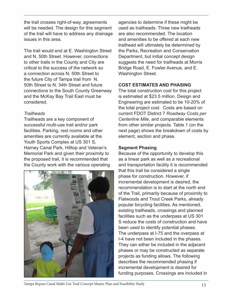
TrailheadsTrailheads are a key component of successful multi-use trail and/or park facilities. Parking, rest rooms and other amenities are currently available at the Youth Sports Complex at US 301 S, Harney Canal Park, Hilltop and Veteran’s Memorial Park and given their proximity to the proposed trail, it is recommended that the County work with the various operating

Tampa Bypass Canal Multi-Use Trail Concept Master Plan and Feasibility Study 14
DRAFT
Table 1: Trail Cost Estimate

15Tampa Bypass Canal Multi-Use Trail Concept Master Plan and Feasibility Study
DRAFT
Phase 5: E. Adamo Drive to E. Washington Street/50th Street (approximately 2 miles)This phase is estimated to cost $520,000. (Includes one signalized road crossing and one unsignalized crossing)
The underpass at I-75 and the overpass at I-4 may be constructed in conjunction with the adjacent phases or as separate projects. As such, the costs for these items are not included in any of the previously described phases and are listed below.
the segment except where noted.
Phase A: Public AccessThe first phase would be to address access issues with the existing gates.
Phase 2: Morris Bridge Road to I-75 (approximately 3 miles, does not include underpass at I-75)This phase is estimated to cost $4.6 million. (Includes 3 new underpasses. Cost does not include the underpass being built by FDOT with the reconstruction of Harney Road)
Phase 3: I-75 to Maple Lane (approximately 3 miles, does not include underpass at I-75 or overpass at Maple Lane/I-4)This phase is estimated to cost $867,200.
Phase 4: Garden Lane to E. Adamo Drive (approximately 3.4 miles, does not include overpass at Garden Lane/ I-4)This phase is estimated to cost $5.9 million. (Includes five underpasses and one road crossing)
Figure 2: Two step crossing for bridges with less than eight feet of vertical clearance

Tampa Bypass Canal Multi-Use Trail Concept Master Plan and Feasibility Study 16
DRAFT
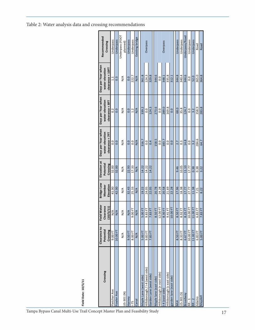
However, it should be noted that because the Tampa Bypass Canal is a flood control waterway used to provide flood protection for the Cities of Temple Terrace and Tampa by diverting floodwaters from the Hillsborough River, water levels vary by season and storm event. In order to determine the feasibility of underpasses at the bridges along the Canal, ten years of Southwest Florida Water Management District (SWFWMD) water level data was analyzed. Table 2 summarizing the analysis and the crossing recommendations is included on the next page. At three locations along the southern portion of the canal, water level data suggests that even eight feet of clearance between the trail and the lowest bridge member will not be possible at certain time periods during the year. At these locations, E. Martin Luther King Jr. Boulevard, S. Broadway Avenue and US 301 north of Veteran’s Park, for example, an alternative crossing strategy has been developed to allow for uninterrupted use of the trail. In these cases, in addition to the trail it is recommended that there be a pedestrian walkway offering seven feet of vertical clearance. This step design, illustrated in Figure 2, while it would require a bicycle rider dismount and use the crossing as a pedestrian, would enable trail users to cross under the roadway with
Underpass at I-75: Estimated at $1.5 million
Overpass at I-4: Estimated at $6.5 million
DESIGN RECOMMENDATIONS The five project principles discussed previously were developed to guide the future design and construction of the Tampa Bypass Canal Trail. The following recommendations should be used to help the County achieve the vision.
Safe and Comfortable Crossings of RoadwaysThere are thirteen roadway crossings along this proposed trail. They are Morris Bridge Road, E. Fowler Avenue, US 301 S, Harney Road, I-75, E. Dr. Martin Luther King Boulevard, US 301 S At Veterans Park, E. Broadway Avenue, two CSX rail crossings, E. Adamo Drive and Maydell Dr. Each crossing was analyzed to identify the optimal crossing design and there are three potential ways to cross: over, under and at roadway grade or road. Input from the Hillsborough Parks, Recreation and Conservation Department, analysis of the SWFWMD water level data in the Canal and site reviews were used to identify the optimal crossing type for each roadway or bridge.
For the underpasses, the Hillsborough Parks, Recreation and Conservation Department and AASHTO recommend a ten-foot vertical clearance distance. In six cases, analysis indicated that there is at least ten feet of clearance from the proposed trail to each of the bridges for an underpass. In three cases, eight feet of vertical clearance is available. AASHTO does allow for this minimum clearance distance under constrained circumstances.
17Tampa Bypass Canal Multi-Use Trail Concept Master Plan and Feasibility Study
DRAFT
Project:
Date:
10/9/201
2Field Date: 10/5/11
Water Clearan
ce Ana
lysis‐ DRA
FT
Crossing
Clearance to
Potential
Crossing
Field Water
Clearance
(10/5/11
)
Bridge
Low
Mem
ber
Elevation
Elevation at
Potential
Crossing
Days pe
r Ye
ar whe
n water elevation
clearance < 7FT
Days pe
r Ye
ar whe
n water elevation
clearance < 8FT
Days pe
r Ye
ar whe
n water elevation
clearance < 10
FT
Recommen
ded
Crossing
Fletcher Ave
9.00
FT
N/A
41.00
32.00
0.0
0.2
1.1
Und
erpass
Fowler Ave
10.00 FT
N/A
42.00
32.00
0.0
0.0
0.3
Und
erpass
US‐30
1 (N)
N/A
N/A
N/A
N/A
N/A
N/A
N/A
Und
erpass (FDOT
planne
d)Harne
y9.50
FT
N/A
32.43
22.93
0.0
0.0
0.0
Und
erpass
I‐75
8.00
FT
9.00
FT
25.33
17.33
0.0
1.2
222.7
Und
erpass
Canal
N/A
N/A
N/A
N/A
N/A
N/A
N/A
Existing
bridge
Maple Lane (w
est side)
5.00
FT
5.00
FT
19.22
14.22
316.7
339.2
361.8
Hillsborou
gh / I‐4 (w
est side)
9.83
FT
9.83
FT
24.05
14.22
0.0
0.0
124.3
Garde
n Lane
(west side)
7.83
FT
7.83
FT
22.05
14.22
0.4
124.3
329.8
Maple lane
(east side)
8.50
FT
20.78
158.5
273.6
344.6
Hillsborou
gh (n
east side)
12.00 FT
24.28
0.0
0.0
0.0
I‐4 (east side)
8.30
FT
20.58
183.7
289.0
348.1
Hillsborou
gh (s east side)
9.41
FT
21.69
0.0
169.8
335.8
garden
lane
(east side)
10.00 FT
22.28
0.0
0.0
312.1
MLK
8.50
FT
8.50
FT
17.96
9.46
2.7
68.0
344.8
Und
erpass
US‐30
1 (S)
8.33
FT
8.92
FT
18.38
10.05
0.3
35.8
340.4
Und
erpass
Broadw
ay6.67
FT
8.25
FT
17.77
11.10
14.8
124.7
344.6
Und
erpass/Road
RR ‐ 1
10.00 FT
10.00 FT
27.77
17.77
0.0
0.0
0.0
Und
erpass
RR ‐ 2
11.00 FT
11.00 FT
11.38
0.38
3.2
3.2
52.0
Und
erpass
Adamo
6.83
FT
6.83
FT
7.21
0.38
284.6
358.9
365.0
Road
Mayde
ll5.00
FT
7.83
FT
8.22
3.22
64.7
283.8
364.8
Road
Tampa
Bypass Canal
Overpass
Overpass
T:\12\82
70‐12 Tampa
Bypass Ca
nal\Water data\WaterLevelClearan
ceAna
lysis 2
Table 2: Water analysis data and crossing recommendations
Tampa Bypass Canal Multi-Use Trail Concept Master Plan and Feasibility Study 18
DRAFT
envisioned by the County as reaching to the South County Greenway, the Selmon Greenway, downtown Tampa and to the trail along McKay Bay from 50th Street to 34th Street. The development of the Tampa Bypass Canal Trail will allow bicycle riders to travel much of the county by facilitating commuter access as well as building a premier recreational facility for exercise and passive recreation.
In addition to connecting to major parks in the North and South County, this trail connects a number of smaller facilities along the canal including Harney Canal Park, the Temple Terrace Youth Sports Complex the Veteran’s Memorial Park Complex and Museum and the Hilltop Dog Park. Each of these locations may also serve as a trailhead, allowing easy local access to different trail sections.ImplementationBecause of the short-term opportunities for recreation and the potentially long time horizon for the completion of the ultimate vision as cross-county asphalt multi-use trail, the stakeholders also developed a strategy that would allow greater public access in the near term.
Much of this Southwest Florida Water Management District land is currently available to the public via walk-thru access gates and the area along the Bypass Canal is mowed in certain areas for maintenance truck access. Not all of these gates are bicyclist friendly, however. The short term recommendation is to improve the gates to facilitate better access for current users. More frequent mowing of the entire length could also allow better community access to the Canal.
minimal interruption at these locations. In one case, at S. Broadway Avenue, analysis showed that there will be times during the year when even seven feet of clearance isn’t available. In these cases, while the trail may have to be closed per County procedure, a roadway crossing would allow bicyclists and pedestrians to continue to use the trail. Because of traffic volumes and posted speed, a pedestrian hybrid signal is recommended.
It is recommended that the crossings at E. Adamo Drive and Orient Road and at E. Adamo Drive and Maydell Drive be enhanced to better accommodate additional pedestrian and bicycling traffic.
West Side Alignment PreferredThe west side of the canal was identified by the County as the preferred location for the trail for a number of reasons including better access and availability of uninterrupted land.
Available for All Non-Motorized Transportation UsersLike many of the trails in the County, this one is intended for non-motorized transportation and pedestrian use and as such, based on the Florida Plans Preparation Manual (PPM) and the AASHTO Guide for the Development of Bicycle Facilities, should ultimately be developed, generally, as a 12-foot wide asphalt trail.
Regional Amenity, Local AccessOne of the goals of this project is to allow for uninterrupted travel along the trail, facilitating longer distance bicycle travel in a part of the county that currently does not currently provide for it. This trail is identified as an important part of the Hillsborough County Greenways regional trail system, connecting north and south Hillsborough County. A key connector, this trail is

19Tampa Bypass Canal Multi-Use Trail Concept Master Plan and Feasibility Study
DRAFT
Safety: Because of the separation of motor vehicle and bicycle and pedestrian traffic the potential for crashes are reduced. As a result, these facilities are safe for bicyclists, pedestrians and motor vehiclesSecurity: Most of the underpasses can be designed to enhance the openness of the crossing which will help increase visibility and reduce security concerns.
Cost: Estimated at $1,000,000 per crossing
Note: While the sections of the trial on the berm can be constructed over time and interim steps may be taken to get to the ultimate asphalt surface, concrete is recommended for the under crossings because of the likelihood of inundation and the need to minimize erosion due to storm water flow along the trail surface.
Overpass (over I-4). Garden Lane and Maple Lane)Operations: Because of the separation of motor vehicle and bicycle and pedestrian traffic, overpasses provide a very safe way to cross the roadway.
Safety: Because of the separation of motor vehicle and bicycle and pedestrian traffic the potential for crashes is reduced. As a result, overpasses provide a very safe way to cross the roadway.
Security: Overpasses by design are very open, therefore personal safety is rarely a concern.
Cost: Estimated at $6.5 million
Road CrossingOperations: This is the least preferable option for a trail crossing. Because of the traffic volume and posted speed along
A recommended mid-term step is to lay crushed shell or asphalt millings to make the trail more accessible. Parts of the proposed trail used by SWFWMD for maintenance are already laid with crushed shell. It is recommended that the County work with SWFWMD to continue and perhaps expand this practice.
The segments described in the previous Segment Phasing section outline the longer-term plan to construct the trail in its entirety.
COMPARISON OF CROSSING OPTIONS (COST/SAFETY/SECURITY/OPERATIONS)As discussed earlier, there are three ways for a multi-use trail to cross obstacles: go under, go over or cross the road. Each crossing was analyzed for cost, safety, security and operations to identify the best crossing option.
UnderpassOperations: Because of the separation of motor vehicle and bicycle and pedestrian traffic, underpasses provide a very safe way to cross the roadway.

Tampa Bypass Canal Multi-Use Trail Concept Master Plan and Feasibility Study 20
DRAFT
ecosystems that make up the Canal area should be encouraged with signage.
• And finally, as this trail has been determined to be constructible, funding should be indentified to move the project into Project Design & Engineeing wtih the intent to construct this trail as a design/build project.
CONCLUSIONThe study determined that a multi-use trail along the Tampa By Pass canal right of way is feasible. Constructing this trail will provide alternative travel options and provide recreational infrastructure for the community. Additional benefits include support of local business and perhaps even the promotion of additional small businesses to support the users of the trail. The vision for this trail is to provide the community with a safe, attractive and attractive recreational experience connecting people to neighborhoods, parks and activity areas. It is recommended that the Metropolitan Planning Organization adopt this study and urge Hillsborough County Parks, Recreation and Conservation implement the recommendations of the report.
this segment, a pedestrian hybrid signal is recommended.
Safety: Because of the interaction between motor vehicle and pedestrians and bicyclists at the trail crossing there is risk for crashes.Security: There are no additional security risks associated with road crossings.
Cost: $125,000
NEXT STEPSThis study was the first step in the process to ultimately get this trail constructed. This effort, like those trail projects already built around the County, will be collaborative. The study has identified a number of agencies have been identified as stakeholders and partners in this process.
Other steps include:
• Parks, Recreation and Conservation Department support is needed for the implementation of the Tampa Bypass Canal trail.
• Amenities should be identified as the design moves forward. Because this trail is part of an active flood control waterway, items such as benches, water fountains and even trees may be limited as to where they may be located.
• Areas of historic interest have been identified in the area of the trail. As a result, there may be opportunities to highlight the history of this part of the county. Partnership with the local historical society to develop historic markers or identifiers along the Bypass Canal Trail is suggested to enhance the user experience. Along the same lines, education about the wildlife and

21Tampa Bypass Canal Multi-Use Trail Concept Master Plan and Feasibility Study
DRAFT
Appendix 1: Public Workshop FeedbackTa
mpa
Byp
ass C
anal Pub
lic W
orksho
p Co
mmen
t ‐ 9‐20‐12
2Glad to poten
tial com
men
t to Palm
River Road. M
any of us w
alk from
78t
hto M
ayde
ll. Turning
into poten
tial trail wou
ld be a bo
nus for us. – L
Walker
3I live in Sugarcreek and wou
ld LOVE
this project to take place. A
lso m
ore access & parking
in th
e 30
1‐MLK‐Broadway area. The
re is a very
small park just so
uth of th
e Ve
teran’s p
ark bu
t it’s not sa
fe ‐ not friend
ly. Som
ething
shou
ld be do
ne abo
ut th
at as w
ell. I skate, bike and walk.
STAR
T AT
MLK‐VETER
AN’S PAR
K!!
4I am very excited abou
t this e
xcellent use of p
ublic prope
rty to provide
a sa
fe ro
ute for cyclists and
a won
derful place to
enjoy
Florid
a bicycling free
from
dangers and
unclogging roads.
5There are many bike peo
ple in Sun
City
Cen
ter. Our m
ost con
venien
t access w
ould be Ad
amo & 301
. Please consider a trail head at th
is locatio
n. – D
ave Kiefer W
e ne
ed th
is for b
ikes!
6Soun
ds goo
d. Need to be patrolled for security
and
safety.
7I think
it is im
portant to prom
inen
tly and
specifically sh
ow th
e conn
ectio
ns to
existing and planne
d trails/paths in the core of T
ampa. This is
not a
standalone
trail – it will becom
e part of the
entire
network.
8Love th
e Bypass Canal Trail plans, Suggest in
short term im
proving access gates. A
t Fow
ler, 30
1 espe
cially. If this access is im
proved
I could
ride from
my ho
use in Tem
ple Terrace to Flatw
oods. Yes th
ere wou
ld be a coup
le of road crossin
gs, but m
uch be
tter th
an th
e existing
alternatives. – Don
Gou
ld (tbp
c@do
gbreath.us)
9Wou
ld love to
have the Bypass Canal Trail be
come a viable riding
opp
ortunity fo
r me. Currently if gates were fixed
or installed at 301
North of
Harney and
also
at F
owler I wou
ld be able to
ride
all the way to
Flatw
oods from
Tem
ple Terrace. Heck, whe
n it is fin
ished
I could conceivably
ride all the
way to
work in DOWNTO
WN TAM
PA!
10Cano
py of trees ‐ very im
portant !! –
Gail Parsons, Sierra Club
VP and Outings Chair
10Ha
ve a nam
ing contest from th
e T Bypass Canal Rou
te. $25
0 prize
. Put entry boxes in
all of th
e SW
FBUD shop
s.11
Thank you for the
meetin
g. Loved
the idea
and
can’t wait to see it happ
en. A
paved
con
nection be
tween Flatwoo
ds Park Trail and
the Bypass
Canal Trail wou
ld be greatly
app
reciated
, As w
e resid
e in Sou
th Hillsborou
gh Cou
nty whe
re th
ere is really nothing, w
e have a great deal of
interest in
a plan called the South Co
ast G
reen
way and
Cross Cou
nty Green
way presented
at a
meetin
g 7/13
/200
6 & 11/16
/200
6.
12Thanks fo
r the
meetin
g. Very interested
in th
e concep
t. Wou
ld love to
see something
happe
n soon
. As a
boo
mer, tim
e is runn
ing ou
t. South
Hillsbo
rough Co
unty doe
sn’t have any
paved
trails. W
hat a
bout us? Paved
con
nection to Flatw
oods Trail wou
ld be a good
idea.
Great idea. I’m
right o
n the canal and
look
forw
ard to se
eing
this.
Que
stions: W
ill th
is fall un
der the
parks and
recreatio
ns?
How wou
ld it be patrolled as far a
s the
restrictio
ns?
Wou
ld we still have access from
our prope
rty?
1Co
mmen
t
T:\12\82
70‐12 Tampa
Bypass C
anal\Pub
lic W
orksho
p Co
mmen
ts 9‐20‐12
Tampa Bypass Canal Multi-Use Trail Concept Master Plan and Feasibility Study 22
DRAFTTampa Bypass Canal Section: Conceptual on berm section
Tampa Bypass Canal Section: Conceptual underpass section
Appendix 2: Tampa Bypass Canal Typical Sections
23Tampa Bypass Canal Multi-Use Trail Concept Master Plan and Feasibility Study
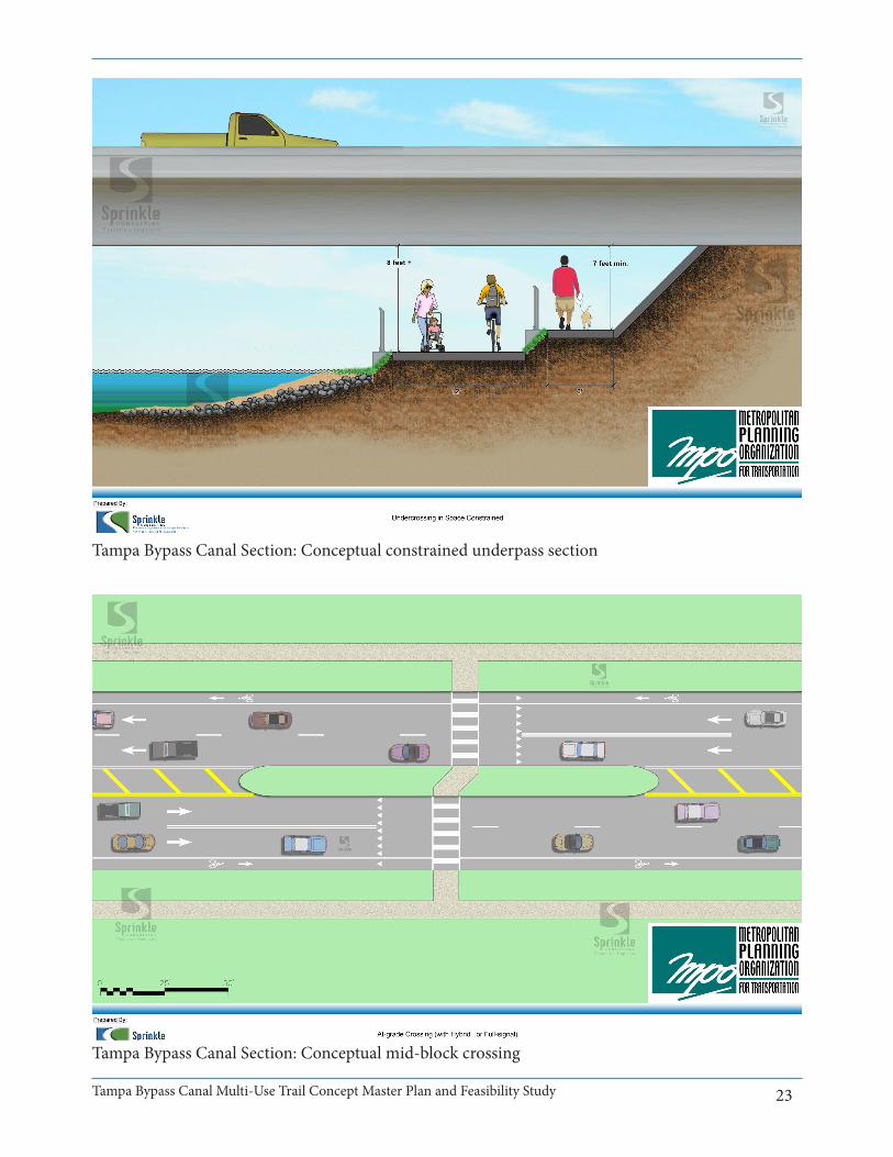
DRAFTTampa Bypass Canal Section: Conceptual constrained underpass section
Tampa Bypass Canal Section: Conceptual mid-block crossing

Tampa Bypass Canal Multi-Use Trail Concept Master Plan and Feasibility Study 24
DRAFT
Exhibit from Public Workshop
Related Documents