SW Maps for Low-Cost GNSS Receiver Systems Presented by Dinesh Manandhar, The University of Tokyo on behalf of Avinab Malla Space System Applications and Geospatial Engineering, Nepal [email protected]

Welcome message from author
This document is posted to help you gain knowledge. Please leave a comment to let me know what you think about it! Share it to your friends and learn new things together.
Transcript

SW Maps for Low-Cost GNSS Receiver Systems
Presented by Dinesh Manandhar, The University of Tokyo on behalf of
Avinab MallaSpace System Applications and Geospatial Engineering, Nepal
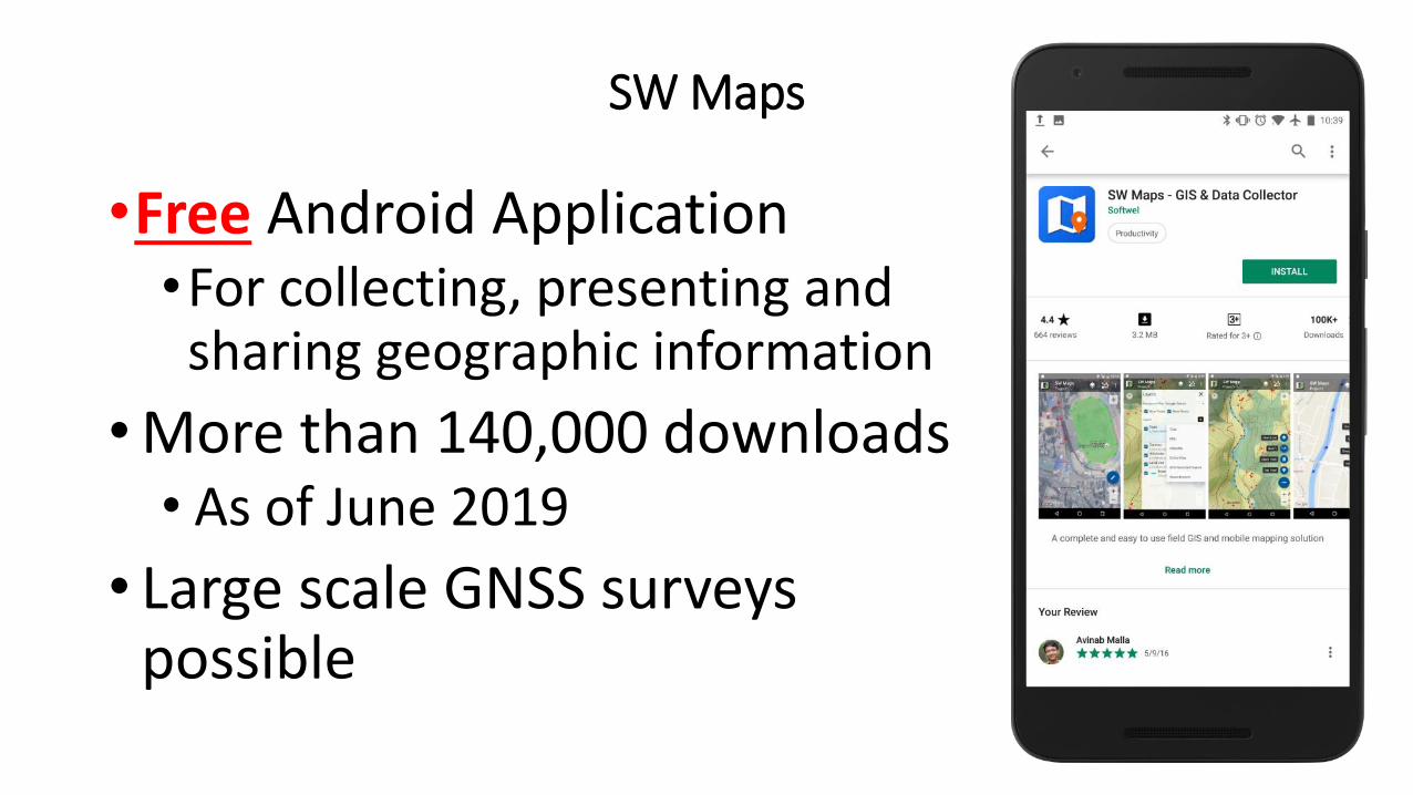
SW Maps
•Free Android Application•For collecting, presenting and sharing geographic information
•More than 140,000 downloads• As of June 2019
• Large scale GNSS surveys possible
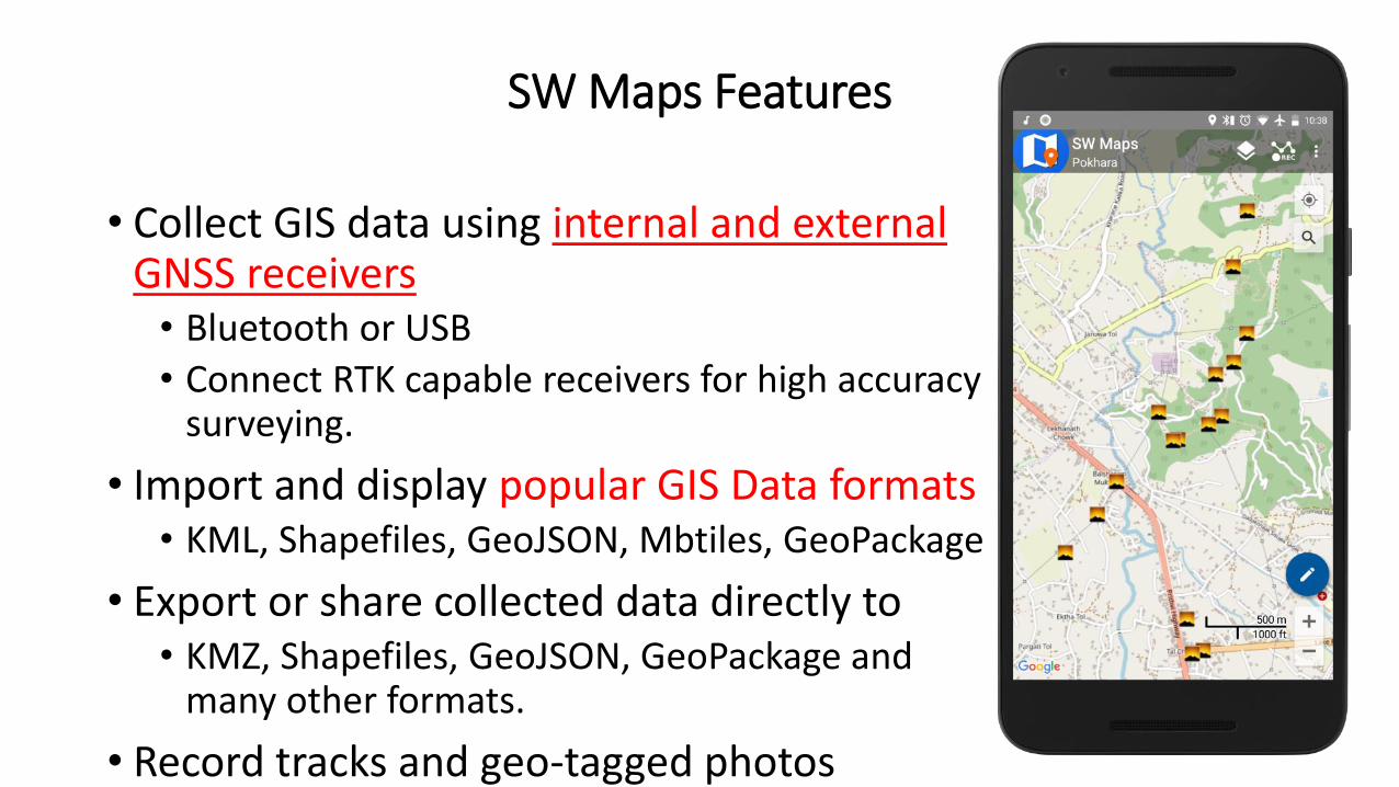
SW Maps Features
• Collect GIS data using internal and external GNSS receivers• Bluetooth or USB
• Connect RTK capable receivers for high accuracy surveying.
• Import and display popular GIS Data formats• KML, Shapefiles, GeoJSON, Mbtiles, GeoPackage
• Export or share collected data directly to • KMZ, Shapefiles, GeoJSON, GeoPackage and
many other formats.
• Record tracks and geo-tagged photos
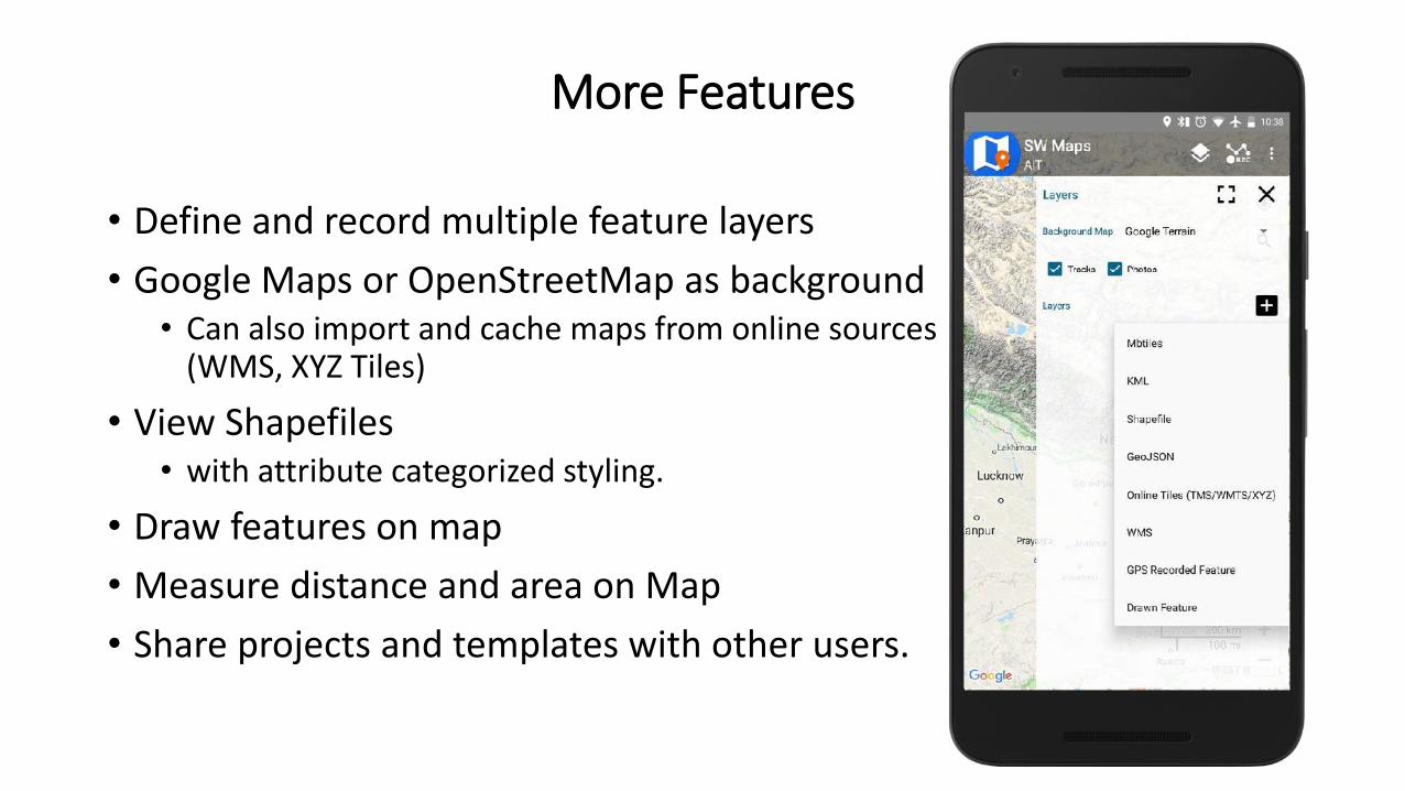
More Features
• Define and record multiple feature layers
• Google Maps or OpenStreetMap as background• Can also import and cache maps from online sources
(WMS, XYZ Tiles)
• View Shapefiles• with attribute categorized styling.
• Draw features on map
• Measure distance and area on Map
• Share projects and templates with other users.
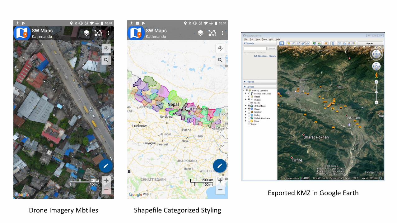
Drone Imagery Mbtiles Shapefile Categorized Styling
Exported KMZ in Google Earth
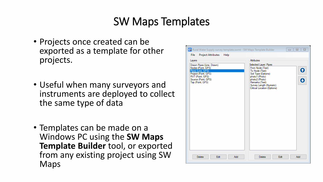
SW Maps Templates
• Projects once created can be exported as a template for other projects.
• Useful when many surveyors and instruments are deployed to collect the same type of data
• Templates can be made on a Windows PC using the SW Maps Template Builder tool, or exported from any existing project using SW Maps
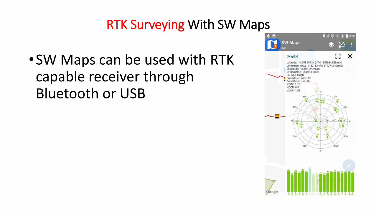
RTK Surveying With SW Maps
•SW Maps can be used with RTK capable receiver through Bluetooth or USB
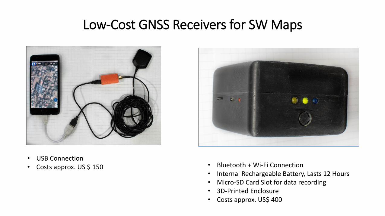
Low-Cost GNSS Receivers for SW Maps
• USB Connection• Costs approx. US $ 150 • Bluetooth + Wi-Fi Connection
• Internal Rechargeable Battery, Lasts 12 Hours• Micro-SD Card Slot for data recording• 3D-Printed Enclosure• Costs approx. US$ 400
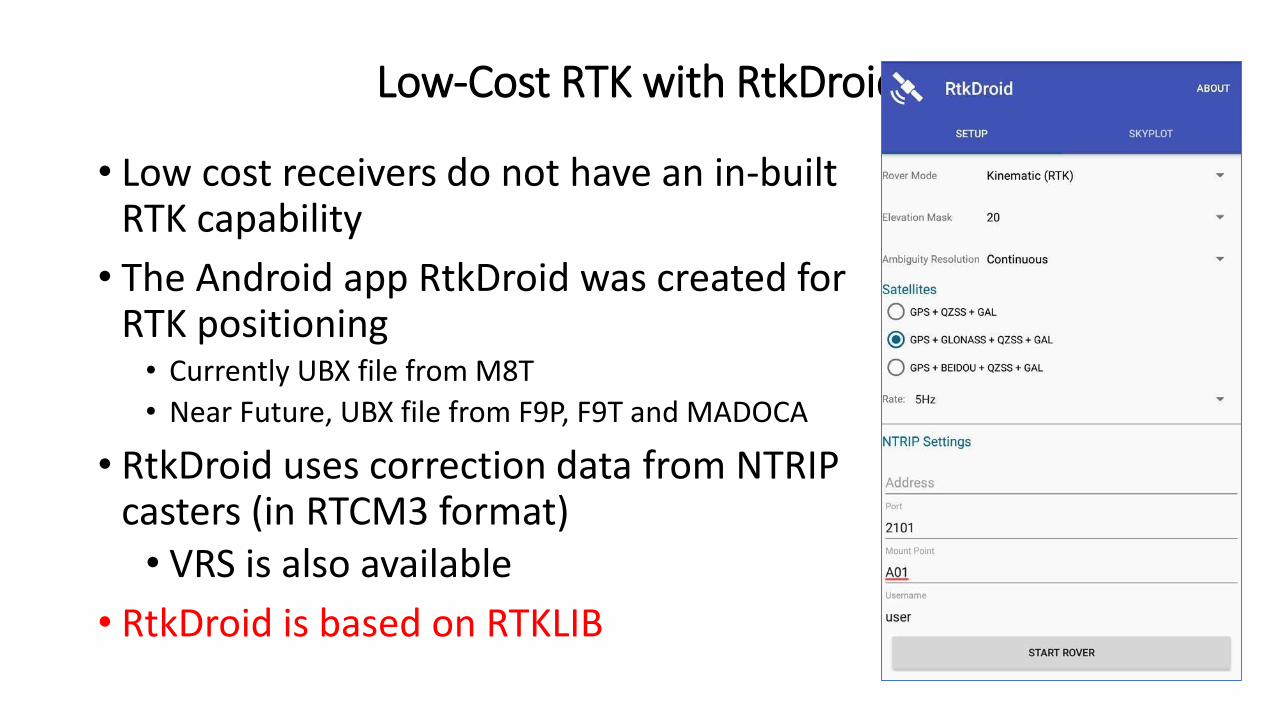
Low-Cost RTK with RtkDroid
• Low cost receivers do not have an in-built RTK capability
• The Android app RtkDroid was created for RTK positioning• Currently UBX file from M8T
• Near Future, UBX file from F9P, F9T and MADOCA
• RtkDroid uses correction data from NTRIP casters (in RTCM3 format) • VRS is also available
• RtkDroid is based on RTKLIB
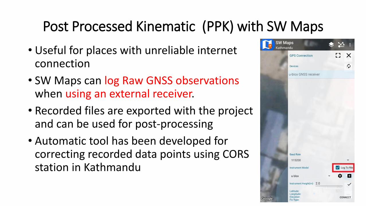
Post Processed Kinematic (PPK) with SW Maps
• Useful for places with unreliable internet connection
• SW Maps can log Raw GNSS observations when using an external receiver.
• Recorded files are exported with the project and can be used for post-processing
• Automatic tool has been developed for correcting recorded data points using CORS station in Kathmandu
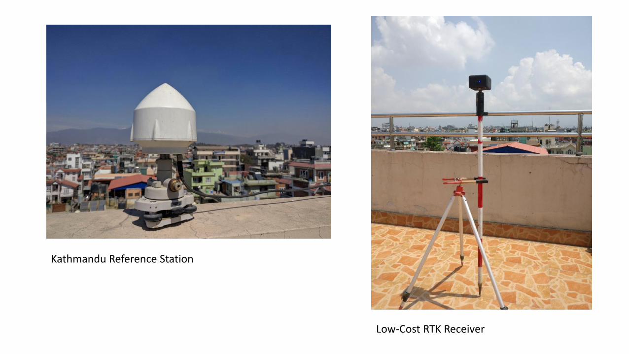
Kathmandu Reference Station
Low-Cost RTK Receiver
SW Maps Applications
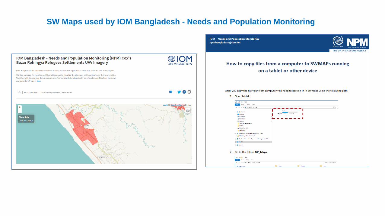
SW Maps used by IOM Bangladesh - Needs and Population Monitoring
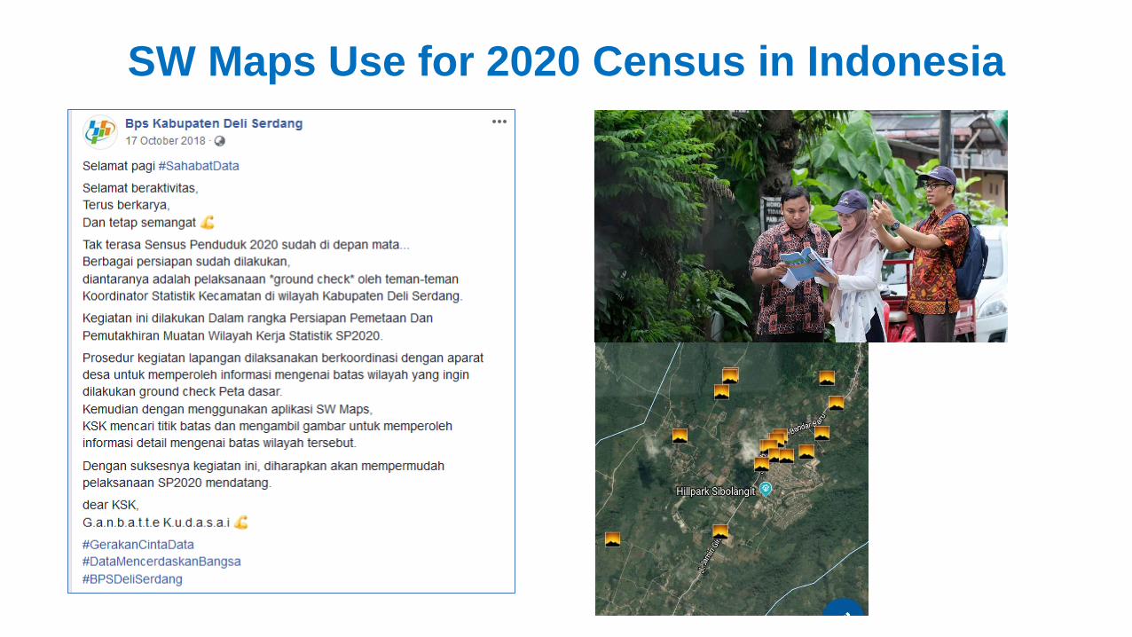
SW Maps Use for 2020 Census in Indonesia
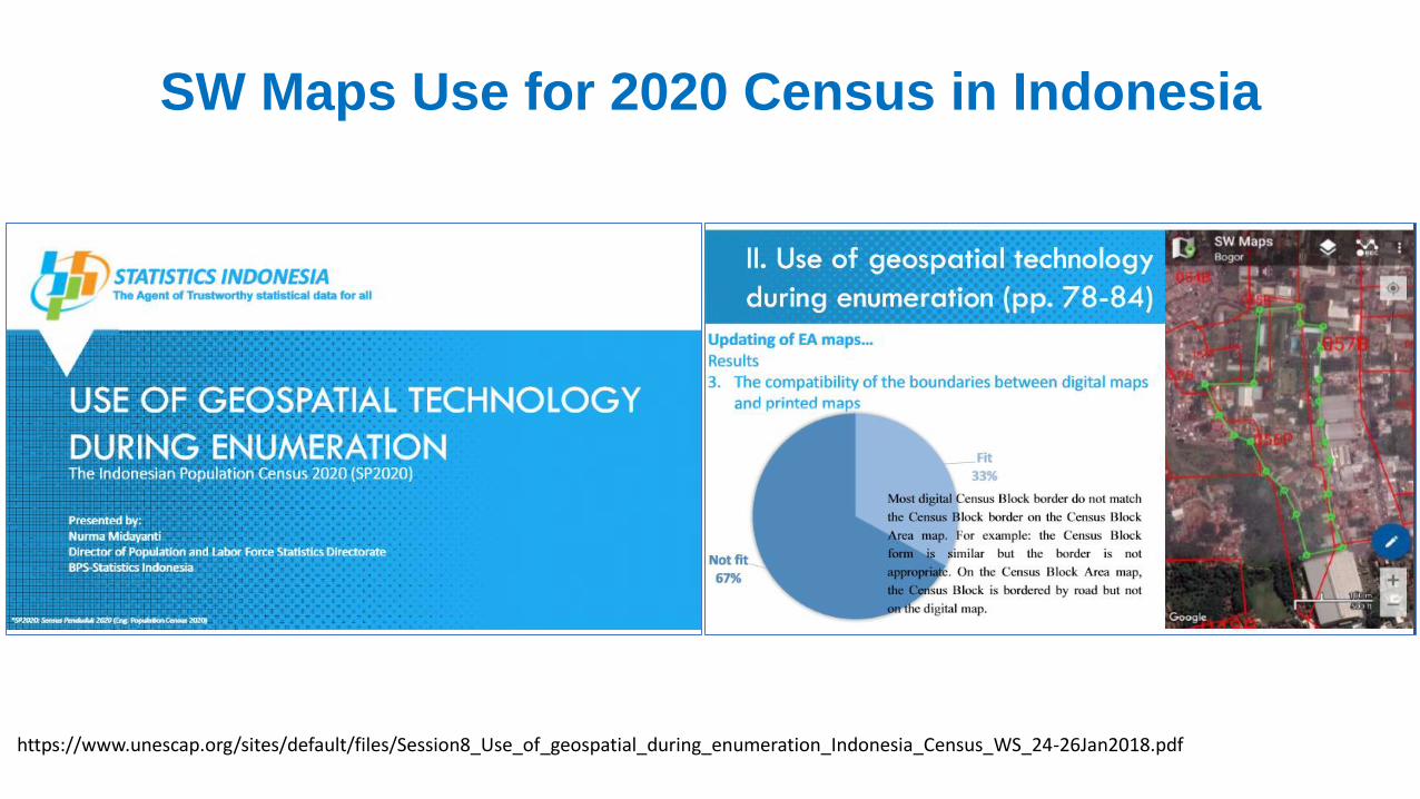
https://www.unescap.org/sites/default/files/Session8_Use_of_geospatial_during_enumeration_Indonesia_Census_WS_24-26Jan2018.pdf
SW Maps Use for 2020 Census in Indonesia
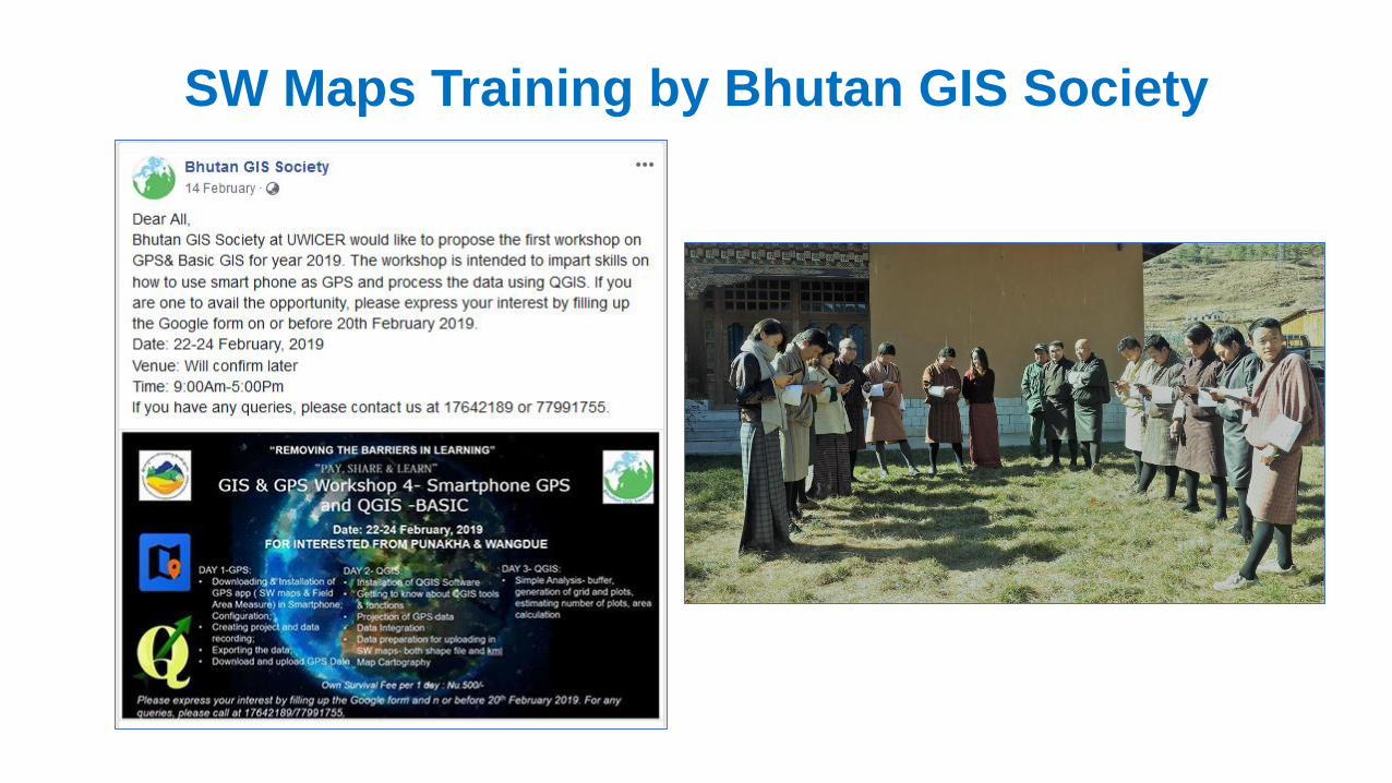
SW Maps Training by Bhutan GIS Society
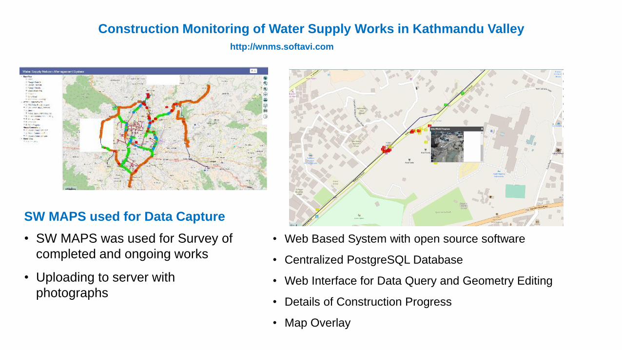
Construction Monitoring of Water Supply Works in Kathmandu Valley
SW MAPS used for Data Capture
• Web Based System with open source software
• Centralized PostgreSQL Database
• Web Interface for Data Query and Geometry Editing
• Details of Construction Progress
• Map Overlay
http://wnms.softavi.com
• SW MAPS was used for Survey of
completed and ongoing works
• Uploading to server with
photographs
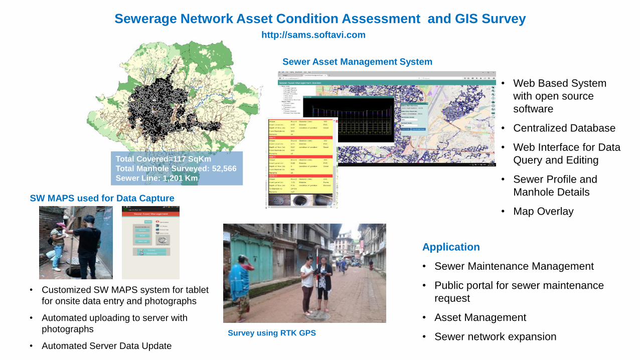
Sewerage Network Asset Condition Assessment and GIS Survey
Total Covered=117 SqKm
Total Manhole Surveyed: 52,566
Sewer Line: 1,201 Km
SW MAPS used for Data Capture
• Customized SW MAPS system for tablet
for onsite data entry and photographs
• Automated uploading to server with
photographs
• Automated Server Data Update
Sewer Asset Management System
• Web Based System
with open source
software
• Centralized Database
• Web Interface for Data
Query and Editing
• Sewer Profile and
Manhole Details
• Map Overlay
Survey using RTK GPS
Application
• Sewer Maintenance Management
• Public portal for sewer maintenance
request
• Asset Management
• Sewer network expansion
http://sams.softavi.com
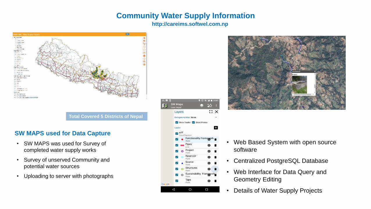
Community Water Supply Information
Total Covered 5 Districts of Nepal
SW MAPS used for Data Capture
• SW MAPS was used for Survey of
completed water supply works
• Survey of unserved Community and
potential water sources
• Uploading to server with photographs
• Web Based System with open source
software
• Centralized PostgreSQL Database
• Web Interface for Data Query and
Geometry Editing
• Details of Water Supply Projects
http://careims.softwel.com.np
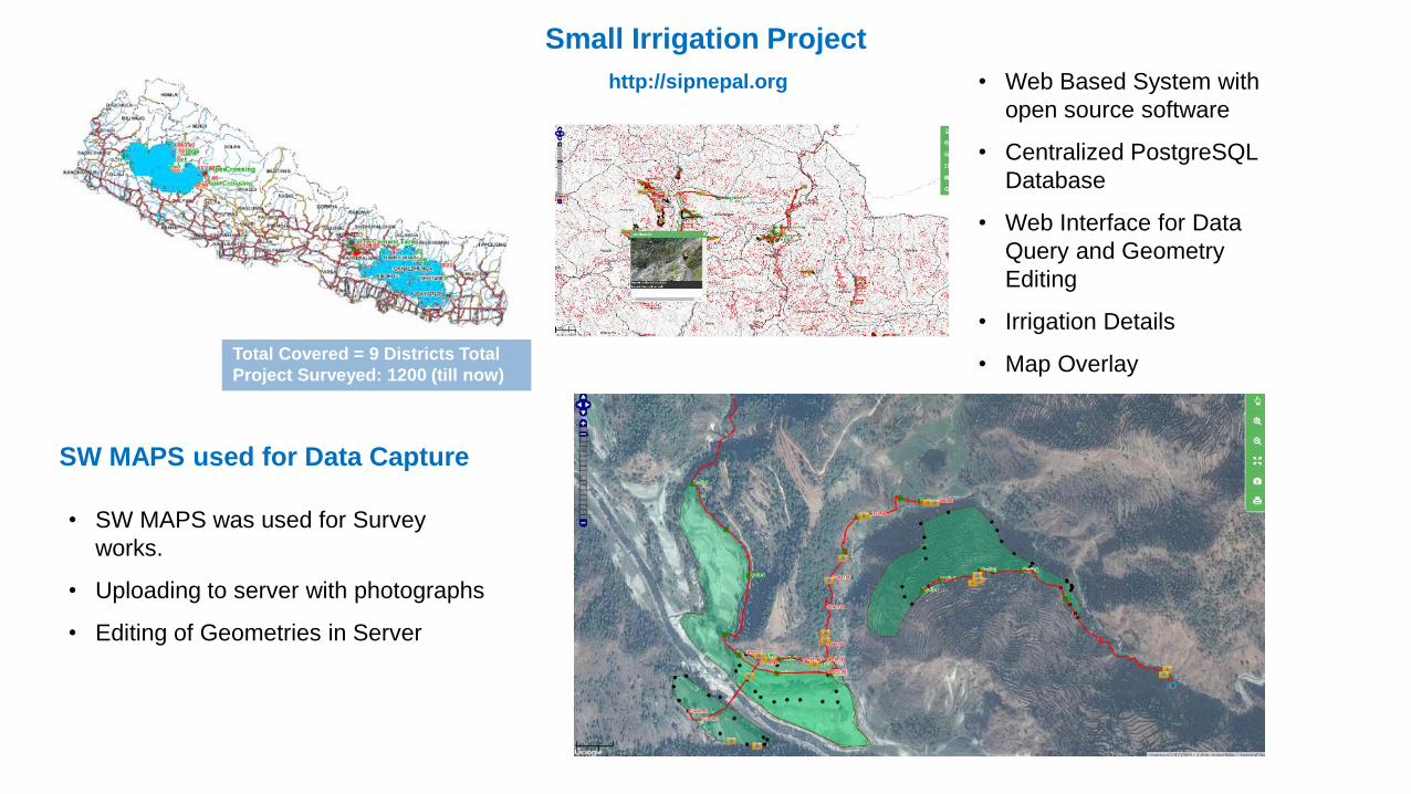
Small Irrigation Project
Total Covered = 9 Districts Total
Project Surveyed: 1200 (till now)
SW MAPS used for Data Capture
• SW MAPS was used for Survey
works.
• Uploading to server with photographs
• Editing of Geometries in Server
• Web Based System with
open source software
• Centralized PostgreSQL
Database
• Web Interface for Data
Query and Geometry
Editing
• Irrigation Details
• Map Overlay
http://sipnepal.org

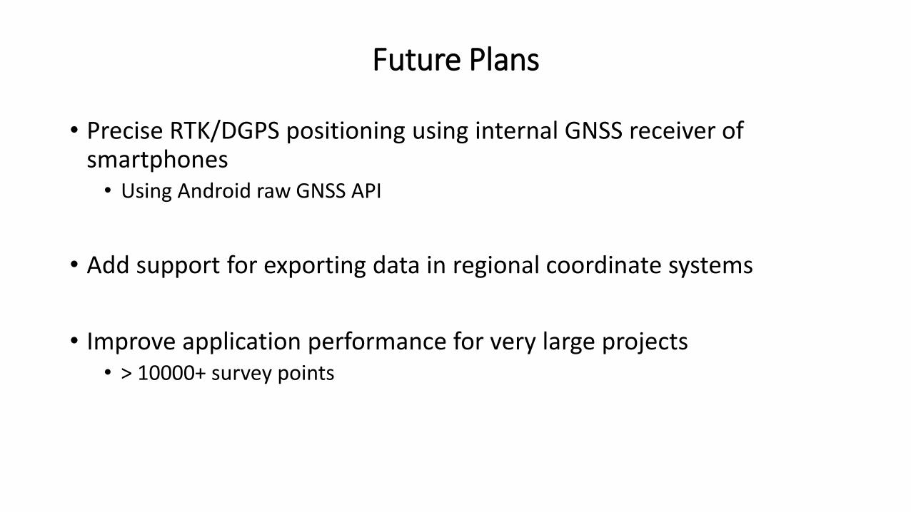
Future Plans
• Precise RTK/DGPS positioning using internal GNSS receiver of smartphones • Using Android raw GNSS API
• Add support for exporting data in regional coordinate systems
• Improve application performance for very large projects• > 10000+ survey points
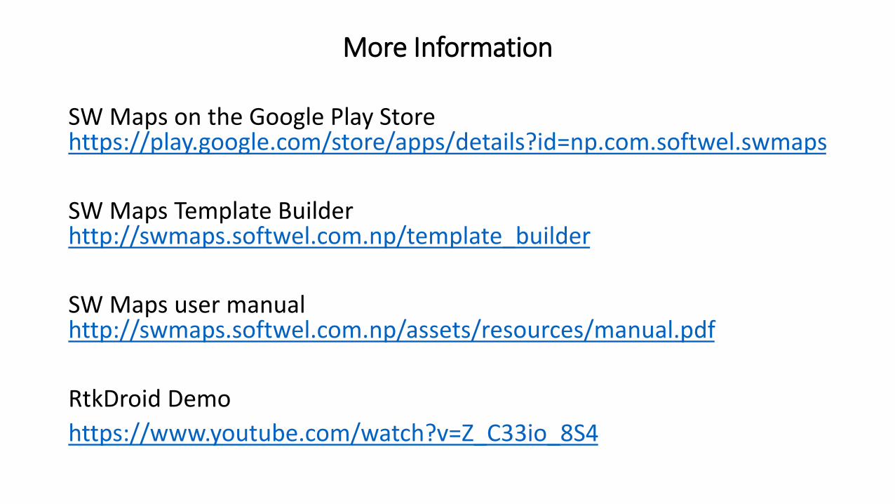
More Information
SW Maps on the Google Play Store https://play.google.com/store/apps/details?id=np.com.softwel.swmaps
SW Maps Template Builderhttp://swmaps.softwel.com.np/template_builder
SW Maps user manualhttp://swmaps.softwel.com.np/assets/resources/manual.pdf
RtkDroid Demo
https://www.youtube.com/watch?v=Z_C33io_8S4
Related Documents