Supplementary Online Material: Secon 2, Research sites The 2011 P5 survey located and described 28 rock shelters. Numerous light scaers of shellfish were encountered, but we described an addional 5 open-air sites that had stone tools, poery, iron slag, or terrestrial fauna associated with the shellfish. Here, we provide a detailed catalog of these sites. Each site is demarcated by a tle page, followed by a descripon of the site and its locaon. Each site secon also includes photos of the site, maps , lithostragraphic drawings, and photographs of surficial archaeological and faunal finds. A2SE-1…....S30 A3NW-6…..S46 B3SE-3…..S98 B3SE-9…....S144 C4NE-1…..S169 C4SW-2…..S214 A3NW-1…..S37 A3NW-7…..S48 B3SE-4…..S103 B3SE-10…..S144 C4NE-2…..S184 C4SW-3…..S215 A3NW-2…..S44 A3NW-8…..S56 B3SE-5…..S116 B3SE-11…..S144 C4SE-1…...S193 C4SW-4…..S219 A3NW-3…..S45 A3NW-9…..S77 B3SE-6…..S119 B4NE-1…...S146 C4SE-2…...S196 A3NW-4…..S45 B3SE-1…....S87 B3SE-7…..S121 B4NW-1….S155 C4SE-3…...S200 A3NW-5…..S45 B3SE-2…....S91 B3SE-8…..S131 B4SW-1…..S167 C4SW-1….S207 Table of Contents (click to navigate) PaleoAnthropology 2013: S28–S223 doi:10.4207/PA.2013.ART82.dat1 © 2013 Paleoanthropology Society. All rights reserved. ISSN 1545-0031

Welcome message from author
This document is posted to help you gain knowledge. Please leave a comment to let me know what you think about it! Share it to your friends and learn new things together.
Transcript
Supplementary Online Material: Section 2, Research sites The 2011 P5 survey located and described 28 rock shelters. Numerous light scatters of shellfish were encountered, but we described
an additional 5 open-air sites that had stone tools, pottery, iron slag, or terrestrial fauna associated with the shellfish. Here, we
provide a detailed catalog of these sites. Each site is demarcated by a title page, followed by a description of the site and its location.
Each site section also includes photos of the site, maps , lithostratigraphic drawings, and photographs of surficial archaeological and
faunal finds.
A2SE-1…....S30 A3NW-6…..S46 B3SE-3…..S98 B3SE-9…....S144 C4NE-1…..S169 C4SW-2…..S214
A3NW-1…..S37 A3NW-7…..S48 B3SE-4…..S103 B3SE-10…..S144 C4NE-2…..S184 C4SW-3…..S215
A3NW-2…..S44 A3NW-8…..S56 B3SE-5…..S116 B3SE-11…..S144 C4SE-1…...S193 C4SW-4…..S219
A3NW-3…..S45 A3NW-9…..S77 B3SE-6…..S119 B4NE-1…...S146 C4SE-2…...S196
A3NW-4…..S45 B3SE-1…....S87 B3SE-7…..S121 B4NW-1….S155 C4SE-3…...S200
A3NW-5…..S45 B3SE-2…....S91 B3SE-8…..S131 B4SW-1…..S167 C4SW-1….S207
Table of Contents (click to navigate)
PaleoAnthropology 2013: S28–S223 doi:10.4207/PA.2013.ART82.dat1
© 2013 Paleoanthropology Society. All rights reserved. ISSN 1545-0031
SOM-S2: Research Sites S29

SOM-S2: Research Sites S30
Site: A2SE-1
Location Easting (m) 768289
Northing (m) 65188445
Elevation (m) "'20
UTM Zone 35s
Dimensions Length (m)
Width (m)
73 9.6
Region: Lupatana
Overview
This rockshelter is located approximately 3 km south of the Lupatana gorge and
river mouth. The site is located directly on the coastline and the southern
margin has been eroded by the Mlambomkulu River waterfall. The rockshelter
is large and dry. Archaeological materials are found throughout. There are
abundant stone tools that have been preliminary classified into multiple lithic
facies. Marine shellfish and terrestrial fauna are also present. There is a
shallow, naturally-eroded exposure located at the drip line, which shows
stratified hearth de osits and archaeolo ical sediments.

Figure S2-1: Generalized planview map of the different sedimentary facies ob-served at site A2SE-1.
The upper figure shows a view of the site looking south. A natural erosional face from drip water is visible in the lower right corner of the image. The coastline is to the left of the image. The Mlambomkulu waterfall of waterfall bluff is visible in the background.
The lower figure show the generalized
sedimentology observed at the site.
The transect line from A to A’ is marked
in both the upper and lower images.
SOM-S2: Research Sites S31
Figure S2-2: Generalized profile of the main lithological facies at site A2SE-1.
SOM-S2: Research Sites S32
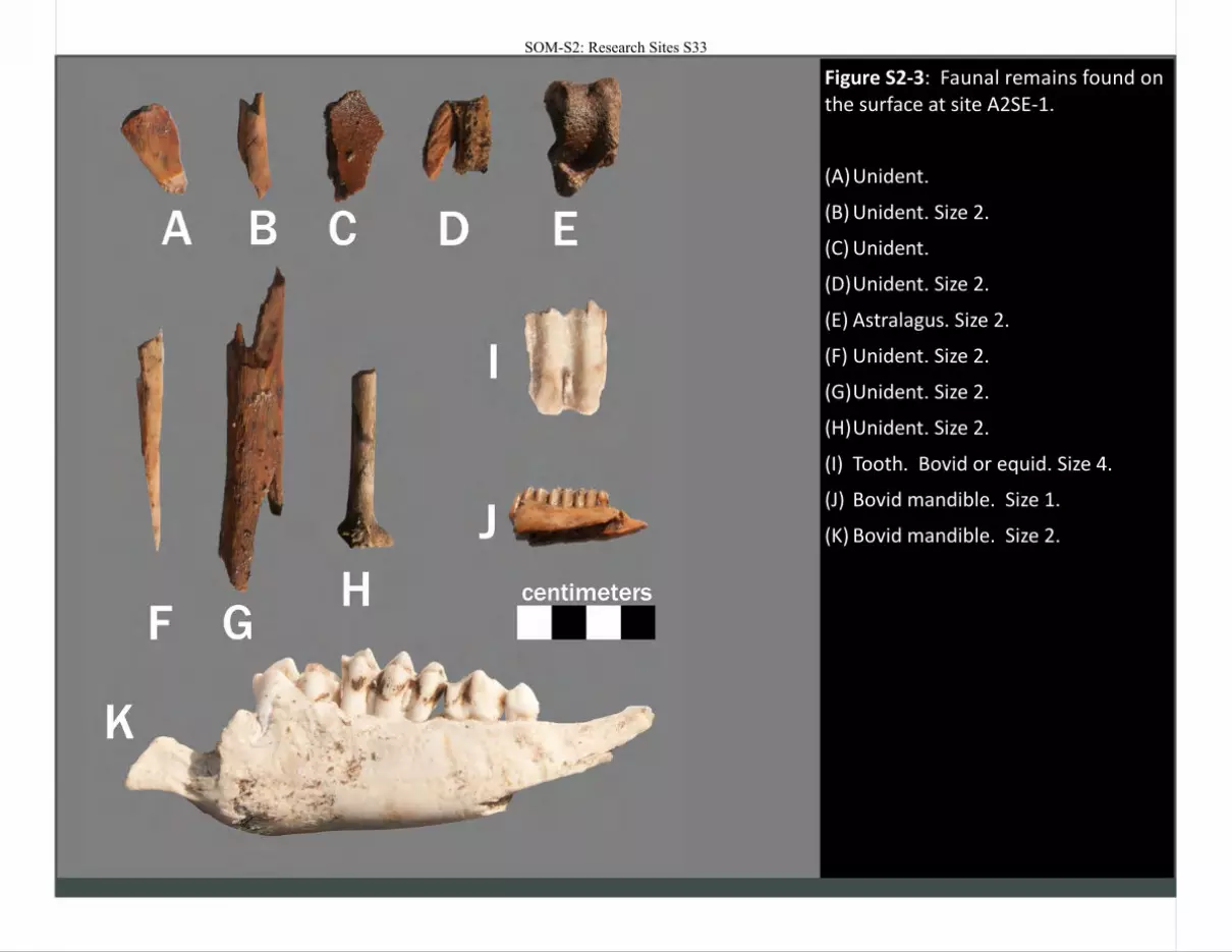
Figure S2-3: Faunal remains found on the surface at site A2SE-1.
(A) Unident.
(B) Unident. Size 2.
(C) Unident.
(D) Unident. Size 2.
(E) Astralagus. Size 2.
(F) Unident. Size 2.
(G) Unident. Size 2.
(H) Unident. Size 2.
(I) Tooth. Bovid or equid. Size 4.
(J) Bovid mandible. Size 1.
(K) Bovid mandible. Size 2.
SOM-S2: Research Sites S33
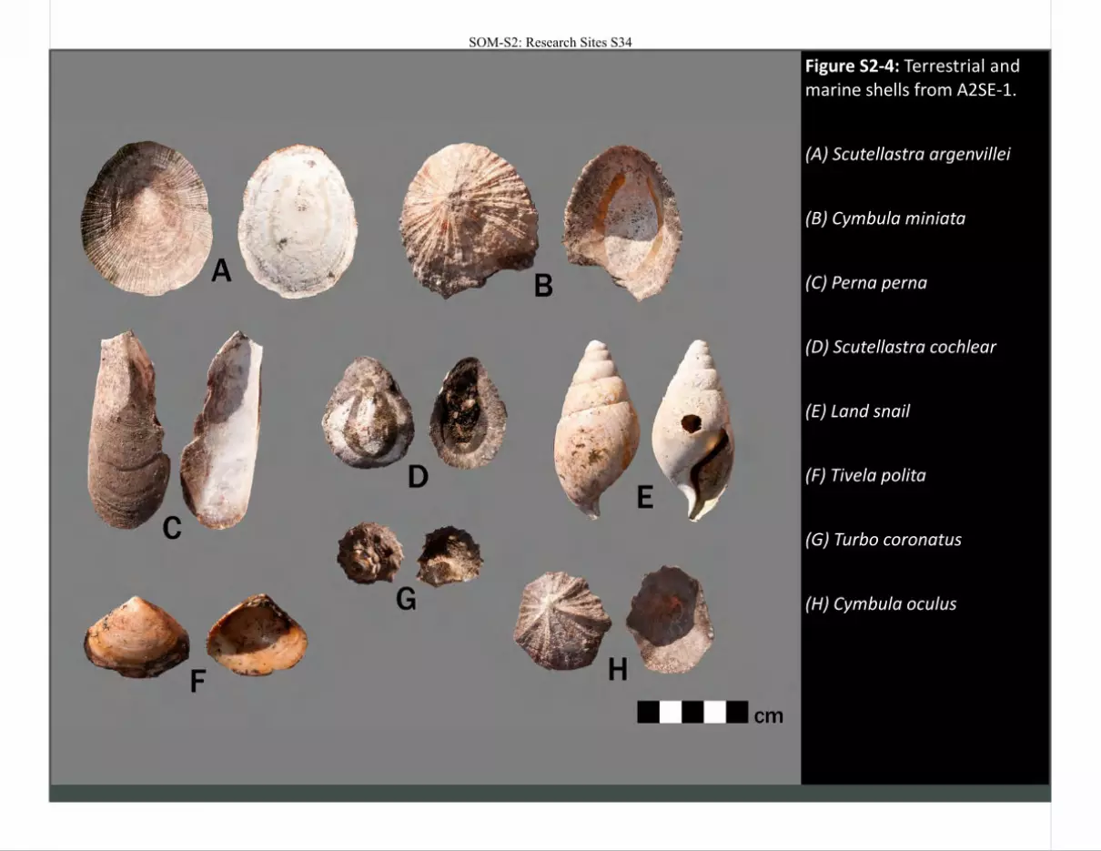
Figure S2-4: Terrestrial and marine shells from A2SE-1.
(A) Scutellastra argenvillei
(B) Cymbula miniata
(C) Perna perna
(D) Scutellastra cochlear
(E) Land snail
(F) Tivela polita
(G) Turbo coronatus
(H) Cymbula oculus
SOM-S2: Research Sites S34
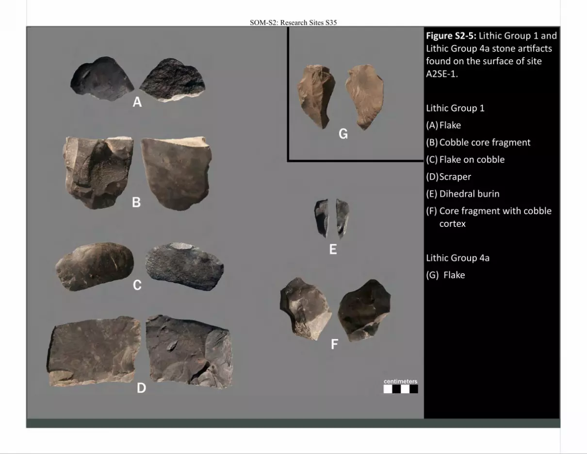
Figure S2-5: Lithic Group 1 and Lithic Group 4a stone artifacts found on the surface of site A2SE-1.
Lithic Group 1
(A) Flake
(B) Cobble core fragment
(C) Flake on cobble
(D) Scraper
(E) Dihedral burin
(F) Core fragment with cobble cortex
Lithic Group 4a
(G) Flake
SOM-S2: Research Sites S35

SOM-S2: Research Sites S36
SOM-S2: Research Sites S37
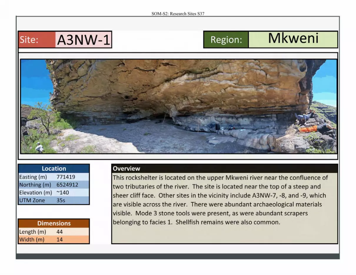
Site: A3NW-1
Location Easting (m) 771419
Northing (m) 6524912
Elevation (m) "'140
UTM Zone 35s
Dimensions Length (m) 44
Width (m) 14
Region: Mkweni
Overview
This rockshelter is located on the upper Mkweni river near the confluence of
two tributaries of the river. The site is located near the top of a steep and sheer cliff face. Other sites in the vicinity include A3NW-7, -8, and -9, which are visible across the river. There were abundant archaeological materials visible. Mode 3 stone tools were present, as were abundant scrapers
belonging to facies 1. Shellfish remains were also common.
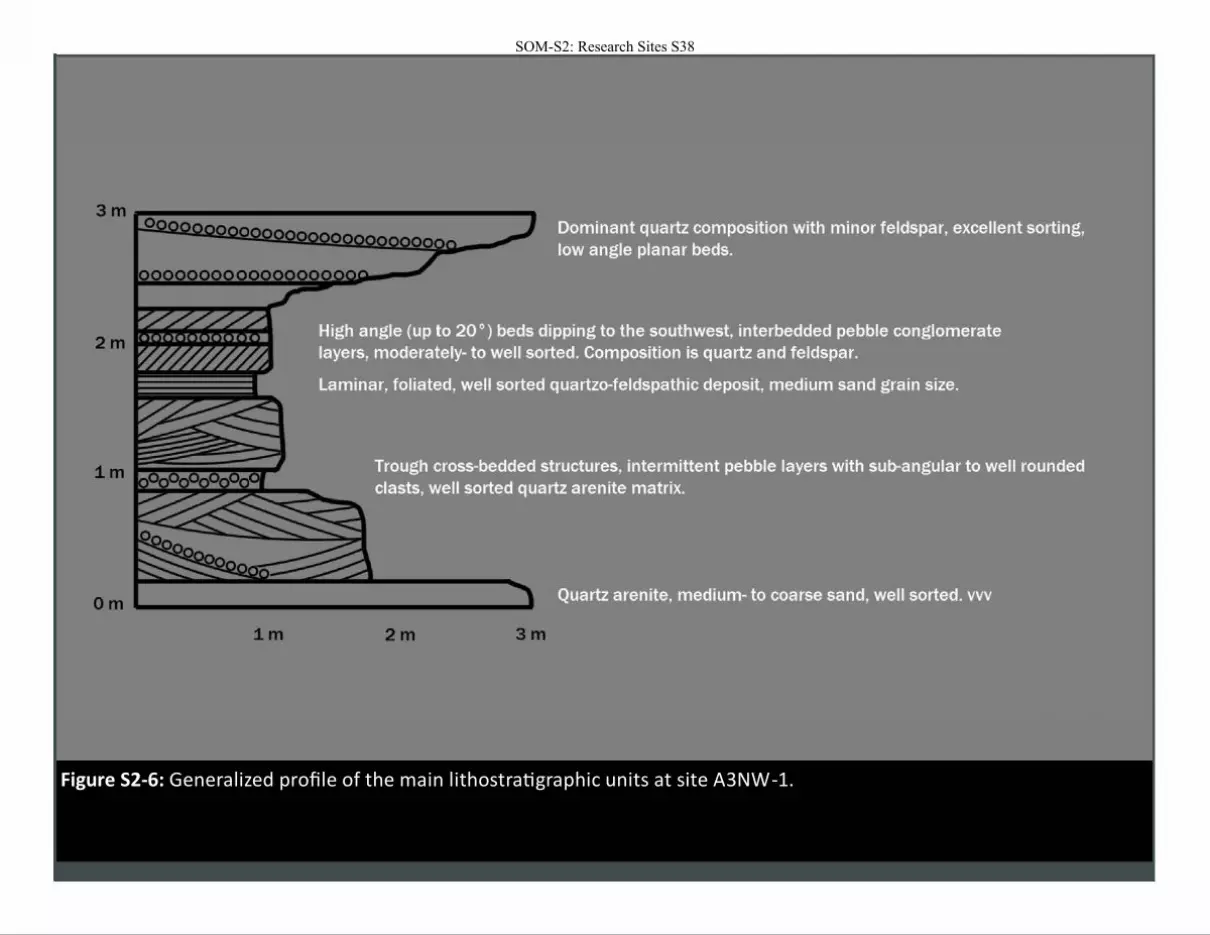
Figure S2-6: Generalized profile of the main lithostratigraphic units at site A3NW-1.
SOM-S2: Research Sites S38
m
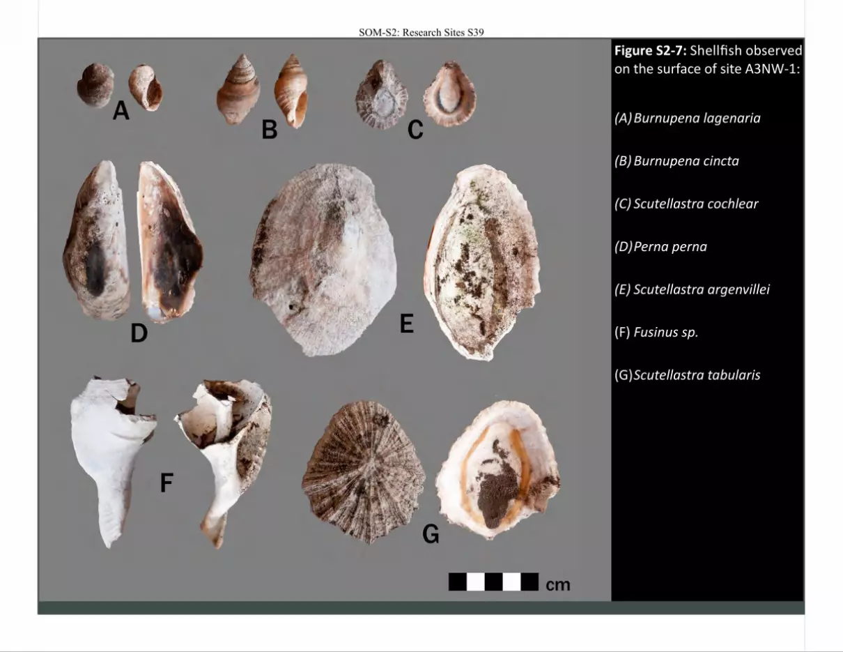
Figure S2-7: Shellfish observed on the surface of site A3NW-1:
(A) Burnupena lagenaria
(B) Burnupena cincta
(C) Scutellastra cochlear
(D) Perna perna
(E) Scutellastra argenvillei
(F) Fusinus sp.
(G) Scutellastra tabularis
SOM-S2: Research Sites S39
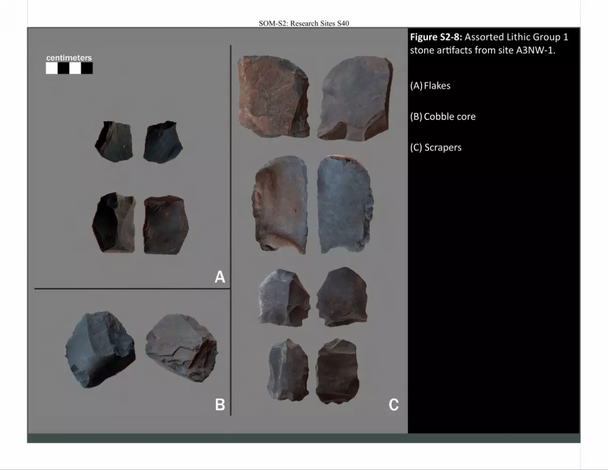
Figure S2-8: Assorted Lithic Group 1 stone artifacts from site A3NW-1.
(A) Flakes
(B) Cobble core
(C) Scrapers
SOM-S2: Research Sites S40
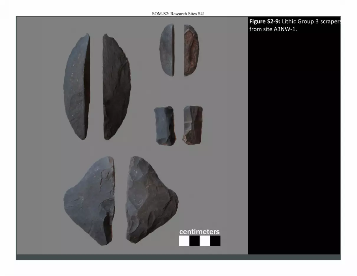
Figure S2-9: Lithic Group 3 scrapers from site A3NW-1.
SOM-S2: Research Sites S41
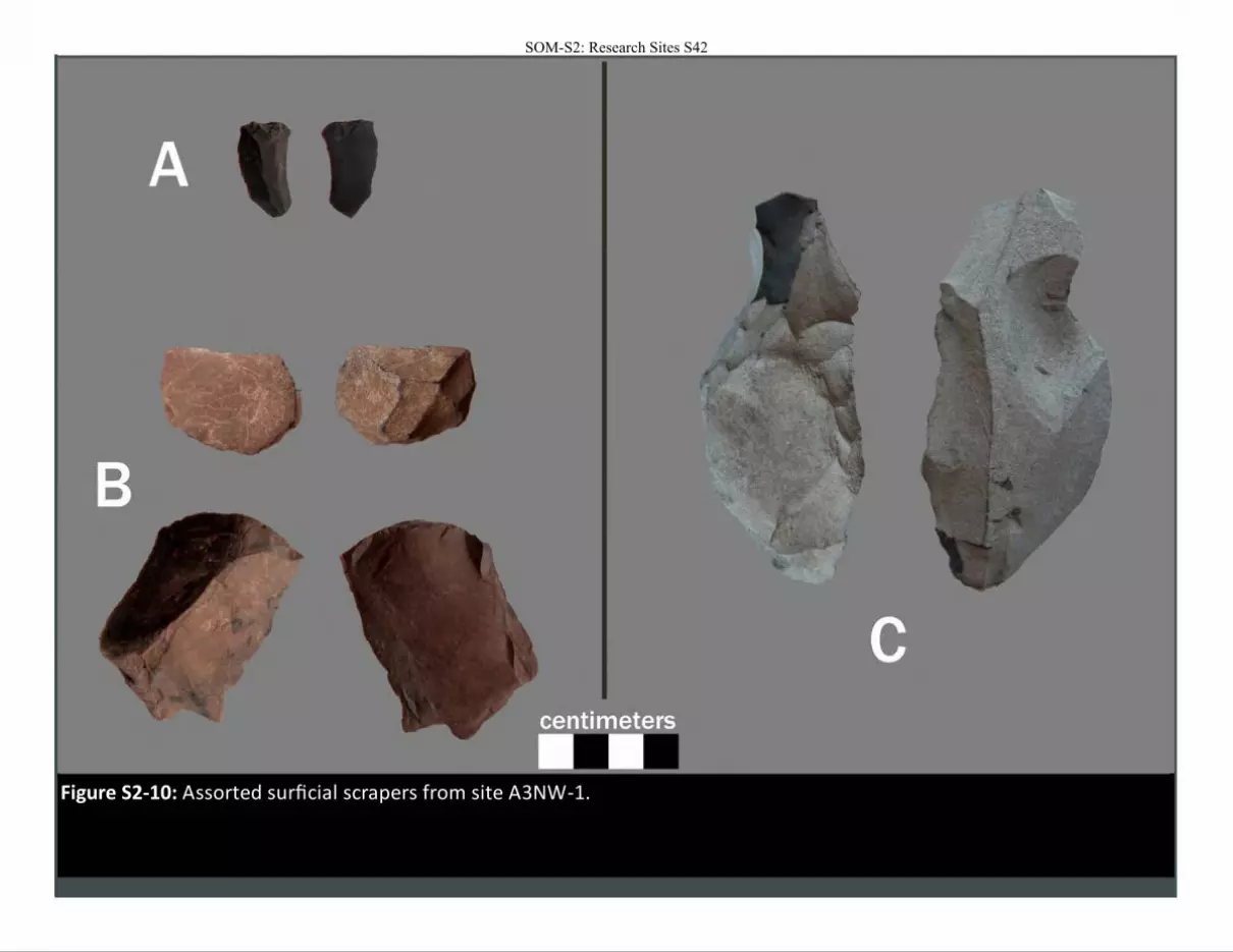
Figure S2-10: Assorted surficial scrapers from site A3NW-1.
SOM-S2: Research Sites S42
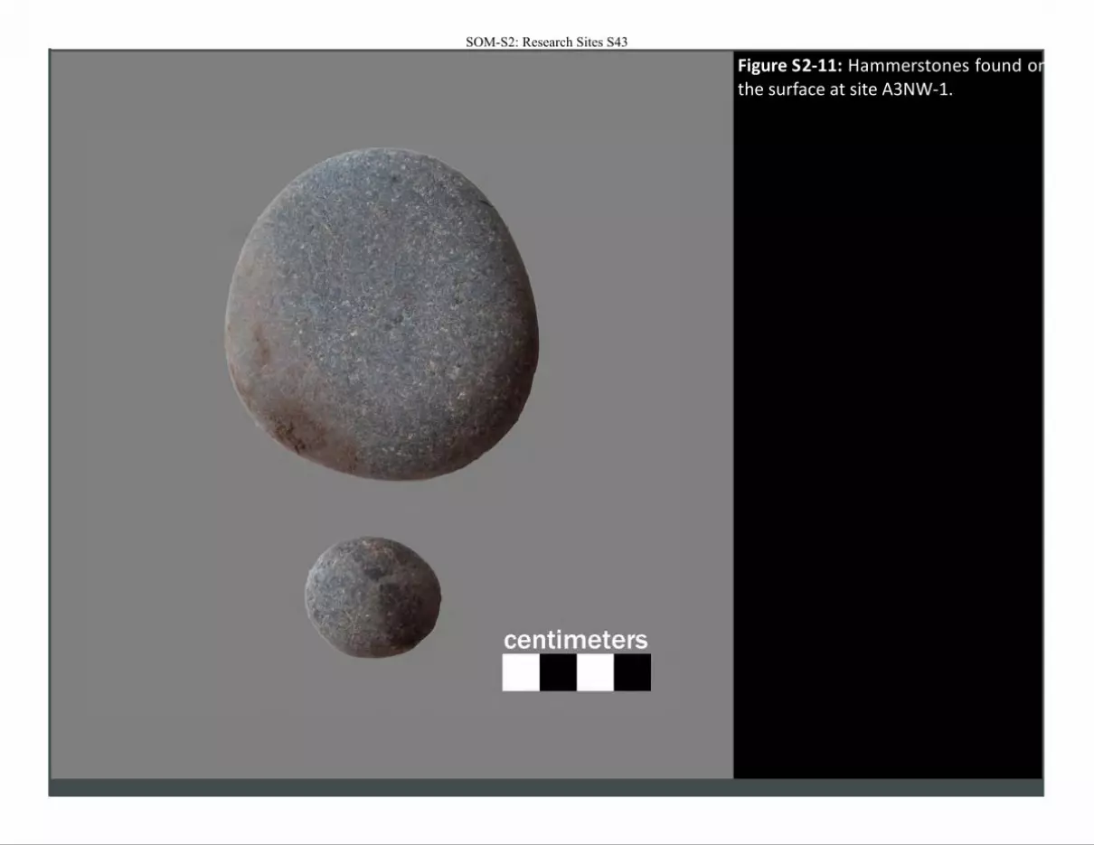
Figure S2-11: Hammerstones found on the surface at site A3NW-1.
SOM-S2: Research Sites S43
SOM-S2: Research Sites S44
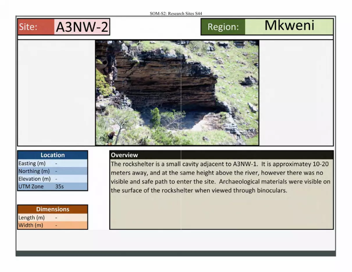
Site: A3NW-2
Location Easting (m) Northing (m) -
----
Elevation (m) -
UTM Zone 35s
Dimensions Length (m) Width (m)
• wen1 Region: M
Overview
e rockshelter is a small cavity adjacent to A3NW-1. It is approximatey 10-20 meters away, and at the same height above the river, however there was no
visible and safe path to enter the site. Archaeological materials were visible on he surface of the rockshcelter when viewed through binoculars.
SOM-S2: Research Sites S45
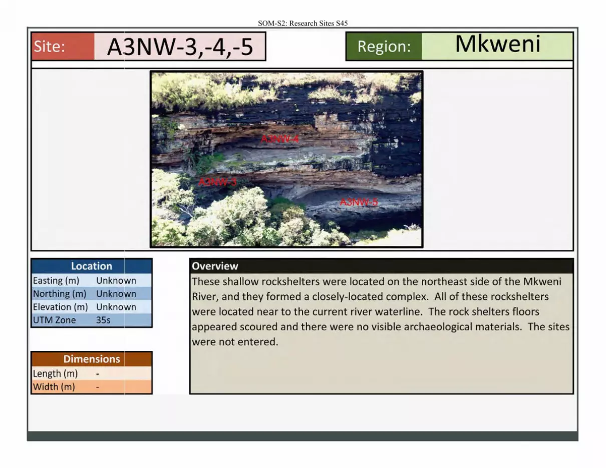
Site:
location Easting (m)
Northing (m)
Elevation (m)
UTM Zone
Dimensions Length (m)
Width (m)
Region: Mkweni
Overview
These shallow rockshelters were located on the northeast side of the Mkweni River, and they formed a closely-located complex. All of these rockshelters
were located near to the current river waterline. The rock shelters floors appeared scoured and there were no visible archaeological materials. The sites
were not entered.

SOM-S2: Research Sites S46
Site: A3NW-6
Location Easting (m) 771474 Northing (m) 6524849
Elevation (m) Unknown UTM Zone 3Ss
Dimensions Length (m) Width (m)
Region: Mkweni
Overview
This small rockshelter was located on the upper Mkweni River. The rockshelter
was shallow and it had only a very light scatter of marine shellfish remains/
which all appeared to be limpets. There were no visible stone tools.
SOM-S2: Research Sites S47
SOM-S2: Research Sites S48
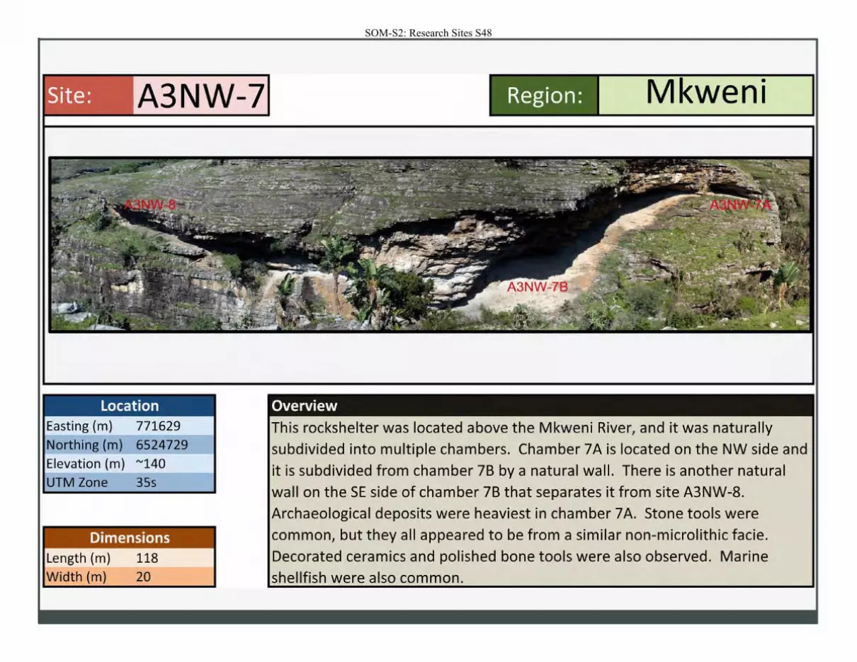
Site: A3NW-7 - ----- --
Location Easting (m) 771629
Northing (m) 6524729
Elevation (m) "'140
UTM Zone 35s
Dimensions Length (m) 118
Width (m) 20
Region: Mkweni
Overview
This rockshelter was located above the Mkweni River, and it was naturally
subdivided into multiple chambers. Chamber 7 A is located on the NW side and it is subdivided from chamber 7B by a natural wall. There is another natural wall on theSE side of chamber 7B that separates it from site A3NW-8. Archaeological deposits were heaviest in chamber 7 A. Stone tools were common, but they all appeared to be from a similar non-microlithic facie .
Decorated ceramics and polished bone tools were also observed. Marine shellfish were also common.
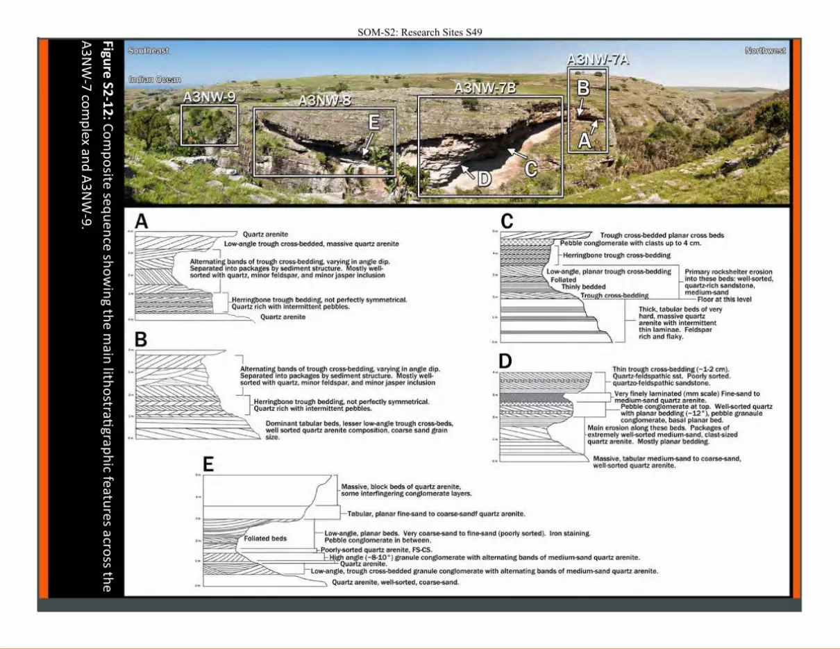
Figure
S2-1
2: C
om
po
site se
qu
en
ce sh
ow
ing th
e m
ain lith
ostrati
graph
ic featu
res across th
e
A3
NW
-7 co
mp
lex and
A3
NW
-9.
SOM-S2: Research Sites S49
Quartz arenite Low-angle trough cross-bedded, massive quartz arenite
~~~~~::::=::A~I~te'=r~n-'a.:Jg bands of trough cross-bedding, varying in angle dip. Separated Into packages by sediment structure. Mostly wellsorted with quartz, minor feldspar, and minor jasper inclusion
I Alternating bands of trough cross-bedding, varying in angle dip. Separated into packages by sediment structure. Mostly well· sorted with quartz, minor feldspar, and minor j asper inclusion
_j
!~i~~~~~~i~~~lHerrlngbone trough bedding, not perfectly symmetrical. Quartz rich with intermittent pebbles.
Dominant tabular beds, lesser low-angle trough cross-beds, well sorted quartz arenite composition. coarse sand grain size.
Massive. block beds of quartz arenite. some Interfingering conglomerate layers.
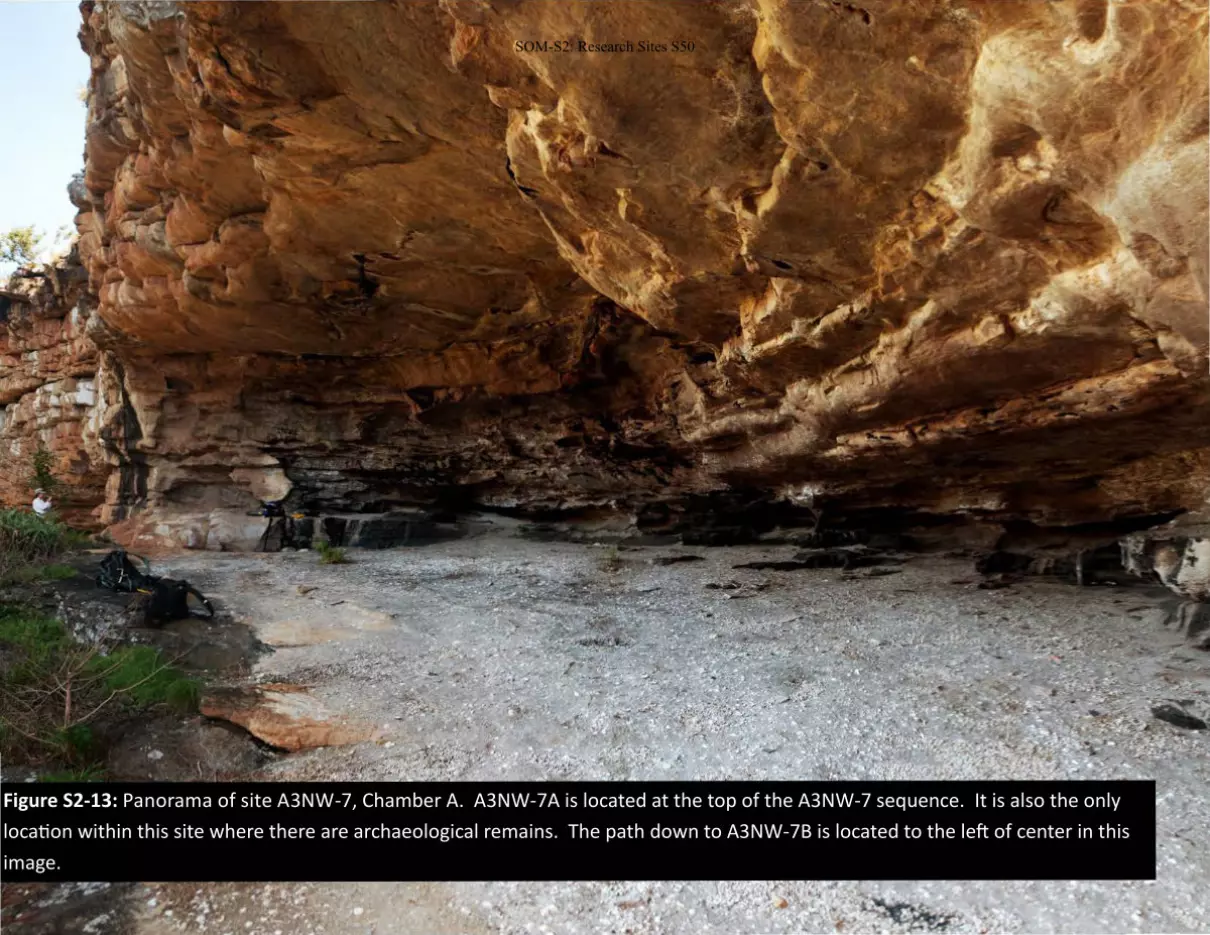
Figure S2-13: Panorama of site A3NW-7, Chamber A. A3NW-7A is located at the top of the A3NW-7 sequence. It is also the only
location within this site where there are archaeological remains. The path down to A3NW-7B is located to the left of center in this
image.
SOM-S2: Research Sites S50
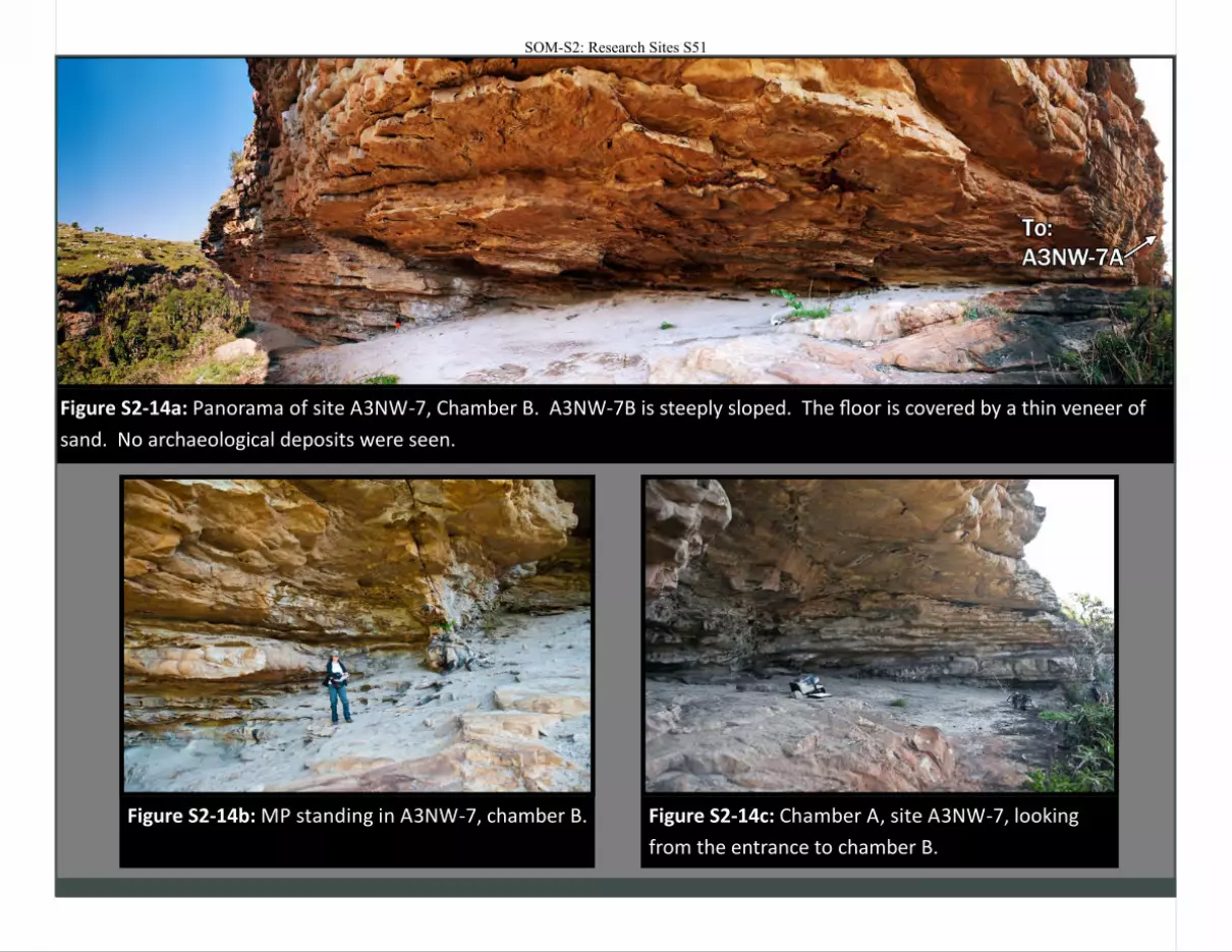
Figure S2-14a: Panorama of site A3NW-7, Chamber B. A3NW-7B is steeply sloped. The floor is covered by a thin veneer of
sand. No archaeological deposits were seen.
Figure S2-14b: MP standing in A3NW-7, chamber B.
Figure S2-14c: Chamber A, site A3NW-7, looking
from the entrance to chamber B.
SOM-S2: Research Sites S51
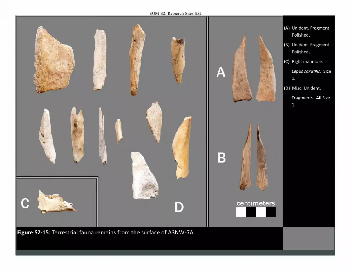
Figure S2-15: Terrestrial fauna remains from the surface of A3NW-7A.
(A) Unident. Fragment.
Polished.
(B) Unident. Fragment.
Polished.
(C) Right mandible.
Lepus saxatilis. Size
1.
(D) Misc. Unident.
Fragments. All Size
1.
SOM-S2: Research Sites S52
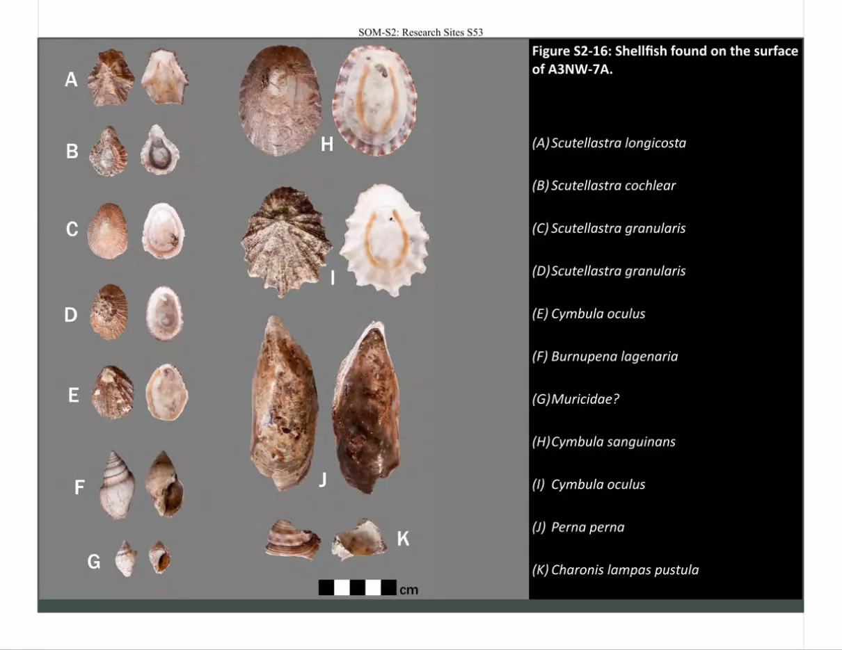
Figure S2-16: Shellfish found on the surface of A3NW-7A.
(A) Scutellastra longicosta
(B) Scutellastra cochlear
(C) Scutellastra granularis
(D) Scutellastra granularis
(E) Cymbula oculus
(F) Burnupena lagenaria
(G) Muricidae?
(H) Cymbula sanguinans
(I) Cymbula oculus
(J) Perna perna
(K) Charonis lampas pustula
SOM-S2: Research Sites S53
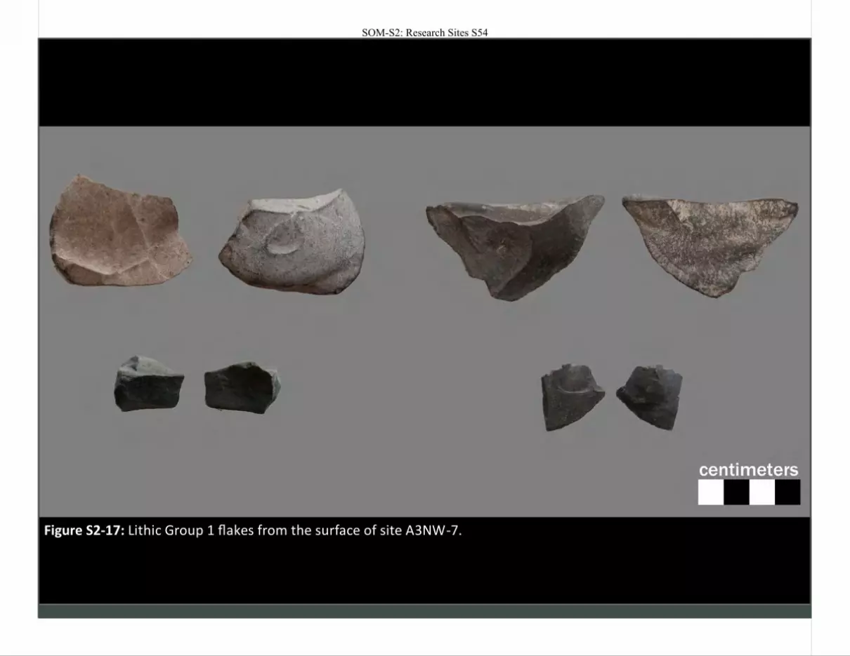
Figure S2-17: Lithic Group 1 flakes from the surface of site A3NW-7.
SOM-S2: Research Sites S54
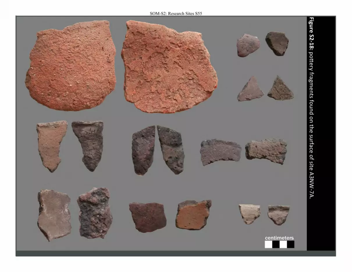
Figure
S2-1
8: p
ott
ery fragme
nts fo
un
d o
n th
e su
rface o
f site A
3NW
-7A
.
SOM-S2: Research Sites S55
SOM-S2: Research Sites S56
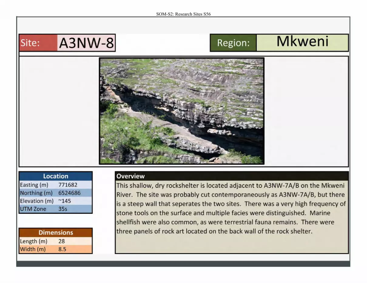
Site: A3NW-8
Location Easting (m) 771682 Northing (m) 6524686 Elevation (m) "'145 UTM Zone 35s
Dimensions Length (m) 28 Width (m) 8.5
M • wen1 Region:
Overview
is shallow, dry rockshelter is located adjacent to A3NW-7A/B on the Mkweni River. The site was probably cut contemporaneously as A3NW-7A/B, but there
is a steep wall that seperates the two sites. There was a very high frequency of
stone tools on the surface and multiple facies were distinguished. Marine
shellfish were also common, as were terrestrial fauna remains. There were hree panels of rock art located on the back wall of the rock shelter.
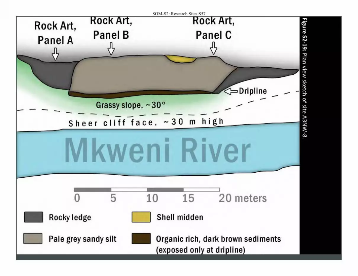
Figure
S2-1
9: P
lan view
sketch o
f site A
3N
W-8
.
SOM-S2: Research Sites S57
Rock Art, Panel A
--- --
'
Grassy slope, -30° -- -- --
'
--..-
----Sheer cliff face, -30 m high
kwe I • I
0 5 10 15 20 meters
Rocky ledge D Shell midden
D Pale grey sandy silt
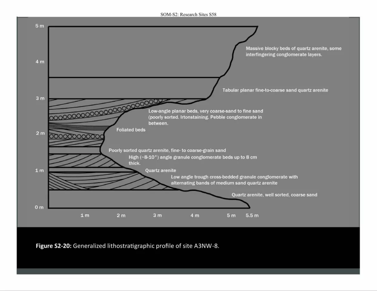
Figure S2-20: Generalized lithostratigraphic profile of site A3NW-8.
SOM-S2: Research Sites S58
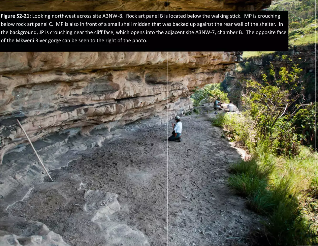
Figure S2-21: Looking northwest across site A3NW-8. Rock art panel B is located below the walking stick. MP is crouching
below rock art panel C. MP is also in front of a small shell midden that was backed up against the rear wall of the shelter. In
the background, JP is crouching near the cliff face, which opens into the adjacent site A3NW-7, chamber B. The opposite face
of the Mkweni River gorge can be seen to the right of the photo.
SOM-S2: Research Sites S59
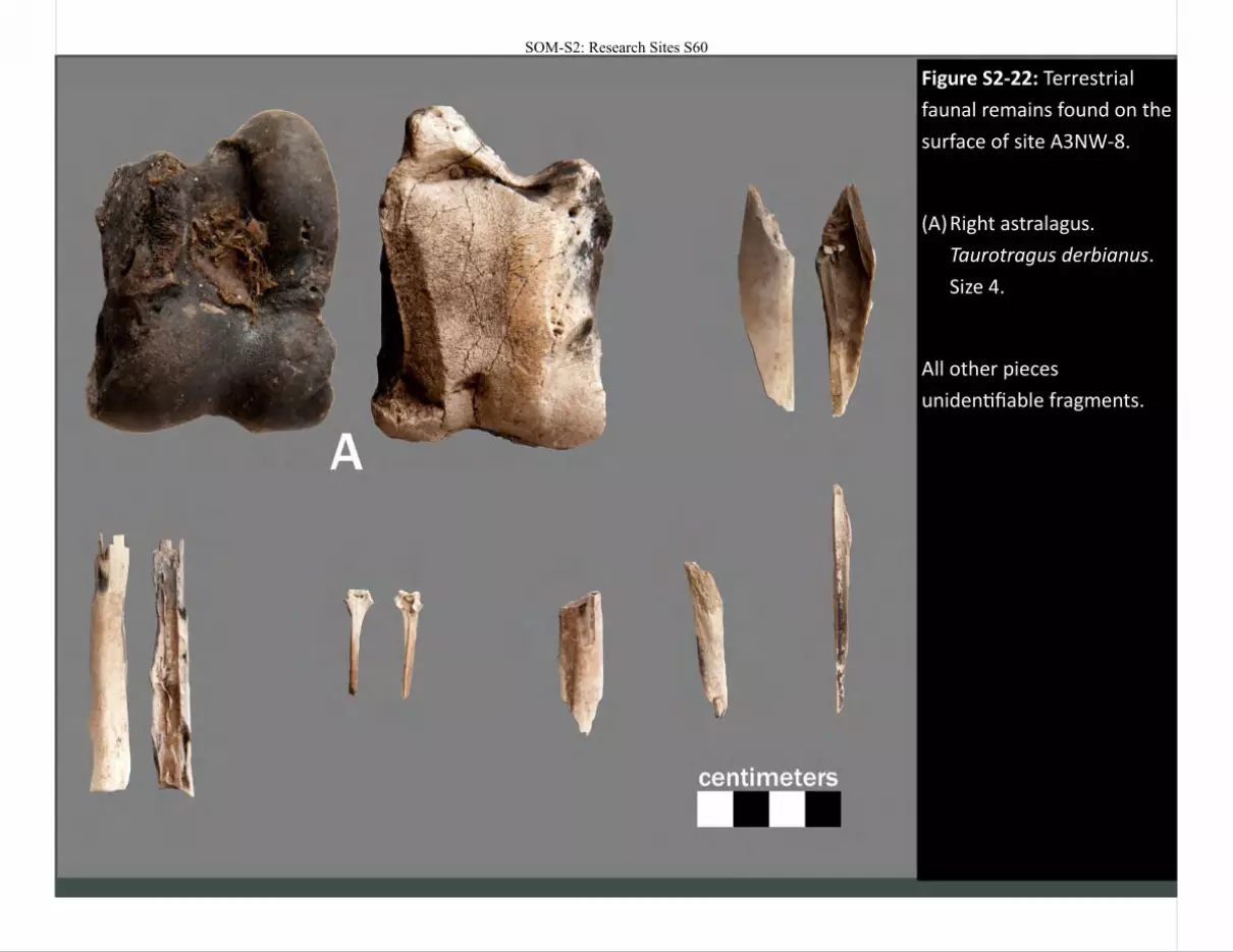
Figure S2-22: Terrestrial
faunal remains found on the
surface of site A3NW-8.
(A) Right astralagus.
Taurotragus derbianus.
Size 4.
All other pieces
unidentifiable fragments.
SOM-S2: Research Sites S60
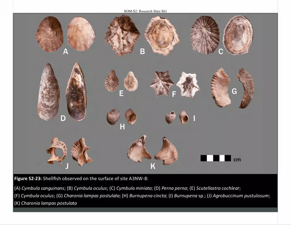
Figure S2-23: Shellfish observed on the surface of site A3NW-8:
(A) Cymbula sanguinans; (B) Cymbula oculus; (C) Cymbula miniata; (D) Perna perna; (E) Scutellastra cochlear;
(F) Cymbula oculus; (G) Charonia lampas postulata; (H) Burnupena cincta; (I) Burnupena sp.; (J) Agrobuccinum pustulosum;
(K) Charonia lampas postulata
SOM-S2: Research Sites S61
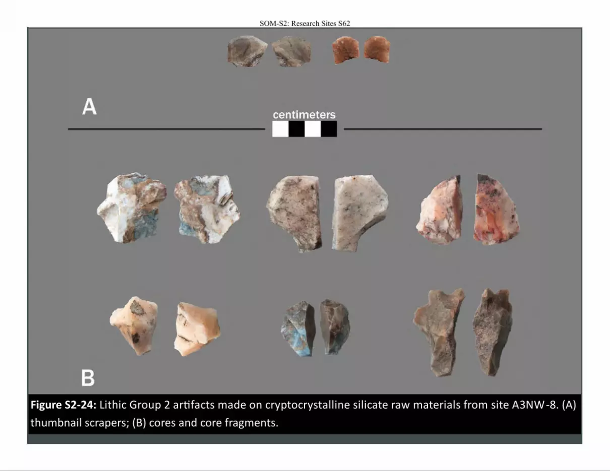
Figure S2-24: Lithic Group 2 artifacts made on cryptocrystalline silicate raw materials from site A3NW -8. (A)
thumbnail scrapers; (B) cores and core fragments.
SOM-S2: Research Sites S62
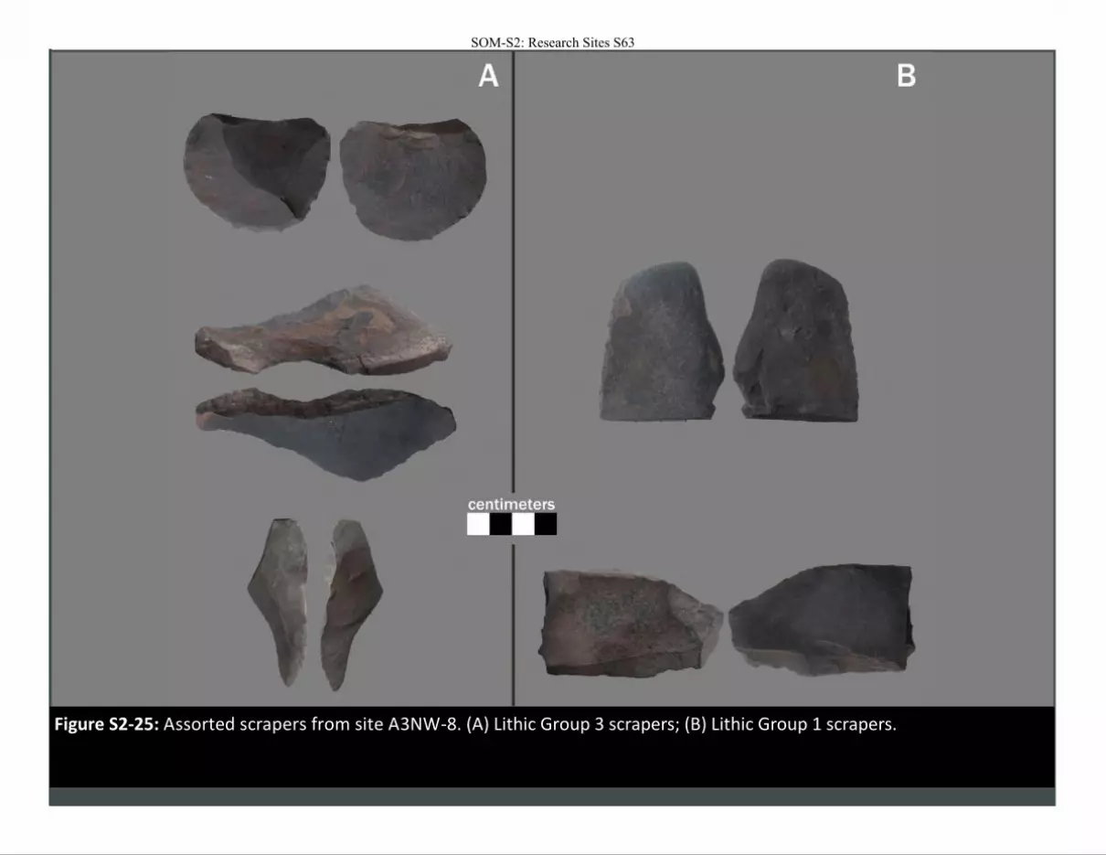
Figure S2-25: Assorted scrapers from site A3NW-8. (A) Lithic Group 3 scrapers; (B) Lithic Group 1 scrapers.
SOM-S2: Research Sites S63
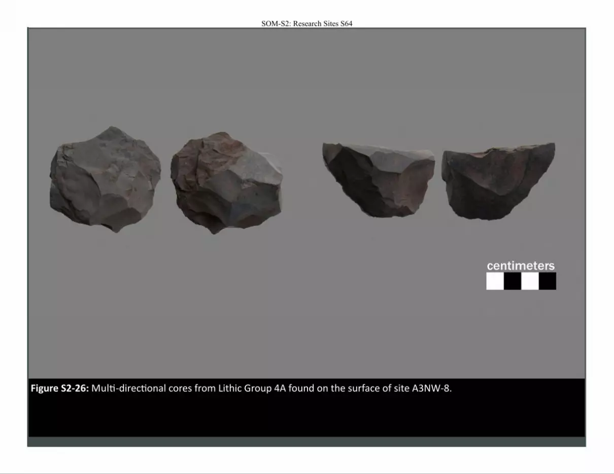
Figure S2-26: Multi-directional cores from Lithic Group 4A found on the surface of site A3NW-8.
SOM-S2: Research Sites S64
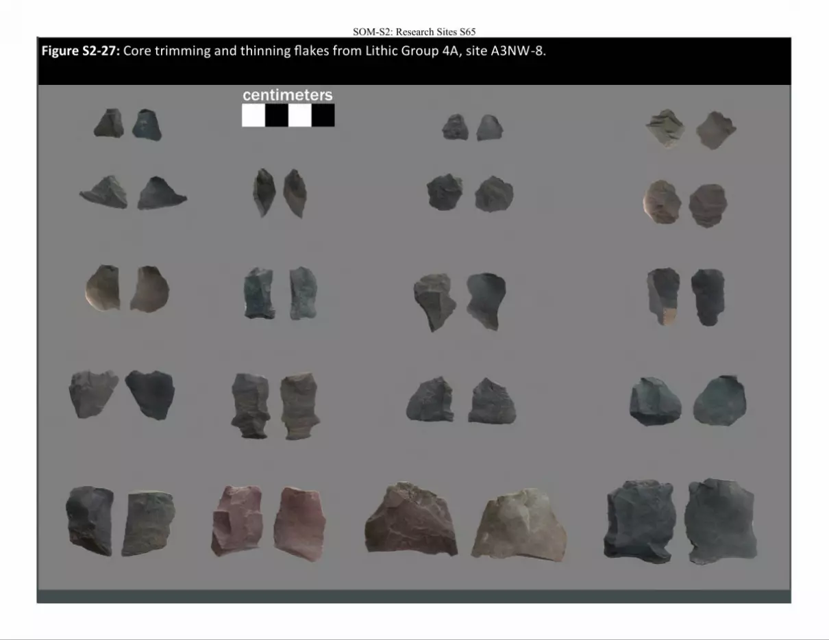
Figure S2-27: Core trimming and thinning flakes from Lithic Group 4A, site A3NW-8.
SOM-S2: Research Sites S65
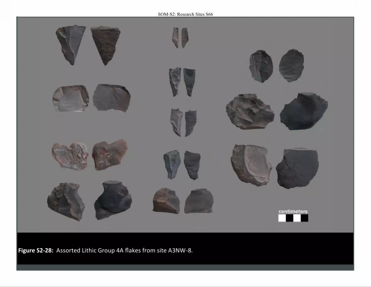
Figure S2-28: Assorted Lithic Group 4A flakes from site A3NW-8.
SOM-S2: Research Sites S66
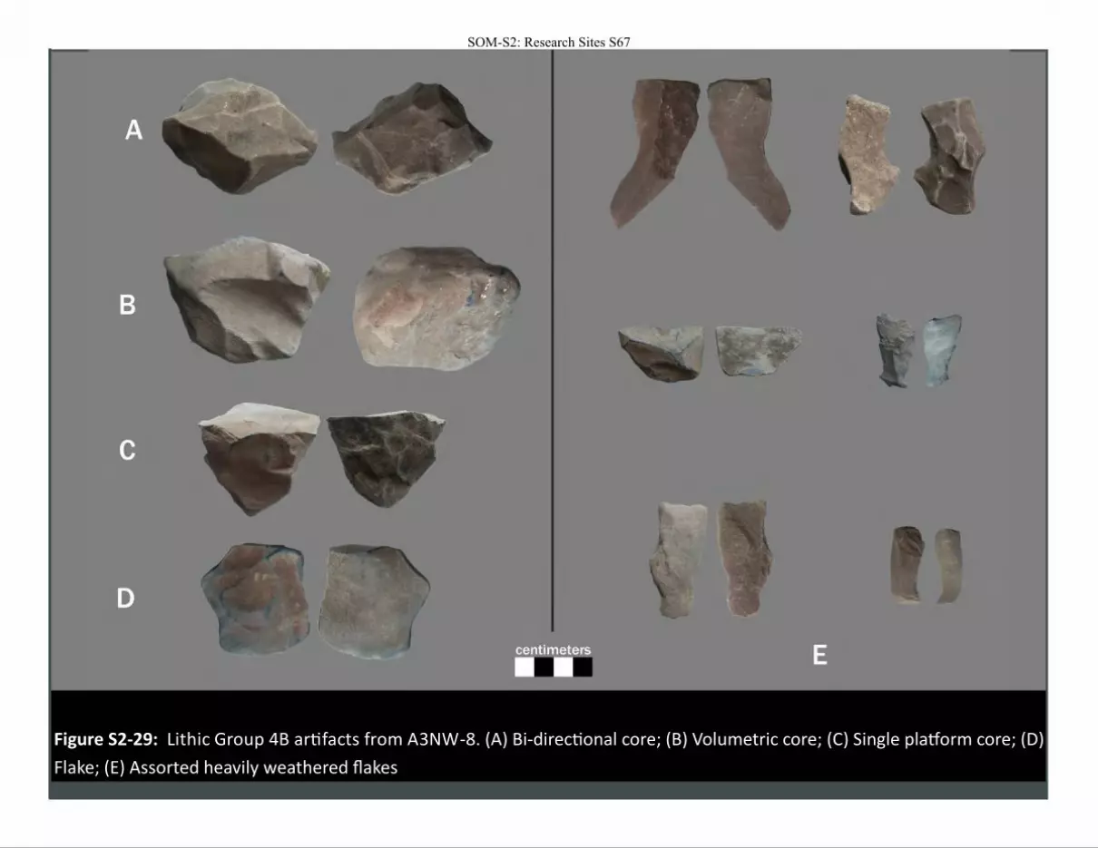
Figure S2-29: Lithic Group 4B artifacts from A3NW-8. (A) Bi-directional core; (B) Volumetric core; (C) Single platform core; (D)
Flake; (E) Assorted heavily weathered flakes
SOM-S2: Research Sites S67
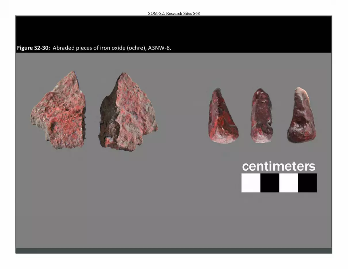
Figure S2-30: Abraded pieces of iron oxide (ochre), A3NW-8.
SOM-S2: Research Sites S68

Panel A, Element A Panel B, Element B Panel B, Element C
Figure
S2-3
1: R
ock art p
ane
ls at A3
NW
-8 an
d th
eir corresp
on
din
g locati
on
on
the ro
ck shelter w
all.
SOM-S2: Research Sites S69
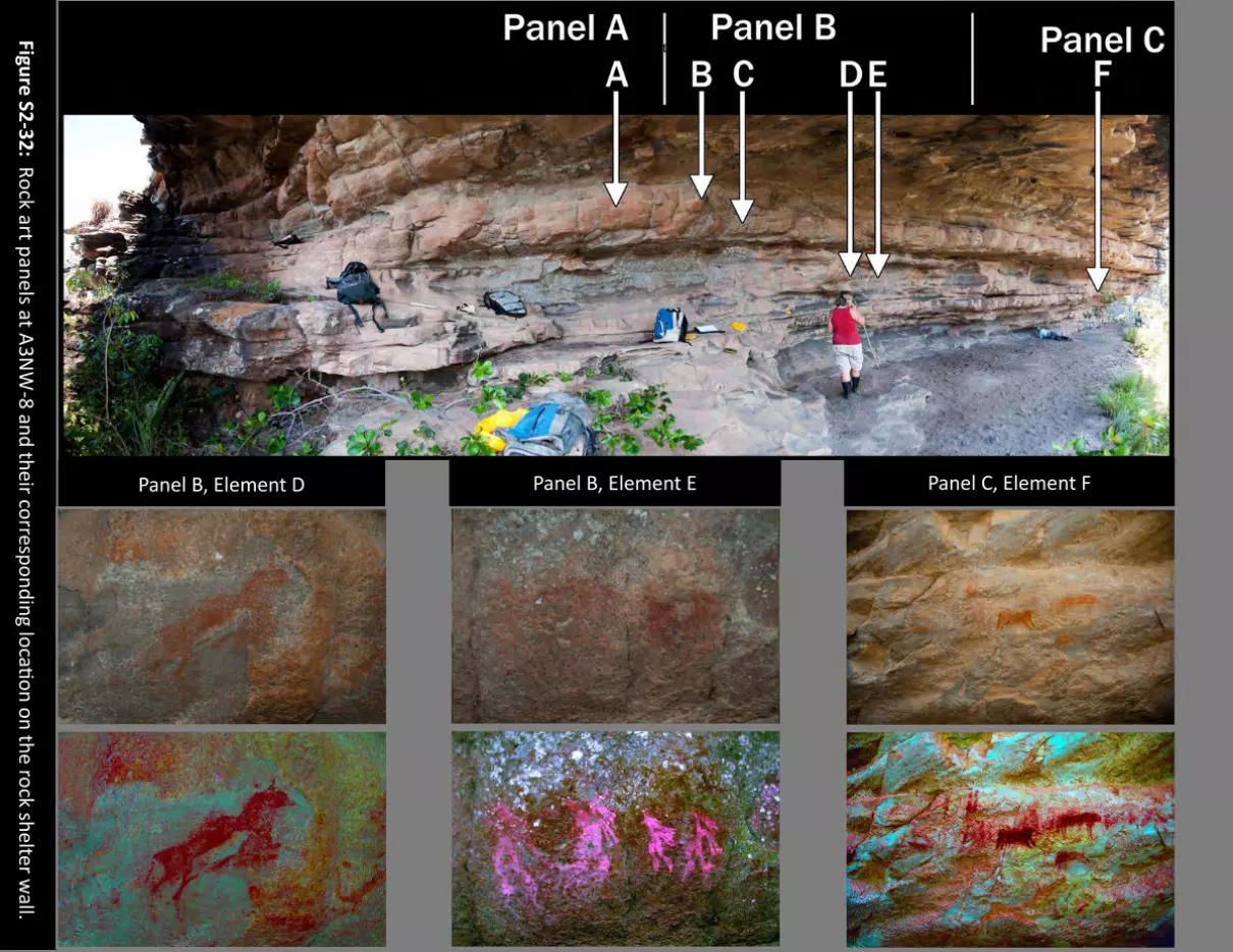
Panel B, Element D Panel B, Element E Panel C, Element F
Figure
S2-3
2: R
ock art p
ane
ls at A3
NW
-8 an
d th
eir corresp
on
din
g locati
on
on
the ro
ck shelter w
all.
SOM-S2: Research Sites S70
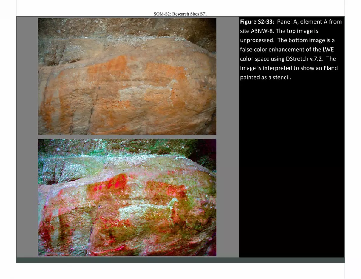
Figure S2-33: Panel A, element A from
site A3NW-8. The top image is
unprocessed. The bottom image is a
false-color enhancement of the LWE
color space using DStretch v.7.2. The
image is interpreted to show an Eland
painted as a stencil.
SOM-S2: Research Sites S71
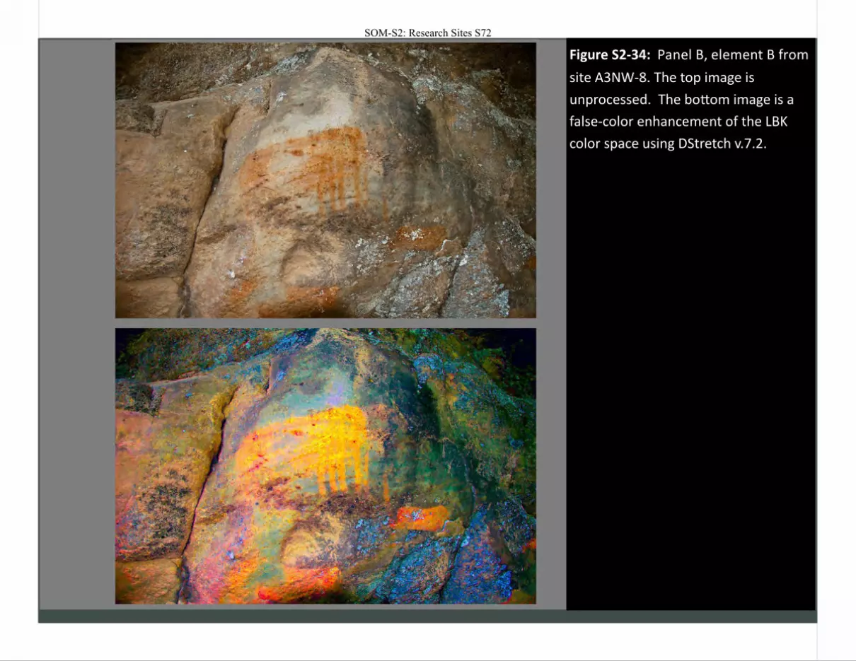
Figure 2-38
Figure S2-34: Panel B, element B from
site A3NW-8. The top image is
unprocessed. The bottom image is a
false-color enhancement of the LBK
color space using DStretch v.7.2.
SOM-S2: Research Sites S72
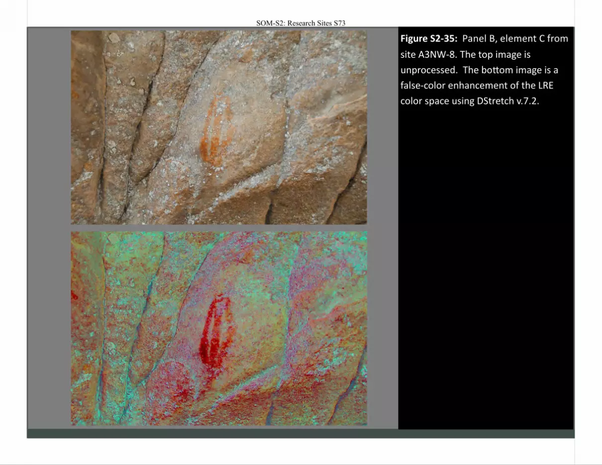
Figure 2-39
Figure S2-35: Panel B, element C from
site A3NW-8. The top image is
unprocessed. The bottom image is a
false-color enhancement of the LRE
color space using DStretch v.7.2.
SOM-S2: Research Sites S73
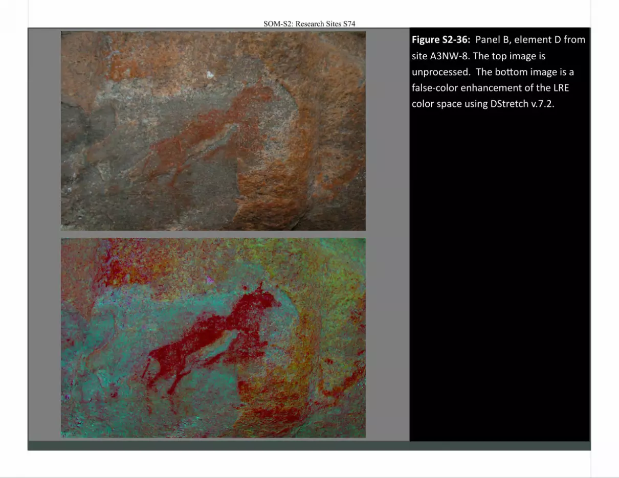
Figure 2-40
Figure S2-36: Panel B, element D from
site A3NW-8. The top image is
unprocessed. The bottom image is a
false-color enhancement of the LRE
color space using DStretch v.7.2.
SOM-S2: Research Sites S74
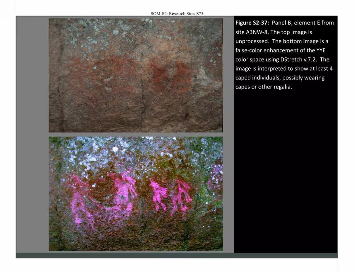
Figure 2-41
Figure S2-37: Panel B, element E from
site A3NW-8. The top image is
unprocessed. The bottom image is a
false-color enhancement of the YYE
color space using DStretch v.7.2. The
image is interpreted to show at least 4
caped individuals, possibly wearing
capes or other regalia.
SOM-S2: Research Sites S75
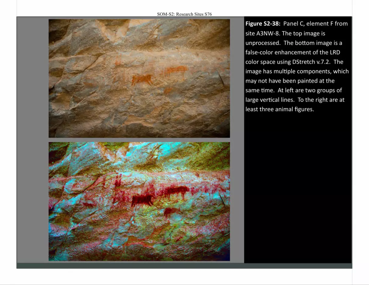
Figure 2-41
Figure S2-38: Panel C, element F from
site A3NW-8. The top image is
unprocessed. The bottom image is a
false-color enhancement of the LRD
color space using DStretch v.7.2. The
image has multiple components, which
may not have been painted at the
same time. At left are two groups of
large vertical lines. To the right are at
least three animal figures.
SOM-S2: Research Sites S76
SOM-S2: Research Sites S77
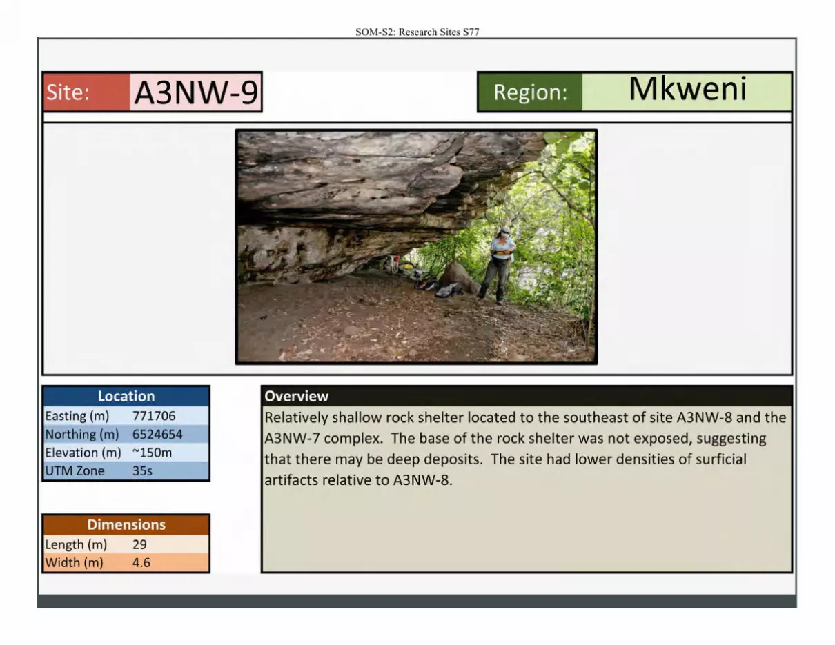
Site: A3NW-9
Location Easting (m) 771706
Northing (m) 6524654
Elevation (m) "'150m
UTM Zone 35s
Dimensions Length (m) 29
Width (m) 4.6
Region: Mkweni
Overview
Relatively shallow rock shelter located to the southeast of site A3NW-8 and the
A3NW-7 complex. The base of the rock shelter was not exposed, suggesting that there may be deep deposits. The site had lower densities of surficial
artifacts relative to A3NW-8.
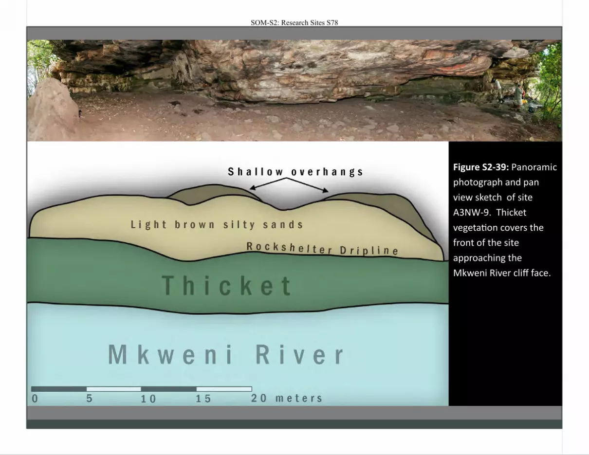
Figure S2-39: Panoramic
photograph and pan
view sketch of site
A3NW-9. Thicket
vegetation covers the
front of the site
approaching the
Mkweni River cliff face.
SOM-S2: Research Sites S78
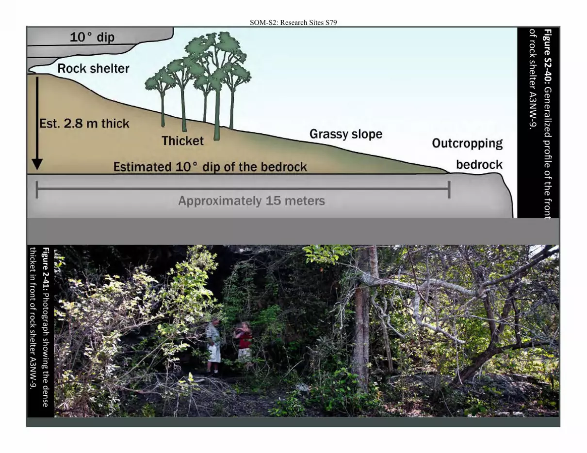
Figure
S2-4
0: G
en
eralize
d p
rofi
le o
f the
fron
t
of ro
ck shelter A
3NW
-9.
Figure 2
-41
: Ph
oto
graph
sho
win
g the d
ense
thicket in
fron
t of ro
ck shelter A
3N
W-9
.
SOM-S2: Research Sites S79
Est. 2.8 m thick
Outcropping
Estimated 10° di of the bedrock
I Approximately 15 meters I
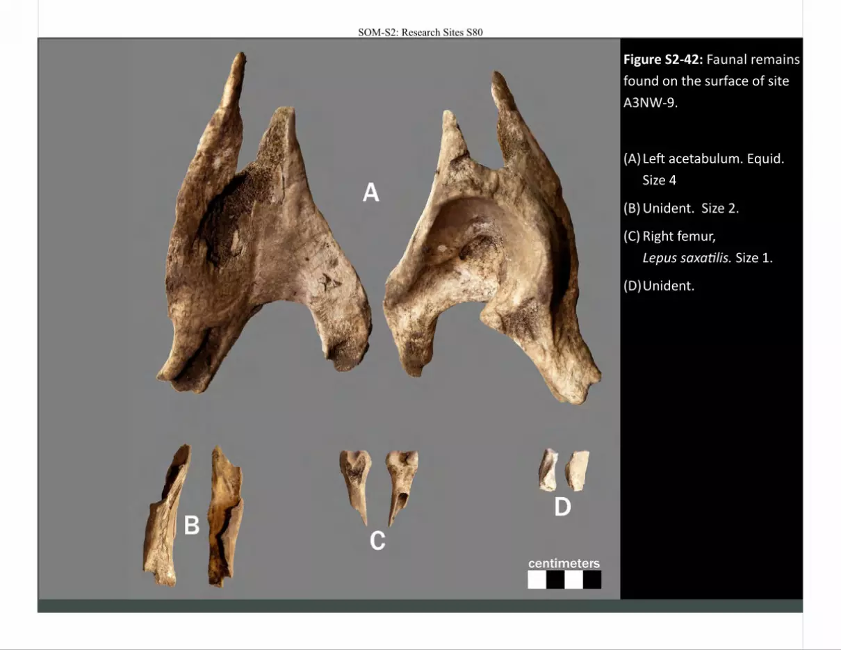
Figure S2-42: Faunal remains
found on the surface of site
A3NW-9.
(A) Left acetabulum. Equid.
Size 4
(B) Unident. Size 2.
(C) Right femur,
Lepus saxatilis. Size 1.
(D) Unident.
SOM-S2: Research Sites S80
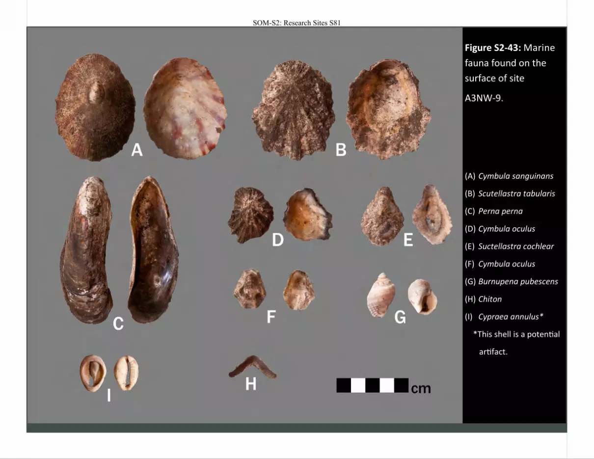
Figure S2-43: Marine
fauna found on the
surface of site
A3NW-9.
(A) Cymbula sanguinans
(B) Scutellastra tabularis
(C) Perna perna
(D) Cymbula oculus
(E) Suctellastra cochlear
(F) Cymbula oculus
(G) Burnupena pubescens
(H) Chiton
(I) Cypraea annulus*
*This shell is a potential
artifact.
SOM-S2: Research Sites S81
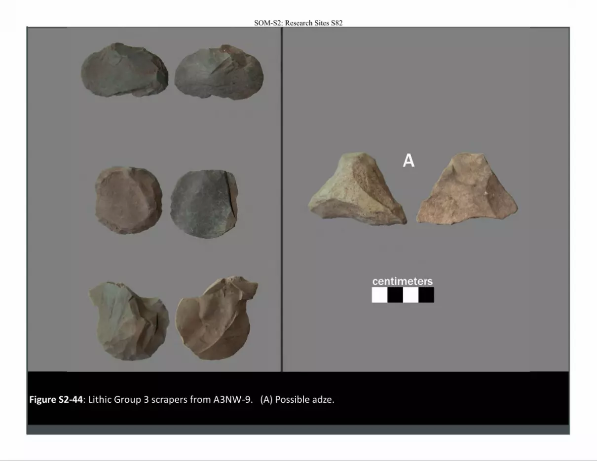
Figure S2-44: Lithic Group 3 scrapers from A3NW-9. (A) Possible adze.
SOM-S2: Research Sites S82
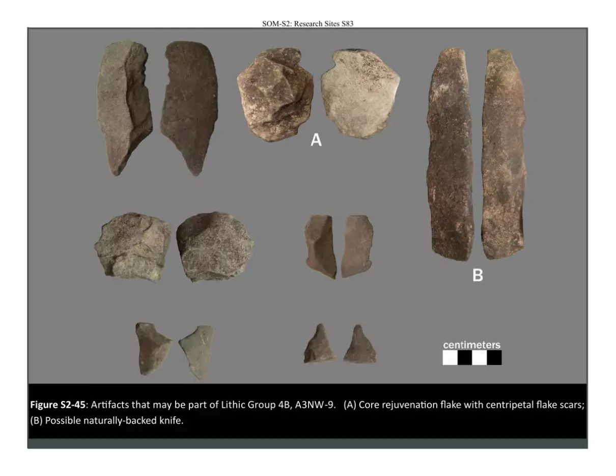
Figure S2-45: Artifacts that may be part of Lithic Group 4B, A3NW-9. (A) Core rejuvenation flake with centripetal flake scars;
(B) Possible naturally-backed knife.
SOM-S2: Research Sites S83
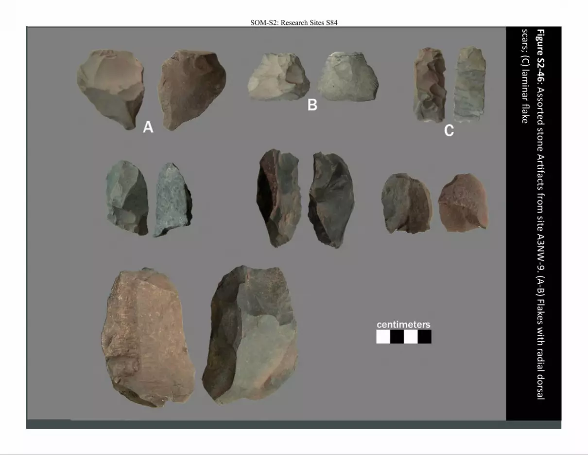
Figure
S2-4
6: A
ssorted
ston
e A
rtifacts fro
m site
A3
NW
-9. (A
-B) Flakes w
ith rad
ial do
rsal
scars; (C) lam
inar fl
ake
SOM-S2: Research Sites S84
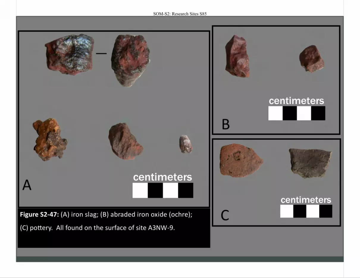
Figure S2-47: (A) iron slag; (B) abraded iron oxide (ochre);
(C) pottery. All found on the surface of site A3NW-9.
A
B
C
SOM-S2: Research Sites S85
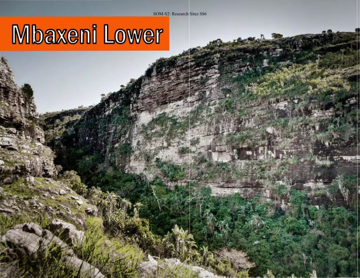
SOM-S2: Research Sites S86
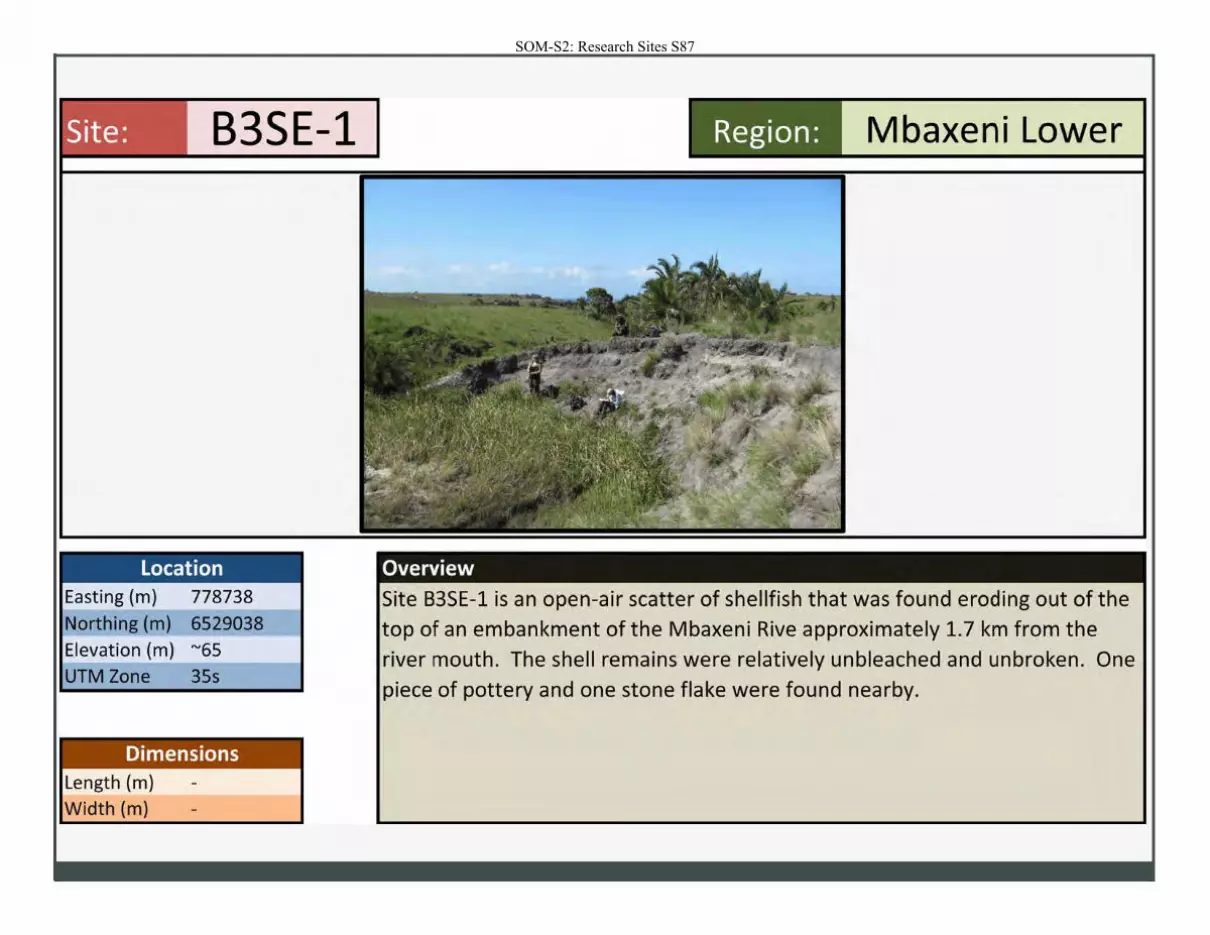
SOM-S2: Research Sites S87
Site: B3SE-1
Location Easting (m) 778738
Northing (m) 6529038
Elevation (m) "'65
UTM Zone 35s
Dimensions Length (m)
Width (m)
Region: Mbaxeni Lower
Overview
Site B3SE-1 is an open-air scatter of shellfish that was found eroding out of the top of an embankment of the Mbaxeni Rive approximately 1.7 km from the river mouth. The shell remains were relatively unbleached and unbroken. One
piece of pottery and one stone flake were found nearby.
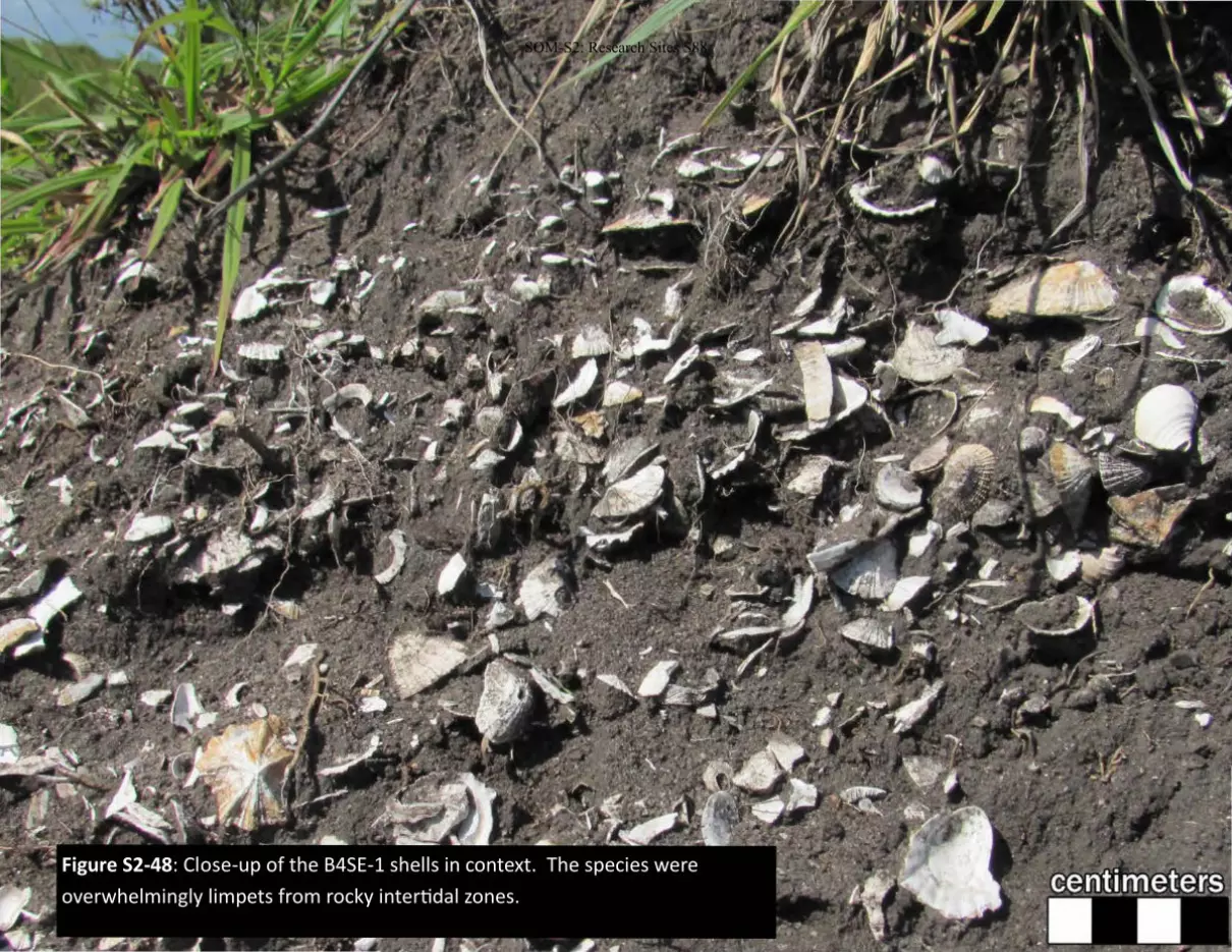
Figure S2-48: Close-up of the B4SE-1 shells in context. The species were
overwhelmingly limpets from rocky intertidal zones.
SOM-S2: Research Sites S88
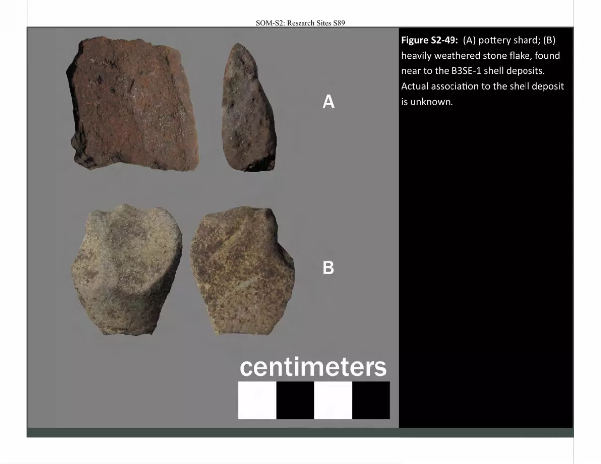
Figure S2-49: (A) pottery shard; (B)
heavily weathered stone flake, found
near to the B3SE-1 shell deposits.
Actual association to the shell deposit
is unknown.
SOM-S2: Research Sites S89
SOM-S2: Research Sites S90
-~~-
- .__,
SOM-S2: Research Sites S91
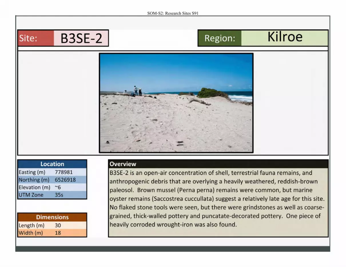
Site: B3SE-2
Location Easting (m) 778981
Northing (m) 6526918
Elevation (m) "'6
UTM Zone 35s
Dimensions Length (m)
Width (m)
30 18
Region: Kilroe
Overview
B3SE-2 is an open-air concentration of shell, terrestrial fauna remains, and anthropogenic debris that are overlying a heavily weathered, reddish-brown paleosol. Brown mussel (Perna perna) remains were common, but marine
oyster remains (Saccostrea cuccullata) suggest a relatively late age for this site. No flaked stone tools were seen, but there were grindstones as well as coarsegrained, thick-walled pottery and puncatate-decorated pottery. One piece of heavily corroded wrought-iron was also found.

Figure S2-50: Exposure of the reddish-brown paleosol underlying
site B3SE-2. Note the wood storm debris that has become
embedded into the paleosol.
SOM-S2: Research Sites S92
-, ,.-:;-__ . .. --:. .. ' at. ..... . -... ~---
•
./
. " "
-
---
, _ . .. . .. . .. .. .. .
'- .... ·. t?'~
....
.·
::'
I ->
.. .... .... .... - ·""-·
.. ..
"' ~ -.. ' _,
.... .......,,..H. _ _ --...
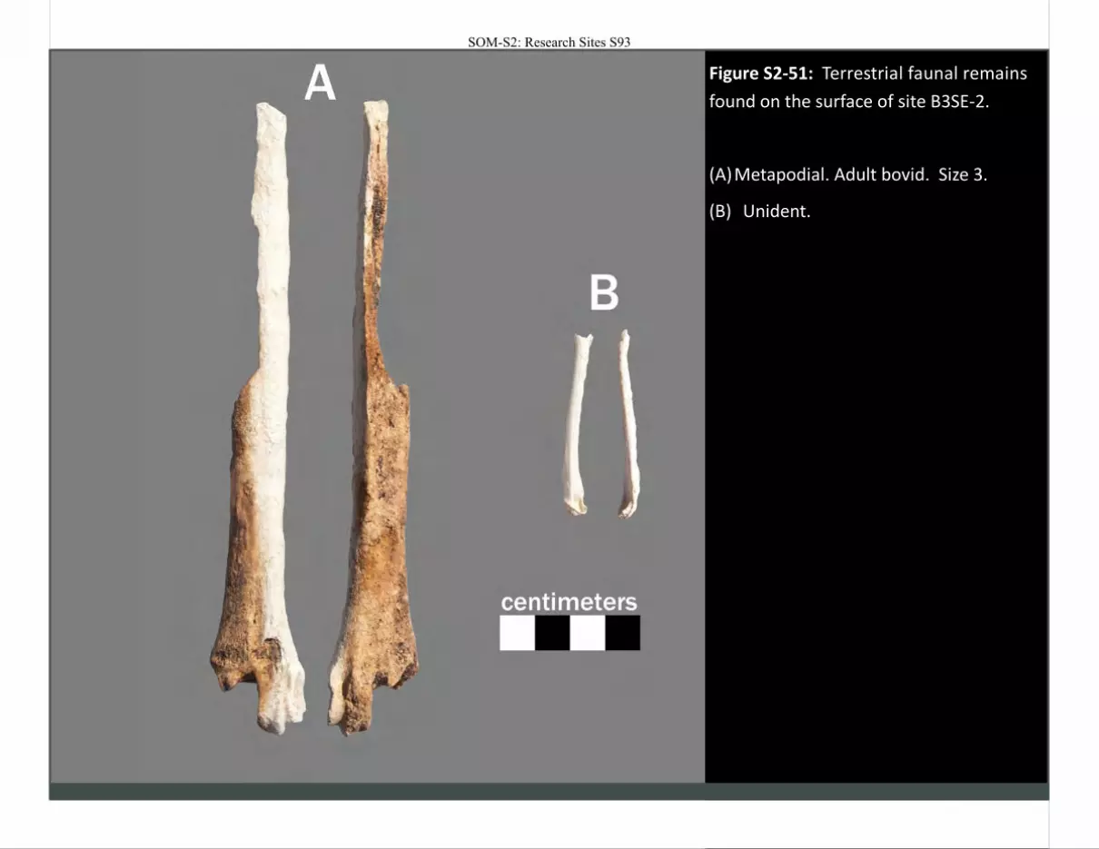
Figure S2-51: Terrestrial faunal remains
found on the surface of site B3SE-2.
(A) Metapodial. Adult bovid. Size 3.
(B) Unident.
SOM-S2: Research Sites S93
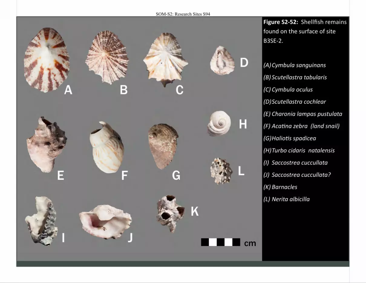
Figure S2-52: Shellfish remains
found on the surface of site
B3SE-2.
(A) Cymbula sanguinans
(B) Scutellastra tabularis
(C) Cymbula oculus
(D) Scutellastra cochlear
(E) Charonia lampas pustulata
(F) Acatina zebra (land snail)
(G) Haliotis spadicea
(H) Turbo cidaris natalensis
(I) Saccostrea cuccullata
(J) Saccostrea cuccullata?
(K) Barnacles
(L) Nerita albicilla
SOM-S2: Research Sites S94
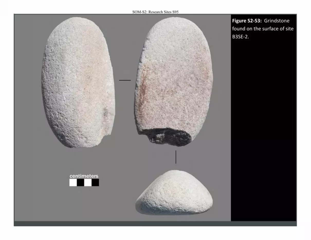
Figure S2-53: Grindstone
found on the surface of site
B3SE-2.
SOM-S2: Research Sites S95
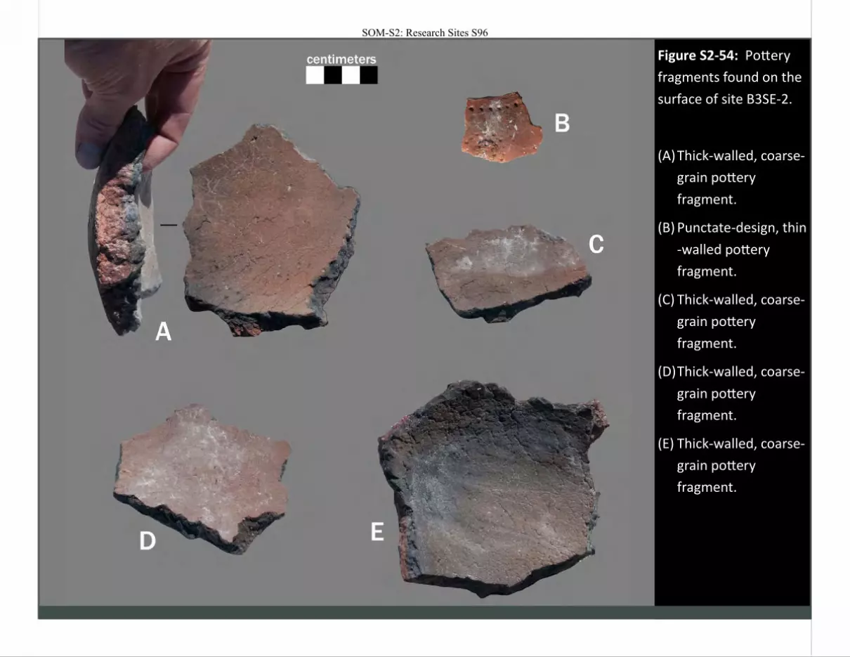
Figure S2-54: Pottery
fragments found on the
surface of site B3SE-2.
(A) Thick-walled, coarse-
grain pottery
fragment.
(B) Punctate-design, thin
-walled pottery
fragment.
(C) Thick-walled, coarse-
grain pottery
fragment.
(D) Thick-walled, coarse-
grain pottery
fragment.
(E) Thick-walled, coarse-
grain pottery
fragment.
SOM-S2: Research Sites S96
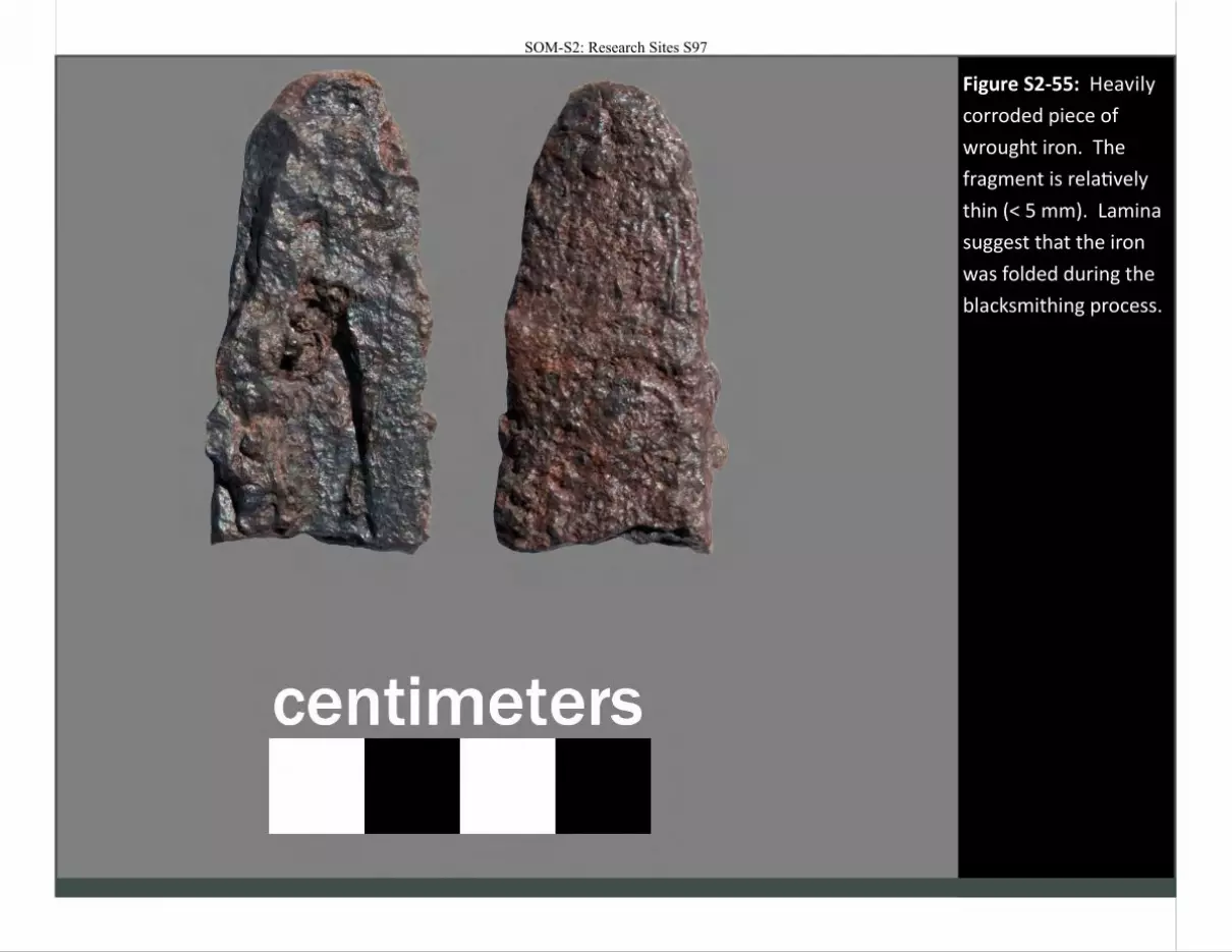
Figure S2-55: Heavily
corroded piece of
wrought iron. The
fragment is relatively
thin (< 5 mm). Lamina
suggest that the iron
was folded during the
blacksmithing process.
SOM-S2: Research Sites S97
SOM-S2: Research Sites S98
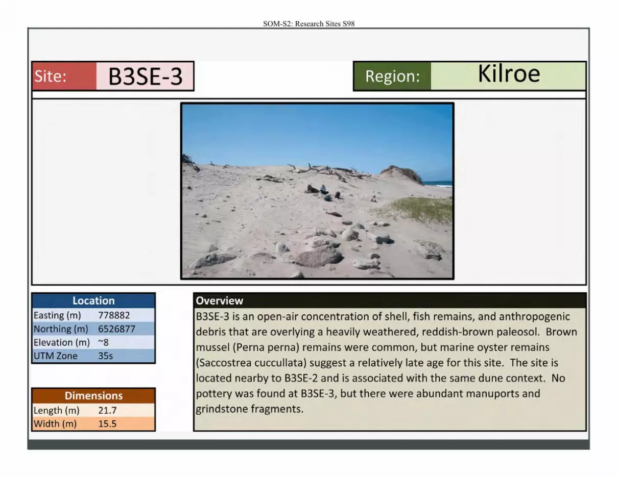
Site: B3SE-3
Location Easting (m) 778882
Northing (m) 6526877
Elevation (m) "'8
UTM Zone 35s
Dimensions Length (m)
Width (m)
21.7
15.5
.... --- ,;. - ·
Overview
Region: Kilroe
B3SE-3 is an open-air concentration of shell, fish remains, and anthropogenic
debris that are overlying a heavily weathered, reddish-brown paleosol. Brown
mussel (Perna perna) remains were common, but marine oyster remains
(Saccostrea cuccullata) suggest a relatively late age for this site. The site is
located nearby to B3SE-2 and is associated with the same dune context. No
pottery was found at B3SE-3, but there were abundant manu ports and
grindstone fragments.
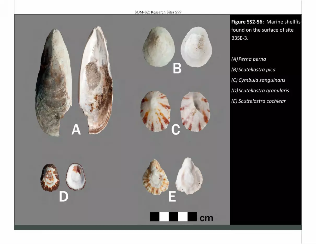
Figure SS2-56: Marine shellfish
found on the surface of site
B3SE-3.
(A) Perna perna
(B) Scutellastra pica
(C) Cymbula sanguinans
(D) Scutellastra granularis
(E) Scuttelastra cochlear
SOM-S2: Research Sites S99
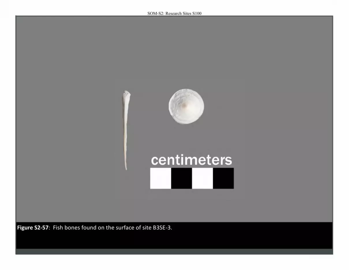
Figure S2-57: Fish bones found on the surface of site B3SE-3.
SOM-S2: Research Sites S100

Figure S2-58: Two heavily weathered grindstone fragments found on the surface of site B3SE-3.
SOM-S2: Research Sites S101
SOM-S2: Research Sites S102
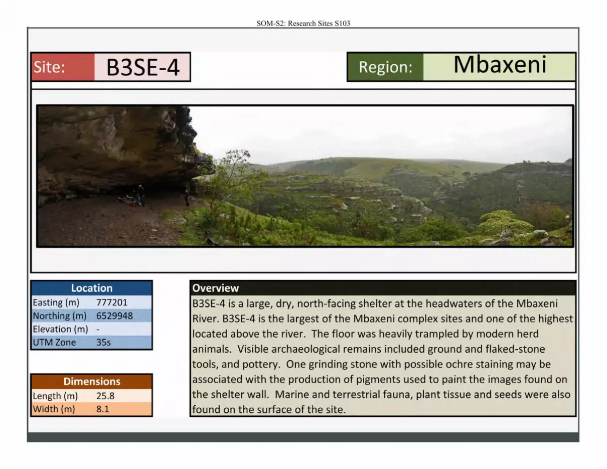
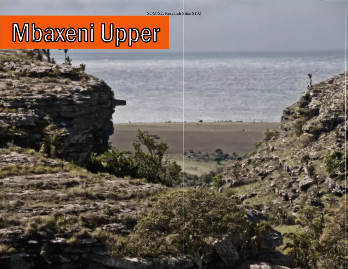
SOM-S2: Research Sites S103
Site: B3SE-4
Location Easting (m) 777201
Northing (m) 6529948 Elevation (m) -
UTM Zone 35s
Dimensions Length (m) 25.8 Width (m) 8.1
Region: M • axen1
Overview
B3SE-4 is a large, dry, north-facing shelter at the headwaters of the Mbaxeni River. B3SE-4 is the largest of the Mbaxeni complex sites and one of the highest located above the river. The floor was heavily trampled by modern herd
animals. Visible archaeological remains included ground and flaked-stone tools, and pottery. One grinding stone with possible ochre staining may be associated with the production of pigments used to paint the images found on the shelter wall. Marine and terrestrial fauna, plant tissue and seeds were also
found on the surface of the site.
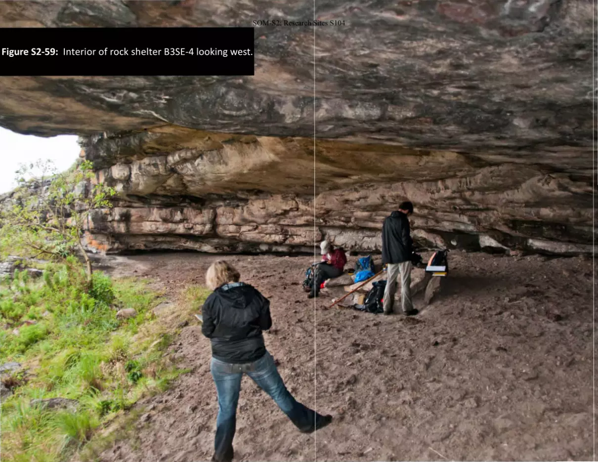
Figure S2-59: Interior of rock shelter B3SE-4 looking west.
SOM-S2: Research Sites S104
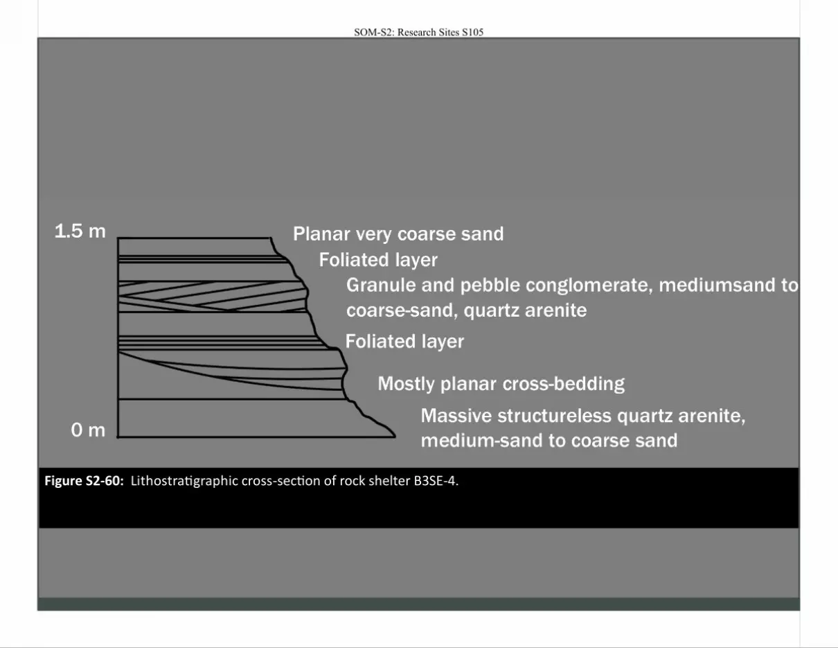
Figure S2-60: Lithostratigraphic cross-section of rock shelter B3SE-4.
SOM-S2: Research Sites S105
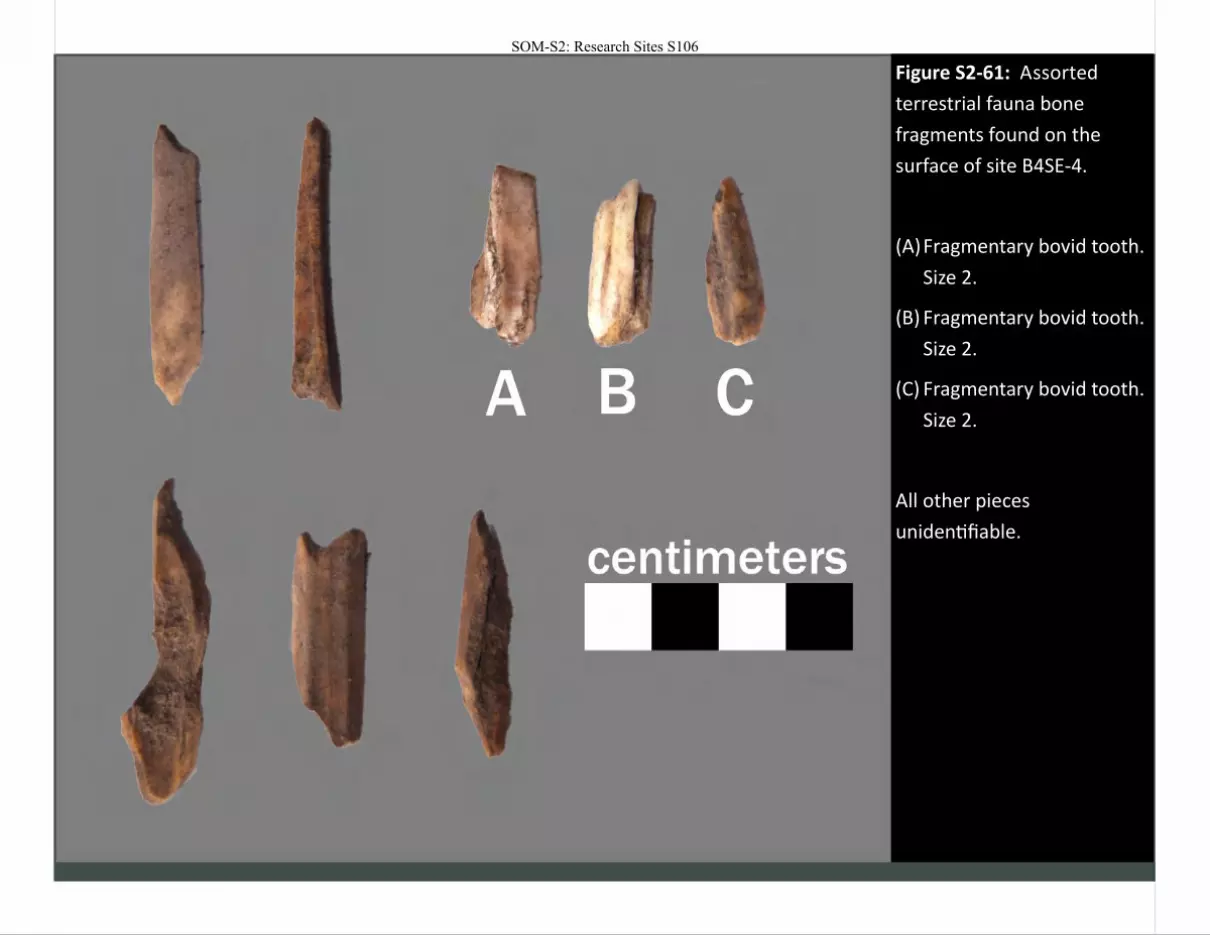
Figure S2-61: Assorted
terrestrial fauna bone
fragments found on the
surface of site B4SE-4.
(A) Fragmentary bovid tooth.
Size 2.
(B) Fragmentary bovid tooth.
Size 2.
(C) Fragmentary bovid tooth.
Size 2.
All other pieces
unidentifiable.
SOM-S2: Research Sites S106
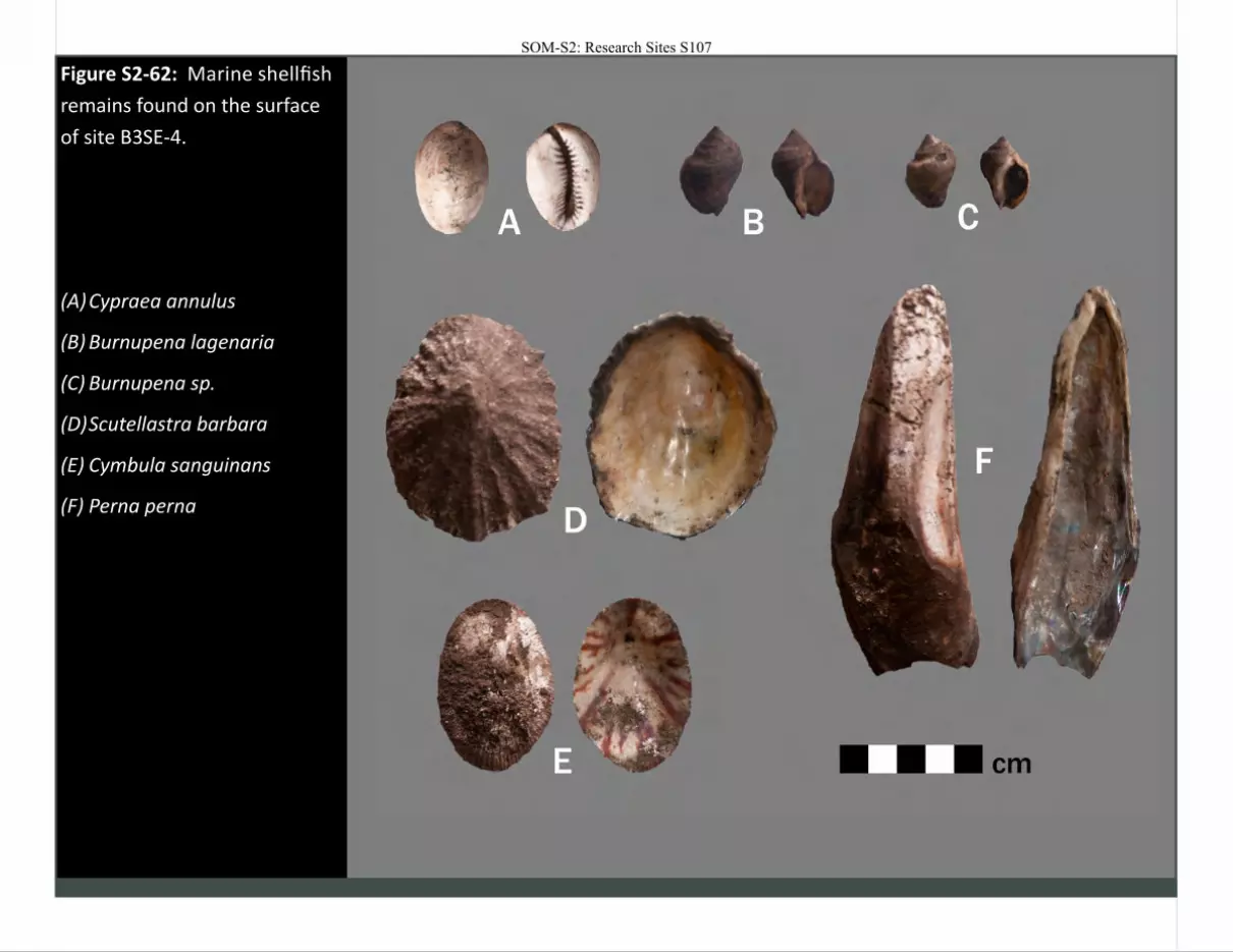
Figure S2-62: Marine shellfish
remains found on the surface
of site B3SE-4.
(A) Cypraea annulus
(B) Burnupena lagenaria
(C) Burnupena sp.
(D) Scutellastra barbara
(E) Cymbula sanguinans
(F) Perna perna
SOM-S2: Research Sites S107
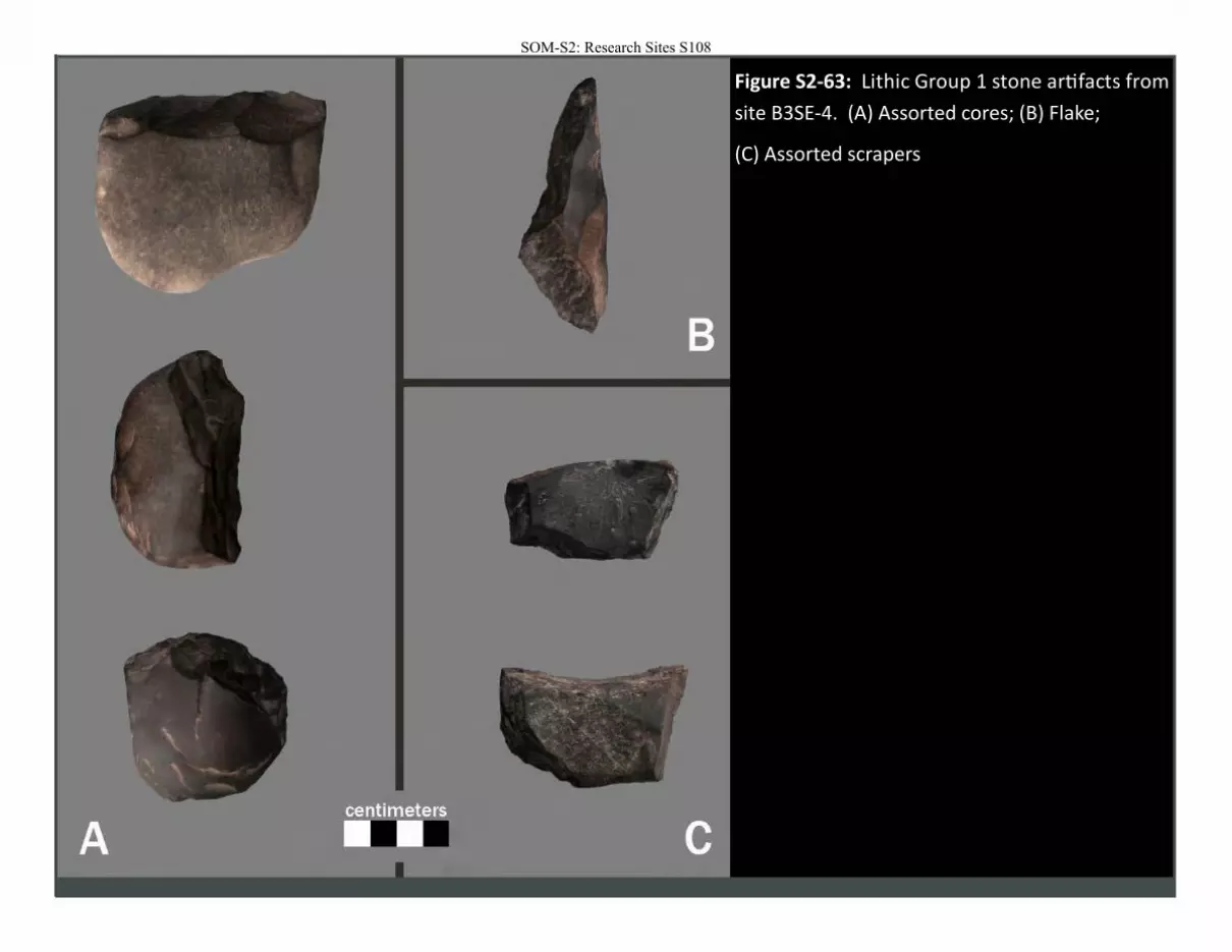
Figure S2-63: Lithic Group 1 stone artifacts from
site B3SE-4. (A) Assorted cores; (B) Flake;
(C) Assorted scrapers
SOM-S2: Research Sites S108
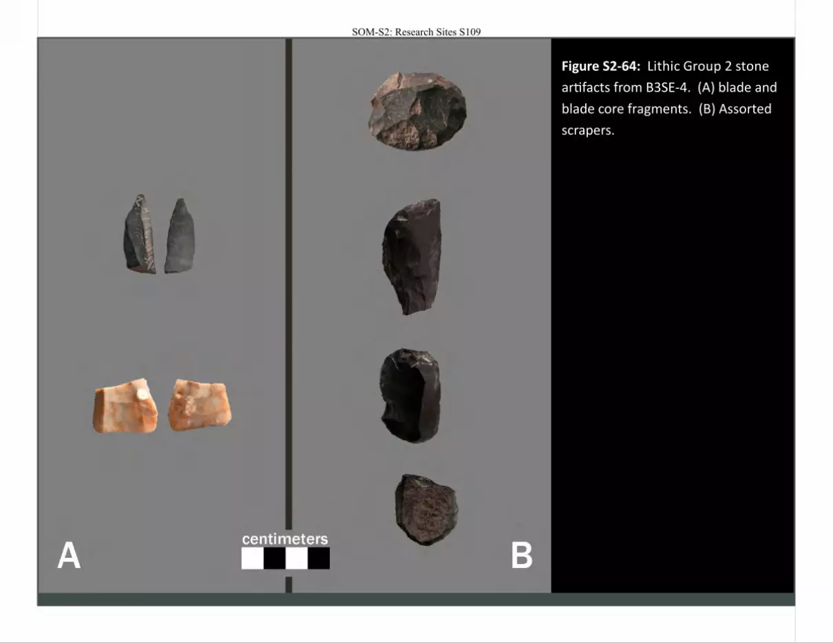
Figure S2-64: Lithic Group 2 stone
artifacts from B3SE-4. (A) blade and
blade core fragments. (B) Assorted
scrapers.
SOM-S2: Research Sites S109
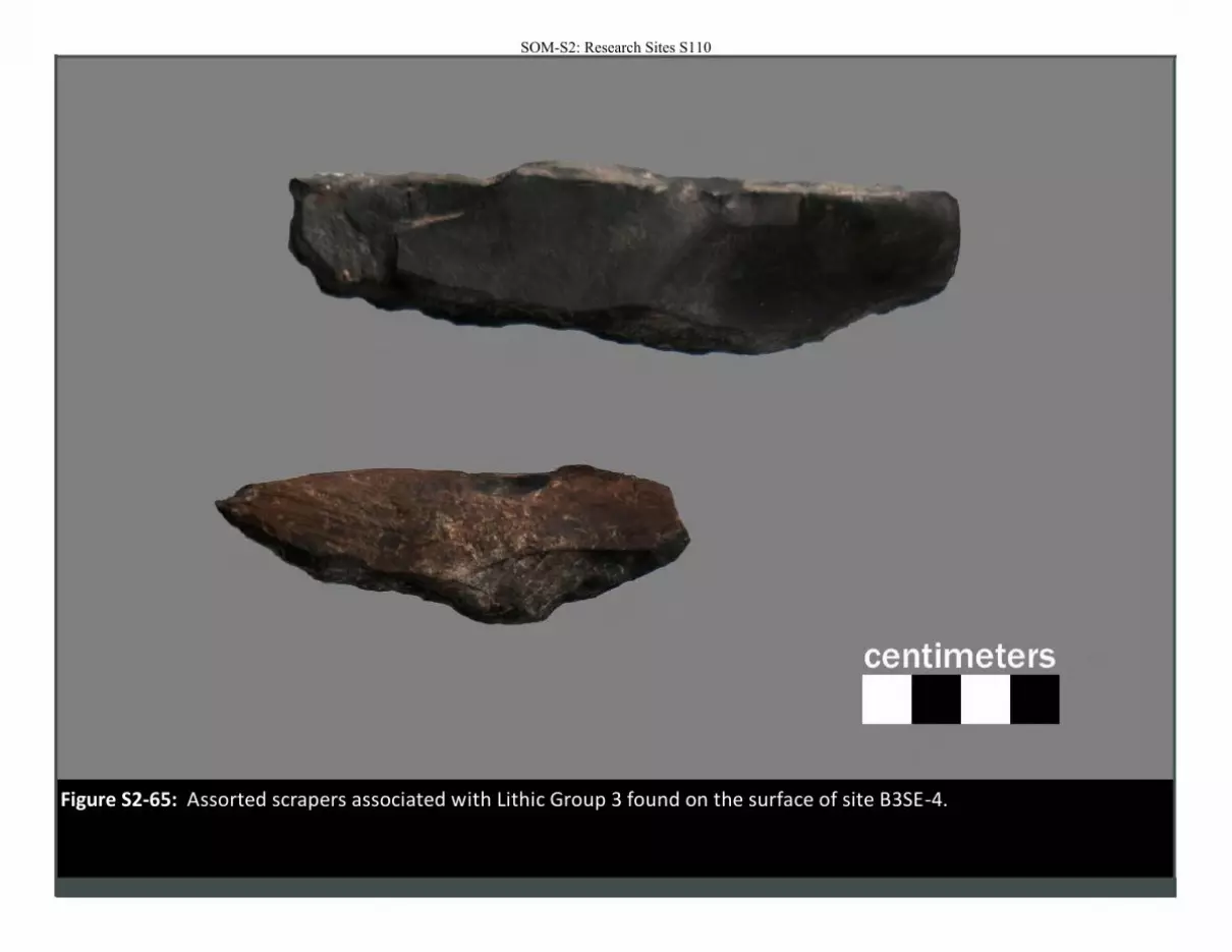
Figure S2-65: Assorted scrapers associated with Lithic Group 3 found on the surface of site B3SE-4.
SOM-S2: Research Sites S110
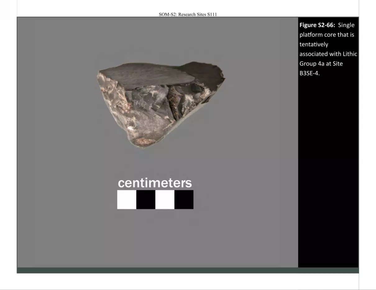
Figure S2-66: Single
platform core that is
tentatively
associated with Lithic
Group 4a at Site
B3SE-4.
SOM-S2: Research Sites S111
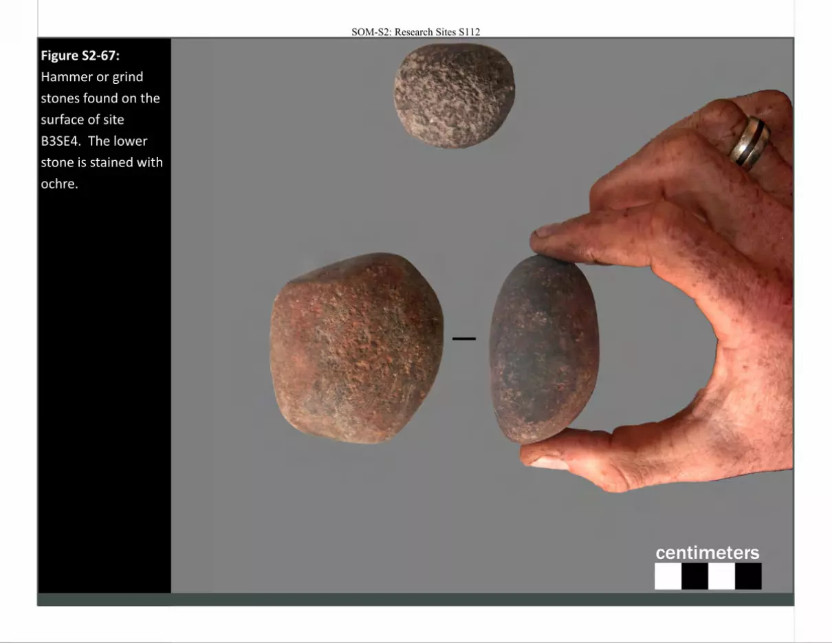
Figure S2-67:
Hammer or grind
stones found on the
surface of site
B3SE4. The lower
stone is stained with
ochre.
SOM-S2: Research Sites S112
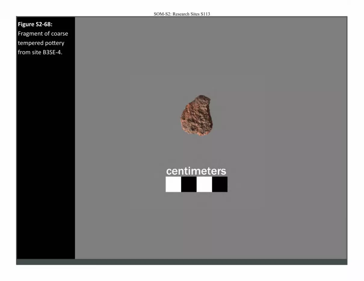
Figure S2-68:
Fragment of coarse
tempered pottery
from site B3SE-4.
SOM-S2: Research Sites S113
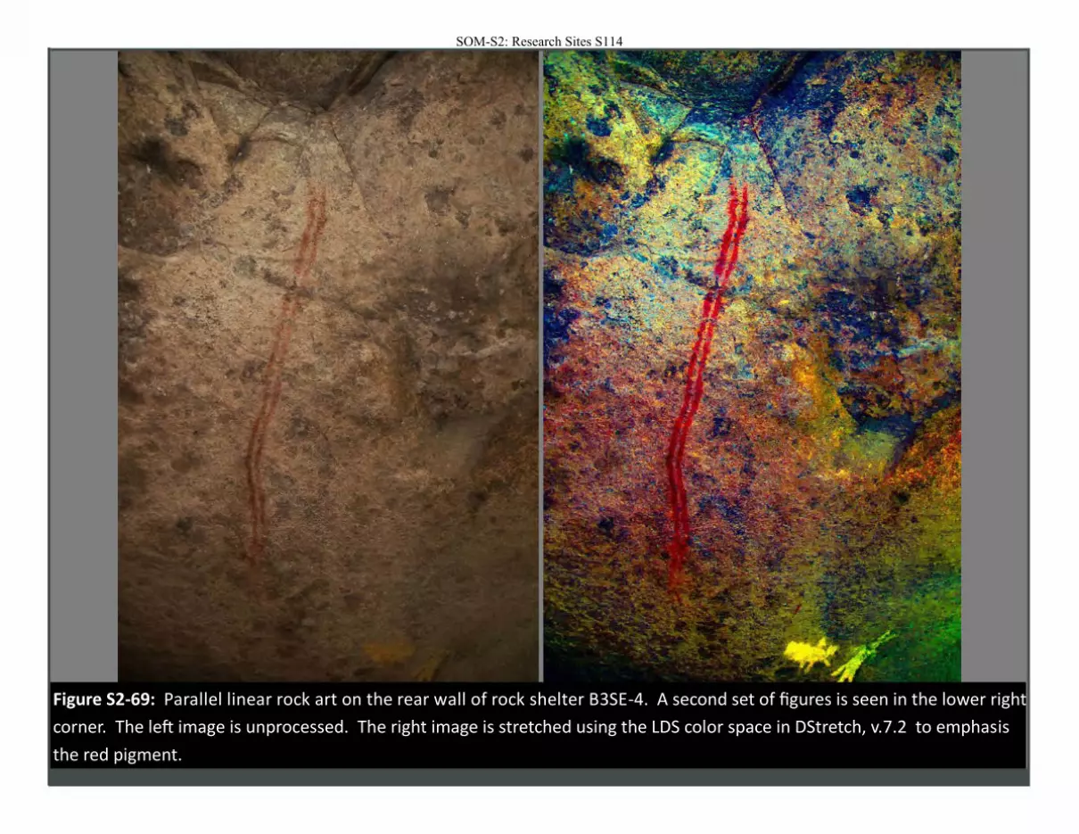
Figure S2-69: Parallel linear rock art on the rear wall of rock shelter B3SE-4. A second set of figures is seen in the lower right
corner. The left image is unprocessed. The right image is stretched using the LDS color space in DStretch, v.7.2 to emphasis
the red pigment.
SOM-S2: Research Sites S114
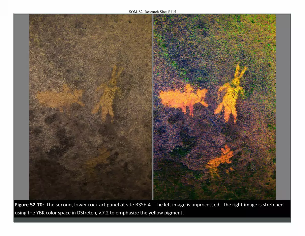
Figure S2-70: The second, lower rock art panel at site B3SE-4. The left image is unprocessed. The right image is stretched
using the YBK color space in DStretch, v.7.2 to emphasize the yellow pigment.
SOM-S2: Research Sites S115
SOM-S2: Research Sites S116
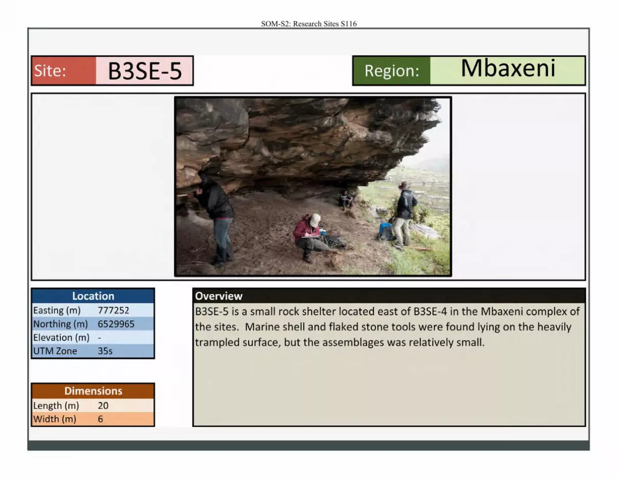
Site: B3SE-5 Mbaxeni Region:
Location Overview Easting (m) 777252 B3SE-5 is a small rock shelter located east of B3SE-4 in the Mbaxeni complex of Northing (m) 6529965 the sites. Marine shell and flaked stone tools were found lying on the heavily
Elevation (m) - trampled surface, but the assemblages was relatively small. UTM Zone 35s
Dimensions Length (m) 20 Width (m) 6
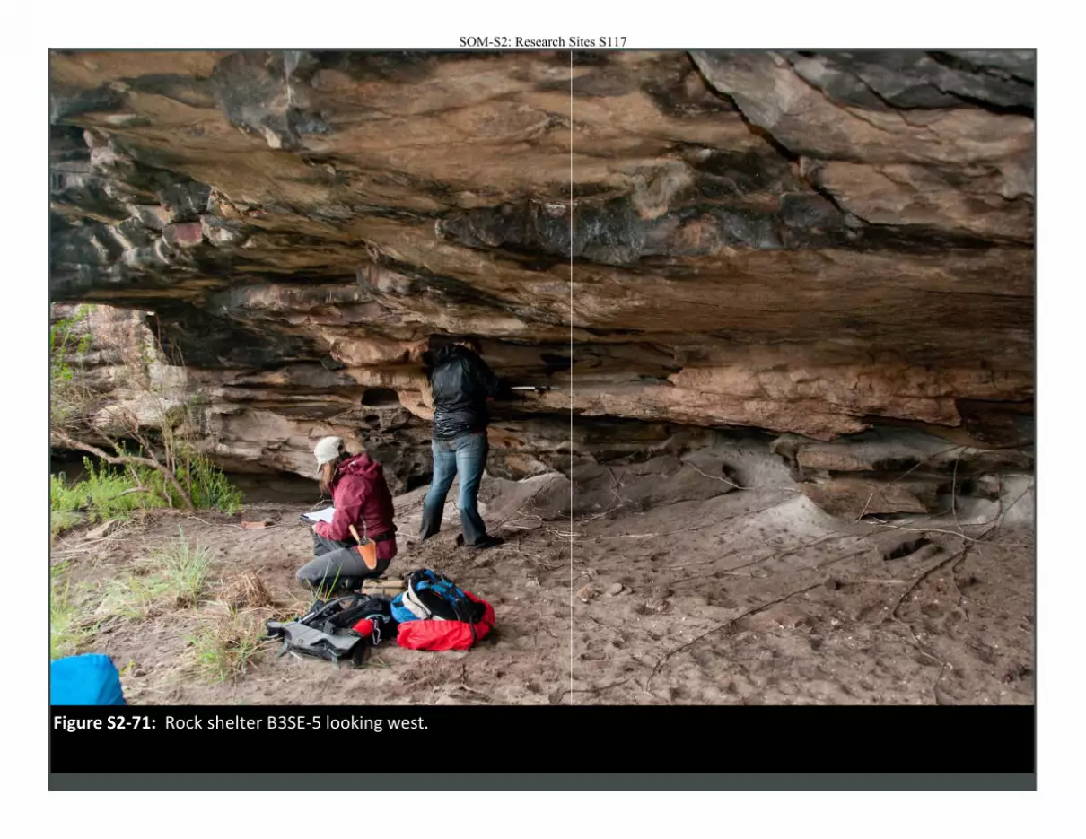
Figure S2-71: Rock shelter B3SE-5 looking west.
SOM-S2: Research Sites S117
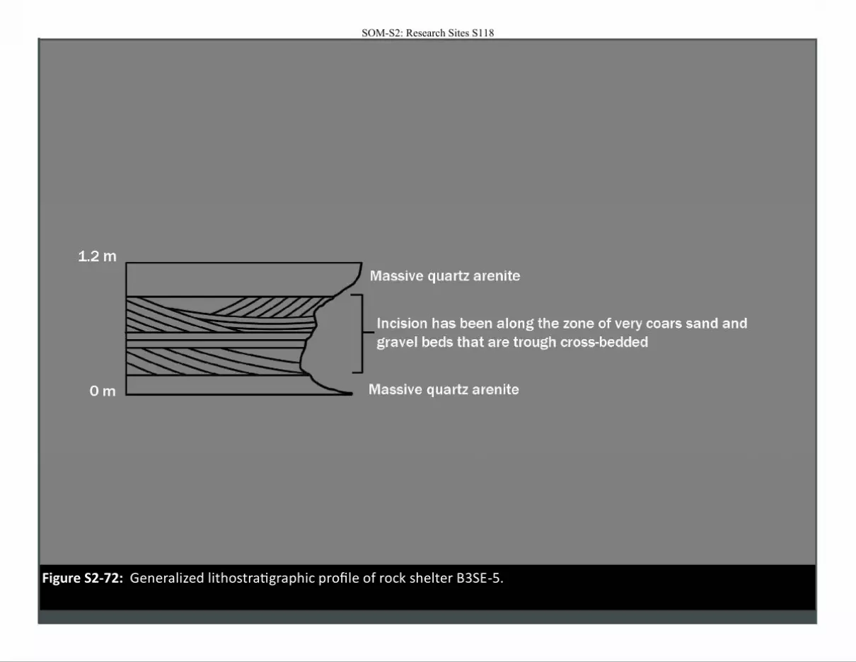
Figure S2-72: Generalized lithostratigraphic profile of rock shelter B3SE-5.
SOM-S2: Research Sites S118
SOM-S2: Research Sites S119
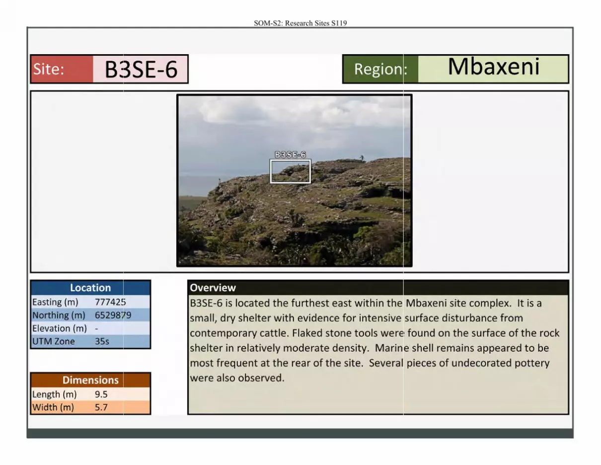
Site: B3SE-6 I
Location Easting (m) 77742~>
Northing (m) 65298lr9 Elevation (m) -
UTM Zone 35s
Dimensions Length (m) 9.5 Width (m) 5.7
Region I _M_ba_x_e_n _i ____.
Overview
B3SE-6 is located the furthest east within the Mbaxeni site complex. It is a
small, dry shelter with evidence for intensive surface disturbance from
contemporary cattle. Flaked stone tools were found on the surface of the rock
shelter in relatively moderate density. Marine shell remains appeared to be
most frequent at the rear of the site. Several pieces of undecorated pottery
were also observed.
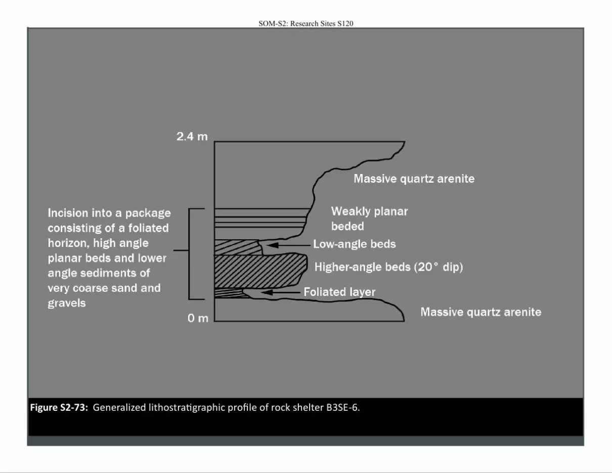
Figure S2-73: Generalized lithostratigraphic profile of rock shelter B3SE-6.
SOM-S2: Research Sites S120
SOM-S2: Research Sites S121
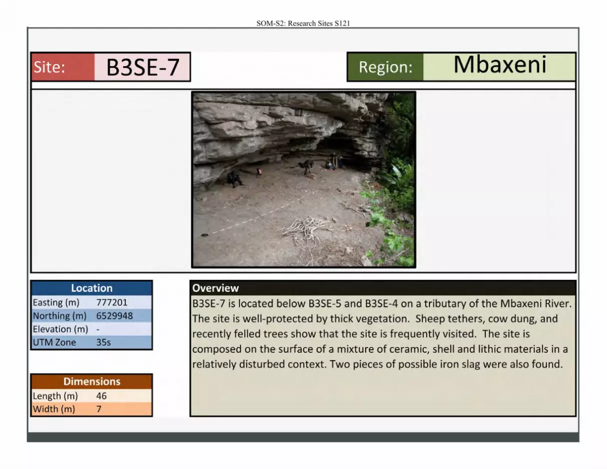
Site: B3SE-7
Location Easting (m) 777201
Northing (m) 6529948
Elevation (m) -
UTM Zone 35s
Dimensions Length (m) 46 Width (m) 7
Region: M • axen1
Overview
B3SE-7 is located below B3SE-5 and B3SE-4 on a tributary of the Mbaxeni River. The site is well-protected by thick vegetation. Sheep tethers, cow dung, and recently felled trees show that the site is frequently visited. The site is
composed on the surface of a mixture of ceramic, shell and lithic materials in a relatively disturbed context. Two pieces of possible iron slag were also found.
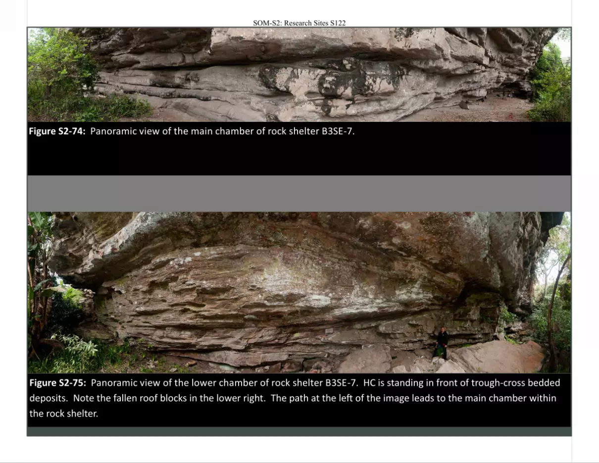
Figure S2-74: Panoramic view of the main chamber of rock shelter B3SE-7.
Figure S2-75: Panoramic view of the lower chamber of rock shelter B3SE-7. HC is standing in front of trough-cross bedded
deposits. Note the fallen roof blocks in the lower right. The path at the left of the image leads to the main chamber within
the rock shelter.
SOM-S2: Research Sites S122
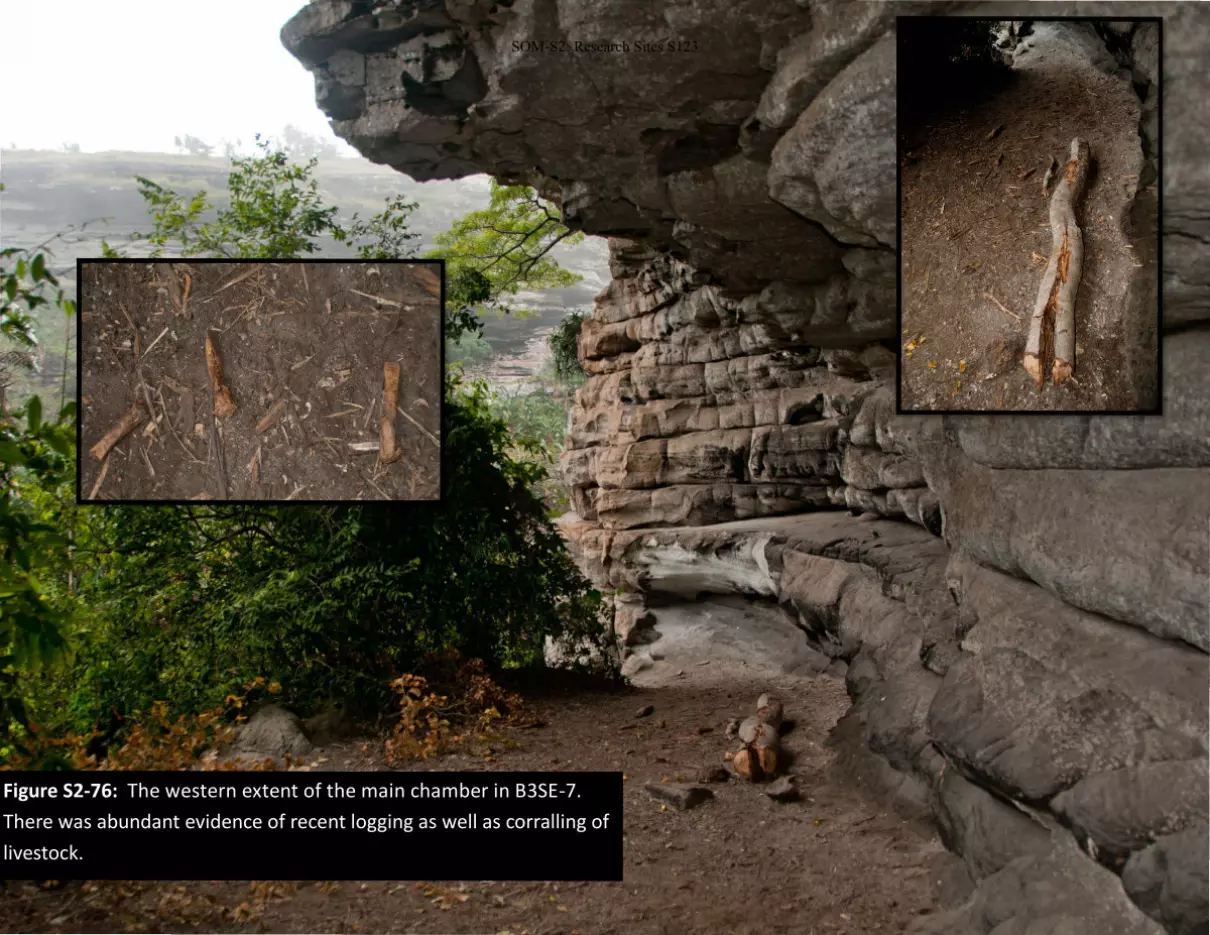
Figure S2-76: The western extent of the main chamber in B3SE-7.
There was abundant evidence of recent logging as well as corralling of
livestock.
SOM-S2: Research Sites S123
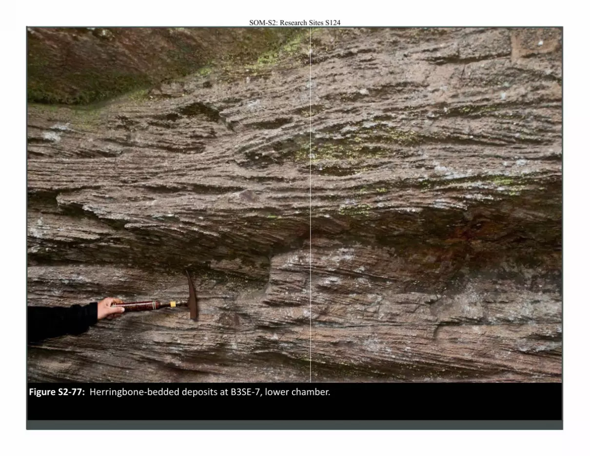
Figure S2-77: Herringbone-bedded deposits at B3SE-7, lower chamber.
SOM-S2: Research Sites S124
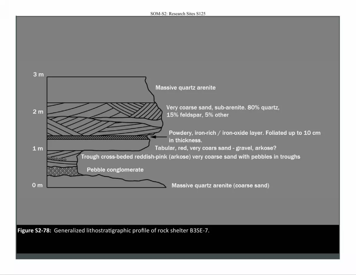
Figure S2-78: Generalized lithostratigraphic profile of rock shelter B3SE-7.
SOM-S2: Research Sites S125
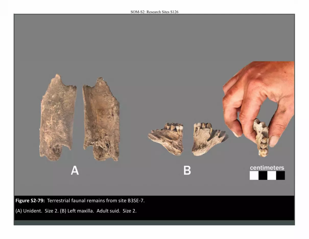
Figure S2-79: Terrestrial faunal remains from site B3SE-7.
(A) Unident. Size 2. (B) Left maxilla. Adult suid. Size 2.
SOM-S2: Research Sites S126
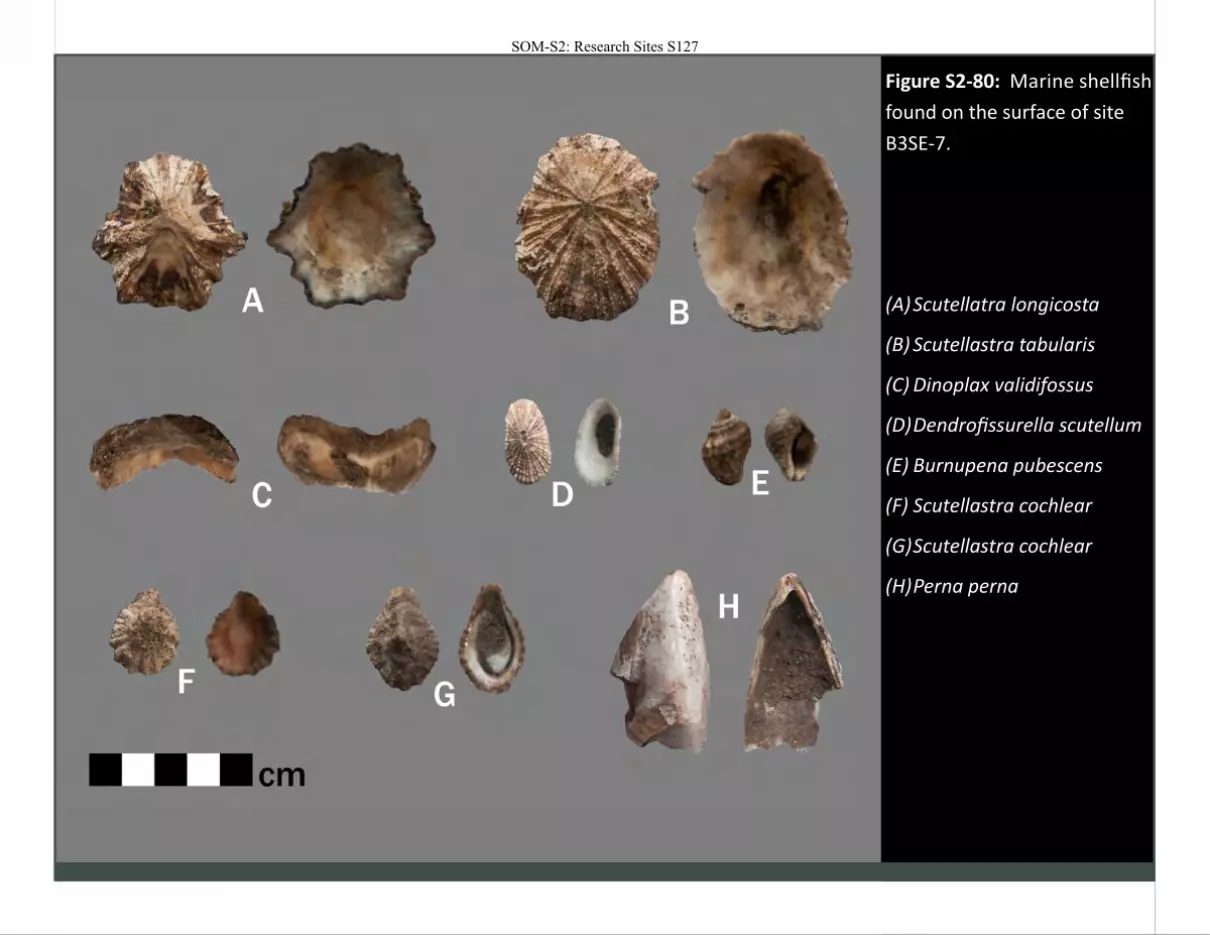
Figure S2-80: Marine shellfish
found on the surface of site
B3SE-7.
(A) Scutellatra longicosta
(B) Scutellastra tabularis
(C) Dinoplax validifossus
(D) Dendrofissurella scutellum
(E) Burnupena pubescens
(F) Scutellastra cochlear
(G) Scutellastra cochlear
(H) Perna perna
SOM-S2: Research Sites S127
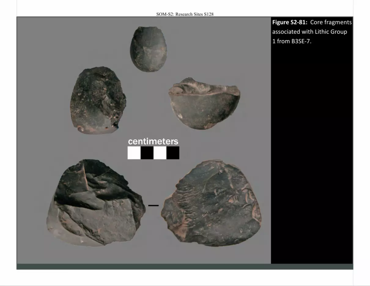
Figure S2-81: Core fragments
associated with Lithic Group
1 from B3SE-7.
SOM-S2: Research Sites S128
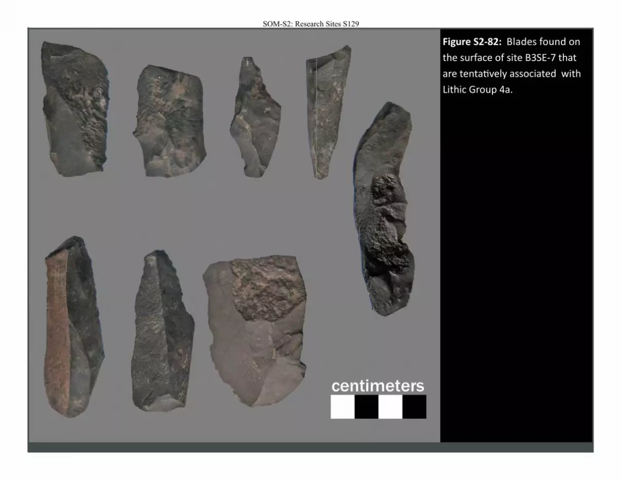
Figure S2-82: Blades found on
the surface of site B3SE-7 that
are tentatively associated with
Lithic Group 4a.
SOM-S2: Research Sites S129
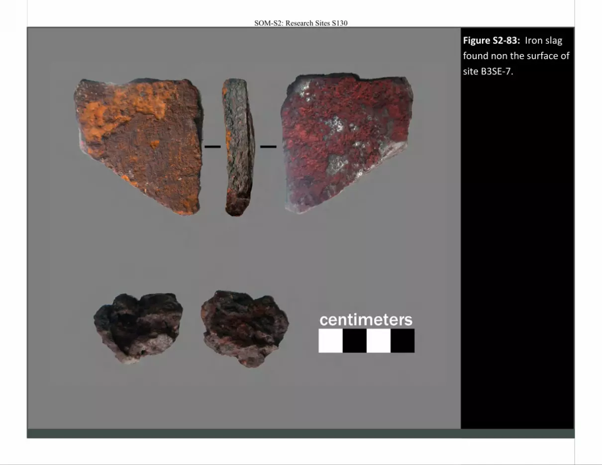
Figure S2-83: Iron slag
found non the surface of
site B3SE-7.
SOM-S2: Research Sites S130
SOM-S2: Research Sites S131
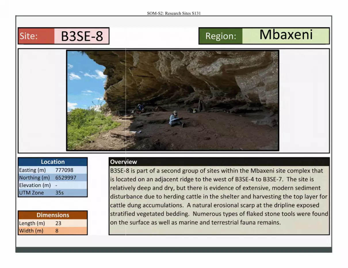
Site: B3SE-8
Location Easting (m) 777098 Northing (m) 6529997 Elevation (m) -
UTM Zone 35s
Dimensions Length (m)
Width (m)
23 8
Region: Mbaxeni
• • iew
B3SE-8 is part of a second group of sites within the Mbaxeni site complex that
is located on an adjacent ridge to the west of B3SE-4 to B3SE-7. The site is
relatively deep and dry, but there is evidence of extensive, modern sediment
disturbance due to herding cattle in the shelter and harvesting the top layer for
cattle dung accumulations. A natural erosional scarp at the dripline exposed
stratified vegetated bedding. Numerous types of flaked stone tools were found
on the surface as well as marine and terrestrial fauna remains.
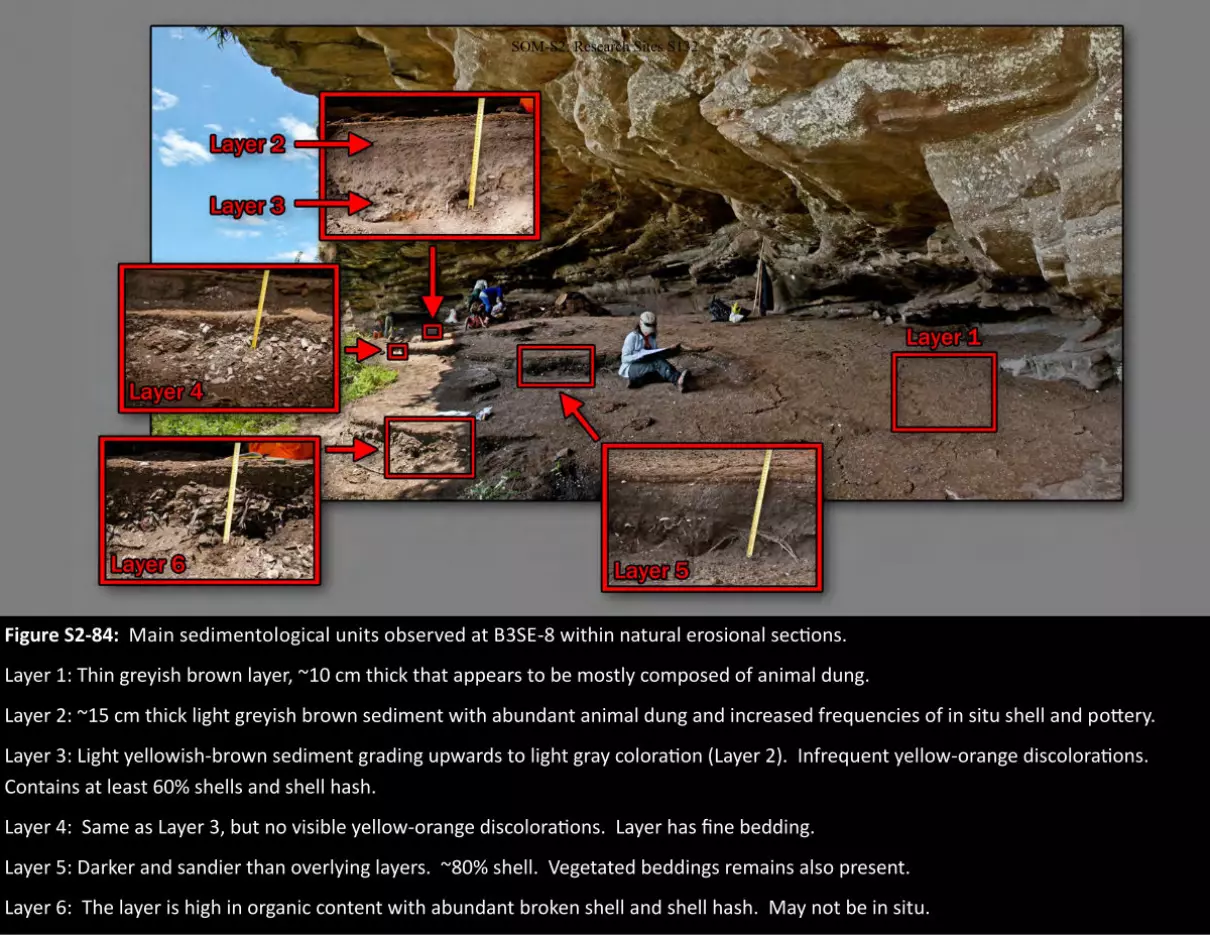
Figure S2-84: Main sedimentological units observed at B3SE-8 within natural erosional sections.
Layer 1: Thin greyish brown layer, ~10 cm thick that appears to be mostly composed of animal dung.
Layer 2: ~15 cm thick light greyish brown sediment with abundant animal dung and increased frequencies of in situ shell and pottery.
Layer 3: Light yellowish-brown sediment grading upwards to light gray coloration (Layer 2). Infrequent yellow-orange discolorations.
Contains at least 60% shells and shell hash.
Layer 4: Same as Layer 3, but no visible yellow-orange discolorations. Layer has fine bedding.
Layer 5: Darker and sandier than overlying layers. ~80% shell. Vegetated beddings remains also present.
Layer 6: The layer is high in organic content with abundant broken shell and shell hash. May not be in situ.
SOM-S2: Research Sites S132
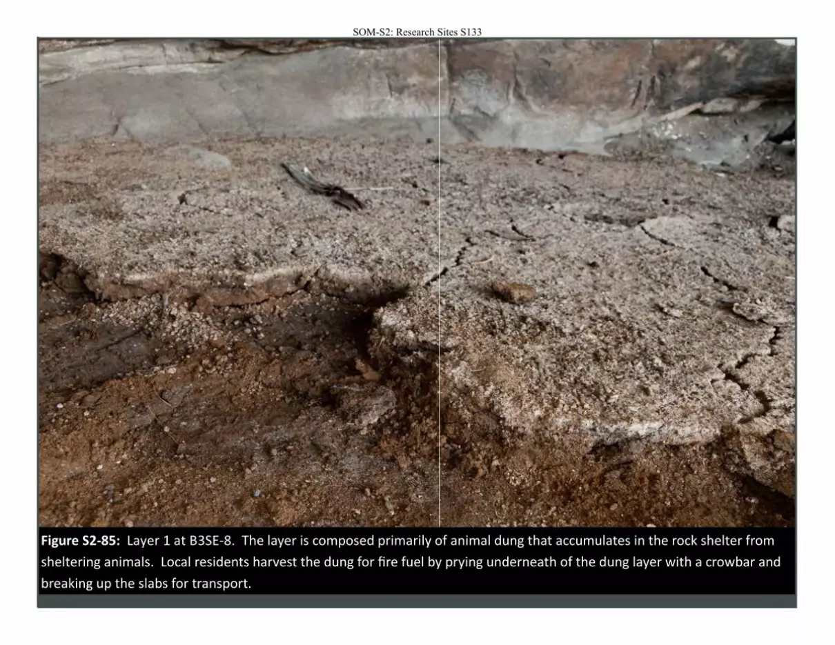
Figure S2-85: Layer 1 at B3SE-8. The layer is composed primarily of animal dung that accumulates in the rock shelter from
sheltering animals. Local residents harvest the dung for fire fuel by prying underneath of the dung layer with a crowbar and
breaking up the slabs for transport.
SOM-S2: Research Sites S133
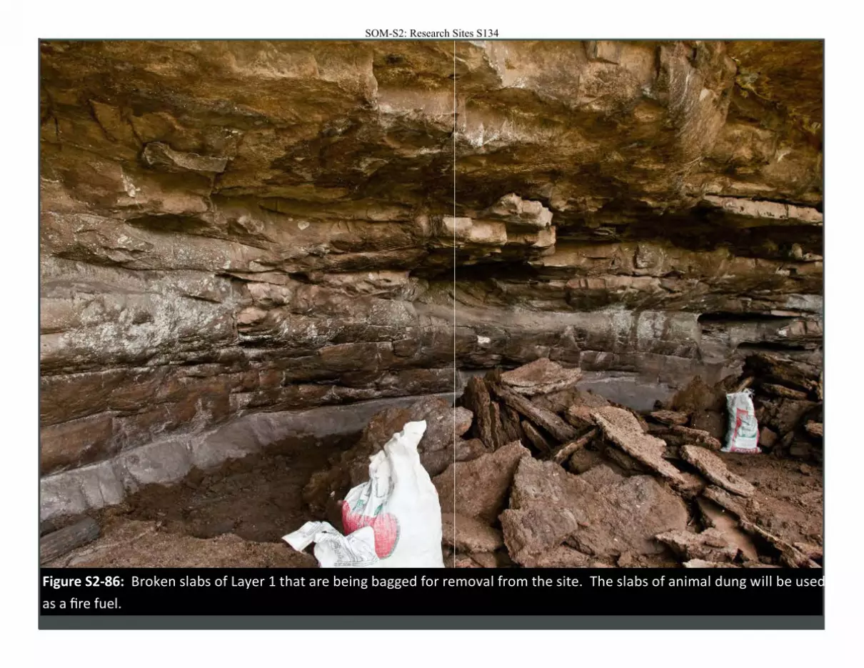
Figure S2-86: Broken slabs of Layer 1 that are being bagged for removal from the site. The slabs of animal dung will be used
as a fire fuel.
SOM-S2: Research Sites S134
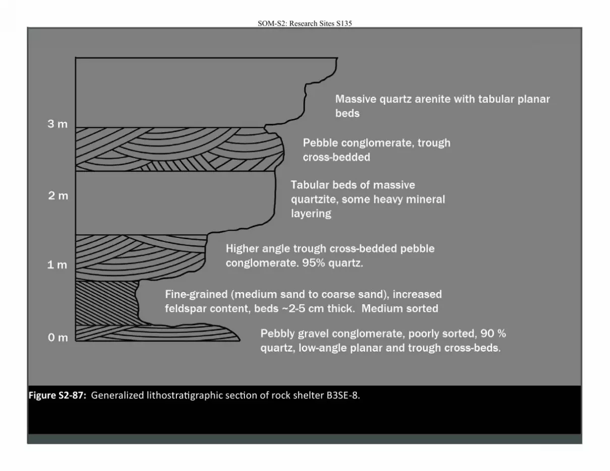
Figure S2-87: Generalized lithostratigraphic section of rock shelter B3SE-8.
SOM-S2: Research Sites S135
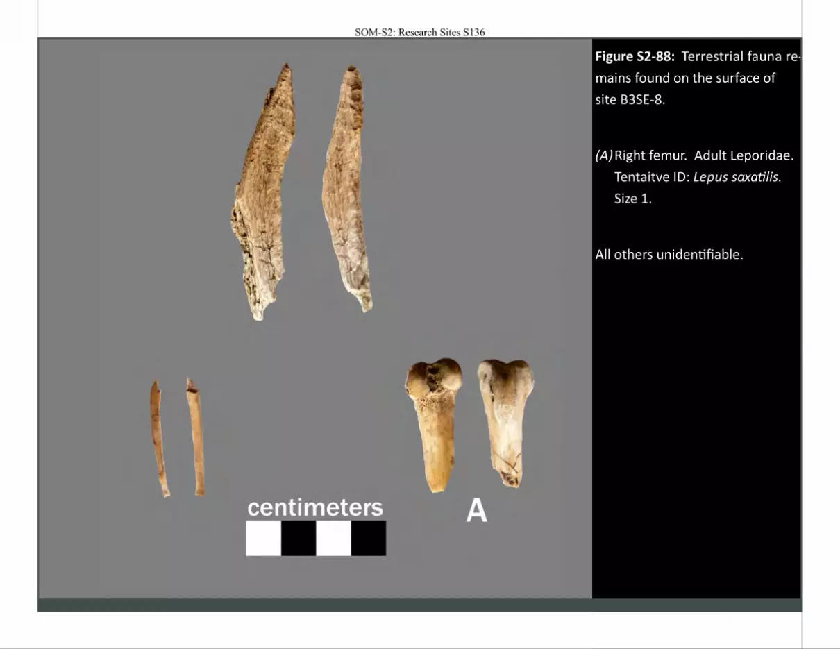
Figure S2-88: Terrestrial fauna re-
mains found on the surface of
site B3SE-8.
(A) Right femur. Adult Leporidae.
Tentaitve ID: Lepus saxatilis.
Size 1.
All others unidentifiable.
SOM-S2: Research Sites S136
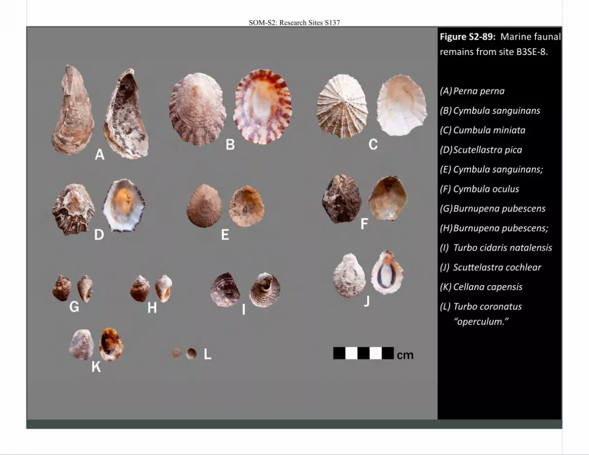
Figure S2-89: Marine faunal
remains from site B3SE-8.
(A) Perna perna
(B) Cymbula sanguinans
(C) Cumbula miniata
(D) Scutellastra pica
(E) Cymbula sanguinans;
(F) Cymbula oculus
(G) Burnupena pubescens
(H) Burnupena pubescens;
(I) Turbo cidaris natalensis
(J) Scuttelastra cochlear
(K) Cellana capensis
(L) Turbo coronatus
“operculum.”
SOM-S2: Research Sites S137
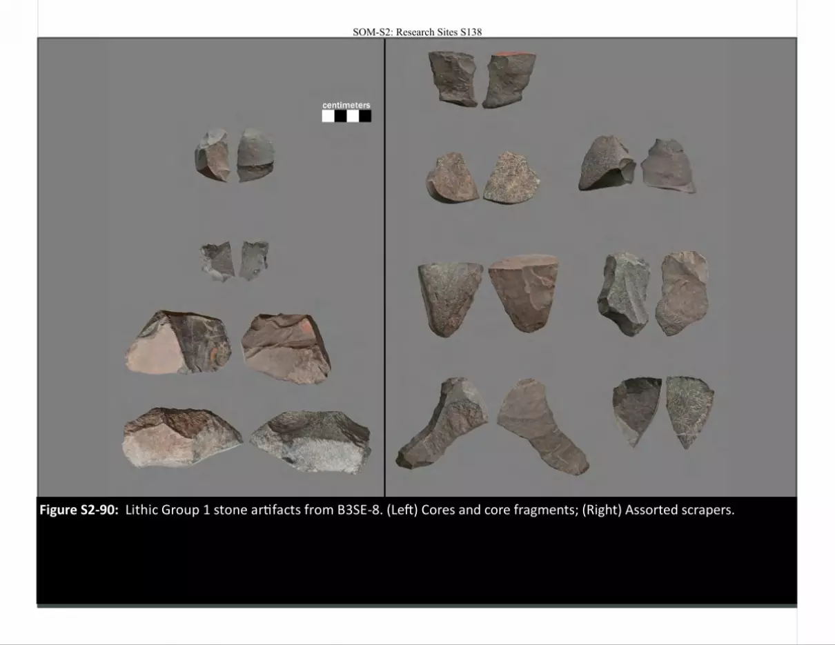
Figure S2-90: Lithic Group 1 stone artifacts from B3SE-8. (Left) Cores and core fragments; (Right) Assorted scrapers.
SOM-S2: Research Sites S138
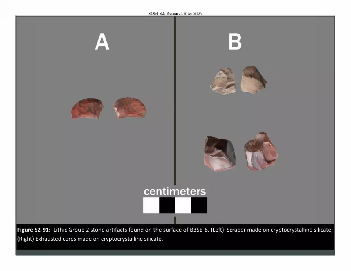
Figure S2-91: Lithic Group 2 stone artifacts found on the surface of B3SE-8. (Left) Scraper made on cryptocrystalline silicate;
(Right) Exhausted cores made on cryptocrystalline silicate.
SOM-S2: Research Sites S139

Figure S2-92: Core attributed to Lithic Group 4A found on the surface of B3SE-8.
SOM-S2: Research Sites S140
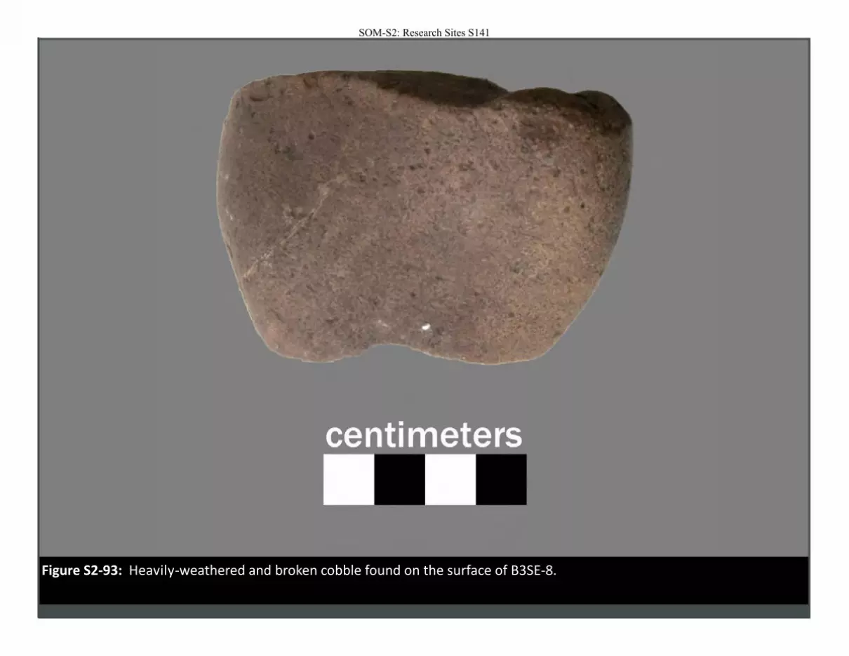
Figure S2-93: Heavily-weathered and broken cobble found on the surface of B3SE-8.
SOM-S2: Research Sites S141
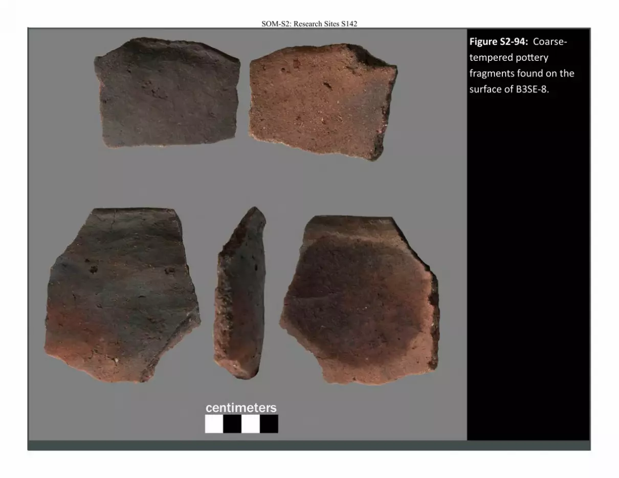
Figure S2-94: Coarse-
tempered pottery
fragments found on the
surface of B3SE-8.
SOM-S2: Research Sites S142
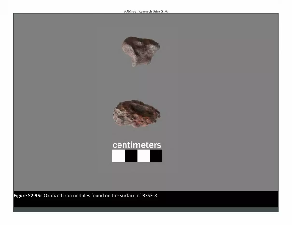
Figure S2-95: Oxidized iron nodules found on the surface of B3SE-8.
SOM-S2: Research Sites S143
SOM-S2: Research Sites S144
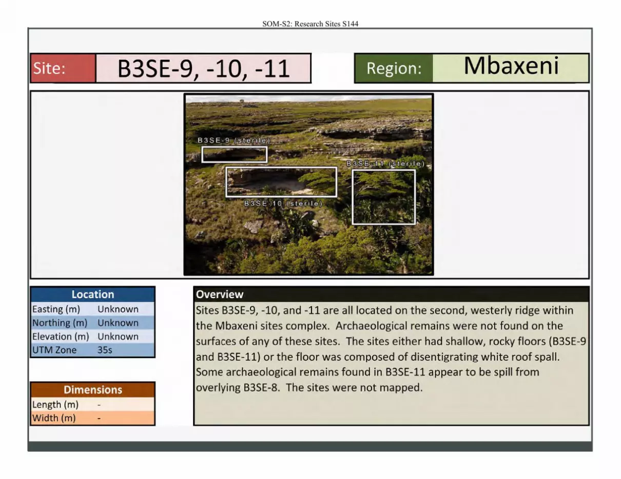
B3SE-9 -10 -11 J J Region: Mbaxeni
Location Easting (m) Unknown
Northing (m) Unknown
Elevation (m) Unknown
UTM Zone 35s
Dimensions Length (m)
Width (m)
~~:--- ~ ·--~; . ·p
:.~-;":~-:r-- ·_ ,.......c:._ . .::; .
Overview
Sites B3SE-9, -10, and -11 are all located on the second, westerly ridge within
the Mbaxeni sites complex. Archaeological remains were not found on the
surfaces of any of these sites. The sites either had shallow, rocky floors (B3SE-9
and B3SE-11) or the floor was composed of disentigrating white roof spa II. Some archaeological remains found in B3SE-11 appear to be spill from
overlying B3SE-8. The sites were not mapped.
SOM-S2: Research Sites S145
. ·
\
-....
,
.. . . ""\'"' .--.... ' " .. .,.~-t..r~ .. ...... ~ ..... .... -...
-......: ..:~~~
""' "• .. ,•\ .. .....
,. ..
:
-----
, '
f'C ~
SOM-S2: Research Sites S146
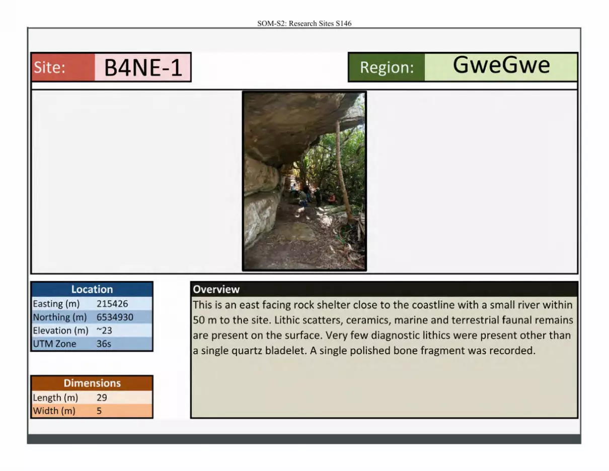
Site: B4NE-1
Location Easting (m) 215426
Northing (m) 6534930
Elevation (m) "'23 UTM Zone 36s
Dimensions Length (m) 29
Width (m) 5
Region: GweGwe
Overview
This is an east facing rock shelter close to the coastline with a small river within
SO m to the site. Lithic scatters, ceramics, marine and terrestrial faunal remains are present on the surface. Very few diagnostic lithics were present other than a single quartz bladelet. A single polished bone fragment was recorded.
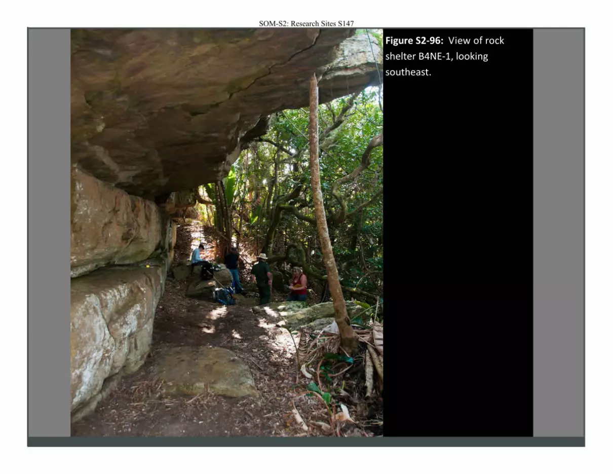
Figure S2-96: View of rock
shelter B4NE-1, looking
southeast.
SOM-S2: Research Sites S147
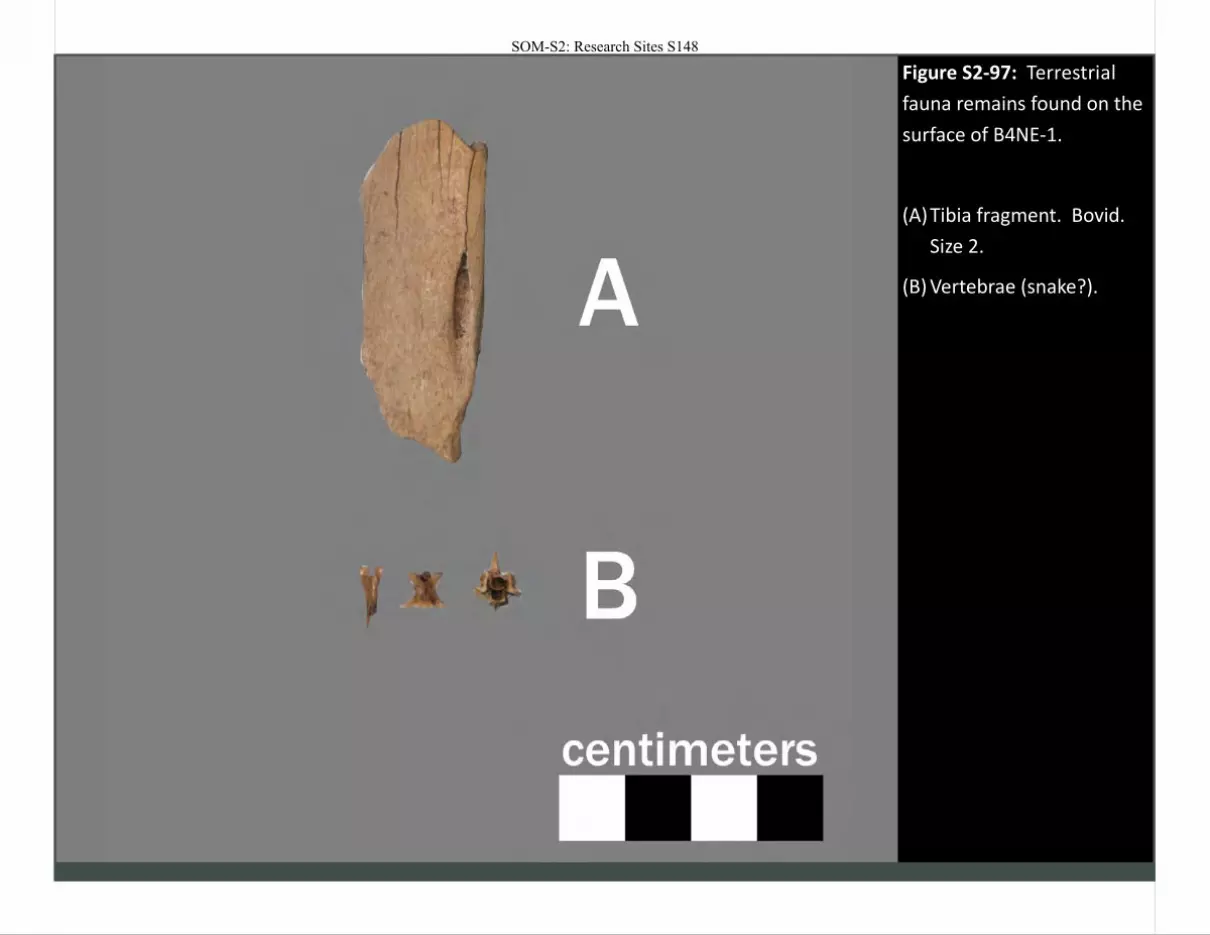
Figure S2-97: Terrestrial
fauna remains found on the
surface of B4NE-1.
(A) Tibia fragment. Bovid.
Size 2.
(B) Vertebrae (snake?).
SOM-S2: Research Sites S148
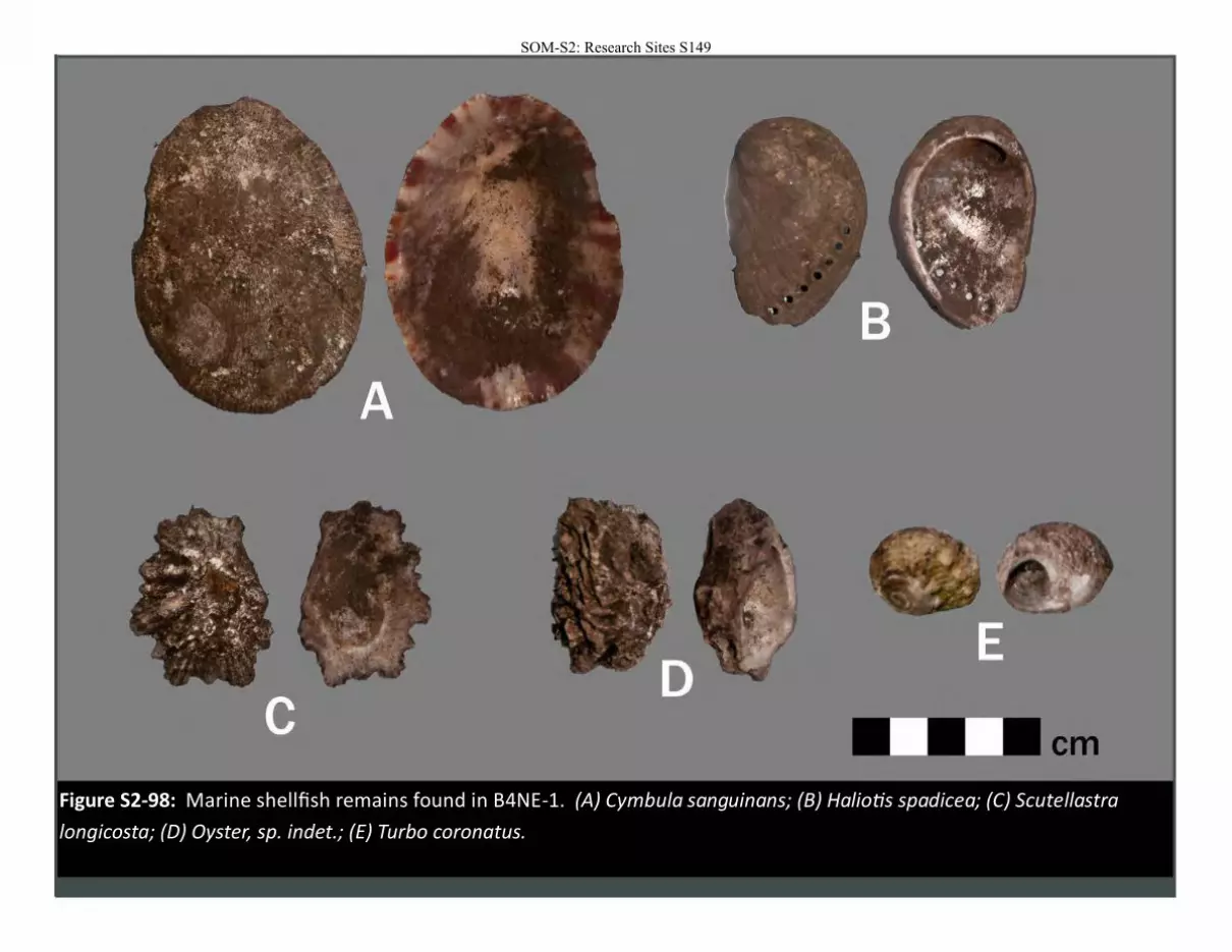
Figure S2-98: Marine shellfish remains found in B4NE-1. (A) Cymbula sanguinans; (B) Haliotis spadicea; (C) Scutellastra
longicosta; (D) Oyster, sp. indet.; (E) Turbo coronatus.
SOM-S2: Research Sites S149
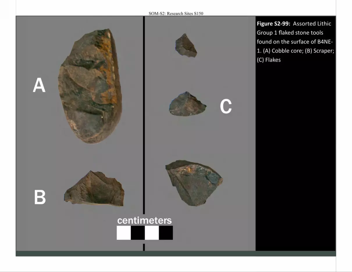
Figure S2-99: Assorted Lithic
Group 1 flaked stone tools
found on the surface of B4NE-
1. (A) Cobble core; (B) Scraper;
(C) Flakes
SOM-S2: Research Sites S150
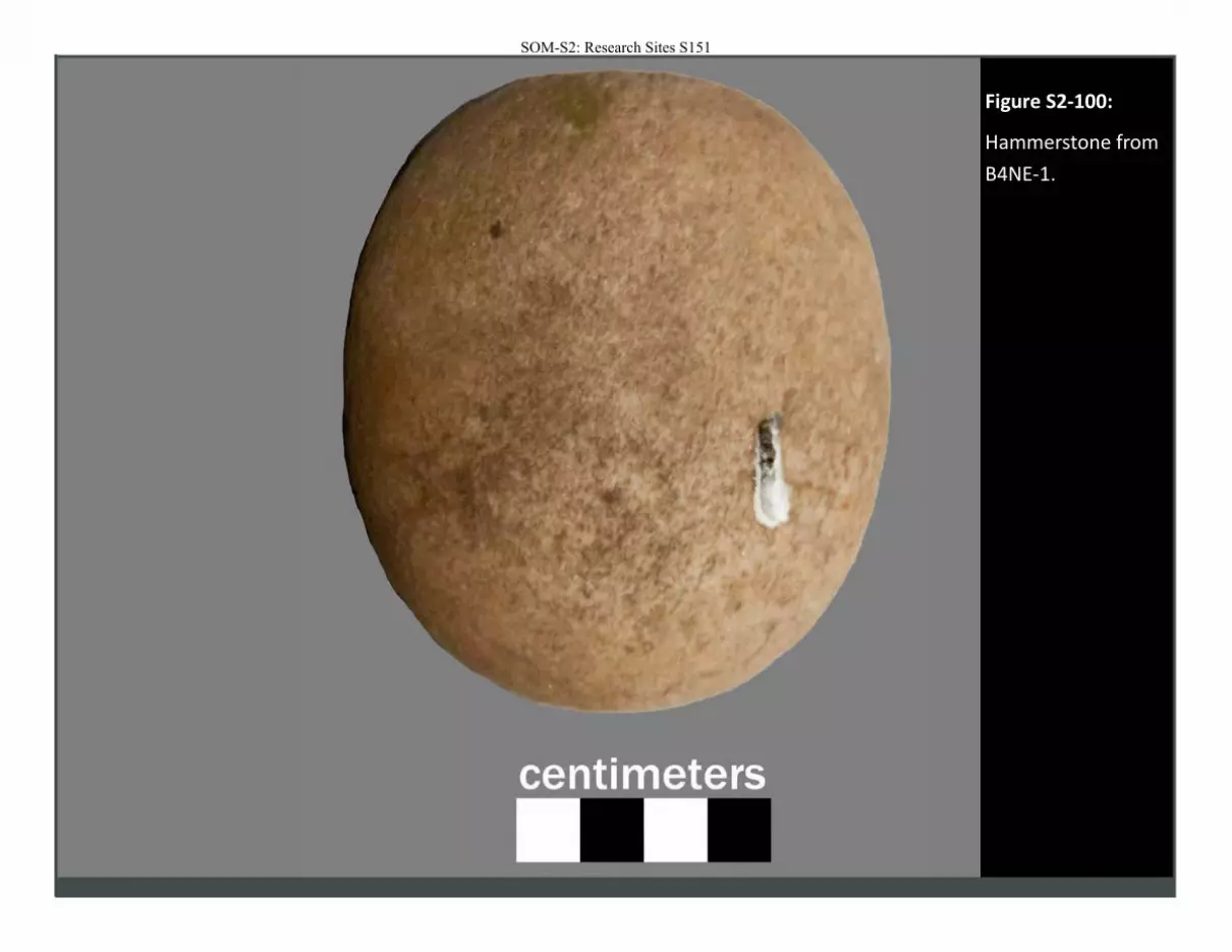
Figure S2-100:
Hammerstone from
B4NE-1.
SOM-S2: Research Sites S151
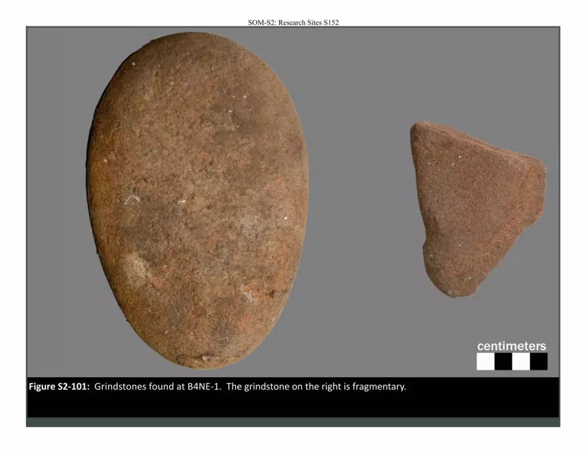
Figure S2-101: Grindstones found at B4NE-1. The grindstone on the right is fragmentary.
SOM-S2: Research Sites S152
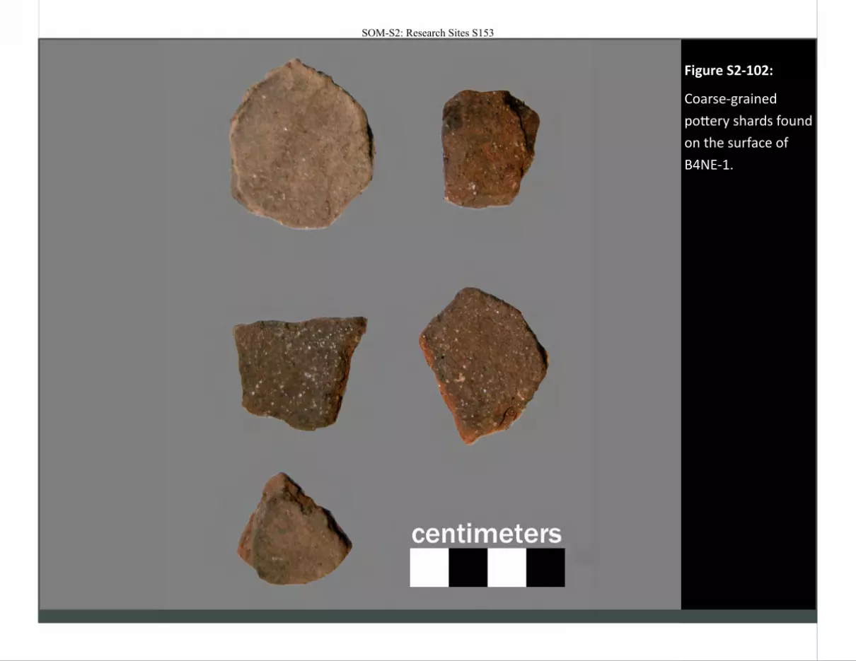
Figure S2-102:
Coarse-grained
pottery shards found
on the surface of
B4NE-1.
SOM-S2: Research Sites S153
SOM-S2: Research Sites S154

SOM-S2: Research Sites S155
Site: B4NW-1
Location Easting (m) 783440
Northing (m) 6531602 Elevation (m) "'34
UTM Zone 35s
Dimensions Length (m) 102 Width (m) 70
Region: Msikaba
Overview
This site is located on top of coastal dune deposits near the mouth of the
Msikaba River. Stone artifacts are eroding out of at least one of two rubified paleosols, which have been incised by more recent weathering processes.
Rhyzoliths also common. Historical glazed ceramics and iron slag was also observed. No shellfish remains were found. More information can be found in
the main text.
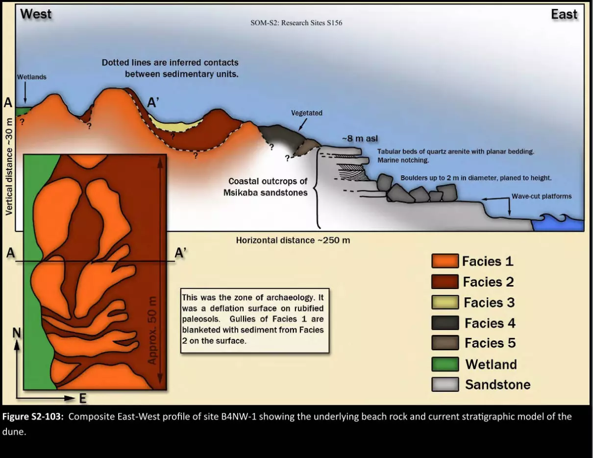
Figure S2-103: Composite East-West profile of site B4NW-1 showing the underlying beach rock and current stratigraphic model of the
dune.
SOM-S2: Research Sites S156
West
Dotted lines are inferred contacts between sedimentary units.
Coastal outcrops of Msikaba sandstones
Horizontal distance -250 m
This was the zone of archaeology. It was a deflation surface on rubified paleosols. Gullies of Facies 1 are blanketed with sediment from Facies 2 on the surface.
Tabular beds of quartz arenite with planar bedding. Marine notching.
Facies 1
Facies 2
D Facies 3
Facies 4
Facies 5
Wetland
D Sandstone
East

Figure S2-104: View of the B4NW-1 dune on the seaward flank. The paleosol exposures would be located uphill, to the left
of the image.
Figure S2-105: Panorama of the B4NW-1 exposure. The middle of the image is approximately east.
SOM-S2: Research Sites S157
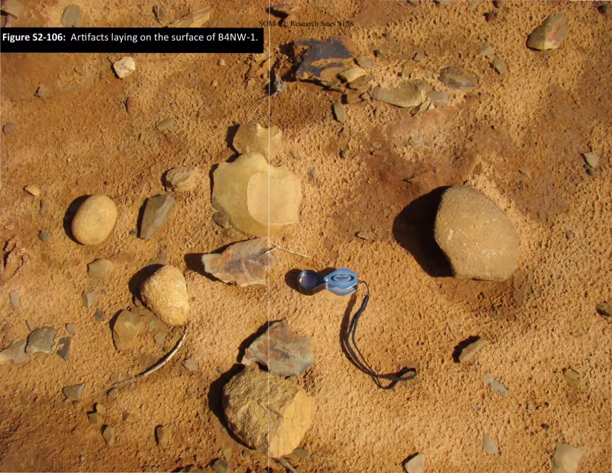
Figure S2-106: Artifacts laying on the surface of B4NW-1.
SOM-S2: Research Sites S158
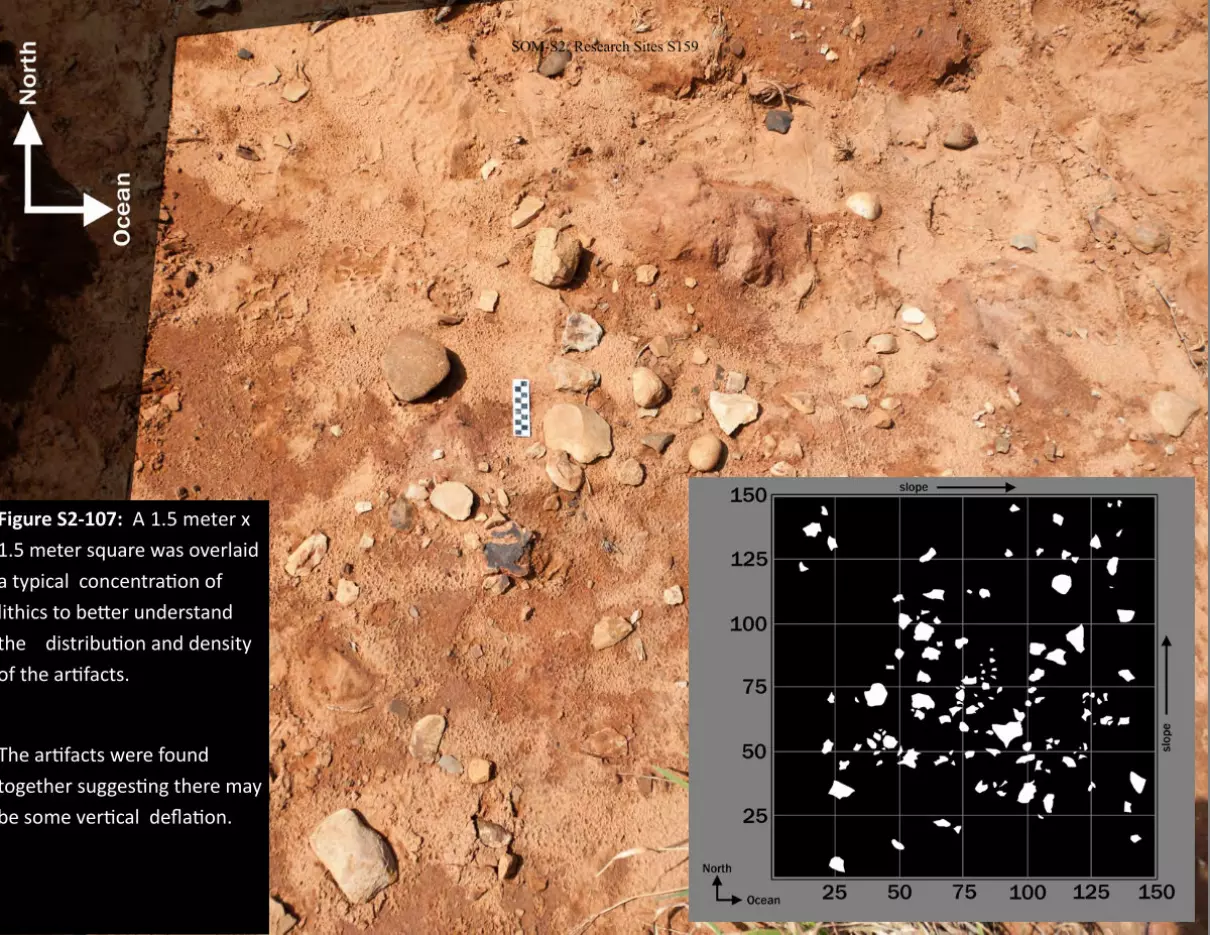
Figure S2-107: A 1.5 meter x
1.5 meter square was overlaid
a typical concentration of
lithics to better understand
the distribution and density
of the artifacts.
The artifacts were found
together suggesting there may
be some vertical deflation.
SOM-S2: Research Sites S159
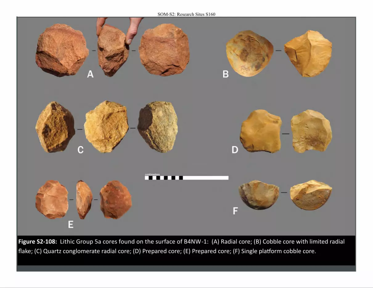
Figure S2-108: Lithic Group 5a cores found on the surface of B4NW-1: (A) Radial core; (B) Cobble core with limited radial
flake; (C) Quartz conglomerate radial core; (D) Prepared core; (E) Prepared core; (F) Single platform cobble core.
SOM-S2: Research Sites S160
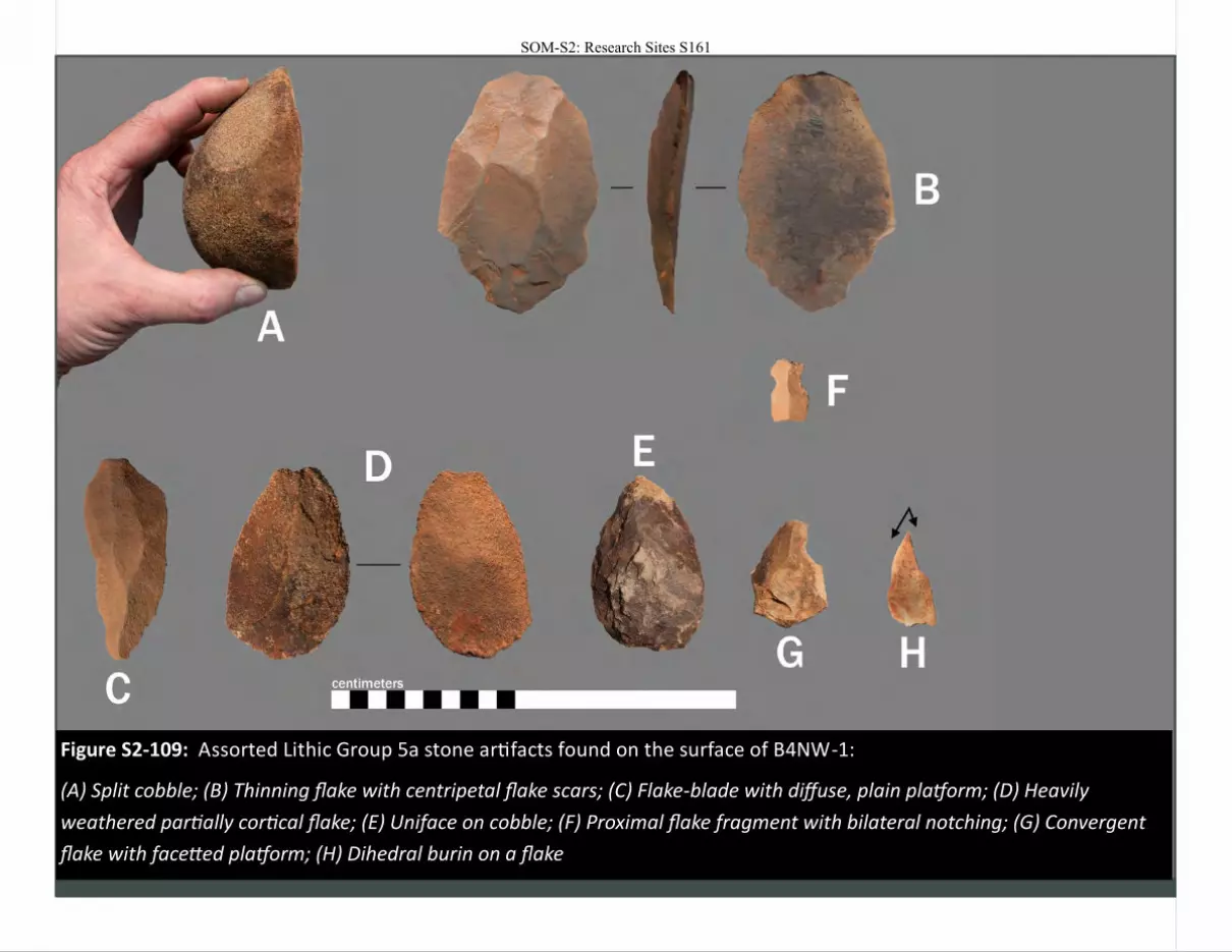
Figure S2-109: Assorted Lithic Group 5a stone artifacts found on the surface of B4NW-1:
(A) Split cobble; (B) Thinning flake with centripetal flake scars; (C) Flake-blade with diffuse, plain platform; (D) Heavily
weathered partially cortical flake; (E) Uniface on cobble; (F) Proximal flake fragment with bilateral notching; (G) Convergent
flake with facetted platform; (H) Dihedral burin on a flake
SOM-S2: Research Sites S161
Figure S2-110: Lithic
Group 5A blade
fragments found on
the surface of B4NW-
1:
(A) Proximal blade
fragment with a
plain platform
(B) Proximal blade
fragment with a
facetted platform
(C) Proximal blade
fragment with a
facetted platform
SOM-S2: Research Sites S162
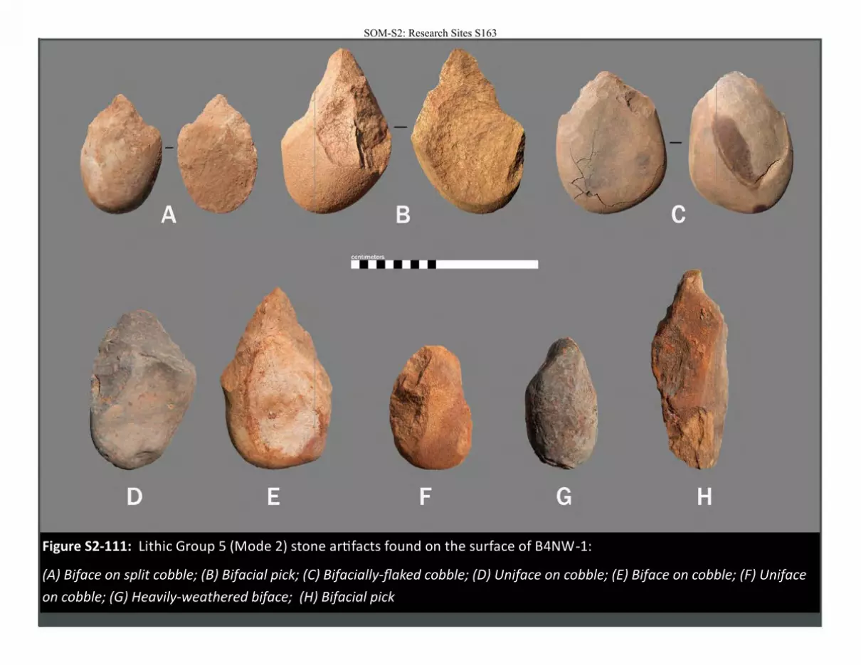
Figure S2-111: Lithic Group 5 (Mode 2) stone artifacts found on the surface of B4NW-1:
(A) Biface on split cobble; (B) Bifacial pick; (C) Bifacially-flaked cobble; (D) Uniface on cobble; (E) Biface on cobble; (F) Uniface
on cobble; (G) Heavily-weathered biface; (H) Bifacial pick
SOM-S2: Research Sites S163

Figure S2-112: Iron slag found on the surface of B4NW-1.
SOM-S2: Research Sites S164
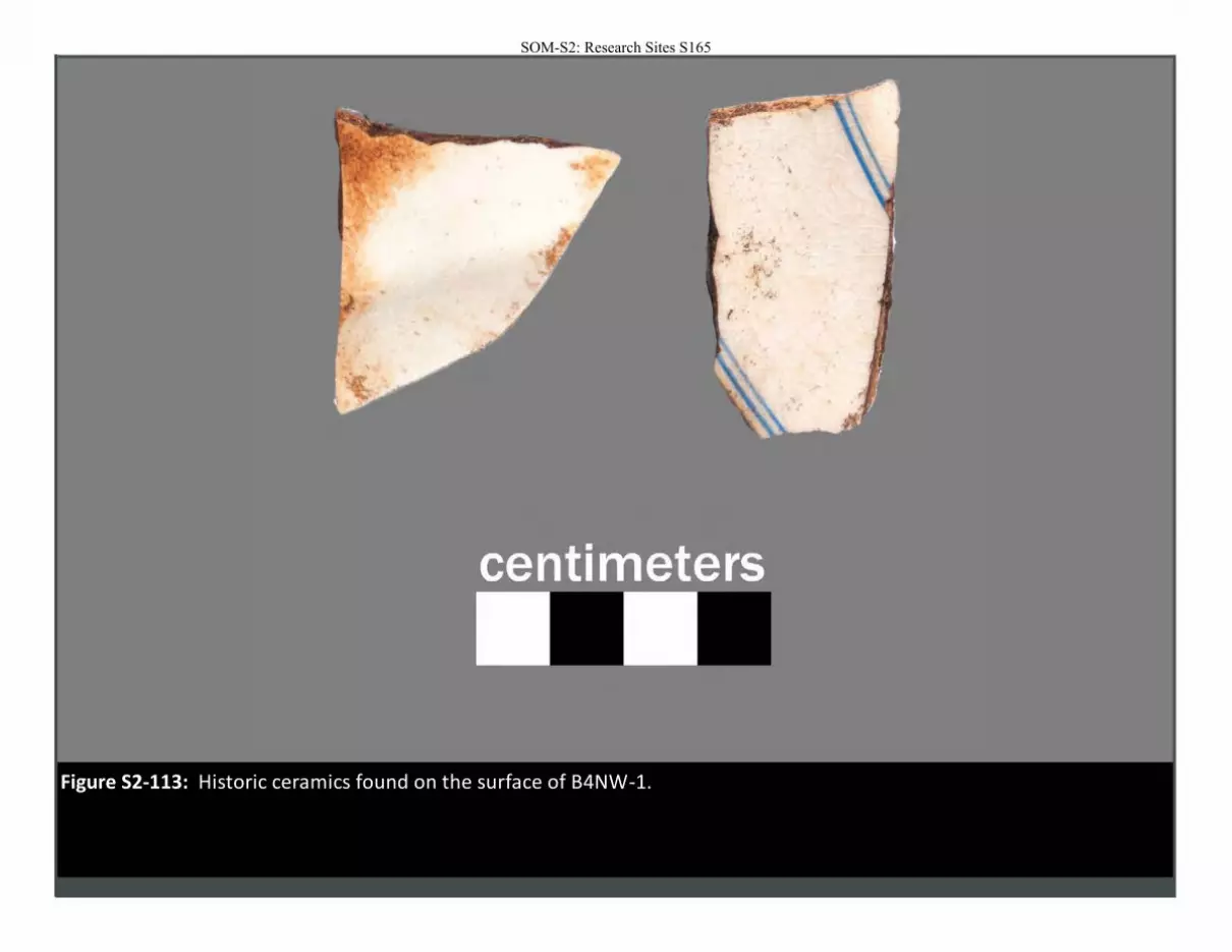
Figure S2-113: Historic ceramics found on the surface of B4NW-1.
SOM-S2: Research Sites S165
SOM-S2: Research Sites S166
SOM-S2: Research Sites S167
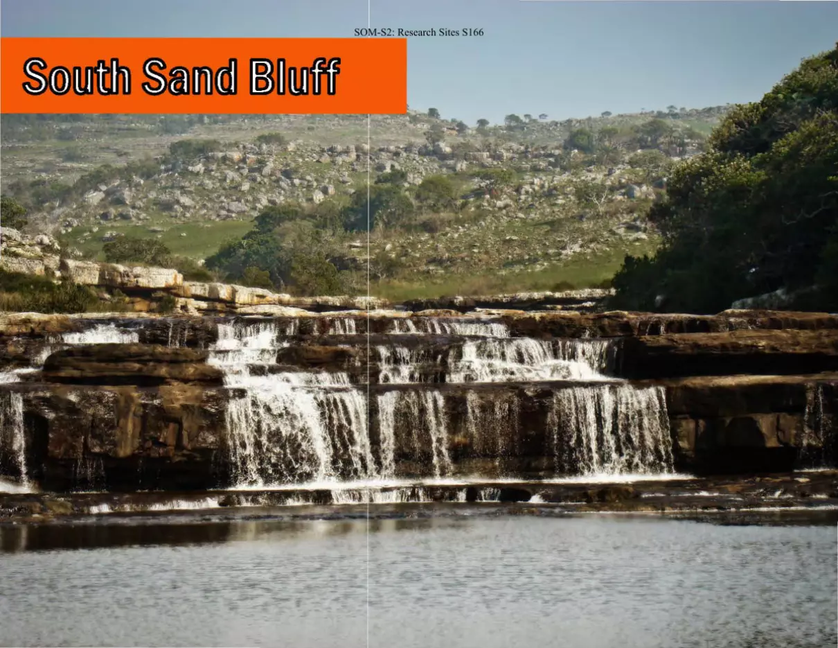
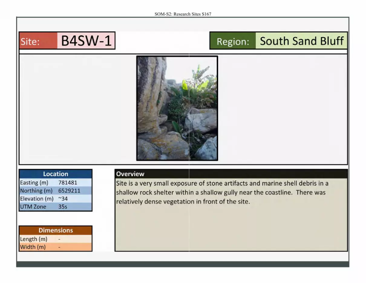
Site: B4SW-1
Location Easting (m) 781481 Northing (m) 6529211
Elevation (m) "'34
UTM Zone 35s
Dimensions Length (m)
Width (m)
Region: South Sand Bluff
Overview
Site is a very small exposure of stone artifacts and marine shell debris in a shallow rock shelter withiin a shallow gully near the coastline. There was
relatively dense vegetation in front of the site.
SOM-S2: Research Sites S168
. . .. , . .. .. . ( . ~
:;. •. .Jill', . ,.6.. • • • •• " ... ..... . _ .. ' #I ... •
~--- f4·· .. ~. ., . : . . ..• ~,. ' . . . . i • . . •

SOM-S2: Research Sites S169
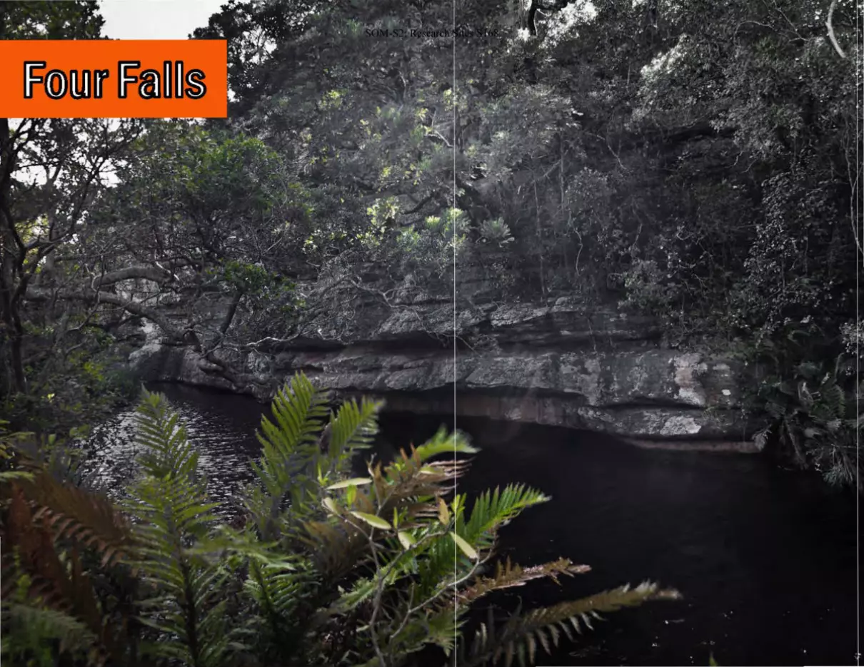
Site: C4NE-1
Location Easting (m) 214863
Northing (m) 6540318
Elevation (m) "'187
UTM Zone 36s
Dimensions Length (m)
Width (m)
27
9
Region:
Overview
The site is a relatively large rock shelter partly covered in front of the drip line
by dense thicket. Five main depositional facies were identified across the rock
shelter floor within natural erosional profiles. The depositional facies may
correspond to multiple facies of stone tools also found on the surface. Marine
and terrestrial fauna were also abundnat, and a burm at the rear of the site included abundant shellfish remains. Additioal information can be found in the
main text of the paper.

Figure S2-114: Panorama of the valley surrounding site C4NE-1. The photo was taken standing above the rockshelter.
Figure S2-115: View of rock shelter C4NE-1 looking to the south. The
shell burm is visible to the right, underneath of the overhang.
Figure S2-116: View of C4NE-1 taken within the thicket in front of the
site.
SOM-S2: Research Sites S170
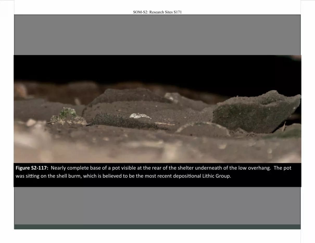
Figure S2-117: Nearly complete base of a pot visible at the rear of the shelter underneath of the low overhang. The pot
was sitting on the shell burm, which is believed to be the most recent depositional Lithic Group.
SOM-S2: Research Sites S171
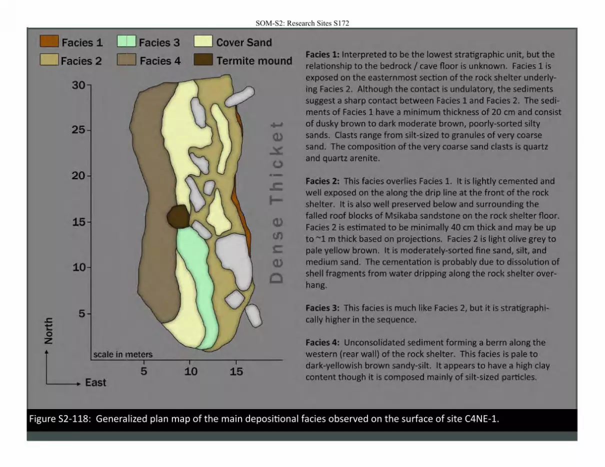
Figure S2-118: Generalized plan map of the main depositional facies observed on the surface of site C4NE-1.
SOM-S2: Research Sites S172
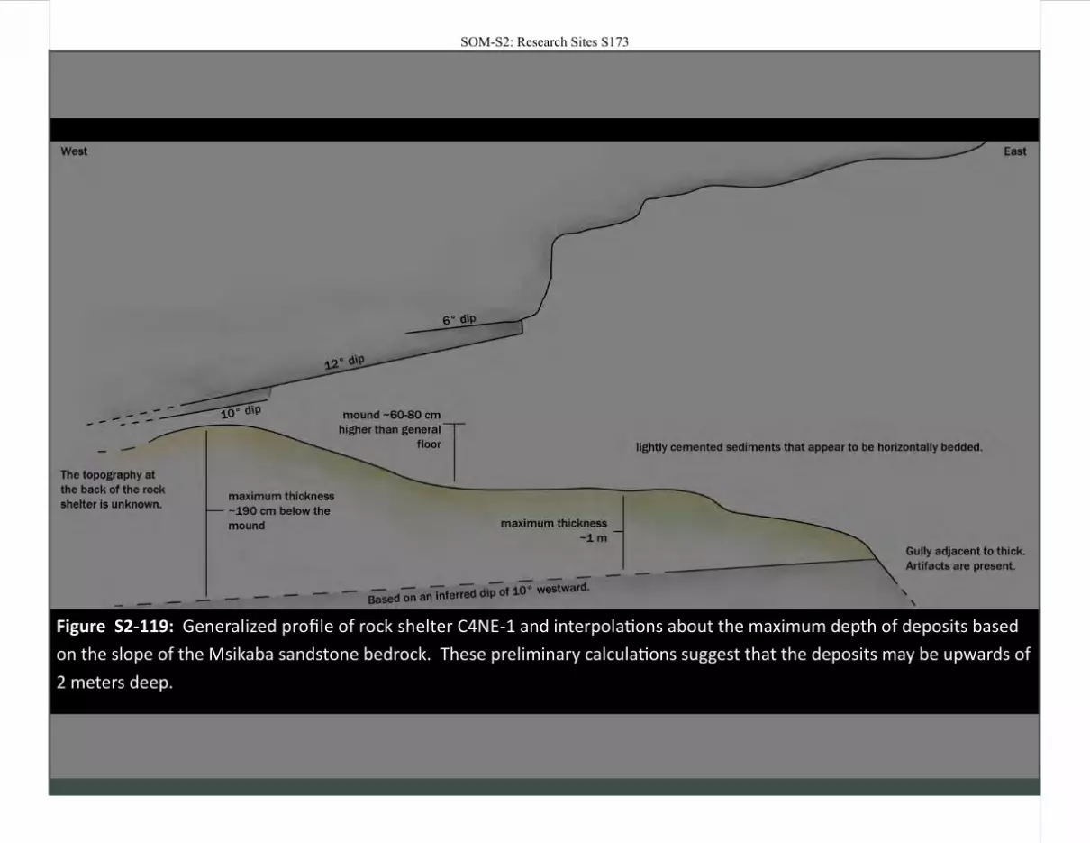
Figure S2-119: Generalized profile of rock shelter C4NE-1 and interpolations about the maximum depth of deposits based
on the slope of the Msikaba sandstone bedrock. These preliminary calculations suggest that the deposits may be upwards of
2 meters deep.
SOM-S2: Research Sites S173
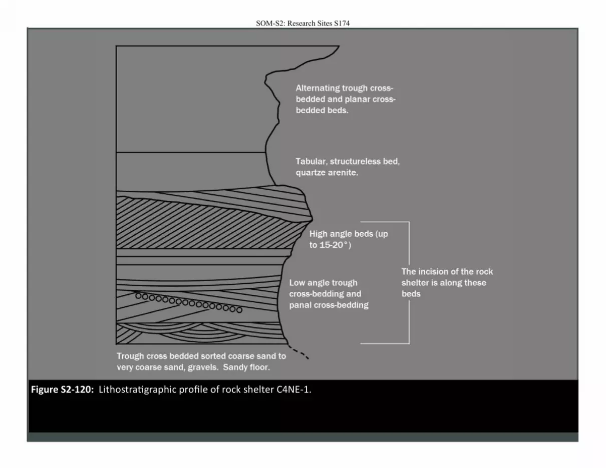
Figure S2-120: Lithostratigraphic profile of rock shelter C4NE-1.
SOM-S2: Research Sites S174
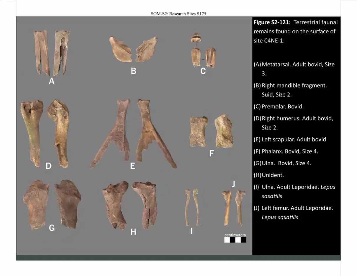
Figure S2-121: Terrestrial faunal
remains found on the surface of
site C4NE-1:
(A) Metatarsal. Adult bovid, Size
3.
(B) Right mandible fragment.
Suid, Size 2.
(C) Premolar. Bovid.
(D) Right humerus. Adult bovid,
Size 2.
(E) Left scapular. Adult bovid
(F) Phalanx. Bovid, Size 4.
(G) Ulna. Bovid, Size 4.
(H) Unident.
(I) Ulna. Adult Leporidae. Lepus
saxatilis
(J) Left femur. Adult Leporidae.
Lepus saxatilis
SOM-S2: Research Sites S175
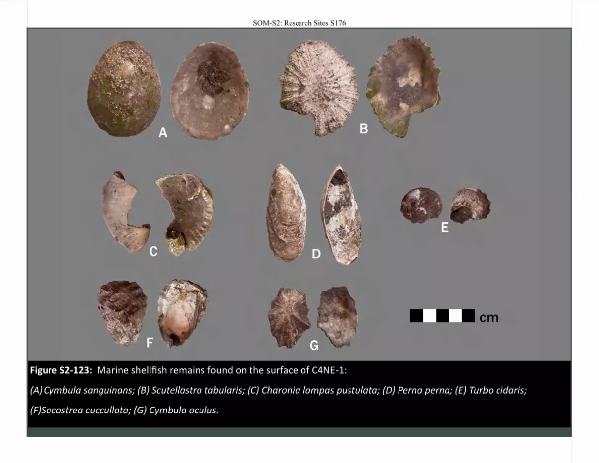
Figure S2-123: Marine shellfish remains found on the surface of C4NE-1:
(A) Cymbula sanguinans; (B) Scutellastra tabularis; (C) Charonia lampas pustulata; (D) Perna perna; (E) Turbo cidaris;
(F)Sacostrea cuccullata; (G) Cymbula oculus.
SOM-S2: Research Sites S176
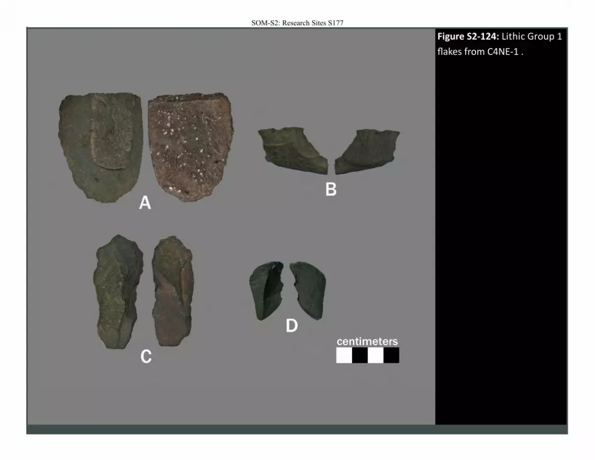
Figure S2-124: Lithic Group 1
flakes from C4NE-1 .
SOM-S2: Research Sites S177
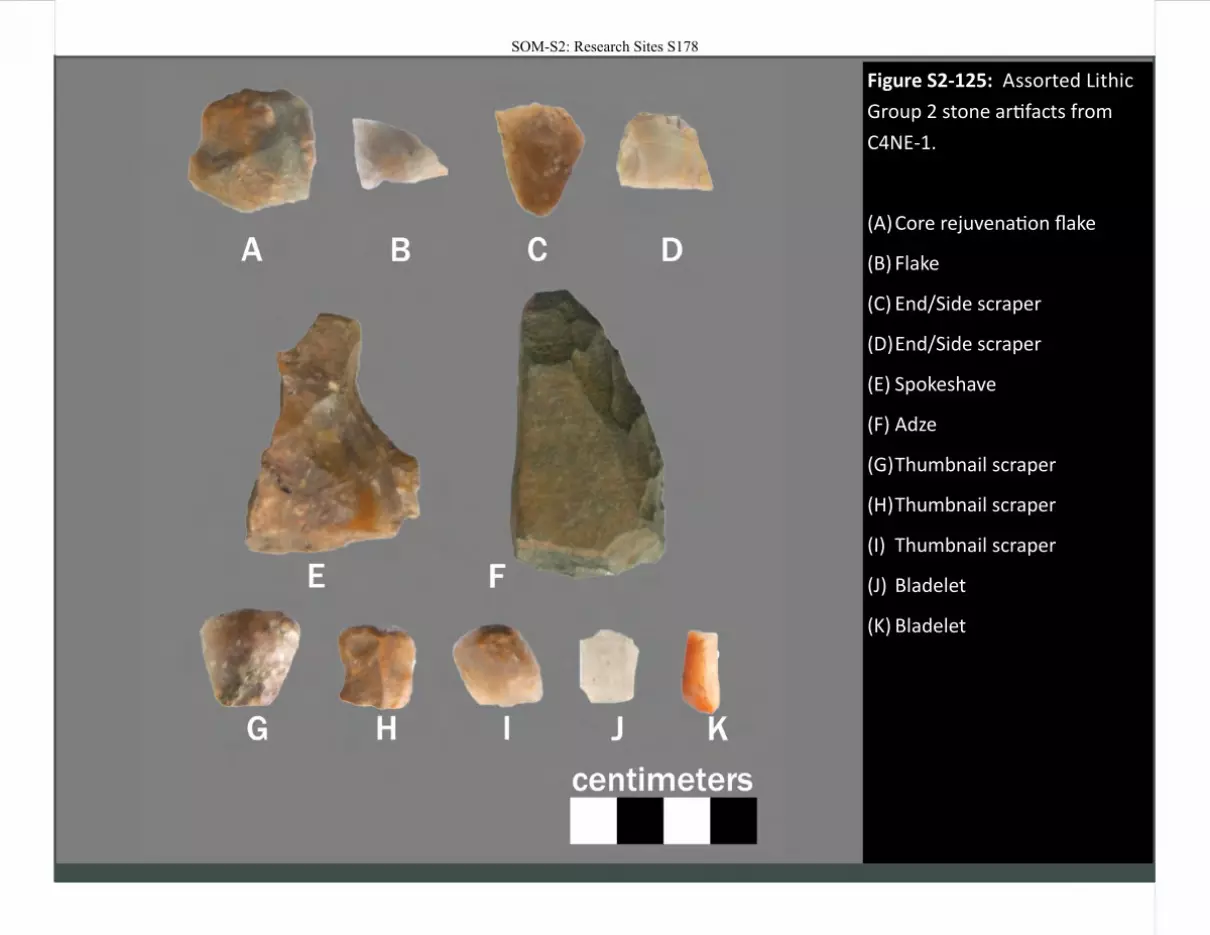
Figure S2-125: Assorted Lithic
Group 2 stone artifacts from
C4NE-1.
(A) Core rejuvenation flake
(B) Flake
(C) End/Side scraper
(D) End/Side scraper
(E) Spokeshave
(F) Adze
(G) Thumbnail scraper
(H) Thumbnail scraper
(I) Thumbnail scraper
(J) Bladelet
(K) Bladelet
SOM-S2: Research Sites S178
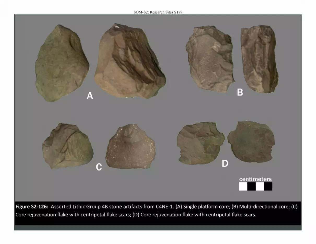
Figure S2-126: Assorted Lithic Group 4B stone artifacts from C4NE-1. (A) Single platform core; (B) Multi-directional core; (C)
Core rejuvenation flake with centripetal flake scars; (D) Core rejuvenation flake with centripetal flake scars.
SOM-S2: Research Sites S179
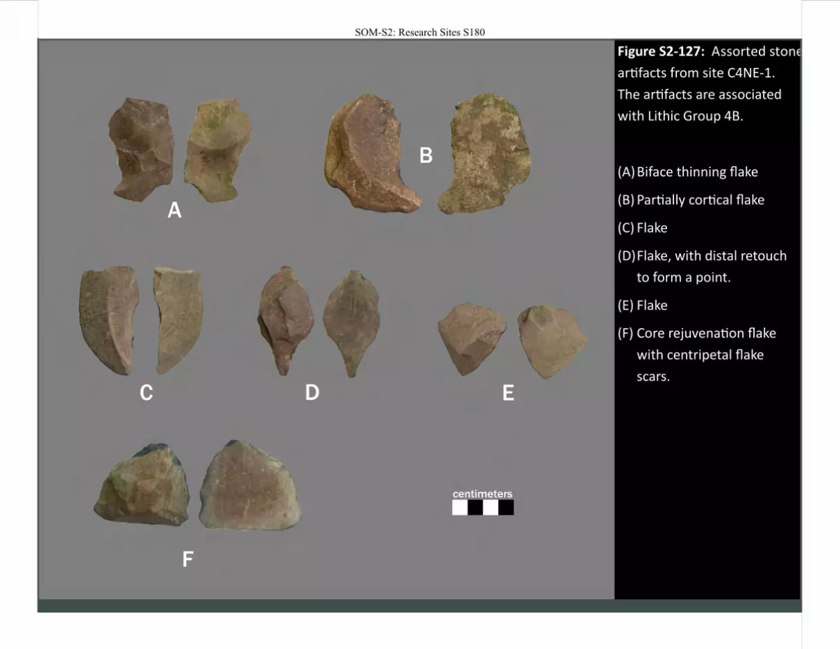
Figure S2-127: Assorted stone
artifacts from site C4NE-1.
The artifacts are associated
with Lithic Group 4B.
(A) Biface thinning flake
(B) Partially cortical flake
(C) Flake
(D) Flake, with distal retouch
to form a point.
(E) Flake
(F) Core rejuvenation flake
with centripetal flake
scars.
SOM-S2: Research Sites S180

Figure S2-128: Hammerstone /
grindstone found on the surface of
site C4NE-1.
SOM-S2: Research Sites S181
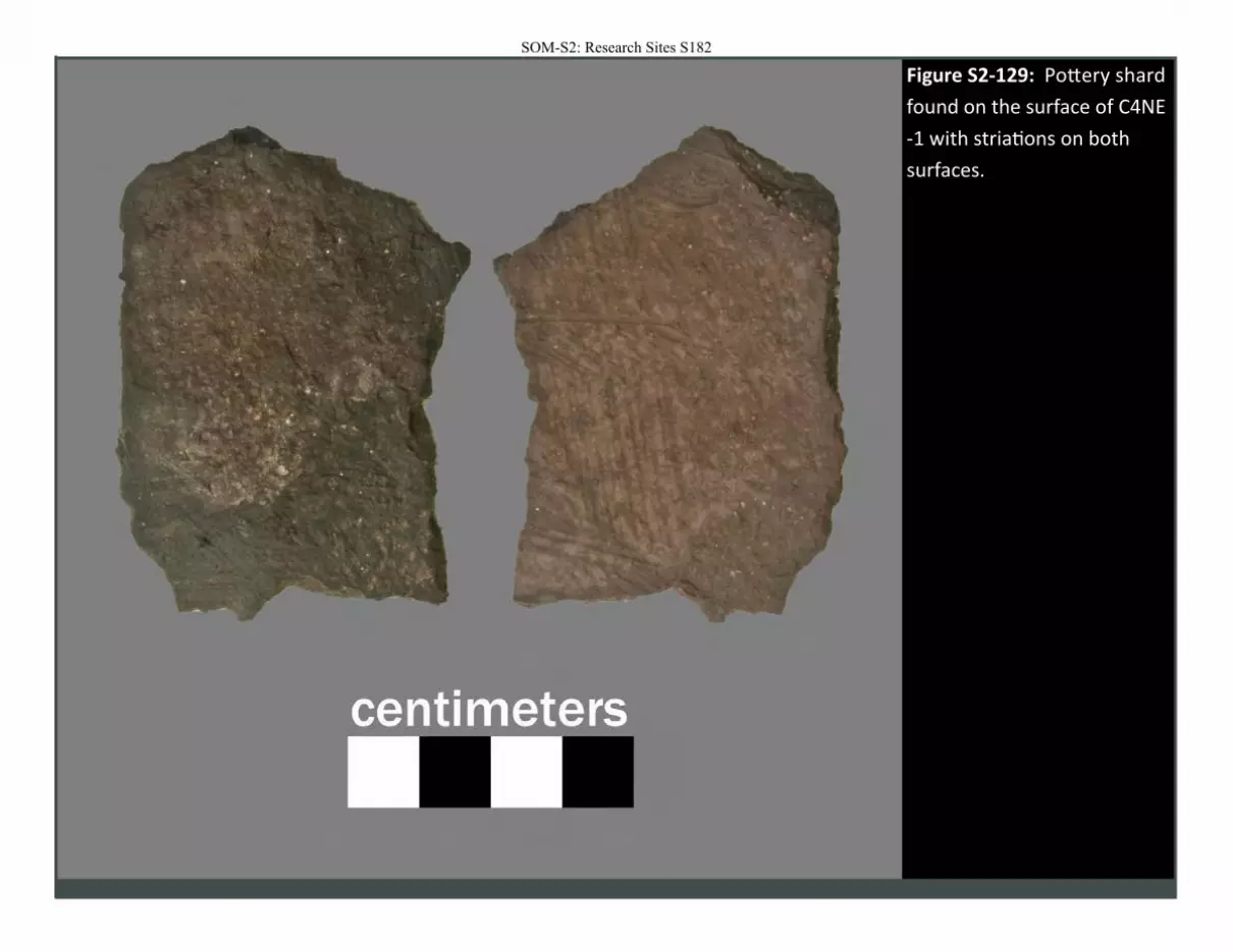
Figure S2-129: Pottery shard
found on the surface of C4NE
-1 with striations on both
surfaces.
SOM-S2: Research Sites S182
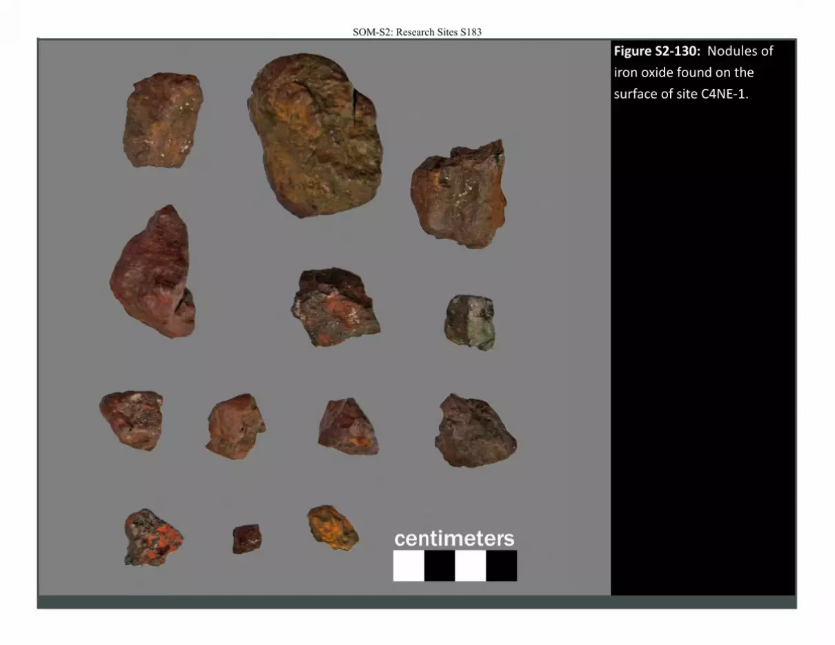
Figure S2-130: Nodules of
iron oxide found on the
surface of site C4NE-1.
SOM-S2: Research Sites S183

SOM-S2: Research Sites S184
Site: C4NE-2
Location Easting (m) 214527
Northing (m) 6540318
Elevation (m) "'196
UTM Zone 36s
Dimensions Length (m) 11.7
Width (m) 6.4
Region:
Overview
Site C4NE-2 is a dry rockshelter with a silty floor. Marine shell is present, but not abundant, as are stone artifacts in similar quantity. Natural erosional section along the dripline at the front of the cave have revealed stratified sediments and archaeological materials.
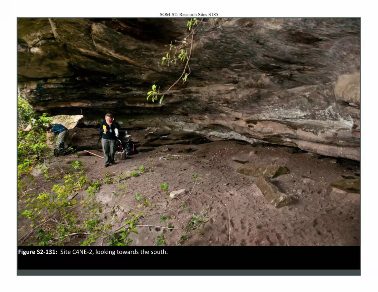
Figure S2-131: Site C4NE-2, looking towards the south.
SOM-S2: Research Sites S185
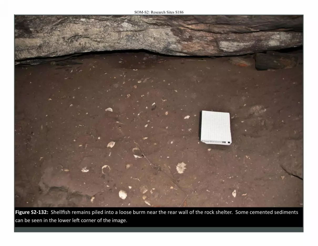
Figure S2-132: Shellfish remains piled into a loose burm near the rear wall of the rock shelter. Some cemented sediments
can be seen in the lower left corner of the image.
SOM-S2: Research Sites S186
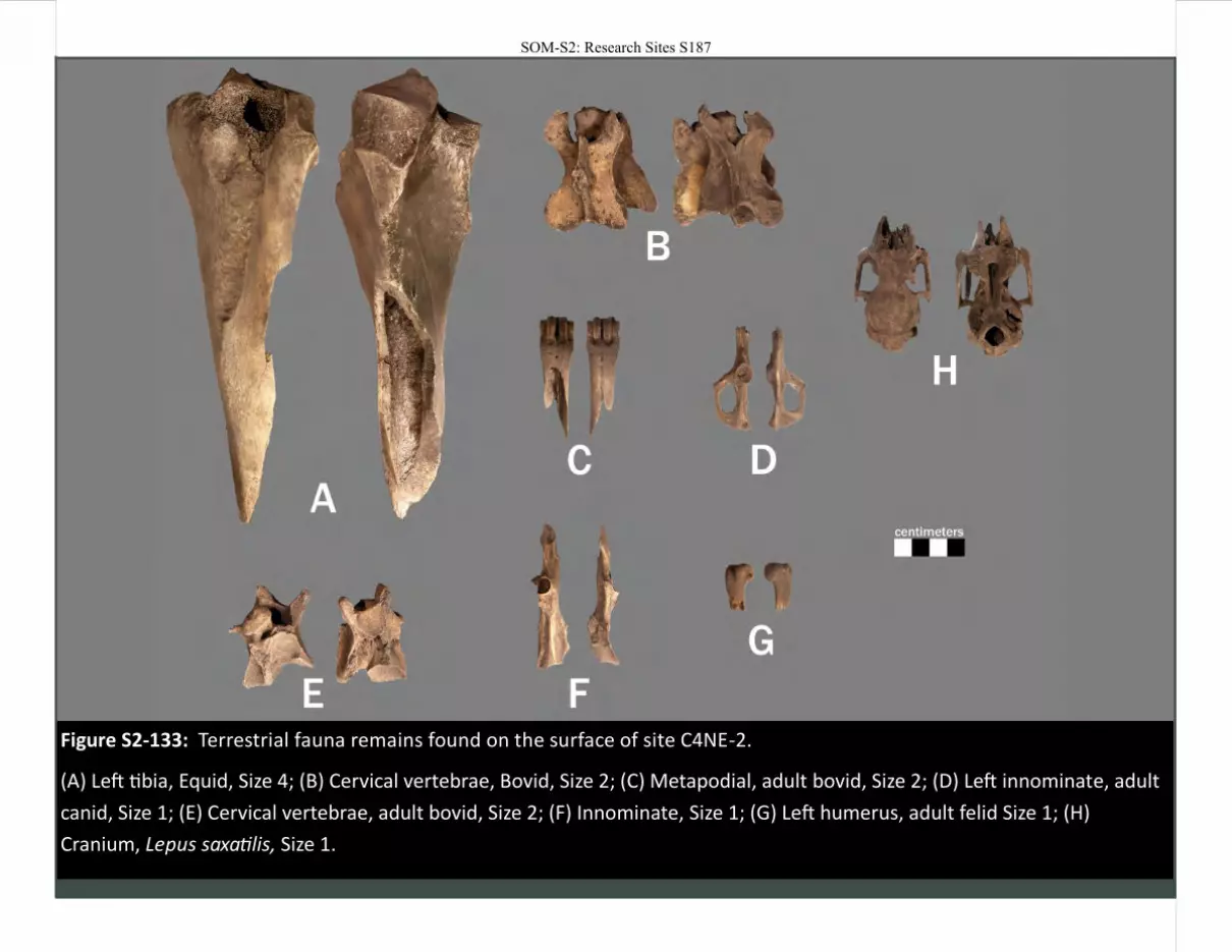
Figure S2-133: Terrestrial fauna remains found on the surface of site C4NE-2.
(A) Left tibia, Equid, Size 4; (B) Cervical vertebrae, Bovid, Size 2; (C) Metapodial, adult bovid, Size 2; (D) Left innominate, adult
canid, Size 1; (E) Cervical vertebrae, adult bovid, Size 2; (F) Innominate, Size 1; (G) Left humerus, adult felid Size 1; (H)
Cranium, Lepus saxatilis, Size 1.
SOM-S2: Research Sites S187
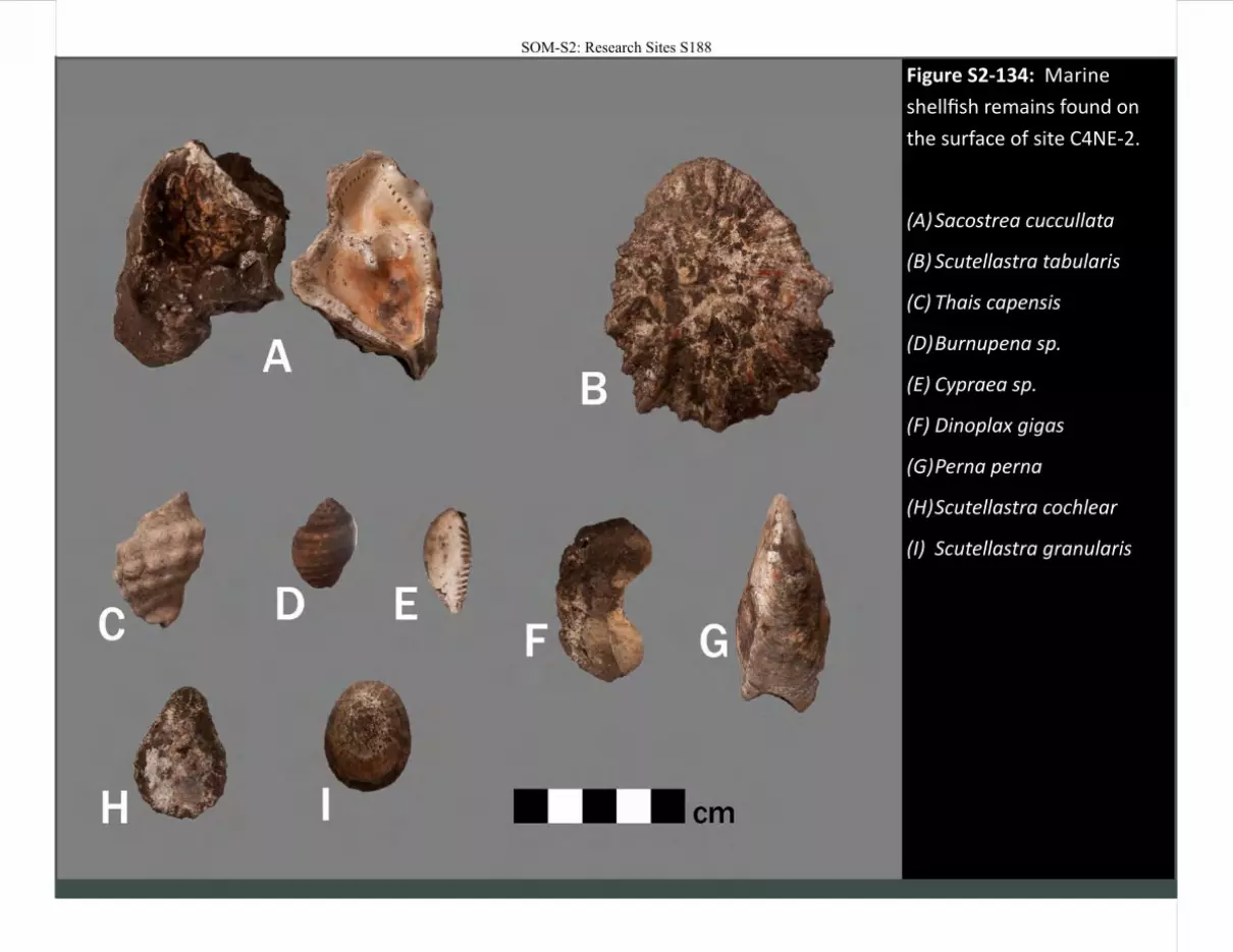
Figure S2-134: Marine
shellfish remains found on
the surface of site C4NE-2.
(A) Sacostrea cuccullata
(B) Scutellastra tabularis
(C) Thais capensis
(D) Burnupena sp.
(E) Cypraea sp.
(F) Dinoplax gigas
(G) Perna perna
(H) Scutellastra cochlear
(I) Scutellastra granularis
SOM-S2: Research Sites S188
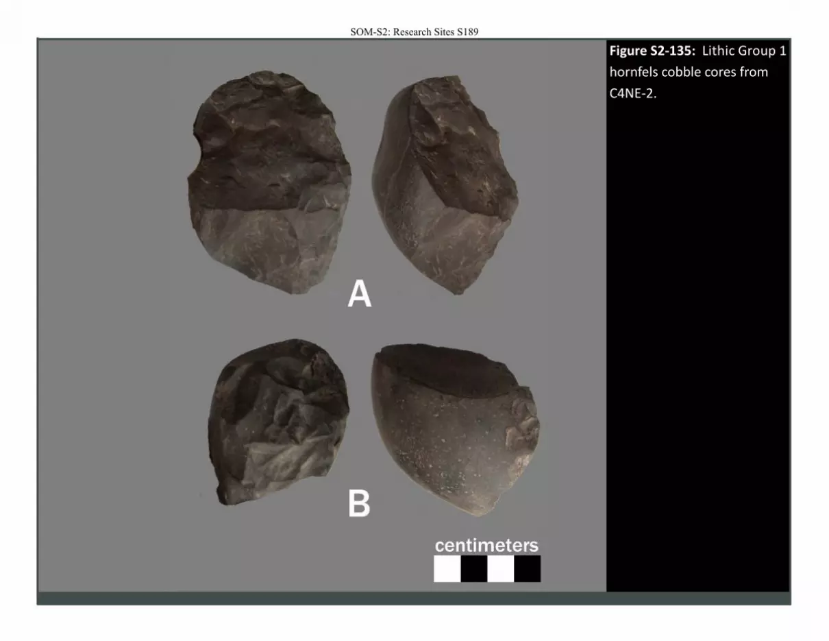
Figure S2-135: Lithic Group 1
hornfels cobble cores from
C4NE-2.
SOM-S2: Research Sites S189
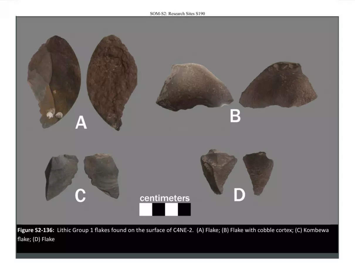
Figure S2-136: Lithic Group 1 flakes found on the surface of C4NE-2. (A) Flake; (B) Flake with cobble cortex; (C) Kombewa
flake; (D) Flake
SOM-S2: Research Sites S190
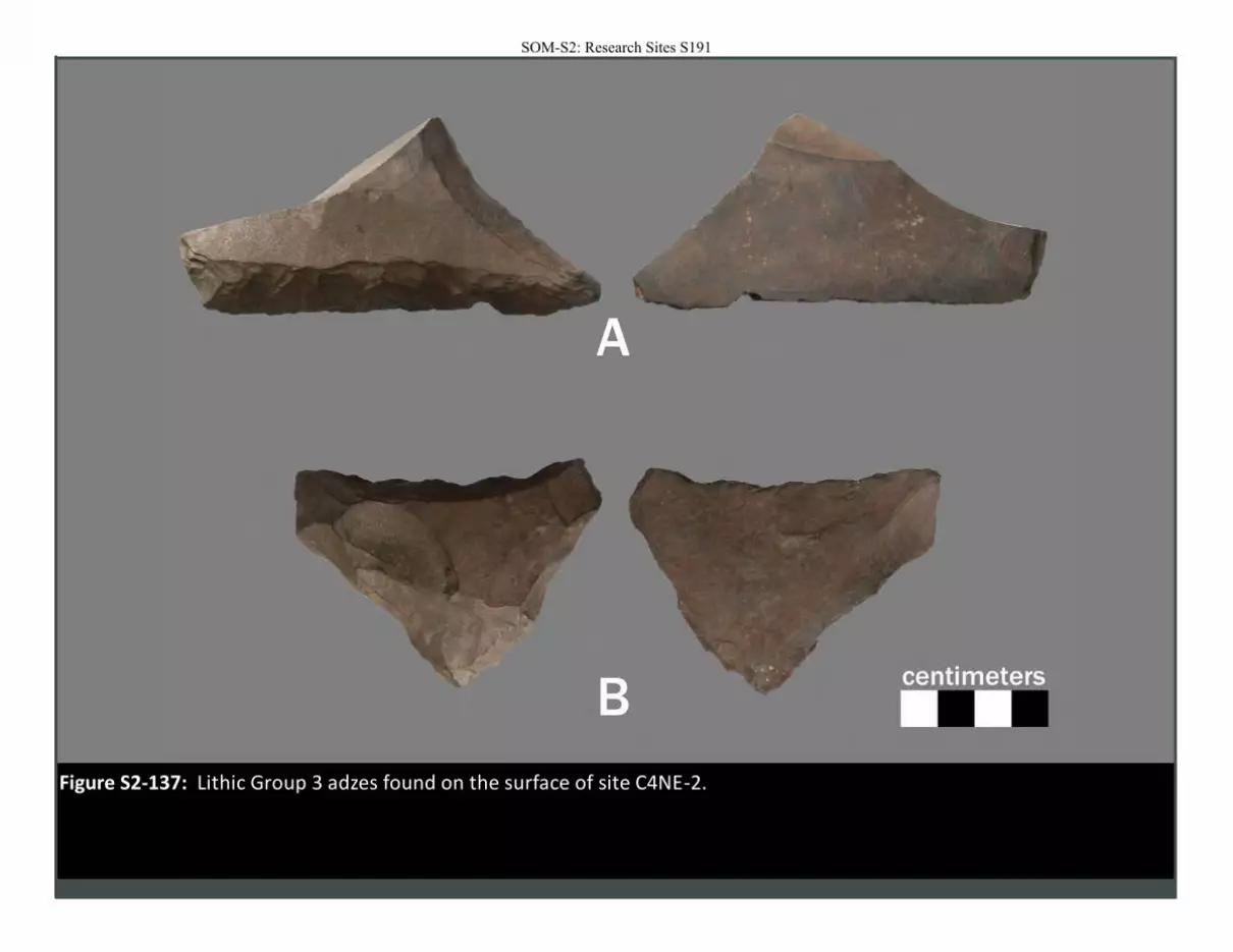
Figure S2-137: Lithic Group 3 adzes found on the surface of site C4NE-2.
SOM-S2: Research Sites S191
SOM-S2: Research Sites S192

SOM-S2: Research Sites S193
Site: C4SE-1
Location Easting (m) 215321
Northing (m) 6536886
Elevation (m) -
UTM Zone 36s
Dimensions Length (m)
Width (m)
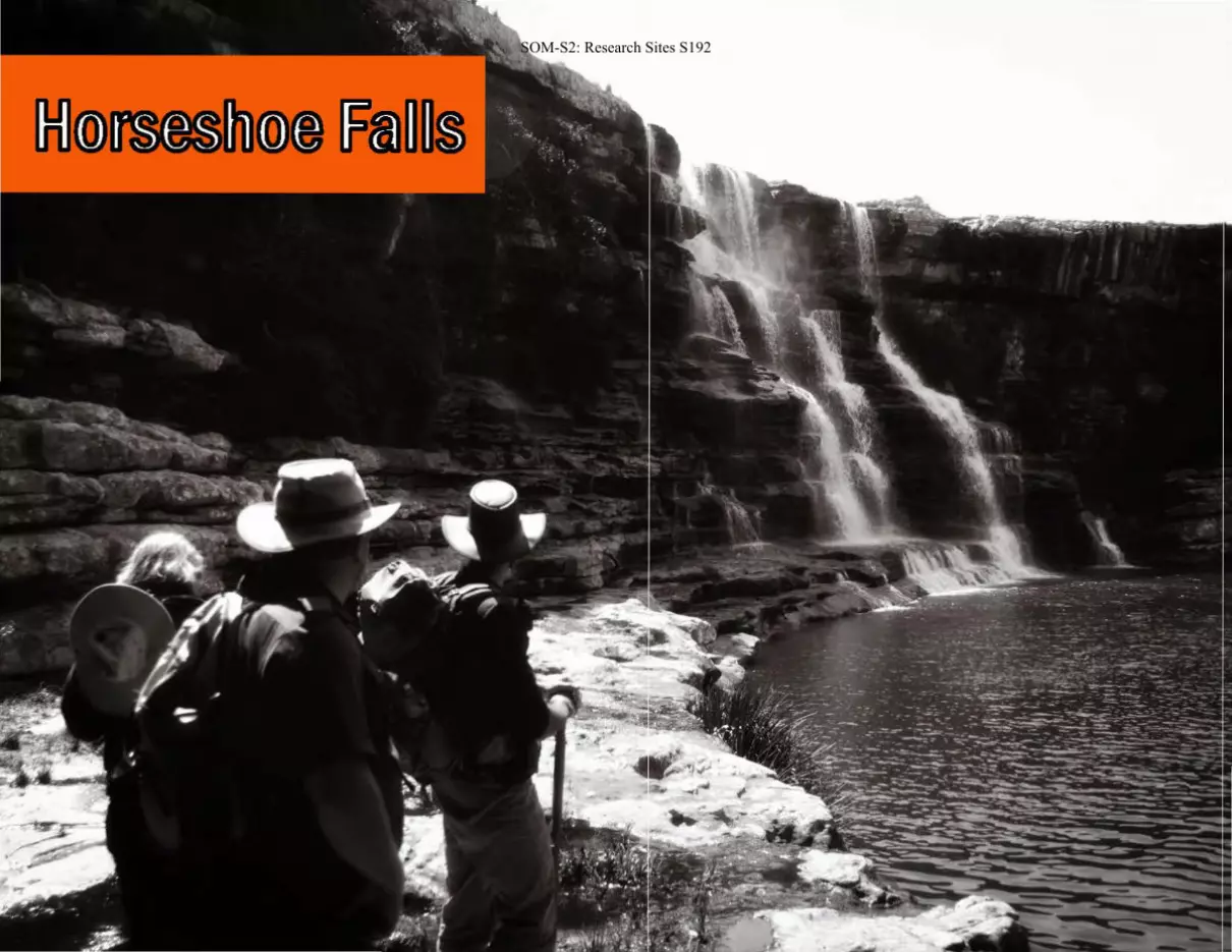
Region: Horseshoe Falls
Overview
C4SE-1 was a small overhang located in dense thicket. There was a light scatter
of shellfish on the rocky floor. There was also one visible rock art painting on
the wall.
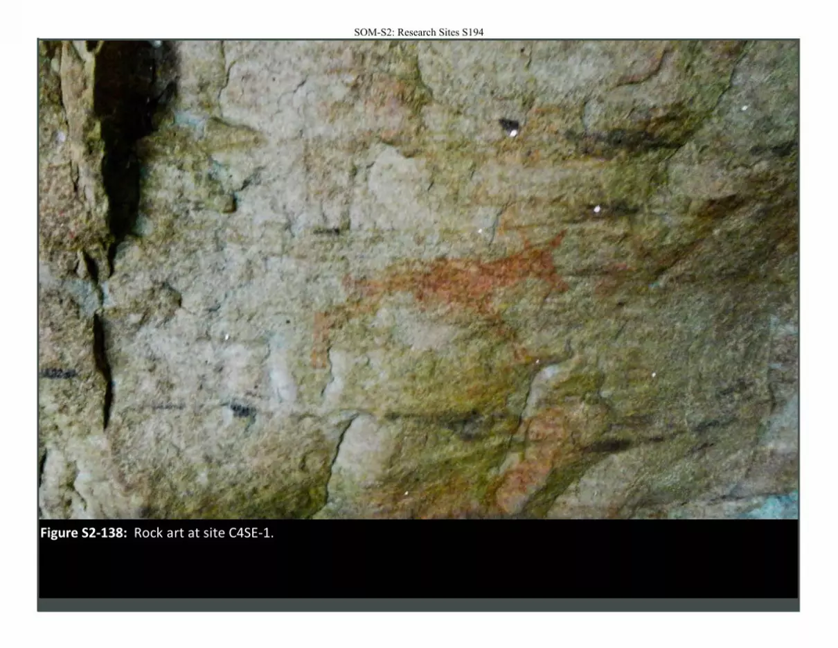
Figure S2-138: Rock art at site C4SE-1.
SOM-S2: Research Sites S194
SOM-S2: Research Sites S195
SOM-S2: Research Sites S196
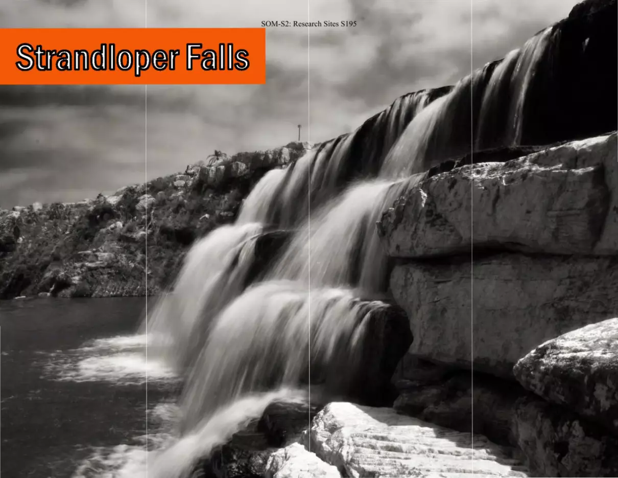
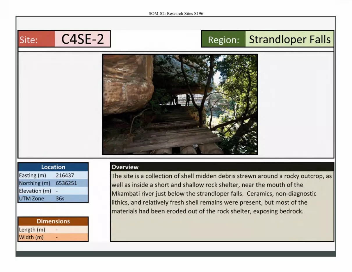
Site: C4SE-2
Location Easting (m) 216437
Northing (m) 6536251
Elevation (m) -
UTM Zone 36s
Dimensions Length (m)
Width (m}
Region: Strand Ioper Falls
Overview
The site is a collection of shell midden debris strewn around a rocky outcrop, as
well as inside a short and shallow rock shelter, near the mouth of the Mkambati river just below the strandloper falls . Ceramics, non-diagnostic
lithics, and relatively fresh shell remains were present, but most of the materials had been eroded out of the rock shelter, exposing bedrock.
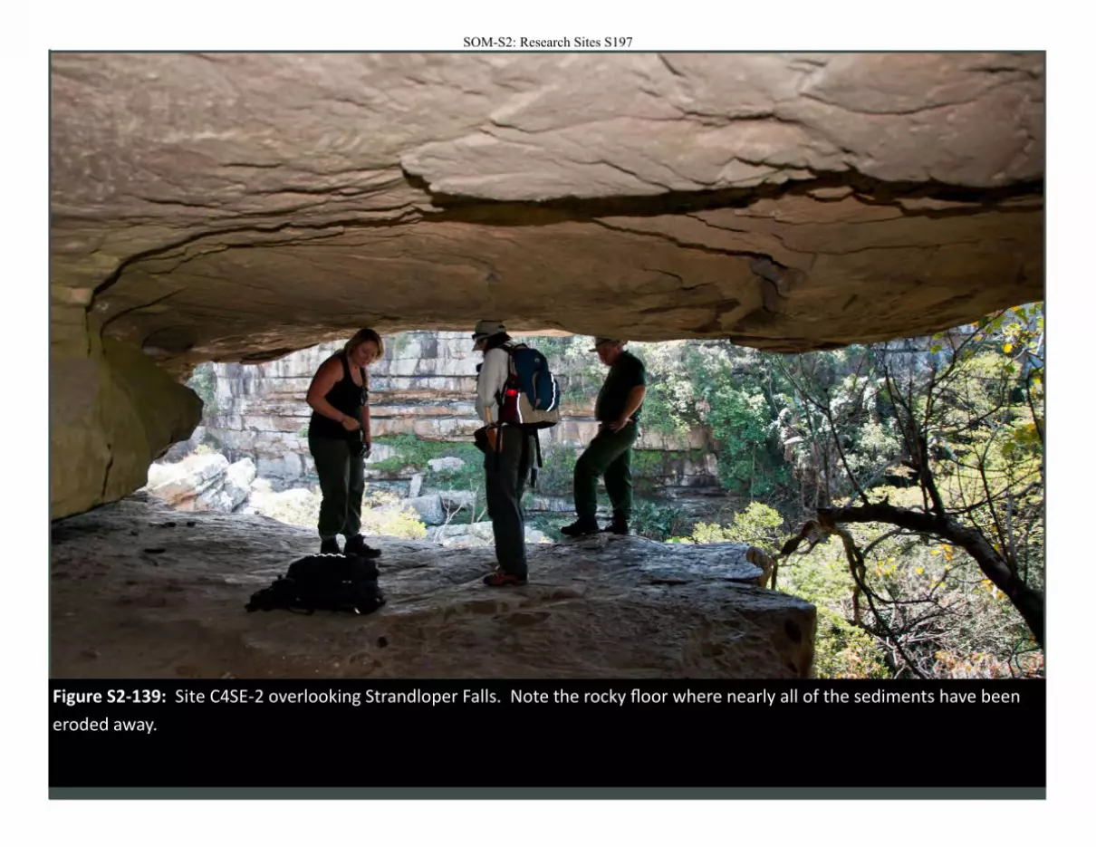
Figure S2-139: Site C4SE-2 overlooking Strandloper Falls. Note the rocky floor where nearly all of the sediments have been
eroded away.
SOM-S2: Research Sites S197
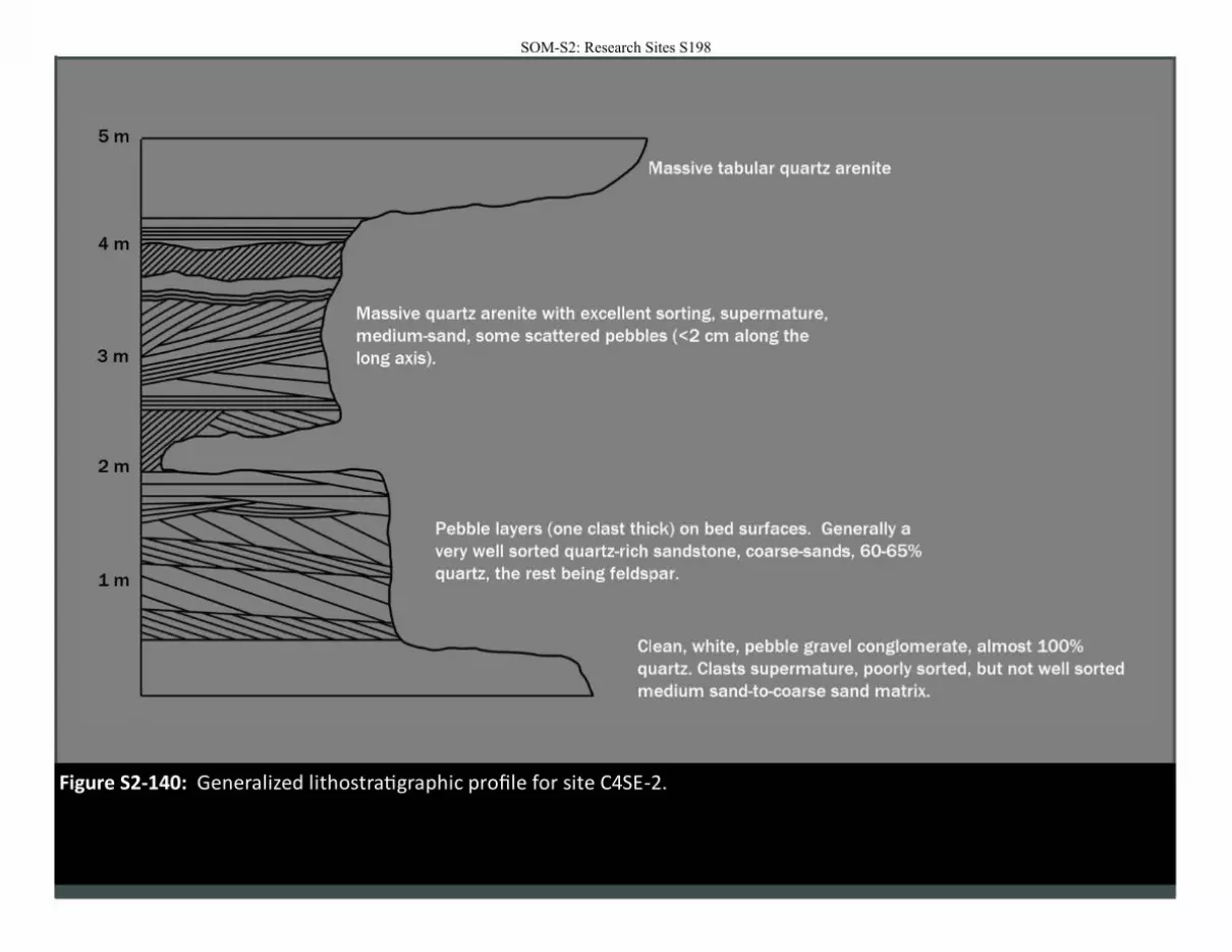
Figure S2-140: Generalized lithostratigraphic profile for site C4SE-2.
SOM-S2: Research Sites S198
SOM-S2: Research Sites S199
SOM-S2: Research Sites S200
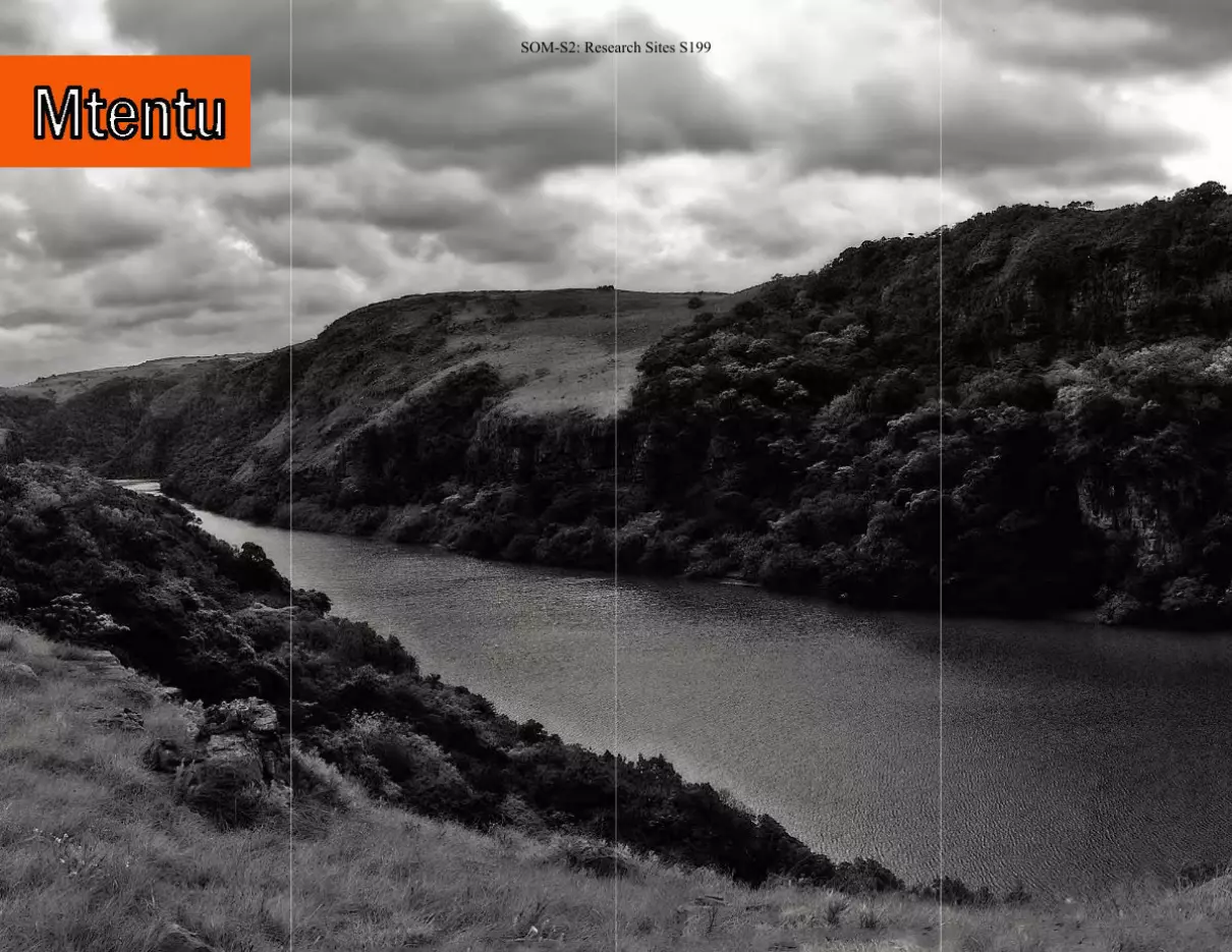
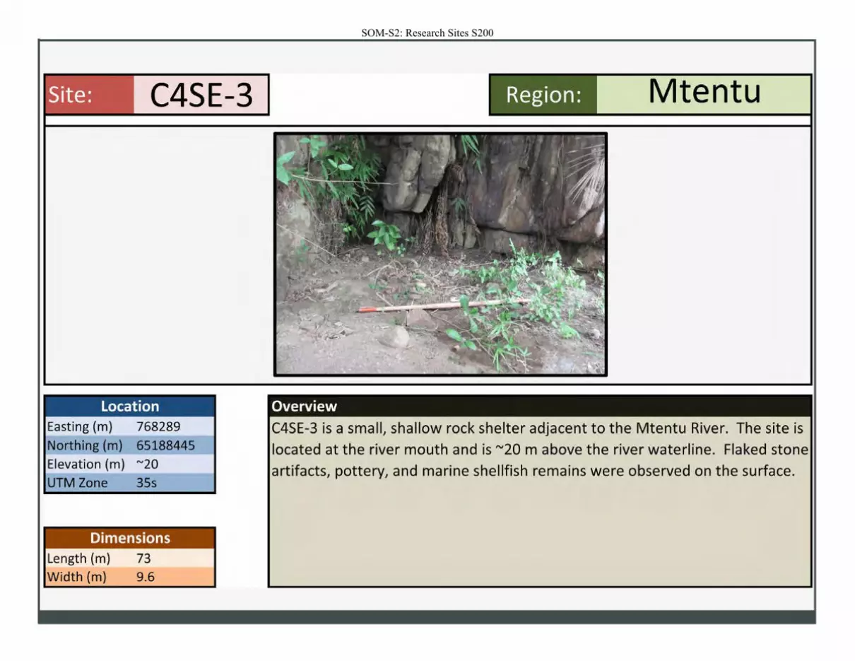
Site: C4SE-3 Mtentu Region :
Location Overview
Easting (m) 768289 C4SE-3 is a small, shallow rock shelter adjacent to the Mtentu River. The site is Northing (m) 65188445 located at the river mouth and is "'20 m above the river waterline. Flaked stone Elevation (m) "'20 artifacts, pottery, and marine shellfish remains were observed on the surface. UTM Zone 35s
Dimensions Length (m) 73 Width (m) 9.6
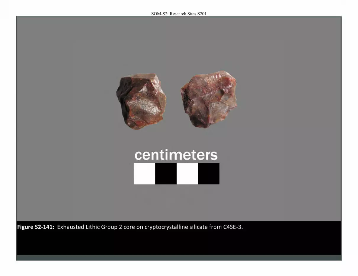
Figure S2-141: Exhausted Lithic Group 2 core on cryptocrystalline silicate from C4SE-3.
SOM-S2: Research Sites S201
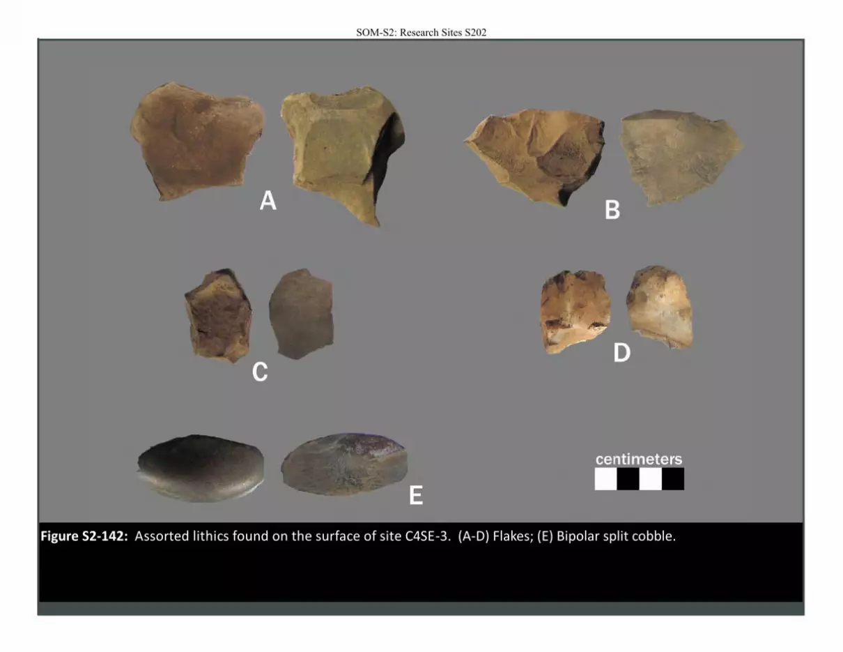
Figure S2-142: Assorted lithics found on the surface of site C4SE-3. (A-D) Flakes; (E) Bipolar split cobble.
SOM-S2: Research Sites S202
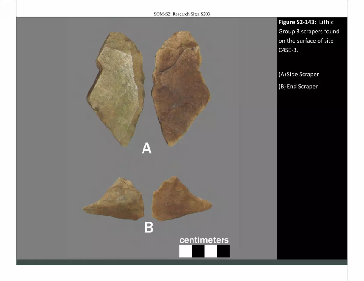
Figure S2-143: Lithic
Group 3 scrapers found
on the surface of site
C4SE-3.
(A) Side Scraper
(B) End Scraper
SOM-S2: Research Sites S203
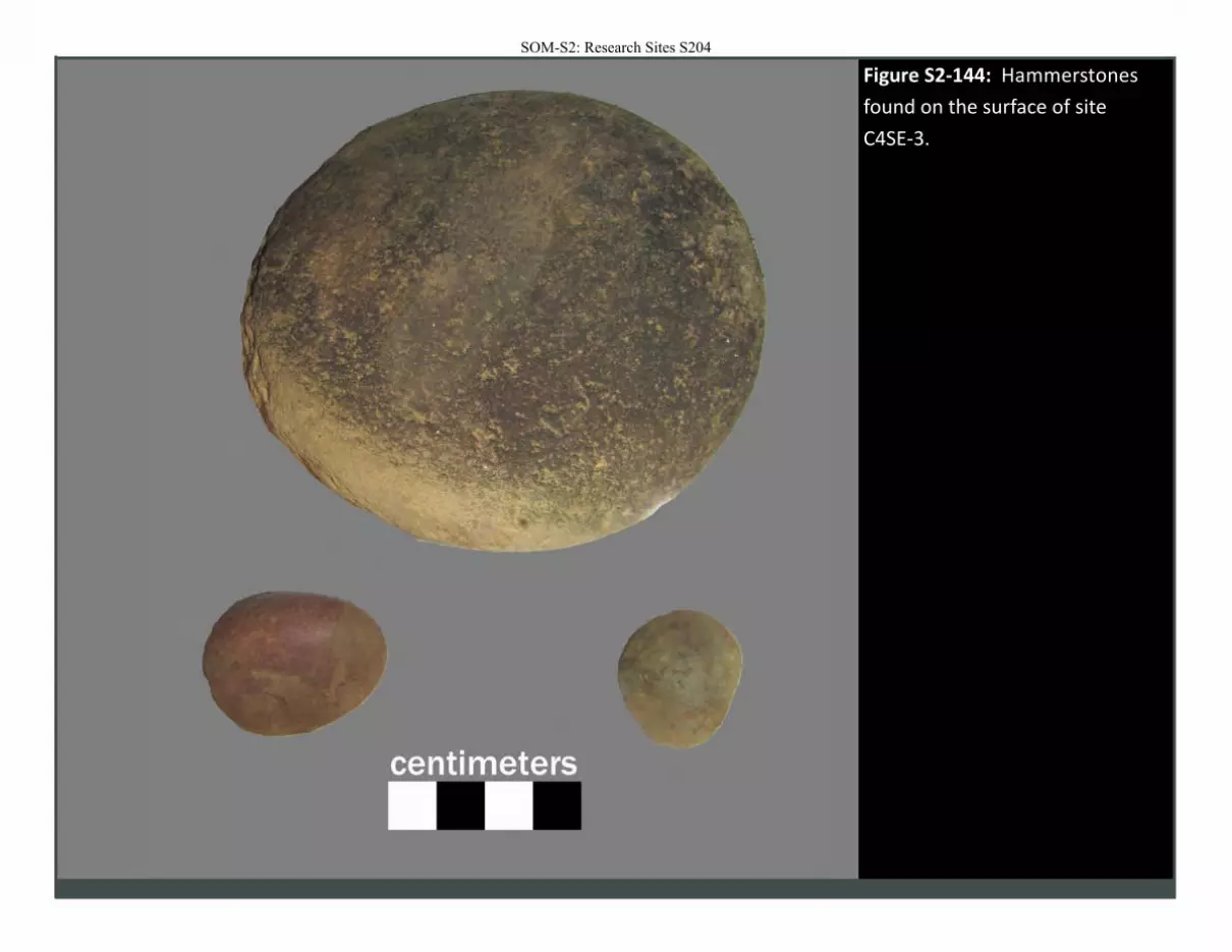
Figure S2-144: Hammerstones
found on the surface of site
C4SE-3.
SOM-S2: Research Sites S204
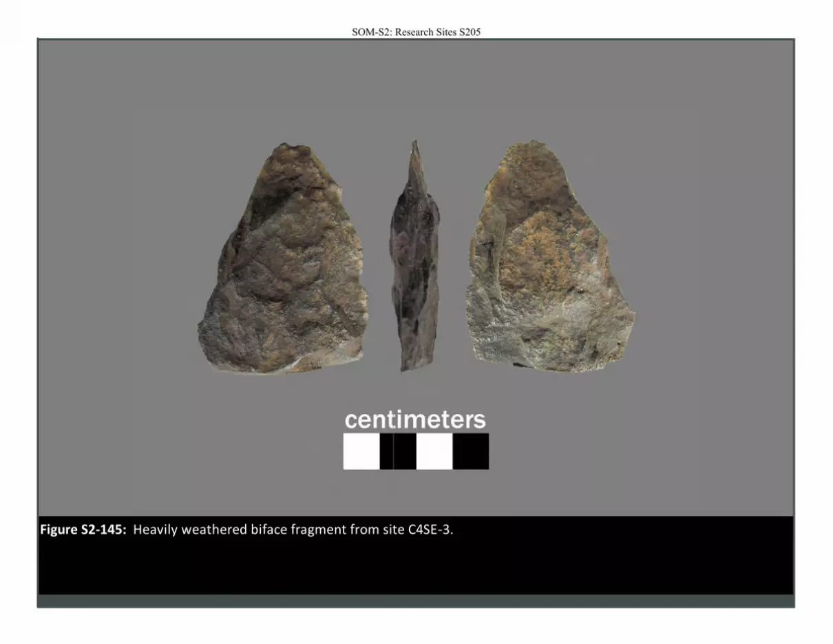
Figure S2-145: Heavily weathered biface fragment from site C4SE-3.
SOM-S2: Research Sites S205
SOM-S2: Research Sites S206
SOM-S2: Research Sites S207
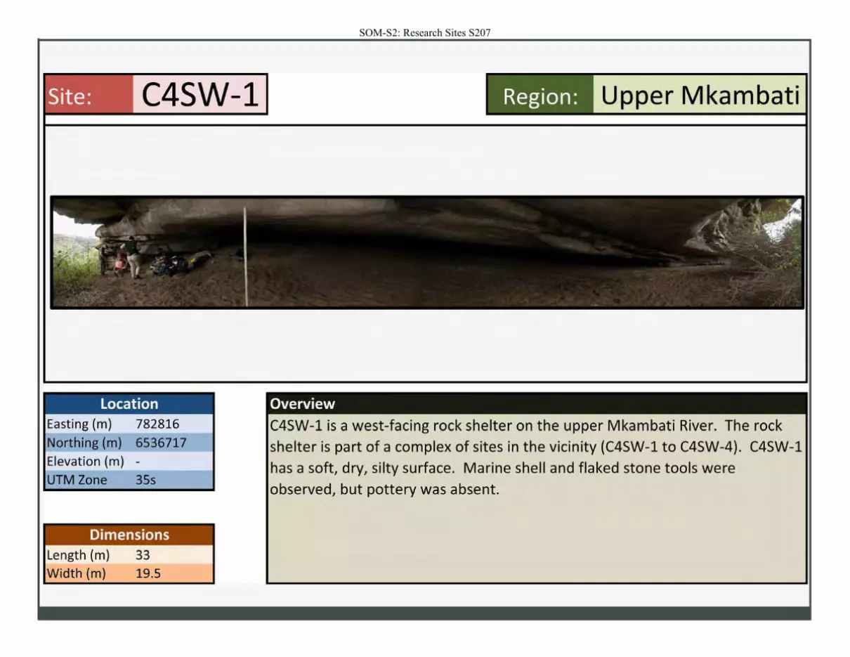
Site: C4SW-1
Location Easting (m) 782816
Northing (m) 6536717
Elevation (m) -
UTM Zone 35s
Dimensions Length (m) 33
Width (m) 19.5
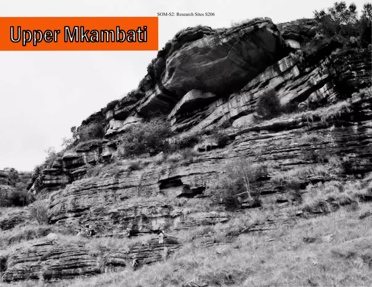
Region: Upper Mkambati
Overview
C4SW-1 is a west-facing rock shelter on the upper Mkambati River. The rock
shelter is part of a complex of sites in the vicinity (C4SW-1 to C4SW-4). C4SW-1
has a soft, dry, silty surface. Marine shell and flaked stone tools were
observed, but pottery was absent.
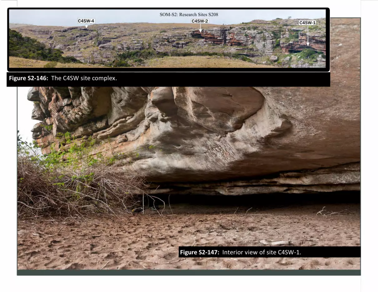
Figure S2-146: The C4SW site complex.
Figure S2-147: Interior view of site C4SW-1.
SOM-S2: Research Sites S208
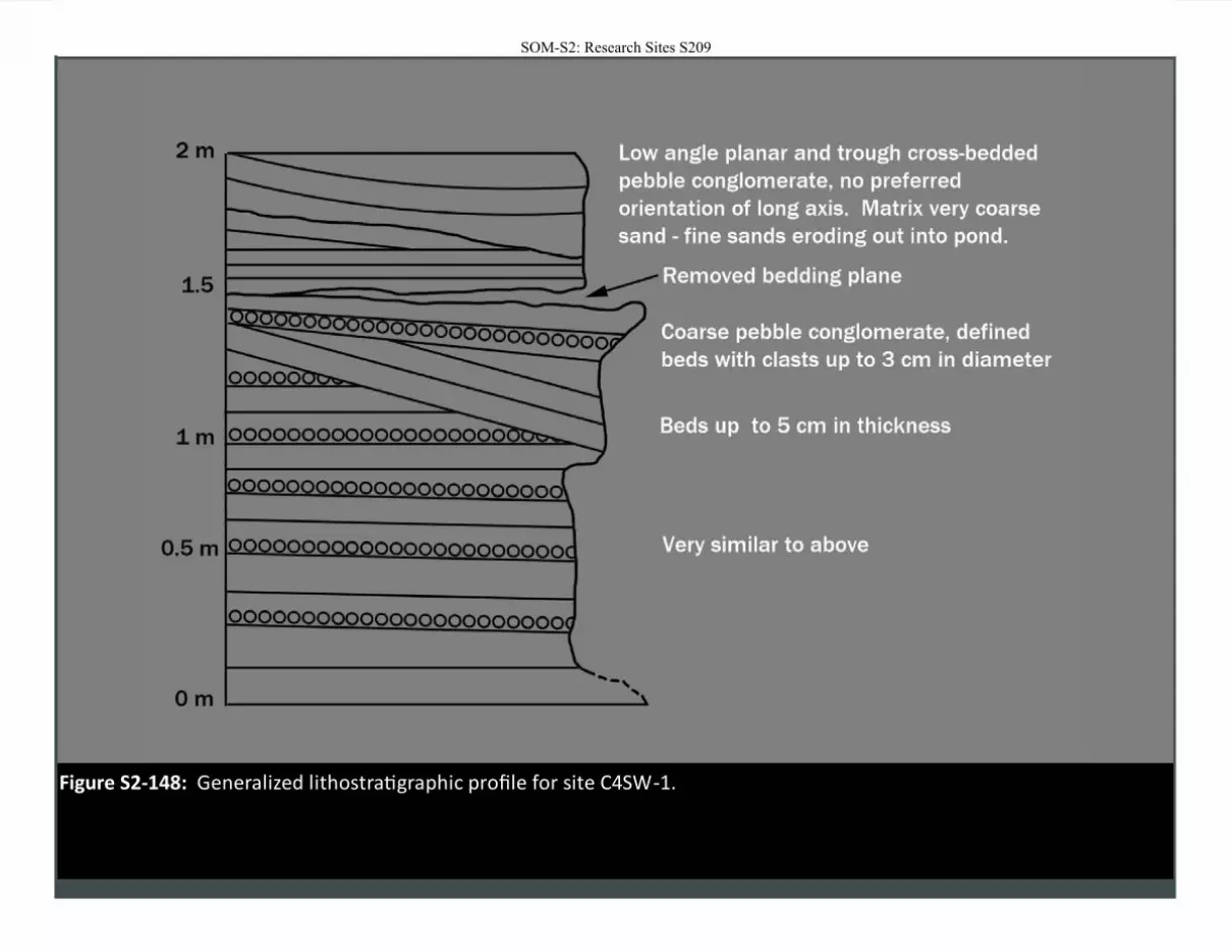
Figure S2-148: Generalized lithostratigraphic profile for site C4SW-1.
SOM-S2: Research Sites S209
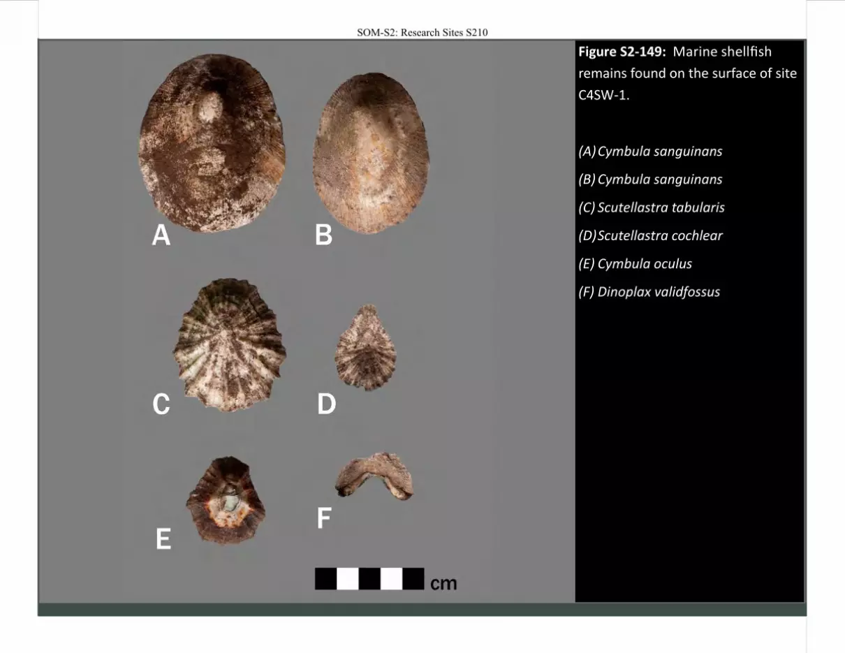
Figure S2-149: Marine shellfish
remains found on the surface of site
C4SW-1.
(A) Cymbula sanguinans
(B) Cymbula sanguinans
(C) Scutellastra tabularis
(D) Scutellastra cochlear
(E) Cymbula oculus
(F) Dinoplax validfossus
SOM-S2: Research Sites S210
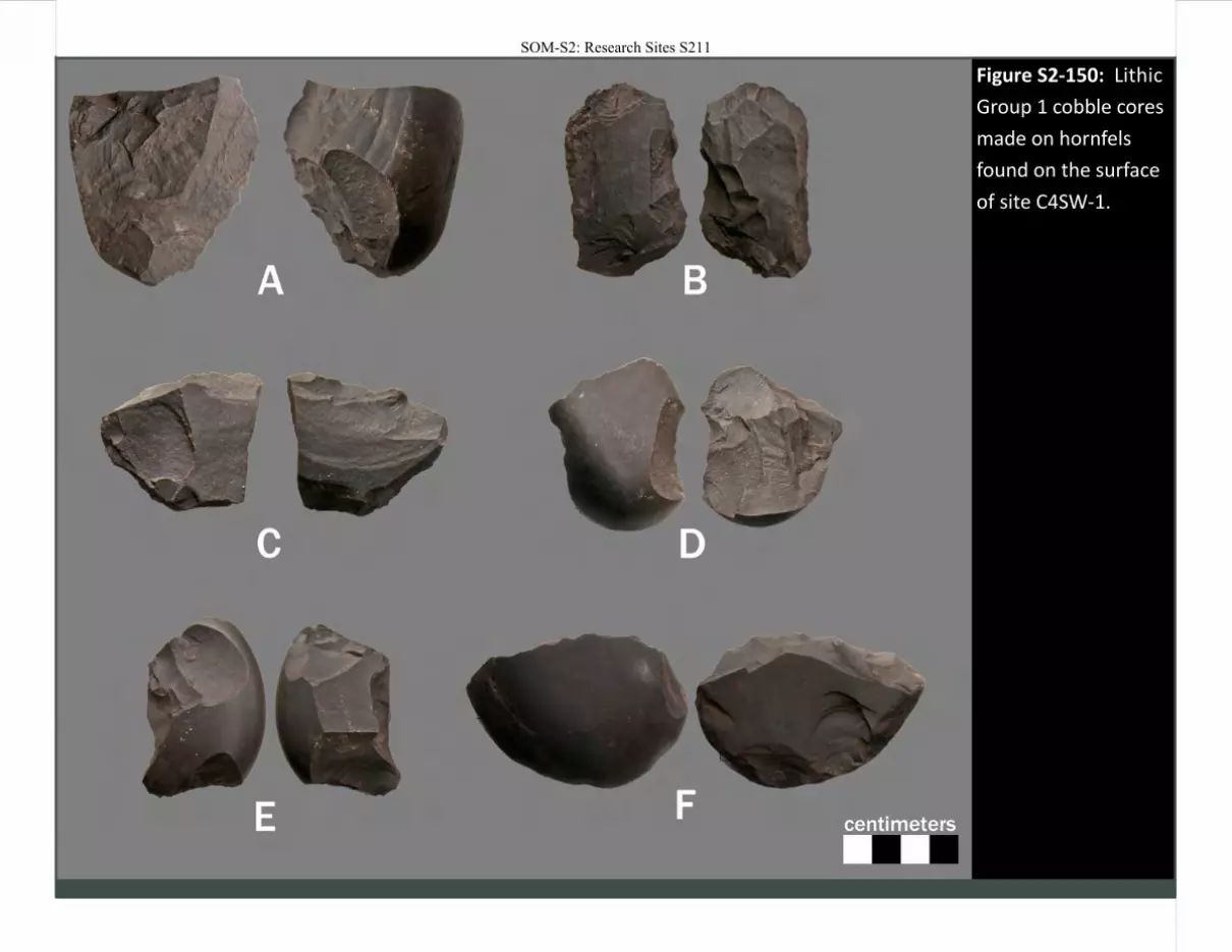
Figure S2-150: Lithic
Group 1 cobble cores
made on hornfels
found on the surface
of site C4SW-1.
SOM-S2: Research Sites S211
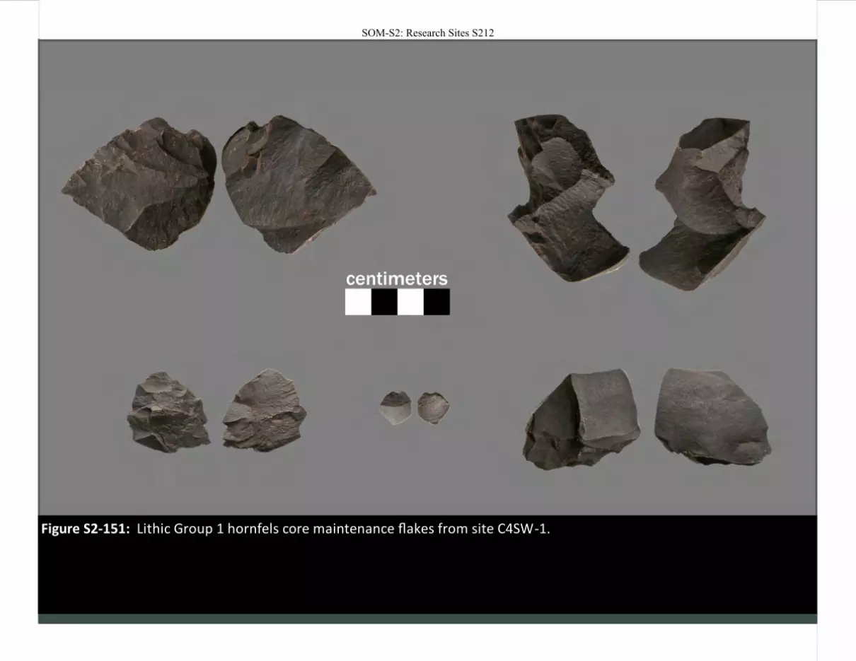
Figure S2-151: Lithic Group 1 hornfels core maintenance flakes from site C4SW-1.
SOM-S2: Research Sites S212
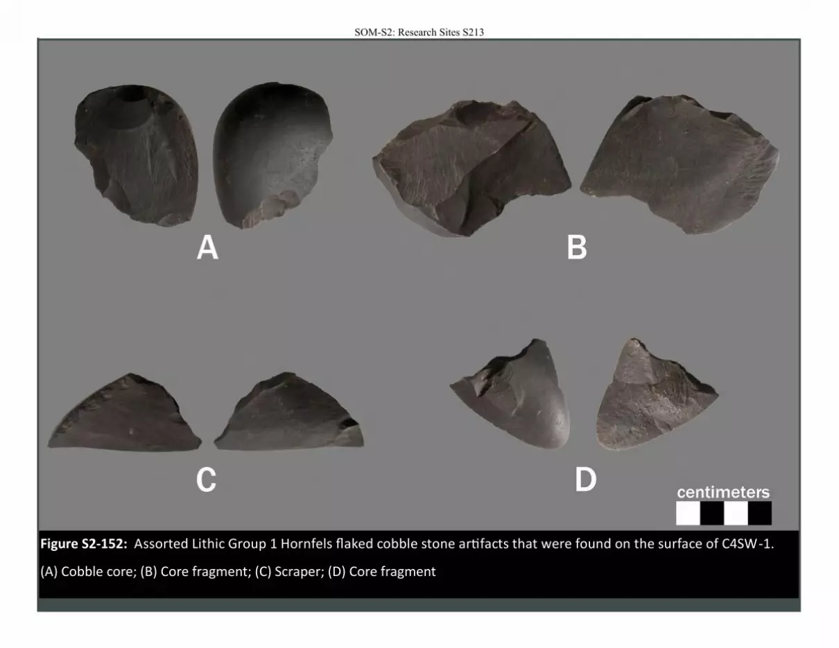
Figure S2-152: Assorted Lithic Group 1 Hornfels flaked cobble stone artifacts that were found on the surface of C4SW-1.
(A) Cobble core; (B) Core fragment; (C) Scraper; (D) Core fragment
SOM-S2: Research Sites S213

SOM-S2: Research Sites S214
Site: C4SW-2
Location Easting (m) 782895 Northing (m) 6536793 Elevation (m) -
UTM Zone 35s
Dimensions Length (m) 23.5 Width (m) 6.2
Region: Upper Mkambati
Overview
C4SW-2 is a small rock shelter around 50 m north of C4SW-1. Shallow sediment appear to overly bedrock and there is only a light scatter of shellfish remains (mostly limpets). No stone artifacts or faunal remains were found.
SOM-S2: Research Sites S215
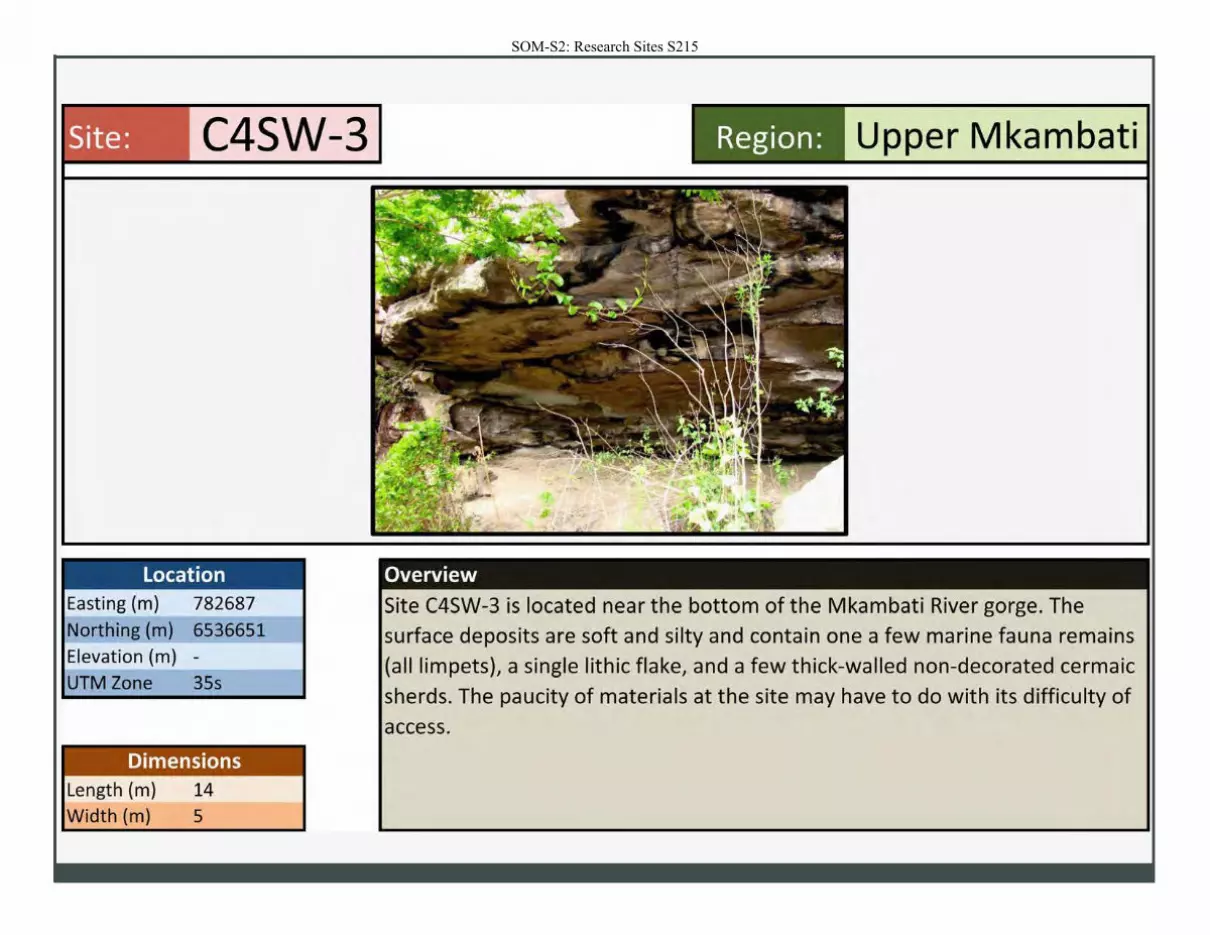
Site: C4SW-3
Location Easting (m) 782687
Northing (m) 6536651
Elevation (m) -
UTM Zone 35s
Dimensions Length (m) 14 Width (m) 5
Region : Upper Mkambati
Overview
Site C4SW-3 is located near the bottom of the Mkambati River gorge. The surface deposits are soft and silty and contain one a few marine fauna remains (all limpets), a single lithic flake, and a few thick-walled non-decorated cermaic
sherds. The paucity of materials at the site may have to do with its difficulty of access.
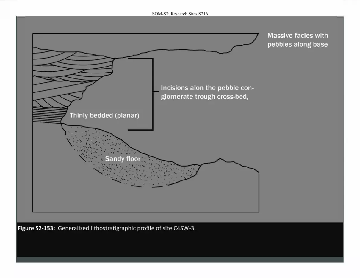
Figure S2-153: Generalized lithostratigraphic profile of site C4SW-3.
SOM-S2: Research Sites S216
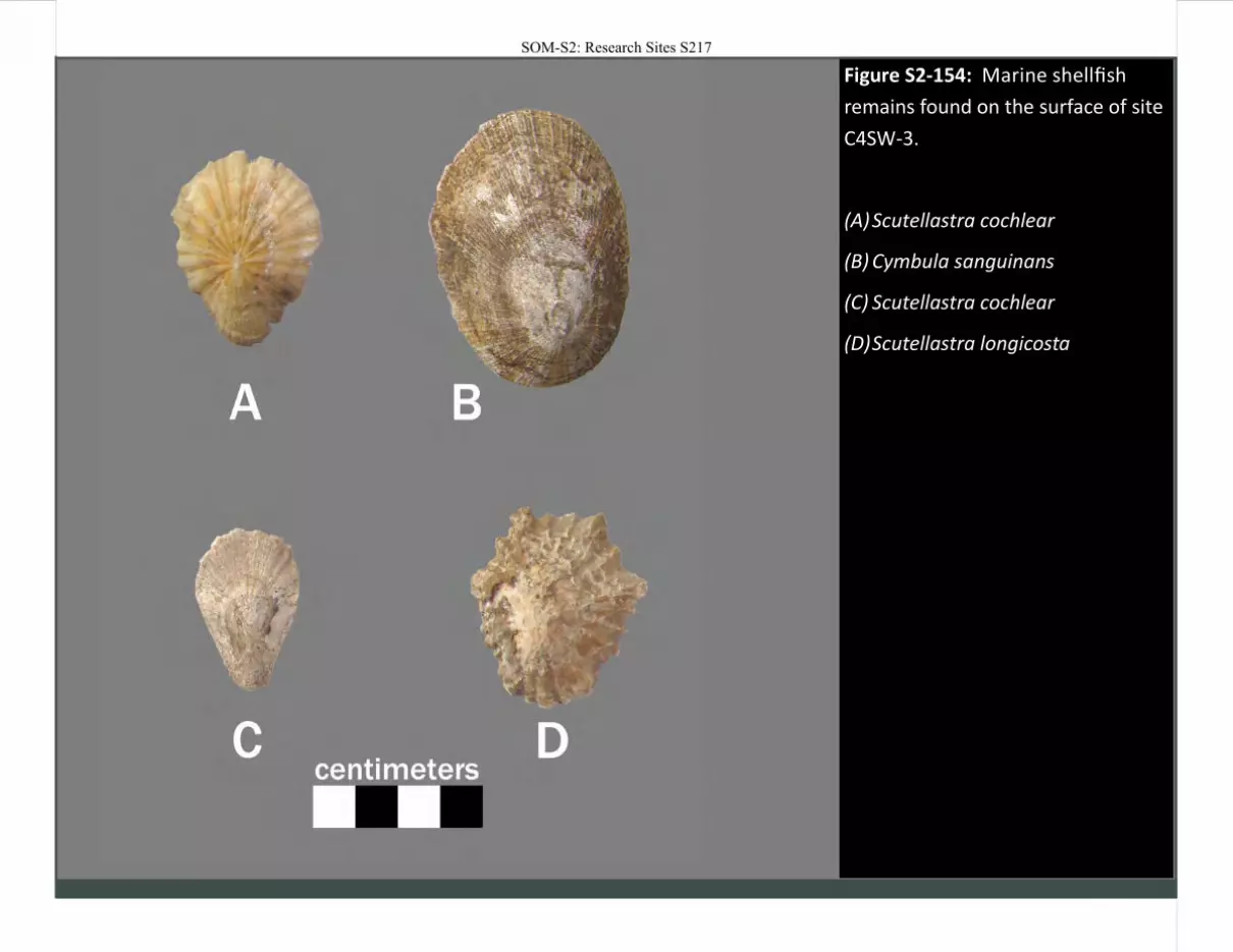
Figure S2-154: Marine shellfish
remains found on the surface of site
C4SW-3.
(A) Scutellastra cochlear
(B) Cymbula sanguinans
(C) Scutellastra cochlear
(D) Scutellastra longicosta
SOM-S2: Research Sites S217
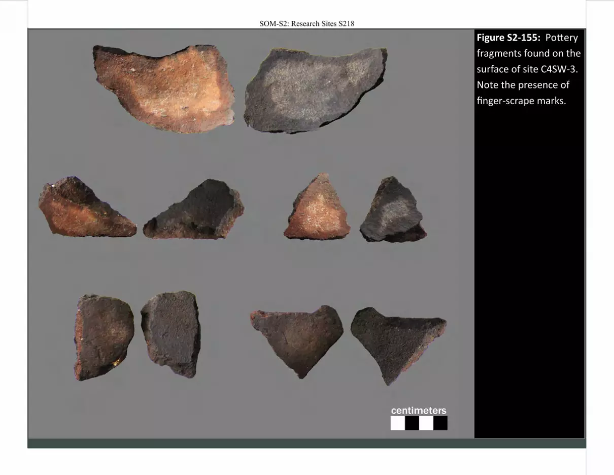
Figure S2-155: Pottery
fragments found on the
surface of site C4SW-3.
Note the presence of
finger-scrape marks.
SOM-S2: Research Sites S218
SOM-S2: Research Sites S219
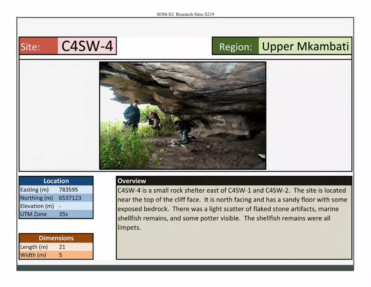
Site: C4SW-4
Location Easting (m) 783595
Northing (m) 6537123
Elevation (m) -
UTM Zone 35s
Dimensions Length (m) 21
Width (m) 5
Region: Upper Mkambati
Overview
C4SW-4 is a small rock shelter east of C4SW-1 and C4SW-2. The site is located
near the top of the cliff face. It is north facing and has a sandy floor with some
exposed bedrock. There was a light scatter of flaked stone artifacts, marine
shellfish remains, and some potter visible. The shellfish remains were all
limpets.
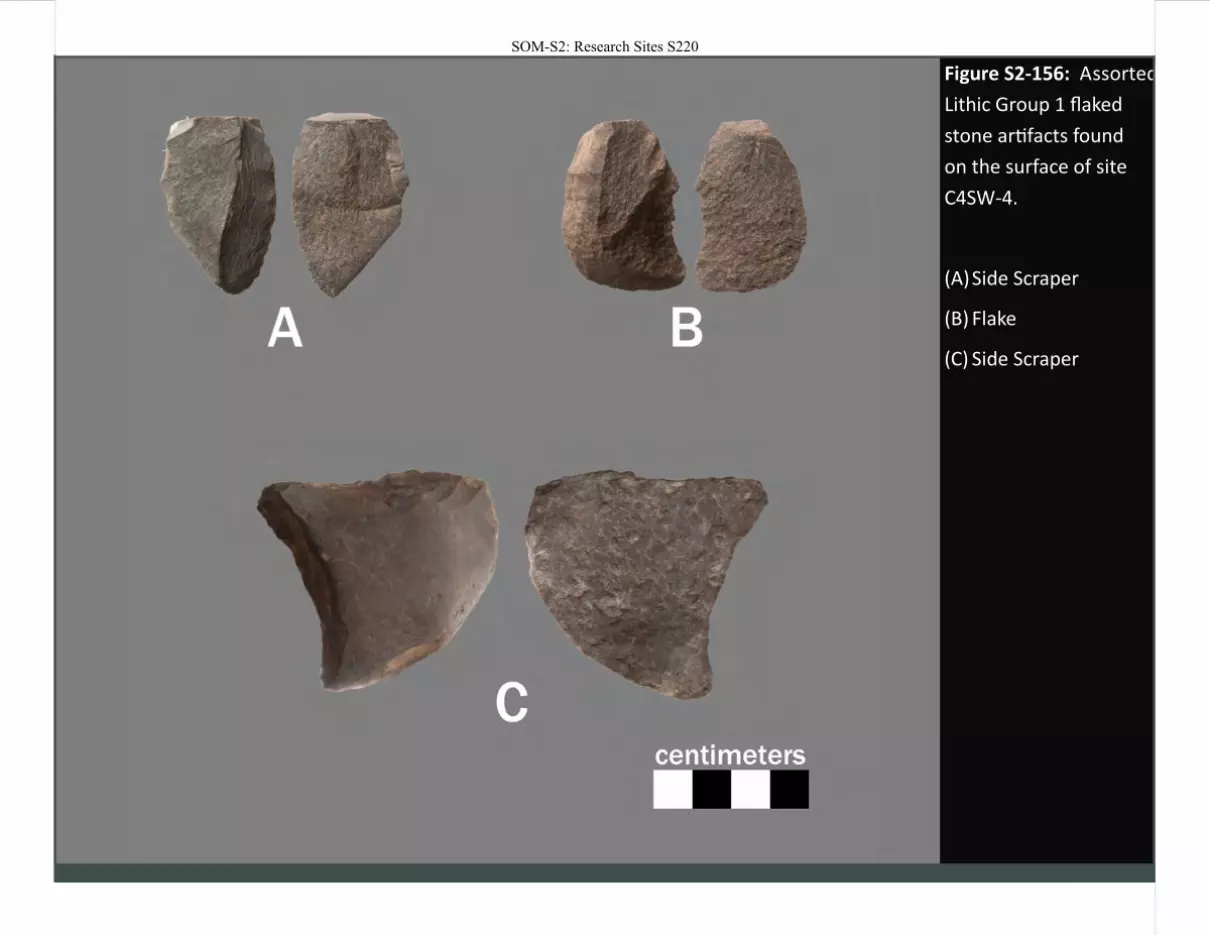
Figure S2-156: Assorted
Lithic Group 1 flaked
stone artifacts found
on the surface of site
C4SW-4.
(A) Side Scraper
(B) Flake
(C) Side Scraper
SOM-S2: Research Sites S220
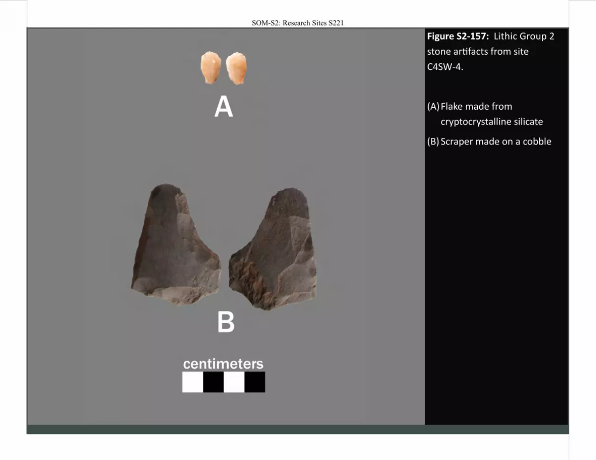
Figure S2-157: Lithic Group 2
stone artifacts from site
C4SW-4.
(A) Flake made from
cryptocrystalline silicate
(B) Scraper made on a cobble
SOM-S2: Research Sites S221

Figure S2-158: Core maintenance / trimming flakes associated with Lithic Group 4A from site C4SW-4.
SOM-S2: Research Sites S222

Figure S2-159: Pottery fragment from site C4SW-4.
SOM-S2: Research Sites S223
Related Documents