STORMWATER MANAGEMENT BY ADOPTING INFILTRATION TECHNIQUES OF PERVIOUS CONCRETE ON BROWN CLAY SOIL IN GVMC AREA OF VISAKHAPATNAM CITY B.RAVI KUMAR 1 , P. STEPHEN 2 , G. JAI SHANKAR 3 , V. VINUSHA 4 12 3 4 Department of Geo Engineering, Andhra University College of Engineering, Visakhapatnam Mail id: [email protected], [email protected], [email protected] ph: +91 9848-628-711, +91 970-652-318, +91 8143-105-632 Abstract: The development of Smart cities in India, result Urbanization, Industrialization and increasing in infrastructure. Therefore, maximum Metro cities are getting covered with impermeable surfaces such as asphalt roads, concrete sidewalks, parking lots, building roofs, and areas of highly compacted soils. In India, groundwater table is decreasing at a faster rate due to reduction in groundwater recharge. These days, the vegetation cover is replaced by infrastructure hence the water gets less opportunity to infiltrate itself into the soil. Increase in urban storm water over the past few decades in Visakhapatnam city led to increase in pollution and runoff due to Urbanization. This directly leads to environmental issues such as erosion, pollution of rivers and lakes, decrease in groundwater table and flooding problems. One of the solutions to avoid these problems is to percolate natural water into the soil which can be done by Pervious concrete. Pervious Concrete is a type of porous pavement that can be used as an infiltration practice for storm water management contains little or no fine aggregates. Storm water management has become a concern for cities and municipalities due to increased urbanization of residential and commercial neighborhoods. Pervious concrete is one of the most effective and environmentally friendly solutions available as permeable pavement to control uncontrolled runoff, reduce pollution and replenish ground water. Pervious concrete is a mixture of coarse aggregate, Portland cement, water and admixtures. Lacking fines, this material has a void ratio that typically range from 15-25% allows to store and infiltrate storm water. Important part of this research involves determining the infiltration rates through pervious concrete samples that are made with pure cement, cement partially replaced with fly ash and cement partially replaced with GGBS (Ground granulated blast furnace slag). Hardened concrete cubes were casted with these samples of materials. There was conducted a test for compressive strength on these hardened concrete cubes. The infiltration rate of pervious concrete samples was tested for concrete cast on different sub grades and was also tested without sub grade by the application of water at a constant rate to the concrete surface based on the test procedure as stipulated in ASTM1701/C 1701 M. Also, the properties of the sub grade were investigated to know the effect of the permeability of concrete. As a part of this study the infiltration test was conducted mainly on Brown clay soil and Red Clay Soil in Visakhapatnam city. These soils cover an area of 35% in GVMC area of Visakhapatnam. These soils are smaller size particles have slow infiltration rates. These soils are mapped by using remote sensing and GIS techniques. Keywords: Pervious Concrete, Flyash, GGBS, void ratio, Infiltration, ground water Recharge, Remote sensing and GIS Techniques. International Journal of Management, Technology And Engineering Volume 8, Issue XII, DECEMBER/2018 ISSN NO : 2249-7455 Page No:3278

Welcome message from author
This document is posted to help you gain knowledge. Please leave a comment to let me know what you think about it! Share it to your friends and learn new things together.
Transcript
STORMWATER MANAGEMENT BY ADOPTING INFILTRATION TECHNIQUES OF
PERVIOUS CONCRETE ON BROWN CLAY SOIL IN GVMC AREA OF
VISAKHAPATNAM CITY
B.RAVI KUMAR1, P. STEPHEN
2, G. JAI SHANKAR
3, V. VINUSHA
4
12 3 4 Department of Geo Engineering, Andhra University College of Engineering, Visakhapatnam
Mail id: [email protected], [email protected], [email protected]
ph: +91 9848-628-711, +91 970-652-318, +91 8143-105-632
Abstract:
The development of Smart cities in India, result Urbanization, Industrialization and
increasing in infrastructure. Therefore, maximum Metro cities are getting covered with
impermeable surfaces such as asphalt roads, concrete sidewalks, parking lots, building roofs, and
areas of highly compacted soils. In India, groundwater table is decreasing at a faster rate due to
reduction in groundwater recharge. These days, the vegetation cover is replaced by infrastructure
hence the water gets less opportunity to infiltrate itself into the soil. Increase in urban storm water
over the past few decades in Visakhapatnam city led to increase in pollution and runoff due to
Urbanization. This directly leads to environmental issues such as erosion, pollution of rivers and
lakes, decrease in groundwater table and flooding problems. One of the solutions to avoid these
problems is to percolate natural water into the soil which can be done by Pervious concrete.
Pervious Concrete is a type of porous pavement that can be used as an infiltration practice for storm
water management contains little or no fine aggregates. Storm water management has become a
concern for cities and municipalities due to increased urbanization of residential and commercial
neighborhoods. Pervious concrete is one of the most effective and environmentally friendly
solutions available as permeable pavement to control uncontrolled runoff, reduce pollution and
replenish ground water. Pervious concrete is a mixture of coarse aggregate, Portland cement, water
and admixtures. Lacking fines, this material has a void ratio that typically range from 15-25%
allows to store and infiltrate storm water.
Important part of this research involves determining the infiltration rates through pervious
concrete samples that are made with pure cement, cement partially replaced with fly ash and
cement partially replaced with GGBS (Ground granulated blast furnace slag). Hardened concrete
cubes were casted with these samples of materials. There was conducted a test for compressive
strength on these hardened concrete cubes. The infiltration rate of pervious concrete samples was
tested for concrete cast on different sub grades and was also tested without sub grade by the
application of water at a constant rate to the concrete surface based on the test procedure as
stipulated in ASTM1701/C 1701 M. Also, the properties of the sub grade were investigated to
know the effect of the permeability of concrete.
As a part of this study the infiltration test was conducted mainly on Brown clay soil and Red
Clay Soil in Visakhapatnam city. These soils cover an area of 35% in GVMC area of
Visakhapatnam. These soils are smaller size particles have slow infiltration rates. These soils are
mapped by using remote sensing and GIS techniques.
Keywords: Pervious Concrete, Flyash, GGBS, void ratio, Infiltration, ground water Recharge,
Remote sensing and GIS Techniques.
International Journal of Management, Technology And Engineering
Volume 8, Issue XII, DECEMBER/2018
ISSN NO : 2249-7455
Page No:3278
Introduction:
Due to rapid urbanization most of the places are covered with impermeable surfaces like cement
concrete. This has a major impact on ground water table [1]. Pervious concrete pavement is an
innovative solution to minimize this issue. Pervious concrete (also called porous concrete,
permeable concrete, no fines concrete and porous pavement) is a special type of concrete with a
high porosity used for concrete flatwork applications that allows water from precipitation and other
sources to pass directly through, thereby reducing the runoff from a site and allowing groundwater
recharge. Pervious concrete is made using large aggregates with little to no fine aggregates. The
concrete paste then coats the aggregates and allows water to pass through the concrete slab.
Pervious concrete is traditionally used in parking areas, areas with light traffic, residential streets,
pedestrian walkways, and greenhouses. It is an important application for sustainable construction
and is one of many low impact development techniques used by builders to protect water quality.
Pervious concrete was first used in the 1800s in Europe as pavement surfacing and load bearing
walls. Cost efficiency was the main motive due to a decreased amount of cement. It became popular
again in the 1920s for two store homes in Scotland and England. It became increasingly viable in
Europe after WWII due to the scarcity of cement. It did not become as popular in the US until the
1970s. In India it became popular in 2000. The proper utilization of pervious concrete is a
recognized Best Management Practice by the U.S. Environmental Protection Agency (EPA) for
providing first flush pollution control and storm water management.
Study Area
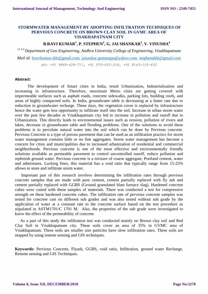
The study area of GVMC is lies between 17˚32’-17˚54’ northern latitude and 83˚5’ - 83 ˚25’
eastern longitude with an area of 598 km². The area is located in and around the Visakhapatnam
city in Visakhapatnam district of Andhra Pradesh. GVMC is divided in to six zones and further
divided into 72 municipal wards. The city is bounded in the North by the Kailasa hill, in the south
by Yarada hill and the west by the Narava hill while the eastern side of the city is Bay of Bengal.
International Journal of Management, Technology And Engineering
Volume 8, Issue XII, DECEMBER/2018
ISSN NO : 2249-7455
Page No:3279
Fig.1. Study area – Location map GVMC, Visakhapatnam
DATA USED
The details of the different data used in this study is given below
● Survey of India toposheets — 65 0/1, 65 0/2 & 0/3, 65 0/5, 65 0/6, scale 1:50,000. ● Sentinel 2A and ASTER DEM data was used. ● Code books of Civil Engineering, ASTM C1701 ● Reference maps of various data ● Field data
SOFTWARE USED
● ARC GIS 10.3
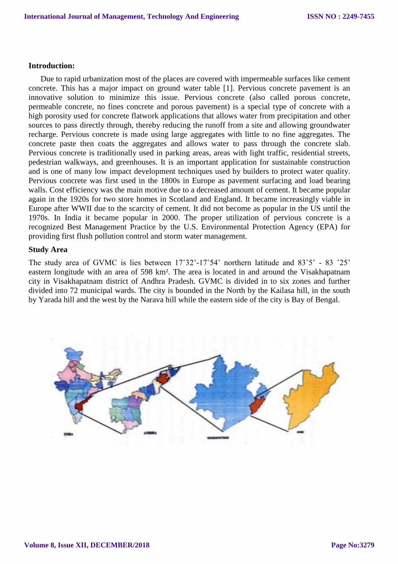
METHODOLOGY:
An integrated approach of Remote Sensing and GIS for evaluation of land use and land cover,
hydro geomorphology, geology, soil and slope, groundwater table map followed by determination
of surface water infiltration on newly developed pervious concrete surface in different soil types of
Visakhapatnam and surrounding areas. Methods followed in the study comprise field-work,
laboratory work, remote sensing and GIS work following the standard scientific procedures.
Fig 1.2 Methodology
Drainage network map:
Drainage network map helps to know the patterns formed by streams, rivers and lakes in a
particular drainage basin. A drainage basin is the topographic region from which stream receives
runoff, through flow and groundwater flow.
International Journal of Management, Technology And Engineering
Volume 8, Issue XII, DECEMBER/2018
ISSN NO : 2249-7455
Page No:3280
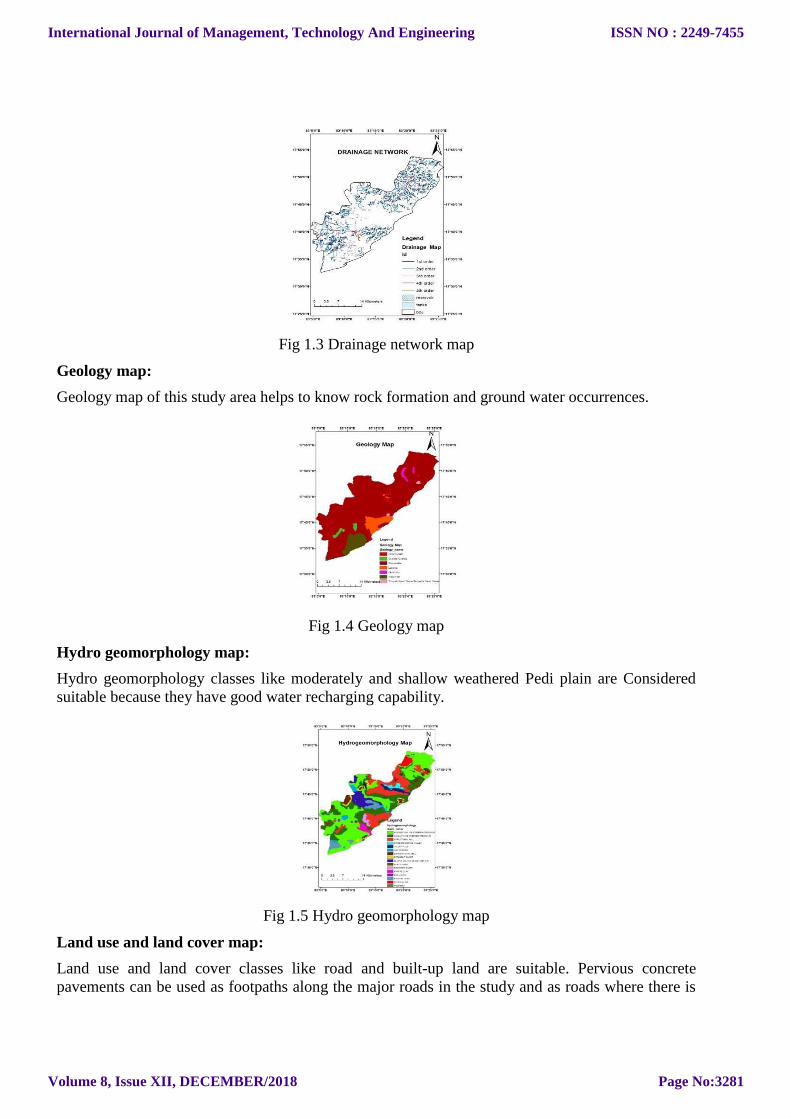
Fig 1.3 Drainage network map
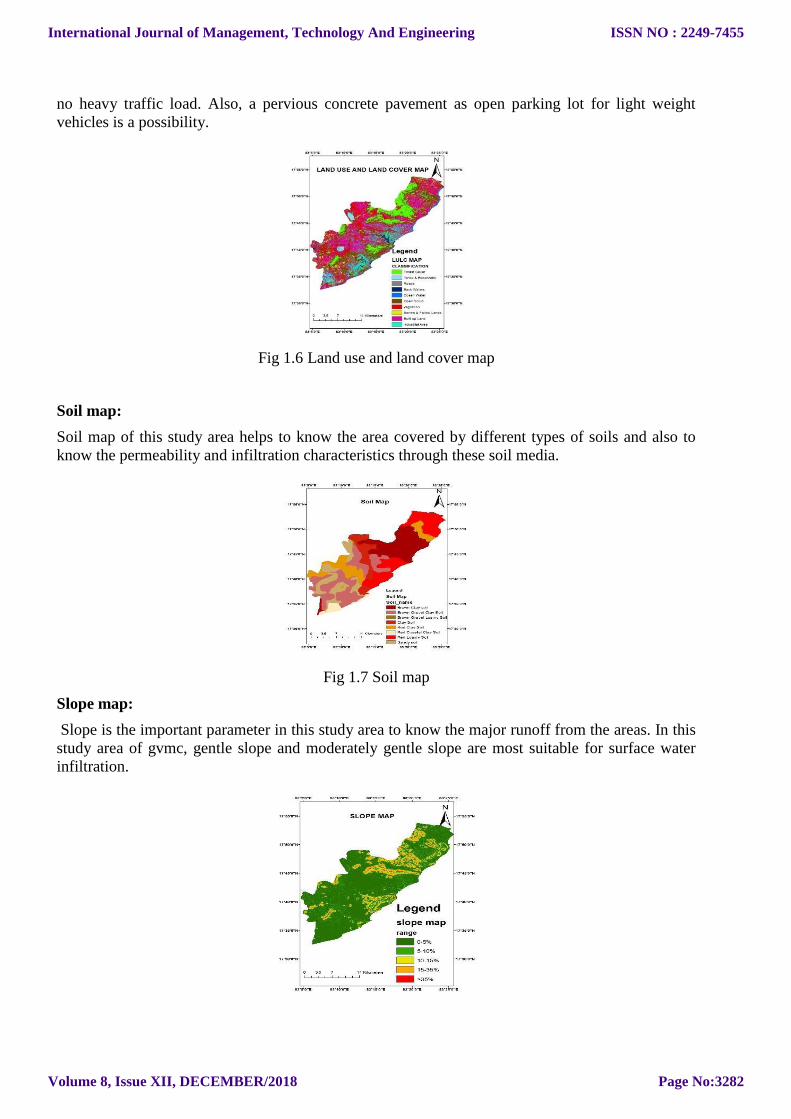
Geology map:
Geology map of this study area helps to know rock formation and ground water occurrences.
Fig 1.4 Geology map
Hydro geomorphology map:
Hydro geomorphology classes like moderately and shallow weathered Pedi plain are Considered
suitable because they have good water recharging capability.
Fig 1.5 Hydro geomorphology map
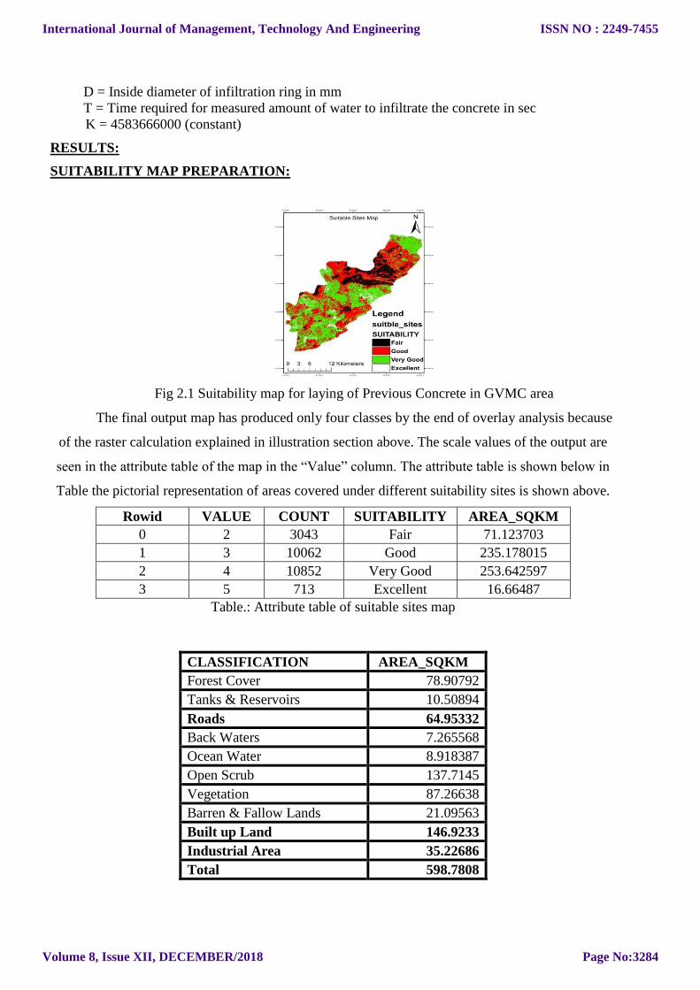
Land use and land cover map:
Land use and land cover classes like road and built-up land are suitable. Pervious concrete
pavements can be used as footpaths along the major roads in the study and as roads where there is
International Journal of Management, Technology And Engineering
Volume 8, Issue XII, DECEMBER/2018
ISSN NO : 2249-7455
Page No:3281
no heavy traffic load. Also, a pervious concrete pavement as open parking lot for light weight
vehicles is a possibility.
Fig 1.6 Land use and land cover map
Soil map:
Soil map of this study area helps to know the area covered by different types of soils and also to
know the permeability and infiltration characteristics through these soil media.
Fig 1.7 Soil map
Slope map:
Slope is the important parameter in this study area to know the major runoff from the areas. In this
study area of gvmc, gentle slope and moderately gentle slope are most suitable for surface water
infiltration.
International Journal of Management, Technology And Engineering
Volume 8, Issue XII, DECEMBER/2018
ISSN NO : 2249-7455
Page No:3282
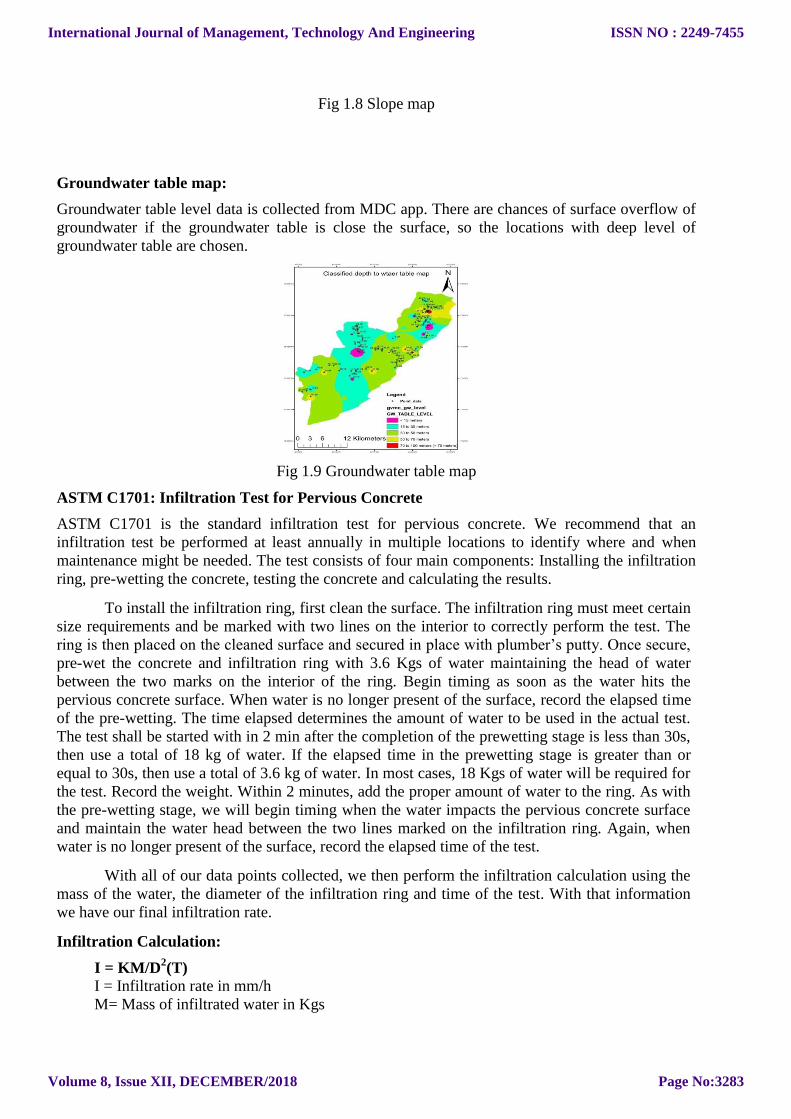
Fig 1.8 Slope map
Groundwater table map:
Groundwater table level data is collected from MDC app. There are chances of surface overflow of
groundwater if the groundwater table is close the surface, so the locations with deep level of
groundwater table are chosen.
Fig 1.9 Groundwater table map
ASTM C1701: Infiltration Test for Pervious Concrete
ASTM C1701 is the standard infiltration test for pervious concrete. We recommend that an
infiltration test be performed at least annually in multiple locations to identify where and when
maintenance might be needed. The test consists of four main components: Installing the infiltration
ring, pre-wetting the concrete, testing the concrete and calculating the results.
To install the infiltration ring, first clean the surface. The infiltration ring must meet certain
size requirements and be marked with two lines on the interior to correctly perform the test. The
ring is then placed on the cleaned surface and secured in place with plumber’s putty. Once secure,
pre-wet the concrete and infiltration ring with 3.6 Kgs of water maintaining the head of water
between the two marks on the interior of the ring. Begin timing as soon as the water hits the
pervious concrete surface. When water is no longer present of the surface, record the elapsed time
of the pre-wetting. The time elapsed determines the amount of water to be used in the actual test.
The test shall be started with in 2 min after the completion of the prewetting stage is less than 30s,
then use a total of 18 kg of water. If the elapsed time in the prewetting stage is greater than or
equal to 30s, then use a total of 3.6 kg of water. In most cases, 18 Kgs of water will be required for
the test. Record the weight. Within 2 minutes, add the proper amount of water to the ring. As with
the pre-wetting stage, we will begin timing when the water impacts the pervious concrete surface
and maintain the water head between the two lines marked on the infiltration ring. Again, when
water is no longer present of the surface, record the elapsed time of the test.
With all of our data points collected, we then perform the infiltration calculation using the
mass of the water, the diameter of the infiltration ring and time of the test. With that information
we have our final infiltration rate.
Infiltration Calculation:
I = KM/D2(T)
I = Infiltration rate in mm/h
M= Mass of infiltrated water in Kgs
International Journal of Management, Technology And Engineering
Volume 8, Issue XII, DECEMBER/2018
ISSN NO : 2249-7455
Page No:3283
D = Inside diameter of infiltration ring in mm
T = Time required for measured amount of water to infiltrate the concrete in sec
K = 4583666000 (constant)
RESULTS:
SUITABILITY MAP PREPARATION:
Fig 2.1 Suitability map for laying of Previous Concrete in GVMC area
The final output map has produced only four classes by the end of overlay analysis because
of the raster calculation explained in illustration section above. The scale values of the output are
seen in the attribute table of the map in the ―Value‖ column. The attribute table is shown below in
Table the pictorial representation of areas covered under different suitability sites is shown above.
Rowid VALUE COUNT SUITABILITY AREA_SQKM
0 2 3043 Fair 71.123703
1 3 10062 Good 235.178015
2 4 10852 Very Good 253.642597
3 5 713 Excellent 16.66487
Table.: Attribute table of suitable sites map
CLASSIFICATION AREA_SQKM
Forest Cover 78.90792
Tanks & Reservoirs 10.50894
Roads 64.95332
Back Waters 7.265568
Ocean Water 8.918387
Open Scrub 137.7145
Vegetation 87.26638
Barren & Fallow Lands 21.09563
Built up Land 146.9233
Industrial Area 35.22686
Total 598.7808
International Journal of Management, Technology And Engineering
Volume 8, Issue XII, DECEMBER/2018
ISSN NO : 2249-7455
Page No:3284
COMPRESSIVE STRENGTH VALUES:
Concrete 28 days Compressive Strength Results (all values in N/mm2)
Table:1 Compressive Strength Values for Pervious Concrete Cubes tested in CTM
S.
No. Cubes with Pure Cement
Cubes with Cement +
Fly ash
Cubes with Cement +
GGBS
Trail 1 Trail 2 Trail 3 Trail 1 Trail 2 Trail 3 Trail 1 Trail 2 Trail 3
1 23.12 22.75 22.93 22.47 21.81 22.72 23.79 22.37 23.08
2 Avg = 22.93 Avg = 22.33 Avg = 23.08
Compressive strength results of all the combinations of Pervious Concrete samples have achieved
moreover same results 22 N/mm2 to 23 N/mm
2.
Fig 2.2 Compression testing machine
Fig 2.3 Average Compressive Strength Values for different Pervious concrete Samples
International Journal of Management, Technology And Engineering
Volume 8, Issue XII, DECEMBER/2018
ISSN NO : 2249-7455
Page No:3285
INFILTRATION RATE: LABORATORY TESTING
From ASTM C1701 code book, a formula is used to find the infiltration rate of water passing
through the pervious concrete to sub grade soils.
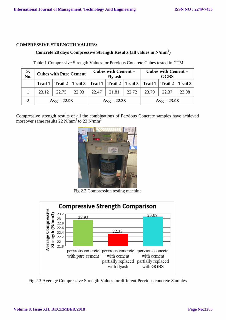
Fig 2.4 Laboratory Core Test
I = KM/D2×T
I - Infiltration Rate in mm/h
K - Constant Value (4583666000)
M- Mass of infiltrated Water in Kgs
D- Inside diameter of the infiltration ring in mm and
T- Time required for measured amount of water to infiltrate the concrete in sec
Values of Cement:
Trail-1 I = KM/D
2 ×t
I = 4583666000 ×18/ (300)2 × (32) = 28.647 x 10
3 mm/h
Trail-2 I = KM/D
2 ×t
I = 4583666000 ×18/ (300)2 × (29) = 31.611 x 10
3 mm/h
Trail-3 I=KM/D
2 ×t
I = 4583666000 ×18/ (300)2 × (30) = 30.557 x 10
3 mm/h
Average Value I= (28.65+ 31.61 + 30.55)/3 = 30.27 x 103 mm/h
Values of Fly ash:
Trail-1
I=KM/D2 ×t
I =4583666000 ×18/ (300)2 × (38) = 24.124 x 10
3 mm/h
Trail-2
I=KM/D2 ×t
I =4583666000 ×18/ (300)2 × (41) =22.36 x 10
3 mm/h
Trail-3
International Journal of Management, Technology And Engineering
Volume 8, Issue XII, DECEMBER/2018
ISSN NO : 2249-7455
Page No:3286
I=KM/D2 ×t
I =4583666000 ×18/ (300)2 × (42) = 21.826 x 10
3 mm/h
Average Value I= (24.12+22.36+21.82)/3 = 22.77 x 103 mm/h
Values of GGBS:
Trail-1
I=KM/D2 ×t
I= 4583666000 ×18/ (300)2 × (60) = 15.278 x 10
3 mm/h
Trail-2
I=KM/D2 ×t
I=4583666000 ×18/ (300)2 × (58) = 15.805 x 10
3 mm/h
Trail-3 I=KM/D
2 ×t
I= 4583666000 ×18/ (300)2 × (59) = 15.537 x 10
3 mm/h
Average Value I= (15.27 + 15.80 + 15.53) / 3 = 15.54 x 103 mm/h
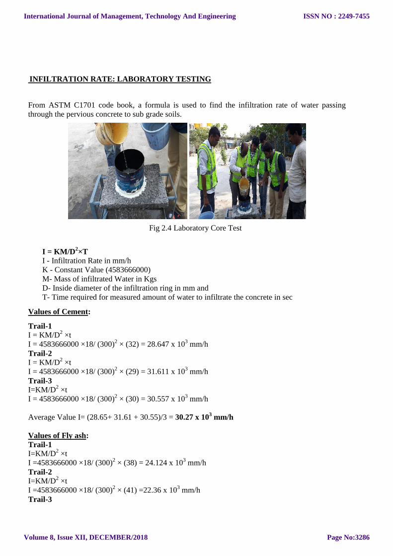
LABORATORY INFILTRATION TEST RESULTS:
Table:2 Laboratory Infiltration test results for different pervious concrete Samples
S. No Description Average Infiltration rates for
different Samples(mm/h)
1 Pervious concrete with Pure Cement 30.25 × 10³
2 Pervious concrete
(Cement Partially replaced with Fly ash) 22.77 × 10
3
3 Pervious concrete
(Cement Partially replaced with GGBS) 15.54 × 10
3
Fig 2.5 Average Laboratory Infiltration rate values for different Pervious Concrete Samples
International Journal of Management, Technology And Engineering
Volume 8, Issue XII, DECEMBER/2018
ISSN NO : 2249-7455
Page No:3287
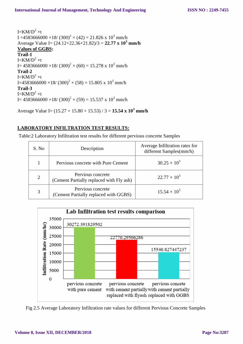
INFILTRATION RATE ON BROWN CLAY SOIL:
Field Testing Calculations:
Fig 2.6 Infiltration rate Testing of Pervious Concrete Samples on Brown clay soil.
From ASTM C1701 code book, a formula is used to find the infiltration rate of water passing
through the pervious concrete to sub grade soils.
I=KM/D2
× T I - Infiltration Rate in mm/h
K - Constant Value (4583666000)
M- Mass of infiltrated Water in Kgs
D- Inside diameter of the infiltration ring in mm and
T- Time required for measured amount of water to infiltrate the concrete in sec
Values of Cement:
Trail-1
I = KM/D2 ×t
I = 4583666000 ×18/ (300)2 × (64) = 14.32×10³ mm/h
Trail-2
I = KM/D2 ×t
I =4583666000 ×18/ (300)2 × (68) = 13.48 × 10³ mm/h
Trail-3
I = KM/D2 ×t
I = 4583666000×18/ (300)2 × (74) =12.39 × 10³ mm/h
Average value I = [(14.32 + 13.48 + 12.39)/3] ×10³ mm/h = 13.40 ×10³ mm/h
Values of Fly ash:
Trail-1
I = KM/D2 ×t
I = 4583666000 ×18/ (300)2 × (58) = 15.81 × 10³ mm/h
Trail-2
I = KM/D2 ×t
International Journal of Management, Technology And Engineering
Volume 8, Issue XII, DECEMBER/2018
ISSN NO : 2249-7455
Page No:3288
I = 4583666000 ×18/ (300)2 × (63) = 14.55 × 10³ mm/h
Trail- 3
I = KM/D2 ×t
I = 4583666000×18 / (300) ² × (68) = 13.48 × 10³ mm/h
Average Value I = [(15.81 + 14.55 + 13.48) / 3] × 103 mm/h = 14.61 ×10³ mm/h
Values of GGBS:
Trail-1
I = KM/D2 ×t
I = 4583666000 ×18/ (300)2 × (85) = 10.79 ×10³ mm/h
Trail-2
I = KM/D2 ×t
I = 4583666000 ×18/ (300)2 × (94) = 9.75×10³ mm/h
Trail-3
I = KM/D2 ×t
I = 4583666000 ×18/ (300)2 × (98) = 9.35×10³ mm/h
Average Value I = [(10.79 + 9.75 + 9.35)/3] × 103 mm/h = 9.96 ×10³ mm/h
FIELD INFILTRATION TEST RESULTS
Table:3 Field Infiltration test results for different pervious concrete Samples on Brown clay soil
S. No Description Average Infiltration rates for
different Samples(mm/h)
1 Pervious concrete with Pure Cement 13.40 × 10³
2 Pervious concrete
Cement Partially replaced with Fly ash 14.61 × 10
3
3 Pervious concrete
Cement Partially replaced with GGBS 9.96 × 10
3
International Journal of Management, Technology And Engineering
Volume 8, Issue XII, DECEMBER/2018
ISSN NO : 2249-7455
Page No:3289
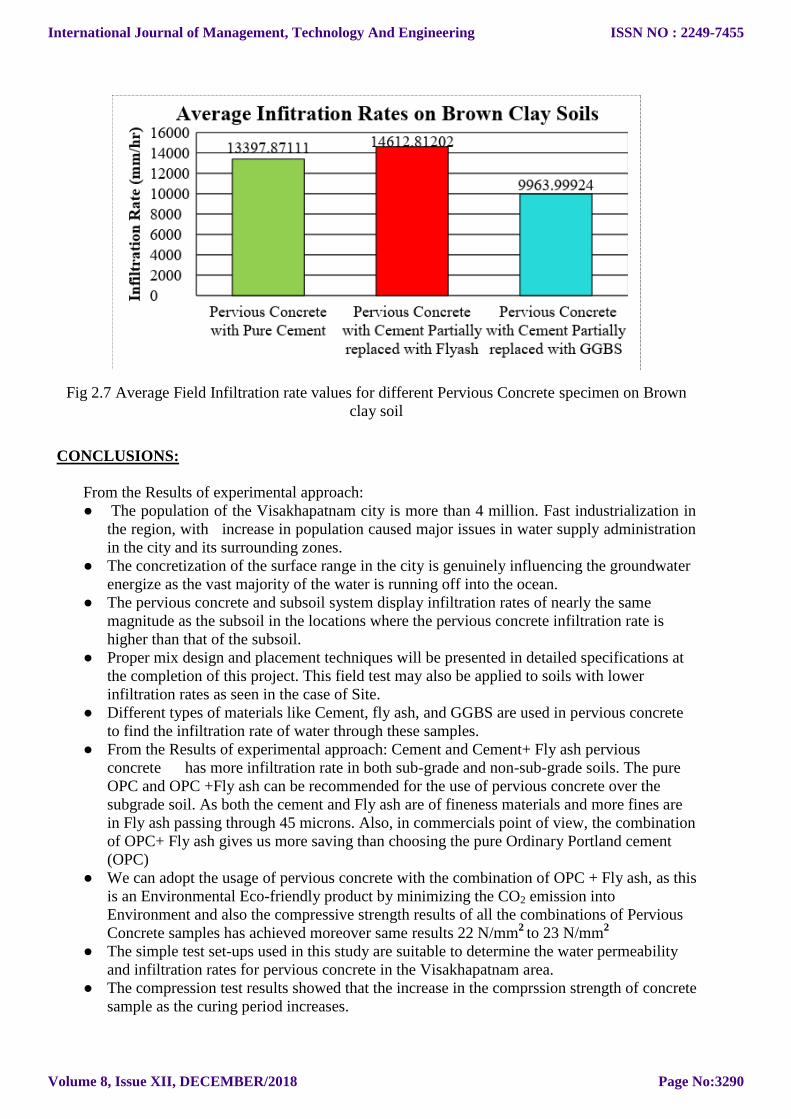
Fig 2.7 Average Field Infiltration rate values for different Pervious Concrete specimen on Brown
clay soil
CONCLUSIONS:
From the Results of experimental approach:
● The population of the Visakhapatnam city is more than 4 million. Fast industrialization in
the region, with increase in population caused major issues in water supply administration
in the city and its surrounding zones. ● The concretization of the surface range in the city is genuinely influencing the groundwater
energize as the vast majority of the water is running off into the ocean. ● The pervious concrete and subsoil system display infiltration rates of nearly the same
magnitude as the subsoil in the locations where the pervious concrete infiltration rate is
higher than that of the subsoil. ● Proper mix design and placement techniques will be presented in detailed specifications at
the completion of this project. This field test may also be applied to soils with lower
infiltration rates as seen in the case of Site. ● Different types of materials like Cement, fly ash, and GGBS are used in pervious concrete
to find the infiltration rate of water through these samples. ● From the Results of experimental approach: Cement and Cement+ Fly ash pervious
concrete has more infiltration rate in both sub-grade and non-sub-grade soils. The pure
OPC and OPC +Fly ash can be recommended for the use of pervious concrete over the
subgrade soil. As both the cement and Fly ash are of fineness materials and more fines are
in Fly ash passing through 45 microns. Also, in commercials point of view, the combination
of OPC+ Fly ash gives us more saving than choosing the pure Ordinary Portland cement
(OPC) ● We can adopt the usage of pervious concrete with the combination of OPC + Fly ash, as this
is an Environmental Eco-friendly product by minimizing the CO2 emission into
Environment and also the compressive strength results of all the combinations of Pervious
Concrete samples has achieved moreover same results 22 N/mm2
to 23 N/mm2
● The simple test set-ups used in this study are suitable to determine the water permeability
and infiltration rates for pervious concrete in the Visakhapatnam area. ● The compression test results showed that the increase in the comprssion strength of concrete
sample as the curing period increases.
International Journal of Management, Technology And Engineering
Volume 8, Issue XII, DECEMBER/2018
ISSN NO : 2249-7455
Page No:3290
● Use of flyash reduces the amount of cement content as well as heat of hydration in a
concrete mix. Thus , the construction work with flyash concrete becomes environmentally
safe and economical. ● The Replacement of Cement by GGBS not only increases the compressive strength but also
reduces the cement content which eventually leads to the decrease in emission of co₂. ● The tests are carried out based on ASTM C1701 code, which is suitable to determine the
water permeability and infiltration rates of pervious concrete on different soils in the
GVMC area. ● Nearly 247.10 Sq Km of the GVMC area is under Concretization in 598.7808 Sq Km. In
Brief decision Built up Land is 146.9233 Sq Km, Industrial Area is 35.22686 Sq Km and
Roads has covered 64.95332 Sq Km.
REFERENCES:
● Al-Kloub, B.A. and AL-Shemmeri, T.T. (1996). Developed a computer aided decisions
support system for water strategic planning in Jordan by E & FN Spon. ISBN 0 419 216502. ● ASTM D 3385-94, (2002). Standard Test Method for Infiltration Rate of Soils Using
Double-Ring Infiltrometer. American Society for Testing and Materials. ASTM
International, 100 Barr Harbor Drive, PO Box C700, West Conshohocken, PA 19428-2959,
United States. ● Cement M.Rajiv , R.Gunaseelan , M.Ranjith Kumar , R.Sathiyaraj , M.Anbalagan (2016).
Study of Porous Pavement Using GGBS as Partial Replacement of Cement. ● Conshohocken, PA.Bean, E.Z.; Hunt, W. F.; Bidelspach, D. A., (2004) .Study on the
Surface Infiltration of Permeable Pavements. 2070-2083; doi:10.3390/w6072070, Journal ● Darshan S. Shah, Prof. Jayesh kumar Pitroda Prof.J.J.Bhavsar (2013).Pervious Concrete:
New Era for Rural Road Pavement. International Journal of Engineering Trends and
Technology (IJETT) – Volume 4 Issue 8- August 2013 ● Dr. Vijaya kumar dasari (2016). environmental hydrogeo chemistry and water management
Impact Assessment of ground water in Visakhapatnam area using R&S and GIS
Techniques. ISSN: 1947-5705 (Print) 1947-5713 (Online) Journal homepage:
http://www.tandfonline.com/loi/tgnh20 ● E. Z. Bean, W. F. Hunt, and D. A. Bidelspach (2004) .Study On The Surface Infiltration
Rate Of Permeable Pavements. https://doi.org/10.1061/40737(2004)72 ● Gert A. Schultz (1997). The role of remote sensing and GIS in water resources management.
Institute of Hydrology, Water Resources and Environmental Technology, Ruhr University
Bochum, D-44780 Bochum, Germany. Proceedings of Rabat Symposium S3, April 1997.
IAHS Publ. no. 242, 1997 ● Hilal El-Hassan & Peiman Kianmehr (2016).Pervious concrete pavement incorporating
GGBS to alleviate pavement runoff and improve urban sustainability.
http://dx.doi.org/10.1080/14680629.2016.1251957 ● Hilany Smithers and Susan Walker (1995). Experiences in updating an integrated decision-
support system for sustainable water resource management in northwest England.
Proceedings of a Boulder Symposium, July 1995). 1AHS Publ. no. 231, 1995
International Journal of Management, Technology And Engineering
Volume 8, Issue XII, DECEMBER/2018
ISSN NO : 2249-7455
Page No:3291
● Jagdale Satyawan Dagadu, Nimbalkar P. T, (2012). Infiltration Studies of Different Soils
Under Different Soil Conditions and Comparison of Infiltration Models with Field Data.
Impact Factor value: 4.45, ISO 9001:2008 Certified Journal, Page 601 ● Joy R. Lund (1999). Approaches to Planning Water Resources Professor Department of
Civil and Environmental Engineering University of California, Davis [email protected] ● Karthik H. Obla, (2009). Pervious Concrete for Sustainable Development, Research and
Materials Engineering Silver Spring, Maryland, USA ● KING, W., (1886) The geological sketch of Vizagapatam District. Rec. Geol, Surv, India, v.
19, pp. 143-156. ● Levent Tezcan,Mehmet Ekmekci (2004). Surface cover infiltration index: a suggested
method to assess infiltration capacity for intrinsic vulnerability in karstic areas in absence of
quantitativedata, Scholar Commons ,USF Libraries , Environmental
Sustainability, IJS , Vol. 33 (2004) , Iss. 1 ● Manoj Chopra et al. (2010).have explained the ―Effect of Rejuvenation Methods on the
Infiltration Rates of Pervious Concrete Pavements.‖ ● Manoj Nallanathel et al. (2016).have studied the concept of Partial Replacement of Cement
in Pervious Concrete. Journal of Recent Activities in Architectural Sciences Volume 1 Issue
3 ● Marty Wanielista Manoj Chopra Josh Spence Craig Ballock, (2007). Stormwater
Management Academy University of Central Florida Orlando, FL 32816,‖ Hydraulic
Performance Assessment of Pervious Concrete Pavements for Stormwater Management
Credit.‖ , Final Report FDOT Project BD521-02 ● M. Jagannadha Rao, Greeshma Gireesh A.G., P. Avatharam, N.C. Anil and T. Karuna
Karudu, (2012). Studies on Coastal Geomorphology along Visakhapatnam to
Bhimunipatnam, East Coast of India, J. Ind. Geophysics. Union (October 2012) Vol.16,
No.4, pp. 179-187 ● Narasimha Rao (1945). studied the geology and petrology of the Kailasa hill range,
Visakhapatnam, India, ISBN:978-1-365-07929-0 ● NICHOLAS KING, (1996). Achieving decision support with GIS: learning from water
management applications in South Africa, (Proceedings of the Vienna Conference, April
1996). IAHS Publ. no. 235, 1996. ● O Sarva Mangala, Pratibha Toppo and Shraddha Ghoshal, (2016). Study of Infiltration
Capacity of Different Soils Civil Engineering Department, Volume 3(2), ISSN: 2394-9333,
www.ijtrd.com IJTRD, Bhilai, Chhattisgarh, India. ● Petre Gâştescu, William Water resources and wetlands, Petre Gâştescu, William Lewis Jr.,
Petre Breţcan Conference Proceedings, 14-16 September 2012, Tulcea - Romania ISBN:
978-606-605-038-8 ● Prinya Chindaprasirt , Chai Jaturapitakkul , Theerawat Sinsiri (2004). Effect of fly ash
fineness on compressive strength and pore size of blended cement paste, 0958-9465/$ 2004.
doi: 10.1016/j.cemconcomp.2004.07.003 ● Rajiv Chopra, Raman Deep Dhiman, P. K. Sharma (2005). Morphometric analysis of sub-
watersheds in Gurdaspur district, Punjab, India using remote sensing and GIS techniques,
P.K.J Indian Soc Remote Sens (2005) 33:
531.https://doi.org/10.1007/BF02990738,doi:https://doi.org/10.1007/BF02990738, Print ISSN0255-660X, Online ISSN0974-3006
● K. H. V. Durga Rao, D.Satish Kumar,(2004). Spatial Decision Support System for
Watershed Management October 2004, Volume 18, Issue 5, pp 407–423 ● Ray and Raina (1973). made an attempt to describe the hydrogeomorphological parameters
of Kotipally catchment area of Hyderabad.
International Journal of Management, Technology And Engineering
Volume 8, Issue XII, DECEMBER/2018
ISSN NO : 2249-7455
Page No:3292
● Semere Solomon Friedrich Quiel, (2006) Groundwater study using remote sensing and
geographic information systems (GIS) in the central highlands of Eritrea, September
2006, Volume 14, Issue 6, pp 1029–1041 ● S.Deepika, K.Lalithanjali, M.R.Ponmalar, B.Vinushitha and T.Manju (2015). Influence of
Recycled Aggregate based Pervious Concrete with Flyash, CODEN (USA): IJCRGG ISSN:
0974-4290 Vol.7, No.6, pp 2648-2653, 2014-2015 ● V Jayaraman, M G Chandrasekhar & U R Rao (1997). Managing The Natural Disasters
From Space Technology Inputs, Indian Space Research Organisation Antariksh Bhavan,
New B.E.L.Road Bangalore - 560 094, India, Acra Astronautica Vol. 40, No. 2-8, pp. 291-
325, 1997.
International Journal of Management, Technology And Engineering
Volume 8, Issue XII, DECEMBER/2018
ISSN NO : 2249-7455
Page No:3293
Related Documents