STATE OF ALASKA DEPARTMENT OF NATURAL RESOURCES DIVISION OF FORESTRY TOK AREA FORESTRY FINAL BEST INTEREST FINDING / FOREST LAND USE PLAN AND DECISION FOR EAGLE TRAIL FIRE & 2012 BLOWDOWN SALVAGE SALE NC - 1117 ADL –420044 2015

Welcome message from author
This document is posted to help you gain knowledge. Please leave a comment to let me know what you think about it! Share it to your friends and learn new things together.
Transcript

STATE OF ALASKA
DEPARTMENT OF NATURAL
RESOURCES
DIVISION OF FORESTRY
TOK AREA FORESTRY
FINAL BEST INTEREST FINDING / FOREST LAND USE PLAN AND DECISION FOR
EAGLE TRAIL FIRE & 2012 BLOWDOWN SALVAGE SALE
NC - 1117
ADL –420044
2015

I. PROPOSED ACTION
The Division of Forestry (DOF) proposes to offer a salvage timber sale area of approximately 18864
acres with harvest units totally approximately 5,800 acres southwest of Tok and west of Tanacross
(Map 1). The timber sale includes saw timber, fuel wood, and biomass. This timber is comprised of
black spruce, white spruce, birch, aspen, and poplar from state lands that were affected by the 2010
Eagle Trail Fire and the September 2012 blow-down event. The proposed area is roughly eight to
twenty air miles west of Tok, Alaska: the entire project area covers 18864 acres. The total volume
offered is approximately 10.7 million net board feet (MMBF), or 5.6 million net cubic feet (MMCF),
or 108,707 green tons of woody biomass. DOF will sell the timber in a negotiated sale for
commercial use. Limited personal use firewood permit harvest activities will be facilitated in the
area by commercial operations constructing and maintaining road access to the area over the
winter season(s). Limitations will be placed on personal use due to the restricted access through
Tanacross, Inc. lands and conditions of the Temporary Easement and Road Use Agreement; and, in
active commercial harvest areas.
The management objectives for the proposed timber sale are:
Harvest the commercial sawtimber, fuel wood, and biomass before significant economic loss
occurs due to decay. Provide timber products for the industry, the state and local economy.
Mitigate the significant threat of wildfire in areas of blowdown where suppression activities are
extremely difficult and dangerous to firefighters and extremely expensive to the state.
Convert the site to an early successional stage and productive mixed stand forest. Accelerate
the restoration of the health and usability of the forest for subsistence, recreation, fiber
production, and personal use activities. The current condition of the blow down forest is
dangerous for use by most people and generally inaccessible. This proposed sale will aid in
restoring areas of the forest and likely promote additional use of the forest within a generation
of the residents of the community.
Help protect undamaged forest by minimizing potential local outbreaks of deleterious insects,
specifically engraver beetles (Ips perterbus) and spruce bark beetle (Dendroctonus rufipennis).
Provide some limited, accessible firewood for local residential heating needs.
Work cooperatively with Tanacross, Inc. where possible to optimize road location and
construction and access from the Alaska Highway to benefit opportunities for salvage harvest of
timber on Tanacross, Inc. lands.
II. STATUTORY AND REGULATORY AUTHORITY
The Division is taking this action under the authority of

1
AS 38.05.035(e) Best Interest Finding;
AS 38.05.110-120 and 11 AAC 71, Timber Sale Statutes and Regulations; and
AS 41.17.010-950 and 11 AAC 95 Alaska Forest Resources and Practices Act and Regulations.
III. ADMINISTRATIVE RECORD
The Division will maintain an administrative record regarding the decision of whether or not to
proceed with the action as proposed. This record will be maintained at the DOF’s Tok Office filed as
NC 1117 ADL-420044.
IV. SCOPE OF DECISION
This Final best interest finding FBIF(FBIF) and Forest Land Use Plan (FLUP) are step two and three
of a five-step process used to design, sell, and administer timber sales. This FBIF covers the sale
area of approximately 18864 with harvest units of approximately 5,800 acres of burned and
blowdown timber on state land in the areas the 2010 Eagle Trail Fire and the 2012 Blow down
event as identified on the maps. The following summarizes the overall process:
Step 1: Regional planning. The Department of Natural Resources (DNR) develops area plans and
state forest management plans to designate appropriate uses for state land, classify the land
accordingly, and establish management guidelines for multiple use. These plans determine where
timber sales are an allowed use and what other uses must be considered when designing and
implementing sales. Subsequent land use decisions must be consistent with the area plans covered
by the Tanana Basin Area Plan. The finding also considers the Interagency Wildland Fire
Management Plan. The proposed area is not within a municipality nor borough, therefore no
municipal or borough plans apply.
Step 2: Best Interest Finding. A best interest finding is the decision document that:
Establishes the overall area within which the timber sale may occur,
Determines the amount of timber that will be offered for sale and the duration of the sale,
Sets the overall harvest and reforestation strategy for the sale area,
Determines whether the sale proposal complies with the Alaska Constitutional requirement to
manage for sustained yield by evaluating the amount of timber in the sale and the annual
allowable cut for the affected area,
Selects the appropriate method of sale (i.e., competitive or negotiated), and
Determines the appraisal method that will be used to determine the sale price.

2
The FBIF is intended to provide sufficient information for reviewers to ensure that the best interest
of the State will be served by the proposed action.
This FBIF covers the decision for the sale area of approximately 18864 acres to harvest
approximately 5,800 acres of harvest units with burned white spruce, black spruce, birch, poplar,
and aspen saw timber, fuel wood, and biomass timber from state lands. The sale is within the
18,000 acre 2010 Eagle Trail Fire perimeter and the 2012 Blowdown event in the form of
negotiated sales for commercial and limited personal use. After public and agency review of the
FBIF, DOF will review comments, make changes as appropriate, and issue a final best interest
finding. A person affected by the final decision who provided timely written comment or public
hearing testimony on the Final decision may appeal it, in accordance with 11 AAC 02.
Because of fire damage and the risk of additional damage from beetles and decay (see Stand
Silviculture section, p. 9) , this FBIF determines that these salvage sales are emergency sales with
respect to AS 38.05.113(c) as defined by 11 AAC 71.010(d) and must be expedited to avoid loss of
market value. Therefore, these salvage sales within the area covered by this FBIF do not have to
appear on a Five-Year Schedule of Timber Sales prior to sale. However, whenever feasible, DOF will
include sales under this FBIF in the Five-year Schedule for the Tok Area.
Step 3: Forest Land Use Plans (AS 38.05.112). Prior to authorizing harvest of timber on any area
greater than 10 acres, the DOF must adopt a site-specific Forest Land Use Plan (FLUP) for the
harvest area. This document is also the FLUPs for harvest areas within the overall sale area
covered by this best interest finding. FLUPs specify the site, size, timing, and harvest methods for
harvest unit within the sale area. FLUPs also address site-specific requirements for access
construction and maintenance, reforestation, and multiple use management.
Step 4: Timber sales and contracts. Following adoption of the final FBIF and completion of the
FLUPs, DOF will offer the timber for sale negotiating sales with purchasers. The DOF will sign a
contract with each contractor for each sale. The contract will include stipulations to ensure
compliance with the best interest finding, FLUP, and statutory requirements.
V. Step 5: Sale administration. DOF administers timber sales and conducts field inspections to
ensure compliance with the final BIF, FLUP, timber sale contract, and applicable laws,
including the Alaska Forest Resources and Practices Act and Regulations (AS 41.17 and 11

3
AAC 95), and forest management statutes and regulations in AS 38.05 and 11 AAC
71.PROJECT LOCATION, LAND STATUS, AND DESCRIPTION
A. Location
The sale area encompasses state land approximately 8 to 20 miles from the community of Tok and
Tanacross, Alaska located in charts shown below. The proposed salvage sale area of 18864 acres is
shown on the attached Map: Eagle Trail Fire and Blowdown Salvage Sale Map 1 & 2. The closest
regional native corporation is Doyon Limited. Tanacross Inc. and Tanacross Village are the closest
Alaska Native owned lands.
The proposed timber harvest activity is located within the following legal description
Tanana Valley State Forest
Township Range Section* Meridian
19 N 9 E 1,12,13,14,24,25 Copper River
18 N 11 E 26,27,35,36 Copper River
17 N 11 E 10,11,2,3 Copper River
USGS 1: 63,360 Quadrangle map Tanacross B-6
Forest Classified Lands
Township Range Section* Meridian
19 N 10 E 5-8,17-30,33-36 Copper River
19 N 9 E 24-26 Copper River
USGS 1: 63,360 Quadrangle map Tanacross B-5
*Area of the sections: Black = All, Red = Portion

4
B. Title Status
The proposed timber salvage areas are on General State land and Tanana Valley State Forest Lands.
C. Land Use Planning, Classification, and Management Intent
Portions of the proposed area are within the Tanana Basin Area Plan (TBAP) and the proposed
Eastern Tanana Area Plan units 6D (Mt. Neuberger – Yerrick Creek) and 6H (West Fork). Most of
the proposed harvest units are within subunit 6H3 for which Forestry is the primary use along with
Wildlife Habitat.
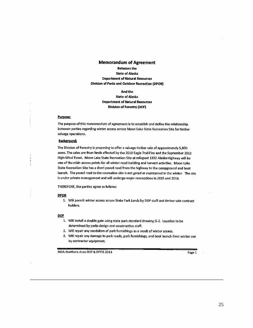
Unit 6H2 is the area which includes the Moon Lake Campground. The campground is closed in the
winter; therefore, this location could serve as winter access without conflicting with campground
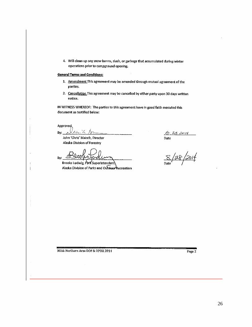
use. A signed MOA with DNR Parks stipulating the approved use of the park is signed and attached.
Portions of the proposed area are within Tanana Valley State Forest Units 12 (Tower Bluffs) and 14
(Tok River).
As part of the FBIF process, DOF is in consultation with the DNR Division of Mining Land and Water,
DNR Historic Preservation Office (SHPO), DNR Division of Parks and Outdoor Recreation,
Department of Fish and Game (ADF&G), and Department of Environmental Protection (DEC) prior
to adopting a Final Finding and Decision.
The Interagency Fire Management Plan includes these lands in the “Full” protection category.
No municipal or borough plans apply.
D. Current Access and Land Use:

5
The area in the vicinity of Yerrick Creek and Moon Lake has very limited vehicular access to state
lands from the Alaska Highway.
The first access point is the Moon Lake State Campground at Mile Post 1332 of the Alaska Highway.
It has one short paved road from the highway to the oxbow known as Moon Lake. The DOF
installed a gate per DNR Parks specifications at the entrance to the park for this timber sale as
required in the signed MOA with parks. This project gates the road to the campground limiting
access in the winter when winter harvest activities are occurring and will be controlled by the DOF.
This will potentially be one of the main access points for the timber sale for all winter road building
and harvest activities. The winter road starts on the frozen Moon Lake and proceeds across
Tanacross, Inc. lands via the Temporary Easement and Road Use Agreement. Road location’s intent
is to make access impossible outside of the winter frozen conditions. Upon closure of the timber
harvest operations the road will be closed out and made unpassable for winter travel.
The second access point is a State of Alaska DOT rock pit known as the Yerrick Creek Material Site
(M.S 62-2-176-2), less than one mile west of Yerrick Creek at Mile Post 1335 of the Alaska Highway.
Current access to the pit is down the section line and is not the authorized location for the 17B
easement but as stated in the letter from Tanacross, Inc. January 27, 2013 (attached as an
appendix), “we propose that Tanacross, Inc. and the State of Alaska jointly petition BLM to
recognize the existing access as fulfilling the intent of EIN23 and moving the location of the EIN to
the existing location.” This access will be the main access point off the Alaska Highway west of
Yerrick Creek for salvage harvest of all timber south of the Tanana River and west of Yerrick Creek.
At this time the legal access by way of the rock pit for timber harvest operations of this sale across
Tanacross, Inc. lands are pending. This harvest area will be harvested once legal access has been
established.
The third access road is Eagle Trail starting at MP 1324.7 Alaska Highway or MP 117 Tok Cutoff
Glenn Highway. This trail is a one lane gravel and sometimes muddy road capable of highway
vehicle traffic at various times of the year depending on ground conditions. Many portions of the
road have overburden on the running surface of the road creating the muddy condition. This
overburden needs removed to the underlying gravel base. The road needs maintenance including
clearing of wind thrown trees and over growth, blading, shaping, and ditching. This public
easement is used for dog mushing, subsistence hunting and trapping, firewood harvest, and other
recreational activities. The Eagle Trail road is the main access into the Tanana Valley State Forest
and other state lands in the area. This timber sale would upgrade the road and routine
maintenance would be performed on the road. The 2012 blowdown timber patch southwest of Tok
will be accessed from this road and the cleared section line from the end of Midnight Sun road that
runs east west, south of 8 sections. This section line road will require minimal clearing and blading

6
and will necessitate co-use in the winter with dog sleds and log truck and pickup truck traffic. This
road is currently usable for pickup traffic.
Multiple trap lines and recreational dog and ATV trails are within the general vicinity.
E. Background and Description of Proposal
May 26, 2010, a lightning strike two miles south of the Alaska Highway at MP 1325 ignited the
Eagle Trail Fire. The fire burned for 30 days and included a total of almost 19,000 acres of forest on
State of Alaska, and Tanacross Village, and Tanacross, Inc. lands. This fire was a fast moving and
dangerous fire with most of the acreage burning in just 6 days.
September 16th 2012, a strong weather system produced high winds throughout much of eastern
interior Alaska that resulted in widespread wind and flooding damage to hundreds of thousands of
acres of forests. On September 21, Governor Sean Parnell issued a disaster declaration and the
event later was declared a National Disaster by President Obama to be administered through FEMA.
The immediate consequence of this storm was trees blown onto homes and roads, trails were made
impassible with layers of downed trees causing substantial damage. In the forest immediately
surrounding Tanacross 90% of the trees were damaged or destroyed. The long term outlook is for
these areas to have an increased wildland fire danger and potentially increased adjacent tree
mortality from forest insects. In the Tok and Tanacross area the DOF is proposing to mitigate some
of these issues and salvage the downed wood while it is economically practical through salvage
operations.
June 25, 2013, a lightning strike in an area of 2012 blowdown, 11 miles to the west of Tanacross
was the start of the Moon Lake Fire. This fire burned for 75 days consuming nearly 22,000 acres of
forest mostly on State land and Tanana Valley State Forest lands. A portion of this fire reburned a
portion of the Eagle Trail fire and is included in this sale. The fire at times demonstrated extreme
fire behavior and presented a dangerous and difficult fire to suppress in the areas of the 2012
blowdown. Following the fire, DOF reviewed existing land use plans, considered markets for the
burned timber, and designed this proposal, while protecting the fish, wildlife, water resources, and
avoiding impacts to local access, recreation uses, and archaeological sites.
1. Timber volume and sustained yield:
The salvage timber sale area is 18864 gross acres with an estimated net harvest unit acreage and
volume of approximately 5,800 acres of state land and contains an estimated, 5.6 MCF or 10.7

7
MMBF (Net) saw log or 108,707 standing tons of salvageable wood biomass. The Tok Area Annual
Allowable Cut (AAC) is approximately 2,370 acres of harvest annually. The Sustained Yield (SY)
volume is calculated at over 3,299,068 cubic feet annually. Harvest duration for this proposal is
expected to occur over a 10 year period. This action alone or in combination with timber sales
(proposed or sold) will not exceed the Tok AAC or SY volume due to the proposed harvest duration
or anticipated sale schedule.
2. Harvest unit design:
Unit size is anticipated to range between 0.5 acres and 200 acres. Sale unit boundaries will be
located along the fire perimeter and naturally occurring vegetative type changes within the burn
and or blow down areas.
The sale areas will be designed to encourage harvest of all species and sizes of burned and or
blowdown trees within the designated harvest units. All harvests, commercial and personal use,
shall be managed on the landscape with the intent to minimize impacts to the designated uses listed
in the TBAP. Harvests will be subject to the Forest Resources and Practices Act and regulations.
3. New access design and construction:
Roads constructed during timber harvest operations are designed and utilized as temporary access
routes to conduct specific harvest and silvicultural activities on the land. Ancillary use of the roads
by the general public occurs, but must be managed as a matter of safety during silvicultural
operations or to protect the resource values of the area. Proposed forest access roads will initially
be constructed to a secondary winter road and all season standards. The roads will be constructed
with two separate methods and techniques. Winter road construction will be by removing trees
and vegetative material and creating a flat service on the frozen ground or water body. The all
season will be by removing the trees and vegetative mat using cut and fill excavation with earth
moving equipment producing running surfaces 12-16 feet wide.
Proposed road locations are generally on flat and/or rolling topography with low potential to erode
during spring break-up and rainy weather. Roads will be built and maintained consistent with the
best management practices in the Alaska Forest Resources and Practices Regulations (11 AAC 95)
and Tanana Valley State Forest Management Plan (Appendix A).
Timber sale contracts will require measures to prevent erosion including installation of water bars,
sediment barriers, fiber mats, and placement of culverts where needed. The proposed access
routes do not cross any stream north of the Tanana River but will cross seasonal drainages. Cross

8
drains, rolling dips, wing ditches or water bars will be placed or constructed where necessary to
prevent erosion on any all season roads.
Road maintenance and road closure actions will be conducted consistent with the best management
practices in the Forest Resources and Practices regulations.
DOF proposes to extend access by constructing winter and all season roads from the existing Moon
Lake Campground, Yerrick Creek Material Site and the Eagle Trail. The attached map shows
approximately 54 miles of winter road and 8.7 miles of all season that could potentially be
constructed if all salvage areas were harvested. Access controls are an important feature of this
timber sale. Moon Lake campground is gated and will only be accessed in the winter via Moon lake
winter road. The other roads will be tank trapped or gated to control access to prevent damage to
the environment or trespass onto neighboring private lands. In all cases, harvest activities and
roads will be managed to not preclude or obstruct existing public access and uses.
4. Appraisal method:
Based on transactional evidence and market demand for saw logs/cabin logs and fuel wood volume,
the DOF will apply a likely value for those delivered products. The State will be compensated based
on that market rate minus the estimated total harvest cost and fees from the Temporary Easement
and Road Use Agreement. The DOF will factor in local demand, timber type, amount of decay,
difficulty of harvest and road construction, economies of scale and other factors in its decision to
differentiate the cordwood from the sawlog volumes. The method of payment will be based on
standardized scaling methods for weight and volumes. Access will only be permitted through the
Moon Lake Campground with signed personal use and timber sale contracts that will compensate
Tanacross Inc. per the Temporary Easement and Road Use Agreement. Anticipated stumpage
revenues are forecasted to be optimistically moderate. It will however, generate significant
revenue to the local economy in the Tanana Valley.
F. Resources and Management
1. Existing timber stand composition and structure:
The forest stands to be salvaged were a mixture of fully mature white spruce, aspen, poplar, and
birch saw timber and pole timber prior to the fire and blow down events. The target timber stands
either burned by the forest fires or sustained severe wind damage in the form of wind throw, main
stem breakage, and tipped where the root wad is partially uprooted and the tree is leaning. This
condition, termed “stump-jacked”, is wide spread throughout the salvage area creating thousands
of hazardous trees. Some timber was burned, then wind thrown, and again burned again. Eventual

9
mortality rate of these stump-jacked and leaning trees remains unknown but is anticipated to be
high based on past experience. Of the area identified in this FLUP, the DOF estimates that more
than 90% of the trees have been killed and/or mortally damaged. Surviving trees will be stressed
from exposure to wind, sun, and beetles. This type of stand condition is prone to a beetle
infestation. Because of the physical difficulty in traversing jack-strewn and stump-jacked timber,
volume estimations were determined through aerial reconnaissance flights and existing inventory
data. Without active management, the stand remnants will likely continue to decline in vigor and
growth for the foreseeable future—such areas do not contribute to the annual allowable cut.
Stands exhibiting this type of damage can take a long time (70-100 years) to recover to conditions
observed prior to the wind event. The wind event has created denser and horizontally realigned
wildfire fuel conditions than is typically found in stands of this class. The stand will likely be more
volatile if burned due to vertical continuity of the fuels and dryer conditions caused by lack of
shade. The likely natural forest progression for this type condition is for it to burn. The stand will
then go to an early successional stand of aspen, birch, and/or balsam poplar commonly with spruce
regeneration in the understory.
2. Stand Silviculture:
a. Stand Goals
The conversion to an early stage successional stage stand as rapidly and economically as possible
without the use of wildfire or adjacent stands damage.
b. Specific Management Objectives
Protect undamaged forest conditions by preventing outbreaks of deleterious insects specifically
engraver beetles and spruce bark beetle by treatment of slash and removal of dead green material
for the blow down portion of the sale. White spruce damaged by fire attracts infestations of the
large white spotted sawyer (Monochamus scutellatus). These are large black flying insects with a
small white patch on the back behind the head and long black antenna. They are common in the
Tanana Basin during July. The beetles can be easily heard boring holes to lay eggs that will hatch
next summer. White spruce with large sawyer beetle infestations will be riddled with 3/8” sized
holes in the wood, devaluing its marketability as sawlog products within the next several years.
c. Harvest Methods
Due to the existing conditions, mechanical harvest methods are the only viable and safe option.
Commercial logging in the area typically consists of tracked harvesters with processor heads and
rubber tired grapple skidders. Because of the complexity of the stand conditions, the salvage
operations are expected to cost far more than normal. Live, healthy and undamaged trees in
clumps or islands of trees throughout the harvest area will be a priority. Leaving individual trees
alone will not be favored as the potential for long term survival is low. Decking of timber
throughout the sale will be allowed due to the seasonal market demand for biomass and green fuel
wood. Slash will be generally scattered through the sale area. This sale has areas that are
considered to be good ground for summer and or winter harvest of timber. For example, units
south of the Alaska Highway are good for either summer or winter harvest, while access through

10
Moon Lake would be winter only. Winter harvest may not provide the required scarification to
ensure good mineral soil exposure for seeding.
d. Regeneration
Passive, natural reforestation will be used due to expected recolonization of the area by hardwood
species. Birch is expected to establish in the upland locations and aspen and balsam poplar will
recolonize the lowland and moist sites. White and black spruce will naturally regenerate as well.
This methodology has been proven to be a successful burn area reforestation strategy in the Tok
area as evidenced on the 1988 Porcupine Creek, 1990 Tok River and 2004 Taylor Complex Fires.
Good seeding from hardwood of birch and poplar from the stream area and surrounding area is
expected due to the root mass disturbance and logging activity. With scarification of the soil, both
birch and white spruce will regenerate more successfully from natural seed dispersal. The size and
shapes of the blow down areas allow for natural regeneration to have a predicted high degree of
success due to the fact that there is a high percentage of stand perimeter compared to total acreage.
Areas that fall below recommended stocking levels (450 stems/acre) will be hand planted. Stand
regeneration is expected to have a higher percentage of aspen which will further add to the safety
of the public from impending wildfire danger. Where aspen is present, the total removal of the
aspen and spruce over story will promote aspen’s natural reaction to grow new shoots from its
roots – a common practice where aspen is managed as a forest crop. Logging equipment crushing
existing aspen without destroying the root systems will encourage coppice regeneration and
increase the stems per acre. High utilization of browse by moose and hares at the time of stand
establishment may have a strong effect on successional trajectory, potentially reducing hardwood
biomass and increasing spruce dominance (and fire risk) at the desired rotation period. Depending
on site specific management objectives, logging debris such as non-merchantable tops can deter or
reduce browsing of seedlings and small saplings by ungulates to allow survival of hardwoods to the
free-to-grow stage, and hunting of moose and hares in the areas of new road access could be
encouraged among local residents. Spruce is shade tolerant and if given time will outlast the
shorter lived hardwoods and dominate the site. Spruce stands outside the desired fire resistant
buffers described above will not be discouraged in order to provide the forest mosaic needed for a
diverse wildlife habitat. A mature stand of burned spruce or mixed spruce and aspen/birch
typically reforests to aspen or birch as the primary species after the fire. Birch and aspen stands
typically recolonize burned areas within 4-6 years.
3. Soils and Topography :
Topography:
Topographically the salvage area consists of three units: south of the Tanana River on the Tok
outwash fan, northeast of the River on the Yukon-Tanana Upland, and to the northwest in the
Yerrick creek area.

11
The area south of the Tanana River on the Tok outwash fan is relatively flat and gently sloping
toward the River to the north. This area has a loess cap overlying outwash gravels. The area north
of the River is hillier with a loess cap over granitic bedrock (slightly weathered). The area south of
the River to the west of the Tok River Fan (Alaska Range easternmost ridge) is more complex and
consists of fluvial, glacial, colluvial materials interspersed with organic landforms.
Soils:
The area encompassing the Eagle Trail Fire and Blow-down Salvage Sale does not have a soil survey
listed by the NRCS. The closest area with a soil survey is Gerstle River Soil Survey. A Custom Soil
Resource Report was created using the NRCS web soil survey and is included in the file and
available on request. Although there will be differences between the two sites there are many
geographic, and timber type similarities which could allow direct comparisons of sites. At the Dry
Creek survey there are rivers and creeks that drain into the Tanana River similar to the Yerrick
creek drainage. Listed are the soil types from the Dry Creek area that are geographically similar to
areas to the proposed sale.
Soils in the proposed sale area are not typical of the more westerly interior Alaska lowlands and
upland series. Area soils are generally silt loams over coarse sand and/or gravel (loess over
alluvium). They range from well drained to poorly drained, and are mostly shallow soils.
219 Moosehead Soil Series (Coarse-loamy over sandy or sandy-skeletal, mixed, super active
Fluventic Haplocryepts), found on Interior Alaska Lowlands on alluvial plains and terraces in
broad valleys, are deep , moderately well drained soils found on gentle slopes (1-3%). Parent
materials are stratified silty and sandy alluvium overlying sand and gravel. Depth to seasonal
high water table is usually more than 6 feet; a perched water table is near the surface in spring. The
soil series is of limited extent on Interior Alaska Lowlands. This soil series is among the most
productive (White Spruce Site Index 100 = 82) series in the area and supports forests containing
white spruce, balsam poplar, black spruce, Alaska birch, and aspen. If undisturbed for a long
period, forest succession may lead to the buildup of a thick O horizon and permafrost may
become established. Cleared areas are used for small grains, forages, and vegetables. Equipment
limitations: Avoid when wet, especially during spring thaw.
222 Salchaket Soil Series (Coarse-loamy, mixed, super active, nonacid Typic Cryofluvents),
found on Interior Alaska Lowlands on floodplains, are very deep, well drained soils found on flats
and gentle slopes (0-4%). Parent materials are stratified silty and sandy alluvium. Depth to
seasonal high water table is more than six feet. The soil series is extensive on Interior Alaska
Lowlands. This soil series is among the most productive (White Spruce Site Index100 = 80) series in
the area and support forests containing white spruce, balsam poplar, black spruce, Alaska birch,
12
and aspen. These soils are subject to occasional flooding; permafrost is uncommon to none.
Cleared areas are used for small grains, forages, and vegetables. Equipment limitations: Avoid
when wet, especially during spring thaw and flooding.
223 Tanacross Soil Series (Coarse-loamy, mixed, super active, subgelic Typic Histoturbels)
found on Interior Alaska Lowlands floodplains and floodplains on alluvial flats, on alluvial
fans, and on terraces, are shallow to deep over permafrost, poorly drained to very poorly drained
soils found on flats and gentle slopes (0-5%). Depth to seasonal high water table is 0 to 1 foot and
more than 5 feet in cleared areas. Parent materials: Organic materials over micaceous loamy
alluvium that have in some areas a loess mantle over alluvium. The soil series is of moderate
extent on Interior Alaska Lowlands. This soil series has very low productivity and is dominated by
open-grown, stunted black spruce. Depth to continuous permafrost is 10 to 25 to 60 inches;
greatest depth for cleared areas. Equipment limitations: winter road/ice roads only acceptable
access for crossing.
226 Tetlin Soil Series (Coarse-loamy, mixed, super active, subgelic Typic Aquiturbels) found
on Interior Alaska Highlands bedrock-cored hill-slopes, are shallow to deep over permafrost, poorly
drained soils found on gentle to steep slopes. Depth to seasonal high water table is 0 to 3 feet.
Parent materials: Micaceous loess or colluvium derived from loess. The soil series is of
limited extent on Alaska Interior Highlands. This soil series has good productivity (White
Spruce Site Index100 = 71) and supports white spruce and black spruce with an alder understory.
Depth to continuous permafrost is 10 to 60 inches. Equipment limitations: Steep slopes, wet
moisture regime; probably limited to winter logging.
232 Volkmar Soil Series (Coarse-silty over sandy or sandy-skeletal, mixed, super active
Aquic Haplocryepts) found on Interior Alaska Lowlands in slight depressions on outwash plains,
terraces, and stream terraces, are very deep, moderately well drained found on flats and gentle
slopes (0-5%). Depth to seasonal high water table is more than 6 feet; in spring water table is held
up by seasonal frost. Parent materials: Micaceous silty loess overlying sand or sand and
gravel. The soil series is of moderate extent on Alaska Interior Lowlands. This soil series supports
forests dominated by black spruce, white spruce, and paper birch. Cleared areas are used for small
grains, grasses, and vegetables. Permafrost is not present. Equipment limitations: Avoid activity
during spring break and while seasonal frost creates a perched water table.
4. Wildlife Habitat and Harvest:
Moose, caribou, black and grizzly bear, several raptors, sharp-tailed and ruffed grouse, and a
multitude of furbearing animals as well as all the normally occurring species within the Tanana

13
Valley that exist at this elevation are expected to be present. USF&W has provided a map of known
raptor nesting sites and territories within the sale area. The Peregrine falcon nests are on bluffs and
these sites, including adequate buffers, will be excluded from the sale. Additionally the nesting sites
will be vacant during the winter logging, thus negating logging disturbances during the nesting
periods. Current stand conditions impede mega fauna (moose) travel. Silvicultural treatments
proposed for this sale should significantly improve habitat for moose. ADFG recommended that an
adequate number of larger diameter trees snapped mid stem be left in place to facilitate late seral
bird nesting opportunities. Harvest unit design will be developed to recover damaged and stressed
timber while promoting a natural varied edge. This type of layout creates a greater perimeter
distance enhancing the edge effect beneficial to many wildlife species. The basis for wildlife habitat
protection and enhancement on state land is provided in AS 41.17.010(1) and AS 41.17.060(c) (7),
and on the Tanana Valley State Forest is provided in AS 41.17.400(e). The following section is
provided by the Department of Fish and Game for the Tok BIF and is deemed pertinent information
for this document
“The term wildlife broadly includes birds and mammals in Alaska. Some resident wildlife is
managed by the Alaska Department of Fish and Game (ADF&G) on the sustained yield basis for
harvest, such as moose, caribou, and gallinaceous birds (grouse, ptarmigan). Migratory wildlife is
managed by the U.S. Fish and Wildlife Service (USF&WS) under international treaties; in forested
ecosystems this includes waterfowl harvest and songbird conservation. Per FRPA a no-harvest
radius of 330 feet will be planned for and established to protect the nest site of bald eagles. The
USF&WS will be notified about nest locations discovered during sale layout.”
Most common species of wildlife that are normally found in interior Alaska forests inhabited the
area prior to the fire. Large animal species may be displaced from the burn areas until sufficient
hiding, thermal cover and sufficient browse is available. Timber harvest in burn areas is not
expected to diminish available cover for these species. A potential for moose foraging on hardwood
regeneration in fall (leaf-stripping) and winter (browsing), which in extreme cases can accelerate
or facilitate transition from hardwoods to conifers possibly reducing biomass yield in the short
term. Timber harvest may reopen areas for hunting access as most of the burn areas are currently
a tangle of toppled trees.
Small animal species typically recolonize a burn area quickly. Long-time trappers have stated that
some of the best trapping can occur in burn areas, especially for lynx and coyote due to the
resulting high vole populations. Grouse and other birds use new growth in the burn areas for food
and habitat as well.
Hunting and trapping occur in the area. Active trap lines are located within and in the vicinity of
the proposed salvage areas. Historically, there has been significant hunting activity in the area due
to relatively high moose density and close proximity to Tok and Tanacross.

14
Projected Habitat: Fire suppression and limited timber markets presently hinder maintenance of
early seral hardwood trees and shrubs for wildlife habitat near settlements in interior Alaska
(Haggstrom and Kelleyhouse 1996). Future amount and distribution of habitat in the sale area is
expected to be influenced primarily by forest management (including hazardous fuels reduction)
and wildland fire on upland sites and fluvial action in active riparian areas. Mineral development
and other surface activities may also influence vegetation. Trends in climate may influence the rate
of vegetative response to disturbance through potential effects on nutrient cycling, growing season
length, soil moisture, and other ecological effects.
Regeneration of shrubs and hardwoods on harvested spruce sites may require mechanical or
prescribed fire scarification where grass (especially Calamagrostis Canadensis)exists and its dense
regeneration can hinder woody species. Maintenance of late-seral features (snags, cavity trees,
spruce rust brooms), particularly the larger, more rare features in the landscape, will require
operator education to identify them for avoidance.
Subsistence: By harvesting, the area will revert to younger early successional plant species, which
will in turn support wildlife adapted to those plant communities such as moose and ruffed grouse,
allowing for a potential increase in those wildlife populations and increased hunting opportunity.
Required riparian and wetland zones will keep habitat required by species needing an older forest.
Furbearer trapping success may vary for a period of time and will likely be better sooner than if
nothing is done with the existing condition. Berry picking should increase as stands are opened up
allowing existing plants to multiply. With adherence to the FRPA best management practices of
water bodies, no noticeable effect on fishing should be evident by the proposed harvest activities.
The few roads resulting from harvest operations will increase access. These temporary roads will
be closed once harvest and regeneration activities are complete. Highway vehicles may not be able
to use the closed roads but ATV’s, snow machines, and mushers will likely take advantage of the
closed roads in the Eagle Trail area rather than have to brush their own trails.
5. Fish Habitat and Harvest, Water Resources, and Water Quality:
The Forest Resources Practices Act (FRPA) and its Regulations establish standards for timber
harvest and forest road construction and maintenance. The sale areas are designed and operations
will be conducted in a manner that is in compliance with the Alaska Forest Resources and Practices
Act (FRPA). To maintain water quality during road construction and harvest operations, the
Division of Forestry will mandate implementation of FRPA’s Best Management Practices in the
timber sale contract; this includes a combination of retention areas, directional felling, partial
suspension of logs, split-yarding, and removal of logging debris from stream channels. These
15
standards are designed to minimize the potential for significant adverse effects to water quality due
to forest harvesting activities.
The FRPA BMPs have been determined to provide adequate protection from potential water
degradation. Information from field inspections, compliance monitoring, and the State’s Alaska
Clean Water Actions database indicate that FRPA is effective in protecting water quality. The
annual report from the Alaska Department of Environmental Conservation (DEC) on the
effectiveness of FRPA concluded that, “when properly implemented, the BMPs are effective at
protecting water quality.”
The Tanana River, including its side channels and Little Tanana Slough, provides habitat for
anadromous and high value resident fish species including chum and coho salmon, round whitefish,
burbot, northern pike, and Arctic grayling. With its glacial characteristics, it is a Type III-B water
body under FRPA. Type III-A water bodies providing habitat for high value resident fish species
include Yerrick Creek (Arctic grayling and Dolly Varden) and Moon Lake (Arctic grayling).
Appropriate riparian buffers will be placed along these water bodies.
Frozen conditions will be utilized to minimize disturbance in these sensitive areas. The FRPA and
its Regulations are designed to protect fish habitat and water quality from significant adverse
effects of timber harvest activities. All activity in the streams will be subject to approval from
ADF&G. The ADF&G Division of Habitat has been consulted during the process of planning this
operation and writing this document. If access requires Title 16 (Fish Habitat) Permits from the
ADF&G Division of Habitat to construct access to the project area, they will be pursued as needed
and according to statutory requirements.
6. Recreation, Tourism, and Scenic Resources:
Summer and winter recreational use of the area, with the exception of Moon Lake Campground in
the summer, is low.
Multiple recreational trails are within the general vicinity with summer and winter use. If any trails
are encountered during road construction, contractors will provide for trail crossings as well as
post warning signs along the road. No conflicts are anticipated with recreational use of these trails
either in summer or winter.
Multiple trap lines utilize the area in the winter; no conflict is anticipated.
The region’s scenery includes the lakes and streams that draw recreational users and views south
to the Alaska Range. Typical interior Alaska views of forested vistas and mountainous horizons
typify this area. Visual impacts from the proposed harvests are not anticipated to be of any
16
significant concern to the general public due to the nature of the project harvesting firekilled and
blowdown areas.
Moon Lake campground is the only known tourism area with close proximity of the sale.
7. Cultural Resources:
DOF received comments from the State Historic Preservation Officer (SHPO) and no known sites
were identified. If any archaeological sites are identified, proposed salvage areas and road
locations will be appropriately adjusted to avoid conflicts. If any historic or archaeological sites are
encountered during road construction or harvest activities, DOF will immediately inform SHPO and
take action to protect the findings.
If burials or human remains are found, all land-altering activities that would disturb the burial or
remains shall cease and measures will be taken to protect it in place. The Alaska State Troopers,
State Historic Preservation Office (SHPO), and the State Medical Examiner shall be contacted for
further guidance pursuant to State laws and protocols pertaining to the discovery of human
remains within the State of Alaska.
8. Subsurface Resources:
There are no mining claims in the proposed project area.
9. Wildland Fire Management:
Most of the forest stands in the area are the result of past wildfires. After a fire, seeds from
surrounding spruce and root sprouts and seeds from hardwoods regenerate the area. The faster
growing hardwoods typically dominate the site for many years while the spruce remains in the
understory. Early on, the stand is relatively fire resistant as hardwoods offer little fuel for a
wildfire. Spruce on the other hand, provide fuel because of their low dead limbs acting as a fuel
ladder for ground based fires to reach the explosive needles in their crowns. As the stand ages,
these longer lived spruce eventually take over creating conditions ripe for another wildfire and
starting the ecological process all over again. Fire management options include allowing wildfires
to burn where they do not threaten life or property. Much of the more remote parts of the Tok
Forestry Management Area are managed in this manner. Fires are monitored for possible threats.
These fires result in a mosaic of forest stands ranging from young stands dominated by hardwoods,
to older spruce stands that have not seen fires for a hundred years or more. Management options
for wildland fires in and around communities require a more aggressive approach to protect life
and property. These fires are suppressed creating after many years an older forest where fire
prone spruce dominates the landscape. If these stands are left unmanaged, they can evolve to a
level where a fire can become a catastrophic event. Active forest management can reduce the
17
likelihood of a wildfire becoming a threat to the whole community. The interest in biomass for fuel
to produce heat and power has created a use for trees that, not so long ago were considered of little
value and communities paid to remove them to alleviate the wildfire risk. Fuels within a hardwood
stand are mostly on the forest floor. There are far fewer lower limbs (ladder fuels) on birch and
aspen to allow the fire to burn up into the tree tops and create a dangerous fast moving crown fire.
Fires on the forest floor tend to be slow moving creeping fires because of higher moisture content
and the reduced influence from wind. Stands next to the community will be managed for hardwood
by removing the spruce and encouraging hardwood reproduction creating a forest resembling the
younger early successional forests present outside the community where wildfires are allowed to
burn if they do not threaten life and property.
10. Wildland Fire Historic Costs and Projection:
Fire plays a significant role in the ecology of the Tok Area. Since 1947, the Tok Forestry
Management Area has burned 205,600 acres within the Tanana Valley State Forest and forest
classified lands- averaging 3,200 acres per year. The operable area is in Full Protection. This
protection level requires aggressive firefighting strategies during the most fire prone part of the
season. These protection levels are discussed and agreed by all the different private, native, state
and federal land managers. Fighting fires is expensive. For example, the last large fire in Tok was
the 18,000 acre Eagle Trail Fire in 2010 and cost the State $9,295,884. Costs associated with large
fires threatening communities vary between $500,000 and $20,000,000. These fires are typically
fueled by white and black spruce and are very difficult to control. Once aircraft and additional
crews and equipment are ordered, costs quickly escalate. The following are estimated costs for
various resources:
Cost for a load of jumpers: $9,000/day
Cost for a helicopter and bucket: $3,500/day plus $1,250/hour
Cost of air tanker: $8,995/day plus $3,000/flight hour
Cost of Type 1 crew: $9,310/day
Cost of Type 2 crew: $6,090/day
In addition to the direct costs incurred while fighting fires, the National Institute of Standards and
Technology reports, during 2008, the nation suffered the death of 18 people, 257 injuries and a
property loss of 3.1 billion dollars as a result of 364,000 wildfires (Hamins et al. 2012). A managed
forest will create conditions favorable to the reduction of highly flammable fuels and to more
effective and efficient initial response to new fires. The breakup of fuel types by harvesting older
spruce stands and encouraging hardwood regeneration will reduce the threat of crown fires and
drop fires to the ground where they are more easily managed with existing personnel. An

18
estimated $15,000,000 was spent in preparedness and suppression activities in 2013 in the Tok
Area.
G. Costs and Benefits
No significant negative economic effects are anticipated upon the timber markets, local or regional,
as result of this proposed action. Salvage of the proposed timber volume may provide a short-term
benefit to the local economy due to the availability of low-cost fuel for home heating and timber
harvesting jobs. DOF may have to close roads to the commercial and personal use timber sales to
prevent unauthorized harvest.
The Division of Forestry has provided personal use firewood permits and small personal use sales
from this area to ensure an adequate supply of firewood for local residents. Public use firewood
demand in this area is expected to be quite high during the winter access period. The Division will
continue to issue general use permits and designate areas for personal use sales within the salvage
area boundary. Commercial timber salvage harvest operations in portions of the sale near the
Eagle Trail, will provide winter road maintenance facilitating public access to the salvage areas
VI. PUBLIC REVIEW
The public and agencies were invited to comment on this Final Best Interest Finding. Objections or
comments pertaining to the proposed action must have been received in writing by the DOF Tok
Area Office by 4:30 PM on December 10th, 2014, in order to ensure consideration for review.
Comments were mailed to Jeff Hermanns State of Alaska, Division of Forestry, Tok Area Office, and
P.O. Box 10 Tok, Alaska, 99780. Comments were also accepted by email to [email protected].
For additional information the Tok Area Office phone number is 907-883-1400. To be eligible to
appeal the final decision, a person must have provided written comment by 4:30 PM on December
10, 2014.
VII. PUBLIC NOTICE

19
This FBIF was publicly noticed in compliance with AS 38.05.945. Notice was posted on the
Alaska Online Public Notice System, and at the Tok US Post Office Public Notice Board.
A person is eligible to participate in any appeal or request for reconsideration to the final
finding if s/he has submitted comment to the Final finding and decision during the
comment period.
If you have any questions, please contact Jeff Hermanns, Tok Area Forester, at
[email protected] or by phone at 907-883-1400.
VIII. ALTERNATIVES AND DISCUSSION
There are four possible alternatives to consider for this project area. A discussion of each of the
four alternatives follows. All alternatives are consistent with the area plan and applicable statutes
and regulations.
A. Conduct the project as proposed:
This alternative meets the objectives for timber salvage prior to loss of economic value,
returning the site to a young productive mixed forest, and providing commercial timber
products. It will also provide fuel wood to the local area and commercial dry firewood to the
statewide market. Additional employment opportunities associated with salvage operations,
saw milling, and value-added processing will result. This alternative has ample room for small
modifications while remaining very close the sales objectives.
B. Modify the project by making it significantly smaller or larger
The estimated volume and acreage of timber to be salvaged from the Eagle Trail Fire & 2012
Blow down Salvage as stated in this Best Interest Finding is designed to accommodate the
existing market in the vicinity of Tok as well as provide commercial fuel wood to other areas of
the state. Little opportunity exists to increase the size of the proposed project because most of
the commercial sized timber was included in this proposal. Some commercial stands were left
out of the proposal or were not feasible due to access development costs. Decreasing the size of
the project substantially would potentially waste valuable, burned timber that could be used in
the local economy in the next 1-10 years.
C. Defer the project to a later date:

20
Deferring harvest to a later date would result in lost timber value and potentially increase the
threat of a large catastrophic wildfire. Burned timber, especially on the ground, degrades
rapidly due to subsequent infestations of insects, sap rot, wind throw, and checking. The value
of the timber could drastically decline within the next 12 months for both the industry and the
State. Access to the salvage area is only during the winter months; delaying this project would
not allow the timber industry to utilize the available saw timber and the local area residents
would not have access to firewood that is in extremely high demand.
D. Cancel the project:
Canceling the project would not meet the objectives outlined for this management action. The
blow down would continue to be a high fire risk for a catastrophic wildfire. The burned timber
would not be utilized, and there would be no contribution to the State and local economies.
21
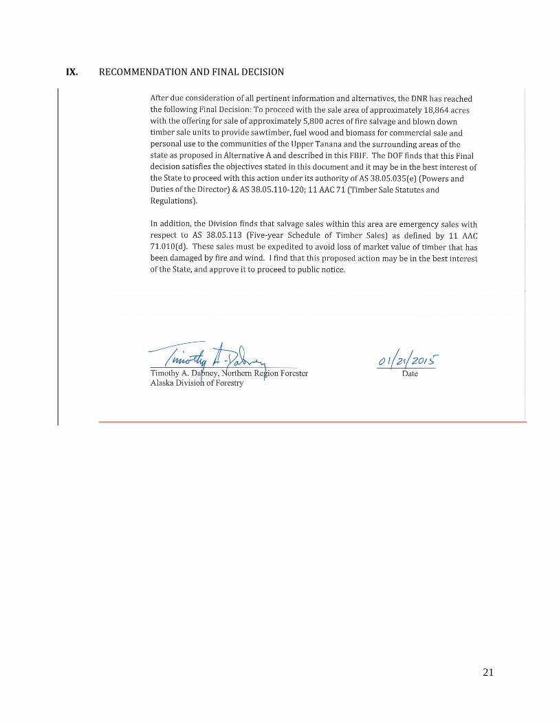
IX. RECOMMENDATION AND FINAL DECISION
22
X. ATTACHMENTS
Maps: Eagle Trail Fire & Blowdown Salvage Sale Map #1, Map #2, and Sale Area Map
MOA between DNR (DPOR) and DNR (DOF)
Grant of Temporary Easement / Road Use Agreement between State of Alaska DNR Forestry and
Tanacross Inc.
Tanacross letter to DNR January 27, 2013
Appendix A: Tanana Valley State Forest Road Specifications

23

24
25
26

27
28
29

30
31

32

33

34
Appendix A - Northern Region Forest Road Standards (Tanana Valley State Forest Management Plan)
Level of Use Curve Radius Grade Drivable Surface Turnouts
Primary all-
season road (1)
Moderate to Heavy; Long
Term; Year-round
300' normal design 100'
minimum (2) Curve
widening on minimum
radius curves
8% Normal 10%
Maximum
16'-20' Width and Rock
Surfacing may be
Required.
Not Required if Driving Surface ≥ 18'.
Otherwise 1000' feet Max. interval.
Intervisible. 25' ingress, 25' egress, 50' Full.
12' Width
Secondary all-
season road
Light to Moderate; Long
Term; Year-round
100' normal design 60'
minimum (2)
15% Max. Favorable
10% Max. Adverse12'-16' Width. Same as Above
Spur Road Light; Short Term Same as Secondary All-
Season Road20% Maximum 10'-16' Width. Not Required
Primary Winter
Road
Moderate to Heavy; Long
Term
Same as Primary All-
Season Road
Same as Primary All-
Season Road16' to 20' Width Same as Primary All-Season Road
Secondary Winter
Road
Light to Moderate;
Medium to Long Term
Same as Secondary All-
Season Road
Same as Secondary All-
Season Road
Same as Secondary All-
Season RoadSame as Primary All-Season Road
Note (1) - Higher construction standards may be needed for site specific projects and conditions.
Note (2)- To be applied only under topographically limiting conditions.
Design Considerations

35
Appendix A - Northern Region Forest Road Standards (Tanana Valley State Forest Management Plan)
Cut and Fill Clearing 3 Grubbing Debris Disposal Permafrost
Primary all-
season road (1)
Fill slope 1.5 : 1 Max. Cut slope 1:1
Max. excepting Loess soils where
vertical cuts are acceptable See also 11
AAC 95.290c.
5' beyond cut and fills or min. 35'
width. Merch. Timber cut and
decked ahead of Construction.
Removal of Stumps, roots, and
organics from road bed to
outside of ditches unless tops
of stumps under 2' of fill
If ≥ 2' beyond ditches,
windrow or place in
pushouts. If ≤ 2' bury
under min. 1' of fill.
Avoid exposing thaw unstable permafrost
through routing or using raised fill
construction. If exposed, min. sedimentation
w/ effective erosion controls. See 11 AAC
95.290c.
Secondary all-
season roadSame as above
5' beyond cut and fills or min. 30'
width. Merch. Timber cut and
decked ahead of Construction.
Same as above Same as above Same as above
Spur Road Avoid where reasonable and prudentMin. 12' width. Merch. Timber cut
and decked ahead of Construction.Under Drivable Surface
Use Windrowing or Push-
out techniques as
appropriate
Avoid exposing thaw unstable permafrost. If
exposed, stabilize by treating w/ effective and
appropriate measures, sp. Recovering,
seeding, drainage struct. And settling basins.
See 11 AAC 95.290c., g.; 295 g.
Primary Winter
Road
Minimize cuts and fills in thaw-unstable
permafrost. Avoid where feasible and
prudent, cuts in thaw unstable
permafrost; exceptions will be
identified in FLUP.
Minimum 16'
Partial removal of surface
organics only as needed to
provide a level running
surface.
Same as Spur Road Same as Spur Road
Secondary
Winter Road
Avoid where feasible and prudent, cuts
in thaw unstable permafrost;
exceptions will be identified in FLUP.
Minimum 12'Same as Primary Winter road
RoadSame as Spur Road Same as Spur Road
Note (1) - Higher construction standards may be needed for site specific projects and conditions.
Note (3)- Minimum is used for safety and snow storage reasons
Construction Considerations
Appendix A- Northern Region Forest Road Standards (Tanana Valley State Forest Management Plan)
Ditches Culverts Maintenance
Primary all-
season road (1)
1.0' Min. Depth; 2.0 Min width. Block Ditch
on Down hill Side of culvert inlet where
needed.
Min.Dia 12" except as stated in 11 AAC 95.295.
Installed at or below natural ground line and natural
stream gradient.
Grading and Ditching as Necessary
Secondary all-
season road
Block Ditch on Down hill Side of culvert inlet
where needed.Same as Above
Grading and Ditching as Necessary. Maintained or
Closed after logging use.
Spur Road As Needed Same as AboveClosed or treated as per 11 AAC 95.315(c) after logging
use
Primary Winter
RoadNone Same as Above Open drainages before breakup.
Secondary Winter
RoadNone Same as Above
Closed or treated as per 11 AAC 95.315(c) after logging
use. Open Drainages before breakup.
Note (1) - Higher construction standards may be needed for site specific projects and conditions.
Maintenance Considerations
36
References
Haggstrom, D.A., and D.G. Kelleyhouse. 1996. Silviculture and wildlife relationships in the boreal forest
of Interior Alaska. Forestry Chronicle 72:59–62.
Hamins, et al. 2012. Reducing the Risk of Fire in Buildings and Communities: A Strategic Roadmap to
Guide and Prioritize Research. NIST Special Publication 1130, National Institute of Standards and
Technology, U.S. Department of Commerce, Gaithersburg, MD. 171 pages
Related Documents