STATE COUNCIL OF EDUCATIONAL RESEARCH AND TRAINING TELANGANA, HYDERABAD. Class: X Medium: English Subject: Social Studie Name of the chapter: 4. Climate of India s Worksheet Name of the topic/concept: Climate and Weather, Climographs LEARNING OUTCOMES: The Student Differentiates climate and weather Analyses the climographs of Delhi, Jaipur, Leh and Chennai. CONCEPTS: Weather and Climate Weather: The state of atmospheric conditions of elements like sunshine, temperature, atmospheric pressure, winds, humidity, clouds and precipitation over an area at a particular time refers to weather. These weather conditions fluctuate very often even in a short period. Climate: climate refers to such conditions over a large area and follows a similar general pattern over 30 or more years. There will be variations from year to year but the basic pattern remains the same. On the basis of these generalised conditions, the year is divided into seasons. Climographs: The pattern of the elements of weather and climate for a place can be shown using pictures called climographs or climatographs. Climographs show average monthly values of maximum temperature, minimum temperature and rainfall for a given place Climographs of a few places in India. The climographs below show that temperature and rainfall vary in different parts of the country. Activity 1: Collect the weather report of the months May and June from the newspaper and observe the changes in the elements of weather. Record your observations and discuss in your classroom www.tsupdate.in Downloaded from www.tsupdate.in Downloaded from www.tsupdate.in

Welcome message from author
This document is posted to help you gain knowledge. Please leave a comment to let me know what you think about it! Share it to your friends and learn new things together.
Transcript
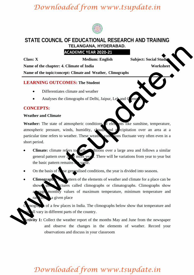
STATE COUNCIL OF EDUCATIONAL RESEARCH AND TRAINING TELANGANA, HYDERABAD.
Class: X Medium: English Subject: Social StudieName of the chapter: 4. Climate of India
sWorksheet
Name of the topic/concept: Climate and Weather, Climographs
LEARNING OUTCOMES: The Student
Differentiates climate and weather
Analyses the climographs of Delhi, Jaipur, Leh and Chennai.
CONCEPTS: Weather and Climate
Weather: The state of atmospheric conditions of elements like sunshine, temperature, atmospheric pressure, winds, humidity, clouds and precipitation over an area at a particular time refers to weather. These weather conditions fluctuate very often even in a short period.
Climate: climate refers to such conditions over a large area and follows a similar general pattern over 30 or more years. There will be variations from year to year but the basic pattern remains the same.
On the basis of these generalised conditions, the year is divided into seasons.
Climographs: The pattern of the elements of weather and climate for a place can be shown using pictures called climographs or climatographs. Climographs show average monthly values of maximum temperature, minimum temperature and rainfall for a given place
Climographs of a few places in India. The climographs below show that temperature and rainfall vary in different parts of the country.
Activity 1: Collect the weather report of the months May and June from the newspaper and observe the changes in the elements of weather. Record your observations and discuss in your classroom
w
ww.tsup
date.
in
Downloaded from www.tsupdate.in
Downloaded from www.tsupdate.in
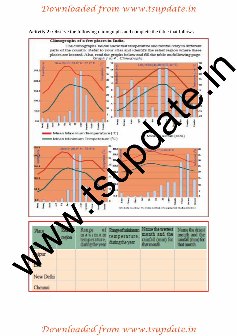
Activity 2: Observe the following climographs and complete the table that follows
www.ts
upda
te.in
Downloaded from www.tsupdate.in
Downloaded from www.tsupdate.in
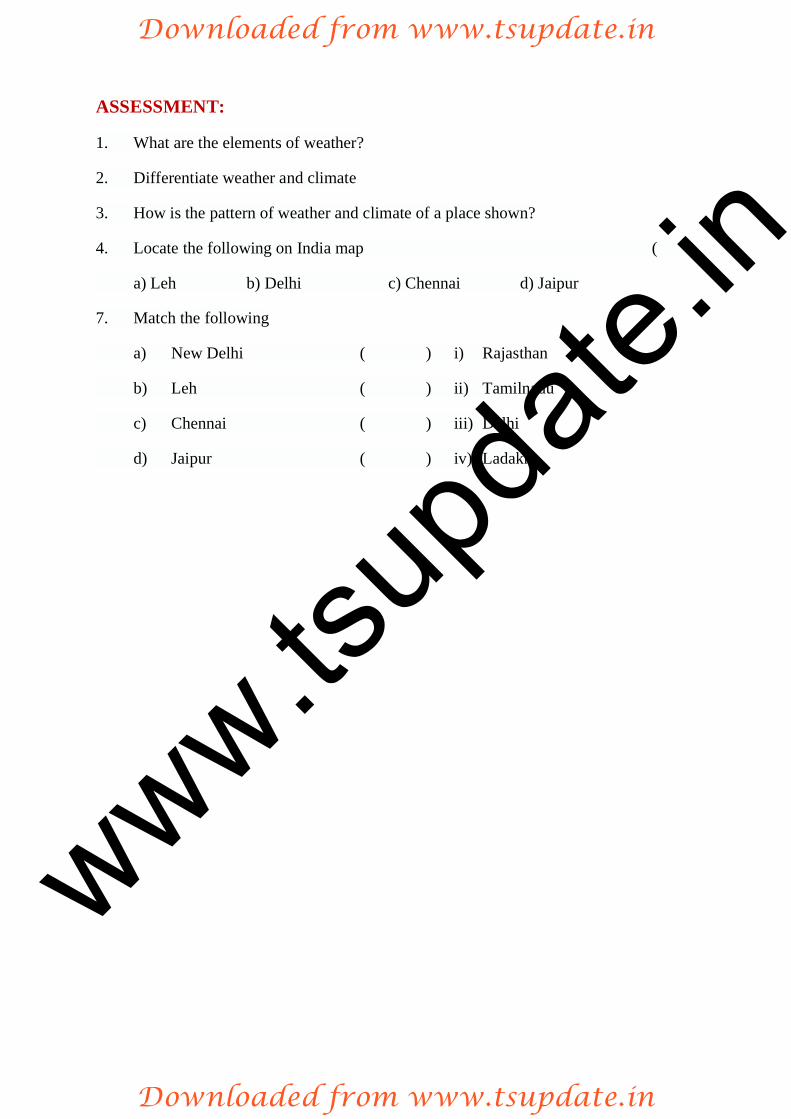
ASSESSMENT:
1. What are the elements of weather?
2. Differentiate weather and climate
3. How is the pattern of weather and climate of a place shown?
4. Locate the following on India map ( )
a) Leh b) Delhi c) Chennai d) Jaipur
7. Match the following
a) New Delhi ( ) i) Rajasthan
b) Leh ( ) ii) Tamilnadu
c) Chennai ( ) iii) Delhi
d) Jaipur ( ) iv) Ladakh
www.ts
upda
te.in
Downloaded from www.tsupdate.in
Downloaded from www.tsupdate.in
STATE COUNCIL OF EDUCATIONAL RESEARCH AND TRAINING TELANGANA, HYDERABAD.
Class: X Medium: English Subject: Social Studies Name of the chapter: 4. Climate of India Worksheet Name of the topic/concept: Factors influencing climate and weather
LEARNING OUTCOMES: The Student
explains the factors that influence the climate and weather.
locates important hill stations on India map.
CONCEPTS: Factors influencing climate and weather
It has been observed that for some places (e.g. Chennai), there is not much difference in the temperature across months. Some places (e.g. Delhi) have wide differences in temperature across the months. India experiences wide variations in temperature. The northern portion is bound by the Himalayas whereas southern peninsula is surrounded by seas. Some places are far from the coasts; they are inland. Some places are at high altitude, whereas others are on the plains. The factors that affect climate are called climatic controls. These include:
1. Latitude 2. Land-water relationship 3. Relief 4. Upper air circulation
1. Latitude or distance from the equator: The average temperatures for the year drops as you go further away from the equator. Intensity of temperature depends on
surface depends upon the insolation (heat from sun rays) received at that location. This is more intense in the low latitudes than in the high latitudes. As we move away from the equator towards the poles, the average annual temperature decreases. In India, the southern part lies in the tropical belt closer to the equator. Therefore, this region has higher average temperature than the northern part. India is divided into almost two equal parts by the Tropic of Cancer. The part that is on the south of the Tropic of Cancer lies in the tropical zone. The part that is on the north of the Tropic of Cancer lies in the temperate zone.
www.ts
upda
te.in
Downloaded from www.tsupdate.in
Downloaded from www.tsupdate.in

2. Land water relationship: The amount of sunlight that is first absorbed and then radiated back or directly reflected depends on the nature of the surface. Darker areas such as heavily vegetated regions, tend to be good absorbers; lighter areas, such as snow and ice-covered regions, tend to be good reflectors. The ocean absorbs and loses heat more slowly than land. This affects climate in many ways. One of this is the formation of land and sea breezes. A large part of southern India, because of its long coast line, comes under the moderating influence of the sea. As such, the difference between the temperature of day and night and that of summer and winter is not much. This is known as equable climate.
3. Relief: Temperature decreases as altitude increases. Hence, hills and mountains will have lower temperature than locations on the plain. Therefore, relief or altitude of a region influences the climate of the area. Several hill stations of the Himalayan region like Shimla, Gulmarg, Nainital, Darjeeling and Kodaikanal and Udagamandalam(Ooty) have a cooler climate even during the peak summer months compared to places near the coast.
4. Upper atmospheric circulation: In the northern hemisphere, subtropical high pressure belt gives rise to permanent winds. They blow toward the equatorial low pressure belt by reflecting towards the west and are called trade winds. The German
in a constant course. India lies in the belt of dry north-east trade winds. The climate
causes the neighbouring atmosphere to cool. This cooling effect of the easterly jet stream causes rain from clouds already found over this latitude (250N).
Activity 1: Collect the weather report of Mumbai, Thiruvanantapuram, Delhi and Shimla (Similar places as it may be available to you) for the month of June and record the differences in the weather conditions
Activity 2: Does our life style get affected by weather conditions? Give reasons
ASSESSMENT:
1. What are the climatic controls? Explain any two.
2. Mention any two places that have equable climate.
3. Locate the following on India map a) Tropic of Cancer b) Kanyakumari c) Himalayan hill stations d) Hill stations in South India
www.ts
upda
te.in
Downloaded from www.tsupdate.in
Downloaded from www.tsupdate.in
Choose the correct answer and write in the bracket provided
4. This lies in the temperate zone ( )
A) Darjeeling B) Panaji C) Kodaikanal D) Bangalore
5. Identify the correct statement ( )
A) India lies in the belt of south east trade winds belt.
B) Temperature increases as the altitude increases.
C) Intensity of temperature depends on the latitude.
D) Hyderabad has equable climate.
6. ( )
A) monsoon B) temperature C) track D) season
7. Jet streams are ( )
A) aeroplanes B) clouds C) air currents D) cyclones
8. This absorbs and loses heat more slowly ( )
A) ocean B) plateau C) plain D) island
www.ts
upda
te.in
Downloaded from www.tsupdate.in
Downloaded from www.tsupdate.in
Related Documents