-1- STAFF REPORT C17 A 2 11/29/17 W 27113 S 2 M. Schroeder GENERAL LEASE – OTHER APPLICANT: The Wildlands Conservancy PROPOSED LEASE: AREA, LAND TYPE, AND LOCATION: Sovereign land in the Eel River Estuary Preserve, including Cutoff Slough, Centerville Slough and historic tidal sloughs within the approximate limits of distubance of the Eel River Estuary Preserve Ecosystem Enhancement Project, adjacent to Assessor's Parcel Numbers 100-121-01, 100-143-01, 100-142-01, 100-131-03 and -04; 100-121-04 and -05, near Ferndale, Humboldt County. AUTHORIZED USE: Construction, use, and maintenance of the Eel River Estuary Preserve Ecosystem Enhancement Project, a tide gate, two kayak launching areas, tidal wetlands, ponds and side channels, aquatic habitat cover, interpretive area, gated culverts, a vault toilet, improvements to access roads, repair or removal of culverts and culvert holes, enhancement of existing freshwater ponds, removal of non-native beach grass, establishment of dunes and sediment management areas, improvement of drainage on agricultural land; and temporary construction work areas including cofferdams, diversion pipelines, and fish screens. LEASE TERM: 25 years, beginning November 29, 2017. CONSIDERATION: Public use and benefit; with the State reserving the right at any time to set a monetary rent if the Commission finds such action to be in the State’s best interests. SPECIFIC LEASE PROVISIONS: Liability insurance in an amount no less than $2,000,000 per occurrence.

Welcome message from author
This document is posted to help you gain knowledge. Please leave a comment to let me know what you think about it! Share it to your friends and learn new things together.
Transcript

-1-
STAFF REPORT C17
A 2 11/29/17 W 27113 S 2 M. Schroeder
GENERAL LEASE – OTHER APPLICANT:
The Wildlands Conservancy PROPOSED LEASE:
AREA, LAND TYPE, AND LOCATION: Sovereign land in the Eel River Estuary Preserve, including Cutoff Slough, Centerville Slough and historic tidal sloughs within the approximate limits of distubance of the Eel River Estuary Preserve Ecosystem Enhancement Project, adjacent to Assessor's Parcel Numbers 100-121-01, 100-143-01, 100-142-01, 100-131-03 and -04; 100-121-04 and -05, near Ferndale, Humboldt County.
AUTHORIZED USE:
Construction, use, and maintenance of the Eel River Estuary Preserve Ecosystem Enhancement Project, a tide gate, two kayak launching areas, tidal wetlands, ponds and side channels, aquatic habitat cover, interpretive area, gated culverts, a vault toilet, improvements to access roads, repair or removal of culverts and culvert holes, enhancement of existing freshwater ponds, removal of non-native beach grass, establishment of dunes and sediment management areas, improvement of drainage on agricultural land; and temporary construction work areas including cofferdams, diversion pipelines, and fish screens.
LEASE TERM:
25 years, beginning November 29, 2017.
CONSIDERATION: Public use and benefit; with the State reserving the right at any time to set a monetary rent if the Commission finds such action to be in the State’s best interests.
SPECIFIC LEASE PROVISIONS: Liability insurance in an amount no less than $2,000,000 per occurrence.

STAFF REPORT NO. C17 (CONT’D)
-2-
STAFF ANALYSIS AND RECOMMENDATION: Authority:
Public Resources Code sections 6005, 6216, 6301, 6501.1, and 6503; California Code of Regulations, title 2, sections 2000 and 2003.
Public Trust and State’s Best Interests Analysis:
The Wildlands Conservancy has applied for a General Lease – Other for the proposed Eel River Estuary Preserve Ecosystem Enhancement Project (project). The purpose of the project is to improve ecosystem functions that will enhance habitat for aquatic life, support waterfowl and wildlife, and benefit agricultural land management by more effectively managing onsite flooding and sedimentation.
The project area is approximately 1,200 acres and is a historic reclamation district with the purpose of managing tidal inundation, as well as the Eel River and Wildcat Hill stream floodwaters. Tidal salt marsh, brackish marsh, riparian scrub, sloughs and open water channels, freshwater ponds and ditches, and nearshore dune ridges and swales are located within the project area. Cutoff Slough, Centerville Slough and historic tidal sloughs are located on sovereign land in the project area and are subject to lease. The abandoned channel of Centerville Slough is also located within the project area. However, the channel was patented on April 12, 1946, and is no longer sovereign land; therefore, a lease for the project located within the channel is not required at this time. In addition, the existing bridges, proposed new bridge, enhancement and reestablishment of the Centerville Slough, and the existing Cutoff Slough tide gate are not located on sovereign land and a lease is not required at this time. The project area includes nine parcels. Seven of the nine parcels are owned by the Applicant, one parcel is owned by O’Rourke Foundation and one parcel is owned by Harville Ranch LLC. The Applicant is in the process of obtaining access agreements from the other owners. The Applicant has established the largest nonprofit nature preserve system in California. This project is a component of that nature preserve system. This system preserves and restores a variety of areas and makes them available to the public for educational and recreational purposes. A combination of grants from the California State Coastal Conservancy and the California Department of Fish and Wildlife were awarded to California Trout to design and implement the project within the Applicant’s preserve.
Implementation of the project will occur using a phased approach over multiple years and multiple construction seasons. Each season will last approximately 120 days (May through October). The initial phase is

STAFF REPORT NO. C17 (CONT’D)
-3-
proposed to commence in 2018 and will include site preparation and invasive species removal. Construction in 2019 is proposed to include the new tide gate construction and sand dune reconfiguration. Additionally, the side channel and pond complexes within the Inner Marsh will be constructed and connected to existing channels. The Inner Marsh is a 150-acre former salt marsh used for summer grazing and is hydraulically connected with culverts to Cutoff Slough and Centerville Slough. In 2020, the majority of the earthwork is proposed to be completed through the excavation of the Inner Marsh Slough and construction of a new sediment management area. The gates on the new tide gate structure will be opened and seasonal operations will commence.
Construction of a new tide gate structure will re-introduce tidal exchange into the Inner Marsh, enabling tidewaters to re-occupy historic tidal slough channels. As a result, enhancement of aquatic species passage through the Eel River Estuary, Centerville Slough, and Cutoff Slough will occur, while improving drainage efficiency. The new tide gates will be aluminum or stainless steel. The disconnected slough channels in the Inner Marsh will be reconnected through excavation of new connector channels which will further enhance re-introduction of the tidal exchange. Creation and enhancement of tidal pools in the Inner Marsh will occur with grading activities. Introduction of habitat cover for aquatic species will be implemented by anchoring approximately 20 in-channel woody structures within primary or secondary channel banks. Culverts connecting the Inner Marsh with Cutoff and Centerville Sloughs will either be removed and the dike repaired or retrofitted with flap gates. Material from excavated channels will be reused on site to construct refurbished berms or placed in the designated upland agricultural reuse area. Existing freshwater ponds managed for waterfowl will be deepened with controlled inlets and outlets to enhance their habitat value. This enhancement of habitat will protect Public Trust resources in the area. Natural sand dunes are generally self-maintaining; however, the form of the sand dunes can be altered by vegetation, sediment recruitment, storm/wave strength, and geologic changes. Non-native invasive vegetation alters dune mobility and shape. Dunes traditionally migrate, and possess various zones of recruitment. The dunes have been significantly disturbed with movement of sand further into the project area, which facilitates breach and wave over-wash events that have inundated hundreds of acres of pasture with salt water, impacting their agricultural utility and causing conversion to salt marsh. This trend threatens the safety and land use of the project area. The proposed dune work includes

STAFF REPORT NO. C17 (CONT’D)
-4-
trapping and retaining sand in a manner that rebuilds the dune in over-wash areas to former and surrounding heights. The Applicant intends to preserve agricultural land productivity through managed short-grass habitat for pasture. Existing access roads and berms within the project area will be improved by raising and resurfacing with gravel. Culverts will be replaced or installed along the road in areas of poor drainage. Excavation of channels will be through a variety of methods, including track-mounted excavators, scrapers, and large clam-shell type equipment. Clam shell buckets are generally attached to excavators, cranes, or dredges and can be used to excavate both saturated and unconsolidated material. Dredges are not anticipated to be used on this project due to size, weight, and access constraints. The multiple sediment reuse areas coupled with the extent of the project excavation is anticipated to necessitate multiple active staging and excavation sites within the project area. Each work site may include excavators, graders, scrapers, dozers, loaders, dump trucks, small tractors, compactors, and water trucks. Brief restrictions on access to portions of the project area, including Cutoff Slough, Centerville Slough, and historic tidal sloughs are expected during construction for purposes of public safety; however, it is expected that navigation in waterways in the project area will not be impeded. Primary construction access to the project area will be through Russ Lane from Centerville Road with connecting easements. Temporary construction easements will be used to stage equipment, store material, and transport material. Temporary construction areas will be predominantly contained within the same locations as permanent impacted areas such as excavation and fill placement areas (berms, channel corridor, agricultural reuse lands), and within areas where grading will occur such as lowered berms and channels. All areas disturbed by temporary staging and stockpiling will be de-compacted and naturalized as needed prior to project completion. Placement of temporary cofferdams will be used to divert and control water flows in the waterways during in-water work. The cofferdams will include a water bladder, geotextile wrapped fill, sheet piles, or a combination of these types. A combination of pumped or gravity diversion pipes will be used to route flow around the active work areas. If diversion pipes are used, temporary sheet piles will be advanced or pushed into the sediments using non-vibratory methods. Fish screens will be installed immediately upstream from the cofferdams to prevent aquatic life from

STAFF REPORT NO. C17 (CONT’D)
-5-
being transported into the bypass pipe. Turbidity curtains and silt fencing will be used to reduce transport of turbid water. In-water work on the tide gates will take place during low tides since it is not feasible to dewater the structures as the tide gates are located below mean sea level. Seepage water will be pumped to adjacent areas such as adjoining pastures or the back dune area. Ponds and connector channels will be constructed while maintaining an earthen plug at the connection to existing sloughs. Once the final grades are achieved in the newly created habitat, the earthen plugs will be excavated and the habitat allowed to fill in with water. Excavation of the Inner Marsh Slough will be phased and will also utilize earthen plugs to reduce inflow to the active excavation areas.
Public access to the site is from Russ Lane off Centerville Road. Title to the upland includes a right-of-way easement for road uses. The project area is managed for natural resources enhancement, agricultural production, outdoor recreation, and educational opportunities. Public access and recreational components of the project include continuation of access for a waterfowl hunting club, improvements to access roads, trails, an interpretive area, a vault toilet, construction of kayak launch facilities with foot-accessible ramps built of all-weather gravel surfaces to provide recreational amenities for visitors, and installation of interpretative signage at the kayak launch areas. In addition, improvements to the public access parking areas will be completed. The kayak launch ramps will also provide access to the Inner Marsh to facilitate post-project monitoring of the Inner Marsh aquatic educational programs. The addition of these improvements will facilitate the public’s ability to access and enjoy the unique coastal features and Public Trust resources at this location. The Applicant must carry a $2,000,000 per occurrence liability insurance policy to insulate the state from any incidents or damage that could occur in relation to the lease activities. The project will require ongoing maintenance and monitoring activities to ensure that the project meets its goals and objectives; thus, the lease term is for 25 years. Maintenance may require planting to revegetate in the project area, optimization of drainage inflows, integration of sediment and vegetation maintenance.
Climate Change Analysis: Climate change impacts, including sea-level rise, more frequent and intense storm events, and increased flooding and erosion, affect both open coastal areas and inland waterways in California. The project area is located adjacent to the Eel River, and is a tidally influenced site vulnerable to flooding at current sea levels that will be at higher risk of flood exposure given projected scenarios of sea-level rise. The project area ranges in

STAFF REPORT NO. C17 (CONT’D)
-6-
elevation from below sea level to an approximate elevation of 30 feet. Prominent water features within the lease area include the remnant Centerville Slough and Cutoff Slough, as well as smaller (seasonal) slough channels and drainage ditches.
The goal of the project is to improve geomorphic and ecosystem functions to enhance habitat for native fisheries and aquatic species, support waterfowl and wildlife species, and benefit agricultural land management by more effectively managing onsite flooding and sedimentation. This would include increasing resiliency to sea-level rise and reducing salt water influences to pastures, and improving drainage; enhancing tidal processes by restoring tidal prism and increasing reliability of tide gate infrastructure to provide adaptability for sea-level rise and varied land management; and augmenting dune formation to increase resiliency to sea-level rise. The project does not propose to place any habitable structures into the lease area; however, it would include the replacement of an existing culvert with a gated culvert at Centerville/Cutoff Slough and removal of an existing culvert and berm repair in Cutoff Slough.
The risk of flood exposure to portions of the project area under lease is likely to increase with time. The region could see up to 0.8 foot of sea-level rise (from year 2000 levels) by 2030, 1.6 feet by 2050, and approximately 4.7 feet by 2100 (National Research Council 2012). Rising sea levels can lead to more frequent flood inundation in low lying areas and larger tidal events. In addition, as stated in Safeguarding California (California Natural Resources Agency 2014), climate change is projected to increase the frequency and severity of natural disasters related to flooding, fire, drought, extreme heat, and storms (especially when coupled with sea-level rise). In rivers and tidally influenced waterways, more frequent and powerful storms can result in increased flooding conditions and damage from storm-created debris. Climate change and sea-level rise will further influence coastal and riverine areas by changing erosion and sedimentation rates. In rivers and tidally influenced waterways, flooding and storm flow will likely increase scour, decreasing bank stability and structure.
The proposed improvements within the lease area would result in increased resiliency from sea-level rise. Regular maintenance, as required by the lease, will reduce the likelihood of severe structural degradation or dislodgement. Pursuant to the proposed lease, the Applicant acknowledges that the lease premises are located in an area that may be subject to effects of climate change.

STAFF REPORT NO. C17 (CONT’D)
-7-
Conclusion: For all the reasons above, staff believes the proposed lease is consistent with the common law Public Trust Doctrine and is in the best interests of the State.
OTHER PERTINENT INFORMATION:
1. This action is consistent with Strategy 1.1 of the Commission’s Strategic Plan to deliver the highest levels of public health and safety in the protection, preservation and responsible economic use of the lands and resources under the Commission’s jurisdiction.
2. An Environmental Impact Report (EIR), State Clearinghouse No. 2014122040, was prepared for this project by the California State Coastal Conservancy and certified on February 2, 2017. Commission staff has reviewed the EIR and Mitigation Monitoring Program prepared pursuant to the provisions of the California Environmental Quality Act (CEQA) (Pub. Resources Code, § 21081.6) and adopted by the lead agency.
3. The EIR and related project approvals have been challenged in a lawsuit
under CEQA raising issues in various categories including Agricultural Resources, Cultural Resources, Greenhouse Gas Emissions, Hydrology, Recreation and others. (Jack Russ, et al. v. California State Coastal Conservancy, et al., Humboldt County Superior Court (Case No. CV170269).) No injunction or stay has been issued. When a lawsuit has been filed and no stay or injunction has been issued, responsible agencies must assume the EIR complies with the requirements of CEQA and proceed with consideration of the project. If the Commission approves the project, the approval constitutes permission to proceed with the project at the applicant’s risk pending final determination of the lawsuit. (Pub. Resources Code, § 21167.3 subdivision (b).)
4. A Mitigation Monitoring Program and Statement of Findings made in conformance with the State CEQA Guidelines (Cal. Code Regs., tit. 14, §§ 15091, 15096) are contained, respectively, in the attached Exhibits C and D.
5. This activity involves lands identified as possessing significant
environmental values pursuant to Public Resources Code section 6370 et seq., but such activity will not affect those significant lands. Based upon staff’s consultation with the persons nominating such lands and through the CEQA review process, it is staff’s opinion that the project, as proposed, is consistent with its use classification.

STAFF REPORT NO. C17 (CONT’D)
-8-
APPROVALS REQUIRED: U.S. Army Corps of Engineers North Coast Regional Water Quality Control Board California Department of Fish and Wildlife California Coastal Commission Humboldt County U.S. Fish and Wildlife Service National Oceanic and Atmospheric Administration
EXHIBITS: A. Land Description B. Site and Location Map C. Mitigation Monitoring Program D. CEQA Statement of Findings
RECOMMENDED ACTION: It is recommended that the Commission:
CEQA FINDING: Find that an EIR, State Clearinghouse No. 2014122040, was prepared for this Project by the California State Coastal Conservancy and certified on February 2, 2017, and that the Commission has reviewed and considered the information contained therein; that in the Commission’s independent judgement, the scope of activities to be carried out under the lease to be issued by this authorization have been adequately analyzed; that none of the events specified in Public Resources Code section 21166 or the State CEQA Guidelines section 15162 resulting in any new or substantially more severe significant impact has occurred; and, therefore no additional CEQA analysis is required.
Adopt the Mitigation Monitoring Program, as contained in Exhibit C, attached. Adopt the Statement of Findings, made pursuant to California Code of Regulations, title 14, sections 15091 and 15096, subdivision (h), as contained in Exhibit D, attached.
Determine that the project, as approved, will not have a significant effect on the environment.

STAFF REPORT NO. C17 (CONT’D)
-9-
PUBLIC TRUST AND STATE’S BEST INTERESTS: Find that the proposed lease will not substantially impair the public rights to navigation and fishing or substantially interfere with the Public Trust needs and values at this location, at this time, and for the foreseeable term of the lease; is consistent with the common law Public Trust Doctrine; and is in the best interests of the State.
SIGNIFICANT LANDS INVENTORY FINDING:
Find that this activity is consistent with the use classification designated by the Commission for the land pursuant to Public Resources Code section 6370 et seq.
AUTHORIZATION: Authorize issuance of a General Lease – Other to The Wildlands Conservancy, beginning November 29, 2017, for a term of 25 years, for the construction, use, and maintenance of the Eel River Estuary Preserve Ecosystem Enhancement Project, which includes a tide gate, two kayak launching areas, tidal wetlands, ponds and side channels, aquatic habitat cover, interpretive area, gated culverts, a vault toilet, improvements to access roads, repair or removal of culverts and culvert holes, enhancement of existing freshwater ponds, removal of non-native beach grass, establishment of dunes and sediment management areas, improvement of drainage on agricultural land; and temporary construction work areas including cofferdams, diversion pipelines, and fish screens, as described in Exhibit A and shown on Exhibit B (for reference purposes only), attached and by this reference made a part hereof; consideration being the public use and benefit, with the State reserving the right, at any time, to set a monetary rent as specified in the lease if the Commission finds such action to be in the State’s best interests; and liability insurance in an amount no less than $2,000,000 per occurrence.


W 27113WILDLANDS
CONSERVANCYGENERAL LEASE -
OTHERHUMBOLDT COUNTY
MAP SOURCE: USGS QUAD
EEL RIVER ESTUARY PRESERVE ECOSYSTEM ENHANCEMENT PROJECT
This Exhibit is solely for purposes of generally defining the lease premises, isbased on unverified information provided by the Lessee or other parties and isnot intended to be, nor shall it be construed as, a waiver or limitation of any Stateinterest in the subject or any other property.
JWP 10/03/17
NO SCALE
NO SCALE
FERNDALE
SITE
SITE
MAP SOURCE: USGS QUAD
CUTOFF SLOUGH
CENTERVILLE SLOUGH
HISTORIC TIDAL SLOUGHS
WITHIN THE APPROXIMATELIMITS OF DISTURBANCE OF
THE EEL RIVER ESTUARYPRESERVE ECOSYSTEM
ENHANCEMENT PROJECT.
AutoCAD SHX Text
.
AutoCAD SHX Text
PACIFIC OCEAN

November 2017 Page C-1 Eel River Estuary and Centerville SloughEnhancement Project
EXHIBIT CCALIFORNIA STATE LANDS COMMISSION
MITIGATION MONITORING PROGRAM
EEL RIVER ESTUARY AND CENTERVILLE SLOUGH ENHANCEMENT PROJECT(W27113, State Clearinghouse No. 2014122040)
The California State Lands Commission (Commission) is a responsible agency underthe California Environmental Quality Act (CEQA) for the Eel River Estuary andCenterville Slough Enhancement Project (Project). The CEQA lead agency for theProject is the California State Coastal Conservancy.
In conjunction with approval of this Project, the Commission adopts this MitigationMonitoring Program (MMP) for the implementation of mitigation measures for theportion(s) of the Project located on Commission lands. The purpose of a MMP is toimpose feasible measures to avoid or substantially reduce the significant environmentalimpacts from a project identified in an Environmental Impact Report (EIR) or a MitigatedNegative Declaration (MND). State CEQA Guidelines section 15097, subdivision (a),states in part:1
In order to ensure that the mitigation measures and project revisions identified in theEIR or negative declaration are implemented, the public agency shall adopt aprogram for monitoring or reporting on the revisions which it has required in theproject and the measures it has imposed to mitigate or avoid significantenvironmental effects. A public agency may delegate reporting or monitoringresponsibilities to another public agency or to a private entity which accepts thedelegation; however, until mitigation measures have been completed the leadagency remains responsible for ensuring that implementation of the mitigationmeasures occurs in accordance with the program.
The lead agency has certified an EIR, State Clearinghouse No. 2014122040, and hasadopted a MMP for the whole of the Project (see Exhibit C, Attachment C-1), andremains responsible for ensuring that implementation of the mitigation measures occursin accordance with its program. The Commission’s action and authority as a responsibleagency apply only to the mitigation measures listed in Table C-1 below. The full text ofeach mitigation measure, as set forth in the MMP prepared by the CEQA lead agencyand listed in Table C-1, is incorporated by reference in this Exhibit C.
1 The State CEQA Guidelines are found at California Code of Regulations, title 14, section 15000 et seq.

Exhibit C – CSLC Mitigation Monitoring Program
November 2017 Page C-2 Eel River Estuary and Centerville SloughEnhancement Project
Table C-1. Project Impacts and Applicable Mitigation Measures
Potential Impact Mitigation Measure (MM)2
Impact AQ-1: Violate Any Air Quality Standardor Result in Cumulatively Considerable NetIncrease of Any Criteria Pollutant for which theProject Region is in Non-attainment.
MM AQ-1: Dust Control Measures duringConstruction.
Impact BIO-1: Substantial Adverse Effect onSpecial-Status Wildlife Species.
MM BIO-1a: Avoidance, Minimization, andMitigation for Tidewater Goby.MM BIO-1b: Conduct Pre-construction AvianSurveys for Nesting Passerine Birds and AvianSpecies of Special Concern.MM BIO-1c: Avoid, Minimize, and Mitigate forPotential Impacts to Western Snowy Plover.MM BIO-1d: Habitat Enhancement forNorthern Red-legged Frog.MM BIO-1e: Mitigate for Potential Impacts toSalmonid Species and Longfin Smelt.
Impact BIO-2: Substantial Adverse Effect onSpecial-Status Plant Species.
MM BIO-2a: Mitigate Impacts to Beach Layia.MM BIO-2b: Mitigate Impacts to Sensitive-Listed Plant Species.
Impact BIO-3: Substantial Adverse Effect onSensitive Natural Community.
MM BIO-3a: Mitigate Impacts to SensitiveListed Habitats through Avoidance and Re-establishment.MM BIO-3b: Mitigate Impacts to SensitiveListed Habitats Through Control of InvasiveSpecies.
Impact BIO-4: Substantial Adverse Effect onFederally and/or State Protected Wetlands.
MM BIO-4: Mitigate Temporary and Short-termImpacts to Sensitive Habitats IncludingWetlands through Construction Minimizationand Avoidance Measures.
Impact CR-1: The Project could cause asubstantial change in the significance of ahistorical or archaeological resource asdefined in Section 15064.5.
MM CR-1: Disturbance of UndiscoveredCultural Resources.
Impact CR-2: The Project could directly orindirectly destroy a unique paleontologicalresource or site or unique geologic feature.
MM CR-2: Potential Disturbance ofUndiscovered Paleontological Resources.
Impact CR-3: The Project could disturb anyhuman remains, including those interredoutside of formal cemeteries.
MM CR-3: Potential to Uncover HumanRemains.
Impact GEO-1: Expose People or Structuresto Potential Substantial Adverse EffectsInvolving Strong Seismic Ground Shaking orSeismic-related Ground Failure, includingLiquefaction.
MM GEO-1: Implement Recommendations inthe Geotechnical Report.
2 See Attachment C-1 for the full text of each MM taken from the MMP prepared by the CEQA lead agency.

Exhibit C – CSLC Mitigation Monitoring Program
November 2017 Page C-3 Eel River Estuary and Centerville SloughEnhancement Project
Potential Impact Mitigation Measure (MM)2
Impact GEO-2: Result in Substantial SoilErosion or Loss of Topsoil.
MM HWQ-1a: Manage Construction StormWater.MM HWQ-1b: Implement Contractor Trainingfor Protection of Water Quality.MM HWQ-1c: In‐Stream Erosion and WaterQuality Control Measures during ChannelExcavation and Operations.MM HWQ-3: Implement Erosion and WaterQuality Monitoring, Maintenance, and AdaptiveManagement Plan.MM GEO-1 (see above)
Impact GEO-3: Be Located on Geologic Unitor Soil that is Unstable, or would becomeUnstable as a Result of the Project, andPotentially Result in Liquefaction, LateralSpreading, Subsidence, or Collapse.
MM GEO-1 (see above)
Impact GEO-4: Be Located on Expansive Soil,as Defined in Table 18-1-B of Uniform BuildingCode (1994), Creating Substantial Risks toLife or Property.
MM GEO-1 (see above)
Impact HWQ-1: Violate any Water QualityStandards or Waste Discharge Requirements.
MM HWQ-1a (see above)
MM HWQ-1b (see above)MM HWQ-1c (see above)
Impact HWQ-3: Substantially Alter the ExistingDrainage Pattern of the Site or Area andIncreasing Erosion or Siltation.
MM HWQ-3 (see above)
Impact HWQ-5: Substantial AdditionalSources of Polluted Runoff or OtherwiseSubstantially Degrade Water Quality.
MM HWQ-1a (see above)MM HWQ-1b (see above)MM HWQ-1c (see above)MM HWQ-3 (see above)

ATTACHMENT C-1
Mitigation Monitoring Program Adopted by the
California State Coastal Conservancy

A-1 Eel River Estuary and Centerville Slough Enhancement Project October 2016 Mitigation Monitoring and Reporting Program
MITIGATION MONITORING AND REPORTING PROGRAM
EEL RIVER ESTUARY AND CENTERVILLE SLOUGH ENHANCEMENT PROJECT
In order to mitigate or avoid significant effects resulting from the proposed project, Public Resources Code Section 21081.6 requires that monitoring and reporting procedures take place through a Mitigation Monitoring and Reporting Program (MMRP). Table A-1 provides the MMRP for the proposed Project in accordance with those guidelines.

MITIGATION MONITORING AND REPORTING PROGRAM
TABLE A-1 MITIGATION MONITORING AND REPORTING PROGRAM
October 2016 A-2 Eel River Estuary and Centerville Slough Enhancement Project
Monitoring Measure
Individual Responsible
for Monitoring
and/or Reporting
Individual or Organization Responsible for Verifying Compliance
Timing of Initial Action
Frequency and/or
Duration of Monitoring
Performance Criteria
Proposed Funding
3.2 Agricultural Resources
AR-1 Pasture Monitoring Plan (not a Mitigation Measure). The Coastal Conservancy shall put in place a Pasture Monitoring Plan to monitor the increase in productivity resulting from the proposed Project for no fewer than five years. The Pasture Monitoring Plan will assess the Project’s ability to provide a more predictable management of flow and sediment in the avulsion areas, and will quantify pasture production for the five-year period. Additionally, the Coastal Conservancy shall place $90,000 into an escrow account, or otherwise cause such funds to be set aside, to be used only in the event that the Pasture Monitoring Plan shows that the projected productivity increases do not occur by the conclusion of the five-year monitoring period. The funds will be used to acquire or otherwise protect or improve agricultural land in or near the Project area for the benefit of the agricultural economy of Humboldt County. The fund amount is based on agricultural land in the Project area being worth an estimated $6,000/acre, and the potential conversion of prime agricultural land being 15 acres. If this outcome is triggered, the funds will be granted to a suitable non-profit or special district capable of and willing to administer the funds. Possible recipients include the Humboldt Resource Conservation District, the Salt River Watershed Council or the Northcoast Regional Land Trust.
Applicant Humboldt County Planning and Building Department
Project operation
Project operation
County/ State standards
Applicant/ Coastal Conservancy
Mitigation Measure
3.3 Air Quality
AQ-1 Dust Control Measures during Construction. The contractor shall implement the following Best Management Practices: 1. All exposed surfaces (e.g., parking areas, staging
areas, soil piles, active graded areas, and unpaved access roads) shall be watered two times per day.
2. All haul trucks transporting soil, sand, or other loose material off-site shall be covered.
Applicant’s Contractor
Humboldt County Planning and Building Department
Project construction
During construction
County/ standards
Applicant

October 2016 A-3 Eel River Estuary and Centerville Slough Enhancement Project
Monitoring Measure
Individual Responsible
for Monitoring
and/or Reporting
Individual or Organization Responsible for Verifying Compliance
Timing of Initial Action
Frequency and/or
Duration of Monitoring
Performance Criteria
Proposed Funding
3. All visible mud or dirt track-out onto adjacent public roads shall be removed using wet power vacuum street sweepers at least once per day. The use of dry power sweeping is prohibited.
4. All vehicle speeds on unpaved roads shall be limited to 15 mph, unless the unpaved road surface has been treated for dust suppression with water, rock, wood chip mulch, or other dust prevention measures.
3.4 Biological Resources
BIO-1a
Avoidance, Minimization, and Mitigation for Tidewater Goby. Because implementing the Project could directly or indirectly harm or kill Tidewater Gobies, the following avoidance and minimization measures will be incorporated into the Project: Construction activities will be phased and conducted
in a sequence that minimizes impacts to Tidewater Gobies. Construction also will be limited to dry-season work windows (June 15 through October 15) to reduce the amount of goby habitat affected and minimize the impact on water quality. Although dry-season work windows may coincide with spawning and larval development, the footprint of available goby habitat may be smaller because summer conditions typically are drier, reducing the area in which Tidewater Gobies may be present. In addition, conducting work during the dry season will minimize the impact on water quality from sediment generated by construction activities and from spills that could occur during construction and maintenance of the Project (e.g., oil, fuel, hydraulic fluid).
Phase Project construction so Tidewater Gobies can be relocated to sites in the Project area but away from areas targeted for restoration. During excavation, Tidewater Gobies may be crushed by equipment or debris or may be removed from
Applicant
USFWS First year of construction during the dry season and pre-operation
During construction and operation
State and Federal standards
Applicant

October 2016 A-4 Eel River Estuary and Centerville Slough Enhancement Project
Monitoring Measure
Individual Responsible
for Monitoring
and/or Reporting
Individual or Organization Responsible for Verifying Compliance
Timing of Initial Action
Frequency and/or
Duration of Monitoring
Performance Criteria
Proposed Funding
channels or marshes unintentionally by equipment. Mortality can be minimized by capturing and relocating Tidewater Gobies out of construction areas. Relocating Tidewater Gobies from areas targeted for restoration to habitat outside of the immediate restoration area before construction begins is intended to protect individual fish; however, improper capture and handling may result in injury or mortality. In addition, Tidewater Gobies that need to be relocated should be taken to areas that have suitable habitat (e.g., where Tidewater Gobies are known to thrive). Therefore, the capture and handling of Tidewater Gobies will be conducted by qualified biologists, and suitable habitats for relocation will be identified before construction begins. Tidewater gobies were successfully translocated as part of restoration activities at the nearby Riverside Ranch (Kramer 2016).
Where dewatering needs to occur, all pump intakes will be screened, and only qualified biologists will conduct goby rescue during dewatering. Dewatering to facilitate excavation and other construction activities may be harmful if Tidewater Gobies become entrained into dewatering pumps or if Tidewater Gobies become stranded.
To compensate for the increased potential for predation by non-native species on Tidewater Gobies, the quantity and quality of post-construction habitat for Tidewater Gobies will be increased in the Project area. Tidewater Goby populations are expected to expand into restored areas and be able to withstand any potential increase in predation by non-native species such as Sacramento Pikeminnow as a result of this increase in complex vegetated aquatic habitat.
Bio-1b Conduct pre-construction Avian Surveys for Nesting Passerine Birds and Avian Species of Special Concern.
Applicant
USFWS; CDFW
Pre-construction
Pre-construction
Federal and State standards
Applicant

October 2016 A-5 Eel River Estuary and Centerville Slough Enhancement Project
Monitoring Measure
Individual Responsible
for Monitoring
and/or Reporting
Individual or Organization Responsible for Verifying Compliance
Timing of Initial Action
Frequency and/or
Duration of Monitoring
Performance Criteria
Proposed Funding
Trees are not present; therefore, none would be removed. Clearing of shrubs or other vegetation, if necessary for construction or maintenance, shall be conducted during the fall and/or winter months from August 16 to February 29, outside of the active nesting season for migratory bird species (i.e., March 1 to August 15). If vegetation removal or ground disturbance cannot be confined to work during the non-breeding season, the applicant shall have a qualified biologist conduct preconstruction surveys within the impact area for ground disturbance, vegetation removal and/or maintenance activities, to check for nesting activity of migratory, raptors, and special-status bird species. The biologist shall conduct the preconstruction surveys within the 14-day period prior to vegetation removal and ground-disturbing activities (on a minimum of three separate days within that 14-day period). If ground disturbance and vegetation removal work lapses for 15 days or longer during the breeding season, a qualified biologist shall conduct a supplemental avian preconstruction survey before Project work may be reinitiated. If active nests are detected within the construction or maintenance (operation) footprint or within 500 feet of construction activities, the applicant shall have locations flagged that are supporting breeding, and will not begin ground disturbing work or vegetation removal inside the buffers until the nests have fledged. Construction activities shall avoid nest sites until the biologist determines that the young have fledged or nesting activity has ceased. If nests are documented outside of the construction (disturbance) footprint, but within 500 feet of the construction area, buffers will be implemented if deemed appropriate in coordination with CDFW. In general, the buffer for common species would be determined on a case-by-case basis with consultation with CDFW, the buffer for sensitive species would be 300 feet, and the buffer for raptors would be 500 feet.
BIO-1c Avoid, Minimize, and Mitigate for Potential Impacts to Applicant USFWS During During Federal Applicant

October 2016 A-6 Eel River Estuary and Centerville Slough Enhancement Project
Monitoring Measure
Individual Responsible
for Monitoring
and/or Reporting
Individual or Organization Responsible for Verifying Compliance
Timing of Initial Action
Frequency and/or
Duration of Monitoring
Performance Criteria
Proposed Funding
Western Snowy Plover. Construction and maintenance activities associated with dune re-establishment would be conducted between September 1 and March 1, outside of the plover nesting season. The area of impact, defined as permanent or semi-permanent change in elevation or conversion to > 30 percent vegetation cover, would be mitigated through enhancement of dunes elsewhere on the EREP site, in the northern half of the dune complex within the site (generally between the northern limit of the Inner marsh and the outlet of the Eel River). Enhancement would occur at a minimum ratio of 1.1:1, and would include removal of European beach grass through mechanical or other appropriate methods; and quarterly maintenance, through removal of re-sprouts, for a period of two years post-construction. The initial removal effort would occur concurrently with the impacts. This would result in no net loss nor temporal loss of suitable Western Snowy Plover breeding habitat.
construction construction, quarterly and for two years post-construction
standards
BIO-1d Habitat Enhancement for Northern Red-legged Frog. Although direct impacts to Northern Red-legged Frog breeding habitat is not anticipated because the duckponds will remain in freshwater conditions, measures for this species are included because individual frogs may disperse for considerable distances and could enter construction areas. Pre-construction surveys would occur prior to ground disturbance in any areas of potential frog habitat (not in saline or tidal areas). After consultation with CDFW, a qualified Project biologist will relocate Northern Red-legged Frog eggs if observed within the direct Project footprint in spring prior to construction or if observed during Project implementation.
Applicant CDFW
Pre-construction
During construction
State standards
Applicant
BIO-1e Mitigate for potential impacts to salmonid species and Longfin Smelt. The in-water construction and maintenance work window will be limited to June 15th through October 15th to avoid or minimize impacts to juvenile salmonids and Longfin
Applicant CDFW/ NOAA Fisheries
Pre-construction and pre-operation
During construction
Federal and State standards
Applicant

October 2016 A-7 Eel River Estuary and Centerville Slough Enhancement Project
Monitoring Measure
Individual Responsible
for Monitoring
and/or Reporting
Individual or Organization Responsible for Verifying Compliance
Timing of Initial Action
Frequency and/or
Duration of Monitoring
Performance Criteria
Proposed Funding
Smelt. Before potential de-watering activities begin in creeks or channels within the Project area, the qualified Biologist shall ensure that native aquatic vertebrates and larger invertebrates, if feasible, are relocated out of the construction footprint into a flowing channel segment by a qualified fisheries biologist. In deeper or larger areas, water levels shall first be lowered to manageable levels using methods to ensure no impacts to fisheries and other special status aquatic species. A qualified fisheries biologist or aquatic ecologist shall then perform appropriate seining or other trapping procedures to a point at which the biologist is assured that almost all individuals within the construction area have been caught. These individuals shall be kept in buckets with aerators to ensure survival. They shall then be relocated to an appropriate flowing channel segment or other appropriate habitat as identified by the qualified Biologist in consultation with NOAA Fisheries and CDFW. Federally threatened salmonid species that occur within the Project area either natal or non-natal Coho salmon, steelhead, and Chinook salmon.
BIO-2a Mitigate Impacts to Beach Layia. The following measures shall be implemented to mitigate impacts to the federally listed beach layia during construction and operation/ongoing maintenance of the Project, primarily associated with dune building on EREP and European beachgrass removal associated with Western Snowy Plover habitat enhancement required by Mitigation Measure BIO-1c. A pre-construction survey shall be conducted prior to the beginning of ground disturbing work and at the appropriate season to verify the extent of known beach layia occurrences and to identify new occurrences on or adjacent to dunes, if any. At the beginning of construction, flagging or exclusion fencing shall be installed around all known occurrences of beach layia within 10 feet of construction limits. Locations of fencing shall be identified and flagged by a qualified biologist and installed while the
Applicant USFWS Pre-construction and pre-operation
Annual monitoring post-construction for two years
No net loss in number of individual plants. If replanting is employed, a 2:1 planting ratio includes built in overplanting in order to meet success criteria and no net loss.
Applicant

October 2016 A-8 Eel River Estuary and Centerville Slough Enhancement Project
Monitoring Measure
Individual Responsible
for Monitoring
and/or Reporting
Individual or Organization Responsible for Verifying Compliance
Timing of Initial Action
Frequency and/or
Duration of Monitoring
Performance Criteria
Proposed Funding
biologist is present. The fencing shall be inspected weekly for the duration of construction to ensure that the fencing remains installed properly. Direct impacts to beach layia shall be avoided. If any new or existing occurrences of beach layia are in proximity to areas of Project-related ground disturbance and if Project activities could conceivably result in indirect impacts such as alteration of dune erosion or deposition patterns, then mitigation will be employed that includes one or more of the following mechanisms: protective wooden fencing to shelter the population from shifting sand, seed collection from the site and/or nearby known occurrences so that replacement plants can be grown out at a nursery and replaced at a stable portion of the site (2:1 planting ratio), seed collection for seed banking in the event indirect impacts occur as a result of the Project in a dynamic coastal environment, plant relocation, and/or preparation of a sensitive species management plan (SSMP) that provides further details about the above options in cooperation with USFWS as to which mechanism(s) are preferred option(s) at the time of impact. The triggering mechanism for seed banking would be if this plant species is identified within 100 feet in a downwind direction of dune establishment, and/or 50 feet in any other direction, or within the footprint of the proposed Western Snowy Plover mitigation area. If an SSMP is deemed appropriate by jurisdictional agencies, the report would lay out specific timing and details of seed collection, mitigation site identification (within EREP), substrate preparation, monitoring and maintenance. If plant replacement, or relocation is deemed necessary (whether through relocation and/or replanting) annual monitoring for two years shall be required, with no net loss of number of individual number of plants. If replanting is employed, a 2:1 planting ratio includes built in overplanting in order to meet success criteria and no net loss.
BIO-2b Mitigate Impacts to Sensitive-Listed Plant Species. Applicant CDFW/ NMFS Pre- Pre- Success Applicant

October 2016 A-9 Eel River Estuary and Centerville Slough Enhancement Project
Monitoring Measure
Individual Responsible
for Monitoring
and/or Reporting
Individual or Organization Responsible for Verifying Compliance
Timing of Initial Action
Frequency and/or
Duration of Monitoring
Performance Criteria
Proposed Funding
Mitigation for special status plant species other than beach layia is addressed collectively for all species, with modifications noted for individual species; this measure is patterned after and slightly modified from one used successfully on the adjacent Salt River (Grassetti et al. 2011). Significant impacts to special-status plant species present or likely to be present onsite shall be minimized, avoided, and (if necessary) compensated by complying with the following: • Pre-construction and maintenance surveys: Potential habitat for special-status plant species shall be surveyed in appropriate seasons for optimal species-specific detection prior to Project excavation/dredging, fill, drainage, or flooding activities associated with Project construction and maintenance. Survey methods shall comply with CNPS/CDFG rare plant survey protocols, and shall be performed by qualified field botanists. Surveys shall be modified to include detection of juvenile (pre-flowering) colonies of perennial species when necessary. Any populations of special-status plant species that are detected shall be mapped. Populations shall be flagged if avoidance is feasible and population is located adjacent to construction areas. Previous special-status plant surveys documented populations of Lyngbye’s sedge and Humboldt Bay owl’s clover as described above. • The locations of any special status plant populations to be avoided shall be clearly identified in the contract documents (plans and specifications). • If special-status plant populations are detected where construction or maintenance would have unavoidable impacts, a compensatory mitigation plan shall be prepared and implemented in coordination with CDFW. Such plans may include salvage, propagation, on-site reintroduction in restored habitats, and monitoring. Plans have been developed for Lyngbye’s sedge, Humboldt Bay owl’s
construction and pre-operation
construction through construction; and monitored for five years post-construction
criteria achieved

October 2016 A-10 Eel River Estuary and Centerville Slough Enhancement Project
Monitoring Measure
Individual Responsible
for Monitoring
and/or Reporting
Individual or Organization Responsible for Verifying Compliance
Timing of Initial Action
Frequency and/or
Duration of Monitoring
Performance Criteria
Proposed Funding
clover, and eelgrass, and will be further revised in consultation with regulatory agencies. Impacts to these species shall be avoided or minimized to the extent feasible. It should be noted that populations of owl’s clover can fluctuate dramatically between years (Pickart 2001), making the number of individuals impacted difficult to predict in advance. • Humboldt Bay owl’s clover: A qualified botanist shall collect and conserve seed from local (preferable on-site, or from the immediate region if on-site sources are insufficient) populations of Humboldt Bay owl’s clover. These seeds shall be used to replant a population of this species to mitigate for the population lost to construction impacts. The Project area shall be monitored for five years and compared with a reference population to determine whether replanting and natural recruitment have resulted in population numbers equal to or greater than those present before Project implementation. If the population does not appear to have reestablished during the five-year period, seed shall be collected from elsewhere and additional attempts shall be made to reestablish the population. • Lyngbye’s sedge: Seed shall be collected from Lyngbye’s sedge in the Project area to be used for replanting in the event that natural recruitment does not result in a post-Project population size equal to or greater than the pre-Project population size. Monitoring and adaptive management will be conducted for a ten year period to determine whether the area and approximate number of Lyngbye’s sedge in the Project area is similar to the area of sedge before the Project. Additional planting efforts (from seed or from rootstock of mature plants) shall be undertaken if the population size is declining below pre-Project size during the monitoring period. • Eelgrass: The extent and density of eelgrass cover within areas of Project impact shall be mapped prior to

October 2016 A-11 Eel River Estuary and Centerville Slough Enhancement Project
Monitoring Measure
Individual Responsible
for Monitoring
and/or Reporting
Individual or Organization Responsible for Verifying Compliance
Timing of Initial Action
Frequency and/or
Duration of Monitoring
Performance Criteria
Proposed Funding
construction. Natural recruitment shall be monitored for three years to determine whether eelgrass is naturally recruiting in newly created channels adequately to replace the area of eelgrass lost due to Project impacts. If eelgrass does not establish in an area equal to or greater than that lost due to Project impacts in the first three years, eelgrass shall be actively planted to offset any lack of natural recruitment, using the most current scientific methods and following NMFS guidance. If CDFW requires propagation or transplantation, scientifically sound genetic management guidelines and protocols for rare plants shall be applied.
BIO-3a Mitigate Impacts to Sensitive Listed Habitats Through Avoidance and Re-establishment. The restored tidal wetlands will be monitored to determine whether it is developing the diversity representative of native tidal marshes. If necessary, planting and/or seeding or other remedial measures may occur to augment natural recruitment and/or to increase the diversity of salt marsh species using an adaptive management approach. The small patches of intact Dune Mat vegetation will be protected in a similar manner as proposed to protect sensitive plant species above so that impacts during construction can be avoided. If any new or existing occurrences of Dune Mat vegetation communities are in proximity to areas of Project-related ground disturbance, and if Project activities could conceivably result in indirect impacts such as alteration of dune erosion or deposition patterns, then mitigation will be employed that includes one or more of the following mechanisms: protective wooden fencing to shelter the sensitive vegetation community from shifting sand, seed collection from the site and/or nearby known occurrences so that replacement plants can be grown out at a nursery and replaced at a stable portion of the site (2:1 planting ratio), seed collection for seed banking in the event indirect impacts occur as a result of
Applicant CDFW/ CCC Post-construction
Annually for 10 years and post-construction
No performance criteria for restored tidal wetlands or dune mat
Applicant

October 2016 A-12 Eel River Estuary and Centerville Slough Enhancement Project
Monitoring Measure
Individual Responsible
for Monitoring
and/or Reporting
Individual or Organization Responsible for Verifying Compliance
Timing of Initial Action
Frequency and/or
Duration of Monitoring
Performance Criteria
Proposed Funding
the Project in a dynamic coastal environment. BIO-3b Mitigate Impacts to Sensitive Listed Habitats Through
Control of Invasive Species. In order to reduce the likelihood of dense-flowered cordgrass (Spartina) colonizing restored tidal marsh, existing populations in and adjacent to (north of the tidegates) the Project footprint shall be controlled prior to construction using manual, mechanical, and/or approved chemical methods, and in compliance with appropriate methods analyzed and disclosed in the Regional Invasive Spartina Management Plan and the associated EIR. During the operation period of the Project (10 year maintenance under the adaptive management plan), removal of cordgrass would be conducted under the authority of the Regional Invasive Spartina Management Plan and the associated EIR. Colonization of the Inner Marsh and other portions of the Project footprint by cordgrass will be controlled in collaboration with the region-wide eradication program. Invasive weed removal shall be conducted as part of Project maintenance. Weed removal techniques may include manual, mechanical, and/or approved chemical means (including mowing, cutting, pulling, grinding, and/or excavation and burial) as discussed in the adaptive management plan and as approved by jurisdictional agencies. Heavy equipment would be required to be cleaned and weed-free before entering the site.
Applicant CDFW/ CCC
Pre-construction and pre-operation
Pre-construction through construction; and 10 years operation post-construction
Success criteria achieved
Applicant
BIO-4 Mitigate Temporary and Short-term Impacts to Sensitive Habitats Including Wetlands Through Construction Minimization and Avoidance Measures. • The locations of sensitive habitats including wetlands to be avoided shall be clearly identified in the contract documents (plans and specifications).
Applicant USACE/ CCC
Pre-construction
Pre-construction through construction and post-construction for five years
Agency standards
Applicant

October 2016 A-13 Eel River Estuary and Centerville Slough Enhancement Project
Monitoring Measure
Individual Responsible
for Monitoring
and/or Reporting
Individual or Organization Responsible for Verifying Compliance
Timing of Initial Action
Frequency and/or
Duration of Monitoring
Performance Criteria
Proposed Funding
• Before clearing and grubbing commences, disturbance areas shall be flagged to clearly define the limits of the work area. These areas shall be clearly identified on the contract documents (plans and specifications). • Selected contractors shall sign a document stating that they have read, understand, and agree to the required resource avoidance measures, and shall have construction/maintenance crews participate in a training session on sensitive resources. • A qualified biologist shall be on-site to observe activities as appropriate when construction or maintenance in or adjacent to sensitive habitat including wetlands occurs. Site disturbance shall be minimized to the greatest extent feasible by using existing disturbed areas for access roads and staging areas, and concentrating the area of disturbance associated with restoration actions within the minimum space(s) necessary to complete the Project. Where feasible, temporary measures for access or construction, such as the use of temporary tracks or pads, shall be used to minimize impacts. Revegetation activities shall take place at seasonally appropriate times based on habitat types, and as soon as feasible following habitat disturbance, to restore disturbed areas to pre-Project conditions or better. • There would be no net loss of jurisdictional wetlands. Any permanent fill in wetlands would be compensated through in-kind re-establishment or enhancement of wetlands at a ratio determined by use of the USACE SPD Mitigation Ratio Checklist and the California Coastal Commission.
3.5 Cultural Resources
CR-1
Disturbance of Undiscovered Cultural Resources. During the course of ground-disturbing activities associated with Project implementation, if any cultural resources are discovered, work shall be halted immediately within 66 feet
Applicant
Humboldt County Planning and Building
During construction
Throughout construction
County standards
Applicant

October 2016 A-14 Eel River Estuary and Centerville Slough Enhancement Project
Monitoring Measure
Individual Responsible
for Monitoring
and/or Reporting
Individual or Organization Responsible for Verifying Compliance
Timing of Initial Action
Frequency and/or
Duration of Monitoring
Performance Criteria
Proposed Funding
of the discovery, and the Humboldt County Planning Department shall be immediately notified. At that time, the county will coordinate any necessary investigation and evaluation of the discovery with a qualified archaeologist. If the archaeological resources are Native American, representatives of the appropriate culturally affiliated tribe shall also be enlisted to help evaluate the find and suggest appropriate treatment. The county shall consult with the archaeologist and agree upon implementation of treatment of the resources that is deemed appropriate and feasible. Such treatment may include avoidance, curation, documentation, excavation, preservation in place, or other appropriate measures. The final disposition of archaeological, historical, and paleontological resources recovered on State lands under the jurisdiction of the Commission must be approved by the CSLC.
Department
CR-2 Potential Disturbance of Undiscovered Paleontological Resources. During the course of ground-disturbing activities associated with Project implementation, if any paleontological resources are discovered, work shall be halted immediately within 66 feet of the discovery, and the Humboldt County Planning Department shall be immediately notified. At that time, the county will coordinate any necessary investigation of the discovery with a qualified paleontologist. The county shall consider the mitigation recommendations of the qualified paleontologist for any unanticipated discoveries of paleontological resources. The county shall consult with the paleontologist and agree upon implementation of a measure(s) that are deemed appropriate and feasible. Such mitigation measures may include avoidance, curation, documentation, excavation, preservation in place, or other appropriate measures.
Applicant
Humboldt County Planning and Building Department
During construction
Throughout construction
County standards
Applicant

October 2016 A-15 Eel River Estuary and Centerville Slough Enhancement Project
Monitoring Measure
Individual Responsible
for Monitoring
and/or Reporting
Individual or Organization Responsible for Verifying Compliance
Timing of Initial Action
Frequency and/or
Duration of Monitoring
Performance Criteria
Proposed Funding
CR-3 Potential to Uncover Human Remains. If construction activities result in the discovery of human remains during ground disturbing activities, in accordance with California Health and Safety Code Section 7050.5, no further disturbance shall occur until the Coroner has made a determination of origin and disposition pursuant to PRC Section 5097.98. The Coroner shall be notified of the find immediately. If the human remains are determined to be prehistoric, the Coroner shall notify the NAHC, which shall determine and notify a Most Likely Descendant. The Most Likely Descendant shall complete the inspection of the site within 48 hours of notification and may recommend scientific removal and non-destructive analysis of human remains and items associated with Native American burials.
Applicant Humboldt County Coroner
During construction
Continuously during construction
State standards
Applicant
3.6 Geology and Soils
GEO-1 Implement Recommendations in the Geotechnical Report. The California State Coastal Conservancy shall ensure that the Project is designed to comply with the recommendations in the Project’s Geotechnical Report (LACO 2016) to ensure seismic stability and adherence to the CBC. The geotechnical recommendations are proposed to be incorporated in the final plans and specifications and implemented during construction. Professional inspection by a qualified engineer or geologist of foundation and excavation, earthwork and other geotechnical aspects of site development shall be performed during construction in accordance with the current version of the CBC.
Applicant Humboldt County Planning and Building Department
Pre-construction
During construction
County/ State standards
Applicant
3.9 Hydrology and Water Quality
HWQ-1a
Manage Construction Storm Water. The Project and operations shall obtain coverage under State Water Resources Control Board Order No. 2009-0009-DWQ, Waste Discharge Requirements for Discharges of Storm Water Runoff Associated with
Applicant
Humboldt County Planning and Building Department/
Pre-construction
Pre-construction through construction
County/ NCRWQCB standards
Applicant

October 2016 A-16 Eel River Estuary and Centerville Slough Enhancement Project
Monitoring Measure
Individual Responsible
for Monitoring
and/or Reporting
Individual or Organization Responsible for Verifying Compliance
Timing of Initial Action
Frequency and/or
Duration of Monitoring
Performance Criteria
Proposed Funding
Construction and Land Disturbance Activities, as amended by Order No. 2012-0006. In compliance with the NPDES requirements, a Notice of Intent (NOI) shall be prepared and submitted to the NCRWQCB, providing notification and intent to comply with the State of California General Permit. In addition, a Construction Storm Water Pollution Prevention Plan (SWPPP) would be prepared for pollution prevention and control prior to initiating site construction activities. The Construction SWPPP shall identify and specify the use of erosion sediment control BMPs for control of pollutants in stormwater runoff during construction related activities, and would be designed to address water erosion control, sediment control, off-site tracking control, wind erosion control, non-stormwater management control, and waste management and materials pollution control. A sampling and monitoring program shall be included in the Construction SWPPP that meets the requirements of the NCRWQCB to ensure the BMPs are effective. A Qualified Storm Water Pollution Prevention Plan Practitioner shall oversee implementation of the Plan, including visual inspections, sampling and analysis, and ensuring overall compliance. The operations associated with the adaptive management plan include but not limited to activities associated with sediment management and channel maintenance are not anticipated to require preparation and implementation of a SWPPP as per section I (C) of Order No. 2009-0009 DWQ which lists activities that are not covered under the general permit: (24) Routine maintenance to maintain the original line and grade, hydraulic capacity, or original purpose of the facility and (25) Disturbance to land surfaces solely related to agricultural operations such as disking, harrowing, terracing and levelling and soil preparation.
NCRWQCB
HWQ-1b Implement Contractor Training for Protection of Water Quality. All contractors that would be performing demolition,
Applicant
Humboldt County Planning and
Pre-construction
Pre-construction through
County standards
Applicant

October 2016 A-17 Eel River Estuary and Centerville Slough Enhancement Project
Monitoring Measure
Individual Responsible
for Monitoring
and/or Reporting
Individual or Organization Responsible for Verifying Compliance
Timing of Initial Action
Frequency and/or
Duration of Monitoring
Performance Criteria
Proposed Funding
construction, grading, operations or other work that could cause increased water pollution conditions at the site (e.g., dispersal of soils) shall receive training regarding the environmental sensitivity of the site and need to minimize impacts. Contractors also shall be trained in implementation of stormwater BMPs for protection of water quality.
Building Department
construction
HWQ-1c In‐Stream Erosion and Water Quality Control Measures during Channel Excavation and Operations. In instances where excavation occurs in an effort to widen/deepen Project channels and ditches, in-stream erosion and turbidity control measures shall be implemented. These measures include installation and maintenance of in-stream turbidity curtains, cofferdams and silt-fence along channel banks as specified in Project designs, specifications and erosion control plans.
Applicant
Humboldt County Planning and Building Department
During construction
Throughout construction
County standards
Applicant
HWQ-3 Implement Erosion and Water Quality Monitoring, Maintenance and Adaptive Management Plan. The long-term erosion monitoring of on-site channels would routinely screen the Project for areas experiencing excessive erosion leading to degraded water quality. Maintenance and adaptive management strategies are contained in the plan to stabilize areas experiencing excessive erosion.
Applicant
Humboldt County Planning and Building Department
Post-construction
Pre-construction per AMP
County standards
Applicant

November 2017 Page D-1 Eel River Estuary and Centerville Slough
Enhancement Project
EXHIBIT D – EEL RIVER ESTUARY AND CENTERVILLE SLOUGHENHANCEMENT PROJECT
CALIFORNIA STATE LANDS COMMISSIONSTATEMENT OF FINDINGS
1.0 INTRODUCTION
The California State Lands Commission (CSLC), acting as a responsible agency underthe California Environmental Quality Act (CEQA), makes these findings to comply withCEQA as part of its discretionary approval to authorize issuance of a General lease, tothe Wildlands Conservancy (Applicant), for use of sovereign land associated with theproposed Eel River Estuary and Centerville Slough Enhancement Project (Project).(See generally Pub. Resources Code, § 21069; State CEQA Guidelines, § 15381.)1 TheCSLC has jurisdiction and management authority over all ungranted tidelands,submerged lands, and the beds of navigable lakes and waterways. The CSLC also hascertain residual and review authority for tidelands and submerged lands legislativelygranted in trust to local jurisdictions. (Pub. Resources Code, §§ 6301, 6306, 6009,subd. (c).) All tidelands and submerged lands, granted or ungranted, as well asnavigable lakes and waterways, are subject to the protections of the common law PublicTrust.
The CSLC is a responsible agency under CEQA for the Project because the CSLC mustapprove a lease for the Project to go forward and because the California State CoastalConservancy (Coastal Conservancy), as the CEQA lead agency, has the principalresponsibility for approving the Project and has completed its environmental reviewunder CEQA. The Coastal Conservancy analyzed the environmental impactsassociated with the Project in a Final Environmental Impact Report (EIR) (StateClearinghouse [SCH] No. 2014122040) and, in February 2017, certified the EIR andadopted a Mitigation Monitoring and Reporting Program (MMRP) and Findings.
Per the EIR, the Project would improve geomorphic and ecosystem functions that wouldenhance habitat for native fisheries and aquatic species, support waterfowl and wildlifespecies, and benefit agricultural land management by more effectively managing onsiteflooding and sedimentation.
The Coastal Conservancy determined that the Project could have significantenvironmental effects on the following environmental resources:
• Air Quality• Biological Resources• Cultural Resources• Geology/Soils• Hydrology and Water Quality
1 CEQA is codified in Public Resources Code section 21000 et seq. The State CEQA Guidelines arefound in California Code of Regulations, title 14, section 15000 et seq.

Exhibit D – Findings
November 2017 Page D-2 Eel River Estuary and Centerville Slough
Enhancement Project
Of the five resources areas noted above, Project components within the CSLC’sjurisdiction (i.e., the replacement of an existing culvert with a gated culvert atCenterville/Cutoff Slough and removal of an existing culvert and berm repair in CutoffSlough) could have significant environmental effects on all of these resource areas.
In certifying the Final EIR and approving the Project, the Coastal Conservancy imposedvarious mitigation measures for Project-related significant effects on the environment asconditions of Project approval and concluded that Project-related impacts would besubstantially lessened with implementation of these mitigation measures such that theimpacts identified as potentially significant would be less than significant.
As a responsible agency, the CSLC complies with CEQA by considering the EIR andreaching its own conclusions on whether, how, and with what conditions to approve aproject. In doing so, the CSLC may require changes in a project to lessen or avoid theeffects, either direct or indirect, of that part of the project which the CSLC will be calledon to carry out or approve. In order to ensure the identified mitigation measures orProject revisions are implemented, the CSLC adopts the Mitigation Monitoring Program(MMP) as set forth in Exhibit C as part of its Project approval.
2.0 FINDINGS
The CSLC’s role as a responsible agency affects the scope of, but not the obligation toadopt, findings required by CEQA. Findings are required under CEQA by each “publicagency” that approves a project for which an EIR has been certified that identifies oneor more significant impacts on the environment (Pub. Resources Code, § 21081, subd.(a); State CEQA Guidelines, § 15091, subd. (a).) Because the EIR certified by theCoastal Conservancy for the Project identifies potentially significant impacts that fallwithin the scope of the CSLC’s approval, the CSLC makes the Findings set forth belowas a responsible agency under CEQA. (State CEQA Guidelines, § 15096, subd. (h);Riverwatch v. Olivenhain Mun. Water Dist. (2009) 170 Cal.App.4th 1186, 1202, 1207.
While the CSLC must consider the environmental impacts of the Project as set forth inthe EIR, the CSLC’s obligation to mitigate or avoid the direct or indirect environmentalimpacts of the Project is limited to those parts which it decides to carry out, finance, orapprove (Pub. Resources Code, § 21002.1, subd. (d); State CEQA Guidelines, §§15041, subd. (b), 15096, subds. (f)-(g).) Accordingly, because the CSLC’s exercise ofdiscretion involves issuing a General lease for this Project, the CSLC is responsible forconsidering only the environmental impacts related to lands or resources subject to theCSLC’s jurisdiction. With respect to all other impacts associated with implementation ofthe Project, the CSLC is bound by the legal presumption that the EIR fully complies withCEQA.
The CSLC has reviewed and considered the information contained in the Project EIR.All significant adverse impacts of the Project identified in the EIR relating to the CSLC’sapproval of a General Lease, which would allow the replacement of an existing culvertwith a gated culvert at Centerville/Cutoff Slough and removal of an existing culvert and

Exhibit D – Findings
November 2017 Page D-3 Eel River Estuary and Centerville Slough
Enhancement Project
berm repair in Cutoff Slough, are included herein and organized according to theresource affected.
These Findings, which reflect the independent judgment of the CSLC, are intended tocomply with CEQA’s mandate that no public agency shall approve or carry out a projectfor which an EIR has been certified that identifies one or more significant environmentaleffects unless the agency makes written findings for each of those significant effects.Possible findings on each significant effect are:
(1) Changes or alterations have been required in, or incorporated into, the Projectthat avoid or substantially lessen the significant environmental effect as identifiedin the Final EIR.
(2) Such changes or alterations are within the responsibility and jurisdiction ofanother public agency and not the CSLC. Such changes have been adopted bysuch other agency or can and should be adopted by such other agency.
(3) Specific economic, legal, social, technological or other considerations, includingprovision of employment opportunities for highly trained workers, make infeasiblethe mitigation measures or project alternatives identified in the Final EIR.2
A discussion of supporting facts follows each Finding.
• Whenever Finding (1) occurs, the mitigation measures that lessen the significantenvironmental impact are identified in the facts supporting the Finding.
• Whenever Finding (2) occurs, the agencies with jurisdiction are specified. Theseagencies, within their respective spheres of influence, have the responsibility toadopt, implement, and enforce the mitigation discussed.
Because all potentially significant impacts will be reduced to a less than signicant levelthrough mitigation, Finding 3 is not required.
These Findings are supported by substantial evidence contained in the EIR, the leadagency’s Findings (Attachment D-1), and other relevant information provided to theCSLC or existing in its files, all of which is contained in the administrative record. Themitigation measures are briefly described in these Findings; more detail on themitigation measures is included in the Final EIR.
The CSLC is the custodian of the record of proceedings upon which its decision isbased. The location of the CSLC’s record of proceedings is in the Sacramento office ofthe CSLC, 100 Howe Avenue, Suite 100-South, Sacramento, CA 95825.
2 See Public Resources Code section 21081, subdivision (a) and State CEQA Guidelines section 15091,subdivision (a).

Exhibit D – Findings
November 2017 Page D-4 Eel River Estuary and Centerville Slough
Enhancement Project
A. SUMMARY OF FINDINGS
Based on public scoping, the proposed Project will have No Impact on the followingenvironmental issue areas:
• Population and Housing
The EIR subsequently identified the following impacts as Less Than Significant:
• Aesthetics• Agricultural Resources• Greenhouse Gas Emissions• Hazards and Hazardous Materials• Land Use and Planning• Mineral and Energy Resources• Noise• Public Services and Utilities• Recreation• Transportation
For the remaining potentially significant effects, the Findings are organized bysignificant impacts within the EIR issue areas as presented below.
B. IMPACTS REDUCED TO LESS THAN SIGNIFICANT LEVELS WITHMITIGATION
The impacts identified below were determined in the Final EIR to be potentiallysignificant absent mitigation; after application of mitigation, however, the impacts weredetermined to be less than significant. For the full text of each mitigation measure (MM),please refer to Exhibit C, Attachment C-1.
Air Quality AQ-1Biological Resources BIO-1, BIO-2, BIO-3, BIO-4Cultural Resources CR-1, CR-2, CR-3Geology/Soils GEO-1, GEO-2, GEO-3, GEO-4Hydrology and Water Quality HWQ-1, HWQ-3, HWQ-5

Exhibit D – Findings
November 2017 Page D-5 Eel River Estuary and Centerville Slough
Enhancement Project
1. AIR QUALITY
CEQA FINDING NO. AQ-1
Impact: Impact AQ-1. Violate Any Air Quality Standard or Result inCumulatively Considerable Net Increase of Any Criteria Pollutant forwhich the Project Region is in Non-attainment. Unless controlled,fugitive dust emissions during construction of the proposed Project could bea significant impact.
Finding(s): (1) Changes or alterations have been required in, or incorporated into, theproject that mitigate or avoid the significant environmental effect asidentified in the EIR.
FACTS SUPPORTING THE FINDING(S)
Construction emissions would not exceed significance thresholds; however, earth-moving activities would generate fugitive dust (particulate matter 10 micrometers or lessin diameter [PM10]). The amount of fugitive dust generated would be highly variable andis dependent on the size of the area disturbed at any given time, amount of activity, soilconditions, and meteorological conditions. Implementation of MM AQ-1 has beenincorporated into the Project to reduce this impact to a less than significant level.
MM AQ-1: Dust Control Measures during Construction
LEVEL OF SIGNIFICANCE AFTER MITIGATION. With the mitigation described above,this impact is reduced to a less than significant level.
2. BIOLOGICAL RESOURCES
CEQA FINDING NO. BIO-1
Impact: Impact BIO-1. Substantial Adverse Effect on Special-Status WildlifeSpecies. Construction and operation of the proposed Project could directlyor indirectly impact populations of tidewater gobies, raptors, migratory birds,western snowy plover, northern red-legged frog, salmonids, and theirhabitats
Finding(s): (1) Changes or alterations have been required in, or incorporated into, theproject that mitigate or avoid the significant environmental effect asidentified in the EIR.
FACTS SUPPORTING THE FINDING(S)
The Project would require activities that could directly or indirectly affect special-statuswildlife species, including retrofit of the existing tide gates, the installation of new tidegates, improvements to Centerville Slough, the reconnection of Centerville Slough toRuss Creek and Shaw Creek, and the improvement of existing, and establishment ofnew, off-channel habitat in the Project area. Operational activities could also directly or

Exhibit D – Findings
November 2017 Page D-6 Eel River Estuary and Centerville Slough
Enhancement Project
indirectly affect some species. MMs BIO-1a through BIO-1e would be incorporated intothe Project to minimize the impacts on species to a less than significant level.
MM BIO-1a: Avoidance, Minimization, and Mitigation for Tidewater Goby
MM BIO-1b: Conduct pre-construction Avian Surveys for Nesting PasserineBirds and Avian Species of Special Concern
MM BIO-1c: Avoid, Minimize, and Mitigate for Potential Impacts to WesternSnowy Plover
MM BIO-1d: Habitat Enhancement for Northern Red-legged Frog
MM BIO-1e: Mitigate for Potential Impacts to Salmonid Species and LongfinSmelt
LEVEL OF SIGNIFICANCE AFTER MITIGATION. With the mitigation described above,this impact is reduced to a less than significant level.
CEQA FINDING NO. BIO-2
Impact: Impact BIO-2. Substantial Adverse Effect on Special-Status PlantSpecies. The proposed Project could directly or indirectly impactpopulations of one federally listed and several California Rare Plant Rank -listed plant species.
Finding(s): (1) Changes or alterations have been required in, or incorporated into, theproject that mitigate or avoid the significant environmental effect asidentified in the EIR.
FACTS SUPPORTING THE FINDING(S)
The Project footprint would avoid direct impacts to populations of sensitive listed plantspecies that have been mapped on the site except for Lyngbye’s sedge in areasadjacent to installation of the new tidegate. The proposed Project could also directly orindirectly impact populations of one federally listed plant species (Beach Layia), andseveral California Rare Plant Rank-listed plant species through changes in tidal prismand site hydrology, operation activities, post-construction (operational) changes in sandmovement associated with foredunes, if new plant populations are identified beyond thepreviously mapped extent, or if new species are identified at the site. Implementation ofMMs BIO-2a and BIO-2b has been incorporated into the Project to reduce this impactto a less than significant level.
MM BIO-2a: Mitigate Impacts to Beach Layia
MM BIO-2b: Mitigate Impacts to Sensitive-Listed Plant Species

Exhibit D – Findings
November 2017 Page D-7 Eel River Estuary and Centerville Slough
Enhancement Project
LEVEL OF SIGNIFICANCE AFTER MITIGATION. With the mitigation described above,this impact is reduced to a less than significant level.
CEQA FINDING NO. BIO-3
Impact: Impact BIO-3. Substantial Adverse Effect on Sensitive NaturalCommunity. Four sensitive natural vegetation communities identified withinthe Project area include dune mat, saltmarsh bulrush, coastal dune willowthickets, and pickleweed mats.
Finding(s): (1) Changes or alterations have been required in, or incorporated into, theproject that mitigate or avoid the significant environmental effect asidentified in the EIR.
FACTS SUPPORTING THE FINDING(S)
Temporary impacts to the 41.7 acres of combined saltmarsh habitats (saltmarsh bulrushand pickleweed) would be considered a significant impact. In addition, constructionactivities could import noxious weed propagules on construction machinery. Avoidanceand re-establishment of sensitive habitats and control of invasive species as stipulatedin MMs BIO-3a and BIO-3b would reduce this impact to a less than significant level.
MM BIO-3a: Mitigate Impacts to Sensitive Listed Habitats through Avoidanceand Re-establishment
MM BIO-3b: Mitigate Impacts to Sensitive Listed Habitats Through Control ofInvasive Species
LEVEL OF SIGNIFICANCE AFTER MITIGATION. With the mitigation described above,this impact is reduced to a less than significant level.
CEQA FINDING NO. BIO-4
Impact: Impact BIO-4. Substantial Adverse Effect on Federally and/or StateProtected Wetlands. The Project design includes both filling of two andthree parameter wetlands, as well as re-establishment of new wetlands.
Finding(s): (1) Changes or alterations have been required in, or incorporated into, theproject that mitigate or avoid the significant environmental effect asidentified in the EIR.
FACTS SUPPORTING THE FINDING(S)
Although no net loss overall to wetland acreage/quantity or quality is expected, theproposed Project could result in short-term temporary impacts to permanent, seasonal,and transitional wetland areas. Construction activities associated with restoration woulddisturb wetlands and waters through vegetation clearing activities, grading andinstallation of restoration features, dewatering activities, and construction and use ofaccess roads and staging areas for construction equipment, materials and stockpiles.

Exhibit D – Findings
November 2017 Page D-8 Eel River Estuary and Centerville Slough
Enhancement Project
Minimization and avoidance measures, as included in MM BIO-4, have beenincorporated into the Project to reduce this impact to a less than significant level.
MM BIO-4: Mitigate Temporary and Short-term Impacts to Sensitive HabitatsIncluding Wetlands through Construction Minimization and AvoidanceMeasures
LEVEL OF SIGNIFICANCE AFTER MITIGATION. With the mitigation described above,this impact is reduced to a less than significant level.
3. CULTURAL RESOURCES
CEQA FINDING NO. CR-1
Impact: Impact CR-1. The Project could cause a substantial change in thesignificance of a historical or archaeological resource as defined inSection 15064.5. Unanticipated buried archaeological materials may bepresent at the Project site.
Finding(s): (1) Changes or alterations have been required in, or incorporated into, theproject that mitigate or avoid the significant environmental effect asidentified in the EIR.
FACTS SUPPORTING THE FINDING(S)
Due to an extensive history of flooding and silt deposits in the area, significant historicalor unique archaeological resources, if buried on the Project site, could potentially gounobserved during field surveys. Implementation of MM CR-1 has been incorporatedinto the Project to reduce this impact to a less than significant level.
MM CR-1: Disturbance of Undiscovered Cultural Resources
LEVEL OF SIGNIFICANCE AFTER MITIGATION. With the mitigation described above,this impact is reduced to a less than significant level.
CEQA FINDING NO. CR-2
Impact: Impact CR-2. The Project could directly or indirectly destroy a uniquepaleontological resource or site or unique geologic feature.Unanticipated, buried paleontological resources may be present at theProject site.
Finding(s): (1) Changes or alterations have been required in, or incorporated into, theproject that mitigate or avoid the significant environmental effect asidentified in the EIR.

Exhibit D – Findings
November 2017 Page D-9 Eel River Estuary and Centerville Slough
Enhancement Project
FACTS SUPPORTING THE FINDING(S)
There are no known unique paleontological resources or geologic features on theProject site. Because the sand dunes are relatively new geologically, and river floodingover the decades has resulted in silt deposits, the likelihood of the proposed Projectaffecting paleontological resources is low. However, there is the possibility ofunanticipated discovery of paleontological resources during ground-disturbing activitiesassociated with construction of the Project. Implementation of MM CR-2 has beenincorporated into the Project to reduce this impact to a less than significant level.
MM CR-2: Potential Disturbance of Undiscovered Paleontological Resources
LEVEL OF SIGNIFICANCE AFTER MITIGATION. With the mitigation described above,this impact is reduced to a less than significant level.
CEQA FINDING NO. CR-3
Impact: Impact CR-3. The Project could disturb any human remains, includingthose interred outside of formal cemeteries. Disturbance of buriedhuman remains could result in a significant impact.
Finding(s): (1) Changes or alterations have been required in, or incorporated into, theproject that mitigate or avoid the significant environmental effect asidentified in the EIR.
FACTS SUPPORTING THE FINDING(S)
While no evidence exists for the presence of historic or prehistoric burials at the Projectsite, this does not preclude the existence of buried subsurface human remains. If anyhuman remains were unearthed during Project construction, particularly those that weredetermined to be Native American, a potentially significant disturbance of humanremains would occur. Implementation of MM CR-3 has been incorporated into theProject to reduce this impact to a less than significant level.
MM CR-3: Potential to Uncover Human Remains
LEVEL OF SIGNIFICANCE AFTER MITIGATION. With the mitigation described above,this impact is reduced to a less than significant level.

Exhibit D – Findings
November 2017 Page D-10 Eel River Estuary and Centerville Slough
Enhancement Project
4. GEOLOGY AND SOILS
CEQA FINDING NO. GEO-1
Impact: Impact GEO-1. Expose People or Structures to Potential SubstantialAdverse Effects Involving Strong Seismic Ground Shaking or Seismic-related Ground Failure, including Liquefaction. Past seismic historysuggests that the Project area is susceptible to moderate to strong seismicground shaking.
Finding(s): (1) Changes or alterations have been required in, or incorporated into, theproject that mitigate or avoid the significant environmental effect asidentified in the EIR.
FACTS SUPPORTING THE FINDING(S)
The Project includes reinforced structures that would be at risk of collapse fromgroundshaking, and road (haul roads and access roads) improvements that would besusceptible to damage during strong seismic ground shaking. The Project site is in anarea with a high liquefaction potential. Quantitative liquefaction analysis indicates thatthe unconsolidated alluvium underlying the Ferndale bottoms is susceptible toliquefaction. Implementation of MM GEO-1, which will ensure seismic stability andadherence to the California Building Code, has been incorporated into the Project toreduce this impact to a less than significant level.
MM GEO-1: Implement Recommendations in the Geotechnical Report
LEVEL OF SIGNIFICANCE AFTER MITIGATION. With the mitigation described above,this impact is reduced to a less than significant level.
CEQA FINDING NO. GEO-2
Impact: Impact GEO-2. Result in Substantial Soil Erosion or Loss of Topsoil.Grading, earthwork, and stockpiling during construction and maintenancecould result in increased potential for erosion or loss of topsoil.
Finding(s): (1) Changes or alterations have been required in, or incorporated into, theproject that mitigate or avoid the significant environmental effect asidentified in the EIR.
FACTS SUPPORTING THE FINDING(S)
The potential for increased soil erosion or loss of topsoil due to Project activities(grading, earthwork, stockpiling) would be reduced with the implementation of the MMsnoted below. Most Project actions are designed to reduce/control flooding hazards andsusceptibility of soil to erosion or loss of topsoil. All soil areas disturbed duringconstruction would be treated with adequate erosion control practices and revegetatedto further ensure long-term stabilization pursuant to the Stormwater Pollution PreventionPlan. Levees, berms, and access and haul roads would be constructed with additional

Exhibit D – Findings
November 2017 Page D-11 Eel River Estuary and Centerville Slough
Enhancement Project
best management practices to ensure immediate protection from erosion and wouldalso include design components (e.g., erosion-resistant vegetation, aggregate baserock for access and haul roads) as needed to ensure long-term stability. Implementationof the MMs noted below has been incorporated into the Project to reduce this impact toa less than significant level.
MM HWQ-1a: Manage Construction Storm Water
MM HWQ-1b: Implement Contractor Training for Protection of Water Quality
MM HWQ-1c: In‐Stream Erosion and Water Quality Control Measures duringChannel Excavation and Operations
MM HWQ-3: Implement Erosion and Water Quality Monitoring, Maintenanceand Adaptive Management Plan
MM GEO-1. Implement Recommendations in the Geotechnical Report
LEVEL OF SIGNIFICANCE AFTER MITIGATION. With the mitigation described above,this impact is reduced to a less than significant level.
CEQA FINDING NO. GEO-3
Impact: Impact GEO-3. Be Located on Geologic Unit or Soil that is Unstable, orwould become Unstable as a Result of the Project, and PotentiallyResult in Liquefaction, Lateral Spreading, Subsidence, or Collapse.Soils in the Project area are susceptible to liquefaction.
Finding(s): (1) Changes or alterations have been required in, or incorporated into, theproject that mitigate or avoid the significant environmental effect asidentified in the EIR.
FACTS SUPPORTING THE FINDING(S)
The Project site is potentially susceptible to lateral spreading from liquefaction.Subsidence from liquefaction could also occur. Tidegates, berms, access and haulroads, and bridges could be susceptible to damage or collapse. Implementation of MMGEO-1, which will require a site-specific geotechnical report, and design andconstruction in conformance with applicable design standards, has been incorporatedinto the Project to reduce this impact to a less than significant level.
MM GEO-1: Implement Recommendations in the Geotechnical Report
LEVEL OF SIGNIFICANCE AFTER MITIGATION. With the mitigation described above,this impact is reduced to a less than significant level.

Exhibit D – Findings
November 2017 Page D-12 Eel River Estuary and Centerville Slough
Enhancement Project
CEQA FINDING NO. GEO-4
Impact: Impact GEO-4: Be Located on Expansive Soil, as Defined in Table 18-1-B of Uniform Building Code (1994), Creating Substantial Risks toLife or Property. Expansive soils can damage structures and foundations.
Finding(s): (1) Changes or alterations have been required in, or incorporated into, theproject that mitigate or avoid the significant environmental effect asidentified in the EIR.
FACTS SUPPORTING THE FINDING(S)
The geotechnical report prepared for the Project identified moderate to highly plasticclays, which are potentially expansive, in borings excavated along Centerville Slough,the proposed Russ Creek Channel alignments, and in the Inner Marsh. A site-specificgeotechnical report and design and construction in conformance with applicable designstandards would reduce the risk to life or property due to expansive soils.Implementation of MM GEO-1, which will require a site-specific geotechnical report, anddesign and construction in conformance with applicable design standards, has beenincorporated into the Project to reduce this impact to a less than significant level.
MM GEO-1: Implement Recommendations in the Geotechnical Report
LEVEL OF SIGNIFICANCE AFTER MITIGATION. With the mitigation described above,this impact is reduced to a less than significant level.
5. HYDROLOGY AND WATER QUALITY
CEQA FINDING NO. HWQ-1
Impact: Impact HWQ-1. Violate any Water Quality Standards or WasteDischarge Requirements. Project impacts to water quality could resultfrom sediment mobilization during channel/wetland construction andoperations.
Finding(s): (1) Changes or alterations have been required in, or incorporated into, theproject that mitigate or avoid the significant environmental effect asidentified in the EIR.
FACTS SUPPORTING THE FINDING(S)
Construction and operation activities such as site clearing, grading, excavation, channelwidening/deepening, material stockpiling, tide gate removal and installation, demolition,and berm construction could leave soils exposed to rain or surface water runoff thatmay carry soil contaminants (e.g., nutrients or other pollutants) into waterways adjacentto the site, degrade water quality, and potentially violate water quality standards forspecific chemicals, dissolved oxygen, suspended sediment, or nutrients.Implementation of MMs HWQ-1a, -1b, and -1c, which will ensure that construction and

Exhibit D – Findings
November 2017 Page D-13 Eel River Estuary and Centerville Slough
Enhancement Project
operation activities associated with the Project are properly managed, has beenincorporated into the Project to reduce this impact to a less than significant level.
MM HWQ-1a: Manage Construction Storm Water
MM HWQ-1b: Implement Contractor Training for Protection of Water Quality
MM HWQ-1c: In‐Stream Erosion and Water Quality Control Measures duringChannel Excavation and Operations
LEVEL OF SIGNIFICANCE AFTER MITIGATION. With the mitigation described above,this impact is reduced to a less than significant level.
CEQA FINDING NO. HWQ-3
Impact: Impact HWQ-3. Substantially Alter the Existing Drainage Pattern of theSite or Area and Increasing Erosion or Siltation. The Project proposesthe beneficial reuse of excavation material to recontour the floodplain inspecific areas and for agronomic placement in upland areas located on thevalley floor.
Finding(s): (1) Changes or alterations have been required in, or incorporated into, theproject that mitigate or avoid the significant environmental effect asidentified in the EIR.
FACTS SUPPORTING THE FINDING(S)
All sediment reuse areas would be located within the Federal Emergency ManagementAgency (FEMA) flood zone and subject to potential localized remobilization during floodperiods. The Project and operations would alter drainage patterns of the site, althoughinternal slough channels would be located and sized to optimize internal marshcirculation and water quality. Through intensive hydraulic modeling and establishedhydraulic geometry relationships for local area reference sites, internal channeldimensions are designed to be in equilibrium with Project hydraulic conditions in orderto minimize erosion, down-cutting and bank failure. Bioengineering methods would beused, as necessary, to stabilize sites of potential bank and berm erosion. Hardstabilization measures (e.g., rock slope protection) may also be incorporated, ifnecessary, to prohibit excessive erosion at notable energy transition points such asculverts, bridges and gates. Measures to protect new setback berms and existinglevees from erosion would also be integrated into the stable Project design.Implementation of MM HWQ-3 has been incorporated into the Project to reduce thisimpact to a less than significant level.
MM HWQ-3: Implement Erosion and Water Quality Monitoring, Maintenanceand Adaptive Management Plan
LEVEL OF SIGNIFICANCE AFTER MITIGATION. With the mitigation described above,this impact is reduced to a less than significant level.

Exhibit D – Findings
November 2017 Page D-14 Eel River Estuary and Centerville Slough
Enhancement Project
CEQA FINDING NO. HWQ-5
Impact: Impact HWQ-5. Substantial Additional Sources of Polluted Runoff orOtherwise Substantially Degrade Water Quality. The development of theproposed Project and operations and intended land use would alter thetypes, quantities, and timing of stormwater contaminates relative to existingconditions.
Finding(s): (1) Changes or alterations have been required in, or incorporated into, theproject that mitigate or avoid the significant environmental effect asidentified in the EIR.
FACTS SUPPORTING THE FINDING(S)
If altered stormwater runoff is uncontrolled and not treated, the water quality of thedischarge could affect offsite drainage channels and downstream water bodies.Construction activities could result in substantial stormwater discharges of suspendedsolids and other pollutants into local drainage channels from the Project area.Construction and operational related chemicals (e.g., fuels, paints, adhesives, etc.)could be washed into surface waters by stormwater runoff. The deposition of pollutants(e.g., gas, oil, etc.) onto the ground surface by construction equipment could similarlyresult in the transport of pollutants to surface waters by stormwater runoff or in seepageof such pollutants into groundwater.
Implementation of MMs HWQ-1a, -1b, -1c, and HWQ-3, which will ensure that Projectconstruction and operation activities are properly managed, has been incorporated intothe Project to reduce this impact to a less than significant level.
MM HWQ-1a: Manage Construction Storm Water
MM HWQ-1b: Implement Contractor Training for Protection of Water Quality
MM HWQ-1c: In‐Stream Erosion and Water Quality Control Measures duringChannel Excavation and Operations
MM HWQ-3: Implement Erosion and Water Quality Monitoring, Maintenanceand Adaptive Management Plan
LEVEL OF SIGNIFICANCE AFTER MITIGATION. With the mitigation described above,this impact is reduced to a less tan significant level.

ATTACHMENT D-1
California State Coastal ConservancyResolution and Findings

Page 1 of 26
COASTAL CONSERVANCY
Staff Recommendation
February 2, 2017
EEL RIVER ESTUARY AND CENTERVILLE SLOUGH ENHANCEMENT PROJECT:
IMPLEMENTATION
Project No.: 12-018-03
Project Manager: Michael Bowen
RECOMMENDED ACTION: Consideration and certification of the Final Environmental
Impact Report (EIR) for the Eel River Estuary and Centerville Slough Enhancement Project;
approval of the version of the project identified as Alternative 4 in that report (“the Project”);
adoption of findings and Mitigation Monitoring and Reporting Program; and authorization to
disburse up to $950,000 of U.S. Fish and Wildlife Service funds to The Wildlands Conservancy
for implementation of the Project.”
LOCATION: Centerville Slough, tributary to the Salt River, near Ferndale, Humboldt County
(Exhibit 1)
PROGRAM CATEGORY: Coastal Resource Enhancement
EXHIBITS
Exhibit 1: Project Location Maps and Alternatives
Exhibit 2: Proposed Actions and Budget
Exhibit 3: Staff Recommendation April 18, 2013
Exhibit 4: Final EIR
Exhibit 5: Mitigation Monitoring and Reporting Program and Adaptive
Management Program.
Exhibit 6: Project Letters
RESOLUTION AND FINDINGS:
Staff recommends that the State Coastal Conservancy adopt the following resolution pursuant to
Sections 31251 – 31270 of the Public Resources Code:
“The State Coastal Conservancy hereby certifies the Final Environmental Impact Report, Eel
River Estuary and Centerville Slough Enhancement Project, January 2017 (Final EIR), approves
the version of the Eel River Estuary and Centerville Slough Enhancement Project identified as
Alternative 4 in the Final EIR (“the Project”) at Centerville Slough, near Ferndale (Exhibit 1),

EEL RIVER ESTUARY AND CENTERVILLE SLOUGH ENHANCEMENT PROJECT:
IMPLEMENTATION
Page 2 of 26
and adopts the Mitigation Monitoring and Reporting Program (MMRP) (Final EIR and MMRP
are attached to the accompanying staff recommendation as Exhibits 4 and 5, respectively). The
Conservancy further authorizes the disbursement of up to $950,000.00 (nine hundred fifty
thousand dollars) of U.S Fish and Wildlife Service grant funds to The Wildlands Conservancy
(TWC) to implement the Project subject to the following conditions:
1. Prior to the disbursement of funds, TWC shall have obtained sufficient matching funds to
satisfy the obligations of the federal grant agreement.
2. Prior to the disbursement of funds, TWC shall submit for the review and approval of the
Conservancy’s Executive Officer: 1) a work program including schedule and budget, and
the names of any contractors it intends to use to complete the improvements, 2) a sign
plan, and 3) evidence that all necessary permits and approvals have been obtained.
3. Prior to commencing the Project, TWC shall enter into and record an agreement pursuant
to Public Resources Code 31116(c) sufficient to protect the public interest in the
improvements.
4. In carrying out the Project, TWC shall comply with all applicable mitigation and
monitoring measures identified in the Final EIR and comply with all measures that are
required by any permit or approval.
5. TWC shall comply with all applicable terms and conditions imposed by any federal or
state grant.
Staff further recommends that the Conservancy adopt the following findings:
“Based on the accompanying staff report and attached exhibits, the State Coastal Conservancy
hereby finds that:
1. The authorization is consistent with Chapter 6 of Division 21 of the Public Resources
Code, regarding enhancement of coastal resources.
2. The Project is consistent with the current Conservancy Project Selection Criteria and
Guidelines.
3. The Conservancy has independently reviewed and considered the information contained
in the Final EIR pursuant to its responsibilities as the lead agency for the Project under
the California Environmental Quality Act (CEQA). The Final EIR was completed in
compliance with CEQA under the direction and supervision of the Conservancy and
reflects the Conservancy’s independent judgment and analysis.
4. The Final EIR identifies varying degrees of impacts from the implementation of the
Project in several resource categories. With regard to these impacts, as modified by
incorporation of the mitigation measures identified in the Final EIR, or through design
elements intended to minimize or avoid harmful impacts, the Project was changed to
avoid, reduce or mitigate the possible significant environmental effects of the Project as
described further in the accompanying staff recommendation.
5. The Wildlands Conservancy is a nonprofit organization existing under section 501(c)(3)
of the U.S. Internal Revenue Code, and whose purposes are consistent with Division 21
of the Public Resources Code.”

EEL RIVER ESTUARY AND CENTERVILLE SLOUGH ENHANCEMENT PROJECT:
IMPLEMENTATION
Page 3 of 26
PROJECT SUMMARY:
Staff is recommending the Conservancy certify the final environmental impact report for the Eel
River Estuary and Centerville Slough Enhancement Project in Humboldt County (see Exhibit 1)
(Final EIR), approve the Project in the form of Alternative 4 (“the Project” or “Alternative 4”),
and approve the disbursement of funds received from the U.S. Fish and Wildlife Service to The
Wildlands Conservancy (TWC) to implement the Project on the Eel River Estuary Preserve
(EREP). Certification of the EIR will enable TWC to apply for permits and seek additional
necessary funding to implement the Project. The Project will significantly advance ecosystem
restoration and agricultural preservation in the Eel River Delta, an area once hosting more than
six thousand acres of tidally influenced habitat that has received national recognition for the
several significant ecosystem restoration projects underway there.
The Project is recommended by staff over the EIR proposed Project (“2016 Proposed Project”)
primarily due to the recent withdrawal of co-applicants and adjacent property owners from the
2016 Proposed Project. The Project is distinguished from the 2016 Proposed Project in three key
ways: 1) Work is limited to the Eel River Estuary Preserve (EREP) owned by TWC; 2) the
Project avoids any alteration or adjustment to the existing Drainage Easement amongst the
property owners in the area, and 3) the Project reduces environmental impacts below those levels
identified and mitigated under the 2016 Proposed Project. These differences are discussed in
greater detail, below.1
The goal of the Project is to improve geomorphic and ecosystem function on the EREP. The
Project will enhance habitats for native fisheries and aquatic species, support waterfowl and
wildlife species, and benefit agricultural land management by more effectively managing onsite
flooding and sedimentation. The Project objectives also incorporate various measures intended to
accommodate future climate change and sea level rise. Proposed actions and costs of the Project
are summarized in the attached Exhibit 2.
Proposed activities will enhance the approximately 1,237-acre Project area, transitioning it from
a landscape of diked pasture land to a system of pastures and natural habitats, including estuarine
and tidal slough channels, freshwater streams, freshwater waterfowl ponds and enhanced
agricultural pastures. Critical to achieving the Project goals and objectives is an enhancement in
tidal flushing to reactivate wetlands functions within the Inner Marsh and Centerville Slough
portion of the Project area (Exhibit 1).
The Project includes design and installation of new tidegates to introduce muted tidal prism into
the Inner Marsh and Centerville Slough, occupying historic tidal slough channels that have
persisted more than a century, despite former reclamation efforts, floods and significant tectonic
activity. This will enhance aquatic organism passage from the Eel River to Centerville Slough,
and Russ Creek, while improving drainage efficiency for the betterment of agricultural activities
in the Project area.
1 This staff recommendation uses a lowercase “the project” in some contexts that refer equally to the 2016 Proposed
Project and Alternative 4.

EEL RIVER ESTUARY AND CENTERVILLE SLOUGH ENHANCEMENT PROJECT:
IMPLEMENTATION
Page 4 of 26
All construction activities proposed under this authorization will take place on the EREP, as
described in Alternative 4 and as required by the terms of the federal grant agreement with the
U.S. Fish and Wildlife Service.
The 2016 Proposed Project analyzed in the Final EIR contains activities that would take place on
both the EREP as well as adjacent parcels owned by Russ Ranch and Timber, LLC (RR&T) and
Jack and Linda Russ, collectively referred to as “Russ.” The analysis of the larger 2016
Proposed Project took place at the request of Russ, and was funded primarily with grant
augmentations by the Conservancy to an existing grant to California Trout described under
Project History, below. Despite more than two years of discussions and analysis, the grantee
(CalTrout), the Conservancy, and their consultants (collectively “The Project Team”) were
unable to satisfy the Russ’ concerns about project related activities.. Therefore, Conservancy
staff are recommending that the Conservancy approve the Final EIR, Alternative 4 (referred to in
this staff recommendation as “the Project” or “Alternative 4”), which is limited to the EREP, and
which avoids conflicts with the existing Drainage Easement, a legal instrument in which TWC
and another neighbor grant the Russes certain rights to access and maintain drainage
infrastructure on the EREP.
TWC is a nonprofit organization whose dual mission is to “preserve the beauty and biodiversity
of the earth and to provide programs so that children may know the wonder and joy of nature.”
TWC has extensive experience in agricultural land management, public access and education and
natural resource enhancement, and therefore has the necessary skill and capacity to achieve the
goals and objectives of the Project.
The Project will culminate years of planning and design work funded by the Conservancy and
the California Department of Fish and Wildlife (CDFW), most notably the Conservancy
authorization of 2013 (Exhibit 3). The construction elements and anticipated costs are
summarized in Exhibit 2 and are more specifically described below:
Retrofit Existing Cut-Off Slough Tidegate
The Cut-Off Slough tidegate structure will be repaired to serve its original purpose with modified
gates that will improve fish passage without significantly altering water quality and water level
relative to existing conditions. The Project does not propose to increase capacity at this structure;
however, proposed repairs there will likely improve gate efficiency. The Project proposes to
improve aquatic passage, and not adversely impact existing hydraulic conditions upstream.
Repaired tidegates and/or fish passage doors inserted into the existing structure will allow for
improved, but managed, tidal function and improved drainage efficiency in Cut-Off Slough and
adjoining properties, while also providing fish passage and complying with state and federal law.
The repaired or replaced gates will be steel or aluminum, side- and/or top hinged designed to
meet specific hydraulic performance and installed by a gate manufacturer to the existing concrete
wall with a new seal. To reduce costs and minimize abrupt hydraulic changes, gates may be
installed or replaced individually.
Reestablish Historic Centerville Slough
In order to increase aquatic habitat and enhance the movement of water and fish/wildlife to the
north and south, the Project proposes to restore much of Centerville Slough, once the largest
tributary of nearby Salt River. This will be achieved by excavating a channel along its historic

EEL RIVER ESTUARY AND CENTERVILLE SLOUGH ENHANCEMENT PROJECT:
IMPLEMENTATION
Page 5 of 26
alignment. The south end of the proposed Centerville Slough alignment will terminate near an
existing bridge at the southern portion of the EREP, north of the existing Angels Camp area. The
channel would terminate a sufficient distance from the Western Drainage Ditch maintaining the
integrity of that feature encompassed in an existing Drainage Easement between TWC and the
Russes. The northern end will follow its historic alignment into Cut-Off Slough near an existing
bridge crossing. By limiting the tidal exchange into Centerville Slough, the Project will provide
habitat and agricultural benefits while also ensuring that restored tidal exchange to Centerville
Slough is maintained at a low enough elevation to ensure that adjacent property owners –whose
levees have deteriorated to low elevations—will not be adversely impacted by the Project.
Reintroduce Tidal Prism to Inner Marsh and Historic Centerville Slough
To increase and improve tidal wetland and salmonid rearing habitat, tidal exchange will be
reintroduced to the Inner Marsh and to a lesser degree to the reestablished Centerville Slough. A
new tidegate structure connecting the Inner Marsh to Cutoff Slough will be installed through the
existing dike immediately west (outboard) and separate from the existing Cut-Off Slough
tidegate structure. This new tidegate will likely have multiple gates including a muted tidegate
regulator (MTR). Strategic design and sizing of these new tidegates will restrict tidal exchange
to the Inner Marsh such that tidally-controlled water levels will not raise above 2.5 feet in
elevation during the winter months and 5 feet during the summer months. This design approach
ensures that the Inner Marsh has the capacity to store Russ Creek floodwater following winter
storm events. The new tidegate structure will be approximately 75 feet long by 100 feet wide and
20 feet tall. The Project’s Water Level Management Plan will include specific tidegate settings
and seasonal operation guidelines to meet the desired hydraulic conditions for the area. The
existing interior Inner Marsh dike will be raised to a minimum 8.0 feet elevation, widened in
discrete areas, and resurfaced with gravel to improve access reliability for operation and
maintenance needs. Existing failed culverts that connect the Inner Marsh to Cut-Off Slough will
be removed and the dike repaired in these locations.
Reconnect Russ Creek to Centerville Slough
A newly graded channel will follow an historic Russ Creek alignment to re-establish hydrologic
and biological connectivity with Centerville Slough. This excavation above the 2.5’ elevation
will improve site drainage, create in-channel flood storage, reestablish a long tidal to freshwater
ecotone and provide a wetland prism that includes freshwater wetland and/or riparian habitat. In
addition, the improved Russ Creek channel will restore habitat connectivity for anadromous fish
unavailable for more than a century.
Develop Sediment Management Area on Russ Creek
To accommodate natural flood processes, sediment management areas will be established in
avulsion prone regions along Russ Creek. Sediment deposits on the Eel River Estuary Preserve
will remain or be seasonally relocated within sediment management areas and approved
locations as needed. The sediment management area will then be seeded and irrigated as needed
to enhance agricultural productivity in those areas.
Public Access and Recreation Components

EEL RIVER ESTUARY AND CENTERVILLE SLOUGH ENHANCEMENT PROJECT:
IMPLEMENTATION
Page 6 of 26
TWC allows public access on the EREP in the form of a historic duck hunting club, scheduled
and docent led small group site visits, and educational events for elementary school children to
learn about wetland and estuary systems and agriculture as practiced in the coastal zone. The
issue of public access to the EREP remains a subject of controversy. The Project contains the
following public access and recreation features:
North Barn Parking Area and Interpretive Signage
Minor improvements to the North Barn Parking Area and signage limiting visitors to existing
trails will facilitate TWC’s outreach and education efforts while minimizing impacts to the
Project area. Signs about the cultural, agricultural and natural heritage of the area would interpret
the landscape for viewers. A vault toilet will be installed to reduce impacts and traffic back to the
entrance.
Dune Walk and Overlook
A short boardwalk and trail with an overlook will take visitors from an existing trail into an
intact dunefield for birding and natural observation.
Kayak Put In and Take Out
Two kayak put in and take out facilities will be installed, one along Cut-Off Slough at the
outboard site of the tidegates, and another near the north end of the Inner Marsh. These minor
structures will facilitate post-project monitoring of the Inner Marsh, aquatic educational
programs and minor recreational use by visitors.
Road and Pasture Improvements
In order to ensure the viability of continued agricultural operations within and around the Project
site, a variety of minor appurtenant structures are proposed, such as new gates, road
improvements, lighting and fencing.
Adaptive Management Program
Ongoing operations and maintenance activities are necessary to assure long-term hydraulic and
ecological functions of the overall Project. Establishing a formal and predictable structure to
facilitate these O&M activities is essential to the Project. An Adatpive Management Program
(AMP) including a Water Level Management Plan (WLMP) will assist land managers to respond
to unanticipated changes to Project components reliably and affordably.
Site Description: The Project area is limited to the Eel River Estuary Preserve (EREP) owned
by TWC, and does not include various parcels owned by former co-applicants Russ Ranch and
Timber, L.L.C (RR&T) and Jack and Linda Russ, collectively referred to as “Russ”. The Project
area is approximately 1,237 acres and is located approximately four miles west of the City of
Ferndale. The EREP, formerly known as Connick Ranch, comprises approximately 1,153 acres
of reclaimed remnant tidal sloughs, tidal wetlands managed for agricultural production, and a

EEL RIVER ESTUARY AND CENTERVILLE SLOUGH ENHANCEMENT PROJECT:
IMPLEMENTATION
Page 7 of 26
strip of approximately 84 acres of coastal dunes about 3 miles long and 1-3 acres wide, formerly
known as the “Palco Property.” TWC acquired Connick Ranch in 2008 and then assembled the
highly fragmented Palco Property parcels with private funding at significant effort and expense.
TWC continues to make this scenic area available for ecological enhancement and recreational
use, while maintaining and improving agricultural use through land management efforts and
leases to the Miranda Brothers. The EREP extends from the mouth of the Eel River nearly to
Centerville Beach, 3.5 miles to the south. (Exhibit 1).
The Project site is part of the greater floodplain of the Eel River, and is at the mouth of the Eel
River Delta, an area extending from the mouth up to the confluence of the Van Duzen River. The
Delta, located 13 miles south of the City of Eureka, covers approximately 33,000 acres, or 50
square miles. Elevations range from sea level at the river mouth to approximately 700 feet in
upland areas near Table Bluff and the Wildcat Hills. Most of the delta lands are relatively flat.
The Eel River estuary, particularly the Project area, was once comprised of an intricate network
of sloughs, side channels and open water, which, in combination with the tidal exchange and a
substantial input of freshwater, provided a hospitable and ever-changing environment for a rich
assemblage of wildlife. Due to the depth and complexity of the channel network, the Project area
supported a significant commercial shipping industry capable of transporting much of the bounty
of southern Humboldt County to faraway ports such as San Francisco.
The Eel River estuary and the Project area particularly was significantly altered over the last 150
years. By 1900, much of the Project area had been patented and reclaimed from tidal marsh for
agricultural purposes. By 1970, the estuary, inclusive of sloughs and side channels, was reduced
by tens of thousands of acres to 2,200 acres, or 3.4 square miles. The reduction in estuarine size
corresponded with the increase of agricultural land within the delta region, as salt marsh was
converted to pasture. It also corresponds to a general decline in the quality and quantity of the
estuarine environment, declining salmon populations, and a marked reduction in the tidal prism
of the estuary. This equates to a possible 60 percent reduction in overall tidal prism2 and a
commensurate decrease in estuarine area over time.
Due to the reduction in hydraulic connectivity and associated tidal prism, flooding and ponding
has increased over time. As with the nearby Salt River, drainage of flood waters is impaired by
diminishment of channel capacity. Unlike the Salt River, however, the Project area experiences
additional challenges in the form of dune breaches and tidal incursions.
Project History: Early history and recent Conservancy involvement in the Project are described
extensively in the Final EIR and in the 2013 staff recommendation (Exhibit 3), respectively. The
2013 authorization awarded funds to California Trout, Inc., matched by CDFW funds, to prepare
designs for tidal marsh restoration on the EREP. Total funding for planning and design exceeded
$1 million. As discussed in those documents, the Project area was marsh reclaimed in the late
nineteenth to early twentieth century for agricultural production by Joseph Russ and others. The
1,153-acre Connick Ranch was purchased by TWC in 2008 to enhance habitat and provide
recreational and educational opportunities for children. The Palco Property was subsequently
acquired in a series of transactions and consolidated into the EREP. Extensive enhancement
2 The tidal prism is the quantity of water that flows in and out of an area with changes in tides.

EEL RIVER ESTUARY AND CENTERVILLE SLOUGH ENHANCEMENT PROJECT:
IMPLEMENTATION
Page 8 of 26
planning amongst various stakeholders and TWC ensued from 2009 to 2015, at which time the
Coastal Conservancy agreed to serve as lead agency under CEQA.
The Coastal Conservancy issued the original Notice of Preparation of an environmental impact
report (NOP) for the original version of the project on December 17, 2014. In August 2015,
adjacent property owners, primarily Russ family members, requested that the project scope
extend beyond the EREP to include approximately 600 acres of adjacent properties to the south
owned by Russ. In response, the project was revised to include and accommodate those adjacent
properties with project components similar to those originally proposed for the EREP. CalTrout,
the 2013 grantee, secured from the Coastal Conservancy two grant augmentations totaling
$220,000 to extend the project footprint to include the Russ properties, as requested by the
Russes. These augmentations included funding to conduct additional topographic surveys,
hydrologic modeling, analysis of dune morphology and processes, and biological resources
investigations, and to include the Russ properties in CEQA analyses and permit preparations. To
address the addition of these properties into the project area, the Coastal Conservancy prepared a
revised NOP to allow for additional public and agency comment on the preparation of an EIR for
the revised proposed project. The revised NOP was circulated between November 13, 2015 and
December 18, 2015. Comments provided in a series of meetings with property owners and
agency personnel were considered and incorporated into the project and reflected in the Draft
EIR. The Draft EIR was submitted to the State Clearinghouse September 8, 2016, and a public
comment meeting was held at the Fortuna River Lodge on September 28, 2016. Minor comments
were received at the meeting, and extensive comments, most from the Russes or their
consultants, were received in writing between October 21 and the close of the public comment
period on October 24, 2016.
The comments focused on three areas: hydrology, operations (how the system will be operated)
and public access. The critical tone of the comments from the Russes, some of whom were then
formally project applicants, prompted Conservancy staff to take several steps. First, staff drafted
thorough responses to comments and provided them to the Russes. These responses included
four master responses on the topics of: Coordination and Project Development; the Drainage
Easement; Reclamation Districts and Operation Needs; and Public Access and Recreation. This
unusual step enabled the commenters to determine prior to the release of the Final EIR whether
or not their concerns and questions were adequately addressed. Second, the Conservancy
recirculated the Draft EIR (RDEIR) in order to include a revised project description that
addressed many of the comments. The RDEIR contained a revised project description, two new
alternatives that diminished environmental impacts while still meeting the project goals and
objectives, and included the draft Adaptive Management Plan (AMP), Water Level Management
Plan (WLMP) and the 2013 draft Public Access Plan. In summary these steps and materials were
intended to address the comments and concerns about the Draft EIR, and the 2016 Proposed
Project in general, so that the Russes would remain as co-applicants for the 2016 Proposed
Project.

EEL RIVER ESTUARY AND CENTERVILLE SLOUGH ENHANCEMENT PROJECT:
IMPLEMENTATION
Page 9 of 26
The RDEIR was filed with the Office of Planning and Research December 5, 2016. During the
public comment period, Conservancy staff with the Project Team made repeated and concerted
efforts to engage with the Russes and determine their applicant status and general position
regarding the 2016 Proposed Project. No reply from the Russes was forthcoming. The review
period closed January 19, 2017. Between January 18-19, the Conservancy received comment
letters from Harville Ranch, LLC, Lane Russ representing RR&T, and the L.D. O’Rourke
Foundation and a joint comment letter from these same individuals and organizations and Jack,
Linda and Jay Russ. The more than 130 comments on the RDEIR focused on and largely
reiterated concerns about the three key areas of hydrology, operations and public access, as well
as the alleged inadequacy of the RDEIR. The joint letter also raised new concerns about the
revised alternatives analysis, transportation, energy, greenhouse gas impacts and tribal cultural
resource impacts.
Collectively, the comments demonstrated that the Russ’ concerns about the 2016 Proposed
Project remained unabated. As their joint letter stated “the RDEIR exacerbates the problems in
the DEIR previously identified by the Commenters and also introduces new deficiencies.” The
joint letter requested that the Final EIR clarify that RR&T and the Russes are no longer project
applicants or proponents of the project. Due to the extensive nature of the Russ’ concerns about
the 2016 Proposed Project, and the Project Team’s inability to make any measurable progress
addressing such concerns, Conservancy staff developed this staff recommendation advising the
Conservancy to limit activities to the EREP by adopting Alternative 4.
The Final EIR, comprising the January 2017 responses to comments as well as the DEIR and
RDEIR, has been circulated in compliance with CEQA.
PROJECT FINANCING
US Fish and Wildlife Service NCWC Grant $950,000
Department of Fish and Wildlife (requested) $2,000,000
Wildlife Conservation Board (requested) $3,000,000
NOAA Coastal Resiliency (requested) $920,788
Estimated Total Project Budget $8,000,000
This Authorization Total $950,000
The construction funds proposed to be authorized for disbursement comprise an award of
$950,000 in reimbursable grant funds to the Coastal Conservancy from the U.S. Fish and
Wildlife Service National Coastal Wetlands Conservation Grant Program. This fund source
includes an additional $50,000 for Conservancy staff costs. The NCWC grants are limited to
implementation on the EREP.
The estimated construction cost for the Project is approximately $8 million. The funds in italics
have been applied for but are not yet secured. Moreover, TWC cannot disburse USFWS NCWC

EEL RIVER ESTUARY AND CENTERVILLE SLOUGH ENHANCEMENT PROJECT:
IMPLEMENTATION
Page 10 of 26
funds until $457,501 of state match indicated in the original NCWC grant application is secured
for the Project. Nonetheless, certification of the EIR and completion of the CEQA process is a
prerequisite to seeking additional funding and completing permit applications for the Project.
The Coastal Conservancy and TWC are working with California Trout and state and federal
agency staff to help secure these funds while the CEQA process is reaching its completion and
permit applications are being filed. If the additional funds are not obtained, the Project will be
implemented in phases until sufficient funding is secured. No USFWS funds will be disbursed
until sufficient non-federal match is secured.
CONSISTENCY WITH CONSERVANCY’S ENABLING LEGISLATION:
The Project will be undertaken pursuant to Chapter 6 of the Conservancy’s enabling legislation,
Public Resource Code sections 31251-31270, as follows:
Pursuant to section 31251, the Conservancy may award grants to nonprofit organizations in order
to relocate improperly designed or located improvements and for other corrective measures that
will enhance coastal resources that have suffered loss of natural and scenic values due to natural
or human-induced events or incompatible land uses. The Project consists of corrective measures
to restore an estuarine area degraded by reclamation and improperly located agriculture and tide
gates. The Project will restore hydrologic and estuarine connectivity within the remnant
Centerville/Cut-Off Slough system, and restore many acres of salt marsh and freshwater habitat
on the EREP property while also preserving and enhancing agriculture by relocating it to areas of
the EREP better suited for and more capable of sustaining higher production levels.
Implementation activities under this grant will benefit a variety of natural resources within and
outside the coastal zone (Pub. Resources Code § 31251.2.), particularly coastal salmon
populations of the Eel River that utilize habitat within and outside the Coastal Zone.
Consistent with section 31252, the County of Humboldt’s Local Coastal Program includes
policies in favor of public action (in particular, the County, working with property owners and
state and federal agencies) to resolve resource protection problems in the Eel River area,
including the Project site, as described in the “Consistency with Local Coastal Program Policies”
section below.
Consistent with section 31253, the amount of funding recommended for the Project is based on
the total amount of funding available for coastal resource enhancement projects, the fiscal
resources of the applicant and its partners, and the urgency of the Project relative to other eligible
coastal resource enhancement projects.
CONSISTENCY WITH CONSERVANCY’S 2013 STRATEGIC PLAN
GOALS & OBJECTIVES, AS REVISED JUNE 25, 2015:
Consistent with Goal 5, Objective B of the Conservancy’s 2013-2018 Strategic Plan, the Project
will preserve and enhance coastal watersheds and floodplains by restoring habitat function and
hydrologic connectivity within a diked former marsh. The Project will achieve this by restoring
100-acres of historic tidal wetland, 19-acres of historic aquatic slough and stream habitat, and
overall enhancement of ecosystem function within the Project area.
Consistent with Goal 5, Objective E, the Project will modify a tidegate to restore fish passage to
a restored estuarine area following more than 150 years of complete obstruction to migration.

EEL RIVER ESTUARY AND CENTERVILLE SLOUGH ENHANCEMENT PROJECT:
IMPLEMENTATION
Page 11 of 26
Consistent with Goal 5, Objective G, the Project will significantly improve water quality within
this basin by eliminating the historic practice of deliberately avulsing Russ Creek onto pastures,
a practice that resulted in impaired water quality, increased sediment loads and hydraulic
dysfunction within the Project area.
Consistent with Goal 6, Objective B, the implementation of this Project will markedly improve
drainage and sediment management within the pastures in the Project area, thereby helping
ranchers increase productivity while decreasing adverse impacts of their operations on wildlife
habitat and water quality.
Consistent with Goal 7, Objective B, the Project has already incorporated a site-specific
vulnerability assessment crafted in accord with the Coastal Commission’s newly adopted Sea
Level Rise Guidance Manual and devised project components that address these threats in a way
that protects natural resources and provides maximum public benefit.
Consistent with Goal 7, Objectives D, and F, the Project is a pilot project that provides
resilience to sea level rise and extreme storm events through dune enhancement and drainage
networks, and incorporates marsh restoration components that result in carbon sequestration.
Consistent with Goal 9, Objectives A and B, the Project includes trails, kayak launches,
overlooks, interpretive displays and other minor amenities that expand environmental education
opportunities in the region, and improve public understanding, use and stewardship of coastal
resources, particularly with respect to the compatible uses of agricultural production and
ecosystem restoration.
CONSISTENCY WITH CONSERVANCY’S
PROJECT SELECTION CRITERIA & GUIDELINES:
The Project is consistent with the Conservancy’s Project Selection Criteria and Guidelines, last
updated on October 2, 2014, in the following respects:
Required Criteria
1. Promotion of the Conservancy’s statutory programs and purposes: See the “Consistency
with Conservancy’s Enabling Legislation” section above.
2. Consistency with purposes of the funding source: See the “Project Financing” section
above.
3. Promotion and implementation of state plans and policies: The Project is consistent with
the following state and federal plans and policies concerning restoration of riparian habitat
and increasing natural production of the coastal salmon populations that depend upon that
habitat for certain life history stages:
a. The Project is consistent with the recommendations for planning, acquisition and
habitat enhancement made in the report Natural Resources of the Eel River Delta,
published by the California Department of Fish and Game in November 1974.
Among other things, the report recommended higher levels of protection for the
Delta’s natural resources, restoration and floodplain enhancement efforts and

EEL RIVER ESTUARY AND CENTERVILLE SLOUGH ENHANCEMENT PROJECT:
IMPLEMENTATION
Page 12 of 26
acquisitions that will help advance ecosystem restoration –though they didn’t use
that expression—as a “highest and best use” of the Delta. This specific site is
identified in that plan as the highest priority for acquisition and enhancement
within the entire Eel River Delta.
b. While it doesn’t specifically address the Eel Delta, the Steelhead Restoration and
Management Plan for California of February 1996 features the Eel River and
underscores the importance of reversing watershed disturbance through
restoration activities. Focusing primarily on the introduction of Pikeminnow to
the Eel River, the study’s author could have noted that juvenile salmonids are
safer from predation in the Delta because Pikeminnow cannot tolerate the high
salinity of the Delta during summer months. Therefore, the Delta provides a
refuge for juvenile salmonids, and other species, in an altered system. Thus, the
Project specifically addresses the issues raised in the Steelhead Plan through
alternative and likely more feasible and successful means than the chemical
treatments recommended in the plan. Finally, and thematically, the plan advises
that “(h)abitat improvement projects should be focused on the many areas
throughout the State where steelhead habitat is severely degraded and restoration
work is sorely needed.” This is certainly true in the highly reclaimed Delta where
opportunities abound to support the growth and survival of juvenile salmonids
and other marine and freshwater species.
c. More recently, and more specifically, the Project is consistent with the California
Fish and Game issued Recovery Strategy For California Coho Salmon of
February 2004 in that the highest priority recommendation of that plan relating to
the Eel Delta is to “(e)ncourage the Salt River Local Implementation Plan to
incorporate coho salmon-friendly measures, in cooperation with the agencies.”
Centerville Slough is the largest historic tributary to the Salt River, and its
enhancement advances the goals and objectives of the Recovery Strategy within
the Eel Delta. TWC and its partners have developed the Project in a way that
benefits from experiences gained at the nearby Salt River Ecosystem Restoration
Project, and is likely to leverage those ecological benefits significantly.
Additionally, the plan recommends that “(i)n cooperation with agencies and
landowners, plan to re-establish estuarine function, restore and maintain historical
tidal areas, backwater channels and salt marsh” (ER-HU-12 pg. 8.27).
d. The Project is consistent with the Final Recovery Plan for the Southern
Oregon/Northern California Coast Evolutionarily Significant Unit of Coho Salmon
(Oncorhynchus kisutch) (National Marine Fisheries Service 2014). That report
highlights the statewide importance of the Eel River population of Coho salmon and
adds that “(t)he tributaries and estuary located within this population may serve as
essential non-natal rearing habitats for all populations in the Eel River watershed”
(SONCC 26-7). The report states that “(i)n the estuary, salt marsh was drained and
riparian vegetation cleared to convert tidelands to pasture...Tideland reclamation and
the construction of dikes and levees have changed the function of the estuary
considerably. Slough and creek channels that once meandered throughout the delta

EEL RIVER ESTUARY AND CENTERVILLE SLOUGH ENHANCEMENT PROJECT:
IMPLEMENTATION
Page 13 of 26
are confined by levees, sufficiently slowing flow to a point that many have become
filled with sediment. Remnant slough channels are visible throughout the delta. The
estuary and tidal prism have been reduced by over half of their original size (CDFG
2010b).” (SONCC p. 26-4). Top recommendations from the report include: 1)
setback or remove dykes and levees; 2) restore salt marsh and tidal sloughs, and; 3)
reconnect tidal channels and wetlands.
e. The Project is consistent with the California Water Action Plan, a collaborative
effort of the California Natural Resources Agency, the California Environmental
Protection Agency, and the California Department of Food and Agriculture. This
plan was developed to meet three broad objectives: more reliable water supplies,
the restoration of species and habitat, and a more resilient, sustainably managed
water resources system. It lays out the state’s challenges, goals and actions
needed to put California’s water resources on a safer, more sustainable path. The
plan identifies ten overarching strategies to protect our resources, include two
particular to this Project that the Conservancy can help implement: 4) Protect and
restore important ecosystems (restore coastal watersheds and strategic coastal
estuaries to restore ecological health and nature system connectivity to benefit
local water systems and help defend against sea level rise, eliminate barriers to
fish migration) and 7) Increase flood protection (encourage flood projects that
plan for climate change and achieve multiple benefits).
f. The California State Wildlife Action Plan 2015 Update (SWAP 2015 Update)
points out that the North Coast Klamath Mountain Province is known for its
extensive river systems and the anadromous fish populations they support. These
rivers, according to CDFW, support one-third of the state’s Chinook salmon, most
of the state’s coho salmon and steelhead, and all of the coastal cutthroat trout.
These populations have suffered significant declines. That is why one of the
fourteen conservation targets for the Province is the “native aquatic species
assemblages/communities of coastal watersheds.” Restoring lost rearing habitat in
former salt marsh is a proven strategy for protecting and enhancing populations of
these native aquatic species assemblages, as well as a host of other aquatic and
terrestrial species.
g. Finally, California @ 50 Million: The Environmental Goals and Policy Report
(2013 Draft) Key Action #3 for the “Preserve and Steward State Lands and
Natural Resources” section calls for building resilience in natural systems and
specifically points out that wetlands “provide important carbon sequestration
opportunities for the state.”
3. Support of the public: The Project is supported by Senator Mike McGuire, Assemblyman
Jim Wood, the County of Humboldt, the U.S. Fish and Wildlife Service, National Oceanic
and Atmospheric Administration, California Department of Fish and Wildlife, North Coast
Regional Water Quality Control Board, Pacific Birds Partnership, the Pacific Marine
Estuarine Partnership, the California Fish Passage Forum, California Trout, Trout Unlimited,

EEL RIVER ESTUARY AND CENTERVILLE SLOUGH ENHANCEMENT PROJECT:
IMPLEMENTATION
Page 14 of 26
the landowner, their lessees and others. Some of the support letters received over the past
year, some in relation to the solicitation of funds from other agencies, are included (Exhibit
6).
4. Location: The Project is located at the mouth of the Eel River, near Ferndale, in Humboldt
County.
5. Need: Approximately 85 percent of the tidal marsh in Humboldt Bay and the Eel River Delta
has been lost since the Gold Rush, leading to dramatic losses of fish and wildlife, decreased
water quality and increased turbidity in the Bay, and changes to physical processes as the size
of the Estuary shrank, increasing the need for dredging and the local hazards of flooding. The
need for restoration of tidal marsh in Humboldt Bay and the Eel River Delta in order to aid in
the recovery of at-risk species, and improve water quality and the physical health of the area,
is well-recognized among scientists and resource managers.
6. Greater-than-local interest: Restoration of this area is of national significance. It will result in
up to 100 acres of tidal wetland restoration and extensive dune enhancement that will provide
benefits to a large number of species, including anadromous salmonids, migratory waterfowl
and shorebirds, and aid in the recovery of several threatened or endangered species. In addition,
the Project will improve flood management for agricultural operations in the area and
provide regional recreational opportunities.
Sea level rise vulnerability: Due to their location, all tidal wetland restoration projects can
be vulnerable to sea-level rise impacts. This Project site is somewhat protected from such
effects due to the fact that the reintroduction of tidal prism is muted and occurring within a
closed cell. Nonetheless, as a low-lying coastal floodplain, the area is highly vulnerable.
Conservancy staff conducted a thorough analysis of the Project using the Coastal
Commission’s new Sea Level Rise Policy Guidance, adopted August 12, 2015. This effort
helped determine how sea level rise may impact the Project site from flooding and erosion;
identified the longevity and durability of each Project component; and evaluated the impacts
of the Project on agricultural resources, coastal habitats, and public access in light of sea
level rise.
This analysis found that the Project area is predicted to be affected by sea level rise sooner
and more extensively than other areas in the Humboldt region and on the north coast due to
subsidence in the area. According to the “Humboldt Bay: Sea Level Rise Hydrodynamic
Modeling, and Inundation Vulnerability Mapping” report by Northern Hydrology and
Engineering (2015), the closest site to the Project area (Hookton Slough in southern
Humboldt Bay) has the highest rate of subsidence (VLM of -3.56 mm/yr) and thus the
highest relative sea-level rise rate, 5.84 mm/yr, relative to other study sites in the Humboldt
region and north coast.
The Project is designed to protect coastal resources from sea level rise and address the area’s
vulnerability to sea level rise. The Project incorporates a number of elements designed to
increase the lifespan of the area, including: 1) elevated berms with gradually sloping side-
slopes capable of promoting vegetative shifts across the landscape, 2) dune enhancements
intended to protect the area from wave overwash, and 3) sediment management techniques
that provide elevation increases to accommodate shifting habitat types and agricultural
productivity in the context of sea level rise. Although high sea level rise rates are predicted,

EEL RIVER ESTUARY AND CENTERVILLE SLOUGH ENHANCEMENT PROJECT:
IMPLEMENTATION
Page 15 of 26
the Eel Delta is an excellent place to accommodate sea level rise, due to the fact that the
sedimentation and sediment accumulation rates are very high –second only to the Yangtze
River. Once the marsh plain of a restored wetland is colonized by vegetation, the marsh plain
becomes an efficient sediment traps, contributing to aggradation and elevation increases.
With the exception of the dunes, the longevity of the Project is expected to exceed fifty years
due in large part because the Project is within a closed and muted tidal system. Due to
erosion, the dune system is unlikely to persist that long, though it will likely accommodate
sea level rise for at least twenty years.
Additional Criteria
7. Urgency: Failing infrastructure, wave overwash events, aggraded drainage channels and
other problems are rendering much of the Project area unsuitable for farming, and inadequate
for habitat enhancement. The Project is needed urgently to protect agricultural resources
while also enhancing habitat to a semblance of its historic abundance.
8. Resolution of more than one issue: The restoration of wetlands combined with
enhancements to and increased protection of agricultural areas in the Coastal Zone provides
an excellent opportunity to protect and enhance two of the most important natural resource
values in the North Coast.
9. Leverage: See the “Project Financing” section above.
11. Innovation: The Project provides an excellent opportunity to restore ecological function and
agricultural productivity within a muted system, thereby providing significant improvements
to habitat function, while also honoring and maintaining the existing agricultural utility and
infrastructure of the site, and area that has provided significant economic and social benefit
for more than a century.
13. Realization of prior Conservancy goals: The Project builds on the Conservancy’s
participation in the development of the Salt River Ecosystem Restoration Project, a more
than 25-year effort to restore ecosystem function and agricultural productivity to the Ferndale
Bottom region of the Eel River Delta, near Ferndale. Centerville Slough was once the Salt
River’s largest tributary, and will be again following Project completion. Certification of this
EIR and award of funds will enable the Conservancy to begin implementing a Conservancy-
developed plan and project as enunciated in a Conservancy-led EIR.
15. Cooperation: The Conservancy has helped assemble a team of agency personnel, non-
governmental organization staff and a private landowner and its lessee intent on developing
and advancing the Project. Although debate with Russ continues over detailed aspects of the
Project, the Project enjoys the foundation of more than five years of preparation, planning,
negotiations and design work.
CONSISTENCY WITH LOCAL COASTAL PROGRAM POLICIES:
The County of Humboldt Local Coastal Program (LCP) Eel River Area Plan (ERAP) was
certified by the Coastal Commission in 1982 and last updated in 1995. The ERAP outlines
numerous policies pertaining to the preservation and restoration of sensitive coastal habitat, but it

EEL RIVER ESTUARY AND CENTERVILLE SLOUGH ENHANCEMENT PROJECT:
IMPLEMENTATION
Page 16 of 26
also includes strong provisions in support of agriculture. The Project is consistent with these
policies in that it will restore coastal habitat and enhance agriculture. Further, all of these LCP
policies will influence the preparation of the Project’s final designs which will address
agricultural preservation and habitat restoration.
There is significant fear within Ferndale’s agricultural community that enhancement efforts at
the EREP will result in wholesale conversion of prime agricultural lands to non-agricultural uses.
However, the Project has been designed to protect agricultural lands (and will continue to do so
as final designs are prepared) consistent with the Coastal Act and the zoning of the Project site.
Section 30242 of the Coastal Act limits conversion of agricultural land to non-agricultural uses.
(Pub. Resources Code § 30242.) Conversion to non-agricultural uses is allowed only where
agriculture is either infeasible, or where such conversion will preserve prime agriculture
elsewhere and be compatible with continued agricultural use on surrounding lands. As discussed
extensively in the DEIR, RDEIR and Final EIR, the Project will convert a small percentage of
the agricultural land in the Project area while protecting, preserving and enhancing productivity
on non-prime and prime agricultural land elsewhere in the Project area consistent with Section
30242. Ultimately, Section 30242 controls the overall design approach of the Project.
Moreover, the Project area is located primarily in transitional agricultural lands, where
development and conversion is even more strongly restricted in favor of maintaining prime
agricultural productivity. Thus, per the guidelines of ERAP Section 3.41 C, it is essential that the
Project adhere to the principal uses in agriculture exclusive designation, notably the production
of food, fiber or plants.
With regard to the protection and enhancement of natural resources, Section 3.34 B states that
management for watershed and fish and wildlife is a compatible use with agriculture. The Project
provides for management of the area for fish and wildlife as a compatible use, in addition to
management for agriculture.
In addition to the above guidelines, it is worthwhile noting the following policies that are highly
compatible with the Project. Policy 3.41: “Environmentally sensitive habitat areas shall be
protected against any significant disruption of habitat values”; Policy 3.41 1.a.(2): “The County
shall continue to pursue opportunities to restore or enhance, if possible, in-stream flows”; Policy
3.41 F.6.a: “long-term protection of riparian vegetation . . . should be provided. . . . To achieve
these objectives, the County should work with property owners and affected State and Federal
agencies”; Policy 3.41 G.7: “Natural drainage courses . . . shall be retained and protected from
development which would impede the natural drainage pattern or have a significant adverse
effect on water quality or wildlife habitat.”
In all respects, the Project will adhere to the LCP.
COMPLIANCE WITH CEQA:
In order to comply with the California Environmental Quality Act (CEQA) the Conservancy
prepared the Final Environmental Impact Report for the Eel River Estuary and Centerville
Slough Enhancement Project, January 2017 (Final EIR). This environmental document is a
project-level environmental impact report that examines the environmental impacts resulting

EEL RIVER ESTUARY AND CENTERVILLE SLOUGH ENHANCEMENT PROJECT:
IMPLEMENTATION
Page 17 of 26
from the construction, development and ultimate operation of the 2016 Proposed Project and five
alternatives.
Since both the DEIR and RDEIR retained the 2016 Proposed Project as described, specifically in
the inclusion of Russ property within the project area, so too, does the Final EIR. However, the
RDEIR included two new alternatives that: a) were limited to the EREP, and; b) resulted in
fewer benefits and fewer adverse impacts. In its analysis, staff also determined that Alternative 4:
1) limited project activities to the EREP where TWC remained a cooperative landowner; 2)
avoided any conflict with the Drainage Easement, a legal instrument establishing certain rights
for water management by the Russes across EREP, and 3) modestly reduced environmental
impacts further than the 2016 Proposed Project. Therefore, Alternative 4 is recommended to the
Conservancy for approval instead of the 2016 Proposed Project.
The Final EIR is attached as Exhibit 4, and the Adaptive Management Plan and Mitigation
Monitoring and Reporting Plan are attached as Exhibit 5.
The material that constitutes the administrative record is located at the offices of the State
Coastal Conservancy, 1515 Clay Street, 10th floor, Oakland, California. The custodian of the
record is project manager Michael Bowen.
Significant Effects Of The Project (Alternative 4) Reduced To Less Than Significant Levels
by Mitigation
The Final EIR identifies thirteen potentially significant effects of the Project in the categories of
Air Quality, Biological Resources, Cultural Resources, Geology and Soils, and Hydrology and
Water Quality. The Final EIR also finds that in nearly each of the thirteen categories the
potentially significant effects are reduced under Alternative 4 relative to the 2016 Proposed
Project. While it is also true that the environmental benefits in some categories decline under
Alternative 4 relative to the 2016 Proposed Project, the benefits of Alternative 4 remain
substantially comparable to the 2016 Proposed Project.
To reduce impacts to less than significant the Final EIR identifies the following mitigation
measures, summarized in Exhibit 5.
Air Quality
The EIR concludes that, unless controlled, fugitive dust emissions during construction of the
Project could be a significant impact. Therefore, Mitigation Measure AQ-1 provides dust control
measures during construction that will reduce this potential air quality impact to less-than-
significant.
Agricultural Resources
Due to the importance of agriculture to the local economy, the EIR extensively analyzed the
Project’s potential to have local and regional adverse impacts to Agricultural Resources. The EIR
concluded that impacts are considerable for the 2016 Proposed Project, but not potentially
significant, and reduced by at least 25 acres under Alternative 4. Alternative 4 reduces the
conversion levels of agricultural land by twenty-five acres, including the reduction of conversion
of prime agricultural land from approximately 14-acres to nine-acres due to the reduced footprint
of Centerville Slough. In both instances, impacts were found to be less than significant due to
design constraints and a net increase in overall agricultural productivity and utility within the

EEL RIVER ESTUARY AND CENTERVILLE SLOUGH ENHANCEMENT PROJECT:
IMPLEMENTATION
Page 18 of 26
Project footprint. This is highlighted, for example, in the Project intent to offset low productivity
pasture lost to inundation by improving pasture at higher and less saline parts of the Project area
where Russ Creek currently and routinely avulses at the expense of predictable and productive
pasture. In order to ensure that this projection holds true, a Pasture Monitoring Plan will validate
or dispel the Final EIR findings in this area. In the event that anticipated agricultural benefits do
not materialize as predicted, the Final EIR provides a means of offsetting unforeseen impacts
should Project benefits fall short. This is achieved through the deposit of funds into an escrow
account for transfer to a suitable non-profit or special district capable of and willing to
administer the funds in order to compensate for lost agricultural productivity, should EIR
projections not be achieved.
Biological Resources
The EIR concludes that despite the Project’s avoidance or minimization of impacts to special
status wildlife and plant species through planning and design measures, construction and
operation of the Project could directly or indirectly impact populations of Tidewater Gobies,
raptors, migratory birds, Western Snowy Plover, Norther Red-legged Frog, salmonids, Longfin
smelt and collectively a variety of other special-status plant species and their habitats.
Furthermore, implementation of mitigation measures to enhance Snowy Plover habitat could
impact sensitive dune plant species such as Beach Layia.
Avoidance, minimization and mitigation for salmonids, Longfin smelt, Tidewater Goby and Red
legged Frog include but are not limited to temporal phasing of construction, relocation of
sensitive species out of construction areas, prudent dewatering techniques that protect aquatic
species and oversight by qualified biologists. Through such means Mitigation Measures BIO-1a,
BIO-1d and Bio-1e reduce potential impacts to a less than significant level.
Potential impacts to avian species, including nesting passerine birds, avian species of special
concern and Snowy Plover, are addressed through pre-construction surveys and construction
buffers of three feet for common birds, 300-feet for sensitive species and 500-feet for raptors.
Dune enhancement at a ratio of 1.1:1 via removal of European Beach Grass to mitigate for dune
enhancement activities within the Project area reduce impacts to Snowy Plover to a less than
significant level. See Mitigation Measures BIO-1b and BIO-1c.
As for potential impacts to plants, surveys, avoidance and physical protection measures for
Special Status or Sensitive-Listed Plant Species, in combination with pre-construction seed
collection, replanting efforts and, where necessary, compensatory mitigation plans, reduce
potential impacts through Mitigation Measures BIO-2aand BIO-2b to less than significant levels.
The EIR finds that four sensitive natural vegetation communities were identified within the
Project area, and that these would be temporarily impacted by Project activities. Mitigation
Measure BIO-3a provides that through avoidance and reestablishment, temporary impacts to
Dune Mat will be reduced to a less than significant level, and that community will increase in
size as a result of the Project.
Sensitive Listed Habitat types will be enhanced, and temporary impacts reduced to less than
significant levels, via invasive species control measures described in Mitigation Measure BIO-
3b.

EEL RIVER ESTUARY AND CENTERVILLE SLOUGH ENHANCEMENT PROJECT:
IMPLEMENTATION
Page 19 of 26
The EIR finds that the Project design includes filling of wetlands and reestablishment of new
wetlands. No net loss in quality or quantity of wetlands is expected, but short term impacts will
be reduced to less than significant levels under Mitigation Measure BIO-4 through demarcation,
contracting requirements and contractor training, supervision of work by a qualified biologist
and if necessary compensation for any net loss of wetlands.
In summary, the Biological Resources section of the EIR shows that the ecological benefits of
the Project are extensive, and that the short term potential impacts are sufficiently addressed and
reduced to less than significant levels by means of mitigation measures.
Cultural Resources
An extensive and thorough cultural resources investigation concluded that no cultural resources,
paleontological resources, or human remains were identified or likely to be found within or
immediately adjacent to the Project site. The potential disturbance of undiscovered cultural
resources paleontological resources, or human remains is addressed in Mitigation Measures CR-
1, 2 and 3, which require work stoppage and notification procedures in the event of such
discovery. The potential significant impacts are reduced to a less than significant level.
Geology and Soils
The Project involves heavy construction near a triple juncture zone and is located on unstable
and/or expansive soils. Therefore, the Project has the potential for significant impacts through
exposing people or structures to seismic events including liquefaction, to result in substantial soil
erosion, and to be developed on an unstable geologic unit or soil that could result in liquefaction,
lateral spreading, subsidence or collapse and create a risk to life or property. These potential
impacts are addressed in Mitigation Measures GEO-1, 2 and 3 by requiring adherence to the
recommendations presented in the geotechnical report (LACO 2016), through development of a
Stormwater Pollution Prevention Plan (SWPPP) specific to the proposed grading and
earthmoving activities and through the implementation of erosion and water quality control
measures, including water quality monitoring and adaptive management efforts. Overall,
potentially significant impacts to Geology and Soils are reduced to less than significant levels.
Hydrology and Water Quality
The dynamic hydrologic environment of the Project area, in combination with the extensive
construction proposed for the area, guarantee the potential for significant impacts to Hydrology
and Water Quality, particularly in the areas of drainage patterns, erosion and siltation. These
impacts will be addressed through various measures including: HWQ-1a, the management of
construction storm water runoff via the development of and adherence to an adequate and
approved Construction Storm Water Pollution Prevention Plan (SWPPP); HWQ-1b, the training
of contractors in the adherence to the SWPPP; HWQ-1c, the implementation of various in-stream
erosion and water quality control measures such as cofferdams, silt fences, etc.; HWQ-3, the
long term erosion monitoring of on-site channels to screen for excessive erosion and degraded
water quality and the accompanying adoption of the Adaptive Management Plan that is
specifically designed to accommodate the dynamic, erosive, and unpredictable conditions within
the Project area over time in a continuing effort to improve Hydrology and Water Quality
resources within and outside of the Project area. Staff notes that the design intent in combination
with mitigation measures such as seasonal operation of the tidegates will maximize flood storage
capacity of the Project area resulting in less than significant findings in the area of Hydrology

EEL RIVER ESTUARY AND CENTERVILLE SLOUGH ENHANCEMENT PROJECT:
IMPLEMENTATION
Page 20 of 26
and Water Quality, though at the expense of maximizing available aquatic habitat for increased
biological benefit.
The Project Alternatives
Meetings amongst property owners with land adjacent to the EREP to discuss land management
and improvements began in 2009-2011. During the preliminary modeling and feasibility
assessment phase of the project, various configurations were assessed, including some on
adjacent lands. Despite those discussions, and in large part due to an ongoing dispute over public
access, a proposed project limited to TWC property was developed and a Notice of Preparation
was circulated in December 2014. At the first scoping meeting, the National Oceanic and
Atmospheric Administration requested that the Conservancy analyze an alternative that
contemplated removal of the Cut-Off Slough tidegate and full tidal exchange into the project
area.
Subsequently, and in recognition of the agricultural benefits afforded by the project components,
adjacent landowners held their concerns about public access in abeyance, requested participation
in a broader project, and sought funding from the Conservancy to support that participation
(Exhibit 6). The Conservancy augmented its grant by $240,000, and the proposed project was
revised and re-scoped in 2015 to include adjacent properties. Thus, the alternatives analyzed in
the Draft EIR included the 2016 Proposed Project, the No Project Alternative, the 2014 (original)
NOP Alternative and the Full Tidal Exchange Alternative.
The public comment period for the Draft EIR closed October 24, 2016. Public comment on the
Draft EIR focused on three key areas: hydrology, infrastructure operations (“operations”) and
public access. Consequently, the Conservancy recirculated the Draft EIR on December 5, 2016
with a revised project description, responses to comments, an Adaptive Management Plan, a
Water Level Management Plan, and two new alternatives that limited proposed project activities
to the EREP and reduced overall environmental impacts. The public comment period for the
recirculated Draft EIR (RDEIR) closed January 19, 2017. Public comments again focused on the
same three key areas, as well as new concerns about greenhouse gas emissions, utilities, traffic
and tribal cultural resources. Responses were incorporated into the Final EIR to accompany the
initial response to comments on the Draft EIR. Thus, the alternatives analyzed in the Final EIR
include the 2016 Proposed Project, the No Project Alternative, the 2014 (original) NOP
Alternative, the Full Tidal Exchange Alternative, Alternative 4, and Alternative 5. Each is
described, below, with summary analysis.
No Project Alternative
Under the No Project Alternative, no modifications to the area will occur. The alternative
maintains the existing levee and tidegate conditions and continues to preclude tidal exchange
within the area with no provisions for sea level rise adaptation, sediment management, drainage
improvement or ecosystem restoration. The site will continue to be managed to maximize
agricultural potential and flood control. There is no improvement proposed for internal channels,
culverts, tidegates, dune or levee improvements under the No Project Alternative.

EEL RIVER ESTUARY AND CENTERVILLE SLOUGH ENHANCEMENT PROJECT:
IMPLEMENTATION
Page 21 of 26
The No Project Alternative will have similar impacts to the 2016 Proposed Project for Public
Services, Recreation, and Transportation resource categories; and lesser impacts than the 2016
Proposed Project for all other resource categories with the exception of Agricultural Resources,
Biological Resources, and Hydrology and Water Quality as over time –perhaps rapidly–these
resources will continue to degrade.
2014 Original Notice of Preparation Alternative
The 2014 Original Notice Of Preparation (NOP) provides a detailed description of the proposed
elements for this alternative. The enhancement features associated with the 2014 Original NOP
Alternative, which is restricted to the EREP, or TWC property, are similar to the 2016 Proposed
Project. Most impact categories analyzed under CEQA are similar or lesser to the 2016 Proposed
Project, with a few exceptions. For this reason, the 2014 Original NOP Project was identified in
the EIR as the environmentally superior alternative.
In the key categories of Biological Resources, Cultural Resources, Greenhouse Gas Emissions,
and Hydrology and Water Quality, the 2014 Original NOP Alternative would have slightly lesser
impact levels than the 2016 Proposed Project, and very similar impacts to Alternative 4. These
lesser impacts are primarily associated with fewer construction activities than the 2016 Proposed
Project. Notably, however, in the category of Hydrology and Water Quality, the 2016 Proposed
Project offers greater benefit to the surrounding area.
Biological Resource, Cultural Resources and Greenhouse Gas impacts associated with this
alternative are reduced relative to the 2016 Proposed Project as construction-related activity
diminishes. All impacts would fall into the less than significant category. As with the 2016
Proposed Project, minus the Russ land south of the EREP, this alternative would also provide a
net benefit to terrestrial, avian and aquatic species by the introduction of a muted tidal exchange
into the EREP and recreates historic on- and off-channel ponds and the associated wetland
habitats within the historic back-dune Centerville Slough channel system.
As with the 2016 Proposed Project, Hydrology and Water Quality impacts were determined to be
less than significant with implementation of mitigation measures (reference Final EIR Section
3.9.5). However, the improvements to Centerville Slough and Russ Creek would be limited to
EREP property only; thus, poor drainage and unchecked wave over wash would still occur on
Russ property. Therefore, although the hydrology and water quality impacts are anticipated to be
similar, the resulting hydrologic deterioration of agricultural pastures on Russ property under this
scenario is expected to be more severe. For these reasons, the hydrology and water quality
impacts associated with this alternative are anticipated to be greater than with the 2016 Proposed
Project.
Full Tidal Exchange Alternative
Although this alternative has generally fewer impacts in most categories, analysis demonstrated
that its impacts upon agricultural resources are severe, involving the inundation of nearly 2,000-
acres of pasture and permanent conversion of that agricultural resource to tidal marsh. In so
doing, this alternative cannot meet project objectives of protecting and enhancing agricultural
resources.
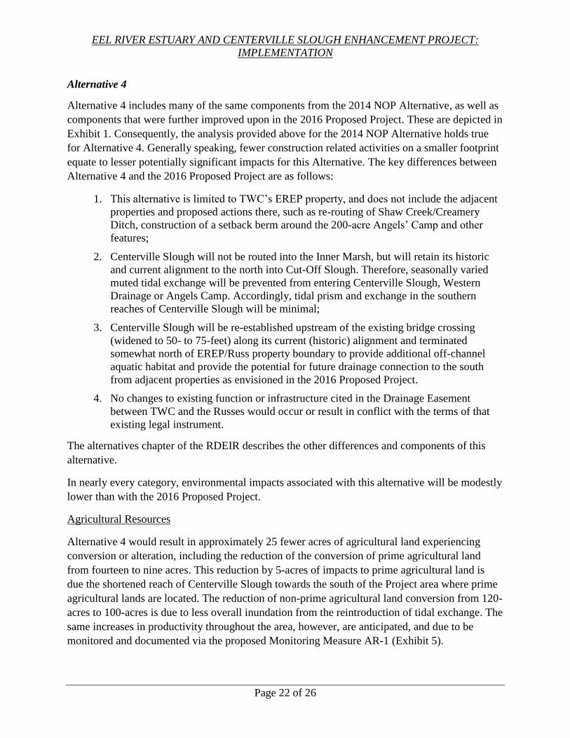
EEL RIVER ESTUARY AND CENTERVILLE SLOUGH ENHANCEMENT PROJECT:
IMPLEMENTATION
Page 22 of 26
Alternative 4
Alternative 4 includes many of the same components from the 2014 NOP Alternative, as well as
components that were further improved upon in the 2016 Proposed Project. These are depicted in
Exhibit 1. Consequently, the analysis provided above for the 2014 NOP Alternative holds true
for Alternative 4. Generally speaking, fewer construction related activities on a smaller footprint
equate to lesser potentially significant impacts for this Alternative. The key differences between
Alternative 4 and the 2016 Proposed Project are as follows:
1. This alternative is limited to TWC’s EREP property, and does not include the adjacent
properties and proposed actions there, such as re-routing of Shaw Creek/Creamery
Ditch, construction of a setback berm around the 200-acre Angels’ Camp and other
features;
2. Centerville Slough will not be routed into the Inner Marsh, but will retain its historic
and current alignment to the north into Cut-Off Slough. Therefore, seasonally varied
muted tidal exchange will be prevented from entering Centerville Slough, Western
Drainage or Angels Camp. Accordingly, tidal prism and exchange in the southern
reaches of Centerville Slough will be minimal;
3. Centerville Slough will be re-established upstream of the existing bridge crossing
(widened to 50- to 75-feet) along its current (historic) alignment and terminated
somewhat north of EREP/Russ property boundary to provide additional off-channel
aquatic habitat and provide the potential for future drainage connection to the south
from adjacent properties as envisioned in the 2016 Proposed Project.
4. No changes to existing function or infrastructure cited in the Drainage Easement
between TWC and the Russes would occur or result in conflict with the terms of that
existing legal instrument.
The alternatives chapter of the RDEIR describes the other differences and components of this
alternative.
In nearly every category, environmental impacts associated with this alternative will be modestly
lower than with the 2016 Proposed Project.
Agricultural Resources
Alternative 4 would result in approximately 25 fewer acres of agricultural land experiencing
conversion or alteration, including the reduction of the conversion of prime agricultural land
from fourteen to nine acres. This reduction by 5-acres of impacts to prime agricultural land is
due the shortened reach of Centerville Slough towards the south of the Project area where prime
agricultural lands are located. The reduction of non-prime agricultural land conversion from 120-
acres to 100-acres is due to less overall inundation from the reintroduction of tidal exchange. The
same increases in productivity throughout the area, however, are anticipated, and due to be
monitored and documented via the proposed Monitoring Measure AR-1 (Exhibit 5).

EEL RIVER ESTUARY AND CENTERVILLE SLOUGH ENHANCEMENT PROJECT:
IMPLEMENTATION
Page 23 of 26
Overall, Alternative 4 (the Project) will have fewer impacts to Agricultural Resources than the
2016 Proposed Project for three key reasons: 1) Seasonally adjusted muted tidal exchange is
limited to the Inner Marsh, so less area (approximately 20 acres) is inundated and converted to
non-agricultural uses; 2) Centerville Slough excavation terminates further north, so less pasture
(prime agricultural land in that location) is impacted by channel construction, and; 3) Most other
project features such as drainage improvements and sediment management activities are retained,
so overall productivity increases are commensurate with the 2016 Proposed Project.
Accordingly, Alternative 4 will have commensurate benefits to the 2016 Proposed Project, but
fewer impacts to Agricultural Resources than the 2016 Proposed Project.
Air Quality
Alternative 4 will have fewer impacts to Air Quality than the 2016 Proposed Project simply
because less construction will translate directly to fewer construction-related impacts to Air
Quality.
Biological Resources
Biological resource, cultural resource and greenhouse gas impacts associated with this alternative
are reduced relative to the 2016 Proposed Project as construction-related activity diminishes. All
impacts will fall into the less than significant category. This alternative will also avoid
potentially significant impacts to biological resources by avoiding the proposed construction of
an extensive levee on Russ property, and the redirection of Shaw Creek and Creamery Ditch
from their present course and into the Angels Camp area. This alternative will provide a net
benefit to terrestrial, avian and aquatic species by the introduction of a muted tidal exchange into
the EREP and the recreation of historic on- and off-channel ponds and the associated wetland
habitats within the historic back-dune Centerville Slough channel system.
Cultural Resources
Alternative 4 will have fewer potential impacts to Cultural Resources due to a smaller project
footprint, less construction activity and thus a lower potential to disturb cultural resources in the
area.
Geology and Soils
Regarding Geology, the impacts are reduced slightly under this alternative to the extent that
construction related activities are reduced. However, they remain potentially significant, but
reduced to a less than significant level with the proposed mitigation measures.
Hydrology and Water Quality
As with the 2016 Proposed Project, Hydrology and water quality impacts were determined to be
less than significant with implementation of mitigation measures. However, the improvements to
Centerville Slough and Russ Creek will be limited to EREP property only; thus, poor drainage
and unchecked wave over wash will still occur on Russ property. Therefore, although the

EEL RIVER ESTUARY AND CENTERVILLE SLOUGH ENHANCEMENT PROJECT:
IMPLEMENTATION
Page 24 of 26
hydrology and water quality impacts will be similar or slightly lesser, the resulting hydrologic
deterioration of agricultural pastures on Russ property under this scenario is expected to
continue. For these reasons, the hydrology and water quality impacts associated with this
alternative are comparable to the 2016 Proposed Project, but the immediate benefits are fewer.
Nevertheless, this alternative affords maximum flexibility for the future accommodation of
additional properties into the design, permitting and implementation phases of the Project. This
is particularly true for a southward extension of Centerville Slough onto Russ property to
improve drainage from that area, an effort that would ameliorate wave overwash events and
provide the opportunity to accommodate sea level rise through construction of a setback berm on
the western boundary of Russ property. However, until the Russes actively pursue those
additional project components, the benefits of this alternative are commensurately lesser than the
2016 Proposed Project. In other words, absent the extension of the Project onto adjacent
properties as the 2016 Proposed Project does, this alternative provides a lower level of long-term
protection and resiliency to the overall Project area. In particular, this alternative excludes
activities south of the EREP such as dune enhancements, setback berm construction around
Angels Camp and a restored Centerville Slough on the Russ property, all of which are intended
to protect the agricultural land from future wave over wash events and to provide adequate
drainage for future operations. Therefore, this Alternative will have fewer overall benefits to the
Project area but lesser or equal impacts compared to the 2016 Proposed Project, and still less
than significant impacts.
Alternative 5
Alternative 5 represents most of the same components as the 2016 Proposed Project, but its
components are limited to those on the EREP. These are depicted in Exhibit 1. The key
differences between Alternative 5 and the 2016 Proposed Project are as follows:
1. This alternative is limited to TWC’s EREP property, and does not include the adjacent
properties;
2. Centerville Slough would still be routed into the Inner Marsh, and therefore, seasonally
varied muted tidal exchange would be allowed to enter Centerville Slough. However, a
muted tidal regulator would be needed to separate Western Drainage from Centerville
Slough so that tidal exchange and tidal prism would not interfere with drainage from
properties to the south;
3. Centerville Slough would be re-established upstream of the existing bridge crossing
(widened to 50- to 75-feet) along its current (historic) alignment and terminated north
of EREP/Russ property boundary to provide additional off-channel aquatic habitat and
provide potential future drainage connection to the south from adjacent properties.
The alternatives chapter of the Final EIR describes the other differences and components of this
alternative.

EEL RIVER ESTUARY AND CENTERVILLE SLOUGH ENHANCEMENT PROJECT:
IMPLEMENTATION
Page 25 of 26
In nearly every category, environmental impacts associated with this alternative are expected to
be lower than with the 2016 Proposed Project, and nearly identical to Alternative 4, above.
However, benefits of this alternative are also lower than with the 2016 Proposed Project, much
as is the case and described more thoroughly under Alternative 4, above. Potentially significant
impacts also appear to be modestly greater than Alternative 4 due to the routing of Centerville
Slough out of its historic alignment and into the Inner Marsh directly.
With respect to Agricultural Resources, Air Quality, Biological Resources, Cultural Resources,
Geology and Hydrology resources, see the discussion previously concerning Alternative 4.
Similarly, with respect to biological resources, the biological impacts of less construction are
lower, but the inability to connect Centerville Slough to the Angels Camp area, thereby reducing
both tidal prism opportunities and diminishing habitat connectivity, reduces the overall
biological benefits of this alternative, relative to the 2016 Proposed Project. Nonetheless, the
benefits of this alternative are significant, and the impacts are less than significant.
Mitigation Monitoring and Reporting Program
Under CEQA whenever measures are required and adopted in order to mitigate or avoid the
significant effects on the environment of an approved project, the agency must also prepare and
adopt a mitigation monitoring or reporting program designed to ensure compliance with the
required mitigation during project implementation (Public Resources Code Section 21081.6).
Staff has prepared a Mitigation Monitoring and Reporting Program, attached as part of Exhibit 5.
The proposed Conservancy resolution for this project serves to adopt the program.
Significant Impacts
The Final EIR found that all potentially significant impacts of the Project will be reduced to less-
than-significant levels with mitigation measures adopted.
Cumulative Impacts
The Final EIR also evaluates the potential environmental impacts of the Project when considered
together with other projects. This analysis found no cumulative impacts; therefore, all cumulative
impacts are determined to be less than significant.
Project Benefits
The Project provides the following benefits:
Improve access to restored aquatic habitats for salmonids and other aquatic dependent
species by increasing or creating migratory access between estuarine and inland
waters and by restoring overwintering and rearing habitat for juvenile salmonids;
Improve drainage efficiency and manage sediment loads more effectively using both
passive natural processes and active management approaches, while enhancing tidal
influences by reestablishing connectivity of Russ Creek to a rehabilitated Centerville
Slough;

EEL RIVER ESTUARY AND CENTERVILLE SLOUGH ENHANCEMENT PROJECT:
IMPLEMENTATION
Page 26 of 26
Increasing resiliency to sea level rise and reducing salt water influences to pastures,
enhancing drainage and establishing avulsion management areas for Russ Creek;
Enhance tidal processes by restoring tidal prism and improve reliability of tidegate
infrastructure to provide adaptability for sea level rise and varied land management;
Enhance dune formation to increase resiliency to sea level rise;
Enhance freshwater pond habitat for waterbirds and other native aquatic dependent
species;
Facilitate access for continued passive and active agricultural land management, and
nature study opportunities, including installation of two kayak launches and dune
nature trail;
Suppress invasive species; and
Establish a long-term Adaptive Management Program to promote and sustain the
agricultural and ecological viability of the landscape for the future.
The Project offers significantly greater environmental benefit than any of the other alternatives
analyzed in the Final EIR, excepting the 2016 Proposed Project. Moreover, the components and
environmental impacts of the Project are sufficiently similar to the 2016 Proposed Project that
mitigation requirements as identified in the MMRP are identical for the Project, the 2016
Proposed Project and Alternative 5.
Overall, the environmental benefits of the Project as detailed above and in the Final EIR lead
staff to recommend that the Conservancy certify the EIR and approve the Project. As discussed
above, and in the Final EIR, the environmental impacts of the Project, however considerable,
pale in comparison to the risk of doing nothing to remediate the significant deterioration of and
risk to the Project area and its environmental components by natural and anthropogenic forces.
Upon Conservancy certification of the Final EIR and approval of the Project, Conservancy staff
will file a Notice of Determination with the County of Humboldt Clerk and with the Office of
Planning and Research.
Related Documents