To: Coastal Zone Advisory Board Date: Friday, July 23, 2021 Re: Meeting Notice The St. James Parish Coastal Zone Advisory Board will host a regular meeting on Monday, July 26, 2021 at 5:00 p.m., inside the Convent Courthouse (Council Chambers- 2nd floor). 5800 Highway 44, Convent, LA 70723, Enclosed for your review are minutes of the previous regular meeting, and a copy of the tentative agenda. If you have any questions, please feel free to contact the Planning & Permitting Office at (225)562-2500. Sincerely Marrill McKarry Marrill McKarry Planning & Permitting supervisor St. James Parish Government MM Attachments Richard Webre Director of Operations Felix Boughton Director of Finance Ingrid Bergeron-LeBlanc Director of Human Resources Eric Deroche Director of Emergency Preparedness St. James Parish Government P. O. Box 106 Convent, Louisiana 70723-0106 (225) 562-2260 FAX (225) 562-2279 TDD: (225) 562-8500 Peter A. Dufresne Parish President

Welcome message from author
This document is posted to help you gain knowledge. Please leave a comment to let me know what you think about it! Share it to your friends and learn new things together.
Transcript
To: Coastal Zone Advisory Board Date: Friday, July 23, 2021 Re: Meeting Notice The St. James Parish Coastal Zone Advisory Board will host a regular meeting on Monday, July 26, 2021 at 5:00 p.m., inside the Convent Courthouse (Council Chambers- 2 P
ndP floor). 5800 Highway 44,
Convent, LA 70723, Enclosed for your review are minutes of the previous regular meeting, and a copy of the tentative agenda. If you have any questions, please feel free to contact the Planning & Permitting Office at (225)562-2500.
Sincerely
Marrill McKarry Marrill McKarry Planning & Permitting supervisor St. James Parish Government
MM
Attachments
Richard Webre Director of Operations
Felix Boughton
Director of Finance
Ingrid Bergeron-LeBlanc
Director of Human Resources
Eric Deroche
Director of Emergency Preparedness
St. James Parish Government P. O. Box 106
Convent, Louisiana 70723-0106 (225) 562-2260
FAX (225) 562-2279 TDD: (225) 562-8500
Peter A. Dufresne Parish President

ST. JAMES PARISH COASTAL ZONE MANAGEMENT REGULAR MEETING AGENDA
MONDAY, JULY 26, 2021 - 5:00 p.m.
I. CALL TO ORDER II. ROLL CALL
III. MINUTES OF PREVIOUS MEETINGS
1. June 1, 2021 Special Meeting Minutes 2. June 28, 2021 Meeting Minutes
IV. CORRESPONDENSE
1. None V. PRESENTATION AND PUBLIC COMMENTS 1. Presentation - Earth Justice- Letter regarding South Louisiana Methanol. (Corinne Van Dalen)
2. Public Comments - (on agenda items) VI. OLD BUSINESS
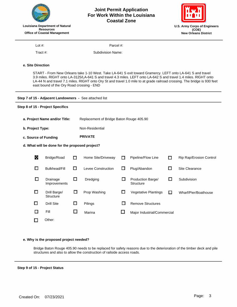
1. Illinois Central Railroad Company P20210007- Requesting to replace the existing four-span 53-foot long ballasted deck timber trestle bridge with three concrete box culverts and compacted fill. The culverts will consist of a 88-foot long, 9-foot by 9-foot box culvert flanked on each side by a 88-foot long, 6-foot by 7-foot box culvert
VII. NEW BUSINESS
1. Mosaic Fertilizer LLC P20210650- Requesting to cut and remove a portion of the existing revetment concrete, backfilling, and replacing it with new concrete.
VIII. STATE CONCERNS
All state applications can be viewed through OCM PermitTRAK Database link below:
http://sonlite.dnr.state.la.us/sundown/cart_prod/cart_cmd_menu
Applicant Project Coastal Use Permit #
Enlink Midstream Project: Transco St. James Bridge Repair/Replacement
Application Modification: Determination changed to exempt, normal maintenance and repair
P20210381
Belle Company, LLC Project: Project: Bayou Napoleon Mitigation Bank
Application Modification: Figures A-1, 3, 29, 30, 37, 38, 39 & 40 of plats have been revised.
P20210032
St. James Parish Council
Project: Magnolia Heights Drainage Improvements
Application Modification: N/A
P20210566
Shell Oil Products US-Convent Refinery
Project: Facility Maintenance Dredging
Uploading revised plats to include additional note on Sheet 1
P20210542
Lone Star NGL Refinery Services,
LLC
Project: Catwalk Replacement Project
Application Modification: Application redistributed for CPRA notification. No changes to project. AZ 05/19/2021
P20210373
Enterprise Products Operating LLC
Project: Railroad Pipeline Casing Extension
Application Modification: Agent updated step 4 of application.
P20210665
IX. ADJOURNMENT

PROCEEDING OF THE COASTAL ZONE MANAGEMENT ADVISORY COMMISSION, PARISH OF ST. JAMES, STATE OF LOUSIANA, TAKEN AT A SPECIAL MEETING AT ST. JAMES PARISH EASTBANK COURTHOUSE ON TUESDAY, JUNE 1, 2021.
The Coastal Zone Management Advisory Commission (CZMAC) of the Parish of St. James, State of Louisiana, met in a regular session on Tuesday, June 1, 2021 at 5:03 p.m.
PRESENT: Craig Calcagno, Carl Vicknair, Brandon Gravois, Yvette Melancon, Wayne Becnel, and Elton Chenier
ABSEENT: Ed Arceneaux Jr., and Levar Joseph ALSO, IN ATTENDANCE: Marrill McKarry, Rick Webre, Erica McCallister, Vic Frankiewicz
MINUTES: Motioned by Carl Vicknair and seconded by Yvette Melancon to approve the regular meeting of April 26, 2021 minutes of the last meeting as presented. All in favor. Motion carried.
CORRESPONDENCE:
1. None
PRESENTATION AND PUBLIC COMMENTS: 1. Presentation- None 2. Public Comments (on Agenda items) None
OLD BUSINESS: Carl Vicknair made a motion to deviate the agenda to move P2020109 Union Pacific Railroad on the agenda before state concerns due to applicant calling advising she was stuck in traffic and will be a few minutes late. Motion was second by Elton Chenier. Roll Call: Craig Calcagno, Jr.- absent, Car Vicknair- yes, Brandon Gravois- yes, Ed Arceneaux, Jr. – absent, Yvette Melancon- yes, Wayne Becnel- yes, Elton Chenier- yes, Levar Joseph- absent Motion Carried.
1. P20210333 Mosaic- Elton chenier motion to table and was second by Brandon Gravois for lack of representative for the proposal of the Replacement of Mosaic ship dock electrical infrastructure.
NEW BUSINESS:
1. P20210324 Zen Noh Grain Corp- Represented by Melvin Leblanc. The proposed project is for the piping connection of a lift station at Zen Noh's Convent, LA facility. The lift station and piping have already been installed but were never connected. The lift station is approximately 500' on the land side of the centerline of the Mississippi River levee. Carl Vicknair motion to exempt for the ground elevation well above the 5’ contour and was second by Elton Chenier. Roll Call: Craig Calcagno, Jr.- absent, Car Vicknair- yes, Brandon Gravois- yes, Ed Arceneaux, Jr. – absent, Yvette Melancon- yes, Wayne Becnel- yes, Elton Chenier- yes, Levar Joseph- absent Motion Carried.
STATE CONCERNS:
All state applications can be viewed through OCM PermitTRAK Database link below:
http://sonlite.dnr.state.la.us/sundown/cart_prod/cart_cmd_menu
Applicant Project Coastal Use Permit #
Boardwalk Louisiana Midstream, LLC
Project: Proposed 2-16" Formosa Pipelines
Application Modification: Request for extension
P20180487
No Comment was made.
Enlink Midstream Project: Transco St. James Bridge Repair/Replacement
Application Modification: Determination changed to exempt, normal maintenance, and repair
P20210381
No Comment was made. The Kansas City Southern Railway Company (KCS)
Project: KCS New Orleans Subdivision Bridges Reconstruction Project (Br. L-824.80, Br. L-826.10, Br. L-826.30, Br. L-826.90, Br. L-848.60, Br. L-849.30, Br.
L-849.90, Br. L-850.20, Br. L-850.80, Br. L-851.10, Br. L-851.60, Br. L-852.10, Br. L-852.60, & Br. L-852.9.
Application Modification: N/A
P20210066
No Comment was made.
Lone Star NGL Refinery Services, LLC
Project: Catwalk Replacement Project
Application Modification: Application redistributed for CPRA notification. No changes to project. AZ 05/19/2021
P20210373
No Comment was made. South Louisiana Methanol LP Project: Methanol and Terminal Storage
Application Modification: Updated plats showing dock redesign to comply with St.
James zoning ordinance.
P20191180
Parish Counsel Mr. Victor Franckiewicz gave background information on this item. Yvette Melancon moved to defer because more information was needed to determine whether the project would extend beyond the expansion area approved in 2014 under the land use ordinance. The motion was seconded by Carl Vicknair and carried unanimously.
ADJOURNMENT: Motioned by Brandon Gravois and seconded by Craig Calcagno to adjourn. All in favor. Motion carried. Meeting adjourned at 6:00 p.m.
s/ LeVar Joseph, Chairman

PROCEEDING OF THE COASTAL ZONE MANAGEMENT ADVISORY COMMISSION, PARISH OF ST. JAMES, STATE OF LOUSIANA, TAKEN AT AREGULAR MEETING AT ST. JAMES PARISH EASTBANK COURTHOUSE ON MONDAY, JUNE 28, 2021. The Coastal Zone Management Advisory Commission (CZMAC) of the Parish of St. James, State of Louisiana, was scheduled to meet at the regular meeting on Monday, June 28, 2021, but a quorum was not present.
s/ .LeVar Joseph, Chairman


9 0 0 C A M P S T R E E T , S U I T E 3 0 3 N E W O R L E A N S , L A 7 0 1 3 0
T : 4 1 5 . 2 1 7 . 2 0 0 0 F : 4 1 5 . 2 1 7 . 2 0 4 0 W W W . E A R T H J U S T I C E . O R G
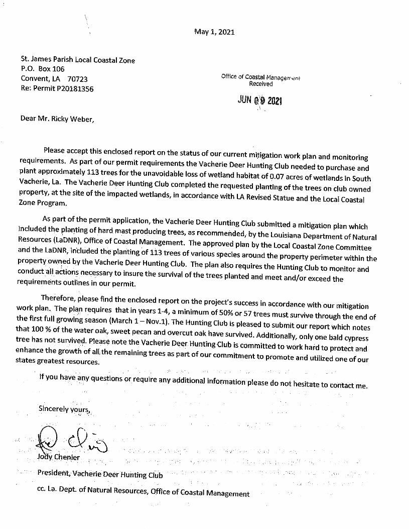
July 23, 2020
Via Email: [email protected] St. James Parish Coastal Zone Advisory Board c/o Mr. Marrill McKarry St. James Parish Planning & Permitting Office P.O. Box 106 Convent, Louisiana 70723-0106 Re: South Louisiana Methanol CUP Application, P20191180, for construction of a
Methanol Terminal and Storage Facilities in St. James, Louisiana Dear Coastal Zone Advisory Board:
I am writing on behalf of Healthy Gulf, RISE St. James, and Louisiana Bucket Brigade regarding South Louisiana Methanol’s (“SLM’s”) pending Coastal Use Permit (“CUP”) application P20191180. I am providing information sought at the last Coastal Zone Advisory Board meeting for the Board to determine whether SLM’s proposed project to construct a methanol terminal and storage facility at its planned methanol complex would extend beyond the “expansion area” under the Planning Commission’s 2014 land use approval.1, 2
I am also requesting to make a presentation on this subject at upcoming Coastal Zone Advisory Board meeting schedule for Monday, July 26, 2021.
1 Proceeding of the Coastal Zone Management Advisory Commission, June 1, 2021, pdf. p. 4, https://www.stjamesla.com/AgendaCenter/ViewFile/Agenda/_06282021-296. The minutes from that meeting provide: “Parish Council Mr. Victor Franckiewicz gave background on [SLM’s modified CUP application for its proposed Methanol and Terminal Storage]. Yvette Melancon moved to defer because more information was needed to determine whether the project would extend beyond the expansion area approved in 2014 under the land use ordinance. The motion was seconded by Carl Vicknair and carried unanimously.” Id. 2 St. James Parish Planning Commission, Minutes from Special Meeting, April 23, 2014 (approving SLM’s land use application), available on the CUP Database as Attachment C to Letter from B. Jones to J. Pecot, re. Response to Public Comments on Joint Application Permit, dated July 20, 2020, https://sonlite.dnr.state.la.us/sundown/cart_prod/cart_crm_view_cmnt?pcup_num=P20191180&pauthorization=N&psort=2%20(click%20on%20CommentResponseAttachmentsC-H.pdf (click on CommentResponseAttachmentsC-H.pdf, dated 7/22/2020 @ 14:36:21).
Healthy Gulf, RISE St. James, and La. Bucket Brigade Letter to St. James Parish Coastal Advisory Board July 23, 2021 Page 2 of 13
Introduction SLM recently redesigned a portion of its proposed project in an attempt to comply with
the St. James land use ordinance.3 However, as detailed below, the proposed project still does not comply with the parish land use ordinance. As shown in the maps below, several project features would extend beyond the “expansion area” on land that is designated as “Residential Growth” in violation of the ordinance.
The land use ordinance restricts uses for “Residential Growth” areas to “[d]wellings and
uses customarily associated with dwellings (such as garages, carports, patios, outbuildings used by residences of the dwellings.”).4 Industrial uses are not allowable uses for this land use category. The land use ordinance further provides that “[u]ses not specifically listed as allowable in a use category in subsection (c) of this section are prohibited unless the planning commission considers the use in accordance with subsections (g), (h), and (i), and the parish council approves the use.”5 The Planning Commission has not considered SLM’s proposal to extend its facility beyond the “expansion area,” and therefore any such construction would violation the land use ordinance.
Indeed, not only would the proposed project violate the land use ordinance unless SLM is
somehow able to obtain Planning Commission and Council approval, it poses health and safety threats to the immediately adjacent public park and nearby residences. That is, SLM seeks to construct its methanol terminal directly next to Welcome Park, which is a large public complex that includes a walking path, playground equipment, ball field, all-purpose building that is under construction, senior program center, and community meeting hall for District 5. Several hundred residents from predominantly Black District 5 voiced opposition to SLM’s plans from the start, asserting concerns about the “possibility of a leak, fire or explosion” and “toxic emissions” that could endanger nearby residences and people who use the public park.6 Petra Pless, D.Env., an environmental engineer and safety specialist, reviewed the proposed project and confirmed what the residents’ concerns. She found that a methanol terminal and storage facility is simply not compatible with the adjacent recreational and residential uses, and that siting an export terminal
3 Id. (referencing SLM’s CUP application modification providing updated plats showing dock redesign). 4 SJP Land Use Plan, 82-25(c), available on the St. James Parish website and Municode at https://library.municode.com/la/st._james_parish_council/codes/code_of_ordinances?nodeId=PTIICOOR_CH82PL_ARTIIPAPLCO_S82-25LAUSPL 5 Id. at (e). 6 See Petition of District 5 residents to LDEQ, Dec. 16, 2013, https://edms.deq.louisiana.gov/app/doc/view?doc=9126521&ob=yes&child=yes (providing hundreds of signatures protesting the location of SLM’s proposed methanol facility).

Healthy Gulf, RISE St. James, and La. Bucket Brigade Letter to St. James Parish Coastal Advisory Board July 23, 2021 Page 3 of 13
in this area would create safety and health hazards.7 She explains that “[m]ethanol is [] a highly flammable and explosive substance and is susceptible to ignition and fire from seasonal lightning strikes, and notes the volatile substance has been “involved in catastrophic and lethal industrial and transportation incidents in the past.”8 Dr. Pless further explains that “[a] tanker truck accident on the main facility road could easily result in ambient concentrations of methanol high enough to cause serious injuries or death,” and she also provides a long list of examples of catastrophic events involving methanol – including a major explosion at a docked methanol-filled tanker ship.9
Furthermore, SLM’s request to now build a terminal and storage facility, which it had
planned to do from the start but failed to obtain the necessary approval at that time, is an improper segmentation of its project. Moreover, it is unlikely that SLM has any approval under the 2014 Planning Commission decision as its non-comforming use status probably expired due to non-use.
For these reasons, which are detailed below, the Coastal Zone Advisory Board should
urge the LDNR Office of Coastal Management to deny SLM’s CUP application P20191180.
Detailed Comments
I. SLM’s proposed project extends beyond the “expansion area” in the Planning Commission’s April 23, 2014 land use approval.
The Planning Commission’s 2014 land use approval specifically limits any construction or future expansions to the area identified as “Potential to Expand” in “Figure Number 3” of SLM’s application package.10 Below is an image of Figure 3 from SLM’s Land Use application package. It shows that the “Potential to Expand” area is limited to the area inside the then-
7 See Affidavit of Dr. Petra Pless, Nov. 23, 2020, Attach. B, pp. 30-47, 59-63 (Comments on Air Permits for SLM’s Proposed Methanol Terminal and Storage Facility), uploaded to the Coastal Use Permit Database on Jan. 11, 2021 and available at this link: https://sonlite.dnr.state.la.us/sundown/cart_prod/cart_crm_view_cmnt?pcup_num=P20191180&pauthorization=N&psort=2. 8 Id. at 39. 9 Id. 45-60. 10 St. James Parish Planning Commission, Minutes from Special Meeting, April 23, 2014 (approving SLM’s land use application), available on the CUP Database as Attachment C to Letter from B. Jones to J. Pecot, re. Response to Public Comments on Joint Application Permit, dated July 20, 2020, https://sonlite.dnr.state.la.us/sundown/cart_prod/cart_crm_view_cmnt?pcup_num=P20191180&pauthorization=N&psort=2%20(click%20on%20CommentResponseAttachmentsC-H.pdf (click on CommentResponseAttachmentsC-H.pdf, dated 7/22/2020 @ 14:36:21).

Healthy Gulf, RISE St. James, and La. Bucket Brigade Letter to St. James Parish Coastal Advisory Board July 23, 2021 Page 4 of 13
existing site footprint as shown by the dashed line that runs alongside the orange site boundary.11
Figure 3 from SLM's Parish Application Package
The Expanded Site Map below shows the same site footprint and expansion boundary as
Figure 3, but with clearly delineated lines in accordance with the relevant parish property records.
11 Full document available on CUP Database as Attachment D to Letter from B. Jones to J. Pecot, re. Response to Public Comments on Joint Application Permit, dated July 20, 2020, p. 3, http://sonlite.dnr.state.la.us/sundown/cart_prod/cart_crm_view_cmnt?pcup_num=P20191180&pauthorization=N&psort=2 (click on CommentResponseAttachmentsC-H.pdf, dated 7/22/2020 @ 14:36:21).

Healthy Gulf, RISE St. James, and La. Bucket Brigade Letter to St. James Parish Coastal Advisory Board July 23, 2021 Page 5 of 13
Expanded Site Map (created by Justin Kray)
The green shaded area in SLM’s Expanded Site Map shows land that is now part of the SLM site that is outside of the expansion area, which SLM acquired after it received land use approval. Any attempt to expand the methanol facility into this area, which is designated as “Residential Growth,” is not authorized and would violate the parish land use ordinance.
The Marine Terminal Map below is an image of SLM’s recently reconfigured marine terminal/dock from its CUP application drawings with an overlay of the expansion boundary.12 The Marine Terminal Map shows that the proposed project is outside the approved expansion area. Apparently, SLM moved part of its terminal out into the Mississippi River to avoid parish jurisdiction, but much of the terminal infrastructure still exists on land that is outside the expansion area as shown below.
12 SLM CUP Application (P20191180), 5/14/2021, Sheet No. 4 (click on JPAPermitsSet2020511r.pdf, pdf. 7), https://sonlite.dnr.state.la.us/sundown/cart_prod/cart_crm_application?pcup_num=P20191180&pline_id=6&pshow_appl_email=N

Healthy Gulf, RISE St. James, and La. Bucket Brigade Letter to St. James Parish Coastal Advisory Board July 23, 2021 Page 6 of 13
Marine Terminal Map (overlay by Justin Kray)
In its CUP application, SLM claims that because “Figure 3 specifically provides for a potential dock located along the stretch of batture,” its proposed terminal “is consistent with the 2014 Land Use Approval.13 But what SLM fails to disclose is that the potential dock area in Figure 3 is more than 1/2 mile upriver away from Welcome Park and is within the area approved for expansion (i.e., within the Potential to Expand area in Figure 3), whereas the location for the proposed marine terminal at issue in the pending CUP application is clearly outside the area approved for expansion and is adjacent to Welcome Park.
Moreover, this is a classic example of improper project segmentation, or piecemealing.
According to recent correspondence with the parish, SLM admits that “it always intended to provide Loading [i.e., a methanol terminal] and Storage on site,” and further claims that it 13 Letter from B. Jones to J. Pecot, re. Response to Public Comments on Joint Application Permit, dated July 20, 2020, p. 3, CUP Database Doc. 13465125, http://sonlite.dnr.state.la.us/sundown/cart_prod/cart_crm_view_cmnt?pcup_num=P20191180&pauthorization=N&psort=2 (click on SLMResponsetoCUPCommentsP20191180.pdf, dated 7/22/2020 @ 14:35:28).

Healthy Gulf, RISE St. James, and La. Bucket Brigade Letter to St. James Parish Coastal Advisory Board July 23, 2021 Page 7 of 13
“advised the Planning Commission [of this plan] when it sought its land use approval in 2014.”14 But what SLM actually discussed with the parish in 2014 was the vague idea of a “potential” dock far upriver away from Welcome Park. Today, SLM claims that the area it identified for its “potential” dock is not a possible site due to various factors such as interference with river navigation.15 This is certainly something SLM could have figured out in 2014 but it failed to do so, or if it did, it did not reveal the problem to the parish. Today, SLM asserts that the plant that the parish authorized in 2014 is not even viable without the terminal and storage.16 This is akin to applying for a permit to build an airport terminal and then years later asking for another permit to build a runway to serve the terminal next to a park – knowing full well that the full project would not have been approved had it been revealed that the necessary runway would be next to a park. Here, it is highly doubtful that the parish would have ever approved SLM’s land use application had the company revealed the full plan to build a methanol terminal next to a public park. Given that the terminal is a necessary component required for a viable project, SLM was required to obtain parish authorization for that portion of the project instead of applying for a terminal-less methanol plant in 2014 where SLM had no way to get the methanol product to market. SLM cannot now try to piggyback the terminal onto the failed project by trying to locate the terminal right next to Welcome Park. Likewise, SLM improperly segmented its CUP permit application. The Coastal Zone Advisory Board should urge LDNR Office of Coastal Management to deny SLM’s pending application and require the company to apply anew for the full project that includes the processing plant plus the necessary terminal and storage.
Beyond the marine terminal, other features of the proposed project also exceed the land
use-approved expansion area. For instance, the Drainage Map below shows that the rock dams extend beyond the expansion area into land designated for “Residential Growth,” and pipeline infrastructure/road traverses land that is also not included in SLM’s 2014 approved area.
14 Email from Paul More of Todd Corporation, which owns SLM, to St. James Parish President Pete Dufresne, Dec. 17, 2020. 15 See SLM’s Alternatives Analysis for its Joint Army Corps 404 permit application for the proposed terminal, stating that “pilots from the Maritime Navigation Safety Association (MNSA) expressed opposition to this location,” described as “the St. Alice Revetment” that appears to be the “proposed” dock location shown in the 2014 land use application. 16 Letter from SLM to LDEQ, April 22, 2020, https://edms.deq.louisiana.gov/app/doc/view?doc=12144013&ob=yes&child=yes (asserting that “SLM will be unable to secure any new partner interest in its project” unless it receives a permit to build the terminal and storage components).

Healthy Gulf, RISE St. James, and La. Bucket Brigade Letter to St. James Parish Coastal Advisory Board July 23, 2021 Page 8 of 13
Drainage Map (overlay by Justin Kray)
Furthermore, the pipeline slated to delivery methanol to the marine terminal, along with the road for methanol-filled tanker trucks, would run directly next to Welcome Park and straight through the meager 50-foot tree buffer mandated in the 2014 authorization.17
17 St. James Parish Planning Commission, Minutes from Special Meeting, April 23, 2014, available on the CUP Database as Attachment C to Letter from B. Jones to J. Pecot, re. Response to Public Comments on Joint Application Permit, dated July 20, 2020, https://sonlite.dnr.state.la.us/sundown/cart_prod/cart_crm_view_cmnt?pcup_num=P20191180&pauthorization=N&psort=2%20(click%20on%20CommentResponseAttachmentsC-H.pdf (click on CommentResponseAttachmentsC-H.pdf, dated 7/22/2020 @ 14:36:21) (“[A] 50 foot tree buffer shall be planted and maintained around the site where the facility adjoins any residential property or public park.”). It is impossible to have both a 50-foot tree buffer and a major road in the same space.

Healthy Gulf, RISE St. James, and La. Bucket Brigade Letter to St. James Parish Coastal Advisory Board July 23, 2021 Page 9 of 13
Excerpted from SLM Air Application EAS
Another example is the portion of the proposed project shown in the Utility Map below, which extends beyond the expansion boundary.

Healthy Gulf, RISE St. James, and La. Bucket Brigade Letter to St. James Parish Coastal Advisory Board July 23, 2021 Page 10 of 13
Utility Map (overlay by Justin Kray)
In sum, the proposed project exceeds the area approved by the Planning Commission and SLM must apply for new approval.
II. SLM has likely lost any authorization under the Parish’s April 23, 2014 land use approval due to the failure to construct and operate.
It also appears that SLM no longer has parish approval to construct any part of the
proposed project that is within the “Potential to Expand” area in Figure 3. To explain, the Parish amended its land use ordinance in 2018, converting the land use designation for the area around and including SLM’s site from “Residential/Future Industrial” to “Residential Growth.”18 The
18 St. James Parish Code of Ordinances, Sec. 82-25 (a) (incorporated land use map amended by Ord. No. 18-02), https://library.municode.com/la/st._james_parish_council/codes/code_of_ordinances?nodeId=PTIICOOR_CH82PL (see link to Ord. No. 18-02 at end of Sec. 82-25, formerly codified at Sec. 86-37).
Healthy Gulf, RISE St. James, and La. Bucket Brigade Letter to St. James Parish Coastal Advisory Board July 23, 2021 Page 11 of 13
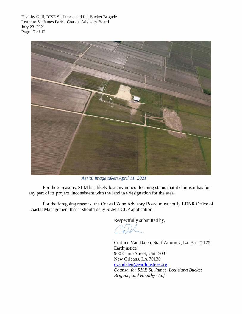
amendment was introduced to make the area “safer for families.”19 And while the “Residential/Future Industrial” land use category allows for industrial uses subject to certain conditions, the “Residential Growth” category does not allow for industrial uses.20, 21 This means that the methanol plant and related facilities that the Planning Commission authorized on April 23, 2014 are now “nonconformities” since they “would not constitute an allowable use” under the land use ordinance as amended.22 “Nonconformities” lose their nonconforming status if they “discontinue[] operations for more than six continuous months.”23 Here, SLM has not constructed, much less operated, its methanol plant since acquiring nonconforming use status over three years ago when the parish changed the land use designation to “Residential Growth” on May 2, 2018.24 Indeed, SLM has been struggling for over eight years to get its project off the ground. It has postponed its operation date, originally promising the parish it would be operational by 2016 and have 63 permanent employees. Meanwhile, to date, SLM has only managed to build an office building and grade some areas of the site (see recent aerial image below). Furthermore, the company is still seeking a “project partners and a new debt financing package.”25
19 SJP Planning Commission, Regular Session, Mar. 28, 2018, Minutes, https://www.stjamesla.com/AgendaCenter/ViewFile/Minutes/_03282018-141 (Councilmember Cooper’s remarks). 20 Id. at (c). 21 The land use ordinance provides that “[u]ses not specifically listed as allowable in a use category . . . are prohibited” unless approved by both the Planning Commission and Council on a case-by-case basis after public notice and hearing and pursuant to heightened criteria that recognizes a one to two-mile “impact area” for “parks, playgrounds, churches, schools, community or senior citizen centers, nursing homes, hospitals, other places of public assembly, and historic sites.” Id. at (e) & (g). 22 Id. at (k)(1). 23 Id. at (k)(4). 24 SLM claims that it began to construct at the site sometime prior to December 2018 that included site clearing and grubbing, preliminary work on an office building, and surveying activities. See SLM letter to LDEQ, Feb. 12, 2019, EDMS Doc. ID 11521502, https://edms.deq.louisiana.gov/app/doc/view.aspx?doc=11521502&ob=yes&child=yes. On April 22, 2020, SLM told LDEQ that it has “suspend[ed] further site construction for an indefinite period,” citing COVID-19, decrease in global market demand for methanol, and need for “new project partners and a new debt financing package.” SLM Letter to LDEQ, April 22, 2020, EDMS Doc. ID 12144013, https://edms.deq.louisiana.gov/app/doc/view.aspx?doc=12144013&ob=yes&child=yes. SLM has not announced that it has resumed construction. 25 K. Mosbrucker, Methanol plant in St. James construction on hold indefinitely, The Advocate, May 6, 2020, https://www.theadvocate.com/baton_rouge/news/coronavirus/article_317e2190-8fb9-11ea-ab25-9345b418f366.html.
Healthy Gulf, RISE St. James, and La. Bucket Brigade Letter to St. James Parish Coastal Advisory Board July 23, 2021 Page 12 of 13
Aerial image taken April 11, 2021
For these reasons, SLM has likely lost any nonconforming status that it claims it has for any part of its project, inconsistent with the land use designation for the area.
For the foregoing reasons, the Coastal Zone Advisory Board must notify LDNR Office of
Coastal Management that it should deny SLM’s CUP application. Respectfully submitted by,
________________________________________ Corinne Van Dalen, Staff Attorney, La. Bar 21175 Earthjustice 900 Camp Street, Unit 303 New Orleans, LA 70130 [email protected] Counsel for RISE St. James, Louisiana Bucket Brigade, and Healthy Gulf
Healthy Gulf, RISE St. James, and La. Bucket Brigade Letter to St. James Parish Coastal Advisory Board July 23, 2021 Page 13 of 13
Cc: St. James Parish Planning Commission Linda Hubbell, linda.hubbell@stjamesparish,gov Vic Franckiewicz, [email protected]
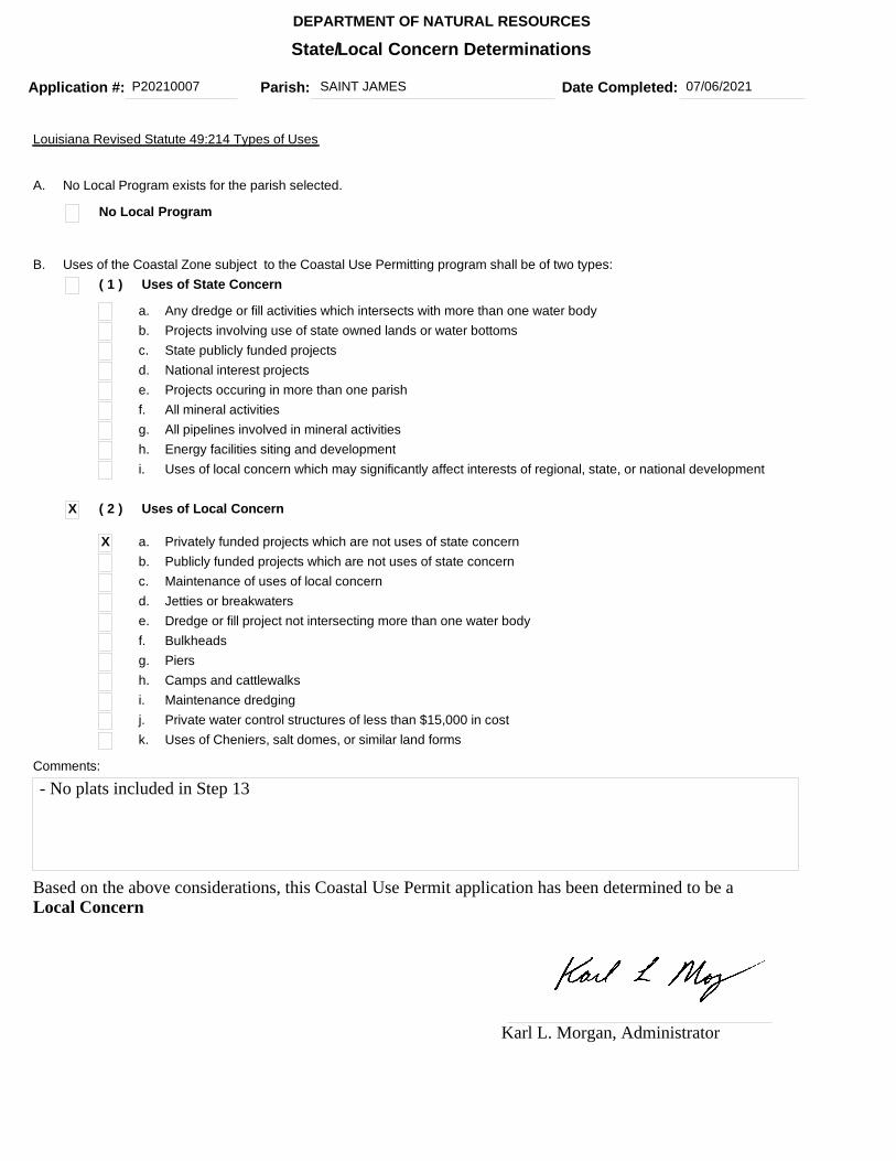
Application #: P20210007 Date Completed: 07/06/2021
State/Local Concern Determinations
1 ofPage
DEPARTMENT OF NATURAL RESOURCES
Parish: SAINT JAMES
1
( 1 ) Uses of State Concern
Any dredge or fill activities which intersects with more than one water bodyProjects involving use of state owned lands or water bottomsState publicly funded projects
Projects occuring in more than one parishAll mineral activitiesAll pipelines involved in mineral activitiesEnergy facilities siting and developmentUses of local concern which may significantly affect interests of regional, state, or national development
Louisiana Revised Statute 49:214 Types of Uses
Comments:
No Local Program
National interest projects
A. No Local Program exists for the parish selected.
B. Uses of the Coastal Zone subject to the Coastal Use Permitting program shall be of two types:
a.b.c.d.e.f.g.h.i.
X
X
( 2 ) Uses of Local Concern
Privately funded projects which are not uses of state concernPublicly funded projects which are not uses of state concernMaintenance of uses of local concern
Dredge or fill project not intersecting more than one water bodyBulkheadsPiersCamps and cattlewalksMaintenance dredging
Jetties or breakwaters
a.b.c.d.e.f.g.h.i.
Private water control structures of less than $15,000 in costUses of Cheniers, salt domes, or similar land forms
j.k.
- No plats included in Step 13
Based on the above considerations, this Coastal Use Permit application has been determined to be a Local Concern
Karl L. Morgan, Administrator
Joint Permit ApplicationFor Work Within the Louisiana
Coastal ZoneLouisiana Department of Natural
ResourcesOffice of Coastal Management
U.S. Army Corps of Engineers(COE)
New Orleans District
Created On: 07/23/2021 Page: 1
28011
Illinois Central Railroad Company COMMERCIAL/NOT INDUSTRY
17641 S. Ashland Avenue
Brophy-Heineke & Associates, Inc.
2978 Shelby Street
Application Number: Permit Number: Date Received: 07/06/2021
Step 1 of 15 - Applicant Information
Applicant Name:
ApplicantType:
Mailing Addr :
Homewood, IL 60430
Contact Info:
Yen-Chih Tsai
Phone: (708) 332-3286 Fax: (708) 332-3052 Email:
Step 2 of 15 - Agent Information
Agent Name:
Mailing Addr:
Bartlett, TN 38134
Contact Info:
Margaret Lee
Phone: (901) 373-3289 Fax: (000) 000-0000 Email:
Step 3 of 15 - Permit Type
Coastal Use Permit (CUP) Solicitation of Views (SOV) Request for Determination (RFD)
Step 4 of 15 - Pre-Application Activity
a. Have you participated in a Pre-Application or Geological Review Meeting for the proposed project?
No Yes Date meeting was held:
Attendees:
(Individual or Company Rep) (OCM Representative ) (COE Representative)
b. Have you obtained an official wetland determination from the COE for the project site?
No Yes
c. Is this application a mitigation plan for another CUP?
No Yes OCM Permit Number:
P20210007
If Yes, Please upload a copy with your application.
JD Number:

Joint Permit ApplicationFor Work Within the Louisiana
Coastal ZoneLouisiana Department of Natural
ResourcesOffice of Coastal Management
U.S. Army Corps of Engineers(COE)
New Orleans District
Created On: 07/23/2021 Page: 2
This project proposes to replace the existing four-span 53-foot long ballasted deck timber trestle bridge with threeconcrete box culverts and compacted fill. The culverts will consist of a 88-foot long, 9-foot by 9-foot box culvert flanked on each side by a 88-foot long, 6-foot by 7-foot box culvert.
Marrill McKarry (St James Parish)
Pending
Dirreen S. ArnoldMVN-2021-00039-CA
Pending
Convent 70723
30 1 13.73 -90 48 37.12
14 12S 40E
Step 5 of 15 - Project Information
a. Describe the project.
b. Is this application a change to an existing permit?
No Yes OCM Permit Number:
c. Have you previously applied for a permit or emergency authoriation for all or any part of the proposed project?
No Yes
Contact Permit Number Decision Status Decision Date
OCM
COE
Other
Step 6 of 15 - Project Location
a. Physical Location
Street:
City: Parish: Saint James Zip:
b. Latitude and Longitude
Latitude: Longitude:
c. Section, Township, and Range
Section #: Township #: Range #:
Section #: Township #: Range #:
d. Lot, Tract, Parcel, or Subdivision Name
P20210007
Agency
Bayou des AcadiensWater Body:
Joint Permit ApplicationFor Work Within the Louisiana
Coastal ZoneLouisiana Department of Natural
ResourcesOffice of Coastal Management
U.S. Army Corps of Engineers(COE)
New Orleans District
Created On: 07/23/2021 Page: 3
START - From New Orleans take 1-10 West. Take LA-641 S exit toward Gramercy. LEFT onto LA-641 S and travel 3.9 miles. RlGHT onto LA-3125/LA-641 S and travel 4.3 miles. LEFT onto LA-642 S and travel 1.4 miles. RlGHT onto LA-44 N and travel 7.1 miles. RlGHT onto Ory St and travel 1.0 mile to at grade railroad crossing. The bridge is 930 feet east bound of the Ory Road crossing - END
Replacement of Bridge Baton Rouge 405.90
Non-Residential
Bridge Baton Rouge 405.90 needs to be replaced for safety reasons due to the deterioration of the timber deck and pile structures and also to allow the construction of railside access roads.
Lot #: Parcel #:
Tract #: Subdivision Name:
e. Site Direction
Step 7 of 15 - Adjacent Landowners - See attached list
Step 8 of 15 - Project Specifics
a. Project Name and/or Title:
b. Project Type:
d. What will be done for the proposed project?
e. Why is the proposed project needed?
Step 9 of 15 - Project Status
Bridge/Road Home Site/Driveway Pipeline/Flow Line Rip Rap/Erosion Control
Bulkhead/Fill Levee Construction Plug/Abandon Site Clearance
Drainage Improvements
Dredging Production Barge/ Structure
Subdivision
Drill Barge/ Structure
Prop Washing Vegetative Plantings
Drill Site Pilings Remove Structures
Wharf/Pier/Boathouse
Other:
c. Source of Funding: PRIVATE
Fill Marina Major Industrial/Commercial

Joint Permit ApplicationFor Work Within the Louisiana
Coastal ZoneLouisiana Department of Natural
ResourcesOffice of Coastal Management
U.S. Army Corps of Engineers(COE)
New Orleans District
Created On: 07/23/2021 Page: 4
08/01/2021 08/01/2022
1,500 0.247
1,258 0.247
200
1058
a. Proposed start date: Proposed completion date:
b. Is any of the project work in progress?
No Yes
Step 10 of 15 - Structures, Materials, and Methods for the Proposed Project
Acres
a. Excavations
b. Fill Areas
Cubic Yards Acres
c. Fill Materials
Concrete: Cubic Yards Rock: Cubic Yards
Crushed Stone or Gravel:
Cubic Yards Sand: Cubic Yards
Excavated andPlaced onsite :
Hauled in Topsoil/Dirt:
Cubic YardsCubic Yards
Other: Cubic Yards
d. What equipment will be used for the proposed project?
Cubic Yards
c. Is any of the project work completed?
No Yes
Excavated andhauled offsite:
1500 Cubic Yards

Joint Permit ApplicationFor Work Within the Louisiana
Coastal ZoneLouisiana Department of Natural
ResourcesOffice of Coastal Management
U.S. Army Corps of Engineers(COE)
New Orleans District
Created On: 07/23/2021 Page: 5
locomotive (on-track) crane
Due to the nature of the project, alternative locations are not available. Construction will be accomplished using standard methodology and best management practices. Access to the site will be along the existing track via rail-mounted equipment and/or from Ory Street along the proposed access road. No wetlands or other waters will be impacted to access the site.
This project, which involves the replacement of an existing bridge, will not impact wetlands and will have minimal impacts on waterbottoms. Impacts from this project consist of the placement of culverts and riprap into the waterbottom of Bayou des Acadiens and adjacent railside drainage channels. This project will impact 0.247 acres within the banks of these waterways, of which approximately 0.08 acre is below the plane of ordinary high water. Best management practices will be utilized to minimize impacts. As much as practicable, work will be done in the dry. All necessary erosion and sediment controls will be installed to protect water quality during construction.
Airboat Bulldozer/Grader Marsh Buggy
Backhoe Dragline/Excavator Other Tracked or Wheeled Vehicles
Barge Mounted Bucket Dredge
Handjet Self Propelled Pipe Laying Barge
Barge MountedDrilling Rig
Land Based Drilling Rig Tugboat
Other:
Step 11 of 15 - Project Alternatives
b. What alternative locations, methods, and access routes were considered to avoid impact to wetlands and/or waterbottoms?
c. What efforts were made to minimize impact to wetlands and/or waterbottoms?
Step 12 of 15 - Permit Type and Owners
a. Are you applying for a Coastal Use Permit?
No Yes
b. Are you the sole landowner / oyster lease holder?
d. How are unavoidable impacts to vegetated wetlands to be mitigated?
Due to the minimal impacts, no mitigation is proposed.
a. Total acres of wetlands and/or waterbottoms filled and/or excavated.
0.07 acres

Joint Permit ApplicationFor Work Within the Louisiana
Coastal ZoneLouisiana Department of Natural
ResourcesOffice of Coastal Management
U.S. Army Corps of Engineers(COE)
New Orleans District
Created On: 07/23/2021 Page: 6
$ 100.00
No Yes
The applicant is an owner of the property on which the proposed described activity is to occur.
The applicant has made reasonable effort to determine the identity and current address of the owner(s) of the land on which the proposed described activity is to occur, which included, a search of the public recordsof the parish in which the proposed activity is to occur.
The applicant hereby attests that a copy of the application has been distributed to the following landowners / oyster lease holders. See attached list.
Step 13 of 15 - Maps and Drawing Instructions
Step 14 of 15 - Payment
The fee for this permit is:
Step 15 of 15 - Payment Processed
Applicant Information
Applicant Name: Illinois Central Railroad Company
Address: 17641 S. Ashland Avenue
Homewood, IL 60430
Note: OCM Compiled Plats consist of a complete and current set of plats that have been pieced together by OCM using only the most current portions of the plat files provided by the applicant/agent. All out-of-date plats have been excluded.
To the best of my knowledge the proposed activity described in this permit application complies with, and will be conducted in a manner that is consistent with the Louisiana Coastal Resources Program. If applicable, I also certify that the declarations in Step 12c, oil spill response, are complete and accurate.
Landowners List
c. Does the project involve drilling, production, and/or storage of oil and gas?
No YesIf yes, you must attach a list of all state and federal laws and rules and regulations
CUP Num: P20210007 Created on: 07/06/2021
Live Map

CUP Num: P20210007 Created on: 07/06/2021
Legend
Less than 500 feet buffer results. No dredging & PL's <= 6" (Oyster Lease Layer Only)Between 500 feet and 1500 feet buffer results. Bucket dredge & PL's > 6" (Oyster Lease Layer Only)Within 1/4 mile buffer resultsWithin 1/2 mile buffer results. Prop washing and wheel washing (Oyster Lease Layer Only)Within 1 mile buffer results
On feature buffer results (Oyster Leases, Oyster Seed Ground, Master Plan Features, WMA and WDP only)
Coastal Zone
Conservation Plan
Parishes
USGS Quads
Hydrologic Basins
Fastlands
Atchafalaya Basin
Chitimacha Aboriginal Grounds
State Lands
State Water Bottoms
LA 1 Sand Mining
Bayou Lafourche Fresh Water District
Mississippi River Corridor
TRUE
FALSE
ST JAMES
187-D
PO
FALSE
FALSE
TRUE
FALSE
FALSE
FALSE
FALSE
FALSE
47
CONVENT
Pontchartrain

CUP Num: P20210007 Created on: 07/06/2021
National Parks
Permit Points
Permit Lines
Permit Polygons
Permit Seismic3d
Consistency Lines
FALSE
P20210007P20050203P19880358P20051097P20190735P20061786
P20141416P20121283P19860996P20200052P20070753P20070147P20040617P20121506P20210129P20190212P20150336
P20141416P20180156
P20031283P20041227
C20150053

Application #: P20210650 Date Completed: 07/12/2021
State/Local Concern Determinations
1 ofPage
DEPARTMENT OF NATURAL RESOURCES
Parish: SAINT JAMES
1
( 1 ) Uses of State Concern
Any dredge or fill activities which intersects with more than one water bodyProjects involving use of state owned lands or water bottomsState publicly funded projects
Projects occuring in more than one parishAll mineral activitiesAll pipelines involved in mineral activitiesEnergy facilities siting and developmentUses of local concern which may significantly affect interests of regional, state, or national development
Louisiana Revised Statute 49:214 Types of Uses
Comments:
No Local Program
National interest projects
A. No Local Program exists for the parish selected.
B. Uses of the Coastal Zone subject to the Coastal Use Permitting program shall be of two types:
a.b.c.d.e.f.g.h.i.
X
X
( 2 ) Uses of Local Concern
Privately funded projects which are not uses of state concernPublicly funded projects which are not uses of state concernMaintenance of uses of local concern
Dredge or fill project not intersecting more than one water bodyBulkheadsPiersCamps and cattlewalksMaintenance dredging
Jetties or breakwaters
a.b.c.d.e.f.g.h.i.
Private water control structures of less than $15,000 in costUses of Cheniers, salt domes, or similar land forms
j.k.
No work on State WaterbottomsNear Lafourche Basin Levee District Federal_River_Levee
Based on the above considerations, this Coastal Use Permit application has been determined to be a Local Concern
Karl L. Morgan, Administrator

Joint Permit ApplicationFor Work Within the Louisiana
Coastal ZoneLouisiana Department of Natural
ResourcesOffice of Coastal Management
U.S. Army Corps of Engineers(COE)
New Orleans District
Created On: 07/23/2021 Page: 1
28746
Mosaic Fertilizer LLC INDUSTRY/OTHER
9959 LA-18
HARGROVE AND ASSOCIATES, INC.
4150 S. Sherwood Forest Blvd.
Application Number: Permit Number: Date Received: 07/12/2021
Step 1 of 15 - Applicant Information
Applicant Name:
ApplicantType:
Mailing Addr :
St. James, LA 70086
Contact Info:
Gill Walker
Phone: (225) 413-6602 Fax: - Email:
Step 2 of 15 - Agent Information
Agent Name:
Mailing Addr:
Baton Rouge, LA 70816
Contact Info:
Jaci Bourgeois
Phone: (225) 706-4132 Fax: - Email:
Step 3 of 15 - Permit Type
Coastal Use Permit (CUP) Solicitation of Views (SOV) Request for Determination (RFD)
Step 4 of 15 - Pre-Application Activity
a. Have you participated in a Pre-Application or Geological Review Meeting for the proposed project?
No Yes Date meeting was held:
Attendees:
(Individual or Company Rep) (OCM Representative ) (COE Representative)
b. Have you obtained an official wetland determination from the COE for the project site?
No Yes
c. Is this application a mitigation plan for another CUP?
No Yes OCM Permit Number:
P20210650
If Yes, Please upload a copy with your application.
JD Number:

Joint Permit ApplicationFor Work Within the Louisiana
Coastal ZoneLouisiana Department of Natural
ResourcesOffice of Coastal Management
U.S. Army Corps of Engineers(COE)
New Orleans District
Created On: 07/23/2021 Page: 2
his project includes saw cutting and removing a portion of the existing revetment concrete, backfilling, and replacing it with new concrete.
St. James 70086
9959 LA-18
30 5 15.7 -90 54 50.1
Step 5 of 15 - Project Information
a. Describe the project.
b. Is this application a change to an existing permit?
No Yes OCM Permit Number:
c. Have you previously applied for a permit or emergency authoriation for all or any part of the proposed project?
No Yes
Contact Permit Number Decision Status Decision Date
OCM
COE
Other
Step 6 of 15 - Project Location
a. Physical Location
Street:
City: Parish: Saint James Zip:
b. Latitude and Longitude
Latitude: Longitude:
c. Section, Township, and Range
Section #: Township #: Range #:
Section #: Township #: Range #:
d. Lot, Tract, Parcel, or Subdivision Name
Agency
Mississippi River - Mile Marker 166.7Water Body:

Joint Permit ApplicationFor Work Within the Louisiana
Coastal ZoneLouisiana Department of Natural
ResourcesOffice of Coastal Management
U.S. Army Corps of Engineers(COE)
New Orleans District
Created On: 07/23/2021 Page: 3
START I-10 toward New Orleans. Exit #182 onto LA-22 W in Sorrento. LEFT onto LA-70 W. LEFT onto Frontage St. RIGHT onto LA-18 E. RIGHT into Mosaic parking lot. -END
Levee Revetment Concrete Repair
Non-Residential
This project is necessary to repair damages (due to natural causes) to the concrete revetment on the the river side of the levee at Mosaic's Faustina facility in St. James.
Lot #: Parcel #:
Tract #: Subdivision Name:
e. Site Direction
Step 7 of 15 - Adjacent Landowners - See attached list
Step 8 of 15 - Project Specifics
a. Project Name and/or Title:
b. Project Type:
d. What will be done for the proposed project?
e. Why is the proposed project needed?
Step 9 of 15 - Project Status
a. Proposed start date: Proposed completion date:
Bridge/Road Home Site/Driveway Pipeline/Flow Line Rip Rap/Erosion Control
Bulkhead/Fill Levee Construction Plug/Abandon Site Clearance
Drainage Improvements
Dredging Production Barge/ Structure
Subdivision
Drill Barge/ Structure
Prop Washing Vegetative Plantings
Drill Site Pilings Remove Structures
Wharf/Pier/Boathouse
Pour new concreteOther:
c. Source of Funding: PRIVATE
Fill Marina Major Industrial/Commercial
Joint Permit ApplicationFor Work Within the Louisiana
Coastal ZoneLouisiana Department of Natural
ResourcesOffice of Coastal Management
U.S. Army Corps of Engineers(COE)
New Orleans District
Created On: 07/23/2021 Page: 4
0 0
12.04 0.01
4.81
Structural Fill Per USACE Dwg H-8-29027
7.22
b. Is any of the project work in progress?
No Yes
Step 10 of 15 - Structures, Materials, and Methods for the Proposed Project
Acres
a. Excavations
b. Fill Areas
Cubic Yards Acres
c. Fill Materials
Concrete: Cubic Yards Rock: Cubic Yards
Crushed Stone or Gravel:
Cubic Yards Sand: Cubic Yards
Excavated andPlaced onsite :
Hauled in Topsoil/Dirt:
Cubic YardsCubic Yards
Other: Cubic Yards
d. What equipment will be used for the proposed project?
Airboat Bulldozer/Grader Marsh Buggy
Cubic Yards
c. Is any of the project work completed?
No Yes
Excavated andhauled offsite:
Cubic Yards

Joint Permit ApplicationFor Work Within the Louisiana
Coastal ZoneLouisiana Department of Natural
ResourcesOffice of Coastal Management
U.S. Army Corps of Engineers(COE)
New Orleans District
Created On: 07/23/2021 Page: 5
Backhoe Dragline/Excavator Other Tracked or Wheeled Vehicles
Barge Mounted Bucket Dredge
Handjet Self Propelled Pipe Laying Barge
Barge MountedDrilling Rig
Land Based Drilling Rig Tugboat
Other:
Step 11 of 15 - Project Alternatives
b. What alternative locations, methods, and access routes were considered to avoid impact to wetlands and/or waterbottoms?
c. What efforts were made to minimize impact to wetlands and/or waterbottoms?
Step 12 of 15 - Permit Type and Owners
a. Are you applying for a Coastal Use Permit?
No Yes
b. Are you the sole landowner / oyster lease holder?
No Yes
The applicant is an owner of the property on which the proposed described activity is to occur.
The applicant has made reasonable effort to determine the identity and current address of the owner(s) of the land on which the proposed described activity is to occur, which included, a search of the public recordsof the parish in which the proposed activity is to occur.
d. How are unavoidable impacts to vegetated wetlands to be mitigated?
a. Total acres of wetlands and/or waterbottoms filled and/or excavated.
acres
Joint Permit ApplicationFor Work Within the Louisiana
Coastal ZoneLouisiana Department of Natural
ResourcesOffice of Coastal Management
U.S. Army Corps of Engineers(COE)
New Orleans District
Created On: 07/23/2021 Page: 6
$ 100.00
The applicant hereby attests that a copy of the application has been distributed to the following landowners / oyster lease holders. See attached list.
Step 13 of 15 - Maps and Drawing Instructions
CoverLetter.pdf
P20210650_CompiledPlats.pdf
07/08/2021 09:27:24 AM
07/12/2021 03:34:59 AM
Step 14 of 15 - Payment
The fee for this permit is:
Step 15 of 15 - Payment Processed
Applicant Information
Applicant Name: Mosaic Fertilizer LLC
Address: 9959 LA-18
St. James, LA 70086
Note: OCM Compiled Plats consist of a complete and current set of plats that have been pieced together by OCM using only the most current portions of the plat files provided by the applicant/agent. All out-of-date plats have been excluded.
To the best of my knowledge the proposed activity described in this permit application complies with, and will be conducted in a manner that is consistent with the Louisiana Coastal Resources Program. If applicable, I also certify that the declarations in Step 12c, oil spill response, are complete and accurate.
Landowners List
c. Does the project involve drilling, production, and/or storage of oil and gas?
No YesIf yes, you must attach a list of all state and federal laws and rules and regulations
CUP Num: P20210650 Created on: 07/12/2021
Live Map
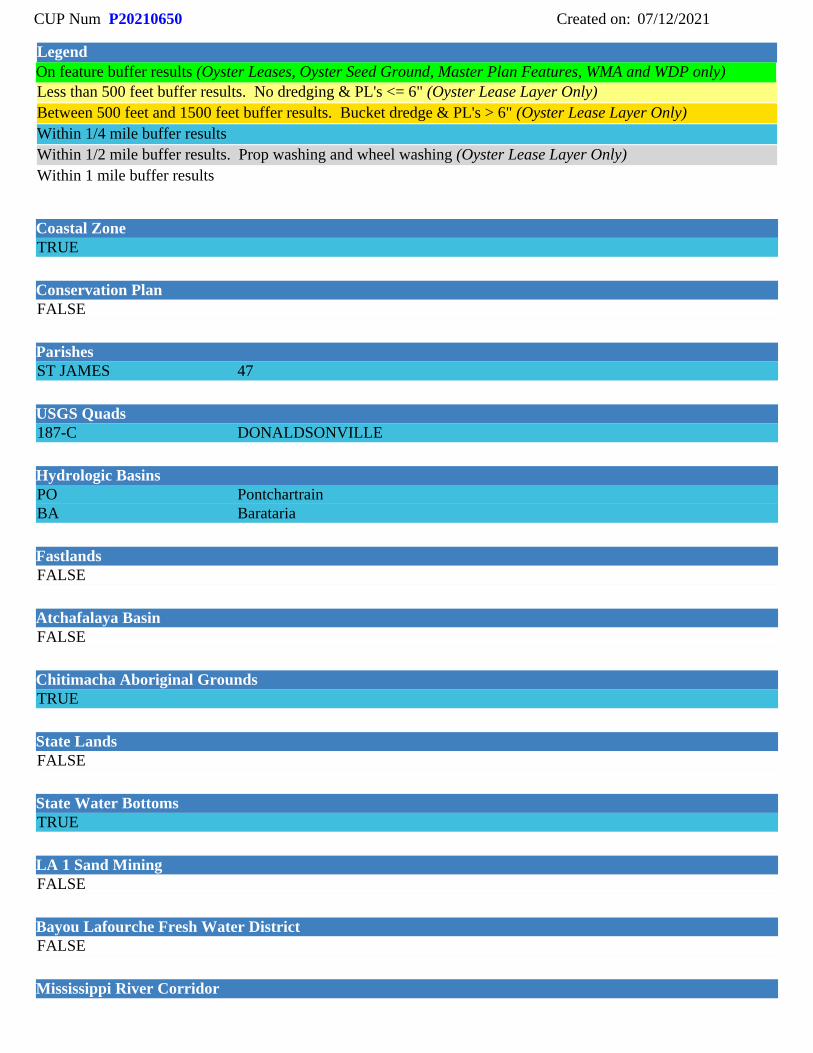
CUP Num: P20210650 Created on: 07/12/2021
Legend
Less than 500 feet buffer results. No dredging & PL's <= 6" (Oyster Lease Layer Only)Between 500 feet and 1500 feet buffer results. Bucket dredge & PL's > 6" (Oyster Lease Layer Only)Within 1/4 mile buffer resultsWithin 1/2 mile buffer results. Prop washing and wheel washing (Oyster Lease Layer Only)Within 1 mile buffer results
On feature buffer results (Oyster Leases, Oyster Seed Ground, Master Plan Features, WMA and WDP only)
Coastal Zone
Conservation Plan
Parishes
USGS Quads
Hydrologic Basins
Fastlands
Atchafalaya Basin
Chitimacha Aboriginal Grounds
State Lands
State Water Bottoms
LA 1 Sand Mining
Bayou Lafourche Fresh Water District
Mississippi River Corridor
TRUE
FALSE
ST JAMES
187-C
POBA
FALSE
FALSE
TRUE
FALSE
TRUE
FALSE
FALSE
47
DONALDSONVILLE
PontchartrainBarataria

CUP Num: P20210650 Created on: 07/12/2021
Mississippi River Corridor
National Parks
OCPR Levees
Permit Points
Permit Lines
FALSE
FALSE
Lafourche Basin Levee Distric
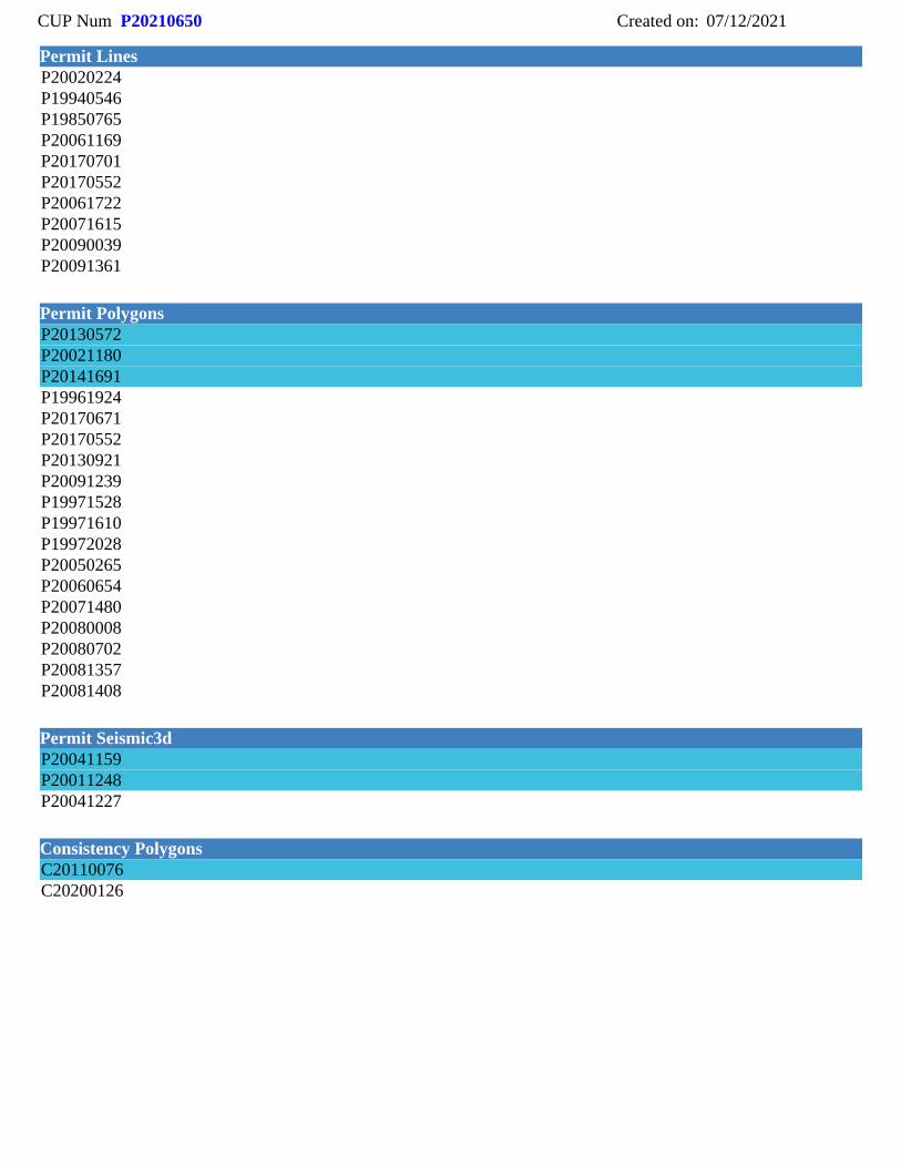
P20180947P20190335P20210333P20210438P20160441P19921314P19890309P20210650P20141637P19840689P19841692P19841751P19850765P19880650P19880880P19890401P19930129P19930671P19941360P20010414P20050221P20050284P20071528P20071615P20090039P20091361P20110173P20130572P20160733P20171181P20190986P20200270
P20020952P19880003P19961440P19970928P20011727
Federal_River_Levee
CUP Num: P20210650 Created on: 07/12/2021
Permit Lines
Permit Polygons
Permit Seismic3d
Consistency Polygons
P20020224P19940546P19850765P20061169P20170701P20170552P20061722P20071615P20090039P20091361
P20130572P20021180P20141691P19961924P20170671P20170552P20130921P20091239P19971528P19971610P19972028P20050265P20060654P20071480P20080008P20080702P20081357P20081408
P20041159P20011248P20041227
C20110076C20200126
Related Documents


