Vol Unit A. A.1. INSTRUCTOR NAVIGATION SYSTEM MAIN INSTRUCTOR CONTROL AND MONITORING MODULE: Areas of application: - Root Task application. Program is intended for training process management. - Integrated application for exercise editing, running and debriefing ; - High accuracy data presentation on the basis of vector charts (capability to automatically load all the charts referring to the selected gaming area); - Facilities for creating an exercise; - Control of simulator session(s); - Continuous automatic recording of data in the course of the exercise (main, audio and videolog files); - Working with measurement tools: - Capability to set of ERBL; - Capability to attach, move or delete ERBL during exercise fulfilment; - Capability to move the own ship during exercise fulfilment without ship grounding and collision; - Capability to apply named virtual tug force to 8 points of the ship hull in any direction; - Displaying of the actual ship contours; - The continuous display of the ship motion parameters and environmental conditions: ship course and speed, course over the ground, speed transverse component on the bow and on the stern, gyro heading, rate of turn, speed and direction of the current and wind, wave height and direction, depth; - Mooring operations: - Capability to set the rope material; - Capability to control the mooring winch on the instructor workplace. - Anchor operations: - Capability to set the user ground type with the required anchor holding force coefficients; - Display on the instructor chart of an anchor chain segment lying on the ground. - Control of navigational lights and shapes: - Capability to control the navigational lights; - Capability to switch on/off deck lights on the target ships. - Loading/discharging of own ship during the exercise; - Weather conditions manager: - Capability to set the predefined weather conditions by Beaufort number (wind, wave, whitecaps and foam, 3D clouds, cloud layer, visibility) on the fly; - Capability to set customized weather conditions; - Separate settings for wind wave and swell; - Manual wind direction and force control; - Setting atmosphere parameters – temperature, humidity, pressure; - Capability of using thunderstorm, precipitation. - Displaying of object tracks: contour or point with selectable resolution, track history and time stamp; - Displaying of walls and piers; - Displaying of true or relative speed vectors; LOT 1 NAVIGATION BRIDGE INSTRUCTOR ROOM Visualisasi Nama Alat Specification 245 degree CLASS-B NAVIGATION BRIDGE SIMULATOR (NTS Pro 6000) No. QTY Spesifikasi 1. Instructor Navigation Software License

Welcome message from author
This document is posted to help you gain knowledge. Please leave a comment to let me know what you think about it! Share it to your friends and learn new things together.
Transcript

Vol Unit
A.
A.1.
INSTRUCTOR NAVIGATION SYSTEM
MAIN INSTRUCTOR CONTROL AND MONITORING MODULE:
Areas of application:
- Root Task application. Program is intended for training process
management.
- Integrated application for exercise editing, running and debriefing ;
- High accuracy data presentation on the basis of vector charts (capability to
automatically load all the charts referring to the selected gaming area);
- Facilities for creating an exercise;
- Control of simulator session(s);
- Continuous automatic recording of data in the course of the exercise (main,
audio and videolog files);
- Working with measurement tools:
- Capability to set of ERBL;
- Capability to attach, move or delete ERBL during exercise fulfilment;
- Capability to move the own ship during exercise fulfilment without ship
grounding and collision;
- Capability to apply named virtual tug force to 8 points of the ship hull in any
direction;
- Displaying of the actual ship contours;
- The continuous display of the ship motion parameters and environmental
conditions: ship course and speed, course over the ground, speed transverse
component on the bow and on the stern, gyro heading, rate of turn, speed
and direction of the current and wind, wave height and direction, depth;
- Mooring operations:
- Capability to set the rope material;
- Capability to control the mooring winch on the instructor workplace.
- Anchor operations:
- Capability to set the user ground type with the required anchor holding
force coefficients;
- Display on the instructor chart of an anchor chain segment lying on the
ground.
- Control of navigational lights and shapes:
- Capability to control the navigational lights;
- Capability to switch on/off deck lights on the target ships.
- Loading/discharging of own ship during the exercise;
- Weather conditions manager:
- Capability to set the predefined weather conditions by Beaufort number
(wind, wave, whitecaps and foam, 3D clouds, cloud layer, visibility) on the fly;
- Capability to set customized weather conditions;
- Separate settings for wind wave and swell;
- Manual wind direction and force control;
- Setting atmosphere parameters – temperature, humidity, pressure;
- Capability of using thunderstorm, precipitation.
- Displaying of object tracks: contour or point with selectable resolution,
track history and time stamp;
- Displaying of walls and piers;
- Displaying of true or relative speed vectors;
LOT1
NAVIGATION BRIDGE
INSTRUCTOR ROOM
VisualisasiNama Alat
Specification 245 degree CLASS-B NAVIGATION BRIDGE SIMULATOR
(NTS Pro 6000)
No. QTYSpesifikasi
1. Instructor Navigation Software
License

- Selectable display mode: true motion, relative motion;
- Use of a mouse wheel for chart centering and scaling;
- User configurable workplace;
- Setting navigation equipment parameters and faults: Radar, GPS, Loran C,
Log, Gyro, Echo Sounder, UAIS;
- Setting of exercise weather and bathymetric conditions: global and local
zones, importing tide and current databases (NTS Pro - 6000 (ECDIS));
- On-chart monitoring of own ships and targets: Ship info panel, CPA-TCPA
panel, Events panel;
- On-chart control of own ships and targets: direct control of steering and
propulsion systems, autopilot, mooring lines, anchors;
- Setting faults of nav. equipment, steering and propulsion system, fire and
general alarm;
- Continuous data logging during exercise;
- Real and fast time replay of recorded exercise;
- Exercise pre-play on the chart to test its suitability for the simulator
training;
- Producing distress signals (flare, smoke signals, dye markers);
- Adding new target ships;
- Change of weather conditions;
- Moving buoys, turning off lights on them and hiding them both, on the
visualization and on the radar;
- Control of automatic tugboats with commands from the bridge or from the
Instructor;
- Generation and print out of exercise reports.
- RCC, ship and coast stating assignment;
- Assignment of working groups;
- Scenario editor – ability of crating and editing exercise scenarios for various
cases of ship-to-ship and ship-to-shore communication;
- Registration of working groups;
- Log module with possibility to print out and create archives;
- Window for listening/monitoring of the radiotelephone traffic including the
possibilities to intervene in the radiotelephone traffic;
- The possibility to introduce background noise from a list and instrument
faults to trainee stations;
- Ability of changing names, call signs, MMSI, telex numbers and Inmarsat
mobile numbers
- of all emulated ship stations and coast station according to the needs of
different exercises;
- Electronic chart with ships position indication and change the position,
course and speed;
- Ability of displaying and instantly altering trainee stations' positions on
electronic chart for conducting Search and Rescue (SAR) exercise;
- Full monitoring of any trainee workplace - Ability of monitoring the status
of each GMDSS instrument and listening to radio traffic of each trainee
station;
- Connection to external printer;
- Connection to active speaker to watch channels simultaneously;
- Providing functions of a coast telex or phone subscriber, coast radio station
and RCC
- operator from the log window;
- Status window of all the instruments at any workplace;
- Ability of logging trainee communication and action for playback and
subsequent review;
- Database on the coast radio stations, NVTEX and MSI stations and
INMARSAT shore based
- stations plotted on the chart;
- Information on the GMDSS Sea Areas on the chart;
- A rough estimate of the radio waves propagation in the selected frequency
band;
- Evaluation and assessment module.
3. Tug and Mooring Module 1 LOT Areas of application:
- The ability to carry out the simulation training in mooring operations (ship-
to-ship and ship to-pier);
- The ability to carry out the simulation training in anchoring operations;
- The ability to carry out the simulation training in tug operations (automatic
and manual mode).
LOT
LOT1
2. - Module GMDSS Software (for
Instructor)
- Module Software of Instructor
- Module Software of Coastal
Radiostations
1
1. Instructor Navigation Software
License

Areas of application:
- Root and Bridge Task. Program is intended for recording and replay all
dangerous situation.
General: The program is designed for the evaluation and assessment of
range of the predefined assessment parameters from the following
categories:
- Plan and conduct a passage and determine position;
- Maintain a safe navigational watch;
- Use of Radar and ARPA to maintain safety of navigation;
- Ability to operate and to interpret and analyse information obtained from
ARPA;
- Respond to emergencies;
- Use the IMO Standard Marine Communication Phrases and use English in
written and oral
- form;
- Transmit and receive information by visual signalling;
- Manoeuvre the ship;
- COLREG;
Program has capability to setting up a scoring and grading system to assess
operator performance. Program enables to control below results of the
Bridge Team/Trainee automated assessment during the scenario execution.
- Own ship collision;
- Beacon crash by own ship;
- Grounding of own ship;
- Distances for channel coast;
- Collision of own ship with coast;
- Break of anchor chain of own ship;
- Break of Mooring Line of own ship;
- Crush of fender of own ship;
- Overloading of engine.
For each item recording:
- Time
- Position;
- Depth;
- Passed distation;
- HDG;
- COG;
- LOG
- SOG;
- Angular velocity;
- Prow. Doppler velocity;
- Stern Doppler velocity;
- Ort. Velocity;
- List;
- Trim;
- Engines Controller position;
- Main engines load;
- VPP angles;
- Propellers revolution;
- Rudder setter,
- Rudder blade position
- Thrusters loading;
LOT4. 1Evaluation and Assessment
Module
Areas of application:
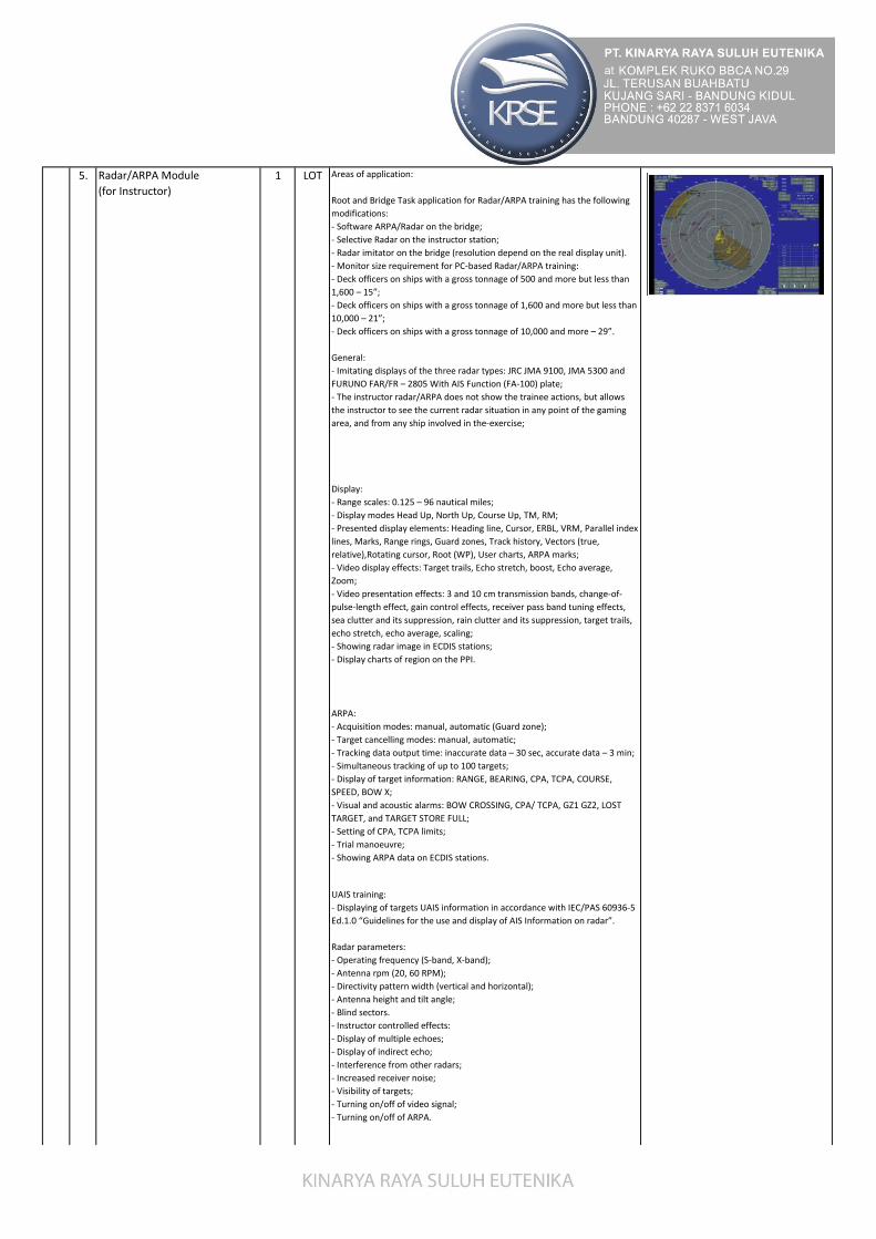
Root and Bridge Task application for Radar/ARPA training has the following
modifications:
- Software ARPA/Radar on the bridge;
- Selective Radar on the instructor station;
- Radar imitator on the bridge (resolution depend on the real display unit).
- Monitor size requirement for PC-based Radar/ARPA training:
- Deck officers on ships with a gross tonnage of 500 and more but less than
1,600 – 15”;
- Deck officers on ships with a gross tonnage of 1,600 and more but less than
10,000 – 21”;
- Deck officers on ships with a gross tonnage of 10,000 and more – 29”.
General:
- Imitating displays of the three radar types: JRC JMA 9100, JMA 5300 and
FURUNO FAR/FR – 2805 With AIS Function (FA-100) plate;
- The instructor radar/ARPA does not show the trainee actions, but allows
the instructor to see the current radar situation in any point of the gaming
area, and from any ship involved in the-exercise;
Display:
- Range scales: 0.125 – 96 nautical miles;
- Display modes Head Up, North Up, Course Up, TM, RM;
- Presented display elements: Heading line, Cursor, ERBL, VRM, Parallel index
lines, Marks, Range rings, Guard zones, Track history, Vectors (true,
relative),Rotating cursor, Root (WP), User charts, ARPA marks;
- Video display effects: Target trails, Echo stretch, boost, Echo average,
Zoom;
- Video presentation effects: 3 and 10 cm transmission bands, change-of-
pulse-length effect, gain control effects, receiver pass band tuning effects,
sea clutter and its suppression, rain clutter and its suppression, target trails,
echo stretch, echo average, scaling;
- Showing radar image in ECDIS stations;
- Display charts of region on the PPI.
ARPA:
- Acquisition modes: manual, automatic (Guard zone);
- Target cancelling modes: manual, automatic;
- Tracking data output time: inaccurate data – 30 sec, accurate data – 3 min;
- Simultaneous tracking of up to 100 targets;
- Display of target information: RANGE, BEARING, CPA, TCPA, COURSE,
SPEED, BOW X;
- Visual and acoustic alarms: BOW CROSSING, CPA/ TCPA, GZ1 GZ2, LOST
TARGET, and TARGET STORE FULL;
- Setting of CPA, TCPA limits;
- Trial manoeuvre;
- Showing ARPA data on ECDIS stations.
UAIS training:
- Displaying of targets UAIS information in accordance with IEC/PAS 60936-5
Ed.1.0 “Guidelines for the use and display of AIS Information on radar”.
Radar parameters:
- Operating frequency (S-band, X-band);
- Antenna rpm (20, 60 RPM);
- Directivity pattern width (vertical and horizontal);
- Antenna height and tilt angle;
- Blind sectors.
- Instructor controlled effects:
- Display of multiple echoes;
- Display of indirect echo;
- Interference from other radars;
- Increased receiver noise;
- Visibility of targets;
- Turning on/off of video signal;
- Turning on/off of ARPA.
LOT5. 1Radar/ARPA Module
(for Instructor)

Hands-on controls:
- Radar imitators can be controlled via realistic keyboards: JRC Radar
Keyboard (for JMA 9100 and JMA 5300), Generic Radar Keyboard (for
FURUNO FAR/FR 2805).
Signal components:
- Direct echo from ships (tugboats, barges, etc.);
- Direct echo from helicopters;
- Direct echo from aircrafts;
- Indirect echo (echo from ships reflected from the own ship mast);
- Multiple echo;
- Side lobe echo;
- Echo from the coast and coastal objects;
- Echo from aids to navigation (buoys, lighthouses);
- Racon signals;
- SART signals;
- Echo from the rain cloud (rain clutter);
- Echo from the sea surface (sea clutter);
- Echo from ice;
- Interference from other radars;
- Echo from own ship structures.
Effects:
- Attenuation of signal with distance;
- Additional attenuation of signal as a rain cloud is passed;
- Shadowing of a ship by another ship;
- Shadowing of a ship by the coast;
- Shadowing of a costal object by another one;
- Curvature of the earth surface;
- Loss of targets in heavy sea;
- Radar picture change in dependence on ship’s rolling and pitching
(movement of the antenna in space);
- Change of the coastline contour with the Tidal height;
- Reflection from ship structures (multiple and indirect echo);
- Shadowing by ship structures (blind sectors);
- Transmitting power;
- Antenna directivity (vertical and horizontal);
- Bandwidth;
- Pulse length;
- Repetition frequency;
- Radar gain;
- Radar sea clutter suppression;
- Radar rain clutter suppression;
- Video boost;
- Interference rejection.
Detailed 3-D databases with a high-resolution true-colour texturing can be
displayed by visualization systems. Spatial terrain, 3-D radar model and
floating objects models support water level (tidal effect) simulation. The
database can include more than 1000 models of aids to navigation, cultural
and industrial objects and consist from more than 500 000 triangles.
Databases are supplied together with a set of C-MAP vector electronic
charts, which correspond to the database content, to be displayed on ECDIS
and Instructor station.
- Possible applications (not limited to):
- Pilots training;
- Mooring operations training;
- Common navigation training;
- Consulting and port construction;
- Demo and gaming purposes.
Object library can include (but not limited to):
- 3-D submarine and above-water terrain;
- Aids to navigation – buoys, lighthouses with the light characteristics
according to a British Admiralty list of lights and vector electronic chart,
unique labels (numbering), shapes (top marks) sound signals and radar
beacons;
- Port facilities models – cranes, tanks, chimneys, elevators, containers,
LOT
UNIT
5. 1Radar/ARPA Module
(for Instructor)
Exercise Area
(Area Pelayaran)
Note :
Exercise Ports is in the
attachment
106.

- Exercise areas for Radar and Visualization scenes are available from
permanently expanding library.
- Development of new Exercise areas, which are not presently included into
the library, is possible upon request.
- Detailed description of the available exercise areas collection is contained in
a separate specification.
SHIP
Various purpose ships with 6-DoF. These are OWN SHIPS and are controlled
from the bridge either with hands-on controls, or with a trackball from the
conning display.
TUG
Tugs of various power and propulsion plant types with 6-DoF. These are
OWN SHIPS and are controlled from the bridge by using either hands-on
controls or the trackball from the conning display.
BARGE
Non self-propelled barges with 6-DoF. These can be used as TARGET SHIPS
only (individually or within the groups of up to 9 barges), towed on the line
or pushed in a rigid link.
SHIP TARGET
These are TARGET SHIPS which move automatically along the routes plotted
in an exercise, or are controlled by the instructor. 6-DoF models. The ship is
affected by the wind, current and wave drift and can be used for towing and
mooring.
TUG TARGET
Tugs of various power and propulsion plant types with 6-DoF. These are
TARGET TUGS and move automatically along the routes plotted in an
exercise or are controlled by the instructor manually. They can automatically
execute towing commands, are affected by the wind, current and wave drift.
Ship models for own ship and passive targets are available from the
permanently expanding library.
Development of new Ship models, which are not included into presently
library, is possible upon request.
Detailed description of the available ship models collection is contained in a
separate specification.
8. Module Hardware Handset 1 UNIT Replica Hardware that has the ability
to resemble original hardware with buttons and menus connected to a
simulator system, so students can get to know and more familiar with
devices on board both in terms of function and capability of the device.
9. Instructor Module System 2 LOT - Fast Ethernet Switch 24 sockets (1 Unit)
- Processor i5 10400, Gigabyte H510M, DDR4 8Gb, SSD 240 Gb, 500 Wat,
Windows 10 (2 Unit), Monitor LED 24" (3 Unit)
- UPS 1400VA
- Multi-Color Printing Machine
10. Work Desk For Instructor 1 UNIT Wooden Table
A.2.
1 Radar/ARPA
Display Console
1 SET
(1) Instrument Console 1 SET Iron Plate & Frame
10 UNIT
UNIT
Ship Models
(Ship Models untuk pelatihan)
BRIDGE SIMULATOR 245 degree Visualization
Exercise Area
(Area Pelayaran)
Note :
Exercise Ports is in the
attachment
10
7.
6.
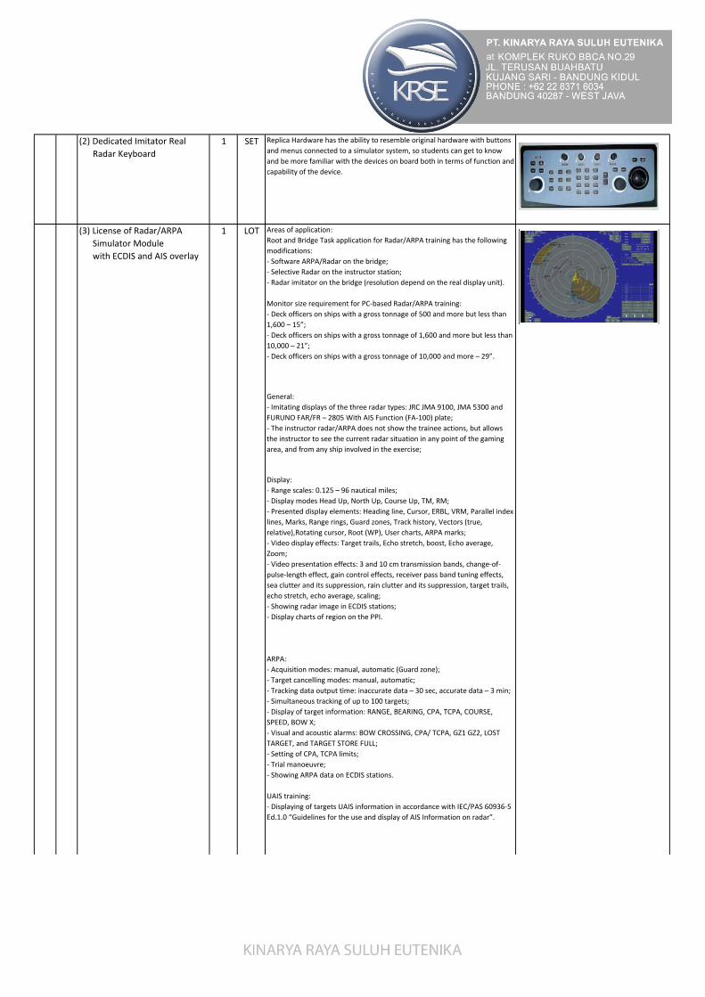
(2) Dedicated Imitator Real
Radar Keyboard
1 SET Replica Hardware has the ability to resemble original hardware with buttons
and menus connected to a simulator system, so students can get to know
and be more familiar with the devices on board both in terms of function and
capability of the device.
Areas of application:
Root and Bridge Task application for Radar/ARPA training has the following
modifications:
- Software ARPA/Radar on the bridge;
- Selective Radar on the instructor station;
- Radar imitator on the bridge (resolution depend on the real display unit).
Monitor size requirement for PC-based Radar/ARPA training:
- Deck officers on ships with a gross tonnage of 500 and more but less than
1,600 – 15”;
- Deck officers on ships with a gross tonnage of 1,600 and more but less than
10,000 – 21”;
- Deck officers on ships with a gross tonnage of 10,000 and more – 29”.
General:
- Imitating displays of the three radar types: JRC JMA 9100, JMA 5300 and
FURUNO FAR/FR – 2805 With AIS Function (FA-100) plate;
- The instructor radar/ARPA does not show the trainee actions, but allows
the instructor to see the current radar situation in any point of the gaming
area, and from any ship involved in the exercise;
Display:
- Range scales: 0.125 – 96 nautical miles;
- Display modes Head Up, North Up, Course Up, TM, RM;
- Presented display elements: Heading line, Cursor, ERBL, VRM, Parallel index
lines, Marks, Range rings, Guard zones, Track history, Vectors (true,
relative),Rotating cursor, Root (WP), User charts, ARPA marks;
- Video display effects: Target trails, Echo stretch, boost, Echo average,
Zoom;
- Video presentation effects: 3 and 10 cm transmission bands, change-of-
pulse-length effect, gain control effects, receiver pass band tuning effects,
sea clutter and its suppression, rain clutter and its suppression, target trails,
echo stretch, echo average, scaling;
- Showing radar image in ECDIS stations;
- Display charts of region on the PPI.
ARPA:
- Acquisition modes: manual, automatic (Guard zone);
- Target cancelling modes: manual, automatic;
- Tracking data output time: inaccurate data – 30 sec, accurate data – 3 min;
- Simultaneous tracking of up to 100 targets;
- Display of target information: RANGE, BEARING, CPA, TCPA, COURSE,
SPEED, BOW X;
- Visual and acoustic alarms: BOW CROSSING, CPA/ TCPA, GZ1 GZ2, LOST
TARGET, and TARGET STORE FULL;
- Setting of CPA, TCPA limits;
- Trial manoeuvre;
- Showing ARPA data on ECDIS stations.
UAIS training:
- Displaying of targets UAIS information in accordance with IEC/PAS 60936-5
Ed.1.0 “Guidelines for the use and display of AIS Information on radar”.
LOT1(3) License of Radar/ARPA
Simulator Module
with ECDIS and AIS overlay

Radar parameters:
- Operating frequency (S-band, X-band);
- Antenna rpm (20, 60 RPM);
- Directivity pattern width (vertical and horizontal);
- Antenna height and tilt angle;
- Blind sectors.
- Instructor controlled effects:
- Display of multiple echoes;
- Display of indirect echo;
- Interference from other radars;
- Increased receiver noise;
- Visibility of targets;
- Turning on/off of video signal;
- Turning on/off of ARPA.
Hands-on controls:
- Radar imitators can be controlled via realistic keyboards: JRC Radar
Keyboard (for JMA 9100 and JMA 5300), Generic Radar Keyboard (for
FURUNO FAR/FR 2805).
- Signal components:
- Direct echo from ships (tugboats, barges, etc.);
- Direct echo from helicopters;
- Direct echo from aircrafts;
- Indirect echo (echo from ships reflected from the own ship mast);
- Multiple echo;
- Side lobe echo;
- Echo from the coast and coastal objects;
- Echo from aids to navigation (buoys, lighthouses);
- Racon signals;
- SART signals;
- Echo from the rain cloud (rain clutter);
- Echo from the sea surface (sea clutter);
- Echo from ice;
- Interference from other radars;
Effects:
- Attenuation of signal with distance;
- Additional attenuation of signal as a rain cloud is passed;
- Shadowing of a ship by another ship;
- Shadowing of a ship by the coast;
- Shadowing of a costal object by another one;
- Curvature of the earth surface;
- Loss of targets in heavy sea;
- Radar picture change in dependence on ship’s rolling and pitching
(movement of the antenna in space);
- Change of the coastline contour with the Tidal height;
- Reflection from ship structures (multiple and indirect echo);
- Shadowing by ship structures (blind sectors);
- Transmitting power;
- Antenna directivity (vertical and horizontal);
- Bandwidth;
- Pulse length;
- Repetition frequency;
- Radar gain;
- Radar sea clutter suppression;
- Radar rain clutter suppression;
- Video boost;
- Interference rejection.
LOT1(3) License of Radar/ARPA
Simulator Module
with ECDIS and AIS overlay

(4) Module Hardware for
Radar/ARPA
1 LOT - Processor i5 10400 , Gigabyte H510M, DDR4 8Gb, SSD 240 Gb, 500 Watt,
Monitor LED 24", Windows 10
- UPS ICA 1400 VA
2. Big Conning
Display Module
1 SET
(1) Instrument + Steering Stand
Console
1 SET Iron Plate and Frame
Bridge Task application.
Areas of application:
- Bridge Task application. Program is intended for ship handling, mooring,
automatic tugs and navigation instruments operations.
Main features:
- Multi-page display intended for ship handling on the navigation bridge
- Conning display multilevel 'Call-up' pages: general characteristics, control of
ME and autopilot (page «Common»); own ship data (page «Ship»); control of
anchor gear, mooring gears and control of roll and pitch (page «Anchor &
Mooring»); repeater gyro and satellite compass (page «Compass») digital
barograph, water temperature and humidity sensors (page «Weather»);
echosounder (page «EchoSounder»); Bridge Navigational Watch Alarm
System and Auxiliary Engines control (page «BNWAS, BAMS & Power»);
Fire Alarm control panel (page «FireAlarm»); Fire doors status information
panels (page «Fire doors status »); observer’s sight, control of lights, sound
signals and figures (page «Light &View»); signal flags (page «Signals»);
thruster control for azimuth propellers, azimuth indicators, loading of
thruster indicators (page «Extensions»); result of training (page
«Assessment»).
- Day and night palettes control;
- During the operation, ship controls are available from any of conning
display pages on its permanently presented part;
- Below mentioned parameters are available from all pages:
• speed of bow and stern speed in knots over the ground;
• position of rudder blade;
• rate of turn of vessel (deg/min);
• course over ground;
• heading;
• position of rudder setter and rudder executor;
• engine telegraph;
• Indicators of start air pressure, MEs loading, VPP and MR RPM.
«Common» page include:
- value of propeller shaft(s) revolutions per minute - for the left (or single)
shaft and for the right shaft;
- values of turning angle of control pitch propeller(s) blades in degrees – for
the left (or single) propeller and for the right propeller;
- values of rudder blade responder in degrees ;
- Modes of bow thruster and aft thruster operation (load in %);
- value of angle speed of turn in degrees per minute;
- gyrocompass and magnetic compass course in degrees;
- log speed and speed over ground in;
- ship’s time;
- traversed distance;
- depth under keel ;
- limit of signal response about hazardous depth under keel in meters in the
block;
- geographical coordinates of ship;
- choosing day or night palette;
- autopilot panel:
- direction and distance to coast;
- velocity (in meter per second) and direction (in degrees) of wind;
- velocity (in knots) and direction (in degrees) of stream;
- Echo sounder picture.
(2) License of Big
Conning Software
Module
1 LOT
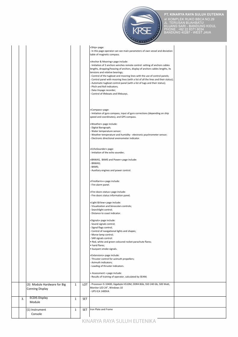
«Ship» page:
- In this page operator can see main parameters of own vessel and deviation
table of magnetic compass.
«Anchor & Mooring» page include:
- Imitation of 3 anchors winches remote control: setting of anchors cables
lengths, dropping/heaving of anchors, display of anchors cables lengths, its
tensions and relative bearings;
- Control of the tugboat and mooring lines with the use of control panels;
- Control panel with mooring lines (with a list of all the lines and their status);
- Automatic tugboat control panel (with a list of tugs and their status);
- Pitch and Roll indicators;
- Data Voyage recorder;
- Control of lifeboats and lifebuoys.
«Compass» page:
- Imitation of gyro compass, input of gyro corrections (depending on ship
speed and coordinates), and GPS compass.
«Weather» page include:
- Digital Barograph;
- Water temperature sensor;
- Weather temperature and humidity - electronic psychrometer sensor;
- Electronic directional anemometer indicator.
«EchoSounder» page:
- Imitation of the echo sounder;
«BNWAS, BAMS and Power» page include:
- BNWAS;
- BAMS;
- Auxiliary engines and power control.
«FireAlarm»» page include:
- Fire alarm panel.
«Fire doors status» page include:
- Fire doors status information panel;
«Light &View» page include:
- Visualization and binoculars controls;
- Searchlight control;
- Distance to coast indicator.
«Signals» page include:
- Sound signals control;
- Signal flags control;
- Control of navigational lights and shapes;
- Morse lamp control;
- SAR signals control:
• Red, white and green coloured rocket parachute flares;
• hand flares;
• buoyant smoke signals.
«Extensions» page include:
- Thruster control for azimuth propellers;
- Azimuth indicators;
- Loading of thruster indicators.
« Assessment » page include:
- Results of training of operator, calculated by SEAM;
(3) Module Hardware for Big
Conning Display
1 LOT - Processor i5 10400, Gigabyte H510M, DDR4 8Gb, SSD 240 Gb, 500 Watt,
Monitor LED 24", Windows 10
- UPS ICA 1400VA
3. ECDIS Display
Module1 SET
(1) Instrument
Console
1 SET Iron Plate and Frame
(2) License of Big
Conning Software
Module
1 LOT

Areas of application:
Bridge Task application for the training in use of Electronic Chart Display and
Information System:
- (ECDIS) software can be used software of MARIS ECDIS, NAVMASTER ECDIS
from PC Maritime, Totem ECDOS from Totem plus, NAVIC from SAN or from
any manufacturers.
General:
- Multi chart loading;
- Chart INFO (General Chart Information, Information on Chart Objects);
- Manual chart update;
- Chart orientation (North UP, Head UP, Course UP);
- Chart control (Layers Control, Auto-load, Auto-scale, Auto-scroll, Zoom,
Chart Formats Priority (ARCS/ENC), day/night palettes);
- Alarms (AIS, Anti-grounding, Sensors, Route, ARPA/Targets (CPA/TCPA),
Chart Areas, etc.);
- Ship motion data (COG, SOG, HDG, LOG);
- ERBL for measuring bearings and ranges;
- Two modes of displaying the ship motion on the chart (True Motion,
Relative Motion);
- Split screen (2 Chart Panel);
- MOB mode (Man Overboard mode is intended for the performance of
“Man Overboard” manoeuvre);
- Route planning, checking and monitoring;
- Work with multiple routes;
- Schedule calculations;
- UAIS information;
- Voyage documenting hard copy support, etc.;
- Trial manoeuvring module;
- Interface with Position sensors, Gyro, Log, Echo sounder, ARPA, etc.;
- User adjustable NMEA output messages;
- Radar overlay with target extractor functionality;
- User configurable GUI;
- Multiunit support (Speed, Distance, Depth, Height, Draft, Wind Speed,
Temperature);
- Screen resolution (1280x1024 (standard), 1024x768).
UAIS training:
- Display of UAIS targets on the screen;
- Full target information;
- Sending and receipt of messages and target information;
- Fast search of targets on Name, IMO number, MMSI, and Call Sign;
highlighting of the selected target on the electronic chart screen.
Supported chart formats:
- CM Prof (vector);
- CM –ENC;
- ENC (S-57 v.3) (vector);
- S-57 Primary (vector);
- ARCS - a Raster Nautical Chart (RNC) produced by the UK Hydrographic
Office standard S-61.
Databases:
- Tidal currents (world-wide database);
- Tidal water levels (world-wide database);
- Seasonal surface currents (world-wide database);
- Weather (world-wide database).
(3) License of Electronic Charts 1 LOT Electronic Charts that are in accordance with or designated ECDIS, and meet
international standards
(4) Module Hardware for ECDIS
Display
1 LOT - Processor i5 10400 , Gigabyte H510M, DDR4 8Gb, SSD 240 Gb, 500 Watt,
Monitor LED 24", Windows 10
- UPS ICA 1400VA
4. Navigation Devices Module 1 LOT
(1) Instrument
Console
1 SET Iron Plate & Frame
(2) License of ECDIS
Software
Module
LOT1

(2) License of
DGPS & GPS Module
1 LOT DGPS :
- Automatic and manual operation modes;
- Position readouts, geodesic datum;
- Waypoints input and storage;
- Dead reckoning mode; steering data computing;
- Man Overboard;
- Faults and errors controlled by instructor: power failure
- Simulation of Furuno GP-170 GPS Navigator fully meeting IMO MSC.
112(73) and IEC 61108-1 regulations;
- WGS-84 geodetic datum is used;
- GPS Satellite Almanac and DGPS land station database;
- DGPS capability with built-in DGPS beacon kit;
- Comprehensive navigation data displays;
- Man overboard feature records latitude and longitude coordinates at time
of man overboard and provides continuous updates of range and bearing to
that point;
- Storage for 999 waypoints and 30 routes;
- Memory stores 2000 points of track and marks;
- Alarms: Waypoint Arrival, Anchor Watch, Cross Track Error, Ship’s Speed,
Trip, and DGPS;
- Menu-driven operation;
- Position is shown in latitude and longitude coordinates;
- 4 display modes: Plotter 1, Plotter 2, Highway and Navigation;
- “Highway” display provides perspective view;
- Faults and errors controlled by the instructor: power failure, quantity of
satellites, DGPS data error, dilution of precision
(3) License of
BNWA System Module
1 LOT Bridges Navigational Watch Alarm System (BNWA System) features :
- Provides light and sound sgnals to attract the attention of the officer in
charge of the watch
- Operation modes of BNWA System comply with IMO Resulotion MSC. 128
(4) License of
Echo Sounder Module
1 LOT Echo Sounder features :
- Measurement of depths from 1 to 200m
- Sound signaling about the ship's exit to a given depth
- Manual setting of a given depth
- Presentation of depth information simultaneously in two form (Graphic
form and numerically)
(5) Doppler Speed Log Module 1 LOT Doppler Speed Log features :
- Display of the speed (relative to water and relative to Ground)
- Display of distance traveled
(6) VDR Remote Alarm Panel
Module
1 LOT VDR Remote Alarm Panel features :
- Recording interval of various data

(7) License of
AIS Module
1 LOT UAIS Simulation of Class A Ship borne Mobile Equipment compliant with the
latest IMO SOLAS requirements:
- IMO MSC. 74(69) Annex 3;
- ITU-R M.1371-1 (Class A);
- IALA Technical Clarifications of Rec. ITU-R M.1371-1 (Edition 1.3);
- ITU-R M.825-3;
- ITU-R M.1084-3;
- Complies with part of the Vessel Tracking and Tracing Standard for Inland
Navigation (Edition 1.01) requirements.
- Text user interface;
- Capability to view received targets on a graphical, radar-like display;
- Capability to enter Static (MMSI and IMO number, Ship Type, Call Sign),
Dynamic (Navigational Status) and Voyage Related Data (Cargo Type,
Draught, Destination, ETA, Number of Persons on Board);
- Capability to enter ship’s main external and internal GPS antenna location;
- Capability to transmit and receive short safety related messages regarding
navigation safety;
- Capability of composing and sending message with report of ETA at
lock/bridge/terminal, shown on the Instructor workplace;
- Capability to filter incoming messages
(6) Module Hardware for
Navigation Devices
1 LOT Processor i5 10400, Gigabyte/MSI H510M, DDR4 8Gb, SSD 240 Gb, 500
Watt, Monitor LED 24", Windows 10, UPS ICA 1400VA
5. Overhead Display
(1) Software Module
1 UNIT Application areas: Bridge application.
The program is intended for display Loading of Main engines 1, 2, the
turnover rate of main engines shafts, angles of WRMs, heading, speed of log,
time, rate of turn, rudder angle, pitch, roll, depth and speed and direction of
wind.
(2) Module Hardware for
Overhead Display
1 LOT - Processor i5 10400 , Gigabyte H510M, GE Force GTX 1650 4GB, DDR4 8Gb,
SSD 240 Gb, 500 Watt, 3 unit Display 19", Windows 10
- UPS ICA 1400VA
6. GMDSS Module Simulator 1 LOT
(1) Instrument Console 1 SET Iron Plate and Frame
(2) License of GMDSS
Communication Module
1 LOT

(2.1) VHF Radio Station with
DSC VHF Sailor 6222 (Vessel -
Shore)
VHF radio station with DSC VHF SAILOR 6222 imitator simulate of the
following principal functions:
- turning ON/OFF and volume control;
- noise suppression adjustment;
- selection of any out of 55 international channels;
- prompt selection of call and distress channel 16;
- function of keeping watch on two channels;
- programming and turning of the channel scanning mode;
- reduction of the station’s transmitting power;
- setting of channels used in the USA;
- changing of the display illumination;
- operation in the telephony mode;
- manual and automatic input of coordinates and time;
- viewing of the own MMSI numbers;
- transmission of a distress call using the «hot» key;
- preparation, transmission and reception of all the types of DSC calls
required for the class A VHF DSC equipment;
- keeping watch on channel 70;
- acoustic alarm upon the reception of distress calls, as well as calls requiring
the operator's presence;
- list of stations and a facility for editing it;
- control of the channels and transmitting power of the VHF radio station;
- storage and viewing of 20 last received DSC distress calls and calls unrelated
to the distress;
- check of the modem without transmission;
- address book and a facility for editing it;
- printing out of the received messages;
- Setting of options in accordance with the description of the unit.
By pressing HELP button the trainee can familiarize him/herself in detail with
the procedure to operate a VHF radio station.
HELP system allows obtaining full information on the control of all the
instruments imitated in the simulator.
(2.2) MF/HF Radio Station with
DSC MF/HF Sailor 6301 (Vessel -
Shore)
The simulator imitation of the following principal functions:
- turning ON/OFF and volume control;
- manual and automatic gain adjustment;
- setting of the reception and transmission frequencies;
- setting the channel number;
- receiver frequency control with a step of 10, 100, 500 and 1000 Hz;
- selection of the transmission mode;
- changing of the transmitter's output power;
- transmission of a radio telephone alarm signal;
- acoustic check of the radio telephone alarm generator;
- changing of the display illumination;
- switching on/off of the noise suppression;
- operation in the telephony mode, as well as in combination with the DSC
and telex modem;
- manual and automatic input of coordinates and time;
- - viewing of the own MMSI numbers;
- internal and external check;
- transmission of a distress call using the «hot» key;
preparation, transmission and reception of all the types of DSC calls required
for the class A
- MF/HF DSC equipment;
- acoustic alarm upon the reception of distress calls, as well as calls requiring
the operator's
- presence;
- list of stations and a facility for editing it;
- keeping watch on the distress DSC frequencies;
- keeping watch on the public DSC frequencies;
- storage and viewing of up to 20 last received distress calls and calls
unrelated to the distress;
- printing out of the received DSC messages;
Setting of options in accordance with the description of the unit.

(2.3) MF/HF Radiotelex modem
& terminal (Vessel - Shore)
The simulator imitation of the following principal functions:
- text editor for the preparation of messages;
- operation in ARQ and FEC modes between the ships;
- calling of and work with a coast radio station in ARQ mode in accordance
with procedures of ITU-R Recommendation M.492;
- re-phasing procedure in accordance with ITU-R Recommendation M.625;
- keeping watch in the mode of scanning the telex frequencies;
- list of telex stations with a facility for editing it;
- address book with a facility for editing it;
- printing out of messages;
- Setting of options in accordance with the description of the unit.
- The simulator imitates work with the following coast radio stations:
- Argentina Radio, Lyngby, Halifax, Rogaland, Scheveningen, Portishead,
Saint-Lys. The list can be supplemented with the following coast radio
stations operating in ARQ mode: Bern (telex number 3502), Lisboa (3560).
When these stations are entered, these stations' actual operating
frequencies should be used.
- The program imitates the transmission of the free channel signal by all the
coast radio stations listed above. You can hear this signal by tuning the
MF/HF radio station to the appropriate frequencies.
(2.4) INMARSAT-B Ship Earth
Station NERA SATURN-B
The simulator imitation of the following principal functions:
- ON/OFF and input of initial data;
- Manual antenna tuning;
- Automatic antenna tuning to the specified satellite by the entered
coordinates;
- Text editor for the preparation of messages;
- Transmission of a distress alert in telex and telephony modes;
- Ship-to-shore, shore-to-ship and ship-to-ship communication in the
telephony, telex and facsimile modes;
- Address book with editing facility;
- List of coast earth stations;
- Test check of the station NERA SATURN-B;
- Viewing of the own identifier;
- Operation in the interactive mode (using the built-in HELP system);
- Viewing and setting of some options in accordance with the description of
the unit;
- Printing of messages.
(2.5) INMARSAT-C Ship Earth
Station with EGC Receiver Sailor
6110
The simulator imitation of the following principal functions:
- ON/OFF and input of initial data;
- Manual and automatic log-in procedures to the satellite;
- Manual and automatic input of coordinates;
- Transmission of distress alerts by using "hot" keys;
- Transmission of message with distress priority;
- Ship-to-ship and ship-to-shore transmission and reception of messages in
the telex mode;
- Sending of E-mail messages;
- Text editor for the preparation of messages;
- Address book with editing facility;
- List of stations;
- Test check of the station;
- Printing of messages;
- Programming of the EGC receiver and reception of EGC messages;
- Log of transmitted and received messages including EGC messages;
- Viewing of own identifier;
- Sending of position reports;
- Setting of main options in accordance with the description of the unit.

(2.6) SSAS The new SOLAS resolution 6 states that the Ship Security Alert System shall
provide ships with two alarm buttons, which can be activated in case of a
piracy or terrorist attack. The alarm is a covert signal, which will have no
sound and no flashing lights so that it is in no way obvious to any intruders
on board the ship.
The simulator imitation of the following principal functions:
- Built in Inmarsat-C ship earth station;
- Automatic input of coordinates;
- Transmission of security alerts by using "red" keys to 3 addresses;
- - Transmission of test message by using "green" key to 3 addresses.
(2.7) LRIT The simulator imitation of the following principal functions:
- Built in Inmarsat-C ship earth station;
- Manual and remote programming;
- Printing of messages;
- Sending of position reports;
- Polling reply;
- Viewing of reporting status;
- Setting of main options in accordance with the description of the unit.
(2.8) INMARSAT-FLEET 77 Ship
Earth Station NERA - F77
The simulator imitation of the following principal functions:
- ON/OFF and input of initial data;
- Automatic antenna tuning and tuning to the specified satellite;
- Transmission of a distress alert in telephony mode;
- Transmission of a messages by using two digits services (32,38,39,42,91, at
least) in the telephone mode;
- Ship-to-shore, shore-to-ship and ship-to-ship communication in the
telephony mode;
- Address book with editing facility;
- Test check of the station NERA F77;
- Viewing and setting of some options in accordance with the description of
the unit.
(2.9) Two Band Receiver
NAVTEX NX -700 A/B FURUNO
The simulator imitation of the following principal functions:
- ON/OFF;
- Programming of the Navtex stations' reception and message types;
- Test check;
- Setting of options in accordance with the description of the unit;
- Reception and printing of messages.
(2.10) Cospas-Sarsat EPIRB Tron
60 GPS, Jotron
The simulator imitation of the following principal functions:
- ON/OFF switching of the buoy and initiation of the alert transmission;
- Test check of the buoy.
(2.11) SART Tron SART 20,
Jotron
The simulator imitation of the following principal functions:
- ON/OFF switching of the transponder;
- Test check of the transponder.

(2.12) AIS SART SAR-16,
Samyung ENC Co.
The simulator imitation of the following principal functions:
- ON/OFF switching of the transponder;
- Test check of the transponder.
(2.13) AIS Transponder SI-30 R The information provided by UAIS software includes:
- AIS SART information;
- call sign and name;
- ship position with indication of system accuracy and integrity;
- Universal coordinated time (UTC) (the date is fixed by the reception
equipment);
- the course relative to the ground;
- speed relative to the ground etc.
(2.14) Portable Two-way Radio
for Aircraft Communication
TRON Air, Jotron
The simulator imitation of the following principal functions:
- ON/OFF;
- Volume and noise suppression control;
- Operation in the telephone mode;
- Tuning of the station to frequencies 121.5 MHz and 123.1 MHz.
(2.15) Two-way VHF Radio
Station TRON TR 20
GMDSS/PLUS
The simulator imitation of the following principal functions:
- ON/OFF;
- Volume and noise suppression control;
- Selection of channels;
- Reduction of the transmitter's output power;
- Prompt selection of call and distress channel 16 and at least one of the
operating channels;
- Turning on/off keyboard beep function;
- Operation in the telephone mode.
(2.16) GMDSS Alarm Panel The simulator imitation of the following principal functions:
- Remote initiation of distress alert transmissions via VHF, MF/HF and
InmarsatC SES;
- Visible and audible indication of incoming distress and urgency calls on VHF,
MF/HF and Inmarsat-C;
- Test check of the alarm panel.
(2.17) Radar Image The software of simulated instrument is intended for display SART signal and
AIS symbol (with changeable radar range):
- Range scales: 0.125 – 96 nm;
- Radar picture stabilisation modes: «Head Up», «North Up», «Course Up»,
«Course Stab»;
- Motion modes: true (TM), relative (RM);
- Displayed on the screen are: course mark on the PPI, movable marker,
ERBL, VRM, up to 8 index lines, marks, range rings, automatic acquisition
zones, vectors (true, relative), route
- (waypoints), user radar charts, ARPA symbols, UAIS symbols;
- a Video effects: 3 and 10 cm transmission bands, pulse length change
effect, gain effects, receiver bandwidth tuning effects, sea clutter and its
suppression, rain clutter and its suppression, target trails, echo stretching,
scaling.
(2.18) Feeder Switchboard The simulator imitation of the following principal functions:
- Display of the accumulator voltage;
- Display of the charging and discharging current;
- Visual and acoustic alarm in case of voltage drop below the permissible
limit (for both, the main power supply and the battery).
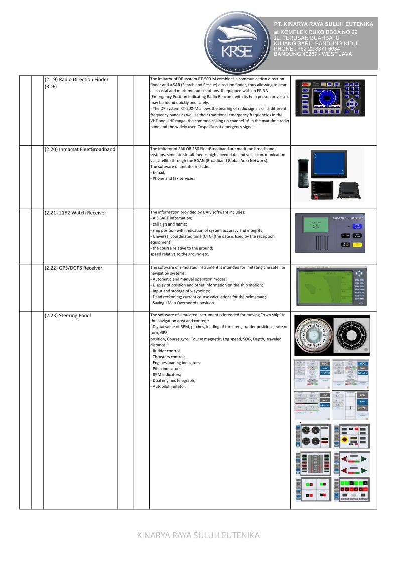
(2.19) Radio Direction Finder
(RDF)
The imitator of DF-system RT-500-M combines a communication direction
finder and a SAR (Search and Rescue) direction finder, thus allowing to bear
all coastal and maritime radio stations. If equipped with an EPIRB
(Emergency Position Indicating Radio Beacon), with its help person or vessels
may be found quickly and safely.
- The DF-system RT-500-M allows the bearing of radio signals on 5 different
frequency bands as well as their traditional emergency frequencies in the
VHF and UHF range, the common calling up channel 16 in the maritime radio
band and the widely used CospasSarsat emergency signal.
(2.20) Inmarsat FleetBroadband The Imitator of SAILOR 250 FleetBroadband are maritime broadband
systems, simulate simultaneous high-speed data and voice communication
via satellite through the BGAN (Broadband Global Area Network).
The software of imitator include:
- E-mail;
- Phone and fax services.
(2.21) 2182 Watch Receiver The information provided by UAIS software includes:
- AIS SART information;
- call sign and name;
- ship position with indication of system accuracy and integrity;
- Universal coordinated time (UTC) (the date is fixed by the reception
equipment);
- the course relative to the ground;
speed relative to the ground etc.
(2.22) GPS/DGPS Receiver The software of simulated instrument is intended for imitating the satellite
navigation systems:
- Automatic and manual operation modes;
- Display of position and other information on the ship motion;
- Input and storage of waypoints;
- Dead reckoning; current course calculations for the helmsman;
- Saving «Man Overboard» position.
(2.23) Steering Panel The software of simulated instrument is intended for moving “own ship” in
the navigation area and content:
- Digital value of RPM, pitches, loading of thrusters, rudder positions, rate of
turn, GPS
position, Course gyro, Course magnetic, Log speed, SOG, Depth, traveled
distance;
- Rudder control,
- Thrusters control;
- Engines loading indicators;
- Pitch indicators;
- RPM indicators;
- Dual engines telegraph;
- Autopilot imitator.

(3) VHF Handset Hardware 1 UNIT Replica Hardware that has the ability to resemble original hardware with
buttons and menus connected to a simulator system, so students can get to
know and be more familiar with the devices on board both in terms of
function and capability of the device.
(4) Module Hardware for
GMDSS Simulator
1 LOT - Processor i5 10400 , Gigabyte H510M, DDR4 8Gb, SSD 240 Gb, 500 Watt,
Monitor LED 24", Windows 10
- UPS ICA 1400VA
7. Visualization Module 245
degree
1 LOT
Areas of application:
Root and Bridge Task application:
- Visualization channel on the bridge;
- Selective visualization channel on the instructor station;
- Bearing station on the bridge;
General:
- Visual presentation of a simulator virtual environment;
- Capability to dynamically change the texture and scene objects’ state;
- Picture refresh rate up to 60 FPS (depending upon scene intensity).
Visual scene content:
- 3D terrestrial surface;
- Controlling binoculars focal length settings;
- Static coastal objects;
- Dynamic coastal objects (cranes, auto vehicles, trains, radar antenna units);
- Exercise objects (ships, tugboats, helicopters, aircrafts, barges, bollards,
mooring and tow lines, land objects, buoys, );
- SAR objects (liferaft, life buoy, MOB, SART, helicopters, aircrafts, floating
garbage, damaged tanker, dye marker, oil slick), International flags and
pennants, distress signals (rockets, parachute red flare, buoyant smoke);
- Aids to navigation (buoys, lighthouses);
- Lights (navigational, cultural lights);
- Visual effect from icing;
- Detailed own ship bow;
- Shadows for vessels, scene objects.
Sky:
- Display of stars, main asterisms, moon, sun (according time of day and
geographical coordinates), clouds.
Sea:
- 3D wavy sea surface;
- Ripples;
- Reflection of sky, sun, clouds in the sea;
- Water disturbances: wake, bow waves, foam of breaking waves.
Weather:
- Precipitation;
- Fog;
- Rain clouds;
- Lightings.
(2) Module Hardware for
Visualization
1 LOT - Processor i7 10700, Gigabyte Z590, RTX 2060 8 GB Gaming , DDR4 16Gb,
SSD 240 Gb, 750 Watt, Windows 10 (2 Unit)
- UPS ICA 1400VA (2 Unit)
LOT7(1) License of Visualization
Module 35 degree

(3) TV LED DISPLAY 7 UNIT - 55" LED UHD / 4K
- Bright Panel : Super Bright Panel
- Screen Resolution : 1,920 (W) x 1,080 (H)
- Panel Drive : 180Hz BMR
- Picture Mode : Standard, Dynamic, Mild, User
- Speaker Output: 16 W (8 W x 2)
- On Screen Display Menu Languages:
2 Languages (English, Bahasa)
- Support Format : H.264/MPEG4/MPEG2/HEVC
FHD/MKV,MP3/WMA,JPG/JPEG/ Motion JPEG/BMP
- Teletext Reception: 1000P
- Power Supply: AC 110V-240V 50/60Hz
- Digital Tuner Reception:
DVB-T/T2 (EWS) (MPEG2, H.264/AVC)
- Analogue Tuner: PAL BG/DK/I ; SECAM
- HDMI*⁸ : 2 (side), 1 (down)
- Support Feature: Audio Return Channel (Input 1)
- USB: 1(side,USB2.0)
- Digital Audio Output (Optical): 1 (side, Coaxial)
- General Included Accessory*⁹ :
TV Remote
8. Chart Table 1 UNIT Rangka Besi dan Kayu
9. Steering Stand 1 SET
9.1 Steering Display Module
9.2 Engine Control Module
9.3 Steering Shaft
9.4 Steering Wheel
9.5 Telegraph
9.6 Control Knob for Autopilot
9.7 General Alarm Button
10. Sound System 1 SET
10.1 Speaker system 1 SET Model : 2-way 3 speaker, Bass Reflex type
Max Allowable Input : 300 W
Diameter : 203mm Cone Type (Woofer), 76mm Cone type x2 (Tweeter)
Impedance : 8
Frequency Range : 50Hz ~ 20 Khz
Anti-Magnetic Type : Yes
10.2 Amplifier 1 SET

11. Briefing and Debriefing Module 1 SET - Software of Bridge Operation for Briefing and Debriefing Room
- Projector for visual purpose 3200 ANSI Lumens (min)
- LED TV 32” for CCTV
- Computing System with Processor i3 RAM 4GB, 240 GB SSD, Windows 10
- UPS ICA 1400VA
12. Setting for Briefing and
Debriefing Room
1 SET - Setting Briefing Room
- Partition for briefing and debriefing room
13. Instrument Console and Visual
Frame (represent real 245
degree of view)
1 SET Iron Plate coated with powder coating paint for consoles
14. Mock-Up Bridge for Trainee and
Instructor Room
1 SET 1. Mock-up Bridge for Trainee
2. Partition for Instructor Room
15. CCTV System 1 SET 4 channel security camera
16. Fire Extinguisher 2 UNIT Extinguisher 6kg
B 1 LOT Exclude Delivery for Material (Base on location)
2,500,000,000
275,000,000
2,775,000,000
TRAINING & INSTALLATION
JUMLAH
PPN 11%
* Harga diatas belum termasuk ongkos kirim
JUMLAH TOTAL
Related Documents