SPE 27640 Society of Petroleum Engineers Reservoir Management of the Fullerton Clearfork Unit R.K. Bane,* R.A. Parker,* W.G. Storbeck,* and R.L. Sunde, Exxon Co. USA *SPE Members Copyright 1994, Society of Petroleum Engineers. Inc. This paper was prepared lor presentation at Ihe 1994 SPE Permian Basin Oil and Qas Recovery Conference hold In Midland, Texas, 16-16 March 1994. This paper was selected lor presentation by an SPE Program Committee following review of Information contained in an abstracl submitted by the authorfs). Contents of the paper, as presented, have not bean reviewed by the Society of Petroleum Engineers and are subject to correction by the author(s|. The material, as presented, does not necessarily reflect any position of the Society of Petroleum Engineers, lis officers, or members. Papers presented al SPE meetings are subiect to publication review by Editorial Committees of the Society of Petroleum Engineers. Permission lo copy is restricted to an abstract of nol more than 300 words. Illustrations may not be copier]. The abstract should contain conspicuous acknowledgment of where and by whom the paper is presented. Write Librarian, SPE, P.O. Box 833836. Richardson, TX 75083-3836. U.S.A. Telex, 163245 SPEUT. ABSTRACT Upper Clearfork, Lower Clearfork and Wichita formations. The Fullerton Clearfork field, Andrews County, Production is primarily from a 600 ft. section in the Lower Texas, was discovered in 1942 and waterflooding was Clearfork and Wichita formations that averages initiated in 1956. Field development continues through infill approximately 160 ft. of pay. Unit data and reservoir drilling, injection conversions, and add-pay workovers. properties are summarized in Table 1. Recent reservoir management efforts in the Fullerton Clearfork Unit have concentrated on improving workover Unit production has been maintained between 11,000 and drill well economics, and optimizing waterflood and 16,000 BOPD since 1974. During that time the water performance. This paper discusses techniques that have production has increased from 20,000 BWPD to 120,000 been developed to identify potential thief zones, improve BWPD. Oil production has been maintained through perforation selection in workovers and drill wells, balance continuing efforts to ^optimize waterflood and reservoir waterflood patterns, and optimize location selection for new performance. Stiles reported on efforts to optimize drill wells. The flood balancing techniques described in this waterflood recovery through pattern modification and infill paper have been implemented in a test area and results drilling. George and Stiles developed techniques to from this test will be discussed. Results from recent determine the relationship between floodable volume and workovers, conversions, and drill well programs will also be discussed. The Fullerton Clearfork Unit (FCU) is located in Andrews County, Texas, about 50 miles northwest of Midland, Texas as shown in Figure 1. Unit production and injection history is shown in Figure 2. The Fullerton Clearfork field was discovered in 1942 and' was originally developed on 40-acre spacing. Peak production occurred in April 1948, at 44,000 BOPD. In 1954 the field was unitized and gas injection was initiated. A pilot waterflood was installed in 1956. Field scale waterflooding was initiated in 1961 with a north-south oriented 3-1 line drive pattern in the North Dome. Infill drilling to 20-acre spacing began in 1973. The line drive pattern was converted to a five-spot pattern beginning in 1973. A pilot 10 acre infill drilling program was initiated in 1986. Current development is occurring on 10 acre spacing in the developed areas of the field in addition to the drilling of selected 20 and 40 acre locations in less developed areas of the field. The unit is approximately 13 miles long and 6 1/2 miles wide and covers 29,542 acres. A total of over 1300 wells have been drilled in the unit. There are currently 529 active producers and 432 active injectors in the unit. The unitized interval is approximately 2000 ft. thick and includes the San Angelo, IWTROPUCTIOW discussed the results and impact of infill drilling at FCU. FCU benefited from these optimization efforts many years prior to development of the current concept of reservoir management as described in industry literature. While this field has proven very profitable, there is additional recovery to be realized through improved management of the reservoir. This process is controlled by a multi-disciplinary multi-functional team consisting of operations personnel, reservoir engineers, a subsurface engineer and technician, a reservoir geologist, an artificial-lift technician, and a facilities engineer. This team meets regularly with the goals of minimising operating costs, maximizing field profitability, and improving both waterflood recovery and reservoir management. RESERVOIR GEOLOGY FCU is located on the Central Basin Platform of the Permian Basin in Andrews County, Texas, Figure 1. Unit production is primarily from the Permian Lower Clearfork and Wichita formations with minor production from the Upper Clearfork formation. Non-unit production in the Fullerton field occurs from the Ordovician Ellenburger formation, the Devonian formation (actually Silurian in age), 259 REFERENCES AND ILLUSTRATIONS AT END OF PAPER

Welcome message from author
This document is posted to help you gain knowledge. Please leave a comment to let me know what you think about it! Share it to your friends and learn new things together.
Transcript

SPE 27640 Society of Petroleum Engineers
Reservoir Management of the Fullerton Clearfork Unit R.K. Bane,* R.A. Parker,* W.G. Storbeck,* and R.L. Sunde, Exxon Co. USA
*SPE Members
Copyright 1994, Society of Petroleum Engineers. Inc.
This paper was prepared lor presentation at Ihe 1994 SPE Permian Basin Oil and Qas Recovery Conference hold In Midland, Texas, 16-16 March 1994.
This paper was selected lor presentation by an SPE Program Committee following review of Information contained in an abstracl submitted by the authorfs). Contents of the paper, as presented, have not bean reviewed by the Society of Petroleum Engineers and are subject to correction by the author(s|. The material, as presented, does not necessarily reflect any position of the Society of Petroleum Engineers, lis officers, or members. Papers presented al SPE meetings are subiect to publication review by Editorial Committees of the Society of Petroleum Engineers. Permission lo copy is restricted to an abstract of nol more than 300 words. Illustrations may not be copier]. The abstract should contain conspicuous acknowledgment of where and by whom the paper is presented. Write Librarian, SPE, P.O. Box 833836. Richardson, TX 75083-3836. U.S.A. Telex, 163245 SPEUT.
ABSTRACT Upper Clearfork, Lower Clearfork and Wichita formations.
The Fullerton Clearfork field, Andrews County, Production is primarily from a 600 f t . section in the Lower Texas, was discovered in 1942 and waterflooding was Clearfork and Wichita formations that averages initiated in 1956. Field development continues through infill approximately 160 ft . of pay. Unit data and reservoir drilling, injection conversions, and add-pay workovers. properties are summarized in Table 1. Recent reservoir management efforts in the Fullerton Clearfork Unit have concentrated on improving workover Unit production has been maintained between 11,000 and drill well economics, and optimizing waterflood and 16,000 BOPD since 1974. During that time the water performance. This paper discusses techniques that have production has increased from 20,000 BWPD to 120,000 been developed to identify potential thief zones, improve BWPD. Oil production has been maintained through perforation selection in workovers and drill wells, balance continuing efforts to optimize waterflood and reservoir waterflood patterns, and optimize location selection for new performance. Stiles reported on efforts to optimize drill wells. The flood balancing techniques described in this waterflood recovery through pattern modification and infill paper have been implemented in a test area and results drilling. George and Stiles developed techniques to from this test will be discussed. Results from recent determine the relationship between floodable volume and workovers, conversions, and drill well programs will also be discussed.
The Fullerton Clearfork Unit (FCU) is located in Andrews County, Texas, about 50 miles northwest of Midland, Texas as shown in Figure 1. Unit production and injection history is shown in Figure 2. The Fullerton Clearfork field was discovered in 1942 and' was originally developed on 40-acre spacing. Peak production occurred in April 1948, at 44,000 BOPD. In 1954 the field was unitized and gas injection was initiated. A pilot waterflood was installed in 1956. Field scale waterflooding was initiated in 1961 with a north-south oriented 3-1 line drive pattern in the North Dome. Infill drilling to 20-acre spacing began in 1973. The line drive pattern was converted to a five-spot pattern beginning in 1973. A pilot 10 acre infill drilling program was initiated in 1986. Current development is occurring on 10 acre spacing in the developed areas of the field in addition to the drilling of selected 20 and 40 acre locations in less developed areas of the field. The unit is approximately 13 miles long and 6 1/2 miles wide and covers 29,542 acres. A total of over 1300 wells have been drilled in the unit. There are currently 529 active producers and 432 active injectors in the unit. The unitized interval is approximately 2000 f t . thick and includes the San Angelo,
IWTROPUCTIOW
discussed the results and impact of infill drilling at FCU. FCU benefited from these optimization efforts many years prior to development of the current concept of reservoir management as described in industry literature.
While this field has proven very profitable, there is additional recovery to be realized through improved management of the reservoir. This process is controlled by a multi-disciplinary multi-functional team consisting of operations personnel, reservoir engineers, a subsurface engineer and technician, a reservoir geologist, an artificial-lift technician, and a facilities engineer. This team meets regularly with the goals of minimising operating costs, maximizing field profitability, and improving both waterflood recovery and reservoir management.
RESERVOIR GEOLOGY FCU is located on the Central Basin Platform of the
Permian Basin in Andrews County, Texas, Figure 1. Unit production is primarily from the Permian Lower Clearfork and Wichita formations with minor production from the Upper Clearfork formation. Non-unit production in the Fullerton field occurs from the Ordovician Ellenburger formation, the Devonian formation (actually Silurian in age),
259
REFERENCES AND ILLUSTRATIONS AT END OF PAPER
•SPE-27SW
the Permian Wolfcamp formation, and the Permian San
Andres formation.
Volumetrically, dolomite is the most important
reservoir lithology within the unit , although limestones are
locally significant reservoirs. Average porosity is 7%, and
average permeability is 3 md. Reservoir heterogeneity is
high, wi th a Dyskra-Parsons coefficient of 0.94. Reservoir
rock results from the preservation of primary porosity or
secondary porosity enhancement. Secondary porosity types
include raoldic, intercrystalline, intergranular, vugular, and
fenestral. Wichita formation deposition occurred i n a
shallow water carbonate platform environment. Wichita
reservoir rocks were deposited as thinly bedded lime muds
and local grainstones interstratified wi th thin,
shallow-water shales. The Lower Clearfork was also
deposited i n a shallow-water carbonate platform
environment as lime muds and grainstones. Bedding is
thicker, and shales are less common. Producing intervals
wi th in the unitized interval have been subdivided into a
series of zones as shown on the type log in Figure 3. Zone 1
and zone 2 are the meet important producing zones.
However, other zones can be significant as the stratigraphic
distribution of reservoir character varies across the field.
The Fullerton field is a large anticlinal structure
which is subdivided into a northern structural closure and a
much smaller southern closure referred to as the North
Dome and the South Dome i n Figure 4. Maximum
structural relief is 300 to 400 f t . Mississippian to
Pennsylvanian structuring resulted i n a depositions! drape
of Permian sediments over pre-Permian, faulted and folded
rocks. Faulting does not propagate up to the Wichita or
Lower Clearfork formations. Hydrocarbon traps within the
Lower Clearfork and Wichita formations are
pre-dominantly structural. Several oil-water contacts have
been defined within the field. These oil-water contacts
increase in depth w i t h increasing stratigraphic age. There
are additional local hydrocarbon accumulations which may
be combination structural and stratigraphic traps as well as
small, subtle structural closures.
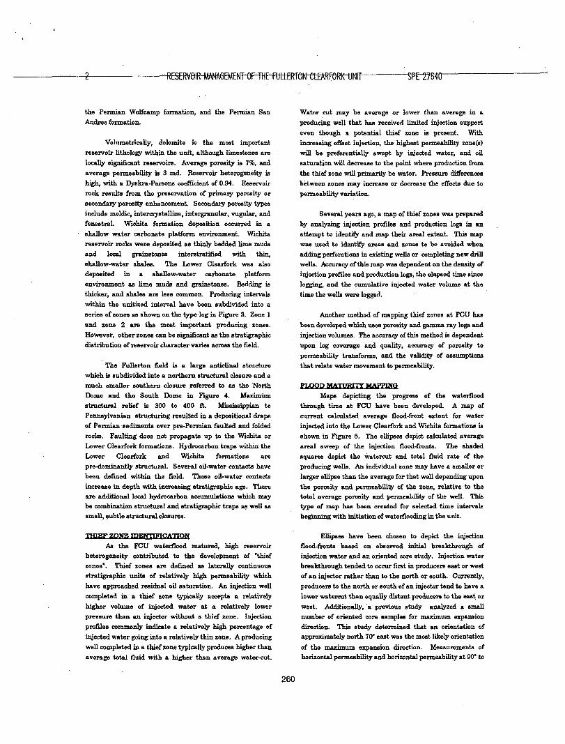
THIEF ZONE rDEiVTTFICATTO N
As the FCU waterflood matured, high reservoir
heterogeneity contributed to the development of "thief
zones'. Thief zones are defined as laterally continuous
stratigraphic units of relatively high permeability which
have approached residual oil saturation. A n injection well
completed i n a thief zone typically accepts a relatively
higher volume of injected water at a relatively lower
pressure than an injector without a thief zone. Injection
profiles commonly indicate a relatively high percentage of
injected water going into a relatively th in zone. A producing
well completed in a thief zone typically produces higher than
average total f luid with a higher than average water-cut.
Water cut may be average or lower than average in a
producing well that has received limited injection support
even though a potential thief zone is present. With
increasing offset injection, the highest permeability zone(s)
wi l l be preferentially swept by injected water, and oil
saturation wi l l decrease to the point where production from
the thief zone wi l l primarily be water. Pressure differences
between zones may increase or decrease the effects due to
permeability variation.
Several years ago, a map of thief zones was prepared
by analyzing injection profiles and production logs in an
attempt to identify and map their a real extent. This map
was used to identify areas and zones to be avoided when
adding perforations in existing wells or completing new dr i l l
wells. Accuracy of this map was dependent on the density of
injection profiles and production logs, the elapsed time since
logging, and the cumulative injected water volume at the
time the wells were logged.
Another method of mapping thief zones at FCU has
been developed which uses porosity and gamma ray logs and
injection volumes. The accuracy of this method is dependent
upon log coverage and quality, accuracy of porosity to
permeability transforms, and the validity of assumptions
that relate water movement to permeability.
FLOOD MATURITY MAPPING
Maps depicting the progress of the waterflood
through time at FCU have been developed. A map of
current calculated average flood-front extent for water
injected into the Lower Clearfork and Wichita formations is
shown in Figure 6. The ellipses depict calculated average
a real sweep of the injection flood-fronts. The shaded
squares depict the watercut and total f luid rate of the
producing wells. A n individual zone may have a smaller or
larger ellipse than the average for that well depending upon
the porosity and permeability of the zone, relative to the
total average porosity and permeability of the well. This
type of map has been created for selected time intervals
beginning with initiation of waterflooding in the unit.
Ellipses have been chosen to depict the injection
flood-fronts based on observed initial breakthrough of
injection water and an oriented core study. Injection water
breakthrough tended to occur first in producers east or west
of an injector rather than to the north or south. Currently,
producers to the north or south of an injector tend to have a
lower watercut than equally distant producers to the east or
west. Additionally, a previous study analyzed a small
number of oriented core samples for maximum expansion
direction. This study determined that an orientation of
approximately north 70° east was the most likely orientation
of the maximum expansion direction. Measurements of
horizontal permeability and horizontal permeability at 90* to
260

SPE 27640 R.K. BANE, R.A. PARKER, W.G. STORBECK AND RI. SUNDE 3
the orientation of the first measurement in non-oriented conventional core from FCU typically vary by a factor of 1.5. Neither orientation is likely to measure the maximum or minimum horizontal permeability in non-oriented core, so the actual ratio of maximum horizontal permeability to horizontal permeability at 90° would be somewhat greater than 1.6:1. A ratio of 2:1 has been used for flood-front maps at FCU with an orientation of maximum permeability of north 70" eaat. This ratio describes the relationship between the calculated flood-front positions and the observed watercut in offset producers. This orientation is sub-parallel to one common fault trace trend and approximately perpendicular to the fault trace trend of the largest displacement faults at FCU.
The calculation of the area that has been swept uses a variation of the oil in place equation:
W~7758$ Ah(l-Sorw). (1)
Where W{-= cumulative injected water
4> =porosity, fraction
h- thickness, feet SQrw= residual oil saturation to water flood
solving for area: A=W{ 17758* h(l-Sorw). (2)
This technique is not intended to be used in an absolutely quantitative manner. There are many other factors that control the movement of injected water within the reservoir, such as continuity, completion efficiency, reservoir pressure, and production and injection well pressures.
The map created using these assumptions is useful for obtaining an overall picture of flood maturity throughout the unit, but is not useful for identifying individual thief zones. This problem has been addressed by creating flood-front maps by zone. Permeability was calculated from porosity logs using a core derived porosity-permeability transform for each of the zones. A kh (md-ft) value was calculated or interpolated where logs were not available. The injected water was then allocated to each zone based on the kh of that zone relative to the kh of the total well. These kh values only include intervals open for production or injection. These calculations were done at two year time intervals to account for changes in completed intervals. A map of zone 2, shown in Figure 6, illustrates a zone that has better than average permeability over the eastern half of the North Dome. This thief zone has caused early water breakthrough in many producing wells. This flood-front map of zone 2 depicts the calculated average a real extent of injected water in a small area of the North Dome. The size of the squares is proportional to the total fluid rate and the kh of zone 2 relative to the total kh for the well. These maps were useful in identifying thief zones and correlated with
the earUer map of thief zones based upon injection profiles and production logs. These flood-front maps are also used to evaluate add-pay candidates and to screen drill well locations by identifying potential thief zone(s).
The individual zone flood-front maps enhanced the identification of thief zones. However, the averaging of reservoir character over an entire zone still de-emphasized thin thief zones. To further emphasize the heterogeneity of the reservoir and the movement of injected water from injector to producer another tool was developed. This tool is a flood-front profile and is a depth plot of the producer and four closest offset injectors aa shown in Figure 7. The four tracks to the right illustrate the calculated extent of the injected water in solid black. This calculation technique is similar to the individual zone flood-front maps, but instead of using the zone kh and $h (porosity-ft.), the profile shows the flood-front extent on a foot by foot basis. This total does not take into account the porosity and permeability of the injectors but assumes porosity and permeability of the producer is constant throughout the producer centered pattern. This obviously is not the case. However, the log suites for injectors in the unit are generally older and the porosity logs are difficult to interpret quantitatively. This tool, in conjunction with conventional logs analysis, can be used to pick additional perforations or to identify the likely source of water in high water-cut wells. Although there are many assumptions involved with this tool, production logs and injection profiles confirm that this tool can be used to identify thief zones. A production log is shown on Figure 7 in the track entitled"% Flow*.
TOFILL DRILLING RESULTS
Fifty-eight 10-acre producers were drilled in 1986-88. The wells were drilled in a group of clusters as shown in Figure 8. There were two reasons for drilling these clusters. First, this strategy would provide data on the effect of directional permeability. Previous work had indicated that there was evidence of an east-west directional permeability in the North Dome. Secondly, the location of clusters would provide data on areas of the field which could be economically viable to develop on 10 acre spacing.
Analysis of the 10 acre infill drilling program began with an analysis of the production performance and completion strategy for each well. Most of the wells were completed by perforating and acidizing all calculated pay. However, in a few wells, potential thief zones were not perforated. This was done to limit water production. Three of the 58 wells produced such high water volumes that they were not economic. Thirty-four of the remaining 55 wells were oriented north-south of existing 40-acre injectors. The EUR (Estimated Ultimate Recovery) for these wells averages 72,000 STB. The EUR for the 21 east-west wells averages 50,000 STB. While these results support an
261

-4"
east-west directional permeability, there were several
anomalies. For example, one of the best 10 acre wells was
an east-west well that has an EUR of over 180,000 STB.
The techniques described above for thief zone
identification and mapping had not been developed when
these wells were drilled. Flood-front maps were also used
i n a post dri l l ing analysis to evaluate the potential for
improving d r i l l well location selection. A flood-front map was
generated using injection data through the end of 1985. The
fifty-eight 10-acre producers were then spotted on this map
and ranked based on proximity to injection flood-fronts. The
results of this ranking are shown i n Table 2. Wells farther
f rom existing flood fronts, typically, have a higher EUR.
However, as w i th the directional orientation, there were
anomalies. For example, three wells wi th high EURs were
i n the "good" category. A l l three wells were selectively
completed to l imi t water production by leaving the potential
thief zone(e) unperforated. A total of four wells i n the good
category had been selectively completed. These four wells in
the good category along with the five wells i n the "excellent*
category have an average EUR of 125,000 STB. The last two
dri l l ing packages were developed using similar ranking
criteria.
ADD PAY WORKOVER PROCESS
The - add-pay workover program at FCU has
historically been important to maintaining field production.
The process and tools used to identify and screen add-pay
workover candidates have changed as the waterflood has
matured and as reservoir management objectives have
changed.
A multi-functional team was formed in 1989 to
identify the remaining add-pay workover opportunities at
FCU. This was the f i rs t systematic attempt to identify and
prioritize the remaining add-pay workover opportunities for
the entire field. The team was comprised of geologists,
engineers, and operations personnel. They evaluated the
remaining Lower Clearfork and Wichita add-pay potential in
both producers and injectors, the reserve potential of the
Upper Clearfork and the West Flank, and pay below the
traditional oil-water contacts. The study resulted i n a
prioritized list of over 800 work items that included add-pay
workovers and artificial-lift optimizations in a multi-year
implementation plan.
The prioritized candidate list was worked by
reviewing complete patterns instead of individual wells. As
each successive candidate was worked, the entire pattern
was reviewed for optimization. A l l wells i n the pattern were
evaluated fo r add-pay workovers and artificial-lift
optimization. A l l remaining pay which exceeded the
porosity cutoff was to be added during the workover. This
would maximize sweep efficiency and prepare the wells for a
future carbon dioxide tertiary project. Add-Pay workovers
frequently added high permeability zones wi th low oil
saturations. These zones hold significant reserve potential
for a tertiary project, hut are difficult to manage as part of a
mature multi-layer waterflood because they are capable of
cycling large volumes of water.
Early workover results prompted the need to revisit
the operational strategy which called for the addition of all
calculated pay. A number of the early producer workovers
added 300 to 1500 BWPD and increased producing fluid
levels to the surface. These *Perf-N-Surf workovers
required installation of electric submersible pumps or
fiberglass rodstrings to decrease producing f luid levels.
Additionally, early i n the implementation of the plan, the
anticipated date for initiation of the tertiary project was
delayed due to economic factors. The operational strategy
was changed accordingly. The field would be managed as a
mature waterflood instead of a mature waterflood in
anticipation of carbon dioxide flooding.
Identifying thief zones before they were perforated
was necessary to minimize operating costs and reduce water
cycling. This would reduce water production and improve
vertical distribution of injected water. Zone selection
became the most important part of each workover. The
techniques for thief zone identification and mapping had not
been developed when the 1989 study was completed. A new
process was developed to incorporate these techniques in
future workovers.
This process is outlined below:
1. Select candidate from prioritized list.
2. Review the well history and wellbore sketch.
3. Plot production and perform decline analysis.
4. Post offset production and injection on a map.
5. Generate cross-section including log and profile data
for the subject well, all other wells in the pattern, and
other offsets of interest.
6. Review flood-front maps.
7. Review flood-front profile.
8. Review pressure and core data i f available.
9. Identify potential thief zone(s).
10. Decide i f potential thief zone(s) should be included in
workover.
11. Perform workover.
12. Document results back to the well f i le for future
reference.
13. Initiate remedial work or artificial-lift optimization as
required.
Table 3 summarizes the results of the add-pay
workover program from 1987 through 1992. Reserves were
calculated by three different methods. Only the rate versus
time analysis has been included in the table. The rate
262

SPE 27640 R.K. BANE, RA PARKER, W.G. STORBECK AND R.L. SUNDE
versus time analysis was found to be the most pessimistic
reserve assessment while the WOR versus cumulative
production analysis was the most optimistic. The rate
versus cumulative production analysis agreed well with the
reserves calculated by the rate versus time analysis.
Flowstreams were analyzed based on the aggregate
production of the workovers performed in each calendar
year. Buildups do not always reflect pumped off conditions.
Inflow performance analysis would need to be run on each
workover, taking f lu id levels into account, to determine the
buildups associated wi th wells that are not pumped down.
Average oil buildups and reserves are decreasing with
time, while associated water buildups are increasing with
time. This performance is consistent wi th the operation of a
mature waterflood. However, the process described above
was initiated i n early 1992. Average WOR associated with
these workovers dropped wi th initiation of this process.
While i t is s t i l l too early to determine the impact this
process w i l l have on reserves, operating costs have been
reduced as a result of the reduction in water production
associated wi th oi l build-ups.
INJECTION WELL CONVERSIONS
The pace of injection well conversions at FCU has
slowed over the last few years as the number of 40-acre
conversion candidates has decreased. Three 40-acre
producing wells have been proposed for conversion in late
1993 or early 1994.
2. Review completion dates for all wells in the patterns
of interest.
3. Review offset injection history to identify possible
interference. Where offset injection interference was
noted, reserves were discounted by a factor that
reflected the degree of interference.
4. Calculate an initial EUR for each producer using
production versus rate decline analysis before the
conversion.
5. Calculate the current EUR for each producer after
conversion. EUR's for wells exhibiting flat or
increasing production were calculated by declining
the well at a rate that approximated the field's
average decline rate.
6. Review production histories and adjust the EUR to
eliminate the effects of add-pay workovers and
artificial-lift optimizations.
7. Subtract the initial EUR from the current EUR to
determine the net conversion gain for each producer.
8. Sum the producer reserves to yield net conversion
reserves.
Total flowstreams were determined by aggregating
the production of all wells which offset the conversions in
each package. The yearly buildups and decline rate
differences were determined directly from the decline curve.
The average annual decline rate improvement for wells
offsetting conversions at FCU is eight percent. Yearly
conversion buildups per offset for the first five years are 2.5,
4.6,4.1,2.8 and 0.7 BOPD.
Conversions are an important aspect of reservoir
management for a number of reasons. Conversions improve
a real sweep efficiency. The reserves associated wi th
improved areal sweep efficiencies are greater than the short
term loss of production due to conversion. Offset production
typically experiences both an oil build-up and an
improvement i n the decline rate. Additionally, conversions
maintain reservoir pressure and provide injection support
for pattern flooding. Finally, artificial-lift equipment
becomes available to meet other unit needs as a result of
converting producers to injection.
Before this latest group of conversions was proposed,
all conversions f rom 1987 to 1991 were reviewed. The study
included four conversion packages wi th a total of 53 wells.
Forty-nine of the 53 wells were actually converted to
injection. Three wells were plugged for mechanical reasons,
and another well was deepened and then returned to
production. Results for each package are shown in Table 4.
The reserve impact of past conversions was determined by
the following process.
1. Review past production and injection for offset
20-acre patterns including al l 10-acre wells.
Probability plots were used to confirm the estimated
reserves for the recent conversion proposal. The probability
plot for injection wells wi th six offsets is shown in Figure 9.
The average EUR for conversions on this plot is 224,000 BO,
or 87,300 BO per offset. This method agrees with the
volumes shown in Table 4 for 1987. The EUR associated
with conversions is decreasing with time as shown in Table
4. This is to be expected as the waterflood matures, however
conversions remain attractive at FCU.
WATERFLOOD BALANCING
Optimizing waterflood profitability with existing
facilities and wellbores is a primary focus of FCU reservoir
management. The highly stringerized and discontinuous
nature of the reservoir ' and multiple thief zones make
waterflood optimization difficult. Low pressure pay does not
contribute to production i f the bottom hole pressure is high
due to a high producing fluid level. A possible solution is to
increase the artificial-lift capacity in wells with high fluid
levels. Since this option involves significant additional
investment and increased operating costs, an alternate
option was investigated. A plan was developed to evaluate
the feasibility of optimizing the waterflood with existing
equipment, through "balancing" of the waterflood.
263

I ' RESEWOIRl FJENrOF'THE FULLERTON CLEARFORK UNIT SPE 27640
Typically, waterflood balancing refers to a process
where injection is controlled i n an effort to have al l
flood-fronts i n a pattern reach the producer at
approximately the same time. Balancing, in mature
waterfloods, can also refer to the process of maintaining
reservoir pressure by adjusting injection to match
production. Waterflood balancing at FCU manages water
injection to minimize f lu id levels in offset producers while
providing adequate injection support to all producers.
A field wide balancing model was developed to
manage water injection and control f lu id levels. A total of
1239 wellborea were used to describe a total of 605 blocks.
The blocks typically consist of a regular 20-acre five-spot
pattern. The water injection for each well is "allocated" to
adjacent blocks in proportion to offset production, Figure 10.
For example, i f each of the four offset producing wells
produced exactly the same volume i n a given time period
then each of the four blocks would be allocated 25% of the
wells injection.
Although the entire f ield was described in the model,
i t was realized that balancing a field the size of FCU would
be difficult. A team was formed to select a test area and
develop a process to balance the waterflood. The team
consisted of two reservoir engineers, a field superintendent
and a lease operator. The team selected a 16 pattern area
near the center of the North Dome. The test area, Figure
11, included 26 producers and 26 injectors. The area was
selected based on the following criteria: (1) nearly all wells
were currently active; (2) proximity to the waterflood facility
permitted maximum flexibility for adjusting injection rates
and pressures; (3) high density of modem well logs; (4) wide
variability in production and injection rates; (5) surface
facilities wi th capacity to handle anticipated volume
changes; and (6) the area contained a representative sample
of the artificial-lift equipment being used at FCU.
The objectives of the team were to pump off all wells
i n the test area without overloading the pumping
equipment, to evaluate the results of pumping off al l wells,
and to set target injection rates that would provide adequate
support for al l producers. Not a l l pumping equipment i n the
test area had been previously designed to operate in a
pumped off condition. Four possible processes were
considered to accomplish these goals. These processes are
shown i n Figure 12. The team selected process option three
which involved unloading the wells prior to implementing
target rates. This process was selected to minimize pumping
equipment failures and downtime. The process was initiated
wi th a wellbore review that resulted i n the identification of
27 potential work items. They included injector cleanouts,
acid stimulations, add-pay workovers, artificial-lift changes,
and profile modifications. Seven pumping units were slowed
to prevent overloading at pumped-off conditions. Workovers
to add-pay or upgrade artificial-lift equipment were delayed
un t i l the results of the init ial balancing effort were analyzed.
Injection rate changes were necessary to balance the
test area. Some wells requiring rate increases were already
at the maximum available injection pressure. Al l injectors
i n the test area were checked with wireline to determine the
amount of f i l l i n each wellbore. The amount of f i l l and the
need for increased injection was used to prioritize the wells
for cleanout jobs. Coiled tubing cleanouts were performed
on seven wells. Four of the coiled tubing workovers were
successful and increased injectivity between 60 and 150%.
On the other three wells, the coiled tubing workovers were
unsuccessful in removing f i l l and conventional cleanouts
were required. Target rates were implemented for each
injector i n the test area, based on offset artificial-lift
capacity. The artificial-lift capacity at pumped off conditions
was estimated for each well and input into the balancing
model. Current injection tests were used to calculate an
actual injection to withdrawal ratio (1/W) for each block.
The injection rate necessary to achieve the desired target
I/W for a block, was calculated using the balancing model.
The ini t ial target I/W for all blocks i n the test area was 1.0.
The target I/W ratio was reduced to .76 for blocks with high
producing f lu id levels. Blocks wi th submersible pumps were
maintained at a 1.0 I/W to avoid equipment damage.
Performance was monitored using a number of tools.
Control charts were used to identify producers that
responded to balancing. A control chart for one well that
responded to the drop in producing f luid level caused by
reduced offset injection is shown i n Figure 13. The
producing f luid level in this well was reduced 2000 f t . This
resulted in an increase of 15 BOPD and a decrease of 40
BWPD. Additionally, a test area surveillance map was used
to manage the volume of data associated with the 62 wells.
This map displayed the last three producing f lu id levels and
well tests for each producer. Target and permitted rates are
displayed for each injector along wi th the last three injection
rates and pressures. Producing f lu id levels were mapped
using dot maps to indicate both the magnitude and direction
of f lu id level changes. Fluid level changes observed through
the f i rs t six months of the test are shown on Figure 14.
Open dots indicate producing fluid levels that have
increased and solid dots indicate producing fluid levels that
have decreased.
Production and injection for the balancing test area,
beginning i n January 1992, is shown on Figure 16. The
balancing team was formed in September 1992. Unloading
of the artificial-lift equipment was completed on January 14,
1993 and target rate implementation began on February 20,
1993. This delay in target rate implementation caused the
drop in production seen in February. Three factors caused
the drop in production: (1) the three week period between
264

5PT276W TtK. BANL, R.A. FrMfcWSrrjBE^^ 7
slowing pumping units and the reduction of offset injection
caused the average producing f lu id level to increase and oil
cut to decrease; (2) pump-off controllers on the producers
began shutting down units on a low load alarm; and (3) an
injection well workover i n February caused cross flow into
the pay interval which, in effect, increased injection in the
south central portion of the test area.
Production teste i n association with producing f luid
levels demonstrate the effect that producing f luid level
changes have on production. Ten wells exhibited producing
f lu id level increases or decreases of more than 400 feet that
could be correlated wi th production tests. Production
changes in these wells ranged f rom 0.7 to 2.1 BOPD per 100
feet change i n f lu id level.
The GOR i n the test area has remained constant at
about 650 SCF/3TB and reservoir pressure remains well
above the bubble point pressure. Seven wells in the test
area have responded favorably to reduced injection. Oi l
production has increased in these wells by 80 BOPD and
water production has decreased 270 BWPD. Total oil
production for the test area increased 30 BOPD above the
ini t ia l production level, exclusive of the test area's historic
decline. Water injection has been reduced 1000 BWIPD, and
water production decreased by 300 BWPD. Additional
production data is needed to determine what effect this
process wi l l have on production decline in the test area.
This performance improvement waB not realized for
approximately eight months.
P R O F I L E MPPITICATIOW
A producer completed i n a thief zone typically wi l l
produce large f l u i d volumes at high watercut. Fluid levels i n
these wells are generally near the surface and high capacity
artificial-lift equipment is often needed to reduce the f luid
levels. Cement squeeze treatments and cast iron bridge
plugs have been used to isolate thief zones and reduce water
production and operating expenses. The results of these
workovers are shown i n Table 5. These workovers have
been successful i n reducing water production 59% of the
time.
Most FCU injectors were originally completed as open
hole producers and later converted to water injection. These
open hole completions prevent the use of most mechanical
water-ehut off treatments. Cement and sand have been
used to shutoff injection in a few wells where thief zones
were identified at the bottom of the open hole interval.
A majority of the wells at FCU are completed in at
least one thief zone and a method of treating these wells is
being studied. A team was formed to investigate products
and techniques available for treating thief zones under
conditions present in FCU. This team reviewed products
and techniques ranging f rom dieeel oil cement to
cross-linked polymer. A cross-linked polymer has been
selected for use in a seven well test. The seven wells include
four injectors in a single five-spot pattern and three
producers located elsewhere in the field. These workovers
have not yet been completed and no results are available to
report.
CONCLUSIONS:
1. Reservoir management of the Fullerton Clearfork
Unit has evolved in response to increasing waterflood
maturity and changing operational strategy.
2. Thief zones can be identified at FCU through use of
flood-front mapping and flood-front profiles.
Production logs and injection profiles have confirmed
these flood-front mapping techniques.
3. Selective i n f i l l drilling is attractive at FCU and can be
optimized with flood-front mapping and thief zone
identification.
4. Add-pay workover performance has been optimized
wi th thief zone identification.
5. Although there are a limited number of remaining
candidates, conversion of producing wells to injection
continues to be attractive at FCU.
6. The flood balancing techniques described in this paper
have improved waterflood performance in a test area
at.FCU.
265

"RESERVOIRKANAGEMENT ON HE rULLLKiON CLLAKrOKONIT SPL 2/6W
NOMENCLATURE: 4 = Porosity, fraction
A - Area, acres h = Thickness, feet k = Permeability, md
I/W = Injection to Withdrawal Ratio W. = Cumulative water injections, barrels EUR = Estimated Ultimate Recovery STB = Stock Tank Barrel BFPD = Barrels fluid per day BOPD= Barrels oil per day BWPD = Barrels water per day BWIPD = Barrels water injection per day S o r w = Residual oil saturation to waterflooding,
fraction
ACKNOWLEDGMENTS The authors wish to thank Exxon Company, USA.
and the Fullerton Clearfork Unit working interest owners for their cooperation in presenting this paper. We also want to thank the past and present Fullerton Clearfork Unit team members for their assistance in the work described in this paper.
REFERENCES 1. StileB, L.H.: "Optimizing Waterflood Recovery in a
Mature Waterflood, The Fullerton Clearfork Unit", paper SPE 6198 presented at the SPE-AIME 61st Annual Fall Technical Conference and Exhibition, New Orleans, Oct. 3-6,1976.
2. George, C J . and Stiles, L.H.: "Improved Techniques for Evaluating Carbonate Waterfloods in West Texas", JPT, (November 1978) pp 1547 -1554.
3. Barber, A.H. Jr., George, C.J., Stiles, L.H. and Thompson, B.B.: "Infill Drilling to Increase Reserves-Actual Experience in Nine Fields in Texas, Oklahoma and Illinois", paper SPE 11023 presented at the SPE-AIME 57th Annual Fall Technical Conference and Exhibition, New Orleans, Sept. 26 • 29, 1982.
4. Satter, A., Varnon, J.E. and Hoang, M.T. "Reservoir Management: Technical Perspective", paper SPE 22350 presented at the SPE International Meeting held in Bering, China, March 24 - 27,1992.
TABLE 1 FULLERTON CLEARFORK UNIT DATA
OCTOBER 1993
Discovery Date 1942
Unit Area, acres 29,642
Average Porosity, % 7
Average Permeability, md S
Average Pay, f t 151
Oil Gravity, "API 42
Hydrogen Sulfide, % 0.1
Original Reservoir Pressure, psig 2940
Original Water Saturation, % 24
Bubble Point Pressure, psig 2370
Original FVF, RB/STB 1.636
Original GOR, SCF/STB 1250
Cumulative Oil Production, MMBO 268
Oil Production, BOPD 11,837
Water Production, BWPD 106,732
Active Producers 629
Active Injectors 432
266

SPE 27640 R.K. BANE, RA PARKER, W.G. STORBECK AND R.L. SUNDE 9
— T
LEA
s I
Andrew: ^NDREftS
FULLERTON
"SI
f^r, MARTIN HOWARD
A LOVING C^' WlriKLER E C T 0 R
.%v-A---%
j Midland I MIDLAND GLASSCOCK
y WARD
CRANE PTON I REAGAN
LOCATOR MAP FIGURE 1
z o
g u
GA!
J M
WA7 ER Vu .*"v' ,* V
\ * > J-7*
1 1 I f 1
i
3
Z 3 c
1
1942 1944 1946 1948 1950 1952 19S4 1956 1958 1960 1962 1964 1966 1968 1970 1972 1974 1976 1978 1980 1982 1984 1986 1988 1990 1992 1994
200
1942 1944 1946 1948 1950 1952 1954 1956 1958 1960 1962 1964 1966 1968 1970 1972 1974 1976 1978 1980 1982 1984 1986 1988 1990 1992.1994
FIGURE 2 FULLERTON CLEARFORK UNIT
PRODUCTION/INJECTION HISTORY 267

RESEWOIR ANAGEttLW rTriE_rott£RTON XLEARFORK" UNIT 3PF27Mrj
268 FIGURE 3

SPE 27640 R.K. BANE, R.A. PARKER, W.G. STORBECK AND R.L SUNDE
LOWER CLEARFORK STRUCTURE MAP FIGURE 4
269

RESERVOIR MANAGEMENT OF THE FULLERTON CLEARFORK UNIT SPE 27640
ml
" 8
: :H5O: :
i 5
[Bp; 3*5
8
•IS
•SS
m e g : : *
I I •::-u» : a. < 2 r-Z o DC U.
I a O o _J u. CM
111 z o N
His
m
ft «s»^ ml
11!
3*1
2
SI?
S§4 ^1
3 III;: ilili 15
5 £ h- 3 z u-o cc U-I a o o _ i u. < H Z O
i cc o u. rr < iu _ i O cr iu
O
270

R.K. BANOXTARKERrWXrSTORBKK AND R.L SUNOE
KBCTOft PijECTOR HJBCTOR MJECTOR FCU *2148 FCU #814*5 FCU *21«4 FCU *2C46
FLOOD-FRONT PROFILE FCU # 2 1 4 5
FIGURE 7
271

1ravell^MAMeFJm™^^^ •SPE-27646-
i
i v i \
Table 2 1986-88 10 Acre Wells
Average Number of Flood-Front Ranking* EUR Wells
(STB) Poor 39,800 14 Fair 55,800 13 Good 73,100 23 Excellent 110,600 5
* Based on cumulative injection through 1985
FIGURE B ! 986-88 10-ACRE DRILL WELLS
Table 3 Add-Pay Workover Program Results
(1987-1992) Average
Number of Average Reserves Pay Production Buildup Year Workovers Per Workover Added Per W/O Increase WOR
(STB) (Ft.) (BOPD) 1987 33 72.1 150 18.6 11.1 1988 52 69.2 149 15.2 9.4 1989 46 48.2 162 22.5 11.1 1990 38 39 162 13.4 10.4 1991 33 • 136 13.6 29.2 1992 15 * 147 15.1 4.1
* Not enough production history available to estimate reserve Impact
Table 4 Conversion Program Results
(1987-1991) Average
Number of Reserves per Average Number Reserves per Year Conversions Conversion of Offset Producers . Offset Producer
(STB) (STB) 1987(1) 12 243,100 5.8 41.7
1987 (2) 10 198,400 5.8 34.2
1988 22 86,900 3.6 24.2
1991 5 73,600 5.0 14.7
(1) First Package (2) Second Package
272

SPE. 27640 R.K..BANE, RA PARKER.-W.G.-SIORBECKJiNO-R.L.-SUNOE
AiniGvaoud 3Aa\nnwno 273

RESERVOIR MANAGEMENT OF THE FULLERTON CLEARFORK UNIT SPE 27640
274
Related Documents