Spatial tools for LiDAR based watershed management and forestry analysis Antonello Andrea, Franceschi Silvia, Tonon Giustino and Comiti Francesco FOSS4G-EU Como 16 July 2015

Spatial tools for LiDAR based watershed management and forestry analysis
Aug 16, 2015
Welcome message from author
This document is posted to help you gain knowledge. Please leave a comment to let me know what you think about it! Share it to your friends and learn new things together.
Transcript

Spatial tools for LiDAR based watershed
management and forestry analysis
Antonello Andrea, Franceschi Silvia, Tonon Giustino and Comiti Francesco
FOSS4G-EU Como 16 July 2015
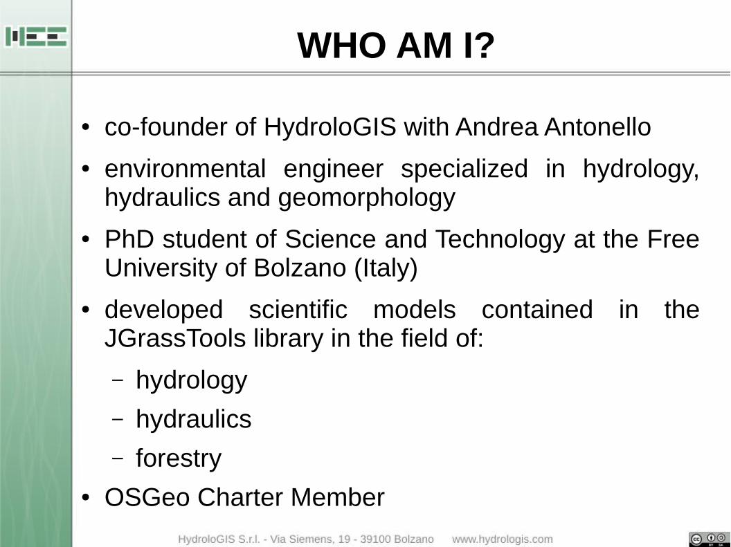
WHO AM I?
● co-founder of HydroloGIS with Andrea Antonello
● environmental engineer specialized in hydrology, hydraulics and geomorphology
● PhD student of Science and Technology at the Free University of Bolzano (Italy)
● developed scientific models contained in the JGrassTools library in the field of:
– hydrology
– hydraulics
– forestry● OSGeo Charter Member
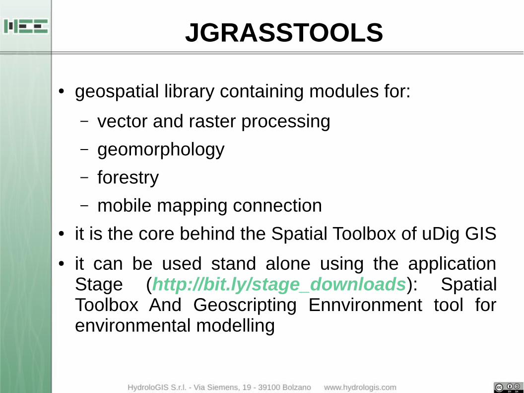
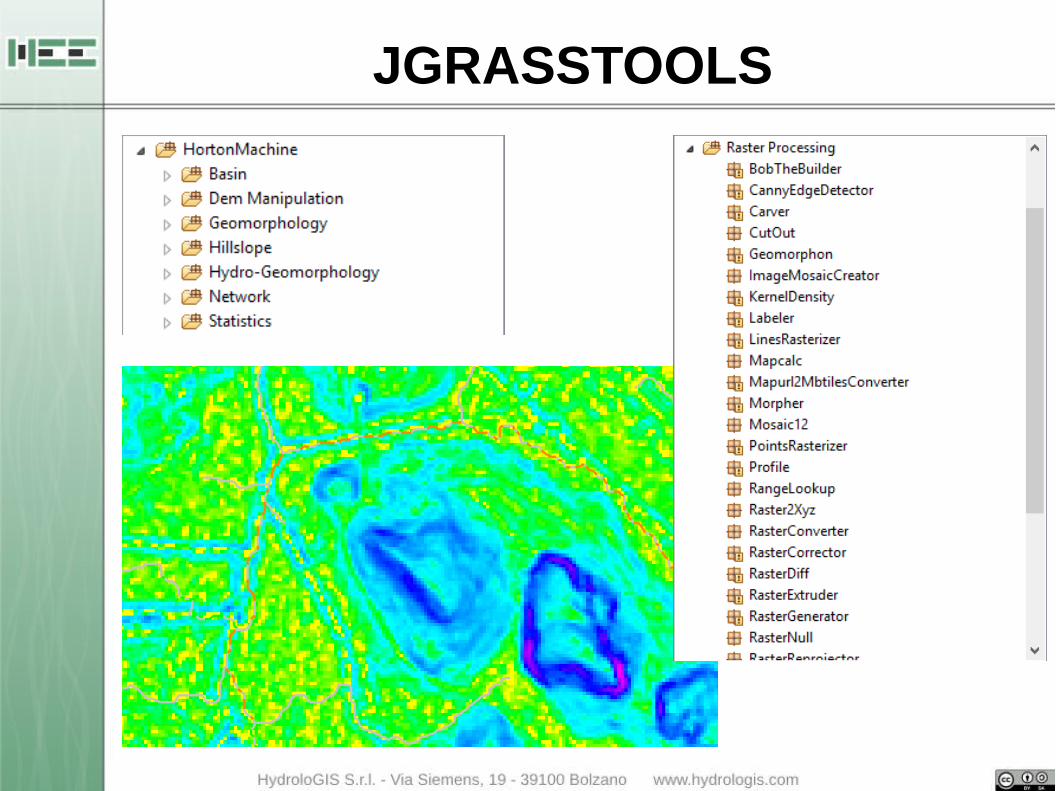
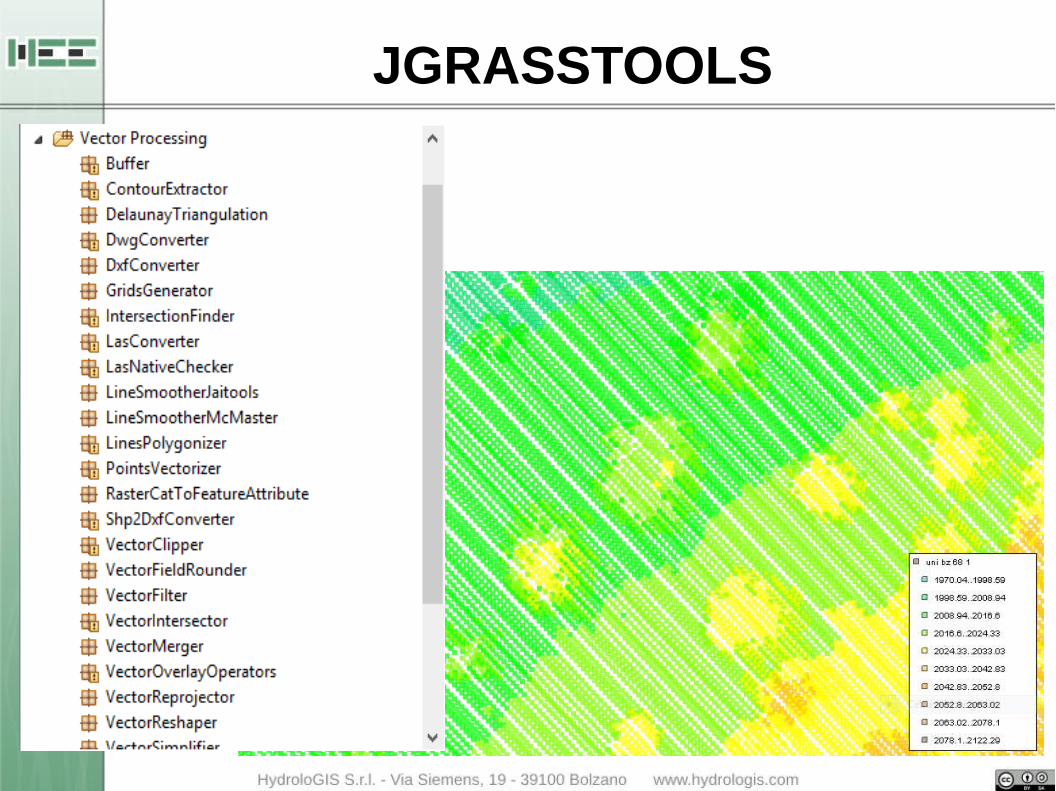
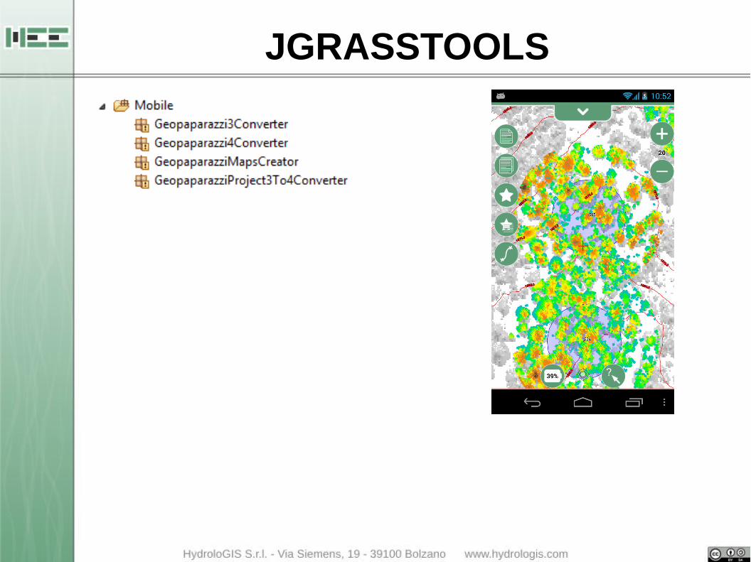
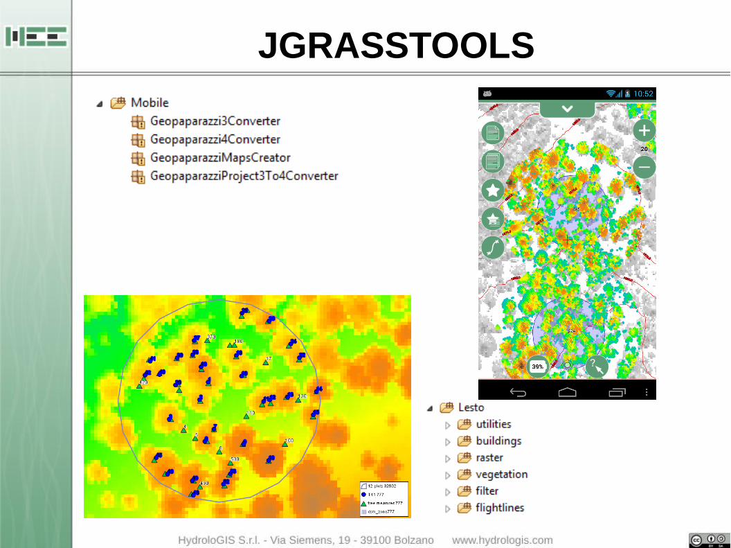
JGRASSTOOLS
● geospatial library containing modules for:
– vector and raster processing
– geomorphology
– forestry
– mobile mapping connection● it is the core behind the Spatial Toolbox of uDig GIS
● it can be used stand alone using the application Stage (http://bit.ly/stage_downloads): Spatial Toolbox And Geoscripting Ennvironment tool for environmental modelling

JGRASSTOOLS
JGRASSTOOLS
JGRASSTOOLS
JGRASSTOOLS
JGRASSTOOLS
JGRASSTOOLS

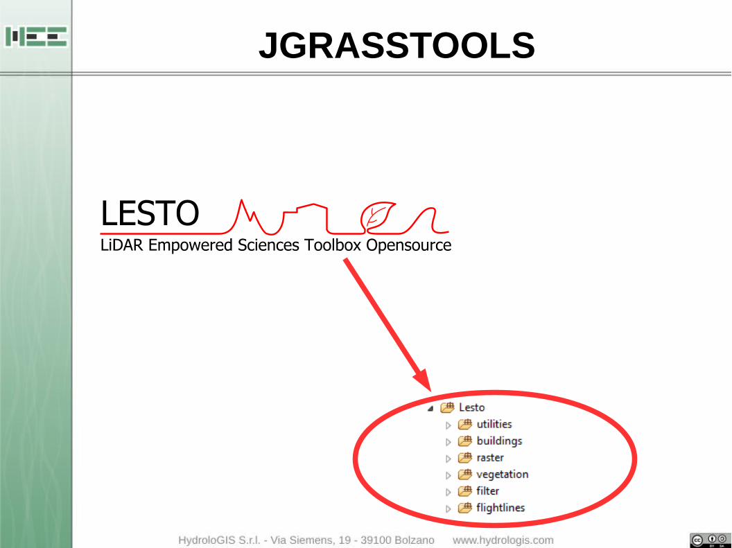
WHAT IS LESTO?
● Open Source
● GIS aware
● library dedicated to
● sciences that make use of
● LiDAR data
Developed and maintained by HydroloGIS and the team of prof. Tonon at the Faculty of Science and Technology of the Free University of Bolzano (Italy).
Contains tools for handling high resolution LiDAR data (LAS) and for LiDAR analysis related to forestry.
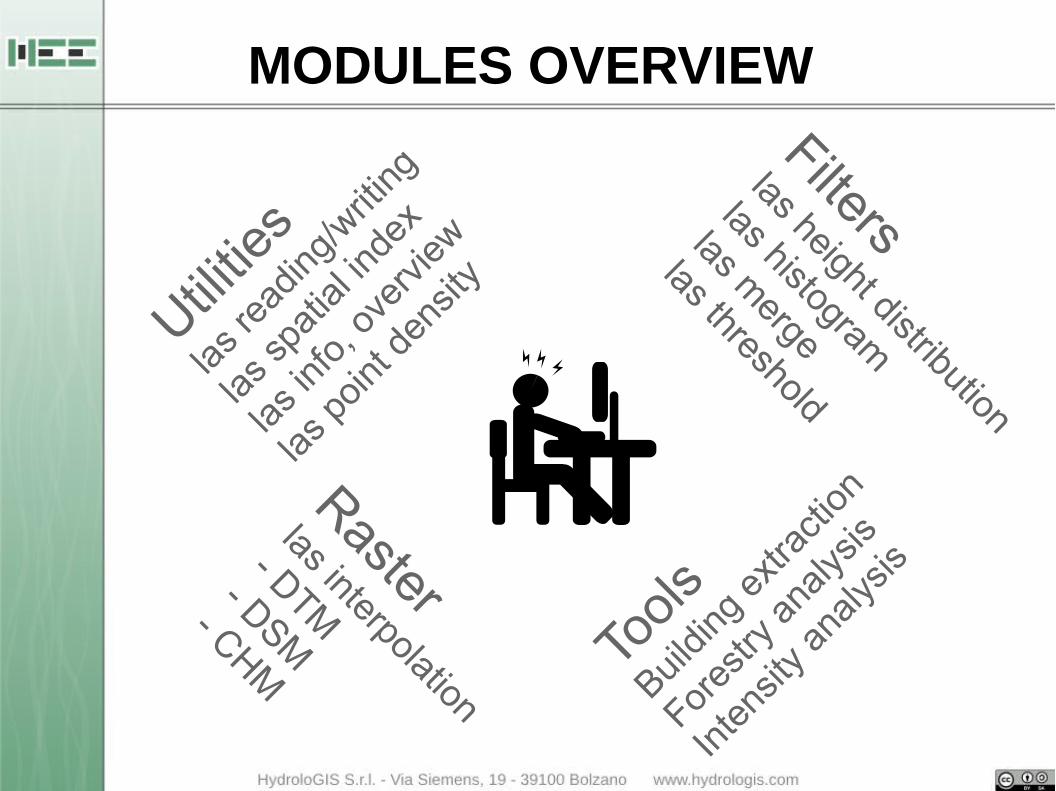
Utilitie
s
las re
ading
/writ
ing
las sp
atial
inde
x
las in
fo, o
verv
iew
las p
oint d
ensit
y
Rasterlas interpolation
- DTM- DSM
- CHM
Filterslas height distribution
las histogram
las merge
las threshold
Tools
Buildin
g ex
tracti
on
Fores
try a
nalys
is
Inte
nsity
ana
lysis
MODULES OVERVIEW

MODULES OVERVIEW IN STAGE

MODULES OVERVIEW IN STAGE
PREPROCESSING
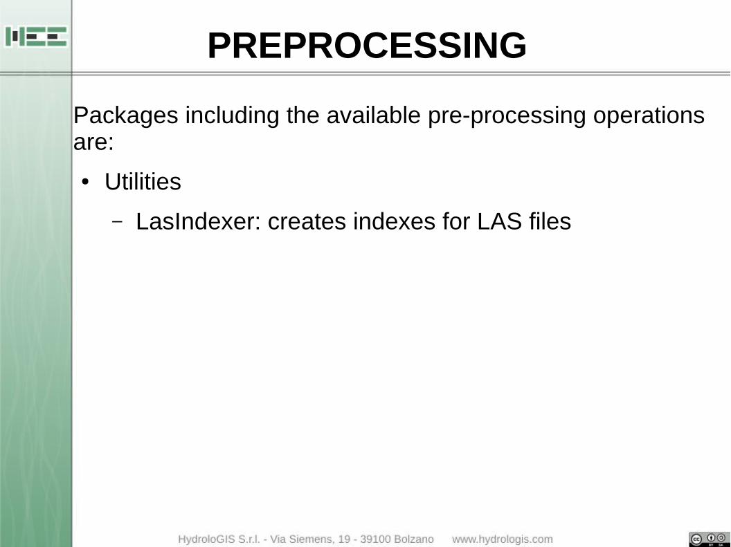
Packages including the available pre-processing operations are:
● Utilities
– LasIndexer: creates indexes for LAS files

LasIndexer
PREPROCESSING
Packaging including the available pre-processing operations are:
● Utilities
– LasIndexer: creates indexes for LAS files
– LasInfo: prints out information of a LAS file/folder
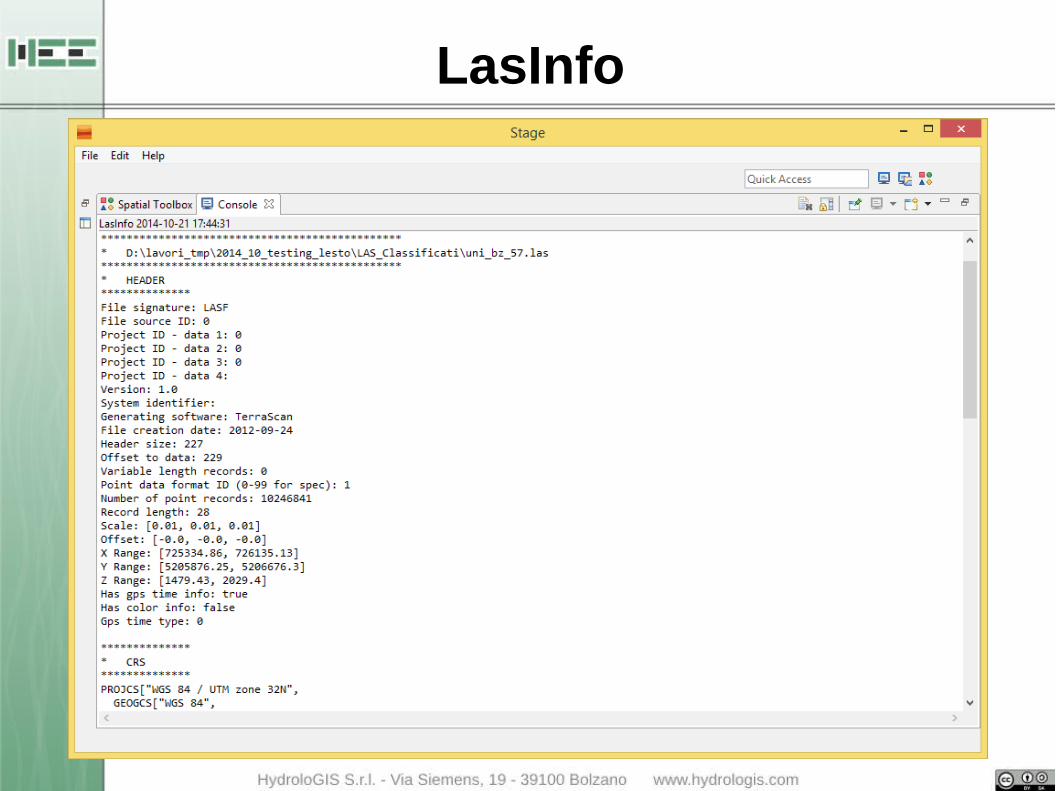
LasInfo
PREPROCESSING
Packaging including the available pre-processing operations are:
● Utilities
– LasIndexer: creates indexes for LAS files
– LasInfo: prints out information of a LAS file/folder
– LasOverviewCreator: creates a shp with overview
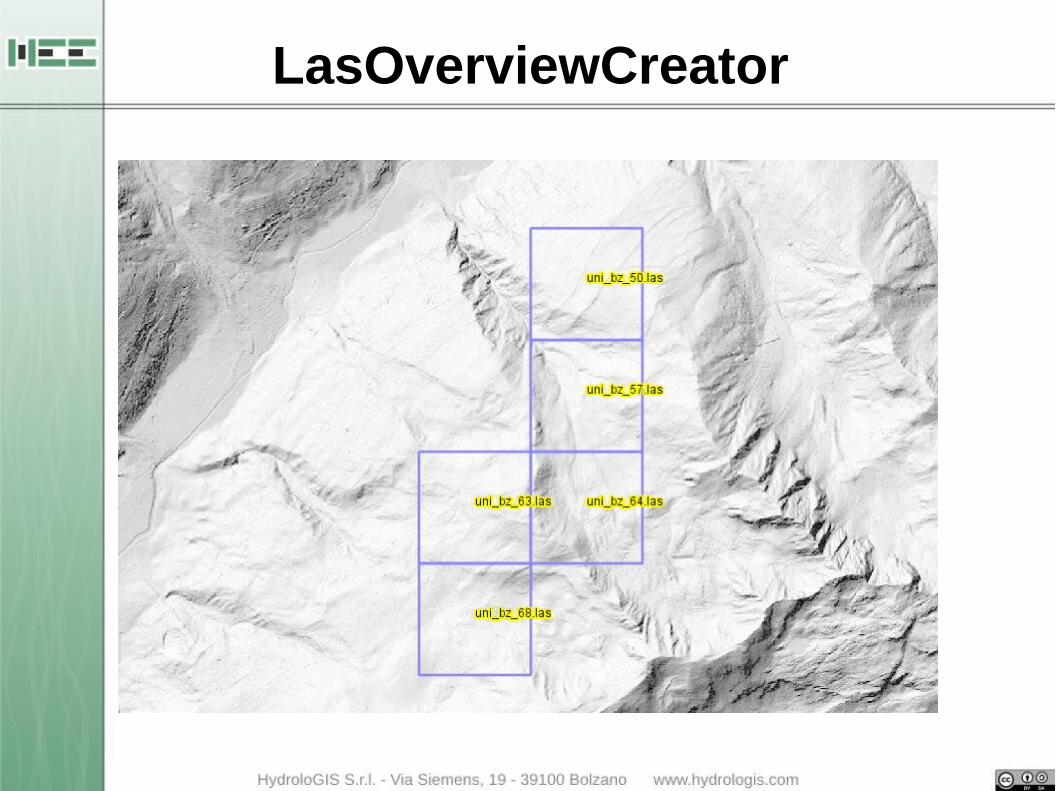
LasOverviewCreator
PREPROCESSING
Packaging including the available pre-processing operations are:
● Utilities
– LasIndexer: creates indexes for LAS files
– LasInfo: prints out information of a LAS file/folder
– LasOverviewCreator: creates a shp with overview
– LasPointDensityExtractor: creates a shp with point cloud density on a given grid

LasPointDensityExtractor

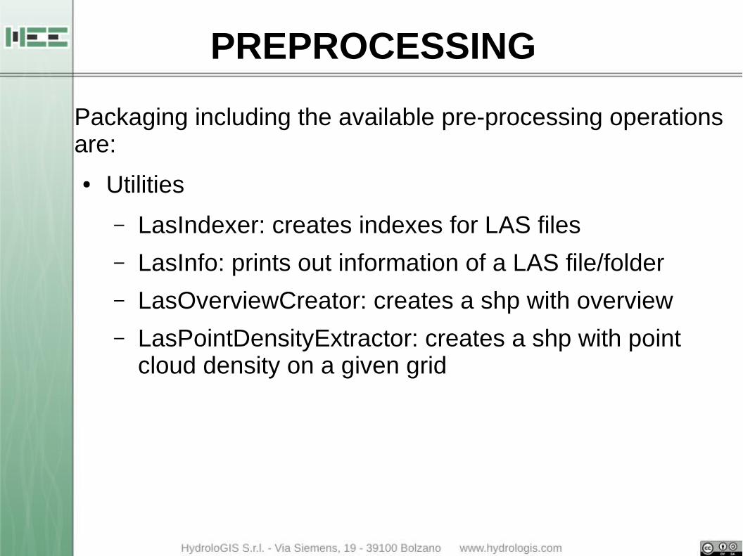
PREPROCESSING
Packaging including the available pre-processing operations are:
● Utilities
– LasIndexer
– LasInfo
– LasOverviewCreator
– LasPointDensityExtractor● Filter
– LasHeightDistribution: analyze the height distribution and categorize the forest type
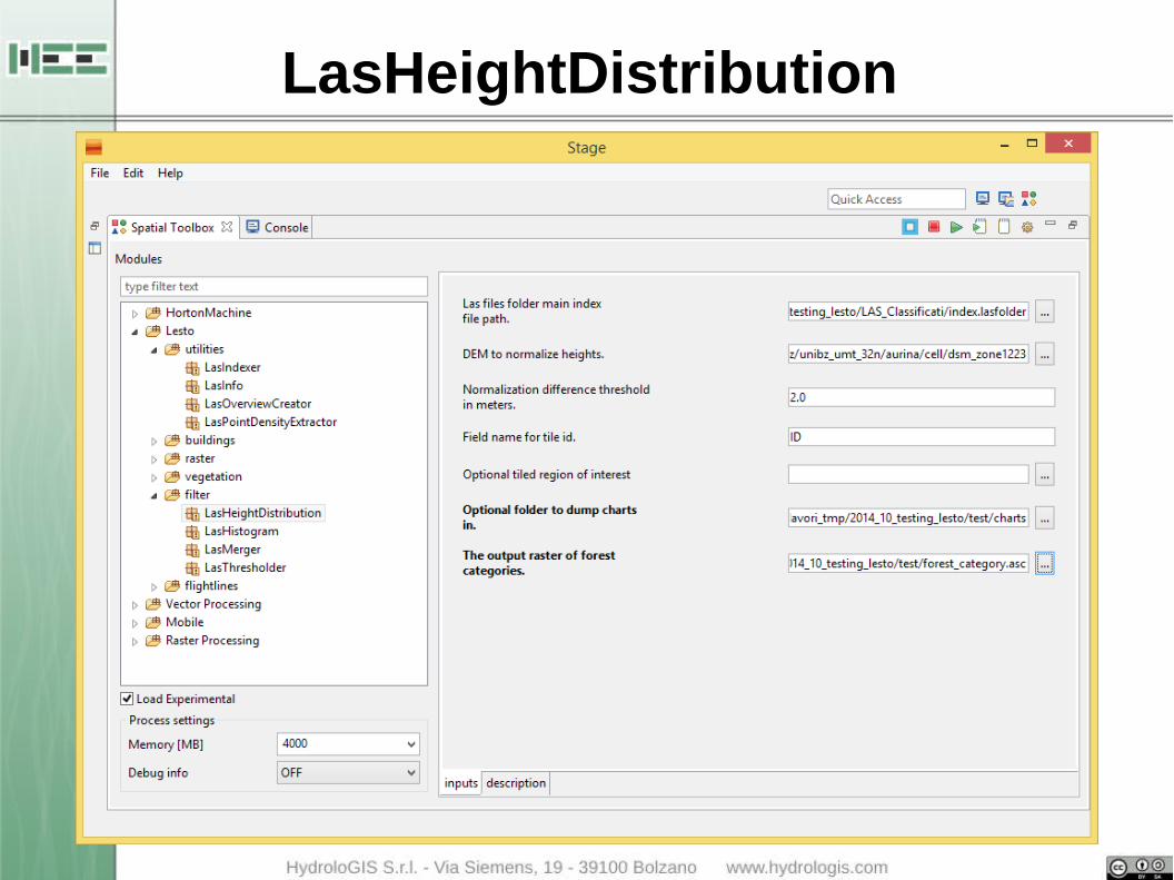
LasHeightDistribution

LasHeightDistribution
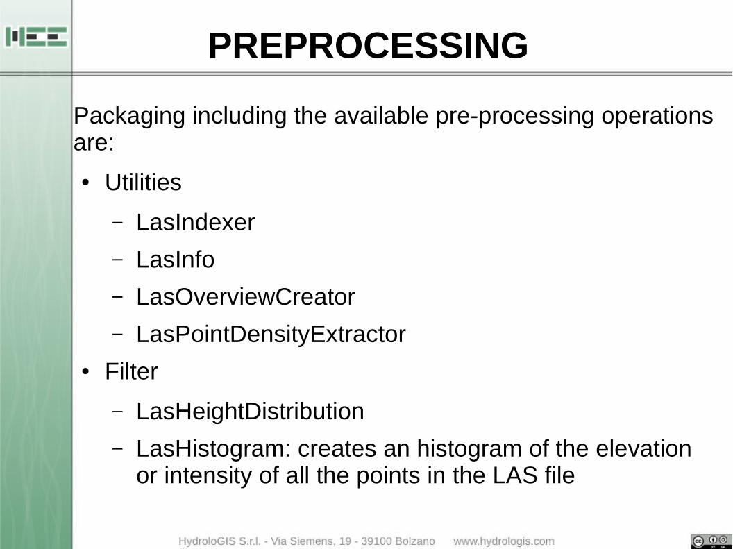
PREPROCESSING
Packaging including the available pre-processing operations are:
● Utilities
– LasIndexer
– LasInfo
– LasOverviewCreator
– LasPointDensityExtractor● Filter
– LasHeightDistribution
– LasHistogram: creates an histogram of the elevation or intensity of all the points in the LAS file
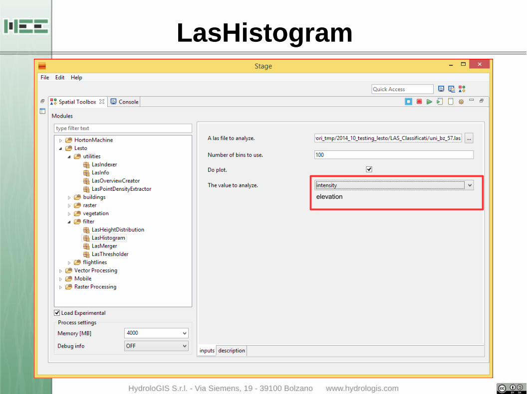
LasHistogram
elevation

LasHistogram

PREPROCESSING
Packaging including the available pre-processing operations are:
● Utilities
– LasIndexer
– LasInfo
– LasOverviewCreator
– LasPointDensityExtractor● Filter
– LasHeightDistribution
– LasHistogram
– LasMerger: merges all the LAS file contained in a folder in a single one
PREPROCESSING
Packaging including the available pre-processing operations are:
● Utilities
– LasIndexer
– LasInfo
– LasOverviewCreator
– LasPointDensityExtractor● Filter
– LasHeightDistribution
– LasHistogram
– LasMerger
– LasThresholder: extracts the points with values interval

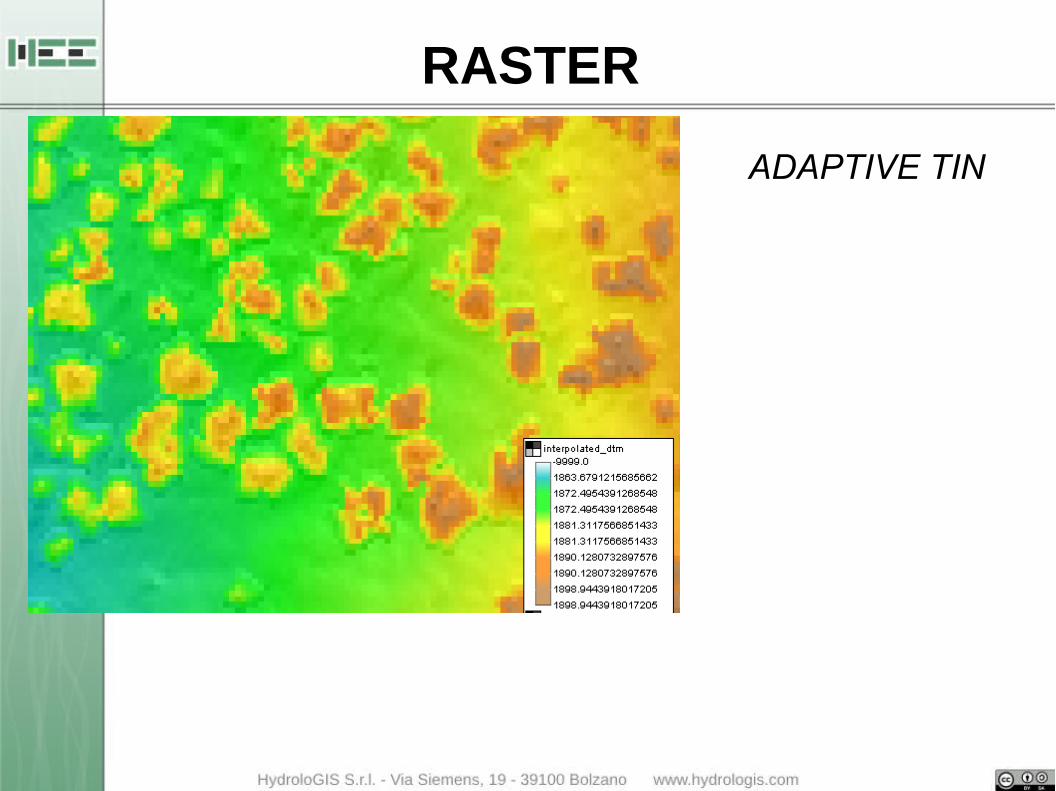
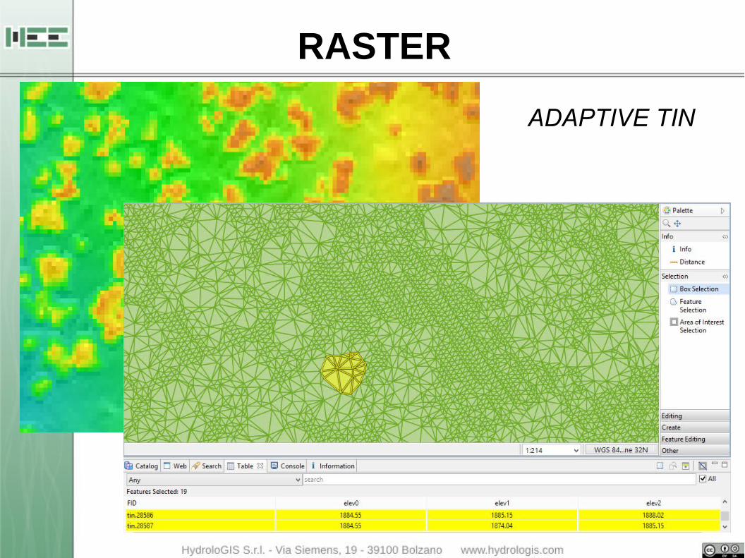
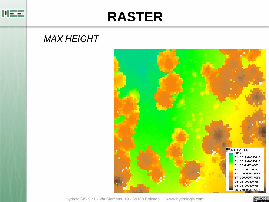
RASTER
Raster package contains all the available modules to interpolate and create a raster (DTM, DSM) from raw point cloud. The different interpolation algorithms are
● AdaptiveTinFilter: the implementation of the adaptive TIN method of Axelsons
● Las2BivariateRasterMosaic: uses the bivariate function to interpolate a raster from the point cloud and creates a mosaic of TIF
● Las2RasterInterpolator: interpolates a raster from LAS points using the Inverse Distance Weight method
● LasOnRasterMapper: creates a raster by mapping max/min elevation point in each pixel
● LasTriangulation2Dsm: creates a DSM from the triangulation of the point cloud
RASTER
ADAPTIVE TIN
RASTER
ADAPTIVE TIN
RASTER
MAX HEIGHT
BUILDINGS
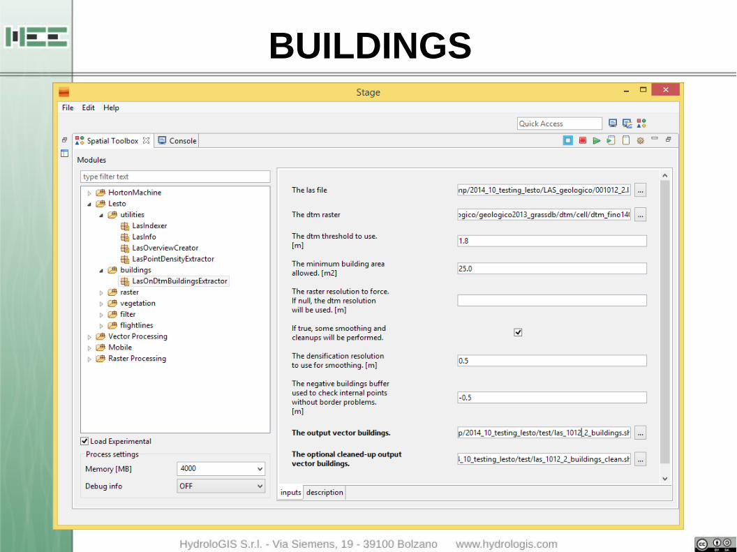
This package contains a module to extract the vector data of the buildings from a LAS file.
● LasOnDtmBuildingExtractor: based on the identification of the holes in the ground generated by cutting all the points with an elevation on the ground over a given threshold
● the output shapefile can be cleaned from noise data and smoothed on the boundaries
BUILDINGS

BUILDINGS
FLIGHTLINES
Modules to separate different flightlines inside a LAS file:
● FlightLinesExtractor: creates different las files for each of the different flightlines inside the single las
● FlightLinesIntensityNormalizer: normalize intensity values between different flightlines considering the position of the aircraft (x,y,z)

FLIGHTLINES
VEGETATION
Extrapolation of the whole forest biometric data (e.g. forest biomass) can be obtained through two approaches:
● area-based approaches (AB): forest attributes are estimated by relating plot data to ALS data by statistically procedure
● individual tree crown (ITC) approaches: ITC approaches can use both raster CHM and point ALS data and are aimed to detect position and main characteristics of each single tree. Single-tree records can then be aggregated at plot, forest, watershed or regional scale.
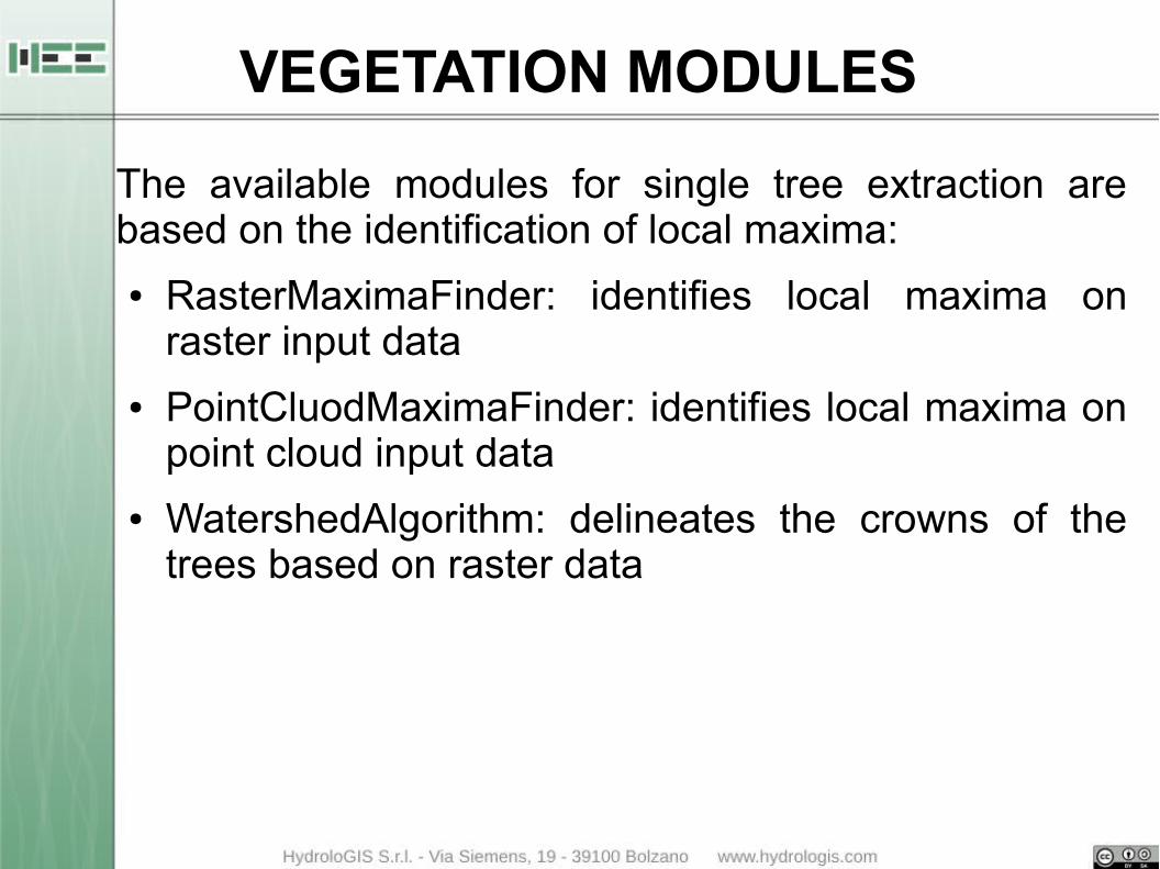
VEGETATION MODULES
The available modules for single tree extraction are based on the identification of local maxima:
● RasterMaximaFinder: identifies local maxima on raster input data
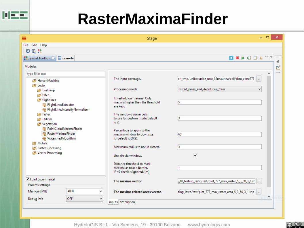
RasterMaximaFinder

RasterMaximaFinder
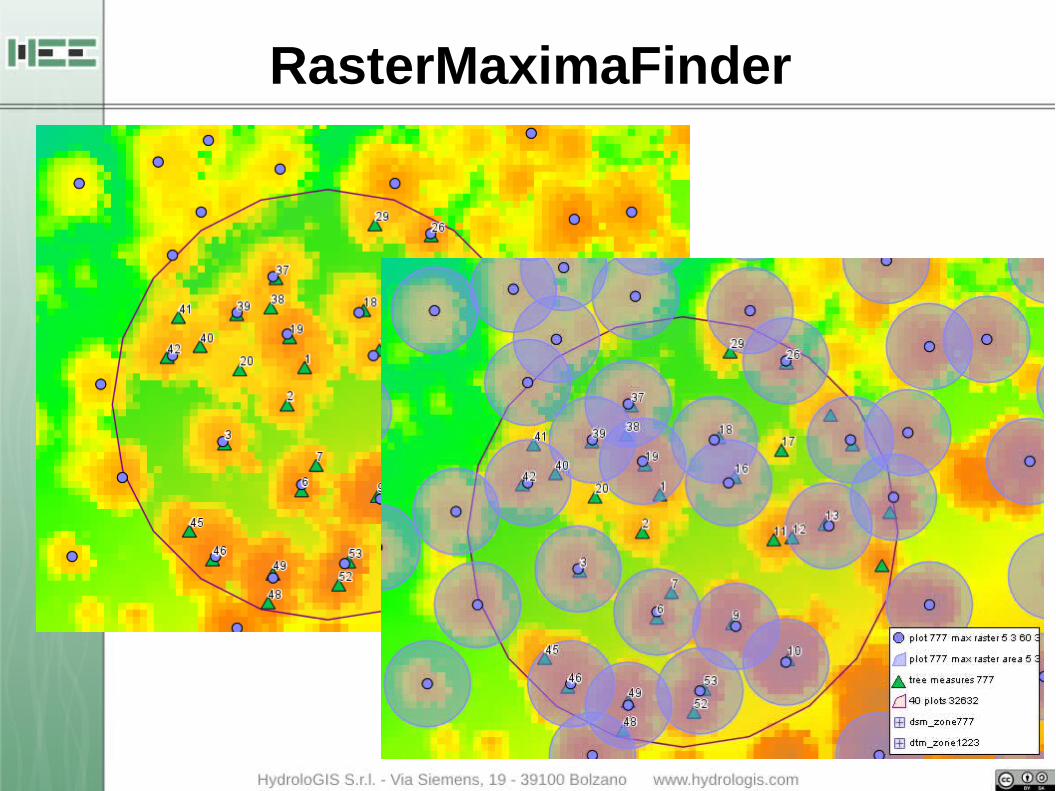
RasterMaximaFinder

RasterMaximaFinder
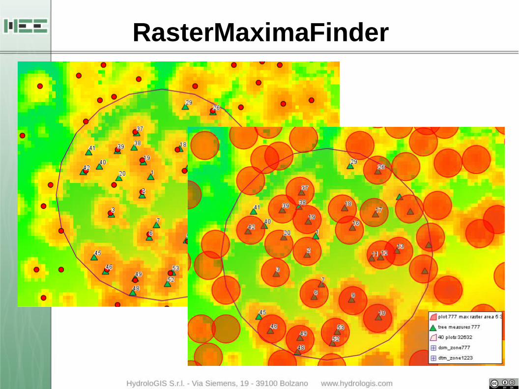
RasterMaximaFinder

VEGETATION MODULES
The available modules for single tree extraction are based on the identification of local maxima:
● RasterMaximaFinder: identifies local maxima on raster input data
● PointCluodMaximaFinder: identifies local maxima on point cloud input data

PointCloudMaximaFinder
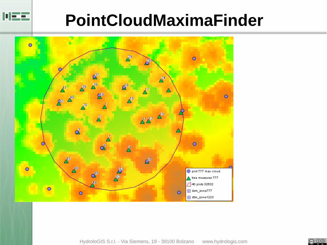
PointCloudMaximaFinder

PointCloudMaximaFinder
VEGETATION MODULES
The available modules for single tree extraction are based on the identification of local maxima:
● RasterMaximaFinder: identifies local maxima on raster input data
● PointCluodMaximaFinder: identifies local maxima on point cloud input data
● WatershedAlgorithm: delineates the crowns of the trees based on raster data
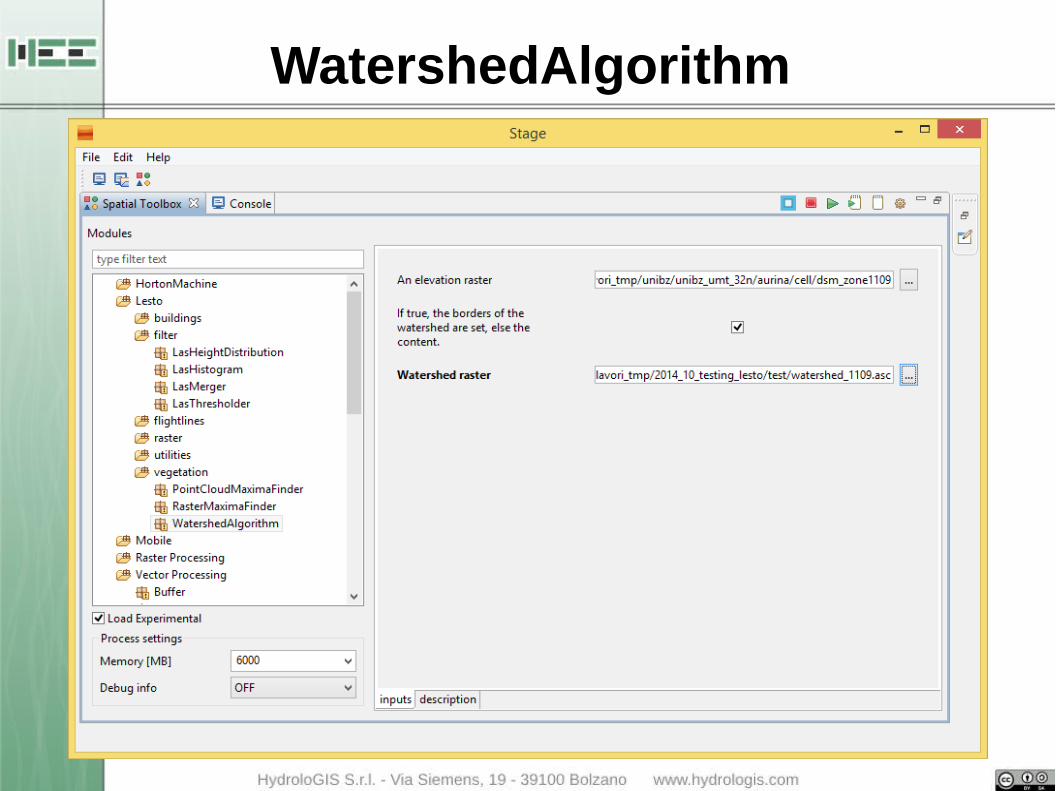
WatershedAlgorithm

WatershedAlgorithm
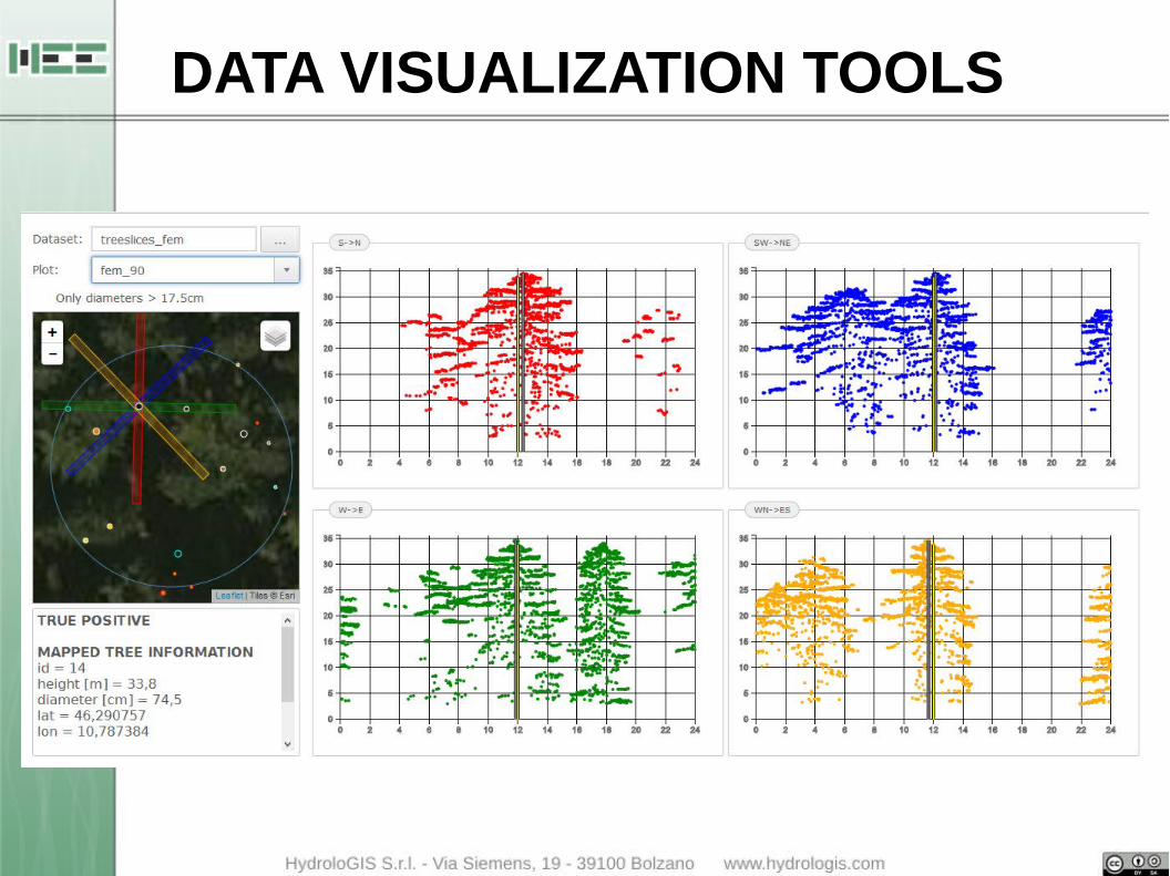
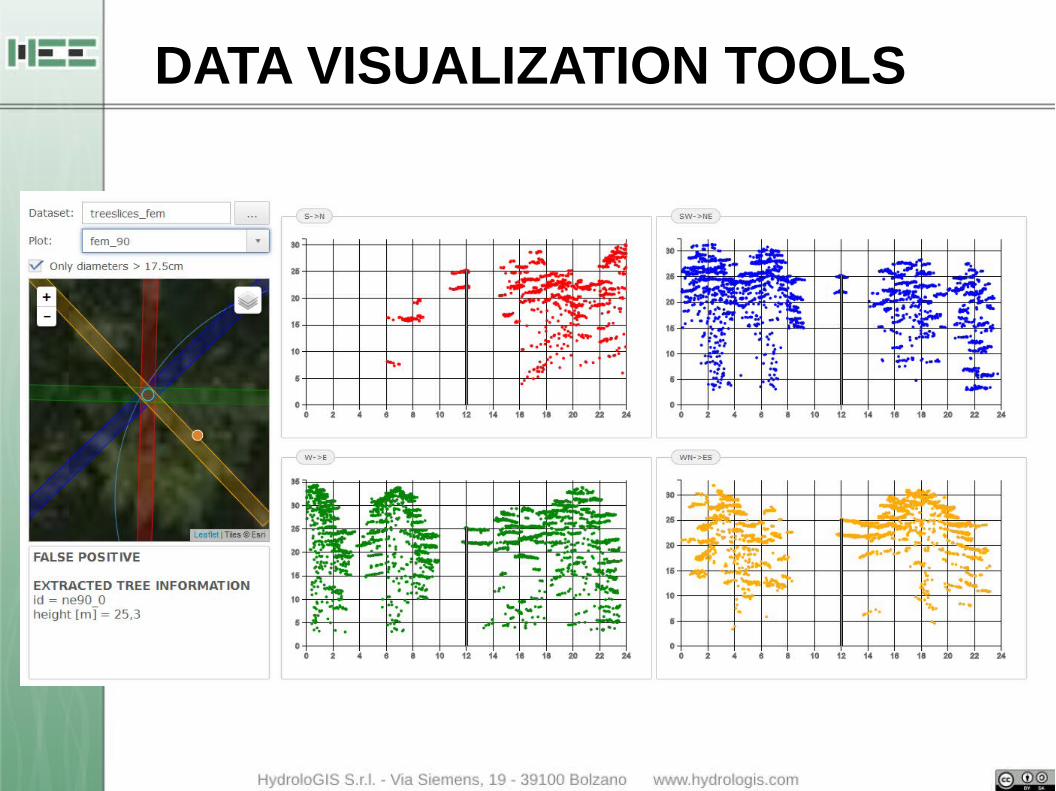
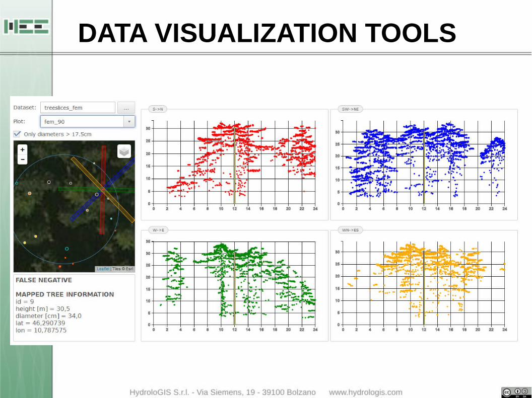
DATA VISUALIZATION TOOLS
● profiles of the LAS data considering 4 main directions
● position of the measured trees
● position of the extracted trees with highlighted the type of the tree: true positive, false positive
DATA VISUALIZATION TOOLS
DATA VISUALIZATION TOOLS
DATA VISUALIZATION TOOLS
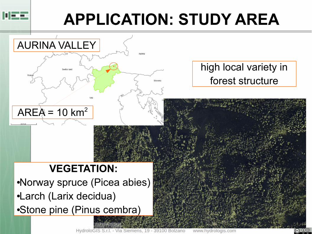
APPLICATION: STUDY AREA
high local variety in forest structure
AURINA VALLEY
VEGETATION:●Norway spruce (Picea abies)●Larch (Larix decidua)●Stone pine (Pinus cembra)
AREA = 10 km2
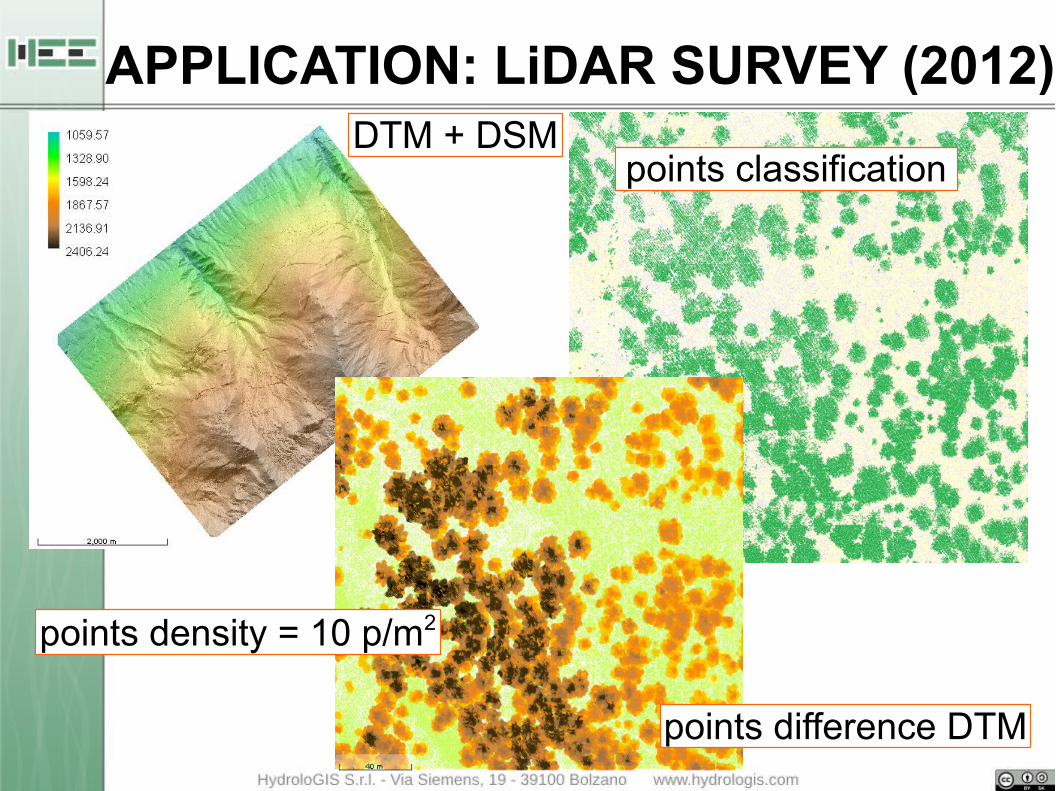
points classification
points difference DTM
DTM + DSM
points density = 10 p/m2
APPLICATION: LiDAR SURVEY (2012)

12 CIRCULAR PLOTS
RADIUS = 15 m
BUFFER 150 m ROADS
FOREST STRUCTURES:● young● biplane● adult● multilayer
APPLICATION: FIELD SURVEY (2013)

Plot 777
Plot 1223
Plot 485
Plot 683
APPLICATION: RESULTS
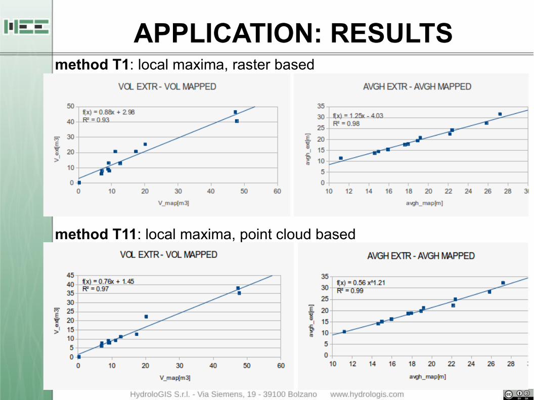
method T1: local maxima, raster based
method T11: local maxima, point cloud based
APPLICATION: RESULTS
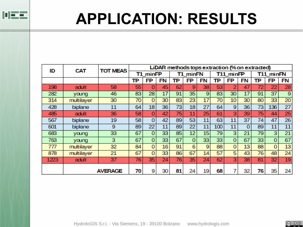
APPLICATION: RESULTS
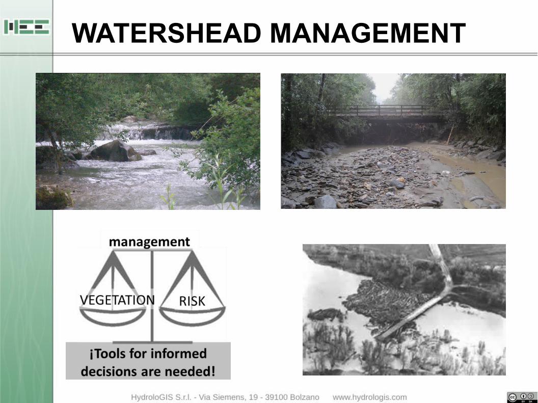
WATERSHEAD MANAGEMENT
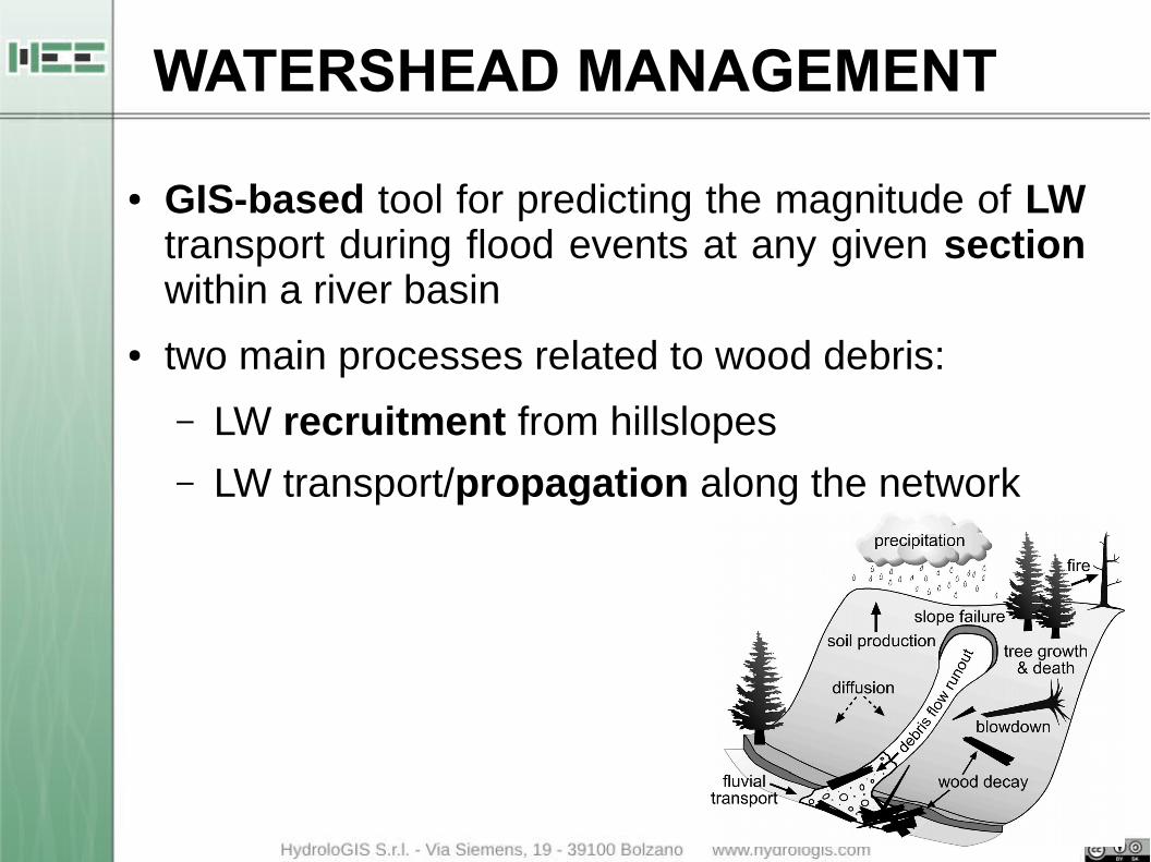
WATERSHEAD MANAGEMENT
● GIS-based tool for predicting the magnitude of LW transport during flood events at any given section within a river basin
● two main processes related to wood debris:
– LW recruitment from hillslopes
– LW transport/propagation along the network

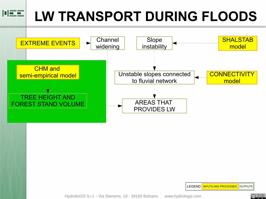
SHALSTABmodel
Unstable slopes connectedto fluvial network
CONNECTIVITYmodel
AREAS THAT PROVIDES LW
Channelwidening
Slopeinstability
EXTREME EVENTS
INPUTS AND PROCESSES OUTPUTSLEGEND
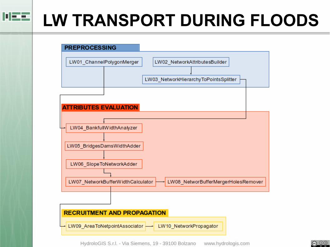
LW TRANSPORT DURING FLOODS
SHALSTABmodel
Unstable slopes connectedto fluvial network
CONNECTIVITYmodel
AREAS THAT PROVIDES LW
TREE HEIGHT ANDFOREST STAND VOLUME
CHM and semi-empirical model
Channelwidening
Slopeinstability
EXTREME EVENTS
INPUTS AND PROCESSES OUTPUTSLEGEND
LW TRANSPORT DURING FLOODS
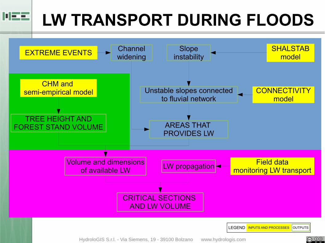
LW TRANSPORT DURING FLOODS
SHALSTABmodel
Unstable slopes connectedto fluvial network
CONNECTIVITYmodel
AREAS THAT PROVIDES LW
TREE HEIGHT ANDFOREST STAND VOLUME
CHM and semi-empirical model
CRITICAL SECTIONS AND LW VOLUME
Channelwidening
Slopeinstability
EXTREME EVENTS
INPUTS AND PROCESSES OUTPUTSLEGEND
Volume and dimensionsof available LW
LW propagationField data
monitoring LW transport
LW TRANSPORT DURING FLOODS
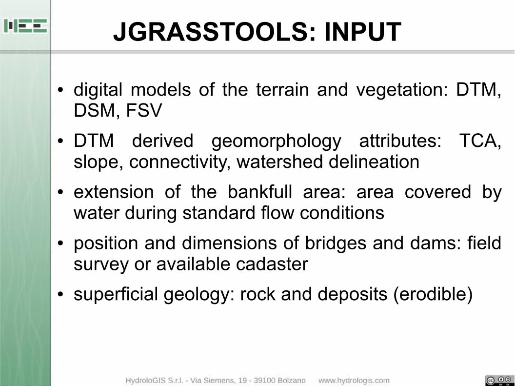
JGRASSTOOLS: INPUT
● digital models of the terrain and vegetation: DTM, DSM, FSV
● DTM derived geomorphology attributes: TCA, slope, connectivity, watershed delineation
● extension of the bankfull area: area covered by water during standard flow conditions
● position and dimensions of bridges and dams: field survey or available cadaster
● superficial geology: rock and deposits (erodible)
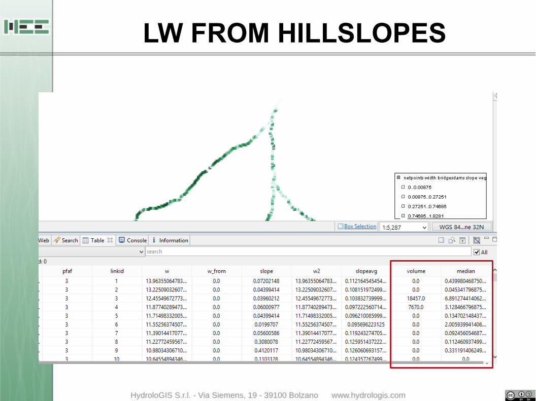
LW FROM HILLSLOPES

LW PROPAGATION
● identifies the critical section for the transit of LW in the given stream network
● based on the comparison between the length of the logs and channel width
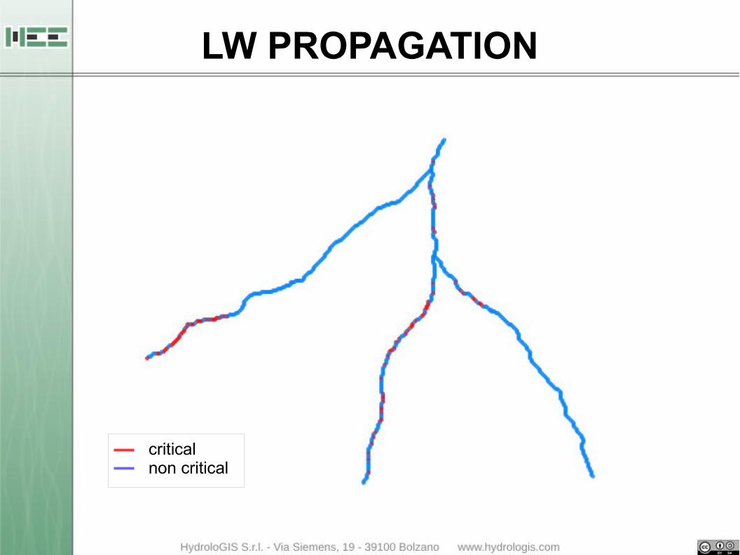
LW PROPAGATION
criticalnon critical

● finalize the implementation of a Particle Swarming Optimizer for automatic calibration of the models
● improve the propagation algorithm to consider also the height of the water in the rivers
● connect the results of the elaboration of LiDAR data for the evaluation of the volume, height and diameter of the logs in each section
FUTURE PLANS
USEFUL LINKShttp://www.jgrasstools.org
http://bit.ly/stage_downloads
Franceschi [email protected]
THANKS FOR THE ATTENTION!
Related Documents