South Island New Zealand SOUTH ISLAND NEW ZEALAND

Welcome message from author
This document is posted to help you gain knowledge. Please leave a comment to let me know what you think about it! Share it to your friends and learn new things together.
Transcript

South Island New Zealand
SOUTH ISLAND NEW ZEALAND

N Z South Island Nelson Marlborough North Canterbury Central Sth Island West Coast Otago
Southland
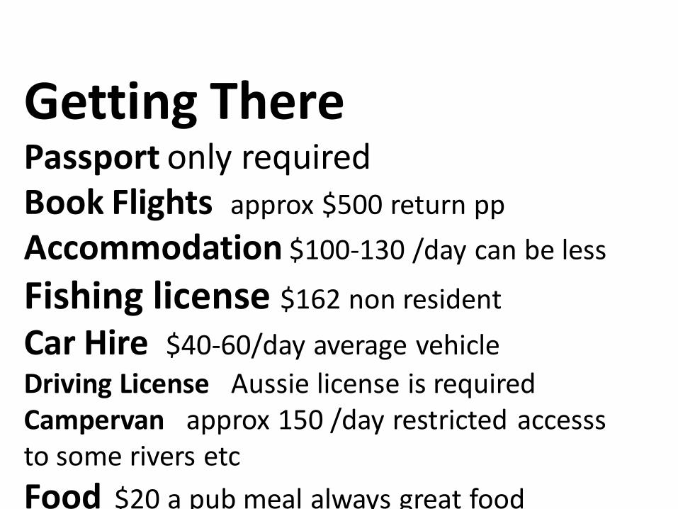
Getting There Passport only required Book Flights approx $500 return pp
Accommodation $100-130 /day can be less
Fishing license $162 non resident
Car Hire $40-60/day average vehicle
Driving License Aussie license is required Campervan approx 150 /day restricted accesss to some rivers etc
Food $20 a pub meal always great food


Best Value is Holiday Park Cabins
Accomodation Types , High End Lodges , Pubs ,parks campervans etc
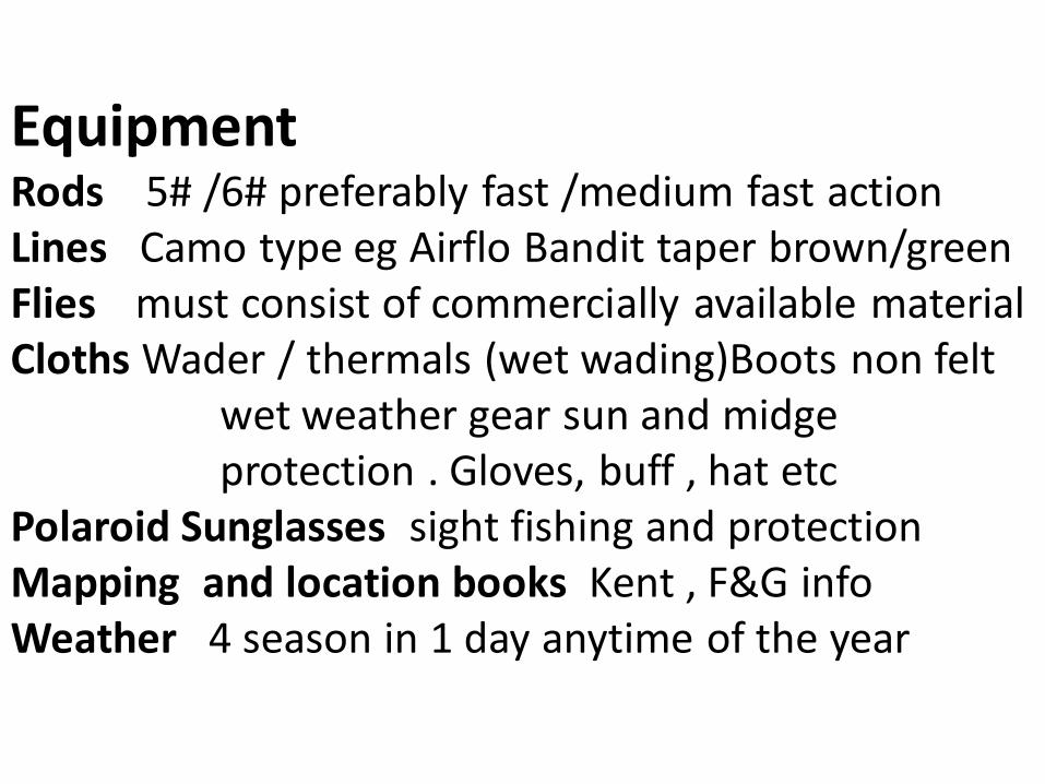
Equipment Rods 5# /6# preferably fast /medium fast action Lines Camo type eg Airflo Bandit taper brown/green Flies must consist of commercially available material Cloths Wader / thermals (wet wading)Boots non felt wet weather gear sun and midge protection . Gloves, buff , hat etc Polaroid Sunglasses sight fishing and protection Mapping and location books Kent , F&G info Weather 4 season in 1 day anytime of the year

5 Essential fly types for NZ
Blowfly
Various Nymphs
Searching fly eg Stimulator
Emerger Type
Duns

Jan Feb Antarctica blast 10 degrees at best

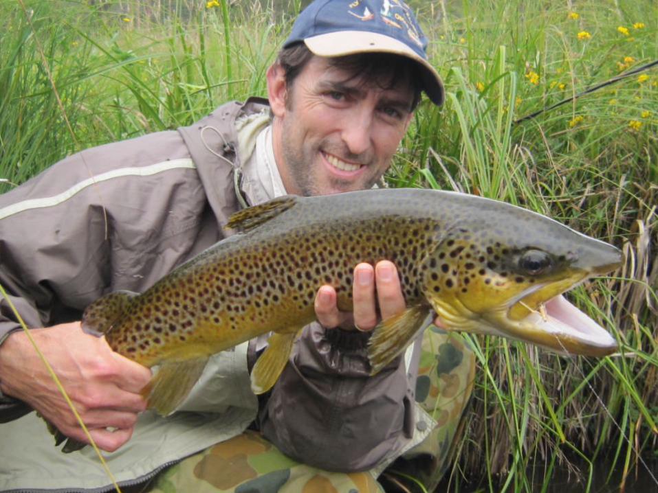
Sometimes It all comes together

Types of Fishing Water
Lakes Rivers and Streams
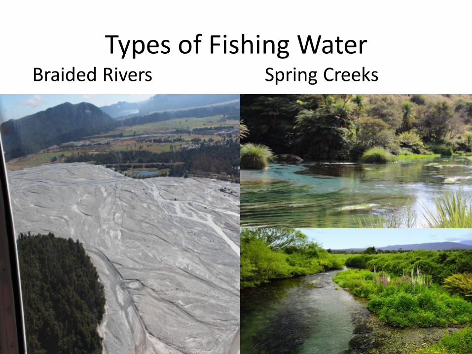
Types of Fishing Water Braided Rivers Spring Creeks

BRAIDED RIVERS
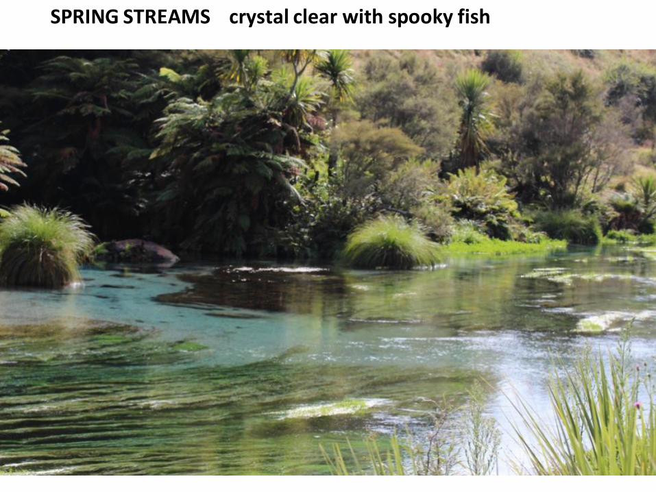
SPRING STREAMS crystal clear with spooky fish

Spring Creeks , Berry & Mary Burn etc

The Small fish was about 2lb maybe more
the water maybe 10 foot deep Spring stream

Regions

Must Do Rivers and Streams Northern South Island Nelson Marlborough Aorere Motueka Rai Pelorus Baton Wankapeka
Nelson Lakes Sabine D’urville Wairau Travers
Hamner Springs Clarence Acheron Upper Waiau Waiau Hope Boyle Lake
Sumner Hurunui
Murchison Mangles Buller Matiri Matakitaki Owen Muruia Upper Grey
Reefton /West Coast Inangahua Larrys Waitahu Lower Grey Moonlight
Spring Creeks ( Duck Murray Berry La Fontaine Bruce Waitangitaona ) plus remote rivers
Haast Haast , Turnbull ,Jackson Cascade


Must do Rivers and Streams Southland and Otago Queenstown Caples Greenstone Rees Dart Diamond Creek Wilkins Young ,Makarora Dingle Burn Timaru Clutha
Gore Matura Waikaia Dome Burn
Lumsden Oreti Aparima Braxton Burn Hamilton Burn Windley
Te Anau Eglington Holleyford Upukerora Whitestone Mararoa Upper Oreti Nevis Waiau Clinton Worsley

Planning your locations Fish and Game Access location brochures Computor apps , Maps , Google Earth Fish and Game access locations utalising WAMs (walking access maps on F@Game site)


Doc Huts

Wet Wading backcountry streams
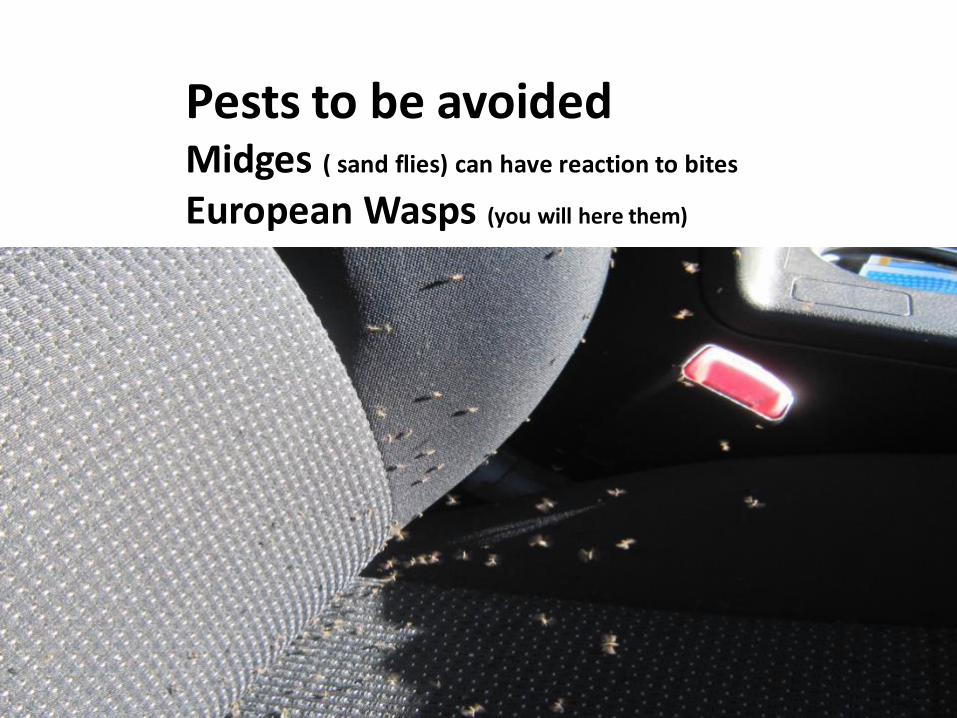
Pests to be avoided Midges ( sand flies) can have reaction to bites
European Wasps (you will here them)

NZ Has some prickly bushes )

What NZ Hasn,t Got

Mapping and location data links Mapping App New Zealand Topographic Nelson .Fishandgame.org.nz Click on regions and select map on that page Access Pamphlets PDR File Interactive WAMs maps Google Earth
k The End ,Thank You

Fishing Areas All Very Weather dependant ,However the Alps provide some
protection from prevailing weather
• Nelson base • Nelson Lakes D’Urville Sabine
Travers Wairau
• Motueka , Baton Wangapeka ,Rai
• Murchison Reefton base • Mangles Inangahua Muruia Grey
• Hokitika / Hari Hari base • Spring streams Duck Murray
Berry La Fontaine Waitangitaona
• Haast base • Haast , Turnbull Jackson Cascade
• South Westerly protected
• Hamnner Springs base • Clarence Acheron upper Waiau
Hope Boyle Lake Sumner Hununui
• MacKenzie Country Twizel base
• Tekapo , Gray Mary Burn Ahuriri Tasman Lake Benmore
• Southland /Otago • Te Anau /Gore base
• Eglington , Oreti Mararoa Aparima Mataura Greensti4one Caples
Related Documents