* Conversion factor from internal floor area to gross floor area is 1.3333. Fanling Area 48 “I” Area 1 (Site A18) Fanling Area 48 Area (Plan A18) : “I” Zone (in ha) (about) 2008 2014 Difference ^ 5.23 5.23 - No. of Private Industrial Buildings : 2008 2014 Difference ^ Occupied 3 3 - Wholly vacant - - - Under renovation - - - Total 3 3 - Other Building(s)/Site(s) : 2008 2014 Difference ^ Private Temporary workshop 2 2 - Temporary open storage 2 3 +1 Temporary car park 1 1 - Vacant site 1 1 - Government Squatter settlements 1 1 - Public toilet 1 1 - Refuse collection point 1 1 - HyD’s maintenance depot 1 1 - Grave 1 1 - ^ Survey undertaken in January 2014. Details of Private Industrial Buildings Total No. of Private Industrial Buildings : 3 Total No. of Units Involved : 3 Total GFA* Involved (about) : 2,476m 2 No. of Units Successfully Surveyed : 3 (100.0%) Total GFA * Successfully Surveyed (about) : 2,476m 2 (100.0%) No. of Buildings Occupied Wholly vacant Under renovation Tot al No. of Storeys 1 - 7 storeys 3 - - 3 8 - 19 storeys - - - - 20 storeys or above - - - - Land Ownership (as at end June 2014) Single 3 - - 3 Multiple - - - -

Welcome message from author
This document is posted to help you gain knowledge. Please leave a comment to let me know what you think about it! Share it to your friends and learn new things together.
Transcript
* Conversion factor from internal floor area to gross floor area is 1.3333. Fanling Area 48 “I” Area 1
(Site A18) Fanling Area 48
Area (Plan A18) :
“I” Zone (in ha) (about)
2008 2014 Difference ^ 5.23 5.23 -
No. of Private Industrial Buildings :
2008 2014 Difference ^ Occupied 3 3 - Wholly vacant - - - Under renovation - - - Total 3 3 -
Other Building(s)/Site(s) : 2008 2014 Difference ^ Private Temporary workshop 2 2 - Temporary open storage 2 3 +1 Temporary car park 1 1 - Vacant site 1 1 - Government Squatter settlements 1 1 -
Public toilet 1 1 - Refuse collection point 1 1 - HyD’s maintenance depot 1 1 - Grave 1 1 -
Survey undertaken in January 2014.
Details of Private Industrial Buildings
Total No. of Private Industrial Buildings : 3 Total No. of Units Involved : 3 Total GFA* Involved (about) : 2,476m
2
No. of Units Successfully Surveyed : 3 (100.0%) Total GFA* Successfully Surveyed (about) : 2,476m2
(100.0%)
No. of Buildings
Occupied Wholly vacant
Under renovation Total
No. of Storeys 1 - 7 storeys 3 - - 3 8 - 19 storeys - - - - 20 storeys or above - - - - Land Ownership (as at end June 2014) Single 3 - - 3 Multiple - - - -

* Conversion factor from internal floor area to gross floor area is 1.3333. Fanling Area 48 “I” Area 2
No. of Buildings
Occupied Wholly vacant
Under renovation Total
Building Age (as at end March 2014) < 15 years - - - - 15 – 29 years 1 - - 1 30 years or above 2 - - 2 Building Condition Good - - - - Fair - - - - Poor 3 - - 3
Surrounding Land Uses : Village settlements, government uses, East Rail, roads and slopes. Vacancy Rate (based on GFA*) PlanD’s Area Assessments
“I” Zone 2005 Area Assessments
2009 Area Assessments Survey in 2013-14
Territorial 7.0% 6.5% 3.5% Northeast New Territories 5.7% 4.3% 2.8% Fanling Area 48 - - -#
# Survey undertaken in January 2014. Derived from R&VD’s Raw Data
“I” Zone 2008 2009 2010 2011 2012 2013 Territorial 4.5% 5.0% 4.6% 3.3% 4.7% 2.4% Northeast New Territories 2.6% 4.0% 2.7% 2.2% 4.1% 1.5% Fanling Area 48 - - - - - -
Take-up (derived from R&VD’s raw data and based on BD’s Monthly Digests)
“I” Zone 2008 2009 2010 2011 2012 2013 Territorial (m2 54,071 )* -49,072 224,505 143,426 -122,913 219,561 Northeast New Territories (m2 39,893 )* -35,519 37,363 28,245 -46,652 67,391 Fanling Area 48 (m2 - )* - - - - -
Subdivision of Units
Types of Units Units GFA* No. % m % 2
Non-subdivided Units 3 100.0 2,476 100.0 Subdivided Units# - - - - Total 3 2,476

* Conversion factor from internal floor area to gross floor area is 1.3333. Fanling Area 48 “I” Area 3
Predominant Uses 2005 2008 2014^
GFA* (m2 % ) GFA* (m2 % ) GFA* (m2 % ) Manufacturing/Workshop 621 16.1 - - - - Warehouse/Storage 3,232 83.9 2,280 100.0 2,476 100.0 Office - - - - - - Others - - - - - - Vacant - - - - - - Under Renovation - - - - - - Non-response - - - - - - Total 3,853 2,280 2,476
^ Survey undertaken in January 2014. Business Nature and No. of Workers in Occupied Units
Business Nature Occupied Units GFA* No. of Workers No. % m % 2 No. %
Manufacturing - - - - - - Non-manufacturing^ 3 100.0 2,476 100.0 19 100.0 Total 3 2,476 19
^ The non-manufacturing business involved is water supply, sewerage, waste management and remediation activities (based on the Hong Kong Standard Industrial Classification Version 2.0 adopted by the Census and Statistics Department).
Area Assessment
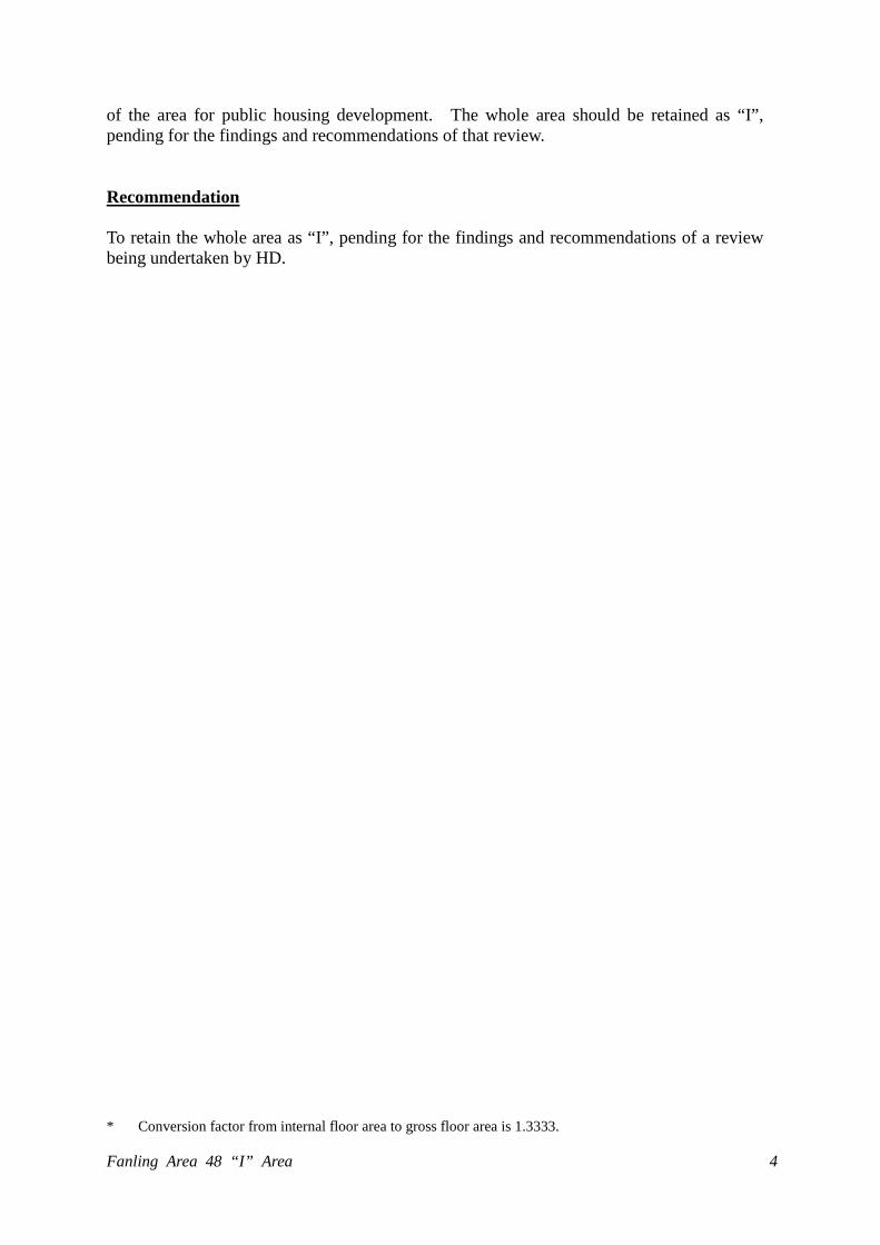
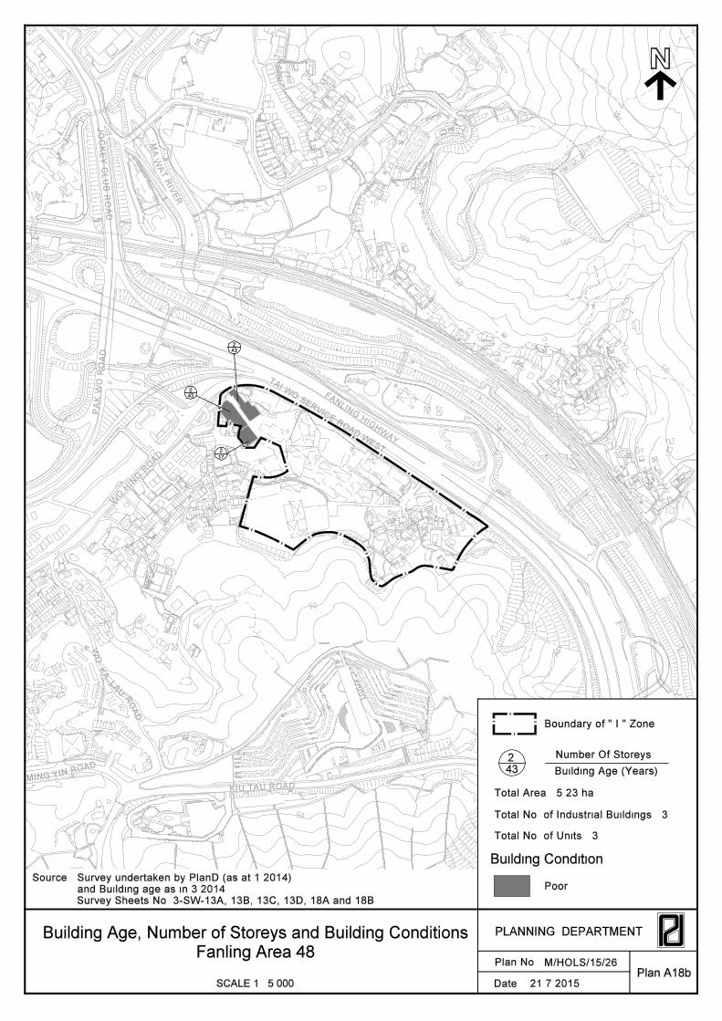
The area (about 5.2 ha) is located at the southeastern edge of Fanling/Sheung Shui New Town and is occupied by three industrial buildings and other uses (mainly temporary workshops, open storage and car park on private land, and some squatter settlements and a HyD’s maintenance depot on government land) (Plan A18). The area was recommended for rezoning for comprehensive residential development in the 2009 Area Assessments subject to the working out of a feasible development option. No new development/redevelopment of the industrial buildings has been undertaken since the completion of 2009 Area Assessments. The total industrial stock is about 2,476 m2
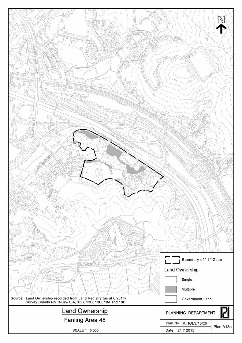
GFA. All three industrial buildings are two-storey, under single ownership and in poor condition. Two of the buildings are 43 years old while the remaining one is 17 years old. No subdivided unit was found in all the buildings. Same as the 2009 Area Assessments, all three buildings are fully occupied with Warehouse/Storage as the only predominant use.
In terms of employment, only about 19 workers are estimated to be engaged in the three industrial buildings in the area, all in one non-manufacturing business (i.e. water supply, sewerage, waste management and remediation activities). The figure is very insignificant when compared to the total of 45,103 persons engaged (other than those in the civil service) in various industry sections in the North District identified by C&SD in June 2014. So far, there is no planning approval or building plan approval for proposed new development in the area or proposed redevelopment/wholesale conversion of the existing industrial buildings in the area. To follow-up the recommendation of 2009 Area Assessments, HD has commenced a review to examine the feasibility of using a large part
* Conversion factor from internal floor area to gross floor area is 1.3333. Fanling Area 48 “I” Area 4
of the area for public housing development. The whole area should be retained as “I”, pending for the findings and recommendations of that review.
Recommendation
To retain the whole area as “I”, pending for the findings and recommendations of a review being undertaken by HD.

30
100
50
50
30
50
50
100
100
50
30
50
TA
S/NE-LYT/16
S/FSS/20
S/NE-KLH/11
S/NE-HT/5
AGR
AGR
V
OU
GB
OU
OU
REC
GB
V
OU
OU
I
O
O
OU
G/IC
GB
G/IC
GBG/IC
O
R(A)
V
OU
OU
AGR
GB
GB
AGR
OU
Country Park
Not covered by OZP
Off-take Station
Open Storage Open
Storage
Machinery
Workshop
PFS
Funeral Parlour &
Cemetery Related Uses
Toilet
Service
Reservoir
Vehicle
Parking
RCPWo Hop Shek
Village
FAN
LING
HIG
HW
AY
East Rail
East R
ail
JO
CK
EY
CL
UB
RO
AD
WO
HIN
G R
OA
D
KIU TAU ROAD
TAI W
O SERV
ICE ROA
D W
EST
PFS
PA
K W
O R
OA
D
Cematorium
Columbarium
ESS
Car
Repairing
Open
Storage
WO
KA
LA
UR
OA
D
MING YIN ROAD
HyD Site
Office
Grave
GIC
Temporary Use/Structure
Squatter Settlements
Land Use Plan
SCALE 1 : 5 000Plan A18
Plan No.
PLANNING DEPARTMENT
Date :
Fanling Area 48
OZP Nos. S/FSS/20, S/NE-HT/5, S/NE-KLH/11 and S/NE-LYT/16
Vacant Land
Land Use Pattern
Industrial
Source : Survey undertaken by PlanD (as at 1.2014)
M/HOLS/15/26
Record of Application as at 31.3.2014
(Warehouse/Storage)
Boundary of " I " Zone
4.8.2015
Z/FSS/P5 (19.5.00)
Rejected Application (date of meeting)Z/FSS/P5 (19.5.00)
Z/FSS/11 (16.3.12)for Residential Development
Y/FSS/7 (4.11.11)
for Commercial /
Residential Development
WO
KA
LA
UR
OA
D
YIN ROAD
MING
KIU TAU ROAD
FAN
LING
HIG
HW
AY
TAI W
O SERV
ICE ROA
D W
EST
WO
HIN
G R
OA
D
PA
K W
O R
OA
D
JO
CK
EY
CL
UB
RO
AD
MA
WA
T R
IVE
R
30
100
50
50
30
50
50
100
100
50
30
50
50
TAI
WO
S
Plan No.
PLANNING DEPARTMENT
Date :SCALE 1 : 5 000Plan A18a
Source : Land Ownership recorded from Land Registry (as at 6.2014)
Land Ownership
Land Ownership
Single
Boundary of " I " Zone
Multiple
Survey Sheets No. 3-SW-13A, 13B, 13C, 13D, 18A and 18B
Fanling Area 48M/HOLS/15/26
Government Land
21.7.2015
WO
KA
LA
UR
OA
D
YIN ROAD
MING
KIU TAU ROAD
FAN
LING
HIG
HW
AY
TAI W
O SERV
ICE ROA
D W
EST
WO
HIN
G R
OA
D
PA
K W
O R
OA
D
JO
CK
EY
CL
UB
RO
AD
MA
WA
T R
IVE
R
30
100
50
50
30
50
50
100
100
50
30
50
50
TAI
WO
2
2
2
17
43
43
Plan No.
PLANNING DEPARTMENT
Date :SCALE 1 : 5 000
Building Age, Number of Storeys and Building Conditions
Fanling Area 48
Plan A18b
and Building age as in 3.2014
Survey Sheets No. 3-SW-13A, 13B, 13C, 13D, 18A and 18B
Source : Survey undertaken by PlanD (as at 1.2014)
M/HOLS/15/26
21.7.2015
Building Condition
Building Age (Years)
Number Of Storeys
Poor
Total No. of Industrial Buildings : 3
Total Area : 5.23 ha
Total No. of Units : 3
Boundary of " I " Zone
2
43
Related Documents