Singer Geoglyphs (Gold Basin‐Rand Intaglios) Description/Location: This unit is located in central Imperial County, approximately 33 miles east of Brawley, California. It is south of the Mesquite Gold Mine and Highway 78. Nationally Significant Values: Ecological: Within this unit is a species of highest management concern, the desert tortoise which also has been found to warrant inclusion by the U.S. Fish and Wildlife Service on its Endangered Species list. The tortoise is present in low numbers in the unit. Cultural: This unit contains a significant type of prehistoric archaeological site, geoglyphs (also known as intaglios), that are extremely susceptible to disturbance. The Singer Geoglyphs have been determined eligible for listing in the National Register of Historic Places (NRHP) as one component of a thematic nomination. This provides the Singer Geoglyphs with formal federal recognition, considered nationally significant because of their rarity and unique expression of Native American culture. Scientific: Potential scientific research opportunities are also present. Archaeologists generally consider geoglyphs to represent physical manifestations of mythological or cosmological aspects of Native American culture . Ground figures go well beyond the usual study of stone tools and ceramic fragments into the very ethnic fabric of prehistoric people. Prehistoric archaeological sites with scientific information potential that make them eligible for listing in the NRHP are located within this unit. Special Designations/Management Plan/Date: ACEC Plan No. 67, 08/08/1986 Relevance and Importance Criteria: Relevant cultural resources. This unit contains a significant cultural resources including a type of prehistoric archaeological site, geoglyphs (also known as intaglios), that are extremely susceptible to disturbance. Goals: To protect and preserve to the greatest extent possible representative samples of the full array of the CDCA’s cultural and paleontological resources for the benefit of the scientific and socio‐cultural use by present and future generations. For NLCS Lands: Where this ruleset differs from the plan‐wide NLCS rulesets, the more restrictive rules will apply.

Welcome message from author
This document is posted to help you gain knowledge. Please leave a comment to let me know what you think about it! Share it to your friends and learn new things together.
Transcript

Singer Geoglyphs (Gold Basin‐Rand Intaglios)
Description/Location: This unit is located in central Imperial County, approximately 33 miles east of
Brawley, California. It is south of the Mesquite Gold Mine and Highway 78.
Nationally Significant Values: Ecological: Within this unit is a species of highest management concern, the desert tortoise which also has been found to warrant inclusion by the U.S. Fish and Wildlife Service on its Endangered Species list. The tortoise is present in low numbers in the unit.
Cultural: This unit contains a significant type of prehistoric archaeological site, geoglyphs (also known as intaglios), that are extremely susceptible to disturbance. The Singer Geoglyphs have been determined eligible for listing in the National Register of Historic Places (NRHP) as one component of a thematic nomination. This provides the Singer Geoglyphs with formal federal recognition, considered nationally significant because of their rarity and unique expression of Native American culture.
Scientific: Potential scientific research opportunities are also present. Archaeologists generally consider geoglyphs to represent physical manifestations of mythological or cosmological aspects of Native American culture . Ground figures go well beyond the usual study of stone tools and ceramic fragments into the very ethnic fabric of prehistoric people. Prehistoric archaeological sites with scientific information potential that make them eligible for listing in the NRHP are located within this unit.
Special Designations/Management Plan/Date: ACEC Plan No. 67, 08/08/1986
Relevance and Importance Criteria: Relevant cultural resources. This unit contains a significant cultural
resources including a type of prehistoric archaeological site, geoglyphs (also known as intaglios), that are
extremely susceptible to disturbance.
Goals: To protect and preserve to the greatest extent possible representative samples of the full array of the
CDCA’s cultural and paleontological resources for the benefit of the scientific and socio‐cultural use by
present and future generations.
For NLCS Lands: Where this ruleset differs from the plan‐wide NLCS rulesets, the more restrictive rules will
apply.

Designation and Acreage by Alternative:
Alternative BLM Acres of NLCS
within ACEC or Wildlife Allocation
BLM Acres within ACEC
BLM Acres within Wildlife Allocation
ACEC Disturbance Cap
No Action 0 1,900 0 NA
Preferred Alternative
1,900 1,900 0 0.5%
1 0 1,900 0 0.5%
2 1,900 1,900 0 0.5%
3 1,900 1,900 0 0.5%
4 0 1,900 0 0.5%
* Acreage values are for BLM managed lands Alternatives :
All Alternatives‐‐ This unit would continue to be managed as it currently is.
Objectives (desired future conditions)/Allowable Uses/Management Actions Resource
Objective: Minimize soil disturbance. Objective: Minimize disturbance to washes that would result in negative ecological consequences to wildlife and plant communities dependent upon them. Management Action: Monitor to ensure materials are not being dumped directly into washes. Management Action: Require all undertakings with the potential to spill hazardous material (e.g., motor oil, coolant) to follow proper federal and state reporting requirements after a spill to avoid material(s) contaminating water. Objective: Protect air quality and visibility standards in accordance with the Southeast Desert Air Basin nonattainment standards. Management Action: Coordinate with the California Environmental Protection Agency Air Resources Board. Objective: Manage the ACEC within the standards for visibility‐reducing particles, and attainment for other criteria in accordance with the standards set by the Imperial County Air Pollution Control District. Management Action: Coordinate with the Imperial County Air Pollution Control
District.
Soil, water, air
Vegetation within the ACEC conforms to drainage patterns. The terraces upon which the geoglyphs have been fashioned largely lack plant life. Sandy washes, however, hold an abundant display and variety of desert plants. These include palo verde, ironwood, ocotillo, barrel cactus, cholla, brittle bush, creosote, and
Vegetation (incl. special
status species)

a number of others. The fairy duster is the only sensitive species. This is considered by the California Native Plant Society to be rare or endangered in California, although it is more common elsewhere. Objective: Maintain robust populations of rare native plants. Management Action: Manage vehicular traffic to stay on designated OHV routes. Management Action: Eradicate and control the spread of invasive and noxious weeds. Objective: Update the baseline of plant species to track environmental changes. Management Action: Inventory vascular and non‐vascular plants, include soil
crust species, in the ACEC.
The faunal community is typical of the lower Colorado Desert. Common species include zebra‐tailed lizard, roundtail ground squirrel, coyote, black‐tailed gnatcatcher, white‐crowned sparrow, and blacktail jackrabbit. Kit fox are also present, and the area is used occasionally by burro mule deer. The species of highest management concern is the desert tortoise which also has been found to warrant inclusion by the U.S. Fish and Wildlife Service on its Endangered Species list. The tortoise is present in low numbers in the ACEC. Objective: Maintain and enhance habitat that supports native wildlife; Desert Tortoise, Mule Deer, Bighorn Sheep. Management Action: Monitor wildlife for habitat and population change. Management Action: Allow construction of wildlife waters as appropriate. Objective: Manage landscape to ensure wildlife passage and connectivity
between wildlife populations.
Fish and Wildlife (incl.
special status species)
See programmatic ACEC cultural resources objective and action items in general cultural resources rules. Objective: Provide for the protection of the highly sensitive geoglyphs. Management Action: Monitor and maintain the fences that enclose the
geoglyphs.
Management Action: Monitor the creation of illegal routes and perform route restoration as needed. Management Action: Conduct regular ranger patrols and surveillance. Management Action: Exclude OHV use within one mile of cultural resources except on designated routes. Management Action: Consult with local Indian tribes and knowledgeable traditional practitioners regarding the cultural resource values present within the ACEC.
Cultural Resources
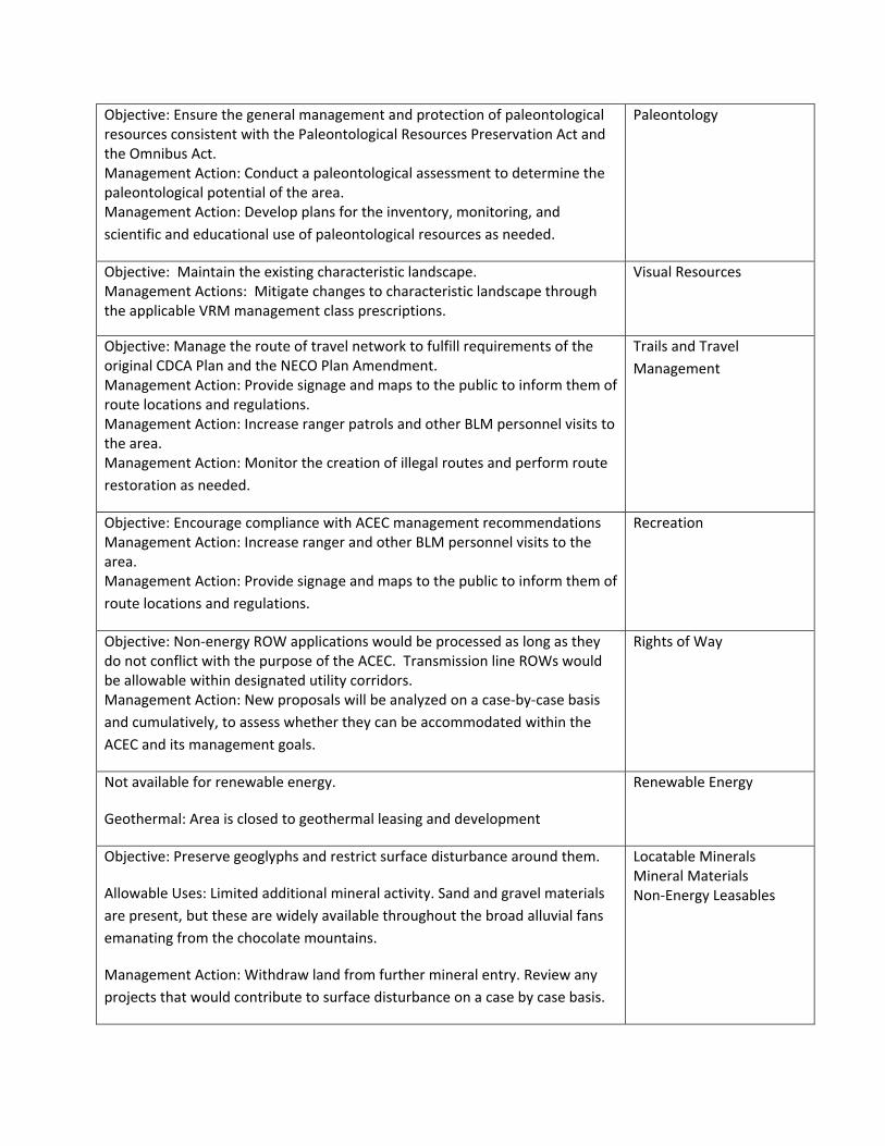
Objective: Ensure the general management and protection of paleontological resources consistent with the Paleontological Resources Preservation Act and the Omnibus Act. Management Action: Conduct a paleontological assessment to determine the paleontological potential of the area. Management Action: Develop plans for the inventory, monitoring, and
scientific and educational use of paleontological resources as needed.
Paleontology
Objective: Maintain the existing characteristic landscape. Management Actions: Mitigate changes to characteristic landscape through the applicable VRM management class prescriptions.
Visual Resources
Objective: Manage the route of travel network to fulfill requirements of the original CDCA Plan and the NECO Plan Amendment. Management Action: Provide signage and maps to the public to inform them of route locations and regulations. Management Action: Increase ranger patrols and other BLM personnel visits to the area. Management Action: Monitor the creation of illegal routes and perform route
restoration as needed.
Trails and Travel
Management
Objective: Encourage compliance with ACEC management recommendations Management Action: Increase ranger and other BLM personnel visits to the area. Management Action: Provide signage and maps to the public to inform them of
route locations and regulations.
Recreation
Objective: Non‐energy ROW applications would be processed as long as they do not conflict with the purpose of the ACEC. Transmission line ROWs would be allowable within designated utility corridors. Management Action: New proposals will be analyzed on a case‐by‐case basis
and cumulatively, to assess whether they can be accommodated within the
ACEC and its management goals.
Rights of Way
Not available for renewable energy.
Geothermal: Area is closed to geothermal leasing and development
Renewable Energy
Objective: Preserve geoglyphs and restrict surface disturbance around them.
Allowable Uses: Limited additional mineral activity. Sand and gravel materials
are present, but these are widely available throughout the broad alluvial fans
emanating from the chocolate mountains.
Management Action: Withdraw land from further mineral entry. Review any
projects that would contribute to surface disturbance on a case by case basis.
Locatable Minerals Mineral Materials Non‐Energy Leasables


78
Picacho
SingerGeoglyphs
ÆN
Preferred Alternative ACECsDate Printed: 5/29/2013
Prepared by BLM California State Office
0.8Miles
1Kilometers
Singer Geoglyphs
GTLFInterstateUS HwyCA HwyCounty HwyBLM Field Office
CDCA BoundaryDRECP Boundary
CitiesOHV Areas
ACEC Layers
Proposed NLCSProposed ACECExisting ACEC
Legislatively andLegally ProtectedDesign Focus Areas
State
PrivateMilitary
Land Status
Other Federal
Bureau of LandManagement

78
SingerGeoglyphs
ÆN
Alternative 1 ACECsDate Printed: 5/29/2013
Prepared by BLM California State Office
0.8Miles
1Kilometers
Singer Geoglyphs
GTLFInterstateUS HwyCA HwyCounty HwyBLM Field Office
CDCA BoundaryDRECP Boundary
CitiesOHV Areas
ACEC Layers
Proposed NLCSProposed ACECExisting ACEC
Legislatively andLegally ProtectedDesign Focus Areas
State
PrivateMilitary
Land Status
Other Federal
Bureau of LandManagement

78
SingerGeoglyphs
ÆN
Alternative 2 ACECsDate Printed: 5/29/2013
Prepared by BLM California State Office
0.8Miles
1Kilometers
Singer Geoglyphs
GTLFInterstateUS HwyCA HwyCounty HwyBLM Field Office
CDCA BoundaryDRECP Boundary
CitiesOHV Areas
ACEC Layers
Proposed NLCSProposed ACECExisting ACEC
Legislatively andLegally ProtectedDesign Focus Areas
State
PrivateMilitary
Land Status
Other Federal
Bureau of LandManagement

78
SingerGeoglyphs
ÆN
Alternative 3 ACECsDate Printed: 5/29/2013
Prepared by BLM California State Office
0.8Miles
1Kilometers
Singer Geoglyphs
GTLFInterstateUS HwyCA HwyCounty HwyBLM Field Office
CDCA BoundaryDRECP Boundary
CitiesOHV Areas
ACEC Layers
Proposed NLCSProposed ACECExisting ACEC
Legislatively andLegally ProtectedDesign Focus Areas
State
PrivateMilitary
Land Status
Other Federal
Bureau of LandManagement

SingerGeoglyphs
SingerGeoglyphs
N
Alternative 4 ACECsDate Printed: 8/6/2014
Prepared by BLM California State Office
0.75Miles
1Kilometers
Singer Geoglyphs
GTLFInterstateUS HwyCA HwyCounty Hwy
Proposed Wildlife Allocation
ACEC Layers
Proposed NLCSExisting ACEC
Legislatively andLegally Protected
Proposed ACEC
BLM Field Office
CDCA BoundaryDRECP Boundary
OHV Areas
Design Focus AreasVariance Lands
Land Status
State
PrivateMilitaryOther Federal
Bureau of LandManagement

78
SingerGeoglyphs
ÆN Date Printed: 5/29/2013
Prepared by BLM California State Office
0.8Miles
1Kilometers
Singer Geoglyphs
GTLFInterstateUS HwyCA HwyCounty Hwy
State
PrivateMilitary
Land Status
Other Federal
Bureau of LandManagement
ACEC LayersExisting ACEC
Legislatively andLegally Protected BLM Field Office
CDCA BoundaryDRECP Boundary
Cities
OHV Areas
afesnock
Typewritten Text
No Action ACECs
Related Documents