Session 9 Waypoints

Welcome message from author
This document is posted to help you gain knowledge. Please leave a comment to let me know what you think about it! Share it to your friends and learn new things together.
Transcript
Session 9
Waypoints

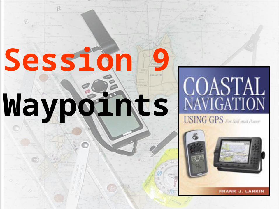
NAVISTAR GPSNAVISTAR GPS
THE OFFICIALTHE OFFICIALNAME ISNAME IS
NAVINAVIgatonalgatonalSSystem usingystem usingTTiming iming AAndndRRangingangingGGloballobalPPositioningositioningSSystemystem
NAVISTAR GPSNAVISTAR GPS

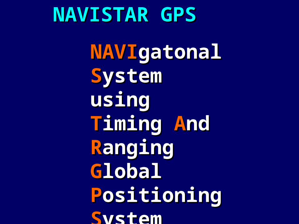
GPSGPS is a satellite is a satellite navigation system navigation system
developed by the developed by the US US Dept. of DefenseDept. of Defense
(DOD)(DOD)

GPSGPS provides provides continuous, continuous,
all-weather, three-all-weather, three-dimensional positioning dimensional positioning
information information (position, speed and time)(position, speed and time)

GPSGPS is used by is used by aviators, aviators, mariners,mariners,
surveyors, surveyors, off-roaders,off-roaders,
truck operators, truck operators, bikers, hikers, hunters & bikers, hikers, hunters &
fishermanfisherman

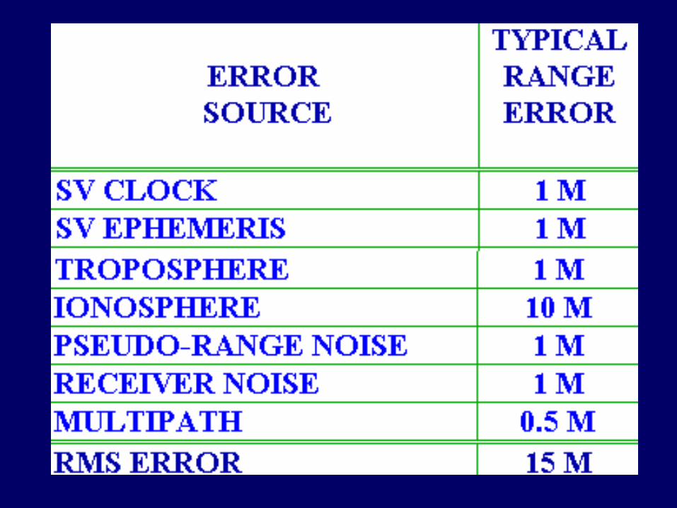
10-12 meters10-12 meters
5-10 meters5-10 meters
12-14 meters12-14 meters

GPSGPSpositions positions
are not are not error free!error free!
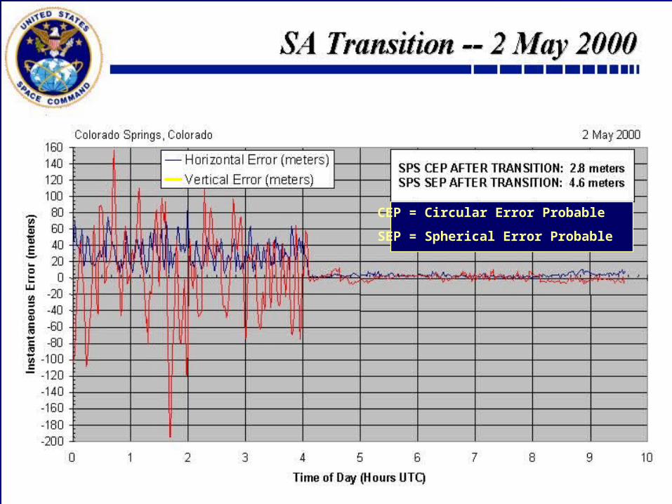
CEP = Circular Error Probable
SEP = Spherical Error Probable

With WithoutWith WithoutSelective AvailabilitySelective Availability
95 % of the time95 % of the timewithin 45 meters within 6.3 meterswithin 45 meters within 6.3 meters or 148 Feet or 21 Feet or 148 Feet or 21 Feet
24 hours24 hours5/1/20005/1/2000
24 hours24 hours5/2/20005/2/2000
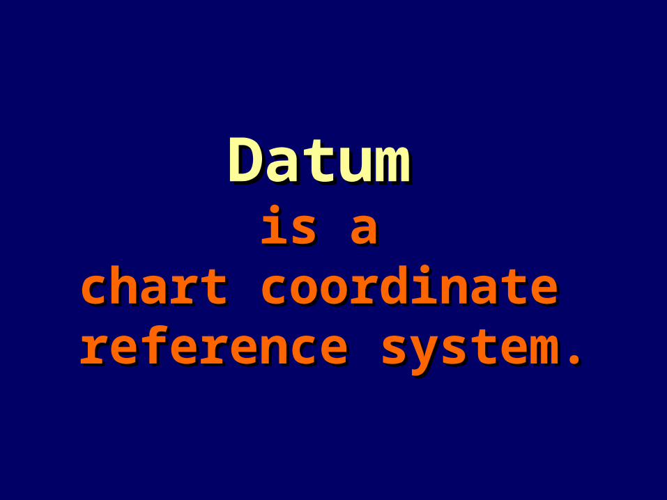
DatumDatum is a is a
chart coordinate chart coordinate reference system.reference system.

A datum A datum is shown on every chartis shown on every chart
Your GPS receiver must Your GPS receiver must be adjusted be adjusted to the datum to the datum
printed on the nautical chartprinted on the nautical chartthat you are using.that you are using.

Selecting the correct datumSelecting the correct datum• WGS-84WGS-84 is the standard, is the standard, NAD-27NAD-27 is is
common.common.
• Becomes more important as local Becomes more important as local datum become increasingly offset datum become increasingly offset from WGS-84.from WGS-84.
• Shown on the General Information Shown on the General Information Blocks of most charts/maps.Blocks of most charts/maps.
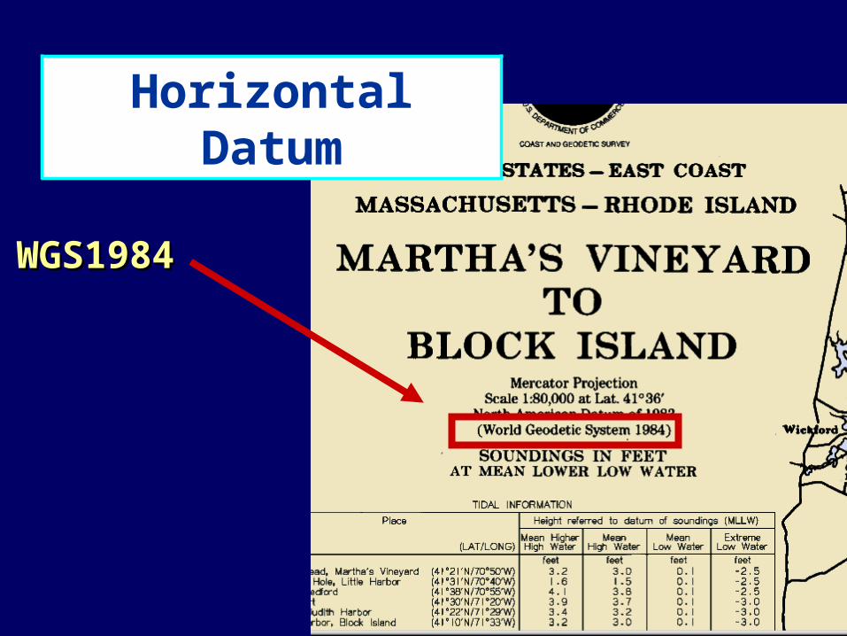
WGS1984WGS1984
Horizontal Datum

GPS SetupsGPS Setups
• You should have already You should have already selected and set up: selected and set up:
–A true or magnetic direction,A true or magnetic direction,
–Nautical miles,Nautical miles,
–The 24 hour clockThe 24 hour clock
GPS Receiver DisplayGPS Receiver Display
What What
is it is it
telling you?telling you?

Provide details of your Provide details of your GPS system’s status.GPS system’s status.
Shows the satellite Shows the satellite positions and signal positions and signal quality.quality.
Basic GPS Receiver Basic GPS Receiver FunctionsFunctions
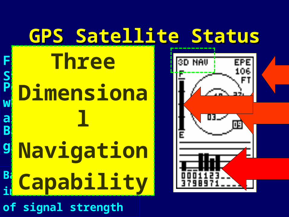
GPS Satellite StatusGPS Satellite Status
Bar graphs give an
immediate indication
of signal strength
Fix Status/EPE
Polar plot shows where satellites are located.
Battery status graph
Three
Dimensional
Navigation
Capability

Always validate satellite
performance before using your GPS set
for navigation.
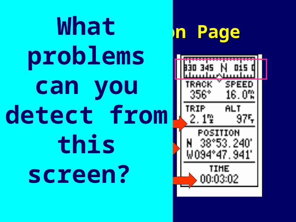
GPS Position PageGPS Position Page
TimeTime
Direction bar at
top of screen.
Course and Speed
Mileage and Altitude
Position
This is not a compass reading!
What problems can
you detect from this screen?

Basic GPS Receiver Basic GPS Receiver FunctionsFunctions
• Continuously determines your Continuously determines your position.position.
• Displays the Displays the time.time.
• Shows a heading and Shows a heading and SOGSOG—speed —speed over the ground--on the present leg.over the ground--on the present leg.
• Show a Show a BRGBRG--bearing and a --bearing and a DTGDTG----distance to go—to the next selected distance to go—to the next selected waypoint.waypoint.
Basic GPS Receiver Basic GPS Receiver FunctionsFunctions
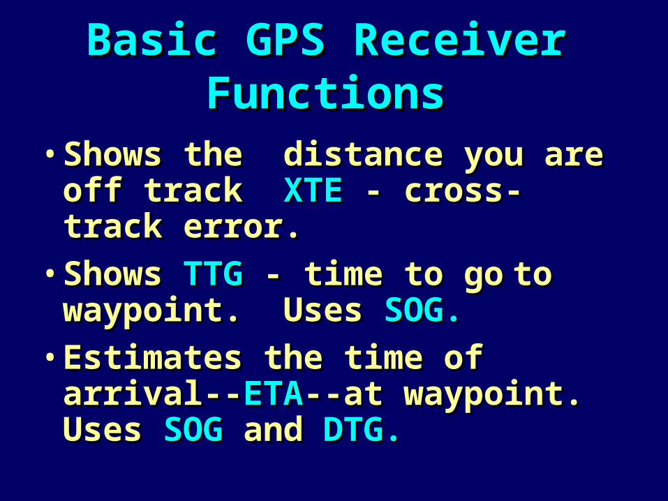
• Shows the distance you are off Shows the distance you are off track track XTEXTE - cross-track error. - cross-track error.
• Shows Shows TTGTTG - time to go- time to go to to waypoint. Uses waypoint. Uses SOG.SOG.
• Estimates the time of arrival--Estimates the time of arrival--ETAETA--at waypoint. Uses --at waypoint. Uses SOG SOG and and DTG.DTG.

Keyboard OrientationKeyboard Orientation+/-+/- Plus or Minus KeyPlus or Minus Key0-90-9 Numeric KeysNumeric KeysA-ZA-Z Alphabetic KeysAlphabetic KeysENTENT Turns cursor on or off.Turns cursor on or off.
Opens or confirms data entry.Opens or confirms data entry.MENUMENU Turns Menu Bar on or off.Turns Menu Bar on or off.MOBMOB Activate Man Overboard function.Activate Man Overboard function.+ Zoom In+ Zoom In Smaller overview – more details.Smaller overview – more details.- Zoom Out- Zoom Out – Larger overview – less details.– Larger overview – less details.

Keyboard OrientationKeyboard OrientationO O Cursor Key – multi-directional.Cursor Key – multi-directional.GOTOGOTO Activates POP-UP window.Activates POP-UP window.
Selects NAV MODE.Selects NAV MODE.Short cut to chart display.Short cut to chart display.
PLOTPLOT Selects PLOT MODE.Selects PLOT MODE.WIN WIN Toggles between selected windows.Toggles between selected windows.
Returns system to manual operation.Returns system to manual operation.CLR CLR Turns off Menu Bar.Turns off Menu Bar.
Turns off Cursor.Turns off Cursor.Deletes data.Deletes data.
PWRPWR Turns unit on and off.Turns unit on and off.
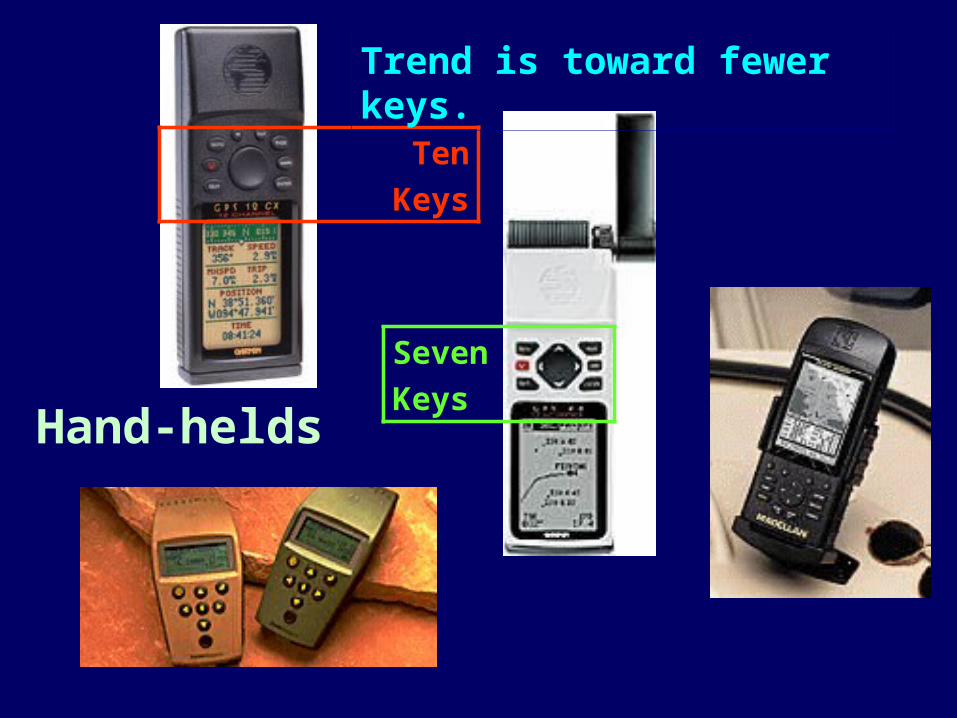
Hand-helds
Ten
Keys
Seven
Keys
Trend is toward fewer keys.

1. Learn how to 1. Learn how to inputinput waypoints.waypoints.
2. Learn how to 2. Learn how to useuse waypoints.waypoints.

A A waypoint waypoint
((WPTWPT or or WPWP) )
is a designatedis a designated
location withlocation with
geographicgeographic
coordinates.coordinates.

You need to learn how to:You need to learn how to:
• Store present positions.Store present positions.
• Enter a position.Enter a position.
• Rename, edit, and Rename, edit, and copycopy waypoints.waypoints.
• Create and edit Create and edit routes.routes.
• Delete Delete waypoints and routes.waypoints and routes.

Entering WaypointsEntering Waypoints• Enter in name/icon.
• Enter LAT/LON.
• Enter message
(not recommended)
• Waypoint number.
(Keep it simple)
• Menu of waypoint options at bottom.
• Bearing and Distance
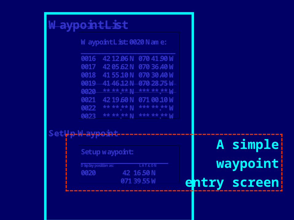
Waypoint List
Waypoint List: 0020 Name: __________________________ 0016 42 12.06 N 070 41.90 W 0017 42 05.62 N 070 36.40 W 0018 41 55.10 N 070 30.40 W 0019 41 46.12 N 070 28.75 W 0020 ** **.** N *** **.** W 0021 42 19.60 N 071 00.10 W 0022 ** **.** N *** **.** W 0023 ** **.** N *** **.** W
Set Up Waypoint
Set up waypoint: ________________________ Display position as: LAT/LON 0020 42 16.50 N 071 39.55 W
A simple
waypoint
entry screen
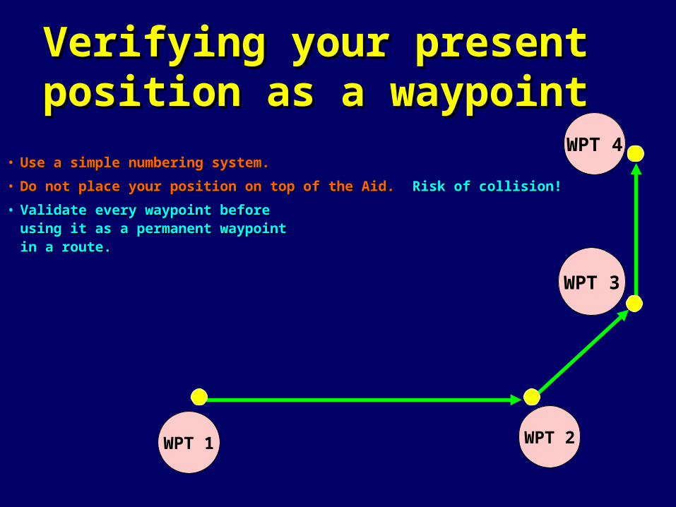
Verifying your present Verifying your present position as a waypointposition as a waypoint
• Use a simple numbering system.Use a simple numbering system.
• Do not place your position on top of the Aid. Do not place your position on top of the Aid. Risk of collision!Risk of collision!
• Validate every waypoint beforeValidate every waypoint beforeusing it as a permanent waypointusing it as a permanent waypointin a route.in a route.
WPT 1 WPT 2
WPT 3
WPT 4
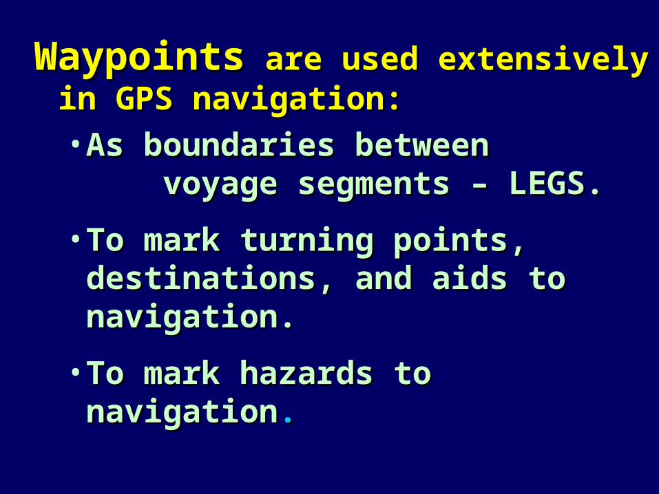
WaypointsWaypoints are used extensively in are used extensively in GPS navigation:GPS navigation:
• As boundaries between As boundaries between voyage segments – LEGS. voyage segments – LEGS.
• To mark turning points, To mark turning points, destinations, and aids to destinations, and aids to navigation.navigation.
• To mark hazards to navigationTo mark hazards to navigation..
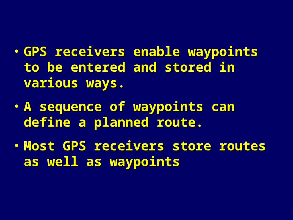
• GPS receivers enable waypoints to be GPS receivers enable waypoints to be entered and stored in various ways.entered and stored in various ways.
• A sequence of waypoints can define a A sequence of waypoints can define a planned route.planned route.
• Most GPS receivers store routes as well Most GPS receivers store routes as well as waypointsas waypoints

Waypoints are often used toWaypoints are often used to
define route segments – legs.define route segments – legs.
– Insert waypoints at all turn points Insert waypoints at all turn points on your courses.on your courses.
– Establish some voyage waypoints Establish some voyage waypoints close to (but not at) aids to close to (but not at) aids to navigationnavigation

Always pre-plot all waypoints on aAlways pre-plot all waypoints on a
nautical chart and measure thenautical chart and measure the
distance and bearing betweendistance and bearing between
waypoints.waypoints.
• Verify that the trip legs are Verify that the trip legs are planned in safe water.planned in safe water.
• Record the data on a Trip Log.Record the data on a Trip Log.

• Waypoints do not have to be Waypoints do not have to be located in the waterlocated in the water--e.g., locate --e.g., locate a waypoint at a lighthouse to a waypoint at a lighthouse to enable you to know where and enable you to know where and when to look for itwhen to look for it
• Waypoints can be used to mark Waypoints can be used to mark hazards to navigationhazards to navigation--areas to --areas to avoid as well as areas to visit avoid as well as areas to visit safely.safely.
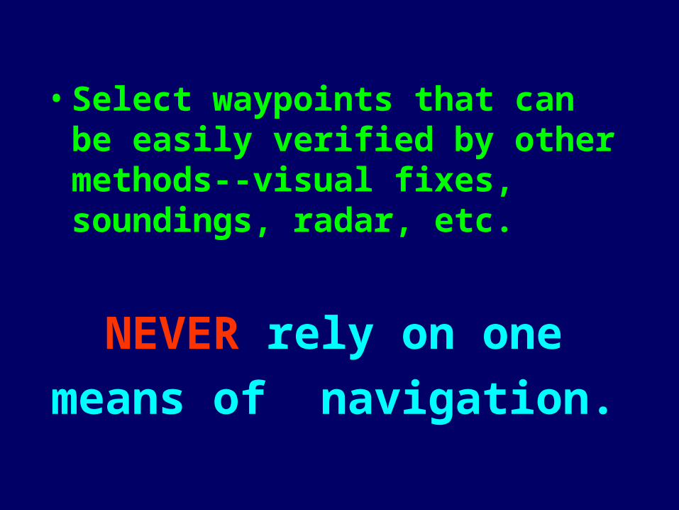
• Select waypoints that can be easily verified by other methods--visual fixes, soundings, radar, etc.
NEVER rely on one
means of navigation.

• It is important to It is important to check your chart check your chart before establishing before establishing WPTs.WPTs.
• If the course crosses If the course crosses an island, the GPS an island, the GPS receiver will direct receiver will direct you to navigate into you to navigate into this hazard.this hazard.
WPT 02
WPT 01
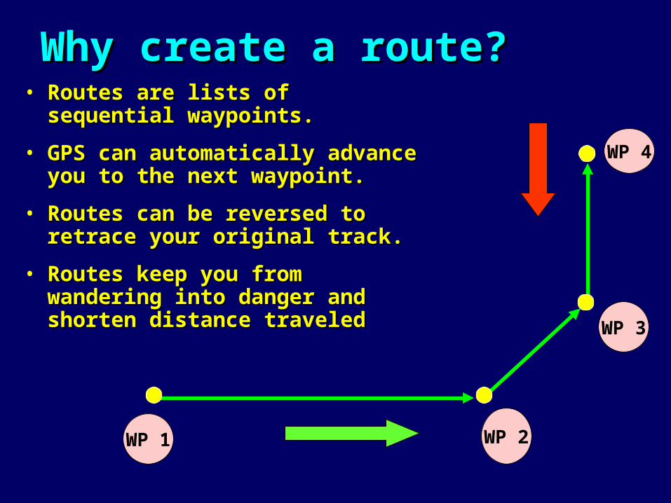
Why create a route?Why create a route?• Routes are lists of sequential Routes are lists of sequential
waypoints.waypoints.
• GPS can automatically advance GPS can automatically advance you to the next waypoint.you to the next waypoint.
• Routes can be reversed to retrace Routes can be reversed to retrace your original track.your original track.
• Routes keep you from wandering Routes keep you from wandering into danger and shorten distance into danger and shorten distance traveledtraveled
WP 1
WP 4
WP 2
WP 3
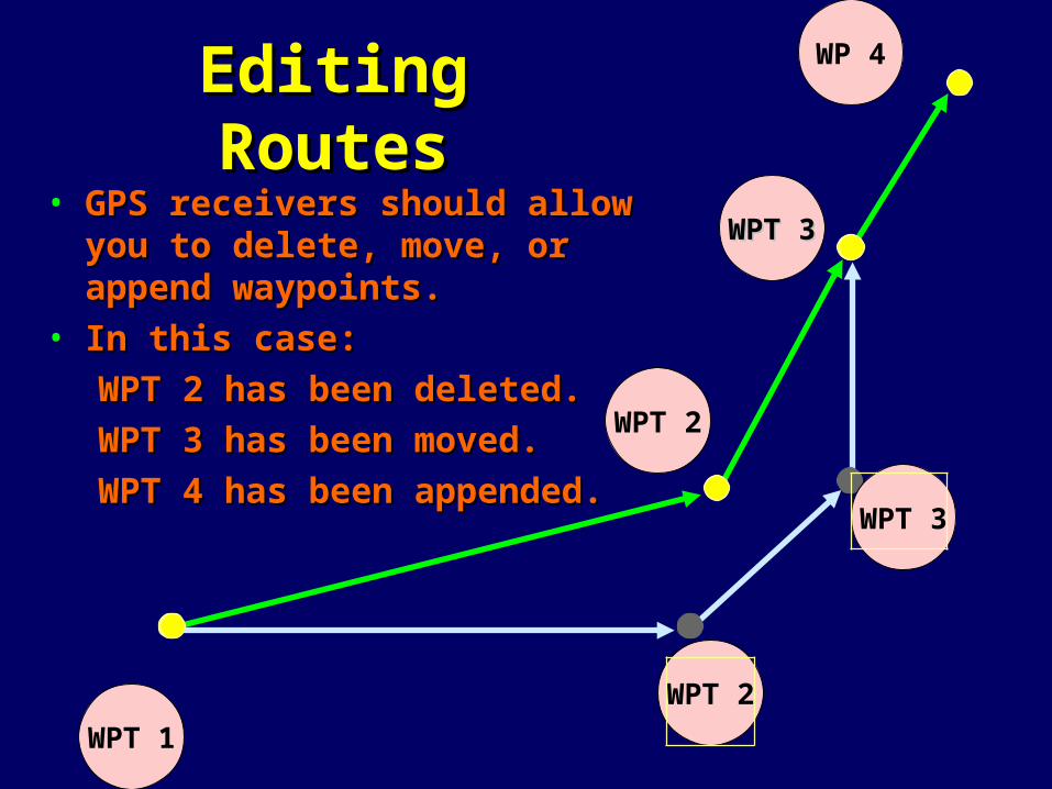
Editing RoutesEditing Routes• GPS receivers should allow you to GPS receivers should allow you to
delete, move, or append delete, move, or append waypoints.waypoints.
• In this case:In this case:
WPT 2 has been deleted.WPT 2 has been deleted.
WPT 3 has been moved.WPT 3 has been moved.
WPT 4 has been appended.WPT 4 has been appended.
WPT 2
WPT 3
WPT 1
WP 4
WPT 2
WPT 3WPT 3
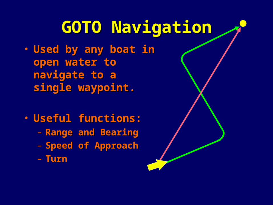
GOTO NavigationGOTO Navigation• Used by any boat in Used by any boat in
open water to navigate open water to navigate to a single waypoint.to a single waypoint.
• Useful functions:Useful functions:– Range and BearingRange and Bearing– Speed of ApproachSpeed of Approach– TurnTurn
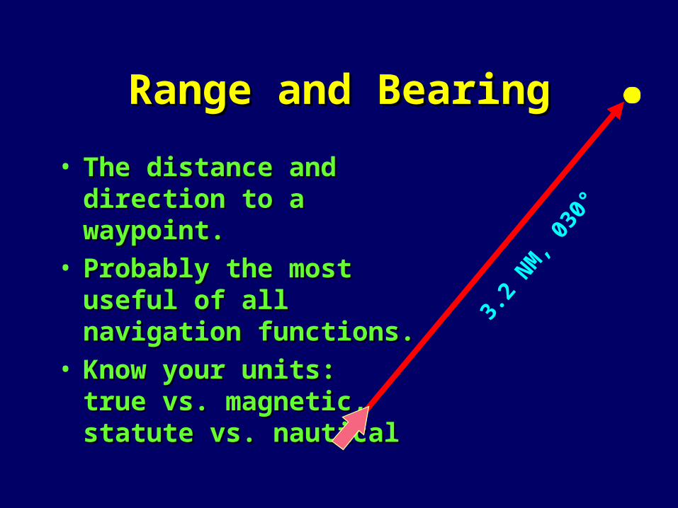
Range and BearingRange and Bearing
• The distance and direction The distance and direction to a waypoint.to a waypoint.
• Probably the most useful Probably the most useful of all navigation functions.of all navigation functions.
• Know your units: Know your units: true vs. magnetic, true vs. magnetic, statute vs. nauticalstatute vs. nautical
3.2
NM, 0
30°

Course To SteerCourse To Steer
• Course To Steer gets you back to the Course To Steer gets you back to the course line at a 45° intercept to try to course line at a 45° intercept to try to keep you out of troublekeep you out of trouble
BearingCTS
Desired Course Line
Third Reef

• Used by boats under power when they have to stay in a channel or follow an exact course line
• Useful functions:– Cross Track Error (XTE)– Course To Steer (CRS)– Time To Go (TTG)– Automatic course
change at next waypoint (WPT)
– Total distance to end of route (DTG)
– Total time to end of route.
ROUTE NavigationROUTE Navigation
WPT 1
WPT 2
Learn toLearn to
useuse
AlarmsAlarms
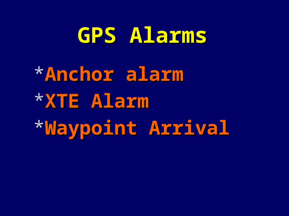
GPS AlarmsGPS Alarms
*Anchor alarmAnchor alarm*XTE AlarmXTE Alarm*Waypoint ArrivalWaypoint Arrival
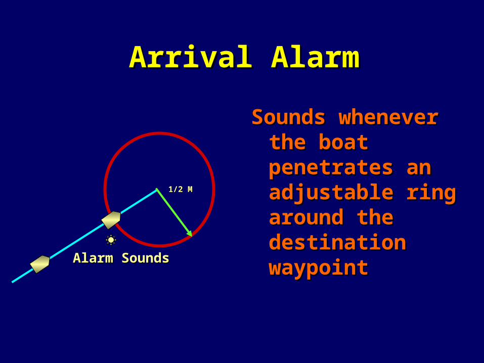
Arrival AlarmArrival Alarm
Sounds whenever Sounds whenever the boat the boat penetrates an penetrates an adjustable ring adjustable ring around the around the destination destination waypointwaypoint
Alarm SoundsAlarm Sounds
1/2 M1/2 M

longitude
latitude
Source of Waypoints
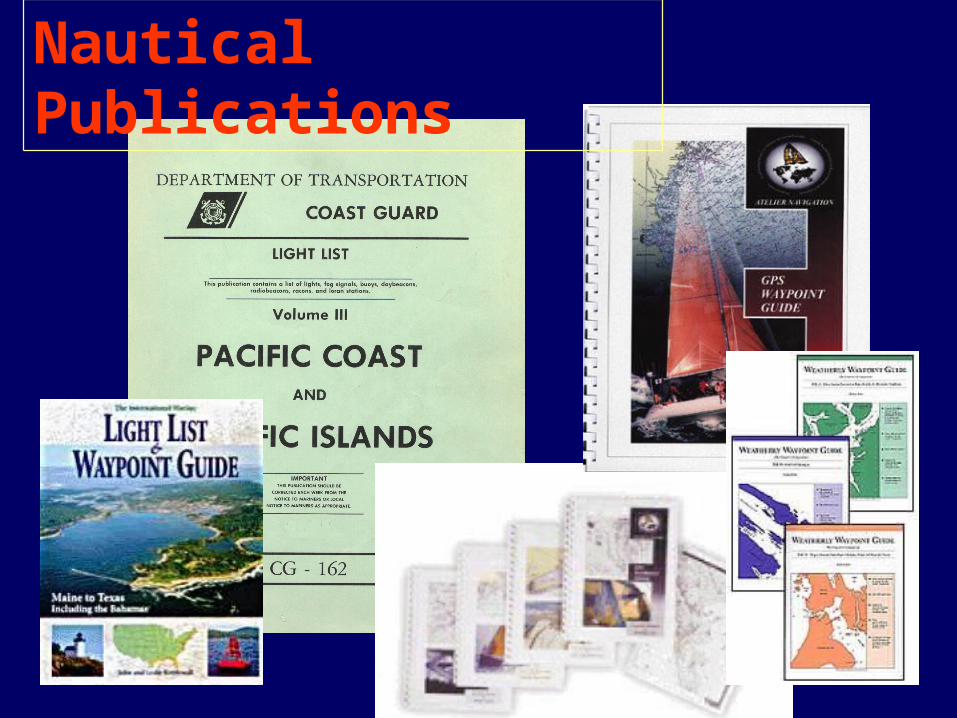
Nautical Publications

48 10 54 N48 10 54 N
123 06 37 W123 06 37 W
Light ListLight List
Converted for GPS use
48 10.833N
123 06.533W

Using GPSUsing GPSto Navigateto Navigate
Identify waypoint locations Identify waypoint locations
or the direction & distance or the direction & distance between them. between them.
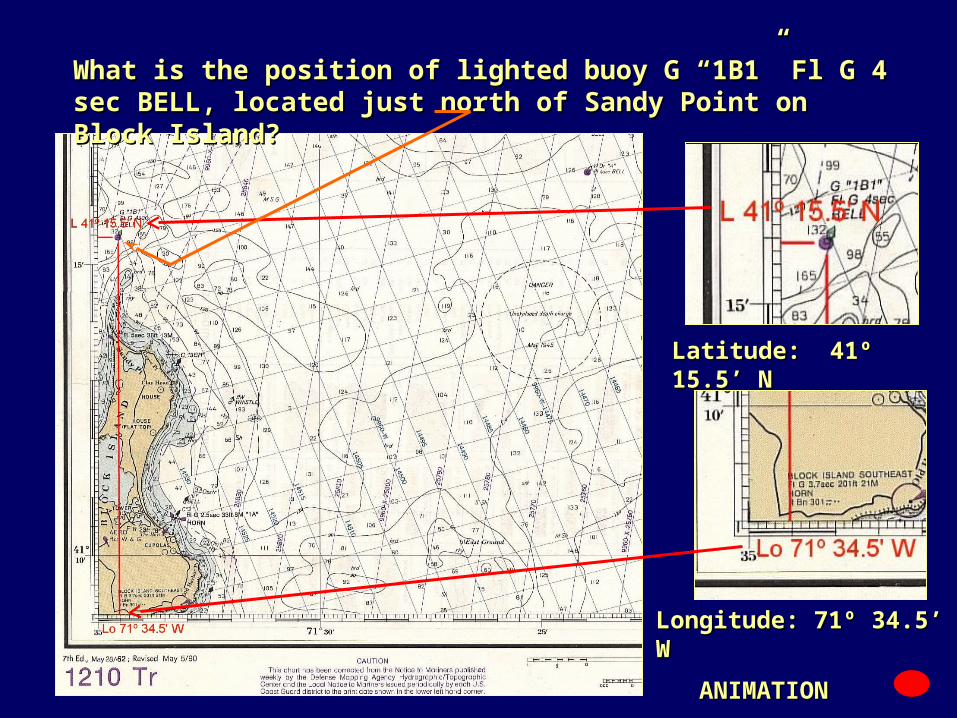
Latitude: 41º 15.5’ NLatitude: 41º 15.5’ N
Longitude: 71º 34.5’ WLongitude: 71º 34.5’ W
What is the position of lighted buoy G “1B1” Fl G 4 sec BELL, What is the position of lighted buoy G “1B1” Fl G 4 sec BELL, located just north of Sandy Point on Block Island?located just north of Sandy Point on Block Island?
ANIMATIONANIMATION

Using GPSUsing GPSto Navigateto Navigate
• Plan a series of waypoints.Plan a series of waypoints.
• Check for obstacles between Check for obstacles between them—shoals, rocks, islands.them—shoals, rocks, islands.
• Check 1/4 mile either side of Check 1/4 mile either side of your planned course for your planned course for obstacles.obstacles.
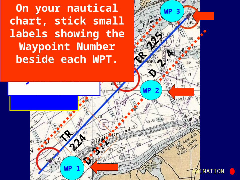
TR 224
D 3.1
TR 2
25D 2
.4ANIMATION
WP 2
WP 1
WP 3
Establish a XTE safety
zone
Measure, plot, and label your course lines.
Update your Trip Log.
Determine the LAT/LON for
each Waypoint and establish Waypoints in
your GPS.
On your nautical chart, stick small labels
showing the Waypoint Number beside each
WPT.
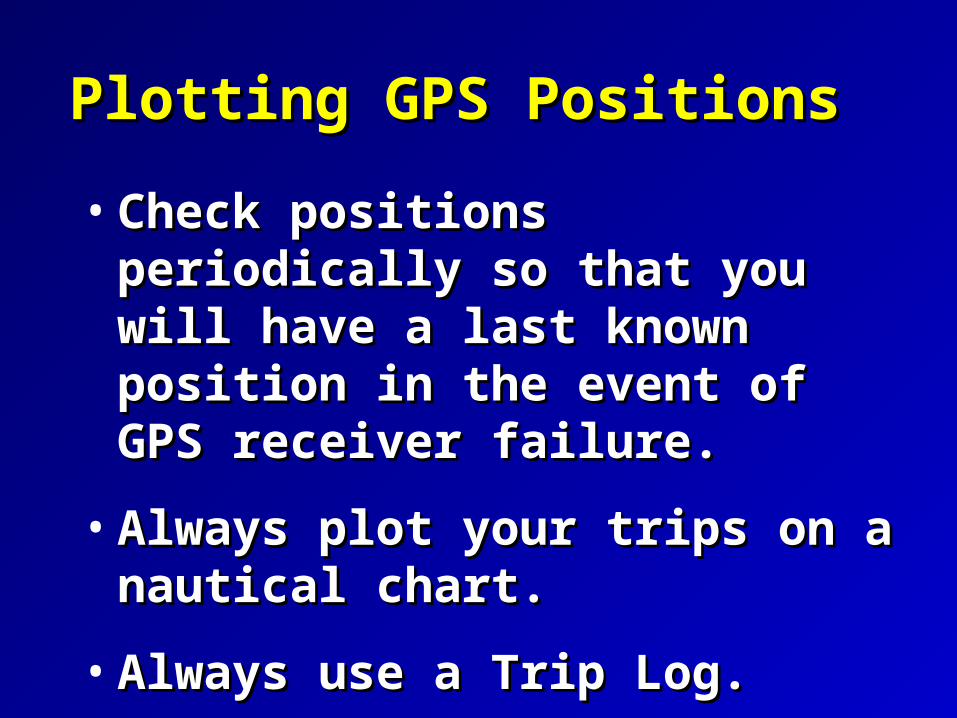
Plotting GPS PositionsPlotting GPS Positions
• Check positions periodically so Check positions periodically so that you will have a last known that you will have a last known position in the event of GPS position in the event of GPS receiver failure.receiver failure.
• Always plot your trips on a Always plot your trips on a nautical chart.nautical chart.
• Always use a Trip Log.Always use a Trip Log.

Wide AreaWide Area
AugmentationAugmentation
SystemSystem
NATIONWIDE DGPSNATIONWIDE DGPS

WAASWAASSeven Seven GROUND CONTROL STATIONS GROUND CONTROL STATIONS (SIMILAR TO DGPS)(SIMILAR TO DGPS)
TwoTwo GEOSTATIONARY SATELLITES GEOSTATIONARY SATELLITES(1 EAST COAST, 1 WEST COAST)(1 EAST COAST, 1 WEST COAST)
GPS RECEIVER IS MODIFIED TO RECEIVE GPS RECEIVER IS MODIFIED TO RECEIVE AND INTERPRET AND INTERPRET WAASWAAS SIGNAL. SIGNAL.
SIGNALS RECEIVED VIA SAME GPS SIGNALS RECEIVED VIA SAME GPS ANTENNA.ANTENNA.
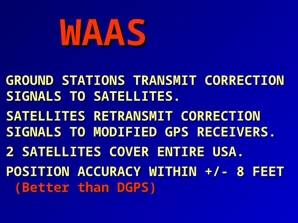
GROUND STATIONS TRANSMIT GROUND STATIONS TRANSMIT CORRECTION SIGNALS TO SATELLITES.CORRECTION SIGNALS TO SATELLITES.
SATELLITES RETRANSMIT CORRECTION SATELLITES RETRANSMIT CORRECTION SIGNALS TO MODIFIED GPS RECEIVERS.SIGNALS TO MODIFIED GPS RECEIVERS.
2 SATELLITES COVER ENTIRE USA.2 SATELLITES COVER ENTIRE USA.
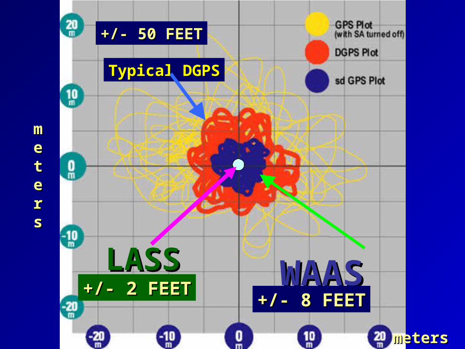
POSITION ACCURACY WITHIN +/- 8 FEET POSITION ACCURACY WITHIN +/- 8 FEET (Better than DGPS)(Better than DGPS)
WAASWAAS

geosgeosgeosgeos
WAASWAAS
gpsgps
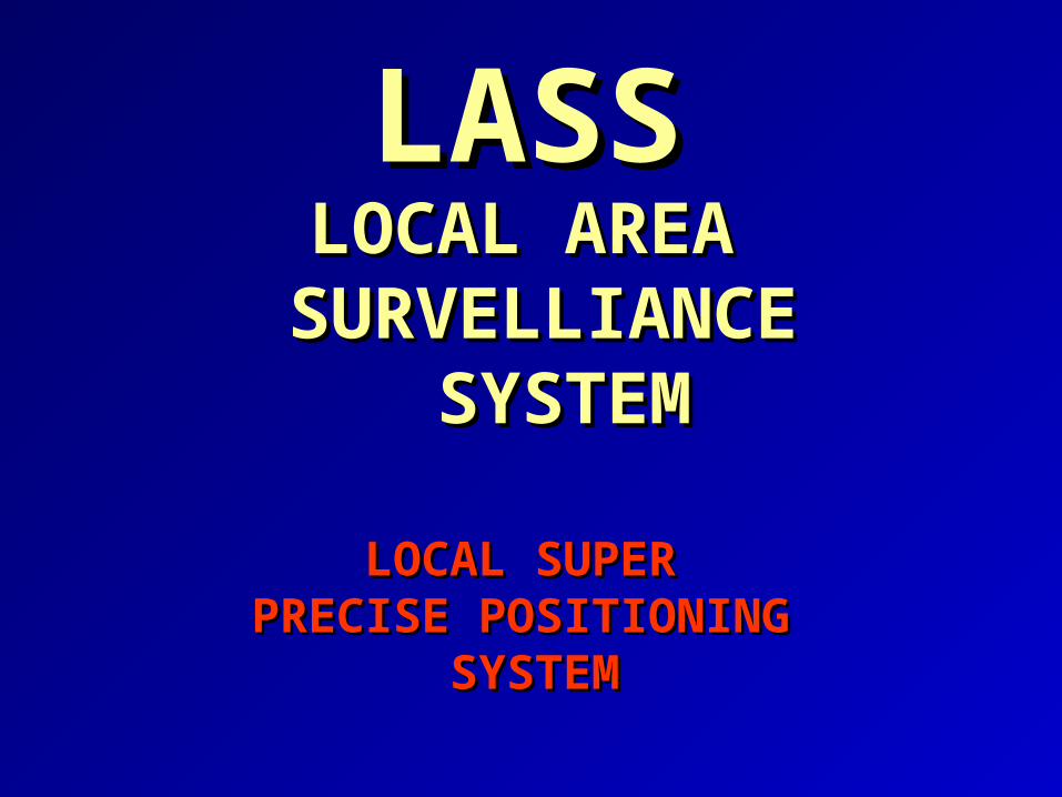
LASSLASSLOCAL AREA LOCAL AREA
SURVELLIANCESURVELLIANCE SYSTEMSYSTEM
LOCAL SUPER LOCAL SUPER PRECISE POSITIONING PRECISE POSITIONING
SYSTEMSYSTEM

LASSLASSLOCAL DIFFERENTIAL TRANSMITTER LOCAL DIFFERENTIAL TRANSMITTER LOCATED AT ENDS OF RUNWAYS SIMILAR LOCATED AT ENDS OF RUNWAYS SIMILAR TO WAAS.TO WAAS.
TRANSMITS ON SAME FREQUENCY AS TRANSMITS ON SAME FREQUENCY AS GPS.GPS.
GPS RECEIVER IS MODIFIED TO PROCESS GPS RECEIVER IS MODIFIED TO PROCESS CORRECTIONS.CORRECTIONS.
ACCURACY IS WITHIN ACCURACY IS WITHIN +/- 2 FEET+/- 2 FEET
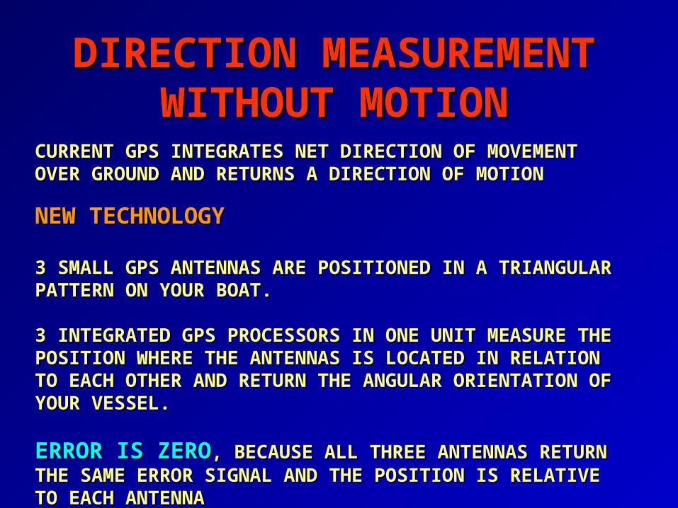
DIRECTION MEASUREMENTDIRECTION MEASUREMENTWITHOUT MOTIONWITHOUT MOTION
CURRENT GPS INTEGRATES NET DIRECTION OF MOVEMENT CURRENT GPS INTEGRATES NET DIRECTION OF MOVEMENT OVER GROUND AND RETURNS A DIRECTION OF MOTIONOVER GROUND AND RETURNS A DIRECTION OF MOTION
NEW TECHNOLOGYNEW TECHNOLOGY
3 SMALL GPS ANTENNAS ARE POSITIONED IN A TRIANGULAR 3 SMALL GPS ANTENNAS ARE POSITIONED IN A TRIANGULAR PATTERN ON YOUR BOAT.PATTERN ON YOUR BOAT.
3 INTEGRATED GPS PROCESSORS IN ONE UNIT MEASURE THE 3 INTEGRATED GPS PROCESSORS IN ONE UNIT MEASURE THE POSITION WHERE THE ANTENNAS IS LOCATED IN RELATION POSITION WHERE THE ANTENNAS IS LOCATED IN RELATION TO EACH OTHER AND RETURN THE ANGULAR ORIENTATION TO EACH OTHER AND RETURN THE ANGULAR ORIENTATION OF YOUR VESSEL.OF YOUR VESSEL.
ERROR IS ZEROERROR IS ZERO, BECAUSE ALL THREE ANTENNAS , BECAUSE ALL THREE ANTENNAS RETURN THE SAME ERROR SIGNAL AND THE POSITION IS RETURN THE SAME ERROR SIGNAL AND THE POSITION IS RELATIVE TO EACH ANTENNARELATIVE TO EACH ANTENNA

GPS2GPS2
GPS3GPS3
GPS1GPS1GPS RECEIVERGPS RECEIVER
GPS GPS SATELLITESATELLITE
GPS2GPS2
GPS3GPS3
GPS1GPS1
GPS RECEIVER
GPS RECEIVER
D2D2D1D1
D3D3 D4D4
D5D5
D6D6
ANGULAR ANGULAR DIRECTION DIRECTION WITHOUT WITHOUT MOTIONMOTION
WAASWAAS
metersmeters
mmeetteerrss
Typical DGPSTypical DGPS
LASSLASS
+/- 50 FEET+/- 50 FEET
+/- 8 FEET+/- 8 FEET+/- 2 FEET+/- 2 FEET
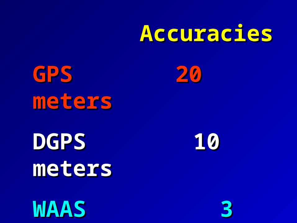
AccuraciesAccuracies
GPSGPS 20 meters 20 meters
DGPS 10 metersDGPS 10 meters
WAAS 3 metersWAAS 3 meters

Fixed Console
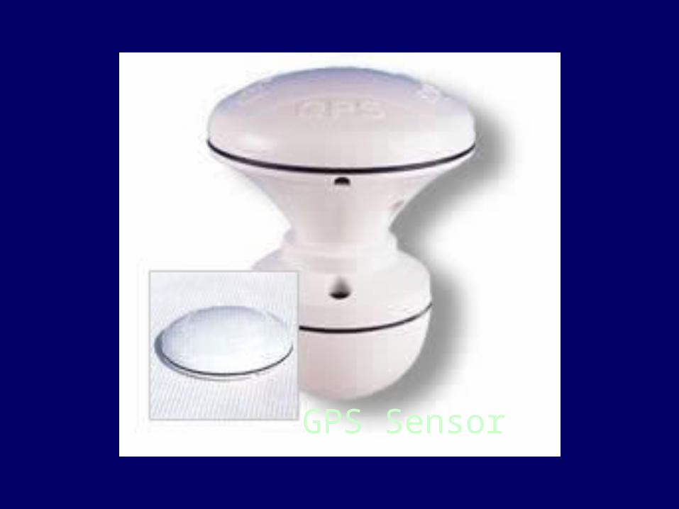
GPS Sensor
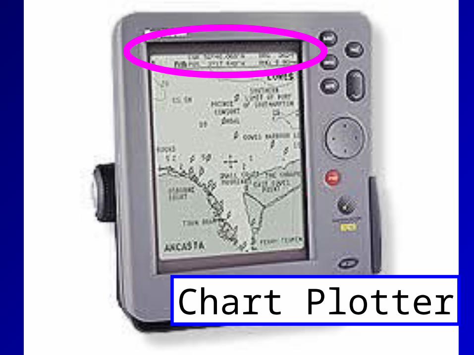
Chart Plotter

LORANLORAN
Is stillIs still
alive and wellalive and well
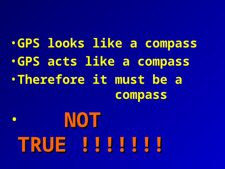
• GPS looks like a compass
• GPS acts like a compass
• Therefore it must be a compass
• NOT TRUE !!!!!!!NOT TRUE !!!!!!!
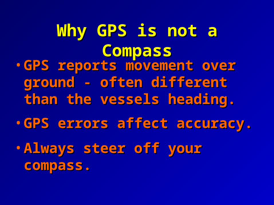
Why GPS is not a CompassWhy GPS is not a Compass
• GPS reports movement over GPS reports movement over ground - often different than ground - often different than the vessels heading.the vessels heading.
• GPS errors affect accuracy.GPS errors affect accuracy.
• Always steer off your compass.Always steer off your compass.

Rely onRely on
your compassyour compass
forfor
Direction.Direction.

*Use a minimum Use a minimum number of characters to number of characters to define a waypoint.define a waypoint.
*Maintain an EXCEL list of waypoints Maintain an EXCEL list of waypoints for reference.for reference.
GPS TipsGPS Tips

GPS TipsGPS Tips
• Waypoints do not have to be Waypoints do not have to be located in the water.located in the water.
• Waypoints can be used to mark Waypoints can be used to mark hazards to navigation--areas to hazards to navigation--areas to avoid and areas to visit.avoid and areas to visit.
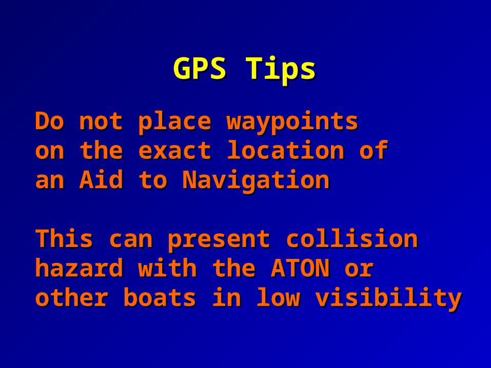
Do not place waypointsDo not place waypointson the exact location ofon the exact location ofan Aid to Navigation an Aid to Navigation
This can present collision This can present collision hazard with the ATON orhazard with the ATON orother boats in low visibilityother boats in low visibility
GPS TipsGPS Tips
GPS TipsGPS Tips
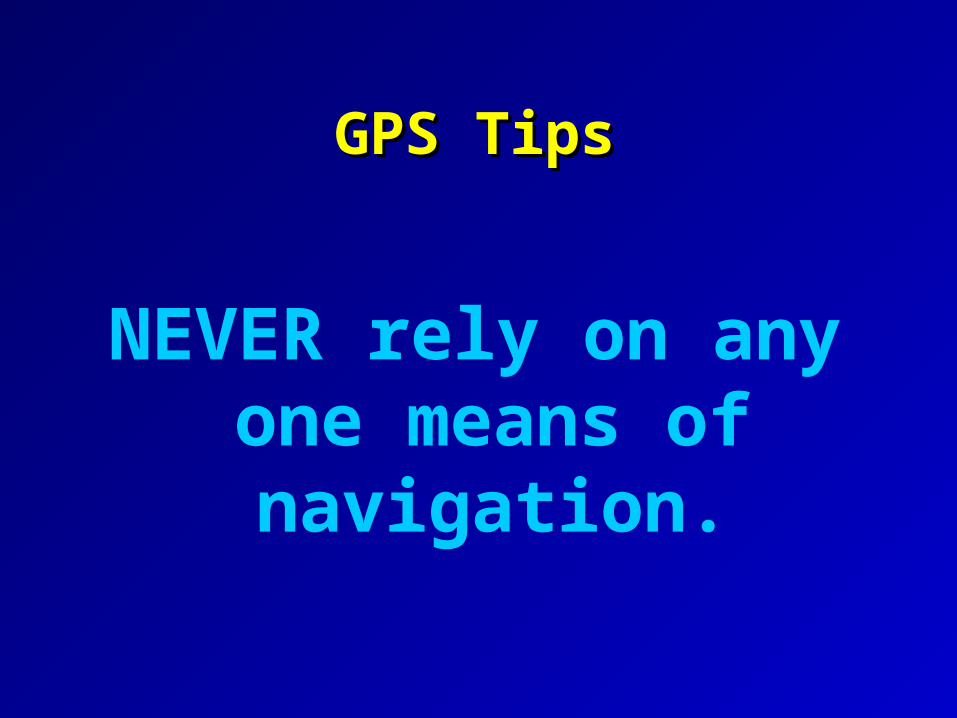
NEVER rely on any one means of
navigation.
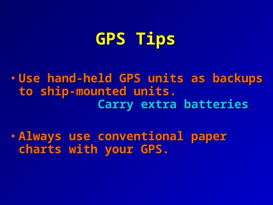
GPS TipsGPS Tips
• Use hand-held GPS units as backups Use hand-held GPS units as backups to ship-mounted units. to ship-mounted units. Carry extra batteriesCarry extra batteries
• Always use conventional paper Always use conventional paper charts with your GPS.charts with your GPS.
GPS TipsGPS Tips
Remember that the greatest Remember that the greatest
hazard to navigation may be a hazard to navigation may be a
bored navigator.bored navigator.
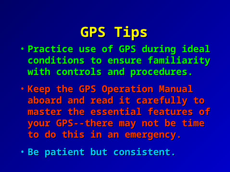
GPS TipsGPS Tips• Practice use of GPS during ideal Practice use of GPS during ideal
conditions to ensure familiarity with conditions to ensure familiarity with controls and procedures.controls and procedures.
• Keep the GPS Operation Manual Keep the GPS Operation Manual aboard and read it carefully to master aboard and read it carefully to master the essential features of your GPS--the essential features of your GPS--there may not be time to do this in an there may not be time to do this in an emergency.emergency.
• Be patient but consistent.Be patient but consistent.
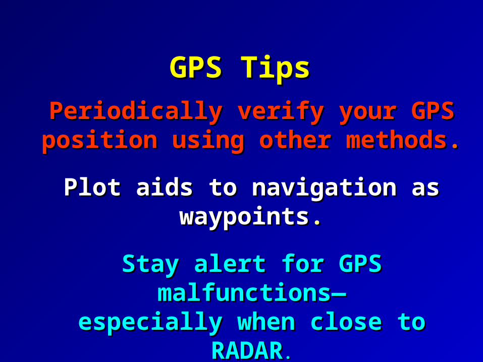
Periodically verify your GPS position Periodically verify your GPS position using other methodsusing other methods..
Plot aids to navigation as waypointsPlot aids to navigation as waypoints..
Stay alert for GPS malfunctions—Stay alert for GPS malfunctions—especially when close to RADARespecially when close to RADAR..
GPS TipsGPS Tips

For More InformationFor More Information
There are instructional video tapes There are instructional video tapes available for many models of available for many models of
GPSGPS..
Any questions about:Any questions about:
AV Task 6-4 AV Task 6-4 Establishment, Establishment, verification and use of waypoints verification and use of waypoints – see page 142.– see page 142.
Related Documents