Sections 1.3, 2.3 & 2.4 and Tables 1.4.1, 1.4.2 & 2.1 contain confidential information or data, as described in Section 2 of the Coal Act Regulation, and have been excluded from this report. Coal Act Regulation: http://www.qp.gov.bc.ca/statreg/reg/C/251_2004.htm

Welcome message from author
This document is posted to help you gain knowledge. Please leave a comment to let me know what you think about it! Share it to your friends and learn new things together.
Transcript

Sections 1.3, 2.3 & 2.4 and Tables 1.4.1, 1.4.2 & 2.1 contain confidential informationor data, as described in Section 2 of the Coal Act Regulation, and have been excluded from this report. Coal Act Regulation: http://www.qp.gov.bc.ca/statreg/reg/C/251_2004.htm
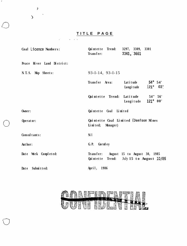
T I T L E P A G E
Coal Licence Numbers: Quintette Trend: 3297, 3309, 3301Transfer: 3341,~3661
Peace River Land District:
N.T.S. Map Sheets: 93-I-14, 93-I-15
Transfer Area: Latitude 54O 54'Longitude i21" 03:
Owner:
0 Operator:
Consultants:
Author:
Date Work Completed:
Date Submitted:
Quintette Trend: Latitude 54" 56'Longitude 121° 00'
Quintette Coal Limited
Quintette Coal Limited (Denison MinesLimited; Manager)
Nil
G.P. Gormley
Transfer: August 15 to August 30, 1985Quintette Trend: July 15 to August lo/85
April, 1986
0
0
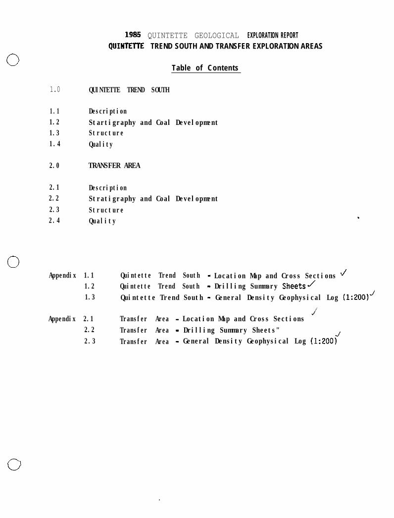
1.0 QUINTETTE TREND SOUTH
1.1 Description1.2 Startigraphy and Coal Development1.3 Structure1.4 Quality
2.0
2.1 Description2.2 Stratigraphy and Coal Development2.3 Structure2.4 Quality
1985 QUINTETTE GEOLOGICAL EXPLORATION REPORTQUINTElTE TREND SOUTH AND TRANSFER EXPLORATION AREAS
Table of Contents
TRANSFER AREA
Appendix 1.1 Quintette Trend South - Location Map and Cross Sections J1.2 Quintette Trend South - Drilling Summary Sheets/1.3 Quintette Trend South - General Density Geophysical Log (1:2001J
JAppendix 2.1 Transfer Area - Location Map and Cross Sections
2.2 Transfer Area - Drilling Summary Sheets"2.3 Transfer Area - General Density Geophysical Log (1:200<
0 1985 QUIHTETTE 6EOLOGICAL EXPLORATION REPORTUUINTETTE TREND SOUTH ANU TRANSFER EXPLORATION AREAS
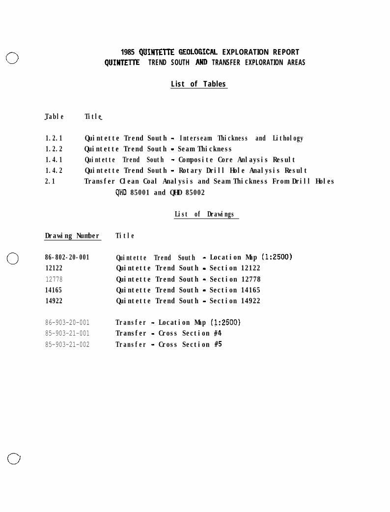
List of Tables
Table Title- -
1.2.1 Quintette Trend South - Interseam Thickness and Lithology1.2.2 Quintette Trend South - Seam Thickness1.4.1 Quintette Trend South - Composite Core Anlaysis Result1.4.2 Quintette Trend South - Rotary Drill Hole Analysis Result2.1 Transfer Clean Coal Analysis and Seam Thickness From Drill Holes
QHD 85001 and QHD 85002
List of Drawings
Drawing Number Title
Cl 86-802-20-001 Quintette Trend South - Location Map (1:2500)12122 Quintette Trend South - Section 1212212778 Quintette Trend South - Section 1277814165 Quintette Trend South - Section 1416514922 Quintette Trend South - Section 14922
86-903-20-001 Transfer - Location Map (1:2500)85-903-21-001 Transfer - Cross Section #485-903-21-002 Transfer - Cross Section #5

GEOLOGICAL ASSESSMENT REPORT
0 QUINTFTTE TREND SOUTH AND TRANSFER AREA, 1985
1.0 INTRODUCTION
1.1 General Geographic and Physiographic Position
The two aforementioned study areas are located on the Quintette Coal Limitedproperty as indicated on the attached index map. Generally the Quintette Trendarea is situated in alpine terrain just above tree level at an averageelevation of 1,650 metres. The Transfer area is situated in forested terrainranging in elevation from 900 metres to 1,550 metres above sea level. Accessto Quintette Trend is possible by 4-wheel drive vehicle via 14 kilometres of"well site" access road connecting the old Babcock campiste to the HeritageHighway (Boundary section). The Transfer area may be approached via the roadwhich accesses Quintette's Transfer Point Building on the overland conveyor oralternately via the well site access as indicated on the index map.
1.2 Property History
The Quintette property was initially acquired in 1969. Regional mapping of
0 both the Quintette Trend and Transfer areas was undertaken in 1970 to 1974.Limited diamond drilling and bulldozer trenching was undertaken on theQuintette Trend,in 1974 and 1976. No drilling or trenching has been undertakenin the Transfer area prior to the 1985 Programme.

0.
0
OUiNTETTE TREND SOUTH AND TRANSFER AREAS ‘ “A.<” .W‘
1.0 QUINTETI-E TREND SOUTH
0
0
0
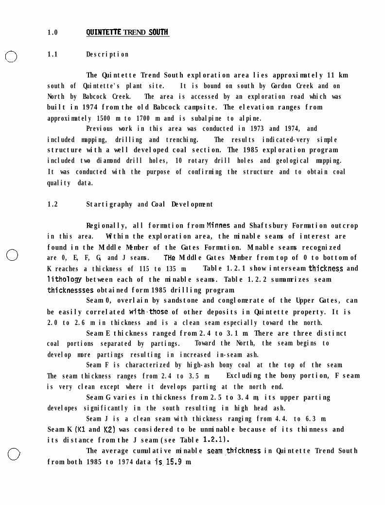
1.1 Description
The Quintette Trend South exploration area lies approximately 11 kmsouth of Quintette's plant site. It is bound on south by Gordon Creek and onNorth by Babcock Creek. The area is accessed by an exploration road which wasbuilt in 1974 from the old Babcock campsite. The elevation ranges fromapproximately 1500 m to 1700 m and is subalpine to alpine.
Previous work in this area was conducted in 1973 and 1974, andincluded mapping, drilling and trenching. The results indicated-very simplestructure with a well developed coal section. The 1985 exploration programincluded two diamond drill holes, 10 rotary drill holes and geological mapping.It was conducted with the purpose of confirming the structure and to obtain coalquality data.
1.2 Startigraphy and Coal Development
Regionally, all formation from Minnes and Shaftsbury Formation outcropin this area. Within the exploration area, the minable seams of interest arefound in the Middle Member of the Gates Formation. Minable seams recognizedare 0, E, F, G, and J seams. THe Middle Gates Member from top of 0 to bottom ofK reaches a thickness of 115 to 135 m. Table 1.2.1 show interseam thicknes.s andlithologv between each of the minable seams. Table 1.2.2 sumamrizes seamthicknessses obtained form 1985 drilling program.
Seam 0, overlain by sandstone and conglomerate of the Upper Gates, canbe easily correlated with.those of other deposits in Quintette property. It is2.0 to 2.6 m in thickness and is a clean seam especially toward the north.
Seam E thickness ranged from 2.4 to 3.1 m. There are three distinctcoal portions separated by partings. Toward the North, the seam begins todevelop more partings resulting in increased in-seam ash.
Seam F is characterized by high-ash bony coal at the top of the seam.The seam thickness ranges from 2.4 to 3.5 m. Excluding the bony portion, F seamis very clean except where it develops parting at the north end.
Seam G varies in thickness from 2.5 to 3.4 m, its upper partingdevelopes significantly in the south resulting in high head ash.
Seam J is a clean seam with thickness ranging from 4.4. to 6.3 m.Seam K (Kl and K2) was considered to be unminable because of its thinness andits distance from the J seam (see Table 1.2.11.
The average cumulative minable seam,thickness in Quintette Trend Southfrom both 1985 to 1974 data is.15.9 m.

0Inter-Seam
D-E
J-K
D-F
F-G
G - J
TABLE 1.2.1
QUINTETTE TREND SOUTHINTER-S!ZM THICKNESS
Thickness Range
11 - 25
13 - 30
21 - 41
4 - 18
10 - 14
Litoholoqy
Carbonaceous and shalybelow D seam to sandyshale to find grainedsandstone .
Shale to very fineand find sandstone
Shale with very findto sandy shale bands
find sandstone toshale andcarbonaceous shale
shale to findsandstone

0Drill Hole
QiD 85001
0
QTD 85009
QTR 85001
QTR 85002',QTR 85003QTR 85004QTR 85005
QTR 85006QTR 85007QTR 85008QTR 85009QTR 85010
TABLE 1.2.2
QUINTETTE TREND SODTHSEAM THICKNESS
Seam
!FGJK:lK2D-
K2D
EF
J”KlK 2
Thickn.ess
2.45/2.642.47/2.863.14l3.482.19/3.214.60/4.930.81/0.81O-26/0.342.09/2.141.99/2.902.X/2.67ywg-;y. .
0.95;0.950.48/0.572.112.372.512.062.844.510.910.462.462.363.212.714.731.260.55
0

1.3 structure
0-
0
Regionally, to the Northeast of the exploration area; the WaterfallSyncline and the Babcock-2 anticline pair runs from Southeast to Northwest. TheGates formation exposed in the exploration area forms the south limb of theWaterfall Creek Syncline, and all strata, dips uniformly to the Northeast at 65"to 70' (see cross sections in Appendix 1). The drill and mapping data indicatethat there are no major faults in thfs area.
Section 1.4 and Table 1.4.2 contain confidential information or data, as described in Section 2 of the Coal Act Regulation, and have been excluded from this report. Coal Act Regulation: http://www.qp.gov.bc.ca/statreg/reg/C/251_2004.htm

TABLE 1.4.2
,0
. I- -
0
/ II I/DRILLHOLE ] SEAM
I I1 QTR 85001 1 D
I I E) QTR 85002 1 E1 QTR 85003 1 F1 QTR 85004 1 G1 QTR 85005 1 J
'1 I K11 QTR 85006 1 ;1 QTR 85007 1 E1 QTR 85008 1 F
1 QTR 85009 1 G1 QTR 85010 1 J
I P1 K 2
TI
tI
I.
I
/
1
I
/1
QlJ1NTEll-E TRERD SOUTRROTARY DRILLtiOLE ANALYSIS RESULT
VERTICALDEPTH FROSURFACE
(ml
20.1183.72
21.9419.4219.4816.8761.4769.11
20.9618.2044.97
1 7 . 8 68.77
85.63
97.49
RAW ANALYSIS
ASH%
44.2753.1661.42
53.6031.5123.22
10.1570.32
27.8342.6718.63
24.3121.0832.54
61.14
I1I
F S I
1.51.5
1.51.05.53.5
3.50
2.53.0
7.56.55.51.5
1.0

Portions of Table 1.4.2 contain confidential information or data,as described in Section 2 of theCoal Act Regulation, and havebeen excluded from this report. Coal Act Regulation: http://www.qp.gov.bc.ca/statreg/reg/C/251_2004.htm

2.0 TRARSFER AREA
0
0
0
2.1 Description
The Transfer Area lies between what was previously known as theHermann North and the Hermann South pits. This area is located approximately 1km southwest of the overland conveyor transfer point. An exploration programwas conducted in the M-11 anticline region within the Transfer Area during theSumner of 1985. The area lies above the treeline with elevation ranging from1400 to 1680 m (see geological map),
The area had been explored with regional scale geolgical mapping in1975, but at that point it had only been determined as belonging to the GatesFormation, and there was no data to confirm minable coal seams. The 1985program was conducted with the purpose of confirming the presence of minablecoal. The work was limited to 2 exploratory diamond drill holes and detailedmapping in the confined area.
2.2 Stratigraphy and Coal Devel oplaent
The Gates Formation reaches up to 300 m in thickness within theexploration area. The formation is divided in descending order, into Upper,Middle and Lower Members. The main coal bearing memeber is the Middle Memberwith thickness of 102 m. It correlates very well with the northern portion ofthe Shikano pit on the opposite bank of the Murray River.
There are eight potentially minable seams, B, D, E, F, G, J, Kl andK2. Seam B belongs to the Upper Member and the others belong to the MiddleMember. Thickness of each seam is shown on Table 2.1.
Seam B and D have no partings but are thin reaching to only 0.8 and1.0 m.
Seam E has developed partings and relatively thin coal splits andtherefore maybe unminable.
Seam F which lies 22 m below E seam has two parting but is relativelythick developing to 4.2 m.
Seam G attains a thickness of 3.2 m. This seam is made up of threecoal splits and two rock partings.
Seam J is 13 m below G and 3.0 m in thickness. It is a very cleanseam.
The J and Kl interseam is only 0.7 m while Kl seam is 0.85 m inthickness.
Seam k2 is 0,.9 m below Kl and 0.7 m in thickness. Seams J,‘Kl and K2may be mined together, but interseam partings will probably be separated. Thecumulative minable coal seam thickness (6, D, F, G, J, Kl, K2) in this area is14.77 m. Without seam B and 0, the thickness is 12.9 m.

0_ .
0
2.3 structure
The structure in the Transfer area is dominated by M-11 anticline.The anticlfne axis runs from NW to SE. Both limbs dip from 35 to 60'. Threefault zones have been interpreted, however, +,hese faults have not yet been welldefined.'

Sections 2.3 & 2.4 and Table 2.1 contain confidential information or data, as described in Section 2 of the Coal Act Regulation, and have been excluded from this report. Coal Act Regulation: http://www.qp.gov.bc.ca/statreg/reg/C/251_2004.htm

APPENDIX 1.1
QUINTETTE TREND SOUTR
LOCATION MAPSECTION 12122, 12778.~14165 and 14922
,eQ-


GEOLOGICAL ASSESSMENT REPORTQUINT!d-TE TREND,- SDDTH AND’ TRANSFER. AREA,
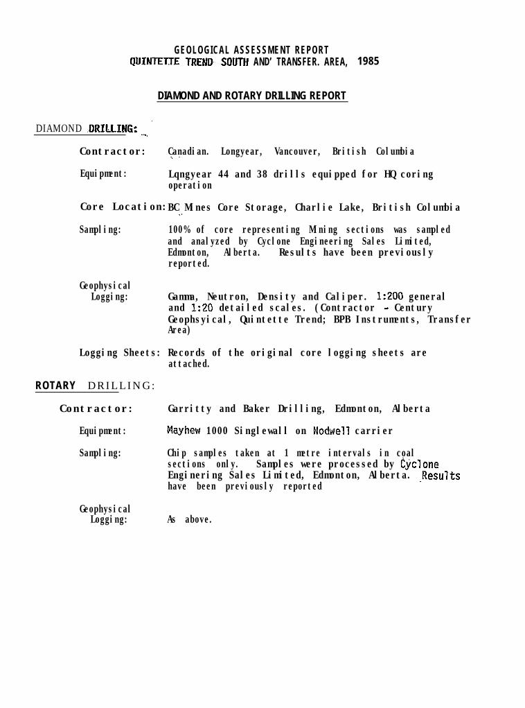
DIAMOND AND ROTARY DRILLING REPORT
DIAMOND .DRILLING: ._., ’
1985
Contractor: Canadian. Longyear, Vancouver, British Columbia..-
Equipment: Lqngyear 44 and 38 drills equipped for HQ coringoperation
Core Location: ._BC Mines Core Storage, Charlie Lake, British Columbia
Sampling: 100% of core representing Mining sections was sampledand analyzed by Cyclone Engineering Sales Limited,Edmonton, Alberta. Results have been previouslyreported.
GeophysicalLogging: Gamma, Neutron, Density and Caliper. 1:200 general
and 1:20 detailed scales. (Contractor - CenturyGeophsyical, Quintette Trend; BPB Instruments, TransferArea)
Logging Sheets: Records of the original core logging sheets areattached.
ROTARY DRILLING:
Contractor: Garritty and Baker Drilling, Edmonton, Alberta
Equipment: Mayhew 1000 Singlewall on Nodwell carrier
Sampling: Chip samples taken at 1 metre intervals in coalsections only. Samples were processed by cycloneEnginering Sales Limited, Edmonton, Alberta. .Resultshave been previously reported
GeophysicalLogging: As above.
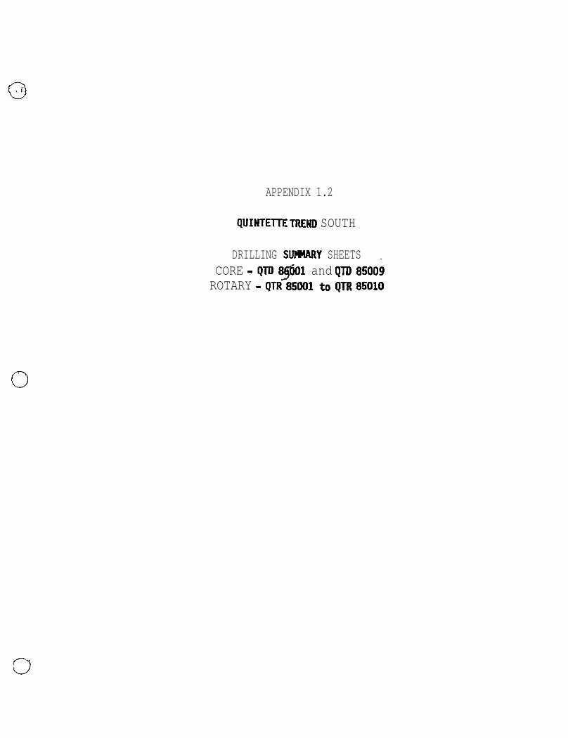
APPENDIX 1.2
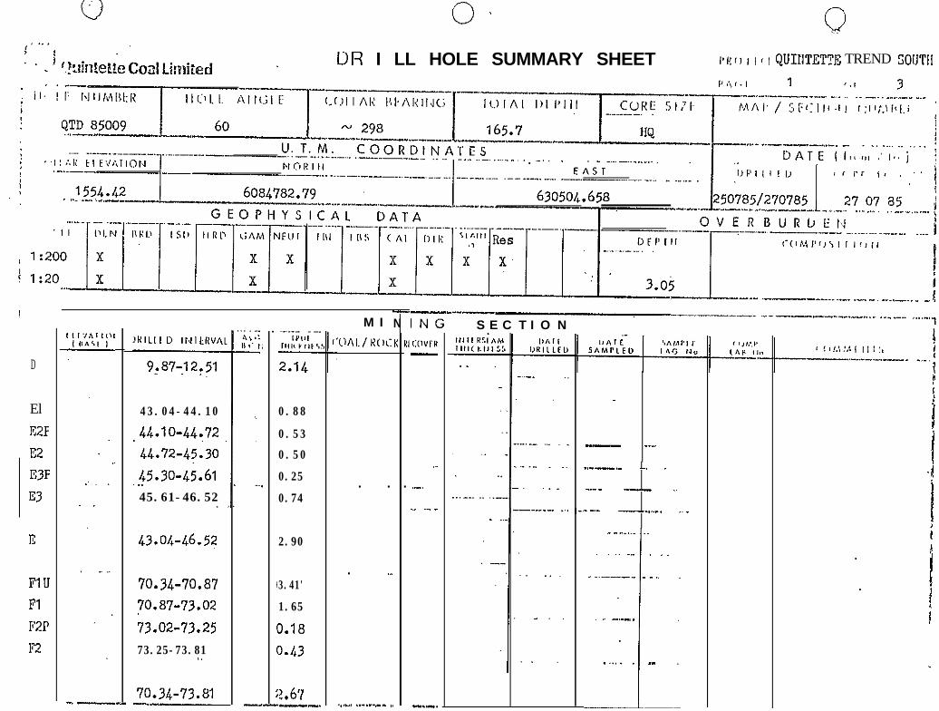
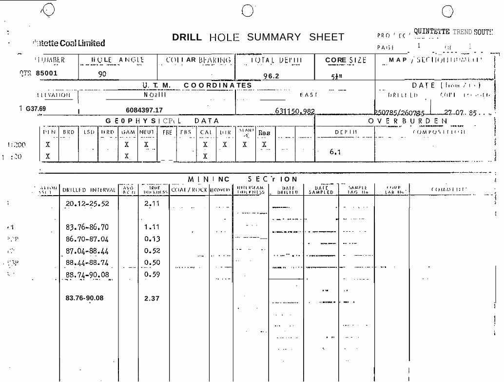
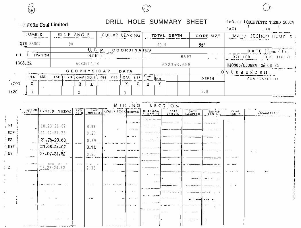
qlJ1NTEnE TREND SOUTH
DRILLING SUMtRY SHEETSCORE - QTD 8$Dl and qTD 85009ROTARY - qTR 8SDOlto qTR 85010

cl 0,. 0
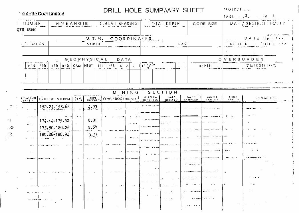
. .’ .AI’ L’.’ DRILL HOLE SUMMARY SHEET,,,!,> ) , < , QUINTETTE TEE!!D S!jUTii
. .: '~ilT~@tteCoalLirni~ed PA<*, 1 0, '3
I ..-I
.--___ ----__
:’:’ !:LC’/AIIOfI
i-
; . ..,
’ -
11.60-35.40~.. .._. .~.
I-_.
43.64-17.05'
66;2&67.ii.-. ..~ . _.
67.44-67.84
67.84-68.96'._ . I _ . _ ._ __ _..68.96-69.14_._~.., .- ,... ._
69.14-69.64.._- ,-..__. ..i_ -... ._
.66.28-69.64
86.03-86.79 0.55
86.79-90.37 2.65
90.37-90.41 0.03
90.41- 90.'74 i 0.25
--_.*“GR c. P 1-
.“.
.-
- _
_.
.2.64,,.. _1.03.~0.34
b.si_-.0.14_0.41._" .
2-.86.
. . _.-
.._ . .
._. _^ _-.
..-.__
ING S E C T I O N
-
--*..
--,.
.._.
._
----
.
^. -_.
llJTERIF,iMIIIICXNES!. __
..-.-___
___I__
_
- - ._
.._
.-... ..-_.
. . - _ .
_....
.
_“AIF
LwILLtn
..--.-_ _
.- .-_--
I ._ _ _
-. -
-.--___
-. ._
. .“.i...
.
.
.
_
_ ._
.,
._
t
Cli,“l?,*,, ,111.
I
._
..-

0 0 l&J
i, a-:‘! .”
. *%:tte Coal Li.mitedDR I LL HOLE SUMMARY SHEET PROlFf I .__. ,.
PAGr.. . . 2 . or 3
':. I Il.!I,1BER--.. .^. .,
H 0 I. fi A ~4 G I E COLLAR REARING TOTAL U6P’IIH ’-----..-- ----.---.-.--..-- ---.- - - - - - - - -.-....-.-. -.-- .-.. - .--.____ _ --- ..._.........I.. --- .__._ _
:O'D 85061.,.?U. T. M._---.- -_ C O O R D I N A T E Sr ----... .---I- -.-.---.-
tI’F‘lAlIrJr.1 NORIll F A S T.._ CI.,I?I /--.--._ _.._ -_-- .._ -__ - .-..
-- ,G E O P H Y S I C A L D A T A O V E R B U R D E N - ”.-__.. --.~ - - - - ._i---..- -----_I._..
DEPlll toMnrosl I I-!;!
...““-- ” ‘~ i
-.I !
143.63-143.98
143.9%?44.71
144.71-146.22
146.22-146.31
,_ 146.37~147.65
'143.63-147.65
152.24-153.03
.._
I
--
0.29
0.68
1.11
0.12
1 .Ol.
3.21
0.73
0.60
0.20"
4.13
_i5 c:
M I N I N G S E C T I O N
,.
-
:K HI
.,
.
cc-
..- _-_..
---_~-. __
_
-.. .___DATE
SAM,LLD
--_ . - .--- -
.--.
-.- _... - -__.
. --
“_.._ . .
.- ._ ._.-.
. . ____ -_,
.- . . L. _
I I
I !
DRILL HOLE SUMPr/lARY SHEET.PAtiE 3 0, 3~.,.. .
- - - - _ ._.._-- - . . _-.- ,: lJtIMl3t:R HOI E A N G I E CC,LLAR RkAI:ING IOTA1 DFPTIi C O R E S I Z E InAl’ / SEC1ll,II II!‘:;! I !’
.-. . -. -. ^. 1... - _ _ _ _ _ _ _ .._. ~_ ._ _.._. _-____ . _._ _.. .__. . . ~ _,____ . _ ._ .__ ._ .._.. -. __O,TD 85001
i-....._. .--_I..U. T . M COORDI-ii-hTES-----2 ____ -----.. .--- --.-...-- - D A T E ( from / 4.. ) i
‘: r, IVAIION NORlll EASI <,.,!!I I. ,.‘,I._ ,______. - .._.-_ - - - -....--.. ----.__- ..,
---.. I^.G E O P H Y S I C A L D A T A O V E R B U R D E N I
._-..- _..-_ - - - - - -..-_.-- - ____ -. .._ _ _,___. _ _ ___--.--- --._..---.
‘..m------I->- .-I....--- ..
__-__ --....nEN rII:n LSD llKn CAM NElJl FllF b”S C A L DIR “.A”’ VEPTll r:oM,‘OSI I Ir’!I,
_ _ _ _ _ _ _ .._n:- .-_-.. . ..--- - - - -._. _.____ .___.._ . ._... -...-___ ,_-.-- .-r
- - _._... . . ..- i
,_ _.-. . _ _-..-._ ..-..- _--- ..__..- - ~- ;
.1 . 174.44-175.50.175.50-180.26_ _. _ -. _. - .-180.26-180.94_ . _ . ,,- . -
._.. _. ~-. _..~ . . ~ . -.,.
_,.__._ _._. _... _ .
. . -
-
0, 0LIR I LL HOLE SUMMARY SHEET I*I!~I, I 1 I QUIIITETTE TREND SOlJTII
!
I
D
ElK2FE2E3FE3
1;:
FIUFlF2PF2
--
43.04-44.10
.44.10-44.72
44.72-45:30
,$5.30-4k.61
45.61-46.52.
43.04-46.52
70.34-70.87
70.87-73.02
;3.02-73.25
73.25-73.81,.
10.34-73.81-
.I
.
I
(
(
:-
0.88
0.53
0.50
0.25
0.74
2.90
3.41'
1.65
1.18
I.43
1.67---
M I‘0hl.j KOC
. .
. ._
.,.-. .._...r_ ,.
-.NK 111
.
--_IN<I:oVI”-
.-. ,.
.._,
., ._ _
,-..-.
S E C T I O N
.
-- __I
..--.- -. _
-.-- __ _
--._ --.-__ _.__ _ _..- ,~- ..“----” _ -_l--v
._._ -.. __

1 i;‘. r.. DRILL HOLE SUMMARY SHEET. . -i. I,~I~~BEK tIoLE ANGLf COI.LAR HFARING lOTAL DEPTIi
- - I _--,----.-----.- -. --.--..-- 1-
C O R E S I Z E -
‘yl 85009
G E O P H Y S I C A L D A T A 0 V f R 0 U. R D E 14
I-- --_ ._ -
19.24-99.68
19.6B-99.83
'9.83:101.42 .,
01.42-jo1.6~
.(1?.,60:102.67..
9.9..?4,?02.67-.
- .._..
103.66-1.04.54
124.24-124.46
124.46-124.89
124.89-130.22
124.24-130.22
-I
_.
I
-
.-_. .~lHl!l
rl,K:KrlLS
0.38
0.11
1.34
0.16
049..
..-.
2.ss
- . . . .
0.77.
0.18
0.35
4.38
4.91
M I N I N G S E C l
.
. _
..~. __.
.__. -
_ I
: K RF
. .
_
- -
._. __
-_
^
‘CWFR
-_~.-
-L-
- -
,l,I,“IIAhI,II<.I.IICS
_.._ -..
_,___.. --
__. . . . . -.
..” .._.
” . _ .._
L. _. _ _
._.
_... I^.-.
--. .._
- - - - - -
-.-_.-
. _. . ..-.. .
.,.. ,,
..~_ __... -..
_. _
_ .
_.-
_
_ ..___
.----
_.-...
...--I
.
_..I.
.I
f
--
- . .
.
Ilihll’,bIAG II”- -
. _ _. .._-
-... -._
___... -_
_- .-.. -_.
. _ .
-
-.... .- . .
.
t
-.
-.-
_..
.
.

..:* . . ..I
’ . .PRO I ItI I __
..‘A’ . :l tii~fetle Coal LimitedDRILL HOLE SUMMARY SHEET
P A G E _. .3 _, OI 3. .._. -_--_-._-..: I( 'J IlhllXR l-i 0 I E r\ Id G I. E ~:(!LL.AR HFARINii TOTAL UEI’TH CORE SIZE;
. . M A P / SECTl(~lI ~llI/.‘i!i i’ , I,.
I~ ,. !!'I'0 85_qO9 , . ..- i. _! . u. 'r. M. COORi)INATES..I__- .--
--I
~-.---.----I--.--._._l_l_- DATE (III II) f )j.
_..._.- ----I.- . ..-. - .-.-.-.-_ - -__........ _..-. ._.._...-..: L l IV,\1 I O N N 0 I< I I I EASl I)liI, I FL,’ - C,,,” ,111 ,,I(
:’-_- .----- -..-..-- ____ --- . __.___,,I_______ - - - _.... ._- .__-... -.. ~. _ _.
I N G 5 E(_ _ _
on,*S/IMPLED
_ ..__ ._-..
- - _.-_.
URILLEU INrtRVAt ‘CMt/ ROC
147.60-148.76148.76-151.12
151.12-151.8;
.--- .,1.28
0.57.._
--- _...0.62
..__ .--.-.. ~,-159.95-161.09
~..
.
.
-,
._.~.__ ._._
,-__-
_-._--
.-.--
.
_ -
.,.
.
-. .
.
0. 0DRILL HOLf: SUMMARY SHEET
PR c) , ('( , CfINTE;TTE TREND SOUT!:
PAl;r 1 /:i 1- -.,I-
.-.-I ~’
- -. _ - - - - .._... - - ‘--,’ i ~.I/,ll3tK Ii U L E A 1‘4 i.:; I. E (.‘(lI I AR ut/\liIN(; I 0 T A I. I> E I’ I I I CORE SIZE M A P 1’ 5I:C‘IliilI I;!!,‘.!i: I ’ 1_. ._- __._._._.___ .._ ~., ~. ..^..
.?
. ..-... --_.-. ._ _ ._.
QT!: 85001 6.21
,jfrl --.-..,...e”.. i_-- .---U. T. M. C O O R D I N A T E S --DATE (l,,ir,,t’,.j-_-^-__.-.-_-_.. ..__ -.- -_..___
CA;I..- _..- _ _.
N 0 u I I I ,,R,LI I.,, r. ( I I’ I.
I G37.69 I 6084397.17.,-G E 0 P Ii Y S
! : 200
i :lO
CP , I-.- _.FliE
I- -
?s5~2607~.r-L-22..07.. 85 . . L. 4OVERDURDEN_______,_-_. . ._.--- .__._.I----= t
NC ,C’
I:- -
-.
___
_.
_.
r I O NI,AlP
I~HlllIII
_.-..
_ - . ..- _._
__... - .-__~
. . .- -- - .
..^_.. ..~
\1 I
K “I’
.~
2.37
I-._._ ~-
unrcSAMPLE,>
_ ..---.
_ _.--.
.-...-
-.--..-
..-
. ,, _..-,_
. ,..
c
.
__
83.764%.70
86.70-87.04
W.O&?&.U
88.&88.7L
aa.74-90.08~._. _. .._, _.
.
..~..
.~. . . . -. . _... .-
.
,^
-. .83.76-90.08.r
j
E

e - 7 , - 1 .s
1)--. ---..-----I A T E---... ..-,---- ( I,r,,:> I-.-.. -.-. ..-._. -.___ -__ .,EAsr.- --_----
19.21 I 6084376.14 631131~908 01 08 85 01 08G E O P H Y S I C A L D A T A
Kll-‘-O V E R B U R D E N .~’- - - - - --.--._ - - - - - - -__ -_---I__-____-_~
I ,,I: CR5 CAI Ill,! Res DEPTH rOr*IP~SII,~~:~- .____ - __._________.._~5 y I
X x x xx
x ‘-. _. .~.- ._I
4.5
S E C T I O N
1.95:25..1.4 ._,
5.14-22.50
5.50-26.65
6.65~27.03.~__.7103128.65,. -. .,-, . .,~ _
TRllFIIIfTkNEl
.f?O ._0.13
0.43, .~~~0.14
i61
M I I.-_ .-- ..__.:OAL/ROCI
IN<-_-I.KDYFR-
t
1,95-28165 -‘-’---. .._ . .- ._...____._ 2.51
._ -
.-.,
. . _ ._
,- .
.,.
-*-,

0 0. (3
.: tf;:tE& @o;i! Lirflifed DRILL HOLE SUMMARY SHEET P R oi E c fQU!NTETTE TRCHD SOUT;'
.-.-
19.0 1.20,56
20.56 - 24.30
24.3 - 24.3,.._.. _. _- .~.,
'9.43 *,_.- 2i 30
I . _ _
;
. ._ -\ Y<iICI ,-
._A .--...
.
0.48
1.58
._.
2.06
I
. .
_.
-.- - -_.-.
. . . _
-. ..- _
- - - - - ._ _..
‘... ._
-. . _.
_-
G S E C T I 0 N. .
- ” nii-SAMPLED
--.-
_.._.____
-.-_..-._
----.
.---_
. ~ - .._,
.-. -. __
..--.._II.
- .
,-.SAMPIEIAc; #IQ
__.
- - - -^
_ ._... -. _,
_. .
.-.. .“, _
--_ -.._ _.
-__-. .,_
-. _.. _ .
. ” . . _
,.
-
-
_-
_
. .
”
-. -

IIt’ r ANGI F c-01 I A R ttt ARINI; T O T A L I)1 PlJl.._.” ,... .1
- ..- --. --.-. -___-..__
----.I - - - --.- -
_,_ --s- - - - -I,CN DRI)
OVERaURDErdLhL> WRD ‘GAM NE”T
- - - - - - -THE IBS CAI DIK
- --..- _.._____.__
i- .--._. ..-.__ _ D E P I t,_ __. “y & s COMI’OSI I I, 0
;!:?‘I0 x- -
x x----__I --... -
x- x x x̂.., 1 :x
.._..‘X X x 4 . 0
- -. .
\:‘I; 1;:x !. . 12 ,
,;q? j
: 1;3I
.!i ’
’: ! 7.‘.
1 9 . 5 0 - 2 2 - l
2 2 . 1 0 - 2 2 . 5 3.._.. ~.~_.2 2 . 5 3 - 2 4 . 5 0
24.50-24.90
24.90-26.45
1 9 . 5 0 - 2 6 . 4 8- . . - . ,. .~_
32.40-33.90
-.--n ,‘CR ,‘. P .-
.-
--.
,
._
1 . 0 7
0 . 1 7
0 . 8 0
0 . 1 6
0 . 6 4
2 . 8 4.~
0 . 6 3
-.. --- _...
._.
.._. -. __,
. ._ _. _
_
,.--
N IK RI
.
.
G ,S ECTION-..R>.!_.
‘.-I- -,
_..
.~

,,R,j,,i: , QUINTETTE TREIID SOW'11.._.
*“[‘Ii 85005 1.-.9 0 I-.- 1 89.&o I 5i”
U. T . M. COOi<DT;S/\r-ES..- - . . . ..-..-_._.-..-. . ~. . ..__.......! ! , ‘Vi\, 101.1 1‘1 0 I< I I I.._._-
I - - - - - I - - - - - - - -EAST .-...- __._
16.88-18.28.
I 8.28:18.64
18.64-27.56
1 6 . 8 8 - 2 7 . 5 6
61.48-63.82 0.91
jj;.82-69.12 1.98
6 9 . 1 2 - 7 0 . 3 6 0.46
82.08-84.12 0,76
n\u“‘I-I
-.,--,Hllr
IIIKKIIEI
0.590.153.77
4t?'
YCM I_._.
:(IAL/K~.JC
_
.
.
NK Rl
I NCllYL-
. -
C T I O NAI ‘.I‘I
llA!lUKlll,,)
--- . . _
. _.
-- ___._ __
--__. _
--_-
.~
. .
_- .- _
,..
. .._... -__
_.... -__-_
.._ -.-
- --_.-~
_ _. . _
- -
. -,.
-_-
- .-

0“ 0DR I LL WHOLE SUMMARY SHEET I’ R CI , cc I QUXNTETTE TREND SOT’?
I’ll c, c 1 (li 1
U. T. M. C O O R D I N A T E S_____ I ---- - _.-.- -..-..NClKlll EAsr--__I--_-^--_.I _-_._-...._. -_-_-.._-___
boa36a2.13
G E O P H Y S I C A L D A T A
?-T I 0 N- -,
I
J
.
,. .,
_ .
+-.. _ _ ---- __.__ ,....-- --.-.- .--_._ .-______-.--..-.__ .“. .__.1.- . __-.. ---. _. - ,,^- ____ ~_._” _. .- ..- -.--.. -~_II . .._~-... . . .__-.- - _____._-- ..-._-. I__---~ ___._20.96-28.55
. ., . . _ __ .
.- -. . _. . _,
.--.. ._ ,. _.- ._ , . __ ._ ‘-
.-... .._.
_...
..-~._ .._. ____._
. - --.- - ._,. -_--_-._.- ._,___
,--..-.. ..-._.- --.--. ___. ._.
*:?f
. ,_._ I .._ -.. _ _
.
1 .wl---....._ .-‘-~I-~~
..~. __ .
I
gj QJ(J..
<
: 1 ?i :ktte Coaf Limited DRILL HOLE SUMMARY SHEET PHOJeC rQUII?TETTE TFCQID SOUT'I‘1 1
PAGt .(!I ’
bJiJMBEK HO L E ANGl F C(.JttAt? bEAl=- --., II
..-.. .,._ .-... ..--.. -__-.-... .__--.____ T O T A L D E P T H- ~.. .-.--. - C O R E S I Z E- . . ..--... - .-.--.. -.--- MAI’/ SLCTlUtl Iii!i.ii’l Ii ;- - .-..- .--1..~ .-._ - ..__.
QTJI 85007 90 90.9 5P' i____,.-.__
.” .-- U. T . M. C O O R D I N A T E S._-.. ___.5 t I FVATION
- - - - D A T E ( Irwm / !,I JNORlI,
- - - - .- -.-- --... _ r.-.- - ..-.. ,_E A S T
;
- - - - - --__-_-. _ _ DKIIIFD C(IV, ,r>< ,:’ ‘ ,- - .--, .._...-_._ -
16632---._ ~_~, _
6083667.68 632353.658 040885/050885 (06 08 85G E O P H Y S I C A ? D A T A
_ -. ..-, . -..-. dI
, :i?o
------.---l--l-..-__.-- -_.---. ..--.---_/ ii!. 22 __.. CSU.!“RO.2~2.y~:.. .rGZi. ~A!;.- :2$ fkek
OVERdURDEfJ--.- ..-.. -__~-_-_ .._.D E P T H COlAPOSlrl~~:l
1
..1
. i
1:20 X X X 3.0 i...-I _.-._-_._. r
DKlI.LEO lN,CRVA s
- . .
. .-
i
-_.--.AYGRi I 1-
,.__
.--.
_ __
-
.M I 1..- . __....COAl./ ROCl
--... -.-- ---,, ~
418.23-21.0221.02-21.7621.76-23.68-. . ..- - -_.23.68-24.07- __ _24.07~X.82
0.990.270.69 ,.o-i1 40.27_-. _ __._
.--.__ ..-.. _ _.----I_._.. -.-__, .-----l--~‘~- -
..~ .._- ._ _18.23-24.82---- .-_- _._-
” _. .2.36
.
_
- _ . _ .._ ._, .
._. -...
- _.-_- -_
. -.-_--
. -.-. ._.
._~
__
. .._
_.
-.
..,
.-
t
---.
. . -.-- --i ___..
. .
-__. .-

63 @
i --’ :’ ” ?4atette Cm! Limited DR I LL ‘HOLE SUMMARY SHEET
I ‘i ! 1 -;.I l.Jh\likK )_I (5 L E A N c; 1 t COLl.AK l3kAKIN(; lorAt IIEPII~ CORE SILE
QTR.J3JO08 90 6 0 . 5 0U. T . M. COORDINiTES
5&L----_-
, ‘1’ iLE’/ATION NOR1 Ii-I_- -.- ..--- -.--___
EAS1
I III 167L.99 ,6083650.37 I 632335.589 )’ I
G E O P H Y S I C A L D A T A 0 V E K I3 U R D E 14* ,. ~--_-__--___ -
IlLPI BRD LSD IIKD ‘(;AM NEt,T-. -.-.- ._.___ - ..____
FEE FRS C A L t),R s’hrl’ DEPTK- .----.- -..-I-. -._.- - --. ._- .__.__ _ _ _
COMPOSIl!~,,,
i 1:%00 x
._-.. -. ..~-.:L.- .!ks _--_ _ _
x x x x x x._. . :1 I:20 X X. . . . A X 3 . 0 I
- .:’--i
IKILLED INIERVAL
!
;
(
(
.
.
I,28
+54
!:!8I.21
I _ - -M I N I N G S E C T I O NI I
1
! .‘,
Fl uFlF2P
-.-
-.-.____
--- .._
~----__
_..__. - ..__.
--.-_-
,..
--- -._
_.,
.._ .-.... _.
- _ ~.. . .
. _.
.
._ .
..---- -- ___.
,----__--_.
. ___- _I ---.- ” -_-~-. .__ ---- ___...,., .--_..-.~1 .,.,-- ----- ..- -. . .
ICOAI/KOCK RI
t
. .-
-.-.__.,
.-_--,
._
-_-.-
- -_--.,
.- ._
.,.
._.
4-
. .._ -- _..___,.-.
~~-99-45,82....,
45.82-53.26. .!$“2+%/.79__.”53.79-54.39- _._. ._~ - .,_. _ .
._.-.
._ _..._ -
.__ ._.. -__
.._.--_
- . _ _
.._
122
F
._,
.._.
..__.. - . _“..
_.
I .
1I
ji ..- I

i DRILL HOLE SUMtvjARY SHEET I’R c> I C-L' I QUJNTETTE TREND SOUTH
Ij I / !I" rllrMI11:I: IIC)l I: ANc;LL (‘(‘)I.1 AK itk~Aitird(.;- I.---.- .-I..... ---. ..-.--.. _... ._..______
U. T . M~~OORDlNNTEfNORIll
I/ IQ.35 6083604.71 632303.510 01 wziLcw88rlI’ ~------‘-
G E O P H Y S I C A L D A T A OVERUURDEN-SIANI
-.--.--_--- -.._ ._.- .,,__..._ _.II_ D E N URD 150 HRD GAM NEUT FBE iBS C A L D I R
_---r -&~ __._-_D E P T H CoMPr.~sl I I<~El .(_ 1..-- - - _._..--.- . ..- - ---. -..-. _ _
i 1:zoo x X._ ..~ _,... _ _ ._, .x _. ,.. x ,&X x x.^_. _.-~ ..- iX x 5.0
---J
--_.AVGBC I-
_
._
..-.
M I N I N G S E C T I O N
C l
G2P
G 2
G3P
Ka
-
.
-.
I.
I”.
1. . -.”
,OAL/ KOC.-
?7.86-21.84_21.84-22.56..- -. ._.22.56-23.86- .- _23.86-24.89
24.89-26.19
_ - _
__ _ _
_-_--_
.-_._---
_..-.” _
..-“-
_... _ . -
. .- _
I
._. . ..,
..! -300.23- . -
..q.43.0.33
-0142“..__~. “-. _2.71-. .._.
-..-.---.
G3
c
II? 29.93-31.48. . . - _ _. - .
,. ..- .
. .

pi
b. -1 fJuinLette Coal LimitedDRILL HOLE SUMMARY SHEET P R o I F c I QWTETTE TRELfD SOUT!f
PAGI,.. 1 ._,_,__ (;I: _. 1 _.
I -.- -.--
- _ _ . .I II ’ I I N I.1 h\ ati R I-I0I.E ANC;I E~.-- . . . ..-.- -- . .,. _~_- $CrLIAp I~FArIINr;
I -IOTAI L)EPII~ COKE SIZE MAI’/ ;ECII~,K~iM!:i 1,.. . . _. .- ..,.... ._.. -___-... -.... t
6083596.45 632297.493 Jo30885~04oaa5)oi qa85-.---,G E O P H Y S I C A L D A T A OVEKDURDEN_-,_ ___“.,_ -.-__.- - - - - - - - - - - - - - - .--_-..-_. .._. - - - - ---. ..-._ - - .-..
I ISF f IIS C A L ,),I? s’~E”.-,C Res
DFPTll ~‘otv,roslrI~~I~,..-.-. ..--- .--.-- -- --._ - .--.. . .__ _. _.-t- ._-.- _...... . .I....__ .._ ,..
x x x -xX 2 . 0
M I N I N G S E CT I:0 N
0 . 6 20.16._--. . .._. .3.95- - .._.. -..
. .~4.73_ _
.._~_. _- .1 . 2 6-._ . . . .2 . 6 0
0.551 .,
s , .‘I:.--,
11JIP
J2
J
11
C2P
(2
..“,A -
. .:OAL/RtX _.,-1._. LLI4 I
,- .._
- -,
IlllfR’lrAEIIIIICXIILS’
._.-... -. ..,
. . _. -. _..
--..--
--__l..l...
. . .
.-- . . ~ _..
. .._,_.. -
.-_ __ .
- _.... .~ ..,, “.
_.-. “.,
-, -
.._
“AIE““ILLC1
.-_-._.-
. _ _
_.-_ - .._ _
__._.___ ..-
-...... -..,
-.- .
._-.__ . ,
,..
- _..
__ .-
._ ~.
SAUPL Frnc FIQ,
i , . ._. , .
..- -.__ _.
--... ._
--- ..-..
._ - ._ .
-__---
-.. .
_.- _ .._ _...
- - _... .
.^ .
8 . 7 7 - i 0:50.10.50-10196‘-,d.9k-21199^
KR
. .
.._
- .
II
-.
-_
.-
.-
.-
..
. i,..,.
,_
-. -
- -,
-.
._ .
_.. -
:
__ _
“_
. _.
_-
.,
--
_..
,... I _. - -._,
. . . -...._.. -..-_
..-
~_ .-_
-.--.-.. . . _ .._ - -
8.77-21.99-.., .._._. _ . . -..-.--
_-_
._. ..~.,
,.
.
._. ..,
85.6&8$.51‘-.’
89.51-97.50
..---
._ __ ..-- _
. .__--,.
-. .--
.
97.50-99.20. .._,. I,_ ~., _
._.
,.. ., .~
I
1
I
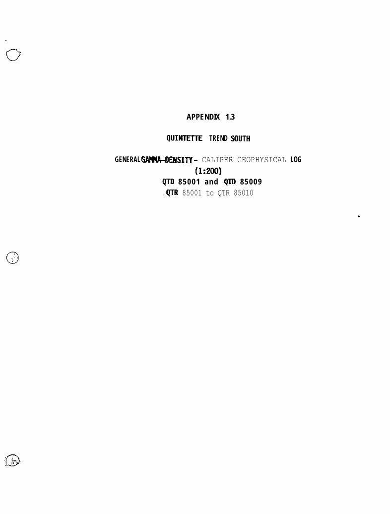
APPENDIX 1.3
QUINTETYE TREND !WTR
GENERAL G4tM-DENSIN - CALIPER GEOPHYSICAL LOG(1:200)
QTD 85001 and QTII 85009.QTR 85001 to QTR 85010


_..
APPENDIX 2.1
TRANSFER AREA
LOCATION MAPSECTIONS W and 55


APPENDIX 2.2
TRAN!FER AREA
CORE DRILLIN SDMUY SHEETSQHD 85001 and QHD 85002

..--. . ,‘R c , I c , . ..?RANSFER. . . . MeHe Coal Limited DRILL H0L.E SUMMARY SHEETP A c.t F 1 ‘(.,[ 2. . .
~lIlMllt~k IlO1 t AIdGLL I.Ul I AR I~l-AI<II~lC;..--.--. -.--.--
..- 10IAl. ULI’IIi C O K E SIIF.__-... ..- . ..--... -- ---,. MAA / ‘,Cf:‘lI(rlj i.iIi.‘i pi- --.- --.-. I. .
G E O P H Y S I C A L D A T A. O V E R B U R D E N. - - - - _ _ .D L N BKD L S D IIKD GAM NEUT FOE FIIS’
- _____. -.-----.- .:..II E P T Ii coIv4PosIrI~~II
. -_- --...- ..-.. -.-- ---. -- __-.-.- __.__. -- .---.---__.,.... --..~-. . .~ i
! :2or: X x x P
, . :g I. ::. ..,
.X X__.,~ __.-, ,. J
S ED R I L L E D INltRVAl
--.-.n VGB c ,.,-
.-
-..- -
._--.
- .J.
_.
M I.(lAL/KOC
N
:K LLI
INc. ..-FCOVEH IIII,.RstAM
IIIICKNTS_.._. ..-..
_ _ .-_.
_ -__--
. .
. ..“._ _.
. _. - -
,_ __._ .__.,
.
,..._. . “_
- - - -
r I 0 r4Dnl EDRlllEl
_-. .._ _.- -- __.-_- _..--- . _.
I ._>
i
I-r-
r’,M1(LAtl II?’1__1.
.
_
--__- - .
_.,
.-.-..
_
+6l-45.78 -._+5.78-46.05.
46.05-46:42 .----_. ---__
69.63~i.79
70.79-72.08
?&OS72.41
72.41-74.29
..-
0~81
_
0.15
0124_.-
0.33..---__
$9.63-74.29 4.24
97.19-100.15‘
~00.15-100.46
.
,. _
_.
I. .
.-
-..-
._. .
_ -_.
_..
.-.--.-
_-...-.-._.. -
..-.. _ __.
.---1-.
I_ ,_._-_.. --..--- ..~._
..1-
-.--.
- -_-.
.,
_
./’..-__ I_-._.-..-.
- .-... -I . , . .”
-.---.-. - . . ..-.
.- _-_.. -
.,
:. ..”
,.I _ .._ .-._
. iI I

DRI LL HOLE SUMMARY SHEET PROJCCI.~--.~ __n 4 G k, 2 c !I %
i’ j. ,i- ‘,I’
I IUMBER H c) L II A IJGI. E COltAlt IJEARING.’ -‘....-‘--- ~^--,-.-.- ..... --.. - --.-..- .~. -. .._ ._ __
1
i'. :-
!/IID 85001 I I
, .:.; .,-iI‘ :
-, . - -. -TWAL D E P T H C O R E S I Z E.- - . _. . . . _, _ .._ ____ _ MAP / SEClltiN t!lii.l: ! !: I
-I----- .- ._,. ._I_ _.__..
,I I I
U. T. M. CO0RD-TiTk-zE l FVAlION N 0 I( i I
F
-_--___- --,- -. - - . ___..D A T E [I:: ;I )- .___... .,.E A S T
I
IJHlIIrr~----.- - - -
I
!“,I:, :‘ ., :- .___.__ --” __._.. -__.
-A-GEOPH~>,LHL v
-v---1HKD I-
--------r--.__
II* .r 1,
.,-,..“ATA O V E R B U R D E N
c A I- - ,,,;-- iz;-_ -.-- -..._
---. ---_--. .._ _.,._. ..-..4.. - _,._ .___ _ _D E P T H COMl’OSl1i~r
_ _--___-_- _.__.. _.~ ,..- _.__._ ,. _ .
-NC
XNCR-
- . .
__-
_ .~...
--__
- -
-3
‘,y~5’b’;“’ mIttcb INIEKVAI.“-100.46-101.34
101.34-101-76-.101.76-102:5;- - .-- ._ _ . _ _
I
._ -_
--.AYG.LC F,-
_.
-
._
. . .
. . . _..
. .
-
S E C T I O N
99.19-102:59'-.. ..-__.. ,.-._ -. ..,..__
.._..116.16-117.62
-_--.-. .._ . . . __, __'. 17.62-120.43_. . . _. _
,_, 116.16-117.62_ _
. .120:;3-121.34
,._121;34-i22.58
.-..122:58-123.24'
3.88
.831.15
0.62
0.71
--.. _-
-..-_.. ___.,
..-.. A.-.-. _
-_ _ . .
----._.
--. __ _._
-.-
-- _ _
.--..... -
_. .
-- ..- -_-
..-.. __ .
- -...-,- . . .
. . ~.
. . . ,^
..- -.
.~... . . _
_-- _-
. . _ .-.-
,~.
. _ .,_
. -.
-_.
,--
((7-J Q.
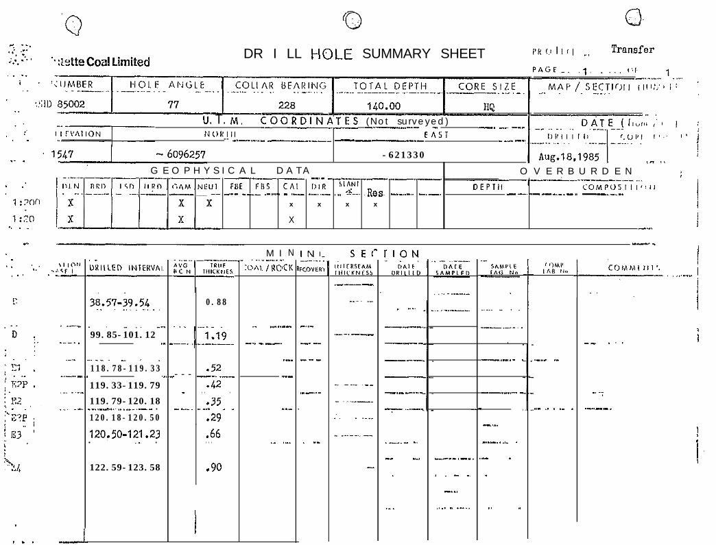
DR I LL HOLE SUMMARY SHEET PH (.I I L c I Transfer.,,
-._ .,,. ,I,,~
..i<f ). . . ._.-
u. T. 14. COORDINIJTES (Not surveyed)-._____.....-_ _. --. .^_ -__NOKIll EAST-- _.-..._..._ ----__-------_-_.- - __- .-_
-621330 !
G E O P H Y S I C A L D A T A O V E R B U R D E N ~-”--.--_- .._._ --_---_-_-_ ;FBE FBS c/i1 ,),R S’AN’ 1
1. -..- ___ ..- -.._ _-- ._.__ - .___ __-.._- ._, &mm. ~&as.DEPTll COMP0SIII~~iI
___.__. -___ - -.-. ..- _-_.__ -.. .__ .-.. -
x x x x
Xj
i-...
-.-I
._DXIILED INIEHVAEl
_..
-..._-.
1
I .
-.
._ _.
. ..-
M I. ..__._.. _:m\1. / UC:
N.CK R
!:
-..-
__.-
__.--
.-_-...
-
.._-.--- -_
. _“.
--_---.
----
----.
---
-.- -...._
7 ‘.“‘--’
t
, IMI’LA” 11”
.-.._ ._
‘i”““‘” .._......_ 1
._-
.__.
__-
-__. .
,_.
--. . . .
0.88
.52--- ---. .--
.42- . . .
.35--.-. .._." _ _
.29
i
._ -..
-~.. - --..
._
._--.-__99.85-101.12
-.___ - .
--..__.-. -
118.78-119.33
119.33-119.79
119.79-120.18__.._I........_. .-- .120.18-120.50
120,50-121.23. ,~., .
.._ .- . ._ _
-’ -:
.-..--.-.-
. ,.
--..”
-...-. . .._ .
.^ _
_
,. .,
/,
.66. . .
122.59-123.58 .90
. -- . _...._ -. .~~
-,. .._
.
._.
._._ -__,-_
. . - .~
-._,
,._. I .-.,,
_-
.
. . . --

APPENDIX 2.3
TRANSFER AREA
GENERAL &4’H4-DENSITY - CALIPER GEOHPYSICiL LOG (1:200)QHD 85001 and QHD 85002


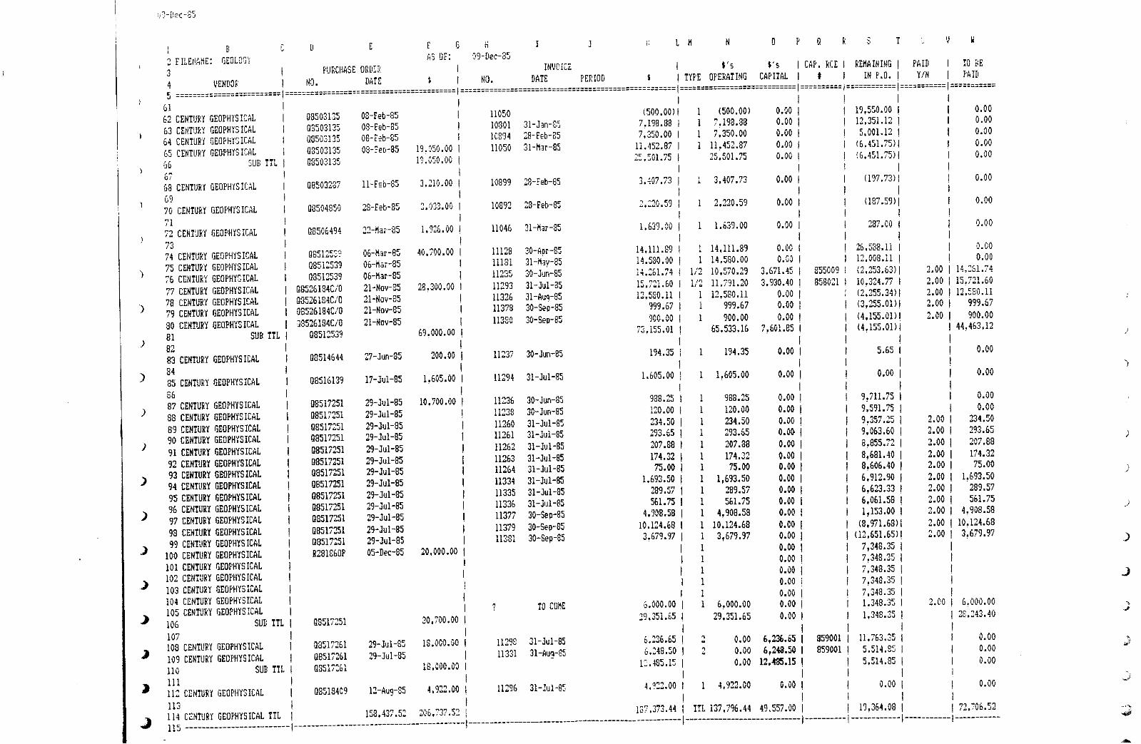
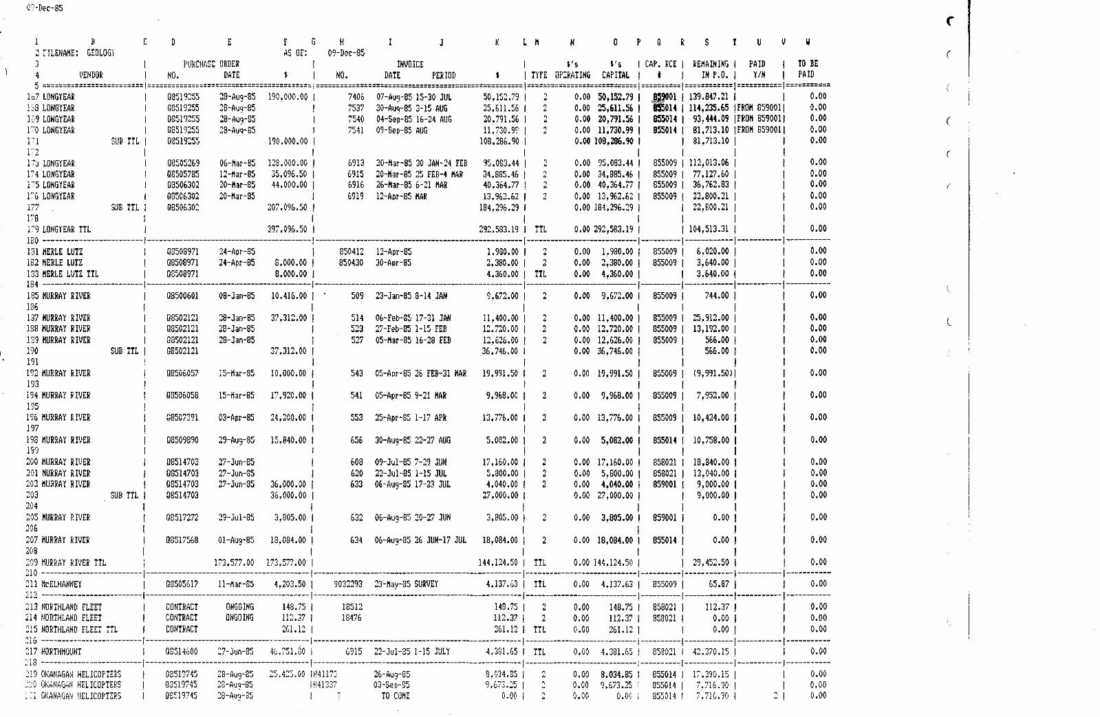
ITEMIZED COST LISTINGFOR 1985 QUINTETTE GEOLOGICAL EXPLORATION REPORT
QUINTETTE TREND SOUTH AND TRANSFER EXPLORATION AREASAPRIL, 1986


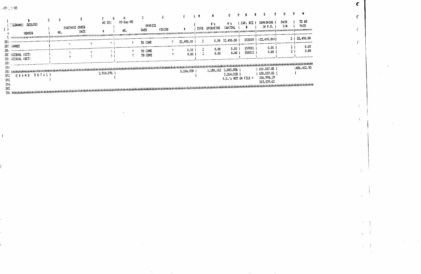

_ *5 :==----- _- -- --- - - --- - __ _ ------_----____________ , === -- - _ _----- ===3======1=====1===--------==5===!3=======; ====== i== ==31=2=:
- 357 ., ‘X0&Y KE S T A T U SA S O F ~q-~Q:l-$j
-------------,------------------_-___-__
SFEM J TO COME B+ TO GOME $ ‘. Vf$ I (INCLUDED~
:I:=I=======:T===El=========1==1=;===5==2== __________1 ==z-- --------
! 51230,000 $1.31@,674.$9 419,x5.21 I 32,190.00 CA&MET =;C.J’:
! Ii H2Q.NQ wE.358;06 P10,04i.94 I 21,ooo.oo WHA = l(r,(
I i
j913o:ooo 912tJi4.46 (86.249.46) 1
1!*. J 65.9.001 ! 9700~000 6236,378.88 f463,021‘12 f lp500.00 THE ORTHOSHO?
! ! I
iTOTAL r L.L, _li.i? TW 000 $2,083.&.13 $$gEt!d3.81 i
I._____-__---.______----------------------------------- I
Related Documents