Seattle, WA January 31, 2011

Welcome message from author
This document is posted to help you gain knowledge. Please leave a comment to let me know what you think about it! Share it to your friends and learn new things together.
Transcript

Seattle, WA
January 31, 2011

Where is Seattle?

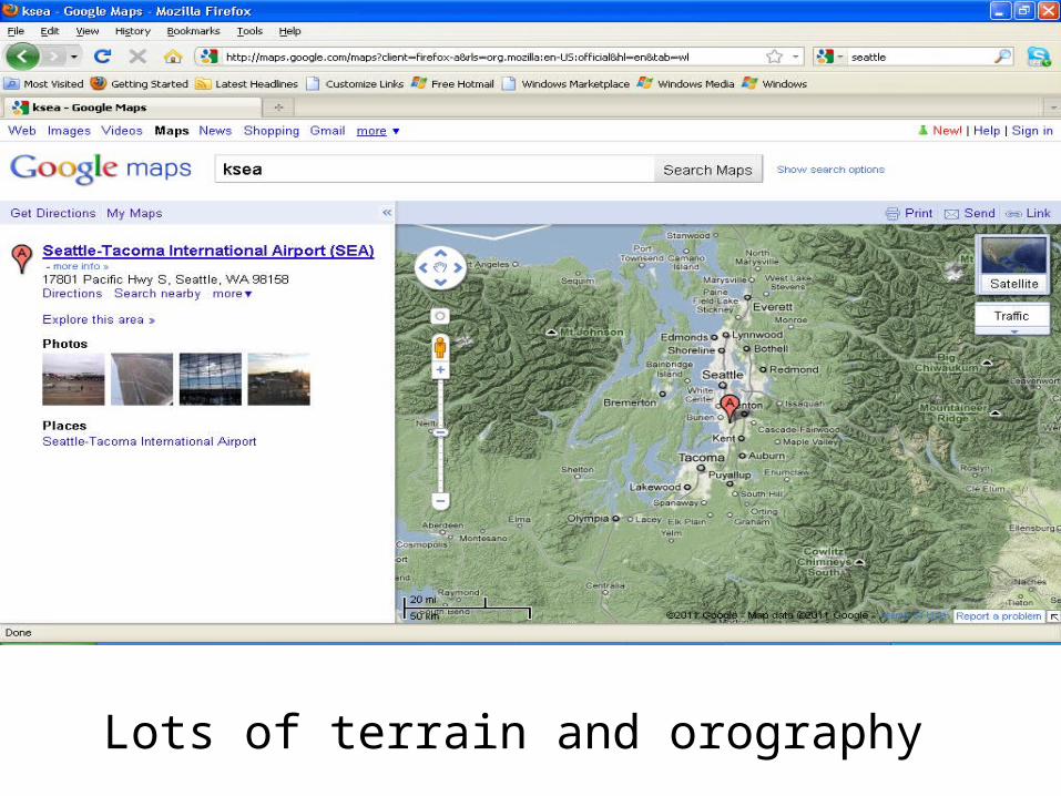
Lots of terrain and orography

Satellite
http://www.atmos.washington.edu/~ovens/loops/
Some high clouds in the area, but they are to the north. There appears to be a ridge in the area for now.

Radar
• http://www.weatheroffice.gc.ca/radar/index_e.html?id=XSI
• http://www.rap.ucar.edu/weather/radar/displayRad.php?icao=KATX&prod=bref1&bkgr=black&endDate=20110131&endTime=-1&duration=0
Not much on radar except for areas of heavy precip? Or is that something else? Hmm…

METARS
http://www.rap.ucar.edu/weather/surface/index.php?metarIds=KSEA&hoursStr=past+60+hours&std_trans=translated&num_metars=number&submit_metars=Retrieve
ZzZzZzZz Boring

Models
• 500 mb height and vorticity:– http://www.nco.ncep.noaa.gov/pmb/nwprod/analysis/namer/nam/
18/index_500_m_loop.shtml
• 700 mb moisture:– http://www.nco.ncep.noaa.gov/pmb/nwprod/analysis/namer/nam/
18/index_700_m_loop.shtml
• MSLP, Precip, and 850mb T:– http://www.nco.ncep.noaa.gov/pmb/nwprod/analysis/namer/nam/
18/index_pcp_m_loop.shtml
• SFC T:– http://www.rap.ucar.edu/weather/model/displayMod.php?
var=gfs_sfc_temp&loop=1
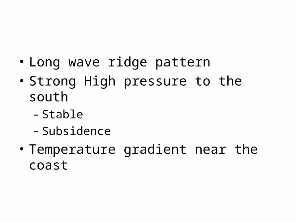
• Long wave ridge pattern
• Strong High pressure to the south– Stable– Subsidence
• Temperature gradient near the coast

MOS
http://www.nws.noaa.gov/cgi-bin/mos/getall.pl?sta=KSEA
The MOS values are pretty similar to each other, so there is good agreement between models.

• High 44– North winds will be light– Clouds look to be lingering
• Low 31– Clouds hanging around overnight– Light winds so more cooling

• Winds 7– Winds might pick up if there is some clearing
• Precip 0– Longwave ridge patter– High pressure

Related Documents