Seattle, WA 2-7-11

Seattle, WA 2-7-11. Where is Seattle? Satellite ovens/loops/w xloop.cgi?ir_common+/48h/3h Satellite shows one system.
Dec 20, 2015
Welcome message from author
This document is posted to help you gain knowledge. Please leave a comment to let me know what you think about it! Share it to your friends and learn new things together.
Transcript

Seattle, WA2-7-11

Where is Seattle?


Satellite
http://www.atmos.washington.edu/~ovens/loops/wxloop.cgi?ir_common+/48h/3h
Satellite shows one system moving over the Seattle area this past weekend. A ridge deepens, much like last week. There is a synoptic low over the Pacific with a HUGE cold front, but the storm seems to be moving more northerly than westerly. What is causing that? The deepening ridge.

Radar
http://www.rap.ucar.edu/weather/radar/displayRad.php?icao=KATX&prod=bref1&bkgr=black&endDate=20110207&endTime=-1&duration=3
Showers are in the area today, but mostly away from Seattle. The rain seems scattered and not convective.

http://www.rap.ucar.edu/weather/surface/index.php?metarIds=KSEA&hoursStr=past+60+hours&std_trans=translated&num_metars=number&submit_metars=Retrieve
The temperature isn't varying very much. The humidity was higher earlier in the day and is still pretty high, so temperatures aren't moving around.

500 mb heights and vorticity http://www.nco.ncep.noaa.gov/pmb/nwprod/analysi
s/namer/nam/12/index_500_m_loop.shtml 700 mb heights and relative humidity
http://www.nco.ncep.noaa.gov/pmb/nwprod/analysis/namer/nam/12/index_700_m_loop.shtml
MSLP, 850mb T, and Precipitation http://www.nco.ncep.noaa.gov/pmb/nwprod/analysi
s/namer/gfs/12/index_pcp_m_loop.shtml

500 mb
There is a shortwave that develops in the standing long wave over Washington today. Note the high values of vorticity on the front edge of the ridge. It's odd to see that, but it's because of the shortwave that's moving through.
There is a cut off high over the Pacific. The strong high pressure keeps the ridge in place all week.
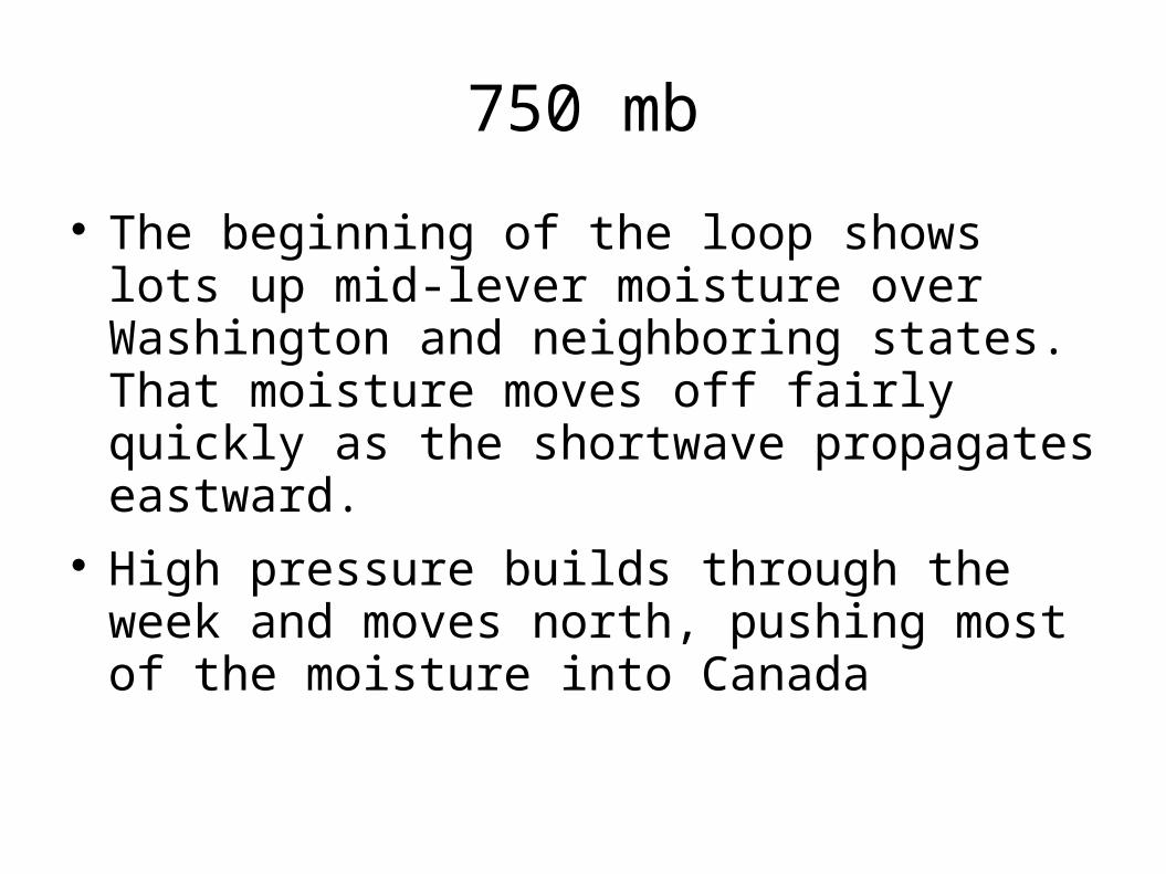
750 mb
The beginning of the loop shows lots up mid-lever moisture over Washington and neighboring states. That moisture moves off fairly quickly as the shortwave propagates eastward.
High pressure builds through the week and moves north, pushing most of the moisture into Canada

MSLP
Some precipitation is possible overnight and it should end between 6Z and 12Z if it happens (I'm going with a no).
As high pressure moves in, the 850mb temperature warms, so there may be some warming during the week.

MOS
GFS 45 36 5 0
NAM 46 36 10 0
THIS IS A 6Z LOW!
USL (not MOS) 43 35 11 0
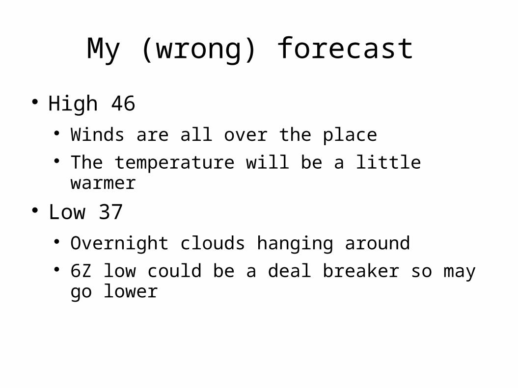
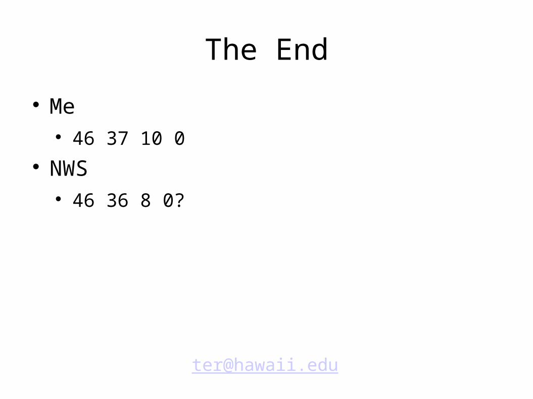
My (wrong) forecast
High 46 Winds are all over the place The temperature will be a little warmer
Low 37 Overnight clouds hanging around 6Z low could be a deal breaker so may go lower

My Forecast Continued
Winds 10 Winds are going from south to north behind the
storm Winds should pick up during the day
Precip 0 It ain't gonna rain
Related Documents