Sea Level Rise and Shifting Maritime Jurisdictional Limits Clive Schofield Australian National Centre for Ocean Resources and Security (ANCORS)

Sea Level Rise and Shifting Maritime Jurisdictional Limits (IWC5 Presentation)
Jul 17, 2015
Welcome message from author
This document is posted to help you gain knowledge. Please leave a comment to let me know what you think about it! Share it to your friends and learn new things together.
Transcript

Sea Level Rise and Shifting Maritime Jurisdictional Limits
Clive Schofield
Australian National Centre for Ocean Resources and Security (ANCORS)
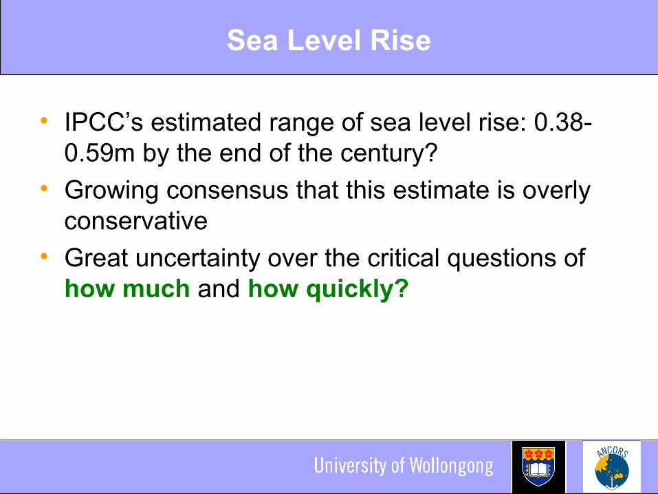
Sea Level Rise
• IPCC’s estimated range of sea level rise: 0.38-0.59m by the end of the century?
• Growing consensus that this estimate is overly conservative
• Great uncertainty over the critical questions of how much and how quickly?
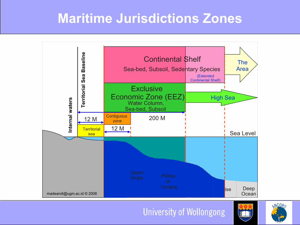
Maritime Jurisdictions Zones
The Area
200 M
Sea Level
12 MContiguous
zone
Territorialsea
12 M
Exclusive Economic Zone (EEZ)
Water Column, Sea-bed, Subsoil
Rise Deep Ocean
Inte
rna
l w
ate
rs
Te
rrit
ori
al
Se
a B
as
eli
ne
(Extended Continental Shelf)
Continental ShelfSea-bed, Subsoil, Sedentary Species
High Sea
Shelf
[email protected] © 2008
UpperSlope Plateu
orTerrace

Migrating Baselines = Shifting Limits
• Maritime jurisdictional limits measured from baselines: Predominantly normal baselines, low-water line baselines
• Traditional interpretation: ambulatory baselines and consequently shifting limits Coastlines dynamic – low water line susceptible to change As normal baselines move, the limits drawn from them also
shift
• Not a new phenomenon• As sea level rises so the low-water line migrates inland • Dramatic horizontal shifts to normal baselines possible
from slight changes to sea level vertically
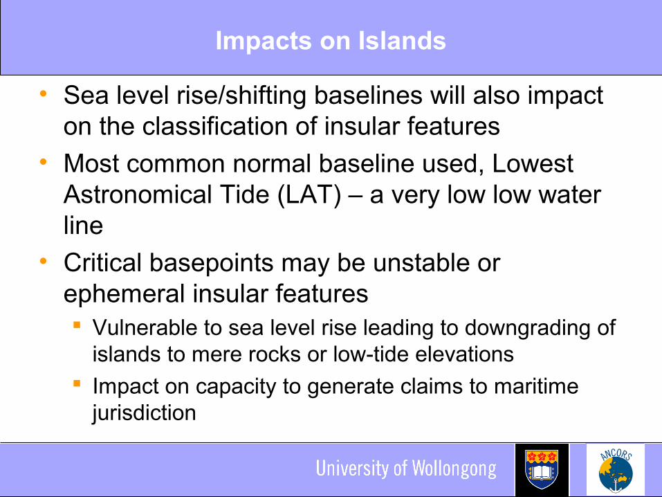
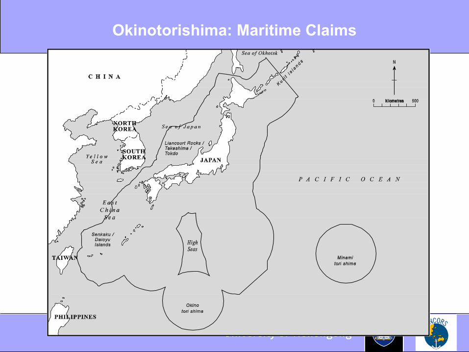
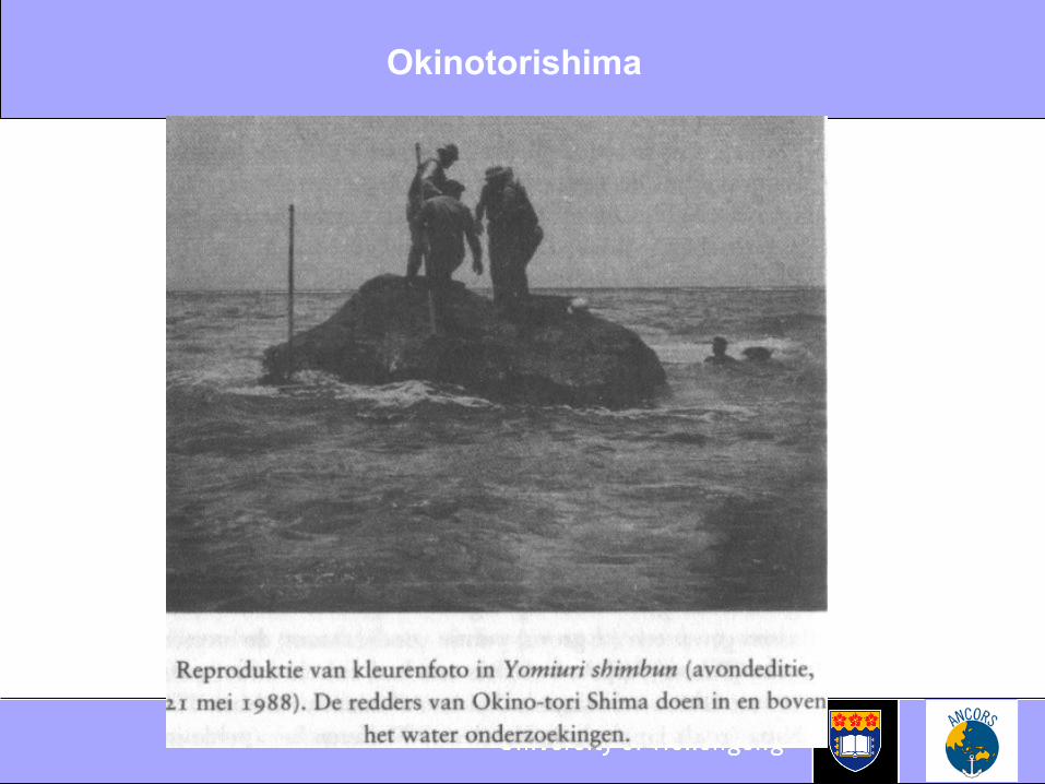
Impacts on Islands
• Sea level rise/shifting baselines will also impact on the classification of insular features
• Most common normal baseline used, Lowest Astronomical Tide (LAT) – a very low low water line
• Critical basepoints may be unstable or ephemeral insular features Vulnerable to sea level rise leading to downgrading of
islands to mere rocks or low-tide elevations Impact on capacity to generate claims to maritime
jurisdiction
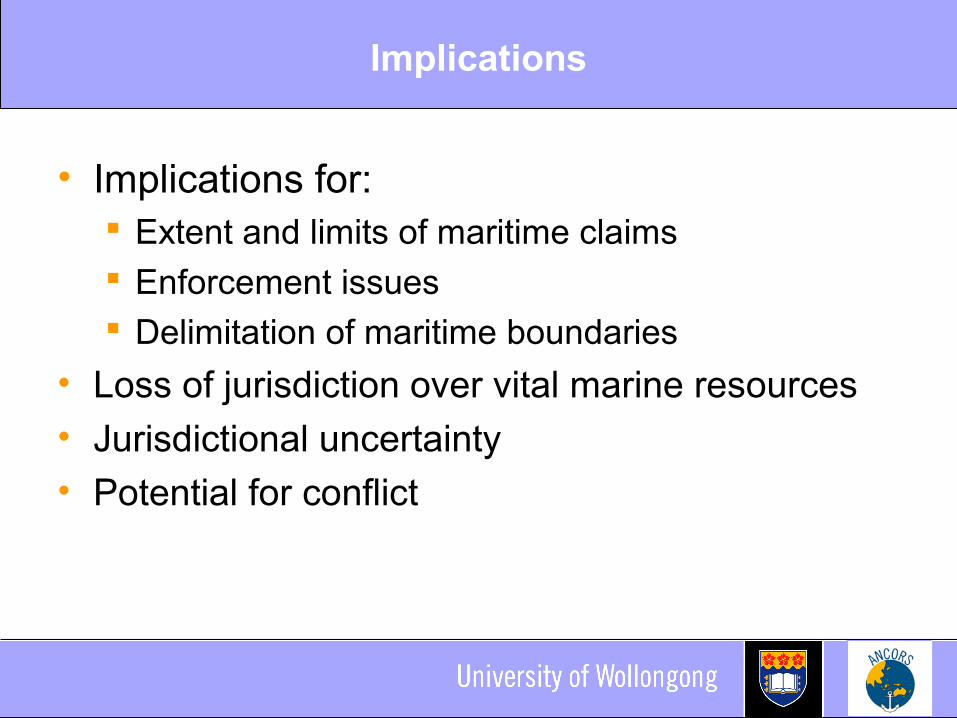
Implications
• Implications for: Extent and limits of maritime claims Enforcement issues Delimitation of maritime boundaries
• Loss of jurisdiction over vital marine resources• Jurisdictional uncertainty• Potential for conflict
Potential Responses
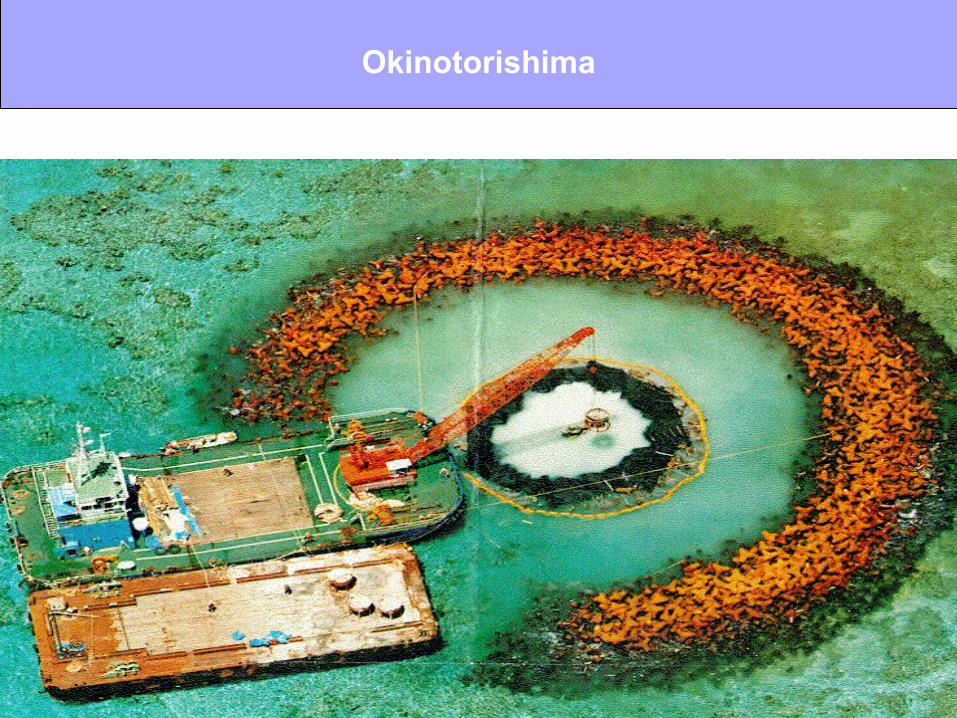
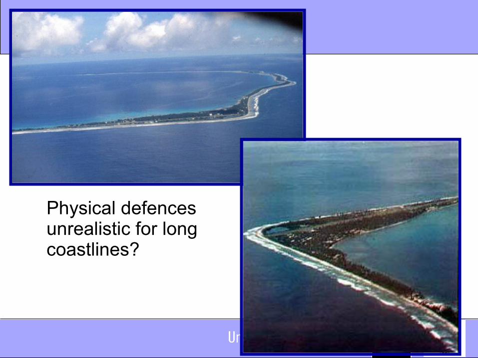
• Fix normal baselines physically Can key basepoints be preserved through sea
defences, ‘building-up’ and/or reclamation? Long tradition and an option for critical basepoints but
unrealistic for long coastlines?
• Fix normal baselines legally• Fix the limits of maritime zones
Fix Normal Baselines Legally
• Choice of chart depicting normal baseline left up to the coastal State (LOSC, Article 5)
• Chart the legal document• Can a coastal State therefore choose a chart that is
advantageous to it? What if there is a difference between the low water line shown
on the chart and reality?
• The drafters of the Convention did not anticipate sea level rise
• BUT: Ambulatory baselines may be fixed with straight baselines on unstable coasts Connection to the low water line still required

Fixing Limits and Boundaries
• Once agreed maritime boundaries remain fixed even though the baselines used to construct them may regress What if the territory in question disappears entirely?
• The outer limits of the continental shelf may also be fixed as “final and binding”
• Fix (declare) maritime limits Provides the advantage of certainty and the
preservation of existing maritime claims BUT: Increasing tension between fixed limit and
receding or disappearing normal baseline it is measured from
Related Documents