TRAINING REPORT ON 1. INDIRA GANDHI INTERNATIONAL AIRPORT (AAI) 2. INDIAN AIRFORCE (1AFMLU)

Satish kumar tripathi ,RITEE RAIPUR
Jul 13, 2015
Welcome message from author
This document is posted to help you gain knowledge. Please leave a comment to let me know what you think about it! Share it to your friends and learn new things together.
Transcript
TRAINING REPORT ON
1. INDIRA GANDHI INTERNATIONAL AIRPORT (AAI)
2. INDIAN AIRFORCE (1AFMLU)

AIRPORT AUTHORITY OF INDIA
• AAI IS AN ORGANISATION WORKING UNDER THE MINISTERY OF CIVIL AVIATIONS.
• It came into existense in 1st april 1995.• Airport –
1.International2.National (domestic)
126 AIRPORT11 INTERNATIONAL AIRPORT89 DOMESTIC AIRPORT26 CIVIL ENCLAVE
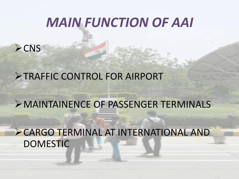
MAIN FUNCTION OF AAI
CNS
TRAFFIC CONTROL FOR AIRPORT
MAINTAINENCE OF PASSENGER TERMINALS
CARGO TERMINAL AT INTERNATIONAL AND DOMESTIC

SERVICE PROVIDED BY AAI
AIR TRAFFIC SERVICE –
1- CNS -
COMMUNIC ATION NAVIGATION SEVILLENCE
2-CONSTRUCTION AND DEVELOPMENT OF AIRPORTS AND AIR ROUTES

FIR
FIR
FLIGHT INFORMATION REGION
INDIA IS DIVIDED INTO FOUR FIR
1. DELHI
2. MUMBAI
3. KOLKATTA
4. CHENNAI
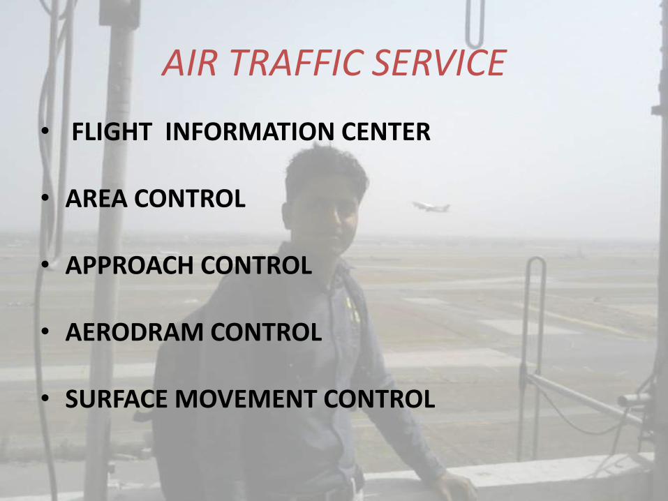
AIR TRAFFIC SERVICE
• FLIGHT INFORMATION CENTER
• AREA CONTROL
• APPROACH CONTROL
• AERODRAM CONTROL
• SURFACE MOVEMENT CONTROL
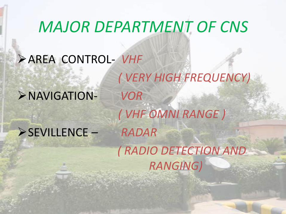
MAJOR DEPARTMENT OF CNS
AREA CONTROL- VHF
( VERY HIGH FREQUENCY)
NAVIGATION- VOR
( VHF OMNI RANGE )
SEVILLENCE – RADAR
( RADIO DETECTION AND RANGING)
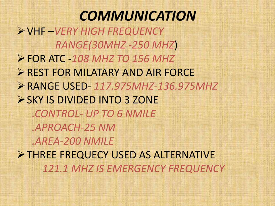
COMMUNICATIONVHF –VERY HIGH FREQUENCY
RANGE(30MHZ -250 MHZ)FOR ATC -108 MHZ TO 156 MHZREST FOR MILATARY AND AIR FORCERANGE USED- 117.975MHZ-136.975MHZSKY IS DIVIDED INTO 3 ZONE
.CONTROL- UP TO 6 NMILE
.APROACH-25 NM
.AREA-200 NMILETHREE FREQUECY USED AS ALTERNATIVE
121.1 MHZ IS EMERGENCY FREQUENCY

What is Navigation
• Navigation is the 'ART' of determining the position of an aircraft over earth's surface and guiding its progress from one place to another.
• To accomplish this ART, some sort of ‘AIDS' are required by the PILOTS.

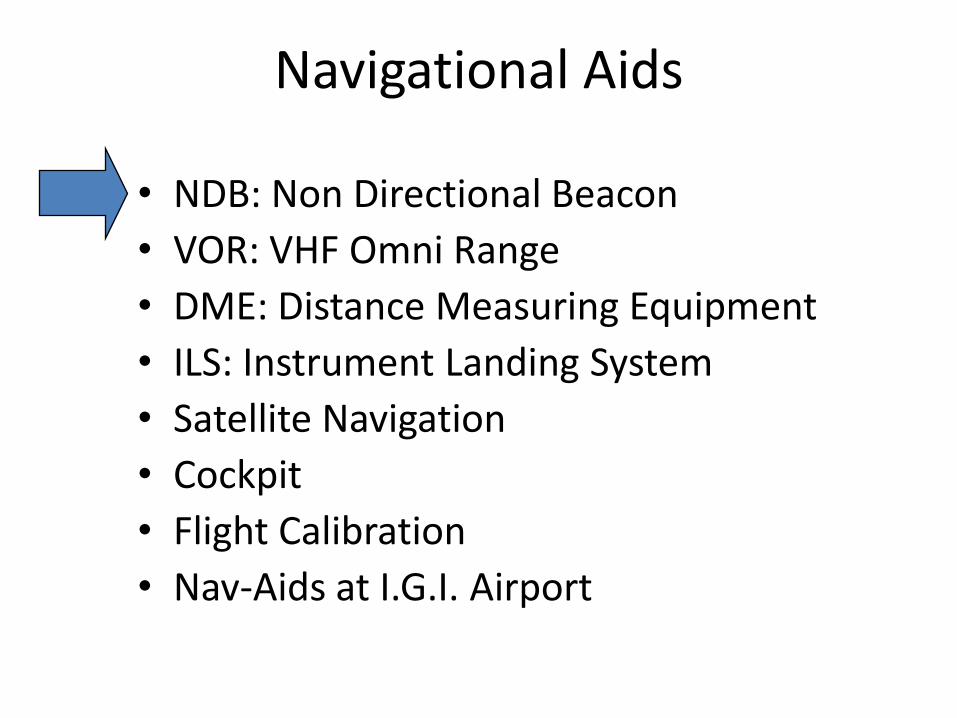
Navigational Aids used in AAI
• NDB: Non Directional Bearing
• VOR: VHF Omni Range
• DME: Distance Measuring Equipment
• ILS: Instrument Landing System
• Satellite Navigation

NAVIGATIONAL AIDS
VOR GBAS
DME
NDB
MARKER
GLIDE PATHLOCALIZER
Navigational Aids
• NDB: Non Directional Beacon
• VOR: VHF Omni Range
• DME: Distance Measuring Equipment
• ILS: Instrument Landing System
• Satellite Navigation
• Cockpit
• Flight Calibration
• Nav-Aids at I.G.I. Airport

NDB PROVIDE RELATIVE BEARING
TO THE AIRCRAFT
W.E.F.
DIRECTION OF
NDB EQUIPMENT
IRRESPECTIVE OF
AIRCRAFT HEADING

N
S
EW
Direction Finder (NDB)
NDB

VOR EQUIPMENT
PROVIDE
ABSOLUTE BEARING
TO AN AIRCRAFT
with respect to
MAGNETIC NORTH
Irrespective of
AIRCRAFT HEADING

VOR (VHF Omni Range)
= 0°
= 90°= 270°
VOR/DME
VOR

180°
N360°
CDI deviations
VOR/DME
OBS = 360
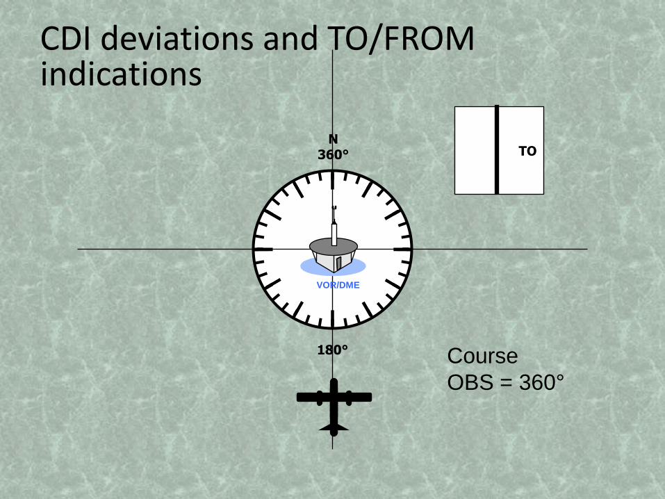
TO
180°
N360°
CDI deviations and TO/FROM indications
Course
OBS = 360°
VOR/DME

TO
CDI deviations
Course
OBS = 30
180°
N360°
VOR/DME

DME(Distance Measuring Equipment)
DME
3.0 136 1
Distance
(NM)
Speed
(KT)
Time
(Mn)
Navigational Aids
• NDB: Non Directional Beacon
• VOR: VHF Omni Range
• DME: Distance Measuring Equipment
• ILS: Instrument Landing System
• Satellite Navigation
• Cockpit
• Flight Calibration
• Nav-Aids at I.G.I. Airport

RUN WAY LLZ ANT
1000
to
1500ft
LLZ BLDG
200 ft
GPGP & DME
ANTENNA
1000ft
Runway
threshold
MMOM
3500ft4 NM
AIRCRAFT
450ft
INSTRUMENT LANDING SYSTEM LAYOUT

ILS : Instrument Landing System
Glide Path
ILS GP
ILS Localizer

ILS Localizer needle

Glide slope Needle
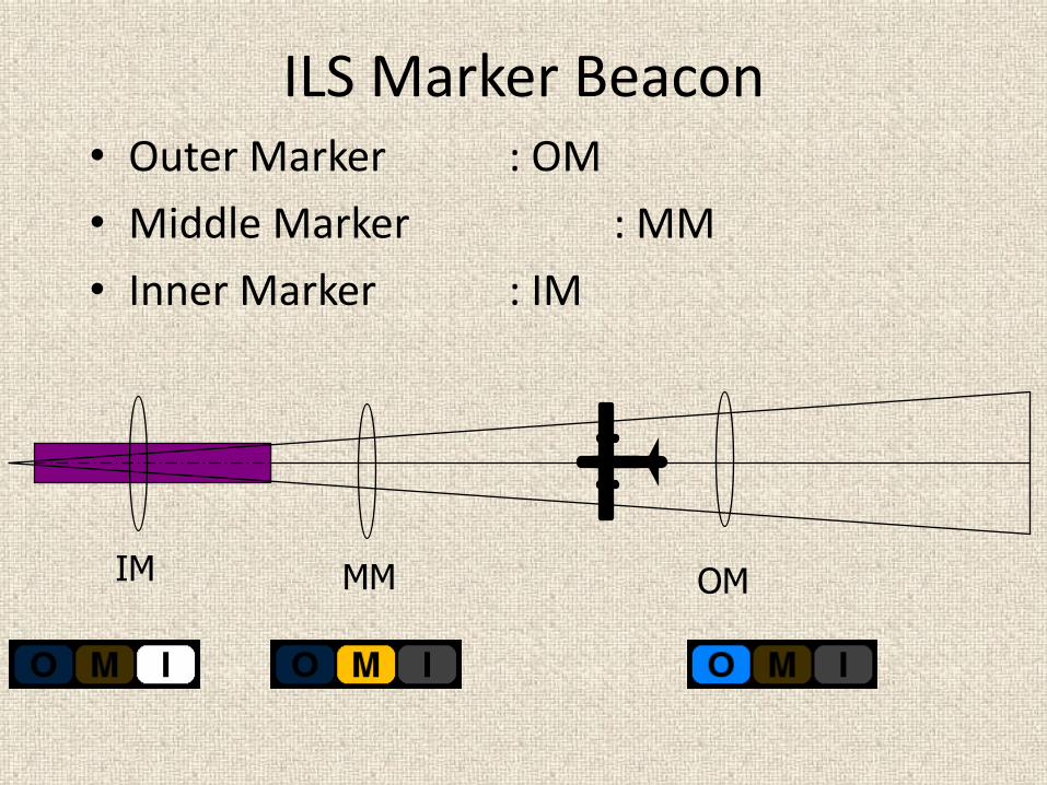
ILS Marker Beacon• Outer Marker : OM
• Middle Marker : MM
• Inner Marker : IM
OMMMIM

SERVEILLANCE
PRIMARY SERVEILLANCE RADAR
SECONDARY SERVEILLANCE RADAR
SURFACE MOVEMENT RADAR
AUTOMATIC DEPENDENT SERVEILENCE


INDIAN AIRFORCE
• > 1AFMLU
• 1AIRFORCE MOVEMENT LIASING UNIT
• A COORDITATE AGENCY BETWEEN IAF AND AAI
• IT CHECKS AND CLEAR ALL CIVIL FLIGHT
• IT CONTINOUSLY MONITOR FLYING IN PROGRESS
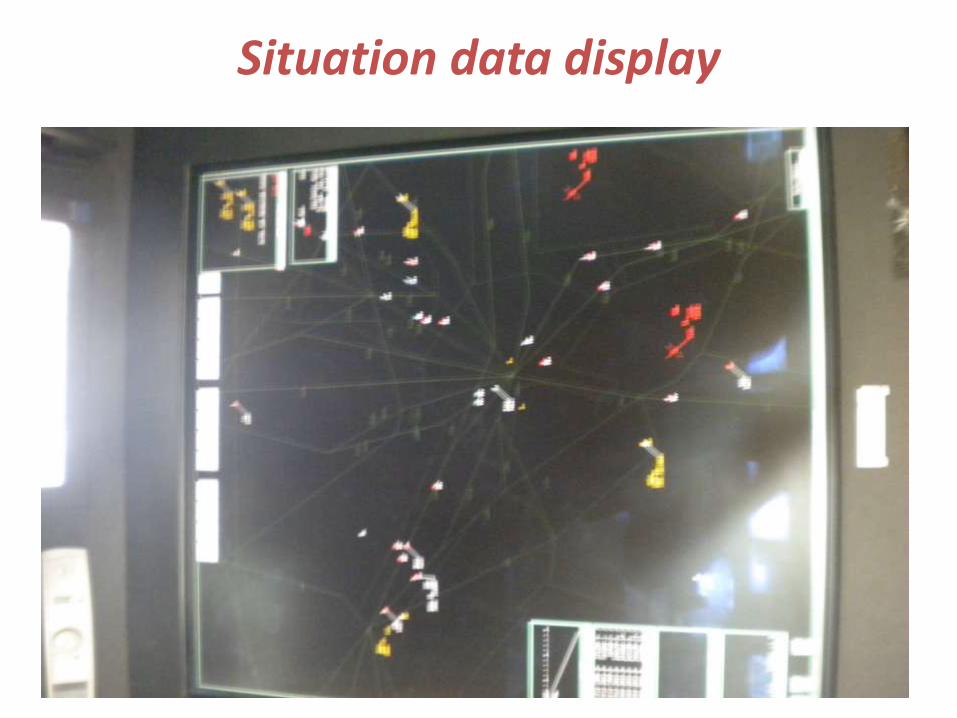
Situation data display

THANK YOU
Related Documents


![Bibliography on TCP/IP Mobility · 2008-08-11 · [44] Pravin Bhagwat, Ibrahim Korpeoglu, Chatschik Bisdikian, Mahmoud Naghshineh, and Satish K. Tripathi. Bluesky: A cordless networking](https://static.cupdf.com/doc/110x72/5e5509977292c116d92f44ef/bibliography-on-tcpip-mobility-2008-08-11-44-pravin-bhagwat-ibrahim-korpeoglu.jpg)


![RAIPUR DEVELOPMENT AUTHORITY, RAIPUR [CG.] · PDF fileRAIPUR DEVELOPMENT AUTHORITY, RAIPUR [CG.] ... RAIPUR [CG.] Email: ... Annexure I-List Showing The Name Of Near Relative Working](https://static.cupdf.com/doc/110x72/5a7a236a7f8b9a4b198d8d34/raipur-development-authority-raipur-cg-development-authority-raipur-cg-.jpg)
