Satellites, Weather and Climate Module 10: Land interpretation – working with photochips

Satellites, Weather and Climate Module 10: Land interpretation – working with photochips.
Dec 22, 2015
Welcome message from author
This document is posted to help you gain knowledge. Please leave a comment to let me know what you think about it! Share it to your friends and learn new things together.
Transcript
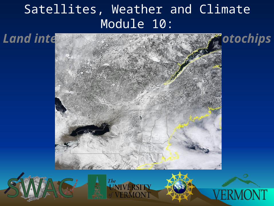
Satellites, Weather and Climate Module 10:Land interpretation – working with
photochips
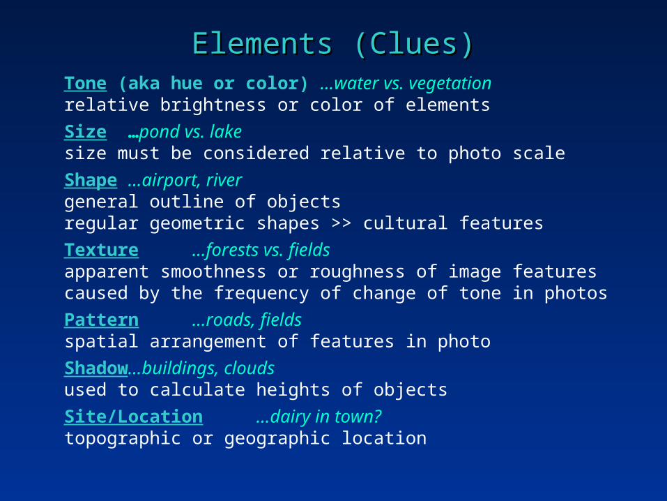
Elements (Clues)Elements (Clues)Tone (aka hue or color) …water vs. vegetation
relative brightness or color of elements
Size …pond vs. lakesize must be considered relative to photo scale
Shape…airport, rivergeneral outline of objectsregular geometric shapes >> cultural features
Texture …forests vs. fieldsapparent smoothness or roughness of image featurescaused by the frequency of change of tone in photos
Pattern …roads, fieldsspatial arrangement of features in photo
Shadow …buildings, cloudsused to calculate heights of objects
Site/Location …dairy in town?topographic or geographic location

Color Vision TestColor Vision Test
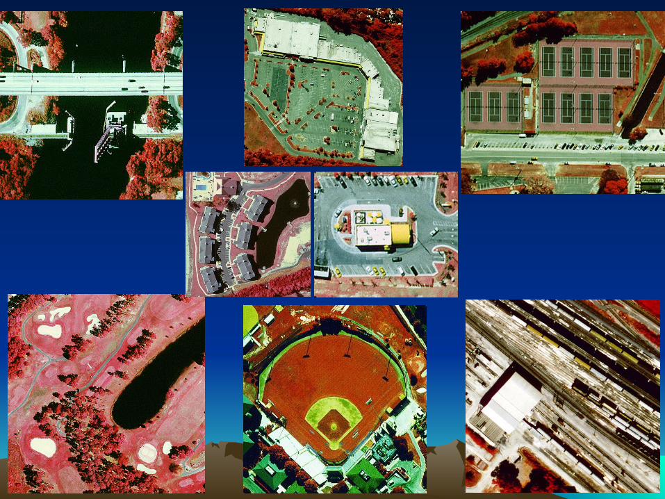
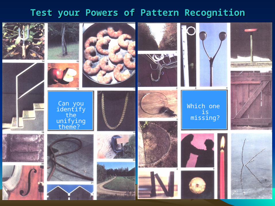
Test your Powers of Pattern RecognitionTest your Powers of Pattern Recognition
Can you identify the
unifying theme?
Which one is missing?

Your TaskYour Task
Form small groups (2-3 students)
Photointerpret 12 B & W photo chips and answer the associated questions (handout)
Compare answers at the end of class

Photo #1: The #1 photo shows an orchard, a wooded area, several agricultural fields and what appears to be a divided highway. Are all the trees in the orchard the same age? How can you tell? What clues indicate that the areas on the left of the photo are agricultural fields?
Photo #3: A water body is shown in a setting that appears rural.
Is the water body natural or is it a reservoir?
What evidence supports your answer?
Photo #4: This image contains some tanks. Some of the tanks hold flammable liquids and some do not. How can you differentiate these two types of tanks? What types of transportation serve this location? What is the evidence?
Photo #5: What is this feature? What evidence is there to substantiate your claim?
Photo #2: What do these snaking patterns on the photo represent on the ground? Hint: this is a technique used to reduce soil
erosion.
Photo #6 What is this complex? How do you know?
Photo #7: Check out this golf course. Can you identify putting
greens, sand traps, fairways, and rough areas?
Photo #8: What is this feature? This type of use represents a feature that was common for several decades in the U.S., particularly the 50's and 60's. What photo characteristics identify the use?
Photo #9: What is this feature? Is this complex used by
professionals or amateurs?
Photo #10: Were these houses built prior to or after WW II?
Photo #11: Is this a factory or a small shopping mall? What evidence is present to indicate this?
Photo #12: This is another unique signature of developed societies that may be identified even on satellite imagery. What is it?

Module Sequence and Suggested Alternatives
1. Remote sensing lecture (ppt file included)
2. Photointerpretation Quiz of generic photo chips (students working in small groups)
3. Suggestions for quiz alternatives
a) Teacher collect local photo chips of your town/area from available imagery or Google Earth so the students will recognize features in the local area.
b) Have students collect their own photo chips from Google Earth and then compile all student photo chips (and answers) into a grand quiz for the class.
I. Photo chips based on the local area or a learning themeI. (e.g. development, global change, disasters, streams)
c) Examine historical imagery of Vermont compared to recent imagery
1. Instructor to provide a historical photo from the local area and compare to current imagery to identify changes on the land (Landscape Change Program and Google Earth)
1. Based on a learning theme or historic event (e.g. flood)
2. Have students locate a historical photo and a photo chip from recent imagery (Google Earth)
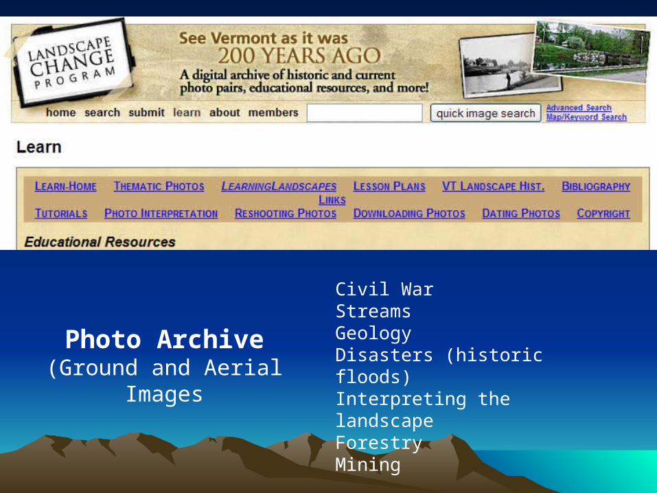
3. Landscape Change Program (http://www.uvm.edu/landscape/)
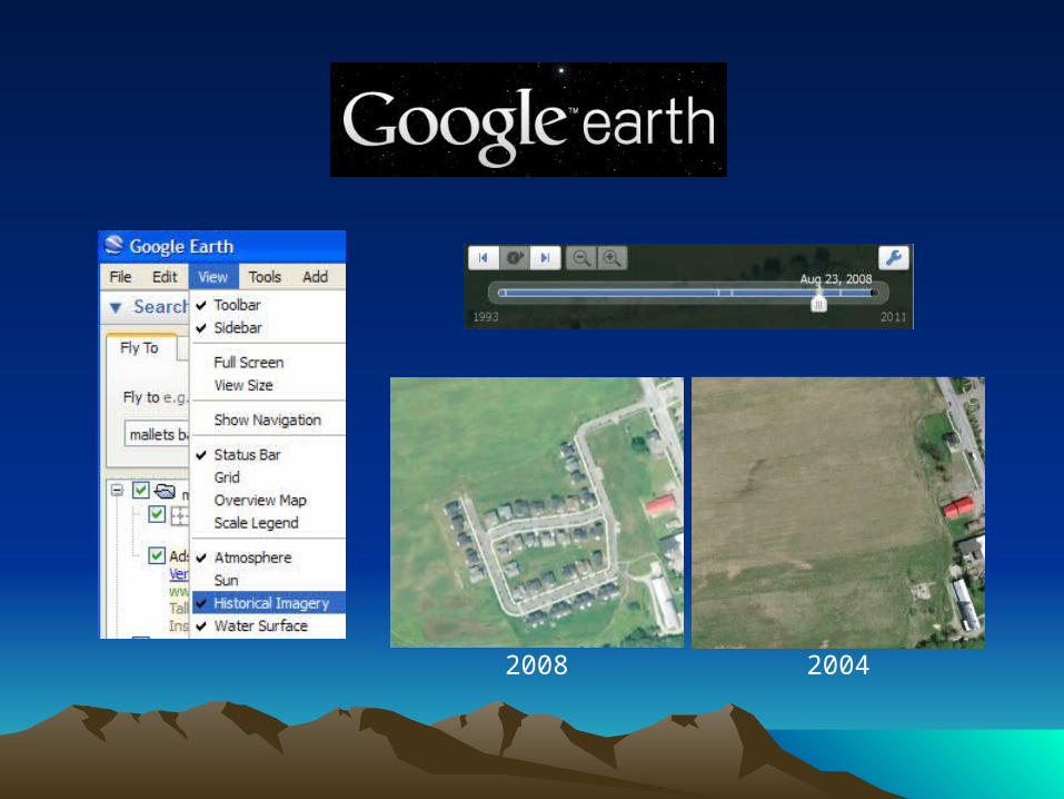
2008 2004
Sample re-shots
Civil WarStreamsGeologyDisasters (historic floods)Interpreting the landscapeForestryMining
Photo Archive(Ground and Aerial
Images

Landscape Landscape Change Change ProgramProgram
1927 flood Development

Imagery Provided for your TownNational Agricultural Imagery Program (NAIP)

What Now?What Now?
Select photo chips (features) of your town• Digital imagery provided today• Google Earth
Select photo chips pairs (historical images)• Google Earth and/or Landscape Change Program
Check out Landscape Change Program• Select imagery themes, places• Check out lesson plans http://www.uvm.edu/landscape/
Landscape Interpretation Landscape Interpretation with Aerial Imagerywith Aerial Imagery
Prepared by Prepared by Leslie A. Leslie A. Morrissey, RSENR/UVMMorrissey, RSENR/UVM
Related Documents


