ROLE OF GEOGRAPHIC INFORMATION ROLE OF GEOGRAPHIC INFORMATION SYSTEMS (GIS) IN DISASTER SYSTEMS (GIS) IN DISASTER MANAGEMENT MANAGEMENT The Ugandan Case The Ugandan Case p resentation at the International Workshop on University Network for Natural Disaster Reduction in resentation at the International Workshop on University Network for Natural Disaster Reduction in Africa, 12th -13th September 2005 at Makerere University Africa, 12th -13th September 2005 at Makerere University

ROLE OF GEOGRAPHIC INFORMATION SYSTEMS (GIS) IN DISASTER MANAGEMENT The Ugandan Case presentation at the International Workshop on University Network for.
Dec 16, 2015
Welcome message from author
This document is posted to help you gain knowledge. Please leave a comment to let me know what you think about it! Share it to your friends and learn new things together.
Transcript

ROLE OF GEOGRAPHIC ROLE OF GEOGRAPHIC
INFORMATION SYSTEMS (GIS) IN INFORMATION SYSTEMS (GIS) IN
DISASTER MANAGEMENTDISASTER MANAGEMENT
The Ugandan CaseThe Ugandan Case
ppresentation at the International Workshop on University Network for Natural Disaster resentation at the International Workshop on University Network for Natural Disaster
Reduction in Africa, 12th -13th September 2005 at Makerere UniversityReduction in Africa, 12th -13th September 2005 at Makerere University

Ali M. Karatunga
GIS Specialist
CoordinatorKaramoja Data Centre
Office of the Prime Minister

IntroductiIntroductionon
• Effective and realistic emergency management programs depend on data from various sources which should be collected, analyzed, displayed, disseminated and used in an organized manner.
• It is therefore desirable to have the right data in the right place at the right time. The data should be organized in a usable format for stakeholders to respond and take action in case of an emergency.
• Most of the emergency data requirements are of spatial nature hence a need for a Geographic Information System (GIS).

Definition of Definition of termsterms
Emergency: Is a course of events that endangers people, property and the environment,
or a deviation from planned or expected behavior.
Hazard: Refers to the physical characteristics that may cause an emergency.
Risk: Potential or likelihood that an emergency might occur.
Disaster: Is an emergency that cannot be managed by the local resources.
Assessment: Analysis of the situation or event.
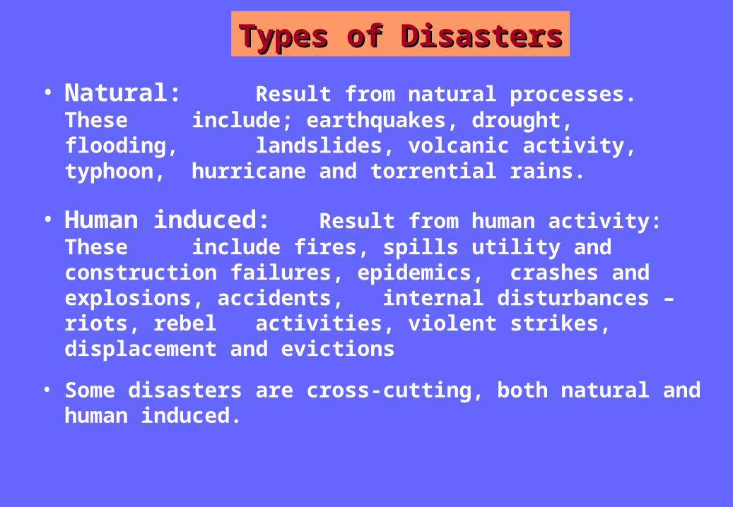
Types of DisastersTypes of Disasters
• Natural: Result from natural processes. These include; earthquakes, drought,
flooding, landslides, volcanic activity, typhoon, hurricane and torrential rains.
• Human induced: Result from human activity: These include fires, spills utility and construction failures, epidemics, crashes and explosions, accidents, internal disturbances – riots, rebel activities, violent strikes, displacement and evictions
• Some disasters are cross-cutting, both natural and human induced.
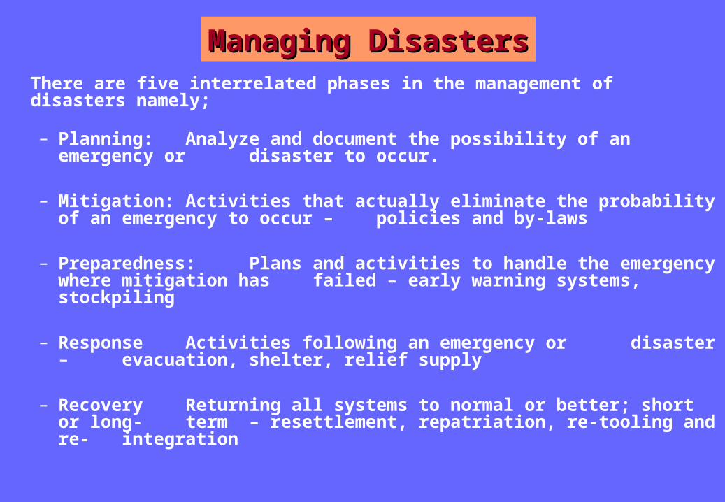
Managing Managing DisastersDisasters
There are five interrelated phases in the management of disasters namely;
– Planning: Analyze and document the possibility of an
emergency or disaster to occur.
– Mitigation: Activities that actually eliminate the probability of an emergency to occur – policies and by-laws
– Preparedness: Plans and activities to handle the emergency where mitigation has failed – early warning systems, stockpiling
– Response Activities following an emergency or disaster – evacuation, shelter, relief supply
– Recovery Returning all systems to normal or better; short or long- term – resettlement, repatriation, re-tooling and re- integration
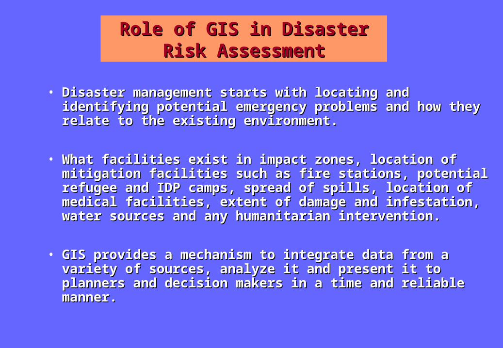
Role of GIS in Disaster Risk Role of GIS in Disaster Risk AssessmentAssessment
• Disaster management starts with locating and Disaster management starts with locating and identifying potential emergency problems and how identifying potential emergency problems and how they relate to the existing environment.they relate to the existing environment.
• What facilities exist in impact zones, location of What facilities exist in impact zones, location of mitigation facilities such as fire stations, potential mitigation facilities such as fire stations, potential refugee and IDP camps, spread of spills, location of refugee and IDP camps, spread of spills, location of medical facilities, extent of damage and infestation, medical facilities, extent of damage and infestation, water sources and any humanitarian intervention.water sources and any humanitarian intervention.
• GIS provides a mechanism to integrate data from a GIS provides a mechanism to integrate data from a variety of sources, analyze it and present it to variety of sources, analyze it and present it to planners and decision makers in a time and reliable planners and decision makers in a time and reliable manner.manner.

Disaster Risk Disaster Risk ZoningZoning
The following disasters have been used in the risk zoning criteria
Man-made •Banditry, Refugees, Neighborhood tension, Tribal conflict
Natural •Drought, Earthquake, Flooding, Landslides, Volcanic activity

Banditry: Areas affected by rebel activities such as Allied Democratic Forces (ADF) in Western Uganda, People’s Redemption Army (PRA) in Western Uganda and West Nile and The Lord’s Resistance Army (LRA) in the North and parts of Eastern Uganda.
Refugees: These are immigrant populations from neighboring countries due to insecurity within their motherland. They normally settle in areas within the neighborhood of their countries of origin or in gazetted settlements in Uganda.
Neighborhood tension: This often results from conflicts with the neighboring countries due political differences or resource usage. This is common on the borders of Uganda and DRC, Rwanda, Sudan, Tanzania and the Lake Victoria region.
Tribal Conflict: This often results from historical differences within the different tribes in the country or inherent cultural practices such as cattle resulting among the Karimojong or tribal conflicts between the Bakonzo and Batooro, the Alur and Banyoro
Man Made Man Made DisastersDisasters

Natural Natural DisastersDisasters
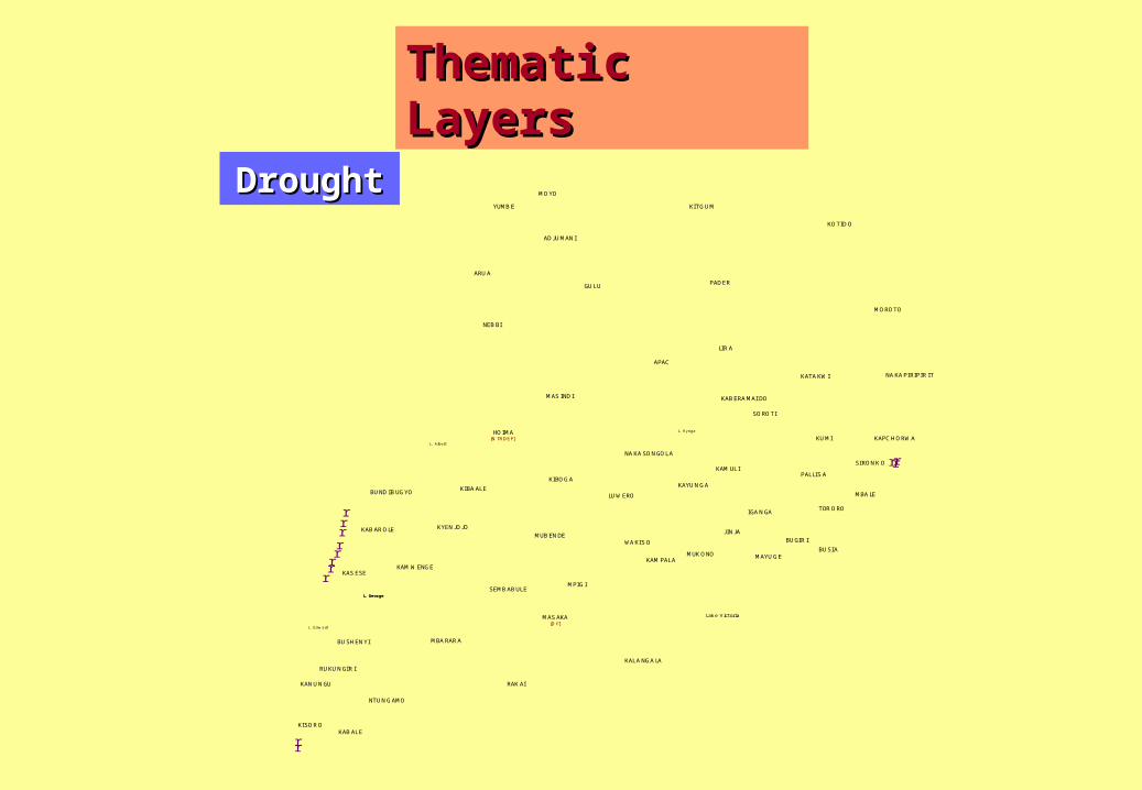
Drought: These are areas that fall within the cattle corridor characterized by dry acacia vegetation and receiving less than 800 mm of annual rainfall.
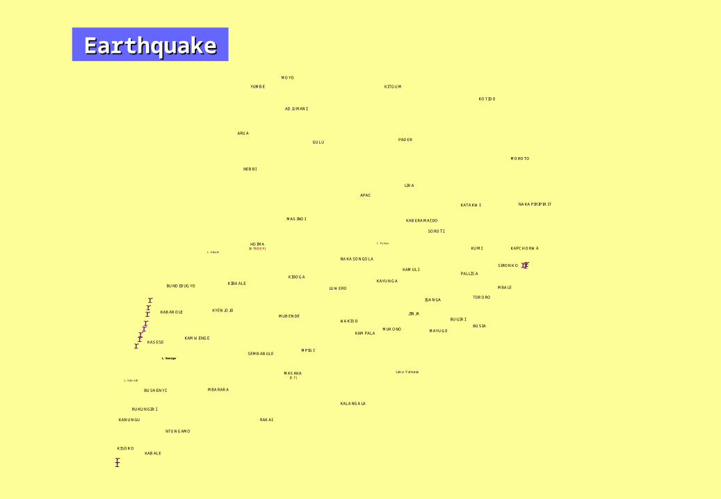
Earthquake: Are areas that fall within the western rift valley and those that have experienced incidences of earthquakes in the rest past.
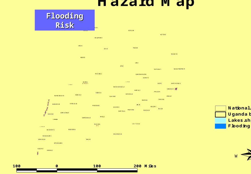
Flooding: These are areas within the neighborhood of water bodies such as lakes and rivers. They are at a risk of flooding in case of any disturbance in the hydrology of such water bodies. Depending on the magnitude the disturbance, it is assumed that the effect of flooding could affect areas within 2 km from the water body
Landslides: These are areas located near steep hill slopes and mountainous areas of Mt. Rwenzori, Mt. Elgon, Kisoro and Kigezi hills.
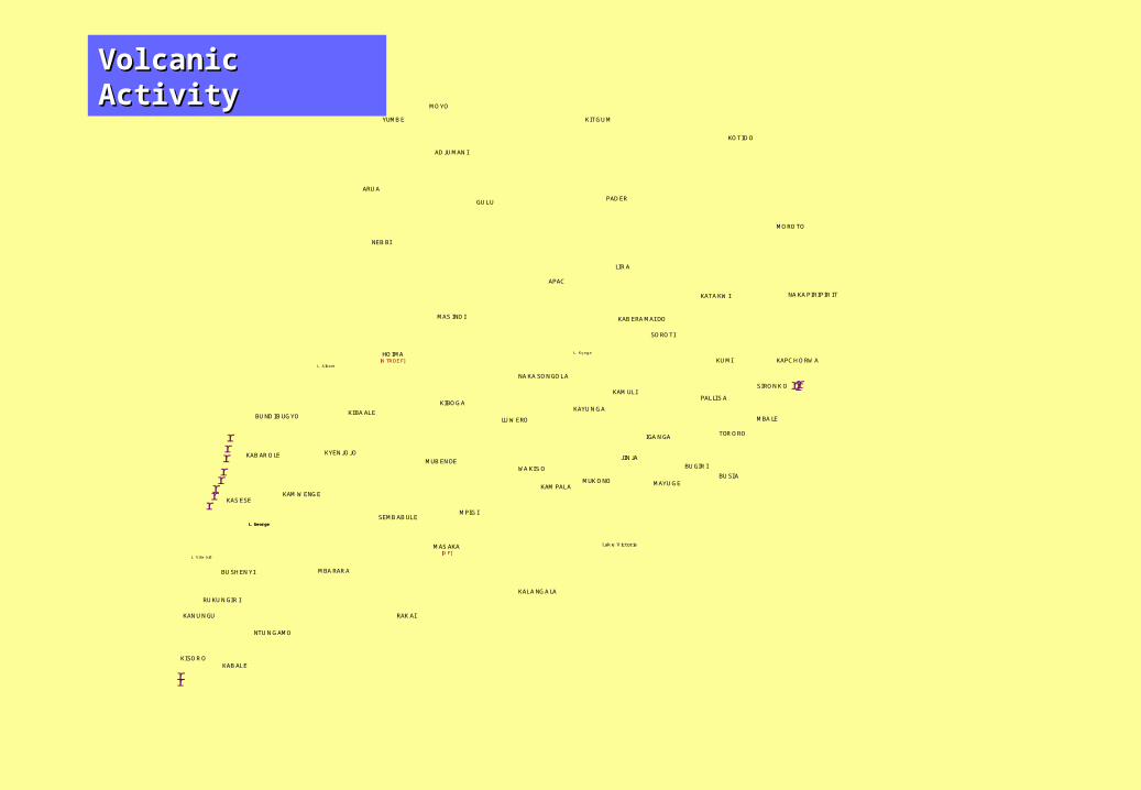
Volcanic Activity: This is due to the presence of both active and dormant volcanic areas such as the caldera area of Mt. Elgon, hot spring areas in the western rift valley and the Muhavura volcanoes in Kisoro.

GIS ImplementationBanditry
[B]
Tribal Conflict [T]
Flooding [F]
Drought [D]
Landslides [L]
Earthquake [E]
Refugees [R]
Neighborhood Tension [N]
Volcanic Activity [V]
GIS GIS ImplementationImplementation
r
r
rrrrrrr
r
r
r
GULU
KOTIDO
LIRA
MUKONO
APAC
KITGUM
MAS INDI
PADER
MBARARA
ARUA
MOROTO
HOIMA
BUGIRI
RAKAI
KALANGALA
LUWERO
MUBENDE
MPIGI
MAS AKA
KAMULI
MAYUGE
KUMI
KATAKWI
KIBOGA
KIBAALE
NEBBI
SOROTI
KAS ESE
NAKAPIRIPIRIT
BUSHENYI
KYENJOJO
WAKIS O
YUMBE
IGANGA
MOYO
ADJUMANI
PALLIS A
NAKASONGOLA
TORORO
KABALE
KAMWENGE
MBALE
SEMBABULE
NTUNGAMO
KAYUNGA
KABAROLE
BUNDIBUGYO
RUKUNGIRI
KAPCHORWA
KANUNGU
JINJA
BUSIA
SIRONKO
KABERAMAI DO
KISORO
KAMPALA
[D F]
r
Lak e Victoria
L. Geor ge
L. Edw ard
L. Albert
L. Kyoga
L. Geor geL. Geor ge
[N TRDEF]
Drought.shpLakes.shpUganda boundary.shpNational.shp
100 0 100 200 Miles
N
EW
S
Hazard MapDroughDrough
tt
Thematic Thematic LayersLayers
r
r
rrrrrrr
r
r
r
GULU
KOTIDO
LIRA
MUKONO
APAC
KITGUM
MAS INDI
PADER
MBARARA
ARUA
MOROTO
HOIMA
BUGIRI
RAKAI
KALANGALA
LUWERO
MUBENDE
MPIGI
MAS AKA
KAMULI
MAYUGE
KUMI
KATAKWI
KIBOGA
KIBAALE
NEBBI
SOROTI
KAS ESE
NAKAPIRIPIRIT
BUSHENYI
KYENJOJO
WAKIS O
YUMBE
IGANGA
MOYO
ADJUMANI
PALLIS A
NAKASONGOLA
TORORO
KABALE
KAMWENGE
MBALE
SEMBABULE
NTUNGAMO
KAYUNGA
KABAROLE
BUNDIBUGYO
RUKUNGIRI
KAPCHORWA
KANUNGU
JINJA
BUSIA
SIRONKO
KABERAMAI DO
KISORO
KAMPALA
[D F]
r
Lak e Victoria
L. Geor ge
L. Edw ard
L. Albert
L. Kyoga
L. Geor geL. Geor ge
[N TRDEF]
Earthquake.shpLakes.shpUganda boundary.shpNational.shp
100 0 100 200 Miles
N
EW
S
Hazard MapEarthquakEarthquak
ee
r
r
rrrrrrr
r
r
r
GULU
KOTIDO
LIRA
MUKONO
APAC
KITGUM
MAS INDI
PADER
MBARARA
ARUA
MOROTO
HOIMA
BUGIRI
RAKAI
KALANGALA
LUWERO
MUBENDE
MPIGI
MAS AKA
KAMULI
MAYUGE
KUMI
KATAKWI
KIBOGA
KIBAALE
NEBBI
SOROTI
KAS ESE
NAKAPIRIPIRIT
BUSHENYI
KYENJOJO
WAKIS O
YUMBE
IGANGA
MOYO
ADJUMANI
PALLIS A
NAKASONGOLA
TORORO
KABALE
KAMWENGE
MBALE
SEMBABULE
NTUNGAMO
KAYUNGA
KABAROLE
BUNDIBUGYO
RUKUNGIRI
KAPCHORWA
KANUNGU
JINJA
BUSIA
SIRONKO
KABERAMAI DO
KISORO
KAMPALA
[D F]
r
Lak e Victoria
L. Geor ge
L. Edw ard
L. Albert
L. Kyoga
L. Geor geL. Geor ge
[N TRDEF]
Flooding.shpLakes.shpUganda boundary.shpNational.shp
100 0 100 200 Miles
N
EW
S
Hazard MapFlooding Flooding
RiskRisk

r
r
rrrrrrr
r
r
r
GULU
KOTIDO
LIRA
MUKONO
APAC
KITGUM
MAS INDI
PADER
MBARARA
ARUA
MOROTO
HOIMA
BUGIRI
RAKAI
KALANGALA
LUWERO
MUBENDE
MPIGI
MAS AKA
KAMULI
MAYUGE
KUMI
KATAKWI
KIBOGA
KIBAALE
NEBBI
SOROTI
KAS ESE
NAKAPIRIPIRIT
BUSHENYI
KYENJOJO
WAKIS O
YUMBE
IGANGA
MOYO
ADJUMANI
PALLIS A
NAKASONGOLA
TORORO
KABALE
KAMWENGE
MBALE
SEMBABULE
NTUNGAMO
KAYUNGA
KABAROLE
BUNDIBUGYO
RUKUNGIRI
KAPCHORWA
KANUNGU
JINJA
BUSIA
SIRONKO
KABERAMAI DO
KISORO
KAMPALA
[D F]
r
Lak e Victoria
L. Geor ge
L. Edw ard
L. Albert
L. Kyoga
L. Geor geL. Geor ge
[N TRDEF]
Banditry.shpLakes.shpUganda boundary.shpNational.shp
100 0 100 200 Miles
N
EW
S
Hazard MapBanditryBanditry

r
r
rrrrrrr
r
r
r
GULU
KOTIDO
LIRA
MUKONO
APAC
KITGUM
MAS INDI
PADER
MBARARA
ARUA
MOROTO
HOIMA
BUGIRI
RAKAI
KALANGALA
LUWERO
MUBENDE
MPIGI
MAS AKA
KAMULI
MAYUGE
KUMI
KATAKWI
KIBOGA
KIBAALE
NEBBI
SOROTI
KAS ESE
NAKAPIRIPIRIT
BUSHENYI
KYENJOJO
WAKIS O
YUMBE
IGANGA
MOYO
ADJUMANI
PALLIS A
NAKASONGOLA
TORORO
KABALE
KAMWENGE
MBALE
SEMBABULE
NTUNGAMO
KAYUNGA
KABAROLE
BUNDIBUGYO
RUKUNGIRI
KAPCHORWA
KANUNGU
JINJA
BUSIA
SIRONKO
KABERAMAI DO
KISORO
KAMPALA
[D F]
r
Lak e Victoria
L. Geor ge
L. Edw ard
L. Albert
L. Kyoga
L. Geor geL. Geor ge
[N TRDEF]
Landslides.shpLakes.shpUganda boundary.shpNational.shp
100 0 100 200 Miles
N
EW
S
Hazard MapLandslidesLandslides

r
r
rrrrrrr
r
r
r
GULU
KOTIDO
LIRA
MUKONO
APAC
KITGUM
MAS INDI
PADER
MBARARA
ARUA
MOROTO
HOIMA
BUGIRI
RAKAI
KALANGALA
LUWERO
MUBENDE
MPIGI
MAS AKA
KAMULI
MAYUGE
KUMI
KATAKWI
KIBOGA
KIBAALE
NEBBI
SOROTI
KASESE
NAKAPIRIPIRIT
BUSHENYI
KYENJOJO
WAKISO
YUMBE
IGANGA
MOYO
ADJUMANI
PALLISA
NAKASONGOLA
TORORO
KABALE
KAMWENGE
MBALE
SEMBABULE
NTUNGAMO
KAYUNGA
KABAROLE
BUNDIBUGYO
RUKUNGIRI
KAPCHORWA
KANUNGU
JINJA
BUSIA
SIRONKO
KABERAMAI DO
KISORO
KAMPALA
[D F]
r
Lak e Victoria
L. Geor ge
L. Edw ard
L. Albert
L. Kyoga
L. Geor geL. Geor ge
[N TRDEF]
Refugees.shpLakes.shpUganda boundary.shpNational.shp
100 0 100 200 Miles
N
EW
S
Hazard MapRefugeesRefugees

r
r
rrrrrrr
r
r
r
GULU
KOTIDO
LIRA
MUKONO
APAC
KITGUM
MAS INDI
PADER
MBARARA
ARUA
MOROTO
HOIMA
BUGIRI
RAKAI
KALANGALA
LUWERO
MUBENDE
MPIGI
MAS AKA
KAMULI
MAYUGE
KUMI
KATAKWI
KIBOGA
KIBAALE
NEBBI
SOROTI
KAS ESE
NAKAPIRIPIRIT
BUSHENYI
KYENJOJO
WAKIS O
YUMBE
IGANGA
MOYO
ADJUMANI
PALLIS A
NAKASONGOLA
TORORO
KABALE
KAMWENGE
MBALE
SEMBABULE
NTUNGAMO
KAYUNGA
KABAROLE
BUNDIBUGYO
RUKUNGIRI
KAPCHORWA
KANUNGU
JINJA
BUSIA
SIRONKO
KABERAMAI DO
KISORO
KAMPALA
[D F]
r
Lak e Victoria
L. Geor ge
L. Edw ard
L. Albert
L. Kyoga
L. Geor geL. Geor ge
[N TRDEF]
Neighbourhood tension.shpLakes.shpUganda boundary.shpNational.shp
100 0 100 200 Miles
N
EW
S
Hazard MapNeighborhood Neighborhood
TensionTension

r
r
rrrrrrr
r
r
r
GULU
KOTIDO
LIRA
MUKONO
APAC
KITGUM
MAS INDI
PADER
MBARARA
ARUA
MOROTO
HOIMA
BUGIRI
RAKAI
KALANGALA
LUWERO
MUBENDE
MPIGI
MAS AKA
KAMULI
MAYUGE
KUMI
KATAKWI
KIBOGA
KIBAALE
NEBBI
SOROTI
KASESE
NAKAPIRIPIRIT
BUSHENYI
KYENJOJO
WAKISO
YUMBE
IGANGA
MOYO
ADJUMANI
PALLISA
NAKASONGOLA
TORORO
KABALE
KAMWENGE
MBALE
SEMBABULE
NTUNGAMO
KAYUNGA
KABAROLE
BUNDIBUGYO
RUKUNGIRI
KAPCHORWA
KANUNGU
JINJA
BUSIA
SIRONKO
KABERAMAI DO
KISORO
KAMPALA
[D F]
r
Lak e Victoria
L. Geor ge
L. Edw ard
L. Albert
L. Kyoga
L. Geor geL. Geor ge
[N TRDEF]
Tribal clashes.shpLakes.shpUganda boundary.shpNational.shp
100 0 100 200 Miles
N
EW
S
Hazard MapTribal Tribal
ClashesClashes
r
r
rrrrrrr
r
r
r
GULU
KOTIDO
LIRA
MUKONO
APAC
KITGUM
MAS INDI
PADER
MBARARA
ARUA
MOROTO
HOIMA
BUGIRI
RAKAI
KALANGALA
LUWERO
MUBENDE
MPIGI
MAS AKA
KAMULI
MAYUGE
KUMI
KATAKWI
KIBOGA
KIBAALE
NEBBI
SOROTI
KAS ESE
NAKAPIRIPIRIT
BUSHENYI
KYENJOJO
WAKIS O
YUMBE
IGANGA
MOYO
ADJUMANI
PALLIS A
NAKASONGOLA
TORORO
KABALE
KAMWENGE
MBALE
SEMBABULE
NTUNGAMO
KAYUNGA
KABAROLE
BUNDIBUGYO
RUKUNGIRI
KAPCHORWA
KANUNGU
JINJA
BUSIA
SIRONKO
KABERAMAI DO
KISORO
KAMPALA
[D F]
r
Lak e Victoria
L. Geor ge
L. Edw ard
L. Albert
L. Kyoga
L. Geor geL. Geor ge
[N TRDEF]
Vulcanic.shpLakes.shpUganda boundary.shpNational.shp
100 0 100 200 Miles
N
EW
S
Hazard MapVolcanic ActivityVolcanic Activity
rr
rrrrrrrr
r r
GULU
KOTIDO
LIRA
MUKONO
APAC
KITGUM
MAS INDI
PADER
MBARARA
ARUA
MOROTO
HOIMA
BUGIRIRAKAI
KALANGALA
LUWEROMUBENDE
MPIGI
MASAKA
KAMULI
MAYUGE
KUMI
KATAKWI
KIBOGA
KIBAALE
NEBBI
SOROTI
KASESE
NAKAPIRIPIRIT
BUSHENYI
KYENJOJO
WAKISO
YUMBE
IGANGA
MOYO
ADJUMANI
PALLISA
NAKASONGOLA
TORORO
KABALE
KAMWENGE
MBALE
SEMBABULE
NTUNGAMO
KAYUNGA
KABAROLE
BUNDIBUGYO
RUKUNGIRI
KAPCHORWA
KANUNGU
JINJA
BUSIA
SIRONKO
KABERAMAI DO
KISOROKAMPALA
[D F] r
Lake Victoria
L. Geor geL. Edward
L. Albert
L. Kyoga
L. Geor ge
L. Geor ge
[N TRDEF]
Tribal clashes.shp
Lakes.shp
Uganda boundary.shp
National.shp
100
0
100
200 Miles
N
E
W
S
Hazard Map
Tribal
Clashe
s
r
r
rrrrrrrr
r
r
GULU
KOTIDO
LIRA
MUKONO
APAC
KITGUM
MAS INDI
PADER
MBARARA
ARUA
MOROTO
HOIMA
BUGIRI
RAKAI
KALANGALA
LUWEROMUBENDE
MPIGI
MAS AKA
KAMULI
MAYUGE
KUMI
KATAKWIKIBOGA
KIBAALE
NEBBI
SOROTIKAS ESENAKAPIRIPIRIT
BUSHENYI
KYENJOJO
WAKIS O
YUMBE
IGANGA
MOYO
ADJUMANI
PALLIS A
NAKASONGOLA
TORORO
KABALE
KAMWENGE
MBALE
SEMBABULE
NTUNGAMO
KAYUNGA
KABAROLE
BUNDIBUGYO
RUKUNGIRI
KAPCHORWA
KANUNGUJ INJA
BUSIA
SIRONKO
KABERAMAI DO
KISORO
KAMPALA
[D F]
r
Lak e Victoria
L. Geor geL. Edward
L. Albert
L. Kyoga
L. Geor ge
L. Geor ge
[N TRDEF]
Neighbourhood tension.shp
Lakes.shp
Uganda boundary.shp
National.shp
100
0
100
200 Miles
N
E
W
S
Hazard Map
Neighborhood Tension
Earthq
uake
r
r
rrrrrrrr
r
r
GULU
KOTIDO
LIRA
MUKONO
APAC
KITGUM
MAS INDI
PADER
MBARARA
ARUA
MOROTO
HOIMA
BUGIRI
RAKAI
KALANGALA
LUWEROMUBENDE
MPIGI
MAS AKA
KAMULI
MAYUGE
KUMI
KATAKWIKIBOGA
KIBAALE
NEBBI
SOROTIKAS ESE NAKAPIRIPIRIT
BUSHENYI
KYENJOJO
WAKIS O
YUMBE
IGANGA
MOYO
ADJUMANI
PALLIS A
NAKASONGOLA
TORORO
KABALE
KAMWENGE
MBALE
SEMBABULE
NTUNGAMO
KAYUNGA
KABAROLE
BUNDIBUGYO
RUKUNGIRI
KAPCHORWA
KANUNGU JINJA
BUSIA
SIRONKO
KABERAMAI DO
KISORO
KAMPALA
[D F]
r
Lake Victoria
L. Geor geL. Edw ard
L. Albert
L. Kyoga
L. Geor ge
L. Geor ge
[N TRDEF]
Earthquake.shp
Lakes.shp
Uganda boundary.shp
National.shp
100
0
100
200 Miles
N
E
W
S
Hazard Map
r
r
rrrrrrrr
r
r
GULU
KOTIDO
LIRA
MUKONO
APAC
KITGUM
MAS INDI
PADER
MBARARA
ARUA
MOROTO
HOIMA
BUGIRI
RAK AI
KALANGALA
LUWEROMUBENDE
MPIGI
MAS AKA
KAMULI
MAYUGE
KUMI
KATAKWIKIBOGA
KIBAALE
NEBBI
SOROTI
KAS ESE
NAKAPIRIPIR IT
BUSHENYI
KYENJOJO
WAKIS O
YUMBE
IGANGA
MOYO
ADJUMANI
PALLIS A
NAKASONGOLA
TORORO
KABALE
KAMWENGE
MBALE
SEMBABULE
NTUNGAMO
KAYUNGA
KABAROLE
BUNDIBUGYO
RUKUNGIRI
KAPCHORWAKANUNGUJ INJA
BUSIA
SIRONK O
KABERAMAI DO
KISORO
KAMPALA
[D F]
r
Lak e Victoria
L. Geor geL. Edw ard
L. Albert
L. Kyoga
L. Geor ge
L. Geor ge
[N TRDEF]
Vulcanic.shp
Lakes.shp
Uganda boundary.shp
National.shp
100
0
100
200 Miles
N
E
W
S
Hazard Map
Volcan
ic Activ
ityr
r
rrr
rrrrr
r
r
GULU
KOTIDO
LIRA
MUKONO
APAC
KITGUM
MAS INDI
PADER
MBARARA
ARUA
MOROTO
HOIMA
BUGIRI
RAKAI
KALANGALA
LUWEROMUBENDE
MPIGI
MASAKA
KAMULI
MAYUGE
KUMI
KATAKWIKIBOGA
KIBAALE
NEBBI
SOROTIKASESE
NAKAPIRIPIRIT
BUSHENYI
KYENJOJO
WAKISO
YUMBE
IGANGA
MOYO
ADJUMANI
PALLISA
NAKASONGOLA
TORORO
KABALE
KAMWENGE
MBALE
SEMBABULE
NTUNGAMO
KAYUNGA
KABAROLE
BUNDIBUGYO
RUKUNGIRI
KAPCHORWA
KANUNGU
JINJA
BUSIA
SIRONKO
KABERAMAI DO
KISORO
KAMPALA
[D F]
r
Lak e Victoria
L. Geor ge
L. Edward
L. Albert
L. Kyoga
L. Geor ge
L. Geor ge
[N TRDEF]
Banditry.shp
Lakes.shp
Uganda boundary.shp
National.shp
100
0
100
200 Miles
N
E
W
S
Hazard Map
Bandit
ry
Refuge
esr
r
rrr
rrrrr
r
r
GULU
KOTIDO
LIRA
MUKONO
APAC
KITGUM
MAS INDI
PADER
MBARARA
ARUA
MOROTO
HOIMA
BUGIRI
RAKAI
KALANGALA
LUWEROMUBENDE
MPIGI
MAS AKA
KAM ULI
MAYUGE
KUMI
KATAKWIKIBOGA
KIBAALE
NEBBI
SOROTIKAS ESE
NAKAPIRIPIR IT
BUSHENYI
KYENJOJO
WAKIS O
YUMBE
IGANGA
MOYO
ADJUMANI
PALLIS A
NAKASONGOLA
TORORO
KABALE
KAMWENGE
MBALE
SEMBABULE
NTUNGAMO
KAYUNGA
KABAROLE
BUNDIBUGYO
RUKUNGIRI
KAPCHORWA
KANUNGU
J INJA
BUSIA
SIRONKO
KABERAMAI DO
KISORO
KAMPALA
[D F]
r
Lak e Victoria
L. Geor geL. Edw ard
L. Albert
L. Kyoga
L. Geor ge
L. Geor ge
[N TRDEF]
Refugees.shp
Lakes.shp
Uganda boundary.shp
National.shp
100
0
100
200 Miles
N
E
W
S
Hazard Map
Floodin
g
r
r
rrrrrrrr
r
r
GULU
KOTIDO
LIRA
MUKONO
APAC
KITGUM
MAS INDI
PADER
MBARARA
ARUA
MOROTO
HOIMA
BUGIRI
RAKAI
KALANGALA
LUWEROMUBENDE
MPIGI
MASAKA
KAMULI
MAYUGE
KUMI
KATAKWIKIBOGA
KIBAALE
NEBBI
SOROTIKASESENAKAPIRIPIRIT
BUSHENYI
KYENJOJO
WAKISO
YUMBE
IGANGA
MOYO
ADJUMANI
PALLISA
NAKASONGOLA
TORORO
KABALE
KAMWENGE
MBALE
SEMBABULE
NTUNGAMO
KAYUNGA
KABAROLE
BUNDIBUGYO
RUKUNGIRI
KAPCHORWA
KANUNGUJINJA
BUSIA
SIRONKO
KABERAMAI DO
KISORO
KAMPALA
[D F]
r
Lak e Victoria
L. Geor geL. Edw ard
L. Albert
L. Kyoga
L. Geor ge
L. Geor ge
[N TRDEF]
Flooding.shp
Lakes.shp
Uganda boundary.shp
National.shp
100
0
100
200 Miles
N
E
W
S
Hazard Map
Land
slides
r
r
rrr
rrrrr
r
r
GULUKOTIDO
LIRA
MUKONO
APAC
KITGUM
MAS INDI
PADER
MBARARA
ARUA
MOROTOHOIMA
BUGIRI
RAKAIKALANGALA
LUWERO
MUBENDE
MPIGI
MASAKA
KAMULI
MAYUGE
KUMI
KATAKWI
KIBOGA
KIBAALE
NEBBI
SOROTI
KASESE
NAKAPIRIPIRIT
BUSHENYI
KYENJOJO
WAKISO
YUMBE
IGANGA
MOYO
ADJUMANI
PALLISA
NAKASONGOLA
TORORO
KABALE
KAMWENGE
MBALE
SEMBABULE
NTUNGAMO
KAYUNGA
KABAROLE
BUNDIBUGYO
RUKUNGIRI
KAPCHORWA
KANUNGU
JINJA
BUSIA
SIRONKO
KABERAMAI DO
KISORO
KAMPALA
[D F]
r
Lak e Victoria
L. Geor ge
L. Edw ard
L. Albert
L. Kyoga
L. Geor ge
L. Geor ge
[N TRDEF]
Landslides.shp
Lakes.shp
Uganda boundary.shp
National.shp
100
0
100
200 Miles N
E
W
S
Hazard Map
Drough
t
r
r
rrr
rrrrr
r
r
GULU
KOTIDO
LIRA
MUKONO
APAC
KITGUM
MAS INDI
PADER
MBARARA
ARUA
MOROTOHOIMA
BUGIRI
RAKAI
KALANGALA
LUWEROMUBENDE
MPIGI
MAS AKA
KAMULI
MAYUGE
KUMI
KATAKWI
KIBOGA
KIBAALE
NEBBI
SOROTI
KAS ESE
NAKAPIRIPIRIT
BUSHENYI
KYENJOJO
WAKIS O
YUMBE
IGANGA
MOYO
ADJUMANI
PALLIS A
NAKASONGOLA
TORORO
KABALE
KAMWENGE
MBALE
SEMBABULE
NTUNGAMO
KAYUNGA
KABAROLE
BUNDIBUGYO
RUKUNGIRI
KAPCHORWA
KANUNGU
JINJA
BUSIA
SIRONKO
KABERAMAI DO
KISORO
KAMPALA
[D F]
r
Lake Victoria
L. Geor ge
L. Edw ard
L. Albert
L. Kyoga
L. Geor ge
L. Geor ge
[N TRDEF]
Drought.shp
Lakes.shp
Uganda boundary.shp
National.shp
100
0
100
200 MilesN
E
W
S
Hazard Map
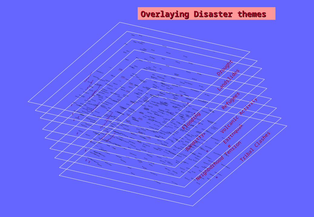
Overlaying Disaster themesOverlaying Disaster themes

UGANDAUGANDADISASTER RISK ZONINGDISASTER RISK ZONING
Emergency factorsEmergency factors
50 0 50 Kilometers
1:1,200,000
Compiled and Produced by:
Lutheran World Federation (LWF)Katakwi Office, [February 2005]
Banditry, Drought, Earthquake, Flooding
Banditry, Drought, Flooding
Banditry, Landslides, Earthquake, Flooding
Banditry, Tribal Conflicts, Drought
Banditry, Tribal Conflict, Drought, Earthquake, Flooding
Banditry, Tribal Conflict, Drought, Flooding
Banditry, Tribal Conflict, Earthquake, Refugees, Drought, Landslides
Banditry, Tribal Conflict, Flooding
Banditry, Tribal Conflicts, Refugees, Drought, Earthquake
Drought
Drought, Flooding
Earthquake, Flooding
Flooding
Landslides, Volcanic Activity
Neighbourhood Tension, Banditry, Flooding
Neighbourhood Tension, Banditry, Landslides, Earthquake, Flooding
Neighbourhood Tension, Banditry, Refugees, Drought, Flooding
Neighbourhood Tension, Banditry, Refugees, Drought, Fooding
Neighbourhood Tension, Banditry, Tribal Conflict, Refugees, Drought, Earthquake, Flooding
Neighbourhood Tension, Banditry, Tribal Conflict, Refugees, Drought, Flooding
Neighbourhood Tension, Banditry, Tribal Conflict, Refugees, Earthquake, Drought, Landslides, Volcanic Activity, Flooding
Neighbourhood Tension, Drought, Flooding
Neighbourhood Tension, Refugees, Drought, Earthquake
Neighbourhood Tension, Tribal Conflict, Flooding
Neighbourhood Tension, Tribal Conflict, Refugees, Drought, Earthquake
Neighbourhood Tension, Tribal Conflict, Refugees, Drought, Earthquake, Flooding
Neighbourhood Tension, Tribal Conflicts, Flooding
Neighbourhood Tension,, Tribal Conflict, Refugees, Drought, Earthquake, Flooding
Nieghbourhood Tension, Drought
No Risk
Tribal Conflict, Landslides, Volcanic Activity
Tribal Conflicts, Drought
Tribal Conflicts, Landslides, Volcanic Activity
Open Water
RWANDA
TANZANIA
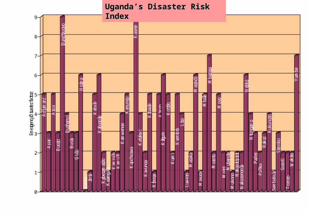
Uganda’s Disaster Risk Uganda’s Disaster Risk IndexIndex

Capacity Development Capacity Development NeedsNeeds
• Assessment of Magnitude of Disasters• Establishment of baseline data with core
datasets• Information Management – data collection,
processing, analysis and dissemination• Development of GIS and Remote Sensing
skills• Stakeholder Participation• Information Needs Assessment• Coordination/Institutional framework

I thank you allI thank you all
Related Documents