Practical Online Map Delivery & Functionality – The Commercial Perspective Data Holdings Group Limited Rod Adkins Consultant

Rod Adkins - Practical Online Map Delivery & Functionality – The Commercial Perspective
Jul 25, 2015
Welcome message from author
This document is posted to help you gain knowledge. Please leave a comment to let me know what you think about it! Share it to your friends and learn new things together.
Transcript
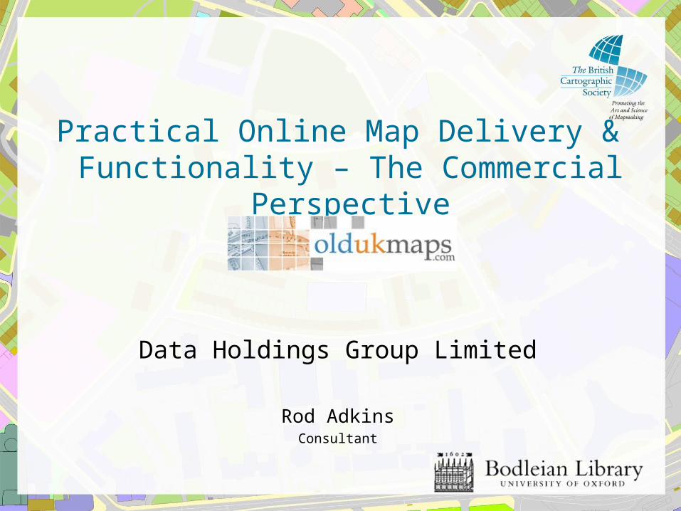
Practical Online Map Delivery & Functionality – The Commercial Perspective
Data Holdings Group Limited
Rod AdkinsConsultant
Practical Online Map Delivery & Functionality – The Commercial Perspective
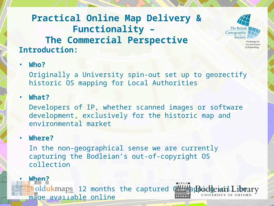
Introduction:
• Who?
Originally a University spin-out set up to georectify historic OS mapping for Local Authorities
• What?
Developers of IP, whether scanned images or software development, exclusively for the historic map and environmental market
• Where?
In the non-geographical sense we are currently capturing the Bodleian’s out-of-copyright OS collection
• When?
In the next 12 months the captured OS mapping will be made available online
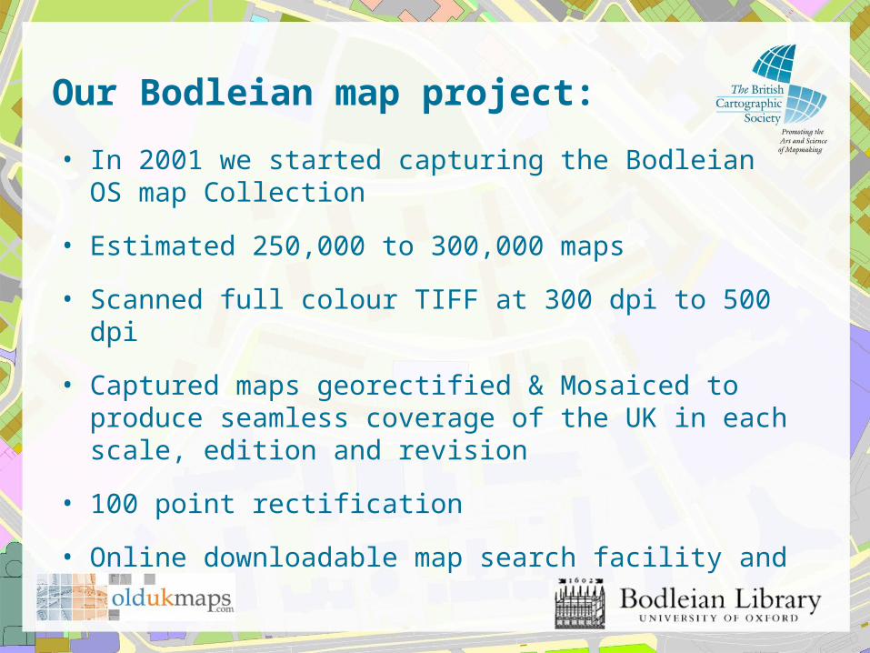
Our Bodleian map project:
• In 2001 we started capturing the Bodleian OS map Collection
• Estimated 250,000 to 300,000 maps
• Scanned full colour TIFF at 300 dpi to 500 dpi
• Captured maps georectified & Mosaiced to produce seamless coverage of the UK in each scale, edition and revision
• 100 point rectification
• Online downloadable map search facility and viewer
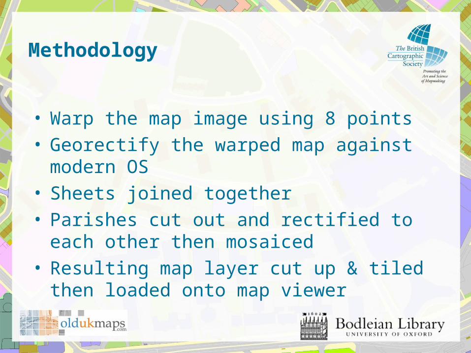
Methodology
• Warp the map image using 8 points• Georectify the warped map against modern OS• Sheets joined together• Parishes cut out and rectified to each other then
mosaiced• Resulting map layer cut up & tiled then loaded onto
map viewer
Practical Online Map Delivery & Functionality – The Commercial Perspective
Our market -
• Risk assessment consultancies who provide commercial environmental desktop reports, interpreting our mapping and the historic land use data contained within them.
Practical Online Map Delivery & Functionality – The Commercial Perspective
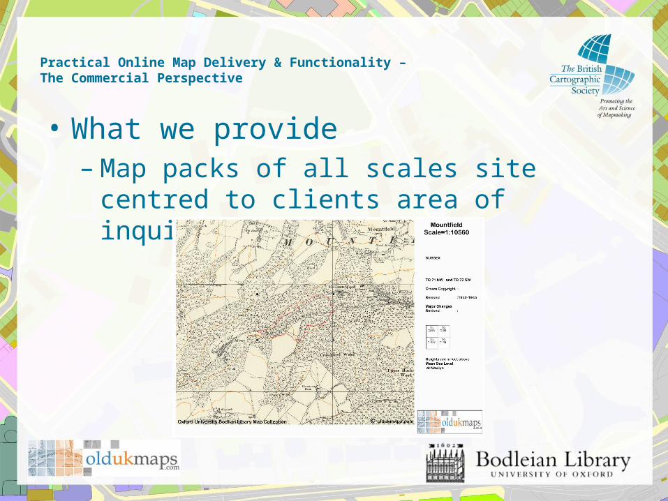
• What we provide– Map packs of all scales site centred to clients
area of inquiry
Practical Online Map Delivery & Functionality – The Commercial Perspective
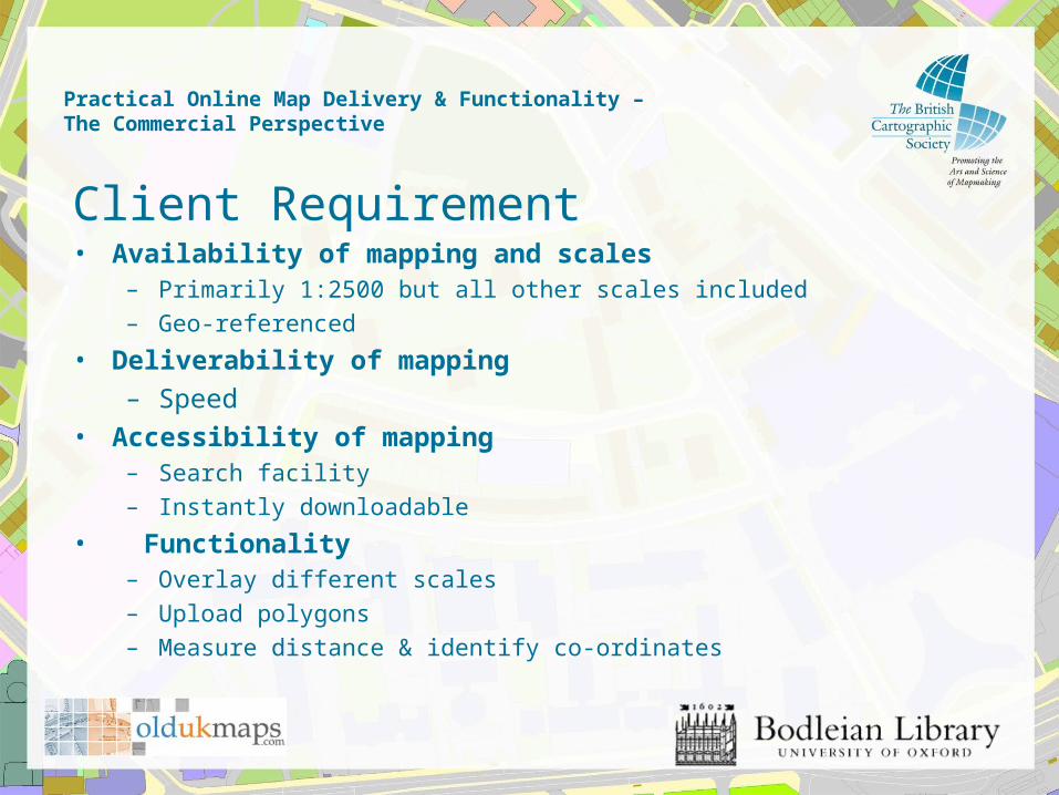
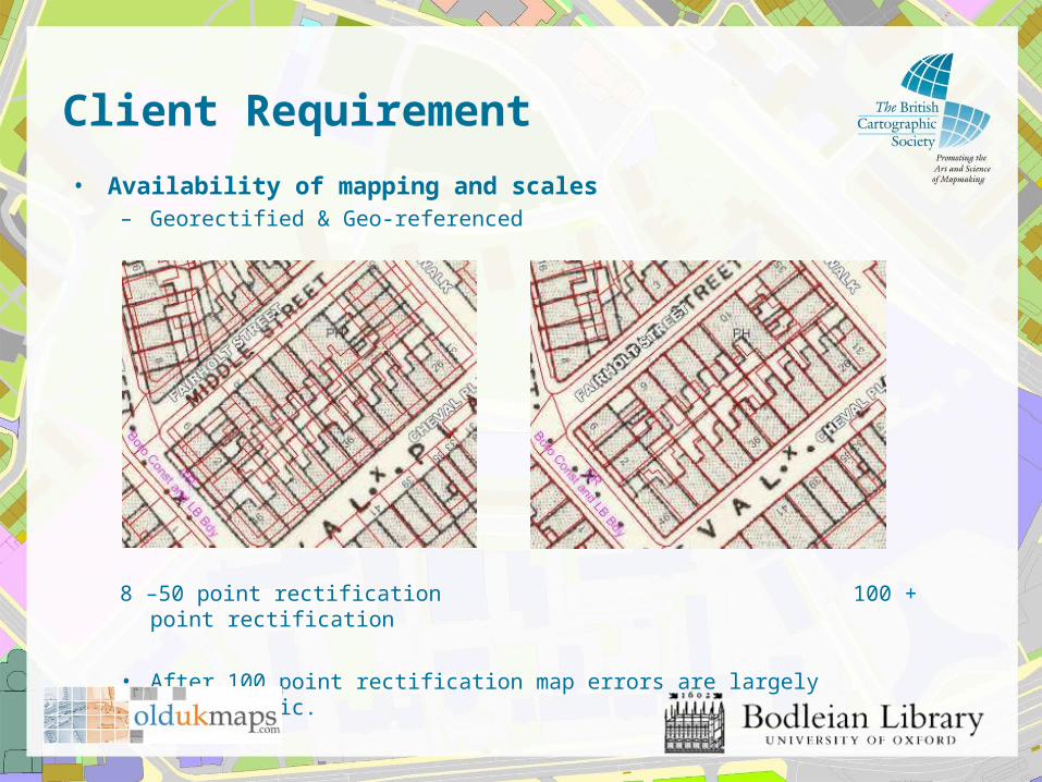
Client Requirement• Availability of mapping and scales
– Primarily 1:2500 but all other scales included
– Geo-referenced
• Deliverability of mapping
– Speed
• Accessibility of mapping– Search facility
– Instantly downloadable
• Functionality– Overlay different scales
– Upload polygons
– Measure distance & identify co-ordinates
Client Requirement
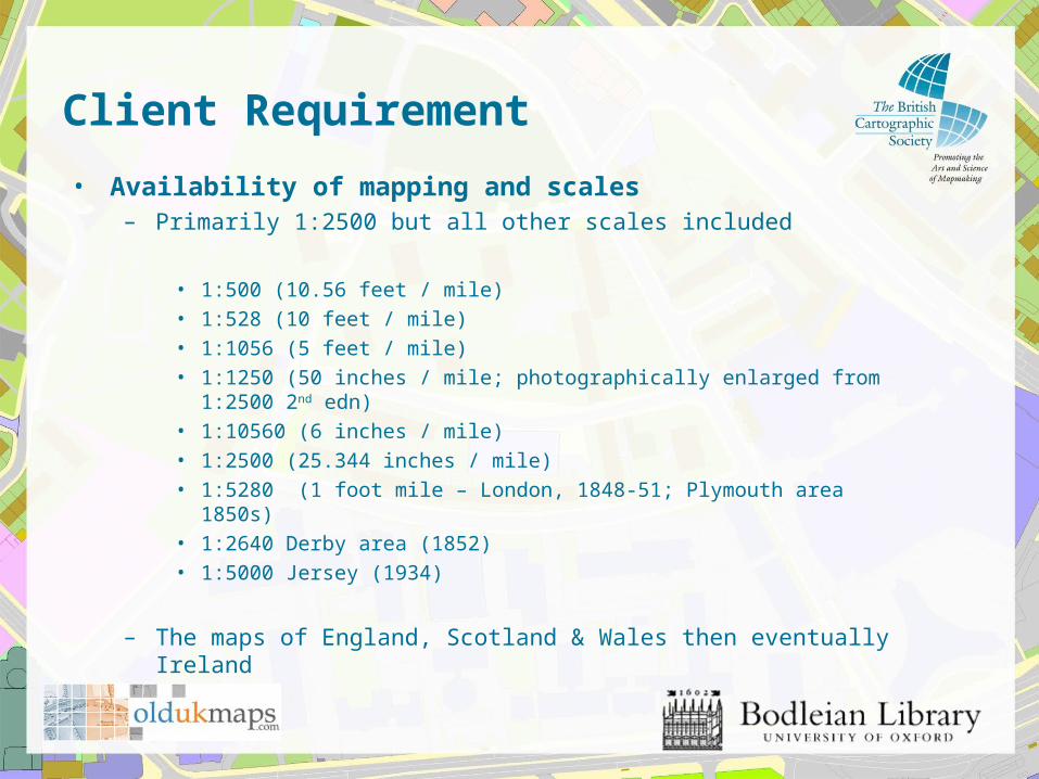
• Availability of mapping and scales– Primarily 1:2500 but all other scales included
• 1:500 (10.56 feet / mile)
• 1:528 (10 feet / mile)
• 1:1056 (5 feet / mile)
• 1:1250 (50 inches / mile; photographically enlarged from 1:2500 2nd edn)
• 1:10560 (6 inches / mile)
• 1:2500 (25.344 inches / mile)
• 1:5280 (1 foot mile – London, 1848-51; Plymouth area 1850s)
• 1:2640 Derby area (1852)
• 1:5000 Jersey (1934)
– The maps of England, Scotland & Wales then eventually Ireland
Client Requirement
• Availability of mapping and scales– Georectified & Geo-referenced
8 –50 point rectification 100 + point rectification
• After 100 point rectification map errors are largely cartographic.

Client Requirement
• Deliverability of mapping– Speed
• Normally 24hr delivery required• Cost implications of internal review and delivery• Normal hardcopy mail• Online delivery system• Impact on usefulness of map

Client Requirement
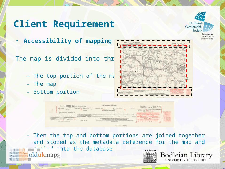
• Accessibility of mapping
The map is divided into three parts:
– The top portion of the map
– The map
– Bottom portion
– Then the top and bottom portions are joined together and stored as the metadata reference for the map and copied onto the database
Client Requirement
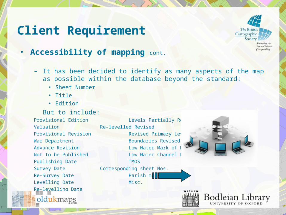
• Accessibility of mapping cont.
– It has been decided to identify as many aspects of the map as possible within the database beyond the standard:
• Sheet Number
• Title
• Edition
But to include:Provisional Edition Levels Partially Revised
Valuation Re-levelled Revised
Provisional Revision Revised Primary Levelling
War Department Boundaries Revised
Advance Revision Low Water Mark of Medium Tides
Not to be Published Low Water Channel Revised
Publishing Date TMOS
Survey Date Corresponding sheet Nos.
Re-Survey Date Parish maps
Levelling Date Misc.
Re-levelling Date
Client Requirement
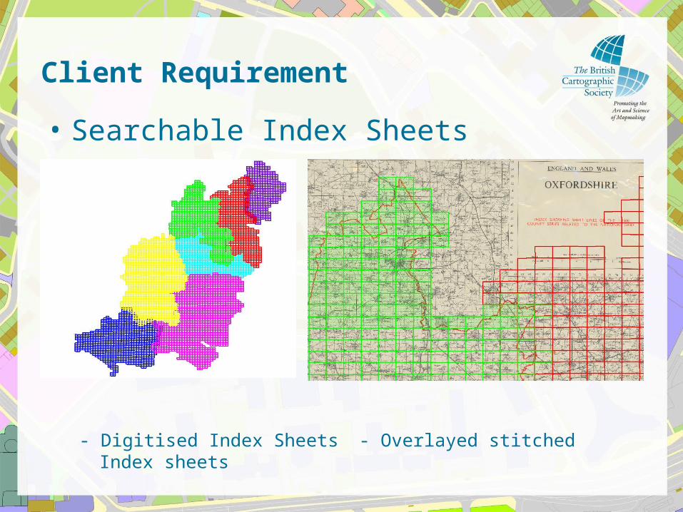
• Searchable Index Sheets
- Digitised Index Sheets - Overlayed stitched Index sheets
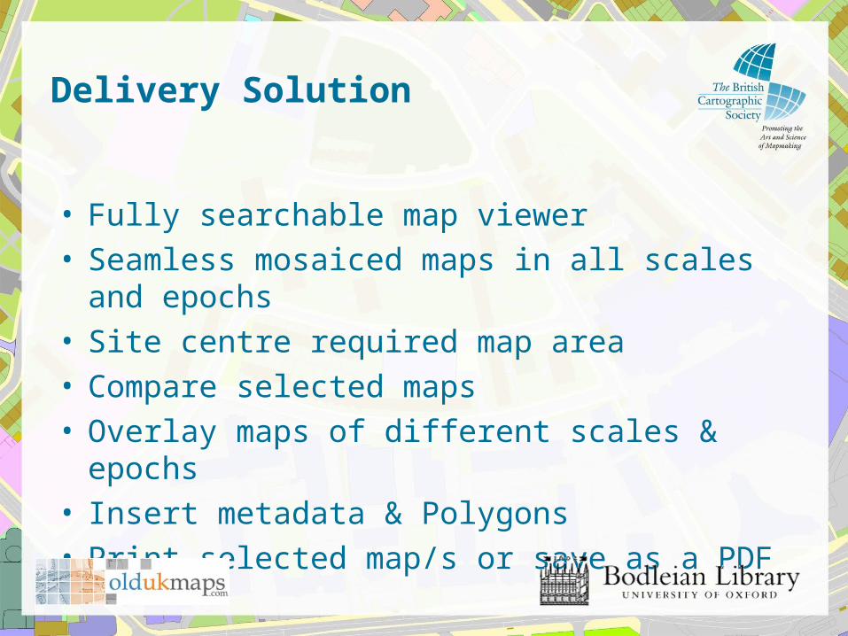
Delivery Solution
• Fully searchable map viewer• Seamless mosaiced maps in all scales and epochs• Site centre required map area• Compare selected maps • Overlay maps of different scales & epochs • Insert metadata & Polygons• Print selected map/s or save as a PDF
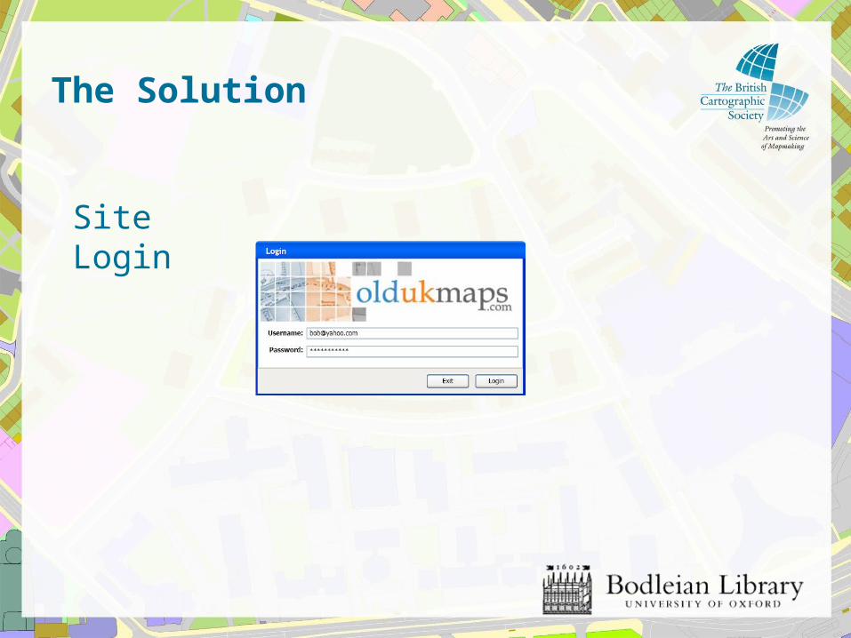
The Solution
Site Login
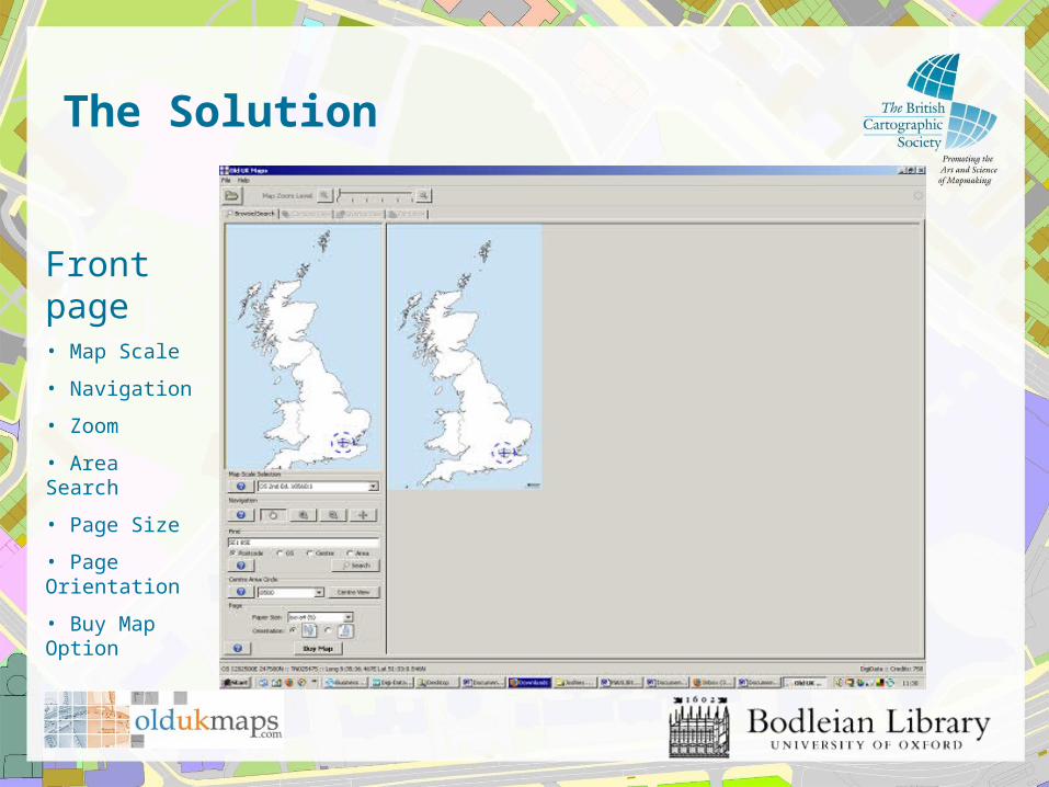
The Solution
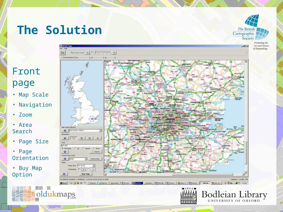
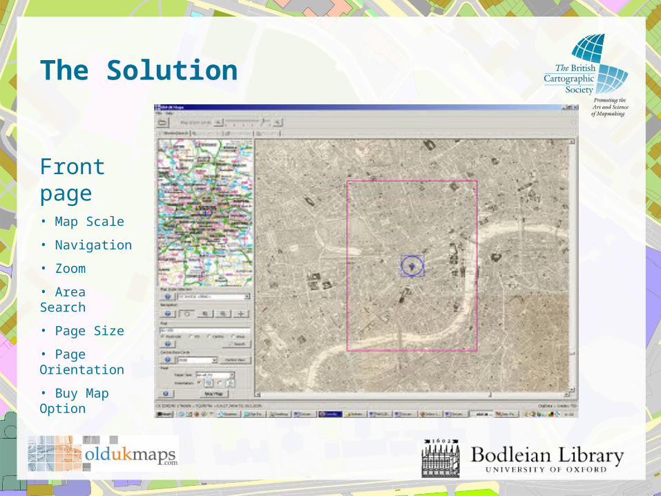
Front page• Map Scale
• Navigation
• Zoom
• Area Search
• Page Size
• Page Orientation
• Buy Map Option
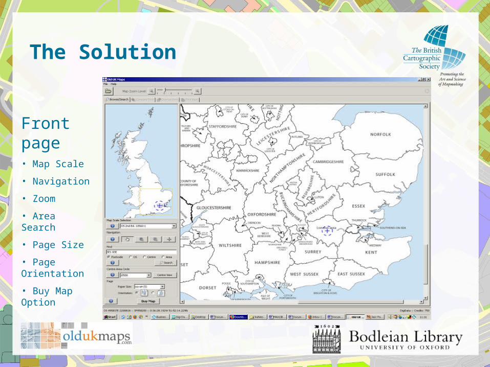
The Solution
Front page• Map Scale
• Navigation
• Zoom
• Area Search
• Page Size
• Page Orientation
• Buy Map Option
The Solution
Front page• Map Scale
• Navigation
• Zoom
• Area Search
• Page Size
• Page Orientation
• Buy Map Option
The Solution
Front page• Map Scale
• Navigation
• Zoom
• Area Search
• Page Size
• Page Orientation
• Buy Map Option

The Solution
Compare Page• Map Scale
• Navigation Sliders
• Zoom
• Site Centre
• Ruler
• Polygon area maker
• Compare Windows
The Solution
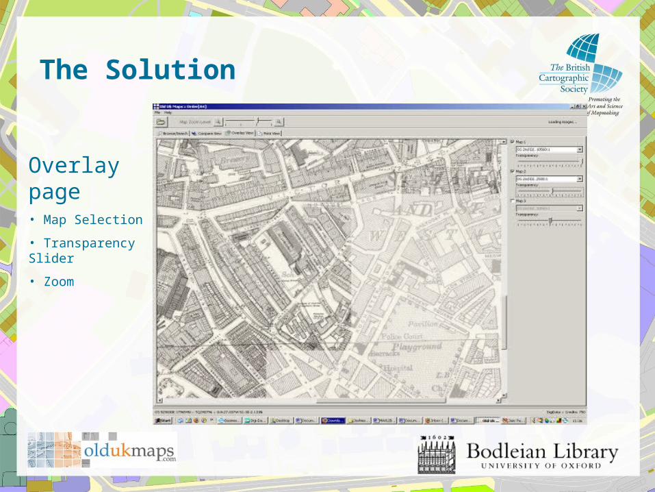
Overlay page• Map Selection
• Transparency Slider
• Zoom
The Solution
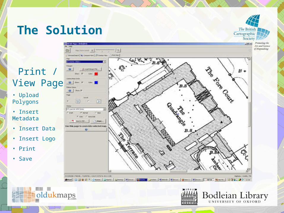
Print / View Page
• Upload Polygons
• Insert Metadata
• Insert Data
• Insert Logo
• Save
Practical Online Map Delivery & Functionality – The Commercial Perspective
Data Holdings Group Limited
Rod AdkinsConsultant
Related Documents