Aim of session: To revise content from the topic of rivers

Welcome message from author
This document is posted to help you gain knowledge. Please leave a comment to let me know what you think about it! Share it to your friends and learn new things together.
Transcript
Aim of session: To revise content from the topic of rivers
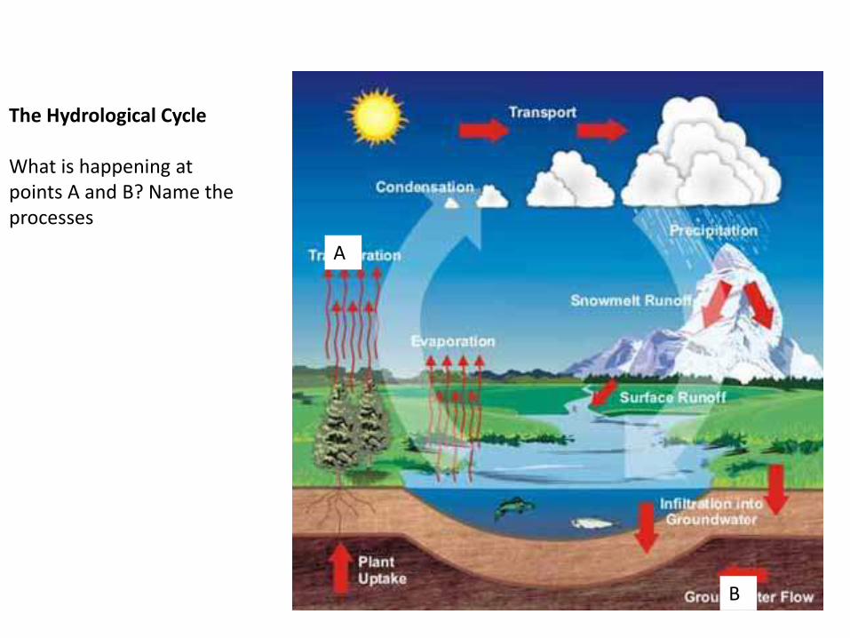
The Hydrological Cycle
What is happening at points A and B? Name the processes
A
B
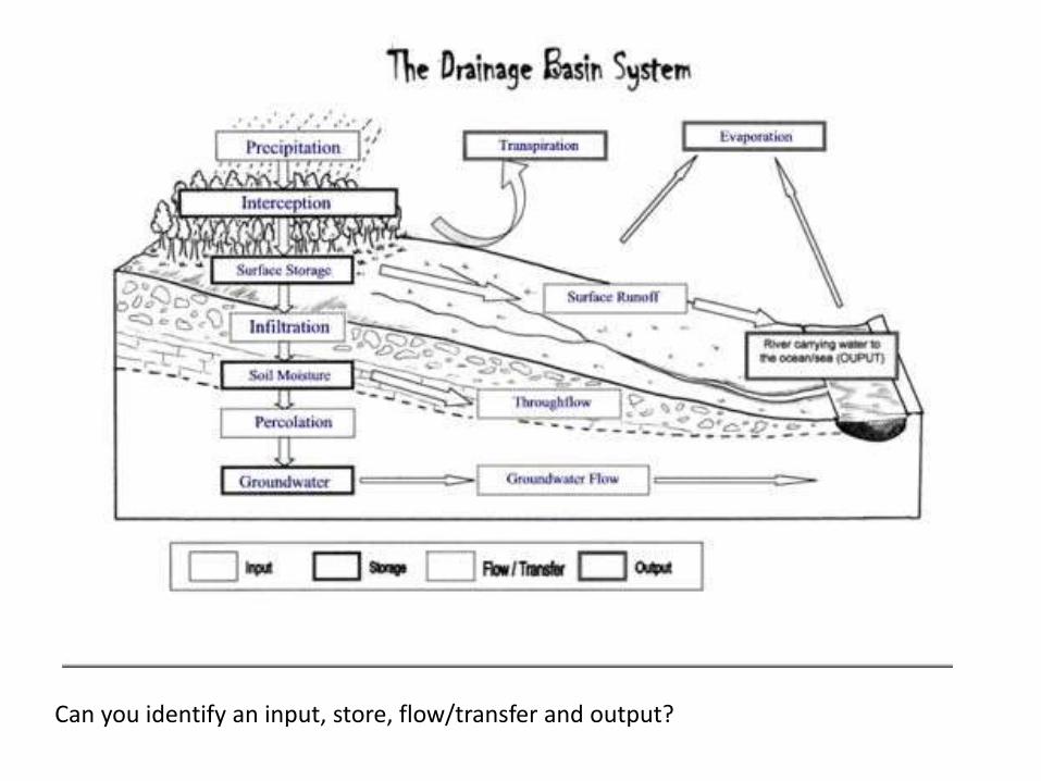
Can you identify an input, store, flow/transfer and output?

Weathering- when natural agents break up the rock.
Can you explain- biological, freeze thaw and chemical weathering? Use the images to help!


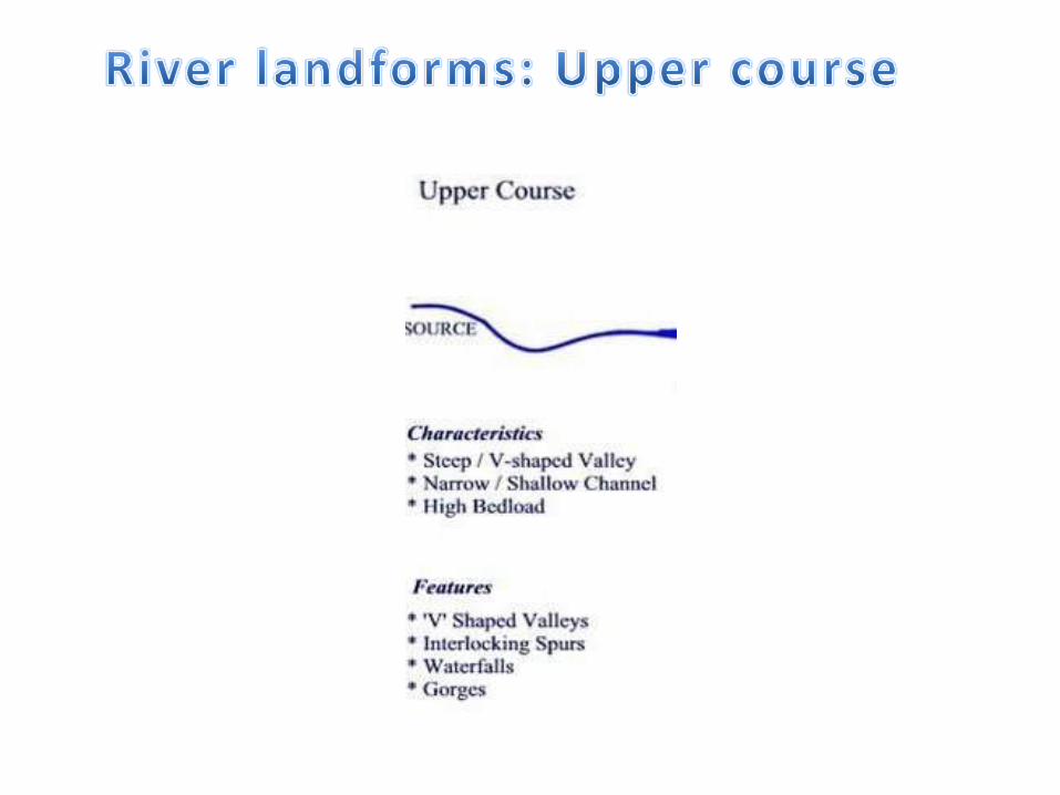
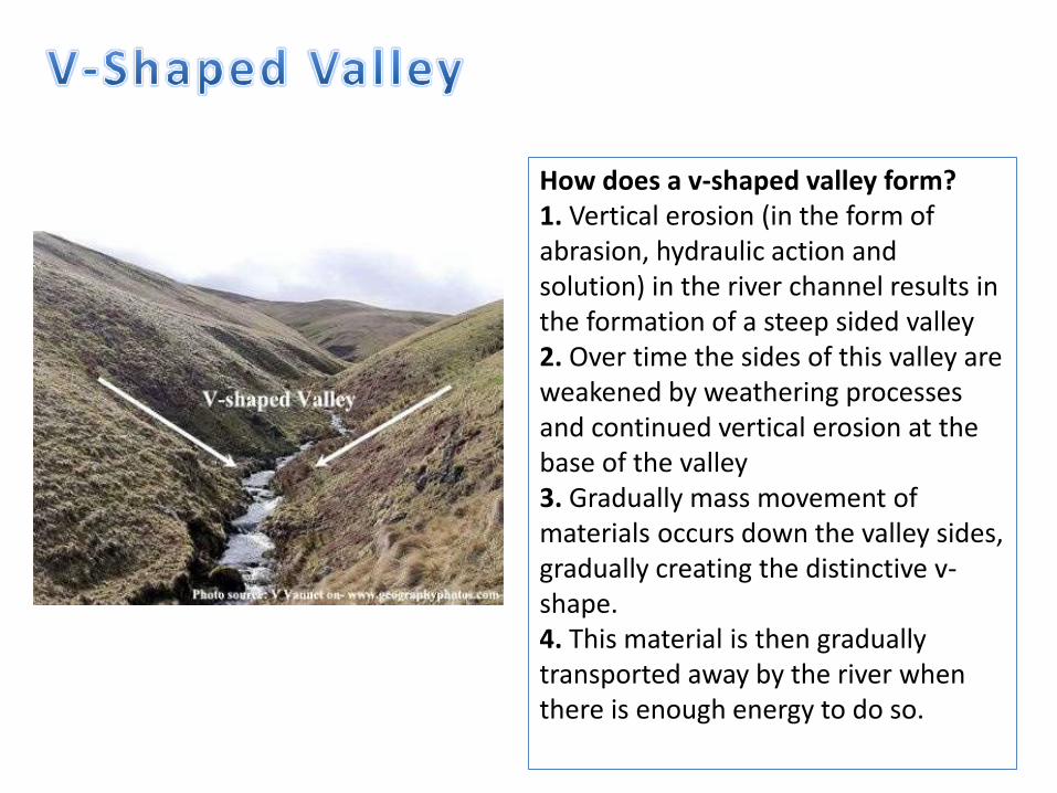
How does a v-shaped valley form?1. Vertical erosion (in the form of abrasion, hydraulic action and solution) in the river channel results in the formation of a steep sided valley2. Over time the sides of this valley are weakened by weathering processes and continued vertical erosion at the base of the valley3. Gradually mass movement of materials occurs down the valley sides, gradually creating the distinctive v-shape.4. This material is then gradually transported away by the river when there is enough energy to do so.
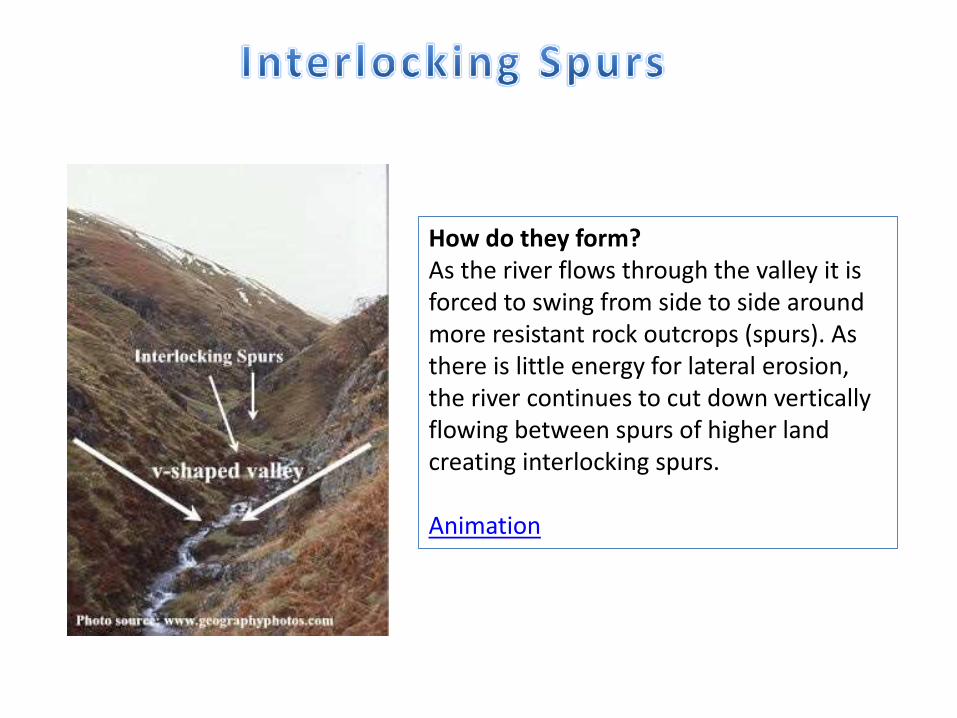
How do they form? As the river flows through the valley it is forced to swing from side to side around more resistant rock outcrops (spurs). As there is little energy for lateral erosion, the river continues to cut down vertically flowing between spurs of higher land creating interlocking spurs.
Animation
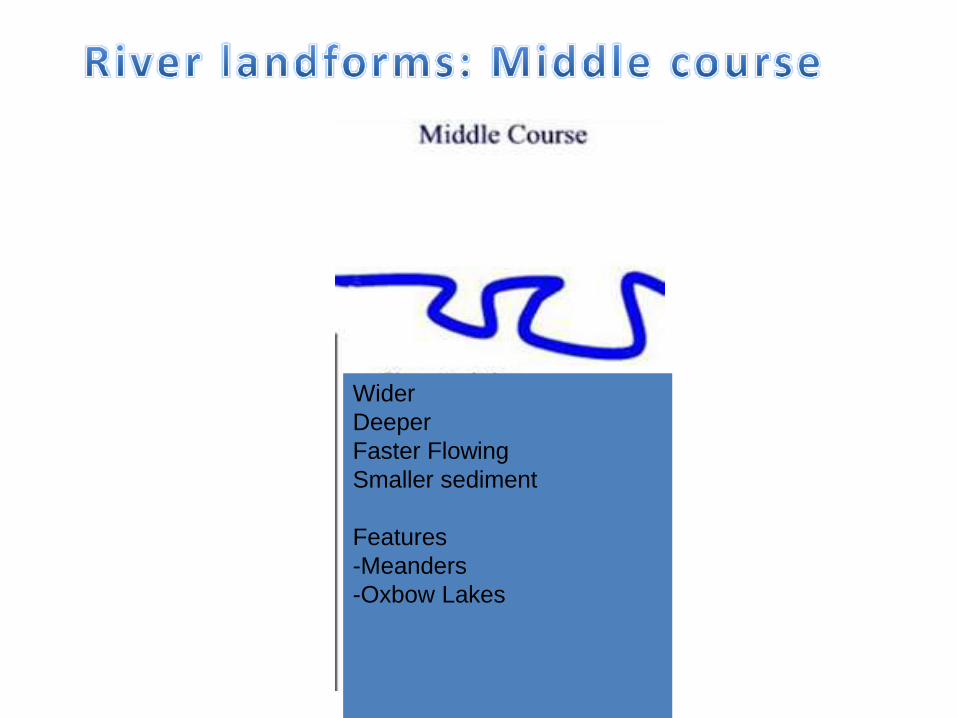
Wider
Deeper
Faster Flowing
Smaller sediment
Features
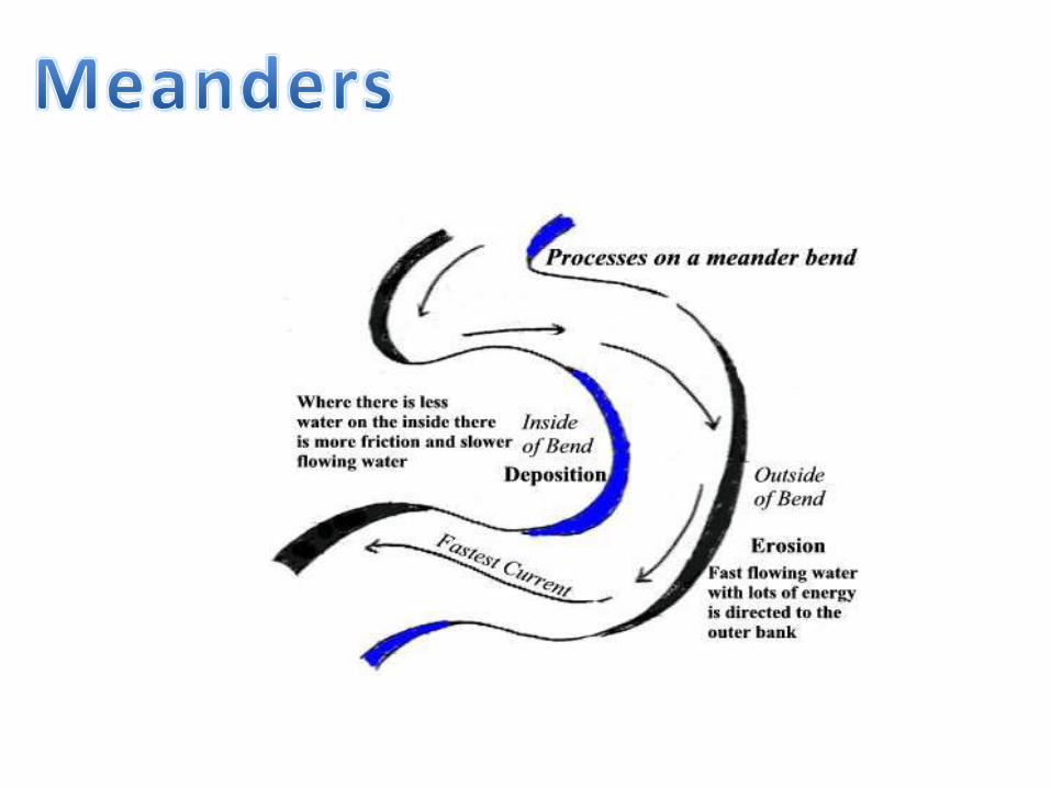
-Meanders
-Oxbow Lakes

Oxbow Lake Animation
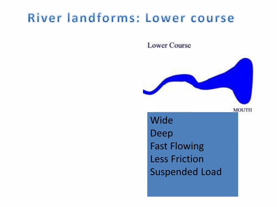
WideDeepFast FlowingLess FrictionSuspended Load
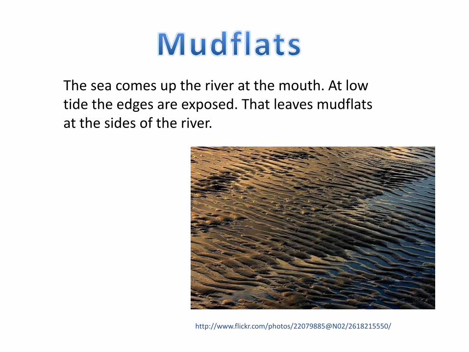
The sea comes up the river at the mouth. At low tide the edges are exposed. That leaves mudflats at the sides of the river.
http://www.flickr.com/photos/22079885@N02/2618215550/
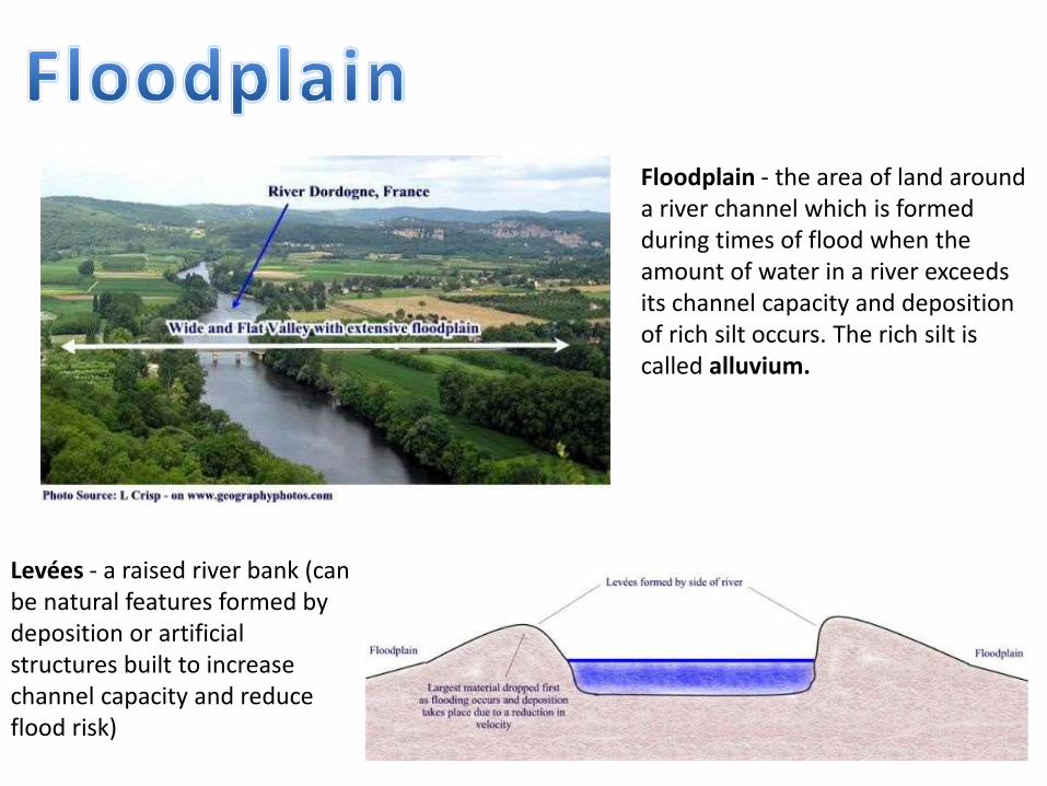
Floodplain - the area of land around a river channel which is formed during times of flood when the amount of water in a river exceeds its channel capacity and deposition of rich silt occurs. The rich silt is called alluvium.
Levées - a raised river bank (can be natural features formed by deposition or artificial structures built to increase channel capacity and reduce flood risk)
http://www.flickr.com/photos/avatrian/2279411722
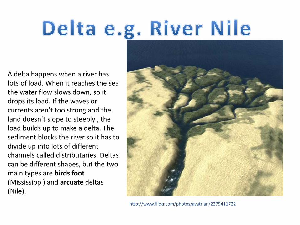
A delta happens when a river has lots of load. When it reaches the sea the water flow slows down, so it drops its load. If the waves or currents aren’t too strong and the land doesn’t slope to steeply , the load builds up to make a delta. The sediment blocks the river so it has to divide up into lots of different channels called distributaries. Deltas can be different shapes, but the two main types are birds foot (Mississippi) and arcuate deltas (Nile).
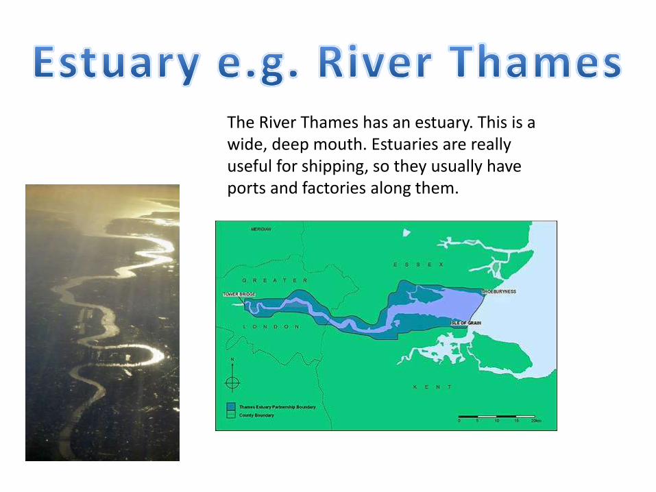
The River Thames has an estuary. This is a wide, deep mouth. Estuaries are really useful for shipping, so they usually have ports and factories along them.
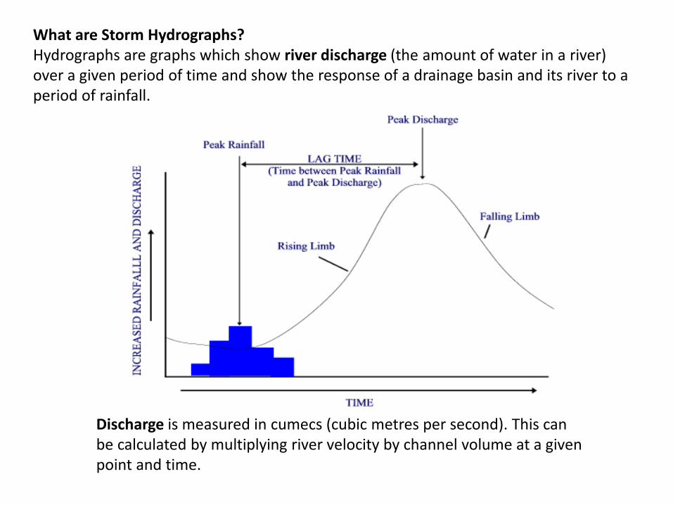
What are Storm Hydrographs?Hydrographs are graphs which show river discharge (the amount of water in a river) over a given period of time and show the response of a drainage basin and its river to a period of rainfall.
Discharge is measured in cumecs (cubic metres per second). This can be calculated by multiplying river velocity by channel volume at a given point and time.

Physical causes of flooding
-Rainfall- long spells of heavy rain or melting snow means more water in the river
-Antecedent rainfall- it has already been raining and the ground is saturated. Water can’t infiltrate so it becomes surface run-off.
-Rock/Soil type- Permeable/Impermeable rocks and soil
-Weather- Sunshine and high temperatures increases evaporation. This can lead to sudden, heavy downpours. After dry weather the ground is baked hard. If there is then heavy rain, water can’t infiltrate. Frozen ground also doesn’t all water to infiltrate. This leads to more surface run-off.
-Relief- Where slopes are steep, water doesn’t sink in as it is flowing too fast. (Gentle slopes mean more infiltration is likely).
Human causes of flooding
-Deforestation- Trees take up water through their roots and intercept water with their leaves. If trees are chopped down, water reaches the ground faster and saturates it, so surface run off increases.
-Soil Erosion- Deforestation leaves soil bare. Rain washes the soil in to rivers. This clogs the rivers up, causing them to flood.
-Farming- Ploughing the land creates vertical channels which allow rainfall to flow straight downhill to the rivers.
Building- Concrete and tarmac surfaces are impermeable-water flows quickly across them into drains, which flow into rivers.

Hard options tend to be more expensive and have a greater impact on the river and the surrounding landscape.
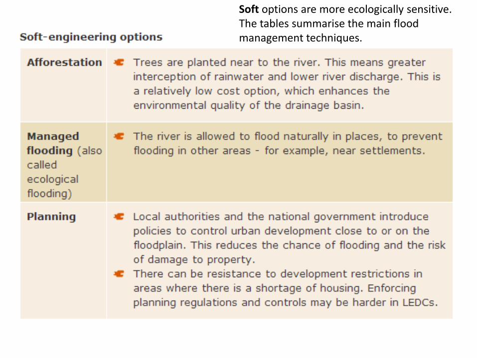
Soft options are more ecologically sensitive. The tables summarise the main flood management techniques.
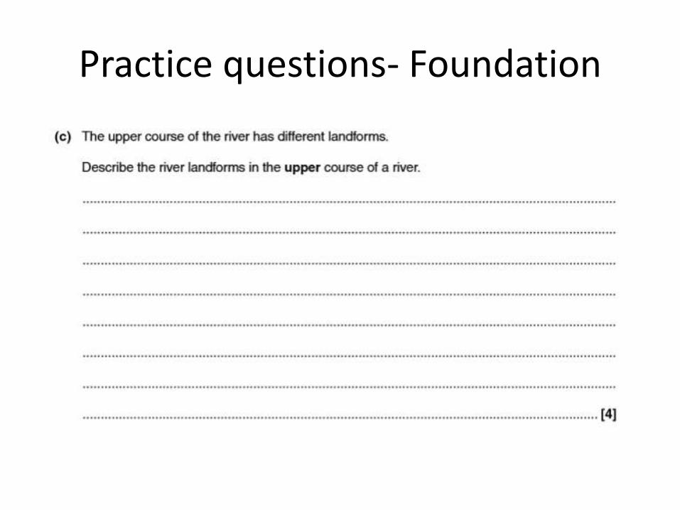
Practice questions- Foundation
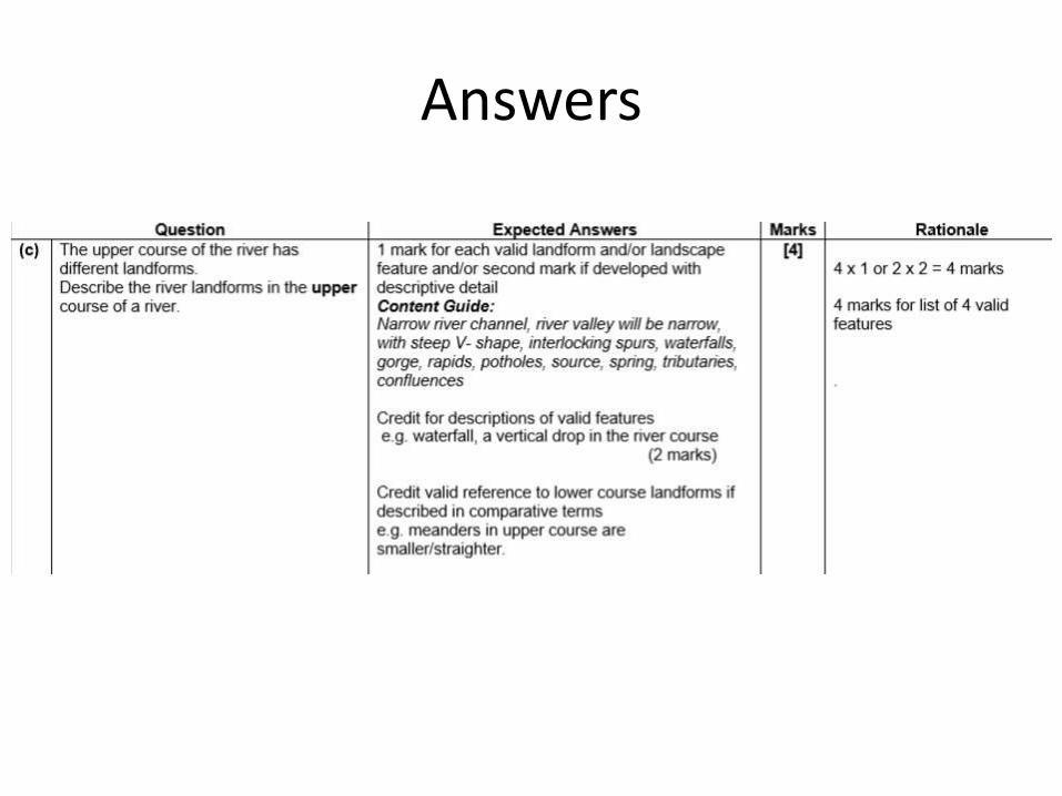
Answers
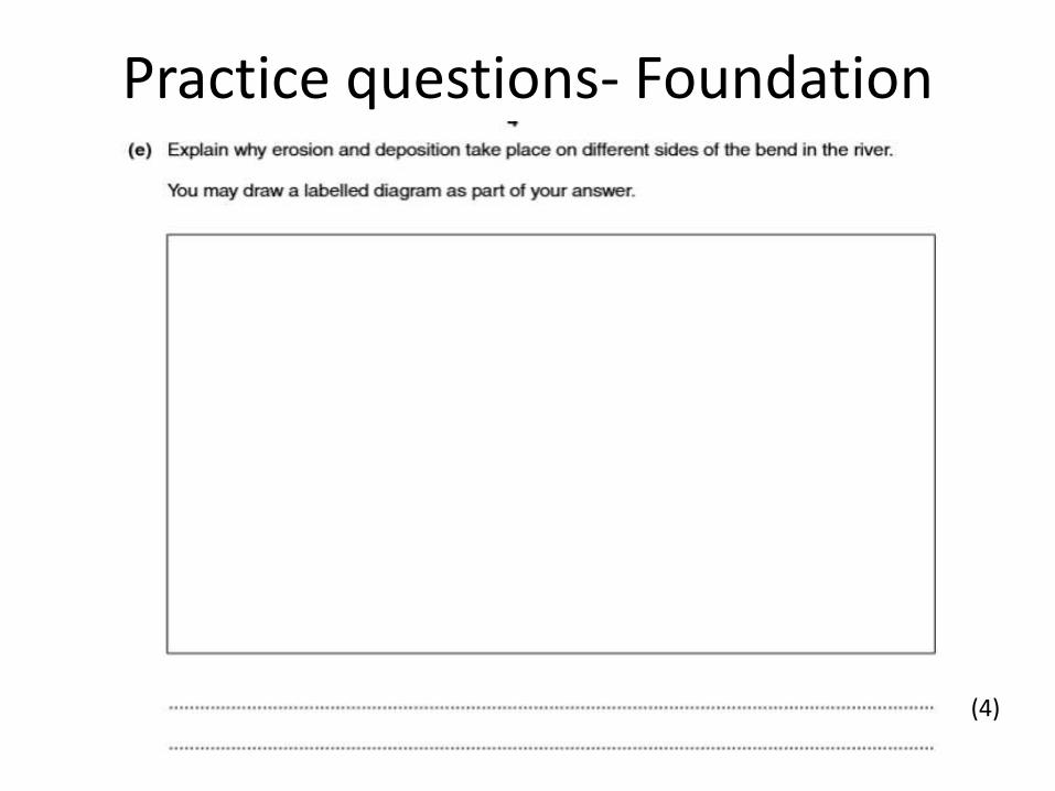
Practice questions- Foundation
(4)

Answers
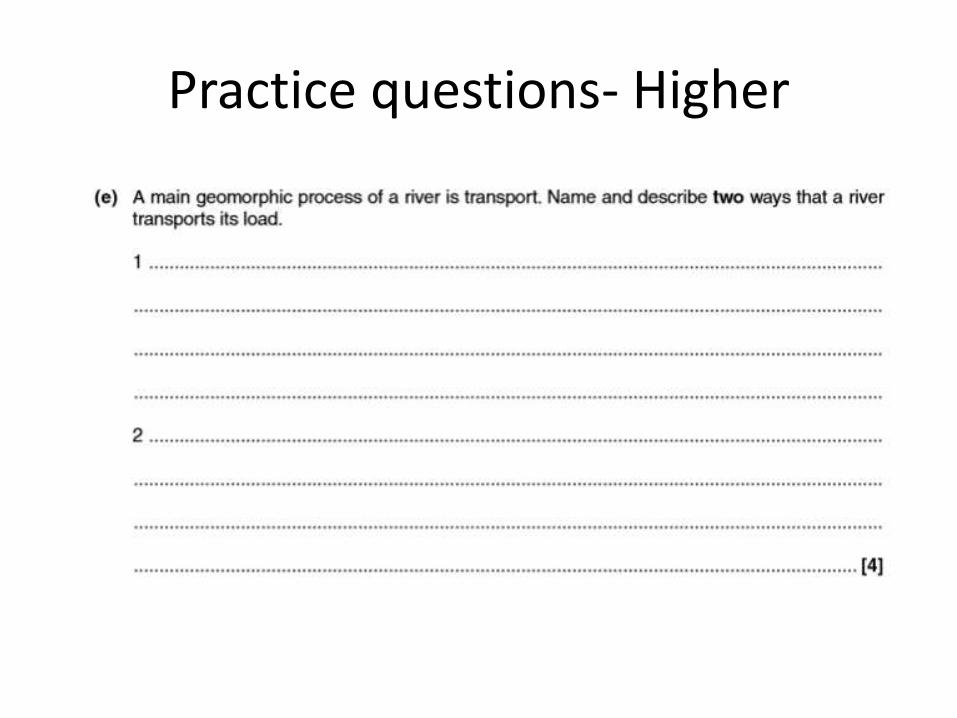
Practice questions- Higher

Answers

Practice questions- Higher
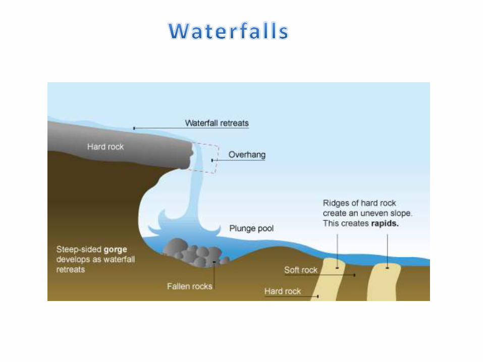
Explain the processes involved in the formation of a waterfall. Draw a diagram to help explain your answer. (4 marks).
Related Documents