Student Edition California Education and the Environment Initiative River Systems and Ancient Peoples History-Social Science Standard 6.2.1. 6

Welcome message from author
This document is posted to help you gain knowledge. Please leave a comment to let me know what you think about it! Share it to your friends and learn new things together.
Transcript
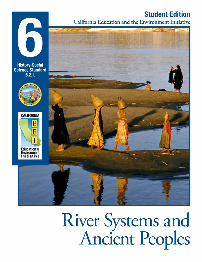
Student EditionCalifornia Education and the Environment Initiative
River Systems and Ancient Peoples
History-Social Science Standard
6.2.1.
6
California Education and the Environment InitiativeApproved by the California State Board of Education, 2010
The Education and the Environment Initiative Curriculum is a cooperative endeavor of the following entities:California Environmental Protection Agency
California Natural Resources Agency
California State Board of Education
California Department of Education
Department of Resources Recycling and Recovery (CalRecycle)
Key Partners:Special thanks to Heal the Bay, sponsor of the EEI law, for their partnership
and participation in reviewing portions of the EEI curriculum.
Valuable assistance with maps, photos, videos and design was provided by the
National Geographic Society under a contract with the State of California.
Office of Education and the Environment1001 I Street • Sacramento, California 95814 • (916) 341-6769
http://www.CaliforniaEEI.org
© Copyright 2011 by the California Environmental Protection Agency© 2018 Third Edition
All rights reserved. This publication, or parts thereof, may not be used or reproduced without
permission from the Office of Education and the Environment.
These materials may be reproduced by teachers for educational purposes.
River Systems and Ancient Peoples
Lesson 1 The Importance of the Bay Delta to California
California Connections: The Giving Power of the Bay Delta . . . . . . . . . . . . . 2
Lesson 2 Physical Features of a Fertile Landscape
None required for this lesson .
Lesson 3 Seasonal Cycles and Soil Renewal
None required for this lesson .
Lesson 4 Growing by the Banks
River People . . . . . . . . . . . . . . . . . . . . . . . . . . . . . . . . . . . . . . . . . . . . . . . . . . . . . 6
Lesson 5 Finding Foundations
Ancient Cities by the River . . . . . . . . . . . . . . . . . . . . . . . . . . . . . . . . . . . . . . . . . 10
Science Background Introducing a River System
River Systems Vocabulary . . . . . . . . . . . . . . . . . . . . . . . . . . . . . . . . . . . . . . . . . . 16
California Connections: The Sacramento-San Joaquin River Delta . . . . . . . 17
ContentsContents

2 CALIFORNIA EDUCATION AND THE ENVIRONMENT INITIATIVE I Unit 6.2.1. I River Systems and Ancient Peoples I Student Edition
The river system of the Sacramento-San Joaquin River Delta (Bay Delta) region has supported California’s human communities for thousands of years. American Indians settled in the region between 10,000 to 12,000 years ago. The Ohlone and the Miwok people enjoyed the natural abundance of the bays and the delta. In summer, the Ohlone and Miwok people made rafts and
traveled the natural waterways.
California Connections: The Giving Power of the Bay DeltaLesson 1 | page 1 of 4
The Giving Power of the Bay Delta
Mussels attached to a rock
They harvested fish, clams, mussels, and oysters and hunted waterfowl, deer, elk, and bears. In winter, when flooding rivers changed the landscape, the people would move east to the foothills of the Sierra Nevada. The native people collected acorns, which they ground into flour, and traded dried meats, including abalone, and the salt they harvested from the bays.
Europeans Arrive In spring 1772, Europeans
traveled into the Bay Delta region for the first time. A Spanish expedition led by Captain Pedro Fages and Franciscan Father Juan Crespi investigated the East Bay and the Bay Delta. The visitors noted the lush valleys, plentiful water, and many Indian
CALIFORNIA EDUCATION AND THE ENVIRONMENT INITIATIVE I Unit 6.2.1. I River Systems and Ancient Peoples I Student Edition 3
villages. The Spanish were the first Europeans the Indians in the area had ever seen.
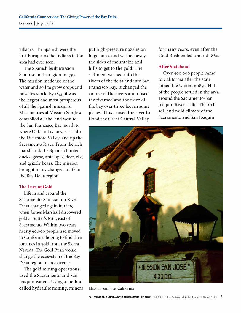
The Spanish built Mission San Jose in the region in 1797. The mission made use of the water and soil to grow crops and raise livestock. By 1833, it was the largest and most prosperous of all the Spanish missions. Missionaries at Mission San Jose controlled all the land west to the San Francisco Bay, north to where Oakland is now, east into the Livermore Valley, and up the Sacramento River. From the rich marshland, the Spanish hunted ducks, geese, antelopes, deer, elk, and grizzly bears. The mission brought many changes to life in the Bay Delta region.
The Lure of Gold Life in and around the
Sacramento-San Joaquin River Delta changed again in 1848, when James Marshall discovered gold at Sutter’s Mill, east of Sacramento. Within two years, nearly 90,000 people had moved to California, hoping to find their fortunes in gold from the Sierra Nevada. The Gold Rush would change the ecosystem of the Bay Delta region to an extreme.
The gold mining operations used the Sacramento and San Joaquin waters. Using a method called hydraulic mining, miners
put high-pressure nozzles on huge hoses and washed away the sides of mountains and hills to get to the gold. The sediment washed into the rivers of the delta and into San Francisco Bay. It changed the course of the rivers and raised the riverbed and the f loor of the bay over three feet in some places. This caused the river to f lood the Great Central Valley
for many years, even after the Gold Rush ended around 1860.
After Statehood Over 400,000 people came
to California after the state joined the Union in 1850. Half of the people settled in the area around the Sacramento-San Joaquin River Delta. The rich soil and mild climate of the Sacramento and San Joaquin
California Connections: The Giving Power of the Bay DeltaLesson 1 | page 2 of 4
Mission San Jose, California

4 CALIFORNIA EDUCATION AND THE ENVIRONMENT INITIATIVE I Unit 6.2.1. I River Systems and Ancient Peoples I Student Edition
Levee, New Orleans, Louisiana
valleys attracted farmers from all over the world. Water from the rivers and the rich soil of the floodplains were soon more precious than gold had ever been. Thousands of acres in the Central Valley were planted with wheat and alfalfa. In 1850, the state government agreed to help farmers drain wetlands in the Bay Delta region and plant crops on that land. To stop the river water from coming back, the government had a system of levees built.
Flood ControlThese early levees were small
and made of dirt. They were constructed using mules, Fresno scrapers (earth movers and spreaders), and human labor. Work was slow. Engineers first thought that levees 4 feet high and 12 feet wide would protect Bay Delta lands from flooding. They were wrong. The natural peat soil was soft and light. It kept sinking, or blowing away when it was dry. Then contractors realized they could use steam-powered dredges to scoop heavier sediment from the river to build the levees. This sediment made stronger levees. The new steam-powered dredges deepened and straightened the riverbeds.
After the flooding was stopped, many more farmers migrated to the area. They grew potatoes, onions, beans, tomatoes, and corn. Asparagus was introduced to the area at the turn of the twentieth century. The bountiful crops made the Bay Delta region famous. The availability of fertile land drew people like a magnet. At the
same time, natural habitat for fish, migratory birds, and other wildlife disappeared under the farm plows. The deer and elk that once freely roamed the Bay Delta moved upriver, to higher ground.
Farming Grows…As agriculture grew, shipping
by boat and by train became
California Connections: The Giving Power of the Bay DeltaLesson 1 | page 3 of 4

CALIFORNIA EDUCATION AND THE ENVIRONMENT INITIATIVE I Unit 6.2.1. I River Systems and Ancient Peoples I Student Edition 5
Port of Sacramento, California
important to the region. Shipping companies wanted to use bigger ships in the Bay Delta and in the rivers, but the channels were much too shallow. Officials proposed dredging the channels to make them deeper. The city of Stockton dredged a 37-foot-deep channel in 1933, so that larger ships could move goods to San Francisco. The city of Sacramento also dredged the river, creating a deepwater port in 1963.
Beginning in 1937, the Sacramento-San Joaquin River Delta was tapped for another important resource: water. The Bay Delta is at the endpoint of California’s largest watershed. State officials designed a system of canals, channels, and dams to provide fresh water and electricity to the communities in
the Central Valley and Southern California. Both the Central Valley Project and State Water Project dramatically changed the course of Bay Delta waterways. Powerful pumping plants reversed the f low of the San Joaquin River. Half of the water that normally f lowed into the delta and bay was moved south to irrigate farmlands in Southern California.
…And Cities Grow, TooThe Sacramento-San Joaquin
River Delta region attracted more and more people in the mid-twentieth century. The cities of San Francisco and Sacramento continued to grow and expand with industry, agriculture, and housing. Stockton, at the southern end of the Bay Delta, became one of the country’s most productive agricultural areas. New
technologies were used to control the water in the Bay Delta and to protect the cities from flooding. These changes would affect the whole river system in ways that would not be known for a long time.
California Connections: The Giving Power of the Bay DeltaLesson 1 | page 4 of 4

6 CALIFORNIA EDUCATION AND THE ENVIRONMENT INITIATIVE I Unit 6.2.1. I River Systems and Ancient Peoples I Student Edition
River PeopleLesson 4 | page 1 of 4
River People
1. MythsMyths are usually a traditional story of
ostensibly historical events that serve to unfold part of the world view of a people or explain a practice, belief, or natural phenomenon. Flood myths, or stories related to floods, are often seen in cultures based near water, such as Mesopotamia and Egypt. These stories help us to see how ancient people made sense of their world.
Mesopotamia: Flood Myth (from The Epic of Gilgamesh)
The Sumerian hero Gilgamesh traveled the world in search of a way to live forever. On one of his journeys, he came across an old man, Utnapishtim, who told Gilgamesh a story from long ago. The gods brought a flood that swallowed Earth.
The gods held a secret meeting on the banks of the Euphrates; they all resolved to destroy the world in a great flood. All the gods [promised] not to reveal this secret to any living thing, but Ea (one of the gods that created humanity) felt bad and told a man named Utnapishtim. Utnapishtim was instructed to build a huge boat and to bring all living things into the boat. Utnapishtim then loaded the boat with gold, silver, and all the living things of Earth, and launched the boat. Ea ordered him into the boat and commanded him to close
Life revolved around the rivers in Mesopotamia and Egypt. Even the materials on which these ancient sources were written were gathered from the river’s edge: clay along the Tigris and Euphrates, and papyrus along the Nile.
the door behind him. The black clouds arrived, with the thunder god Adad rumbling within them; Earth split like an earthenware pot, and all the light turned to darkness. The flood even frightened the gods.
The gods shook like beaten dogs, hiding in the far corners of heaven, Ishtar screamed and wailed:
“We have decided evil things in our Assembly!Why did we decide to destroy our people?We have only just now created our
Fields flooded by the Brahmaputra River, Bangladesh
CALIFORNIA EDUCATION AND THE ENVIRONMENT INITIATIVE I Unit 6.2.1. I River Systems and Ancient Peoples I Student Edition 7
River PeopleLesson 4 | page 2 of 4
beloved humans;We now destroy them in the sea!”
All the gods wept and wailed along with her,All the gods sat trembling, and wept.
The Flood lasted for seven days and seven nights, and finally light returned to Earth. Utnapishtim opened a window and the entire Earth had been turned into a flat ocean; all humans have been turned to stone. Utnapishtim then falls to his knees and cries. Utnapishtim’s boat comes to rest on the top of a mountain; the boat lodged firmly on the mountain peak just below the surface of the ocean and remained there for seven days. On the seventh day:
I [Utnapishtim] released a dove, then a swallow, from the boat;They flew off, but circled around and returned,For they could find no perch.I then released a raven from the boat,It flew off, and the waters had receded:It eats, it scratches the ground, but it does not circle around and return.I then sent out all the living things in every direction and sacrificed a sheep on that very spot.
The gods smell the odor of the sacrifice and begin to gather around Utnapishtim. Enlil, who had originally proposed to destroy all humans, then arrives, furious that one of the humans had survived, since they had agreed to wipe out all humans. He accuses Ea of betrayal, but Ea convinces Enlil to be kind. Enlil then blesses Utnapishtim and his wife:
At one time Utnapishtim was mortal.At this time let him [live forever].
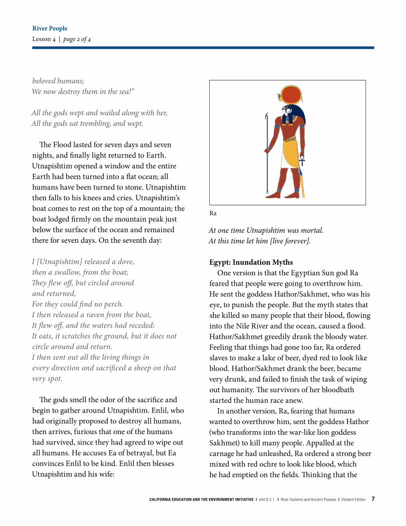
Egypt: Inundation MythsOne version is that the Egyptian Sun god Ra
feared that people were going to overthrow him. He sent the goddess Hathor/Sakhmet, who was his eye, to punish the people. But the myth states that she killed so many people that their blood, flowing into the Nile River and the ocean, caused a flood. Hathor/Sakhmet greedily drank the bloody water. Feeling that things had gone too far, Ra ordered slaves to make a lake of beer, dyed red to look like blood. Hathor/Sakhmet drank the beer, became very drunk, and failed to finish the task of wiping out humanity. The survivors of her bloodbath started the human race anew.
In another version, Ra, fearing that humans wanted to overthrow him, sent the goddess Hathor (who transforms into the war-like lion goddess Sakhmet) to kill many people. Appalled at the carnage he had unleashed, Ra ordered a strong beer mixed with red ochre to look like blood, which he had emptied on the fields. Thinking that the
Ra

8 CALIFORNIA EDUCATION AND THE ENVIRONMENT INITIATIVE I Unit 6.2.1. I River Systems and Ancient Peoples I Student Edition
River PeopleLesson 4 | page 3 of 4
fields were inundated with blood Sakhmet lapped it up, at which point she transformed back into the benevolent Hathor. A remnant human population was able to survive. In both Mesopotamia and Egypt, society mirrored the dynamics of the natural system, which was cyclical. Nature and the gods were at turns turbulent and supportive.
Egypt: Creation MythIn the beginning there was nothing, a formless,
directionless, unknown abyss called Nun. This was the primordial state before creation. Although there is some flood imagery in the creation myth–
an island appears in the watery abyss like the land emerged after the inundation, the myth itself focuses on the Sun god Ra and his appearance, creation of life, and daily journey giving life to everything. It is the stable, life-giving flood of the Nile personified by the god Hapy that contributed to the myth of land emerging from water.
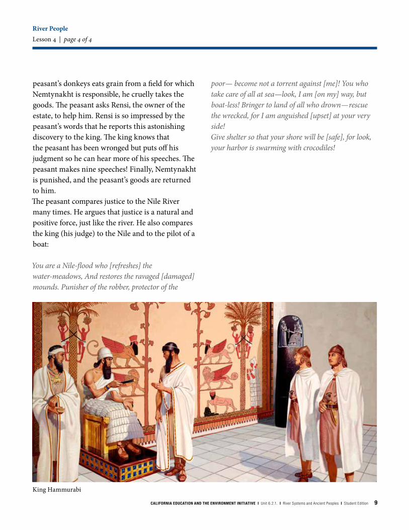
2. Codes of LawMesopotamia: Hammurabi (1792 BCE–
1750 BCE), a Babylonian king, united Mesopotamia during his 43 years in power. People throughout the land knew of his law code. In many of the laws, the rivers were seen as a way to determine if someone was guilty or innocent. Boats are also mentioned in many of the laws.
If a man has accused another of laying a kispu [spell] upon him, but has not proved it, the accused shall go to the sacred river, he shall plunge into the sacred river, and if the river shall conquer him [he drowns], he that accused him shall take possession of his house. If the sacred river shall show his innocence and he is saved, his accuser shall be put to death. He that plunged into the sacred river shall [get] the house of him that accused.
If a boatman has built a boat for a man, and has not made his work [solid], and in that same year that boat is sent on a voyage and suffers damage, the boatman shall rebuild that boat, and, at his own expense, shall make it strong, or shall give a strong boat to the owner.
Egypt: Tale of the Eloquent PeasantA peasant trader sets out on a trip to sell goods
in a large city. A man named Nemtynakht wants to steal the poor man’s goods. When one of the
Hathor
CALIFORNIA EDUCATION AND THE ENVIRONMENT INITIATIVE I Unit 6.2.1. I River Systems and Ancient Peoples I Student Edition 9
River PeopleLesson 4 | page 4 of 4
peasant’s donkeys eats grain from a field for which Nemtynakht is responsible, he cruelly takes the goods. The peasant asks Rensi, the owner of the estate, to help him. Rensi is so impressed by the peasant’s words that he reports this astonishing discovery to the king. The king knows that the peasant has been wronged but puts off his judgment so he can hear more of his speeches. The peasant makes nine speeches! Finally, Nemtynakht is punished, and the peasant’s goods are returned to him.The peasant compares justice to the Nile River many times. He argues that justice is a natural and positive force, just like the river. He also compares the king (his judge) to the Nile and to the pilot of a boat:
You are a Nile-flood who [refreshes] the water-meadows, And restores the ravaged [damaged] mounds. Punisher of the robber, protector of the
poor— become not a torrent against [me]! You who take care of all at sea—look, I am [on my] way, but boat-less! Bringer to land of all who drown—rescue the wrecked, for I am anguished [upset] at your very side!Give shelter so that your shore will be [safe], for look, your harbor is swarming with crocodiles!
King Hammurabi
10 CALIFORNIA EDUCATION AND THE ENVIRONMENT INITIATIVE I Unit 6.2.1. I River Systems and Ancient Peoples I Student Edition
Babylon
Ancient Cities by the RiverLesson 5 | page 1 of 6
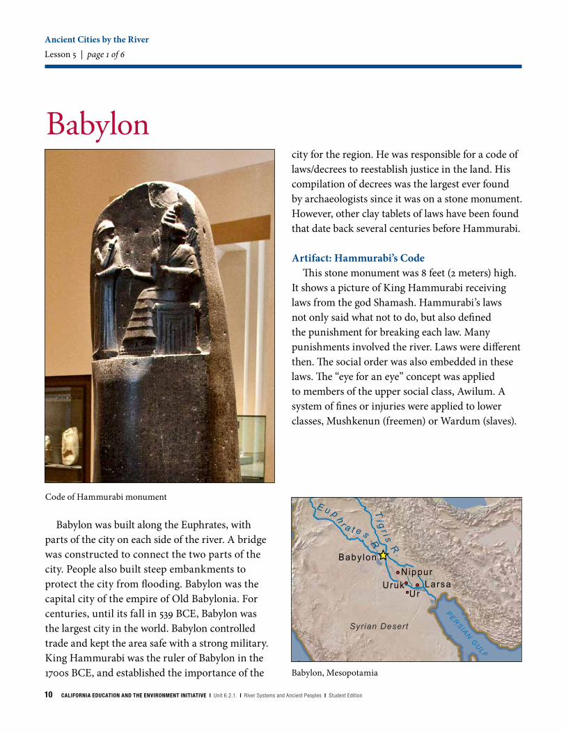
Babylon was built along the Euphrates, with parts of the city on each side of the river. A bridge was constructed to connect the two parts of the city. People also built steep embankments to protect the city from flooding. Babylon was the capital city of the empire of Old Babylonia. For centuries, until its fall in 539 BCE, Babylon was the largest city in the world. Babylon controlled trade and kept the area safe with a strong military. King Hammurabi was the ruler of Babylon in the 1700s BCE, and established the importance of the Babylon, Mesopotamia
NubianDesert
Syrian Desert
Arabian DesertArabian Desert
LakeVictoria
Wh
i t e N
i l e
Bl u
e N
i l e
Ni le
R.
Ti g
r i s R
.
E u p h
r a t e s R.
Baby lon
UrLarsa
Abu Simbel
Kerma
Meroe
CASPIANSEA
M E D I T E R R A N E A N S E A
A R A B I A N
S E A
RE
D S
EA
PE
RS
IAN
GU
LF
0 300 600 Miles
Cairo
Nepata
NippurUruk
Code of Hammurabi monument
city for the region. He was responsible for a code of laws/decrees to reestablish justice in the land. His compilation of decrees was the largest ever found by archaeologists since it was on a stone monument. However, other clay tablets of laws have been found that date back several centuries before Hammurabi.
Artifact: Hammurabi’s CodeThis stone monument was 8 feet (2 meters) high.
It shows a picture of King Hammurabi receiving laws from the god Shamash. Hammurabi’s laws not only said what not to do, but also defined the punishment for breaking each law. Many punishments involved the river. Laws were different then. The social order was also embedded in these laws. The “eye for an eye” concept was applied to members of the upper social class, Awilum. A system of fines or injuries were applied to lower classes, Mushkenun (freemen) or Wardum (slaves).
CALIFORNIA EDUCATION AND THE ENVIRONMENT INITIATIVE I Unit 6.2.1. I River Systems and Ancient Peoples I Student Edition 11
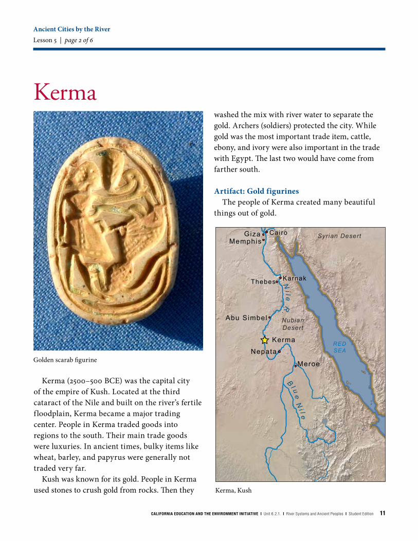
Kerma (2500–500 BCE) was the capital city of the empire of Kush. Located at the third cataract of the Nile and built on the river’s fertile f loodplain, Kerma became a major trading center. People in Kerma traded goods into regions to the south. Their main trade goods were luxuries. In ancient times, bulky items like wheat, barley, and papyrus were generally not traded very far.
Kush was known for its gold. People in Kerma used stones to crush gold from rocks. Then they
Ancient Cities by the RiverLesson 5 | page 2 of 6
Kerma
Kerma, Kush
NubianDesert
Syrian Desert
Arabian DesertArabian Desert
LakeVictoria
Wh
i t e N
i l e
Bl u
e N
i l e
Ni le
R.
Ti g
r i s R
.
E u p h
r a t e s R.
Baby lon
UrLarsa
Abu Simbel
Kerma
Meroe
CASPIANSEA
M E D I T E R R A N E A N S E A
A R A B I A N
S E A
REDSEA
PERSIANGULF
0 300 600
Miles
Karnak
Cairo
Nepata
NippurUruk
Thebes
GizaMemphis
Golden scarab figurine
washed the mix with river water to separate the gold. Archers (soldiers) protected the city. While gold was the most important trade item, cattle, ebony, and ivory were also important in the trade with Egypt. The last two would have come from farther south.
Artifact: Gold figurinesThe people of Kerma created many beautiful
things out of gold.
12 CALIFORNIA EDUCATION AND THE ENVIRONMENT INITIATIVE I Unit 6.2.1. I River Systems and Ancient Peoples I Student Edition
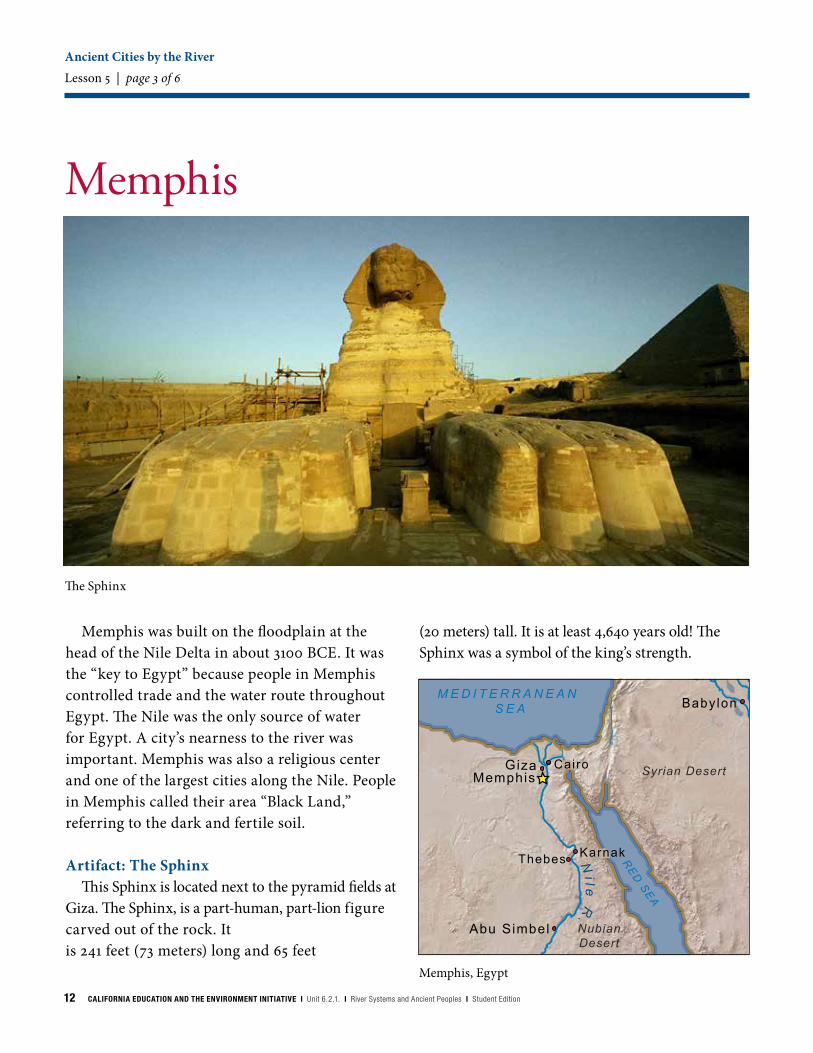
Memphis was built on the floodplain at the head of the Nile Delta in about 3100 BCE. It was the “key to Egypt” because people in Memphis controlled trade and the water route throughout Egypt. The Nile was the only source of water for Egypt. A city’s nearness to the river was important. Memphis was also a religious center and one of the largest cities along the Nile. People in Memphis called their area “Black Land,” referring to the dark and fertile soil.
Artifact: The SphinxThis Sphinx is located next to the pyramid fields at
Giza. The Sphinx, is a part-human, part-lion figure carved out of the rock. It is 241 feet (73 meters) long and 65 feet
Ancient Cities by the RiverLesson 5 | page 3 of 6
(20 meters) tall. It is at least 4,640 years old! The Sphinx was a symbol of the king’s strength.
The Sphinx
Memphis
Memphis, Egypt
NubianDesert
Syrian Desert
Arabian DesertArabian Desert
LakeVictoria
Wh
i t e N
i l e
Bl u
e N
i l e
Ni le
R.
Ti g
r i s R
.Baby lon
UrLarsa
Abu Simbel
Kerma
Meroe
CASPIANSEA
M E D I T E R R A N E A N S E A
A R A B I A N
S E A
RE
D S
EA
PERSIANGULF
0 300 600 Miles
Karnak
Cairo
Nepata
Nippur
Thebes
GizaMemphis
CALIFORNIA EDUCATION AND THE ENVIRONMENT INITIATIVE I Unit 6.2.1. I River Systems and Ancient Peoples I Student Edition 13
Thebes
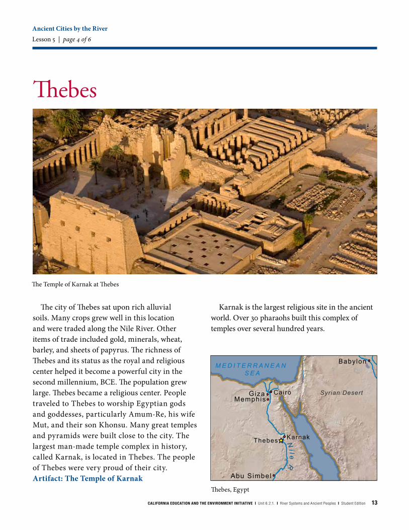
The city of Thebes sat upon rich alluvial soils. Many crops grew well in this location and were traded along the Nile River. Other items of trade included gold, minerals, wheat, barley, and sheets of papyrus. The richness of Thebes and its status as the royal and religious center helped it become a powerful city in the second millennium, BCE. The population grew large. Thebes became a religious center. People traveled to Thebes to worship Egyptian gods and goddesses, particularly Amum-Re, his wife Mut, and their son Khonsu. Many great temples and pyramids were built close to the city. The largest man-made temple complex in history, called Karnak, is located in Thebes. The people of Thebes were very proud of their city.Artifact: The Temple of Karnak
Ancient Cities by the RiverLesson 5 | page 4 of 6
Karnak is the largest religious site in the ancient world. Over 30 pharaohs built this complex of temples over several hundred years.
The Temple of Karnak at Thebes
Arabian DesertArabian Desert
LakeVictoria
Wh
i t e N
i l e
Bl u
e N
i l e
Ni le
R.
Baby lon
UrLarsa
Abu Simbel
Kerma
Meroe
CASPIANSEA
M E D I T E R R A N E A N S E A
A R A B I A N
S E A
REDSEA
PERSIANGULF
0 300 600 Miles
Karnak
Cairo
Nepata
Nippur
Thebes
GizaMemphis
Syrian Desert
Thebes, Egypt

14 CALIFORNIA EDUCATION AND THE ENVIRONMENT INITIATIVE I Unit 6.2.1. I River Systems and Ancient Peoples I Student Edition
Arabian DesertArabian Desert
Syrian Desert Syrian Desert
LakeVictoria
Wh
i t e N
i l e
Bl u
e N
i l e
Ni le
R.
E u p h
r a t e s R.
Baby lon
UrLarsa
Abu Simbel
Kerma
Meroe
CASPIANSEA
M E D I T E R R A N E A N S E A
A R A B I A N
S E A
REDSEA
PERSIANGULF
0 300 600 Miles
Cairo
Nepata
NippurUruk
Thebes
GizaMemphis
Ur
Ur was the capital of a Sumerian/Mesopotamian Empire between 2100–200 BCE with a population of 200,000 and a port city for Mesopotamian trade. Its wealth was based on extensive irrigation, agricultural technology, and control over other cities in southern Mesopotamia. People in Ur traded with other places near the Persian Gulf and beyond for several hundred years. Ur was located near the mouth of the Euphrates and Tigris rivers. Some believe the biblical flood took place near Ur. Abraham of the Bible was from this city. People in Ur worshiped the moon god. Much later, when the course of the rivers changed, the city of Ur was abandoned.
Artifact: Ziggurat at UrPeople at Ur built a ziggurat. That is a large
temple built much like a pyramid but with many platforms and staircases. A high temple was located at the top. Ziggurats were made out of sun-dried
Ancient Cities by the RiverLesson 5 | page 5 of 6
mud brick and coated with a layer of baked brick, materials taken from the riverbed. If you visit Ur today, you can still see the remains of a large ziggurat.
Ur, Mesopotamia
Ziggurat at Ur
CALIFORNIA EDUCATION AND THE ENVIRONMENT INITIATIVE I Unit 6.2.1. I River Systems and Ancient Peoples I Student Edition 15
NubianDesert
Arabian DesertArabian Desert
Syrian Desert Syrian Desert
LakeVictoria
Wh
i t e N
i l e
Bl u
e N
i l e
Ni le
R.
Ti g
r i s R
.
E u p h
r a t e s R.
Baby lon
UrLarsa
Abu Simbel
CASPIANSEA
MEDITERRANEAN SEA
A R A B I A N
S E A
REDSEA
PERSIAN
GU
LF
0 300 600 Miles
Karnak
Nepata
NippurUruk
Thebes
GizaMemphis
Meroe
Uruk
Life revolved around the rivers in Mesopotamia and Egypt. Even the materials on which these ancient sources were written were gathered from the river’s edge: clay along the Tigris and Euphrates, and papyrus along the Nile.
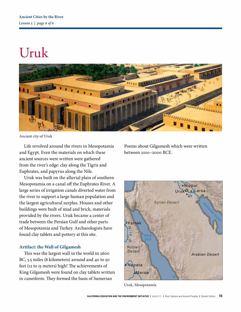
Uruk was built on the alluvial plain of southern Mesopotamia on a canal off the Euphrates River. A large series of irrigation canals diverted water from the river to support a large human population and the largest agricultural surplus. Houses and other buildings were built of mud and brick, materials provided by the rivers. Uruk became a center of trade between the Persian Gulf and other parts of Mesopotamia and Turkey. Archaeologists have found clay tablets and pottery at this site.
Artifact: the Wall of GilgameshThis was the largest wall in the world in 2600
BC; 5.5 miles (8 kilometers) around and 40 to 50 feet (12 to 15 meters) high! The achievements of King Gilgamesh were found on clay tablets written in cuneiform. They formed the basis of Sumerian
Ancient Cities by the RiverLesson 5 | page 6 of 6
Poems about Gilgamesh which were written between 2100–2000 BCE.
Ancient city of Uruk
Uruk, Mesopotamia
16 CALIFORNIA EDUCATION AND THE ENVIRONMENT INITIATIVE I Unit 6.2.1. I River Systems and Ancient Peoples I Student Edition
River Systems VocabularyScience Background
Cataract: A series of steep rapids or a waterfall in a river.
Channel: The bed of a stream, river, or other waterway.
Delta: A large, usually triangle-shaped area at the mouth of a river that gradually builds up as the river deposits sediments.
Deposition: The depositing or settling of rock or soil from one place to another.
Erosion: The moving of rock and soil from place to place by wind, water, or ice.
Flood cycle: The periodic seasonal pattern of flooding in a river system.
Floodplain: A flat area along a river that floods when water flows outside of a river’s banks.
Headwaters: The springs or small streams that supply water where a river first starts.
Meander: A winding section of a river or stream.
Sediment: Stones, sand, and soil carried by water, wind, or glaciers.
Tributary: A small river or stream that flows into a larger one.
Watershed: The land area that drains water into a particular body of water, such as a stream, river, lake, or ocean.
CALIFORNIA EDUCATION AND THE ENVIRONMENT INITIATIVE I Unit 6.2.1. I River Systems and Ancient Peoples I Student Edition 17
California Connections: The Sacramento-San Joaquin River Delta Science Background | page 1 of 4
The Sacramento– San Joaquin River Delta
Mount Shasta, California
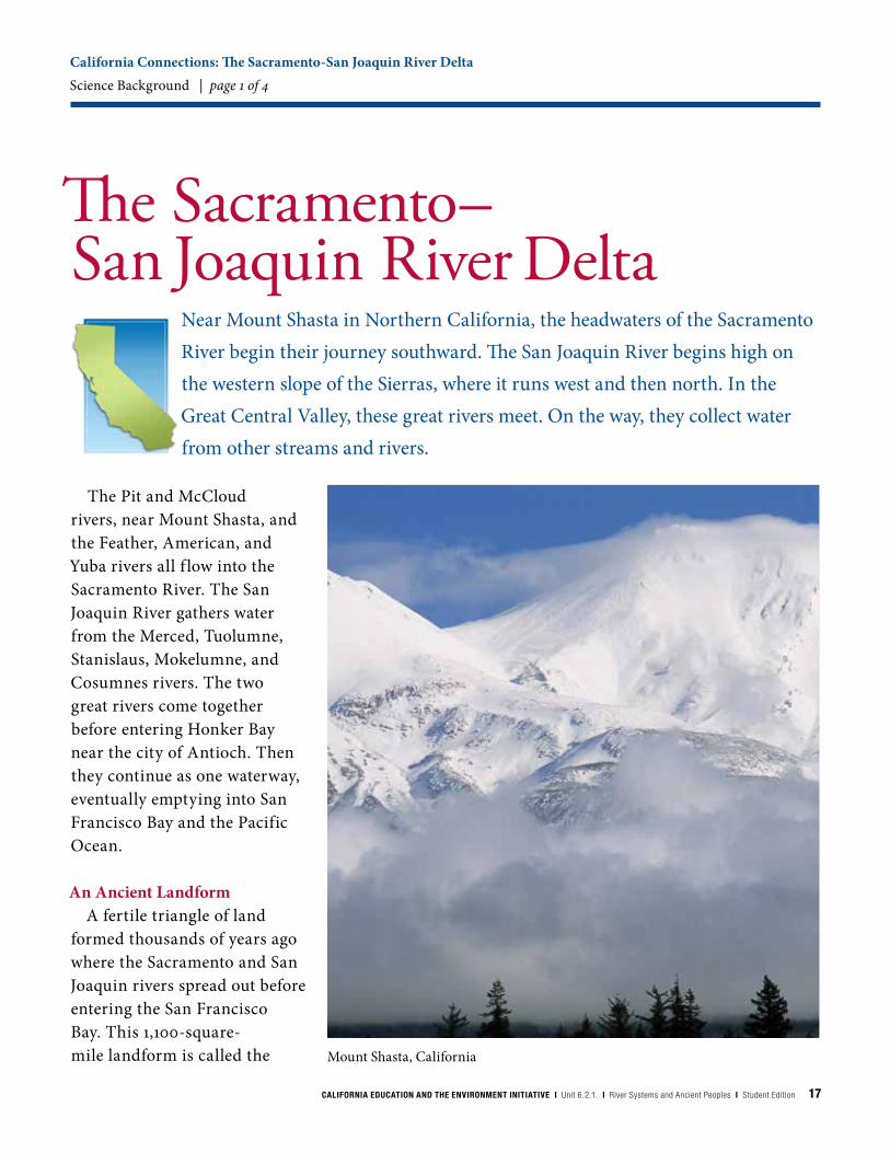
The Pit and McCloud rivers, near Mount Shasta, and the Feather, American, and Yuba rivers all f low into the Sacramento River. The San Joaquin River gathers water from the Merced, Tuolumne, Stanislaus, Mokelumne, and Cosumnes rivers. The two great rivers come together before entering Honker Bay near the city of Antioch. Then they continue as one waterway, eventually emptying into San Francisco Bay and the Pacific Ocean.
An Ancient Landform A fertile triangle of land
formed thousands of years ago where the Sacramento and San Joaquin rivers spread out before entering the San Francisco Bay. This 1,100-square-mile landform is called the
Near Mount Shasta in Northern California, the headwaters of the Sacramento River begin their journey southward. The San Joaquin River begins high on the western slope of the Sierras, where it runs west and then north. In the Great Central Valley, these great rivers meet. On the way, they collect water from other streams and rivers.

18 CALIFORNIA EDUCATION AND THE ENVIRONMENT INITIATIVE I Unit 6.2.1. I River Systems and Ancient Peoples I Student Edition
Sacramento- San Joaquin River Delta (Bay Delta).
A delta is created where a river deposits sediment at the location where it flows into an ocean, a lake, a desert, or a valley. Herodotus, the Greek Historian, named this formation “delta” because it frequently looks like the Greek letter delta, which is the shape of a triangle (∆).
The Bay Delta is an inverted river delta. Most river deltas are narrow where the river enters the plain, and then “fan out” as the water moves toward the ocean, lake, or bay. A good example of this is the delta that the Mississippi River forms as it flows out to the ocean, near the city of New Orleans in Louisiana. Another example, far away, is the Nile Delta in Egypt. Before reaching the Mediterranean Sea, the Nile Delta spreads like a fan in a triangle shape.
Unlike the Nile, the Sacramento and San Joaquin rivers fan out and then rejoin, passing through a narrow gap in the coastal range mountains before flowing into the San Francisco Bay. This gap is called the Carquinez Strait. It connects Suisun Bay with San Pablo Bay (the northern part of San Francisco Bay). This geological
constraint gives the Sacramento-San Joaquin Delta a shape that makes it unique among most of the world’s deltas.
California’s Largest BayTwenty thousand years ago,
there was no San Francisco Bay. Most of Earth’s water was frozen in glaciers. This made the sea level 400 feet lower than it is today. The California coastline lay 20 miles west of its current location. San Francisco Bay was just a flat plain, and water from the rivers flowed across it to the sea. As the glaciers melted, the sea level rose. The coastline
moved east, and the ocean finally found its way through the Carquinez Strait. Water began to fill the San Francisco Bay.
San Francisco Bay is part of a series of bays that receive water from the Sacramento and San Joaquin rivers. The bay is a partly closed body of water that includes several estuaries. Salt water from the sea and fresh water from rivers and streams combine in estuaries. These waterways provide rich habitats for life of all kinds. Estuary ecosystems can contain more life per square inch than the richest
California Connections: The Sacramento-San Joaquin River Delta Science Background | page 2 of 4
Carquinez Strait, California
CALIFORNIA EDUCATION AND THE ENVIRONMENT INITIATIVE I Unit 6.2.1. I River Systems and Ancient Peoples I Student Edition 19
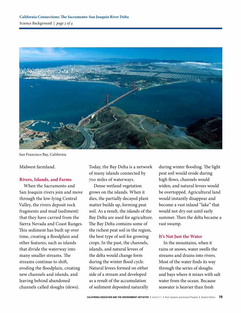
San Francisco Bay, California
Midwest farmland.
Rivers, Islands, and FarmsWhen the Sacramento and
San Joaquin rivers join and move through the low-lying Central Valley, the rivers deposit rock fragments and mud (sediment) that they have carried from the Sierra Nevada and Coast Ranges. This sediment has built up over time, creating a floodplain and other features, such as islands that divide the waterway into many smaller streams. The streams continue to shift, eroding the floodplain, creating new channels and islands, and leaving behind abandoned channels called sloughs (slews).
Today, the Bay Delta is a network of many islands connected by 700 miles of waterways.
Dense wetland vegetation grows on the islands. When it dies, the partially decayed plant matter builds up, forming peat soil. As a result, the islands of the Bay Delta are used for agriculture. The Bay Delta contains some of the richest peat soil in the region, the best type of soil for growing crops. In the past, the channels, islands, and natural levees of the delta would change form during the winter flood cycle. Natural levees formed on either side of a stream and developed as a result of the accumulation of sediment deposited naturally
during winter flooding. The light peat soil would erode during high flows, channels would widen, and natural levees would be overtopped. Agricultural land would instantly disappear and become a vast inland “lake” that would not dry out until early summer. Then the delta became a vast swamp.
It’s Not Just the WaterIn the mountains, when it
rains or snows, water swells the streams and drains into rivers. Most of the water finds its way through the series of sloughs and bays where it mixes with salt water from the ocean. Because seawater is heavier than fresh
California Connections: The Sacramento-San Joaquin River Delta Science Background | page 3 of 4

20 CALIFORNIA EDUCATION AND THE ENVIRONMENT INITIATIVE I Unit 6.2.1. I River Systems and Ancient Peoples I Student Edition
water, it sinks to the bottom. The churning salt water pushes up the fresh water, which rises to the top.
The flow of the rivers and tides and the mixing of salt water and fresh water keep the sediment, plankton, and nutrients suspended in the water. This provides a nutritious food source for animals and plants that live both on land and in the water. If the flow of fresh water changes, as in times of drought or flood, this diverse food web can shrink or even disappear. Many species of mammals, birds, and fish depend on the healthy food source to survive.
The area of the Sacramento-San Joaquin Delta is home to more than 750 species of plants
and animals, including some found nowhere else on Earth. The rivers provide a favorite habitat for migratory birds, and are spawning grounds for more than a hundred species of fish. Water has always been the magnet drawing living things to the Bay-Delta. Once a vast floodplain, today the delta is one of the most productive regions in the world, and government officials are working on many efforts to protect it. For example, earthquakes could threaten the Bay Delta’s levee system. Fish populations like the Delta smelt, Chinook salmon, and longfin smelt are dropping. Plants that are not native to the delta are also invading this estuary region.
More homes and buildings are being built closer to the delta floodplains, which can interfere with the delta’s natural way of dealing with seasonal flooding.
Protecting the Bay Delta for the future is very important for many reasons. It is also the single-largest, most important source of water for California. Though the delta is located in the north part of the state between Sacramento and San Francisco, approximately 25 million people from as far away as Los Angeles and San Diego rely on the Bay Delta, at least in part, for their water.
Flooding in the Sacramento-San Joaquin River Delta, 1980
California Connections: The Sacramento-San Joaquin River DeltaScience Background | page 4 of 4


California Education and the Environment InitiativePrinted on post-consumer recycled paper621SE
Related Documents