Information Sharing Bulletin - May 1996 River Almanac An Information Sharing Bulletin of the Long Term Resource Monitoring Program National Biological Service U.S. Department of the Interior On May 15, 1995, two Amazon River scientists, an English-Spanish in- terpreter, and Robert J. Sheehan of the University of Southern Illinois- Carbondale visited the Open River Field Station at Jackson, Missouri. Enrique Rios Tsern and Norma Arana Flores are Biological Sciences faculty members at the Universidad Nacional de la Amazonia Peruana (Peruvian National University, Amazonia Campus) in Iquitos, Peru. The Peruvian scientists visited the United States through a grant awarded to faculty at the Southern Illi- nois University Cooperative Fisheries Research Laboratory. The grant project, sponsored by the United States Information Agency, will mutually benefit Southern Illinois Uni- versity and the Peruvian National Uni- versity by strengthening faculty knowl- edge, improving instructional programs, and providing cross-cultural under- standing, particularly as these factors apply to the ecology, management, and economic uses of large river systems. Southern Illinois University received this award because of the long history of research activity the two universities have shared on their respective conti- nents’ largest rivers, the Amazon and the Mississippi. Scientists exchange information on Amazon and Mississippi Rivers by Robert A. Hrabik and Robert J. Sheehan The first phase of the project is a faculty exchange program wherein fac- ulty from each university visit their counterparts. Program participants then lecture in classes, conduct individual research, interact with host university faculty, and meet with students. One important objective of the program is to participate in field expeditions, where direct experience with river ecology and management can be gained. An- other is for program participants to in- teract with the agencies involved in the management, preservation, and regula- tion of natural resources. The May 1995 meeting included a trip on the river, staff discussions, and a presentation on the ecology of the Up- per Mississippi River System and the purpose of the Long Term Resource Monitoring Program. The field trip began with an electrofishing demon- stration in flooded areas along the river. This was the first time that Flores and Continued on page 3 (Left to right ) Dr. Robert Sheehan, Norma Arana Flores, Robert Hrabik, and Enrique Rios Tsern enjoy a trip on the open river. Data Sharing Issue

Welcome message from author
This document is posted to help you gain knowledge. Please leave a comment to let me know what you think about it! Share it to your friends and learn new things together.
Transcript
Information Sharing Bulletin - May 1996
River AlmanacAn Information Sharing Bulletin of the
Long Term Resource Monitoring ProgramNational Biological Service
U.S. Department of the Interior
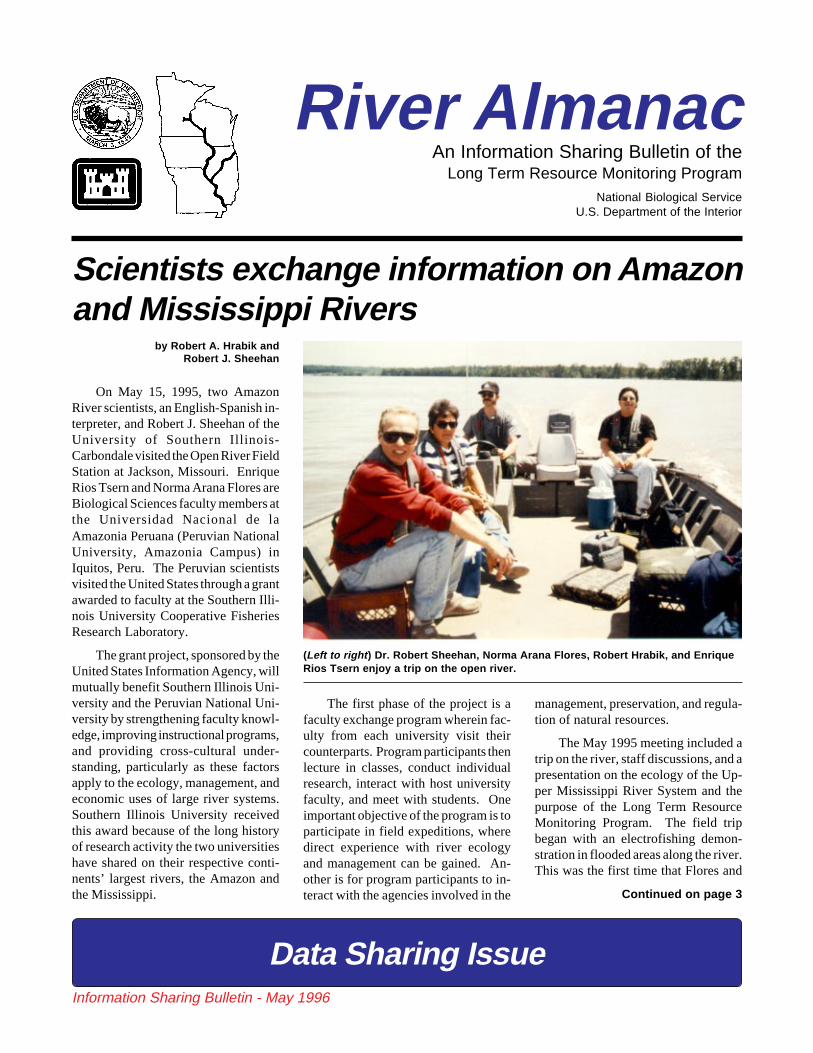
On May 15, 1995, two AmazonRiver scientists, an English-Spanish in-terpreter, and Robert J. Sheehan of theUniversity of Southern Illinois-Carbondale visited the Open River FieldStation at Jackson, Missouri. EnriqueRios Tsern and Norma Arana Flores areBiological Sciences faculty members atthe Universidad Nacional de laAmazonia Peruana (Peruvian NationalUniversity, Amazonia Campus) inIquitos, Peru. The Peruvian scientistsvisited the United States through a grantawarded to faculty at the Southern Illi-nois University Cooperative FisheriesResearch Laboratory.
The grant project, sponsored by theUnited States Information Agency, willmutually benefit Southern Illinois Uni-versity and the Peruvian National Uni-versity by strengthening faculty knowl-edge, improving instructional programs,and providing cross-cultural under-standing, particularly as these factorsapply to the ecology, management, andeconomic uses of large river systems.Southern Illinois University receivedthis award because of the long historyof research activity the two universitieshave shared on their respective conti-nents’ largest rivers, the Amazon andthe Mississippi.
Scientists exchange information on Amazonand Mississippi Rivers
by Robert A. Hrabik andRobert J. Sheehan
The first phase of the project is afaculty exchange program wherein fac-ulty from each university visit theircounterparts. Program participants thenlecture in classes, conduct individualresearch, interact with host universityfaculty, and meet with students. Oneimportant objective of the program is toparticipate in field expeditions, wheredirect experience with river ecologyand management can be gained. An-other is for program participants to in-teract with the agencies involved in the
management, preservation, and regula-tion of natural resources.
The May 1995 meeting included atrip on the river, staff discussions, and apresentation on the ecology of the Up-per Mississippi River System and thepurpose of the Long Term ResourceMonitoring Program. The field tripbegan with an electrofishing demon-stration in flooded areas along the river.This was the first time that Flores and
Continued on page 3
(Left to right ) Dr. Robert Sheehan, Norma Arana Flores, Robert Hrabik, and EnriqueRios Tsern enjoy a trip on the open river.
Data Sharing Issue

River Almanac
Information Sharing Bulletin - May 1996 2
River Almanac is an authorized publicationof the U.S. Department of the Interior, pub-lished periodically by the Environmental Man-agement Technical Center to provide an ongo-ing exchange of information between the EMTCand other Long Term Resource Monitoring Pro-gram participants and the general public.
Robert L. Delaney - Center DirectorNorman W. Hildrum - Almanac Coordinator
Terry D'Erchia - Editor Madelon Wise - Assistant Editor
The Environmental Management TechnicalCenter is a National Biological Service facilitylocated in Onalaska, Wisconsin, USA. TheTechnical Center manages the Long Term Re-source Monitoring Program, which is the largestriver-related inventory, monitoring, research,spatial analysis, and information sharing pro-gram in the United States.
The Long Term Resource Monitoring Pro-gram (LTRMP) for the Upper Mississippi RiverSystem was authorized under the Water Re-sources Development Act of 1986 as an elementof the Environmental Management Program.The mission of the LTRMP is to provide rivermanagers with information for maintaining theUpper Mississippi River System as a sustain-able large river ecosystem given its multiple-use character.
The LTRMP is a cooperative effort by theNational Biological Service, the U.S. ArmyCorps of Engineers, and the States of Illinois,Iowa, Minnesota, Missouri, and Wisconsin.
Questions or comments may be directed tothe EMTC, River Almanac Staff, 575 LesterAvenue, Onalaska, WI 54650-8552, Telephone:608/783-7550, Fax: 608/783-8058.
River Almanac is also available on the WorldWide Web (http://www.emtc.nbs.gov/).
Opinions expressed in this bulletin do notnecessarily reflect the position of the U.S. De-partment of the Interior or any LTRMP partici-pant.
Mention of trade names or commercial prod-ucts does not constitute endorsement or recom-mendation for use by the Department of theInterior.
In this issue
Printed on recycled paper
Scientists exchange information on Amazonand Mississippi Rivers by Robert A. Hrabik
and Robert J. Sheehan - Page 1
Program Notes by Robert L. Delaney - Page 3
New invader of the Illinois River by Jim Stoeckel - Page 4
Mapping of land cover from aerial photography continuesby Kevin Hop and Frank D’Erchia - Page 6
The 28th annual meeting of theMississippi River Research Consortium
by Mi Ae Lipe-Butterbrodt - Page 7
Should we investigate locking to improve fish passageopportunity? by Joe Wlosinski - Page 8
Selected abstracts of ongoing LTRMP efforts - Page 9
Meetings of Interest - Page 9
Tracking the zebra mussel - Page 10
Federal agencies share information on fishby Mark Steingraeber - Page 10
Monitoring zooplankton in Lake Pepinby Robert Burdis - page 11
The pulse of the River by Andy Bartels - Page 12
Rivers Project summer training - Page 12
The Upper Midwest Gap Analysis Programby Daniel Fitzpatrick - Page 13
Personality Profile by Madelon Wise - Page 14
Web Sites of Interest - Page 14
New Reports - Page 16
River AlmanacAn Information Sharing Bulletin of the
Long Term Resource Monitoring ProgramNational Biological Service
U.S. Department of the Interior
Clarification
The photograph caption on the front page of the January 1996 RiverAlmanac incorrectly suggested that all 1994 aerial photographs covering1,300 river miles of the Upper Mississippi River System are availablethrough the EMTC Home Page. The caption should have indicated thatthese photographs are being made available via our home page. Currently,Pools 4–12 in River Reach 1, Pools 14–16 and Pool 26 in River Reach 2,and Peoria and La Grange Pools in River Reach 4 have aerial photocoverages available online. The EMTC is providing public access to thesephotographs as a service to natural resource managers, industry, and thegeneral public. EMTC Home Page: http//www.emtc.nbs.gov

River Almanac
Information Sharing Bulletin - May 1996 3
Tsern had observed electrofishing, andthey were able to see a good cross-section of Mississippi River fishes. Sev-eral buffaloes were captured and, asluck would have it, bighead carp. Afterobserving the electrofishing catch,Flores and Tsern described some Ama-zon River fishes of a size that woulddwarf our typical species. Althoughimpressed with the efficiency ofelectrofishing, Flores and Tsern agreedthat it may not be a practical samplinggear in the Amazon—not because ofsome physicochemical constraint, butbecause it would be too effective. Onthe basis of their observations, the Peru-vian scientists thought that the densityof fishes in the Amazon River was higherthan in the Mississippi River.Electrofishing in the Amazon, they con-cluded, “would turn the water whitewith bellies; we couldn’t count themall.” They went on to explain that intheir reach of the Amazon River at least700 species of fish have been docu-mented. By contrast, Open River biolo-gists have captured 89 species to date.
Tsern had his picture taken with alarge bighead carp, which led to a dis-cussion about exotic species. Unlikethe UMRS, which has several intro-duced exotics, the Amazon has rela-tively few. Only largemouth bass andcommon carp have been introduced intothe Amazon Basin and they have not yetbeen captured in the mainstem river andtributaries.
Open River staff members were inawe as Flores and Tsern described thesize and power of the Amazon River.At one point we were traversing acrossthe river into a chute near CapeGirardeau, Missouri. As we slowed toobserve habitat in the chute, we refer-
enced a grain elevator about 1 km away.When asked to compare the size of theMississippi River with the Amazon,Tsern said that “the distance from onebank to the first island would be fromwhere we are to the grain elevator.” Thefirst island! Our impression after talk-ing to Flores and Tsern was that theAmazon River in Peru is at least 2 kmwide. Perhaps more incredible, tribu-taries to the Amazon River are largerthan the Mississippi River at CapeGirardeau.
This discussion naturally led to sev-eral questions about sampling the Ama-zon River. How do biologists samplesuch a large river? The answer was thatthey do not—at least not in the mainchannel. The main channel was de-scribed as often deeper than 30 m, withvelocities greater than what we experi-ence in the Mississippi (probably ap-proaching 1.5 m/s or twice as swift asthe Mississippi River on average).Flores and Tsern assessed that it wouldbe impossible to set and pull hoop nets.They added that they do sample theflooded riparian corridor with gill netssimilar to ours.
After talking with the Peruvian sci-entists, we concluded that data collec-tion, storage and retrieval, and com-puter technology for analyzing data inPeru seem to lag behind what is avail-able in the United States. Amazonianscientists badly need such technologybecause the large floodplain rivers ofthe basin are relatively pristine environ-ments that offer a rich area of study.Answers to many questions about largeriver ecology, such as the flood pulsehypothesis which originated from workdone on the Amazon River, could beanswered and applied to temperate NorthAmerican rivers. An important objec-tive of our exchange was to provide anopportunity for Peruvian scientists toobserve our Program and data analysistools, in the hope of laying the founda-tion for improved environmental pro-grams in Peru.
Robert Hrabik is the Open RiverField Station Team Leader, MissouriDepartment of Conservation, Jackson,Missouri (see "Personality Profile," thisissue); Dr. Robert Sheehan is an Asso-ciate Professor of Fisheries in Zoologyand the Assistant Director, Coopera-tive Fisheries Research Laboratory,Southern Illinois University,Carbondale, Illinois.r
Scientists from page 1
A growing body of evidence indi-cates that physical (geomorphic) fea-tures control the biological structureand diversity of large floodplain rivers,particularly at large spatial scales. Sci-entists generally agree that large flood-plain river ecological diversity and in-tegrity is maintained by fluvial dynam-ics (flood pulses) and river-floodplainconnectivity. Anything that tends tosuppress the natural flood regime orconstrains channel migration will dis-rupt these interactive pathways and leadto reduced ecological diversity and in-tegrity of large floodplain rivers.
Applying the above assumptionsabout large floodplain rivers to themainstem floodplain of the 2,339-mileMississippi River should reveal some-thing about the ecological diversity andintegrity of the River. Figure 1 dividesand names segments along the Missis-sippi River on the genteral basis ofcommon geomorphic structure. Alongroughly 80% of the river's length, in-cluding the upper, middle, lower anddeltaic plain segments, the river chan-nel is fixed in place as a commercialnavigation channel using a variety ofchannel training structures (wing dams,
See Program Notes on page 5
Headwaters500 mi
Upper Mississippi671 mi
Middle Mississippi195 mi
Lower Mississippi725 mi
Deltaic Plain248 mi
Lake Itasca, Minnesota2,339 mi above river mouth
Figure 1Mississippi River Segments

River Almanac
Information Sharing Bulletin - May 1996 4
A new invader is spreading throughIllinois waterways. Unlike the infa-
mous zebra mussel, this invader doesnot shut down power plants or spreadout in dense carpets over newly ac-quired territory. This is a quiet inva-sion. Currently, few people other thanbiologists are likely to be aware of it; tobiologists, it is yet another species toadd to the rapidly increasing list ofexotic invaders (species native to otherregions) becoming established in NorthAmerican waterways.
Daphnia lumholtzi is a species ofwater flea (no relation to the fleas onyour dog or cat) native to regions ofAfrica, Asia, and Australia. By daphnidstandards, this species is like a giantpincushion. One long spine protrudesfrom the head and another from the tailend. Smaller spines cover the body.Large individuals can reach lengths of1/4 inch (including the spines) and areeasily visible to the naked eye. Thespines make it difficult for fish to eat D.lumholtzi. Other Daphnia species havefewer, smaller spines and are an impor-tant food source for the larval stage ofmost fish species. During the larvalstage, fish initially obtain nutrition from
New invader of the Illinois River by Jim Stoeckel
Close-up of spines on Daphnia lumholtziventral carapace margin. Spines can growmuch larger than those pictured.
their yolk sac. When this yolk is usedup, larvae must begin feeding on otherorganisms. The survival of larval fish isstrongly dependent upon local abun-dance of food. If D. lumholtzi begin toreplace native species of Daphnia andare too large and spiny to be ingested bylarval fish, an important food source forlarval fish will be greatly reduced. In aworst-case scenario, this replacementcould result in a decrease in numbers ofsport and food fish. Similar problemsare expected in fish hatcheries if D.lumholtzi becomes established in hatch-ery ponds.
Daphnia lumholtzi was first reportedin North America after being collectedfrom Texas and Missouri reservoirs in1990 and 1991. Since then it has beenfound as far east as the coastal states andhas begun to spread in a northerly direc-tion. In 1995, researchers at the IllinoisNatural History Survey detected D.lumholtzi in plankton samples from the
Illinois River. These samples were takenas part of a monitoring project for zebramussel veliger larvae. Thus, while moni-toring the presence of one invadingspecies, the arrival of another was docu-mented. In 1995, D. lumholtzi wasfound from Illinois River Mile (IRM) 0(the confluence of the Illinois and Mis-
sissippi Rivers) to IRM 195.9 (betweenthe cities of Hennepin and Henry, IL).Daphnia lumholtzi was not detectedupriver of IRM 195.9. At IRM 121.1(Havana, IL), D. lumholtzi abundancein the main channel of the Illinois River
reached detectable levels in June, peakedat 22.5 individuals per liter (86.5 indi-viduals per gallon) in early August, andfell below detectable levels by Novem-ber. The peak abundance of 22.5 indi-viduals per liter matched or exceededpeak abundances found in many lakesand reservoirs in Illinois and in thesoutheastern states. This level of abun-dance indicated that D. lumholtzi maybe adapted to life in flowing water aswell as in lakes and reservoirs.
The relatively high abundance of D.lumholtzi in a river such as the Illinois isimportant for several reasons. Unlikeisolated bodies of water such as lakesand some reservoirs, rivers may serveas “dispersal highways” for exotic spe-cies. Individuals can easily be trans-ported downriver by currents andupriver by boats in bilge water, baitbuckets, etc. Species that can survive inthe main channel river habitat as well asin lakes and reservoirs can be dispersedmuch more easily than those that areadapted to only one type of environ-ment. Also, because the Illinois River isconnected to Lake Michigan via theDes Plaines River and the Chicago Sani-tary and Ship Canal, water from LakeMichigan eventually flows into the Illi-nois River. Boats can travel from theIllinois River up into Lake Michigan
Daphnia lumholtzi reared in the laboratory.When reared in the absence of predators,D. lumholtzi spines become greatlyreduced. This female has produced anephippium—a protective casing whichencloses two resting eggs. This ephippiumallows the eggs to survive drying, freezing,etc. Eggs can remain viable for many yearsbefore hatching.
Close-up of Daphnia lumholtzi tail spine.Note the smaller spines growing off themain tail spine.

River Almanac
Information Sharing Bulletin - May 1996 5
and vice versa without ever leaving the water.This connection of two major drainage basins(the Great Lakes-St. Lawrence and the Missis-sippi) means that an exotic species that be-comes established in one basin can quicklyinvade the other.
The success of each invasion depends uponhow well each species is adapted to local con-ditions. The best example of an exotic speciesthat has invaded both basins is the zebra mus-sel. Zebra mussels became established in theGreat Lakes Basin in the late 1980s. By 1993,they had spread into the Illinois and Missis-sippi Rivers. Although main channel popula-tions of zebra mussels in the Illinois and Mis-sissippi Rivers are less stable than those in theGreat Lakes, they do occasionally carpet por-tions of the river bottom with abundances ex-ceeding 50,000 per square yard. Other invad-ing species such as Bythotrephes cederstroemihave become established in Lake Michigan butare not found in the Mississippi Basin. Daph-nia lumholtzi now seems poised to invade theGreat Lakes Basin via the Illinois River butwhether or not it becomes well established inany of the Great Lakes remains to be seen.
dikes, riverments, dredging). The fluvial dynamics once responsible forchannel migration across the floodplain, for alternating terrestrial andaquatic phases on the floodplain surface, and for sustaining a diverse arrayof aquatic habitat types and alluvial forest successional stages have beenlargely arrested along 80% of the river's length. Figure 2 compares each riversegment’s total floodplain acreage with the percentage of floodplain that hasbeen isolated from the main river channel. Note that there is a progressivedownstream isolation of the floodplain, with 90% of the total MississippiRiver floodplain largely isolated from the main channel by levees.
If the above assumptions are correct—that geomorphic structure, fluvialdynamics, and river-floodplain connectivity largely control ecological di-versity and integrity of large floodplain rivers—then, given the currentinfluences along the mainstem floodplain of the Mississippi River, somelevel of physical remedial action would seem appropriate.
The level and kinds of remedial actions needed should be set by clear,measurable management goals and objectives for the river. Currently,management goals and objectives do not exist in any systemic fashion for theMississippi River. This makes it difficult to effectively and efficiently directresources toward needed remedial actions. It would appear the States,individually and collectively, have an important role and task here—to reachagreement and establish management goals and objectives for the Missis-sippi River that balance the competing River uses—or should the States leavethis to the Federal Government? Perhaps they already have.r
Program Notes from page 3
the exchange of organisms. However, by the early 1900s, engineers hadreversed the flow of the Chicago River and finished construction of theChicago Sanitary and Ship Canal. This construction allowed water fromLake Michigan to flow directly into the Mississippi Basin, and boaters totravel back and forth between Lake Michigan and the Mississippi Basinrivers. It also made it much easier for aquatic organisms in one basin to onceagain invade the other. Dispersal barriers may need to be reconstructed inplaces where they formerly existed to slow the spread of exotic speciesthroughout our waterways.
Jim Stoeckel is an Associate Supportive Scientist for the Illinois NaturalHistory Survey.
This article was adapted from a news release available on the Illinois Natural HistorySurvey Home Page: http://www.inhs.uiuc.edu/inhshome.html. For additional informationon Daphnia lumholtzi in the Illinois River, contact Jim Stoeckel at Phone: 309/543-3950E-mail: stoeckel@uxl .cso.uiuc.edu. For additional information on potential effects ofDaphnia lumholtzi on fish populations, contact Cindy Kolar at Phone: 618/245-6348E-mail: [email protected] r
The list of exotic invaders now established inthe Great Lakes and Mississippi Basins is al-ready long and seems to be growing at analarming rate. Many scientists are activelyinvolved in developing new techniques to com-bat this problem. Because water from LakeMichigan and boaters from the riverine water-ways must all pass through the same system oflocks and dams to go from one basin to theother, it may be possible to develop dispersalbarriers to prevent the transfer of organismsbetween those basins. Although the two basinswere periodically connected in prehistorictimes, they had been separated by land barriersfor most of the past 6,000 years, minimizing
Figure 2. Mississippi River Floodplain
River SegmentApproximate Floodplain
Acres in 1,000sPercent of Floodplain
Behind Levees
Headwaters 328 <0.01%
Upper Mississippi 1,502 37%
Middle Mississippi 663 82%
Lower Mississippi 25,000 93%
Deltaic Plain 3,000 96%
TOTALS 30,493 90%
Daphnia lumholtzi collected in the Illinois River.Note the long head and tail spines, which are thoughtto serve as anti-predator devices.

River Almanac
Information Sharing Bulletin - May 1996 6
Mapping of land cover from aerialphotography continues
The Operating Plan for the Long Term Resource Monitoring Program specifiescollection of aerial photographs of the entire Upper Mississippi River System at 5-year intervals. Because the initial systemic collection was completed in 1989, thetarget date to repeat the collection was 1994.
In addition to the original premise for collecting photography, the complete 1994systemic collection will document an important historic event, the Flood of 1993.These photos are a valuable asset to the LTRMP and our partners and can also be usedto create spatial databases for analysis using geographic information systems (GIS)technologies.
Upon receiving the 1989 photographs, the EMTC began creating high-resolutionland cover/use spatial databases for selected key pools along the UMRS. In 1994, theLTRMP set the goal of using the remainder of the 1989 color-infrared aerialphotographs to provide a complete GIS database coverage of the UMRS. Thesedatabase coverages provide river managers and planners with baseline informationfor monitoring and managing the UMRS. This project has been funded solely by non-LTRMP projects, such as Rock Island District U.S. Army Corps of Engineers HabitatRehabilitation and Enhancement Projects and navigation studies, and the NationalBiological Service Management Strategy for Migratory Birds.
Specific techniques are used to promote correct interpretation of photographs.First, aerial photograph prints are taken to the field, where an interpreter checks thevegetation photo "signature," or characteristic appearance of an object on thephotograph. The vegetation present has changed considerably since 1989 in manyareas, especially after the extensive flooding in 1993, so the field interpreter must lookfor clues such as residual vegetation and whether the area is wet or dry. Photosignatures are also compared with adjacent pools where field work was performedshortly after the date of photography. Ultimately, the experience of the photointerpretergives the final assurance of accuracy in identifying these areas of change.
After the field work is complete, the photographs are interpreted using stereo-scopes. LTRMP Standard Operating Procedures are followed closely to promoteconsistency in mapping. Currently, photointerpreters are working on the 1989 landcover/use mapping effort. Anjela Fisher, formerly at the LTRMP Pool 26 FieldStation, had devoted half her time to the interpretation of some of the southern pools.Kevin Hop at the EMTC is devoting time to the mapping effort as well as providingsupport to other LTRMP mapping projects. Janis Ruhser, an EMTC cartographer,assists in photointerpretation and quality control.
To date, we have used the 1989 aerial photography to complete the land covermapping of Pools 4–9, 11, 13, 17–19, 21, 22, 25, and 26, as well as 50 miles of theopen river on the Mississippi River and La Grange Pool on the Illinois River.Remaining Pools include 1–3, 10, 12, 14–16, 20, 24, as well as theSt. Croix, the rest of the open river on the Mississippi River, and the rest of the IllinoisRiver. Pools 10, 12, 14–16, 20, and 24 are scheduled to be added to the 1989 databaseby the end of the year. Completion of this effort will result in a detailed spatialdatabase for Pools 4–26 which can be used for systemic analysis and modeling andas a basis for comparison to determine trends and changes in selected reaches.
While we are still working on a systemic spatial database from the 1989 photo-graphs, our partners have expressed the need for a more current spatial database of
LTRMP study pools. Because theLTRMP lacks the funds to complete thisautomation project, we have recruitedalternative funding sources for Pools 8and 26. A spatial database for Pool 8from the 1994 photographs was devel-oped through a cooperative effort withthe Onalaska Field Station. TheGeospatial Applications Division of theEMTC trained staff from the WisconsinDepartment of Natural Resources to in-terpret the aerial photography and tocartographically transfer the informa-tion for automation. Student supportstaff in the Geospatial Applications Di-vision then digitized the information tocreate the final coverage.
In another example of a cooperativeeffort, the White House-sponsored Sci-entific Assessment and Strategy Team(SAST) used geospatial technology andspatial data developed for Pool 26 tostudy the effects of the 1993 flood. TheSAST developed databases and reportsin the year following the flood and pro-vided the funding to complete the landcover database for Pool 26 from the1994 aerial photography. As part of theLTRMP flood analysis effort, GeospatialApplications Division staff will com-pare the 1989 and 1994 spatial databasesto help determine land cover changes.
The databases for these two pools areavailable to LTRMP partners throughthe EMTC Home Page on the Internet(www.emtc.nbs.gov) in both UNIX- andPC-based ARC/INFO formats. If youdo not have Internet access or have ques-tions regarding these databases, pleasecontact GIS Project Coordinator LynneArndt at 608/783-7550, extension 30.
The Geospatial Applications Divisionis continually seeking opportunities todevelop mutually beneficial partnershipswith non-LTRMP entities. With thehelp of such partnerships, we will beable to complete the land cover databasefrom the 1994 photography for the re-maining study pools.
Frank D'Erchia is Director of theEMTC's Geospatial Applications Divi-sion. Kevin Hop is a Saint Mary's Uni-versity photointerpreter. r
by Kevin Hop and Frank D’Erchia

River Almanac
Information Sharing Bulletin - May 1996 7
The 28th annual meeting of the MississippiRiver Research Consortium
by Mi Ae Lipe-Butterbrodt
(Above ) Steve Hagedorn ac-cesses the EMTC HomePage as part of a poster pre-sentation highlighting dis-tribution of spatial data viathe Internet.
(Above, left ) Debbie L.Vaughn of the Large RiversProgram at the Univer-sityof Louisville, Kentucky,shows her poster, "Effectsof Zebra Mussels (Dreissenapolymorpha) on Amphipodsin Artif icial Streams."Vaughn was one of sevenstudent poster presenters atthe MRRC Meeting.
(Left) Daniel Fitzpatrick ofthe EMTC discusses hisposter presentation, "Devel-oping a Current VegetationMap of the Upper Missis-sippi Basin from LandsatThematic Mapper SatelliteImagery and GIS Data."
(Photos by Mi Ae Lipe-Butterbrodt.)
Poster presentations:an exchange ofideas, information,and interests
On April 25–26, 1996, nearly 175 scientists, researchers, and students gatheredat the La Crosse Holiday Inn for the 28th Annual Mississippi River ResearchConsortium Meeting. The meeting included 34 platform presentations, 29 posterpresentations, and several in-person demonstrations. Platform presentations cov-ered diverse topics including fish, invertebrates, birds, vegetation, and habitat of theMississippi River and its tributaries, as well as impacts of the 1993 Flood.
Participants and presenters includedstaff members from the EnvironmentalManagement Technical Center, LTRMPField Stations, the U.S. Army Corps ofEngineers, universities, and other Stateand Federal agencies. r

River Almanac
Information Sharing Bulletin - May 1996 8
According to Fremling et al. (1989), thelock and dam system on the Upper Missis-sippi River is at least somewhat of a barrier tofish passage. Environmental ManagementTechnical Center staff members have com-piled fish movement information from over80 tagging and radiotelemetry studies on theUpper Mississippi River. More than 62,000fishes of 15 species were tagged and 4,594were recaptured. Eighty percent of the re-captured fishes were found to be from thepool in which they were originally marked.Only 12% of the recaptures were found inpools upriver of the tagging location, andonly 8% were found downriver. Scientiststhink most fishes that move through dams doso when dam gates are out of the water. Atmost dams, the gates are out of the water lessthan 20% of the time, and two dams are neverat open river conditions. However, fishesmay also be able to pass dam structures bylocking through. Lock chambers are usedroutinely on the Ohio River to sample fish.At the Willow Island Lock on the Ohio River,69,000 fishes weighing nearly 10,000 poundswere collected in the lock chamber as part ofa sampling study (Keyes and Klein 1984).
Should we investigatelocking to improve fishpassage opportunity?
by Joe Wlosinski
Upper Mississippi River Lock and Dam 7, Dresbach, Minnesota (photo by Mi AeLipe-Butterbrodt).
in order to attract fishes headingupriver and to orient fishes head-ing downriver. After some pre-scribed period of time, close thedownriverlock gates,which willallow thechamber tofill. Whenthe waterl e v e lreaches thepool eleva-tion, openthe upriver lockgates, close theupriver valves and open thedownriver valves, and again allowthe water to flow through the lockchamber. After some prescribedperiod of time, close the uprivergates, allowing the chamber toempty. Continuing this mode ofoperation would presumably al-low fish to pass in both an upriverand a downriver direction.
We could investigate the effi-cacy of this mode of operationwith fish radiotelemetry studies,side-scan hydroacoustics, and/orlock sampling. Allowable damgate manipulations could also be
Scientists think mostfishes that move through
dams do so when damgates are out of the water.
Given the above information, should weinvestigate the use of locking to improve fishpassage opportunity? The following pre-sents the procedure for a hypothetical study:During periods when barges are not beinglocked through, close the upriver lock gatesand open the downriver lock gates. Open theupriver valves and close the downriver valvesso that water flows through the lock chamber
r
attempted to study their effect on fishes.Staff members at the EMTC believe thestudy would best be performed as acooperative effort among all Environ-
mental Management Program partneragencies.
Literature Cited
Fremling, C. R., J. L.Rasmussen, R. E. Sparks, S. P.Cobb, C. F. Bryan, and T. O.
Claflin. 1989. MississippiRiver Fisheries: A case
history. Pages 309-351 in D. P.Dodge, editor.Proceedings ofthe International
Large Rivers Symposium. CanadianSpecial Publication of Fisheries andAquatic Sciences 106.
Keyes, J. L. and W. L. Klein. 1984.Lock rotenoning - A technique usedto sample fish population trends onthe Ohio River. In the Proceedingsof the Fortieth Annual Meeting Up-per Mississippi River ConservationCommittee. Rochester, Minnesota,March 13-15, 1984. 279 pp.
Dr. Joe Wlosinski is an EMTC staffecologist who is investigating alterna-tive water level management strategiesfor the Upper Mississippi River.

River Almanac
Information Sharing Bulletin - May 1996 9
Selected abstracts of ongoing LTRMP effortsPotential for zebra mussel transportvia divers' wetsuits
Blodgett, K. D., L. A. Camlin, R. E. Sparks,and C. E. Kraft. 1995. Paper presented atthe Twenty-Seventh Annual Meeting of theMississippi River Research Consortium, LaCrosse, Wisconsin, April 27-28, 1995.
After their successful introduction intoNorth America about 1986, zebra mussels(Dreissena polymorpha) spread rapidlythrough the Great Lakes and into inlandwaterways. In addition to effective naturaldispersal, especially downstream drift oflarval veligers, their spread has been facil-itated by human-mediated transport mecha-nisms which also can move them upstreamand overland. Of the first 18 inland bodiesof water requiring overland transport forcolonization, 3 were quarries frequented byscuba divers but offering limited opportuni-ties for angling, boating, or other recre-ational activities. This led us to investigatethe potential for passive transport of zebramussels, especially veligers, by divers. Weexposed divers in wetsuits (“farmer john”pants, jackets, boots, and gloves) to natural-ly occurring concentrations of zebra musselveligers and adults in the Illinois River onfour separate occasions. After dives of 30 to195 minutes, divers surfaced and wetsuitswere removed and stowed separately inplastic bags. Suits were returned to thelaboratory in 2 to 5 hours, where we hand-washed them in water for 5 minutes, and thewash water was filtered through 60-micronnetting. Material retained in the netting wassubsampled and inspected under 30- to110-× magnification using cross-polarizedlight.
Calculated veliger concentrations inthe water column on the four occasionsranged from 7 to 68 veligers per liter. Froma total of eight dives, calculated numbers ofveligers collected from suits ranged from 0to 514 per suit. The number of veligers ona suit did not correlate with the density ofveligers in the water column or dive dura-tion. In some subsamples, up to 40% of theveligers were obviously alive (i.e., swim-ming) over 3.5 hours after the divers cameout of the water.
During over 300 hours of diving inzebra mussel-infested waters (concentra-tions up to 61K per square meter) of theIllinois River, we never observed an adultzebra mussel attached to our divers or their
associated diving equipment. However,zebra mussels less than 15 mm have at-tached to our steel sampling frames on theriver bottom in less than 24 hours. Thenumber of zebra mussels, either veligers oradults, needed to establish a reproducingpopulation is unknown, but results of thiswork indicate viable veligers can be trans-ported by divers. While zebra mussels mayincrease water transparency and visibility,their negative impacts, both economic andenvironmental, should prompt precautionsto reduce their spread. The potential foraccidental transport by divers can be re-duced significantly if they subscribe to anyof a number of simple precautionary mea-sures (e.g., rinsing in hot and/or chlorinatedwater or thorough drying of equipment)after diving in infested waters. Therefore,divers and other wetsuit users, such as jet-ski riders, need to be educated to reducetheir potential for contributing to the spreadof zebra mussels.
Hydraulic and spatial models forstudying the effects of managementoptions on habitat
Rogala, J. T., and J. H. Wlosinski. 1995.Poster presented at the Twenty-SeventhAnnual Meeting of the Mississippi RiverResearch Consortium, La Crosse, Wiscon-sin, April 27-28, 1995.
The Environmental Management Tech-nical Center is assisting conservation agen-cies in Illinois and Missouri in developingan ecosystem management strategy for Pool25. One of the objectives of work per-formed in 1994 was to develop tools thatwould predict types and amounts of habitataffected by various water level and leveemanagement alternatives. Forty scenarioswere developed for a range of managementoptions dealing with two levee alternativesand five water level alternatives, each atfour discharge regimes. A geographic in-formation system (GIS) was used to inves-tigate the amounts and types of habitataffected in the 40 scenarios. The investiga-tion required developing GIS coverages ofwater levels, floodplain elevations, levees,and habitat types. A coverage of water levelwas created using data estimated for eachscenario using HEC-2, a hydrologic modelused to predict backwater curves. Dataobtained from bathymetric surveys, U.S.Geological Survey quadrangle maps, andsatellite imagery were used to interpolate
elevation across the floodplain. A 13-classhabitat coverage was developed from 1989aerial photography. An existing levee cov-erage was slightly modified to representareas protected by levees. These fourdatasets were integrated through GIS over-lay to predict changes in habitats for eachscenario. Changes were tabulated andmapped. A computer program was writtento automate much of this model, thus pro-viding managers an opportunity to investi-gate a wide variety of management alterna-tives with a minimal amount of effort.r
Minnesota GIS/LIS Consortium An-nual Conference - Sheraton Park PlaceHotel, St. Louis Park, Minnesota, Sep-tember 25-27, 1996 - For more informa-tion contact GIS/LIS Consortium c/oLMIC, 330 Centennial Bldg., St. Paul,MN 55155.
Eco-Informa ‘96 - Lake Buena Vista,Florida. November 4-7, 1996. This ma-jor international conference, organizedby leaders in the environmental scienceand policy communities, focuses onworldwide communications for environ-mental applications and addresses thecritical need to share information thatpromotes responsible decision makingin environmental problem solving. Formore information contact ERIM/Eco-Informa, P.O. Box 134001, Ann Arbor,MI 48113-4001. Phone: 313/994-1200,ext. 3234. Fax: 313/994-5123.
The Delta: Connecting Points of Viewfor Sustainable Natural Resources -Cook Convention Center, Memphis, Ten-nessee, August 13-16, 1996. For infor-mation on exhibit opportunities and con-ference registration forms, contact MissyKilgore, c/o Tennessee Association ofConservation Districts, 1320 W. Main,#320, Franklin, TN 37064. Phone: 615/790-5792. Fax: 615/ 790-5463.
Upper Mississippi River GeospatialWorkshop - La Crosse, Wisconsin, No-vember 18-20, 1996. This informal work-shop is for users of geospatial technolo-gies such as geographic information sys-tems (GIS), remote sensing technolo-gies, and the Global Positioning System.For more information contact FrankD'Erchia, EMTC, 575 Lester Avenue,Onalaska, WI 54650. Phone: 608/783-7550, ext. 11. Fax: 608/783-8058.
Meetings of Interest

River Almanac
Information Sharing Bulletin - May 1996 10
Federal agencies share information on fishby Mark Steingraeber
Cooperating with other government agencies in the management of nationallysignificant interjurisdictional species of fish and the ecosystems they inhabit is oneof the goals of the U.S. Fish and Wildlife Service La Crosse Fishery ResourcesOffice (FRO). Staff members from the La Crosse FRO and the EnvironmentalManagement Technical Center frequently exchange information needed to evaluatemanagement strategies for the Upper Mississippi River (UMR) ecosystem.
The success of this interagency cooperation is evident in recent FRO and EMTCproducts. For example, the La Crosse FRO is participating in several ongoingpaddlefish studies in the Upper Mississippi River Basin. Since 1994, nearly 400feral paddlefish in Minnesota and Wisconsin have been tagged in support of theseprojects. Lake sturgeon, another interjurisdictional species of concern in the UMRsystem, are frequently captured with paddlefish and tagged as well. Mark andrecapture data for these fish were recently made available to EMTC staff andincorporated into a database used to evaluate alternatives for the operation of UMRlocks and dams to improve fish passage.
The Fishery Resources Office likewise can easily access the EMTC’s hydraulicdata about the UMR to evaluate relationships between river discharge and habitatselection by paddlefish. Moreover, FRO radiotelemetry data of paddlefish move-ments and habitat utilization in Pool 5A were recently plotted on geographicinformation systems (GIS) base map coverages available from the EMTC.
The continued cooperation of the La Crosse FRO and the EMTC on this projectwill expand GIS paddlefish coverage layers to several other UMR pools in the nearfuture. Information of this type should improve State and Federal management ofUMR paddlefish populations by permitting a more accurate assessment of both therisks and benefits of proposed Habitat Rehabilitation and Enhancement Projects tothis interjurisdictional species of concern.
Mark Steingraeber is a fisheries biologist with the U.S. Fish and WildlifeService in Onalaska, Wisconsin, who works on species at risk and aquatic contami-nant issues in river systems of the Upper Midwest. r
Tracking the zebramussel
The Rivers CurriculumProject, funded by the Na-tional Science Foundation,has undertaken a coopera-tive effort with the IllinoisNatural History Survey(INHS) and the Water Re-sources Center at the Uni-versity of Illinois to helptrack the zebra mussel as itenters the Midwest.Sightings of the molluschave been reported in theIllinois, Ohio, and Missis-sippi Rivers. Through agrant from the Illinois- In-diana Sea Grant Program,the teachers of the RiversProject were given moni-toring devices to be placedat their schools’ river ob-servation sites. The schoolswill use the project’s tele-communications system(SOLED NET) to send theirmussel sightings to INHS,which coordinates the ef-fort. If anyone wishes in-formation on the zebra mus-sel incursion into the Mid-west or wishes to place de-tection devices in their ownwater monitoring site, theIllinois Rivers Project hasboth information and de-vices. The devices cost$12.00 and include com-plete instructions.
The Rivers Curriculum ProjectZebra Mussel WatchSouthern Illinois UniversityBox 2222Edwardsville, IL 62026Phone: 618/692-3788 orFax: 618/692-3359
U.S. Fish and Wildlife Service fisheries biologist Ann Runstrom holding a paddlefish.

River Almanac
Information Sharing Bulletin - May 1996 11
Monitoring zooplankton in Lake Pepin
Robert Burdis is the Water Quality Specialist for the Lake City, Minnesota, Field Station. r
Zooplankton are the microscopic animals of the plankton community. Although small, these animals play an important rolein aquatic ecosystems. Zooplankton consume all sorts of organic material, including phytoplankton (algae); in turn, they can beimportant diet items of young fish as well as of adult planktivores such as paddlefish. Two dominant groups of freshwaterzooplankton are the Cladocera (water fleas) and Copepoda (copepods), which typically range in size from 0.2 to 3.0 mm.
The Minnesota Department of Natural Re-sources’ Long Term Resource Monitoring ProgramField Station began collecting zooplankton on LakePepin in April 1993. Lake Pepin is a 22-mile-longriverine lake with a unique hydrology. Under highflow conditions, Lake Pepin acts more like a riverineenvironment, but under low flow conditions it be-haves more like a lake environment. During the highflow summer of 1991, water took an average of 7days to flow through Lake Pepin, but during the lowflow summer of 1988, water in Lake Pepin had anaverage residence time of 45 days.
by Robert Burdis
Zooplankton samples are collected in conjunc-tion with both fixed and random site water qualitymonitoring efforts. Zooplankton are sampled bi-weekly April through October at four fixed water
quality sites on Lake Pepin. In addition, 30 randomly selected sites on Lake Pepin are sampled four times a year—in late April,early June, late July, and mid-October. Zooplankton are collected by pulling a Wisconsin tow net 1 m above the bottom verticallythrough the water. Samples are preserved in the field and brought back to the lab for identification and enumeration. Cladoceransare identified to at least the genus level and adult copepods are identified to suborder.
The zooplankton found in Lake Pepin consists of mainlycyclopoid copepods and their larvae (nauplii) and the cla-doceran genera Daphnia, Diaphnanosoma, and Bosmina.Other cladocerans such as Leptodora kindti and chydoridshave also been numerous at times. Early analysis of the datashows differing seasonal trends among the different groupsof zooplankton. Typically, peak densities occur in earlyJune and are dominated by Daphnia, although in June 1993the flood appears to have decimated zooplankton popula-tions (Fig. 1).
Zooplankton densities typically increase downstream inLake Pepin (Fig. 2); zooplankton tend to thrive in lakelikeenvironments and so reproduce more rapidly as they movethrough Lake Pepin. Greater zooplankton densities areusually found along the Wisconsin (east) side of the lake,probably because of lower water velocities on that side.
Beginning in July 1996, the Minnesota Department of Natural Resources’ Biology Lab in St. Paul has agreed to process our1995 and 1996 samples. The Biology Lab has new computer imaging equipment that allows on-screen identification, enumeration,and length measurements, as well as biomass estimates. The data from this zooplankton study may help us learn the role that thesetiny creatures play in the Lake Pepin ecosystem.
0
50
100
150
200
0
50
100
150
Th
ousa
nds
Zo
opla
nkto
n \ L
Dis
cha
rge
CF
SJan-93 Jul-93 Jan-94 Jul-94 Jan-95 Jul-95
FLOW
ZOOPLANKTON
Figure 1. Total number of zooplankton per liter at site M766.0 (located atthe lower end of Lake Pepin) and mean daily discharge of the MississippiRiver at Prescott, Wisconsin.
0
50
100
150
200
250
300
350
400LAKE PEPIN
Wisconsin Minnesota
Figure 2. Total number of zooplankton per liter on June 3, 1994. Mapbased on data collected from 30 randomly selected sites.
River Almanac
Information Sharing Bulletin - May 1996 12
Floods can cause big problems for people and terrestrial animals, but fish andother aquatic animals often benefit from high waters. According to a theory calledthe “flood pulse concept,” rivers with large floodplains, such as the Mississippi,depend on annual flood cycles to sustain biological productivity. The flood pulseconcept was developed from work on tropical rivers, including the Amazon; to date,it has not been tested in temperate rivers such as the Mississippi.
During floods, the river and its floodplain become connected. This connectionallows nutrients to be exchanged, channels to be scoured deeper, and new topsoilto be deposited on the floodplain. Plants and animals take advantage of floodconditions to make use of newly available resources. For example, water smart-weed, a valuable food plant for waterfowl, quickly establishes itself in moist areasduring and just after a flood. Aquatic and terrestrial insects are concentrated in theshallows during a flood and fish that frequent these shallow habitats often find abonanza of food awaiting them. The border between land and water, called the floodmargin, is where biological activity is concentrated.
A recent study funded by the Upper Mississippi River System Long TermResource Monitoring Program found evidence that this theory is holding true
locally on the River. Research-ers from the Wisconsin Depart-ment of Natural Resources, theNational Biological Service,and the River Studies Center atthe University of Wisconsin-La Crosse studied growth ofbluegills, crappies, and fresh-water drum in Pool 8 of theRiver from 1989 to 1993. Thecooperative research found thatbluegills, which frequent shal-low, vegetated backwaters,
grew faster during the 1993 flood year than in previous years, but that crappies anddrum, which spend more time in deep areas, did not show a growth increase.
Bluegills from 2–4 inches long grew fastest and grew up to 40% more duringthe flood year than in previous years. These medium-size bluegills spend more timein the shallows and rely more heavily on insects in their diet than do very small orlarger size bluegills. Medium-size bluegills showed increased growth, indicatingthat the flood margins were providing good conditions for fish growth during theflood.
The study also indicated that growth rates for both bluegills and crappiesdecreased during the 1989 drought, strengthening the ties between fish growth andthe flood pulse. Poor early growth can have a negative impact on fish populationsbecause natural mortality will remove many of these small fish before they everreach spawning maturity or desirable size for anglers.
From all indications, the River is recovering from the drought years of 1988 and1989. Aquatic vegetation is reestablishing itself, waterfowl populations areincreasing, and many species of fish have had successful spawns in the last fewyears. According to the flood pulse concept, we can thank the Flood of 1993 for atleast part of that recovery.
Andy Bartels is the Fisheries Specialist for the Onalaska, Wisconsin,Field Station. r
The Rivers Curriculum Projectis conducting its fifth annual sum-mer training on the campus of South-ern Illinois University, across theMississippi River from St. Louis.Teachers will concentrate on one ofsix curriculum areas while receiv-ing interdisciplinary training in thestudy of rivers. The six units beingprepared for publication are biol-ogy, chemistry, earth science, geog-raphy, language arts, and mathemat-ics. The units were developed un-der a grant from the National Sci-ence Foundation. Trainers for theweek-long session are teachers whohave used and developed the units.
Participating teachers will at-tend a training session scheduledfor August 4–9, 1996, inEdwardsville, Illinois. Tuition forthree semester hours of credit (Fall1996) and curriculum materials willbe provided. A noncredit option isavailable. Lodging and food will beavailable at low cost. Interdiscipli-nary teams from the same school areencouraged.
For more information:
Phone: 618/692-3788Fax: 618/692-3359World Wide Web:http://www. siue. edu/OSME/river
The Rivers Project also has cur-riculum materials available formiddle school. r
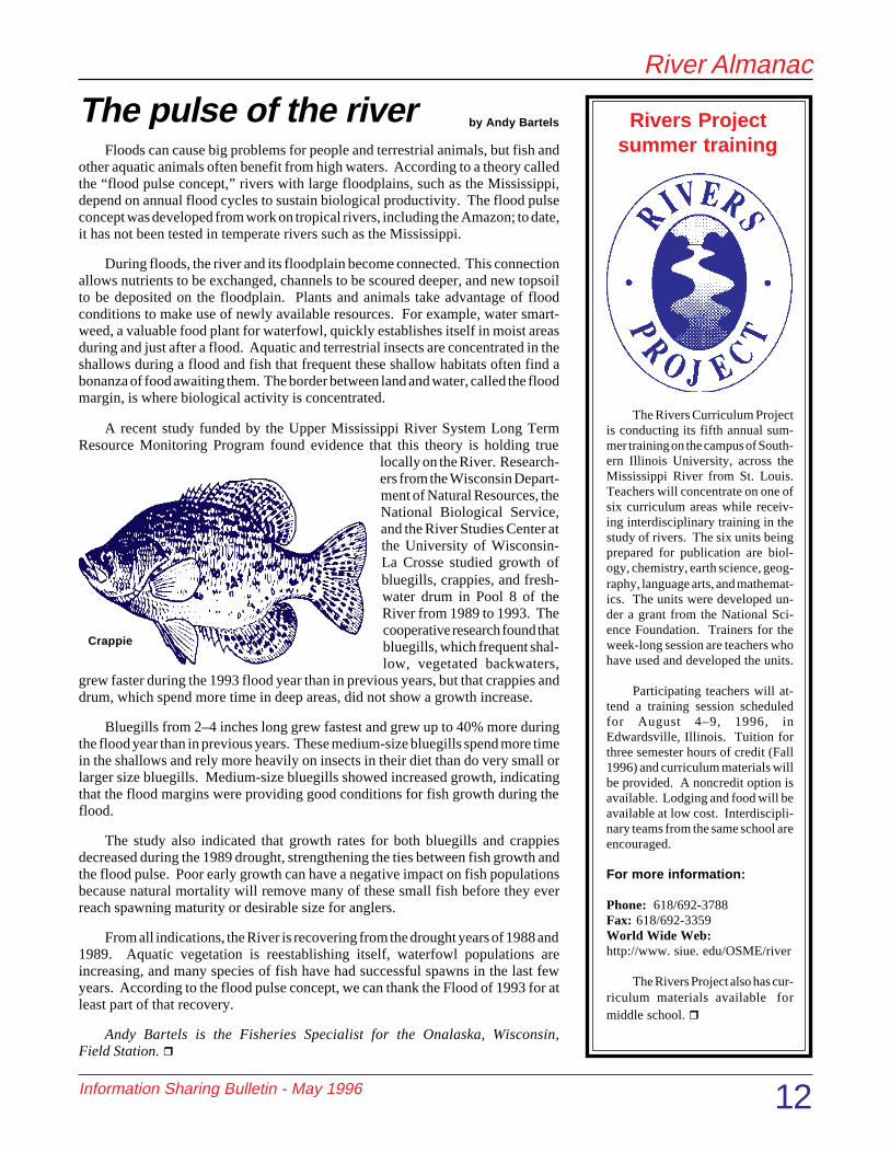
Crappie
Rivers Projectsummer training
The pulse of the river by Andy Bartels

River Almanac
Information Sharing Bulletin - May 1996 13
If ecologically meaningful infor-mation is to be useful at watershed orecoregional scales, the spatial data aboutthe biological resources within thoselandscapes must be uniform and consis-tent throughout their extents. To gener-ate geographic information system(GIS) data that meet these criteria, theUpper Midwest Gap Analysis Program(UMGAP) is developing and imple-menting rigorous regional protocols. Anequally important objective is to buildpartnerships around the developmentand application of this information.
UMGAP is part of the national GapAnalysis Program (GAP), a NationalBiological Service project being imple-mented nationwide with the help ofover 400 cooperators, including the pri-vate sector, nonprofit organizations, andmany government agencies. The pro-gram is an effort to map and analyze thedistribution of natural land cover, ter-restrial vertebrate species, and landsmanaged for conservation. UMGAP isbeing coordinated by the Environmen-tal Management Technical Center, andcurrently is in full progress in the statesof Illinois, Michigan, Minnesota, andWisconsin, while the states of Iowa,Indiana, and Ohio are in various stagesof planning or startup.
Natural Vegetation
Maps of natural vegetation are be-ing developed from satellite imageryand other available data. The EMTCacquires pertinent Landsat ThematicMapper (TM) satellite imagery fromthe EROS (Earth Resources Observa-tion System) Data Center of the U.S.Geological Survey. This imagery isreviewed, copied, and archived by theEMTC before being forwarded to eachState partner for processing. In coop-eration with the State partners, Dr. Tho-mas Lillesand, Director of the Environ-mental Remote Sensing Center, Uni-versity of Wisconsin-Madison, has de-veloped a regional image processingprotocol that is designed to take maxi-
mum advantage of existing ancillaryGIS data. The protocol calls formultidate TM imagery to be stratifiedfirst by ecoregion and then by urban/rural and upland/lowland strata prior tocomputer-assisted classification. Theobjective is to produce a regionally con-sistent classification to the alliance levelof detail following the UNESCO/TNC(United Nations Educational, Scientificand Cultural Organization/The NatureConservancy) vegetation classificationsystem, with an effective minimum map-ping unit of 1–5 acres.
Predicted Terrestrial VertebrateDistribution
Predicted species distributions aremodeled based on existing range mapsand other occurrence data, combinedwith the natural vegetation maps andinformation on the habitat affinities ofeach species. A proposed regional GISprotocol to predict the distribution ofnative terrestrial vertebrates is beingdeveloped by Dr. Nancy Mathews ofthe Department of Wildlife Ecology,University of Wisconsin-Madison. Co-operating in the development of theprotocol are the State partners, the U.S.Forest Service, the Environmental Pro-tection Agency, the Natural ResourceConservation Service, the Great LakesIndian Fish and Wildlife Commission,The Nature Conservancy, and others.Following the developed protocol andworking closely with the State partners,the EMTC will produce maps of the
predicted distribution of all breedingnative terrestrial vertebrates in theUMGAP region.
Stewardship Lands
To assess the conservation statusof species and their habitats, maps ofconservation lands (stewardship maps)are compared with maps of the distribu-tion of species and habitats. TheUMGAP State partners are responsiblefor the development of stewardshipmaps for their respective States. TheseGIS maps are developed by mappingland ownership categories into (1) allpublic lands by their managing agency,(2) voluntarily identified private landsspecifically managed for conservation,and (3) all other private lands. Indi-vidual parcel boundaries are not delin-eated on private lands not voluntarilyidentified as being specifically man-aged for conservation.
Data Distribution
As they are completed, digital the-matic maps of natural land cover, verte-brate species distribution, and steward-ship lands, all of uniform scale andformat and meeting Federal GeographicData Standards, will be made publiclyavailable via the Internet and on CD-ROM. To the extent feasible, data willbe distributed as they become avail-able, rather than waiting for the entireUMGAP project to be completed. Forthose UMGAP States currently in fullprogress, vegetation and stewardshipdata are expected to become availablebeginning in 1997. The EMTC expectsto begin making data available on pre-dicted species distribution in 1998.Currently, UMGAP is serving a geo-referenced, full resolution, single-bandcolor composite of the satellite imagerycovering one ecoregion in Minnesota.This satellite data sample and other in-formation about UMGAP can be foundon the Internet at the UMGAP WorldWide Web Home Page site:www.emtc.nbs.gov/umgaphome.html.
Daniel Fitzpatrick is the UMGAPcoordinator at the EMTC. r
The Upper Midwest Gap Analysis Programby Daniel Fitzpatrick

River Almanac
Information Sharing Bulletin - May 1996 14
Personality Profile
Robert A. (Bob) Hrabik, Team Leader ofthe Open River Field Station at Jackson,Missouri.
A closer look at the people who make the LTRMP a successby Madelon Wise
Open River Field Station TeamLeader Robert (Bob) Hrabik has an “up-beat outlook” for the Middle Missis-sippi River, that portion of the openMississippi River between St. Louis,Missouri, and Cairo, Illinois. Hrabik,who founded the Jackson, Missouri,field station and still works with hisoriginal staff of 6 years, is proud of theOpen River Field Station and its accom-plishments.
“This professor knew that my fatherand I did a lot of seining to collect baitfish,” says Hrabik. “We had purchasedbooks on our own to identify fish.”Through the 2-year grant project,Hrabik’s avocation developed into hisfirst professional love as he “catalogedmany thousands of fish” at the Univer-sity of Nebraska State Museum in Lin-coln.
“I feel I have the ability to recog-nize important characteristics that dif-ferentiate organisms.” Hrabik describeshis approach to taxonomy as “holistic,”a term that also describes his overallway of working within the LTRMP.
When he and his team were estab-lishing the Open River Field Station in1991, they recognized several impor-tant physical and biological differencesbetween the pooled and unpooled por-tions of the Mississippi River. “Be-cause of the nature of the open river,several factors that were not understoodby the LTRMP at the time went intodeveloping our program. Foremost, theMississippi River in this part of theworld has been modified to be narrow,swift, and deep. It is naturally turbidand is actually becoming less turbid,contrary to what many may think.”
“Also, our seasons come much ear-lier compared to other field stations inthe Program. We receive warmer waterearlier because of our physical habitatand geographic position. Because weare so far south, we get an influencefrom the Illinois and Missouri Rivers.These factors make sampling more chal-lenging than in the pooled regions. Asa consequence, our logistics and timeframes are different. We had to makeadjustments in 1991 to ensure compa-rable data with other field stations.”
The Mississippi River in Hrabik’sarea is not impounded with the locksand dams common farther north. Hrabik
describes more differences: “On theUpper Mississippi River above St. Louis,an ample amount of Federally ownedpublic ground provides a little bit of anenvironmental cushion. In the south,most of the land near the river is pri-vately owned, so the river has beennarrowed by levees for agriculture. Any-thing flat is rich ground and is inten-sively farmed, especially the flood-plain.”
Very little information has beenpublished on the environment of theMiddle Mississippi River, according toHrabik. “This, in part, is why the OpenRiver Field Station has become so valu-able, not only to the EnvironmentalManagement Program, but also to theStates of Missouri and Illinois.”
Hrabik is currently heading up theMiddle Mississippi River EcosystemManagement Work Group of the UpperMississippi River Conservation Com-mittee (UMRCC). The work group hasdiscovered that lack of historical datais their biggest problem. Hrabikexplains, “If we don’t know what we’velost, we don’t have a basis for
Web Sites of Interest
• Free Mini-Guide to the UpperMississippi offers a simpleoverview of a trip on the upperriver:www.greatriver.com
• About the Mississippi River:http://www.bcl.net/~whig/lonews.html#local
• Writing Tips for EnvironmentalProfessionals provides quick tipsfor environmental professionalswho want to improve the quality oftheir writing; a new tip is listed andexplained each month:http://members. aol.com/blryan/qtip.htm
• An Internet Notebook forBiologists:http://www.p-pub.com
In addition to his Team Leader du-ties, serving as an expert fish taxono-mist for the six Long Term ResourceMonitoring Program (LTRMP) fieldstations, hosting scientists from hereand abroad, and publishing in journalsand in the LTRMP report series, Hrabikis completing a master’s degree in biol-ogy with a focus on fish taxonomy andsystematics.
Fisheries biology has been a life-long interest for Hrabik, who was influ-enced by his “naturally curious andvery observant” father. While still anundergraduate at the University of Ne-braska, Hrabik received an offer from aprofessor to apply for a position cata-loging the fishes of Nebraska throughan Institute of Museum Services grant.

River Almanac
Information Sharing Bulletin - May 1996 15
Ron Rogers checks the status of the Novell network server at the EMTCto ensure smooth operation. A second Novell server was recently addedto distribute working applications and thus increase computer perfor-mance (photo by Mi Ae Lipe-Butterbrodt).
On February 20–22, 1996, Douglas A. Olsen conducted an “Introductionto ARC/INFO” workshop at the EMTC. Participants included staff mem-bers from LTRMP field stations, the Missouri Department of Conserva-tion, the National Biological Service, the U.S. Army Corps of Engineers,and the U.S. Forest Service (photo by Mi Ae Lipe-Butterbrodt).
restoration. Without the historical data, we don’tknow how to go about making changes to maintaindiversity or improve habitat.”
The Ecosystem Management Work Group con-sists of partners from the U.S. Army Corps of Engi-neers, the Illinois Department of Natural Resources,the Missouri Department of Conservation, the Na-tional Biological Service, universities, and theU.S. Fish and Wildlife Service. Hrabik explains,“Each entity has collected data over time, but thesedata are not published; rather, they are archivedaway. It will be a time-consuming, painstakingprocess—going through old files, desks, and librar-ies, and dusting off old books and papers. This jobwill take a long time, but it must be done.”
“We all know that the Middle Mississippi Riverhas changed but we are not sure by how much nor canwe agree upon the implications of these changes. Thehistorical data are being collected to document physi-cal, chemical, and biological changes over time.Then, armed with such information, we can betterdefine goals, objectives, and strategies in the contextof multipurpose needs to restore the river so it mayprovide maximum benefits to all users.” As theydraw up their plan, the Ecosystem Management WorkGroup has invited the navigation industry and otherindustries with a vested interest in the Mississippi toparticipate, notes Hrabik.
In addition to his involvement with the UMRCC,Hrabik is excited about networking with partnersfrom the Lower Mississippi Conservation Commit-tee. “The Upper Mississippi River ends at theconfluence of the Ohio River. Because we lie at thedividing line of the Upper and Lower Mississippi, wehave received interest from the Lower Mississippipeople. They view the open river data with interestbecause this stretch of the river is considered theheadwaters to the Lower Mississippi. This partner-ship will be very important for our respective pro-grams in sharing information and expertise and inbridging the gap between the Upper and LowerMississippi.”
Hrabik maintains an optimistic view of the fu-ture. “Throughout the time I’ve been here, everyonehas been trying to put on their environmental hats.Since 1991, we have forged good relationships withthe U.S. Fish and Wildlife Service, the NationalBiological Service, and the U.S. Army Corps ofEngineers by working together closely.” The partieshave begun a series of discussions about developingnew engineering technologies to help restore sidechannels and enhance habitat. Hrabik sees greatpotential in this positive cooperation. “I want tomake some difference in the world. I want to make
this world a better place for my children, and I want to leave behind alegacy for those who will carry on after I’ve put in my time so that theymay continue on the same path.”
With his hard work and optimism, Bob Hrabik's time is makinga difference.r

River Almanac
Information Sharing Bulletin - May 1996 16
New Reports
United States Department of the InteriorNational Biological ServiceEnvironmental Management Technical Center575 Lester AvenueOnalaska, WI 54650-8552608/783-7550
BULK RATEU.S. Postage Paid
Cedarburg, WI
Permit No. 199
The following reports were recentlycompleted and have been distributedto Program partners. LTRMP re-ports are available through theNational Technical InformationService, 5285 Port Royal Road,Springfield, Virginia 22161(800/553-6847 or 703/487-4650).
D’Erchia, F. 1995. Geographic infor-mation systems and remote sensing applica-tions for ecosystem management. NationalBiological Service, Environmental Manage-ment Technical Center, Onalaska, Wisconsin,revised December 1995. LTRMP 95-P001R.22 pp.
Gutreuter, S., R. Burkhardt, and K.Lubinski. 1995. Long Term Resource Moni-toring Program Procedures: Fish Monitor-ing. National Biological Service, Environ-mental Management Technical Center,Onalaska, Wisconsin, July 1995. LTRMP 95-P002-1. 42 pp. + Appendixes A-J.
Holland-Bartels, L. E., M. R. Dewey,and S. J. Zigler. 1996. Ichthyoplankton abun-dance and variance in a large river systemconcerns for long-term monitoring. Regu-lated Rivers: Research & Management 10:10-13. Reprinted by the National BiologicalService, Environmental Management Tech-nical Center, Onalaska, Wisconsin, February1996. LTRMP 96-R001. 13 pp.
Laustrup, M. 1995. Geospatial Applica-tion: Evaluation of multidate Landsat Multi-spectral Scanner data for determining changesbetween aquatic and terrestrial habitats onthe Upper Mississippi River System. NationalBiological Service, Environmental Manage-ment Technical Center, Onalaska, Wisconsin,September 1995. LTRMP 95-P009. 19 pp. +Appendixes A and B.
National Biological Service. 1995. An-nual Work Plan, Fiscal Year 1996, for theUpper Mississippi River System Long TermResource Monitoring Program. National Bio-logical Service, Environmental Management
Technical Center,Onalaska, Wisconsin,September 1995.LTRMP 95-P007. 144
pp. + Appendixes A-D.
National Biological Service.1995. Long Term Resource Monitor-ing Program Procedures. NationalBiological Service, EnvironmentalManagement Technical Center,Onalaska, Wisconsin, July 1995.LTRMP 95-P002.
National Biological Service. 1996.Proceedings, Upper Midwest Gap AnalysisMeeting, January 18-19, 1995. F. D'Erchiaand D. Fitzpatrick, editors. National Bio-logical Service, Environmental Manage-ment Technical Center, Onalaska, Wiscon-sin, April 1996. EMTC 96-G001. 66 pp. +Appendixes A-B.
National Biological Service (NBS)and U.S. Fish and Wildlife Service(USFWS). 1996. The Great River Fly-way: The Management Strategy for Mi-gratory Birds on the Upper MississippiRiver. Published by the Upper Missis-sippi Science Center, La Crosse, Wiscon-sin; Environmental Management Techni-cal Center, Onalaska, Wisconsin; andUSFWS Region 3, Fort Snelling, Minne-sota. March 1996. 20 pp.
National Biological Service. 1995.Standard operating procedures for spatialdata processing. National Biological Ser-vice, Environmental Management Tech-nical Center, Onalaska, Wisconsin, July1995. LTRMP 95-P008.
Owens, T., and J. J. Ruhser. 1996.Long Term Resource Monitoring Programstandard operating procedures: Aquaticareas database production. National Bio-logical Service, Environmental Manage-ment Technical Center, Onalaska, Wiscon-sin, March 1996. LTRMP 95-P008-6. 4pp. + Appendix. (NTIS #PB96-172267)
Raibley, P. T., K. D. Blodgett, and R.E. Sparks. 1995. Evidence of grass carp(Ctenopharyngodon idella) reproductionin the Illinois and Upper Mississippi Riv-ers. Journal of Freshwater Ecology
10(1):65-74. Reprinted by the NationalBiological Service, Environmental Manage-ment Technical Center, Onalaska, Wiscon-sin, November 1995. LTRMP 95-R008.10 pp.
Sauer, J. 1996. Annual Status Report:1992 macroinvertebrate sampling. NationalBiological Service, Environmental Manage-ment Technical Center, Onalaska, Wiscon-sin, February 1996. LTRMP 96-P001.18 pp. + Appendix A.
Thiel, P. A., and J. S. Sauer. 1995.Long Term Resource Monitoring ProgramProcedures: Macroinvertebrate monitor-ing. National Biological Service, Environ-mental Management Technical Center,Onalaska, Wisconsin, August 1995. LTRMP95-P002-2. 9 pp. + Appendixes A-G.
Tucker, J. K., and E. R. Atwood. 1995.Contiguous backwater lakes as possible refu-gia for unionid mussels in areas of heavyzebra mussel (Dreissena polymorpha) colo-nization. Journal of Freshwater Ecology10(1):43-47. Reprinted by the National Bio-logical Service, Environmental ManagementTechnical Center, Onalaska, Wisconsin, April1996. LTRMP 96-R003. 5 pp.
Tucker, J. K., and J. B. Camerer. 1995.Colonization of the dragonfly, Gomphusvastus Walsh, by the zebra mussel, Dreissenapolymorpha (Pallas) (Anisoptera:Gomphidae; - Bivalvia, Eulamellibranchia:Dreissenidae). Odonatologica 23(2):179-181. Reprinted by the National BiologicalService, Environmental Management Tech-nical Center, Onalaska, Wisconsin, Decem-ber 1995. LTRMP 95-R009. 3 pp.
U.S. Army Corps of Engineers Louis-ville District. 1995. Navigation PredictiveAnalysis Technique (NAVPAT) pilot appli-cation for Pool 13, Upper Mississippi River.National Biological Service, Environmen-tal Management Technical Center, Onalaska,Wisconsin, September 1995. LTRMP95-S001. 54 pp. + Appendixes A-D.
Wlosinski, J. H. 1996. Pool 25: Analy-sis of water levels and discharge. NationalBiological Service, Environmental Manage-ment Technical Center, Onalaska, Wiscon-sin, March 1996. LTRMP 96-T001. 88 pp.
Related Documents