December 2008 BRITANNIA BEACH SHORELINE AREA PUBLIC CONSULTATION Britannia Remediation Project REPORT Report Number: 04-1421-080 Distribution: Ministry of Agriculture and Lands Ministry of Environment Environment Canada Fisheries and Oceans Canada Golder Associates Ltd. Submitted to: Ministry of Agriculture and Lands P.O. Box 9361 Stn Prov Govt Victoria, BC V8W 9M2

Welcome message from author
This document is posted to help you gain knowledge. Please leave a comment to let me know what you think about it! Share it to your friends and learn new things together.
Transcript

December 2008
BRITANNIA BEACH SHORELINE AREA PUBLIC CONSULTATION
Britannia Remediation Project
REP
OR
T
Report Number: 04-1421-080
Distribution:
Ministry of Agriculture and Lands Ministry of Environment Environment Canada Fisheries and Oceans Canada Golder Associates Ltd.
Submitted to:Ministry of Agriculture and Lands P.O. Box 9361 Stn Prov Govt Victoria, BC V8W 9M2

BRITANNIA BEACH SHORELINE AREA PUBLIC CONSULTATION
December 2008 Report No. 04-1421-080
EXECUTIVE SUMMARY The Britannia Remediation Project is an ambitious undertaking that is the result of considerable planning and budgeting dating back to 1997. The project involves the remediation of the former Britannia Mine which operated primarily as a copper and zinc mine from 1904 to 1974. During its operational life, the mine generated over 40 million tonnes of tailings, largely deposited onto the marine, subtidal slope of Howe Sound in the area of Britannia Beach. The Province of British Columbia assumed responsibility for remediation of the Britannia Mine in April 2001; the Ministry of Agriculture and Lands (MAL) is responsible for the delivery of the Britannia Remediation Project.
The Britannia Remediation Project has had the benefit of considerable consultation that has involved:
Ongoing input from and consultation with an external Technical Advisory Committee (TAC);
Provincial and federal regulatory agencies including the Ministry of Environment (MOE), Environment Canada (EC) and Fisheries and Oceans Canada (DFO);
Public meetings and updates on the Britannia Remediation Project;
A project website (www.britanniamine.ca) where extensive and detailed technical documents can be accessed;
Quarterly update reports to the Squamish Nation;
Site meetings with MAL, their technical project managers, Golder Associates Ltd. (Golder) and the Squamish Nation; and,
Site meetings and ongoing communication with the local developer.
In support of remedial planning along the Britannia Beach shoreline, MAL initiated consultation with the local community. The objectives of this consultation were to provide an opportunity for the community to review environmental information, provide the project team with an understanding of the community’s values and aspirations for the shoreline area and their views on levels of remediation expected. This information is of broad importance to the overall remediation project and of specific importance to helping the project team set Resource Conservation Objectives.
The consultation effort included the preparation of background information on the remediation project and findings from the environmental monitoring program. This information was circulated to the community in printed form in advance of a public meeting where a narrated slide show was presented along with interactive aquarium and scientific instrument displays. Posters were also positioned in various locations in the room and technical specialists from the project team were on hand to answer questions and provide additional information to participants. Participants were then asked to complete an online or “hard copy” survey.
The survey asked participants to identify their level of awareness of the remediation project and their connection to the area (e.g., whether they were a resident), how they currently use the shoreline area, and their desired use and future vision for the shoreline area. They were also asked about their views on the level of ecological restoration that they expected for the shoreline area.
The report provides an analysis of the data obtained from the survey and from direct feedback during the public meeting. An interpretive summary of narrative feedback received is provided, and comments received, in their original form have also been included.

BRITANNIA BEACH SHORELINE AREA PUBLIC CONSULTATION
December 2008 Report No. 04-1421-080
Most of the respondents were residents of the community of Britannia Beach and indicated that they felt they had a good level of awareness of the Britannia Remediation Project. The survey results represent the views of people who live in, or are otherwise closely associated with the community of Britannia Beach.
Survey responses indicate there was a clear desire for the community to have safe access to the waterfront area. The predominant views on ecological restoration reflected a desire to see environmental improvements but those views were balanced by costs and an understanding that the shoreline has been impacted from mining activities. Respondents also indicated a desire to see retention of the community’s heritage as well as some commercial (but not residential) development.

BRITANNIA BEACH SHORELINE AREA PUBLIC CONSULTATION
December 2008 Report No. 04-1421-080 i
Table of Contents
1.0 INTRODUCTION AND BACKGROUND ...........................................................................................................................1
1.1 Consultation Objectives .......................................................................................................................................2
2.0 BRITANNIA SHORELINE REMEDIATION – COMMUNITY CONSULTATION................................................................3
2.1 Consultation Approach.........................................................................................................................................3
2.2 Scope of Community Consulted...........................................................................................................................3
2.3 Consultation Tools ...............................................................................................................................................4
2.3.1 Community Open House ................................................................................................................................4
2.3.2 Survey ............................................................................................................................................................5
3.0 RESULTS OF THE SURVEY............................................................................................................................................6
3.1 Respondent Background......................................................................................................................................6
3.2 Views on Current Shoreline Use ..........................................................................................................................7
3.3 Desired Use and Vision for the Shoreline Area....................................................................................................9
3.4 Additional Comments .........................................................................................................................................15
4.0 SUMMARY AND CONCLUSIONS..................................................................................................................................17
FIGURES
Figure 1: Location of the Britannia Mine
APPENDICES
APPENDIX A Project Summary and Background Information
APPENDIX B Community Flyer
APPENDIX C Open-house Poster Displays
APPENDIX D Public Consultation Survey
APPENDIX E Hand-drawn Sketch of One Respondent’s Vision of the Britannia Shoreline

BRITANNIA BEACH SHORELINE AREA PUBLIC CONSULTATION
December 2008 Report No. 04-1421-080 1
1.0 INTRODUCTION AND BACKGROUND The former Britannia Mine (45 km north of Vancouver, adjacent to Howe Sound; Figure 1) operated primarily as a copper and zinc mine from 1904 to 1974. During its operational life, the mine generated over 40 million tonnes of tailings, largely deposited onto the marine, subtidal slope of Howe Sound in the area of Britannia Beach. Mining operations also led to the generation of acid rock drainage (ARD) that was historically released from two point discharges (2200 Level and 4100 Level portals) which, along with other non-point sources, drained into Britannia Creek. Soil contamination, in combination with non point source ARD, has also resulted in elevated concentrations of metals in groundwater, which in the alluvial fan area of Britannia Creek (Fan Area) subsequently discharge to Howe Sound’s intertidal zone. The Province of British Columbia assumed responsibility for remediation of the Britannia Mine in April 2001; the Ministry of Agriculture and Lands (MAL) is responsible for delivery of the Britannia Remediation Project.
The Britannia Remediation Project is an ambitious undertaking that is the result of considerable planning and budgeting dating back to 1997. Significant stakeholder consultation took place in the development of the remediation plan. Additional technical oversight was provided by an external Technical Advisory Committee (TAC). Throughout the program implementation, the Ministry of Environment (MOE) has provided regulatory oversight and has been joined in these efforts by Environment Canada (EC) and Fisheries and Oceans Canada (DFO) for matters concerned with the mandate of those agencies.
In 2003, an Overall Remediation Plan (ORP) was developed to address site remedial planning, construction of a water treatment plant, treated effluent outfall construction and the disposal of contaminated soils and water treatment plant sludge. The ORP was developed in consultation with the external Technical Advisory Committee, provincial and federal regulators, stakeholders, various technical consultants and technical specialists in the Ministry of Agriculture and Land. Communication and consultation approaches have included technical workshops with the TAC, public meetings and updates on site, and a project web site that makes extensive and detailed project documentation available on the internet (www.britanniamine.ca).
Figure 1: Location of the Britannia Mine

BRITANNIA BEACH SHORELINE AREA PUBLIC CONSULTATION
December 2008 Report No. 04-1421-080 2
1.1 Consultation Objectives The Britannia Fan Area is the portion of the former Britannia Mine site that is most visible to the public and is the area that is most directly connected to the people who live in the community of Britannia Beach. It therefore follows that the local community could be impacted by remedial decisions. The aspirations, expectations and vision of members of the community should be documented so that remedial actions reflect community wishes to the greatest extent possible. This perspective is in keeping with the working view that remediation of the former mine site includes, in addition to controlling ecological impacts, enhancing the local community.1
A remediation program manager for an area that is contaminated needs to know “how clean is clean enough”? This is often expressed in terms of chemical concentrations in soil, sediment or water and, as a starting point, numeric environmental quality guidelines may be used. However, such guidelines are derived using conservative assumptions and most commonly laboratory exposure scenarios. They are not always attainable or can be exceeded under natural background conditions and therefore site-specific remediation objectives, based on environmental protection criteria, may need to be established.
The question of “how clean is clean enough?” can also be considered in ecological terms rather than numeric contaminant concentrations. The term “Resource Conservation Objectives” (RCOs) is used here to provide a description of ecological function and conditions that are considered to be sufficient in the context of the site. These could be expressed in functional terms such as food organism production in that habitat or as a statement of ecological condition, such as the existence and extent of a shoreline species or group of organisms.
The objectives of the community consultation were to:
Provide an opportunity for the community to review environmental information in the Fan Area and comment/contribute to that knowledge;
Provide an opportunity to offer input that can influence future site assessment and management decisions;
Provide an opportunity to identify environmental and land use priorities;
Identify community values in relation to the Fan Area;
Additionally, the objectives of this consultation were to define, with the input of others, the basis for RCOs to be set (along with regulatory agency participation) that will drive the direction of future site remediation efforts.
The present report provides an overview of the input received from the community along with the detailed data.2 In addition to the community’s responses, there are also regulatory drivers that the Britannia Remediation Program is subject to. Regulatory agency officials participated as observers in the consultation program and a meeting with regulators is planned for January 2009.
1 O’Hara, G., B. Azevedo, J. Bordian, and K. Clausen. 2007. Britannia Mine: back to the future…remediation progress at Britannia and a bright future as a consequence. In: W. Price et al. (eds.). Proceedings of the 31st Annual British Columbia Mine Reclamation Symposium “Rejuvenation Through Reclamation and Operating for Closure.” The British Columbia Technical and Research Committee on Reclamation.
2 The opinions expressed in this document are those of members of the public responding to a survey conducted by Golder on behalf of MAL, and are not Golder’s opinions.

BRITANNIA BEACH SHORELINE AREA PUBLIC CONSULTATION
December 2008 Report No. 04-1421-080 3
2.0 BRITANNIA SHORELINE REMEDIATION – COMMUNITY CONSULTATION
2.1 Consultation Approach
In addition to the ongoing consultation that has been part of the Britannia Remediation Project, a focused effort to seek input from the local community regarding the Fan Area shoreline was undertaken. The shoreline consultation effort involved:
Identification of the scope of who would be consulted;
Preparation and dissemination of background environmental information;
Presentation of background environmental information and scientific methods in a public meeting;
An opportunity for the community to pose questions and get answers directly from the project team;
Obtaining feedback from the community through an “open floor” and completion of a survey provided in hard copy at the open house or available electronically via the internet.
2.2 Scope of Community Consulted
Groups identified for consultation were those considered to be most potentially affected by the setting of RCOs in the Fan Area. The impacts along the shoreline of the Fan Area are real and are locally significant. However, data from an ongoing monitoring program3 indicates that significant impacts are unlikely to reach far beyond the area of Britannia Beach and thus the scope of participants identified were primarily those who are part of the local community.
First Nations – The Britannia Mine site is located in the Squamish Nation’s traditional territory. Their use and dependence on ecological resources across their traditional area is acknowledged. The Squamish Nation could be affected by the RCOs set and the potential outcomes associated with them.
Local Community – The local community of Britannia Beach can potentially be directly affected by the Britannia Remediation project as they live adjacent to the Fan Area. Residents in the nearby community of Furry Creek may also be potentially affected by remedial decisions.
Local Government – The Squamish Lillooet Regional District (SLRD) has several functions, such as planning, that could be potentially impacted by the outcomes of remedial decisions. A local government representative (Area D Representative), who resides in the adjacent community of Furry Creek was invited to participate.
Ministry of Environment – The BC Ministry of Environment, Land Remediation Branch continues to provide an active regulatory role on the Britannia Remediation Project. The outcomes of risk assessment and/or the management of risks need to meet their legislative and policy requirements. The Ministry exercised an auditing role during the consultation program.
Federal Environmental Agencies – Fisheries and Oceans Canada (DFO) and Environment Canada (EC) both have responsibilities that impact risk assessment and remedial activities. DFO are the agency responsible for the conservation and management of marine resources and EC are responsible for the management and control of contaminants that may impact on those resources.
3 Golder Associates Ltd. 2008. Interpretive Report on 2004-2007 Environmental Monitoring: Britannia Mine. Report prepared for Ministry of Agriculture and Lands. June 2008.

BRITANNIA BEACH SHORELINE AREA PUBLIC CONSULTATION
December 2008 Report No. 04-1421-080 4
The dissemination of information regarding the consultation effort and request for participation in an open house was as follows:
Project summary and backgrounder – a layperson-oriented document was prepared to provide accessible background information and characterization of the environmental issues (Appendix A).
Project Web Site (Britannia Remediation Project Web Site) – the project website (www.britanniaproject.com) provides transparent and accessible technical and project management details for those who wish to obtain a greater depth of background information. Background information, slides from the public meeting presentation and a link to the online survey were posted to the website.
Community Flyer – The Britannia Post Office distributed flyers to residences at Britannia Beach (Appendix B).
Britannia Community Association – The Britannia Community Association maintains contact with members of the community and email distribution lists for all members. An email invitation, along with electronic copies of background information was sent to the Britannia Community Association who subsequently relayed the email to their distribution list.
2.3 Consultation Tools 2.3.1 Community Open House A community open house was held at the Britannia Community Hall on Wednesday, June 25, 2008 from 7:00 pm to 9:30 pm. A total of 36 people, including Britannia Bay residents (23), local businesses (2), residents of nearby communities (5), a representative of the Squamish Nation (1), and federal, provincial and local government agency staff (5) signed in.4 The open house was also attended by staff from MAL (2) and Golder (4).5
Displays provided hands-on context to the environmental monitoring program. A series of posters featured background on acid rock drainage (ARD) and some of the remediation efforts that have been carried out to date, an overview of the contaminant chemistry in the shoreline environment and an overview of the ecological community that is present in ARD-impacted and un-impacted study areas (Appendix C). Sea-water aquaria provided the public with an example of what the shoreline community looked like in impacted areas of the Britannia Beach shoreline and in study reference areas elsewhere in Howe Sound. Also on display was some of the research equipment that is used in the marine monitoring program. Members of the project team were available to answer questions or to provide more detail. Casual feedback and perspective received during this time was noted by project team members.
4 The sign-in sheet has been retained on record and is available for audit by regulatory agencies if they require. It has not been appended to this report to maintain confidentiality of the participants.
5 As hosts of the open house, MAL and Golder staff were not included in the tally of attendees.
Participants at the Britannia Community Consultation

BRITANNIA BEACH SHORELINE AREA PUBLIC CONSULTATION
December 2008 Report No. 04-1421-080 5
Following welcoming remarks to the community meeting by the MAL Crown Contaminated Sites Program Manager (Gregg Stewart) and introduction of project team members and agency staff in attendance, a narrated slideshow presentation was provided by members of the project team. The slide show provided an overview of the objectives of the consultation program, the Britannia Remediation Project and remedial progress that has been made to date as well as an overview of the findings of the environmental monitoring program. The slide concluded by “turning over the floor” to the community and inviting comment from those who felt comfortable speaking publicly and requesting their feedback on the hard-copy or online-questionnaire. Project team members remained behind to take additional questions and feedback from those less inclined to speak in public.
Some of the most common comments received during the open comment/question period included the following:
Enjoyment of the casual format of the meeting and the visuals (posters, sampling equipment, aquaria showing examples of impacted and unimpacted communities);
In recent years, residents have seen an increase in biodiversity (e.g., perch and river otters by the marina, algae and barnacles now growing on moored vessels); and,
General concern regarding the lack of accessibility to the waterfront (i.e., presence of railway tracks; the fenced off concentrate wharf).
2.3.2 Survey A questionnaire was provided in hard copy at the community open house and was available on-line6 until July 31, 2008. A copy of the printed questionnaire and the online questions is provided in Appendix D. The questions were oriented around seeking the respondents’ views on the current use7 of the shoreline area, the desired use and vision for the shoreline area, background information on the respondent and information on the respondents self-identified level of awareness and knowledge regarding the Britannia Remediation Project.
6 http://websurvey.golder.com/wsb.dll/lnikl/BritanniaShorelineConsultation.htm
7 “use” includes use by people and ecological use.

BRITANNIA BEACH SHORELINE AREA PUBLIC CONSULTATION
December 2008 Report No. 04-1421-080 6
3.0 RESULTS OF THE SURVEY A total of 30 responses were received: 24 via the websurvey, and six hand-written questionnaires were submitted at the open house or subsequently mailed to Golder. Survey responses, grouped by question category (Section 2.3.2) are provided below. The results presented include hard copy and online responses summarized in aggregate.
3.1 Respondent Background Respondents were asked to identify their association with Britannia Beach by selecting a check box. More than one option could be selected because a respondent could, for example, be a Britannia Resident and as well as a having a business association with Britannia Beach. Members of the Britannia Remediation Project technical team were specifically requested not to fill out the survey as the objective was to solicit representative community views regarding the project.
Most respondents (83%) identified themselves as a resident of the community of Britannia Beach as illustrated below. One respondent who selected the category of other identified themselves as a property owner. No respondents identified themselves as scientists, engineers, members of non-governmental environmental organizations or regulators (who will have regulatory input into the remediation program).
Connection of Respondent to Britannia Beach
0% 20% 40% 60% 80% 100%
Environmental Organization
Government - Regulator
Scientist / Engineer
Government - Local
Other
Resident of a nearby Community
Business
Drive through
First Nations
Recreation
Britannia Resident
Percentage of Respondents
Participants were asked about their level of awareness of the Britannia Remediation Project by selecting one of three categories (“not at all”, “somewhat” or “very”). Respondents felt that they were either very aware (62%) or somewhat aware (38%) of the Britannia Remediation Project. None of the respondents indicated that they knew nothing about the project, and one respondent did not answer this question.
The sources of information accessed by community members were queried by asking them to select check boxes (multiple selections were allowed) from a list of potential sources, including an option for “other” if their information source was not listed. The project website (www.britanniamine.ca) was the most frequently selected source of information followed by local sources of information such as other community members and the Britannia Mine Museum. Seven people identified “other” as their source of information (e.g., past owners, various government employees and private scientists, from their own participation in community groups at Britannia Beach, community events at the EPCOR water treatment facility). Responses are illustrated below.

BRITANNIA BEACH SHORELINE AREA PUBLIC CONSULTATION
December 2008 Report No. 04-1421-080 7
Sources of Information About the Britannia Remediation Project
0 5 10 15 20 25
The Britannia Mine Manager
From Technical Advisory Committee Members
Other
Newspaper/other media
Britannia Mine Museum
From others in the Community
Project Website
Number of Resondents
The collection of responses, on the basis of these data, is therefore believed to reflect the views of the layperson who lives or is otherwise closely associated with the community of Britannia Beach and considers themselves to be reasonably well informed of the Britannia Remediation Project.
3.2 Views on Current Shoreline Use Current use was explored by asking participants to provide narrative commentary about how they use the Britannia Beach shoreline and whether or not they avoid use of the shoreline. The overwhelming use of the shoreline identified by respondents was for recreational purposes such as walking, boating, and fishing. Access to the shoreline was either specifically commented on or was implicitly necessary to engage in the identified uses. Comments received in the on-line survey and from hand-written responses are shown in the box below.8
I dont live but work in vicinity, shoreline used for passive use.
Not much . Occasionaly walk under the old bridge to the shoreline and skip rocks with the kids and look for crabs.
kayaking, birdwatching, tent camping, beach fires, socializing, crab fishing, fin fishing (kids only)
Walking, beach combing, firewood gathering.some swimming if warm enough.
I would like to be able to walk along the old dock and sit and enjoy the wharf. Long to to be able to do some fishing off the wharf
Go for walks out to Minaty Bay, boating from the community docks and as a meeting place to socialize.
We used to use it quite a bit, we used to go to shipwreck beach almost daily and of course Minaty Bay, until the security guards started kicking us out of there, simply for just walking through.
Rarely, I have gone down there to watch the Squamish Regatta.
Recreation
Public access (walking)
8 All respondent comments are provided directly as received, either from the websurvey or from hand-written responses, and have not
been edited.

BRITANNIA BEACH SHORELINE AREA PUBLIC CONSULTATION
December 2008 Report No. 04-1421-080 8
For fun and recreation.
We go to the shoreline to sit on the rocks and watch the ocean
Recreational
I walk there sometimes and take photographs
We rarely use it any more because it is so unaccessable.
I enjoy the unobstructed view from home and work.
Picnic, Walking/ Hiking
Swimming, kyaking, picnicing
socializing, kayaking, campfires, camping
swimming, fishing, kayaking/sailing
Photography is my hobby so I like to take photos from the Shoreline.
Camping, walking, fishing
for waliking/hiking
We can’t. Its behind chainlink fencing. Access is blocked.
Walking, swimming. Harvest firewood, small boat
Walking shoreline, hope to launch kayak
It is an integral part of our community. From time to time residents meet on the community docks. Many of us walk out to Minaty Bay. (Would be nice to see the historic access reopened for public use). Boating, beachcombing, picnics along the greenspace.
do not use
Boating with family, or cocktail boating with friends, sitting & enjoying the views of the history or the storms. Fishing, Boat camping, looking for driftwood, stress walks or Dirt Biking along the trail to Minaty Bay
Participants were also asked if they currently avoid using the shoreline and if so, why. Most respondents (68%) indicated that they avoid the shoreline, primarily due to safety of access or the current appearance of the shoreline. About 12% of the respondents attributed avoidance of the shoreline area to contamination and one respondent asked whether they should be avoiding the shoreline area. About one third of respondents indicated that they do not avoid the shoreline area. Specific comments on avoidance of the shoreline area by respondents are shown in the box below.
Should I
No.
at my age, scaling the gulag quality chainlink fence would be unseemly and possibly dangerous
Yes. Because it is not accessable and it is not safe.
No
I have mobility problems, so I can't go for a walk along the shore. I would love to see some kind of a level walking area made available.
limited accessiblity
Usually no, but there have been some pollution and littering concerns that are unpleasant to deal with.
We don't go down there much because of the state of the place.
No

BRITANNIA BEACH SHORELINE AREA PUBLIC CONSULTATION
December 2008 Report No. 04-1421-080 9
no
Yes, it is awkward to get there, the train tracks and then most of it is fenced now.
Currently the area directly in front of Britannia is dangerous and unattractive - plus have to access other shoreline areas along rail tracks which is highly problematic.
Yes, basically because pedestrian access is poor to get to the water. There is no public area for relaxing or swimming unless you walk along railway tracks (illegally)
no
yes because i worry about the pollution so i hesitate to use it.
Yes, I have heard of the contamination there.
In recent times, I have been discouraged from using the shoreline because of poor access during road construction and conflict over public use of land around Minaty Bay.
No
Fenced off.
No, but I resent having to trespass around the existing fencing and having to avoid dangerous areas (old dock, customs house, derelict ships)
Sometimes. Safe access, lack of marine life (downer)
Only the old commercial area now chainlink fenced!! Because it is closed, not unsafe
I can’t walk on rough uneven ground. Mobility problems.
We are so lucking to have the useage of this foreshore. Don’t use it if you can’t enjoy it (don’t complain).
3.3 Desired Use and Vision for the Shoreline Area Four questions were related to the respondent’s desired use and vision for the shoreline area including free-form narrative commentary, selection of a top priority vision from a list and an opportunity to rank their top three shoreline uses in order of priority. When asked to rank a list of shoreline uses in order of priority, most respondents (41%) selected public access and use as their first priority followed by shoreline ecology (21%) as illustrated below.
Respondent's First Priority
0 2 4 6 8 10 12 14
Other - Please comment at end of survey
Fishing
Tourism Development
Economic / Commercial Development
Swimming
Boat Access
Heritage Features
Ecology - Vibrant Shoreline Ecosystem
Public Access/Use
Number of Respondents

BRITANNIA BEACH SHORELINE AREA PUBLIC CONSULTATION
December 2008 Report No. 04-1421-080 10
For their second-ranked priority, most respondents (24%) selected boat access with public access and shoreline ecology being the equal second choice of respondents (17%). One respondent indicated as a second priority that they collect driftwood from the beach for firewood.
Respondent's Second Priority
0 2 4 6 8 10 12 14
Other - Please comment at end of survey
Fishing
Tourism Development
Economic / Commercial Development
Swimming
Boat Access
Heritage Features
Ecology - Vibrant Shoreline Ecosystem
Public Access/Use
Number of Respondents
Public access was selected as the third priority for 21% of respondents, and tourist development and heritage features were the equal second choice for 18% of respondents.
Respondent's Third Priority
0 2 4 6 8 10 12
Other - Please comment at end of survey
Fishing
Tourism Development
Economic / Commercial Development
Swimming
Boat Access
Heritage Features
Ecology - Vibrant Shoreline Ecosystem
Public Access/Use
Number of Respondents

BRITANNIA BEACH SHORELINE AREA PUBLIC CONSULTATION
December 2008 Report No. 04-1421-080 11
When the respondents top three priorities were considered in aggregate, the first priority remained public use for 27% of respondents. Shoreline ecology was second choice (16%) with heritage features ranked third (15%).
Aggregate of Respondent's Top Three Priorities
0 5 10 15 20 25
Other - Please comment at end of survey
Fishing
Tourism Development
Economic / Commercial Development
Swimming
Boat Access
Heritage Features
Ecology - Vibrant Shoreline Ecosystem
Public Access/Use
Number of Respondents
Respondents’ views on an appropriate level of remediation were explored by asking them to select a single option that best reflected their vision for the shoreline. The options ranged from remediation to a pristine9 condition without any consideration of cost to those that reflected a low priority for shoreline remediation. Intermediate in that spectrum were a series of choices balancing human uses and an ecologically-functional shoreline as illustrated below.
Vision for the Britannia Beach Shoreline
I want healthy intertidal plants and
animals, but my priority is for use by
people
Other
Shoreline remediation isn't a
priority for me, if impacts are localized
to a small area
It should be like the rest of Howe Sound, regardless of cost
It should be like the rest of Howe Sound if
the costs are reasonable
Serious impacts should be
addressed but the shoreline does not need to be like the
rest of Howe Sound
9 “Pristine” as used here refers to a shoreline that resembles that of the rest of Howe Sound, in unimpacted areas.

BRITANNIA BEACH SHORELINE AREA PUBLIC CONSULTATION
December 2008 Report No. 04-1421-080 12
Moderate views on remedial targets were expressed by 76% of respondents. The views on either end of the spectrum (i.e., those favouring pristine conditions regardless of cost or those for whom remediation was not a priority) were held by a minority of respondents (14%), with 7% of respondents expecting a pristine shoreline, regardless of any cost implications.
Four respondents selected the “other” option and provided the following narrative comments:
find a balance, abandon the either/or dichotomy trap
acid water keeps off barnacles on boats
Preserve and maintain existing heritage structures and features
Mitigate the impact of mining in a practical manner.
Specific comments provided together with the respondents’ vision for the shoreline included the following:
stabilize it and let it heal on it's own
It should be part of the history of our community
We are obligated to restore the habitat that has been compromised. Specific areas designated for recreational and commercial use must find an harmonic balance within the dominant ecosystem
the area may not have originally been like the rest of howe sound, so it might be overly challenging to completely change the environment (already existing minerals etc).
Swimming
Create a natural park setting for public enjoyment
Dock enhancements needed
In the long term...
The rest of H.S. is not so great around pulp mills, log sorts & Sq. oceanfront.
The two remaining questions relating to use and vision for the shoreline requested a narrative response. The first of these related to the respondent’s values regarding the shoreline by asking what is important to them about it. In general, respondents’ value the shoreline area as being publicly accessible and a place where they can pursue their desired uses such as walking, boating, or scenic pursuits such as photography. Remediation of the pollution also featured prominently, presumably because the shoreline is seen as a connecting point to the natural features of Howe Sound.
Specific comments received on what is viewed as being important to respondents were as follows:
Reestablishing to best pratisces a stable ecology within affordable parameters
That it is safe for my children
Being able to do all of the above. The lands must remain as a Crown asset. (ie. its ours already, let's keep it )
unimpeded access.this is one of a handfull( 3 or 4) of public access points in all of howe sound.
The untamed beauty of the sound. When sitting near the beach the sights and sounds give me a peacefull place of rest.
Mitigating the pollution, retaining the historic element of the Custom's Wharf and infra sturcture

BRITANNIA BEACH SHORELINE AREA PUBLIC CONSULTATION
December 2008 Report No. 04-1421-080 13
(Custom's House and Pier), and facilitating public utility i.e. Marina, commercial development of area surrounding the concentrate shed
Preservation.
It's scenic beauty. Great for taking pictures.
Annual Polar Bear swim and boat launching facilities
healthy accessible shoreline
That it is accessible and safe for public use.
I would love to see a beach area with picnic benches and seats to just watch the ocean and mountains. I would like it to be more visitor friendly
The fact that the community as always had use of the area.
It is photogenic
Nothing, the way it is now.
Preserve and restore historic structures; maintain and enhance parkland in keeping with the existing natural setting
Green Space, accessible.
That it is the waterway access to the community for boats and that the residents and visitors should have access to the water for boating / and or swimming. Features that encourage marine life enhancement needed.
That it accessible to do the things I enjoy without commercialization
the nice beach where the old shipwreck was is a haven.
Marine life habitat is important to the shoreline for me.
I consider it important for access to the shoreline to be improved, but also that the adjacent land between the shore and highway remain largely undeveloped.
To clean it up, preserve as much natural wilderness as possible but to provide access to the community at the same time, if possible.
Free access
Most important is accessibility for all, next is to preserve natural ecosystem after the old tailing dump (parking lot) is remediated. I would not object to limited marina or docking use provided it does not pollute, interfere w/ small craft use or public use of beaches.
Tidal shore life !! Seagulls shellfish fishing. Ripple effect of shore life ….
Keeping public access to the entire shoreline and restoring fish habitat. No widening current hyw!! Perhaps a pedestrian overpass (ideally historic replication of mining overpass).
The view
The Union Dock, The useage of the Britannia Beach Community dock. The spit that the Union Dock sits on (the point). Community freedom to the area (no gates) tolls etc.
The second narrative response question asked respondents to identify what they thought the shoreline should be used for if it were up to them. For half of the respondents, a vision of the shoreline area included various forms and degrees of development. Generally, some commercial and tourism development was desired but the nature of the development would need to include a “public realm” along the shoreline to facilitate safe and easy access. A marina and/or some form of boating facilities were frequently mentioned in the responses, and one respondent included a hand-drawn sketch of their vision for the waterfront along with the survey they returned to Golder (Appendix E). The detailed responses are shown below.
BRITANNIA BEACH SHORELINE AREA PUBLIC CONSULTATION
December 2008 Report No. 04-1421-080 14
active and passive uses of shoreline and water
similar to granvile island . Hotel , market , marina , seawall , park
See above include also windsurfing and sailing and open it up for fishing.
as above.
Walking paths with benches along the way; Telescopes to look around the sound like they have at Portu Cove on the wharf; A walk down memory lane with tributes to all that have passes through the community (this could be put on a ticker tape and run through a light house on the old wharf building where travelers waiting for the next boat to come in); A friend of mine is keeping an updated list of all the people that have passed away that lived at Britannia.
As well defined in the Charrette process facilitated by Patrick Condon, and in the Official Community Plan, there is common vision which incorporates the entire foreshore that would see public access throughout with a mix of recreational and commercial utility in the form of a marina and; development of the commercial wharf. Both Granville Island and Snug Cove could serve as models of reference.
For the general boating public, both residential and for the boaters who want to drop anchor and visit our community.
Build up the shoreline with all of the leftover boulders from the highway construction to make more land, to build shops, a marina and a seawall.
Same as now, with more business development
public access (walking/boating/fishing) and some tourism (waterfront cafe/boardwalk)
Recreation and parkland and an access point for recreational water vessels of all kinds.
For recreation, picnics, playground for children. A place to sit and enjoy the scenery. that's why we live in Britannia
Recreational/Tourism such as boating. kyaking
walking and taking photographs
Being able to go for walks down there, having access to the water and the "beach".
Opportunity for highlighting the historic use of the waterfront in partnership with the Museum through Interpretive Signage and the preservation, restoration and maintenance of the existing historic site structures (Customs Wharf, Customs House, Concentrate Shed); public access parkland in a natural setting; possibly a small boat harbour and cafe and adaptive reuse of exisitng building such as the use of the concentrate shed for a farmer's market. I would not like to see any additional buildings place on the waterfront.
I would love to see a Park at the cove on the Makin Lands. Directly in front of Britannia Beach I would LOVE to see some public green space, a pier, marina/ boat launch, perhaps enough dock space for transportation services (float planes, water taxi, station stop for rail service etc) and Restaurant. Something along the lines of Steveston or Horshshoe Bay (With the Boathouse Restaurant on the peir, marina, and public park - perfect combination.)
Tourism, boating, swimming and eco-research and eco tourism.
The shoreline would be used for fishing and the above mentioned uses.
i actually wouldn't be opposed to improving access/facilities at said beach or closer to minaty bay.
I would like to see a boat marina with a nice boardwalk with small shops. It would also be nice to have a small sea plane facility there too.
I would like to see the shoreline used primarily for recreation, such as walking/jogging, fishing, boating, swimming, etc.
Community access for walking trails, maybe a community market area, just being cleaned up for use would be nice.
Recreation
Mixed tourist commercial w/ at least half as public open space w/ beach (beach park)

BRITANNIA BEACH SHORELINE AREA PUBLIC CONSULTATION
December 2008 Report No. 04-1421-080 15
Water sport friendly (safe boat launch, piers). Trail system. Park/history trail.
Recreational use for public with a mixed utility, ie. Marina, reatail development for artisans, public market *it would be really nice to see a salmon run established our of Britannia Creek with spawning channels on the north creek side. Public resource showcase!!
Marina + maybe some shops
Community marina, dryland marina, marina park for kids. Picnic area. Destination for boaters to go to, wet marina acess to Britannia new town & shops
3.4 Additional Comments The final question on the survey was open-ended to provide a forum for respondents to provide whatever commentary they wished. This ranged from opinions on the consultation process, to suggestions for rationalizing the cost of remediation (i.e., linking remedial objectives to shoreline development plans so that project funds are spent where remediation will result in the most benefits), and further affirmation of the importance of safe shoreline access for all. Specific comments are provided below.
As comments are received and tabulated; I suggest they be shared with local govt; SLRD Planning staff to assist in process and future planning. Presentation to the Board may be suggested along the line at some point; Nice presentation and summary of works to date !
Its a great start . it took many decades to screw up the shore; it might well take decades to sort it out I would be happy to see the acidic water contained for treatment; other then that; some stabilization would be great. What effect would pulling the piles and dolphins out have? would this weaken the delta edge? if this is possible; this aspect would have a great impact on the over all look of the beach.
Well done! Enjoyed the handouts To bad the meeting could not be wheelchair accessable for my dad (oldest miner living in Britannia to be able to attend)
Britannia has served as a model of co-operative initiative. Countless people have participated in the process lending both time and expertise. I am confident that we will see our collective vision realized in due time. The tide has turned.
Many people besides myself were under the mistaken impression that this meeting would be about what we would like to see built on the shoreline; instead we were subjected to a long; boring almost inaudible speech about polution.
If the area in general is going to be redeveloped into anything like the concept drawings why is so much effort going into the remediation? Building a dock will kill any marine life that comes comes back. And tying up large boats will ensure that it never comes back. I feel that the long term approach should be to define specific development areas and try to remediate the periferal areas where shoreline development will not happen.
It is an beautiful area and it would be good for the community to have an accessible/vibrant waterfront.
Please make the shoreline clean and accessible to all. Thank you.
Re: Question #6- to me public access/use would be also for boating for residnts and possibly non-residents.
The boat dock should not be operated by the community association. It is a huge liability which they can ill afford. It should be taken over by someone more professional who has the resources to operate it properly.
Make it so that those of us that live here can access the "beach"!
Mixed use that is simple; flexible; sustainable. An attractive area for residents day use and visitors.

BRITANNIA BEACH SHORELINE AREA PUBLIC CONSULTATION
December 2008 Report No. 04-1421-080 16
Britannia Beach could be a model by which other communities begin to value the ecology of their water front through swimming and other non-invasive activities.
Keep the greedy developers away from it. With so little public access on the Sound it would be nice to see a designated park but the lands are held privately at the southern (Minaty Bay) region.
Would be nice to see lime treatment process eventually replaced with a bioremediation (a la NTBC bio/chem process) system that recovers minerals and becomes more cost effective. $750,000 annually in perpetuity is daunting for all but the service contractors like EPCOR. Enormously significant is the restoration of the customs dock, shed and building as a heritage site!! The marine element of Britannia development is a critical historic element. the community petitioned the SLRD to place a notation of interest to the title for this reason.
I believe this foreshore is a gold mine to the community and for the town. Theirs enough space to do everything we need for the new foreshore but parking? Drawn map is attached to survey form

BRITANNIA BEACH SHORELINE AREA PUBLIC CONSULTATION
December 2008 Report No. 04-1421-080 17
4.0 SUMMARY AND CONCLUSIONS A majority of those attending the public open house and responding to the survey were residents of Britannia Beach and therefore the responses summarized above reflect the views of people who live in, or are otherwise closely associated with, the community of Britannia Beach. Respondents also indicated they feel that they are generally well aware of the Britannia Remediation Project. The most common responses regarding current and desired future uses for the shoreline include public access for recreational activities such as walking along the beach and boating, and an expectation of restoring an ecologically functional shoreline relative to past industrial use.
In terms of the extent of remediation needed, the community expectations are moderated by the view that, contamination aside, the shoreline is not in a natural state. There is not an expectation for the intertidal community to resemble a state similar to unpolluted areas of Howe Sound and there may be sensitivity to the costs of doing so.
There is also a desire to see some form of development but only if public access to the shoreline areas is part of such development. It is clear from the consultation conducted that any remedial decision should include public access to the Britannia Beach shoreline and that such remediation does not preclude the potential for some form of commercial development acceptable to the community.
BRITANNIA BEACH SHORELINE AREA PUBLIC CONSULTATION
December 2008 Report No. 04-1421-080
Report Signature Page
GOLDER ASSOCIATES LTD.
Lee Nikl Barbara Wernick Associate/Senior Environmental Scientist Associate/Senior Environmental Scientist
LHN/BGW/nlb
o:\final\2004\1421\04-1421-080\rep 1219_08 - public consultation - britannia shoreline final\rep 1219_08 - public consultation - britannia shoreline final.doc

BRITANNIA BEACH SHORELINE AREA PUBLIC CONSULTATION
December 2008 Report No. 04-1421-080
APPENDIX A Project Summary and Background Information

BBrriittaannnniiaa BBeeaacchh FFaann AArreeaa RReessoouurrccee CCoonnsseerrvvaattiioonn OObbjjeeccttiivveess::
YYoouurr OOppiinniioonnss CCoouunntt
Prepared by: Golder Associates Ltd. 195 Pemberton Ave. North Vancouver, BC V7P 3Y9 June 4, 2008

i
TABLE OF CONTENTS
SECTION PAGE 1.0 BACKGROUND & CONTEXT...................................... 1
1.1 Purpose of this Document ...................................... 1 1.2 History of the Remediation Project......................... 1
2.0 ACID ROCK DRAINAGE: A PRIMER......................... 3 3.0 OVERALL MINE RECLAIMATION AND REMEDIATION PLAN (ORP).................................................. 4
3.1 ORP Objectives...................................................... 4 3.2 What has been done so far? .................................. 4
4.0 RISK ASSESSMENT ................................................... 6 4.1 The Britannia Mine Risk Assessment Plan ............ 6 4.2 The Fan Area ......................................................... 7
5.0 YOUR OPINIONS COUNT ........................................ 12 6.0 REFERENCES........................................................... 12

1
Background & Context Background information to support public participation Britannia Mine operated between 1904 to 1974 Over 40 million tonnes of tailing were disposed of around the site and into Howe Sound Reactive mine wastes are releasing metals to the groundwater in the fan area
1.0 BACKGROUND & CONTEXT
1.1 Purpose of this Document
Golder Associates Ltd. (Golder) has been retained by the Ministry of Agriculture and Lands to consult with the public to identify resource conservation objectives for the restoration of the alluvial fan area of Britannia Creek (Fan Area). The purpose of these resource conservation objectives is to identify what a functionally adequate shoreline community should look like, bearing in mind that much of the shoreline is man-made from mine waste.
This summary document has been prepared to provide the public with necessary knowledge of the Britannia Mine Remediation Project so they can contribute to the planning of the Fan Area remediation in an informed way. For those wishing to view more detailed information, project documents are available at the Project website (www.britanniamine.ca).
1.2 History of the Remediation Project
The former Britannia Mine (45 km north of Vancouver, adjacent to Howe Sound) operated primarily as a copper and zinc mine from 1904 to 1974. During its operational life, approximately 47 million tonnes of rock were mined for copper, zinc, lead, cadmium, silver, and gold. This rock was mined through a combination of open pit, underground, and glory hole developments. By the time the mine closed in 1974 due to exhaustion of economically accessible ore, a total of 80 km of underground workings were developed covering a vertical distance of 1,700 m.
Through processing the ore bodies for economically valuable metals, the mine generated over 40 million tonnes of tailings. These tailings were largely deposited onto the marine, subtidal slope of Howe Sound within 3 km of Britannia Beach. The mine operation also left major waste rock dumps around the mine site. Mining operations have led to generation of acid rock drainage (ARD), which was historically released from two main portals on the mine slope (2200 Level and 4100 Level) into Britannia Creek. Contaminated soil, in combination with mine waste spread around the Britannia Mine site, has resulted in high levels of metals in groundwater, which make their way into Howe Sound’s intertidal zone through the alluvial fan area of Britannia Creek.
2
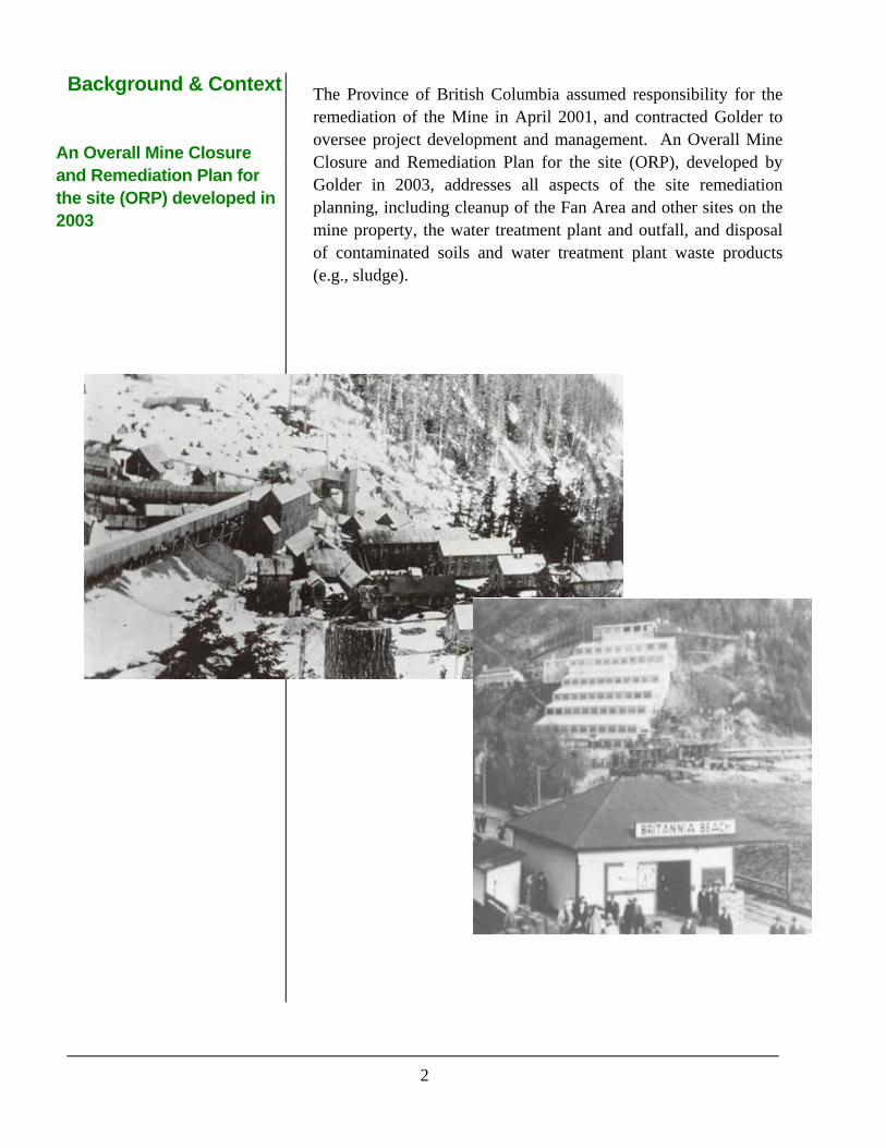
Background & Context An Overall Mine Closure and Remediation Plan for the site (ORP) developed in 2003
The Province of British Columbia assumed responsibility for the remediation of the Mine in April 2001, and contracted Golder to oversee project development and management. An Overall Mine Closure and Remediation Plan for the site (ORP), developed by Golder in 2003, addresses all aspects of the site remediation planning, including cleanup of the Fan Area and other sites on the mine property, the water treatment plant and outfall, and disposal of contaminated soils and water treatment plant waste products (e.g., sludge).

3
Acid Rock Drainage
Sulphide-containing materials react with oxygen and water to form Acid Rock Drainage ARD has resulted in the dishcarge of copper and zinc to Howe Sound
2.0 ACID ROCK DRAINAGE: A PRIMER
Some areas with metal ores also contain sulphide-rich materials like iron pyrite (commonly called “fools’ gold”). At Britannia, sulphides are found in the underground workings, tailings and waste rock. These sulphides can react with oxygen and water to produce Acid Rock Drainage (ARD), which contains sulphuric acid. Sulphuric acid has a low pH and when it travels through or on the ground can cause metals contained in rock or soil to be released into water. The low pH of and metals in ARD can be harmful to plants and animals. This process has resulted in the discharge of acidic water containing dissolved metals like copper and zinc to Howe Sound.
4
Overall Mine Reclaimation and Remediation Plan
Remediation objectives
Remediation activities completed to date
3.0 OVERALL MINE RECLAIMATION AND REMEDIATION PLAN (ORP)
The Overall Mine Reclamation and Remediation Plan (ORP) was prepared by Golder for the Ministry of Agriculture and Lands in 2003, with input from the Environmental Protection Division of the Ministry of Environment, other provincial and Federal regulators, technical consultants and project stakeholders. The ORP evolved from years of study and assessment since closure of mine in 1974.
3.1 ORP Objectives
The objectives of the ORP are as follows:
• Reduce discharge of harmful substances (metals) to habitable areas and aquatic communities;
• Protect, sustain and promote recovery;
• Achieve acceptable levels of risk to health and safety for humans and other terrestrial organisms; and
• Implement a sustainable remediation program in a timely and cost effective manner.
3.2 What has been done so far?
Remediation activities at Britannia Mine have included:
• Installation of a concrete plug in the 2200 Level portal to redirect minewater (which used to discharge to Britannia Creek) back into the mine workings and the lower 4100 Level portal. This work was done by engineers from the University of British Columbia prior to 2003, and was an important step in controlling the discharge of minewater to the environment.
• Construction and operation of a groundwater management system to remove metal–contaminated groundwater in the Britannia Fan Area before it discharges into Howe Sound;

5
Overall Mine Reclaimation and Remediation Plan
Britannia mine water treatment plant (right); Soil
disposal at Jane Basin (below); Surface water
diversions along the Britannia slope
(bottom right)
• Construction and operation of a water treatment plant to treat the ARD collected at the 4100 Level portal and the groundwater from the groundwater management system;
• Installation of a new deep–water outfall about 1 km south of Britannia Beach for the water treatment plant discharge. The outfall is at a depth where most fish, as well as algae, do not live;
• Relocation of over 50,000 m3 of metal–contaminated soils from the 4100 Level and Fan Area to a permitted disposal facility in the open pits at Jane Basin. ARD from this material now enters the mine and is treated in the water treatment plant;
• Installation of three surface water diversions designed to reduce the flow of clean water into the mine and keep clean water clean.
• Installation of a number of surface water drainage improvements to reduce the discharge of metal–contaminated surface water into the intertidal zone at Britannia Beach.
Environmental remediation at the site is ongoing, with improvements to the groundwater management system, surface water drainage in the Fan Area and the 2200 Level waste dumps planned in the near future.
Jane Basin
UpperJane Creek
PipesWeir/flowcapture structure
East Bluff Diversion
Lower Jane Creek
Jane Basin
UpperJane Creek
PipesWeir/flowcapture structure
East Bluff Diversion
Lower Jane Creek

6
Risk Assessment
Risk assessment is used to evaluate the likelihood that contaminants are causing harm to the environment
A Risk Assessment Plan has been developed for the Britannia Remediation Project
4.0 RISK ASSESSMENT
Risk assessment is a process used to evaluate the likelihood that contaminants or other stressors are causing harm to an ecosystem. It provides an outline for structuring and evaluating scientific data and conclusions about:
• Which chemicals are present at the site? (Contamination);
• How do these contaminants get to where plants and animals live? (Pathways);
• Which plants and animals are affected by the contaminants? (Receptors); and
• How much contaminant does the receptor encounter? (Exposure).
Risk to the environment does not exist unless contamination, a pathway, and ecological receptors occur in the same place at the same time.
The first step and the backbone to any risk assessment is what is called a problem formulation. The problem formulation helps identify the scope of the risk assessment and provides a focus for data collection, analysis and reporting; it reduces overall project costs by targeting investigative effort on key issues.
4.1 The Britannia Mine Risk Assessment Plan
In late 2007, a Risk Assessment Plan was developed by Golder for the Ministry of Agriculture and Lands for the Britannia Remediation Project. The purpose of the plan was to summarize remediation and monitoring activities to date and to use this to provide context and a rationale for the next phases of addressing contaminant issues at the site. The plan will also help select appropriate remedial actions to achieve realistic goals. The Risk Assessment Plan proposed that risk assessment activities be divided into three main areas:
1. The Furry Creek watershed;
2. The Britannia Creek watershed; and
3. The Fan Area and adjacent marine sediments (the focus of the present consultation effort)

7
Risk Assessment Intertidal plant and animal communities have been studied yearly at Britannia Beach since 2004
Furry Creek has a thriving intertidal community.
Metals concentrations in intertidal porewater are
relatively low here.
4.2 The Fan Area
Ecology
Studies of the intertidal plant and animal community in the Fan Area have been conducted since 2004 as part of the annual environmental monitoring program for Britannia Mine (Golder 2006, 2007, 2008). The areas focussed on are shown in the map to the right.
Results of the most recent study (2007) showed that the intertidal community immediately west of the mining museum along the Britannia Beach foreshore (i.e., BB-3) has a lower variety and coverage of organisms compared to the foreshore around Furry Creek and Magnesia Creek. Areas with the lowest abundance and variety of plants and animals were exposed to groundwater discharge with the highest metals concentrations. In comparison, the intertidal community north of Britannia Creek is similar to Furry Creek and Magnesia Creek, which do not have high metals concentrations in groundwater.

8
Risk Assessment
The north (above) and south (middle) ends of
Britannia Beach have low porewater metal
concentrations and an adundance of intertidal
plants and animals also found at Furry Creek
(Golder 2008)
The intertidal area immediately west of the mining museum has the highest concentration of
metals in porewater and the lowest abundance of
intertidal life (Golder 2008)

9
Risk Assessment Intertidal porewater chemistry has been monitored yearly since 2005.
The highest porewater copper concentrations have
been measured on the south side of the custroms
wharf.
Other areas along Britannia Beach, like Reach BB-2, south of the concentrate
wharf, have lower copper concentrations
Contaminated Porewater and its Effect on Aquatic Life
Intertidal porewater chemistry has been monitored yearly since 2005, as part of the annual environmental monitoring program for Britannia. Porewater is water in between the spaces of sediment and may be influenced by upland groundwater. Concentrations of metals in the intertidal porewater near the Fan Area are still very high.
Reach BB-3 - South side of the Customs Wharf
0
0.2
0.4
0.6
0.8
1
1.2
11-May-05 18-Jul-05 13-Sep-05 17-Apr-06 11-Jul-06 12-Oct-06 30-Jul-07 2-Oct-07
Co
pp
er C
on
cen
trat
ion
(m
g/L
)
Reach BB-2 - South side of the Concentrate Wharf
0
0.2
0.4
0.6
0.8
1
1.2
11-May-05 19-Jul-05 14-Sep-05 17-Apr-06 11-Jul-06 12-Oct-06 30-Jul-07 2-Oct-07
Co
pp
er C
on
cen
trat
ion
(m
g/L
)
Total copper concentration
Dissolved copper concentration
Ambient water quality guideline (marine) = 0.002 mg/L
Total copper concentration
Dissolved copper concentration
Ambient water quality guideline (marine) = 0.002 mg/L

10
Risk Assessment Caged mussels were used to test the effects of metals in intertidal porewater
Transplanted mussels grew less in intertidal areas with the highest concentration
of metals in porewater (Golder 2006)
Transplanted mussels accumulated more metals in intertidal areas with the
highest concentration of metals in porewater
(Golder 2006)
To study the potential for metals-contaminated porewater to affect the intertidal community, mussels from a clean aquaculture facility were transplanted to the Britannia intertidal zone. The transplanted mussels grew less, or even lost weight, in areas where metal concentrations were highest, while growth in reaches with relatively low porewater metals concentrations was comparable to reference areas. The mussels placed in reaches with higher metals concentrations also accumulated more metals in their tissues.
-0.4
0.0
0.4
0.8
1.2
1.6
2.0
BB-6 BB-4 BB-3 BB-2 FC1 MC1
North ofBritannia Creek
South of Britannia Creek Furry Creek Magnesia Creek
Station
Mea
n G
row
th ±
SD
Weight (g)
Length (mm)
0
10
20
30
40
50
60
70
Time 0 BB-6 BB-4 BB-3 BB-2 FC-1 FC-1(duplicate)
MC-1
North ofBritannia
Creek
South of Britannia Creek Furry Creek MagnesiaCreek
Station
Co
nce
ntr
atio
n (
mg
/kg
ww
)
Total Copper
Total Zinc
11
Risk Assessment Dissolved metals can be harmful to young salmon.
The potential for metals in sediments to affect plants and animals in Howe Sound is unknown.
In a late 1990’s study by Fisheries and Oceans Canada (Barry et al. 2000), young salmon were placed in cages in Howe Sound near the mouth of Britannia Creek. The salmon died within two days, while salmon placed at Porteau Cove (south of Britannia) were still alive after six days (the duration of the test). The conditions in Britannia Creek have improved as remediation of the site has progressed. However, the discharge of contaminated groundwater to Howe Sound may be another source of metals to young salmon, which tend to stay close to shoreline areas during spring migration from the Squamish River.
Data Gaps
While many of the effects of the mine have been studied, a number of things are still unknown. For example, the sediments along the Britannia Beach shoreline have not been well studied. Most of the shoreline has been constructed from mine waste materials (e.g., tailings and waste rock both of which are rich in metals). These materials are a possible source of contamination for the bottom-dwelling organisms in Howe Sound, as well as for the shoreline plant and animal communities. This source/pathway has not been studied through the existing monitoring program.
Mine operations have altered the area surrounding Britannia Beach significantly, and we cannot determine conditions prior to mining. Since the Britannia Mine area is rich in metals, we do not know the extent to which naturally occurring acid rock drainage had shaped the shoreline areas prior to mining operations. It is difficult to then determine what the functional shoreline of the Fan Area should look like.

12
5.0 YOUR OPINIONS COUNT
During late June 2008, Golder and the Ministry of Agriculture and Lands will be hosting an open house at the Britannia Community Hall. This consultation will help us identify resource conservation objectives for the Britannia Remediation Project, which will be used to help build a functionally adequate shoreline community in the Fan Area of Britannia Beach.
6.0 REFERENCES
Barry , K.L., J.A. Grout, C.D. Levings, B.H. Nidle, and G.E. Piercey. 2000. Impacts of acid mine drainage on juvenile salmonids in an estuary near Britannia Beach in Howe Sound, British Columbia. Can. J. Fish. Aquat. Sci. 57: 2032-2043.
Golder. 2006. Data report on environmental monitoring and risk assessment - 2005, Britannia Mine. Prepared for the Ministry of Agriculture and Lands, Surrey, BC.
Golder. 2007. Data report on environmental monitoring, annual report - 2006, Britannia Mine. Prepared for the Ministry of Agriculture and Lands, Surrey, BC.
Golder. 2008. Data report on: Environmental monitoring annual report - 2007, Britannia Mine. Prepared for the Ministry of Agriculture and Lands, Surrey, BC.

BRITANNIA BEACH SHORELINE AREA PUBLIC CONSULTATION
December 2008 Report No. 04-1421-080
APPENDIX B Community Flyer

Britannia Shoreline – Public Meeting Britannia Remediation Project Much progress has been made towards the remediation of the former Britannia Mine site. Some of the work is obvious – a sophisticated water treatment plant is now operating above the refurbished concentrator building – and some of the work is less obvious, having taken place in the hillsides, underground, beneath the sea or at the shoreline. On Wednesday, June 25, 2008 at 7 pm everyone in
the community is invited to a public meeting at the Britannia Hall. The meeting is hosted by the Ministry of Agriculture and Lands and facilitated by Golder Associates. This is your opportunity to share your vision for the Britannia shoreline, provide input into environmental conservation priorities, hear about the remediation project and speak directly to scientists and engineers working on solutions to environmental challenges here at Britannia. Remediation is about more than just science and engineering. It’s also about the community and the views of those who live here – your input is needed. Come out and participate! (refreshments provided). Want more information about the Britannia Remediation Project? Check out the project website at http://www.agf.gov.bc.ca/clad/britannia/index.html.
BRITANNIA BEACH SHORELINE AREA PUBLIC CONSULTATION
December 2008 Report No. 04-1421-080
APPENDIX C Open-house Poster Displays

Britannia Mine Environmental Monitoring – Background
Background & Context
The purpose of resource conservation objectives is to
identify what the ecological shoreline community should
look like, bearing in mind that much of the shoreline is
man-made from mine waste. In other words, how good is
good enough?
The former Britannia Mine (45 km north of Vancouver,
adjacent to Howe Sound) operated primarily as a copper
and zinc mine from 1904 to 1974. During its operational
life, approximately 47 million tonnes of rock were mined
for copper, zinc, lead, cadmium, silver, and gold.
Through processing the ore bodies for these metals, the
mine generated over 40 million tonnes of tailings. These
tailings were largely deposited onto the marine, subtidal
slope of Howe Sound within 3 km of Britannia Beach.
Mining operations have led to generation of acid rock
drainage (ARD), which was historically released from two
main portals on the mine slope (2200 Level and
4100 Level) into Britannia Creek. Contaminated soil, in
combination with mine waste spread around the
Britannia Mine site, has resulted in high levels of metals
in groundwater, which make their way into Howe Sound’s
intertidal zone through the alluvial fan area of Britannia
Creek.
The Province of British Columbia assumed responsibility
for the remediation of the Mine in April 2001, and
contracted Golder to oversee project development and
management. An Overall Mine Closure and Remediation
Plan for the site (ORP), developed by Golder in 2003,
addresses all aspects of the site remediation planning,
including cleanup of the Fan Area and other sites on the
mine property, the water treatment plant and outfall, and
disposal of contaminated soils and water treatment plant
waste products (e.g., sludge).
What has been done so far?
Remediation activities at Britannia Mine have included:
•Installation of a concrete plug in the 2200 Level portal to redirect minewater
(which used to discharge to Britannia Creek) back into the mine workings and
the lower 4100 Level portal. This work was done by engineers from the
University of British Columbia prior to 2003, and was an important step in
controlling the discharge of minewater to the environment.
•Construction and operation of a groundwater management system to remove
metal–contaminated groundwater in the Britannia Fan Area before it
discharges into Howe Sound;
•Construction and operation of a water treatment plant to treat the ARD
collected at the 4100 Level portal and the groundwater from the groundwater
management system;
•Installation of a new deep–water outfall about 1 km south of Britannia Beach
for the water treatment plant discharge.
•Relocation of over 50,000 m3 of metal–contaminated soils from the 4100 Level
and Fan Area to a permitted disposal facility in the open pits at Jane Basin.
ARD from this material now enters the mine and is treated in the water
treatment plant;
•Installation of three surface water diversions designed to reduce the flow of
clean water into the mine and keep clean water clean.
•Installation of a number of surface water drainage improvements to reduce the
discharge of metal–contaminated surface water into the intertidal zone at
Britannia Beach.
Environmental remediation at the site is ongoing, with improvements to the
groundwater management system, surface water drainage in the Fan Area and
the 2200 Level waste dumps planned in the near future.
References :
Barry , K.L., J.A. Grout, C.D. Levings, B.H. Nidle, and G.E. Piercey. 2000. Impacts of acid mine drainage on juvenile salmonids in an estuary near Britannia Beach in Howe Sound, British Columbia. Can. J. Fish. Aquat. Sci. 57: 2032-2043.
Golder. 2006. Data report on environmental monitoring and risk assessment - 2005, Britannia Mine. Prepared for the Ministry of Agriculture and Lands, Surrey, BC.
Golder. 2007. Data report on environmental monitoring, annual report - 2006, Britannia Mine. Prepared for the Ministry of Agricultureand Lands, Surrey, BC.
Golder. 2008. Data report on: Environmental monitoring annual report - 2007, Britannia Mine. Prepared for the Ministry of Agriculture and Lands, Surrey, BC.
Understanding the Issues: Acid Rock Drainage
Some areas with metal ores also contain sulphide-rich materials like
iron pyrite (commonly called “fools’ gold”). At Britannia, sulphides are
found in the underground workings, tailings and waste rock. These
sulphides can react with oxygen and water to produce Acid Rock
Drainage (ARD), which contains sulphuric acid. Sulphuric acid has a
low pH and when it travels through or on the ground can cause metals
contained in rock or soil to be released into water. The low pH of and
metals in ARD can be harmful to plants and animals. This process has
resulted in the discharge of acidic water containing dissolved metals
like copper and zinc to Howe Sound.
Jane Basin
UpperJane Creek
PipesWeir/flowcapture structure
East Bluff Diversion
Lower Jane Creek
Jane Basin
UpperJane Creek
PipesWeir/flowcapture structure
East Bluff Diversion
Lower Jane Creek
The Britannia Mine Risk Assessment Plan
In late 2007, a Risk Assessment Plan was
developed by Golder for the Ministry of
Agriculture and Lands for the Britannia
Remediation Project. The purpose of the plan
was to summarize remediation and monitoring
activities to date and to use this to provide
context and a rationale for the next phases of
addressing contaminant issues at the site. The
plan will also help toselect appropriate remedial
actions to achieve realistic goals. The Risk
Assessment Plan proposed that risk assessment
activities be divided into three main areas:
1.The Furry Creek watershed;
2.The Britannia Creek watershed; and
3.The Fan Area and adjacent marine sediments
(the focus of the present consultation effort)

Britannia Mine Environmental Monitoring – Intertidal Chemistry
Effects on Fish
In a late 1990’s study by Fisheries and Oceans
Canada (Barry et al. 2000), young salmon were
placed in cages in Howe Sound near the mouth
of Britannia Creek. The salmon died within two
days, while salmon placed at Porteau Cove
(south of Britannia) were still alive after six days
(the duration of the test). The conditions in
Britannia Creek have improved as remediation of
the site has progressed. However, the discharge
of contaminated groundwater to Howe Sound
may be another source of metals to young
salmon, which tend to stay close to shoreline
areas during spring migration from the
Squamish River.
Where do we go from here?
Mine operations have altered the area
surrounding Britannia Beach significantly, and
we cannot determine conditions prior to mining.
Since the Britannia Mine area is rich in metals,
we do not know the extent to which naturally
occurring acid rock drainage had shaped the
shoreline areas prior to mining operations. It is
difficult to then determine what the functional
shoreline of the Fan Area should look like.
How good is good enough?
Contaminated Pore Water and its
Effect on Aquatic Life
Chemistry
Intertidal pore water chemistry has been
monitored yearly since 2005, as part of the
annual environmental monitoring program for
Britannia. Pore water is water in between the
spaces of sediment and may be influenced by
upland groundwater. Concentrations of metals
in the intertidal pore water near the Fan Area are
still very high.
Effects on Mussels
To study the potential for metals-contaminated
pore water to affect the intertidal community,
mussels from a clean aquaculture facility were
transplanted to the Britannia intertidal zone. The
transplanted mussels grew less, or even lost
weight, in areas where metal concentrations
were highest, while growth in reaches with
relatively low pore water metals concentrations
was comparable to reference areas. The
mussels placed in reaches with higher metals
concentrations also accumulated more metals
in their tissues.
-0.4
0.0
0.4
0.8
1.2
1.6
2.0
BB-6 BB-4 BB-3 BB-2 FC1 MC1
North ofBritannia Creek
South of Britannia Creek Furry Creek Magnesia Creek
Station
Mea
n G
row
th ±
SD
Weight (g)
Length (mm)
0
10
20
30
40
50
60
70
Time 0 BB-6 BB-4 BB-3 BB-2 FC-1 FC-1(duplicate)
MC-1
North ofBritannia
Creek
South of Britannia Creek Furry Creek MagnesiaCreek
Station
Co
nc
entr
atio
n (
mg
/kg
ww
)
Total Copper
Total Zinc
N
0
0.1
0.2
0.3
0.4
0.5
0.6
0.7
0.8
0.9
BB-6BB-4BB-3BB-2BB-1FC-1MC-1
North of
Britannia
South of
Britannia
South of
CustomsSouth of Concentrate Wharf
Furry CreekMagnesia
Creek
Exposed ReachesReference Reaches
Station
Co
pp
er
co
nc
en
tra
tio
n (
mg
/L)
Dissolved Copper Total Copper
Chronic WQG = 0.002 mg/L
Maximum WQG = 0.003 mg/L
*NS - not sampled
Copper in Intertidal Pore Water - October 2007
*NS
Copper in Intertidal Pore Water - July 2005 to 2007
0
0.1
0.2
0.3
0.4
0.5
0.6
0.7
0.8
0.9
BB-6BB-4BB-3BB-2BB-1FC-1MC-1
To
tal C
op
pe
r (m
g/L
)
2005
2006
2007
Chronic WQG = 0.002 mg/LMaximum WQG = 0.003 mg/L
Wharf Creek Creek
0
0.1
0.2
0.3
0.4
0.5
0.6
0.7
0.8
0.9
BB-6BB-4BB-3BB-2BB-1FC-1MC-1
Dis
so
lve
d C
op
pe
r (m
g/L
)

Britannia Mine Environmental Monitoring – Intertidal Habitat
The Fan Area Ecology
Studies of the intertidal plant and animal
community in the Fan Area have been
conducted since 2004 as part of the
annual environmental monitoring
program for Britannia Mine. The areas
focussed on are shown in the map to the
right.
Results of the most recent study (2007)
showed that the intertidal community
immediately west of the mining museum
along the Britannia Beach foreshore (i.e.,
BB-3) has a lower variety and coverage
of organisms compared to the foreshore
around Furry Creek and Magnesia Creek.
Areas with the lowest abundance and
variety of plants and animals were
exposed to groundwater discharge with
the highest metals concentrations. In
comparison, the intertidal community
north of Britannia Creek is similar to
Furry Creek and Magnesia Creek, which
do not have high metals concentrations
in groundwater.
Magnesia Creek and Furry
Creek have thriving intertidal
communities. Metals
concentrations in intertidal
pore water are relatively low
here.
The north and south ends of Britannia Beach have low pore water metal concentrations and an abundance of intertidal plants and animals also found at Furry Creek
The intertidal area immediately west of the mining museum has the highest concentration of metals in pore water and the lowest abundance of intertidal life
Thriving intertidal communities have a wide variety of plants and animals. The sensitive species that tend to disappear when concentrations of metals become too high are:
bladder wrack, mussels and barnacles.
N

BRITANNIA BEACH SHORELINE AREA PUBLIC CONSULTATION
December 2008 Report No. 04-1421-080
APPENDIX D Public Consultation Survey
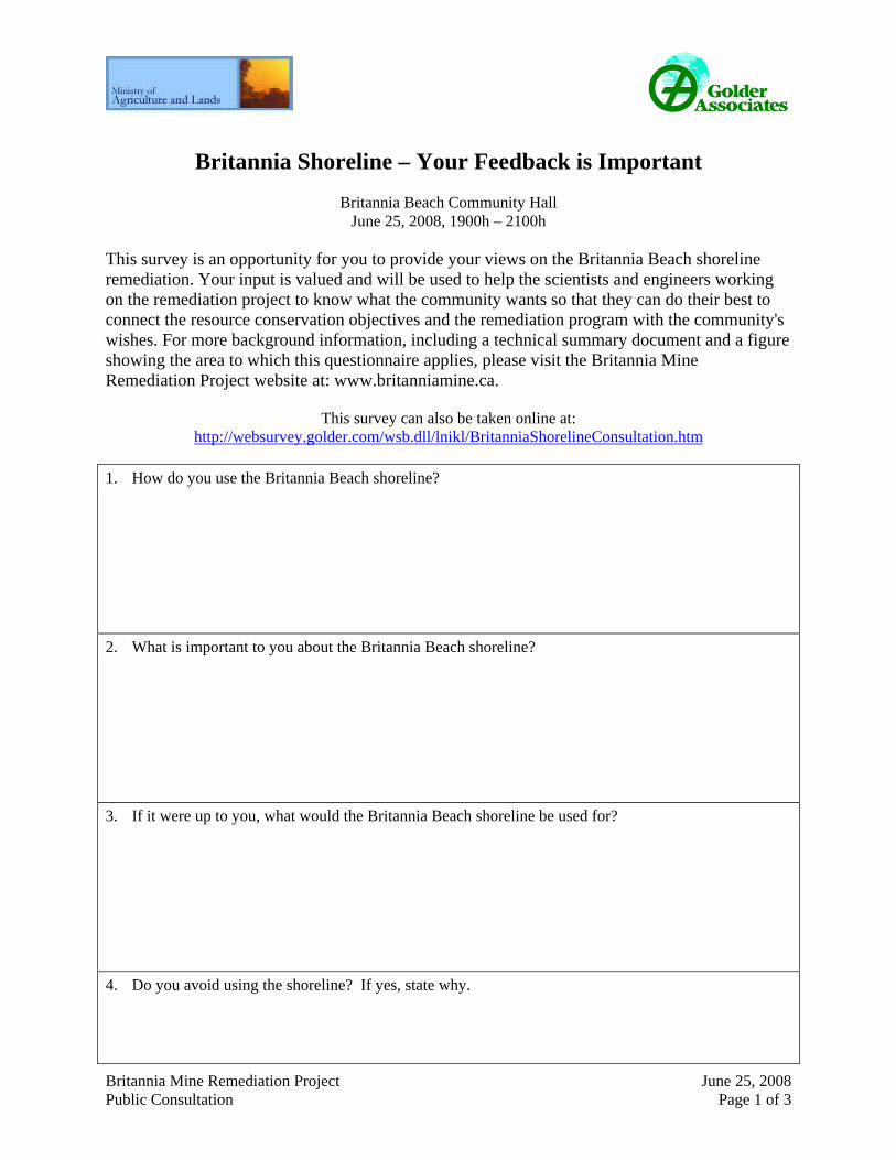
Britannia Mine Remediation Project June 25, 2008 Public Consultation Page 1 of 3
Britannia Shoreline – Your Feedback is Important
Britannia Beach Community Hall June 25, 2008, 1900h – 2100h
This survey is an opportunity for you to provide your views on the Britannia Beach shoreline remediation. Your input is valued and will be used to help the scientists and engineers working on the remediation project to know what the community wants so that they can do their best to connect the resource conservation objectives and the remediation program with the community's wishes. For more background information, including a technical summary document and a figure showing the area to which this questionnaire applies, please visit the Britannia Mine Remediation Project website at: www.britanniamine.ca.
This survey can also be taken online at:
http://websurvey.golder.com/wsb.dll/lnikl/BritanniaShorelineConsultation.htm
1. How do you use the Britannia Beach shoreline?
2. What is important to you about the Britannia Beach shoreline?
3. If it were up to you, what would the Britannia Beach shoreline be used for?
4. Do you avoid using the shoreline? If yes, state why.

Britannia Mine Remediation Project June 25, 2008 Public Consultation Page 2 of 3
5. Which of the following best describes your vision for the Britannia Beach shoreline?
(Select only one)
___ It should be like the rest of Howe Sound, regardless of cost
___ It should be like the rest of Howe Sound if the costs are reasonable
___ I want healthy intertidal plants and animals, but my priority is for use by people
___ Serious impacts should be addressed but the shoreline does not need to be like the rest of Howe
Sound
___ Shoreline remediation isn’t a priority for me if impacts are localized to a small area.
___ Other: Please specify _________________________________________________
6. How would you rank the following shoreline uses in terms of importance to you?
(Please number your top 3 of these with 1 as your first priority)
___ Boat access
___ Fishing (finfish or shellfish)
___ Economic/commercial development
___ Swimming
___ Tourism
___ Vibrant shoreline ecology
___ Heritage features
___ Public access / use
___ ____________________ (add another use if it is missing from the list above)
___ ____________________
7. What is your connection to Britannia Beach? (Check all that apply)
___ Britannia Resident
___ Resident of a nearby community (e.g., Squamish)
___ Business
___ First Nations
___ Recreational use
___ Environmental organization
___ I drive through on my way to other destinations
___ Government – Regulator
___ Government – Local
___ Scientist / Engineer
___ Other ___________________________________

Britannia Mine Remediation Project June 25, 2008 Public Consultation Page 3 of 3
8. How aware are you of the Britannia Mine Remediation Project?
___ Not at all
___ Somewhat
___ Very
9. What is your source of information about the Britannia Mine Remediation Project (please check all
that apply)?
___ Britannia Mine Remediation Project website (www.britanniamine.ca)
___ Newspaper/other media
___ The Britannia Mine Museum
___ I hear about it from others in the community
___ The Britannia Mine manager
___ Technical Advisory Committee members
___ Other: Please specify ___________________________________
10. Additional Comments?
Please return this questionnaire to the address below. You can also take the survey online at: http://websurvey.golder.com/wsb.dll/lnikl/BritanniaShorelineConsultation.htm
Golder Associates Ltd. 195 Pemberton Avenue
North Vancouver, BC V7P 2R4 Fax: 604-662-8548
Additional information about the project is available at www.britanniamine.ca
Britannia Shoreline Remediation - Community Consultation
This survey is an opportunity for you to provide your views on the Britannia Beach shoreline remediation. Your input is valued and will be used to help the scientists and engineers working on the remediation project to know what the community wants so that they can do their best to connect the resource conservation objectives and the remediation program with the community's wishes. For more background information, including a technical summary document and a figure showing the area to which this questionnaire applies, please visit the Britannia Mine Remediation Project website at: www.britanniamine.ca.
How do you use the Britannia Beach shoreline
What is important to you about the Britannia Beach shoreline
If it were up to you,
Page 1 of 6Britannia Shoreline Remediation - Community Consultation
27/11/2008file://C:\Documents and Settings\lnikl\Local Settings\Temp\htm1.htm

what would the shoreline be used for?
Do you avoid using the shoreline? If yes, please state why.
Which of the following best describes your vision for the Britannia Beach shoreline? (please select only one)
It should be like the rest of Howe Sound, regardless of cost It should be like the rest of Howe Sound if the costs are
reasonable I want healthy intertidal plants and animals, but my priority is
for use by people Serious impacts should be addressed but the shoreline does
not need to be like the rest of Howe Sound Shoreline remediation isn't a priority for me, if impacts are
nmlkj
nmlkj
nmlkj
nmlkj
nmlkj
Page 2 of 6Britannia Shoreline Remediation - Community Consultation
27/11/2008file://C:\Documents and Settings\lnikl\Local Settings\Temp\htm1.htm

If you selected other, please specify:
Additional comments:
How would you rank the following shoreline uses in terms of importance to you?
What is your connection to Britannia Beach
localized to a small area Other (please specify) nmlkj
1) Select One
2) Select One
3) Select One
Britannia Resident Resident of a nearby Community (e.g., Squamish) Business First Nations Recreation Environmental Organization Drive through on way to other destinations Government - Regulator Government - Local Scientist / Engineer Other (please specify)
gfedc
gfedc
gfedc
gfedc
gfedc
gfedc
gfedc
gfedc
gfedc
gfedc
gfedc
Page 3 of 6Britannia Shoreline Remediation - Community Consultation
27/11/2008file://C:\Documents and Settings\lnikl\Local Settings\Temp\htm1.htm

If you selected other, please specify:
How aware are you of the Britannia Remediation Project?
What is your source of information about the Britannia Mine Remediation Project? (please check all that apply)
If you selected other, please specify:
Additional comments:
Not at all Somewhat Very
nmlkj
nmlkj
nmlkj
Britannia Mine Remediation Project website (www.britanniamine.ca)
Newspaper / other media The Britannia Mine Museum Hear about if from others in the community The Britannia Mine Manager Technical Advisory Committee Members Other (please specify)
gfedc
gfedc
gfedc
gfedc
gfedc
gfedc
gfedc
Page 4 of 6Britannia Shoreline Remediation - Community Consultation
27/11/2008file://C:\Documents and Settings\lnikl\Local Settings\Temp\htm1.htm

This online survey is powered by WebSurveyor.
Please provide any additional thoughts or comments in the space below.
Thank you for taking the time to complete this survey!
(1 of 1) Submit Survey
Page 5 of 6Britannia Shoreline Remediation - Community Consultation
27/11/2008file://C:\Documents and Settings\lnikl\Local Settings\Temp\htm1.htm

Page 6 of 6Britannia Shoreline Remediation - Community Consultation
27/11/2008file://C:\Documents and Settings\lnikl\Local Settings\Temp\htm1.htm

BRITANNIA BEACH SHORELINE AREA PUBLIC CONSULTATION
December 2008 Report No. 04-1421-080
APPENDIX E Hand-drawn Sketch of One Respondent’s Vision of the Britannia Shoreline


Golder Associates Ltd.
500 - 4260 Still Creek Drive
Burnaby, British Columbia, V5C 6C6
Canada
[+1] (604) 298 6604
[+1] (604) 298 5253
T: [+1] (604) 296 4200
Related Documents