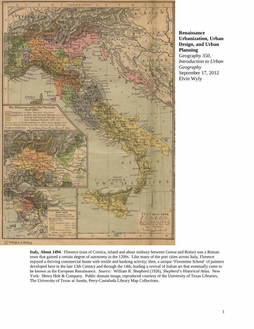
1 Renaissance Urbanization, Urban Design, and Urban Planning Geography 350, Introduction to Urban Geography September 17, 2012 Elvin Wyly Italy, About 1494. Florence (east of Corsica, inland and about midway between Genoa and Rome) was a Roman town that gained a certain degree of autonomy in the 1200s. Like many of the port cities across Italy, Florence enjoyed a thriving commercial boom with textile and banking activity; then, a unique ‘Florentine School’ of painters developed here in the late 13th Century and through the 14th, leading a revival of Italian art that eventually came to be known as the European Renaissance. Source: William R. Shepherd (1926), Shepherd’s Historical Atlas. New York: Henry Holt & Company. Public domain image, reproduced courtesy of the University of Texas Libraries, The University of Texas at Austin, Perry-Castañeda Library Map Collections.

Welcome message from author
This document is posted to help you gain knowledge. Please leave a comment to let me know what you think about it! Share it to your friends and learn new things together.
Transcript
1
Renaissance Urbanization, Urban Design, and Urban Planning Geography 350, Introduction to Urban Geography September 17, 2012 Elvin Wyly
Italy, About 1494. Florence (east of Corsica, inland and about midway between Genoa and Rome) was a Roman town that gained a certain degree of autonomy in the 1200s. Like many of the port cities across Italy, Florence enjoyed a thriving commercial boom with textile and banking activity; then, a unique ‘Florentine School’ of painters developed here in the late 13th Century and through the 14th, leading a revival of Italian art that eventually came to be known as the European Renaissance. Source: William R. Shepherd (1926), Shepherd’s Historical Atlas. New York: Henry Holt & Company. Public domain image, reproduced courtesy of the University of Texas Libraries, The University of Texas at Austin, Perry-Castañeda Library Map Collections.
2
“As the nineteenth-century idea of unceasing change and ‘progress’ raises for us today the problem of stabilization and equilibrium, so the medieval idea of security raised, from the fourteenth century onward, the problem of how life, growth, and movement were to take place in a world governed by the ideas of fixed custom and inherited privilege. Must the wall be torn down? Must the armor be removed? Or did this civilization have the capacity to continue growth from its own center and so to arrive, without disintegration, at a wider synthesis? That was a problem for both its central institution, the Church, and for the medieval city: but neither could solve it without transcending its inherited limitations.”
Lewis Mumford.1 “...our knowledge of social conditions in the cities of early modern Europe will never rest on the type of standardized statistical data which modern censuses routinely produce for every modern city. Much as we may know about one parish or district or even one whole city during a particular period, the systematic comparisons over space and time which modern social analysis takes for granted can never underlie discussions of the early modern city. Even the most sophisticated comparative analyses of European urbanization in the early modern era ultimately depend on a patchwork of estimates and data of highly variant quality. Yet this is not to say that we will never know what we most want to know about the early modern city. It all depends on what we are looking for. If we step back from the relentless search for more data ... we will soon discover not how little we know but how much. ... Despite their many differences in size and character, the towns of early modern Europe all belonged to a common urban civilization .”
Christopher Friedrichs.2
“Years ago in some now-forgotten bookstore in Europe the author came across his first map-plan of a city ‘Published under the Superintendence of the Society for the Diffusion of Useful Knowledge.’ Having an interest in cities, their planning, and cartography, he routinely looked through the portfolio of miscellaneous maps maintained by many bookstores abroad. One by one, over a period of many years, 26 of these remarkable map-plans were collected. ... Only Great Britain in the 19th century could produce an institution with a name so unique that it can hardly be ignored and purposes so apt and universal they can hardly be disclaimed.”
Melville Branch.3 These three quotes present an invitation to study an “urban revolution” that continues to shape our urban world today. Lewis Mumford writes of security and city walls, Christopher Friedrichs documents a common urban civilization, and Melville Branch praises the urban design maps
1 Lewis Mumford (1961). The City in History. New York: Harcourt, Brace, & World, p. 335. 2 Christopher R. Friedrichs (1995). The Early Modern City, 1450-1750. London and New York: Longman, p. 331. 3 Melville C. Branch (1997). An Atlas of Rare City Maps: Comparative Urban Design, 1830-1842. New York: Princeton Architectural Press. Second Edition, quote from p. 1.

3
created by the “Society for the Diffusion of Useful Knowledge” as a unique achievement of Great Britain in the 1800s. All of these processes came together in Europe in a series of social, economic, and political transformations between the 1300s and the 1800s. European societies emerged from a long period of war-torn isolation and stagnation -- variously described as the Middle Ages, the medieval period, or the Dark Ages -- into a dynamic period of urbanization that came to be known as the “Renaissance.” The Renaissance -- translating as the revival or rebirth -- shaped cities around the world. While the conventional wisdom on the emergence of the first cities tells us that the “urban revolution” refers to ancient Mesopotamia, many urbanists regard the European Renaissance as the true urban revolution -- since it produced not just big cities, but entire national societies that became majority urban. The urban revolution of the European Renaissance was felt across the entire world, and continues to shape the interplay between today’s ideas of modernity and the legacies of the past. The European story is fascinating, but it’s not just a story of great cities. While Europe was struggling through the darkest of the Dark Ages, Changan, China -- present-day Xi’an -- had more than a million people in the 7th century, and great cities thrived across the Greater Middle East and Japan for more than a thousand years. But it was European exploration and colonialism that alternately destroyed, transformed, or engaged with existing societies across Asia, Africa, and the Americas.-- spreading institutions of modernity (development, infrastructure, governance) as well as violence (war, slavery, racism, genocide). World urbanism reflected these changes, because
“...as it materialized in Europe and was exported with the creation of colonial empires after 1500 A.D., the European-created city became the model for urban growth and development worldwide. In some regions, it was imposed on indigenous societies that were exterminated and shoved aside (as in North and South America and Oceana). In regions with long histories of indigenous cultures and urban life, it existed alongside of and transformed indigenous cities (as in most of Asia, the Greater Middle East, and Africa).”4
In North America the links between present-day cities and the European transformations is particularly explicit. As Jill Grant observes in an essay on the history of Canadian urban planning, notable shifts in European practice altered key facets of urban design and planning. “Extending their political and military domain to the New World, Europeans soon began their own settlements in Canada. Some of the earliest communities initiated by those who came to reap the rich harvests of the sea and land developed in an essentially organic fashion, with no evident plan.”5 Such ‘organic’ urban forms in Canada are perhaps best illustrated by Quebec City, founded by the French in 1608, reflecting the quintessential spatial layout of the medieval European town. But things changed in only a few generations:
4 Donal J. Zeigler, Stanley D. Brunn, and Jack F. Williams (2003). “World Urban Development.” In Stanley D. Brunn, Jack F. Williams, and Donald J. Zeigler, eds., Cities of the World: World Regional Urban Development. Lanham, MD: Rowman & Littlefield, 1-45, quote from p. 27. 5 Jill Grant (2000). “Planning Canadian Cities: Context, Continuity, and Change.” In Trudi Bunting and Pierre Filion, eds., Canadian Cities in Transition: The Twenty-First Century. Second Edition. Don Mills, ON: Oxford University Press, 443-461, quote from p. 443.

4
Urbanization is the trend of an increasing share of a society’s population living in cities.
“By the eighteenth century, England and France enhanced control of their North American colonies. Establishing towns became a keystone of colonial policy: control the land through new settlements. True to the popular Baroque traditions of the time, the Europeans designed streets, squares, and markets in an elegant geometry: eastern cities like Halifax, Charlottetown ... and the French fortress at Louisbourg reveal such influences. This approach to planning reflected the triumph of authority over landscape; despite the grade of the hill or the presence of waterways, the formal pattern laid out by military engineers dominated. Legal systems provided for private property ownership, imposing an economic order that would continue to influence the shape and development of communities for centuries to come.”6
Canada is not, of course, the only place where you can look at the cities and see the imprint of the urban revolution of Renaissance Europe. We can find these traces in cities around the world, where today a new urban revolution is underway -- a flourishing world cosmopolitanism of urbanization, urban design, and urban planning across the dynamic cities of Asia, Africa, Latin America, and the original hearths of urban civilizations in the Middle East. Urban revolutions continue today across the many diverse cradles of civilization, creating mixed legacies -- wealth and poverty, opportunity and oppression -- that often echo the multifaceted histories of the European urban Renaissance. Important Definitions To navigate this wide-ranging history, we’re going to focus on three major aspects of the
European Renaissance: urbanization, urban design, and urban planning. First , urbanization is the trend of an increasing share of a society’s population that lives in cities or urban areas. This is not simply about the growth of cities, but the role of cities in the context of a broader society: societies marked by rapid population growth
in both rural and urban areas are not necessarily undergoing urbanization.7 Second, urban design refers to the physical layout of streets, buildings, public and private spaces, and other land uses. At least in part, Chris Friedrich’s optimism on how much we know about early modern cities results from the fact that many aspects of urban design are
6 Grant, “Planning Canadian Cities,” p. 444. 7 Obviously, whether urbanization is happening depends on the proportion of a society’s population that is living in cities. In turn, this conceptually simple idea can easily be made more complicated when we consider differences in definitions of “city” and “society.” In practice, most historical assessments of urbanization attempt to measure the proportion of the population within the boundaries of today’s recognizable nation-state boundaries that lived in urban settlements; varied definitions of ‘city’ cause few problems so long as a consistent definition is used across time and space. Regardless of which population or density threshold is chosen, however, it is the increase in the proportion of population that really matters. See Kingsley Davis (1955). “The Origin and Growth of Urbanization in the World.” American Journal of Sociology 60(5), 429-437.

5
Urban design refers to the physical layout of streets, buildings, and other public and private spaces.
Urban planning is state intervention in the urbanization process -- and the ideas used to justify that intervention.
comparatively easy to observe. Hence they were often mapped. This allows us to infer a great deal about different cities from the features of urban design, augmenting the record of archives and other sources of historical knowledge.
Third , urban planning refers to state intervention in the urbanization process -- as well as the ensemble of ideas used to influence, organize, and justify that intervention. To speak of state intervention obviously begs the question of how we define ‘state.’ In the European context the
conventional answer is the modern-day configuration of nation-states that began to take hold after the Treaties of Westphalia were signed on October 24, 1648 by the Holy Roman Empire, several of its ‘Protestant states’ around what is now Germany, and France and Sweden.8 (“Westphalian” is now widely used as an adjective to describe an historically-remembered, comparatively organized nation-state framework that has given way to a more unstable, uncertain, and unpredictable system in recent generations.) But in other times at other places, the
‘state’ is taken to mean very different things. Yet the implications for urban planning are the same: systematic intervention in the urbanization process is inherently and inescapably political -- and it always requires ideas and principles to organize and justify the enterprise. Every appearance of the phrase “urban planning” invokes questions: What was planned? By whom? For what purposes?
Understanding urbanization, then, requires a knowledge of history, archaeology, and demography; while urban design is often closely linked to architecture and landscape architecture, with a heavy dose of historical cartography; and appreciating urban planning takes us into the realm not only of urban planning per se, but also political science, sociology, and history.
8 The Westphalian Treaties ended the Thirty Years’ War, and the recognition of the German states substantially weakened the Holy Roman Empire. Switzerland and the United Netherlands gained recognition as independent states. Lexicon Publications, Inc. (1990). The Lexicon New Webster’s Encyclopedic Dictionary, Second Edition. New York: Lexicon Publications, p. 1118.
6
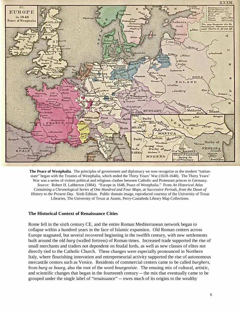
The Peace of Westphalia. The principles of government and diplomacy we now recognize as the modern “nation-state” began with the Treaties of Westphalia, which ended the Thirty Years’ War (1618-1648). The Thirty Years’
War was a series of violent political and religious clashes between Catholic and Protestant princes in Germany. Source: Robert H. Labberton (1884). “Europe in 1648, Peace of Westphalia.” From An Historical Atlas
Containing a Chronological Series of One Hundred and Four Maps, at Successive Periods, from the Dawn of History to the Present Day. Sixth Edition. Public domain image, reproduced courtesy of the University of Texas
Libraries, The University of Texas at Austin, Perry-Castañeda Library Map Collections. The Historical Context of Renaissance Cities Rome fell in the sixth century CE, and the entire Roman Mediterranean network began to collapse within a hundred years in the face of Islamic expansion. Old Roman centers across Europe stagnated, but several recovered beginning in the twelfth century, with new settlements built around the old burg (walled fortress) of Roman times. Increased trade supported the rise of small merchants and traders not dependent on feudal lords, as well as new classes of elites not directly tied to the Catholic Church. These changes were especially pronounced in Northern Italy, where flourishing innovation and entrepreneurial activity supported the rise of autonomous mercantile centers such as Venice. Residents of commercial centers came to be called burghers, from burg or bourg, also the root of the word bourgeoisie. The ensuing mix of cultural, artistic, and scientific changes that began in the fourteenth century -- the mix that eventually came to be grouped under the single label of “renaissance” -- owes much of its origins to the wealthy
7
The classical “urban revolution” was in Mesopotamia, about 5,000 years ago. But there was also a dramatic urban revolution in the European Renaissance, with a “genuine urbanization” -- an increase in the proportion of societies’ population living in cities.
merchant families of the city-states of Venice, Florence, and other Mediterranean ports. Merchant families aggressively and competitively funded art, education, and science in order to maintain power and prestige. More and more of these investments came to have direct and lasting imprints on urban design and urban planning. It is hard to exaggerate the importance of the transformations that swept across Europe. Societal changes altered cities and urban life, and also shaped the way subsequent generations understood the relations between urbanization, society, and culture. Indeed, Kingsley Davis goes so far as to suggest that the ‘real’ urban revolution was not in Mesopotamia in 3,500 BCE, but in Western Europe five thousand years later, during the Renaissance:
“…it was precisely in western Europe, where cities and urbanization had reached a nadir during the Dark Ages, that the limitations that had characterized the ancient world were finally to be overcome. The cities of Mesopotamia, India, and Egypt, of Persia, Greece, and Rome, had all been tied to an economy that was primarily agricultural, where handicraft played at best a secondary role and where the city was still attempting to supplement its economic weakness with military strength, to command its sustenance rather than to buy it honestly. In western Europe, starting at the zero point, the development of cities not only reached the stage that the ancient world
had achieved but kept going after that. It kept going on the basis of improvements in agriculture and transport, the opening of new lands and new trade routes, and, above all, the rise in productive activity, first in highly organized handicraft and eventually in a revolutionary new form of production – the factory run by machinery and fossil fuel. The transformation thus achieved in the fourteenth century was the true urban revolution, for it meant not only the rise of a few scattered towns and cities but the appearance of a genuine urbanization, in the sense that a substantial portion of the population lived in towns and cities.”9
The growth of cities during the Renaissance, however, was neither even nor unproblematic. Four main factors conditioned the growth of cities during this period. First , the modernization of warfare introduced new requirements for urban defense, while rendering medieval fortifications ineffective.10 Gunpowder (believed to have been invented by
9 Davis, “Origin and Growth,” pp. 432-433. 10 G. J. Ashworth (1991). War and the City. New York: Routledge; Joseph W. Konvitz (1985). The Urban Millennium. Carbondale: Southern Illinois University Press; Mumford, The City in History, especially Chapter 11.

8
Factors shaping renaissance cities: 1. Modernization of warfare and the rise of the nation-state. 2. Colonial exploration, exploitation, and expanding networks of trade. 3. Dangers of rapid urbanization. 4. Political and geographical divisions within Christianity.
the Chinese in the 9th century) was introduced to Europe through Arabian trade networks in the fourteenth century, and new artillery made the medieval cities -- walled cities protected by moats, or cities situated on inaccessible hills -- more vulnerable. Mumford’s verdict is unequivocal: “In a very real sense ... the introduction of gunpowder early in the fourteenth century, that century which undermined so many medieval institutions, sounded the death knell of the free cities.”11 Urban design became a matter of elaborate fortifications, and urban defense came to involve new roles for the military. “In the attempt to equalize military conditions, the towns from this point on were compelled to abandon their old system of simple walls, defended for the most part by a citizen soldiery. They were forced to hire soldiers, so that they might sally forth and engage the enemy in open battle; and after the successful defense of Milan by Prospera Colonna in 1521 they were forced to adopt the new methods of fortification that had been worked out there by the Italian military engineers. Perugia, with its projecting towers ‘like the fingers of a man’s hand,’ had set the example, according to Alberti.”12
Second, the expanded networks of trade associated with the rise of European colonialism shaped the course of urbanization. Two distinct trends were apparent. At the regional scale, expanding networks of maritime trade -- and the new wealth brought back from colonial exploration and exploitation -- strengthened the links between European cities and their surrounding hinterlands. There are scores of studies of the city-states that emerged in Italy beginning in the thirteenth century that document this process. One of them marshals detailed evidence on the work and lives of different families struggling to dominate the city of Pisa: “The remarkable aspect of all Pisa’s capitalists is that ... they could appear in the city with a rural background and so rapidly win pre-eminence.”13 Rural-urban linkages were strengthened by the expansion of
Mediterranean maritime trade, especially for textiles and wool products, allowing new kinds of traders to win power from the existing elites. “The center of Pisa’s urbanization revolution was a petty merchant ... who originated in the contado [the countryside] and who lived by bringing to Pisa’s urban market the wool products of her countryside. This man knew the situation, problems, and opportunities of both city and contado; he was able to promote the simultaneous revolution in both from which industrialization was achieved. His rural roots, his
11 Mumford, City in History, p. 357. 12 Mumford, City in History, p. 358. 13 David Herlihy (1958). Pisa in the Early Renaissance. New Haven: Yale University Press, quote from p. 179.
9
interest in wool, gave him a policy to pursue. His late arrival in the city, the social gap which separated him from the aristocracy gave him a kind of self-consciousness, a psychology, ...whose fruits were an unabashed ruthlessness and cruelty in the pursuite of ends which the Renaissance would see again. He was the man with a goal, with an enemy, and with a future.”14 At the wider scale of the Mediterranean world and beyond, maritime exploration and trade networks brought back knowledge and resources from other regions and cities. The Crusades -- the series of holy wars that Western European Christians waged between 1096 and 1291 in an attempt to recover Jerusalem and Palestine from Islamic control -- had the effect of introducing new kinds of spices, cloths, silk, and other products into Europe. In response to dramatic increases in demand, “merchants greatly expanded the trade, wholesaling, and distribution functions of Mediterranean cities.”15 The Crusades thus had significant urban consequences -- and not just because the First Crusade (1096-1099) was inaugurated by Pope Urban II. The empire built by the city-state of Venice provides a prominent example. Even though Venice “took part in more than one Crusade, she hung on to her trading stations in Syria and Egypt: even while she fought the Turks, she maintained her commercial contacts within their territories, and at the height of the antagonism indeed allowed Turkish merchants to establish their own business centre on the Grand Canal in Venice.”16 Other trade and exploration networks also brought back knowledge and unique perspectives on cities and urban design from various parts of the Middle East and Asia.17 As European countries pursued colonial exploration and exploitation, these linkages also required new facilities for the technologies of conquest as well as the circulation of all the resources and commodities associated with colonialism.18 In all of these processes, contrasts in colonizing experience were mirrored in differences in ‘home’ country urban patterns, as well as in varied cities appearing in the colonial possessions of the New World. It is impossible to overstate the importance of colonialism in the growth, form, and symbolic significance of European Renaissance cities. Through the Middle Ages, Chinese technology and wealth were superior to Europe.19 As late as 1776 Adam Smith remarked that “China is a much richer country than any part of Europe.”20 But by then Europe was catching up fast, in large part because of the
14 Herlihy, Pisa, p. 182. 15 Linda McCarthy and Boian Koulov (2008). “Cities of Europe.” In Stanley D. Brunn, Maureen Hays-Mitchell, and Donald J. Zeigler, eds., Cities of the World: World Regional Urban Development. Lanham, MD: Rowman & Littlefield, 199-253, quote from p. 207. 16 Jan Morris (1980). The Venetian Empire: A Sea Voyage. London: Penguin, p. 5. 17 See Naomi Miller (2003). Mapping the City: The Language and Culture of Cartography in the Renaissance. New York: Continuum Publishers. 18 James E. Vance, Jr. (1990). The Continuing City: Urban Morphology in Western Civilization. Baltimore: Johns Hopkins University Press. 19 J. Needham, ed. (1954-1984). Science and Civilization in China (6 Volumes). Cambridge: Cambridge University Press. 20 Cited in Andre Gunder Frank (1998). ReOrient: Global Economy in the Asian Age. Berkeley: University of California Press, p. 13.
10
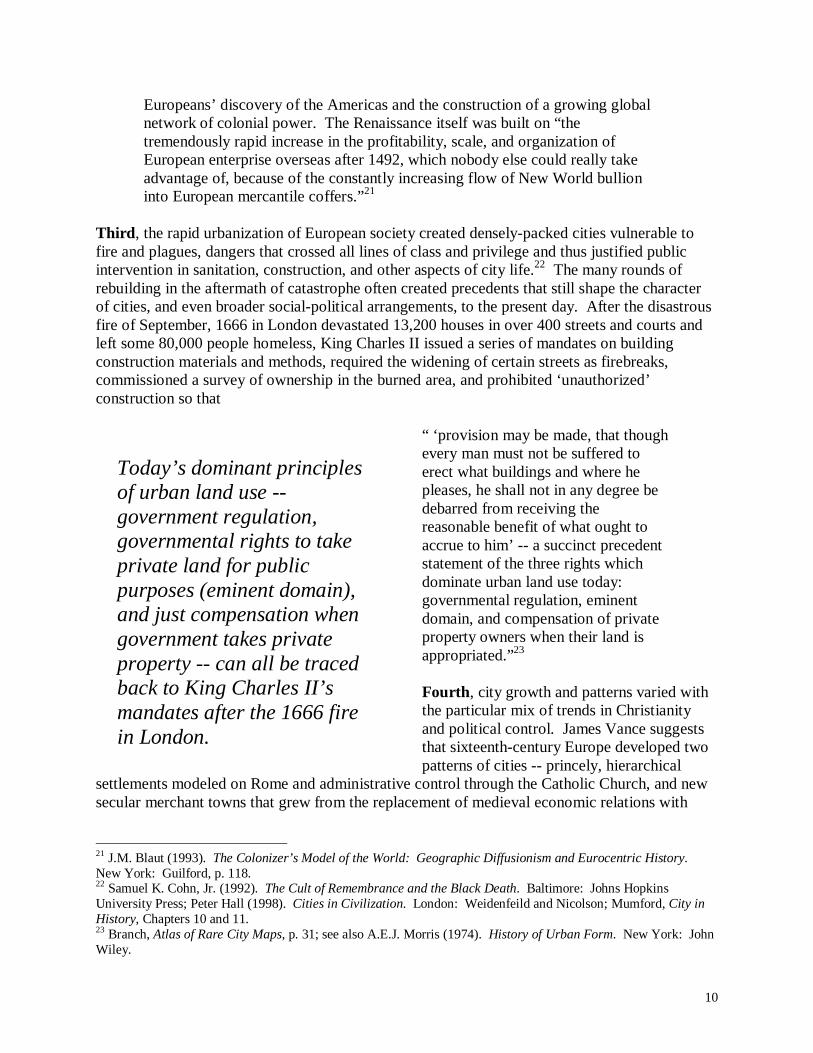
Today’s dominant principles of urban land use -- government regulation, governmental rights to take private land for public purposes (eminent domain), and just compensation when government takes private property -- can all be traced back to King Charles II’s mandates after the 1666 fire in London.
Europeans’ discovery of the Americas and the construction of a growing global network of colonial power. The Renaissance itself was built on “the tremendously rapid increase in the profitability, scale, and organization of European enterprise overseas after 1492, which nobody else could really take advantage of, because of the constantly increasing flow of New World bullion into European mercantile coffers.”21
Third , the rapid urbanization of European society created densely-packed cities vulnerable to fire and plagues, dangers that crossed all lines of class and privilege and thus justified public intervention in sanitation, construction, and other aspects of city life.22 The many rounds of rebuilding in the aftermath of catastrophe often created precedents that still shape the character of cities, and even broader social-political arrangements, to the present day. After the disastrous fire of September, 1666 in London devastated 13,200 houses in over 400 streets and courts and left some 80,000 people homeless, King Charles II issued a series of mandates on building construction materials and methods, required the widening of certain streets as firebreaks, commissioned a survey of ownership in the burned area, and prohibited ‘unauthorized’ construction so that
“ ‘provision may be made, that though every man must not be suffered to erect what buildings and where he pleases, he shall not in any degree be debarred from receiving the reasonable benefit of what ought to accrue to him’ -- a succinct precedent statement of the three rights which dominate urban land use today: governmental regulation, eminent domain, and compensation of private property owners when their land is appropriated.”23 Fourth , city growth and patterns varied with the particular mix of trends in Christianity and political control. James Vance suggests that sixteenth-century Europe developed two patterns of cities -- princely, hierarchical
settlements modeled on Rome and administrative control through the Catholic Church, and new secular merchant towns that grew from the replacement of medieval economic relations with
21 J.M. Blaut (1993). The Colonizer’s Model of the World: Geographic Diffusionism and Eurocentric History. New York: Guilford, p. 118. 22 Samuel K. Cohn, Jr. (1992). The Cult of Remembrance and the Black Death. Baltimore: Johns Hopkins University Press; Peter Hall (1998). Cities in Civilization. London: Weidenfeild and Nicolson; Mumford, City in History, Chapters 10 and 11. 23 Branch, Atlas of Rare City Maps, p. 31; see also A.E.J. Morris (1974). History of Urban Form. New York: John Wiley.
11
new trading wealth.24 Moreover, the Reformation, the sixteenth-century movement against corruption and abuses in the Catholic Church, tended to strengthen the merchant classes who were intimately involved in the new cities. Those who broke from the Catholic Church during the Reformation came to be known as Protestants -- including the Anglicans, Baptists, Congregationalists, Evangelicals, Lutherans, Methodists, Reformed, and Presbyterian. The German sociologist Max Weber (1864-1920) theorized that key features of the Reformation and Protestant Churches helped to resolve one of the contradictions of economic growth suffered by orthodox Catholicism: religious strictures against the selfishness of money-making and competition. Protestant challenges to the Catholic establishment, Weber argued, helped legitimate a work ethic and a “profit ethic” in which economic self-interest was no longer seen as inherently sinful. The title of Weber’s book on the subject, published in 1904-1905, summarizes the argument nicely: The Protestant Ethic and the Spirit of Capitalism.25 Renaissance and Reformation were not unopposed, and the backlash affected cities through what Mumford calls ‘the structure of Baroque power.’ The Baroque movement began in sixteenth century art, emphasizing theatricality, the portrayal of spiritual ecstasy, and the involvement of the beholder. The movement spread to architecture and other fields, however, and flourished in countries of the Counter-Reformation (Italy, Spain, Portugal, France, Austria), where Jesuits (organized in 1540) found in the art the possibility of a reinvigorated Catholicism. Key Baroque principles and themes found their way into urban design and urban planning. Baroque planning came to be associated with state intervention on a grand scale, using elements of urban design to display, consolidate, and justify the power of the state and the Church. From “The Society for the Diffusion of Useful Knowledge” to “The Church of Google” In class, we’ll consider case studies of how these various factors interacted to create the urban forms that appear so vivid in the early-nineteenth century maps produced by the Society for the Diffusion of Useful Knowledge. Some of the cities we’ll consider: Vienna, Antwerp, Brussells, Copenhagen, London, Rome, Venice, and Paris.26 As we consider these views of nineteenth-century European cities, we need to think deeply about earlier histories -- as well as the fast-changing urban histories being experienced today in cities across the world. All of the turbulence of the European Renaissance -- changes in war and defense, all the city-building financed through Colonial plunder, the need to rebuild cities after devastating fires, the religious and political struggles over the meanings of commerce and design -- quite literally changed the places in which European philosophers and scientists tried to understand their world. New kinds of cities reflected new ideas, but then these new cities also created new ideas. The best example comes from the ultimate Renaissance man -- the French philosopher, physicist, and mathematician René Descartes (1596-1650). Descartes is best known for the metaphysics of modernity, summed up in his Discours de la méthod of 1637: “dubito ergo cogito: cogito ergo sum.” “I doubt, therefore I think,” the translation goes; “I think, therefore I am.” We now have
24 Vance, The Continuing City, Chapter 6. 25 Weber’s book was translated to English in 1930 by the U.S. sociologist Talcott Parsons (1902-1979), and subsequently reprinted. Max Weber(1958). The Protestant Ethic and the Spirit of Capitalism. Translated by Talcott Parsons. New York: Scribner. 26 See Branch, Atlas of Rare City Maps.

12
There is circumstantial evidence that the geometric order of the “new towns” and grand public spaces of the Renaissance city influenced the theories of the French physicist, philosopher, and mathematician René Descartes.
some compelling evidence to suggest another interpretation: I think a city, therefore I am a city. the geographer-planner Abraham Akkerman documents a close linkage between the kinds of new towns and public spaces where Descartes spent time in his formative years, and the kinds of reasoning that eventually led to the breakthroughs of Cartesian thought in mathematics and analytical geometry.27 Descartes’s Discours, for instance, includes detailed reflections on differences in urban form, such as
“...ancient cities which have gradually grown from mere villages into large towns are usually ill-proportioned, compared with those orderly towns which planners lay out as they fancy on level ground.”28
Akkerman provides a detailed history of these new “orderly towns” -- as many as a thousand
new towns built across southern France, northern Spain, northern Italy, and Holland, “Descartes’s repeated destination” in his many travels between 1618 and 1647.29 “More than a mere metaphor,” Akkerman writes, “Descartes’s reference to planned towns appears to be something of a policy scheme for the new way of philosophical and scientific deliberation he came to pioneer. ... Descartes’s allusions to townscapes seems also to reveal a bond between his perception of the changing Renaissance environment, and his intellectual disposition towards a fundamental change in the demeanor of reasoning.”30 The neat, orderly arrangement of new towns and grand public spaces built as the European nation-state emerged helped Descartes imagine new ways to organize
human inquiry. “It was the geometrical, mechanistic clarity emanating” from these planned urban landscapes “that was also perceived as reflecting the order of the universe, and through which Descartes himself helped usher a new era of confidence in the intellectual faculty of the individual.”31 This dynamic is what one analyst had in mind when declaring that Renaissance urban planning was the “geometrization of lived space.”32 Now jump ahead several hundred years. The Society for the Diffusion of Useful Knowledge is gone, but now we have companies like Google, whose mission statement is to “organize the world’s information and make it universally accessible and useful.” Such ambitions inspire
27 Abraham Akkerman (2001). “Urban Planning in the Founding of Cartesian Thought.” Philosophy & Geography 4(2), 141-167. 28 Cited in Akkerman, “Urban Planning,” p. 144. 29 Akkerman, “Urban Planning,” p. 145. 30 Akkerman, “Urban Planning,” p. 144. 31 Akkerman, “Urban Planning,” p. 156. 32 Alberto Pérez-Gómez (1983). Architecture and the Crisis of Modern Science. Cambridge, MA: MIT Press, cited in Akkerman, “Urban Planning,” p. 164.
13
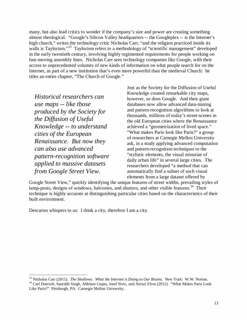
Historical researchers can use maps -- like those produced by the Society for the Diffusion of Useful Knowledge -- to understand cities of the European Renaissance. But now they can also use advanced pattern-recognition software applied to massive datasets from Google Street View.
many, but also lead critics to wonder if the company’s size and power are creating something almost theological. “Google’s Silicon Valley headquarters -- the Googleplex -- is the Internet’s high church,” writes the technology critic Nicholas Carr, “and the religion practiced inside its walls is Taylorism.”33 Taylorism refers to a methodology of “scientific management” developed in the early twentieth century, involving highly regimented requirements for people working on fast-moving assembly lines. Nicholas Carr sees technology companies like Google, with their access to unprecedented volumes of new kinds of information on what people search for on the Internet, as part of a new institution that’s even more powerful than the medieval Church: he titles an entire chapter, “The Church of Google.”
Just as the Society for the Diffusion of Useful Knowledge created remarkable city maps, however, so does Google. And their giant databases now allow advanced data-mining and pattern-recognition algorithms to look at thousands, millions of today’s street-scenes in the old European cities where the Renaissance achieved a “geometrization of lived space.” “What makes Paris look like Paris?” a group of researchers at Carnegie Mellon University ask, in a study applying advanced computation and pattern-recognition techniques to the “stylistic elements, the visual minutiae of daily urban life” in several large cities. The researchers developed “a method that can automatically find a subset of such visual elements from a large dataset offered by
Google Street View,” quickly identifying the unique features of street widths, prevailing styles of lamp-posts, designs of windows, balconies, and shutters, and other visible features.34 Their technique is highly accurate at distinguishing particular cities based on the characteristics of their built environment. Descartes whispers to us: I think a city, therefore I am a city.
33 Nicholas Carr (2011). The Shallows: What the Internet is Doing to Our Brains. New York: W.W. Norton. 34 Carl Doersch, Saurabh Singh, Abhinav Gupta, Josef Sivic, and Alexei Efros (2012). “What Makes Paris Look Like Paris?” Pittsburgh, PA: Carnegie Mellon University.

14
Piazzo San Marco, Venice, December 2009 (Elvin Wyly). In November 1202, a “spectacle, never to be forgotten by the Venetians, began the transformation of their city-state into a maritime empire”; Enrico Dandolo, the forty-first Doge (Duke) of Venice, “boarded his red-painted galley in the Basin, beneath a canopy of vermillion silk, to trumpet calls, priestly chanting and the cheers of a mighty fleet lying all around, and set in motion the events of the Fourth Crusade...” Jan Morris (1980). The Venetian Empire: A Sea Voyage. London: Penguin, p. 12. At the time, Venice had a population of about 80,000; the twin columns had recently been built, but the present Doges’ Palace (on the right) was begun more than a century later (1340).
Related Documents