REMOTE REMOTE SENSING SENSING SUB-DIRECTORATE

REMOTE SENSING REMOTE SENSING SUB- DIRECTORATE Remote Sensing is... The science of obtaining information about an object by acquiring data with a device.
Dec 25, 2015
Welcome message from author
This document is posted to help you gain knowledge. Please leave a comment to let me know what you think about it! Share it to your friends and learn new things together.
Transcript

REMOTE REMOTE SENSINGSENSING
SUB-DIRECTORATE

Remote Sensing is...
• The science of obtaining information about an object by acquiring data with a device which is not in direct contact with that object.
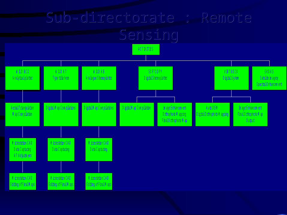
Sub-directorate : Remote SensingSub-directorate : Remote Sensing
M icros tat io n C ADE d it ing o f Fina l M aps
M icros tat io n C ADD ata C ap tu r ingA T A dju s tm ent
A er ia l T r iangu la t ionM ap C o m p ila t ion
W ILD B C 2A n a lyt ica l p lo t ter
M ic ros tat io n C ADE d it ing o f Fina l M aps
M icros tat io n C ADD ata C ap tu r ing
D ig ita l M ap C om p ila t ions
W ILD A 7T ype t i t le he re
M ic ros tat io n C ADE d it ing o f Fina l M aps
M icros tat io n C ADD ata C ap tu r ing
D ig ita l M ap C om p ila t ions
W ILD A 8A n a lo g ue S te reo p lo t ter
D ig i ta l M ap C om p ila t ion im ag e E nh an cem entO rth op h o to M app ing
Fin a l O r th op h o to M ap
S O FT C O P YD ig ita l S te reop lo t ter
A u to D E MD ig ita l Orth o ph o to M ap p ing
Im ag e E nh an cem entFin a l O r th op h o to M ap
O u tp u t
V IR T U O Z OD ig ita l S ys tem
E R D A SS ate l i te im age ry
S p ec tra l E n hancem ent
A C T IV IT IE S
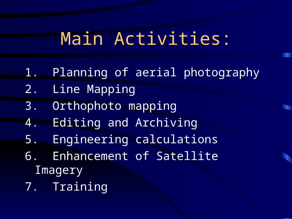
Main Activities:
1. Planning of aerial photography2. Line Mapping3. Orthophoto mapping4. Editing and Archiving5. Engineering calculations6. Enhancement of Satellite Imagery7. Training

1. Aerial Photography Planning:
• A typical flight plan showing layout of photo strips and photo centres to correct scale
• The desired position of field control is also shown

FLIGHT PLANS
1. Photography flown without GPS (Full Control) 2. Photography flown without GPS - Strip
Surveys3. Photography flown with GPS
In all cases:• Planning of flight on 1/50 000 topo map• Determine flying height• Determine scale of photography
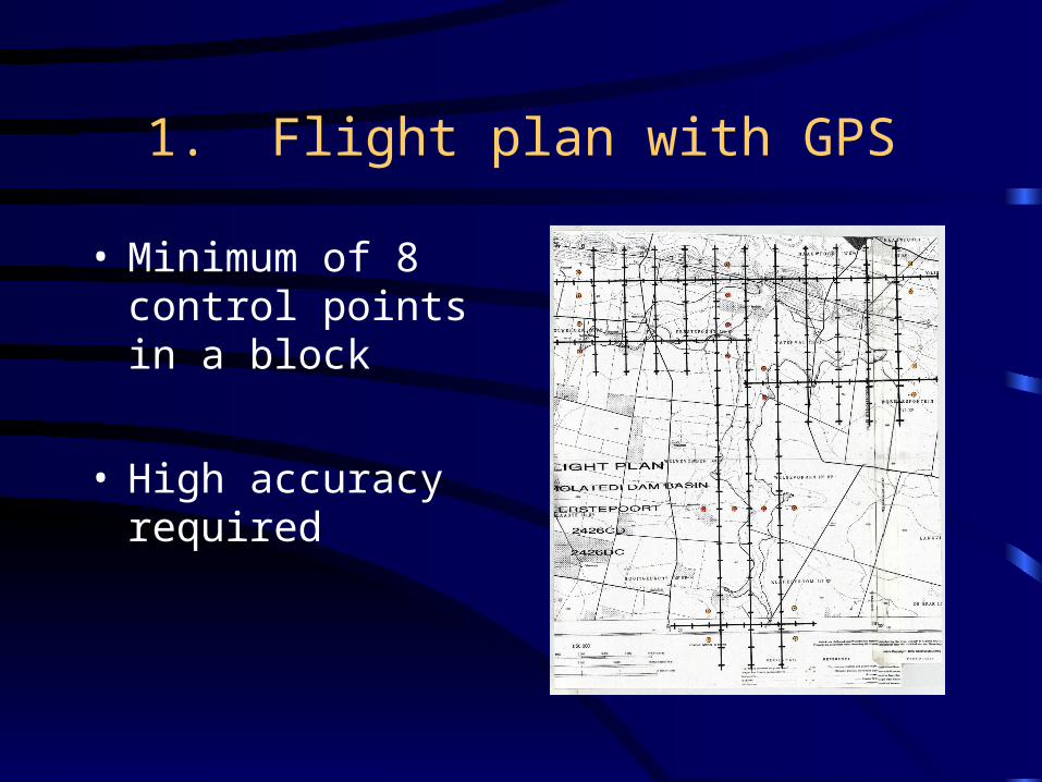
1. Flight plan with GPS
• Minimum of 8 control points in a block
• High accuracy required

2. Flight Plan without GPS - Strip Surveys
• Every second model on outside strips
• Every third - fourth model on inner strips

3. Flight Plan - Site Surveys
• Full Control
• High accuracy
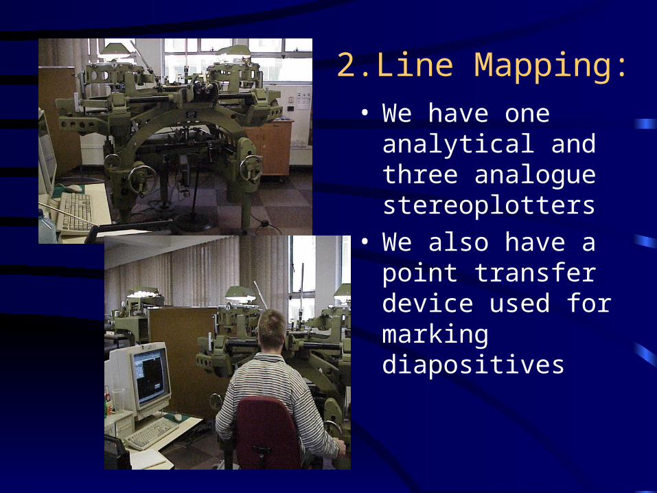
2.Line Mapping:• We have one
analytical and three analogue stereoplotters
• We also have a point transfer device used for marking diapositives

A typical model of mapping:

3. Orthophoto mapping:
• From scanned aerial photography
• From digital satellite imagery
• From other remotely sensed data: videography, laser,etc.
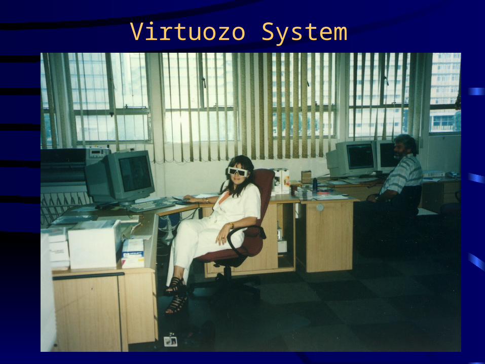
Virtuozo System

Orthophoto Map

4.Final Line Map For Archiving

5. Engineering calculations:
• Areas and volumes for area capacity tables
• Profile data and maps for backwater calculations and floodline determination
• Basic design of dumps and storage dams,e.g.. Indumeni Mine
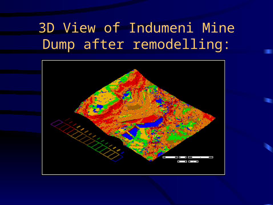
3D View of Indumeni Mine Dump after remodelling:

Remodelling the Indumeni Mine Dump:
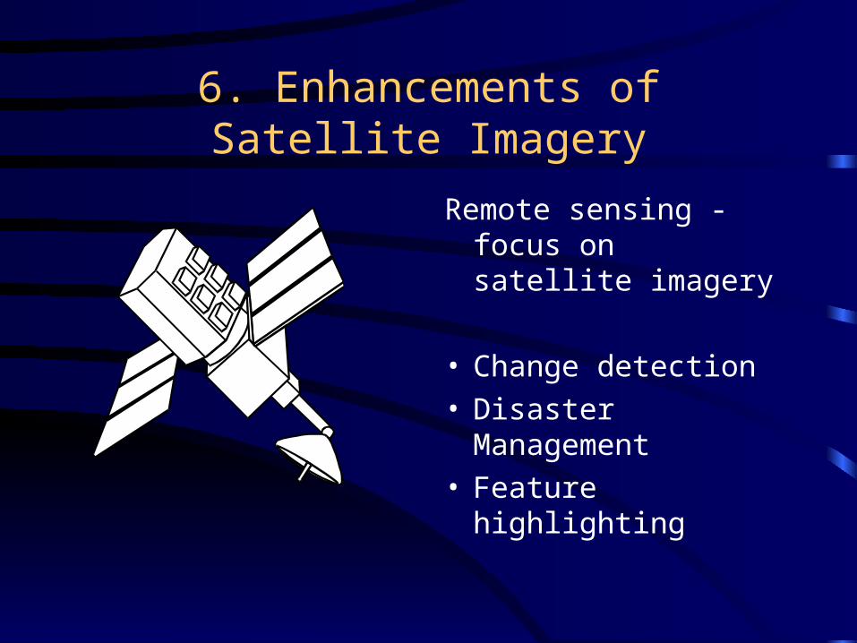
6. Enhancements of Satellite Imagery
Remote sensing - focus on satellite imagery
• Change detection• Disaster
Management• Feature
highlighting

FIELD CHECKS
1. 50% of area should be tested.
2. Maps with reasonable amount of detail to be selected to check.
3. At least two sections on a map.
4. Tests of all control points.
5. Comparison of detail and plans.
6. Final Reports

SCALES and ACCURACIES
SCALES
1. Choice of scale depends on use and accuracy required.
2. Suitable scale is selected in consultation with client.
ACCURACIES
Standards for Fixing of Control Points

7. Training:
• Training of Survey Officers to SAQA accreditation
• Additional survey and photogrammetric training for Technikon students
• In-house training on stereoplotters and digital systems

Typical categories of work:
• For design: reconnaissance and planning of infrastructure development
• As-built - terrestrial monitoring• Disaster management: Merriespruit,
Rovic Mines• Forestry• Environmental - coal mines

Continued…
• For abstraction control: to assist in the compulsory licensing process and to monitor irrigation extents
• Social consulting - local community involvement (esp. orthophotos)
• Recreational - dam zoning• Calculations for backwater curves and
floodline analysis• Training - to pass on skills
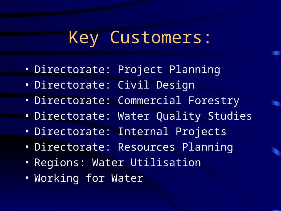
Key Customers:
• Directorate: Project Planning• Directorate: Civil Design• Directorate: Commercial Forestry• Directorate: Water Quality Studies• Directorate: Internal Projects• Directorate: Resources Planning• Regions: Water Utilisation• Working for Water

Continued…..
• Social Consultants• Other Sub-Directorates in Business
Information

The End
Related Documents