REMOTE SENSING : Field work and GPS Stuart Green Teagasc Spatial Analysis Group [email protected] Web for the Week: http://electronics.howstuffworks.com/gps.htm http://www.cstars.ucdavis.edu/classes/ers186-w03/lecture17/lecture17.ppt

REMOTE SENSING : Field work and GPS · PDF fileREMOTE SENSING : Field work and GPS Stuart Green Teagasc Spatial Analysis Group [email protected] Web for the Week:
Mar 06, 2018
Welcome message from author
This document is posted to help you gain knowledge. Please leave a comment to let me know what you think about it! Share it to your friends and learn new things together.
Transcript

REMOTE SENSING :Field work and GPS
Stuart Green
Teagasc
Spatial Analysis Group
Web for the Week:http://electronics.howstuffworks.com/gps.htm
http://www.cstars.ucdavis.edu/classes/ers186-w03/lecture17/lecture17.ppt
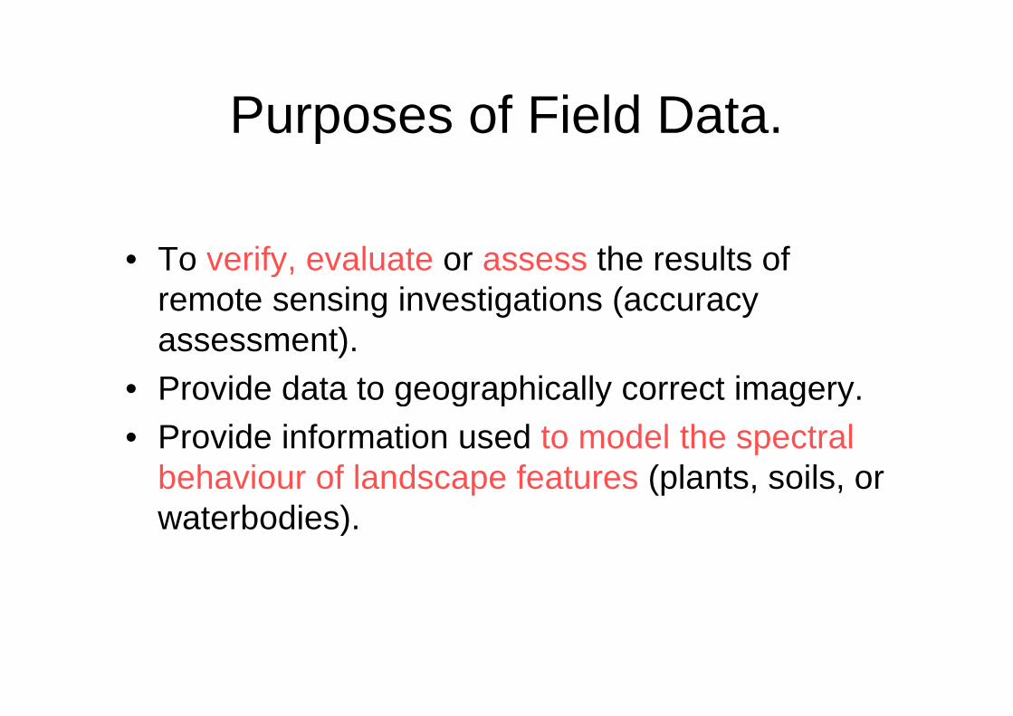
Purposes of Field Data.
• To verify, evaluate or assess the results ofremote sensing investigations (accuracyassessment).
• Provide data to geographically correct imagery.
• Provide information used to model the spectralbehaviour of landscape features (plants, soils, orwaterbodies).

Field data includes least threekinds of information.
• Attributes or measurements that describeground conditions at a specific place.
• Observations must be linked to locationalinformation so the attributes can becorrectly matched to corresponding pointsin image data.
• Observations must also be described withrespect to time and date.

Nominal Data• Nominal labels consist of qualitative designations applied to regions delineated on
imagery that convey basic differences from adjacent regions.
• Nominal labels are derived from different sources:Established classification systems. (Say Fossitts Guide to Habitats in Ireland :
Origins in local terminology or in circumstances that are specific to a particular study.
• In the field nominal data are usually easy to collect at points or for small areas;difficulties arise as one attempts to apply labelling system to larger areas.
• For these reasons, it is usually convenient to annotate maps or aerial photographs inthe field as a means of relating isolated point observations to areal units. Or if yourgood enough you can manually interpret the airphotos as if you we’re in the field.

Biophysical Data
• Biophysical data consist of measurements of physical characteristicscollected in the field.
• e.g, the type, size, form and spacing of plants that form thevegetative cover, or, the texture, drainage status and mineralogy ofthe soil.
• Biophysical data typically apply to points, so often they must belinked to areas by averaging of values from several observationswithin an area.
• Biophysical data must often be associated with nominal labels, sothey do not replace nominal data but rather document the meaningof nominal labels. For example, biophysical data often documentthe biomass or structure of vegetation within a nominal class ratherthan completely replacing a nominal label.

FIELD RADIOMETRY
• Radiometric data permit the analyst torelate brightnesses recorded by the aerialsensor to corresponding brightnesses nearthe ground surface.
• A field spectrometer consists of ameasuring unit with a hand held probeconnected to the measuring unit by a fibreoptic cable.

FIELD RADIOMETRY

Geographic Sampling
• Observation signifies the selection of a specific cell or pixel,
• Sample is used here to designate a set of observations that will beused in an error matrix.
• Three separate decisions must be made when sampling maps orspatial patterns.
• (1) Number of observations to be used.• (2) Sampling pattern to position observations within an image.• (3) Spacing of observations.

Numbers of Observations
• Number of observations determines
– the confidence interval of an estimate of theaccuracy of a classification. A large sample sizedecreases the width of the confidence interval ofour estimate of a statistic.
• For most purposes it is necessary to havesome minimum number of observationsassigned to each class.

Sampling Pattern.
The Simple Random Sampling Pattern
• The choice of any specific location as the site foran observation is independent of the selection ofany other location as an observation.
• All portions of a region are equally subject toselection for the sample, thereby yielding datathat accurately represent the area examined andsatisfying one of the fundamental requirementsof inferential statistics.

The Stratified Random Pattern• Assigns observations to sub-regions of the image to
ensure that the sampling effort is distributed in arational manner. A stratified sampling effort might planto assign specific number of observations to eachcategory on a map to be evaluated. This procedurewould ensure that every category would be sampled.
•

Systematic Patterns
This pattern positionssamples such thatobservations are takenat equal intervalsaccording to a specificstrategy. Systematicsampling is useful if it isnecessary to ensurethat all regions within astudy area arerepresented

Systematic Stratified Unaligned Patterns• This pattern combines features of both systematic and stratified samples while
simultaneously preserving an element of randomness.
• The entire study area is divided into uniform cells.
• The grid cells introduce a systematic component to the sample and form the basisfor the stratification; one observation is placed in each cell.
• An element of randomness is contributed by the method of placing observationswithin each cell.

Cluster Sampling• Cluster Sampling selects points within a study area and
uses each point as a centre to determine locations ofadditional “satellite” observations placed nearby, so thatthe overall distribution of observations forms a clusteredpattern.
Cluster sampling may be efficient with respect totime and finance. If the pattern to be sampled isknown beforehand, it may provide reasonablyaccurate results.

LOCATIONAL INFORMATION
• Identification of Ground Control Points (GCPs) which allow analyststo resample image data to provide accurate planimetric location andcorrectly match image detail to maps and other images.
• Often we would use points of a map (sayu road intersections) togeometrically correct an Image but in some cases we have toidentify a feature on the image and go out and survey that point onthe ground in order to get accutare geographci correction

GLOBAL POSITIONING SYSTEMS (GPS)
• Global Positioning Systems were originallydeveloped by the US military. In recent years theavailability of global positioning system (GPS)technology has permitted convenient,inexpensive and accurate measurement ofabsolute location. GPSs have greatly enhancedthe usefulness of remote sensing data,especially when it is necessary to integrateimage data with field data.

GLOBAL POSITIONING SYSTEMS (GPS)
• A GPS receiver consists of a portablereceiving unit sensitive to signalstransmitted by a network of earth-orbitingsatellites.

These satellites are positionedin orbits such that each pointon the earth’s surface will be inthe view of at least four and upto nine satellites at a giventime.
1. A system of 24 satellites at analtitude of 17,600km
2. Circle the earth in 12 hours

GLOBAL POSITIONING SYSTEMS (GPS)
• Satellites continuously broadcast one-way signals at two frequencies withinthe L-band region of the microwave spectrum.
• These signals permit GPS receivers to solve equations to estimate latitudelongitude and elevation.
• Both L-band signals are modulated to carry a precision code P-code; one ofthe two bands, however, also carries a coarse acquisition code (C/A) thatprovides less precise information.

GPS Receivers
• A GPS receiver consists of an antenna, power supply, electric clockand circuitry that can translate the signal into positional information..
• Four channels are required, at a minimum, for highly accuratescientific or navigational applications (three channels for positionalinformation and a fourth to ensure that timing information is correct).Most everyday remote sensing applications can be satisfied by themore modest capabilities of two-channel GPS receivers.
• GPS signals can be used in several ways to estimate location-two ofthe most important are pseudo-ranging and carrier phasemeasurement.

HOW GPS WORKS
How GPS works
• (1) Satellite Trilateration- the basis of the system.
• (2) Satellite Ranging- measuring distance from a satellite.
• (3) Accurate Timing– why consistent clocks and a fourth spacevehicle are needed.
• (4) Satellite Positioning– knowing where a satellite is in space.
• (5) Correcting Errors- correcting for ionospheric and troposphericdelays.

Satellite Trilateration.
• Exact coordinates can be calculated forany position on earth by measuring thedistance from a group of satellites to theposition. The satellites act as precisereference points. Assuming the distancefrom one satellite is known, the positioncan be narrowed down to the surface of asphere surrounding that satellite.

Satellite Trilateration.

Satellite Trilateration.

Satellite Trilateration.

Satellite Ranging.
• The receiver examines the incoming code fromthe satellite and then looks at how long ago itgenerated the same code. This time differenceis multiplied by the speed of light (186,000miles/second) to give distance.
• The use of a code is important because it allowsthe receiver to make the comparison at any time.It also means that the satellites can operate atthe same frequency, because each satellite isidentified by its own PseudoRandom Number(PRN) code.

Local Differential GPS
• When a GPS receiver can be stationed at a fixed position of known location,it becomes possible to derive estimates of errors and to apply theseestimates to improve the accuracy of GPS location of points at unknownlocations. This process is known as local differential GPS
• Differential GPS requires that a GPS receiver be established at a fixedpoint for which the geographic location is known with confidence-thislocation forms the base station. In Irelands case this is provided by thecommisioner of irish lights.
• Information from the base station can be applied to locational informationfrom roving GPS receivers to derive more accurate estimates of location.
• Atmospheric effects constitute one of the major sources of error in GPSmeasurements. Electrically charged particles in the ionosphere (30-300miles above the earth’s surface) and severe weather in the troposphere(ground to 7.5miles) can combine to cause errors of 1-5ms. Topographiclocation, presence of structures and nearby vegetation canopies also cancontribute to variations in effective use of GPS receivers.

GLOBAL POSITIONING SYSTEMS (GPS)

RTK
• A real time correction for error: Real TimeKinemetrics
• Service supplied by OSI using PhoneNetwork linked to RINEX stations
• Need GPS linked to mobile phone-pay forcall.
• Can post-process with data from OSIwebsite for free
• Compares carrier signal instead of code

Tips
• Allways check for satellite availabilty before going out onfield trip
• If its been a while since last using your GPS, allow forephemeris data to be downloaded before taking points
• Be aware of topography and location- coverage getswors the further north you are. In the northernhemepshere Coverage is bad on steep northern slopes.
• Poor coverage in forests, espically wet ones!• Poor GPS in cities unless uysing satnav that uses
alternaticve location sources• Your body is an effective microwave shield- face south
when taking a meaurm,ent• Check the batteries!

• Additional information from:
• http://europa.eu.int/comm/space/index_en.html
• http://europa.eu.int/comm/dgs/energy_transport/galileo/
• http://www.galileoju.com
• http://www.esa.int/esaNA/galileo.html
• http://www.osi.ie/wp-content/uploads/2015/07/Survey-Ireland-2004-GPS-Network-RTK-Solution-for-Ireland.pdf?ext=.pdf

Accuracy Assessment
We may define accuracy, in a working sense, as the degree of correspondence betweenobservation and reality. We usually judge accuracy against existing maps, large scale aerial photos,or field checks. We can pose two fundamental questions about accuracy:
Is each category in a classification really present at the points specified on a map?
Are the boundaries separating categories valid as located?
Various types of errors diminish the accuracy of feature identification and category distribution. Wemake most of the errors either in measuring or in sampling. When quantifying accuracy, we mustadjust for the lack of equivalence and totality, if possible. Another, often overlooked point aboutmaps as reference standards, concerns their intrinsic or absolute accuracy. Maps require anindependent frame of reference to establish their own validity.
As a general rule, the level of accuracy obtainable in a remote sensing classification depends ondiverse factors, such as the suitability of training sites, the size, shape, distribution, and frequencyof occurrence of individual areas assigned to each class, the sensor performance and resolution,and the methods involved in classifying (visual photointerpreting versus computer-aided statisticalclassifying), and others

In practice, we may test classification accuracy in four ways:
1) field checks at selected points (usually non-rigorous and subjective), chosen either atrandom or along a grid;
2) estimate (non-rigorous) the agreement of the theme or class identity between a classmap and reference maps, determined usually by overlaying one on the other(s);
3) statistical analysis (rigorous) of numerical data developed in sampling, measuring, andprocessing data, using tests, such as root mean square, standard error, analysis ofvariance, correlation coefficients, linear or multiple regression analysis, and Chi-squaretesting .
4) confusion matrix calculations (rigorous).

With the class identities in the photo as the standard, we arranged the number of pixelscorrectly assigned to each class and those misassigned to other classes in the confusionmatrix , listing errors of commission, omission, and overall accuracies.
The producer's accuracy relates to the probability that a reference sample (photo-interpreted land cover class in this project) will be correctly mapped and measuresthe errors of omission (1 - producer's accuracy).
In contrast, the user's accuracy indicates the probability that a sample from landcover map actually matches what it is from the reference data (photo-interpretedland cover class in this project) and measures the error of commission (1- use'saccuracy).
Errors of commission An error of commission results when a pixel is committed to anincorrect class
.
Errors of omission An error of omission results when a pixel is incorrectly classifiedinto another category. The pixel is omitted from its correct class.


urban grass natural water forestry map
urban 12 5 1 6 7 31
grass 1 34 7 2 44
natural 2 9 23 6 40
water 14 2 16
forestry 4 20 24
ground
15 48 31 24 37 155
Urban Ommission: (31-12)/31= 61%So Producers accuracy is: 39%
Urban Comission (15-12)/15= 25%So users accuracy is 75%
Total mapp accuray is (12+34+23+14+20)/155 = 66%

Assessing your map
Once you are happy with your supervised map, load into arcMap and use thecreate random points tool

Add output name
Constrain to Currgah17.tif
Create 25 points
Click OK

Use the Extract Multivalues to point tool to assign the value of your map to each pointIn your test point coverage

Use the “add field” tool to create an extra text field in your testpoints coverage called “Ground”

Right Click on the testpoints field in Table of contents and click edit-start edit
Open up the attribute table for the test points coverage and you can now edit the“Ground Field”
Now simply zoom to each point in turn and record in the “ground field” the landcoverclass visible in the “base image” airphotos.
To create the error matrix, Use Data Management Tools->Tables->Pivot Tables
Related Documents