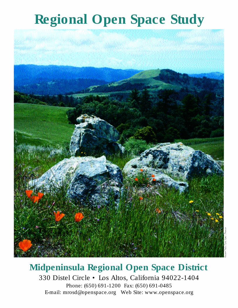
Regional Open Space Study Midpeninsula Regional Open Space District 330 Distel Circle • Los Altos, California 94022-1404 Phone: (650) 691-1200 Fax: (650) 691-0485 E-mail: [email protected] Web Site: www.openspace.org

Welcome message from author
This document is posted to help you gain knowledge. Please leave a comment to let me know what you think about it! Share it to your friends and learn new things together.
Transcript
Regional Open Space Study
Midpeninsula Regional Open Space District330 Distel Circle • Los Altos, California 94022-1404
Phone: (650) 691-1200 Fax: (650) 691-0485E-mail: [email protected] Web Site: www.openspace.org
O ve rv i ew of the Regional Open Space StudyStudy Definition
The Regional Open Space Study is intended to illus-trate a concept of what may be desirable as a futuregreenbelt on the peninsula. The study is not intendedas a commitment to fund, approve, or implement anyspecific acquisitions or improvements. It is a tool forongoing study and discussion as the District pursuesits open space preservation mission. The study areaencompasses the entire peninsula south of SanFrancisco, including lands outside of the District’sboundaries, in order to show the total context for theDistrict’s activities.
The map will be available on an ongoing basis forreview and comment and will be reexamined andrevised based on progress, comments, and changingconditions. It is a tool for communication with thepublic and other agencies about ideas for open spacepreservation and public access.
Relationship of the District’s Master Plan andRegional Open Space Study
To guide the District’s open space preservationefforts, the District produces a Master Plan and aRegional Open Space Study. The Master Plan setsforth guidelines for District acquisitions and shows therelative desirability of potential open space landacquisitions. The Regional Open Space Study show sthe general extent of lands and public access improve-ments existing, under active consideration, or underconceptual study, to complete the District’s mission.
Both documents are subject to periodic review andmodification by the Board of Directors through a pub-lic process. The Regional Open Space Study is subjectto periodic technical updates. Both documents aresubmitted to the counties, cities, and various landconservation-oriented local, state, and federal agen-cies and organizations for review and comment inorder to encourage coordination with their planningand policies.
BackgroundThe concept of the Regional Open Space Study
originated at a January, 1994 Board of Directors’workshop on District goals and objectives. After back-ground research and preparations, a two-year studyprocess was conducted in 1996 and 1997, coincidingwith the District’s 25th anniversary. The study’s objec-tives were to 1) gather ideas and opinions about theDistrict’s policies and future plans through an exten-sive series of meetings with the public and otheragencies, 2) review and update the Basic Policy (the“constitution” of the District) and draft a missionstatement, and 3) prepare a map showing the existingand potential future open space lands and facilities onthe San Francisco peninsula — a vision of the futuregreenbelt that is the District’s mission.
During 1998, another phase of the project wascompleted. This phase evaluated the financial impli-cations of the District’s portion of the envisionedfuture greenbelt.
Public ParticipationThe public participation process for the Regional
Open Space Study took place in seve ral stages. P u b l i cnotice of workshops and meetings included news releas-es, display advertisements, and notice to people wh ohad been interested in previous District planning efforts.
In 1996, public workshops and meetings were heldto solicit input on revision of the Basic Policy, withthe objective of updating the policy to more accurate-ly reflect current circumstances and operating proce-dures. Significant revisions were made and a newMission Statement was created as a result of the work-shops. These were set aside as a draft while the mapstudy process and additional public workshops werecompleted.
In early 1997, the District held workshops with thestaff of local agencies and organizations involved withor concerned about parks and open space planning.Ideas for how the process should be conducted andbase information for the study were collected. Thenext phase was a series of four widely-noticed region-
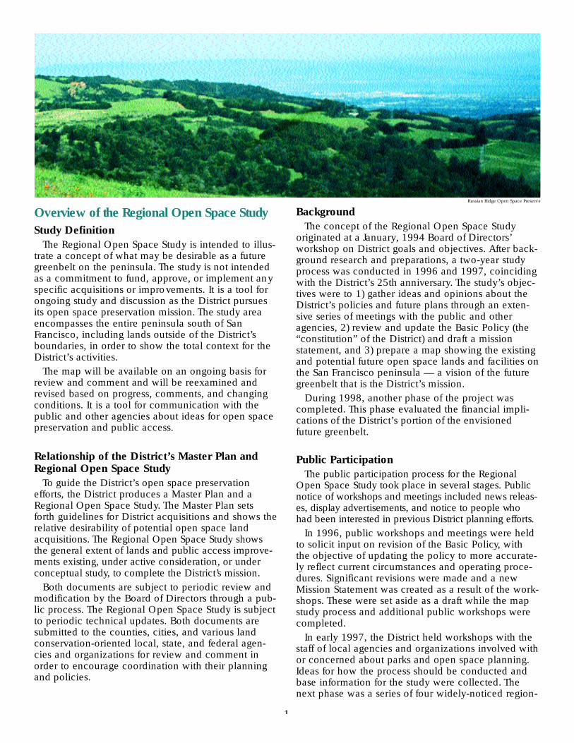
Russian Ridge Open Space Preserve
1

Features and K ey Points of the Regional Open Space Study MapLands
Existing protected open space land. This is shownin different colors according to the type of agency ororganization that owns and manages the land.
Some existing open space lands are not open to thepublic, including some publicly-owned lands andsome lands where existing trails are shown. Pleasecheck with specific park or preserve managers andsee their published maps regarding access.
Horizontal green stripes indicate an existing openspace easement or part-ownership interest. The colorindicates the type of agency or organization owningthe easement or interest. These easements or interestsmay be over private land or other types of public orprivate open space, which show as wider stripes.
Lands worth considering for open space pro t e c t i o n .G e n e ra l l y, these lands are large undeveloped holdingsthat should be studied as part of a potential future region-al greenbelt, and are shown as vertical green stripes.
These lands are not necessarily proposed for acqui-sition — they are identified only for study regardingpotential future preservation.
Many other agencies and organizations are involvedin open space protection on the peninsula in additionto the District. They all may have future roles in pro-tecting and managing additional open space lands.
Land preservation may include purchase of fee ow n e r-ship, conservation or trail easements, life estates, inhold-ings, or other arrangements on a willing seller basis.
The District and other open space protection agen-cies and organizations are typically interested inworking with owners so they can continue to live,farm, and/or ranch on the property. Such arrange-ments may include limits on public access.
The District’s power of eminent domain is used onlyrarely, in response to direct threat of major develop-ment, or for tax benefit to the sellers, in strict accor-dance with the District’s Land Acquisition Policies.
The District does not consider use of eminentdomain as a means of purchasing land unless theproperty concerned is an open space parcel of criticalimportance or is under some dire emergency, such asimmediate destruction of natural resources, or clear-ing for development purposes. Even under suchurgent circumstances, however, eminent domainwould still be used only as a last resort. The Districtwould continue to use negotiation as its primary toolin purchasing land.
Urban/Subdivided Land. Areas that are developedand/or subdivided to an extent that they are not prac-tical to consider for potential large-scale open spacepreservation. These lands are shown as gray.
FacilitiesThe map attempts to show all existing major facili-
ties of the types noted below. Potential facilitiesshown include some on existing public land, somethat may be part of already-adopted plans, and someshown for discussion purposes only (on private land).Existing facilities are shown in black and potentialfacilities are shown in red. Several stages of furtherplanning, public review, and decision-making wouldbe required before these “concept” facilities couldreach the status of a plan.
Field Office. Currently, the District has two majorfield office/shop facilities, at Rancho San Antonio andSkyline Ridge Open Space Preserves, to serve theFoothills and Skyline areas, respectively. Other exist-ing county or state ranger facilities are also shown.The potential future field offices shown may beregional substations — not necessarily majoroffice/shop complexes.
Purisima Creek Redwoods Open Space Preserve
3
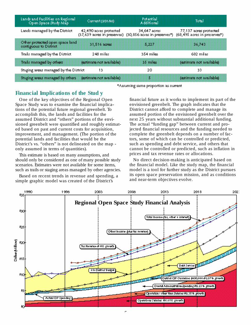
Financial Implications of the Stud yOne of the key objectives of the Regional Open
Space Study was to examine the financial implica-tions of the potential future regional greenbelt. Toaccomplish this, the lands and facilities for theassumed District and “others” portions of the envi-sioned greenbelt were quantified and roughly estimat-ed based on past and current costs for acquisition,improvement, and management. (The portion of thepotential lands and facilities that would be theDistrict’s vs. “others” is not delineated on the map -only assumed in terms of quantities).
This estimate is based on many assumptions, andshould only be considered as one of many possible studyscenarios. Estimates were not available for some items,s u ch as trails or staging areas managed by other agencies.
Based on recent trends in revenue and spending, asimple graphic model was created of the District’s
financial future as it works to implement its part of theenvisioned greenbelt. The graph indicates that theDistrict cannot afford to complete and manage itsassumed portion of the envisioned greenbelt over thenext 25 years without substantial additional funding.The actual “funding gap” between current and pro-jected financial resources and the funding needed tocomplete the greenbelt depends on a number of fac-tors, some of which can be controlled or predicted,such as spending and debt service, and others thatcannot be controlled or predicted, such as inflation inprices and tax revenue rates or allocations.
No direct decision-making is anticipated based onthe financial model. Like the study map, the financialmodel is a tool for further study as the District pursuesits open space preservation mission, and as conditionsand near-term objectives evolve.
5
Regional Open Space Study Financial Analysis
ProgramsThe docent program currently includes over 120
active volunteer docents who lead hikes and tours onthe preserves. The volunteer program provides anopportunity for people to donate their time and ener-gy to a variety of field and office projects.
ActivitiesThe District offers nearly 250 miles of trails that
range from gentle paths to rugged terrain. Bicycles arepermitted on a number of trails, and there are alsomany trails where horseback riders are welcome.
For More District InformationTo get on the District’s quarterly newsletter mailing
list, receive preserve trail maps, order an annualsubscription to Board meeting agendas and minutes,or obtain further information on any of the District’spreserves or programs, please call (650) 691-1200.Our address is 330 Distel Circle, Los Altos, CA94022-01404. You may send electronic mail to<[email protected]>.
Trail maps are usually available at major trailheads,or may be requested in advance from the District.Maps and other information may be obtained on theDistrict’s website at <www.openspace.org>.
Other documents guiding the District’s activities areavailable to the public upon request, including BasicPolicies, Trail Use Policies, Trail Use Guidelines andMitigation Measures, Resource Management Policies,and Use & Management Plans.
The District Speakers Bureau provides guestspeakers for service organizations, homeownersgroups, business clubs, or other associations withinany of the District’s 16 cities. Also available is a free-standing photo display for use at special events.
The Midpeninsula Regional Open Space Districtgratefully accepts contributions to assist in its missionof preserving unspoiled and natural land for futuregenerations. Donations are tax-deductible.
To help with its ongoing efforts to preserve openspace, the District also appreciates in-kindcontributions of equipment, materials, andprofessional services.
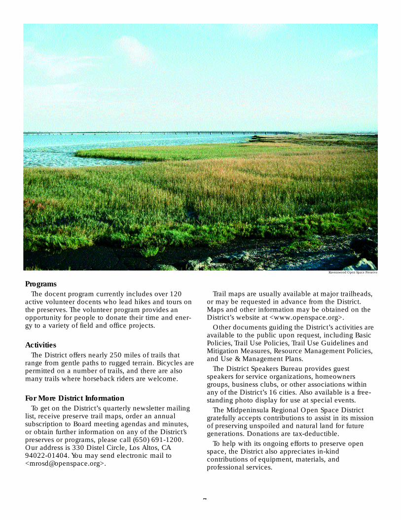
Ravenswood Open Space Preserve
7
Related Documents


![Warrnambool OPEN SPACE STRATEGY 2014 · WARRNAMBOOL OPEN SPACE STRATEGY 2014 [3] ... Environmental Sustainability: ... The Warrnambool Open Space Strategy considers the open space](https://static.cupdf.com/doc/110x72/5b14c4a67f8b9ab6778bd350/warrnambool-open-space-strategy-warrnambool-open-space-strategy-2014-3-.jpg)