REDACTED VERSION Report submitted under 10 CFR 2.390(a)(3). Portions of this report are withheld under Section 304 of the Archaeological Resources Protection Act (16 U.S.C. 470w-3(a)).

Welcome message from author
This document is posted to help you gain knowledge. Please leave a comment to let me know what you think about it! Share it to your friends and learn new things together.
Transcript

REDACTED VERSION Report submitted under 10 CFR 2.390(a)(3). Portions of this report are withheld under
Section 304 of the Archaeological Resources Protection Act (16 U.S.C. 470w-3(a)).

Appendix A.
Cultural Resources Survey of the Proposed Lee Nuclear StationAddendum Report

Cultural Resources Survey of the Proposed Lee Nuclear Station
Addendum
Brockington and Associates, Inc.May 2007
Introduction
Duke Energy, Carolinas plans to construct a meteorological tower (MET Tower 3) toreplace two extant towers at the proposed William S. Lee III Nuclear Station (LNS). Theproposed tower site is located outside the area previously disturbed by the former CherokeeNuclear Station project.
On 15-16 May 2007, Brockington and Associates, Inc., conducted an archaeologicalsurvey of the proposed MET Tower 3 location. The Met Tower 3 Area of Potential Effect (APE)includes a landform that sits overlooking a flooded portion of McKowns Creek, located along thenorth edge of the LNS Tract. The entire APE will be cleared of trees, and two specific areas ofhigh ground will be graded for the construction of MET Tower 3, its associated supportstructure(s), and access road.
Brockington and Associates also recorded the locations of four known cemeteries locatedon the LNS Tract. These cemeteries were originally located by land surveyors during theCherokee Project. We located each cemetery using sub-meter accuracy GPS and assessed thecondition of each. Figure 1 displays the location of the MET Tower 3 APE and the fourcemeteries.
MET Tower 3
The field investigations consisted of shovel testing and visual inspection of the landformsassociated with the MET Tower 3 location, and visual inspections of side slopes for possiblerock shelters. We investigated two landforms that lie west of a spillway/drainage for a reservoir.
Figure 2 displays these as Landforms 1 and 2. A narrow saddle connects these two landforms.Landform 2 is the proposed location of MET Tower 3. Landform 2 and the saddle to the southwill likely be cleared of trees.
I

Figure withheld under Section 304 of the Archaeological Resources Protection Act (16 U.S.C. 470w-3(a))

Figure withheld under Section 304 of the Archaeological Resources Protection Act (16 U.S.C. 470w-3(a))
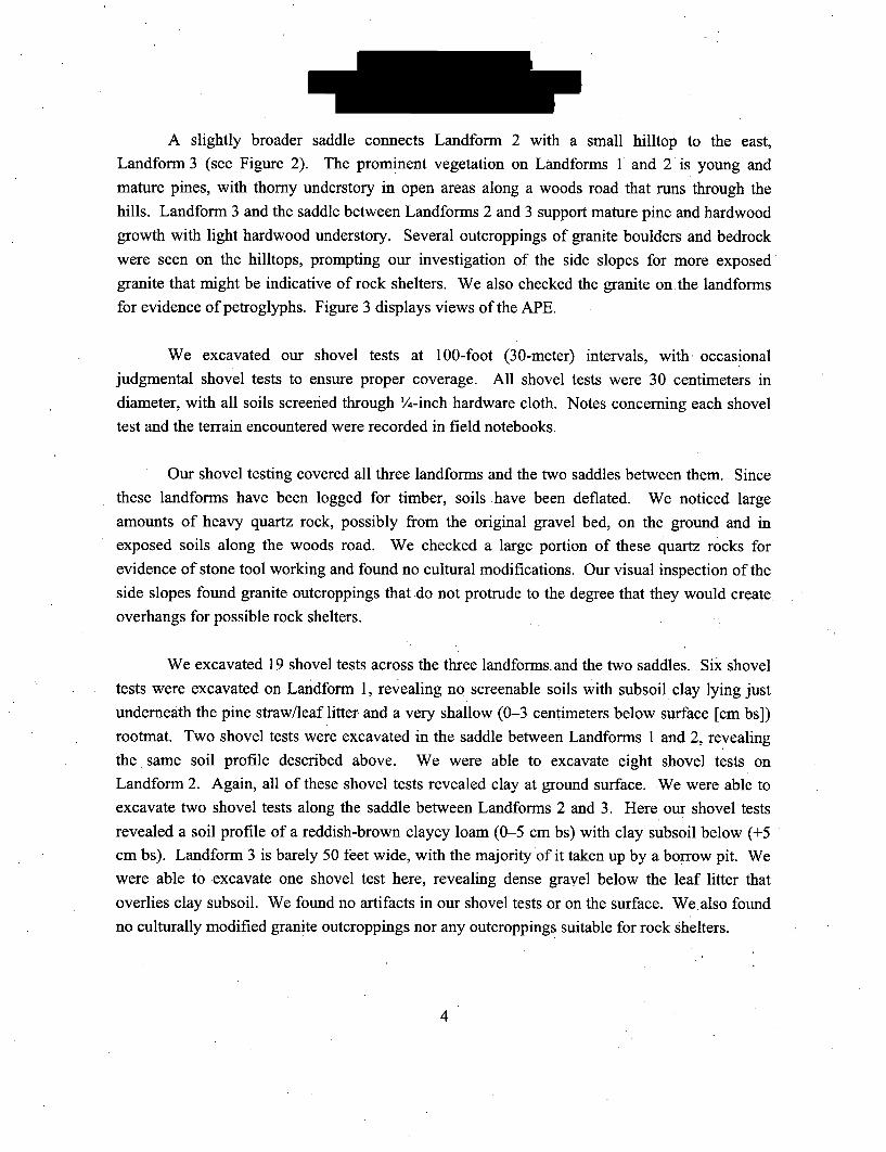
A slightly broader saddle connects Landform 2 with a small hilltop to the east,Landform 3 (see Figure 2). The prominent vegetation on Landforms 1 and 2 is young andmature pines, with thorny understory in open areas along a woods road that runs through thehills. Landform 3 and the saddle between Landforms 2 and 3 support mature pine and hardwoodgrowth with light hardwood understory. Several outcroppings of granite boulders and bedrockwere seen on the hilltops, prompting our investigation of the side slopes for more exposedgranite that might be indicative of rock shelters. We also checked the granite on the landformsfor evidence of petroglyphs. Figure 3 displays views of the APE.
We excavated our shovel tests at 100-foot (30-meter) intervals, with. occasionaljudgmental shovel tests to ensure proper coverage. All shovel tests were 30 centimeters indiameter, with all soils screened through '/4-inch hardware cloth. Notes concerning each shoveltest and the terrain encountered were recorded in field notebooks.
Our shovel testing covered all three landforms and the two saddles between them. Sincethese landforms have been logged for timber, soils have been deflated. We noticed largeamounts of heavy quartz rock, possibly from the original gravel bed, on the ground and inexposed soils along the woods road. We checked a large portion of these quartz rocks forevidence of stone tool working and found no cultural modifications. Our visual inspection of theside slopes found granite outcroppings that do not protrude to the degree that they would createoverhangs for possible rock shelters.
We excavated 19 shovel tests across the three landforms. and the two saddles. Six shoveltests were excavated on Landform 1, revealing no screenable soils with subsoil clay lying justunderneath the pine straw/leaf litter and a very shallow (0-3 centimeters below surface [cm bs])rootmat. Two shovel tests were excavated in the saddle between Landforms 1 and 2, revealingthe same soil profile described above. We were able to excavate eight shovel tests onLandform 2. Again, all of these shovel tests revealed clay at ground surface. We were able toexcavate two shovel tests along the saddle between Landforms 2 and 3. Here our shovel testsrevealed a soil profile of a reddish-brown clayey loam (0-5 cm bs) with clay subsoil below (+5cm bs). Landform 3 is barely 50 feet wide, with the majority of it taken up by a borrow pit. Wewere able to excavate one shovel test here, revealing dense gravel below the leaf litter thatoverlies clay subsoil. We found no artifacts in our shovel tests or on the surface. We. also foundno culturally modified granite outcroppings nor any outcroppings suitable for rock shelters.
4
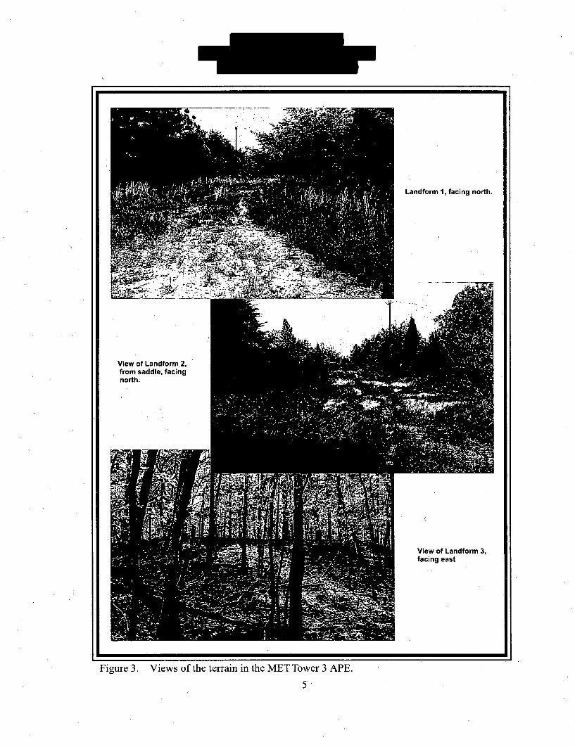
Landform 1, facing north.
View of Landform.2,from saddle, facingnorth.
p.
.~&. .~
41A
View of Landform 3,facing east
Figure 3. Views of the terrain in the MET Tower 3 APE.
5.

Cemetery Recording
Brockington and Associates also verified the locations of four known cemeteries (J. H.Stroup Cemetery, Moss Cemetery, McKown Family Cemetery, and Unnamed Cemetery) andrecorded their exact locations with a Trimble GeoXH handheld receiver. Investigators used GPSPathfinder software for post-processing and differential correction. Brief descriptions of thesecemeteries and their locations follows. All four cemeteries will be outside the fence for the LNSand will remain undisturbed and accessible to the public.
J. H. Stroup Cemetery. This cemetery is contained by a fence. A few of the stones have
fallen over. Most of the stones are in good condition and their inscriptions are legible. A fewfoot marker stones were also observed. This cemetery is easily accessible by road. Figure 4provides a view of the J. H. Stroup Cemetery.
Figure 4. J. H. Stroup Cemetery.
Moss Cemetery.
This cemetery is also contained by a fence. Some of the stones here
have fallen over. Most of the inscriptions on stones still standing are legible. A few foot
.6
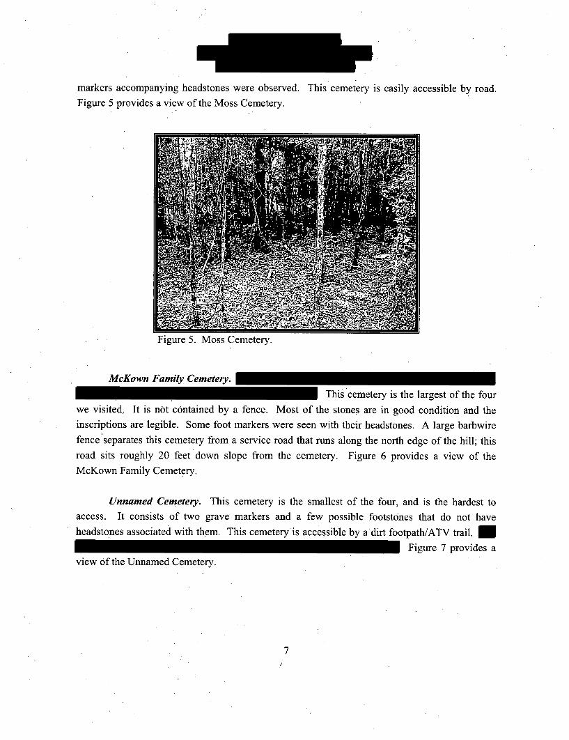
markers accompanying headstones were observed. This cemetery is easily accessible by road.Figure 5 provides a view of the Moss Cemetery.
vigure -'. Moss Uemetery.
McKown Family Cemetery.
This cemetery is the largest of the four
we visited, It is not contained by a fence. Most of the stones are in good condition and theinscriptions are legible. Some foot markers were seen with their headstones. A large barbwire
fence separates this cemetery from a service road that runs along the north edge of the hill; thisroad sits roughly 20 feet down slope from the cemetery. Figure 6 provides a view of the
McKown Family Cemetery.
Unnamed Cemetery. This cemetery is the smallest of the four, and is the hardest toaccess. It consists of two grave markers and a few possible footstones that do not have
headstones associated with them. This cemeteryis accessible by a dirt footpath/ATV trail.
Figure 7 provides a
view of the Unnamed Cemetery.
7

Pigure o. Mc&own Pamily _emetery.
Figure 7. Unnamed Cemetery.
Summary
Brockington and Associates, Inc., conducted investigations of the proposed MET
Tower 3 in May 2007. These investigations consisted of systematic and judgmental shovel
-testing across three landforms along the northern edge of the LNS Tract. The planned timbering
and grading required for the MET Tower 3 construction will not affect any cultural resources.,
No further cultural resource management is recommended.
8

Cultural Resources Survey of the Lee Nuclear Station Railroad CorridorCherokee County, South Carolina
Ralph Bailey Jr., RPABrockington and Associates, Inc.
December 3, 2007
Introduction
In November 2007, Brockington and Associates, Inc., conducted an intensive cultural
resources survey of the proposed railroad corridor that will serve the proposed William S. Lee IIINuclear Station (hereinafter referred to as the Lee Nuclear Station or LNS) in Cherokee County,
South Carolina. The proposed corridor for the railroad line is seven miles long and approximately
50 feet wide, extending from the northwestern portion of the plant site west to Gaffney. This corridor
is the Area of Potential effect (APE). We also considered possible visual or audible effects to knownhistoric properties near the corridor. The proposed rail line lies almost entirely within the existing
rail bed and right-of-way acquired and constructed in the 1970s for the former Cherokee project.Figure 1 presents the location of the tract on the USGS Blacksburg South quadrangle.
The survey was conducted in partial compliance with the National Environmental Protection
Act (NEPA) to determine if the undertaking will affect historic properties (i.e., archaeological sites,
buildings, structures, objects, or districts eligible for or listed on the National Register of HistoricPlaces [NRHP]). Compliance will be administered by the regulatory programs of the Nuclear
Regulatory Commission (NRC). This survey was completed in compliance with state laws and
regulations concerning the management of historic properties.
The cultural resources portion of the NEPA process will be completed in four phases. The
first phase is the 2,000-acre plant site. The scope was approved by the South Carolina State Historic
Preservation Office (SHPO) in late February 2007, and the survey was completed on March 12-14,2007. The remaining phases involve infrastructure, including future railroad, transmission lines, and
water discharge. This study includes the railroad line survey. We will submit to SHPO a separate
proposed scope for the survey of the water discharge facility and transmission line corridors in thenear future after their locations have been determined.
There is one existing business within the right-of-way. Duke Energy plansto acquire a small
section of new right-of-way to avoid the business. We conducted an archaeological survey of the
1

Figure withheld under Section 304 of the Archaeological Resources Protection Act (16 U.S.C. 470w-3(a))

new alignment in this area. No archaeological sites or isolated artifacts were identified.
There will be no new ground disturbance within 38CK68. We visually
inspected 38CK68 to assess the potential for any extant features that may remain at the site to be
adversely affected by construction or operation of the railroad through vibration or visual intrusion.
Construction of the railroad within the existing corridor through 3 8CK68 will have no adverse effect
on this historic property. The remainder of the right-of-way was extensively graded and/or filled as
well and has very little potential, to contain historic properties; we do not recommend any further
investigations in these areas.
Methods of Investigation
Project Objective. The objective of the cultural resources investigations was to assess the
potential for the construction and use of the railroad to affect potential cultural resources. Tasks
performed to accomplish this objective include background research, archaeological survey, and
architectural survey. Methods employed for each of these tasks are described below.
Background Research. The authors conducted research at the South Carolina Institute of
Archaeology and Anthropology (SCIAA) and the South Carolina Department of Archives and
History (SCDAH) to identify nearby areas of previous cultural resources investigations and thelocations of known archaeological sites, historic architectural resources, and historic properties
within one mile of the project corridor. The purposes of the archival research were to identify
potential Pre- or Post-Contact archaeological sites and buildings and to develop a historic context
that would assist in evaluating cultural resources.
ArchaeologicalSurvey. Intensive archaeological survey entailed the systematic examination
of the proposed new alignment segment of the corridor. We employed methods recommended in the
South Carolina Standards and Guidelines for Archaeological Investigations (SCDAH 2005). Shovel
tests were excavated at 100-foot intervals along transects spaced 100 feet apart, or 15 meters north
and south of the centerline of the new alignment.
ArchitecturalSurvey. The project architectural historian conducted an intensive architectural
survey of all aboveground cultural resources within the project tract and a 300-foot area surrounding
the project area to take into account.any possible visual effects of the proposed undertaking (see
3

Figure 1). The survey was designed to identify, record, and evaluate all historic architectural
resources (buildings, structures, objects, designed landscapes, and/or sites with aboveground
components) in the project. Field survey methods complied with the Survey Manual: South Carolina
Statewide Survey of Historic Places (SCDAH 2007) and National Register Bulletin 24, Guidelines
for Local Surveys: A Basis for Preservation Planning (Parker 1985).
Previous Cultural Resources Investigations In and Nearthe Corridor
There are two sites near the right-of-way, sites 38CK38 and 38CK68 (see Figure 1). Site
38CK68, is listed on the National Register of Historic Places. Ferguson and Cowan
(1986:91,. 93) describe this site as follows:
The is directly related to the Susan Furnace Site in that these wereout[ly]ing furnaces to the main manufacturing operation and had sequentiallyplanned production schedules. If one furnace was in operation, the other wasgenerally not. Both sites still exhibit partially collapsed but well preserved furnacesand associated features. Associated features include foundations, sluiceways, slagheaps, and adjacent ore pits.
The when viewed as an operationally related set of sites offers probably
the best single research opportunity of any of the nineteenth century companycomplexes. The research potential of this site is extremely great, particularly in termsof understanding site patterning and organization.
The ten sites includedin the
range of sites documentthe evolution of the iron industry in the state from plantation iron furnace operations
'of the late eighteenth and early nineteenth centuries to the large manufacturingcomplexes associated with the major industrialization of the mid-1800s. The demiseof the South Carolina iron industry began on the eve of the Civil War whencompanies in other regions of the eastern United States adopted broad based rawmaterial procurement and marketing strategies based on rail transportation and moreadvanced and cheaper coal based production technology. These factors coupled withresource depletion and drastic changes in the once slave based labor structure led toanalmost total inability to remain economically competitive.
Site 38CK38 was one of several sites recorded in the late 1970s. The site is recorded as a
small Pre-Contact site, and the site form on file at SCIAA indicates that the site is probably not
4
W e
eligible. Keith Derting, State Site Files Manager at SCIAA, indicated that he considers the locationof the site, as well as several others recorded in this area at the same time, to be problematic.
Results of the Field Investigations
Results of the Archaeological Survey. The project tract consists of mostly heavy slopesgreater than 15 percent. The only level ground within the project tract was fabricated by machinerywhen the original bed of the railroad was constructed in the 1970s. Within the project tract, therailroad bed appears to have been cut into the side of a large hill. A portion of the ice plant wasconstructed on the railroad bed, and the paved driveway into the plant from People's Creek Road liesalong the railroad bed also. Duke Energy plans to widen the current railroad alignment to the northalong the driveway so that the ice plant will continue to have access to People's Creek Road. Thenew alignment of the railroad will also shift north of the ice plant, since the plant sits on the oldalignment.
Investigators excavated 12 shovel tests at 100-foot intervals north and south of the centerlineof the new alignment. Figure 2 presents an aerial view of the proposed alignment shift. Figure 3presents a plan of the'new alignment showing the location of the shovel tests. Shovel tests revealedvarying soil profiles that reflect gravelly sand fill north of the existing railroad bed and erosionaldeposits from the steep hillside south of the railroad bed. Red clay was observed at the groundsurface or directly underneath grass in almost all cases where the ground was level. On the hillside tothe south of the railroad bed, rock was on the surface in most cases. A large portion of the right-of-way for the new railroad alignment lies within the plant, which consists of large paved surfaces andextremely steep slopes greaterthan 15 percent. No artifacts were recovered from the shovel tests; all
were negative.
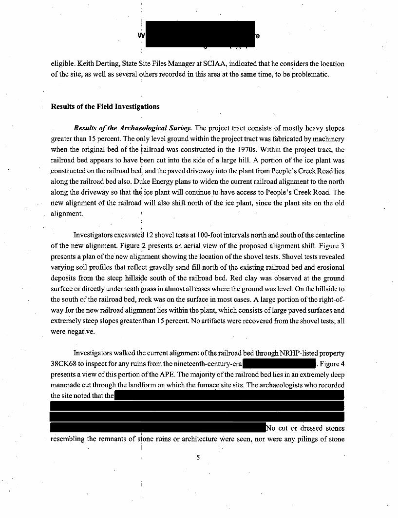
Investigators walked the current alignment of the railroad bed through NRHP-listed property38CK68 to inspect for any ruins from the nineteenth-century-era . Figure 4presents a view of this portion of the APE. The majority of the railroad bed lies in anextremely deepmanmade cut through the landform on which the furnace site sits. The archaeologists who recordedthe site noted that the
No cut or dressed stonesresembling the remnants of stone. ruins or architecture Were seen, nor were any pilings of stone
5

Figure withheld under Section 304 of the Archaeological Resources Protection Act (16 U.S.C. 470w-3(a))

Figure withheld under Section 304 of the Archaeological Resources Protection Act (16 U.S.C. 470w-3(a))

indicative of foundations observed. Using the oldrailroad bed as a railroad today will have no
adverse effect on NRHP-listed property 38CK68.
Results of the Architectural Survey.
Brockington's architectural historian conducted a
reconnaissance of the railroad line that will be usedJ in the current project. The r'ailroad line was
constructed in the 1970s and is not yet 50 years ofFigure 4. View of the railroad corridor.through 38CK68. age; therefore, according to SCDAH. (2007)
regulations, it was not inventoried or assessed. Asplanned, the proposed project will utilize the
current railroad line, with one reroute near the town of Gaffney. The current railroad line and the
proposed reroute comprise the architectural survey universe. See Figure 1 for a portion of the USGS
Blacksburg South quadrangle map showing the architectural survey universe.
The architectural historian first examined the USGS Blacksburg South quadrangle map,which contained the project area, to identify any aboveground resources along the line that might be
50 years of age. Upon inspection of the map, he did not identify any possible resources. Next he
conducted a windshield survey of portions of the railroad line that could be reached withouttrespassing. Again, he identified no new historic architectural resources along the current railroad
line and expansion of the line that would require inventory or assessment according to SCDAH
regulations. Finally, the architectural historian walked portions of the railroad line in an effort to
identify any other resources. Again, no historic architectural resources Were identified.
Since there are no eligible historic resources along the current railroad line or the new
construction, and since the proposed undertaking will not require any major alterations to the
railroad line, we recommend that there will be no effect on any aboveground resources by the
proposed undertaking.
Project Summary
The proposed railroad line to provide service to the LNS in Cherokee County will not affect
any historic properties. With the exception of a small section of realignment to avoid taking an
existing plant, the entire corridor is within an existing, graded alignment. Archaeological survey of
8

the proposed alignment shift did not identify any sites or isolated finds. There are no historic
architectural resources near the corridor.
This survey is part of a multiphase program in which Duke Energy is engaged. In
consultation with SHPO, Duke Energy will also complete a survey of the proposed transmission
lines and water discharge area as part of the Section 106 process for the overall NRC licensing of the
LNS.
References Cited
Ferguson, Terry A., and Thomas A. Cowan1986 Iron Plantations and the Eighteenth- and Nineteenth-Century Landscape of the
Northwestern South Carolina Piedmont. In Carolina's Historical Landscapes:Archaeological Perspectives, edited by Linda F. Stine, Martha Zierden, Lesley M. Drucker,and Christopher Judge, pp. 113-144. University of Tennessee Press, Knoxville.
Parker, Patricia L.1985 Guidelines for Local Surveys: A Basis for Preservation Planning. National Register
Bulletin 24. US Department of the Interior, National Park Service, Interagency ResourcesDivision, Washington, DC.
South Carolina Department of Archives and History (SCDAH)2005 Guidelines and Standardsfor ArchaeologicalInvestigations. State Historic Preservation
Office, Review and Compliance Branch, Columbia.
2007 Survey Manual: South Carolina Statewide Survey ofHistoric Properties. South CarolinaDepartment of Archives and History, Columbia.
9 l-

June 8, 2007
I'or AMI Geisv~iotis
Mr. Ralph BaileyBrockington and Associates1051 Johnnie Dodds Blvd., Ste. FMt. Pleasant, SC 29464
Re: Draft Report and Addendum; Cultural. Resources-Survey of the ProposedLee Nuclear Station, Cherokee County, South Carolina
Dear Mr. Bailey:
Our office has had the opportunity to review the above-referenced report and addendum.The report meets federal and state guidelines for the identification and assessment ofhistoric properties.
Our office concurs with your assessment that architectural resources 0061.00-0068.03are not eligible for listing. in the National Register of Historic Places. The developmentand construction of the Lee Nuclear Station will not affect these properties. Architecturalresource 0042.00-01, the Ninety-Nine Islands Hydro Plan and Dam, is eligible for listingin the National Register of Historic Places. We believe that the proposed work at theLee Nuclear Station should cause no adverse effect to this historic property.
This cultural resources investigation was prepared in anticipation of an application forconstruction and operation to the Nuclear Regulatory Commission. We understand thatadditional cultural resources work will be conducted on the railroad, transmission lines,and the discharge facility for the plant. It is likely that some sort of agreement will beneeded to govern future cultural resources identification and address future work to bedone at the plant through the life of the licqpseif granted. We..look.forard to continuingto work with you and Duke Energy on this project.
*These comments are provided by the State Historic Preservation Office pursuant toSection 106 of the National Historic Preservation Act, as amended. If you havequestions, please contact me at (803) 896-6169 or [email protected].
Sincerely,
Rebekah DobraskoReview and Compliance CoordinatorState Historic Preservation Office
S.C. Departmment orArchives & Histwry )8301 Parklane Road * Columbia ,So uh Carolina *29223-4905 * 803-896-6100 * wiw.state.sc.u•/scd ah
FoRA.
fi IMJanuary 9, 2008
Mr. Theodore BowlingEnvironmental Project Manager
Duke EnergyEC09D/P.O. Box 1006Charlotte; NC 28201-1006704382-591 7
Re: Cherokee Nuclear/Lee Nuclear Station•Cherokee County, South Carolina
Dear Mr. Bowling:
Thank you for your letter of December 10, which we received on December 12, alongwith two copies of the draft report entitled Cultural Resources Survey of the Lee NuclearStation Railroad Corridor, Cherokee County, South Carolina. This survey focuses on therailroad corridor portion of the overall Cherokee Nuclear/Lee Nuclear Station project.
The Ellen Furnace Works (38CK0068) is listed in the National Register of Historic Placesand for this project. Our office concurs with the
assessment that the proposed railroad corridor reactivation will cause no adverse effectto the
We do request that our office be notified immediately if archaeological materials areencountered during any construction activities associated with the railroad.Archaeological materials consist of any items, fifty years old or older, which were madeor used by man. These items include, but are not limited to, stone projectile points . ,(arrowheads), ceramic sherds, bricks, worked wood, bone and stone, metal and glassobjects, and human skeletal materials.
These comments are provided by the State Historic Preservation Office pursuant toSection 106 of the National Historic Preservation Act, as amended. If you havequestions, please contact me at (803) 896-6169 or [email protected].
Sincerely,
Rebekah DobraskoReview and Compliance CoordinatorState Historic Preservation Office
S. C. Department of Archives & Historya 8301 Parklane Road a Columbia - South Carolina * 29223-4905 • (803) 896-6100 * www.state.us/scdah
Related Documents

![Round schedule Notices issued by Ofcom under … · Airspan [REDACTED] EE [REDACTED] H3G [REDACTED] Telefonica [REDACTED] Vodafone [REDACTED] Bidder Eligibility events available (start](https://static.cupdf.com/doc/110x72/5ba4d8c509d3f257608be093/round-schedule-notices-issued-by-ofcom-under-airspan-redacted-ee-redacted.jpg)