BRONX RIVER WATERSHED MANAGEMENT PLAN RECOMMENDATIONS FOR MUNICIPAL ORDINANCES To Improve Water Quality For The Bronx River Watershed Westchester County, NY Prepared by: Westchester County Department of Planning For the: Bronx River Watershed Coalition August 2007 WESTCHESTER COUNTY DEPARTMENT OF PLANNING Gerard E. Mulligan, AICP, Commissioner Westchester P L A N N I N G

Welcome message from author
This document is posted to help you gain knowledge. Please leave a comment to let me know what you think about it! Share it to your friends and learn new things together.
Transcript

BRONX RIVER WATERSHED MANAGEMENT PLAN
RECOMMENDATIONS FOR MUNICIPAL ORDINANCES
To Improve Water Quality For The Bronx River Watershed
Westchester County, NY
Prepared by: Westchester County Department of Planning
For the: Bronx River Watershed Coalition
August 2007
WESTCHESTER COUNTY DEPARTMENT OF PLANNING Gerard E. Mulligan, AICP, Commissioner
Westchester
P L A N N I N G
RECOMMENDATIONS FOR MUNICIPAL ORDINANCES To Improve Water Quality For The Bronx River Watershed
WESTCHESTER COUNTY EXECUTIVE
Andrew J. Spano
WESTCHESTER COUNTY DEPARTMENT OF PLANNING Gerard E. Mulligan, AICP, Commissioner
David Kvinge, AICP, ASLA, Director of Environmental Planning
BRONX RIVER WATERSHED COALITION City of Mount Vernon City of White Plains
City of Yonkers Town of Eastchester Town of Greenburgh
Town/Village of Harrison Town of Mount Pleasant
Town of New Castle Town of North Castle
Village of Ardsley Village of Bronxville Village of Elmsford Village of Scarsdale Village of Tuckahoe
Kensico Environmental Enhancement Program Bronx River Conservancy
Bronx River Alliance New York City Department of Parks and Recreation
New York City Department of Environmental Protection New York State Department of Environmental Conservation,
Division of Water New York Department of State,
Division of Coastal Resources and Waterfront Revitalization Westchester County Department of Parks, Recreation and Conservation
Westchester County Department of Planning
PROJECT STAFF Robert Doscher, PWS, CPESC, Principal Environmental Planner
Lisa Vasilakos, Environmental Planner
2

TABLE OF CONTENTS I. INTRODUCTION 4 II. ORDINANCE RECOMMENDATIONS FOR BRONX RIVER WATERSHED MUNICIPALITIES
1. Village of Ardsley 5 2. Village of Bronxville 5 3. Town of Eastchester 5 4. Village of Elmsford 6 5. Town of Greenburgh 6 6. Village of Harrison 7 7. Town of Mount Pleasant 7 8. City of Mount Vernon 8 9. Town of New Castle 8 10. Town of North Castle 9 11. Village of Scarsdale 9 12. Village of Tuckahoe 10 13. City of White Plains 10 14. City of Yonkers 10
III. GENERAL ENVIRONMENTAL ORDINANCE RECOMMENDATIONS 11 IV. GENERAL SITE DESIGN RECOMMENDATIONS 27 V. APPENDICES (Model Ordinances)
3
I. Introduction Fourteen municipalities, each covering a portion of the area draining into the Bronx River, agreed in 2003 to send representatives to a forum for discussing water quality improvement strategies for the river. Working with staff of the Westchester County Department of Planning, the representatives formed Watershed Advisory Committee 7, which also included representatives from environmental organizations and the Westchester County Department of Parks, Recreation and Conservation. This group later became known as the Bronx River Watershed Coalition. Agencies of the State of New York and City of New York also agreed to participate in the development of a water quality improvement plan for the river, its tributaries, and the area draining into the river by working with the 14 municipalities, County agencies and environmental organizations that were already part of the group. It was decided that the plan’s emphasis would be the improvement of water quality through the control of nonpoint source pollution, also known as polluted stormwater. This is stormwater runoff that has picked up contaminants, including excessive nutrients and sediment, from parking lots, roads, lawns, buildings, etc., creating a solution called polluted stormwater. It becomes a problem when it enters water resources like wetlands, streams, ponds, reservoirs and estuaries. In developing the plan, it was immediately apparent that one of the most effective tools in controlling polluted stormwater is properly planned and executed land use regulations, especially at the local level where the majority of land use decisions are made. Therefore, Department of Planning staff began assessing the land use regulations of the 14 municipalities that may impact water quality and assist in the control of polluted stormwater. As a result of this assessment, Department of Planning staff identified general areas where local regulatory mechanisms can be enhanced or created to further the control of polluted stormwater. These include strengthening existing regulations and adopting new laws based on existing guidelines and models. Staff then made brief recommendations for each municipality, provided brief guidelines for the various types of land use regulations that can help control polluted stormwater, and collected appropriate model ordinances pertaining to these types of regulations. This portion of the Bronx River watershed management plan is separated into three components. The first are brief recommendations for each municipality to enhance existing regulations or adopt new ones. The second are general guidelines pertaining to the development of regulations aimed at improving water quality by reducing polluted stormwater. And the third are the selected model ordinances that can be adopted by Bronx River watershed municipalities in whole or in part to fill regulatory gaps or strengthen existing ordinances.
4
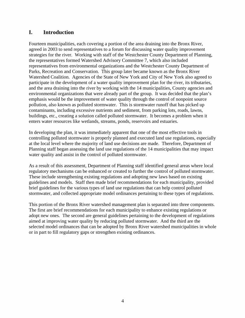
II. Ordinance Recommendations for Bronx River Watershed Municipalities Village of Ardsley
• Adopt a distinct wetland protection ordinance, similar to and containing the key provisions of Model Ordinance for Wetland Protection; when the ordinance has been adopted, delete wetland management criteria in Chapter 200, Section 93, of existing Zoning Ordinance
• Incorporate steep slopes management criteria noted in Chapter 200, Section 93, of the
existing Zoning Ordinance, and excavation management criteria noted in Chapter 105 of the existing Zoning Ordinance, or at least reference these in Chapter 171, Stormwater Management and Erosion and Sediment Control Ordinance
• Amend existing Zoning Ordinance and other applicable chapters of the Village Code to
incorporate recommendations noted below under Section 7, Site Design Village of Bronxville
• Adopt Model Ordinance for Wetland Protection • Apply conservation and management criteria for trees and other vegetation on privately
owned lands, not just publicly owned lands, into the Trees, Shrubs and Plants (Chapter 282) Ordinance
• Amend existing Zoning Ordinance and other applicable chapters of the Village Code to
incorporate recommendations noted below under Section 7, Site Design Town of Eastchester
• Replace the existing Freshwater Wetlands Protection Ordinance by adopting Model Ordinance for Wetland Protection
• Adopt Model Erosion and Sediment Control Ordinance (or adopt proposed ordinance
tentatively titled Stormwater Management and Erosion and Sediment Control Law), and incorporate steep slope management and excavation and filling criteria into Erosion and Sediment Control Ordinance
• Adopt proposed ordinance tentatively titled Stormwater Management and Erosion and
Sediment Control Law • Adopt proposed ordinance tentatively titled Illicit Discharge and Connection Law
5

• Apply conservation and management criteria for trees and other vegetation on privately owned lands, not just publicly owned lands, into the town’s Preservation, Protection, Maintenance and Planting of Trees, Shrubs and Plants on Public Property Local Law
• Amend Zoning Ordinance and subdivision regulations to incorporate recommendations
for parking lot design, minimum standards for sidewalk and driveway dimensions, and alternative paving materials, and other appropriate recommendations, noted below in Section 7, Site Design
Village of Elmsford
• Replace the existing Freshwater Wetlands Ordinance, Chapter 179 of the Village Code, by adopting Model Ordinance for Wetland Protection
• Adopt ordinance that applies conservation and management criteria for trees and other
vegetation on privately and publicly owned lands (see below under Section 6, Vegetation and Tree Conservation)
• Amend Zoning Ordinance (Chapter 335) and Subdivision of Land Ordinance (Chapter
293) to incorporate recommendations noted below in Section 7, Site Design Town of Greenburgh
• Incorporate appropriate elements of the Watercourse Protection Ordinance (Chapter 270) into Wetlands and Watercourses Law (Chapter 280) and repeal the Watercourse Protection Ordinance (Chaper 270)
• Adopt Model Erosion and Sediment Control Ordinance and reference such ordinance in
existing Steep Slopes Protection Ordinance (Chapter 245), Excavation and Soil Removal Ordinance (Chapter 210), Subdivision Regulations (Chapter 250), and Wetlands and Watercourses Law (Chapter 280), and Zoning Regulations (Chapter 285)
• Adopt Model Stormwater Management Ordinance
• Adopt Model Illicit Discharge and Connection Ordinance and reference appropriate
sections of the town’s Sanitation Ordinance (Chapter 410) • Amend Zoning Regulations (Chapter 285) Amend and Subdivision Regulations (Chapter
250) to incorporate recommendations noted below in Section 7, Site Design
6

Town/Village of Harrison
• Incorporate appropriate sections of Model Drinking Water Protection Ordinance and recommendations noted below in Section 1, Drinking Water Protection, into the town’s existing Water Pollution Ordinance (Chapter 230).
• Incorporate watercourses and watercourses protection into existing Freshwater Wetlands
Protection Law (Chapter 149) and incorporate appropriate recommendations noted in Section 2, Wetland and Watercourse Protection, especially for regulated buffers next to both wetlands and watercourses, regulated buffers for steep slopes, “sequencing” approach (impact avoidance, minimization and mitigation), mitigation requirements, reference to stormwater ordinance, reference to erosion and sediment control practices and state guidelines, limitations on pesticide and herbicide use, wetlands definition, professional requirement, replacement ratios for mitigation, and administrative provisions for watercourses
• Strengthen Erosion and Sediment Control Ordinance (Chapter 130) to include
recommendations noted in Section 3, Erosion and Sediment Control, and to reference New York State Standards and Specifications for Erosion and Sediment Control rather than Westchester County Best Management Practices Manual for Erosion and Sediment Control and incorporate filling provisions into Excavation and Soil Removal (Chapter 133) Ordinance
• Adopt Model Stormwater Management Ordinance, referencing it in Water Pollution
Ordinance (Chapter 230)
• Adopt a Model Illicit Discharge and Connection Ordinance, and incorporate, if needed, appropriate provisions for waste management from the town’s Garbage, Rubbish and Refuse (Chapter 155) Ordinance
• Amend Zoning Ordinance (Chapter 235) and Subdivision of Land Ordinance (Chapter
204) to incorporate recommendations noted below in Section 7, Site Design
Town of Mount Pleasant
• Adopt Model Drinking Water Protection Ordinance • Combine Streams and Watercourses Ordinance (Chapter 185) and Freshwater Wetlands
Ordinance (Chapter 111) and revise to incorporate appropriate recommendations noted in Section 2, Wetland and Watercourse Protection
• Adopt Model Erosion and Sediment Control Ordinance and reference this ordinance in
existing Excavations and Topsoil Ordinance ( Chapter 96)
7
• Amend Zoning Ordinance (Chapter 218) and Subdivision Regulations (Chapter A227) to include site design - setbacks to reduce impervious surface coverage, driveway design alternatives, sidewalk design alternatives, open space design and management, and any other appropriate recommendations - noted below in Section 7, Site Design
City of Mount Vernon
• Adopt Model Ordinance for Wetland Protection
• Adopt Model Erosion and Sediment Control Ordinance
• Adopt a Model Stormwater Management Ordinance (see appendices) • Adopt Model Illicit Discharge and Connection Ordinance
• Adopt Vegetation and Tree Conservation and Management Ordinance (see City of New
Rochelle, for example)
• Amend Zoning Ordinance (Chapter 267) to incorporate recommendations noted below in Section 7, Site Design
Town of New Castle
• Amend Environmental Protection Overlay District (Chapter 64) to include additional overlay protection zones: wellhead protection, recharge area protection, watershed area contributing to recharge area (surface and ground waters), and overlay criteria (land use restrictions, performance standards, reference to erosion and sediment control ordinance, pesticide restriction, fertilizer restriction, impact study for work in restricted area, septic and sewer management)
• Merge Watercourses Protection Law (Chapter 135) with Wetlands Ordinance (Chapter
137) to create Wetlands and Watercourses Protection Law, referencing the Environmental Protection Overlay District (Chapter 64), and amend the new Wetlands and Watercourses Protection Law to reduce the size of wetlands afforded protection under this ordinance from 1/10 acre (4,380 square feet) to include those smaller wetlands that may be environmentally significant, such as small headwaters wetlands and vernal pools
• Adopt Model Erosion and Sediment Control Ordinance, referencing the Zoning
Ordinance (Chapter 60), Subdivision of Land Ordinance (Chapter 113), Steep Slope Protection Ordinance (Chapter 108), and Environmental Protection Overlay District (Chapter 64)
8

• Adopt proposed local law tentatively titled Stormwater Management and Erosion and Sediment Control
Town of North Castle
• Adopt Model Drinking Water Protection Ordinance • Merge Watercourses Ordinance (Chapter 206) with Wetlands and Drainage Ordinance
(Chapter 209) to create Wetlands and Watercourses Protection Law, and incorporate recommendations noted below in Section 2, Wetland and Watercourse Protection
• Incorporate steep slope management into existing Erosion and Sediment Control Law
(Chapter 101) and either reference this law in existing Ordinance Governing and Regulating Excavations, Removal of Trees, Removal of Topsoil, Sand, Gravel and Rock, Construction of Retaining Walls and Shoring of Excavated Areas (Chapter 102) and Filling and Grading Ordinance (Chapter 105) or incorporate some or all of the provisions of those ordinances into the Erosion and Sediment Control Law
• Adopt Model Stormwater Management Ordinance
• Amend Zoning Ordinance (Chapter 213) to incorporate recommendations noted below in
Section 7, Site Design Village of Scarsdale
• Combine Diversion of Watercourses Ordinance (Chapter 302) and Freshwater Wetlands Ordinance (Chapter 171) to create a Freshwater Wetlands and Watercourses Protection Ordinance and incorporate appropriate recommendations noted below in Section 2, Wetland and Watercourse Protection, especially to include provisions for identifying and regulating wetlands not shown on the village’s “Freshwater Wetlands Map”
• Incorporate greater restrictions on disturbances to and creation of steep slopes under
Stormwater Management Ordinance (Chapter 254); consideration should be given to adopting Model Erosion and Sediment Control Ordinance to separate erosion and sediment control practices (noted in New York State Standards and Specifications for Erosion and Sediment Control) from post-construction and other stormwater management practices (noted in New York State Stormwater Management Design Manual and elsewhere)
• Amend section of Trees, Brush, Grass and Weeds Ordinance (Chapter 281, Article 1),
which currently provides a potential loophole for the destruction of shrubs, trees and other vegetation without a permit
• Amend Zoning Law (Chapter 310) and Subdivision of Land Regulations (Chapter A319)
to incorporate recommendations noted below in Section 7, Site Design
9
Village of Tuckahoe
• Adopt Model Ordinance for Wetland Protection • Amend Erosion and Sediment Control Law (Chapter 7B) to create Erosion and Sediment
Control and Stormwater Management Law by combining Erosion and Sediment Control Law (Chapter 7B) and Zoning Ordinance, Stormwater Control (Appendix A, Article XII)
• Adopt Vegetation and Tree Conservation and Management Ordinance (see City of New
Rochelle, for example) • Amend Zoning Ordinance (Appendix A) to incorporate recommendations noted below in
Section 7, Site Design
City of White Plains
• Adopt a distinct wetland and watercourse protection ordinance, e.g., Model Ordinance for Wetland Protection or recommendations noted in Section 2, Wetland and Watercourse Protection, that includes the protection of watercourses
• Adopt Model Erosion and Sediment Control Ordinance
• Adopt a Model Stormwater Management Ordinance • Adopt a Model Illicit Discharge and Connection Ordinance
• Amend Tree Preservation Guidelines to incorporate recommendations noted below in
Section 6, Vegetation and Tree Conservation City of Yonkers
• Adopt Model Ordinance for Wetland Protection • Adopt Model Erosion and Sediment Control Ordinance
• Adopt Model Stormwater Management Ordinance • Adopt Model Illicit Discharge and Connection Ordinance
• Apply conservation and management criteria for trees and other vegetation on privately
owned lands, not just publicly owned lands, into the Shade Trees Ordinance (Chapter 80) • Amend Zoning Ordinance (Chapter 43) to incorporate recommendations noted below in
Section 7, Site Design
10
III. GENERAL ENVIRONMENTAL ORDINANCE RECOMMENDATIONS SECTION 1. DRINKING WATER (AQUIFER AND RESERVOIR) PROTECTION “Overlay Districts” Wellhead Protection (Zone 1) Wellhead protection should be part of an "overlay district," encompassing well fields and surrounding lands that directly influence well fields, including from migrating contaminants generated by current and potential land uses. The New York State Source Water Assessment Program Plan should be followed. Recharge Area Protection (Zone 2) A recharge protection area also should be part of an "overlay district" to include the surrounding drainage, or watershed, areas directly influencing groundwater recharge. The New York State Source Water Assessment Program Plan should be followed. Watershed Area Contributing to Recharge Area (Surface Water) An "overlay district" should be established to protect surface drinking water sources. The district should include all lands that directly contribute to the municipal surface water supply. The New York State Source Water Assessment Program Plan should be followed. Upland Buffers in Overlay Districts Upland buffers should be maintained, enhanced or restored along the edge of all public supply reservoirs in surface water overlay districts. The New York State Source Water Assessment Program Plan should be followed. Underground Storage Tanks (UST) The Westchester County Health Department regulates underground storage tanks (USTs) greater than 1,100 gallons. Spill, overfill, and corrosion protection should be required for USTs that are less than 1,100 gallons and permitted in "overlay districts" but USTs should be prohibited in wellhead protection Zone 1 and limited in recharge protection Zone 2 and surface water "overlay districts." Land Use Restrictions Land uses posing a potentially high risk for contaminating ground and surface waters should be prohibited in areas where their potential adverse impacts would be most detrimental, such zones 1 and 1 and surface water “overlay districts” noted above. Examples include, but are not limited
11
to, auto repair shops, gas stations, dry cleaners using on-site dry cleaning chemicals, chemical processing facilities, salvage yards, and waste disposal facilities. Reference to Wetlands and Watercourses Protection Regulations Require compliance with existing wetland and watercourse protection regulations or adopt requirements for wetland and watercourse protection if a distinct ordinance does not currently exist. Reference to Stormwater Ordinance Require compliance with existing stormwater management regulations or adopt requirements for stormwater management if a distinct ordinance does not currently exist. Reference to Erosion and Sediment Control Ordinance Require compliance with existing erosion and sediment control regulations or adopt requirements for erosion and sediment control if a distinct ordinance does not currently exist. Pesticide Application The application of pesticides, including herbicides and other similar chemicals, should be regulated in and around drinking water supplies and a permit should be required. Fertilizer Restriction The application of fertilizers should be predicated on a soils analysis to determine the need for fertilizers prior to application. Impact Assessment or Study for Development in Overlay Districts A comprehensive environmental impact assessment or statement should be required for all development subject to site plan, subdivision or special permit approval or a zoning variance within "overlay districts." Septic and Sewer Management Sewer pipes should be regularly monitored for leaks and repaired, if needed, and septic systems should be approved in strict accordance with county and state regulations, inspected and certified during construction, regularly inspected for leaks following construction, and repaired, if needed. Pump Alarms Alarms at gasoline stations and other facilities that use pumps to discharge potential contaminants to warn of overflows should be installed.
12
SECTION 2. WETLAND AND WATERCOURSE PROTECTION Regulated Adjacent Areas Any regulated activity within one hundred (100) feet of a wetland or watercourse boundary should be reviewed by the regulatory authority and a permit granted prior to the commencement of the activity. Lesser widths may be considered in highly urbanized areas or areas with building lots of five thousand square feet or less. Regulated Buffers for Steep Slopes In conjunction with the above regulated setbacks, the following additional distances should be applied to steep slopes: add 10 feet to 15%-25% slope; add 20 feet to 25%-35% slope; add 30 feet to 35%-45% slope; add 50 feet to >45% slope. Permits Permits should be required for all work in a wetland or watercourse or wetland or watercourse regulated setback. Impact Sequencing The first step in the regulatory review process should be for the applicant to demonstrate and the reviewer to verify that regulated activities have been subjected to the three-tiered impact sequencing process, whereby impacts to wetlands and watercourses have been (1) avoided to the fullest practicable extent, that unavoidable impacts have been (2) minimized to the fullest practicable extent, and that any remaining impacts have been (3) fully mitigated, such as via wetland restoration (preferred) or creation. Mitigation Requirements For unavoidable wetland and watercourse impacts that have been minimized to the fullest practicable extent, mitigation plans should be developed that primarily seek to mitigate impacts through restoration (preferred) or creation; wetland and watercourse enhancement should not be considered except for exceptional circumstances. Replacement Ratio for Mitigation When wetland mitigation is needed and/or required, the mitigation ratio should be at least 1.5:1, meaning that for each acre of wetland that is destroyed, disturbed or impacted in some other way, at least 1.5 acres of wetland should be restored or created. Sequencing and Mitigation for Regulated Setbacks The three-tiered sequencing process and mitigation requirements noted above also should be applied to proposed regulated activities within regulated setbacks, where appropriate. For
13
example, the loss of forested upland immediately next to wetlands should be avoided, minimized or mitigated by the restoration or creation of forested upland elsewhere on site or within the same watershed. Pavement Deicing The storage and dispersal of sodium chloride and other deicing agents should be governed and/or restricted in regulated setbacks. For example, agents should be stored only in watertight or waterproof containers or in facilities that prevent contaminant runoff and leaching. Road salt usage should be minimized - balancing water quality protection with motorist safety - in accordance with best management practices as developed by the New York State Department of Transportation. Regulated Activities in Wetlands, Watercourses and Setbacks Permits are required for the following activities: filling (discharge), excavation (removal), hydrologic diversion (drainage), alteration, obstruction, animal waste storage, grazing, and limitations on pesticide and herbicide use Vegetation Conservation and Replacement Provision Naturally existing, native vegetation should be retained wherever possible and a permanent vegetative cover should be established over all disturbed areas, especially areas next to or near wetlands and watercourses. Reference to Stormwater Ordinance Proposals should comply with any municipal stormwater management ordinance or other regulations or any applicable state stormwater management design regulations, policies and guidelines. Erosion and Sediment Control Guidelines Proposals should comply with any municipal erosion and sediment control ordinance or other regulations or any applicable state erosion and sediment control design regulations, policies and guidelines. Stream Bank Stabilization Whenever there is instability on a watercourse embankment on a site that is the subject of site development plan or subdvisision review, stabilization practices should be required, with preference given to non-structural techniques (bioengineering), where appropriate. In-stream flow diversion, determined through a geomorphological assessement of the watercourse, may also be needed prior to bank stabilization.
14

Pavement Deicing The storage and dispersal of sodium chloride and other deicing agents should be governed and/or restricted in regulated setbacks. For example, agents should be stored only in watertight or waterproof containers or in facilities that prevent contaminant runoff and leaching. Road salt usage should be minimized - balancing water quality protection with motorist safety - in accordance with best management practices as developed by the New York State Department of Transportation. Definition of Wetland Lands and waters of the state that meet the definition provided in subdivision 24-0107.1 of the New York State Freshwater Wetlands Act (Article 24 and title 23 of Article 71 of the ECL) and all areas that satisfy the criteria for wetlands defined in the 1989 "Federal Manual for Identifying and Delineating Jurisdictional Wetlands." Professional Requirement Certified professional wetland scientists should identify and delineate the boundaries of wetlands and watercourses; other professionals might, depending on their training and experience, also be able to provide wetland identification and delineation services. Co-Regulation of NYS DEC-Designated Wetlands Municipalities should co-regulate wetlands shown on the New York State Freshwater Wetland Map and regulated by the NYS Department of Environmental Conservation. Size of Regulated Wetlands Because small wetlands, like vernal pools, can provide significant benefits, all wetlands should be regulated regardless of their size. Definition of Watercourse Watercourses should be defined as noted in the Westchester County Soil and Water Conservation District's "A Model Ordinance for Wetland Protection" SECTION 3. EROSION AND SEDIMENT CONTROL A properly prepared erosion and sediment control plan, required for many projects under state stormwater management regulations, should be required as part of appropriate municipal permit applications, including projects requiring review under SEQRA, site development plan and subdivision reviews, and building permits.
15

Referenced Standards Municipalities should require implementation of the state's “Standards and Specifications for Erosion and Sediment Control” (2005) or other acceptable standards as references to determine the best course of action for both the town and the applicant. Permit Required A municipal permit should be required for any land disturbance greater than ten thousand (10,000) square feet (which is less than the area under state stormwater management regulations but anything greater than this area could result in significant sedimentation) or as required by any other permit. Assistance by Westchester County Soil and Water Conservation District The Westchester County Soil and Water Conservation District has copies of appropriate erosion and sediment control guidelines, generalized soil survey, model ordinance, and other information on recommended erosion and sediment control practices as hard copies or via its webpage (www.westchestergov.com/waterquality, then click on Soil and Water Conservation District in left menu). District staff is available to address general technical questions about erosion and sediment control practices and periodically offer workshops on the subject. Exemptions All sites are subject to permit. Exceptions would be 1. “Normal and reasonable” lawn and landscaping maintenance; 2. Existing nursery and agricultural operations conducted as either a permitted or accessory use; 3. Grading of land in a uniform manner, provided that the elevation in not altered by more than three inches and the normal flow of surface water in not altered; 4. Alteration of the interior of a building and alteration of the exterior of the building provided that alteration does not increase land coverage; 5. Installation, renovation or replacement of a septic system serving an existing residence; or 6. Any emergency activity immediately needed to protect life, property and/or natural resources. Required Information All erosion and sediment control plans should contain adequate information to demonstrate compliance with the referenced standards. Timing for Construction of Erosion and Sediment Controls Stabilization of disturbed areas, even areas cleared of vegetation, and soil stockpiles requires a deadline for stabilization in order to prevent excess erosion and unnecessary sedimentation. Stabilization (erosion control) practices should be implemented as quickly as possible but no longer than fourteen (14) days after active soil disturbing activities have ceased either temporarily or permanently.
16
Erosion Prevention Applications for erosion and sediment control plan approval must demonstrate that areas of disturbance have been minimized and that the plan's emphasis is to control erosion through construction sequencing, preservation of buffer strips and vegetation, seeding and mulching etc. rather than exclusively relying on sediment control measures. However, appropriate sediment control measures must be included in the plan to further safeguard against water quality degradation. Post Construction Control Requirements As part of the permitting process, the long-term implementation and maintenance of erosion control structures and measures following active construction should be addressed. Operation and Maintenance Requirements All temporary and permanent erosion and sediment control practices must be maintained and repaired/replaced, as needed, to ensure that they perform as intended. Furthermore, additional erosion and sediment control practices must be installed if changing site conditions warrant additional practices. A maintenance agreement and/or performance bonds should be part of the permit application to ensure that maintenance, repairs and unexpected but needed practices are implemented. Construction Sequencing A detailed sequence of construction (construction phasing) should be included with the permit. This schedule should break down areas of site disturbance into parcels no greater than five (5) acres in size, where each parcel is stabilized prior to the start of land disturbing activities on the subsequent parcel; identify the expected date that clearing or other land disturbances for each parcel will begin; how long each parcel will remain unstabilized; the schedule for installing temporary and permanent erosion and sediment control practices on each parcel; and the schedule for establishing permanent vegetative or other erosion control practices on each parcel. General Erosion and Sediment Control Provisions Aesthetics Aesthetics should be considered to the fullest practicable extent during the design phase of erosion and sediment control practices. Vegetation Natural vegetation should be retained and protected to the fullest practicable extent, especially in key areas, such as stream corridors, steep slopes, etc., and a permanent vegetative cover should be established on denuded and other disturbed as quickly as possible. Temporary vegetative
17
cover, such as "critical area seeding," should be established to prevent erosion on slopes, stockpiles, etc., or wherever and whenever needed. Cut and Fill Slopes Potential environmental impacts based on topographic and site-specific soils limitations should be considered during the grading design. Grading on steep slopes, usually those greater than twenty (20) percent, sometimes those less than twenty (20) percent, should be avoided. Cut and fill must be minimized to the fullest extent practical. In the design of cut and fill slopes, consideration should be given to length and steepness of slope, soil types, upslope drainage, downslope water resources that could be impacted, and groundwater conditions. Protection of Off-site Properties Off-site properties must be protected during land disturbance activities. If sheet flow is expected, use vegetated buffer strips, usually of at least twenty (20) feet in width. Sediment Trapping Requirements Sediment trapping devices, such as sediment basins and barriers (e.g., silt fence), should be constructed as a first step in grading and prior to land disturbances upslope. Accumulated sediment should be removed when fifty (50) percent of the storage capacity of the sediment retention structure is filled with sediment. Storm Sewer Inlet Protection Stormwater inlets should be protected from unfiltered sediment-laden stormwater runoff. Sediment Basins Sediment basins, silt traps, sediment barriers, buffer strips, etc. should be sited and installed to prevent the movement of sediment into water resources to both on- and off-site locations. Reference to Wetlands/Watercourse Ordinance Compliance with existing wetlands and watercourses protection regulations or the adoption of requirements for additional protection of wetlands and watercourses if such regulations do not exist should be required. Wetlands and watercourse issues must be taken into consideration and must be considered in the permitting process. Underground Utility Construction Excavated material from utility and other trenches should be placed on the upslope side of the trenches. Trench dewatering devices should discharge in a location and manner that do not adversely affect drainage systems, wetlands, streams or adjacent property. Permits should be required, regardless of the entity performing the work, for any project that disturbs more than ten
18
thousand (10,000) square feet of soil or if more than five hundred (500) linear feet of trench are to be open at any one time. Construction Access Routes Stabilized construction vehicle entrance(s) must be installed in accordance with the “New York State Standards and Specifications for Erosion and Sediment Control” to prevent or limit soil tracking onto public roads. Street sweeping should be required if soil is tracked onto public roads. Removal of Temporary Sediment Control Practices Once all disturbed areas associated with a project have been accepted as being permanently stabilized, temporary sediment control practices, such as silt fence, should be promptly removed and in no case should they remain after thirty (30) days of permanent stabilization. Some practices, such as silt fence, could cause adverse environmental impacts, such as by impeding or blocking the migration of animals, including reptiles and amphibians. Working in or Crossing Watercourses Construction vehicles should be kept out of wetlands and watercourses to the greatest extent possible. Where in-channel work or crossings are necessary, stabilization of the work area is required during and after work is complete to minimize disturbances and impacts. If a watercourse must be crossed during construction, an acceptable, pre-approved temporary stream crossing must be provided. Steep Slopes Reference to Erosion and Sediment Control Ordinance For proposed disturbances on steep slopes, compliance with an erosion and sediment control ordinance should be required or, if a distinct ordinance does not exist, erosion and sediment control practices for steep slopes should be required in accordance with applicable state and other standards. Reference to Stormwater Ordinance For proposed disturbances on steep slopes, compliance with the stormwater management ordinance should be required or, if a distinct ordinance does not exist, stormwater management practices for steep slopes, as they relate to erosion and sediment control, should be required in acccordance with applicable state and other standards. Steep Slope Definition Should be defined as areas whose average gradient is equal to or greater than twenty (20) percent.
19

Steep Slope Restrictions Soil disturbances and vegetation clearing on steep slopes should be avoided to the fullest practicable extent. Unavoidable disturbances and clearing should be minimized to the fullest practicable extent. Unavoidable disturbances and clearing that have been fully minimized should be mitigated through extraordinary erosion and sediment control practices, including terracing. In general, disturbances and development on slopes greater than twenty-five (25) percent should not be permitted. Exceptions Exceptions to the above should be limited to temporary emergency situations. Soil Stockpiling Soil stockpiles should not be placed on steep slopes. Steep Slope Exclusion from Developable Land Areas of steep slopes should be excluded from developable area calculations. Cut and Fill on Steep Slopes Newly established slopes resulting from cut and fill activities should not exceed a slope of one vertical to three horizontal except where retaining walls, structural stabilization, or other methods acceptable to the municipal engineer are used. Mitigation Measures In general, strict compliance with the “New York State Standards and Specifications for Erosion and Sediment Control” should be required. Additional or extraordinary erosion and sediment control practices, including those not mentioned in the state standards, might be warranted on steep slopes for approved activities upslope from water resources. Permit Requirements A permit should be required when soil disturbance or vegetation clearing is proposed to occur on steep slopes, regardless of area to be disturbed or cleared. Approving Authority The approval authority for soil disturbances or vegetation clearing should be the same as that identified in the erosion and sediment control ordinance.
20
Performance Bond The approval authority should require the posting of a bond to ensure compliance with permit conditions and/or an approved plan. Work should be periodically inspected by the enforcing entity and prior to the bond's release. Enforcement The enforcement agent for soil disturbances and vegetation clearing on steep slopes should be the same as that identified in the erosion and sediment control ordinance. Excavation and Filling Excavation Provisions A permit should be required for activities involving more than twenty-five (25) cubic yards of excavated or fill material and for any stripping or deposition of topsoil, earth, sand, gravel, rock or other substance from or onto the ground involving more than tweny-five (25) cubic yards of material. No retaining walls should be allowed without a permit in accordance with applicable local and state codes. Erosion and Sediment Control Plan An erosion and sediment control plan, developed in accordance with the “New York State Standards and Specifications for Erosion and Sediment Control,” should be developed and approved for all activities requiring a permit, approval or notification under applicable local, state and federal regulations. SECTION 4. STORMWATER MANAGEMENT Permit Requirements New York State requirements generally do not mandate a stormwater management permit for site disturbances involving less than one (1) acre; an exception includes projects involving other environmental permits. However, municipalities could, and should, regulate site disturbances involving less than one (1) acre due to the cumulative, adverse impacts to water quality likely to result from unmanaged sites of less one (1) acre. Therefore, it is recommended that disturbances involving ten thousand (10,000) square feet or more of land area should be reviewed under a permit process and properly incorporate erosion and sediment control standards and, if needed, stormwater management standards as specified in the “New York State Standards and Specifications for Erosion and Sediment Control” and “New York State Stormwater Management Design Manual.”
21
Recognize State Manuals Municipalities should mandate the implementation of the “New York State Standards and Specifications for Erosion and Sediment Control” (2005) and “New York State Stormwater Management Design Manual” (2004), although other stormwater management practices, using more advanced technology, could be employed if their design is taken from an acceptable and pre-approved guidance document, such as those from the New York State Department of Environmental Conservation, U.S. Environmental Protection Agency or Center for Watershed Protection. Operation and Maintenance Requirements All temporary and permanent stormwater management practices must be maintained and repaired as needed to assure continued performance of their intended function. A maintenance agreement, performance bonding and/or an access/maintenance easement must be part of the permit application to ensure that maintenance of the stormwater management practices will occur. Performance Standards A performance standard is the level of implementation required to demonstrate adequate water resource protection. Performance standards are established based on the overall threat to the natural resource rather than on the risk from each individual project or pollutant source. For example, Long Island Sound's primary pollutant of concern - that which threatens it the most - is nitrogen, and a total maximum daily loading rate (TMDL) has been established for the Sound. This TMDL is for cumulative pollutant loading. The current recommended performance standard for stormwater managment is to treat ninety (90) percent of the average annual runoff volume (see the “New York State Stormwater Management Design Manual”). Landscaping Requirements (Planting Plan) All stormwater management practices, where applicable/appropriate, should include a proposed landscaping plan (i.e., planting plan). Control of Peak Flow Rate/Volume Establish stormwater management practices to control peak flow rates of stormwater discharge associated with specified design storms. Channel Protection Volume: 24-hour extended detention of the 1-year, 24-hour storm; Overbank Flood Volume: storage to attenuate the post-development 10-year, 24-hour storm; Extreme Flood Volume: storage to attenuate the post-development 100-year, 24-hour peak discharge rate to predevelopment. The "water quality volume" to improve water quality is the capture and treatment of ninety (90) percent of the average annual stormwater runoff volume.
22

Direct Discharge into Watercourses or Buffer Provisions Untreated stormwater runoff should not be directed into naturally existing wetlands, watercourses or water bodies from new development or redevelopment projects (naturally existing wetlands should only be used for final stormwater "polishing" - following treatment - and should not be used or transformed into primary stormwater treatment facilities). Annual Groundwater Recharge Rates Should be Maintained Maintain annual groundwater recharge rate by promoting infiltration through the use of structural and non-structural infiltration methods. Reference to Erosion and Sediment Control Ordinance Compliance with erosion and sediment control regulations is required. BMP Identification All projects requiring a stormwater management permit should be accompanied by plans, details and specifications developed in accordance with the practices noted in the “New York State Standards and Specifications for Erosion and Sediment Control” and “New York State Stormwater Management Design Manual.” Selection criteria for specific stormwater management practices are noted in Chapter 7 and a list of acceptable practices is included in Chapter 5 of the Design Manual, with updated recommendations noted at www.westchestergov.com/waterquality, then click on Soil and Water Conservation District in left menu. Stream Channel and Bank Erosion Due to the increasing intensity of storms and increasing frequency of significant storms, coupled with increasing imperviousness in certain watersheds, stream channel and bank erosion is becoming increasingly prevalent and widespread. Stream channel and bank modifications should not be performed unless the characteristics of channel flow, velocity, height, etc. (called a "geomorphological assessment") have been analyzed. Stream channel modifications could include in-stream rock structures to re-direct flows and alter velocities and stream bank emphasis should be on "soft" techniques, called "bioengineering," though "hard" techniques, such as rock riprap, may be required in certain circumstances due to high velocities and flows. SECTION 5. ILLICIT DISCHARGE DETECTION AND ELIMINATION Objectives The objectives of regulations pertaining to illicit discharge detection and elimination should be defined to be:
23
(1) To regulate the contribution of pollutants to the municipal separate storm sewer system (MS4) by stormwater discharges by any user
(2) To prohibit Illicit Connections and Discharges to the municipal separate storm sewer system
(3) To establish legal authority to carry out all inspection, surveillance and monitoring procedures necessary to ensure compliance with this ordinance
All Discharge to Storm Drain Prohibited, With Exceptions
The “commencement, conduct or continuance of any illegal discharge to the storm drain system” should be prohibited except:
(a) The following discharges are exempt from discharge prohibitions established by this ordinance: water line flushing or other potable water sources, landscape irrigation or lawn watering, diverted stream flows, rising ground water, ground water infiltration to storm drains, uncontaminated pumped ground water, foundation or footing drains (not including active groundwater dewatering systems), crawl space pumps, air conditioning condensation, springs, non-commercial washing of vehicles, natural riparian habitat or wet-land flows, swimming pools (if dechlorinated - typically less than one PPM chlorine), fire fighting activities, and any other water source not containing Pollutants.
(b) Discharges specified in writing by the authorized enforcement agency as being necessary to protect public health and safety.
(c) Dye testing is an allowable discharge, but requires a verbal notification to the authorized enforcement agency prior to the time of the test.
(d) The prohibition shall not apply to any non-storm water discharge permitted under an NPDES permit, waiver, or waste discharge order issued to the discharger and administered under the authority of the Federal Environmental Protection Agency, provided that the discharger is in full compliance with all requirements of the permit, waiver, or order and other applicable laws and regulations, and provided that written approval has been granted for any discharge to the storm drain system.
Notification of Spills Upon notification of a suspected or confirmed release of materials, all necessary steps should taken to identify the source of the release and implement immediate containment and cleanup actions. Inspection and Sampling
Whenever the authorized enforcement agency finds that a person has violated a prohibition or failed to meet a requirement of the regualtions, the authorized enforcement agency may order compliance by written notice of violation to the responsible person. The notice may require:
24
(a) The performance of monitoring, analyses, and reporting;
(b) The elimination of illicit connections or discharges;
(c) That violating discharges, practices, or operations shall cease and desist;
(d) The abatement or remediation of storm water pollution or contamination hazards and the restoration of any affected property; and
(e) Payment of a fine to cover administrative and remediation costs; and
(f) The implementation of source control or treatment BMPs.
Stormwater Inlet Provisions It also is should be unlawful to deposit refuse, garbage, debris or other waste material in catch basins, culverts, or storm drains. Sewer Disposal Provisions No connection should be made to any public sewer without a permit. SECTION 6. VEGETATION AND TREE CONSERVATION Preservation of Vegetation on Public Land Naturally existing, native vegetation should be retained and protected to the fullest practicable extent and the removal of shrubs and trees along watercourses, water bodies and wetlands, except under specially approved circumstances, such as the removal of invasive and exotic vegetation, should not be allowed. Preservation of Vegetation on Private Land Naturally existing vegetation should be retained and protected to the fullest practicable extent and the removal of shrubs and trees along watercourses, water bodies and wetlands, except under specially approved circumstances, such as the removal of invasive and exotic vegetation, should not be allowed. Residential Site Development For all residential subdivisions, require the preservation of woodland and specimen trees, especially those bordering streams, water bodies and wetlands. Vegetation preservation also should be used to control polluted stormwater by providing vegetated buffer strips at key locations, such as along streams, along the contours of slopes, etc.
25

Permit Required A permit should be required for the removal of ten (10) or more trees exceeding six (6) inches diameter at breast height per ten thousand (10,000) square feet, all vegetation covering an area equal to or greater than ten thousand (10,000) square feet, or any tree exceeding thirty-six (36) inches diameter at breast height Mitigation Requirements Any denuded area should be stabilized as quickly as possible, preferably with vegetative material to offset the negative impacts of tree and/or vegetation clearing. Reference to Erosion and Sediment Control Regulations Most approvals involving tree or vegetation removal should be granted only when compliance with erosion and sediment control regulations and practices, especially those concerning erosion control practices, i.e., re-vegetation, is required. An erosion and sediment control plan should be required for vegetation removal, especially those adjacent to water resources or on steep slopes. Reference to Stormwater Ordinance Many permits involving tree or vegetation removal should comply with stormwater management regulations, especially those concerning sediment trapping and erosion control practices, i.e., soil stabilization. An erosion and sediment control plan, prepared in accordance with the “New York State Standards and Specifications for Erosion and Sediment Control,” should be required in many instances involving vegetation removal, especially those adjacent to water resources or on steep slopes.
26

IV. GENERAL SITE DESIGN RECOMMENDATIONS SECTION 7. SITE DESIGN Setback Variations to Reduce Impervious Surface Coverage Communities can reduce impervious cover by relaxing or reducing front and side yard setbacks and allowing for narrower frontage distances. Allowing for narrower side yard setbacks leads to narrower lot widths. With narrower lots, shorter roads are required, which reduces site imperviousness. Relaxing front yard setbacks leads to shorter front yards. This eliminates the need for long driveways, which are found in many conventional subdivisions. Flexible setback and frontage requirements allow developers creativity in producing attractive, more compact lots with sufficient room for living, recreation and open space. Driveway Design Alternatives As much as twenty (20) percent of the impervious cover in a residential subdivision consists of driveways. The total site impervious area can be reduced when more than one home is served by a shared driveway. Impervious surfaces can be further reduced by using alternative paving surfaces (e.g., gravel, paver blocks, porous pavement) for some or all driveway surfaces. Communities can reduce the impervious cover of driveways in a number of ways. First, they can specify narrower driveway widths. Second, they can reduce the length of driveways by relaxing front yard setbacks. Third, communities can provide incentives for using permeable paving materials, two track driveways, and allow gravel or grass for the driveway surface. Lastly, communities can encourage the use of shared driveways where enforceable maintenance agreements and easements can be obtained. Sidewalk Design Alternatives Communities should consider more flexible sidewalk requirements that are based on improving pedestrian movement and diverting it away from the street. Communities may wish to allow sidewalks on only one side of the street, or eliminate them altogether where they don’t make sense. In addition, communities can reduce the width of their sidewalks to 3 or 4 feet, and place them further away from the street. Lastly, sidewalks should be graded so that they drain to the front yard rather than to the street. These alternatives reduce imperviousness and provide practical, safe and attractive travel paths. Rooftop Runoff Sending rooftop runoff over a pervious surface before it reaches an impervious surface can decrease the annual runoff volume from residential development sites by as much as 50 percent. This grading technique can significantly reduce the annual pollutant load and runoff volume being generated at a development site.
27
Perceptions about wet basements and/or soggy yards are legitimate concerns when it comes to rooftop runoff. These concerns, however, can be successfully addressed through careful design criteria, construction inspection and grading. Likewise, if rooftop runoff is diverted to a depression storage area specifically designed to receive these flows, such as a bioretention area or an infiltration area, soggy lawn areas will be minimized or eliminated altogether. Riparian Buffers A small, but growing number of communities is now implementing buffer programs. Not merely a setback, a buffer is a vegetated system managed to protect the area adjacent to a shoreline, wetland or stream. Characteristics such as width, target vegetation and allowable uses within the buffer are managed to ensure that the goals designated for the buffer are achieved. The creation of a riparian buffer system is key in protecting the water quality of streams in urban areas. Buffers create a natural “right-of-way” for streams that protect aquatic ecosystems and provide a safe conduit for potentially dangerous flood waters. Buffers can also be used to treat stormwater and prevent drainage problems for adjacent homeowners. Stream buffers offer many economic advantages to the local community. The flood protection afforded to homeowners can represent a fairly significant economic benefit. Stream buffers can be valuable in other ways. They can serve as valuable park and recreational systems that enhance the general quality of life for residents. Buffers can also provide valuable park and recreational systems that enhance the general quality of life for residents. Buffers can also provide valuable wildlife habitat and act as wildlife corridors for smaller mammals and bird species which are present in urban areas. Wildlife biologists often recommend a much wider buffer to maintain wildlife corridor habitat. The site should be conserved in a natural state to the fullest practicable extent. Areas of a site that are conserved in their natural state retain their natural hydrology and do not erode during construction. As a general rule, clearing should be restricted to the minimum area required for building footprints, construction access, and safety setbacks. Communities have several existing tools that might be adapted to limit clearing, including: erosion and sediment control ordinances; grading ordinances; forest conservation or tree protection ordinances; and open space development. Multipurpose Buildings One way that developers can eliminate land expenses is by incorporating parking into a multipurpose building. The parking is located above or below a ground floor level of retail establishments, with additional floors containing offices, hotels, or apartments. This reduces the land cost chargeable to parking. Lastly, communities should practice what they preach and use garages where feasible in the many parking areas they administer. Parking Ratios Communities should re-evaluate the parking demand ratios that they currently have in the books to make sure they are in line with national or regional averages. In addition, local surveys of actual parking lot utilization rates for a mix of common land uses or activities may be desirable
28

as well. When combined with local experience, the data can often be used to modify, and hopefully lower, the parking demand ratios on the books. Parking Spaces and Lots The amount of impervious cover created by parking lots can be reduced in three basic ways. Communities should first evaluate whether their standard parking stall dimensions are too spacious, and if so, consider shaving six inches or a foot off of their length and width. Second, communities may wish to amend their parking codes to require that a fixed percentage of all parking stalls (e.g., 15 to 35%) be dedicated for compact cars; with correspondingly smaller stall dimensions. Compact parking stalls create up to 30% less impervious cover than stalls for larger cars. Increasing the percentage of compact car parking stalls can lead to smaller parking lots, less impervious cover, and reduced construction and maintenance costs. Third, communities may want to require designation of spillover parking areas for larger parking lots and promote the use of alternative paving materials in these areas. Pervious materials such as permeable pavement, grass pavers, grass and gravel, are usually less durable than traditional paving materials, and are appropriate for less traveled spillover parking areas. Pervious paving materials can infiltrate stormwater runoff while simultaneously providing a stable travel pathway. Parking Structures Vertical parking structures can significantly reduce impervious cover by reducing acreage converted for parking. Given the economics of parking lots, however, it is not likely that developers will be willing to build a parking garage when a surface parking lot would be cheaper. Local governments should consider using incentives to encourage the building of multi-level, underground and under-the-building parking garages. Incentives for defraying some of the costs of parking structures could come in the form of tax credits; stormwater waivers; or density, floor area, or height bonuses. Alternative (Permeable) Pavers Alternative pavers are permeable or semi-permeable surfaces that can replace asphalt and concrete and can be used for driveways, parking lots and walkways. From a stormwater perspective, this is important because alternative pavers can replace impervious surfaces, creating less stormwater runoff. The two broad categories of alternative pavers are paving blocks and other surfaces including gravel, cobbles, wood, mulch, brick, and natural stone. While porous pavement is an alternative paver, as an engineered stormwater management practice, it is distinct from alternative pavers and its success in this area of the country is being debated. Stormwater Management for Parking Lots There are several techniques that communities can use to reduce the volume of stormwater generated at parking lots. These include:
29

1. reducing minimum parking requirements to allow smaller lots to be built (see Parking
Ratios); 2. allowing developers to use pervious materials for spillover parking and (see Parking
Spaces and Lots); 3. promoting the use of parking garages which expose less impervious cover to rainfall (see
Parking Structures). Another option is to require onsite stormwater management. Existing landscape areas in parking lots can be used to provide some stormwater management. Many communities already require developers to landscape parking lot islands. Typically, the landscaping is used to enhance the appearance of a parking lot or to visually separate land uses or development. These areas often account for 10-15% of the total parking lot surface area. Street Design Street Widths Several national engineering organizations have recommended that residential streets can be as narrow as 22 feet in width (AASHTO, 1994; ASCE, 1990) if they serve neighborhoods that produce low traffic volumes (less than 500 daily trips, or 50 homes). In addition, several communities such as Bucks County, Pennsylvania and Boulder, Colorado have implemented narrower streets with success. Streets do need to be wider when they serve higher density developments. It is still possible, however, to design a relatively narrow street even when housing densities begin to require more on-street parking. A common solution is the use of queuing streets. In the queuing street design, only one traffic lane is used and parking lanes serve as queuing lanes where oncoming vehicles pull over to allow another vehicle to pass by (Bray and Rhodes, 1997; ASCE, 1990). Communities have a significant opportunity to reduce impervious cover by revising their street standards so that streets are the minimum width to carry traffic and meet residential parking demand. Street Lengths Total street length is a function of the distance between house lots and site layout. There is no one street layout that is guaranteed to minimize total street length in residential developments. Instead, site designers are encouraged to actively look for opportunities to reduce street length. Generally, a more compact street network can be achieved by reducing frontage distances and side yard setbacks and allowing narrower lots (see Setback Variations to Reduce Impervious Surface Coverage). Smaller lots clustered together (see Open Space Design) can also reduce the total street length. Site designers should also reduce the number of non-frontage roads. In other words, as many homes as possible should be directly accessible from the main streets. Long streets serving only one or two homes should be discouraged.
30

Site designs that lend themselves to reduced street length include the “traditional neighborhood development” and “open space development.” Narrower Right-of-Way A narrower right-of-way can generally be accommodated on many residential streets without unduly compromising safety or utility access. Some communities have recently narrowed ROWs for residential streets to 35 to 45 feet. This is done by redesigning each of the main components of the right-of-way. First, the pavement width is reduced on some streets (see Street Width). Second, sidewalks are either narrowed or restricted to one side of the street (see Sidewalk Design Alternatives). Third, the border width, which separates the street from the sidewalk, can be slightly relaxed. Lastly, utilities are installed underneath street pavement at the time of construction. When these design techniques are combined together, the width of most residential ROWs can be reduced by 10 to 25 feet. It should be noted that a narrow right-of-way may not always be desirable if stormwater is conveyed by swales along the road (see Street Swales). Swale designs that provide the best stormwater treatment and prevent standing water may require 10 to 12 feet along one or both sides of the road. Cul-de-Sac Design One option to reduce the impervious cover associated with cul-de-sacs is to reduce the radius of the turnaround bulb. A number of communities are now allowing smaller radii, ranging from 33 to 45 feet. Reducing the radius by even a few feet can sharply reduce the impervious cover created by a cul-de-sac. A second option for designing cul-de-sacs involves the placement of a pervious island in the center of the turn. Vehicles only travel along the outside of a cul-de-sac when turning, leaving an unused “island” of pavement in the center. These cul-de-sac islands can be attractively landscaped and also designed to store and treat stormwater runoff. Concerns regarding sight impairment can be addressed by using slow-growing shrubs or ground cover. Cul-de-sacs are not the only turnaround option. Other designs can be used to create less impervious cover. A T-shaped turnaround (also known as a “hammerhead”) generates approximately 75% less impervious cover than a 40-foot radius circular turnaround. T-shaped turnarounds are only generally applied to cul-de-sacs when streets are short (less than 200 feet) or when lot sizes are very large. The minimum dimensions for a T-shaped turnaround are 60 feet by 20 feet (ULI, 1990; NAHB, 1990). Street Swales The use of engineered swales should be encouraged in residential streets where soils, slope and housing density permit. These engineered swales are a far cry from the roadside ditches that have plagued public works officials in the past.
31

Unlike curb-and-gutter systems, which move stormwater with virtually no treatment, open vegetable channels remove pollutants by allowing infiltration and filtering to occur. Open channels also encourage groundwater recharge, and can reduce the volume of stormwater runoff generated from a site. Reducing Impervious Surface Cover Impervious surface cover represents the imprint of land development on the landscape. It is composed of two primary components—the rooftops under which we live, work and shop, and the transport system (roads, driveways, and parking lots) that we use to get from one roof to another. As it happens, the transport component now often exceeds the rooftop component, in terms of total impervious area created. For example, transportation-related imperviousness comprised 63% to 70% of total impervious cover at the site in 11 residential, multifamily and commercial areas where it had actually been measured. Urban nutrient load can be reduced when urban best management practices (BMPs) are installed, such as stormwater ponds, wetlands, filters or infiltration practices. Performance monitoring data indicate that these BMPs can reduce phosphorus loads by as much as 40%–60%, and nitrogen loads by 20%–40% depending on the practice selected. The net effect is to raise the nutrient threshold to about 35%-60% impervious cover, depending on the removal capability of BMPs. Therefore, even when effective practices are widely applied, we eventually cross a threshold, beyond which we cannot maintain predevelopment water quality. For these reasons, caps on total lot coverage (total amount of impervious surface cover allowed per lot) should be enacted by every municipality. Open Space Open Space Design Open space development is a pattern of development that allows for increased density on one portion of a site in exchange for protected open space elsewhere on the site. Fifty percent or more of open space may be dedicated to conservation areas, including regulated areas such as floodplains and jurisdictional wetlands and non-regulated areas such as forests and native meadows. To encourage open space development, communities should make sure that plan submittal requirements, plan review procedures, and the appeal process are no more arduous than that needed for approval of conventional subdivisions. Designation of open space development as a “by-right” option as opposed to a special exception or variance can further encourage this development option. Communities that currently allow open space development or cluster designs may wish to re-evaluate their current criteria to determine if they really meet impervious cover reduction and land conservation goals. In addition, they may want to implement program changes that will provide additional incentives to developers to make greater use of this option. In particular, communities should consider making open space development a “by-right” development option. Many communities impose an extended special review process on developers of open space
32
developments. The certainty and speed of project approval are prime considerations for developers, and until both become comparable to conventional subdivisions, it is not likely that many developers will choose to use cluster designs. Side-by-side, visual comparison of open space and conventional subdivisions will go a long way toward gaining acceptance for these new concepts by plan reviewers and developers. The ability to implement open space designs depends to a great extent on the base zoning density of the open space design. Flexibility sharply declines as the density of the base zone increases. Generally, high density residential zones (more than six dwelling units per acre) are not feasible for open space developments simply due to the lack of space. Open Space Management Open space managed in natural condition has a minimal annual maintenance cost. This is one reason why communities should encourage designers to retain as much open space as possible in a natural condition. Communities should also explore more reliable methods to assure that the responsibility for open space management can be met within a development. The two primary options are to create a community association or to shift the responsibility to a third party, such as a land trust or park, by means of a conservation easement. The latter technique is especially useful in developments that have high quality conservation areas retained in open space. Lastly, communities that have cluster or open space ordinances should revisit them to ensure that open space is well planned. Clear performance criteria for open space consolidation, maintenance in natural condition, allowable uses, and future management should be carefully considered. Alternative Open Space Designs Consider various open space site design options in regard to the design of a proposed development project so that the most appropriate portion of the site can be preserved as open space. An example might be using cluster development to preserve the headwaters of a tributary to the Bronx River; the headwaters being where polluted stormwater discharges would have the most adverse environmental impact. By-right Open Space Design Projects where open space preservation has been incorporated into their design should not require a special permit or approval. Review Requirements of Open Space Design The review requirements for open space planning and design should not be more stringent than conventional site design. A more stringent review site development or subdivision plan review process discourages developers from preserving open space - incentives should be available for preserving open space, but more a more stringent review process would have the opposite effect.
33
Open Space Management Management of Open Space A long-term steward of the open space should be identified. Legal ownership of the open space or legal authority to oversee conservation easements should be given to this steward, which may be a municipality, land trust or conservancy, nature center, etc. Consolidation of Open Space Where possible, open space should be linked to or abut other open space, including parks, wildlife sanctuaries, watershed protection lands, etc. At least 75% of the designated open space should be contiguous. In other words, preserved open space on any site should not be broken into small parcels whose individual value for environmental protection purposes is limited. Natural Condition of Open Space Set minimum requirements to preserve a certain percentage of open space in its natural condition. Open Space Uses Establish permitted and prohibited uses for open space depending on the objectives of each open space parcel. For example, objective of a parcel of open space in the headwaters of a tributary to the Bronx River might be water quality protection. Therefore, permitted uses might be passive recreation, such as unpaved hiking trails, and prohibited uses might be active recreation, such as athletic fields. Impervious Cover of Open Space If a parcel of open space is used for active recreation, a maximum allowable impervious surface coverage should be established. Impervious surface coverage should generally not exceed 5% of any parcel.
34
Related Documents