Centre for SDIs and Land Administration Department of Geomatics Re Re - - engineering SDI Design to engineering SDI Design to Support Spatially Enabled Support Spatially Enabled Society Society Abbas Rajabifard Centre for SDIs and Land Administration Department of Geomatics, The University of Melbourne INSPIRE Conference Maribor, Slovenija 23 June 2008

Welcome message from author
This document is posted to help you gain knowledge. Please leave a comment to let me know what you think about it! Share it to your friends and learn new things together.
Transcript
Centre for SDIs and Land AdministrationDepartment of Geomatics
ReRe--engineering SDI Design to engineering SDI Design to Support Spatially Enabled Support Spatially Enabled
SocietySociety
Abbas RajabifardCentre for SDIs and Land Administration
Department of Geomatics, The University of Melbourne
INSPIRE ConferenceMaribor, Slovenija
23 June 2008
Centre for SDIs and Land AdministrationDepartment of Geomatics
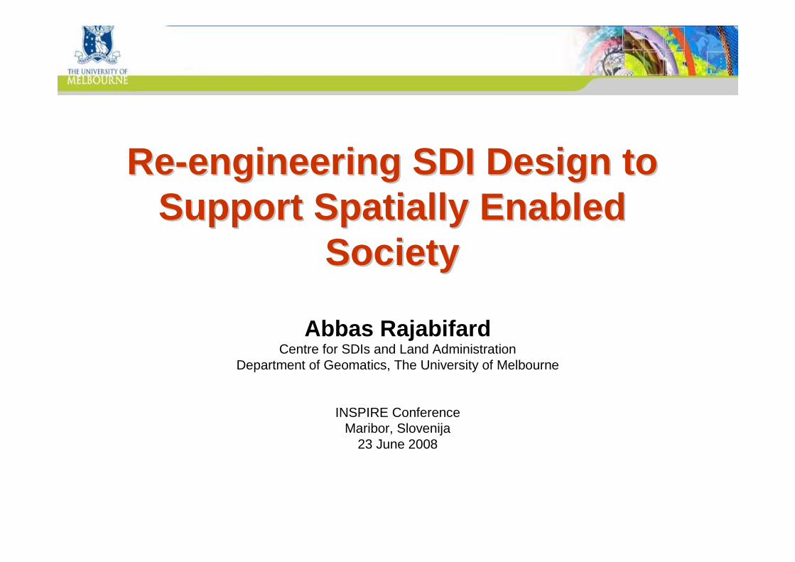
OBJECTIVE OF PRESENTATIONOBJECTIVE OF PRESENTATION
Introduce a new Vision “Spatially Enabled Society”-A Scenario for the
Future (explain SDI design, issues and trends to support this vision).
Centre for SDIs and Land AdministrationDepartment of Geomatics
Spatial Enablement Spatial Enablement ––Experiences & ActivitiesExperiences & Activities
Convergence theme
GSDI 11 Conference
2009, NL
Centre forSDIs and LACentre for
SDIs and LA
Victorian State
Asia-PacificPCGIAP
AsiaAsia--PacificPacificPCGIAPPCGIAP
GSDIAssociation
GSDIAssociation
Victorian Spatial Council
Victorian Spatial Strategy 2008-2010
UN Resolution
2006
SEG Working Group
Centre for SDIs and Land AdministrationDepartment of Geomatics
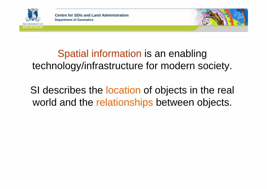
Spatial information is an enabling technology/infrastructure for modern society.
SI describes the location of objects in the real world and the relationships between objects.
Centre for SDIs and Land AdministrationDepartment of GeomaticsEmerging the Web with LocationEmerging the Web with Location
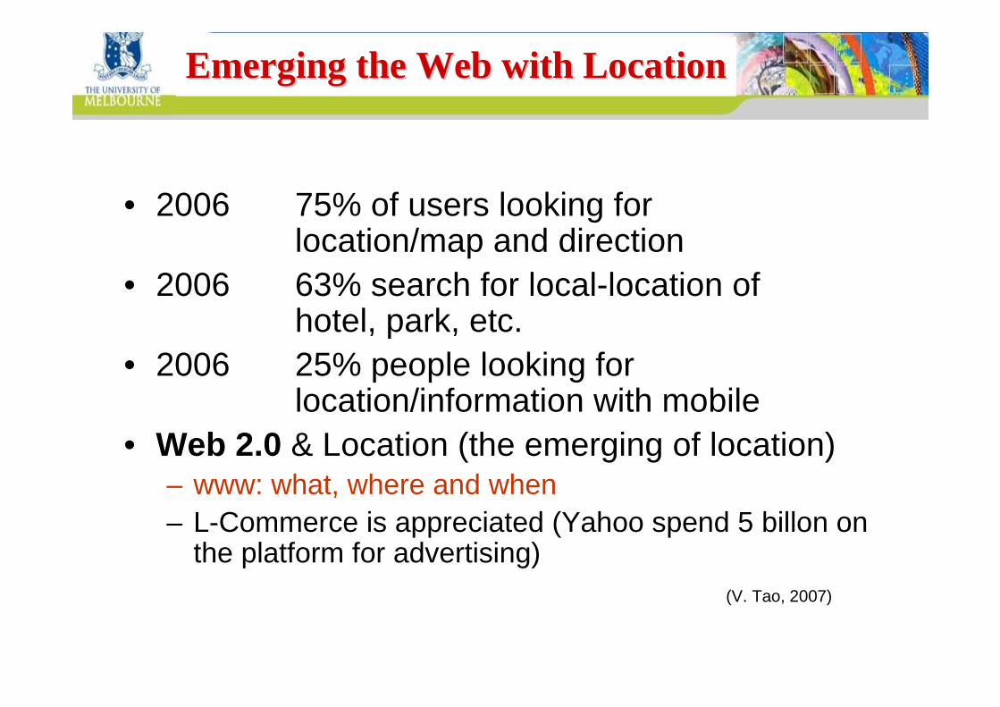
• 2006 75% of users looking for location/map and direction
• 2006 63% search for local-location of hotel, park, etc.
• 2006 25% people looking for location/information with mobile
• Web 2.0 & Location (the emerging of location)– www: what, where and when– L-Commerce is appreciated (Yahoo spend 5 billon on
the platform for advertising)(V. Tao, 2007)

Centre for SDIs and Land AdministrationDepartment of GeomaticsWorldwide Advertising RevenueWorldwide Advertising Revenue
2006 ~$582 Billion
– 370 from paper Ads.– 151 from TV Ads.– 34 from Radio Ads.
– 27 from Online Ads .
(Microsoft Windows Software ~$15 Billion)
370, 63%
151, 26%
34, 6% 27, 5%
(V. Tao, 2007)
Centre for SDIs and Land AdministrationDepartment of GeomaticsServices and Delivery ToolsServices and Delivery Tools
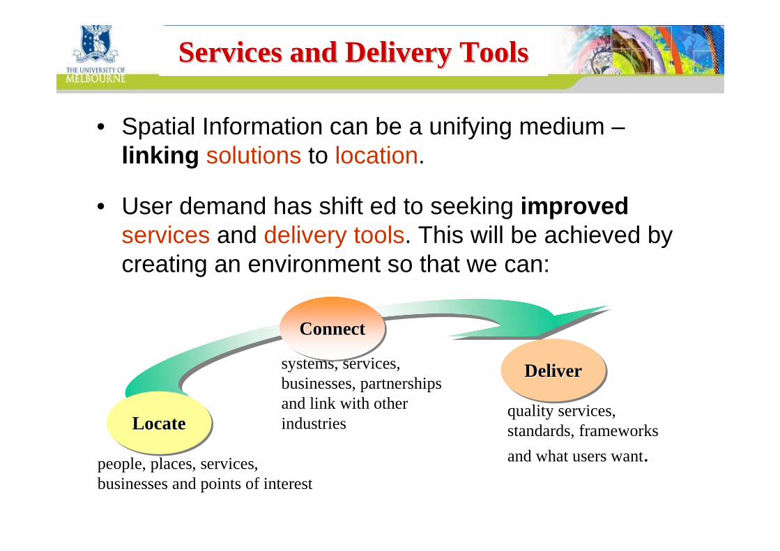
• Spatial Information can be a unifying medium –linking solutions to location.
• User demand has shift ed to seeking improvedservices and delivery tools. This will be achieved by creating an environment so that we can:
DeliverDeliverDeliver
people, places, services, businesses and points of interest
systems, services, businesses, partnerships and link with other industries
quality services, standards, frameworks
and what users want.
ConnectConnectConnect
LocateLocateLocate

Centre for SDIs and Land AdministrationDepartment of Geomatics
Ready and timely access to spatial information – knowing where people and
assets are – is essential for the creation of wealth in any jurisdiction.
It is a critical tool for making informed decisions on key economic, environmental
and social issues.
Centre for SDIs and Land AdministrationDepartment of Geomatics
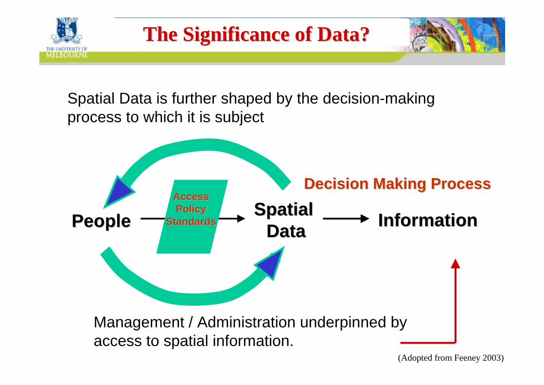
Spatial Data is further shaped by the decision-making process to which it is subject
Spatial Spatial DataDataPeoplePeople InformationInformation
AccessAccessPolicy Policy
StandardsStandards
Decision Making ProcessDecision Making Process
Management / Administration underpinned by access to spatial information.
The Significance of Data?The Significance of Data?
(Adopted from Feeney 2003)

Centre for SDIs and Land AdministrationDepartment of Geomatics
• Immature institutional arrangements
• Immature user/provider relationships
• Poor knowledge of data availability
• Difficulties in assessing data quality
• Inconsistent policies on data access and use
• Lack of best practice in the use of technologies
So Why the Problem?So Why the Problem?

Centre for SDIs and Land AdministrationDepartment of Geomatics
Less than 5% understand the technology
95% do not understand the technology
Who understands place?Who understands place?
Less than 1% of people are specialists
The vast majority of users do not know they are “spatially enabled” – and don’t care!
Society
DSE-SII 2006
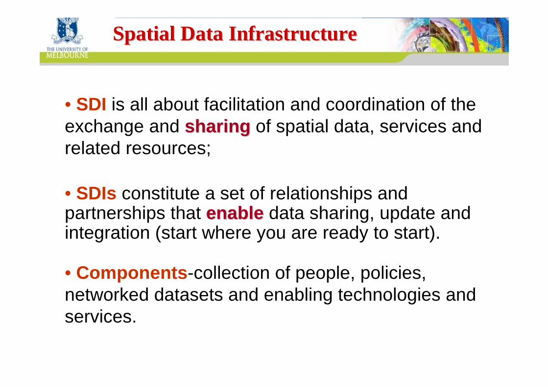
Centre for SDIs and Land AdministrationDepartment of GeomaticsSpatial Data InfrastructureSpatial Data Infrastructure
• SDI is all about facilitation and coordination of the exchange and sharingsharing of spatial data, services and related resources;
• SDIs constitute a set of relationships and partnerships that enableenable data sharing, update and integration (start where you are ready to start).
• Components -collection of people, policies, networked datasets and enabling technologies and services.
Centre for SDIs and Land AdministrationDepartment of Geomatics
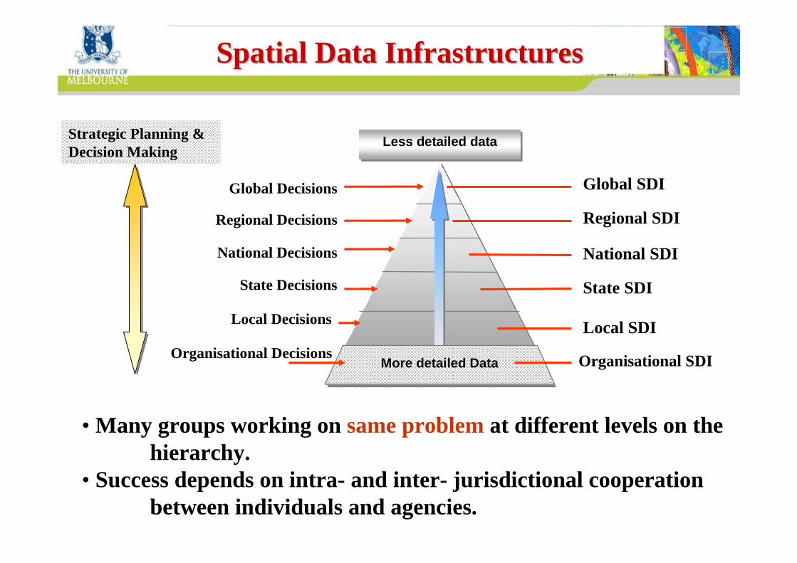
Global SDI
Regional SDI
National SDI
State SDI
Local SDI
Spatial Data InfrastructuresSpatial Data Infrastructures
Organisational SDI
Less detailed dataLess detailed data
Global Decisions
Regional Decisions
National Decisions
State Decisions
Local Decisions
More detailed Data
• Many groups working on same problemat different levels on the hierarchy.
• Success depends on intra- and inter- jurisdictional cooperation between individuals and agencies.
Strategic Planning & Decision Making
Organisational Decisions
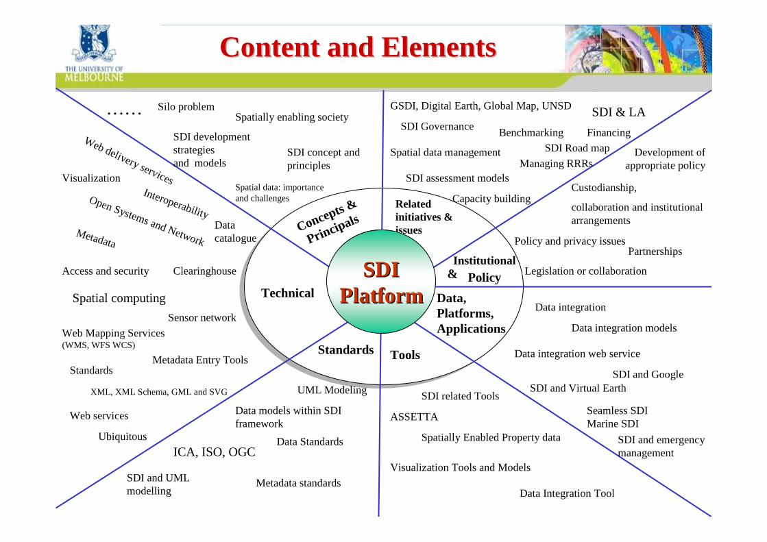
Centre for SDIs and Land AdministrationDepartment of Geomatics
Concepts &
Pr incipalsRelated initiatives & issues
Technical
Institutional &
ToolsStandards
Data, Platforms, Applications
PolicySDISDIPlatformPlatform
Spatial data: importance and challenges
SDI concept and principles
Spatially enabling society
SDI development strategiesand models
Silo problem ……
Data integration
Data integration models
Data integration web service
SDI and GoogleSDI and Virtual Earth
Seamless SDIMarine SDI
SDI and emergency management
GSDI, Digital Earth, Global Map, UNSD
SDI Governance
Spatial data management
SDI assessment models
Benchmarking
Managing RRRs
Capacity building
SDI & LA
SDI Road map
Financing
Policy and privacy issues
Legislation or collaboration
Development of appropriate policy
Custodianship,
collaboration and institutional arrangements
Partnerships
UML Modeling
Data models within SDI framework
Data Standards ICA, ISO, OGC
Metadata standards SDI and UML modelling
Data catalogue
Clearinghouse
Interoperability
Access and security
Web delivery services
Open Systems and Network
Spatial computing
Sensor network
Ubiquitous
Metadata
Metadata Entry ToolsStandards
Web services
XML, XML Schema, GML and SVG
Web Mapping Services (WMS, WFS WCS)
Visualization
ASSETTA
Spatially Enabled Property data
SDI related Tools
Visualization Tools and Models
Data Integration Tool
Content and ElementsContent and Elements

Centre for SDIs and Land AdministrationDepartment of GeomaticsContinuum of SDI Continuum of SDI
DevelopmentDevelopment
1990 1992 1994 1996 1998 2000 2003 2005 2008 Future1990 1992 1994 1996 1998 2000 2003 2005 2008 FutureFuture
Developing Countries
Emerging Economies
Product-BasedSDI development model
Process BasedSDI development model
National/Federal Government Influence –Data Focus
National/Federal Government Influence –Data Focus
National, Sub-national Govt. and Private Sector Influence – Process Focus
National, Sub-national Govt. and Private Sector Influence – Process Focus
1st Generation
Developed Countries
Developed, Emerging and Developing Countries
2nd Generation Towards the Next Generation
Sub-national Govt. and Private Sector Influence – Strategic National focus
Sub-national Govt. and Private Sector Influence – Strategic National focus
Delivery of a Virtual Environment in support of
spatial enablement of society as part of
an e-government strategy

Centre for SDIs and Land AdministrationDepartment of GeomaticsImplementation Implementation –– DriversDrivers
• Increase effectiveness– Better access (reduce barriers)– New services– Exploit data better– Get data on time– Avoid duplication of data
• Increase efficiency– Avoid duplication of effort– Avoid duplication of infrastructure– Commodity access arrangements
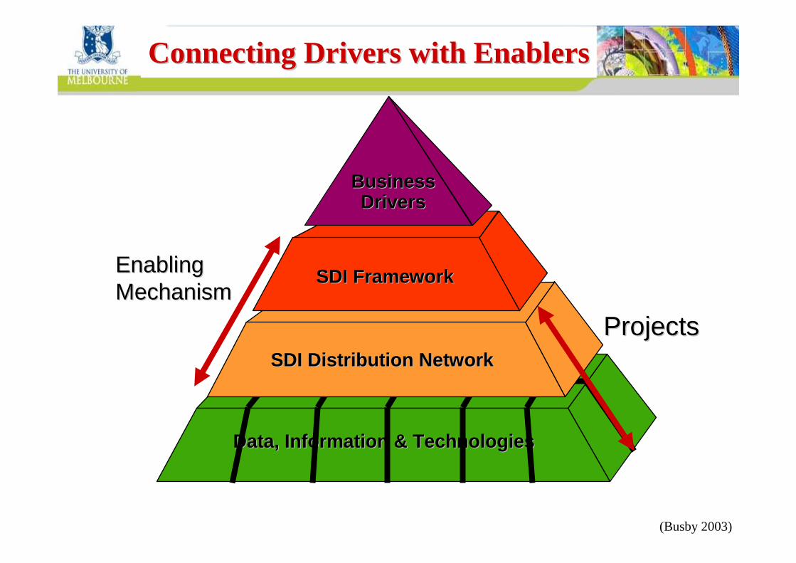
Centre for SDIs and Land AdministrationDepartment of GeomaticsConnecting Drivers with EnablersConnecting Drivers with Enablers
Data, Information & TechnologiesData, Information & Technologies
SDI Distribution NetworkSDI Distribution Network
ProjectsProjects
EnablingEnablingMechanismMechanism
SDI FrameworkSDI Framework
BusinessBusinessDriversDrivers
(Busby 2003)

Centre for SDIs and Land AdministrationDepartment of Geomatics
distributed datasets
information & communication technologies
‘fundamental’ datasets
data access
custodianship
metadata
standards
policies
programs
What does the What does the Enabling Enabling Mechanism Do?Mechanism Do?

Centre for SDIs and Land AdministrationDepartment of Geomatics
Less than 5% understand the technology
95% do not understand the technology
Who understands place?Who understands place?
Less than 1% of people are specialists
The vast majority of users do not know they are “spatially enabled” – and don’t care!
Society
DSE-SII 2006
95% do not understand the technology
Centre for SDIs and Land AdministrationDepartment of Geomatics
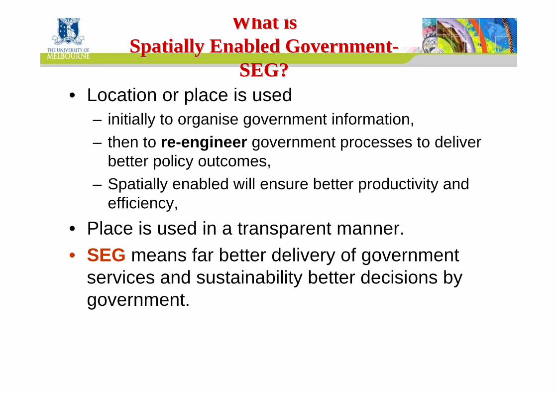
What isWhat isSpatially Enabled GovernmentSpatially Enabled Government--
SEG?SEG?• Location or place is used
– initially to organise government information,– then to re-engineer government processes to deliver
better policy outcomes,– Spatially enabled will ensure better productivity and
efficiency,
• Place is used in a transparent manner.• SEG means far better delivery of government
services and sustainability better decisions by government.

Centre for SDIs and Land AdministrationDepartment of GeomaticsSpatial Information in SocietySpatial Information in Society
Spatial enablement of society and government
Spatial information policy
SDI
Spatial Data layers
Objects
Centre for SDIs and Land AdministrationDepartment of Geomatics
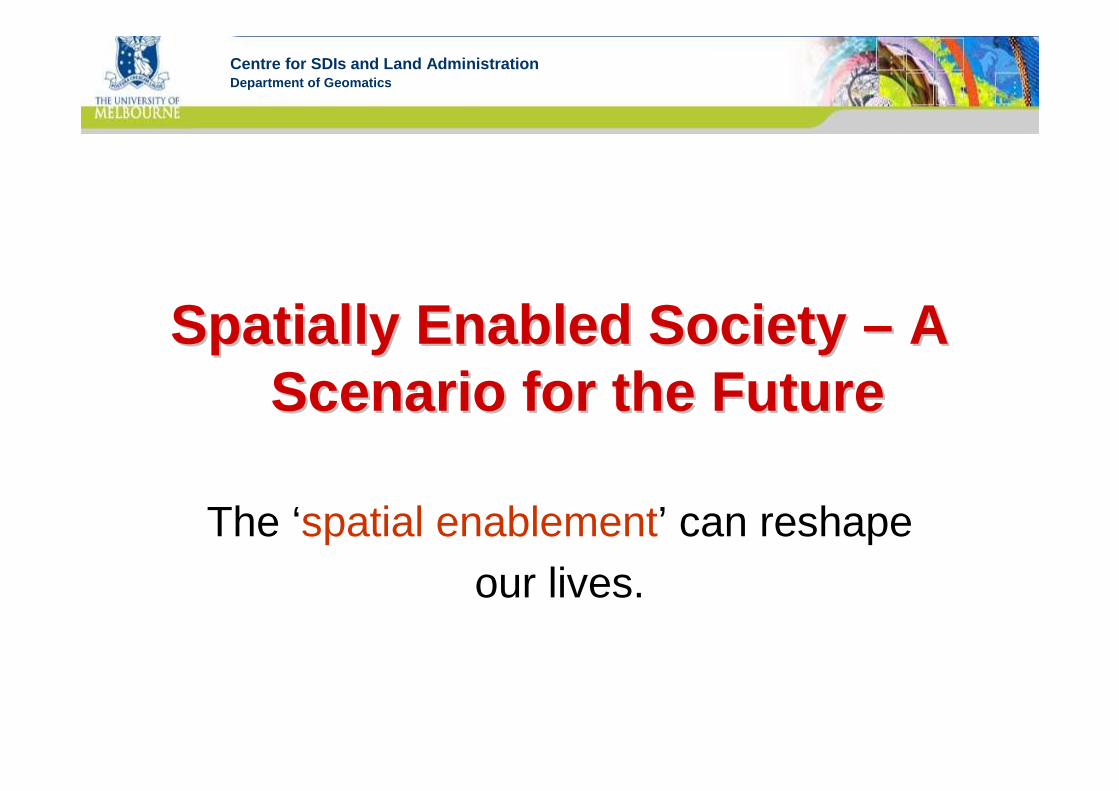
Spatially Enabled Society Spatially Enabled Society –– A A Scenario for the FutureScenario for the Future
The ‘spatial enablement’ can reshapeour lives.

Centre for SDIs and Land AdministrationDepartment of GeomaticsPossibilities provided by Spatial Possibilities provided by Spatial
EnablementEnablementSpatial enablement can contribute to dealing
with the challenges we face as a society. At the same time, however, it brings its own challenges.
• Expanding government services — ‘consultation & participation’
• Policy & Administration• Public Safety• Utilities• Health• Sustainability and our environmental footprint• Land Administration• The economics of production• Consumption and choice

Centre for SDIs and Land AdministrationDepartment of GeomaticsGovernance and Partnership BuildingGovernance and Partnership Building
DB DB

Centre for SDIs and Land AdministrationDepartment of GeomaticsPossibilities provided by Spatial Possibilities provided by Spatial
EnablementEnablementSpatial enablement can contribute to dealing
with the challenges we face as a society. At the same time, however, it brings its own challenges.
• Expanding government services — ‘consultation & participation’
• Policy & Administration• Public Safety• Utilities• Health• Sustainability and our environmental footprint• Land Administration• The economics of production• Consumption and choice

Centre for SDIs and Land AdministrationDepartment of Geomatics
Business licenses
Hydrology
Owners’ names
Geology
Climate
Owners’
addresses
Owners’contact address
Business
entities
Heritage
Residents and or occupiers
Soil
Estates and interests
DCDB
Satellite images
Geographic Names
Geocoded
property
addresses
Habitat
Aerialphotos
Utilities
Topographic map archive
Body corporate rules
and responsibilities
Restricted sites
Parcel
Use, condition
and zoning
Burglary risksLandform (DTM)
Rates
Property
MortgagesDrainage
Transport
Access
Boundaries
Administrative boundariesResources
Water license
Topographic reference data sets
Image data
Geographicnames register
Photogrammetric
control archive
Spatial &Spatial &Spatial &Spatial &NonNonNonNon----Spatial Spatial Spatial Spatial
DataDataDataData
Spatial &Spatial &Spatial &Spatial &Spatial &Spatial &Spatial &Spatial &NonNonNonNonNonNonNonNon--------Spatial Spatial Spatial Spatial Spatial Spatial Spatial Spatial
DataDataDataDataDataDataDataData
Spatial Data Infrastructures
SDIs
Spatial Data Spatial Data InfrastructuresInfrastructures
SDIsSDIs
Web Web Enabled AccessEnabled Access
LocationLocationBased PlatformsBased Platforms
EnablingEnablingTechnologyTechnology
Supported Functions
for Key Government and Business Activities
Supported Supported FunctionsFunctions
for Key Government and for Key Government and Business ActivitiesBusiness Activities
Policy makingPolicy making
Land development & planning Land development & planning
Transactions managementTransactions management
Activity managementActivity management
Emergency managementEmergency management
Land valuation & taxationLand valuation & taxation
Provision of utilities & servicesProvision of utilities & services
Transport and accessTransport and access
Farming & resource Farming & resource managementmanagement
Disclosure of restrictionsDisclosure of restrictions

Centre for SDIs and Land AdministrationDepartment of Geomatics
1. Multipurpose Cadastre(German style)
1. Multipurpose Cadastre(German style)
2. Title or deedstenure stylecadastres
2. Title or deedstenure stylecadastres
3. Taxation driven
cadastre(Latin /Spanish /French)
3. Taxation driven
cadastre(Latin /Spanish /French)
Tenure
Value
Use
Development
Incorporating:
Land policy
SpatiallyenabledLAS
Services tobusinessandpublic
Countrycontext
Sustainabledevelopment- Economic- Environmental- Social- Governance
Cadastralengines…
Land managementparadigm
Spatially enabled
government
ParcelsPropertiesBuildingsRoads
Integrated functions
SDIMapping agencies and other data
providers
Better decision making
Significance of the cadastreSignificance of the cadastre

Centre for SDIs and Land AdministrationDepartment of Geomatics
FutureFutureVisionVision
Time
Ach
ieve
men
t
Present
PastPaper Maps
Centralized archives
Isolated Computing stations
No standardization
Lack of Collaboration
others
Digital data
Computer networks
Web-based applications
Distributed services
Multi-disciplinary applications
??Internet
GISRemotely-sensed
data
Integrated data
managementEffe
ctive databases
ICT advancements

Centre for SDIs and Land AdministrationDepartment of Geomatics
Time
Ach
ieve
men
t
Current
situatio
n
Past
Vision
Spatially-
enabled
Society
SpatiallySpatially--enablement stagesenablement stages
Every country has its own journey

Centre for SDIs and Land AdministrationDepartment of Geomatics
Time
Ach
ieve
men
t
Current
situatio
n
Past
Vision
Spatially-
enabled
Society
Standardized
servi
ces
Policies
Standards
Simple user
interface
s
Web-service
s
Capacity building
Collaboration
Raising
awareness
Governors and
citize
ns
engagement
Governance and
leadership
SDI GovernanceSDI GovernanceOther E
xternal P
ressures

Centre for SDIs and Land AdministrationDepartment of Geomatics
The role is to glue together the technology, organizations and information that comprise an SDI
The setting, application and enforcement of rules t hat determine how a group works together to achieve
common goals.
Processes and institutions to define and manage agreed policies, technologies, standards,practices, protocols & specifications and to monitor the SDI.
GovernanceGovernance
People
Technology
(Information) resources
GovernanceGovernance

Centre for SDIs and Land AdministrationDepartment of GeomaticsGovernance contextsGovernance contexts
Societal governance
• purpose - to ensure improved outcomes in public goods and service delivery• scope – society• exercised by – state, increasing inclusive of on behalf of - society
• purpose - to direct, supervise, monitor operational management of corporation • scope – organisation• exercised by - board• on behalf of - organization owners/stakeholders• purpose - to enable inclusive effective decision-making about an organization’s IT resources• scope – organisation• exercised by - designated IT stakeholders• on behalf of - organizations managers and shareholders
Corporate governance
IT governance
SOA governance
• purpose - to support decision-making about design and operation of shared infrastructure• exercised by - designated stakeholders of an infrastructure • scope - within an organization• scope - increasingly across organizational and jurisdictional boundaries•on behalf of - stakeholders (operators, users)
SDI SDI governancegovernance
(Box 2008)

Centre for SDIs and Land AdministrationDepartment of Geomatics
Spatial Enablement Spatial Enablement ––Experiences & ActivitiesExperiences & Activities
Convergence theme
GSDI 11 Conference, 2009, NL
Victorian StateAustralia
Asia-PacificPCGIAP
AsiaAsia--PacificPacificPCGIAPPCGIAP
GSDIAssociation
GSDIAssociation
Victorian Spatial Council
Victorian Spatial Strategy 2008-2010
UN Resolution, 2006 for SEG and VSDI
SEG International Workshop, Korea 2007 (jointly with GSDI)
SEG Working Group

Centre for SDIs and Land AdministrationDepartment of GeomaticsVictorian Spatial Information Strategy 2008Victorian Spatial Information Strategy 2008--20102010
Spatially Enabled VictoriaSpatially Enabled Victoria
Elements :• governance• custodianship• framework information• business information• data quality• metadata• awareness• access• pricing and licensing• privacy• strategic development of
technology and applications
HighHigh
LowLow
HighLow
LowHigh
PrivatePublic
4 scenarios of the effects of different levels of private and public sector engagement:
HighHigh
LowLow
HighLow
LowHigh
PrivatePublic

Centre for SDIs and Land AdministrationDepartment of Geomatics
17th United Nations RCC17th United Nations RCC --AP, Bangkok, AP, Bangkok, 1818--22 September 200622 September 2006
Resolution: SDI to support spatially enabled government
Recommendation: Member Nations develop a better understanding and pursue the principles of designing SDIs to support spatially enabled government.
Asia and the PacificAsia and the Pacific

GSDI PerspectiveGSDI PerspectiveGI Society: A Partner in GI Society: A Partner in Setting the Global AgendaSetting the Global Agenda
SDI
Convergence
SDI
Convergence
Canada
Americas
Africa
Asia / Pacific
Europe
SDI regions
FAO
Global society
UNISEF
Water Forum
World Bank
WHO
UN
Habitat

GSDI 11 ConferenceGSDI 11 Conference
The The NetherlandsNetherlands JuneJune 15 15 –– 19 200919 2009
GSDI 11 World Conference
Spatial Data Infrastructure Convergence:
Building SDI Bridges to Address Global Challenges

GSDI 11 ConferenceGSDI 11 Conference
The Netherlands June 15 – 19 2009

Centre for SDIs and Land AdministrationDepartment of Geomatics
VisionVision
Currentposition
Mapping Common Paths to achieve Mapping Common Paths to achieve thethe VisionVision
• Requires collective action
• Different groups working on different parts of the problem
• Together pieces provide potential paths to realising vision
• Knowledge managements is required
• Treated as integral part of SDI
To get from where we are now to where we want to be
To assist in collaborativemapping of possible re-usable common paths to a sharedvision:
To assist in collaborativemapping of possible re-usable common paths to a sharedvision:
Enables the past to be leveraged to achieve a future vision.

Centre for SDIs and Land AdministrationDepartment of Geomatics
Thank youThank you
Related Documents