Rainwater Harvesting Methods

Rainwater Harvesting Methods. What do we need to do with water? Slow it, Spread it, Sink it!
Dec 17, 2015
Welcome message from author
This document is posted to help you gain knowledge. Please leave a comment to let me know what you think about it! Share it to your friends and learn new things together.
Transcript
Rainwater Harvesting Methods
What do we need to do with water?
Slow it, Spread it, Sink it!
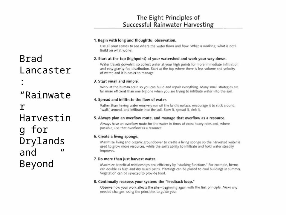
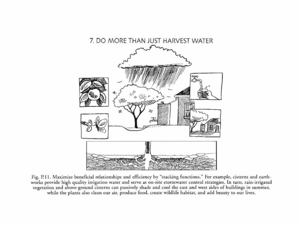
Brad Lancaster:“Rainwater Harvesting for Drylands and Beyond”
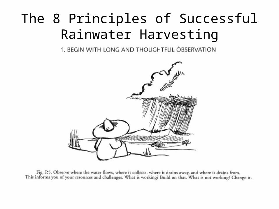
The 8 Principles of Successful Rainwater Harvesting


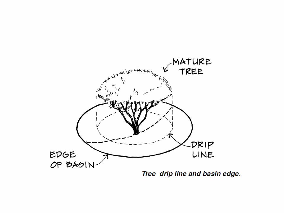
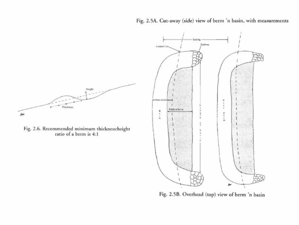
Berm and Basin


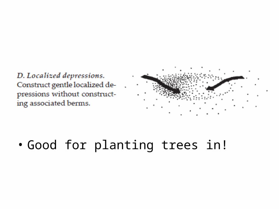
• Good for planting trees in!

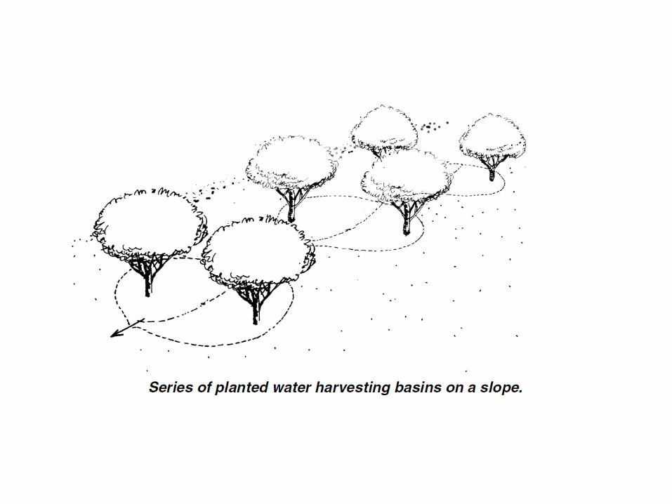
Planting microbasins

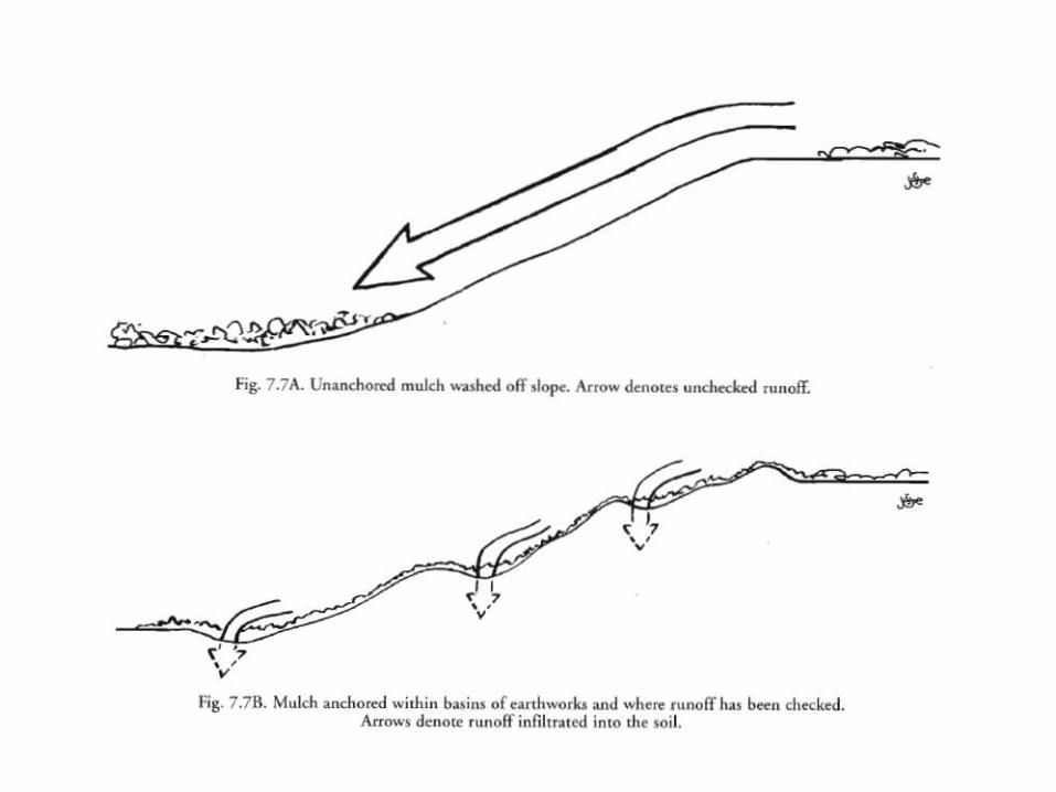
Mulching!• Organic Matter (dead plants)• Living Mulch (ground cover) • Rock Mulch

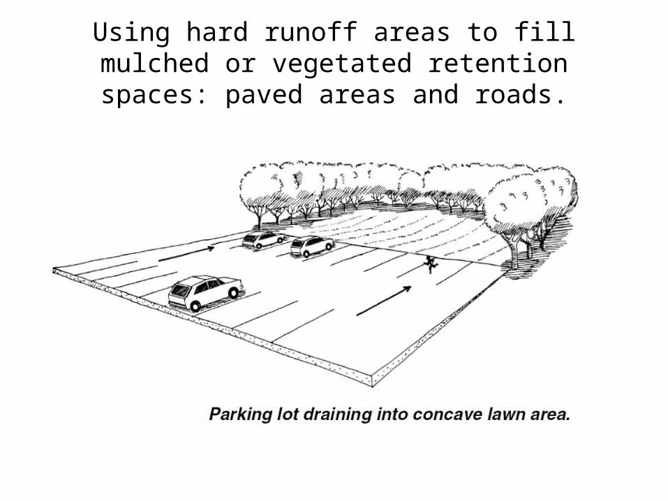
Using hard runoff areas to fill mulched or vegetated retention spaces: paved areas and roads.
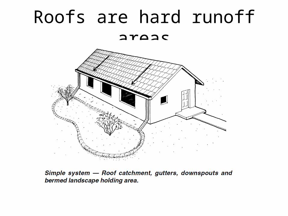
Roofs are hard runoff areas

Swales

Swales on-contour

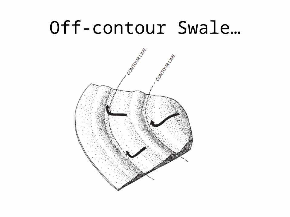
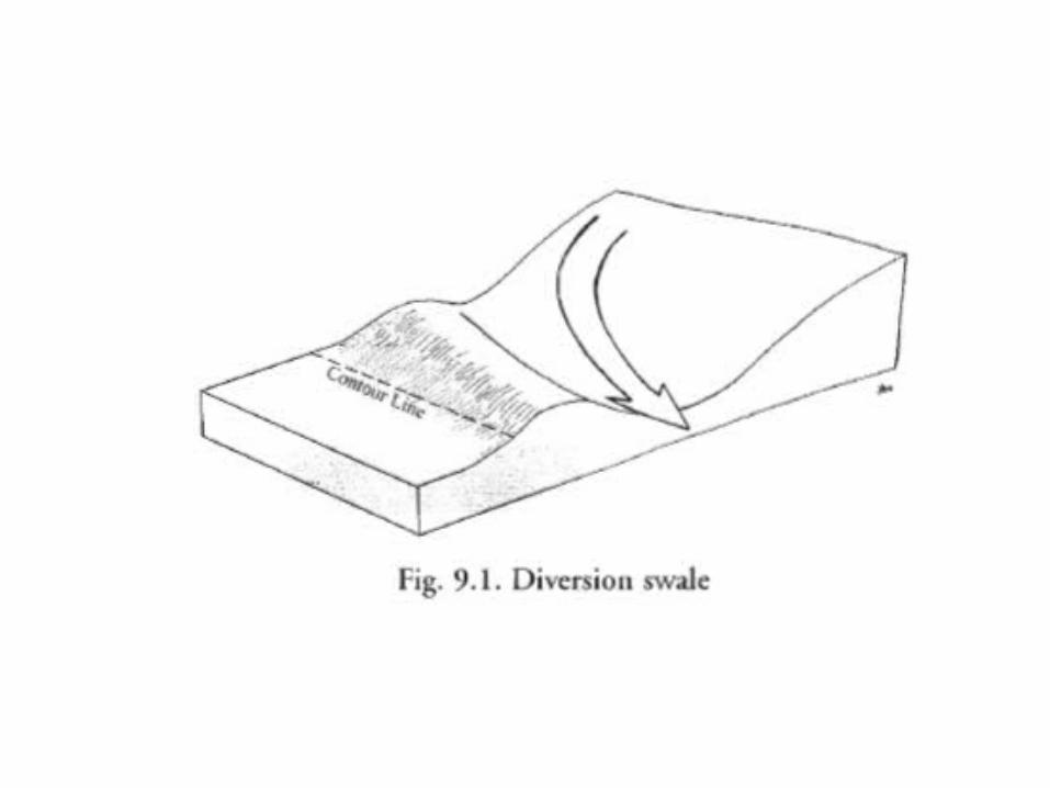
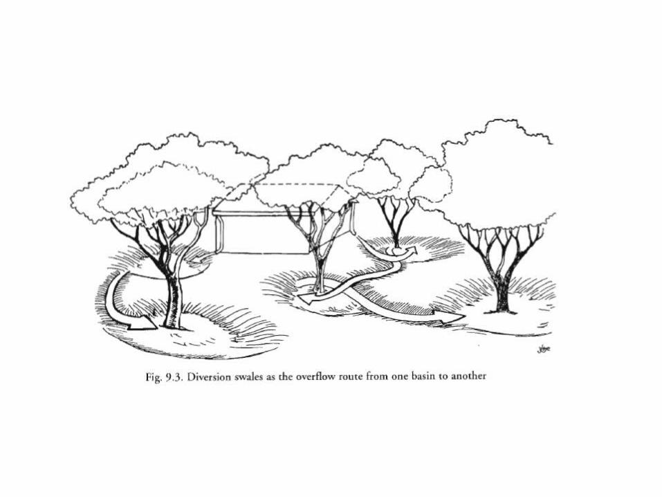
Off-contour Swale…
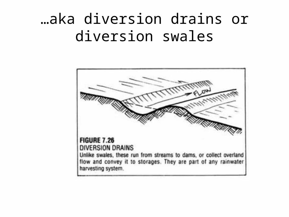
…aka diversion drains or diversion swales
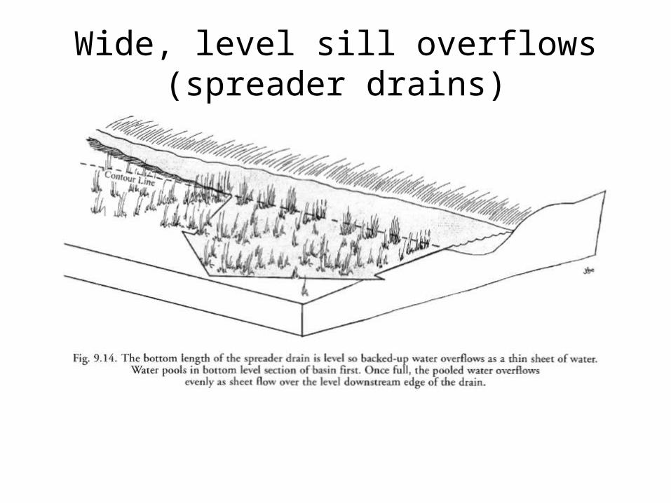
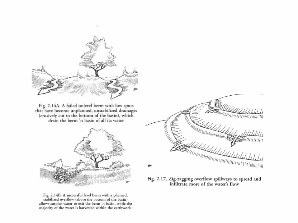
Wide, level sill overflows (spreader drains)
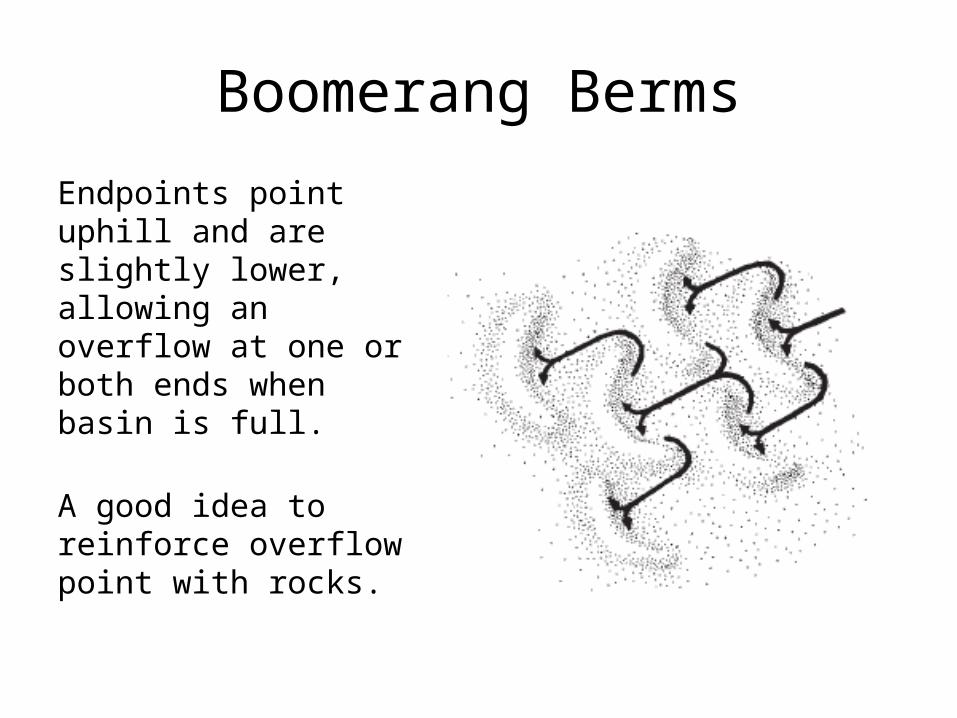
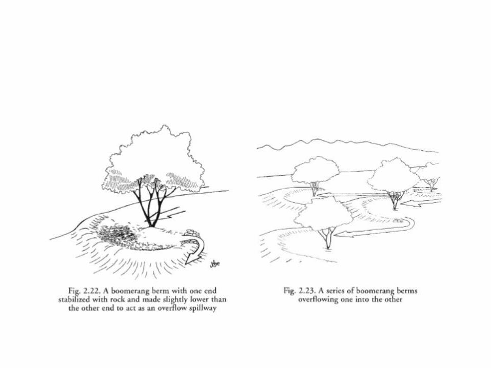
Boomerang Berms
Endpoints point uphill and are slightly lower, allowing an overflow at one or both ends when basin is full.
A good idea to reinforce overflow point with rocks.
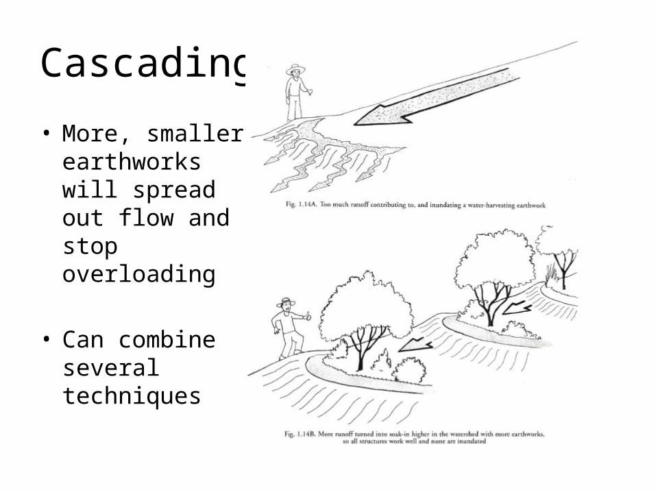
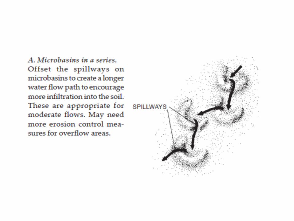
Cascading
• More, smaller earthworks will spread out flow and stop overloading
• Can combine several techniques
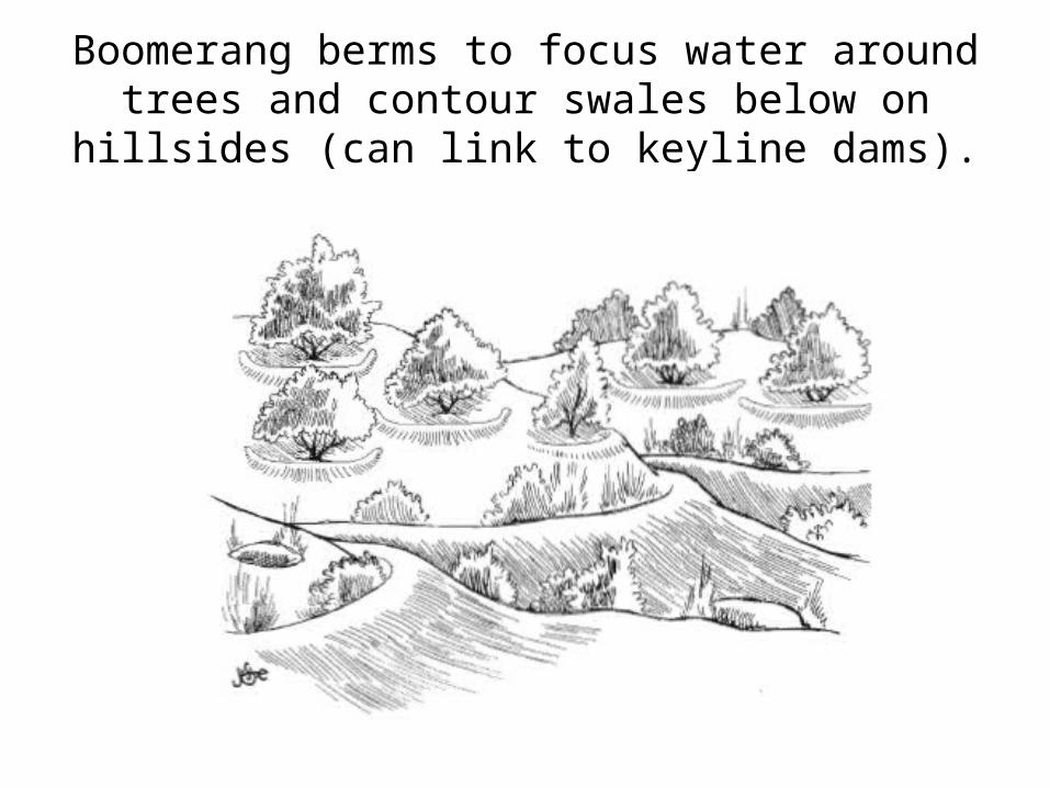
Boomerang berms to focus water around trees and contour swales below on hillsides (can link to keyline
dams).

• The steeper the slope, the narrower earthworks need to be and the more of them we need.
• On very steep slopes they must be reinforced (with rock or concrete).
Swales/ Berm and Basins on Different Slopes

Overflows
• Pipes can be necessary if a road goes over the top
• Can also use a permeable stone “wet crossing”

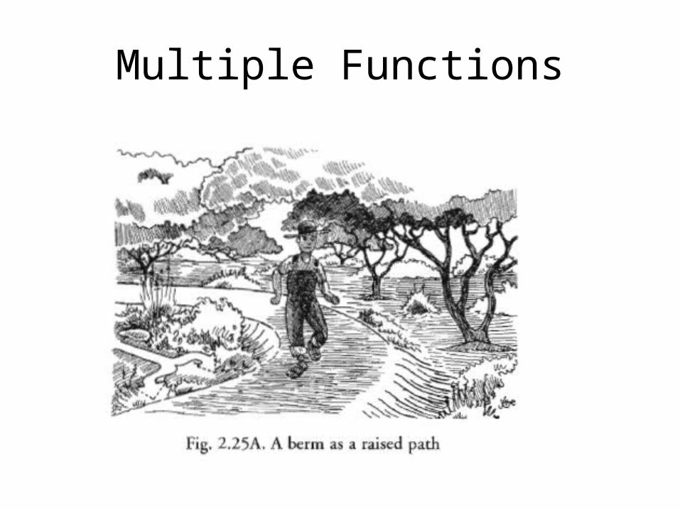
Multiple Functions
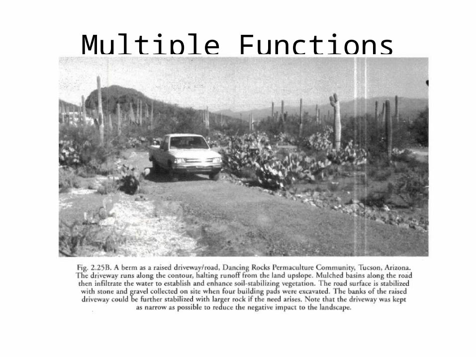
Multiple Functions

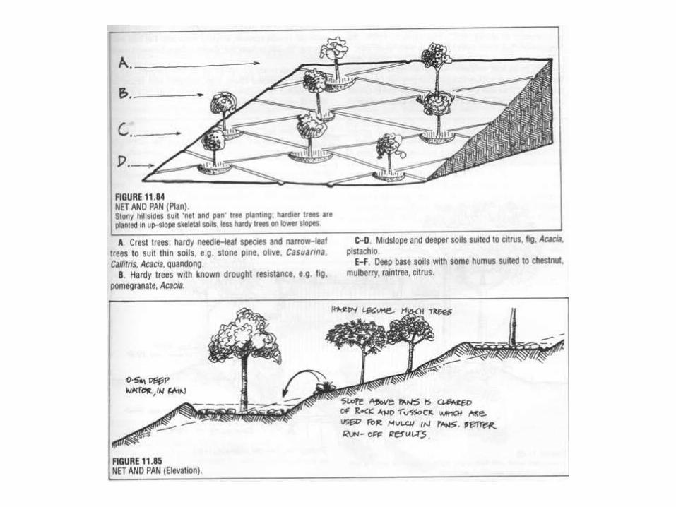
Net and Pan
Upper half of pan is catchment surface draining water to lower half where water infiltrates into tree root zone.

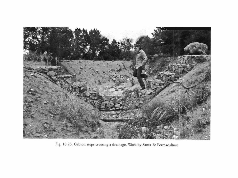
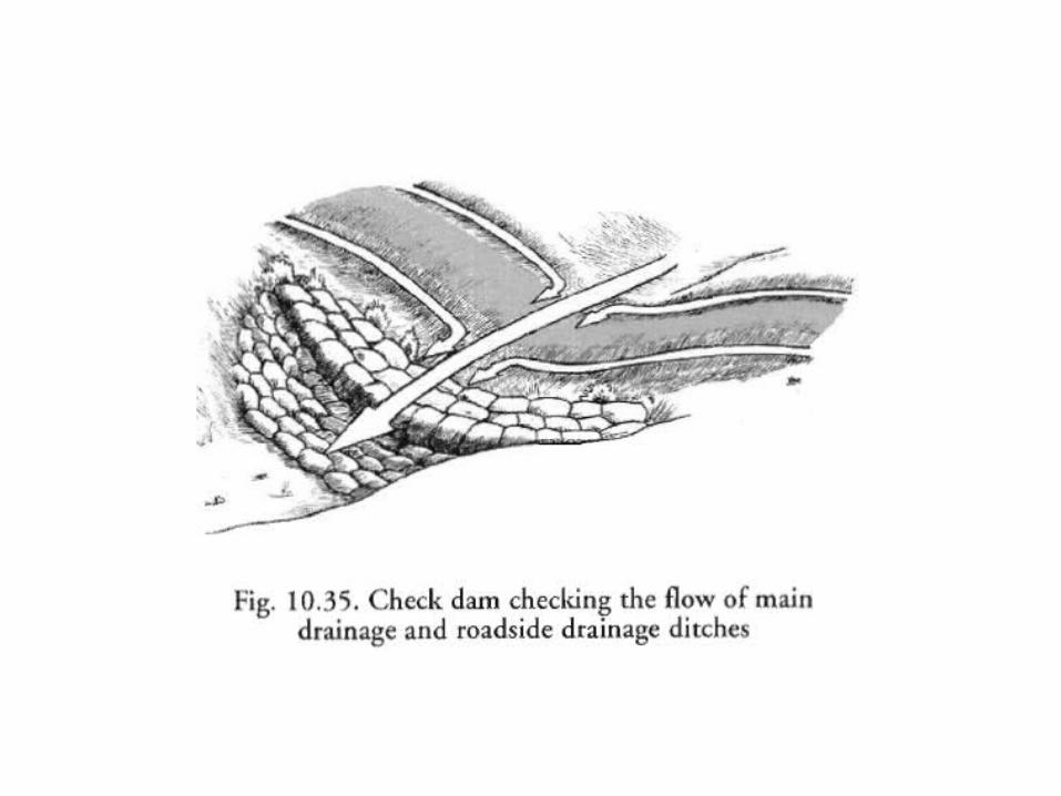
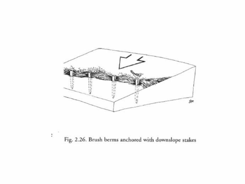
Check damsWater moving downslope carries with it sediment and organic matter. The faster it moves, the more it erodes and carries. In gullies, erosion can happen fast.
Check dams are barriers that make the water slow and pool, depositing its sediment behind the dam, forming a terrace.
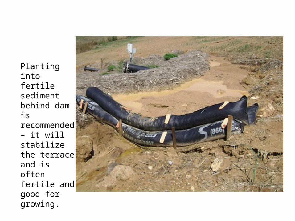
Planting into fertile sediment behind dam is recommended – it will stabilize the terrace and is often fertile and good for growing.
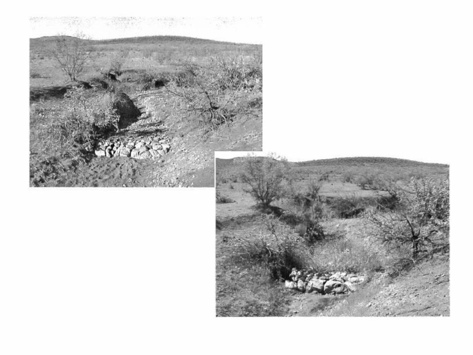

Check dams can be used inside diversion swales to control flow rate and erosion
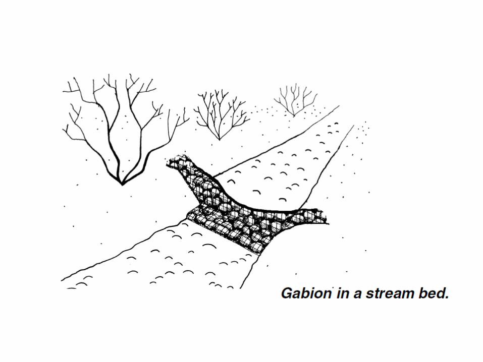
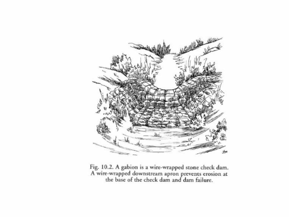

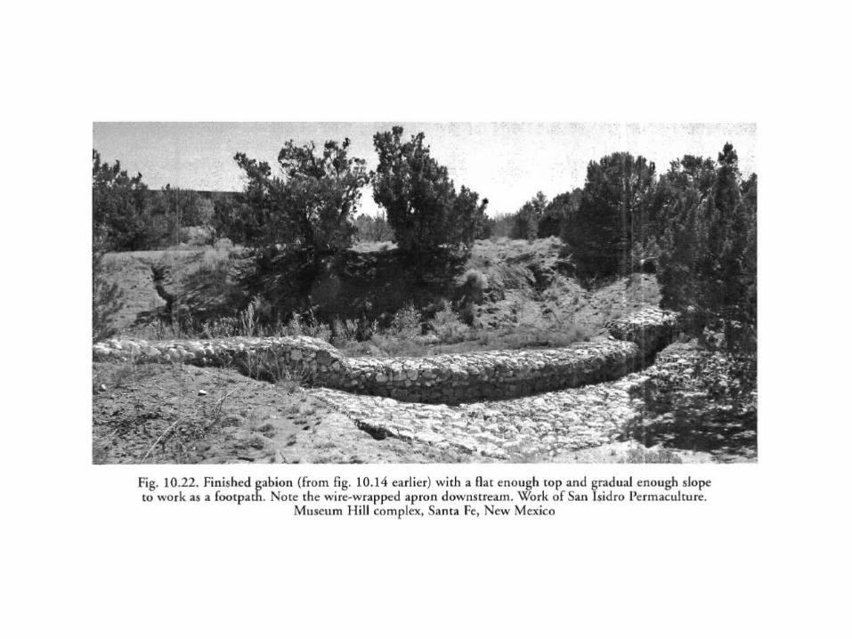
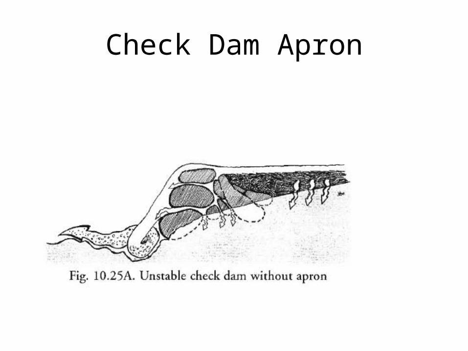
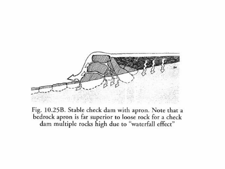
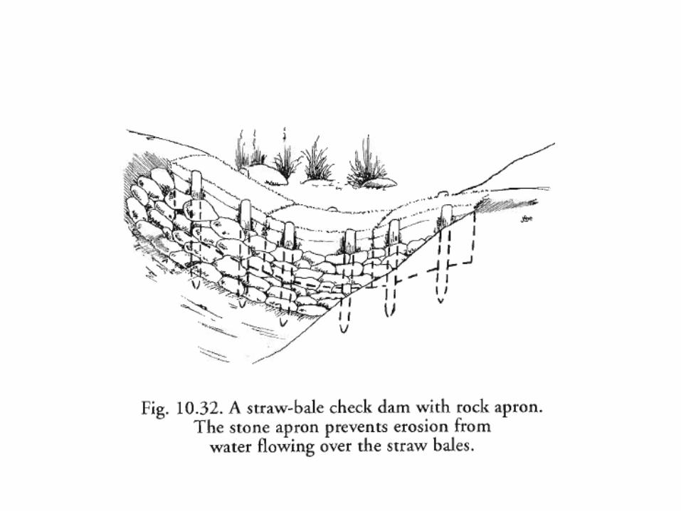
Check Dam Apron

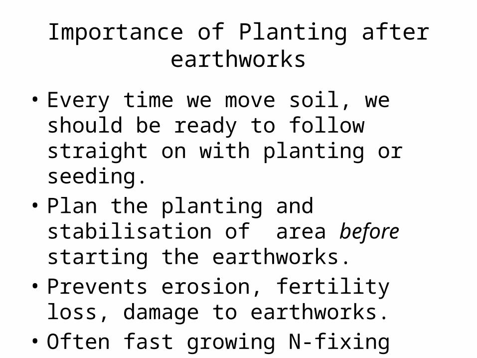
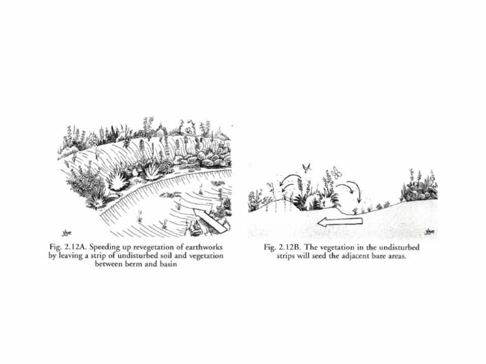
Importance of Planting after earthworks
• Every time we move soil, we should be ready to follow straight on with planting or seeding.
• Plan the planting and stabilisation of area before starting the earthworks.
• Prevents erosion, fertility loss, damage to earthworks.
• Often fast growing N-fixing species are best.
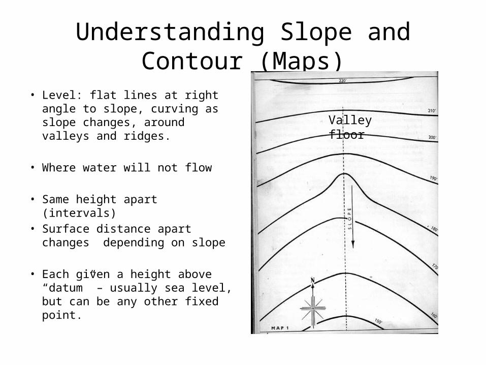
Understanding Slope and Contour (Maps)
• Level: flat lines at right angle to slope, curving as slope changes, around valleys and ridges.
• Where water will not flow
• Same height apart (intervals)• Surface distance apart changes
depending on slope
• Each given a height above “datum” – usually sea level, but can be any other fixed point.
Valley floor

Contour in a landscape
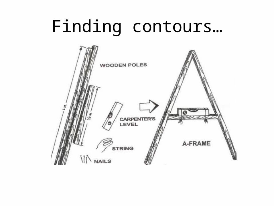
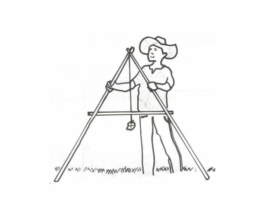
Finding contours…
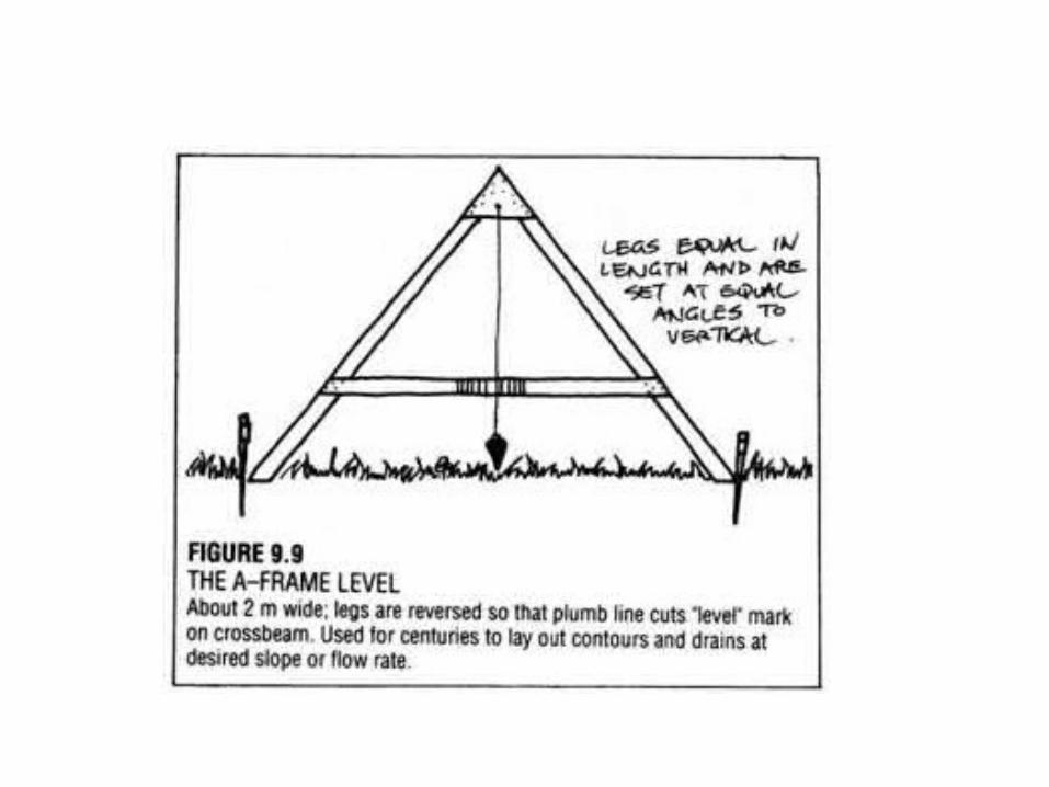
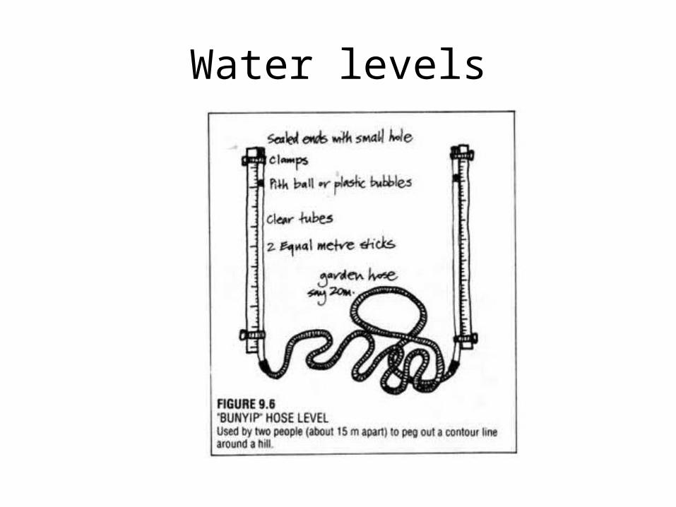
Water levels

Contour Lines

Distance between contours?STEEPER SLOPE: Closer together
GENTLE SLOPE: Further apart
Vertical drop:Generally, no less than 1 meter for erosion control
Surface Distance:If using nitrogen fixing trees, contour hedgerows be no wider apart than 5 meters so alleys get full fertility benefit
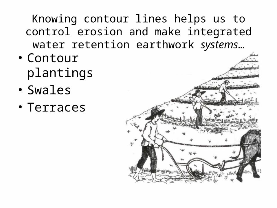
Knowing contour lines helps us to control erosion and make integrated water retention earthwork systems…
• Contour plantings• Swales• Terraces

Alley cropping with nitrogen fixing trees

Biodynamics, crop rotation and other methods can still be practiced inside this pattern

“Passive terracing” over time…
• Over time the accumulation of organic matter on the back side of the treelines will naturally form a terrace
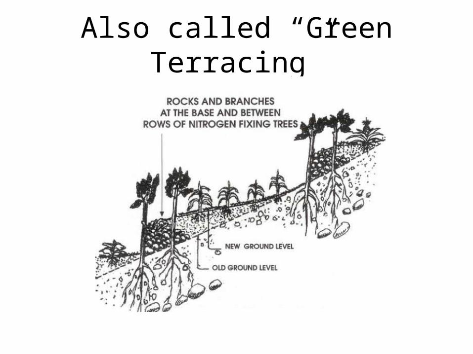
Also called “Green Terracing”

Can also be done with swales and berms
Terracing
• Needs the most caution
• Progressive failure of poorly built terraces over time can lead to severe land damage
• Not appropriate in soils prone to waterlogging where rainwater infiltration can lead to saturated subsurface conditions that stop water moving down through the soil (e.g. very heavy clay layers)

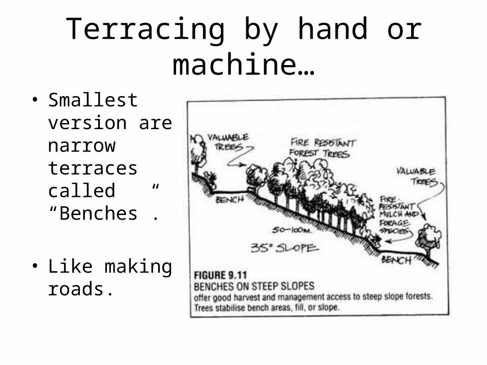
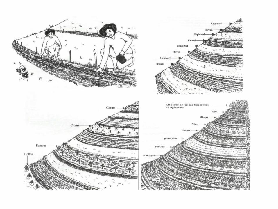
Terracing by hand or machine…
• Smallest version are narrow terraces called “Benches”.
• Like making roads.
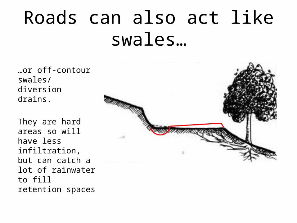
Roads can also act like swales…
…or off-contour swales/ diversion drains.
They are hard areas so will have less infiltration, but can catch a lot of rainwater to fill retention spaces
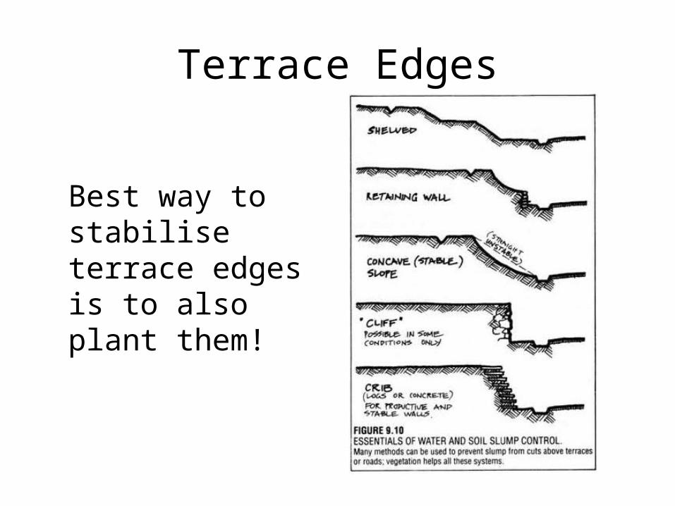
Terrace Edges
Best way to stabilise terrace edges is to also plant them!
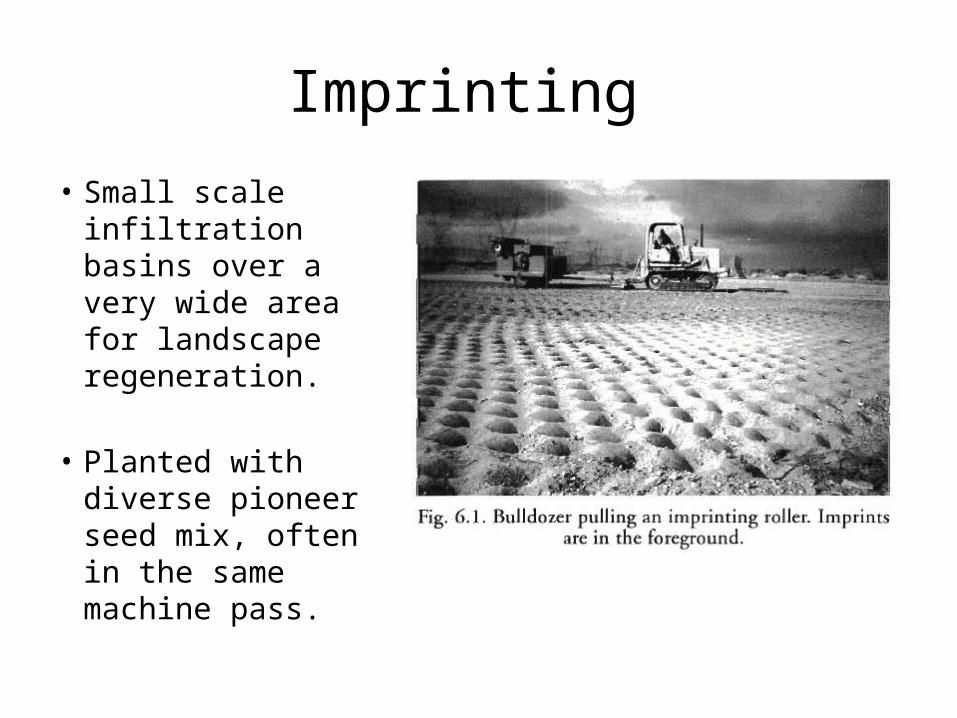
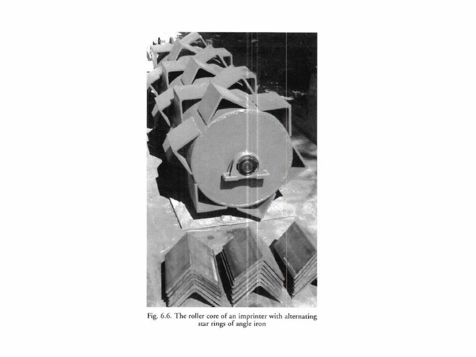
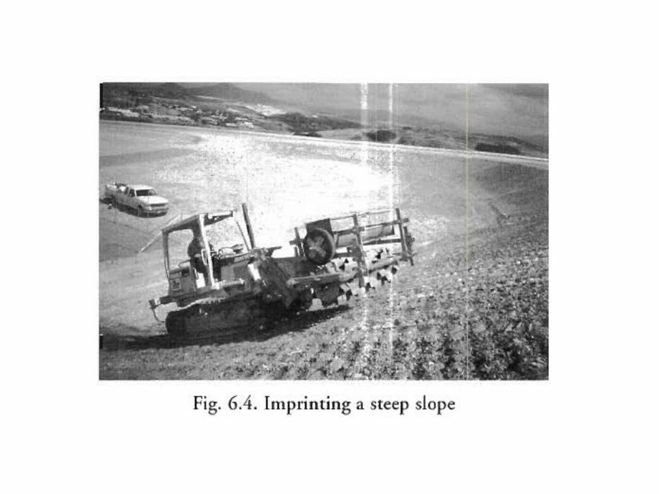
Imprinting
• Small scale infiltration basins over a very wide area for landscape regeneration.
• Planted with diverse pioneer seed mix, often in the same machine pass.
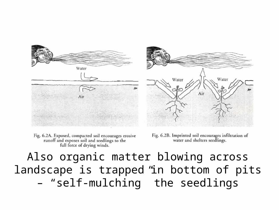
Also organic matter blowing across landscape is trapped in bottom of pits – “self-mulching” the seedlings

Where to Use?
• Abandoned farm fields
• Building sites
• Overgrazed rangeland
• Soils with rock up to 1ft in diameter
• Slopes as steep as 2:1
Related Documents