Radar and Lidar Fundamentals and Applications Active Remote Sensing for Elevation Mapping

Radar and Lidar Fundamentals and Applications. Radar image: Himalayas.
Dec 23, 2015
Welcome message from author
This document is posted to help you gain knowledge. Please leave a comment to let me know what you think about it! Share it to your friends and learn new things together.
Transcript
Radar and Lidar Fundamentals and Applications
Active Remote Sensing for Elevation Mapping
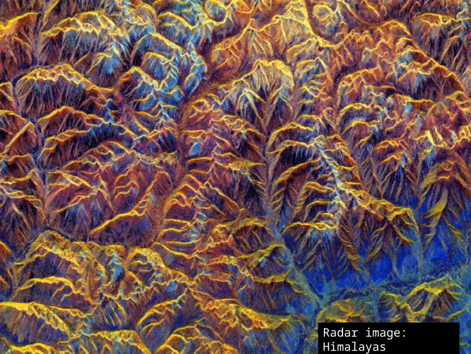
Radar image: Himalayas
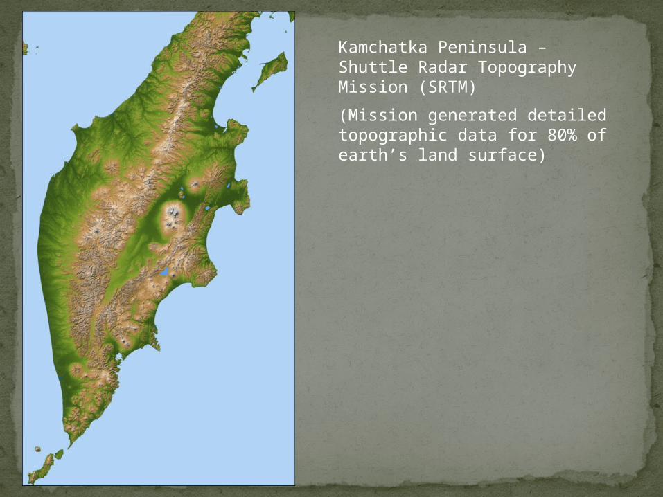
Kamchatka Peninsula – Shuttle Radar Topography Mission (SRTM)
(Mission generated detailed topographic data for 80% of earth’s land surface)
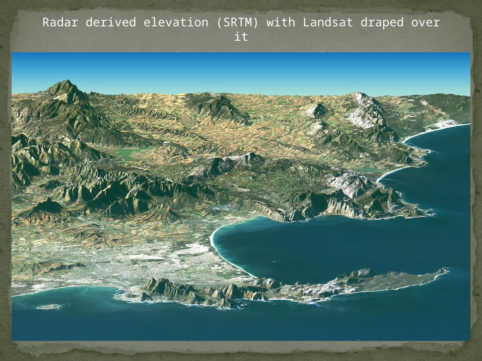
Radar derived elevation (SRTM) with Landsat draped over it
Cape of Good Hope, South Africa
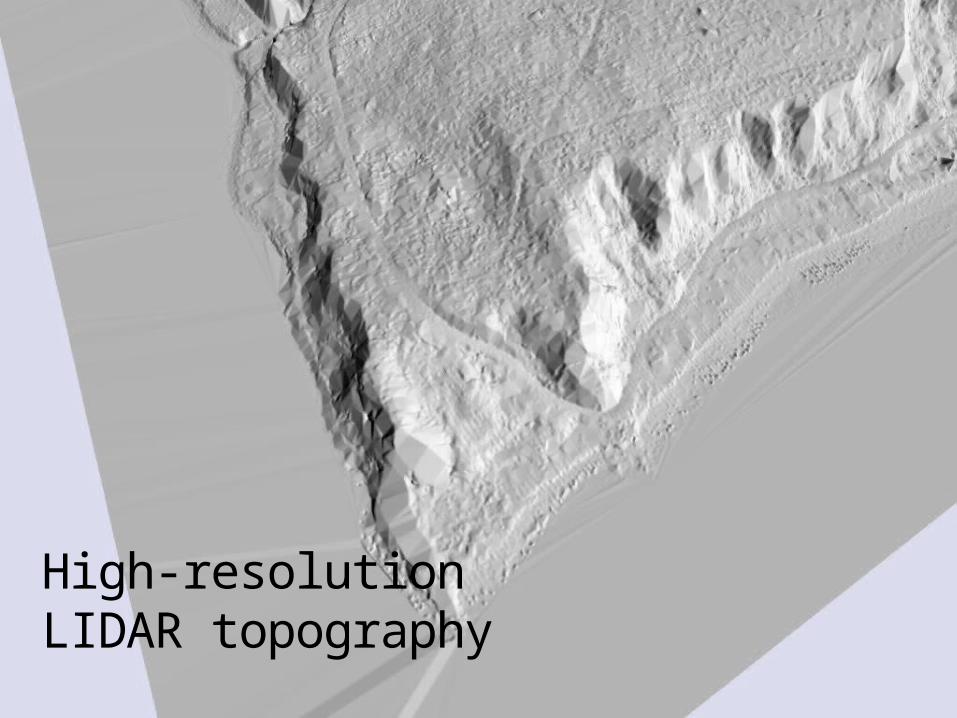
High-resolution LIDAR topography

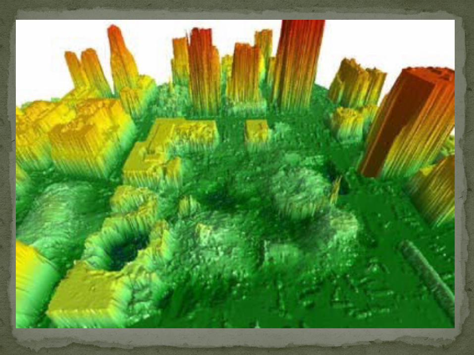
Lidar vs. DEMs from USGS topo map


Passive vs. Active Remote SensingPassive remote sensing uses the energy
from the sun Active remote sensing sends out its own
energy and records how much bounces backImaging Radar uses microwave wavelengths
RAdio Detection And RangingPassive microwave measures emitted long wave
radiationLidar uses visible and NIR wavelengths (laser)
Light Detection and Ranging
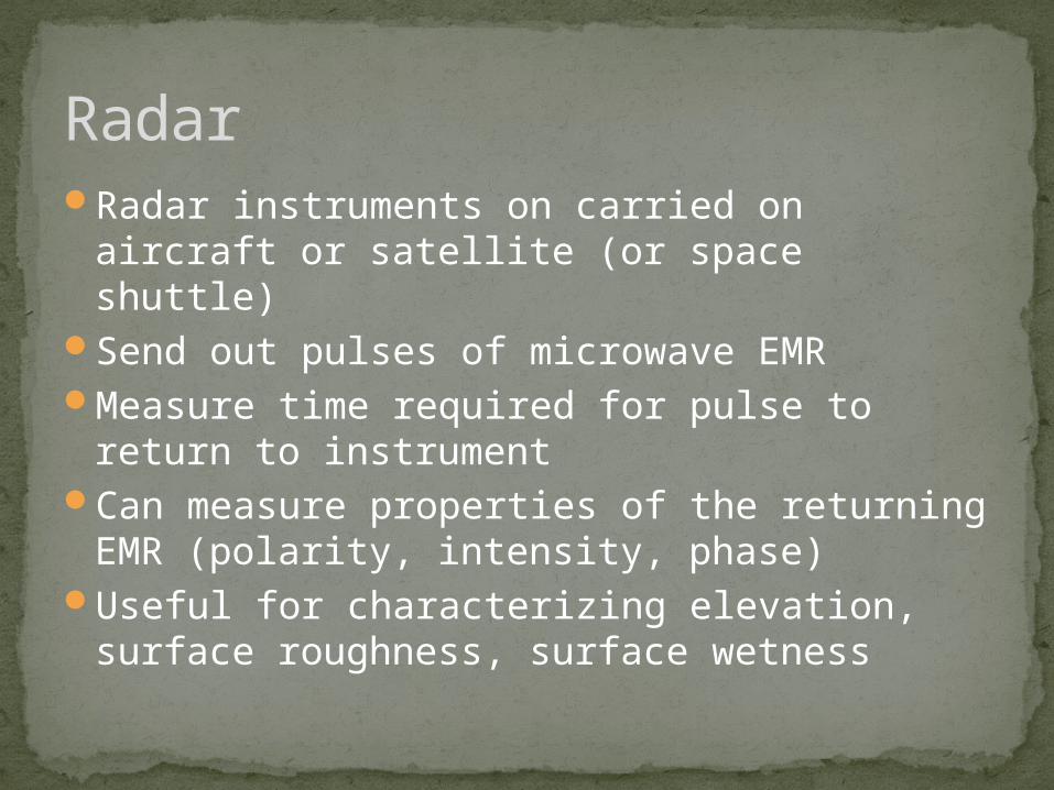
Radar instruments on carried on aircraft or satellite (or space shuttle)
Send out pulses of microwave EMRMeasure time required for pulse to return to
instrumentCan measure properties of the returning EMR
(polarity, intensity, phase)Useful for characterizing elevation, surface
roughness, surface wetness
Radar
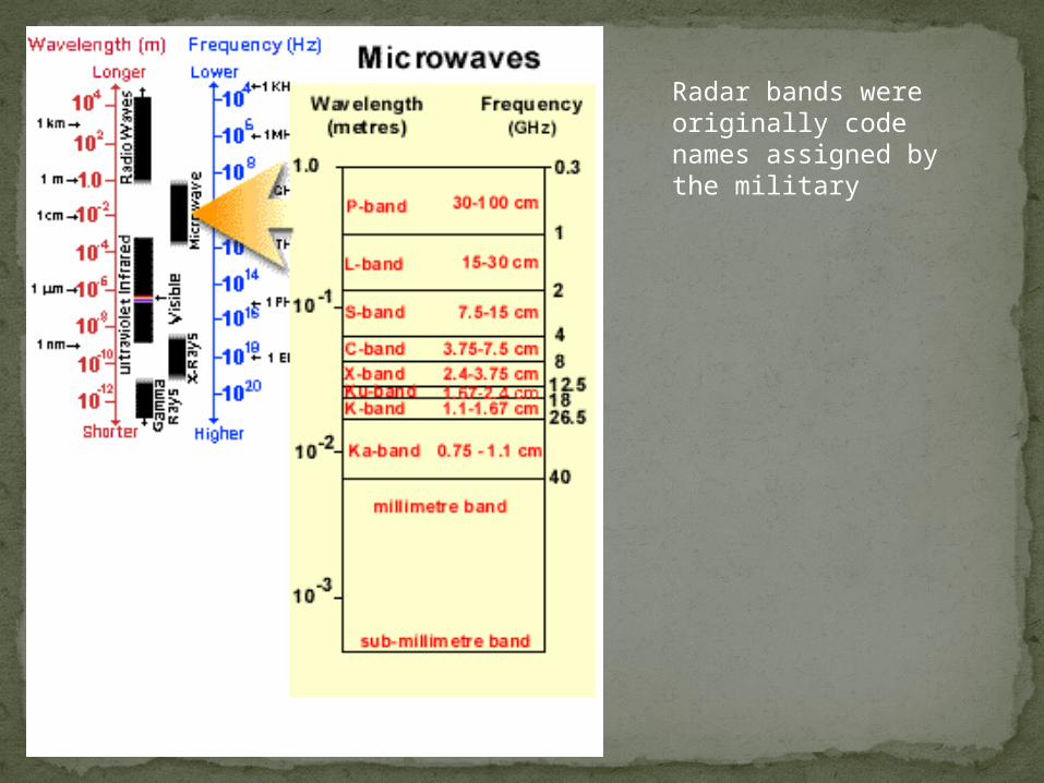
Radar bands were originally code names assigned by the military

Radar AdvantagesCan penetrate cloudsActive, so can use day or nightLess of a radiance vs. reflectance problem
since you know exactly how much energy you send out and can measure what you get back—and atmosphere not a problem
Can penetrate dry soil and get subsurface characteristics (e.g., archaeology)

Radar DisadvantagesDeveloped by military, less civilian experience
so far than passive remote sensingDifficult to interpret—complicated properties
of ground affect reflectanceGeometric distortions caused by side looking
geometryNot much spectral information
Side-looking RadarMost radar systems do not look straight down
but instead off to the sideFor military applications allows planes to fly
over friendly territory and look into enemy territory
Gives us more info about surface than when radar looks straight down because differences in surface roughness become more apparent

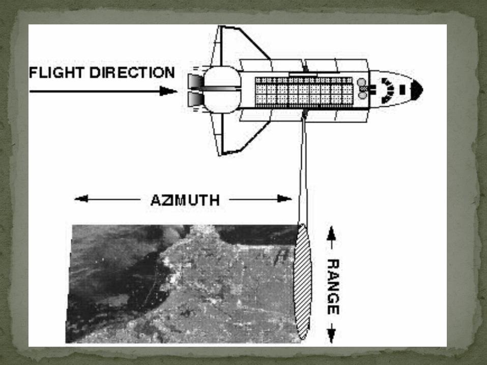
Radar TerminologyDirection of flight = azimuthBackscatter = reflectanceAngle of view = depression
angleetc.—whole new terminology

Depression Angle
Radar Geometry
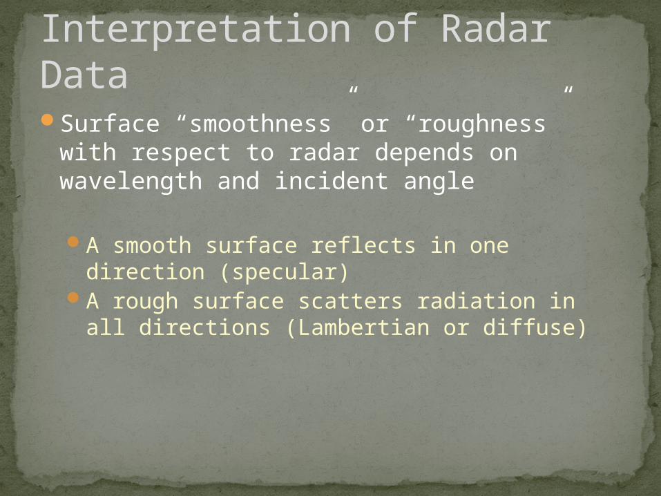
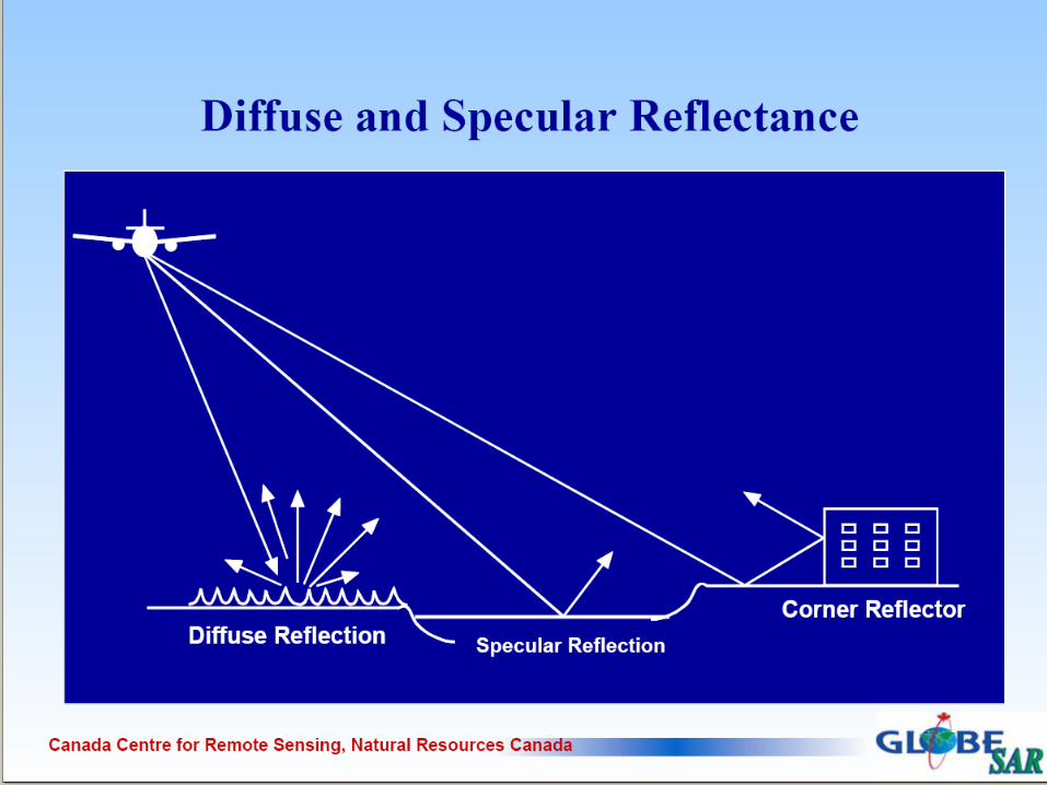
Interpretation of Radar DataSurface “smoothness” or “roughness” with
respect to radar depends on wavelength and incident angle
A smooth surface reflects in one direction (specular)
A rough surface scatters radiation in all directions (Lambertian or diffuse)
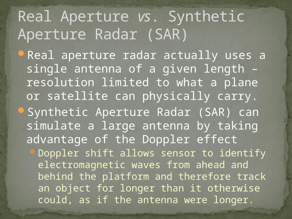
Real Aperture vs. Synthetic Aperture Radar (SAR)Real aperture radar actually uses a single
antenna of a given length – resolution limited to what a plane or satellite can physically carry.
Synthetic Aperture Radar (SAR) can simulate a large antenna by taking advantage of the Doppler effectDoppler shift allows sensor to identify
electromagnetic waves from ahead and behind the platform and therefore track an object for longer than it otherwise could, as if the antenna were longer.

Radar SensorsThere are many imaging radar sensors
available, both airborne and on satellites
Most aircraft use SARAll satellites use SAR (to achieve reasonable
spatial resolution)
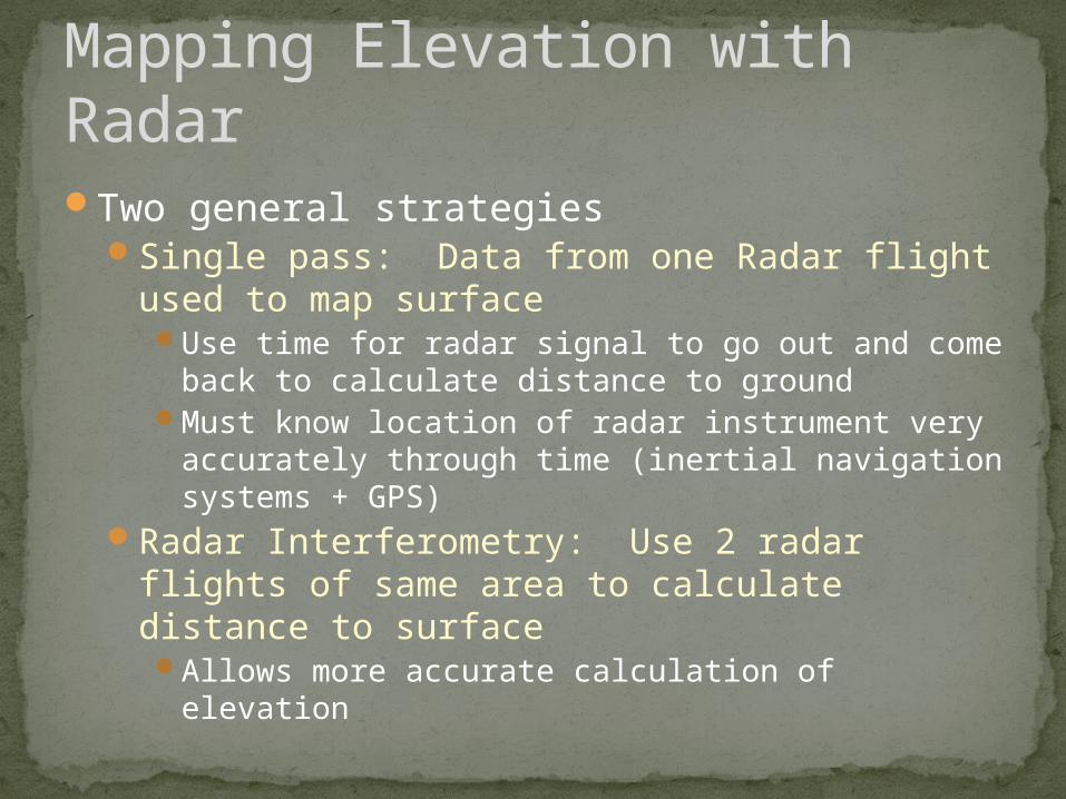
Two general strategiesSingle pass: Data from one Radar flight used
to map surfaceUse time for radar signal to go out and come back
to calculate distance to groundMust know location of radar instrument very
accurately through time (inertial navigation systems + GPS)
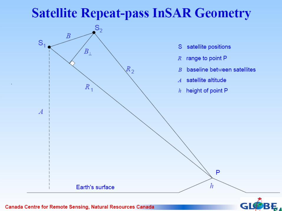
Radar Interferometry: Use 2 radar flights of same area to calculate distance to surfaceAllows more accurate calculation of elevation
Mapping Elevation with Radar
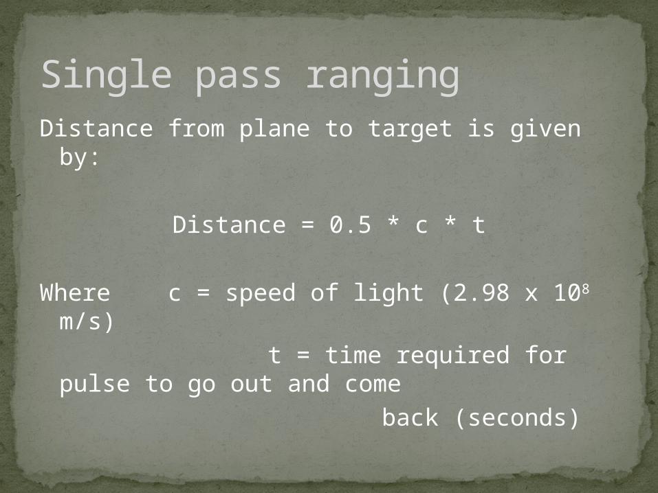
Distance from plane to target is given by:
Distance = 0.5 * c * t
Where c = speed of light (2.98 x 10⁸ m/s) t = time required for pulse to go out
and come back (seconds)
Single pass ranging

Radar Interferometry (2 or more passes)
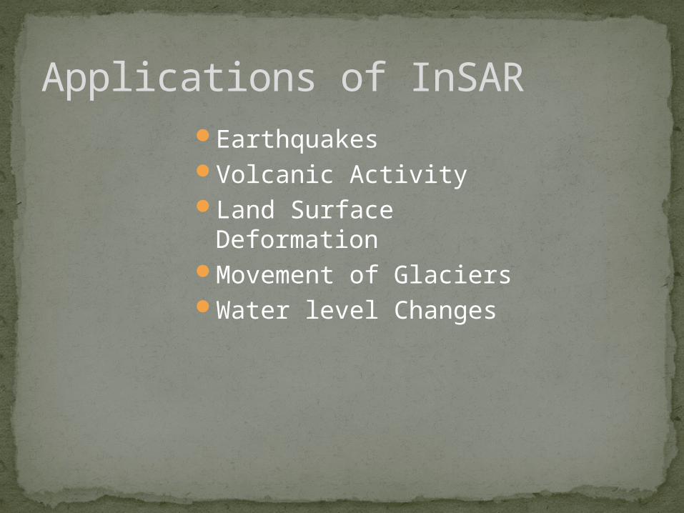
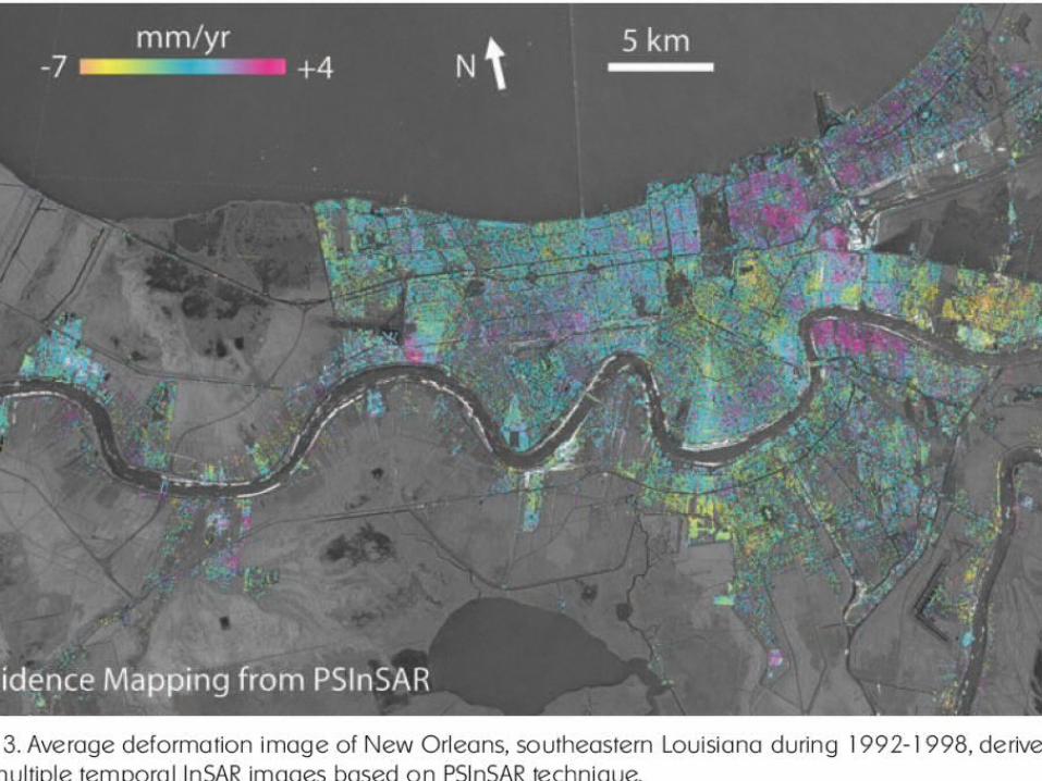
Applications of InSAREarthquakesVolcanic ActivityLand Surface
DeformationMovement of GlaciersWater level Changes

InSAR Volcanic Inflation Image
•Data Before and After Eruption
•Provide Insight into:
•Magma Dynamics
•Structure
•Plumbing
•State of Restless Volcanoes
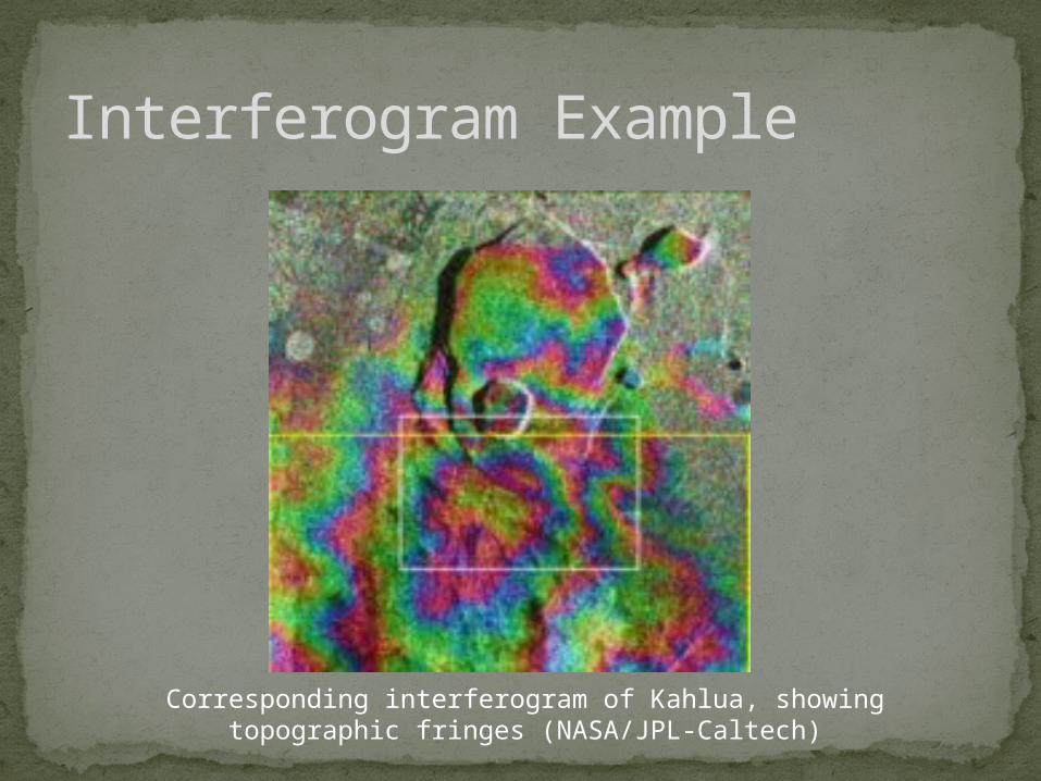
Interferogram Example
Corresponding interferogram of Kahlua, showing topographic fringes (NASA/JPL-Caltech)
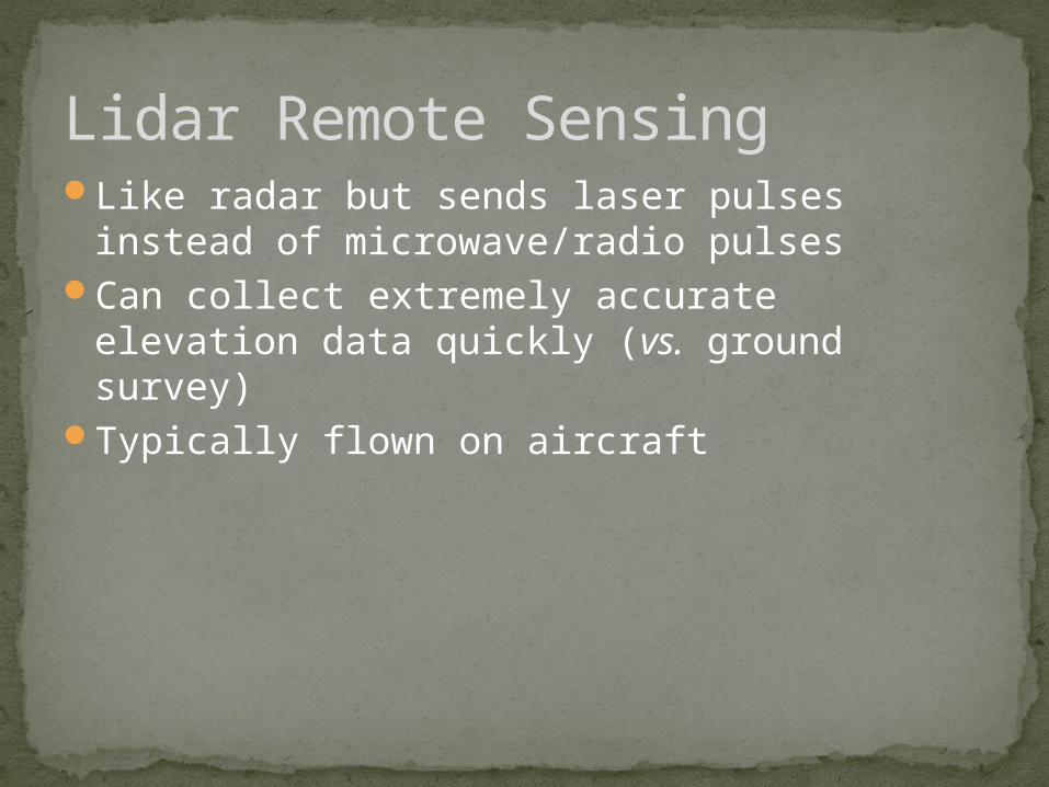
Lidar Remote SensingLike radar but sends laser pulses instead of
microwave/radio pulsesCan collect extremely accurate elevation data
quickly (vs. ground survey)Typically flown on aircraft
Same as for single pass radar – use time for pulse to go out and return and speed of light to calculate distance
Like radar, depends on inertial navigation systems and GPS
More accurate than radar
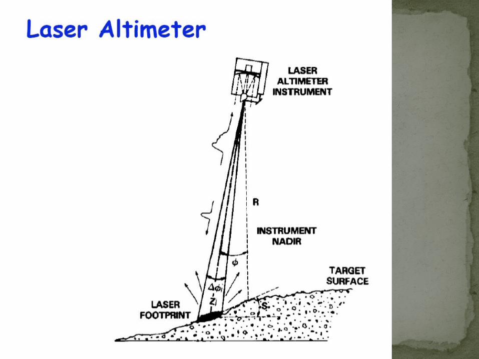
Calculating elevation from Lidar
Generally better than radar resolution because:Radar has a pulse-based (wave) footprint that
is usually broad (pulse radiates outward away from sensor)
Lidar has a beam-based (photon) footprint that is usually narrow (pulse width stays narrow away from sensor)
Lidar uses shorter wavelength light and therefore it is reflected by smaller objects than radar
Lidar resolution

Lidar derived surface models include top of vegetation canopy, buildings, etc.
Lidar derived bare earth elevation must have all of those removed
Lidar for hydrologic flows requires bare earth in some places but not in othersE.g., water doesn’t typically flow through
buildings
Requires fairly interactive human processing
Lidar for different surfaces
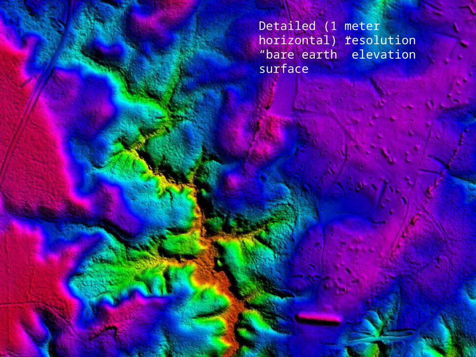
Lidar ApplicationsDetailed (1 meter horizontal) resolution “bare earth” elevation surface

Lidar derived flood plane
Topo derived flood plane
More precise elevation data allows better prediction of flood damage

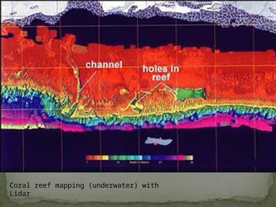
Coral reef mapping (underwater) with Lidar
Radar and Lidar are active remote sensing techniques
Can operate day or nightMany applications, but most important is
development of accurate elevation surfacesElevation data are critical for many other
application, from vegetation mapping to hydrology to geology and others.
Summary
Related Documents


