Department of Science, Information Technology and Innovation Queensland Herbarium —documenting nature

Welcome message from author
This document is posted to help you gain knowledge. Please leave a comment to let me know what you think about it! Share it to your friends and learn new things together.
Transcript
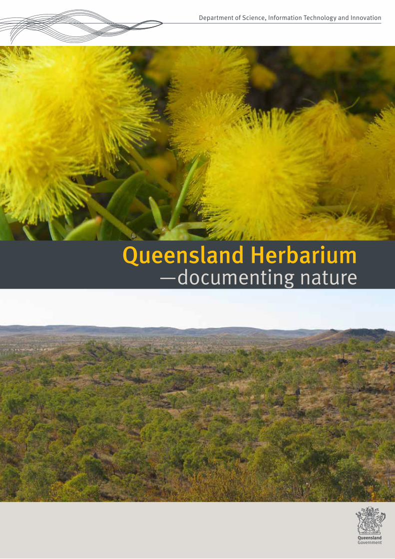
Department of Science, Information Technology and Innovation
Queensland Herbarium —documenting nature

Queensland Herbarium —documenting nature

Prepared by: Queensland Herbarium Science Delivery Division Department of Science, Information Technology and Innovation PO Box 5078 Brisbane Qld 4001
© The State of Queensland (Department of Science, Information Technology and Innovation) 2015
The Queensland Government supports and encourages the dissemination and exchange of its information. The copyright in this publication is licensed under a Creative Commons Attribution 3.0 Australia (CC BY) licence.
Under this licence you are free, without having to seek permission from DSITI, to use this publication in accordance with the licence terms.
You must keep intact the copyright notice and attribute the State of Queensland, Department of Science, Information Technology and Innovation as the source of the publication.
For more information on this licence visit http://creativecommons.org/licenses/by/3.0/au/deed.en.
Disclaimer: This document has been prepared with all due diligence and care, based on the best available information at the time of publication. The department holds no responsibility for any errors or omissions within this document. Any decisions made by other parties based on this document are solely the responsibility of those parties. Information contained in this document is from a number of sources and, as such, does not necessarily represent government or departmental policy.
If you need to access this document in a language other than English, please call the Translating and Interpreting Service (TIS National) on 131 450 and ask them to telephone Library Services on +61 7 3170 5725
Acknowledgements: This report has been prepared by the Department of Science, Information Technology and Innovation. Acknowledgement is made of the many enthusiastic volunteers that have contributed their time and passion to the conservation of Queensland’s plants, animals and their habitats over 2014.
Front cover top: Acacia wickhami, Petford area in the Einasleigh Uplands | © Photo KR McDonald Front cover bottom: Snappy gum woodland in the Lawn Hill area of the Northwest Highlands | Photo Dan Kelman, Queensland Herbarium © State of Queensland Inside front cover: Sesbania sp. fringing flood plain, Lake Constance, Diamantina National Park, Central Western Queensland | Photo Bruce Wilson © State of Queensland Inside back cover: Diporiphora nobbi, Nobbi Dragon, Desert Uplands, Central Western Queensland | Photo Annie Kelly, Queensland Herbarium © State of Queensland Back cover top: A common bluetail damselfly, Ischnura heterosticta, Lake Nuga Nuga National Park, Arcadia Valley, western Queensland | Photo Dan Ferguson, Queensland Herbarium © State of Queensland Back cover bottom: Palustrine wetland near South Yaamba (Rockhampton) in the Brigalow Belt bioregion | Photo Christopher Pennay, Queensland Herbarium © State of Queensland
September 2015 science-150036
2
Contents
About the Queensland Herbarium . . . . . . . . . . . . . . . . . . . . . . . . . . . . . . . . . . . . . 4
Our science . . . . . . . . . . . . . . . . . . . . . . . . . . . . . . . . . . . . . . . .6
Our highpoints 2014 . . . . . . . . . . . . . . . . . . . . . . . . . . . . . . .10
Our priorities . . . . . . . . . . . . . . . . . . . . . . . . . . . . . . . . . . . . . . 12
Customers first . . . . . . . . . . . . . . . . . . . . . . . . . . . . . . . . . . . . . . . . . . . . . . . . . . . .14
Partnerships for outcomes . . . . . . . . . . . . . . . . . . . . . . . . . . . 15
Providing information and expertise: Botanical Information and Advisory Services . . . . . . . . . . . . 17
Advancing our collection . . . . . . . . . . . . . . . . . . . . . . . . . . . . . . . . . . . . . . . . . . . 20
Our partners . . . . . . . . . . . . . . . . . . . . . . . . . . . . . . . . . . . . . .23
Discovering new species. . . . . . . . . . . . . . . . . . . . . . . . . . . . . . . . . . . . . . . . . . . . 25
Our partners . . . . . . . . . . . . . . . . . . . . . . . . . . . . . . . . . . . . . .27
Fungi: the unexplored kingdom . . . . . . . . . . . . . . . . . . . . . . 28
Understanding the ecological processes. . . . . . . . . . . . . . . . . . . . . . . . . . . . . . . 29
Our partners . . . . . . . . . . . . . . . . . . . . . . . . . . . . . . . . . . . . . .32
Is it possible to restore an endangered ecosystem? . . . . . .33
Surveying and mapping our ecosystems . . . . . . . . . . . . . . . . . . . . . . . . . . . . . . . 35
Our partners . . . . . . . . . . . . . . . . . . . . . . . . . . . . . . . . . . . . . .37
Protecting our plants, animals and their habitats. . . . . . . . . . . . . . . . . . . . . . . . .41
Our partners . . . . . . . . . . . . . . . . . . . . . . . . . . . . . . . . . . . . . 44
Profile of a threatened species. . . . . . . . . . . . . . . . . . . . . . . .45
Publications 2013 and 2014 . . . . . . . . . . . . . . . . . . . . . . . . . . . . . . . . . . . . . . . . . 46
3
Queensland Herbarium

About the Queensland Herbarium
The Queensland Herbarium was
established in 1859 and is the state’s
first and oldest scientific institution.
As part of the Queensland Department
of Science Information Technology and
Innovation (DSITI) the Herbarium is
central to the research, identification
and dissemination of information on
Queensland’s plants, fungi, algae and
animals, and the ecosystems they
inhabit.
Grevillea robusta, silky oak, South-East Queensland Photo Gordon Guymer Queensland Herbarium © State of Queensland
4
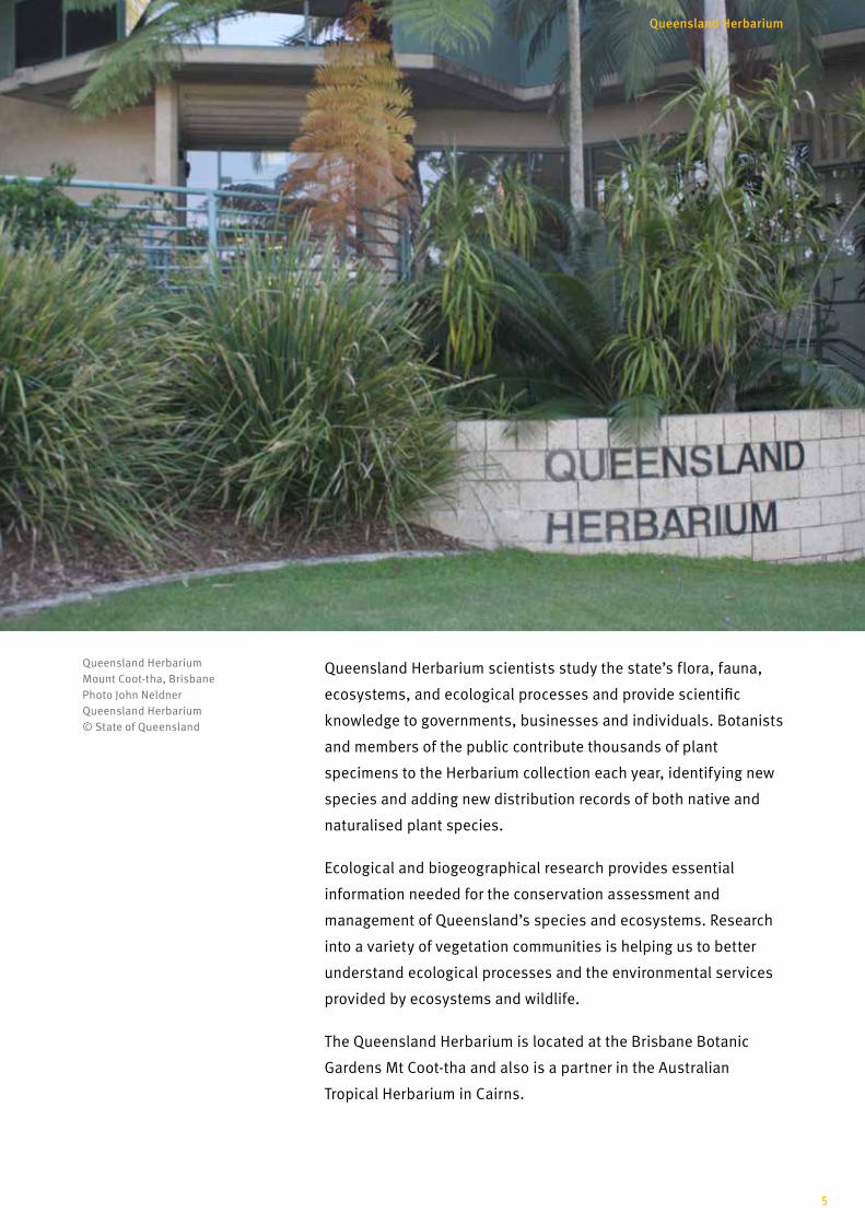
Queensland Herbarium scientists study the state’s flora, fauna,
ecosystems, and ecological processes and provide scientific
knowledge to governments, businesses and individuals. Botanists
and members of the public contribute thousands of plant
specimens to the Herbarium collection each year, identifying new
species and adding new distribution records of both native and
naturalised plant species.
Ecological and biogeographical research provides essential
information needed for the conservation assessment and
management of Queensland’s species and ecosystems. Research
into a variety of vegetation communities is helping us to better
understand ecological processes and the environmental services
provided by ecosystems and wildlife.
The Queensland Herbarium is located at the Brisbane Botanic
Gardens Mt Coot-tha and also is a partner in the Australian
Tropical Herbarium in Cairns.
Queensland Herbarium Mount Coot-tha, Brisbane Photo John Neldner Queensland Herbarium © State of Queensland
5
Queensland Herbarium
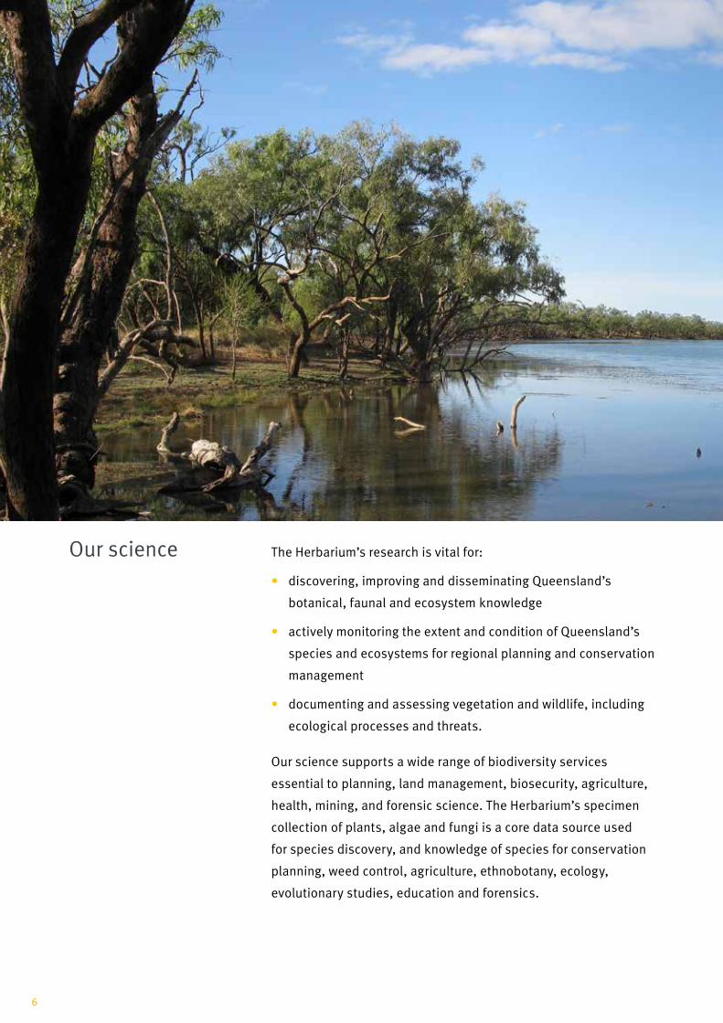
The Herbarium’s research is vital for:
• discovering, improving and disseminating Queensland’s
botanical, faunal and ecosystem knowledge
• actively monitoring the extent and condition of Queensland’s
species and ecosystems for regional planning and conservation
management
• documenting and assessing vegetation and wildlife, including
ecological processes and threats.
Our science supports a wide range of biodiversity services
essential to planning, land management, biosecurity, agriculture,
health, mining, and forensic science. The Herbarium’s specimen
collection of plants, algae and fungi is a core data source used
for species discovery, and knowledge of species for conservation
planning, weed control, agriculture, ethnobotany, ecology,
evolutionary studies, education and forensics.
Our science
6

In addition to managing our collection, discovering new flora,
and evaluating species and populations, a key part of the
Queensland Government’s responsibilities is surveying and
mapping Queensland’s regional ecosystems. This detailed work
contributes to local, regional and national conservation and land
use assessments, planning, and the application of Queensland
legislation.
As well as mapping regional ecosystems the Herbarium is also
Queensland’s lead agency for mapping wetlands and, most
recently, groundwater dependent ecosystems. The identification
and mapping of groundwater dependent ecosystems is providing
scientific information to assist Australian governments assess the
impacts of coal and coal seam gas (CSG) mining on groundwater
dependent ecosystems.
Pandanus Station waterhole in Far North Queensland, part of the Gulf Plains Bioregion, one of Queensland’s 13 bioregions being mapped by the Queensland Herbarium Photo Chris Appelman Queensland Herbarium © State of Queensland
7
Queensland Herbarium
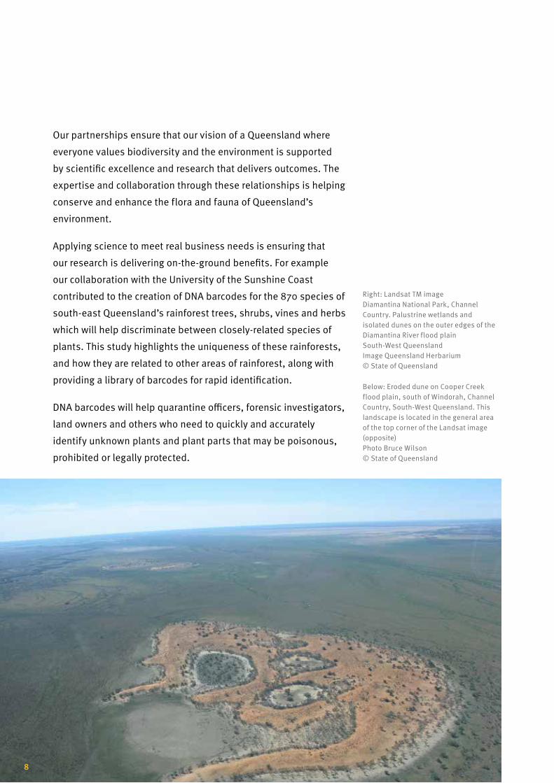
Our partnerships ensure that our vision of a Queensland where
everyone values biodiversity and the environment is supported
by scientific excellence and research that delivers outcomes. The
expertise and collaboration through these relationships is helping
conserve and enhance the flora and fauna of Queensland’s
environment.
Applying science to meet real business needs is ensuring that
our research is delivering on-the-ground benefits. For example
our collaboration with the University of the Sunshine Coast
contributed to the creation of DNA barcodes for the 870 species of
south-east Queensland’s rainforest trees, shrubs, vines and herbs
which will help discriminate between closely-related species of
plants. This study highlights the uniqueness of these rainforests,
and how they are related to other areas of rainforest, along with
providing a library of barcodes for rapid identification.
DNA barcodes will help quarantine officers, forensic investigators,
land owners and others who need to quickly and accurately
identify unknown plants and plant parts that may be poisonous,
prohibited or legally protected.
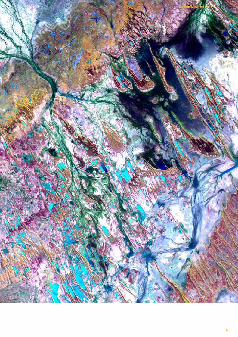
Right: Landsat TM image Diamantina National Park, Channel Country. Palustrine wetlands and isolated dunes on the outer edges of the Diamantina River flood plain South-West Queensland Image Queensland Herbarium © State of Queensland
Below: Eroded dune on Cooper Creek flood plain, south of Windorah, Channel Country, South-West Queensland. This landscape is located in the general area of the top corner of the Landsat image (opposite) Photo Bruce Wilson © State of Queensland
8
9
Queensland Herbarium
• 25 plant species new to science were formally described in the
2014 issue of Queensland Herbarium journal Austrobaileya
• 8,000 additional specimens and associated data of priority
species incorporated into the collections and databases
• 58 new Queensland weed incursions detected and reported
• 47 new fungi species recorded for Queensland
• 20 plant species were assessed for their conservation status
• 4 fauna species were assessed for environmental protection
• Census of the Queensland Flora 2014 was published on
Queensland’s Open Data Portal
• 7,500 plant identifications made for customers
• over 3000 information enquiries
Our highpoints 2014
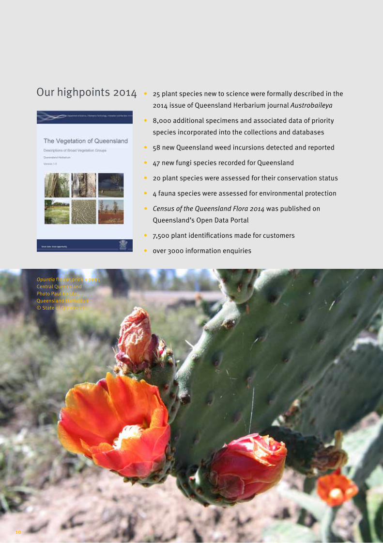
Opuntia flower,prickly pear, Central Queensland Photo Paul Forster, Queensland Herbarium © State of Queensland
10
• over 50,000 maps provided to online clients
• 50 publications and reports published
• 41 peer-reviewed journal articles published
• 93 regional ecosystem benchmark documents were published
for the assessment of vegetation condition in the Desert
Uplands and Northern Brigalow Belt bioregions
• publication of the landmark Vegetation of Queensland by the
Queensland Herbarium. Complimenting Queensland’s regional
ecosystem framework, this publication provides the first
comprehensive overview of the vegetation in the state
• online access from the Biota Globe to Queensland’s broad
vegetation groups down to the property scale (pre-clearing and
remnant)
• 8,317 type specimen images posted and available on JSTOR
• release of the Native Forest Regrowth Benefit Information
System on the Queensland Government website. This calculator
provides information on site suitability for regrowing native
forest and the potential for carbon credits
• publication of six regrowth management guidelines to assist
land managers undertaking carbon abatement projects
involving native forest regrowth
• publication of the Terrestrial Vertebrate Fauna Survey
Guidelines and datasheets for a select number of species of
conservation concern
• commenced groundwater dependent ecosystem assessments
for the Galilee and Cooper sub-basins of the Lake Eyre Basin
to input to the Commonwealth’s Bioregional Assessment
Programme
• hosted the 41st meeting of the Council of Heads of Australasian
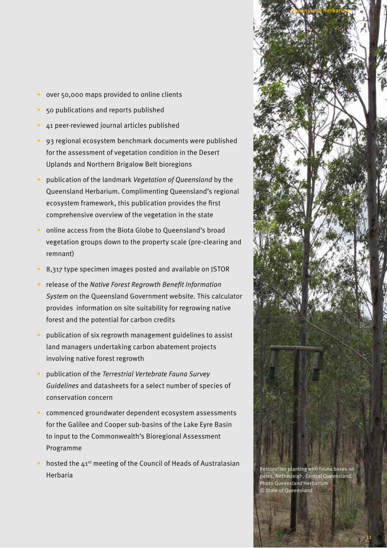
Herbaria Restoration planting with fauna boxes on poles, Netherleigh, Central Queensland. Photo Queensland Herbarium © State of Queensland
11
Queensland Herbarium
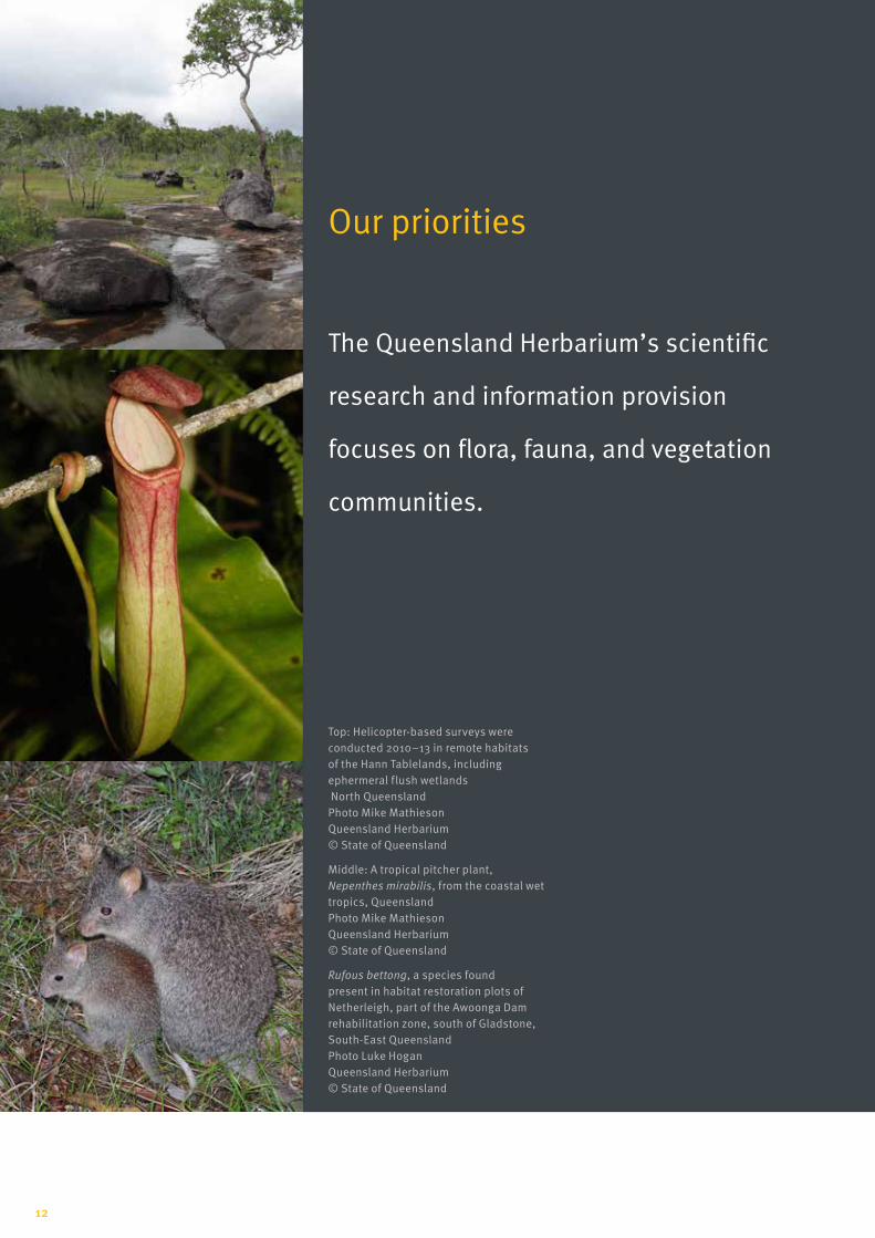
The Queensland Herbarium’s scientific
research and information provision
focuses on flora, fauna, and vegetation
communities.
Our priorities
Top: Helicopter-based surveys were conducted 2010–13 in remote habitats of the Hann Tablelands, including ephermeral flush wetlands North Queensland Photo Mike Mathieson Queensland Herbarium © State of Queensland
Middle: A tropical pitcher plant, Nepenthes mirabilis, from the coastal wet tropics, Queensland Photo Mike Mathieson Queensland Herbarium © State of Queensland
Rufous bettong, a species found present in habitat restoration plots of Netherleigh, part of the Awoonga Dam rehabilitation zone, south of Gladstone, South-East Queensland Photo Luke HoganQueensland Herbarium © State of Queensland
12

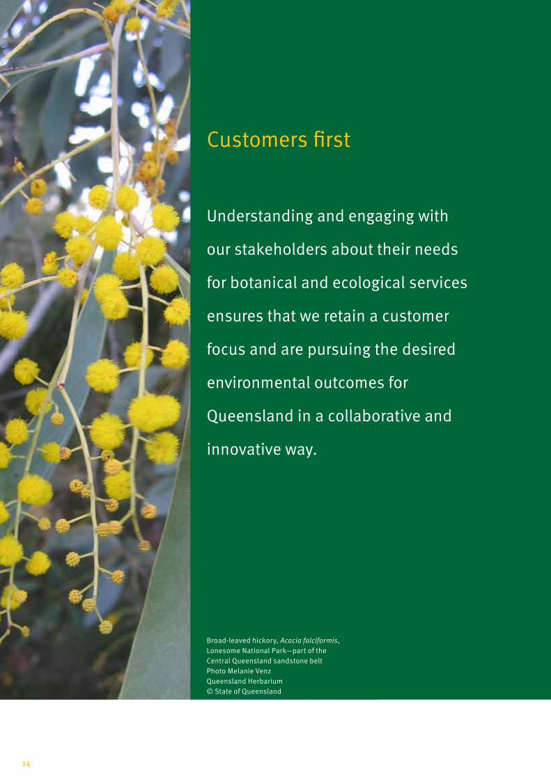
Customers first Understanding and engaging with our stakeholders about their
needs for botanical and ecological services ensures that we retain
a customer focus and are pursuing the desired environmental
outcomes for Queensland in a collaborative and innovative way.
Advancing our collections
The Queensland Herbarium specimen collections and
associated data are the principal resource for knowledge and
information about the flora of the state. Herbarium botanists,
collaborators, volunteers, and other stakeholders are improving
the comprehensiveness, adequacy and representativeness of our
collections.
Discovering new species
Queensland has the most diverse flora and fauna of any state in
Australia. Herbarium scientists are discovering and documenting
dozens of new species each year.
Understanding ecological processes
Research into the ecology of Queensland’s landscapes helps us
understand the impacts of factors such as fire, grazing, drought,
development and climate variability to help us better manage our
environment.
Surveying, mapping and monitoring ecosystems
Ecosystem survey, mapping and monitoring is fundamental to
knowledge of our state’s environment, planning for sustainable
development, and conservation of our biodiversity.
Protecting our plants, animals and their habitats
Researching, assessing and monitoring our flora, fauna, and
ecosystems is essential to determine their conservation status
and to address threatening processes, such as weeds, pests
and land clearing. This allows for development of conservation
strategies to safeguard our biodiversity.
13
Queensland Herbarium
Customers first
Understanding and engaging with
our stakeholders about their needs
for botanical and ecological services
ensures that we retain a customer
focus and are pursuing the desired
environmental outcomes for
Queensland in a collaborative and
innovative way.
Broad-leaved hickory, Acacia falciformis, Lonesome National Park—part of the Central Queensland sandstone belt Photo Melanie Venz Queensland Herbarium © State of Queensland
14

The Queensland Herbarium is committed to providing the best
available information to businesses, government and the public.
Our partnerships and volunteers provide valuable support in
assisting us to achieve this goal.
The Queensland Herbarium has successfully collaborated, over
many decades, with universities, international organisations,
natural resource management organisations, and government and
non-government bodies to achieve biodiversity discovery,
innovation and improved environmental outcomes.
Our current research partners include:
• Queensland Department of Environment and Heritage
Protection
• Queensland Department of Agriculture and Fisheries
• Queensland Department of Natural Resources and Mines
• Queensland Department of National Parks, Sport and Racing
• Queensland Museum
• Australian Tropical Herbarium
• Queensland Natural Resource Management Regional Bodies
• State and Commonwealth scientific advisory committees
• Other Herbaria, Australian and international
• Australian universities
• Queensland businesses
• Community groups and other non-government organisations
• Local governments
• Australian Government
• CSIRO
• Council of Heads of Australian Herbaria
• New York Botanical Gardens
• Chinese Academy of Sciences
• Atlas of Living Australia
Partnerships for outcomes
15
Queensland Herbarium
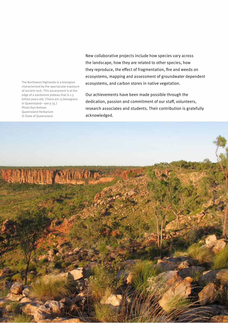
New collaborative projects include how species vary across
the landscape, how they are related to other species, how
they reproduce, the effect of fragmentation, fire and weeds on
ecosystems, mapping and assessment of groundwater dependent
ecosystems, and carbon stores in native vegetation.
Our achievements have been made possible through the
dedication, passion and commitment of our staff, volunteers,
research associates and students. Their contribution is gratefully
acknowledged.
The Northwest Highlands is a bioregion characterised by the spectacular exposure of ancient rock. This escarpment is at the edge of a sandstone plateau that is 1.5 billion years old. (There are 13 bioregions in Queensland—see p 35.) Photo Dan Kelman Queensland Herbarium © State of Queensland
16

The Queensland Herbarium is committed to disseminating
knowledge of Queensland’s flora, fauna and ecosystems. A
comprehensive information and advisory service is provided
for customers, including plant identification. Detailed plant
specimen, species information and vegetation data are available
from the Herbarium’s databases and online sources, including
information on species distribution, ecology, toxicity, weeds, and
conservation status.
Botanical information is used by:
• governments, landowners and businesses to help with
planning, management and conservation
• legal investigators for use in compliance cases including
forensic evidence
• researchers to find out about local native flora species and
ecosystems that support wildlife
• individuals to find out about what plants are poisonous, native,
weedy or threatened.
Hudson Pear, Cylindropuntia rosea, is an invasive cactus and is classified as a B Class 1 declared species in Queensland and is a weed of national significance (WONS) Photo Department of Agriculture and Fisheries © State of Queensland
Providing information and expertise: Botanical Information and Advisory Services
17
Queensland Herbarium

Demand for biodiversity services by governments, business,
universities and the community is high. The Queensland
Herbarium supports over 4,000 clients per year. This covers
identification of specimens (~8,000 specimens for the public,
business and government), regional ecosystem maps (~50,000
per year) and information through the Queensland Government’s
Open Data portal and Queensland’s Biota Globe. Information and
statistics on our most threatened species and their habitats is
also available through Queensland Government’s Wildlife Online,
Australia’s Virtual Herbarium, and Atlas of Living Australia.
In addition the Queensland Herbarium plays a vital role in
providing expert witness services in legal cases involving
government compliance or forensic identification such as the
high-profile Baden–Clay murder investigation in 2014. The
Herbarium is also a key contact for information and advice about
poisonous plants.
As a centre dedicated to botanical and ecosystem research the
Herbarium is an active partner in state, national and global
research, with over 50 papers published each year.
Technical manuals, management guidelines, reports and datasets
for species, ecosystems, vegetation and fauna, are also available
through the Queensland Herbarium website, Queensland
Government’s Publication Portal, Open Data, and the Biota Globe.
Freehand traverse section of fresh leaf of Panicum pymmaeum showing unique vascular bundle configuration © Photo John Thompson
18

The Biota Globe <data.qld.gov.au/maps-geospatial/qld-globe> is
one of several category globes of the Queensland Globe which
displays Queensland Herbarium spatial datasets relating to to
bioregions, vegetation and ecosystems, and other biodiversity
datasets.
Weeds endanger biodiversity, impact agriculture and in some
cases, human and animal health. The cost of weeds to Australian
agriculture alone now exceeds $4 billion per year.
The Queensland Herbarium in collaboration with Biosecurity
Queensland (Department of Agriculture and Fisheries) has
established the Weed Spotters’ Network Queensland. The
network focuses on early detection of new and emerging weeds
through harnessing and fostering community interest and
knowledge of invasive plants. For example, species like rubber
vine in North Queensland have the potential to substantially alter
entire native ecosystems by threatening native animals as well as
plant species.
There are currently 1304 non-native plant species (13.5 per cent
of the flora) in Queensland, increasing at a rate of around 10 new
weeds becoming established each year. More than 80 or these are
already declared weeds and many more have potential to become
serious pests. Preventing new weeds from becoming established
in the first place is our best defence against invasive species.
Weed spotters collect and identify new weeds in their local
region with assistance from their regional coordinators and the
Queensland Herbarium. Network members also provide location
data on where weeds occur, leading to a better understanding
of how far and how quickly they are spreading. This information
is crucial for developing early response strategies and for the
ongoing control and containment of weeds.
The Weed Spotters’ Network trains and supports over 1000
members and 21 regional coordinators. In 2014, the network
reported 58 new records of declared weeds.
Kudzu vine (Pueraria montana var. lobata) is a class 2 pest plant. Kudzu grows rapidly—reaching 20–30 m in length. Kuzu runners can grow 30 cm a day in summer. Photo Department of Agriculture and Fisheries ©State of Queensland
Limnocharis (Limnocharis flava) is a class 1 pest plant. Infestations have been detected in backyard ponds, ornamental lakes, farm drains and natural waterways. Photo Department of Agriculture and Fisheries ©State of Queensland
19
Queensland Herbarium
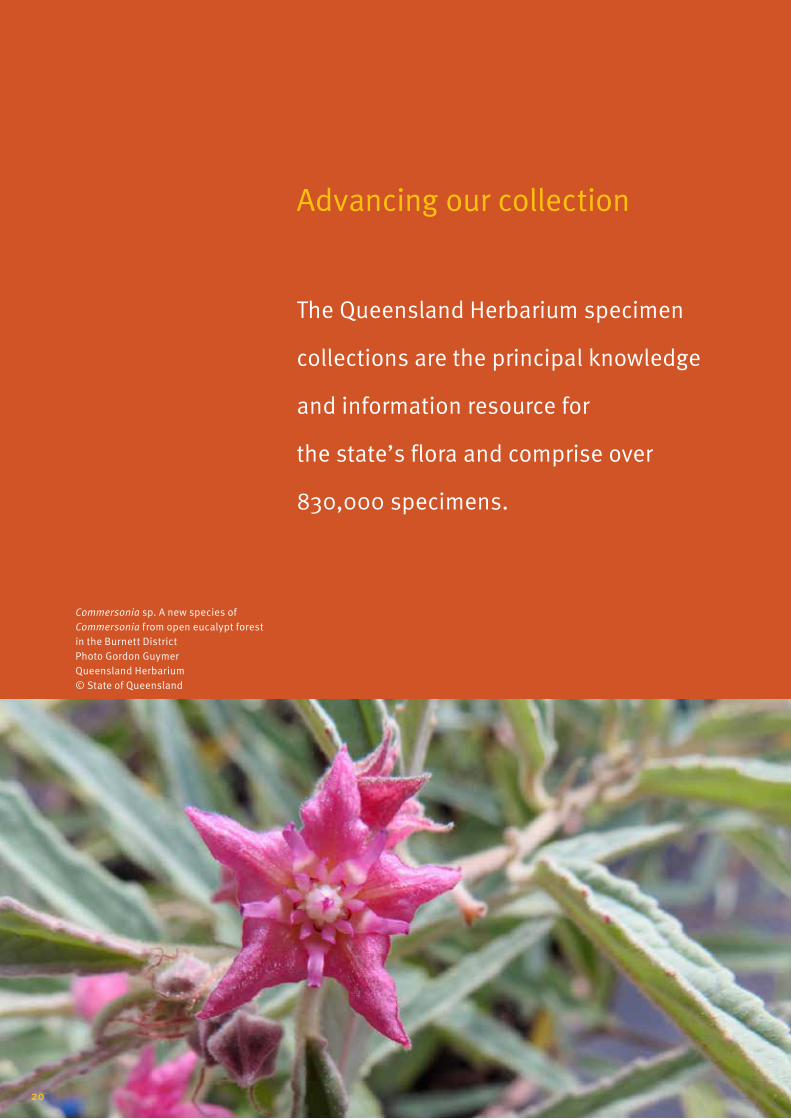
Advancing our collection
The Queensland Herbarium specimen
collections are the principal knowledge
and information resource for
the state’s flora and comprise over
830,000 specimens.
Commersonia sp. A new species of Commersonia from open eucalypt forest in the Burnett District Photo Gordon Guymer Queensland Herbarium © State of Queensland
20
The Queensland Herbarium specimen collections and associated
data form the basis for research and knowledge on the state’s
flora. The specimen collections are a unique record of the state’s
changing flora and comprise over 830,000 individual specimens,
each with their own location and habitat information. The
Herbarium’s collection contains historically important specimens,
such as the first Queensland plant specimens collected by
Sir Joseph Banks and Dr Daniel Solander, the botanists who
accompanied Captain James Cook in 1770.
This world class repository of specimens is actively used by staff,
volunteers and researchers and thousands of quality specimens
are added to the collection each year.
The Queensland Herbarium’s research collaborations extend
nationally and internationally. Recently, a world-wide study on
the brake ferns (Pteris) was completed, with specimens sourced
from every continent in the world except Antarctica. The study
resulted in 15 distinct lineages identified, with the related
endemic Platyzoma embedded amongst the Pteris in the resulting
classification.
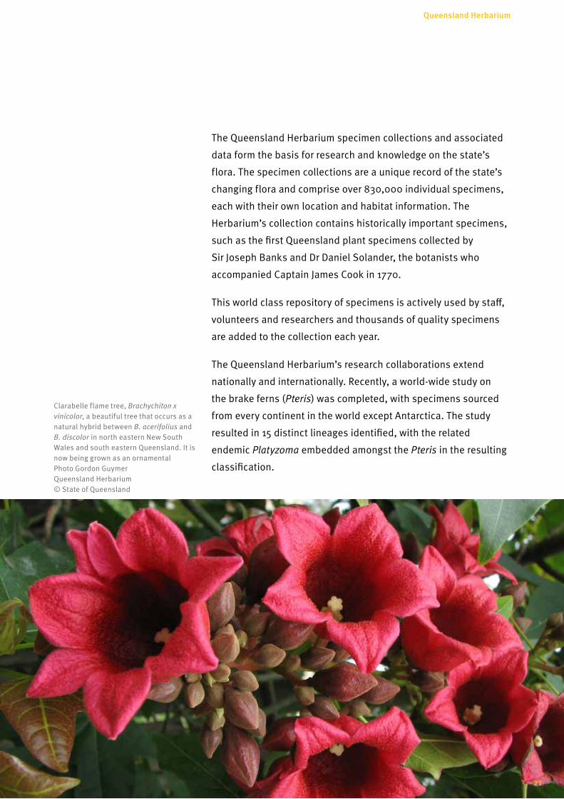
Clarabelle flame tree, Brachychiton x vinicolor, a beautiful tree that occurs as a natural hybrid between B. acerifolius and B. discolor in north eastern New South Wales and south eastern Queensland. It is now being grown as an ornamental Photo Gordon Guymer Queensland Herbarium © State of Queensland
21
Queensland Herbarium

Public access to this essential botanical resource is continuously
improving. For example, specimen label data of all plant
specimens held by the Herbarium are recorded on the HERBRECS
database. HERBRECS data is accessible through Australia’s
Virtual Herbarium, the Atlas of Living Australia, and the Global
Biodiversity Information Facility.
The annual Census of the Queensland Flora provides an
authoritative published list of all known Queensland species of
plants, algae, fungi and lichens, and is available on Queensland’s
Open Data Portal. Images of our representative (Type) specimens
have been scanned for inclusion in the Global Plant Initiative,
available on JSTOR. Type specimens govern the application of
scientific names under the International Code of Nomenclature for
algae, fungi and plants.
Left: A specimen of Lomandra banksii collected by Banks and Solander from the Endeavour River area during Cook’s voyage, 1770 Photo scan Queensland Herbarium © State of Queensland
Right: A Type specimen of Homoranthus tricolor, a new species collected near Mundubbera, Burnett district of Queensland Photo Queensland Herbarium © State of Queensland
22

The Queensland Herbarium is the state’s principal repository for
flora specimens and information and works in partnership with
other state and national herbaria through the Council of Heads of
Australasian Herbaria, and with other recognised international
herbaria that are contributing to our knowledge of Queensland’s
biodiversity.
Many cooperative projects exist, including Australia’s Virtual
Herbarium, the Atlas of Living Australia, and the Australian Plant
Census which provides common nomenclatural information
through the Australian Plant Name Index.
Identification keys to the Queensland flora are hosted by KeyBase,
an national online portal linked to the Atlas of Living Australia.
The Global Plants Initiative captures images of representative
(type) specimens from herbaria around the world, greatly
facilitating taxonomic work and the correct application of names.
The Queensland Herbarium is a partner in this project along with
other state herbaria. The Queensland Herbarium is joint partner
in the Australian Tropical Herbarium (ATH) in Cairns, along with
James Cook University and CSIRO.
The Tropical Indigenous Ethnobotany Centre is an exciting new
project capturing Aboriginal and Torres Strait Islander plant
knowledge, and coordinated by Queensland Herbarium staff as
part of the ATH partnership.
Our partners
Plants: Nelumbo nucifera, lotus—an important food resource for Aboriginal people Photo: Gordon Guymer, Queensland Herbarium © Queensland Government
23
Queensland Herbarium
Other partnerships include collaborations with the New York
Botanic Garden for fungi discovery in Queensland and others
researching Queensland’s cycads, ferns, grasses and legumes.
Areas of the state that are remote or difficult to access are priority
targets for enhancing our specimen collections and improving
our knowledge of Queensland’s flora. In May 2014, collaboration
between the Queensland Herbarium and the Queensland
Department of Aboriginal and Torres Strait Islander Partnerships
enabled a helicopter expedition to the remote Orchid Creek
Station on Cape York Peninsula. The purpose of the expedition
was to document the flora of several previously unsurveyed
sandstone and granite ranges and assess the area for its natural
values.
The sandstones of this area are characterised by steep hill faces
and cliffs and have a distinctive flora. The granite ranges contain
diverse areas of rainforest related to those found in the Iron
and McIlwraith Ranges of Cape York Peninsula. More than 400
plant specimens were collected on the expedition, including new
collections of five plant species currently listed as Vulnerable
under the Queensland Nature Conservation Act 1992. A significant
find for the expedition included the first record for this area of
the Cooktown orchid, Dendrobium bigibbum, Queensland’s state
floral emblem.
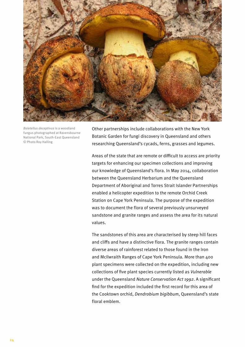
Boletellus deceptivus is a woodland fungus photographed at Ravensbourne National Park, South-East Queensland © Photo Roy Halling
24
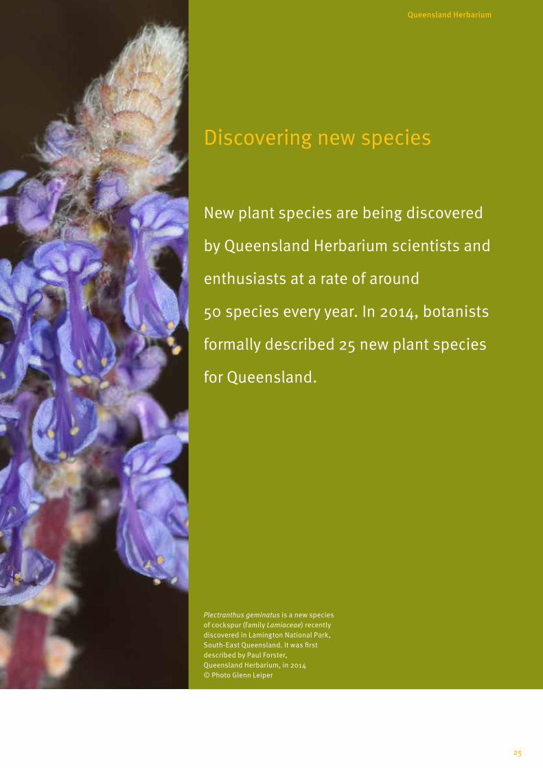
Discovering new species
New plant species are being discovered
by Queensland Herbarium scientists and
enthusiasts at a rate of around
50 species every year. In 2014, botanists
formally described 25 new plant species
for Queensland.
Plectranthus geminatus is a new species of cockspur (family Lamiaceae) recently discovered in Lamington National Park, South-East Queensland. It was first described by Paul Forster, Queensland Herbarium, in 2014 © Photo Glenn Leiper
25
Queensland Herbarium
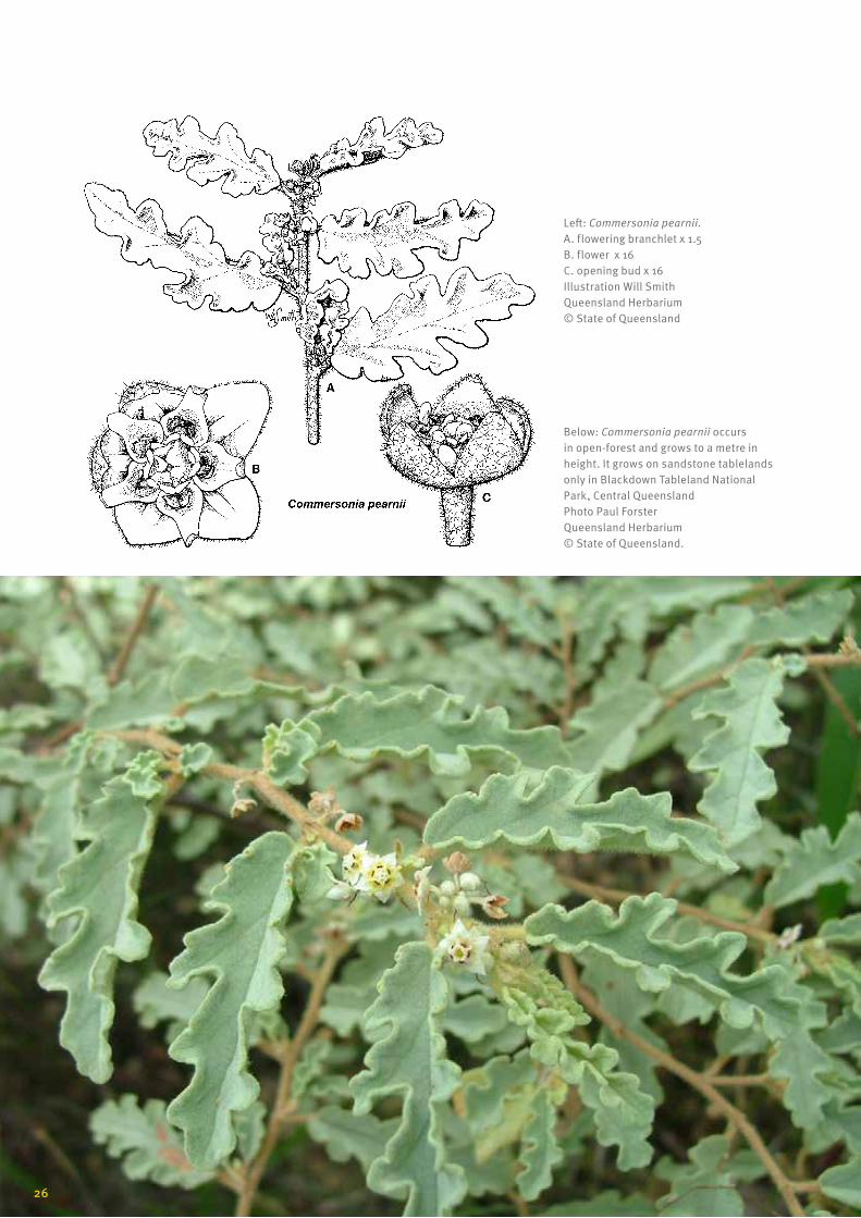
Left: Commersonia pearnii. A. flowering branchlet x 1.5 B. flower x 16 C. opening bud x 16 Illustration Will Smith Queensland Herbarium © State of Queensland
Below: Commersonia pearnii occurs in open-forest and grows to a metre in height. It grows on sandstone tablelands only in Blackdown Tableland National Park, Central Queensland Photo Paul Forster Queensland Herbarium © State of Queensland.
26
The Queensland flora is the most diverse in Australia, with more
than 14,000 native species already described, and many more yet
to discover. Thirty per cent of the state’s flowering plant species
are endemic, known to occur only in Queensland.
In 2014, botanists formally described 25 new plant species for
Queensland. These included wild tomatoes (Solanum), cockspurs
(Plectranthus) and native ebonies (Diospyros). Many of the
newly discovered species were published in the Queensland
Herbarium’s flagship journal Austrobaileya. Previous volumes of
the journal are available from JSTOR.
The New York Botanic Gardens has been a major collaborator, with
the Fraser Island (National Geographic) and Queensland Bolete
(National Science Foundation) surveys aimed at discovering the
wealth of macrofungi occurring in Queensland. This project has
generated global interest in our fungi flora and an estimated 100
new species will be described as a result.
Our partners
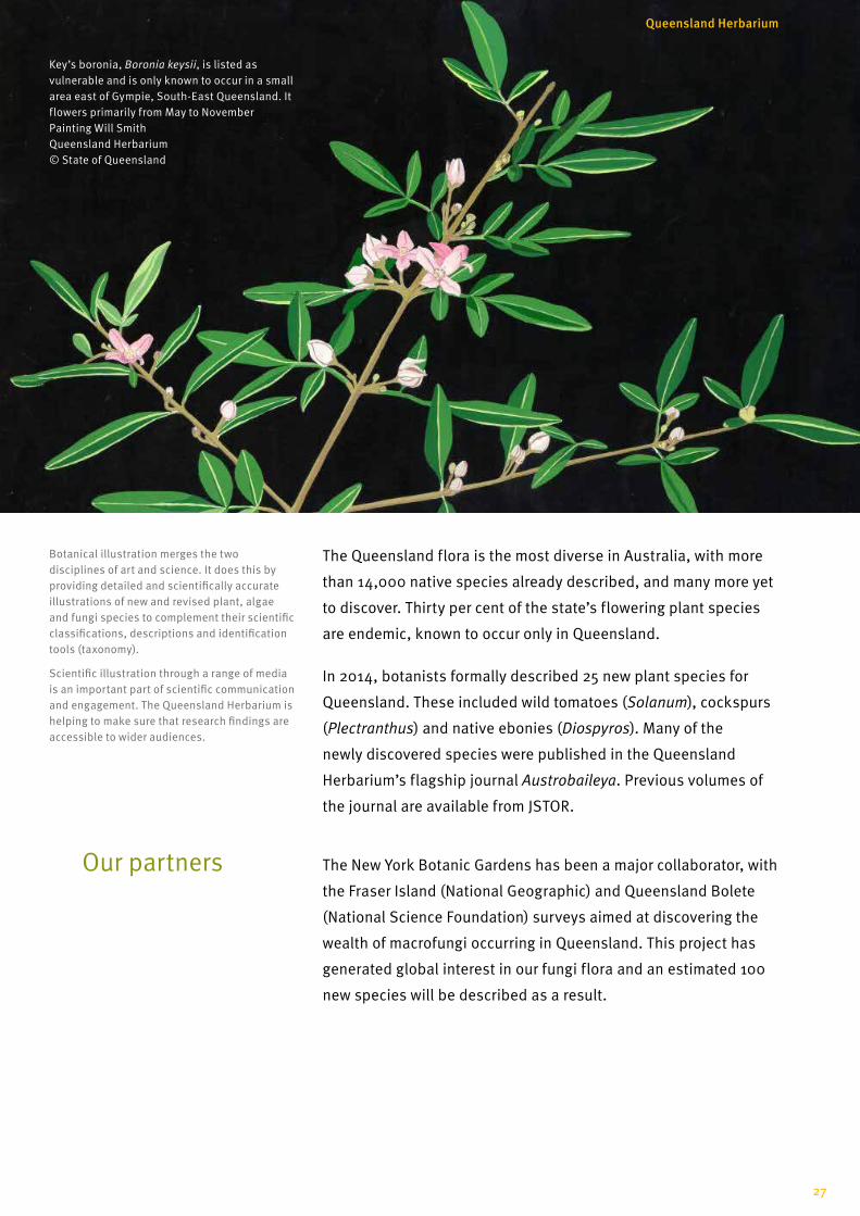
Botanical illustration merges the two disciplines of art and science. It does this by providing detailed and scientifically accurate illustrations of new and revised plant, algae and fungi species to complement their scientific classifications, descriptions and identification tools (taxonomy).
Scientific illustration through a range of media is an important part of scientific communication and engagement. The Queensland Herbarium is helping to make sure that research findings are accessible to wider audiences.
Key’s boronia, Boronia keysii, is listed as vulnerable and is only known to occur in a small area east of Gympie, South-East Queensland. It flowers primarily from May to November Painting Will Smith Queensland Herbarium © State of Queensland
27
Queensland Herbarium
Fungi are essential to life, occurring everywhere in large
numbers, but are still poorly understood. Recent research into
fungi has focused on their potential for bioremediation (use of
biological organisms to solve an environmental problem) and as
new sources of food, medicine and even fuel. Many ecosystem
functions are reliant upon fungi: they are essential for breaking
down organic materials, recycling nutrients and sequestering
carbon. The majority of plant species in Australia rely on
mycorrhizal associations (relationship with fungi) to survive in a
low nutrient environment, and some animals, such as bettongs,
utilise fungi for food.
Queensland’s macrofungi remain largely undiscovered with only
one tenth of estimated species documented. Discovery starts
with finding the fruiting bodies (e.g. mushrooms) and collecting
specimens, photographs and DNA samples, which are all linked
through the Herbarium’s specimen database HERBRECS.
Once the specimen is identified to genus and the DNA is
sequenced, new species of fungi and new records for the state are
then documented.
Fungi: the unexplored kingdom
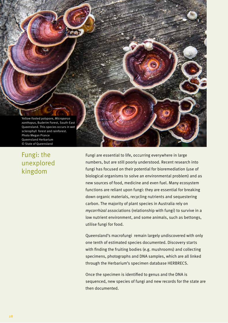
Yellow-footed polypore, Microporus xanthopus, Buderim Forest, South-East Queensland. This species occurs in wet sclerophyll forest and rainforest. Photo Megan Prance Queensland Herbarium © State of Queensland
28

Understanding ecological processes
The Queensland Herbarium is working
with state and local organisations
to monitor and protect our valuable
ecosystems.
Chookie’s waterhole, Doomadgee, Gulf Plains Bioregion, Gulf of Carpentaria, Queensland Photo Chris Appelman Queensland Herbarium © State of Queensland
29
Queensland Herbarium
Scientific research is conducted across the state by the Herbarium
to assess and monitor the condition and trend of ecosystems and
biodiversity, including listed threatened ecological communities.
In some cases this involves establishing permanent sites to
monitor and analyse long term change. Detailed vegetation
surveys, monitoring and assessment are undertaken by the
Herbarium on:
• national parks and state forests
• vegetation offsets
• mangroves of South-East Queensland
• groundwater dependent ecosystems including wetlands
(e.g. springs)
• grasslands
• grazing lands
• mining lands and tenements
• military reserves.
BioCondition (developed by the Queensland Herbarium) is a
vegetation condition assessment tool which measures how well
a terrestrial ecosystem is functioning for the maintenance of
biodiversity values at a local or property scale. BioCondition is
used by local governments, land managers, natural resource
management groups and the Department of Defence, and in the
state’s offset policy.
Critical to the use of this BioCondition tool is the use of
benchmarks. Benchmarks are specific to regional ecosystems
(the state’s mapped vegetation communities) and are the
most practical method of objectively comparing condition for
biodiversity within and between ecosystems.
Benchmarks are quantitative values for each attribute and are
based on data from mature and long undisturbed ‘reference’
sites, or from best-on-offer sites. Benchmarks act as a ‘yardstick’
against which users can compare an assessment site, and
describe features of the vegetation critical for wildlife.
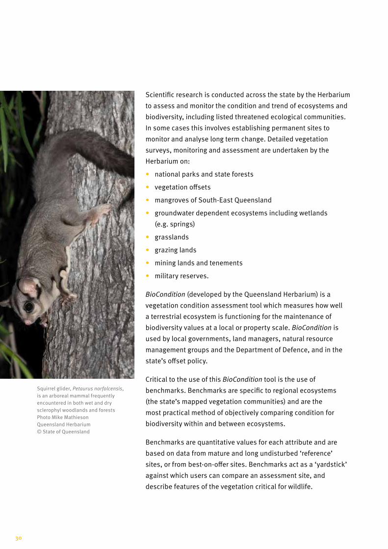
Squirrel glider, Petaurus norfolcensis, is an arboreal mammal frequently encountered in both wet and dry sclerophyl woodlands and forests Photo Mike Mathieson Queensland Herbarium © State of Queensland
30

In 2014, the Queensland Herbarium researched and published 93
Benchmarks for communities, largely in the Desert Uplands and
Northern Brigalow Belt bioregions. The Galilee basin ecosystem
benchmarking project was conducted as a joint initiative between
the Queensland Herbarium, the Department of Environment and
Heritage, and a collective of Galilee basin mining proponents
who required benchmarks for ecological equivalency offset work.
Projects such as this are critical in documenting our ecosystems
in their natural state and providing understanding of the diversity
and characteristics of the state’s vegetation. Conservation
objectives that aim to enhance vegetation in good condition are
vital to the preservation of our varied and unique wildlife.
This information is used by landholders, industry, natural
resource management groups, local authorities and state
government for planning and land management.
Research into a variety of vegetation communities is helping us
to understand ecological processes and the environmental roles
provided by vegetation and wildlife.
Monitoring changes in ecosystems associated with natural and
human induced changes, such as fire, clearing, development,
grazing, weed invasion, and changes to our climate helps us to
track changes in the condition of plant and animal communities.
For example, the Queensland Herbarium is monitoring mangroves
and related communities in Moreton Bay, documenting change in
mangrove extent over the last 50 years. This project will assess
the impacts of anthropogenic influence on the health of mangrove
and inter-tidal communities.
Regrowing native vegetation can play an important role in the
provision of habitat for biodiversity, salinity management and
carbon accumulation.
In 2014, the Department of Environment and Heritage Protection
released the Native Forest Regrowth Benefit Information System
which was developed by DSITI scientists including the Queensland
Herbarium. This system includes a mapping tool which provides
Mangrove site, Short Island Photo Megan Prace Queensland Herbarium © State of Queensland
31
Queensland Herbarium
site-specific advice for Queensland landholders about regrowth
management, carbon sequestration potential and biodiversity
co-benefits from forest regrowth. Six management guidelines
have been developed to assist land managers undertake carbon
abatement projects involving native forest regrowth.
The Queensland Herbarium works closely with other state
government agencies, industry, councils and community
organisations in modelling and monitoring the condition of
various plant and animal communities. For example the Herbarium
is working with the Department of Agriculture and Fisheries
monitoring mangroves and related communities in Moreton Bay,
as well as assessing the flora and fauna values of the offset areas
near Awoonga Dam, south west of Gladstone.
All recreational activities, including horse riding, can generate
impacts on national parks and must therefore be managed.
The impact of horse riders through protected areas in South-East
Queensland is being assessed by the Herbarium in conjunction
with Queensland National Parks, Sport and Racing, through
the South-East Queensland Horsetrail Monitoring Program that
includes more than 500 kilometres of trails within 29 reserves
between Gympie and the state’s southern border.
The Queensland Government has committed to a detailed
scientific monitoring program that will operate over a 20-year
period with regular points of review to monitor any potential
impacts that result from horse riding on these areas.
Mine rehabilitation aims to minimise and mitigate the
environmental effects of mining. CSIRO, Stanwell Corporation and
the Herbarium have been monitoring and modelling the vegetation
rehabilitation on the Meandu open-cut coal mine near Nanango.
This project has involved monitoring the re-establishment of
native vegetation across an area that has previously been mined
and re-vegetated.
Our partners
32
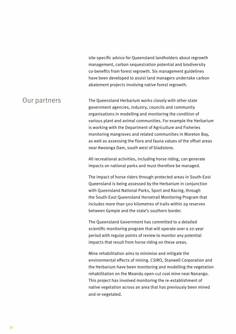
The Awoonga Dam is built across
the Boyne River south west of
Gladstone and in 2002 its wall
was raised flooding an extra 150
hectares of endangered regional
ecosystems. A revegetation
project was initiated on the land
adjacent to the dam, managed by
the Gladstone Area Water Board.
The project involved
revegetation at two sites
(Netherleigh and Futter Creek)
an area of 300 hectares. This
work, conducted between 2002
and 2004 involved planting a
mix of local provenance trees in
areas that had been extensively
cleared; and protecting and
enhancing natural regeneration
in areas where some mature
trees remained.
After 10 years, 70 and 66 per
cent of the total vertebrate
species found in remnant
vegetation had been recorded
in plantings and in natural
regeneration respectively.
The Queensland Herbarium
is now in a position to assess
which actual revegetated areas
have, and have not, reached
remnant status.
Is it possible to restore an endangered ecosystem?
Awoonga Dam revegetation 2004–11. Before regeneration (above) and after (below) Photo Scott Swift, Department of Agriculture and Fisheries © State of Queensland
33
Queensland Herbarium
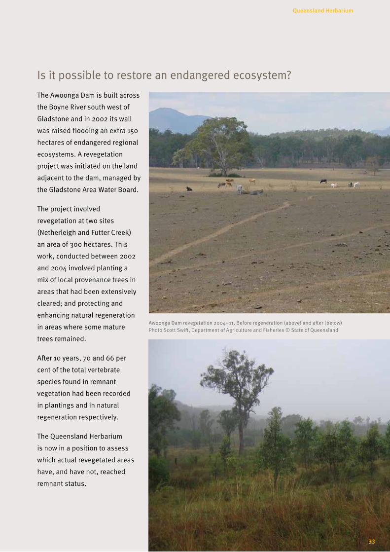
Surveying and mapping our ecosystems
Approximately 95 per cent of our
state (164 million hectares) has been
mapped for regional ecosystems by the
Queensland Herbarium.
This is a manipulated satellite image of the Diamantina River flowing through a lateritic landscape. These landscapes are characterised by red residual soil formed by the leaching of silica and by the enrichment with aluminium and iron oxides, similar to those found in the North West Highlands bioregion Image Dan Kelman Queensland Herbarium © State of Queensland
34
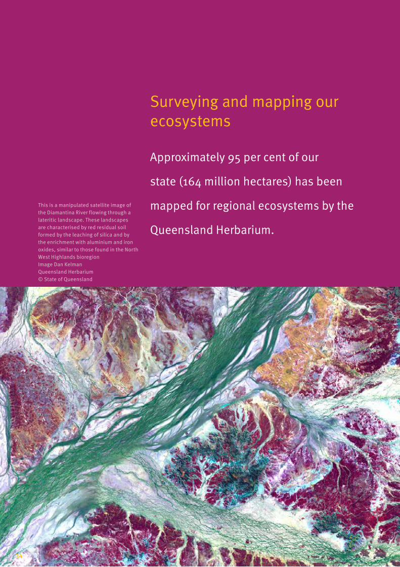
Bioregions of Queensland
Queensland has 13 bioregions supporting over 1300 different ecosystems.
35
Queensland Herbarium
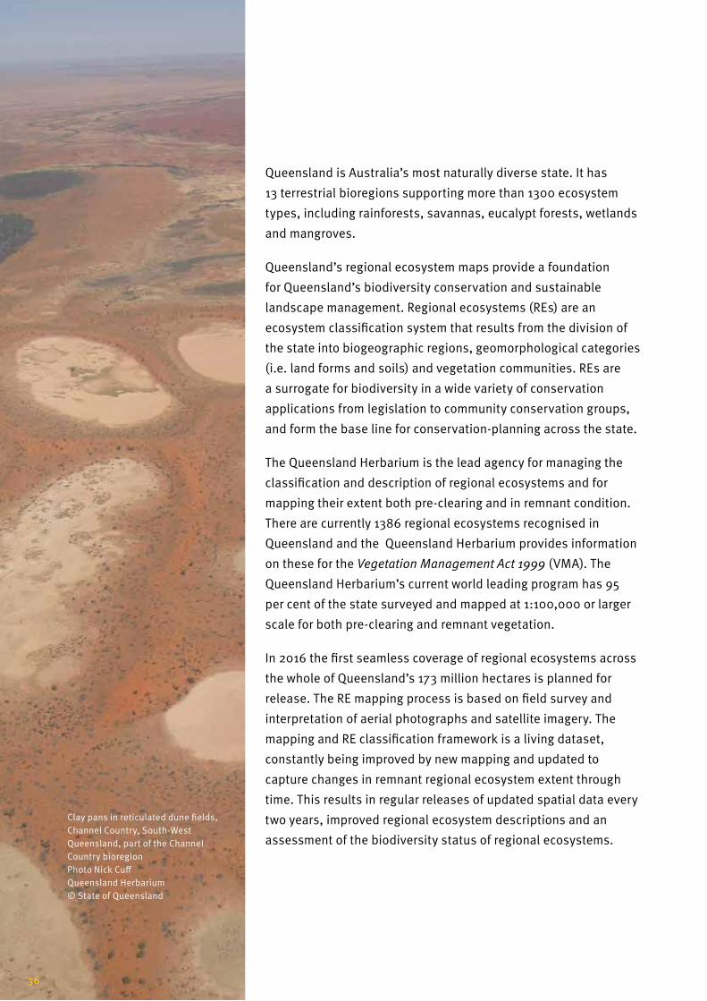
Queensland is Australia’s most naturally diverse state. It has
13 terrestrial bioregions supporting more than 1300 ecosystem
types, including rainforests, savannas, eucalypt forests, wetlands
and mangroves.
Queensland’s regional ecosystem maps provide a foundation
for Queensland’s biodiversity conservation and sustainable
landscape management. Regional ecosystems (REs) are an
ecosystem classification system that results from the division of
the state into biogeographic regions, geomorphological categories
(i.e. land forms and soils) and vegetation communities. REs are
a surrogate for biodiversity in a wide variety of conservation
applications from legislation to community conservation groups,
and form the base line for conservation-planning across the state.
The Queensland Herbarium is the lead agency for managing the
classification and description of regional ecosystems and for
mapping their extent both pre-clearing and in remnant condition.
There are currently 1386 regional ecosystems recognised in
Queensland and the Queensland Herbarium provides information
on these for the Vegetation Management Act 1999 (VMA). The
Queensland Herbarium’s current world leading program has 95
per cent of the state surveyed and mapped at 1:100,000 or larger
scale for both pre-clearing and remnant vegetation.
In 2016 the first seamless coverage of regional ecosystems across
the whole of Queensland’s 173 million hectares is planned for
release. The RE mapping process is based on field survey and
interpretation of aerial photographs and satellite imagery. The
mapping and RE classification framework is a living dataset,
constantly being improved by new mapping and updated to
capture changes in remnant regional ecosystem extent through
time. This results in regular releases of updated spatial data every
two years, improved regional ecosystem descriptions and an
assessment of the biodiversity status of regional ecosystems.
Clay pans in reticulated dune fields, Channel Country, South-West Queensland, part of the Channel Country bioregion Photo Nick Cuff Queensland Herbarium © State of Queensland
36
Vegetation communities are amalgamated into broad vegetation
groups (BVGs). Released in 2014, Vegetation of Queensland
provides the first comprehensive overview of the vegetation in the
state classified into 98 broad vegetation groups.
Maps of these broad vegetation groups (pre-clearing and
remnant) down to the property scale are available online from the
Biota Globe (Queensland Globe).
The Queensland Herbarium is also working with the
Commonwealth under their Bioregional Assessment (BA)
Programme to identify ground water dependent ecosystems
(GDEs). The BA programme is assessing water-related impacts of
coal seam gas and coal mining in key regions.
Queensland’s ecosystems are the subject of ecological research,
condition assessment and monitoring. To undertake this work
the Queensland Herbarium has surveyed, mapped and classified
1,386 unique regional ecosystems across the state.
The Herbarium’s ecosystem survey and mapping team relies on
partnerships and collaboration to produce high-quality mapping
and technical products in order to achieve beneficial outcomes for
Queensland’s regional ecosystems.
Core projects, including mapping regional ecosystems, wetlands
and groundwater dependent ecosystems, are integral in
supporting development and implementation of the state’s
environmental plans and regulations. This work involves close
partnerships with other teams across the Queensland Department
of Science, Information Technology and Innovation, especially the
Queensland Remote Sensing Centre, and other state government
agencies including the Department of Environment and Heritage
Protection and the Department of Natural Resources and Mines.
Our partners
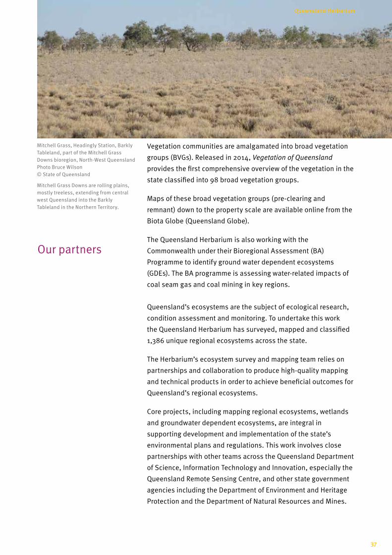
Mitchell Grass, Headingly Station, Barkly Tableland, part of the Mitchell Grass Downs bioregion, North-West Queensland Photo Bruce Wilson © State of Queensland
Mitchell Grass Downs are rolling plains, mostly treeless, extending from central west Queensland into the Barkly Tableland in the Northern Territory.
37
Queensland Herbarium
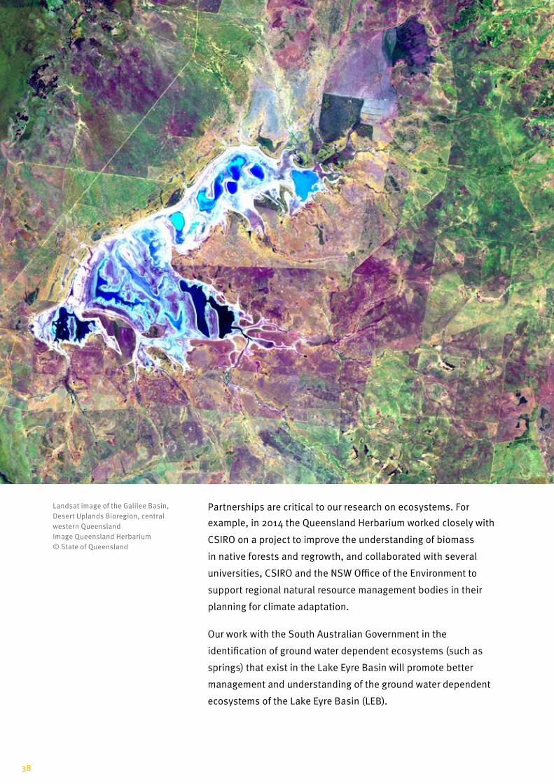
Partnerships are critical to our research on ecosystems. For
example, in 2014 the Queensland Herbarium worked closely with
CSIRO on a project to improve the understanding of biomass
in native forests and regrowth, and collaborated with several
universities, CSIRO and the NSW Office of the Environment to
support regional natural resource management bodies in their
planning for climate adaptation.
Our work with the South Australian Government in the
identification of ground water dependent ecosystems (such as
springs) that exist in the Lake Eyre Basin will promote better
management and understanding of the ground water dependent
ecosystems of the Lake Eyre Basin (LEB).
Landsat image of the Galilee Basin, Desert Uplands Bioregion, central western Queensland Image Queensland Herbarium © State of Queensland
38

The Lake Eyre Basin Springs Assessment Project (LEBSA)
is funded under the Australian Government’s Bioregional
Assessment Programme to support the analysis of the impacts
of coal seam gas and large coal mining development on water
resources, such as ecosystems dependent on ground water (i.e.
ground water dependent ecosystems or GDEs).
LEBSA is being undertaken by the Queensland and South
Australian Governments and involves the mapping of GDEs for
the Lake Eyre Basin. For Queensland this includes springs of the
Galilee and Cooper Basins.
GDEs are natural ecosystems that require access to groundwater.
‘Spring wetlands’ are unique groundwater dependent ecosystems
where the groundwater comes to the land surface.
Springs wetlands are extremely rare and have significant
environmental, economic and social values. Many springs have
become extinct, or at least dormant, over the past 100 years and
are under threat of degradation.
Lake Eyre Basin Springs Assessment Project
Elizabeth Springs (Galilee Basin) like all Great Artesian Basin springs, are threatened by water extraction and feral animals. Elizabeth Springs is in the heart of the Desert Uplands bioregion Photo © Adam Kereszy
39
Queensland Herbarium

In the Queensland portion of the Great Artesian Basin the number
of active artesian springs has declined by almost 40 percent
since 1900. Springs and their source of water are valued by both
agriculturalists and ecologists. Many aquatic invertebrates
(e.g. snails), fish, and rare plants are restricted to springs and
often have very localised distributions.
Both the Queensland and South Australian Governments will
produce a range of technical products that will feed into the LEB
Bioregional Assessment, including:
• aligned springs database
• spatial products showing the location of groundwater
dependent ecosystems
• models that depict their hydrogeological and ecological
interactions.
The LEB is an area targeted under the Federal Government’s
Bioregional Assessment Programme because it is underlain by
significant coal basins in Queensland (Galilee, Cooper), and South
Australia (Pedirka and Arckaringa).
Many aquatic invertebrates (e.g. snails), fish, and rare plants are restricted to springs and often many have very localised distributions. The Red-finned Blue Eye is Australia's smallest freshwater fish, reaching a length of 30 mm and is restricted to the Edgbaston springs in the Barcaldine supergroup, Lake Eyre Basin. The Red-finned Blue is listed as endangered under both Australian and Queensland environmental legislation Photo © Adam Kerezsy
40
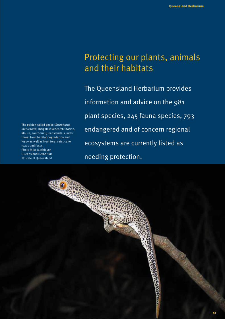
Protecting our plants, animals and their habitats
The Queensland Herbarium provides
information and advice on the 981
plant species, 245 fauna species, 793
endangered and of concern regional
ecosystems are currently listed as
needing protection.
The golden-tailed gecko (Strophurus taenicauda) (Brigalow Research Station, Moura, southern Queensland) is under threat from habitat degradation and loss—as well as from feral cats, cane toads and foxes. Photo Mike Mathieson Queensland Herbarium © State of Queensland
41
Queensland Herbarium

Herbarium scientists are actively researching and monitoring
Queensland’s most threatened species and ecosystems. This
includes investigating threats and the means for ameliorating
impacts to our flora, fauna and vegetation from grazing, fire, weed
invasion, climate, management practices and development.
The Queensland Herbarium provides information and advice on
protection and management of the state’s flora and fauna species,
including 981 plant species and 245 animals listed as endangered,
vulnerable, near threatened or extinct under the Queensland
Nature Conservation Act 1992.
Assessments and compilation of inventory data by the Herbarium
on flora and fauna underpin key legislation (Nature Conservation
Act 1992 (Qld)) and the Environment Protection and Biodiversity
Conservation Act 1999 (Cwlth) (the EBPC Act) aimed at the
protection of our natural assets.
Much of Queensland’s environmental legislation relies on risk-
based assessment, where it is assumed that the distribution
of fauna and flora species in Queensland is well known. Recent
analysis and mapping of fauna surveys across Queensland shows
that further research is needed via systematic vertebrate fauna
surveys in particular for the Mitchell Grass Downs, Gulf Plains and
Channel Country.
To inform biodiversity decision-making it is important that
adequate data across Queensland’s bioregions are available. To
do this zoologists at the Queensland Herbarium have developed
a ‘where to’ and a ‘how to’ of fauna surveying to improve our
knowledge of the distribution of fauna in Queensland.
The Herbarium’s Vertebrate Survey Effort Across Queensland
Report and the Terrestrial Vertebrate Fauna Survey Guidelines
help fill the gaps in our knowledge of the distribution of fauna in
Queensland. These documents are useful for zoologists, natural
resource management groups and consultants who undertake
fauna surveys.
Green tree snake or common tree snake, Dendrelaphis punctulatus, sunbaking metres from tourists at Lake Eacham (Crater Lakes National Park) Photo Dan Ferguson Queensland Herbarium © State of Queensland
42
Knowledge of the distribution, population size, ecology and
habitat needs of plant and animal species and their ecosystems
is essential to enable effective conservation assessment and
management.
Queensland Herbarium botanists and zoologists actively research
and monitor the populations of some of Queensland’s most
threatened species. Accurate assessments of conservation
status of species ensures our vulnerable flora and fauna are
appropriately listed for protection through state environmental
regulation.
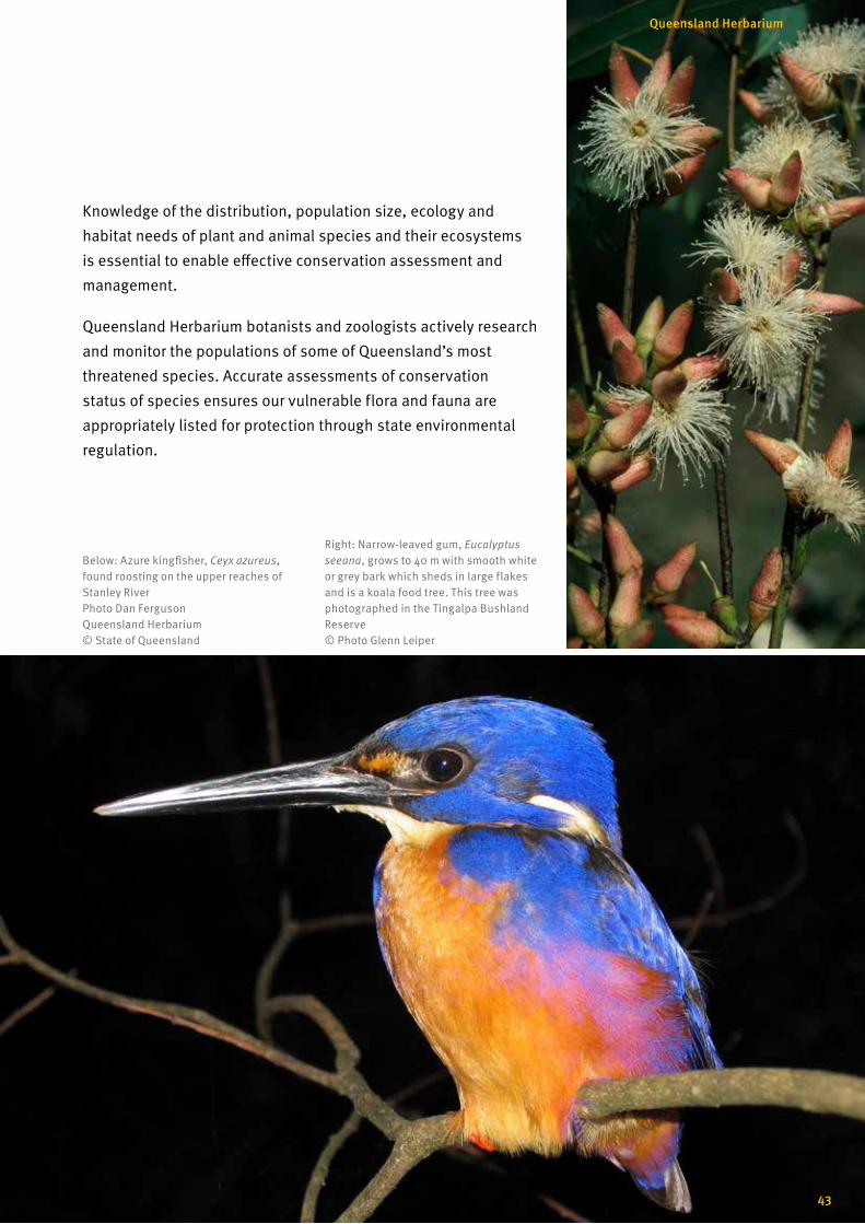
Below: Azure kingfisher, Ceyx azureus, found roosting on the upper reaches of Stanley River Photo Dan Ferguson Queensland Herbarium © State of Queensland
Right: Narrow-leaved gum, Eucalyptus seeana, grows to 40 m with smooth white or grey bark which sheds in large flakes and is a koala food tree. This tree was photographed in the Tingalpa Bushland Reserve © Photo Glenn Leiper
43
Queensland Herbarium
The Queensland Herbarium works in collaborative partnerships
aimed at the conservation of the state’s biodiversity in particular
researching the natural and human induced impacts that can
threaten plant and animal populations and their habitats.
For example the Herbarium in conjunction with CSIRO are
researching the impacts of fire on biodiversity in fragmented
poplar box woodlands of Queensland’s brigalow bioregion, and
contributing to a national trial on the surveillance of rangeland
biodiversity.
The Australian rangelands contain vast tracts of relatively
unmodified ecosystems, a wide diversity of native species and
are home to a large number of rare and endangered species.
Knowledge of these ecosystems and species is limited and the
ability to report change in biodiversity is restricted by patchy and
inadequate data. Interpretation of change is also complicated by
extreme climatic variation.
The primary objective of a national rangeland biodiversity
monitoring program is to track changes in biodiversity of the
rangelands at the national scale with the ultimate goal of
protecting and managing rangeland biodiversity.
Detailed monitoring on species that are threatened or declining
helps contribute to the development of better solutions for
restoration and recovery. The Queensland Herbarium collaborates
on a number of projects that are helping to increase this
understanding.
The Herbarium together with Department of Environment and
Heritage Protection and Queensland Museum are modelling the
potential habitat of 143 threatened and priority flora; and 221
threatened and priority fauna. This research tracks the condition
and distribution of key plant and animal communities, and
informs planning and management strategies.
Together with the three tiers of government, industry, universities
and non-government organisations the Queensland Herbarium
is delivering projects that contribute to the knowledge and
management of plants, animals and their habitats.
Our partners
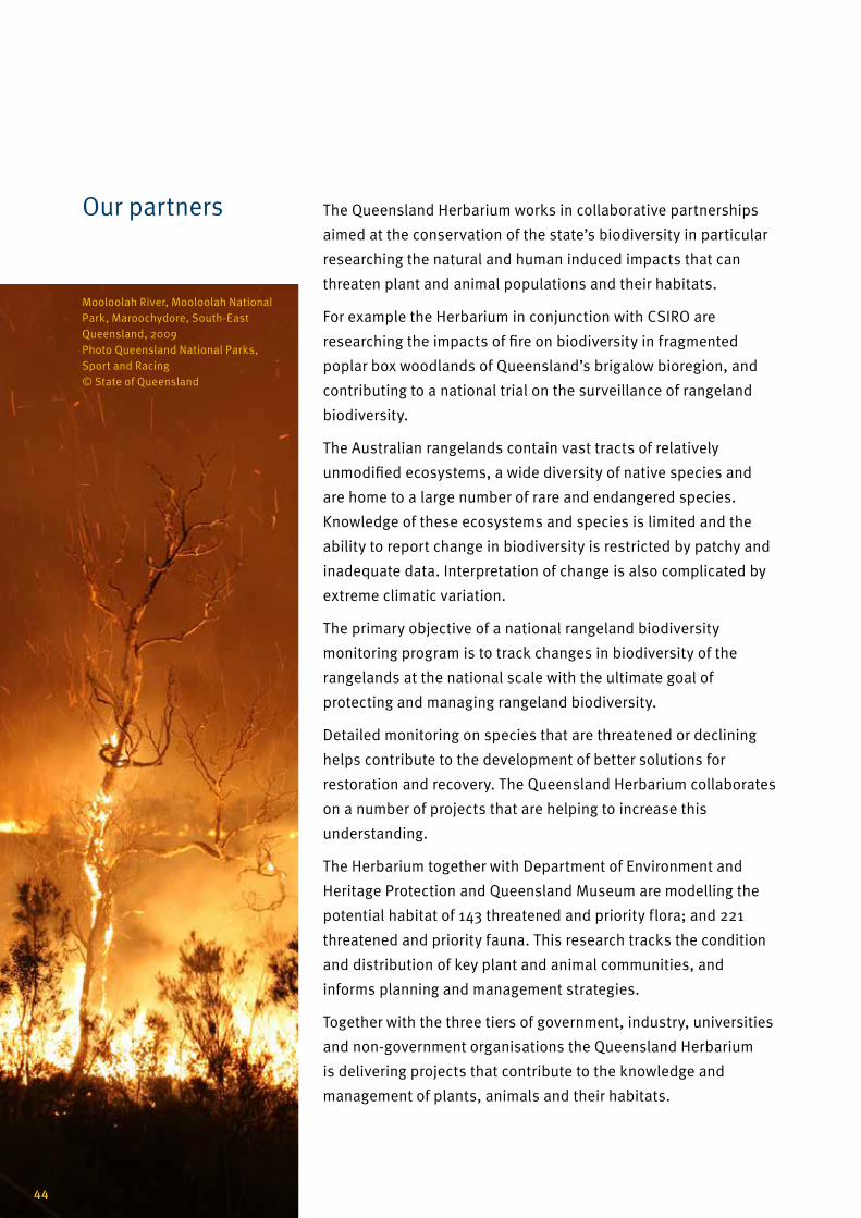
Mooloolah River, Mooloolah National Park, Maroochydore, South-East Queensland, 2009 Photo Queensland National Parks, Sport and Racing © State of Queensland
44
Profile of a threatened species
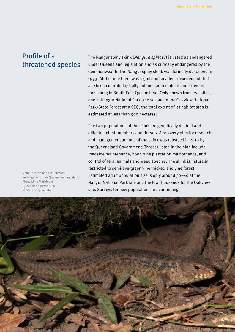
The Nangur spiny skink (Nangura spinosa) is listed as endangered
under Queensland legislation and as critically endangered by the
Commonwealth. The Nangur spiny skink was formally described in
1993. At the time there was significant academic excitement that
a skink so morphologically unique had remained undiscovered
for so long in South East Queensland. Only known from two sites,
one in Nangur National Park, the second in the Oakview National
Park/State Forest area SEQ, the total extent of its habitat area is
estimated at less than 900 hectares.
The two populations of the skink are genetically distinct and
differ in extent, numbers and threats. A recovery plan for research
and management actions of the skink was released in 2010 by
the Queensland Government. Threats listed in the plan include
roadside maintenance, hoop pine plantation maintenance, and
control of feral animals and weed species. The skink is naturally
restricted to semi-evergreen vine thicket, and vine forest.
Estimated adult population size is only around 30–40 at the
Nangur National Park site and the low thousands for the Oakview
site. Surveys for new populations are continuing.
Nangur spiny skink is listed as endangered under Queensland legislation Photo Mike Mathieson Queensland Herbarium © State of Queensland
45
Queensland Herbarium
Publications 2013 and 2014
46
Albrecht, D.E. and Bean, A.R. ( 2014). A new herbaceous species of Pluchea (Asteraceae: Plucheinae) from central Australia. Muelleria 32: 3–7.
Barrett, R.A. Bayly, M.J., Duretto, M.F., Forster, P.I., Ladiges, P.Y. and Cantrill, D.J. (2014). A chloroplast phylogeny of Zieria (Rutaceae) in Australia and New Caledonia shows widespread incongruence with species-level taxonomy. Australian Systematic Botany 27(6): 427–449.
Bayly, M.J., Holmes, G.D., Forster, P.I., Cantrill, D.J. and Ladiges, P.Y. (2013). Major Clades of Australasian Rutoideae (Rutaceae) based on rbcL and atpB Sequences. PLoS ONE 8(8): e72493. doi:10.1371/journal.pone.0072493.
Bean, A.R. (2013). Emmenosperma pancherianum Baill. (Rhamnceae) newly recorded for Australia. Austrobaileya 9(1): 150–152.
Bean, A.R. (2013). Reinstatement and revision of Sphaeromorphaea DC. and Ethuliopsis F. Muell. (Asteraceae: Plucheinae). Austrobaileya 9(1): 30–59.
Bean, A.R. (2013). Two new subspecies of Eucalyptus tereticornis Sm. (Myrtaceae). Austrobaileya 9(1): 107–113.
Bean, A.R. (2014). Biographical notes on C.F. Plant (1843–1932). Australasian Systematic Botany Society Newsletter 160: 12–13.
Bean, A.R. ( 2013). Three new species of Pluchea Cass. (Asteraceae: Inuleae-Plucheinae) from northern Australia. Austrobaileya 9(1): 66–74.
Bean, A.R. (2014). Pluchea tenuis A.R. Bean (Asteraceae: Plucheinae), a new species from Cape York Peninsula, Queensland. Austrobaileya 9(2): 311–313.
Bean, A.R. (2014). Ptilotus senarius A.R. Bean (Amaranthaceae),a new species from northern Queensland. Austrobaileya 9(2): 203–206.
Botkin, D.B., Ngugi, M.R. and Doley, D. (2014). Estimates and forecasts of forest biomass and carbon sequestration in North America and Australia: a forty-five year quest. Drewno 57(192): 7–28.
Butler, D.W., Fensham, R.J., Murphy, B.P., Haberle, S.G., Bury, S.J. and Bowman, D.M.J.S. (2014). Aborigine-managed forest, savanna and grassland: biome switching in montane eastern Australia. Journal of Biogeography 41: 1492-1505.
Butler, D.W., Halford, J. and Evans, M. (2014). Carbon farming and natural resource management in eastern Australia. Queensland Department of Science, Information Technology, Innovation and the Arts, Brisbane.
Butler M.S., Towerzey, L., Pham, N.B., Hyde, E., Wadi, S.K., Guymer, G.P. and Quinn, R.J. (2014). Cardenolide Glycosides from Elaeodendron australe var. integrifolium. Phytochemistry 98: 160–163.
Butler, S., McAlpine, C., Fensham, R.J. and House, A. (2013). Climate and exotic pasture area in landscape determines invasion of forest fragments by two invasive grasses. Journal of Applied Ecology 51: 114–123.
Cowie, I.D. and Guymer, G.P. (2014). A new, rare species of Brachychiton from Fish River Station, Northern Territory. Australian Systematic Botany 27(6): 462–468.
Darragh, T. and Fensham, R. (2013) The Leichhardt diaries. Early travels in Australia during 1842–184. Memoirs of the Queensland Museum 7: i-x 1–540.1–540.
Eyre, T.J., Ferguson, D.J., Hourigan, C.L., Smith, G.C., Mathieson, M.T., Kelly, A.L., Venz, M.F., Hogan, L.D. and Rowland, J. (2014). Terrestrial Vertebrate Fauna Survey Assessment Guidelines for Queensland Version 2.0, Department of Science, Information Technology, Innovation and the Arts.
Fairfax, R.J., Dowling, R.M. and Neldner, V.J. (2014). The use of infrared sensors and digital cameras for documenting visitor use patterns: a case study from D'Aguilar National Park, south-east Queensland, Australia. Current Issues in Tourism 17(1): 72–83.
Fensham, R.J. (2013). For the sake of science: Ludwig Leichhardt as botanist and ecologist. Memoirs of the Queensland Museum 7: 599–620.
Fensham, R.J. and Price, G. (2013). Ludwig Leichhardt and the significance of the extinct Australian megafauna. Memoirs of the Queensland Museum 7: 621–632.
Fensham, R.J., Silcock, J.L. and Firn, J. (2014). Managed livestock grazing is compatible with the maintenance of plant diversity in semidesert grasslands. Ecological Applications 24: 503–517.
Fernando, D.R., Marshall, A.T., Forster, P.I., Hoebee, S.E. and Siegele, R. (2013). Multiple metal accumulation within a manganese-specific genus. American Journal of Botany 100(4): 690–700.
Forster, P.I. (2013). Reinstatement of Rapanea leucobrachya P. Royen (Myrsinaceae) from New Guinea, with a new combination as Myrsine leucobrachya (P. Royen) P.I. Forst. Austrobaileya 9(1): 148–149.
Forster, P.I. (2013). Reinstatement and intraspecific taxa for Bosistoa pentacocca (F. Muell.) Baill. (Rutaceae) with a new combination B. pentacocca subsp. connaricarpa (Domin). Austrobaileya 9(1): 60–65.
Forster, P.I. (2014). Diversity on a tropical sky island: two new species of Plectranthus L.Hérit. (Lamiaceae) from the Hann Tableland, north-east Queensland. Austrobaileya 9(2): 207–215.
Forster, P.I. (2014). Plectranthus acariformis P.I. Forst. and P. geminatus P.I.Forst. (Lamiaceae): new species from south-east Queensland. Austrobaileya 9(2): 279–291.
Forster, P.I. and Dowe, J.L. (2014). Lectotypification of F.M. Bailey names in Conyza (Asteraceae), Diplanthera (Bignoniaceae), Pygeum (Rosaceae), Rhaphidophora (Araceae) and Tetracera (Dilleniaceae) based on E. Cowley collections. Austrobaileya 9(2): 316–318.
Guymer, G.P. (2013). Celtis strychnoides Planch., an earlier name for Celtis australiensis Sattarian (Ulmaceae). Austrobaileya 9(1): 146–147.

47
Queensland Herbarium
Gleason, S.M., Butler, D.W. and Waryszak, P. (2013). Shifts in leaf and stem hydraulic traits across aridity gradients in eastern Australia. International Journal of Plant Sciences. 174, 1292-1301.
Halford, D.A. and Harris, W.K. (2013). Euphorbia operta Halford and W.K. Harris (Euphorbiaceae), a new name for Euphorbia occulta Halford and W.K. Harris, nom. illeg. and lectotypification of the name Euphorbia australis var. subtomentosa (Domin) D.A. Halford and W.K. Harris. Austrobaileya 9(1): 153–154.
Halford, J.J. and Fensham, R.J. ( 2014). Vegetation and environmental relations of ephemeral subtropical wetlands in central Queensland, Australia. Australian Journal of Botany 62: 499–510.
Halling, R.E., Desjardin, D.E., Fechner, N., Arora, D., Soytong, K. and Dentinger, B.T.M. (2014). New Porcini (Boletus sect. Boletus) from Australia and Thailand. Mycologia 106(4): 830–834.
Holland, A.E. (2013). Cullen spicigerum (Domin) A.E. Holland (Fabaceae), a new combination and reinstatement of a north Queensland species. Austrobaileya 9(1): 140–145.
Holland, A.E. (2014). How will the changing uses of herbarium collections affect their future? Australasian Systematic Botany Society Newsletter 160: 5–8.
Holland, A.E. (2014). Aeschynomene micrantha (Poir.) DC. is a synonym of A. brevifolia L.f. ex Poir. Austrobaileya 9(2): 319–320.
Ingham, J.A., Forster, P.I., Crisp, M.D. and Cook, L.G. (2013). Ancient relicts or recent dispersal: How long have cycads been around central Australia? Diversity and Distributions 19(3): 307–316.
Jessup, L.W. (2014). A taxonomic revision of Diospyros L. (Ebenaceae) in Australia. Austrobaileya 9(2): 155–197.
Johnson, R.W. (2014). Six new species of Bonamia Thouars. from northern Australia. Austrobaileya 9(2): 292–310.
Kerezsy, A. and Fensham, R. (2013). Conservation of the endangered red-finned blue-eye, Scaturiginichthys vermeilipinnis, and control of alien eastern gambusia, Gambusia holbrooki, in a spring wetland complex. Marine and Freshwater Research 64: 851–863.
Kitching, R.L., Ashton, L.A., Burwell, C.J., Boulter, S.L., Greenslade, P., Laidlaw, M.J., Lambkin, C.L., Maunsell, S.C., Nakamura, A. and Ødegaard, F. (2013). Sensitivity and threat in high-elevation rainforests: outcomes and consequences of the IBISCA-Queensland project. Treetops at Risk: Challenges of global canopy ecology and conservation (Eds M. Lowman, S. Devy and T. Ganesh), Springer, New York, Chapter 13, pp.131–139.
Lehmann, C.E.R., Anderson, M.J., Sankaran, M., Higgins, S.J., Archibald, S., Hoffmann, W.A., Hanan, N.P., Williams, R.J., Fensham, R.J., Felfili, J., Hutley, L.B., Ratnam, J., San Jose, J., Montes, R., Franklin, D., Russell-Smith J., Ryan, C.M., Durigan, G., Hiernaux, P., Haidar, R., Bowman, D.M.J.S. and Bond, W.J. (2014). Savanna vegetation-fire-climate relationships differ among continents. Science 343: 548–552.
Lewis, T., Swift, S., Smith, G.C. and Hogan, L. (2013). Restoration of a forest red gum (Eucalyptus tereticornis) ecosystem following the raising of Awoonga Dam. Report 21: Biocondition and biodiversity surveys. Report for the Gladstone Water Board.
Lucas R.M., Clewley,D., Accad, A., Butler, D., Armston, J., Bowen, M., Bunting, P., Carreiras, J., Dwyer, J., Eyre, T., Kelly, A., McAlpine, C., Pollock, S. and Seabrook, L. (2014). Mapping forest growth and degradation stage in the Brigalow Belt Bioregion of Australia through integration of ALOS PALSAR and Landsat-derived foliage projective cover data. Remote Sensing of Environment 155: 42–57.
MacNally R., Kutt, A.S., Eyre, T.J., Perry, J.J., Vanderduys, E.P., Mathieson, M., Ferguson, D.J. and Thomson, J.R. (2014). The hegemony of the ‘despots’: the control of avifaunas over vast continental areas. Diversity and Distributions 20(9): 1071–1083.
Macdonald, S.L., Borsboom, A.C., Best, R. and Hoskin, C.J. (2013). Significant range extensions for Delma labialis and a review of its biology. Australian Zoologist 36(4): 470–477.
Mathieson, M.T. (2013). Pterostylis caligna M.T. Mathieson (Orchidaceae), a new species from northern Queensland. Austrobaileya 9(1): 102–106.
Murphy, B.P., Bradstock, R.A., Boer, M.M., Carter, J., Cary, G.J., Cochrane, M.A., Fensham, R.J., Russell-Smith, J., Williamson, G.J. and Bowman, D.M.J.S. (2013). Fire regimes of Australia: a pyrogeographic model system. Journal of Biogeography 40: 1048–1058.
Neldner, V.J. (2014). The contribution of vegetation survey and mapping to Herbarium collections and botanical knowledge: a case study from Queensland. Cunninghamia 14: 77–87.
Neldner V.J. and Ngugi, M.R. (2014). Application of the BioCondition assessment framework to mine vegetation rehabilitation. Ecological Management and Restoration 15(2): 158–161.
Neldner, V.J. (2014). More than vegetation maps: the contribution of vegetation survey and mapping to Herbarium collections and botanical knowledge in Queensland. In: Mucina, L., Price, J.N. and Kalwij, J.M. (eds), Biodiversity and vegetation: patterns, processes, conservation p.250. Kwongan Foundation, Perth.
Neldner, V.J. and Ngugi, M.R. (2014). Assessing vegetation rehabilitation using the BioCondition framework: lessons from an open-cut coal mine and a coral atoll recovering after guano mining. In: L. Mucina, J.N. Price, J.M. Kalwij (eds), Biodiversity and vegetation: patterns, processes, conservation p.161. Kwongan Foundation, Perth.
48
Neldner, V.J., Niehus R.E., Wilson, B.A., McDonald, W.J.F. and Ford, A.J. (2014). The Vegetation of Queensland. Descriptions of Broad Vegetation Groups. Version 1.1. Queensland Herbarium, Queensland Department of Science, Information, Technology, Innovation and the Arts.
Ngugi, M., Doley, D., Botkin, D.B., Cant, M., Neldner, V.J. and Kelley, J. (2014). Long-term estimates of live above-ground tree carbon stocks and net change in managed uneven-aged mixed species forests of sub-tropical Queensland, Australia. Australian Forestry 74(3–4): 189–202.
Ngugi, M.R., Neldner, V.J., Dowling, R. (2014). Non-native plant species richness adjacent to a horse trail network in seven National Parks in southeast Queensland, Australia. Australasian Journal of Environmental Management 21(4): 413–428.
Ohlsen, D.J. and Field, A.R. (2013). A new fern species for Queensland: Diplazium squamuligerum (Rosenst.) Parris (Woodsiaceae). Austrobaileya 9(1): 114–125.
Pedley, L. (2014). New combinations for Senegalia Raf. and Vachellia Wight & Arn. species (Mimosaceae) that occur in Australia. Austrobaileya 9(2): 314–315.
Pedley, L. (2014). Systematics of Tephrosia Pers. (Fabaceae: Millettiae) in Queensland: 1. A summary of the classification of the genus, with the recognition of two new species allied to T. varians (F.M. Bailey) C.T. White. Austrobaileya 9(2): 229–243.
Pegg, G.S., Giblin, F.R., McTaggart, A.R. Guymer, G.P. Taylor, H., Ireland, K.B., Shivas, R.G. and Perry, S. (2014). Puccinia psidii in Queensland, Australia: Disease symptoms, distribution and impact. Plant Pathology 63(5): 1005–1021.
Powell, O., Fensham, R.J. and Memmott, P. (2013). Indigenous use of spinifex resin for hafting in north-eastern Australia. Economic Botany 67: 210–224.
Richter, C., Kusy, B., Neldner, J., Ngugi, M. and Moore, D. (2014). ACARP Project C21042, Final Microclimate Re-vegetation Monitoring. CSIRO Digital Productivity and Services Flagship.
Rowland, J., Nottidge, B., Ferguson, D. and Mathieson, M. (2012 edition, published 2014). Predation by an eastern brown snake Ancanthophis antarcticus (Serpentes: Elapidae). Herpetofauna 42: 28–37.
Silcock, J.L., Piddocke, T.P., and Fensham, R.J. ( 2013). Illuminating the dawn of pastoralism: evaluating the record of European explorers to inform landscape change. Biological Conservation 159: 321–331.
Silcock, J.L. and Fensham, R.J. ( 2014). Specialized and stranded: habitat and biogeographical history determine the rarity of plant species in a semi-arid mountain range. Journal of Biogeography 41: 2332–2343.
Simon, B. (2013). In search of grass types in USA and European herbaria. Australasian Systematic Botany Society Newsletter 157: 45–53.
Smith, G.C. (2013). Vertebrate survey effort across Queensland. Queensland Herbarium, Queensland Department of Science, Information, Technology, innovation and the Arts.
Smith, G.C. and Hogan, L.D. (2013). The birds of remnant forest red gum (Eucalyptus tereticornis) forest. Sunbird 43(2): 29–44.
Wang J. (2014). Diversity of exotic vascular plant species on Moreton Island in subtropical Australia: increase over 100 years. Australian Journal of Botany 62: 379–390.
Wanntorp, L., Grudinski, M., Forster, P.I., Muellner-Riehl, A.N. and Grimm G.W. (2014). Wax plants (Hoya, Apocynaceae) evolution: epiphytism drives successful radiation. Taxon 63: 89–102.
Weber, L.C., VanDerWal, J., Schmidt, S., McDonald, W.J.F. and Shoo, L.P. ( 2014). Patterns of rain forest plant endemism in subtropical Australia relate to stable mesic refugia and species dispersal limitations. Journal of Biogeography 41 (2): 222–238.
Zhang, L., Rothfels, C.J., Ebihara, A., Schuettpelz, E., LePechon, T., Kamau, P., He, H., Zhou, X-M., Prado, J., Field, A., Yatskievych, G., Gao, X-F. and Zhang, L-B. (2014). A global plastid phylogeny of the brake fern genus Pteris (Pteridaceae) and related genera in the Pteridoideae. Cladistics 31(4): 406–423.
Zieminska, K., Butler, D.W., Gleason, S.M., Wright, I.J and Westoby, M. (2013). Fibre wall and lumen fractions drive wood density variation across 24 Australian angiosperms. AoB PLANTS 5: plt046.


Related Documents