Python: Beyond the Basics David Wynne, Jon Bodamer

Welcome message from author
This document is posted to help you gain knowledge. Please leave a comment to let me know what you think about it! Share it to your friends and learn new things together.
Transcript
Esri UC 2014 | Technical Workshop |
Python: Beyond the BasicsDavid Wynne, Jon Bodamer
Esri UC 2014 | Technical Workshop |
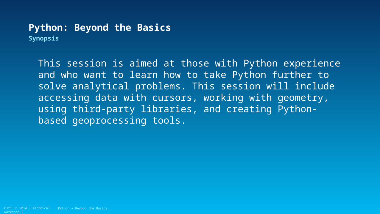
Python: Beyond the BasicsSynopsis
This session is aimed at those with Python experience and who want to learn how to take Python further to solve analytical problems. This session will include accessing data with cursors, working with geometry, using third-party libraries, and creating Python-based geoprocessing tools.
Python – Beyond the Basics
Esri UC 2014 | Technical Workshop |
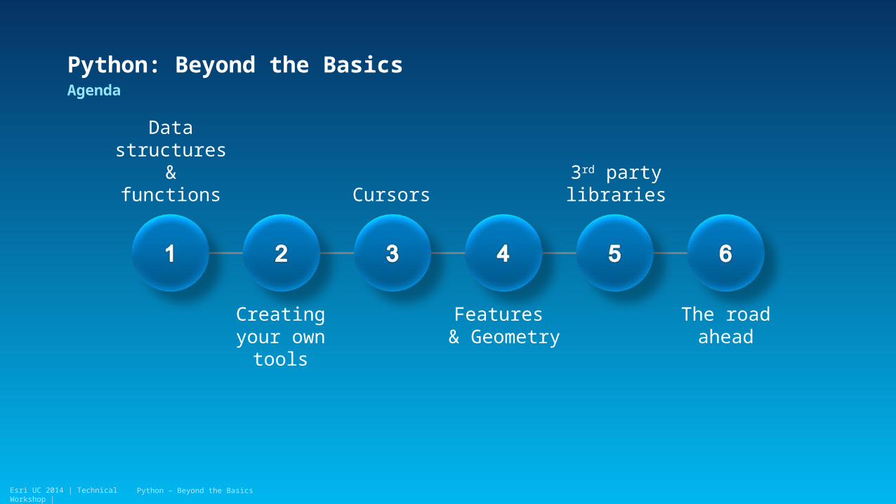
Python: Beyond the BasicsAgenda
Python – Beyond the Basics
Data structures &
functions
Creating your own tools
Cursors
Features & Geometry
3rd party libraries
The road ahead
Esri UC 2014 | Technical Workshop |Esri UC 2014 | Technical Workshop |
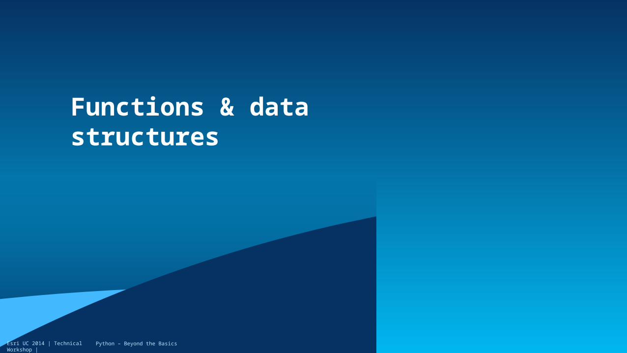
Functions & data structures
Python – Beyond the Basics

Esri UC 2014 | Technical Workshop |
• Organize and re-use functionality
• https://docs.python.org/2/tutorial/controlflow.html#defining-functions
Defining Functions
Define your function
Return a resultCall the function
Python – Beyond the Basics

Esri UC 2014 | Technical Workshop |
Key Python data structures
• Lists- Flexible
- Ordered
• Tuples- Immutable
- Ordered
• Dictionary- Key/value pairs
• https://docs.python.org/2/tutorial/datastructures.html
Python – Beyond the Basics

Esri UC 2014 | Technical Workshop |
List comprehension
• Compact way of mapping a list into another
Python – Beyond the Basics

Esri UC 2014 | Technical Workshop |Esri UC 2014 | Technical Workshop |
Data structures
Demo

Esri UC 2014 | Technical Workshop |Esri UC 2014 | Technical Workshop |
Creating geoprocessing tools
Python – Beyond the Basics
Esri UC 2014 | Technical Workshop |
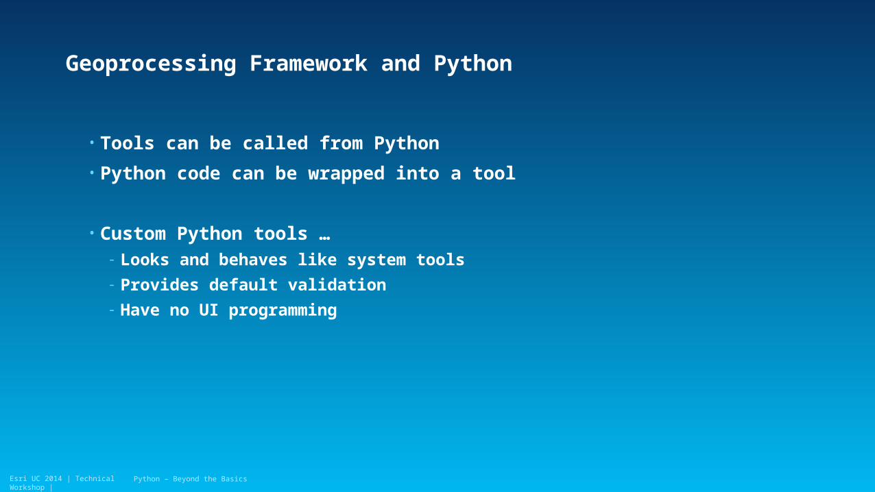
Geoprocessing Framework and Python
• Tools can be called from Python
• Python code can be wrapped into a tool
• Custom Python tools …- Looks and behaves like system tools
- Provides default validation
- Have no UI programming
Python – Beyond the Basics
Esri UC 2014 | Technical Workshop |
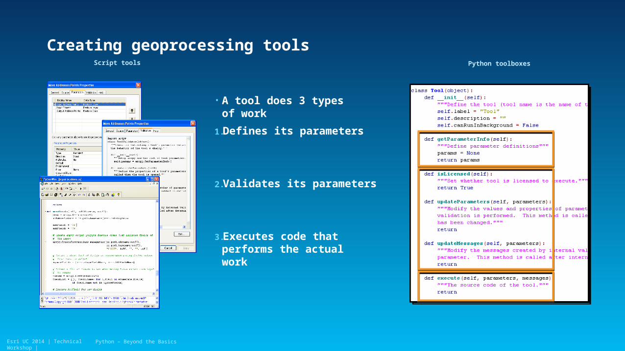
• A tool does 3 types of work
1.Defines its parameters
2.Validates its parameters
3.Executes code that performs the actual work
Creating geoprocessing tools
Python – Beyond the Basics
Script tools Python toolboxes
Esri UC 2014 | Technical Workshop |
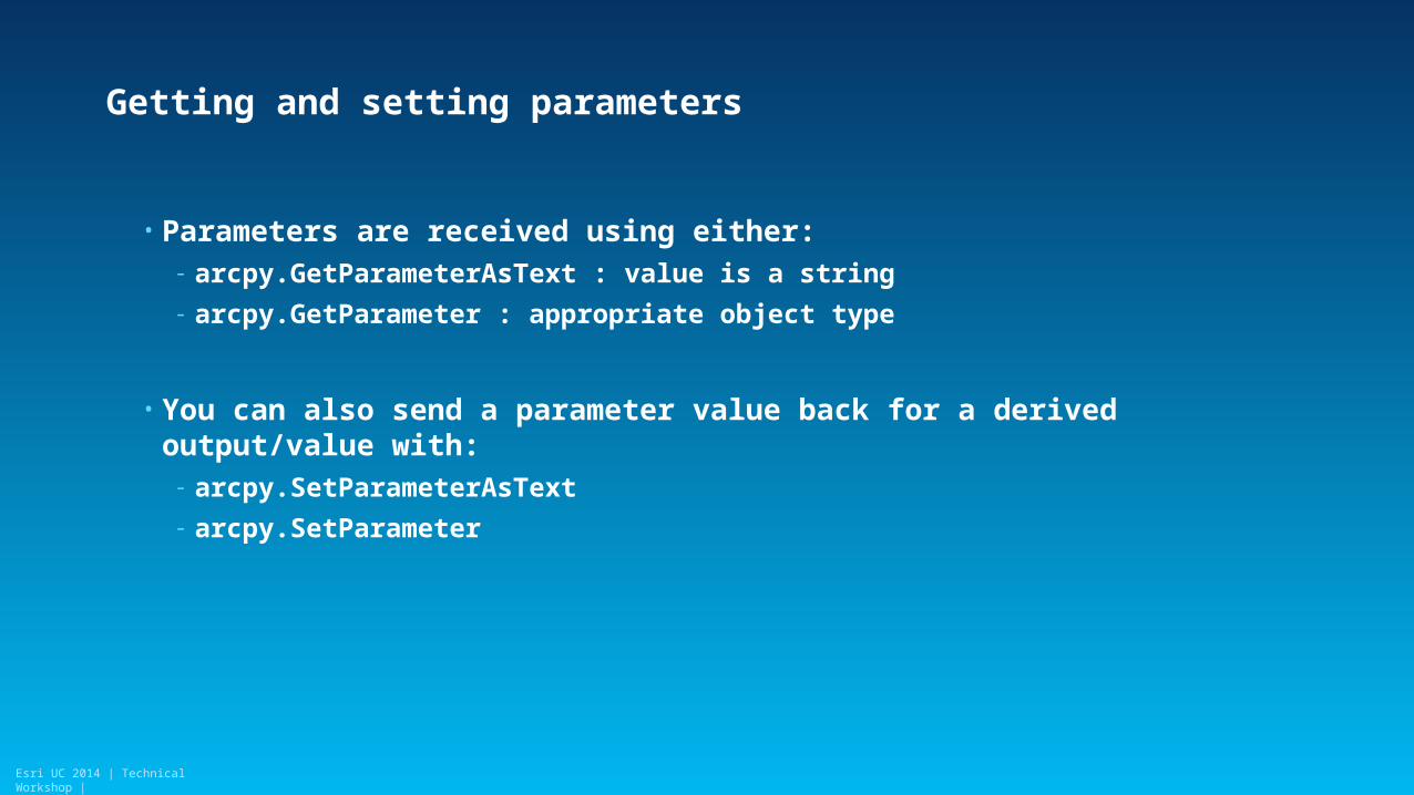
Getting and setting parameters
• Parameters are received using either:- arcpy.GetParameterAsText : value is a string
- arcpy.GetParameter : appropriate object type
• You can also send a parameter value back for a derived output/value with:- arcpy.SetParameterAsText
- arcpy.SetParameter
Esri UC 2014 | Technical Workshop |
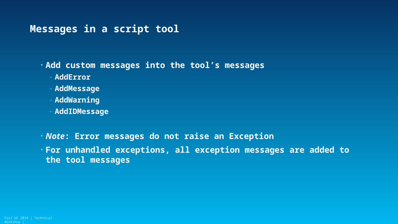
Messages in a script tool
• Add custom messages into the tool’s messages- AddError
- AddMessage
- AddWarning
- AddIDMessage
• Note: Error messages do not raise an Exception
• For unhandled exceptions, all exception messages are added to the tool messages

Esri UC 2014 | Technical Workshop |Esri UC 2014 | Technical Workshop |
Script tools
Demo
Python – Beyond the Basics

Esri UC 2014 | Technical Workshop |Esri UC 2014 | Technical Workshop |
Cursors
Python – Beyond the Basics
Esri UC 2014 | Technical Workshop |
Cursors
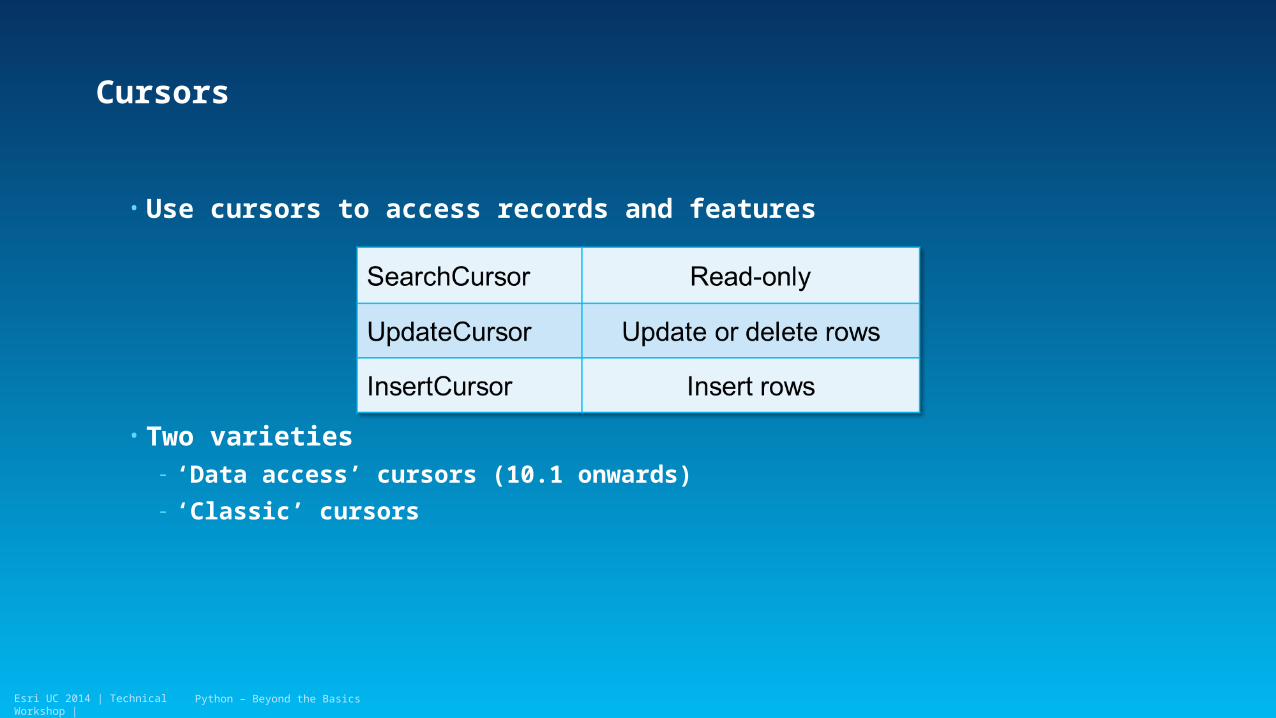
• Use cursors to access records and features
• Two varieties- ‘Data access’ cursors (10.1 onwards)
- ‘Classic’ cursors
Python – Beyond the Basics

Esri UC 2014 | Technical Workshop |
Cursor mechanics
• Data access cursors use lists and tuples- Values are accessed by index
• Classic cursors use row objects- Values are accessed by setValue/getValue
Python – Beyond the Basics

Esri UC 2014 | Technical Workshop |
Cursor performance
• Use only those fields you need
• Use tokens- Get only what you need
- Full geometry is expensive
Python – Beyond the Basics

Esri UC 2014 | Technical Workshop |Esri UC 2014 | Technical Workshop |
Demo
Cursors

Esri UC 2014 | Technical Workshop |Esri UC 2014 | Technical Workshop |
Geometry
Python – Beyond the Basics
Esri UC 2014 | Technical Workshop |
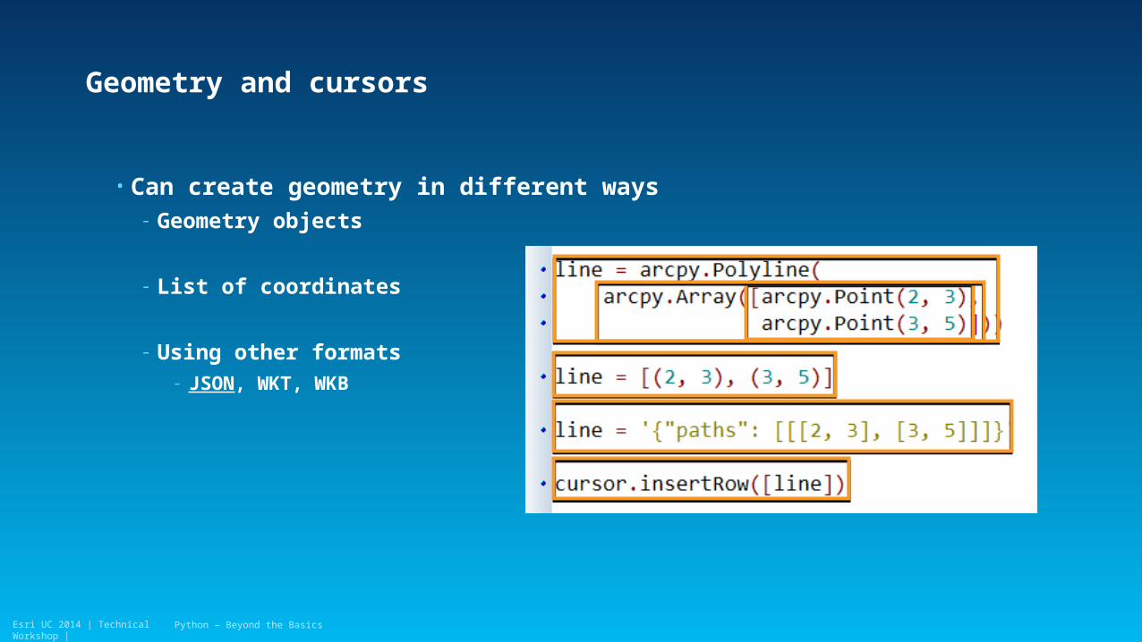
Geometry and cursors
• Can create geometry in different ways- Geometry objects
- List of coordinates
- Using other formats- JSON, WKT, WKB
Python – Beyond the Basics

Esri UC 2014 | Technical Workshop |
Working with geometry
• Relational: - Is a point within a polygon?
Python – Beyond the Basics

Esri UC 2014 | Technical Workshop |
Working with geometry
• Topological- What is the intersection of two geometries?
Python – Beyond the Basics

Esri UC 2014 | Technical Workshop |
Working with geometry
• More:- What is the halfway point of a line?
- What is the geodesic area of a polygon?
Python – Beyond the Basics

Esri UC 2014 | Technical Workshop |Esri UC 2014 | Technical Workshop |
Demo
Geometry

Esri UC 2014 | Technical Workshop |Esri UC 2014 | Technical Workshop |
3rd party libraries
Python – Beyond the Basics
Esri UC 2014 | Technical Workshop |
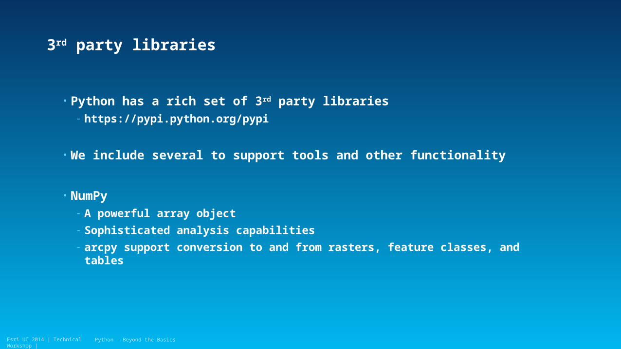
3rd party libraries
• Python has a rich set of 3rd party libraries- https://pypi.python.org/pypi
• We include several to support tools and other functionality
• NumPy- A powerful array object
- Sophisticated analysis capabilities
- arcpy support conversion to and from rasters, feature classes, and tables
Python – Beyond the Basics

Esri UC 2014 | Technical Workshop |Esri UC 2014 | Technical Workshop |
Demo
3rd party library - Request
Author
Rename title as appropriate

Esri UC 2014 | Technical Workshop |Esri UC 2014 | Technical Workshop |
Road ahead
Python – Beyond the Basics
Esri UC 2014 | Technical Workshop |
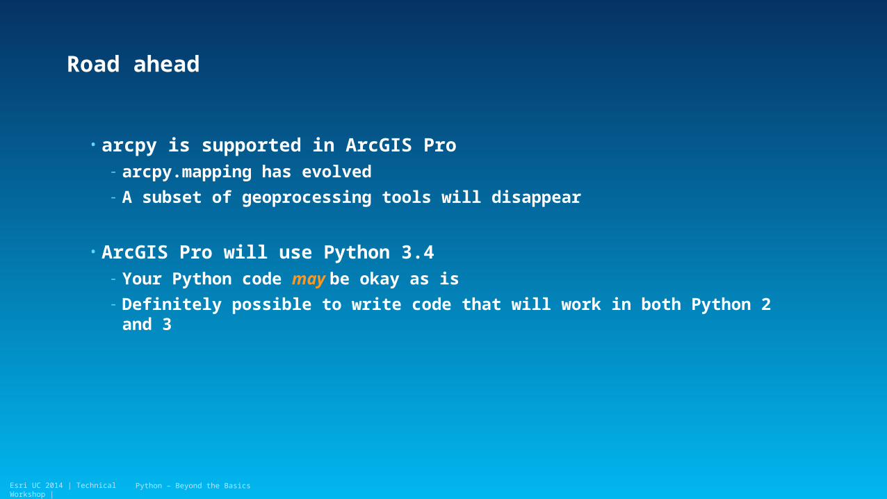
• arcpy is supported in ArcGIS Pro- arcpy.mapping has evolved
- A subset of geoprocessing tools will disappear
• ArcGIS Pro will use Python 3.4- Your Python code may be okay as is
- Definitely possible to write code that will work in both Python 2 and 3
Road ahead
Python – Beyond the Basics

Esri UC 2014 | Technical Workshop |
• Resources:- Python’s 2to3 utility
- Analyze Tools For Pro
- python3porting.com
Planning ahead
Python – Beyond the Basics
Esri UC 2014 | Technical Workshop |
Thank you…
• Please fill out the session survey:
Tuesday Offering ID: 1114
Wednesday Offering ID: 1243
Friday Offering ID: 1997
Online – www.esri.com/ucsessionsurveys
Paper – pick up and put in drop box
Python – Beyond the Basics

Esri UC 2014 | Technical Workshop | Python – Beyond the Basics
Related Documents