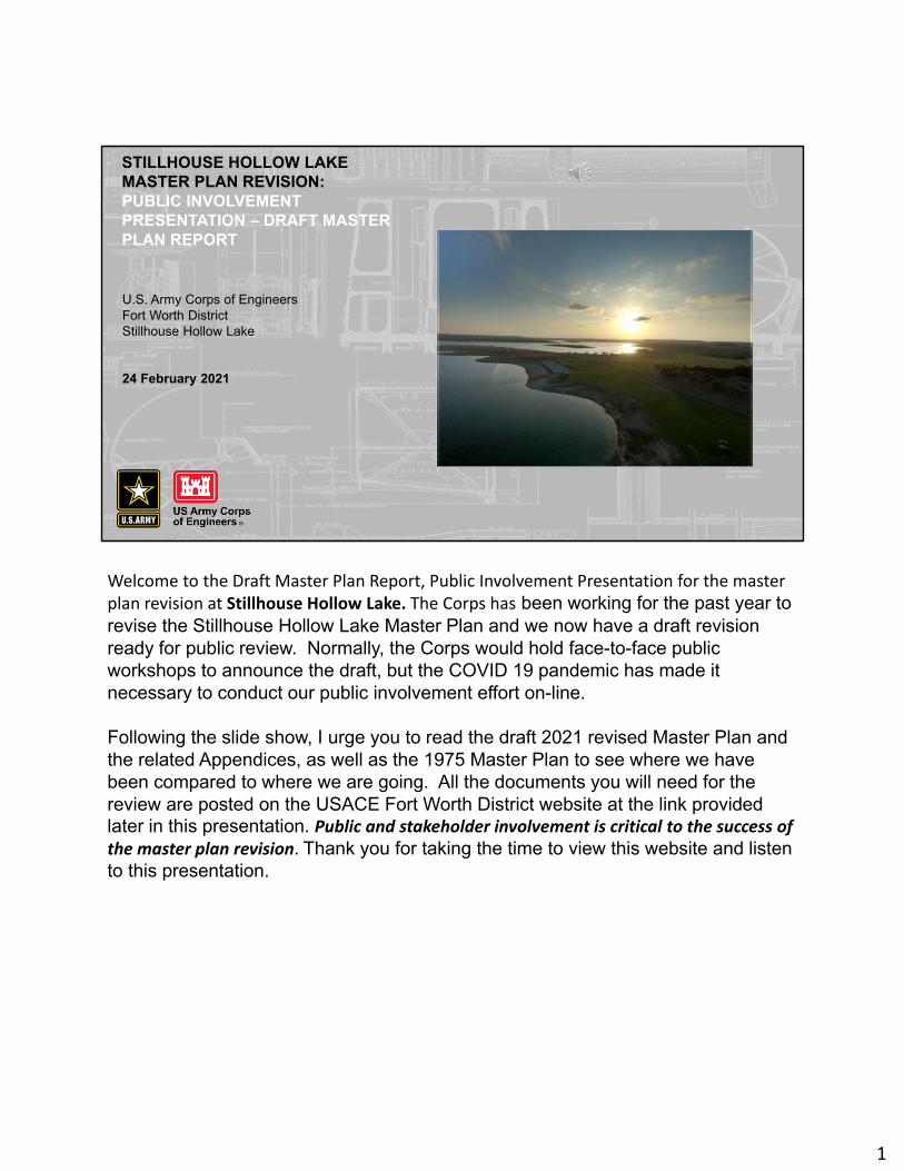
STILLHOUSE HOLLOW LAKE MASTER PLAN REVISION: PUBLIC INVOLVEMENT PRESENTATION – DRAFT MASTER PLAN REPORT U.S. Army Corps of Engineers Fort Worth District Stillhouse Hollow Lake 24 February 2021 Welcome to the Draft Master Plan Report, Public Involvement Presentation for the master plan revision at Stillhouse Hollow Lake. The Corps has been working for the past year to revise the Stillhouse Hollow Lake Master Plan and we now have a draft revision ready for public review. Normally, the Corps would hold face-to-face public workshops to announce the draft, but the COVID 19 pandemic has made it necessary to conduct our public involvement effort on-line. Following the slide show, I urge you to read the draft 2021 revised Master Plan and the related Appendices, as well as the 1975 Master Plan to see where we have been compared to where we are going. All the documents you will need for the review are posted on the USACE Fort Worth District website at the link provided later in this presentation. Public and stakeholder involvement is critical to the success of the master plan revision. Thank you for taking the time to view this website and listen to this presentation. 1

Welcome message from author
This document is posted to help you gain knowledge. Please leave a comment to let me know what you think about it! Share it to your friends and learn new things together.
Transcript
STILLHOUSE HOLLOW LAKEMASTER PLAN REVISION:PUBLIC INVOLVEMENTPRESENTATION – DRAFT MASTER PLAN REPORT
U.S. Army Corps of EngineersFort Worth DistrictStillhouse Hollow Lake
24 February 2021
Welcome to the Draft Master Plan Report, Public Involvement Presentation for the master plan revision at Stillhouse Hollow Lake. The Corps has been working for the past year to revise the Stillhouse Hollow Lake Master Plan and we now have a draft revision ready for public review. Normally, the Corps would hold face-to-face public workshops to announce the draft, but the COVID 19 pandemic has made it necessary to conduct our public involvement effort on-line.
Following the slide show, I urge you to read the draft 2021 revised Master Plan and the related Appendices, as well as the 1975 Master Plan to see where we have been compared to where we are going. All the documents you will need for the review are posted on the USACE Fort Worth District website at the link provided later in this presentation. Public and stakeholder involvement is critical to the success of the master plan revision. Thank you for taking the time to view this website and listen to this presentation.
1
2
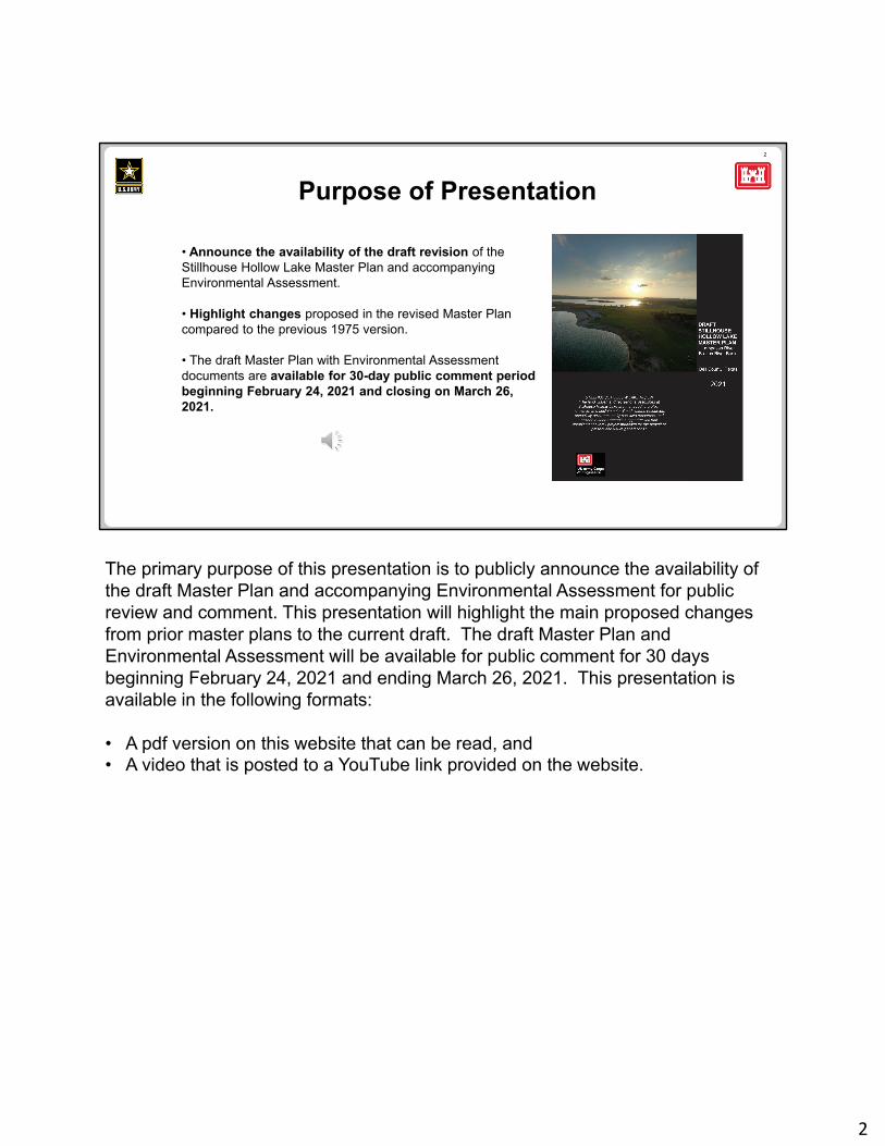
• Announce the availability of the draft revision of the Stillhouse Hollow Lake Master Plan and accompanying Environmental Assessment.
• Highlight changes proposed in the revised Master Plan compared to the previous 1975 version.
• The draft Master Plan with Environmental Assessment documents are available for 30-day public comment period beginning February 24, 2021 and closing on March 26, 2021.
Purpose of Presentation
The primary purpose of this presentation is to publicly announce the availability of the draft Master Plan and accompanying Environmental Assessment for public review and comment. This presentation will highlight the main proposed changes from prior master plans to the current draft. The draft Master Plan and Environmental Assessment will be available for public comment for 30 days beginning February 24, 2021 and ending March 26, 2021. This presentation is available in the following formats:
• A pdf version on this website that can be read, and• A video that is posted to a YouTube link provided on the website.
2
3
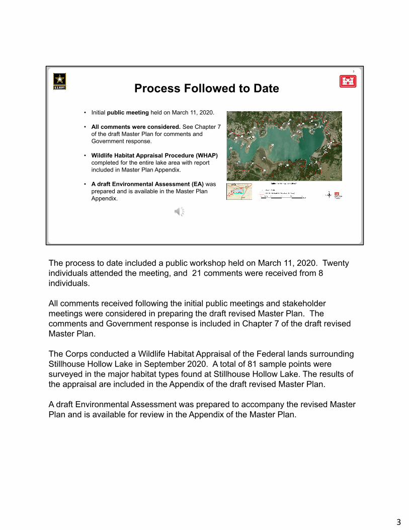
Process Followed to Date
• Initial public meeting held on March 11, 2020.
• All comments were considered. See Chapter 7 of the draft Master Plan for comments and Government response.
• Wildlife Habitat Appraisal Procedure (WHAP)completed for the entire lake area with report included in Master Plan Appendix.
• A draft Environmental Assessment (EA) was prepared and is available in the Master Plan Appendix.
The process to date included a public workshop held on March 11, 2020. Twenty individuals attended the meeting, and 21 comments were received from 8 individuals.
All comments received following the initial public meetings and stakeholder meetings were considered in preparing the draft revised Master Plan. The comments and Government response is included in Chapter 7 of the draft revised Master Plan.
The Corps conducted a Wildlife Habitat Appraisal of the Federal lands surrounding Stillhouse Hollow Lake in September 2020. A total of 81 sample points were surveyed in the major habitat types found at Stillhouse Hollow Lake. The results of the appraisal are included in the Appendix of the draft revised Master Plan.
A draft Environmental Assessment was prepared to accompany the revised Master Plan and is available for review in the Appendix of the Master Plan.
3
4
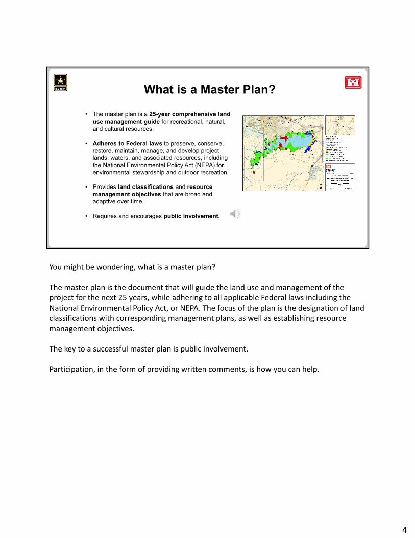
• The master plan is a 25-year comprehensive land use management guide for recreational, natural, and cultural resources.
• Adheres to Federal laws to preserve, conserve, restore, maintain, manage, and develop project lands, waters, and associated resources, including the National Environmental Policy Act (NEPA) for environmental stewardship and outdoor recreation.
• Provides land classifications and resource management objectives that are broad and adaptive over time.
• Requires and encourages public involvement.
What is a Master Plan?
You might be wondering, what is a master plan?
The master plan is the document that will guide the land use and management of the project for the next 25 years, while adhering to all applicable Federal laws including the National Environmental Policy Act, or NEPA. The focus of the plan is the designation of land classifications with corresponding management plans, as well as establishing resource management objectives.
The key to a successful master plan is public involvement.
Participation, in the form of providing written comments, is how you can help.
4
5
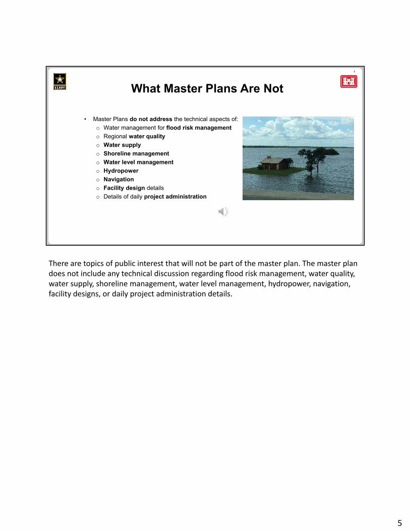
• Master Plans do not address the technical aspects of:
o Water management for flood risk management
o Regional water quality
o Water supply
o Shoreline management
o Water level management
o Hydropower
o Navigation
o Facility design details
o Details of daily project administration
What Master Plans Are Not
There are topics of public interest that will not be part of the master plan. The master plan does not include any technical discussion regarding flood risk management, water quality, water supply, shoreline management, water level management, hydropower, navigation, facility designs, or daily project administration details.
5
6
Principal Changes from Current Master Plan to Revised Plan
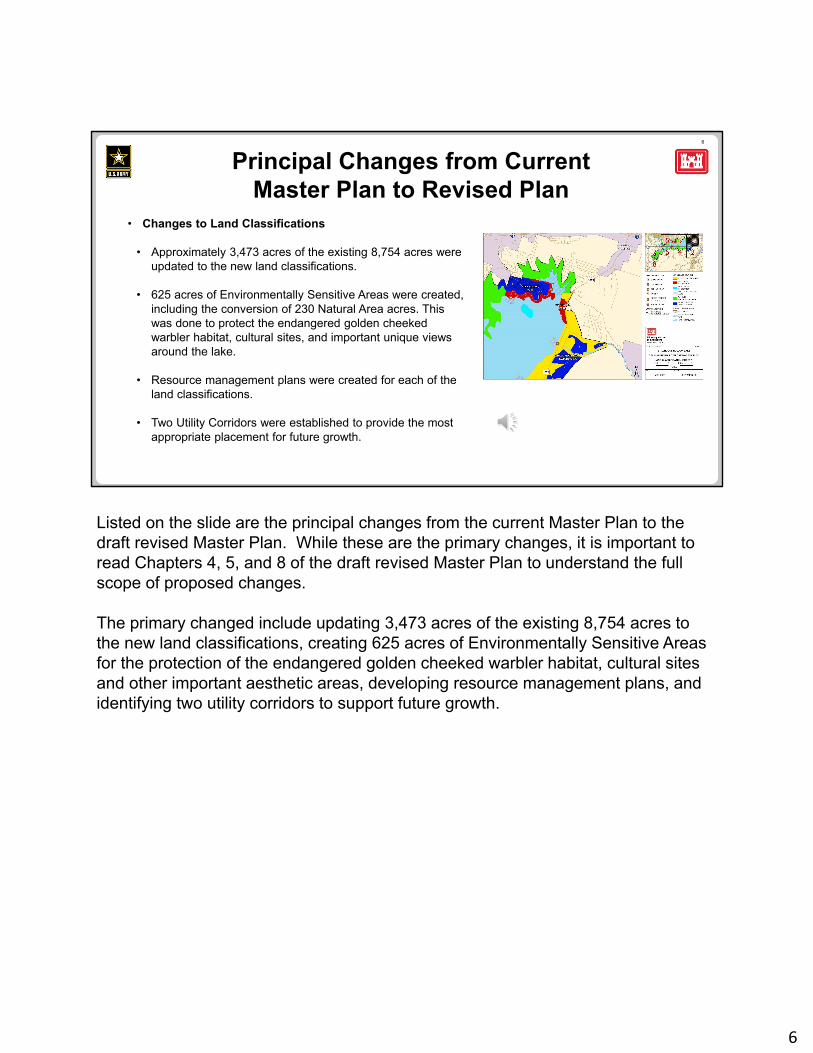
• Changes to Land Classifications
• Approximately 3,473 acres of the existing 8,754 acres were updated to the new land classifications.
• 625 acres of Environmentally Sensitive Areas were created, including the conversion of 230 Natural Area acres. This was done to protect the endangered golden cheeked warbler habitat, cultural sites, and important unique views around the lake.
• Resource management plans were created for each of the land classifications.
• Two Utility Corridors were established to provide the most appropriate placement for future growth.
Listed on the slide are the principal changes from the current Master Plan to the draft revised Master Plan. While these are the primary changes, it is important to read Chapters 4, 5, and 8 of the draft revised Master Plan to understand the full scope of proposed changes.
The primary changed include updating 3,473 acres of the existing 8,754 acres to the new land classifications, creating 625 acres of Environmentally Sensitive Areas for the protection of the endangered golden cheeked warbler habitat, cultural sites and other important aesthetic areas, developing resource management plans, and identifying two utility corridors to support future growth.
6
7
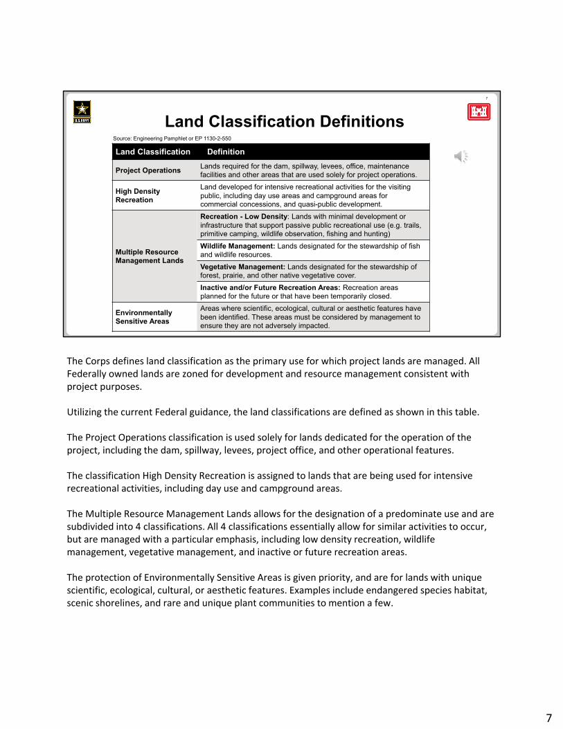
Land Classification Definitions
Land Classification Definition
Project OperationsLands required for the dam, spillway, levees, office, maintenance facilities and other areas that are used solely for project operations.
High Density Recreation
Land developed for intensive recreational activities for the visiting public, including day use areas and campground areas for commercial concessions, and quasi-public development.
Multiple Resource Management Lands
Recreation - Low Density: Lands with minimal development or infrastructure that support passive public recreational use (e.g. trails, primitive camping, wildlife observation, fishing and hunting)
Wildlife Management: Lands designated for the stewardship of fish and wildlife resources.
Vegetative Management: Lands designated for the stewardship of forest, prairie, and other native vegetative cover.
Inactive and/or Future Recreation Areas: Recreation areas planned for the future or that have been temporarily closed.
EnvironmentallySensitive Areas
Areas where scientific, ecological, cultural or aesthetic features have been identified. These areas must be considered by management to ensure they are not adversely impacted.
Source: Engineering Pamphlet or EP 1130-2-550
The Corps defines land classification as the primary use for which project lands are managed. All Federally owned lands are zoned for development and resource management consistent with project purposes.
Utilizing the current Federal guidance, the land classifications are defined as shown in this table.
The Project Operations classification is used solely for lands dedicated for the operation of the project, including the dam, spillway, levees, project office, and other operational features.
The classification High Density Recreation is assigned to lands that are being used for intensive recreational activities, including day use and campground areas.
The Multiple Resource Management Lands allows for the designation of a predominate use and are subdivided into 4 classifications. All 4 classifications essentially allow for similar activities to occur, but are managed with a particular emphasis, including low density recreation, wildlife management, vegetative management, and inactive or future recreation areas.
The protection of Environmentally Sensitive Areas is given priority, and are for lands with unique scientific, ecological, cultural, or aesthetic features. Examples include endangered species habitat, scenic shorelines, and rare and unique plant communities to mention a few.
7
8
Changes in Land & Water Surface Classifications
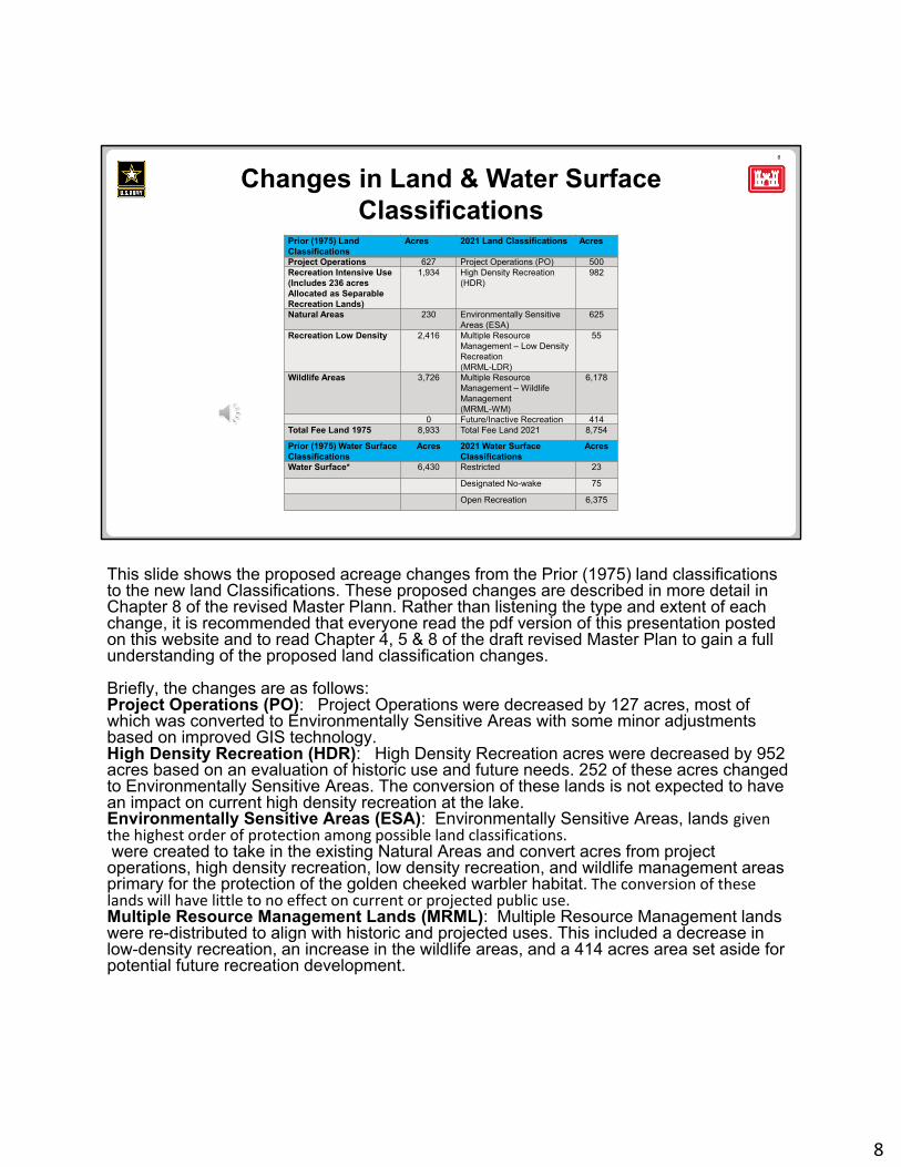
Prior (1975) Land Classifications
Acres 2021 Land Classifications Acres
Project Operations 627 Project Operations (PO) 500Recreation Intensive Use(Includes 236 acres Allocated as Separable Recreation Lands)
1,934 High Density Recreation (HDR)
982
Natural Areas 230 Environmentally Sensitive Areas (ESA)
625
Recreation Low Density 2,416 Multiple Resource Management – Low Density Recreation(MRML-LDR)
55
Wildlife Areas 3,726 Multiple Resource Management – Wildlife Management(MRML-WM)
6,178
0 Future/Inactive Recreation 414Total Fee Land 1975 8,933 Total Fee Land 2021 8,754
Prior (1975) Water Surface Classifications
Acres 2021 Water Surface Classifications
Acres
Water Surface* 6,430 Restricted 23
Designated No-wake 75
Open Recreation 6,375
This slide shows the proposed acreage changes from the Prior (1975) land classifications to the new land Classifications. These proposed changes are described in more detail in Chapter 8 of the revised Master Plann. Rather than listening the type and extent of each change, it is recommended that everyone read the pdf version of this presentation posted on this website and to read Chapter 4, 5 & 8 of the draft revised Master Plan to gain a full understanding of the proposed land classification changes.
Briefly, the changes are as follows:Project Operations (PO): Project Operations were decreased by 127 acres, most of which was converted to Environmentally Sensitive Areas with some minor adjustments based on improved GIS technology.High Density Recreation (HDR): High Density Recreation acres were decreased by 952 acres based on an evaluation of historic use and future needs. 252 of these acres changed to Environmentally Sensitive Areas. The conversion of these lands is not expected to have an impact on current high density recreation at the lake.Environmentally Sensitive Areas (ESA): Environmentally Sensitive Areas, lands given the highest order of protection among possible land classifications.were created to take in the existing Natural Areas and convert acres from project operations, high density recreation, low density recreation, and wildlife management areas primary for the protection of the golden cheeked warbler habitat. The conversion of these lands will have little to no effect on current or projected public use. Multiple Resource Management Lands (MRML): Multiple Resource Management lands were re-distributed to align with historic and projected uses. This included a decrease in low-density recreation, an increase in the wildlife areas, and a 414 acres area set aside for potential future recreation development.
8
9
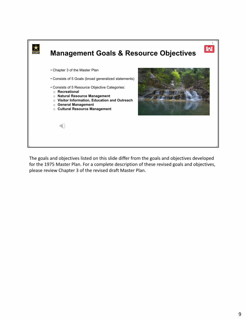
Management Goals & Resource Objectives
• Chapter 3 of the Master Plan
• Consists of 5 Goals (broad generalized statements)
• Consists of 5 Resource Objective Categories:o Recreationalo Natural Resource Managemento Visitor Information, Education and Outreacho General Managemento Cultural Resource Management
The goals and objectives listed on this slide differ from the goals and objectives developed for the 1975 Master Plan. For a complete description of these revised goals and objectives, please review Chapter 3 of the revised draft Master Plan.
9
10
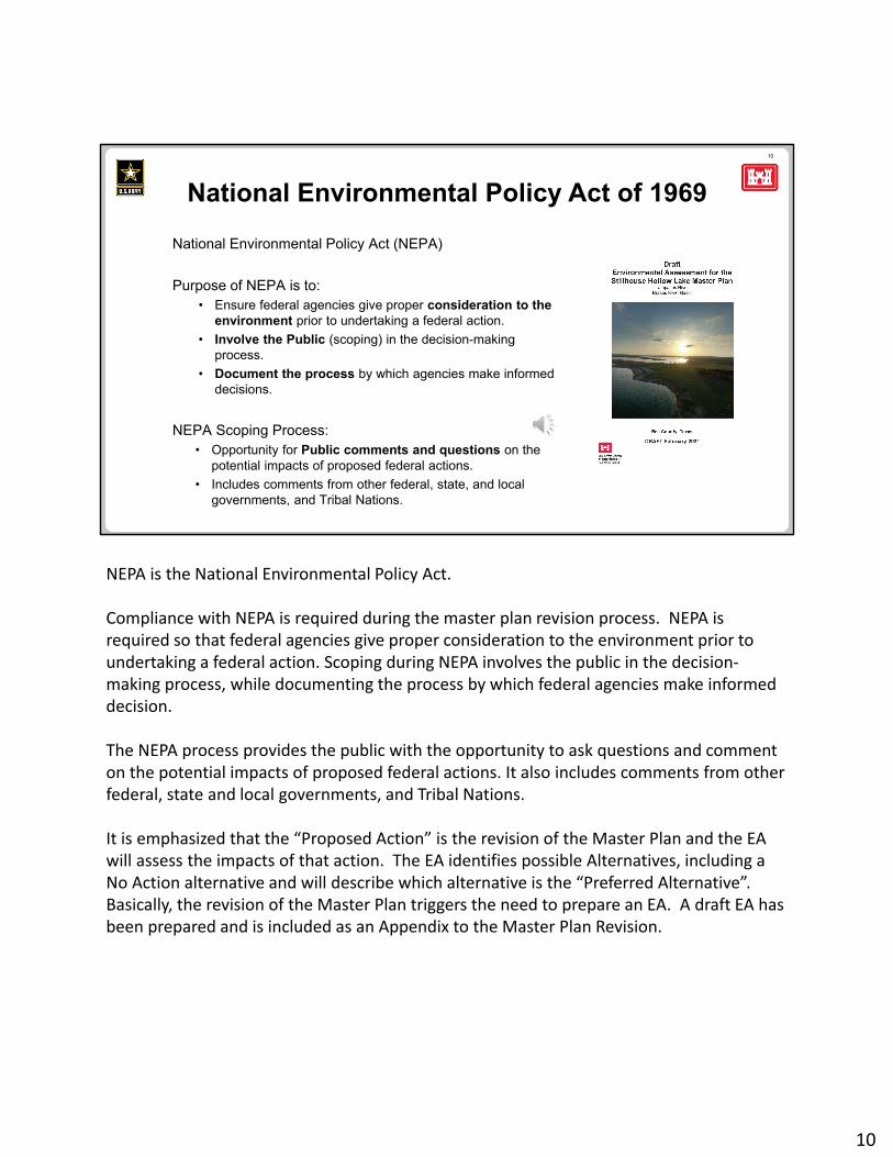
National Environmental Policy Act (NEPA)
Purpose of NEPA is to:• Ensure federal agencies give proper consideration to the
environment prior to undertaking a federal action.
• Involve the Public (scoping) in the decision-making process.
• Document the process by which agencies make informed decisions.
NEPA Scoping Process:• Opportunity for Public comments and questions on the
potential impacts of proposed federal actions.
• Includes comments from other federal, state, and local governments, and Tribal Nations.
National Environmental Policy Act of 1969
NEPA is the National Environmental Policy Act.
Compliance with NEPA is required during the master plan revision process. NEPA is required so that federal agencies give proper consideration to the environment prior to undertaking a federal action. Scoping during NEPA involves the public in the decision‐making process, while documenting the process by which federal agencies make informed decision.
The NEPA process provides the public with the opportunity to ask questions and comment on the potential impacts of proposed federal actions. It also includes comments from other federal, state and local governments, and Tribal Nations.
It is emphasized that the “Proposed Action” is the revision of the Master Plan and the EA will assess the impacts of that action. The EA identifies possible Alternatives, including a No Action alternative and will describe which alternative is the “Preferred Alternative”. Basically, the revision of the Master Plan triggers the need to prepare an EA. A draft EA has been prepared and is included as an Appendix to the Master Plan Revision.
10
11
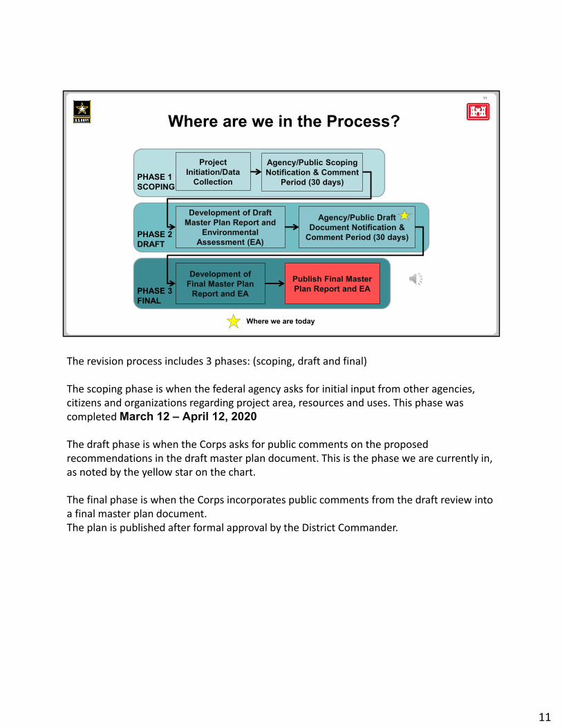
Where we are today
Project Initiation/Data
Collection
Agency/Public Scoping Notification & Comment
Period (30 days)
Development of Draft Master Plan Report and
Environmental Assessment (EA)
Agency/Public Draft Document Notification &
Comment Period (30 days)
Development of Final Master Plan
Report and EA
Publish Final Master Plan Report and EA
PHASE 1SCOPING
PHASE 2DRAFT
PHASE 3FINAL
Where are we in the Process?
The revision process includes 3 phases: (scoping, draft and final)
The scoping phase is when the federal agency asks for initial input from other agencies, citizens and organizations regarding project area, resources and uses. This phase was completed March 12 – April 12, 2020
The draft phase is when the Corps asks for public comments on the proposed recommendations in the draft master plan document. This is the phase we are currently in, as noted by the yellow star on the chart.
The final phase is when the Corps incorporates public comments from the draft review into a final master plan document. The plan is published after formal approval by the District Commander.
11
12
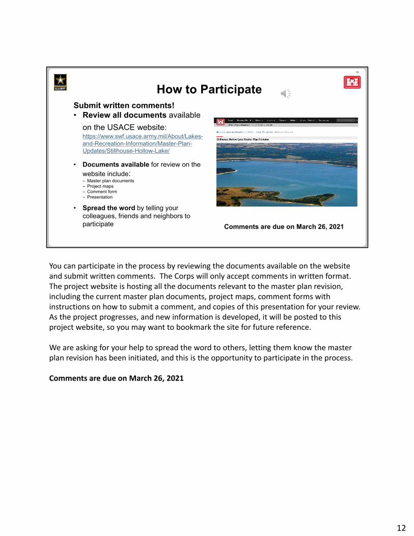
Submit written comments!• Review all documents available
on the USACE website:https://www.swf.usace.army.mil/About/Lakes-and-Recreation-Information/Master-Plan-Updates/Stillhouse-Hollow-Lake/
• Documents available for review on the website include:– Master plan documents– Project maps– Comment form– Presentation
• Spread the word by telling your colleagues, friends and neighbors to participate
How to Participate
Comments are due on March 26, 2021
You can participate in the process by reviewing the documents available on the website and submit written comments. The Corps will only accept comments in written format. The project website is hosting all the documents relevant to the master plan revision, including the current master plan documents, project maps, comment forms with instructions on how to submit a comment, and copies of this presentation for your review. As the project progresses, and new information is developed, it will be posted to this project website, so you may want to bookmark the site for future reference.
We are asking for your help to spread the word to others, letting them know the master plan revision has been initiated, and this is the opportunity to participate in the process.
Comments are due on March 26, 2021
12
13
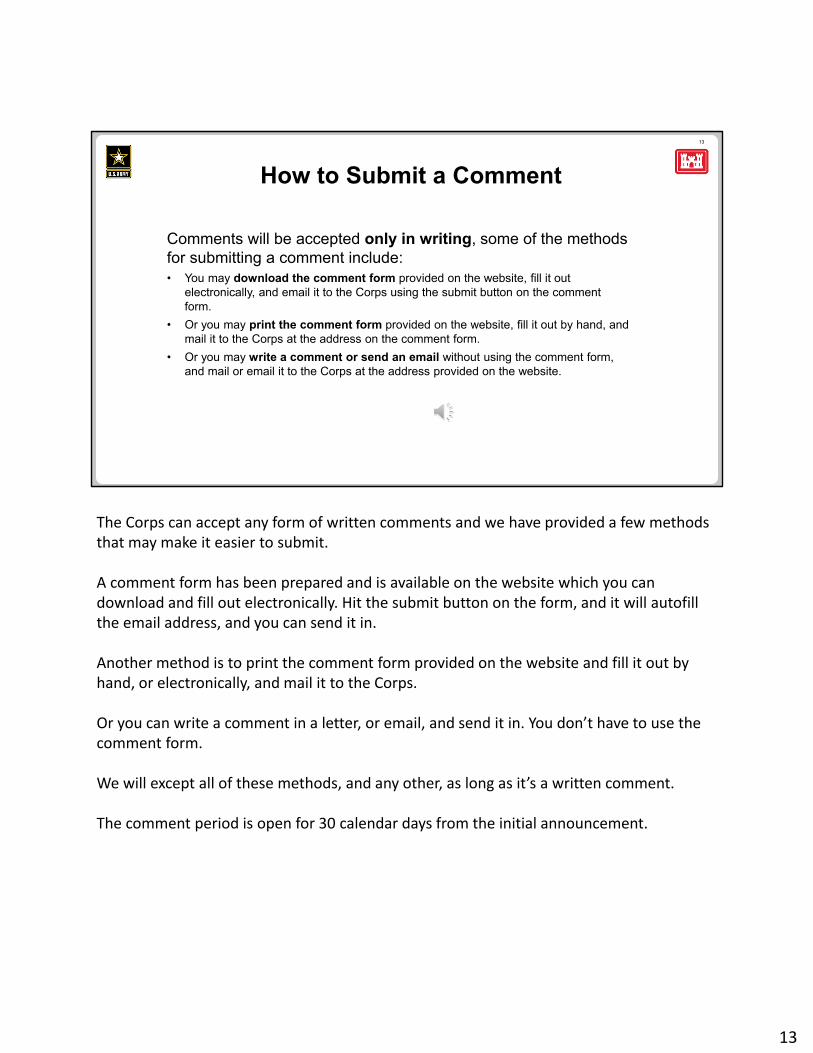
Comments will be accepted only in writing, some of the methods for submitting a comment include:• You may download the comment form provided on the website, fill it out
electronically, and email it to the Corps using the submit button on the comment form.
• Or you may print the comment form provided on the website, fill it out by hand, and mail it to the Corps at the address on the comment form.
• Or you may write a comment or send an email without using the comment form, and mail or email it to the Corps at the address provided on the website.
How to Submit a Comment
The Corps can accept any form of written comments and we have provided a few methods that may make it easier to submit.
A comment form has been prepared and is available on the website which you can download and fill out electronically. Hit the submit button on the form, and it will autofill the email address, and you can send it in.
Another method is to print the comment form provided on the website and fill it out by hand, or electronically, and mail it to the Corps.
Or you can write a comment in a letter, or email, and send it in. You don’t have to use the comment form.
We will except all of these methods, and any other, as long as it’s a written comment.
The comment period is open for 30 calendar days from the initial announcement.
13
14
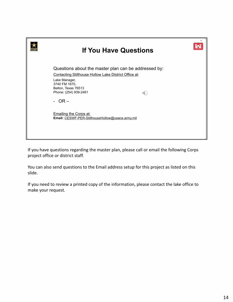
Questions about the master plan can be addressed by:Contacting Stillhouse Hollow Lake District Office at:
Lake Manager, 3740 FM 1670, Belton, Texas 76513Phone: (254) 939-2461
- OR –
Emailing the Corps at:Email: [email protected]
If You Have Questions
If you have questions regarding the master plan, please call or email the following Corps project office or district staff.
You can also send questions to the Email address setup for this project as listed on this slide.
If you need to review a printed copy of the information, please contact the lake office to make your request.
14
15
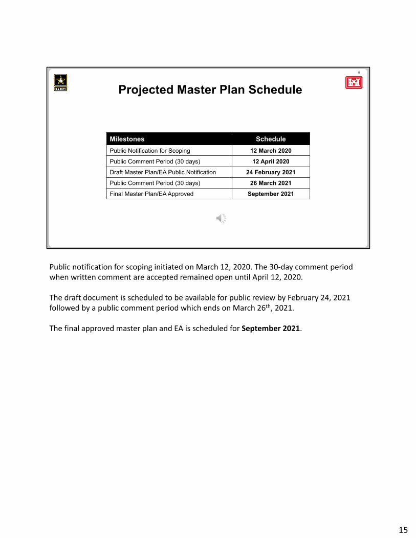
Milestones Schedule
Public Notification for Scoping 12 March 2020
Public Comment Period (30 days) 12 April 2020
Draft Master Plan/EA Public Notification 24 February 2021
Public Comment Period (30 days) 26 March 2021
Final Master Plan/EA Approved September 2021
Projected Master Plan Schedule
Public notification for scoping initiated on March 12, 2020. The 30‐day comment period when written comment are accepted remained open until April 12, 2020.
The draft document is scheduled to be available for public review by February 24, 2021 followed by a public comment period which ends on March 26th, 2021.
The final approved master plan and EA is scheduled for September 2021.
15
16
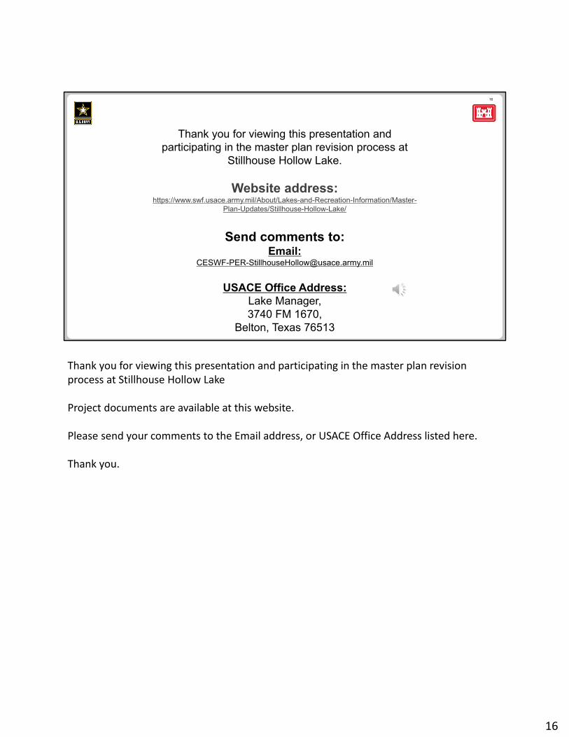
Thank you for viewing this presentation and participating in the master plan revision process at
Stillhouse Hollow Lake.
Website address:https://www.swf.usace.army.mil/About/Lakes-and-Recreation-Information/Master-
Plan-Updates/Stillhouse-Hollow-Lake/
Send comments to:Email:
USACE Office Address: Lake Manager, 3740 FM 1670,
Belton, Texas 76513
Thank you for viewing this presentation and participating in the master plan revision process at Stillhouse Hollow Lake
Project documents are available at this website.
Please send your comments to the Email address, or USACE Office Address listed here.
Thank you.
16
Related Documents