Introducing PTOLEMUS Presentation August 2009 - Confidential Strategies for Mobile Companies PTOLEMUS Consulting Group How connected navigation will change car travel ITS Future Vision - University of Portsmouth Frederic Bruneteau - 5 th November 2009

Welcome message from author
This document is posted to help you gain knowledge. Please leave a comment to let me know what you think about it! Share it to your friends and learn new things together.
Transcript
Introducing PTOLEMUS
Presentation
August 2009 - Confidential
Strategies for Mobile Companies
PTOLEMUS Consulting Group
How connected navigation will change car travel
ITS Future Vision - University of Portsmouth
Frederic Bruneteau - 5th November 2009
PTOLEMUS
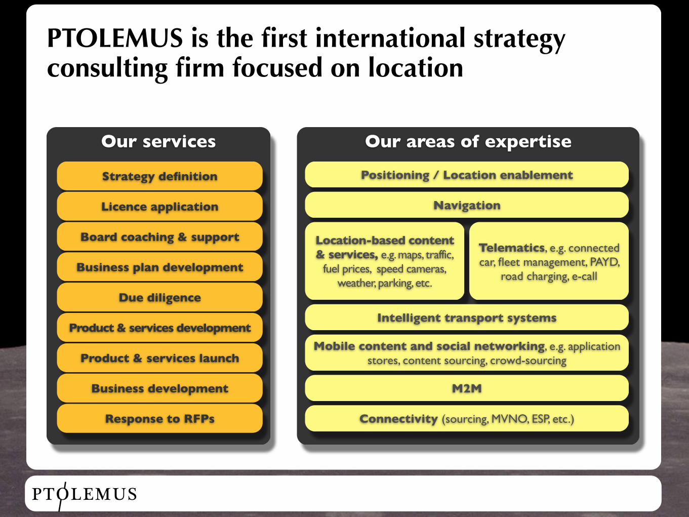
PTOLEMUS is the first international strategy consulting firm focused on location
Our services
Strategy definition
Licence application
Board coaching & support
Business plan development
Due diligence
Product & services development
Product & services launch
Business development
Response to RFPs
Our areas of expertise
Positioning / Location enablement
Navigation
Location-based content & services, e.g. maps, traffic,
fuel prices, speed cameras, weather, parking, etc.
Telematics, e.g. connected car, fleet management, PAYD,
road charging, e-call
Intelligent transport systems
Mobile content and social networking, e.g. application stores, content sourcing, crowd-sourcing
M2M
Connectivity (sourcing, MVNO, ESP, etc.)
PTOLEMUS
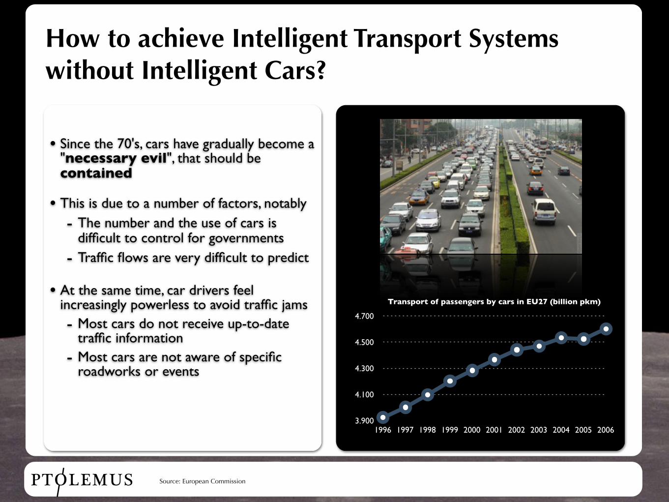
How to achieve Intelligent Transport Systems without Intelligent Cars?
• Since the 70's, cars have gradually become a "necessary evil", that should be contained
• This is due to a number of factors, notably- The number and the use of cars is
difficult to control for governments- Traffic flows are very difficult to predict
• At the same time, car drivers feel increasingly powerless to avoid traffic jams- Most cars do not receive up-to-date
traffic information- Most cars are not aware of specific
roadworks or events
3.900
4.100
4.300
4.500
4.700
1996 1997 1998 1999 2000 2001 2002 2003 2004 2005 2006
Source: European Commission
Transport of passengers by cars in EU27 (billion pkm)
PTOLEMUS
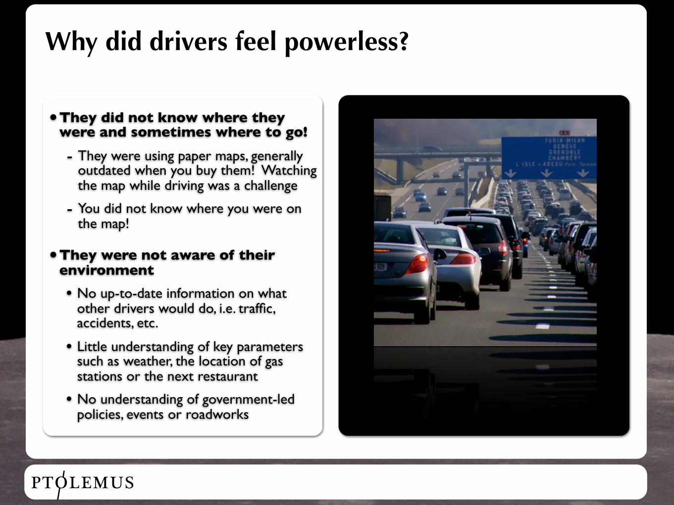
Why did drivers feel powerless?
•They did not know where they were and sometimes where to go!
- They were using paper maps, generally outdated when you buy them! Watching the map while driving was a challenge
- You did not know where you were on the map!
•They were not aware of their environment
• No up-to-date information on what other drivers would do, i.e. traffic, accidents, etc.
• Little understanding of key parameters such as weather, the location of gas stations or the next restaurant
• No understanding of government-led policies, events or roadworks
PTOLEMUS
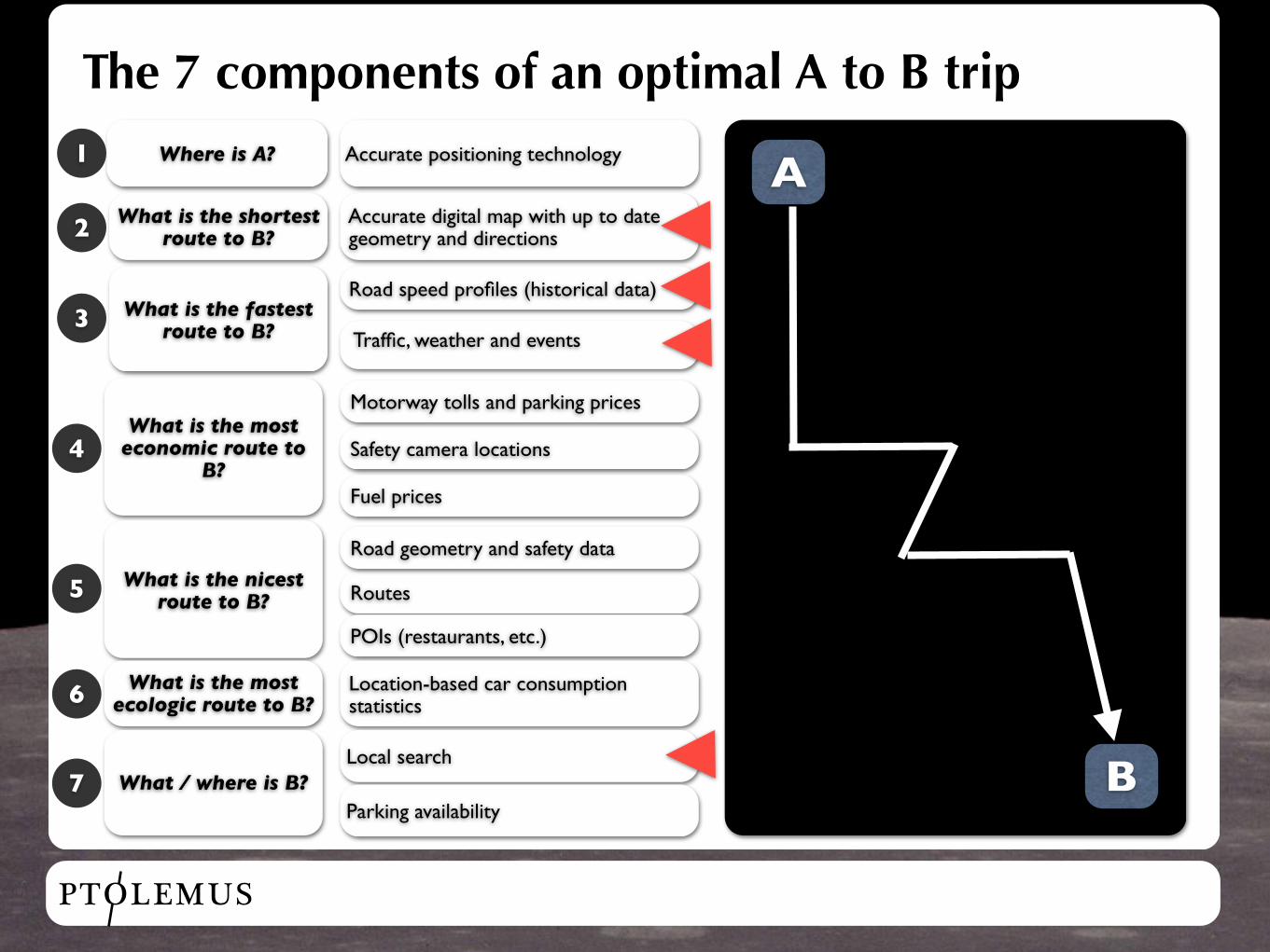
The 7 components of an optimal A to B trip
A
B
Where is A?
What is the shortest route to B?
What is the fastest route to B?
What is the most economic route to
B?
What is the nicest route to B?
What is the most ecologic route to B?
What / where is B?
Accurate positioning technology
Accurate digital map with up to date geometry and directions
Road speed profiles (historical data)
Traffic, weather and events
Motorway tolls and parking prices
Fuel prices
Safety camera locations
Routes
POIs (restaurants, etc.)
Location-based car consumption statistics
Local search
Parking availability
Road geometry and safety data
1
2
3
4
5
6
7
PTOLEMUS
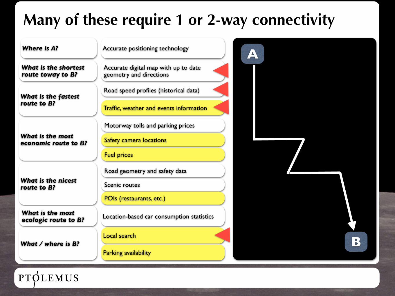
Many of these require 1 or 2-way connectivity
Where is A? A
B
What is the shortest route toway to B?
What is the fastest route to B?
What is the most economic route to B?
What is the nicest route to B?
What is the most ecologic route to B?
Accurate positioning technology
Accurate digital map with up to date geometry and directions
Road speed profiles (historical data)
Traffic, weather and events information
Motorway tolls and parking prices
Fuel prices
Safety camera locations
Scenic routes
POIs (restaurants, etc.)
Location-based car consumption statistics
What / where is B?Local search
Parking availability
Road geometry and safety data
PTOLEMUS
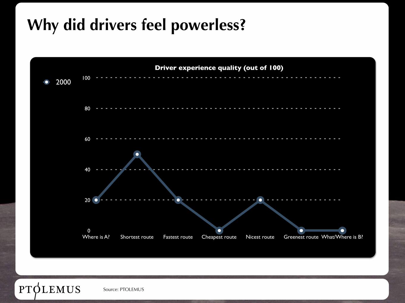
Why did drivers feel powerless?
0
20
40
60
80
100
Where is A? Shortest route Fastest route Cheapest route Nicest route Greenest route What/Where is B?
Driver experience quality (out of 100)
2000
Source: PTOLEMUS
PTOLEMUS
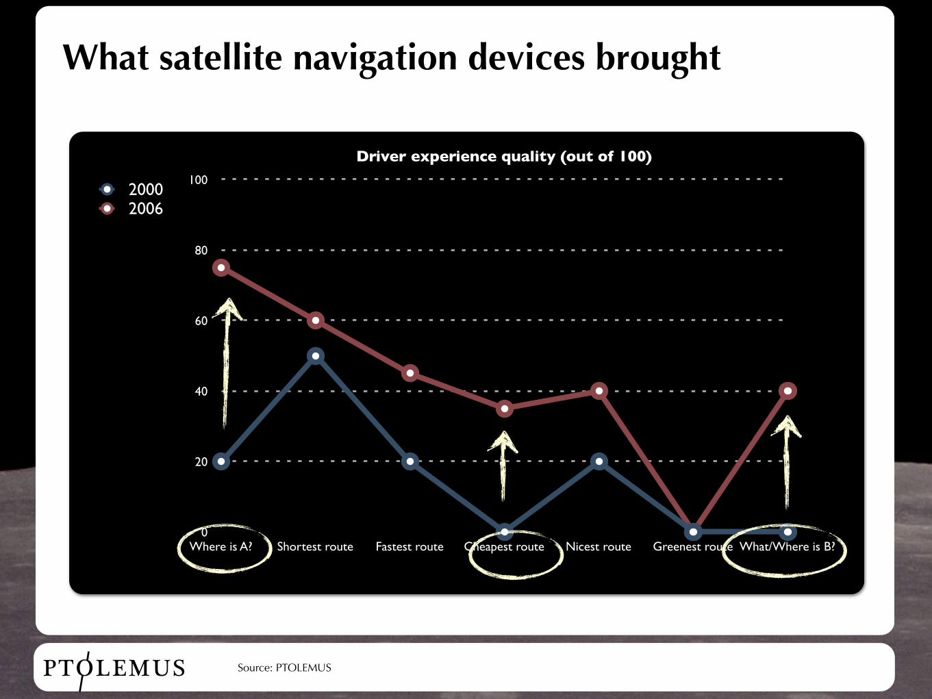
What satellite navigation devices brought
0
20
40
60
80
100
Where is A? Shortest route Fastest route Cheapest route Nicest route Greenest route What/Where is B?
Driver experience quality (out of 100)
20002006
Source: PTOLEMUS
PTOLEMUS
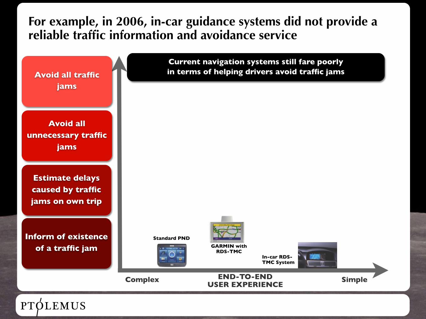
For example, in 2006, in-car guidance systems did not provide a reliable traffic information and avoidance service
Avoid all traffic jams
Avoid all unnecessary traffic
jams
Estimate delays caused by traffic jams on own trip
Inform of existence of a traffic jam
Complex SimpleEND-TO-END USER EXPERIENCE
GARMIN with RDS-TMC
In-car RDS-TMC System
Current navigation systems still fare poorly in terms of helping drivers avoid traffic jams
Standard PND
PTOLEMUS
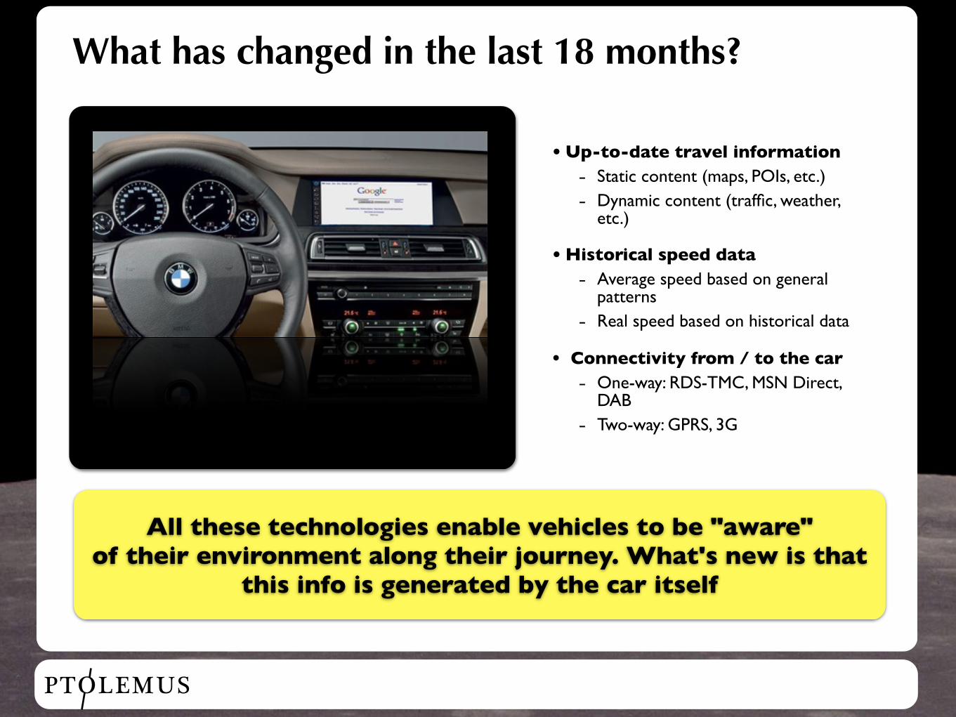
What has changed in the last 18 months?
All these technologies enable vehicles to be "aware" of their environment along their journey. What's new is that
this info is generated by the car itself
• Up-to-date travel information
- Static content (maps, POIs, etc.)
- Dynamic content (traffic, weather, etc.)
• Historical speed data
- Average speed based on general patterns
- Real speed based on historical data
• Connectivity from / to the car
- One-way: RDS-TMC, MSN Direct, DAB
- Two-way: GPRS, 3G
PTOLEMUS
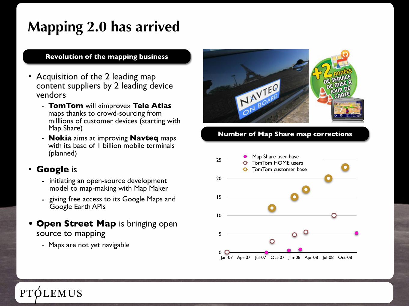
Mapping 2.0 has arrived
• Acquisition of the 2 leading map content suppliers by 2 leading device vendors
- TomTom will «improve» Tele Atlas maps thanks to crowd-sourcing from milllions of customer devices (starting with Map Share)
- Nokia aims at improving Navteq maps with its base of 1 billion mobile terminals (planned)
• Google is- initiating an open-source development
model to map-making with Map Maker
- giving free access to its Google Maps and Google Earth APIs
• Open Street Map is bringing open source to mapping- Maps are not yet navigable
Revolution of the mapping business
Number of Map Share map corrections
0
5
10
15
20
25
Jan-07 Apr-07 Jul-07 Oct-07 Jan-08 Apr-08 Jul-08 Oct-08
Map Share user baseTomTom HOME usersTomTom customer base
PTOLEMUS
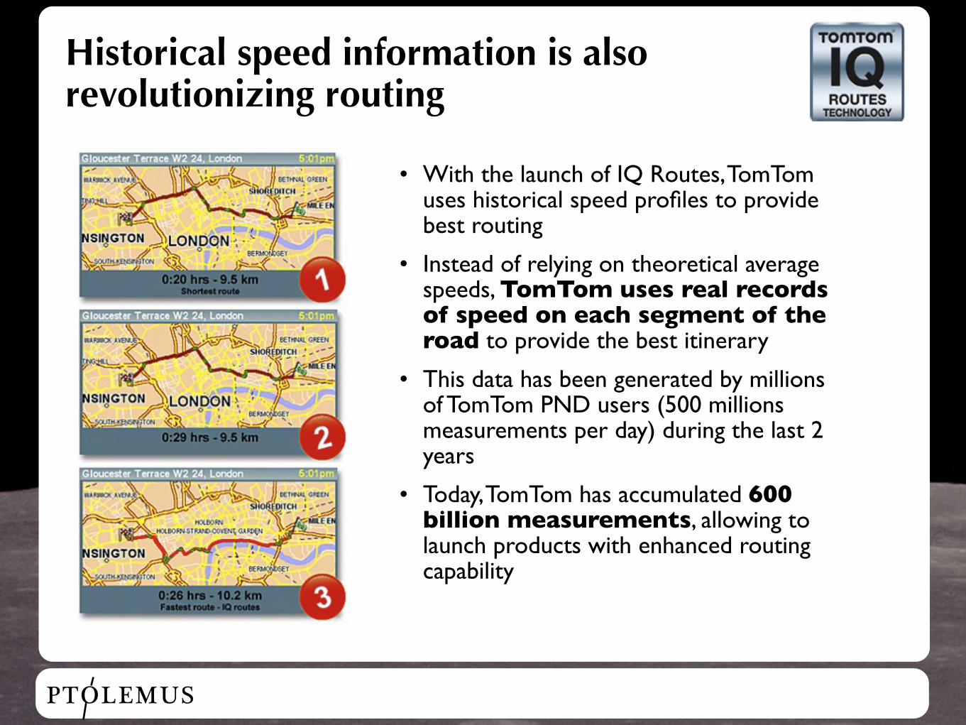
Historical speed information is also revolutionizing routing
• With the launch of IQ Routes, TomTom uses historical speed profiles to provide best routing
• Instead of relying on theoretical average speeds, TomTom uses real records of speed on each segment of the road to provide the best itinerary
• This data has been generated by millions of TomTom PND users (500 millions measurements per day) during the last 2 years
• Today, TomTom has accumulated 600 billion measurements, allowing to launch products with enhanced routing capability
PTOLEMUS
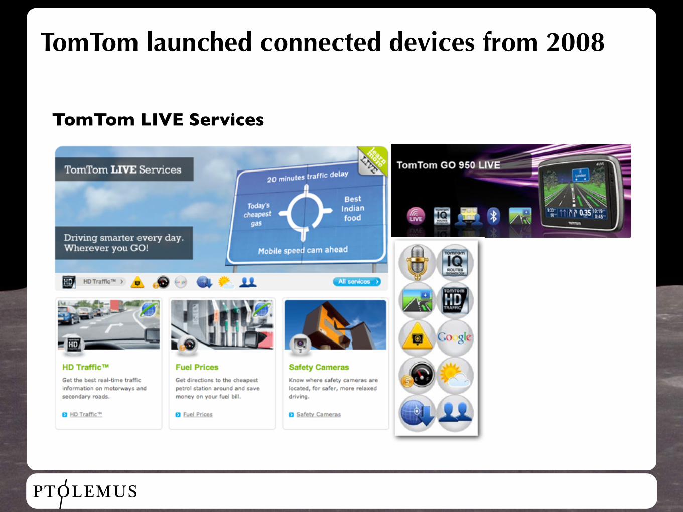
TomTom launched connected devices from 2008
TomTom LIVE Services
PTOLEMUS
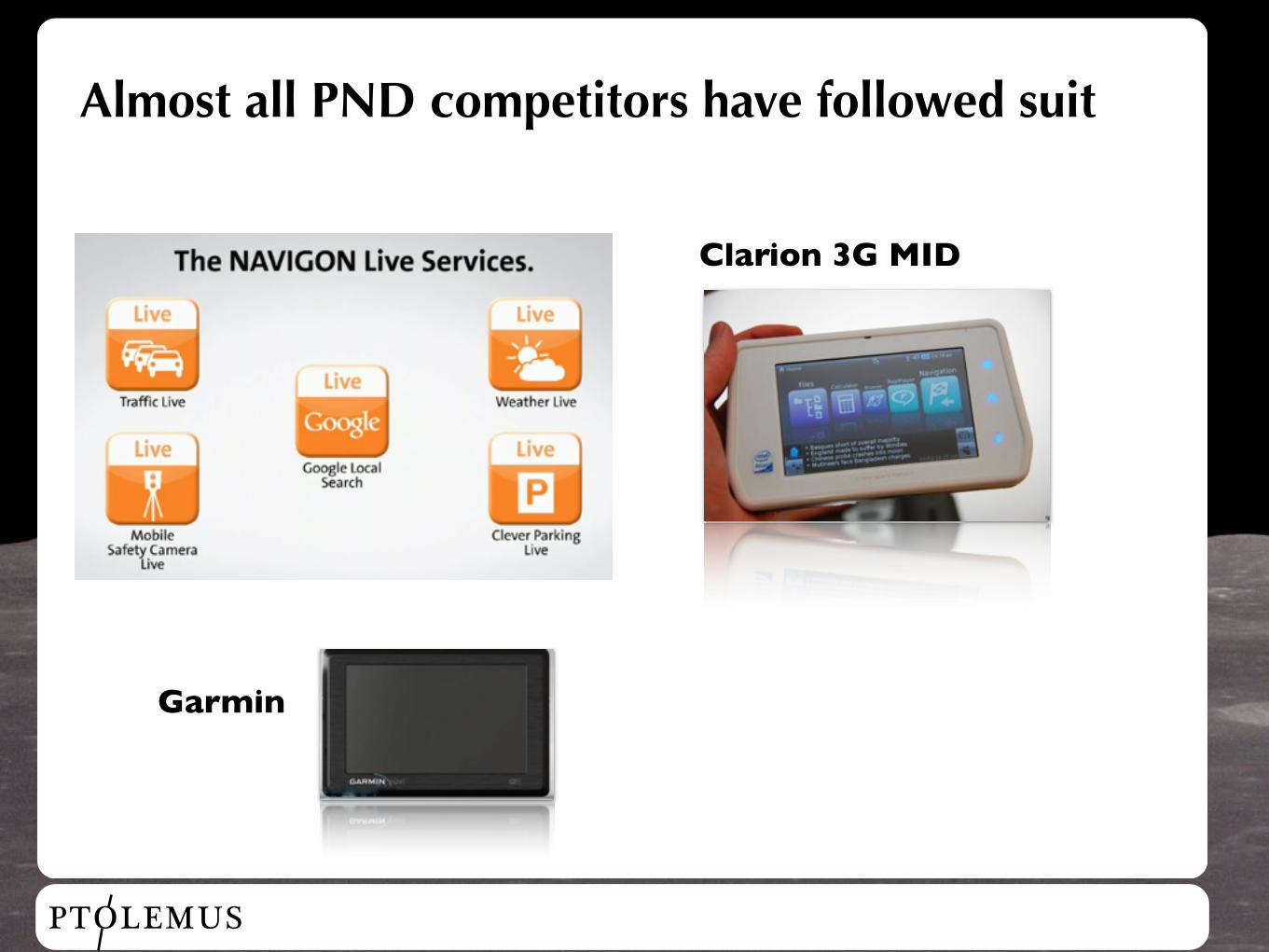
Almost all PND competitors have followed suit
Clarion 3G MID
Garmin
PTOLEMUS
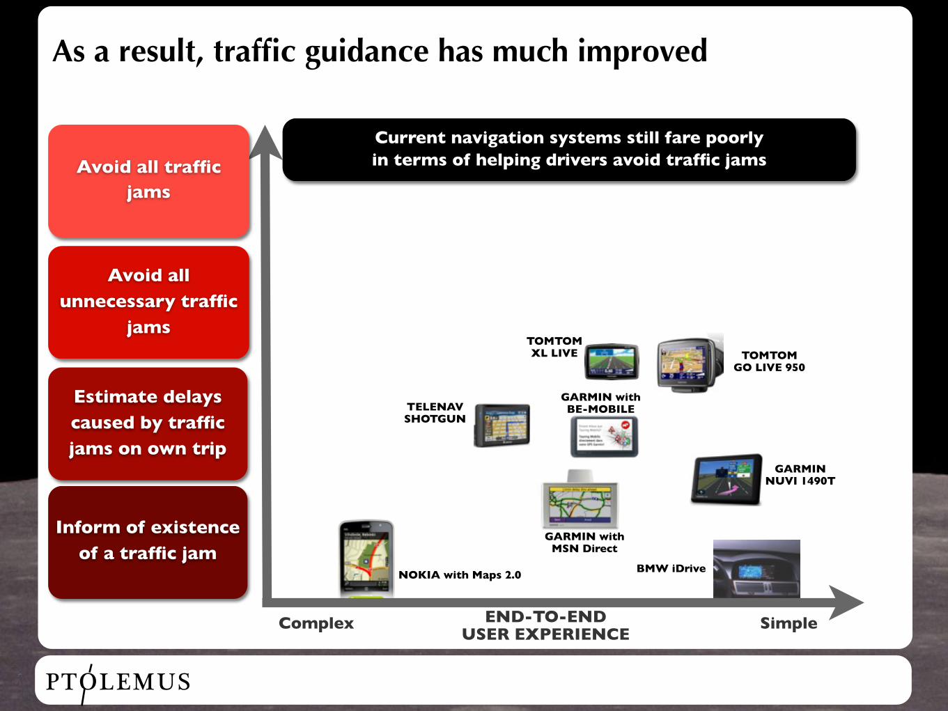
As a result, traffic guidance has much improved
Avoid all traffic jams
Avoid all unnecessary traffic
jams
Estimate delays caused by traffic jams on own trip
Inform of existence of a traffic jam
Complex SimpleEND-TO-END USER EXPERIENCE
TOMTOM GO LIVE 950
TELENAV SHOTGUN
GARMIN NUVI 1490T
GARMIN with MSN Direct
BMW iDriveNOKIA with Maps 2.0
TOMTOM XL LIVE
Current navigation systems still fare poorly in terms of helping drivers avoid traffic jams
GARMIN with BE-MOBILE
PTOLEMUS
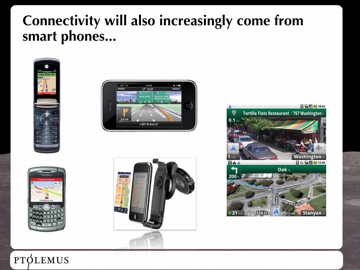
Connectivity will also increasingly come from smart phones...
PTOLEMUS
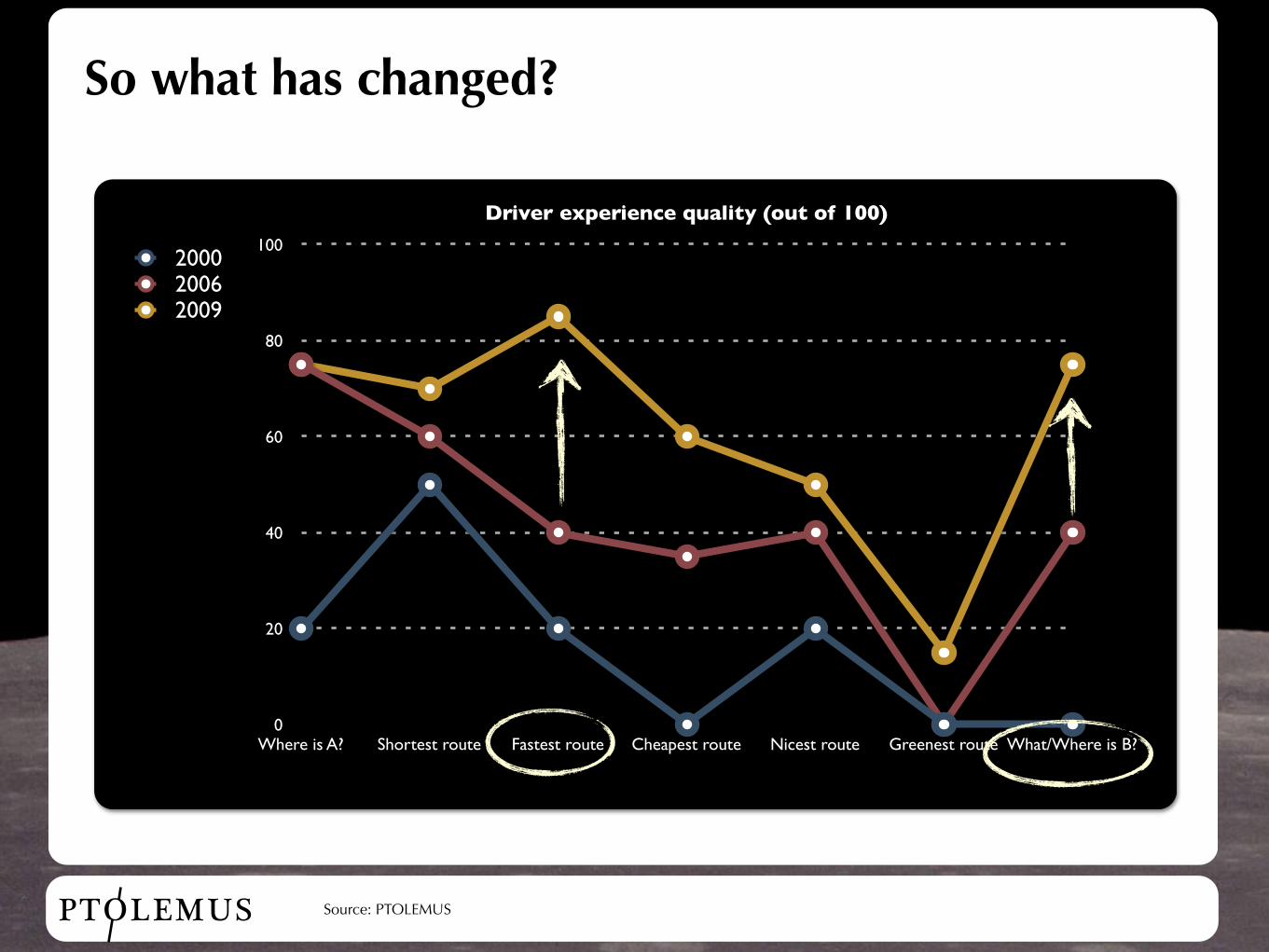
So what has changed?
0
20
40
60
80
100
Where is A? Shortest route Fastest route Cheapest route Nicest route Greenest route What/Where is B?
Driver experience quality (out of 100)
200020062009
Source: PTOLEMUS
PTOLEMUS
Conclusion
• The car has now access to the wealth of the Internet
• It will also increasingly generate information that will be aggregated so as to make road traffic smarter (XFCD)
• As a result, the car navigation experience has dramatically improved, which generates less pollution, productivity gains, etc.
• We expect permanent vehicle connectivity to become the norm by 2020
• This opens up numerous opportunities of new services for private and public authorities (e-call, electronic tolling, PAYD, etc.)
PTOLEMUS Consulting Group
Thank you
Strategies for Mobile Companies
Frederic [email protected]
France +33 6 69 60 42 31 Belgium +32 4 87 96 19 02 Netherlands +31 6 44 46 53 85
PTOLEMUS Consulting Group55, rue Cervantes | Brussels - Forest 1190 | Belgiumwww.ptolemus.com
Related Documents