Great courses to Great courses to take in take in Spring/Summer 2008 Spring/Summer 2008 (Dates to be (Dates to be announced) announced) Have a look ! Some courses may be Have a look ! Some courses may be perfect to reduce your workload perfect to reduce your workload and be perfect add-ons to your and be perfect add-ons to your skills ! skills ! Stephan Lataille Stephan Lataille

(Preview) Great courses to take in Spring/Summer 2008 (Dates to be announced) Have a look ! Some courses may be perfect to reduce your workload and be.
Dec 21, 2015
Welcome message from author
This document is posted to help you gain knowledge. Please leave a comment to let me know what you think about it! Share it to your friends and learn new things together.
Transcript

(Preview)(Preview)Great courses to take in Great courses to take in
Spring/Summer 2008Spring/Summer 2008(Dates to be announced)(Dates to be announced)
Have a look ! Some courses may be Have a look ! Some courses may be perfect to reduce your workload and be perfect to reduce your workload and be
perfect add-ons to your skills !perfect add-ons to your skills !
Stephan LatailleStephan Lataille

GEOG 695.16Business Geographics
There is a war between There is a war between Coca-Cola and Pepsi-Cola, Coca-Cola and Pepsi-Cola, between Second Cup and between Second Cup and Starbucks and they are Starbucks and they are fighting using the ultimate fighting using the ultimate and the most devastating and the most devastating weapon: GIS.weapon: GIS.
Business has its own ‘map Business has its own ‘map projection’ which is projection’ which is distorted by the production distorted by the production and trading ability of and trading ability of geographic regions.geographic regions.
Learn how business shapes Learn how business shapes and reshapes your world and reshapes your world every second and becomes every second and becomes a player in this constantly a player in this constantly accelerating process.accelerating process.

GEOG 695.13Project Management for Remote Sensing and GIS
If you can plan, execute, control, complete a If you can plan, execute, control, complete a project on time, respecting your budget, project on time, respecting your budget, building good relationship every time with building good relationship every time with your collaborators, your sponsors and your your collaborators, your sponsors and your stakeholders…stakeholders…
If you are always sure you can lead a project If you are always sure you can lead a project no matter the risk level and assure a positive no matter the risk level and assure a positive outcome…outcome…
If you can write a project management If you can write a project management certification exam that gives you credibility certification exam that gives you credibility and be a PM recognized internationally…and be a PM recognized internationally…
Please don’t take this coursePlease don’t take this course and leave and leave the opportunity to others.the opportunity to others.

GEOG 531GEOG 531Remote Sensing & Forest EcologyRemote Sensing & Forest Ecology
Difference between Difference between Geographers and Physicists Geographers and Physicists working in Remote Sensing: working in Remote Sensing:
The Geographer is on the The Geographer is on the ground knows everything ground knows everything about the surface and tries about the surface and tries to imagine how the sensor to imagine how the sensor sees the surface.sees the surface.
The Physicists stands with The Physicists stands with the sensor, plays with the the sensor, plays with the physical measurements and physical measurements and tries to imagine what the tries to imagine what the surface is…surface is…
Unify Remote Sensing and Unify Remote Sensing and Forestry with this field Forestry with this field course. It’s not rocket course. It’s not rocket science !science !
True color casi scene
Conifer species map
GEOG 537 GIS in Forest EcologyGEOG 537 GIS in Forest Ecology
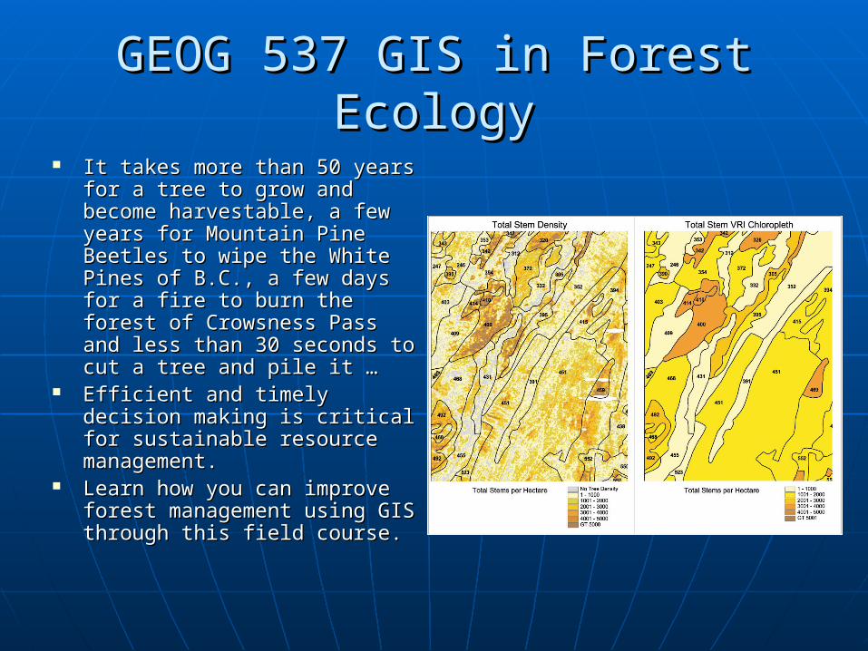
It takes more than 50 years It takes more than 50 years for a tree to grow and become for a tree to grow and become harvestable, a few years for harvestable, a few years for Mountain Pine Beetles to wipe Mountain Pine Beetles to wipe the White Pines of B.C., a few the White Pines of B.C., a few days for a fire to burn the days for a fire to burn the forest of Crowsness Pass and forest of Crowsness Pass and less than 30 seconds to cut a less than 30 seconds to cut a tree and pile it …tree and pile it …
Efficient and timely decision Efficient and timely decision making is critical for making is critical for sustainable resource sustainable resource management.management.
Learn how you can improve Learn how you can improve forest management using GIS forest management using GIS through this field course.through this field course.

GEOG 695.15 GEOG 695.15 GIS for Watershed HydrologyGIS for Watershed Hydrology
The increasing concern The increasing concern about water availability about water availability is now part of our is now part of our everyday life.everyday life.
Understanding the Understanding the hydrologic functions of hydrologic functions of watershed structure is watershed structure is central to water central to water resources resources management. GIS is management. GIS is excellent to generate excellent to generate some parameters some parameters needed to assess needed to assess watershed hydrology.watershed hydrology.

GEOG 557 Advanced Geographic GEOG 557 Advanced Geographic Information Systems: UrbanInformation Systems: Urban
The role of GIS in the urban The role of GIS in the urban realm is explored both realm is explored both theoretically and theoretically and practically. Topics will practically. Topics will relate to urban relate to urban management, design, management, design, planning, and research planning, and research drawn from a broad drawn from a broad spectrum of socio-economic spectrum of socio-economic issues facing urban areas. issues facing urban areas. Advanced analytical Advanced analytical approaches will be critically approaches will be critically examined within lectures examined within lectures and laboratories. A widely and laboratories. A widely used GIS package will be used GIS package will be used for laboratories and used for laboratories and student projects.student projects.

GEOG 599.28GEOG 599.28Environmental Decision SupportEnvironmental Decision Support
The course will examine critically the use of The course will examine critically the use of DSS for tackling environmental planning DSS for tackling environmental planning problems. Six DSS will be used.problems. Six DSS will be used.
Definite Selected environmental planning Definite Selected environmental planning problems will be identified and the ways that problems will be identified and the ways that DSS can assist in the reduction of chances of DSS can assist in the reduction of chances of making mistakes will be explained. making mistakes will be explained.
In a few words, you develop your ability to In a few words, you develop your ability to implement an INFORMATION system to a implement an INFORMATION system to a DECISION system. From GIS to ‘GDS’.DECISION system. From GIS to ‘GDS’.

GEOG 699.03GEOG 699.03Web and Location-Based GISWeb and Location-Based GIS
The World-Wide-Web The World-Wide-Web (WWW) is a useful tool (WWW) is a useful tool for the gathering and for the gathering and manipulation. Most manipulation. Most information that is information that is available in the world available in the world is now available over is now available over the Internet. Now the Internet. Now much the same is true much the same is true concerning GIS concerning GIS information.information.
Be part of it by Be part of it by learning Web-based learning Web-based GIS and make your GIS GIS and make your GIS a Global decision tool!a Global decision tool!
Related Documents