Political Map of South Asia Physical Map of South Asia.
Dec 27, 2015
Welcome message from author
This document is posted to help you gain knowledge. Please leave a comment to let me know what you think about it! Share it to your friends and learn new things together.
Transcript
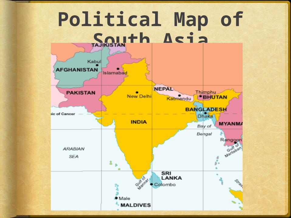
Political Map of South Asia
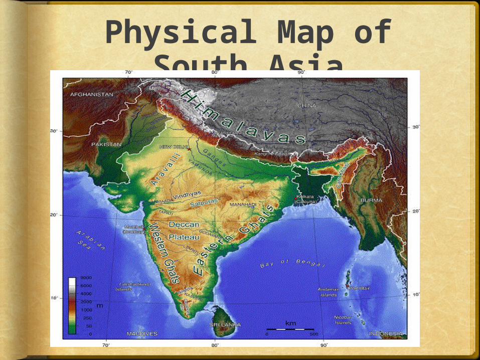
Physical Map of South Asia
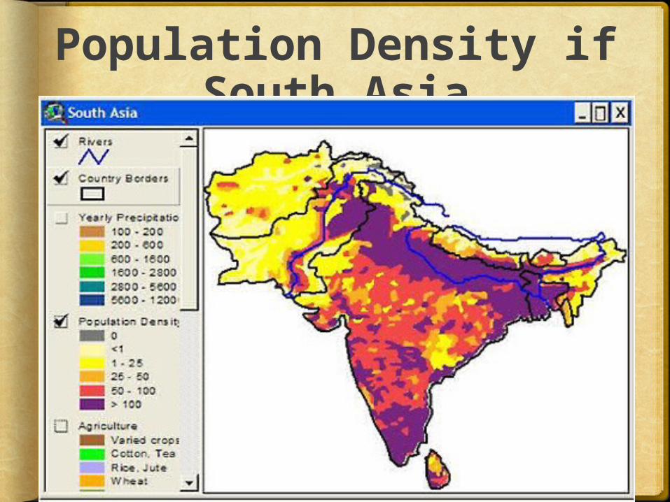
Population Density if South Asia
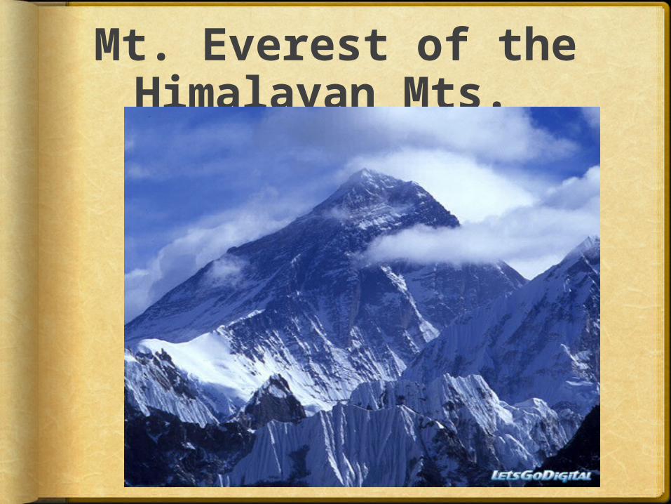
Mt. Everest of the Himalayan Mts.
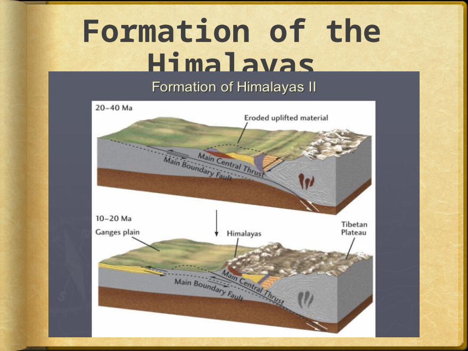
Formation of the Himalayas
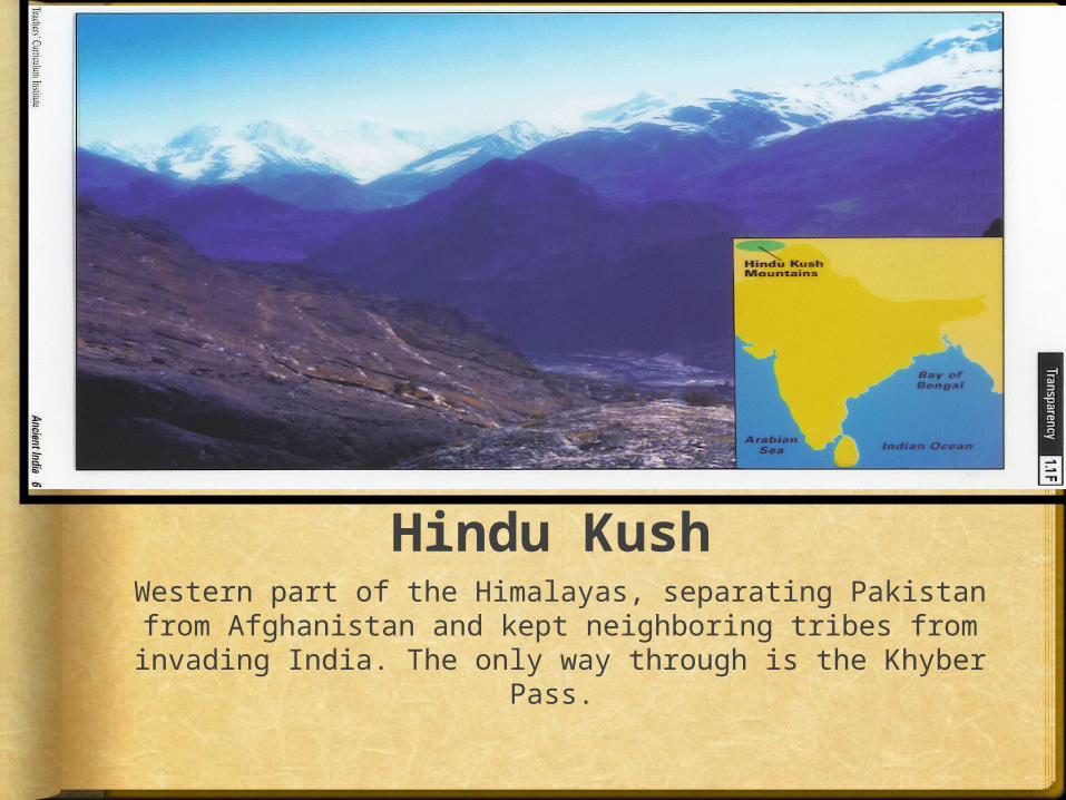
Hindu KushWestern part of the Himalayas, separating Pakistan from Afghanistan and kept neighboring tribes from invading India. The only way through is the Khyber
Pass.
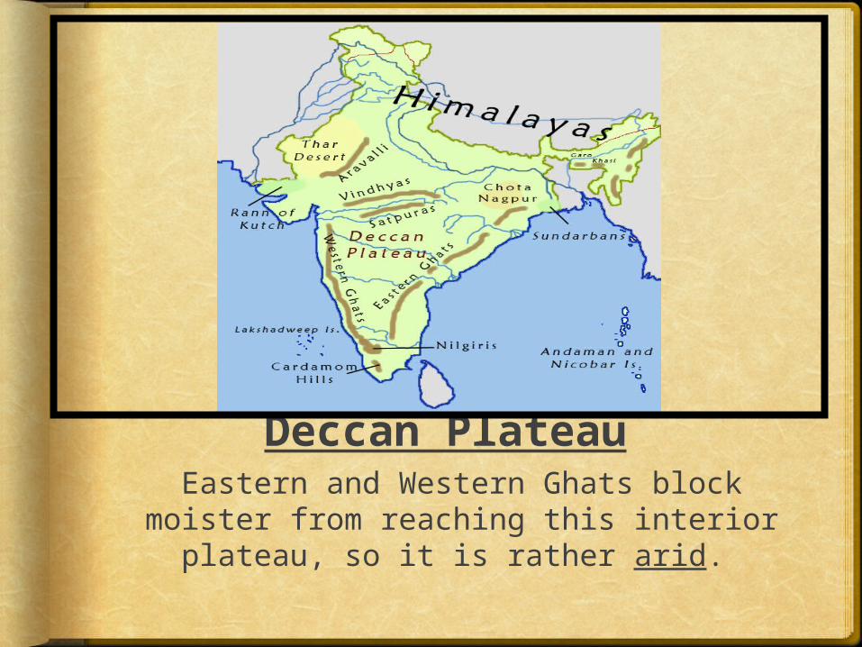
Deccan PlateauEastern and Western Ghats block
moister from reaching this interior plateau, so it is rather arid.
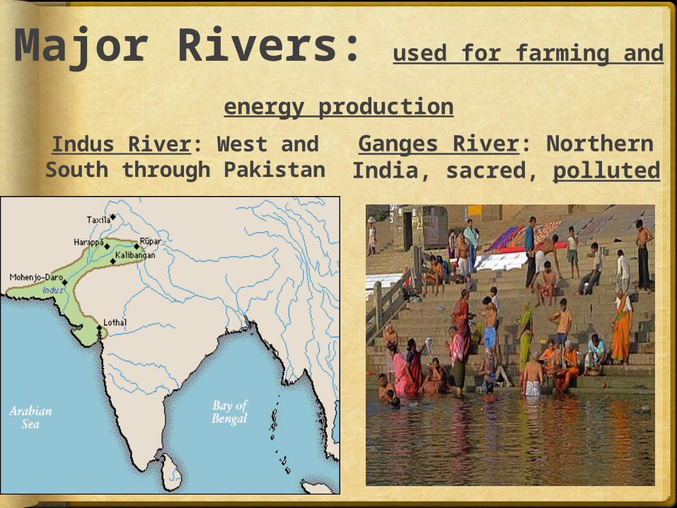
Major Rivers: used for farming and
energy production
Indus River: West and South through Pakistan
Ganges River: Northern India, sacred, polluted
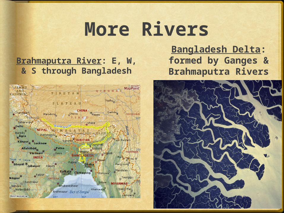
More Rivers
Brahmaputra River: E, W, & S through Bangladesh
Bangladesh Delta: formed by Ganges & Brahmaputra Rivers
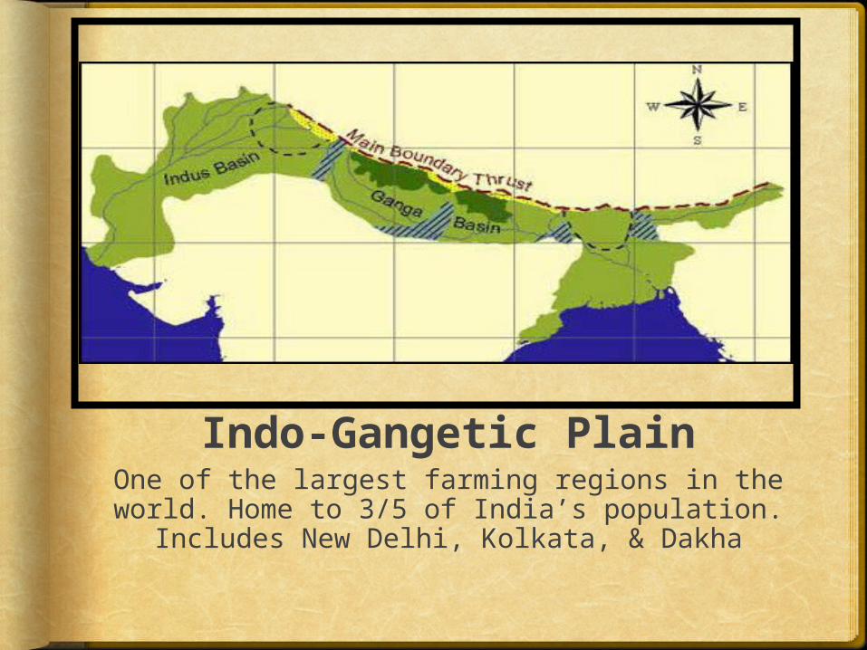
Indo-Gangetic PlainOne of the largest farming regions in the world. Home to 3/5 of India’s population.
Includes New Delhi, Kolkata, & Dakha
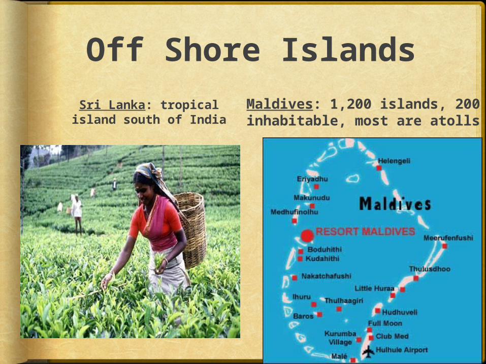
Off Shore Islands
Sri Lanka: tropical island south of India
Maldives: 1,200 islands, 200 inhabitable, most are atolls
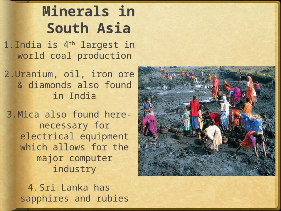
Minerals in South Asia
1.India is 4th largest in world coal production
2.Uranium, oil, iron ore & diamonds also found
in India
3.Mica also found here- necessary for
electrical equipment which allows for the
major computer industry
4.Sri Lanka has sapphires and rubies
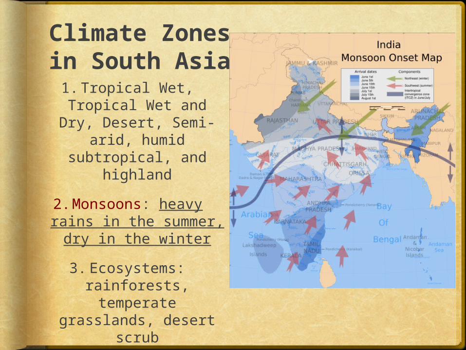
Climate Zones in South Asia1.Tropical Wet, Tropical Wet and
Dry, Desert, Semi-arid, humid
subtropical, and highland
2.Monsoons: heavy rains in the summer, dry in the winter
3.Ecosystems: rainforests, temperate
grasslands, desert scrub
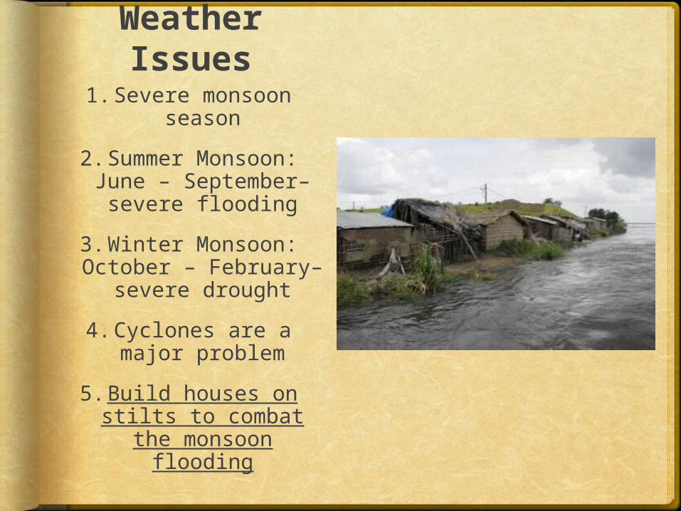
Weather Issues
1.Severe monsoon season
2.Summer Monsoon: June – September– severe flooding
3.Winter Monsoon: October – February–
severe drought
4.Cyclones are a major problem
5.Build houses on stilts to combat
the monsoon flooding
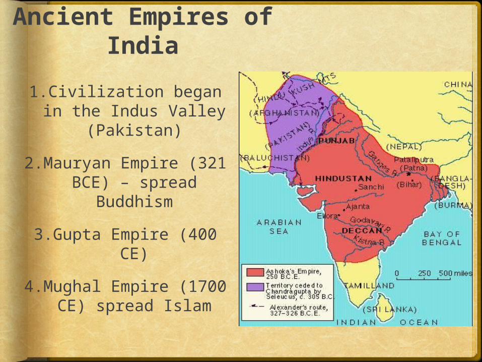
Ancient Empires of India
1.Civilization began in the Indus Valley
(Pakistan)
2.Mauryan Empire (321 BCE) – spread
Buddhism
3.Gupta Empire (400 CE)
4.Mughal Empire (1700 CE) spread Islam
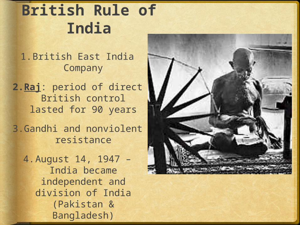
British Rule of India
1.British East India Company
2.Raj: period of direct British control
lasted for 90 years
3.Gandhi and nonviolent resistance
4.August 14, 1947 – India became
independent and division of India
(Pakistan & Bangladesh)
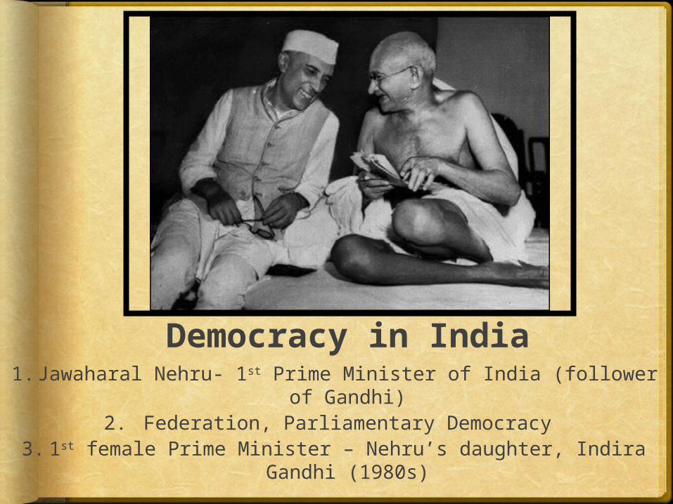
Democracy in India1. Jawaharal Nehru- 1st Prime Minister of India
(follower of Gandhi)2. Federation, Parliamentary Democracy
3.1st female Prime Minister – Nehru’s daughter, Indira Gandhi (1980s)
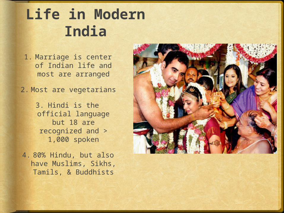
Life in Modern India
1. Marriage is center of Indian life and most are arranged
2.Most are vegetarians
3. Hindi is the official language
but 18 are recognized and >
1,000 spoken
4. 80% Hindu, but also have Muslims, Sikhs, Tamils, & Buddhists
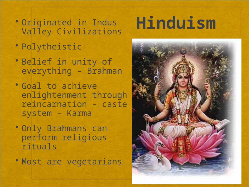
Hinduism Originated in Indus Valley Civilizations
Polytheistic
Belief in unity of everything – Brahman
Goal to achieve enlightenment through reincarnation – caste system – Karma
Only Brahmans can perform religious rituals
Most are vegetarians
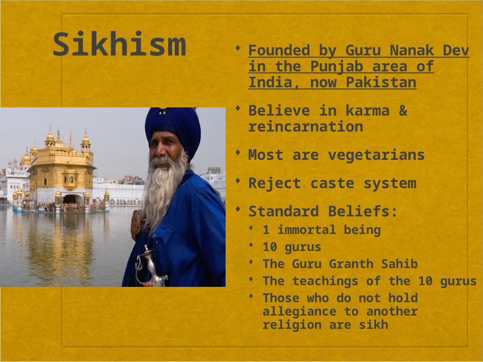
Sikhism Founded by Guru Nanak Dev in the Punjab area of India, now Pakistan
Believe in karma & reincarnation
Most are vegetarians
Reject caste system
Standard Beliefs: 1 immortal being 10 gurus The Guru Granth Sahib The teachings of the 10 gurus
Those who do not hold allegiance to another religion are sikh
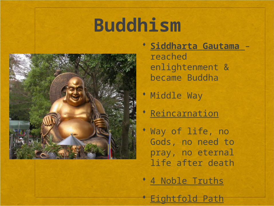
Buddhism Siddharta Gautama – reached enlightenment & became Buddha
Middle Way
Reincarnation
Way of life, no Gods, no need to pray, no eternal life after death
4 Noble Truths
Eightfold Path
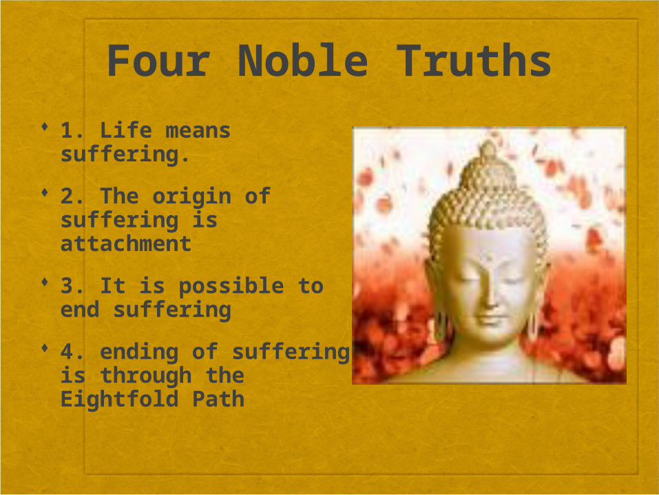
Four Noble Truths 1. Life means suffering.
2. The origin of suffering is attachment
3. It is possible to end suffering
4. ending of suffering is through the Eightfold Path
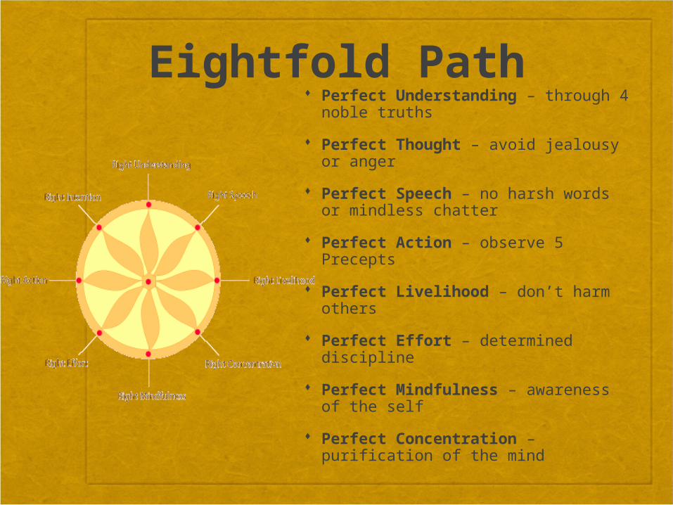
Eightfold Path Perfect Understanding – through 4 noble truths
Perfect Thought – avoid jealousy or anger
Perfect Speech – no harsh words or mindless chatter
Perfect Action – observe 5 Precepts
Perfect Livelihood – don’t harm others
Perfect Effort – determined discipline
Perfect Mindfulness – awareness of the self
Perfect Concentration – purification of the mind
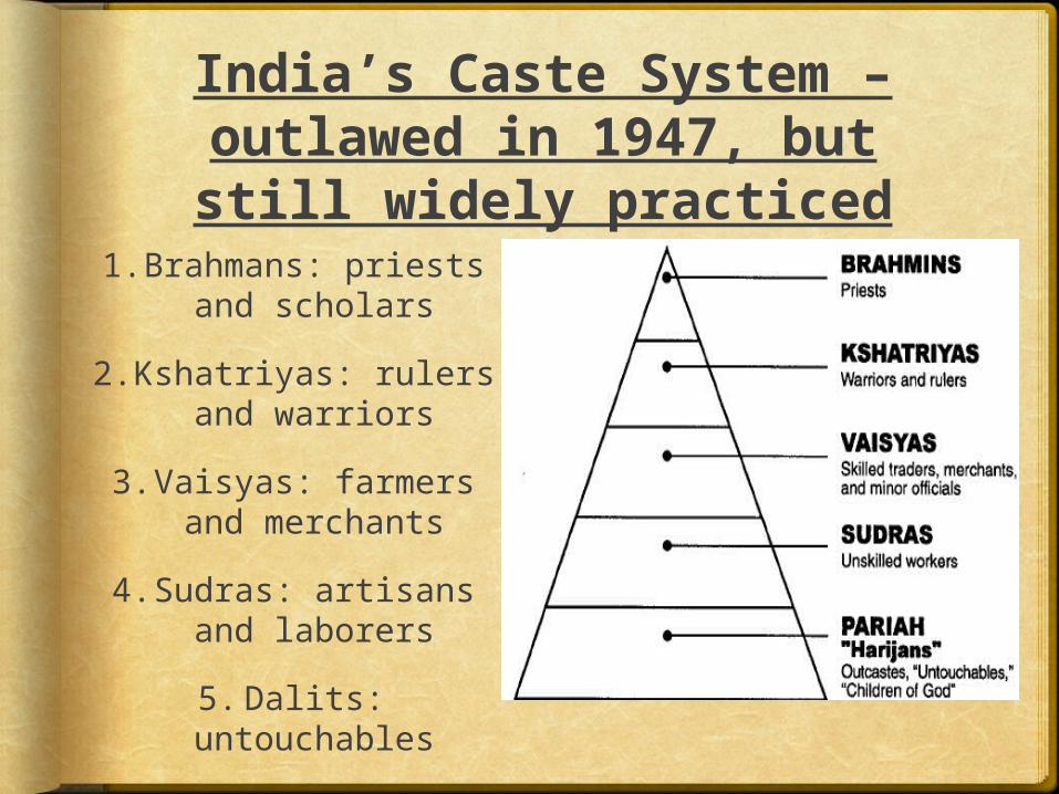
India’s Caste System – outlawed in 1947, but still widely practiced
1.Brahmans: priests and scholars
2.Kshatriyas: rulers and warriors
3.Vaisyas: farmers and merchants
4.Sudras: artisans and laborers
5.Dalits: untouchables
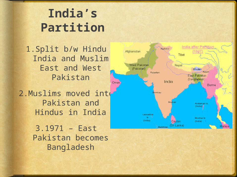
India’s Partition
1.Split b/w Hindu India and Muslim East and West
Pakistan
2.Muslims moved into Pakistan and
Hindus in India
3.1971 – East Pakistan becomes
Bangladesh
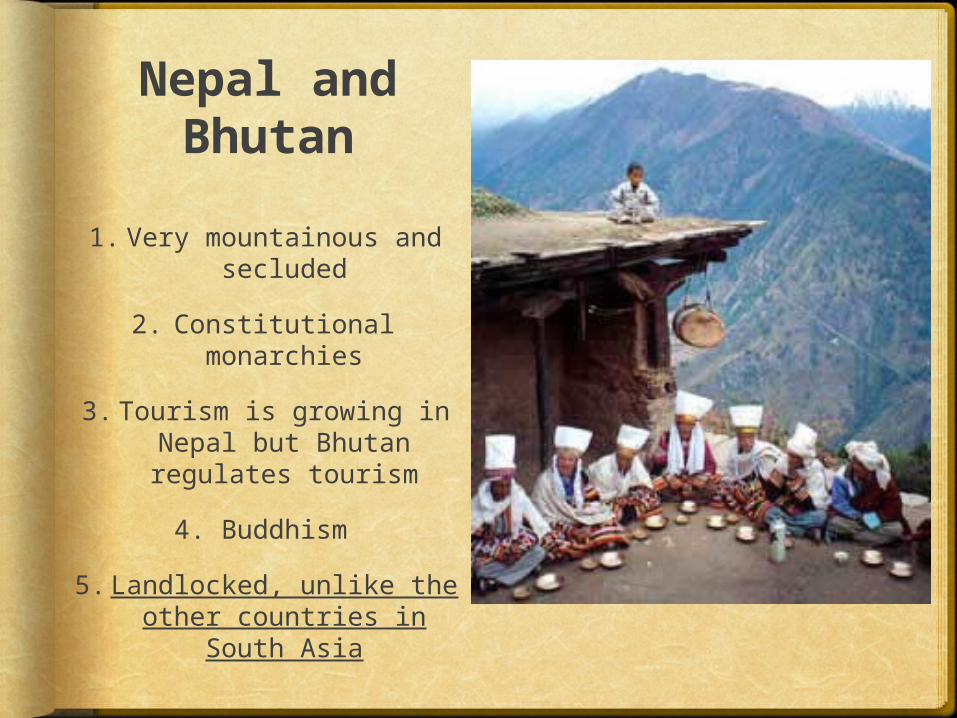
Nepal and Bhutan
1.Very mountainous and secluded
2. Constitutional monarchies
3.Tourism is growing in Nepal but Bhutan regulates tourism
4. Buddhism
5. Landlocked, unlike the other countries
in South Asia
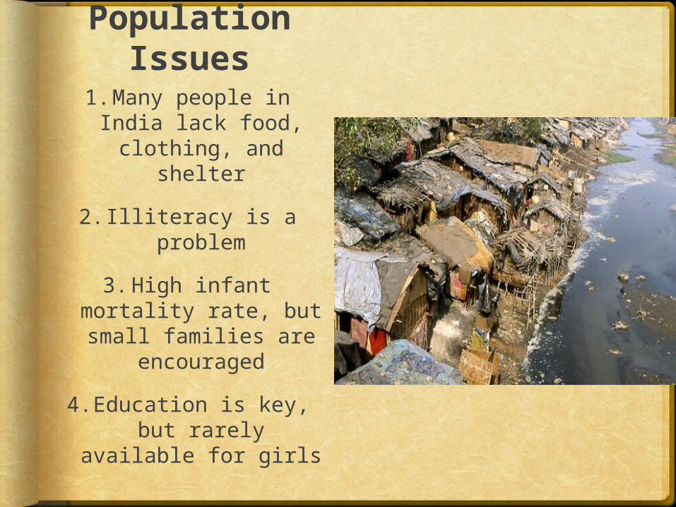
Population Issues
1.Many people in India lack food, clothing, and
shelter
2.Illiteracy is a problem
3.High infant mortality rate, but small families are
encouraged
4.Education is key, but rarely
available for girls
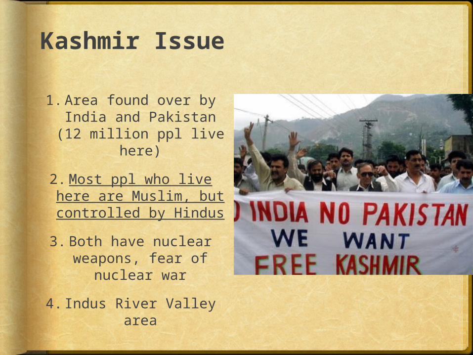
Kashmir Issue
1.Area found over by India and Pakistan (12 million ppl live
here)
2.Most ppl who live here are Muslim, but controlled by Hindus
3.Both have nuclear weapons, fear of
nuclear war
4.Indus River Valley area
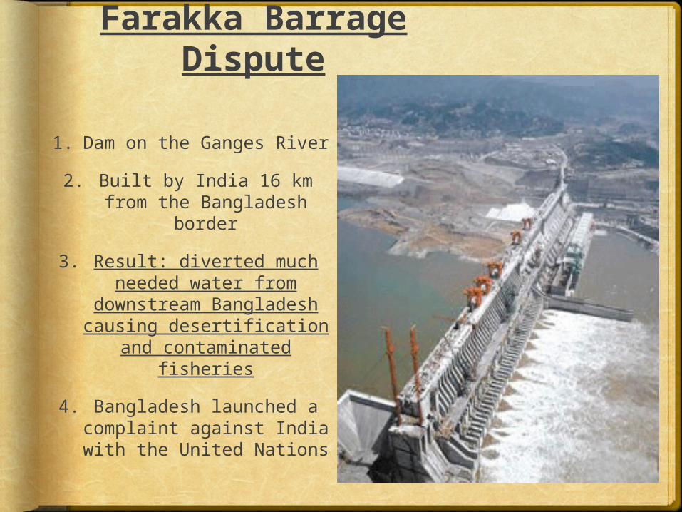
Farakka Barrage Dispute
1. Dam on the Ganges River
2. Built by India 16 km from the Bangladesh
border
3. Result: diverted much needed water from
downstream Bangladesh causing desertification
and contaminated fisheries
4. Bangladesh launched a complaint against India with the United Nations
Related Documents