Plane table surveying with contouring

Plane Table Surveying PPt
Jul 15, 2015
Welcome message from author
This document is posted to help you gain knowledge. Please leave a comment to let me know what you think about it! Share it to your friends and learn new things together.
Transcript

Plane table surveying with contouring

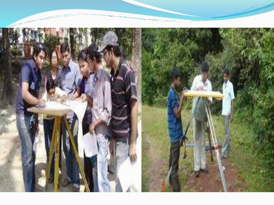
Plane Table Surveying- Plane table is a graphical methodof surveying in which
the field work and the plotting is done simultaneously.
- It is adopted in small mapping.
- It is also ideally suited to filling detail on a map already prepare and available on the drawing sheets.
- It can also be used to prepare a fresh map with the linear measurements being taken with a chain or tape.
Plane Table And Accessories

Plane Table And Tripod A simple plane table is a drawing board provided with
a ball and socket arrangement for leveling the table ,with an arrangement to fix the table to a tripod.

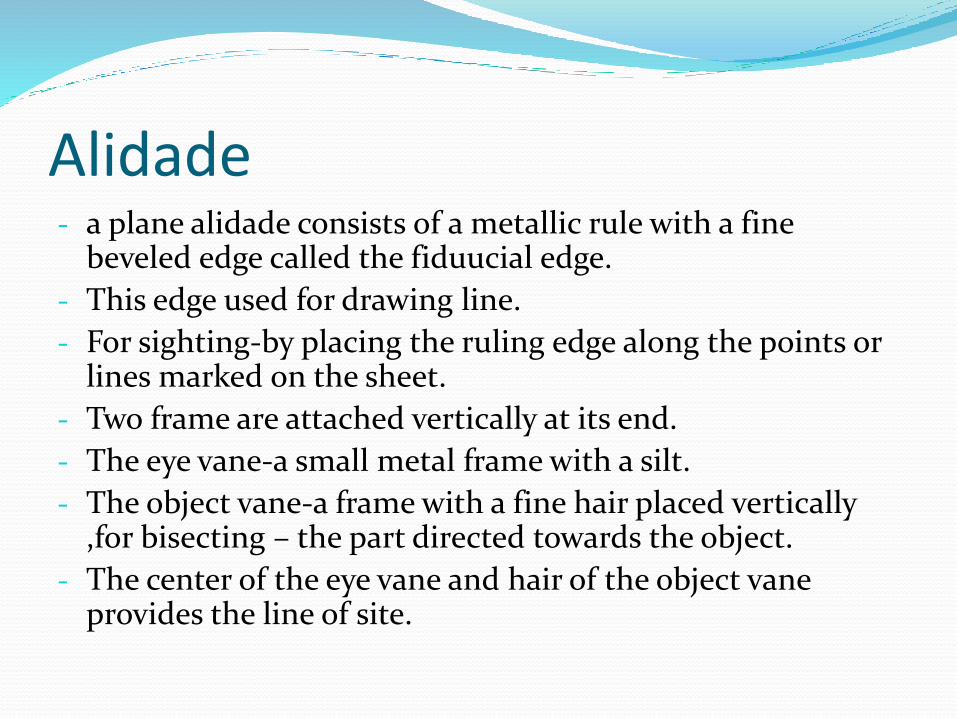
Alidade- a plane alidade consists of a metallic rule with a fine
beveled edge called the fiduucial edge.
- This edge used for drawing line.
- For sighting-by placing the ruling edge along the points or lines marked on the sheet.
- Two frame are attached vertically at its end.
- The eye vane-a small metal frame with a silt.
- The object vane-a frame with a fine hair placed vertically ,for bisecting – the part directed towards the object.
- The center of the eye vane and hair of the object vane provides the line of site.

Object Vane
Sight Vane
Fiducially Edge


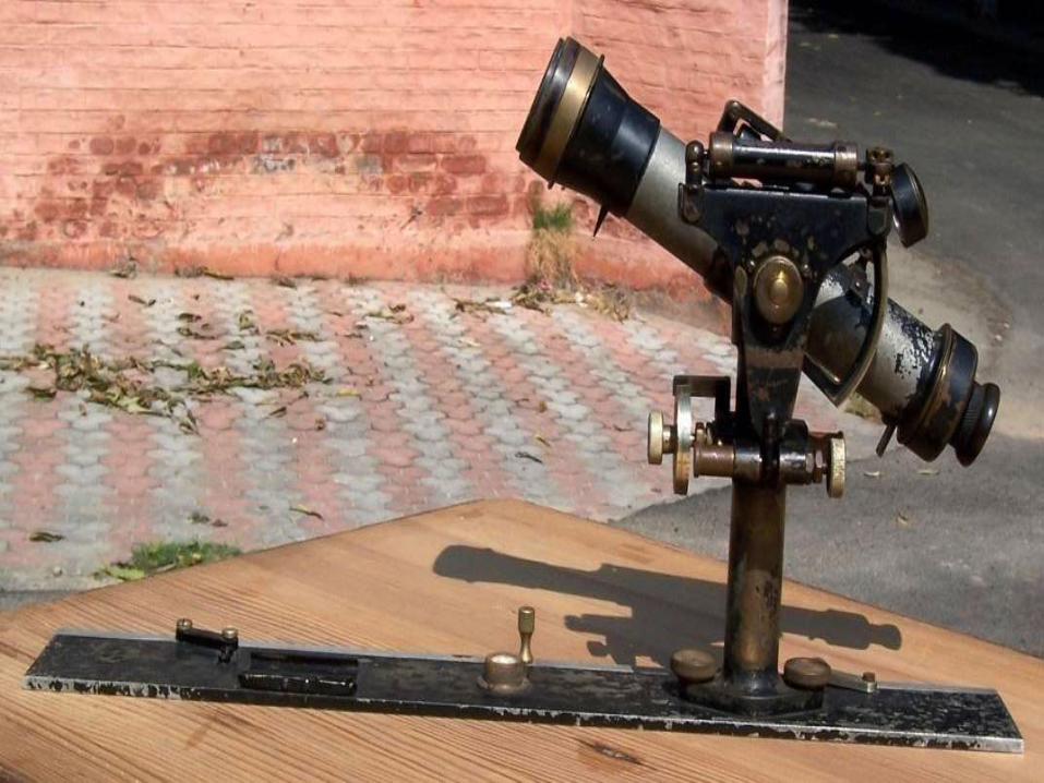
Telescopic AlidadeThe alidade which is fitted with a telescope is known
as a telescopic alidade.
It is used to take inclined sights.
It increases the range and accuracy of the sights.
It consists of a small telescope with a level tube.
A graduated scale is mounted on the horizontal axis.
One side of the metal ruler is used as the working edge along which lines are drawn.
The angles of elevation or depression can be read on the vertical circle.

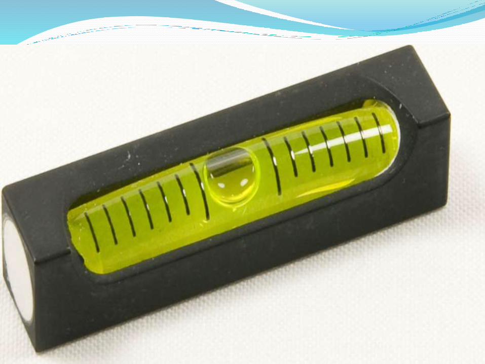
Spirit Level
Spirit level can be used to level the plane table.
It can be tubular level which can be placed in two perpendicular positions and leveled.


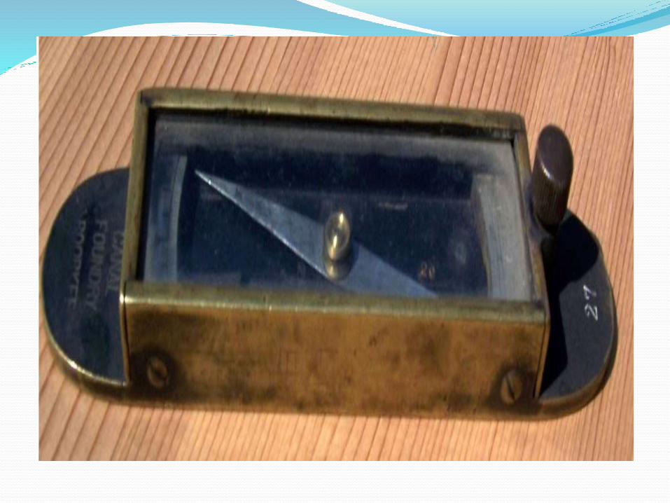
Trough Compass A compass is used for orienting the plane table when it
has to be used in more than one station.
When the table is shifted to another station ,the compass is placed along the meridian previously drawn and the table is rotated to make the needle read zero.
The table is then oriented to the same position it occupied at the previous station.
Plumbing fork The plumb bob is fitted on to a folded frame (fork).
The straight edge can be placed on the table and the bottom leg on the frame is under the table.
The top leg has a fine point which can be kept on a plotted point.

Plumbing Fork
Plane Tabling Methods The plane table can be used in four ways-
i) radiation
ii) intersection
iii) traversing
iv) resection
Plane table is generally used with the traverse drawn on a sheet for filling details or
Can also be used for doing a fresh survey.
These methods cover both these aspects of surveying with the plane table.

Radiation Method It requires the plane table to occupy a single station .
Orientation table is not required.
To conduct the survey of an area ,the table is kept at a convenient station P commanding a full view of the area to be surveyed.


Intersection Method This method requires setting the table up at minimum
of two stations.
Orientation is essential and be can done by back sighting.
Two station A and B are selected so that they command a full view of the area to be surveyed.

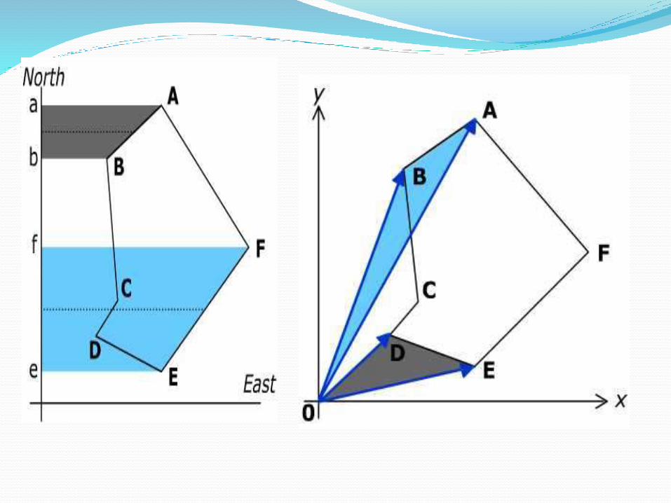
Traversing Method This method is used to connect the two or more
stations , however it is similar to the compass traversing but are done simultaneously.
Traversing is a method of surveying where by a series of lines are surveyed.
Traverse may be open or closed one.

Re-Section Method This is the method of orienting the table . a
characteristic feature of resection is that the objective is to plot the station occupied by the table on the sheet rather than obtaining the other stations or plotting details.
Two method of orienting the table
Method of back sighting
Method using trough compass
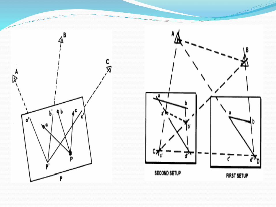

Two-Point Problem This is a special case of resection to obtain the position
of station occupied by the table ,given the plotted position of the two points.
State – to determine the position s of the station S occupied by the plane table, given the accurately plotted position ,p and q of the two points P and Q visible from the instrument station without occupying these two stations.
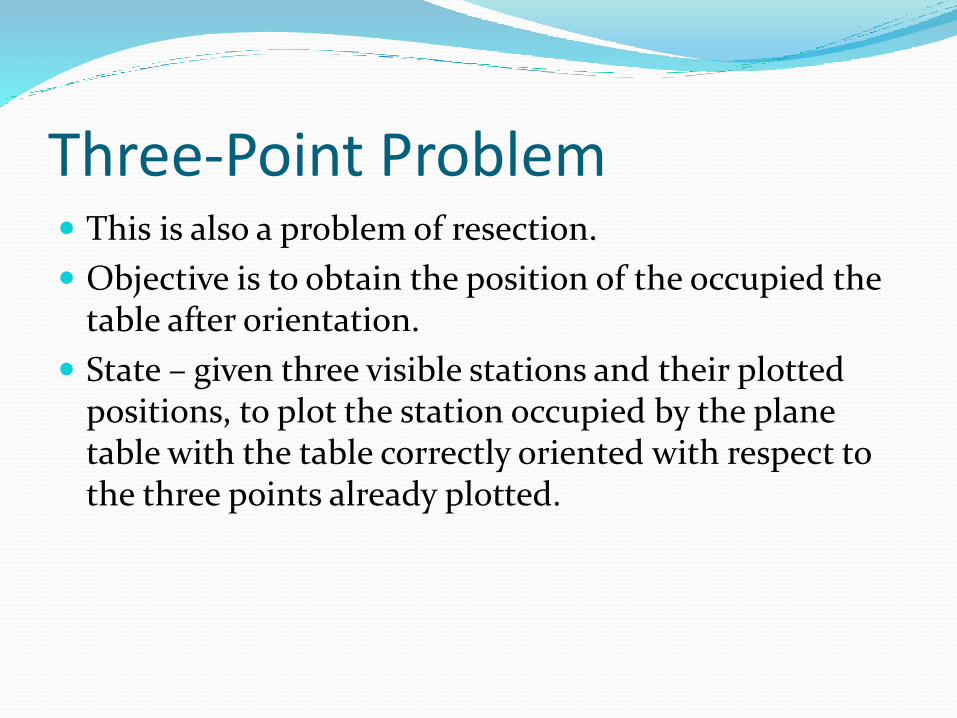
Three-Point Problem This is also a problem of resection.
Objective is to obtain the position of the occupied the table after orientation.
State – given three visible stations and their plotted positions, to plot the station occupied by the plane table with the table correctly oriented with respect to the three points already plotted.
Advantage Of Plane Table Surveying It is suitable for location of details as well as contouring for large scale
maps directly in the field. As surveying and plotting are done simultaneously in the field, chances
of getting omission of any detail get less. The plotting details can immediately get compared with the actual
objects present in the field. Thus errors as well as accuracy of the plot can be ascertained as the work progresses in the field.
Contours and specific features can be represented and checked conveniently as the whole area is in view at the time of plotting.
Only relevant details are located because the map is drawn as the survey progresses. Irrelevant details get omitted in the field itself.
The plane table survey is generally more rapid and less costly than most other types of survey.
As the instruments used are simple, not much skill for operation of instruments is required. This method of survey requires no field book.
Disadvantage Of Plane Table Surveying The plane table survey is not possible in unfavourable
climates such as rain, fog etc. This method of survey is not very accurate and thus
unsuitable for large scale or precise work. As no field book is maintained, plotting at different scale
require full exercise. The method requires large amount of time to be spent in
the field. Quality of the final map depends largely on the drafting
capability of the surveyor. This method is effective in relatively open country where
stations can be sighted easily .
Related Documents


![[PPT]Chapter #1: Basics of Surveying - Faculty Personal ...faculty.kfupm.edu.sa/CE/kaluwfi/Surveying/CE260 CH 1.ppt · Web viewChapter #1: Basics of Surveying 1.1 Surveying Defined](https://static.cupdf.com/doc/110x72/5abdf95a7f8b9aa3088c4dc9/pptchapter-1-basics-of-surveying-faculty-personal-ch-1pptweb-viewchapter.jpg)