DRAFT FINDING OF NO ADVERSE EFFECT WITHOUT STANDARD CONDITIONS FOR THE PICO RIVERA REGIONAL BIKEWAY PROJECT, PICO RIVERA, LOS ANGELES COUNTY, CALIFORNIA FEDERAL AID NUMBER: ATPL 5351(032) Prepared for: California Department of Transportation – District 7 100 South Main Street Los Angeles, California 90012 Approved by: ___________________________________________ To be determined Branch Chief Environmental Studies California Department of Transportation, District 7 Reviewed by: _____________________________________________ Claudia Harbert Associate Environmental Planner PQS – Principal Architectural Historian California Department of Transportation, District 7 Prepared by: ____________________________________________ Pamela Daly, M.S. Principal Architectural Historian Daly & Associates 2242 El Capitan Drive, Riverside, CA 92506 (951) 369-1366 MAY 2019

Welcome message from author
This document is posted to help you gain knowledge. Please leave a comment to let me know what you think about it! Share it to your friends and learn new things together.
Transcript
DRAFT FINDING OF NO ADVERSE EFFECT WITHOUT STANDARD
CONDITIONS
FOR THE
PICO RIVERA REGIONAL BIKEWAY PROJECT, PICO RIVERA, LOS ANGELES COUNTY, CALIFORNIA
FEDERAL AID NUMBER: ATPL 5351(032)
Prepared for:
California Department of Transportation – District 7 100 South Main Street
Los Angeles, California 90012
Approved by:
___________________________________________ To be determined
Branch Chief Environmental Studies
California Department of Transportation, District 7
Reviewed by:
_____________________________________________ Claudia Harbert
Associate Environmental Planner PQS – Principal Architectural Historian
California Department of Transportation, District 7
Prepared by:
____________________________________________ Pamela Daly, M.S.
Principal Architectural Historian Daly & Associates
2242 El Capitan Drive, Riverside, CA 92506 (951) 369-1366
MAY 2019
FNAE for Pico Rivera Regional Bikeway Project
ii
TABLE OF CONTENTS
INTRODUCTION ....................................................................................................................................................... 1
DESCRIPTION OF THE UNDERTAKING ............................................................................................................ 2
AREA OF POTENTIAL EFFECTS .................................................................................................................................... 3
PUBLIC PARTICIPATION ....................................................................................................................................... 4
DESCRIPTION OF HISTORIC PROPERTIES ...................................................................................................... 4
APPLICATION OF THE CRITERIA OF ADVERSE EFFECT ........................................................................... 6 CONDITIONS PROPOSED ....................................................................................................................................... 8
CONCLUSION ............................................................................................................................................................ 9
Attachment A: Project Maps, including APE map Attachment B: Project plan aerial view Attachment C: Eligibility correspondence from Caltrans Attachment D: Photographs of Project site Attachment E: Correspondence to Interested Parties
FNAE for Pico Rivera Regional Bikeway Project
1
INTRODUCTION
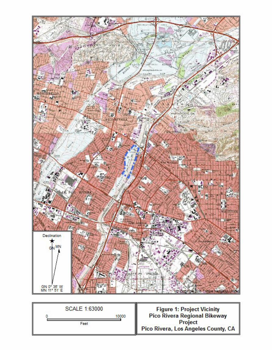
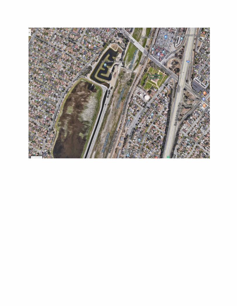
The City of Pico Rivera, in cooperation with the California Department of Transportation (Caltrans), proposes to construct a 1.5‐mile bicycle facility along Mines Avenue, a bike/pedestrian bridge over the San Gabriel River, and a bicycle facility along Dunlap Crossing Road. The Pico Rivera Regional Bikeway Project (Project) would construct a Class IV separated bikeway along Mines Avenue from Paramount Boulevard in the west to the existing Class I bike trail along the San Gabriel River in the east. The Project also includes a new bridge structure located approximately 2,600 feet north of Mines Avenue spanning the San Gabriel River, and Class I and II bike lanes along Dunlap Crossing Road from the San Gabriel River to Norwalk Boulevard. The alignment along Dunlap Crossing Road will connect an existing publicly accessible bike path on the west side of the San Gabriel River to the San Gabriel River Mid Trail. The proposed improvements on Mines Avenue include but are not limited to: pavement reconstruction; installation of bioswales, stormwater catch basins and other improvements such as, reconfiguration of parking lanes; upgrading street lights; traffic signal modifications at Rosemead Boulevard and Mines Avenue; signage; striping; utility relocation; and landscaping. The proposed project is located just south of central Pico Rivera in the Parkview Subdivision (see Attachment A, Figures 1 and 2). Due to flood events, dating from the time the San Gabriel Valley was settled in the mid-1800s, efforts were made from the early 1900s to control the San Gabriel River during high water events that endangered life and property. The San Gabriel River Channel, as seen today was developed in the 1930s by Los Angeles County Flood Control District, and repaired, rehabilitated, and maintained by Los Angeles Department of Public Works since that time. The project will receive construction funding provided by the Active Transportation Project and Urban Rivers Grant Program, and is therefore subject to review under Section 106 of the National Historic Preservation Act (NHPA) and its implementing regulations codified at 36 CFR Part 800, and the January 2014 First Amended Programmatic Agreement Among the Federal Highway Administration, the Advisory Council on Historic Preservation, the California State Historic Preservation Officer, and the California Department of Transportation Regarding Compliance with Section 106 of the National Historic Preservation Act, as it pertains to the Administration of the Federal-Aid Highway Program in California (Section 106 Programmatic Agreement [PA]). Section 106 compliance activities for the project include a Historic Property Survey Report (HPSR) dated May 2019 (VCS Environmental). Caltrans finds there appear to be two potential historic districts within the project Area of Potential Effects (APE) that may be adversely affected by the proposed undertaking. Caltrans Cultural Studies Office has approved assumption of eligibility for the San Gabriel River Channel for the purposes of this Project. The San Gabriel River Channel appears to contribute to two potential historic districts: the San Gabriel River System and/or the larger Los Angeles County Flood Control District. The Los Angeles County Flood Control District, as a whole appears, significant under Criteria A, and has been determined eligible for listing in the National Register of Historic Places by Caltrans as part of compliance with Section 106 for the proposed undertaking under Stipulation VIII.C.(4) of the Section 106 PA. Project actions associated with the undertaking do not have the potential for causing permanent adverse effects to a segment of the San Gabriel River Channel resulting in that segment to no longer be considered a contributing element to a historic linear resource.
FNAE for Pico Rivera Regional Bikeway Project
2
This Finding of No Adverse Effects with No Standard Conditions document for the segment of the San Gabriel River Channel within the APE is the result of the analysis of effects based upon application of the Criteria of Adverse Effect set forth at 36 CFR Part §800.5, and it follows the guidelines for documentation at 36 CFR §800.11 in accordance with Section 106 PA Stipulation X (Assessment of Effects) and Stipulation XVIII (Documentation). In applying the Criteria of Adverse Effect, FHWA in conjunction with the City of Pico Rivera, proposes that a finding of No Adverse Effect with No Standard Conditions is appropriate for the undertaking as a whole and is seeking SHPO’s concurrence in the finding, pursuant to 36 CFR 800.5(c) and Section 106 PA Stipulation X.B.1.b.
DESCRIPTION OF THE UNDERTAKING The City of Pico Rivera, in cooperation with Caltrans, proposes to construct a 1.5‐mile bicycle facility along Mines Avenue, a bike/pedestrian bridge over the San Gabriel River, and a bicycle facility along Dunlap Crossing Road. See Figures 1 and 2 depicting the Project Vicinity and Project Location, respectively, in Attachment A. The Project would construct a Class IV separated bikeway along Mines Avenue from Paramount Boulevard in the west to the existing Class I bike trail along the San Gabriel River in the east. The Project also includes a new bridge structure located approximately 2,600 feet north of Mines Avenue spanning the San Gabriel River, and Class I and II bike lanes along Dunlap Crossing Road from the San Gabriel River to Norwalk Boulevard. The alignment along Dunlap Crossing Road will connect an existing publicly accessible bike path on the west side of the San Gabriel River to the San Gabriel River Mid Trail. See Figure 3 depicting the Project APE, in Attachment A. The proposed improvements on Mines Avenue include but are not limited to: pavement reconstruction; installation of bioswales, stormwater catch basins and other improvements such as, reconfiguration of parking lanes; upgrading street lights; traffic signal modifications at Rosemead Boulevard and Mines Avenue; signage; striping; utility relocation; and landscaping. The Project would expand the recreational aspects of Paseo del Rio at the Rio Hondo Spreading Grounds. The Paseo del Rio at the Rio Hondo Coastal Basins Spreading Grounds consists of a bike and pedestrian trail around the perimeter of the spreading grounds, wrought iron fencing, landscaping and a shaded rest area. When fully completed, the Paseo will include six miles of trails. Educational programs, field trips and group visitors may also become a part of the project after its completion. The current trail connects the existing County LARIO trail with the City's bike lane along Mines Avenue. Access to the Paseo’s trail is provided at Mines Avenue and Paramount Boulevard. The project is being developed in conjunction with the San Gabriel and Los Angeles Rivers Watershed and Open Space Plan in order to promote a regional river parkway that connects neighboring jurisdictions. Public parking is available near the spreading grounds on residential streets. The LA County MTA and Montebello Bus Lines also provide fixed-route bus service near the spreading grounds along Paramount, Washington, Whittier and Rosemead Boulevards.1
The spreading grounds are open to the public 24 hours a day, seven days a week, and are accessible free of charge. Full and partial closure of the spreading grounds to the public will exist during the rainy season when the water level in the spreading basins poses a serious threat to public safety. 1 Text from the City of Pico Rivera: “Paseo del Rio” http://www.pico-rivera.org/thingstodo/rio.asp
FNAE for Pico Rivera Regional Bikeway Project
3
The San Gabriel River was channelized for incorporation into the Los Angeles County Flood Control System, built between 1924 and 1942, to control the flow of water from the San Gabriel Mountains and create a conduit to safely move the water to the Pacific Ocean during the seasonal rains. The river channel remains open at all times in this section of the river, while diversion features are used to move water in-and-out of the immediately adjacent spreading grounds. AREA OF POTENTIAL EFFECTS
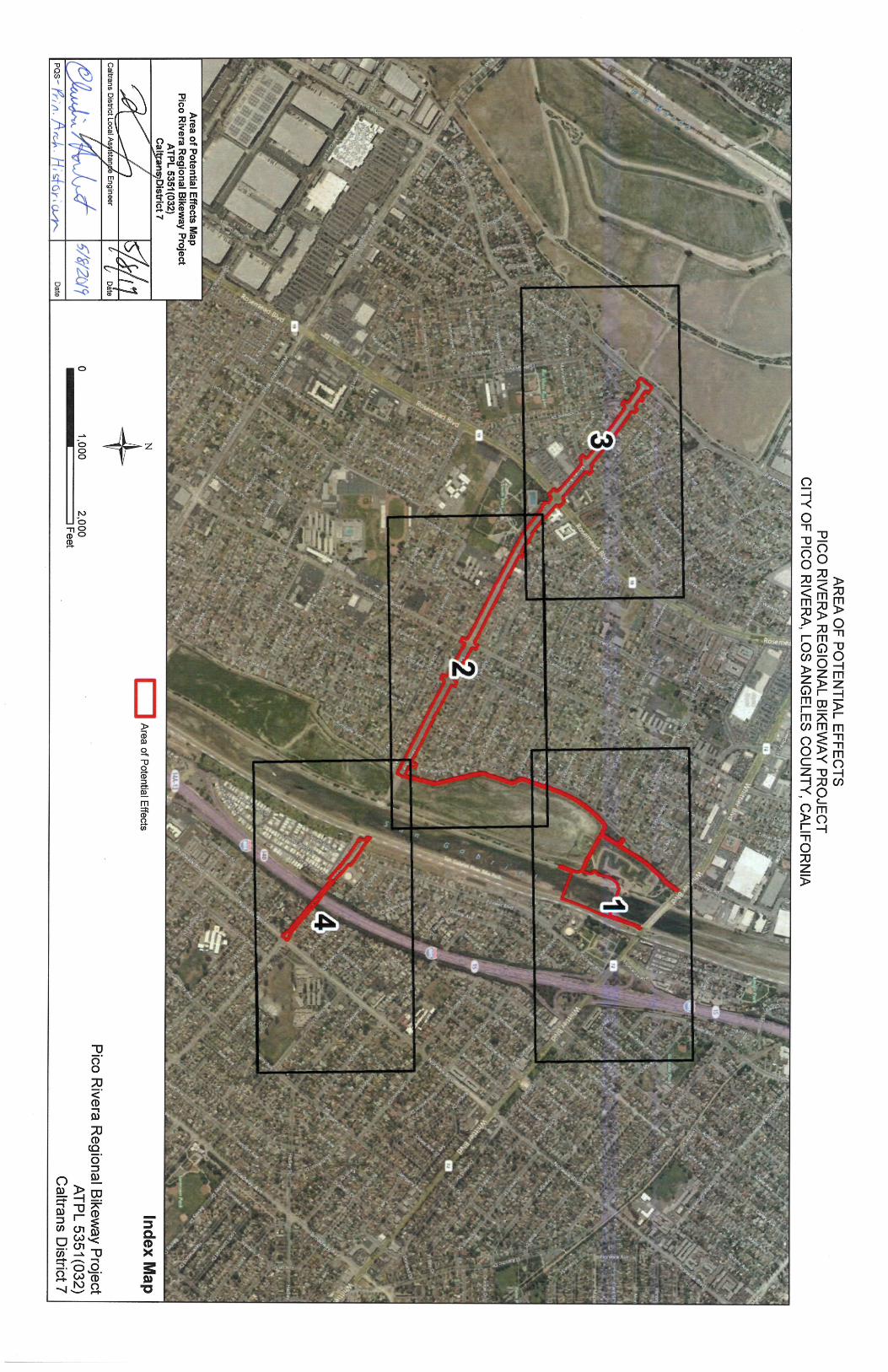
The APE boundary was established in consultation with the City of Pico Rivera and Caltrans District 7 personnel Claudia Harbert, PQS: Principal Architectural Historian, and Henry Nguyen, Local Assistance Engineer. The APE delineation was signed on May 8, 2019 (see APE exhibit in Attachment A).
The Project APE occurs at an elevation of approximately 44.5 meters (146 feet) to 48.7 meters (160 feet) above mean sea level (msl) within predominantly developed land located along a portion of the San Gabriel River and existing streets and bike trails.
The APE was established as the footprint of the project disturbance area that includes the entirety of Mines Avenue, extending from Paramount Boulevard eastward to the San Gabriel River, and along a short segment of Dunlap Crossing Road on the east side of the river to Norwalk Road. The proposed bike path on Mines Avenue will extend down the middle/median of the street, with the dual bioswales located on both sides of the bike path. The APE also includes the existing bicycle path from the eastern end of Mines Avenue on the west side of the river, north along the Spreading Grounds to the San Gabriel River Spreading Basins Trail.
Here the Spreading Basins Trail (and APE) splits – the eastern fork of the Spreading Basins Trail terminates at the San Gabriel River Bike Path, which is the future location of the west end of the proposed bridge. The northern fork of the Spreading Basins Trail extends north a short distance ending at the access gate at Whittier Boulevard. The APE also encompasses a portion of the San Gabriel River Flood Control Channel itself, south of the existing drop structure, and finally, a short section of the existing San Gabriel River Bike Path on the east bank of the river.
While all construction work within the river channel will occur nearest the proposed bridge site, the APE has been extended northward to the drop structure to allow heavy construction equipment room to maneuver and park and equipment to be stored nearest the location of work if necessary. Those areas of the APE within which are US Army Corps of Engineers’ delineated Waters of the United States are also shown on the APE map.
All project impacts, and any potential impacts to cultural resources will occur within the project footprint.
Proposed excavations that have the potential to affect cultural resources will include:
(1) grading of Mines Avenue up to a depth of four feet below the present surface in order to create the inverted road, bike trail, and bioswales;
(2) grading and excavation into each channel wall for the construction of the bridge buttresses;
(3) access ramps for construction equipment built into the channel;
(4) drilling with augers of two, 7-foot diameter holes, to a maximum depth of 15 feet, for the placement of two, 7-foot diameter reinforced concrete pier columns.
FNAE for Pico Rivera Regional Bikeway Project
4
PUBLIC PARTICIPATION Interested Parties: The following organizations were contacted in an effort to obtain their comments or concerns about the proposed project. Letters were sent to the following organizations on April 24, 2019 (See Attachment E). As of the date of this report, no comments have been received from the organizations listed below:
1. Friends of the San Gabriel River 2. San Gabriel & Lower Los Angeles Rivers and Mountains Conservancy 3. Council for Watershed Health 4. Friends of Pio Pico [State Park]
Consulting Parties: The following government agencies are active participants in the proposed project:
1. Los Angeles County Department of Public Works/Los Angeles County Flood Control District; the San Gabriel River is a tributary of the greater flood control system under the control of the Los Angeles County Department of Public Works.
2. U. S. Army Corps of Engineers; the proposed project requires the City of Pico Rivera apply for a Section 408 permit to build within the San Gabriel River channel.
Public Meetings: To our knowledge, information about the proposed project has not been provided by the City of Pico Rivera to consulting parties or to the general public.
DESCRIPTION OF HISTORIC PROPERTIES As the greater Los Angeles area became settled after 1850, the San Gabriel Mountains became a source of gravel, rock, and sand, to build houses, roads, bridges, and other structures, throughout Los Angeles County. The San Gabriel River basin continues to be mined today by such companies as United Rock Products, who have been at their Irwindale location since 1916.2 The San Gabriel River was a constant source of frustration for those living downstream as major rain storms could cause the river to change course and destroy railroad bridges, roads, and personal property.3 Following devastating floods in the 1910s, the Los Angeles County Flood Control District was created by the Los Angeles County Board of Supervisors in 1915.
To protect the most populated communities located down slope of the San Gabriel Mountains, a $35 million bond measure was passed in May 1924 to have the Flood Control District construct dams in a number of places in the San Gabriel Mountains, including on the San Gabriel River. The San Gabriel River dam that was proposed would be 425 feet high with a reservoir capacity of 293,000 acre feet, and built for a cost of $25,000,000.4 (This design of this dam was found to be unsafe and never built.)
It was decided instead, in 1931, to build a series of three dams along the San Gabriel River to break the flow of water during sustained rainfall events.5 The associated “rectification” (realignment) of the San Gabriel River would include the creation of a series of gravel reservoirs located downstream to capture runoff and refresh the water table along the rivers route.6 The river channel itself, south of Whittier Narrows was only controlled with limited sections of piling and wire fencing, sometimes on only one side 2 United Rock Products; http://www.unitedrock.com/ 3 Los Angeles Times. “Peace Nears Water Wars”, February 7, 1907. 4 Los Angeles Times. “To Hold the Floods in Leash” January 1, 1925. 5 Los Angeles Times. “Old Dam Fund Use Voted”, August 27, 1931. 6 Ibid.
FNAE for Pico Rivera Regional Bikeway Project
5
of the river.7 In 1935, Los Angeles County requested funds from the Public Works Administration for $9,855,000 to have the entire river channel south of Foothill Boulevard channelized for future flood control.8
The San Gabriel River is the central backbone of the San Gabriel River Watershed—an area that is drained by the river and its tributaries. Most of the river lies in southeastern Los Angeles County, bordering San Bernardino County, but a small section crosses northern Orange County. The San Gabriel River runs approximately 58 miles from the Cogswell Dam in the Angeles National Forest to the Los Cerritos wetlands system, just upstream of the river’s mouth at the Pacific Ocean.9
Character-defining features of the segment of the San Gabriel River channel within the APE as based on existing conditions:
• Earthen, trapezoidal designed flood control channel with rip-rap lined walls
• Sand and gravel floored channel
• Alignment of the canal
• Depth of the river channel
• Functions as a conduit to channel excess water from the San Gabriel River Dams to the Pacific Ocean
• Engineering design is integral to the proper function of this segment of the flood control system Per Section 106 PA Stipulation VIII.C.4, District 7 would like to request an assumption of eligibility for the National Register for the San Gabriel River Channel for the purposes of the Pico Rivera Regional Bikeway Project only (See correspondence in Attachment C). San Gabriel River Channel: The Pico Rivera Regional Bikeway Project APE intersects with the San Gabriel River Channel in one location, 2600 feet north of Mines Avenue. The approximate 100-foot wide segment of the San Gabriel River Channel located within the APE does not appear individually eligible for listing in the National Register of Historic Places (NRHP). (See photographs in Attachment D) However, for the purposes of this undertaking, this segment does appear to contribute to two potential historic districts: the San Gabriel River System and/or the larger Los Angeles County Flood Control District. Neither resource has been evaluated as a whole. Full evaluation of the entire San Gabriel River System and the Los Angeles County Flood Control District are beyond the scope of a reasonable level of effort for this undertaking due to their large size and the limited potential for effects as a result of the project.
The Los Angeles County Flood Control District as a whole appears significant under Criteria A/1 and the San Gabriel River System does appear to have played a critical role within the overall county-wide district, allowing for and encouraging the development of Los Angeles through consistent, effective flood control. The San Gabriel River System, inclusive of the San Gabriel River Channel, is an integral part of the overall Los Angeles County Flood Control District, and directly resulted in the development of the flood plain adjacent to the once-unpredictable San Gabriel River. Additional research needs to be completed to determine a concise period of significance, but based on preliminary research it would span from 1936 through ca. 1960 during the primary phase of construction for the potential districts. 7 Los Angeles Times. “Flood Control Need Detailed”, October 11, 1931. 8 Los Angeles Times. “Flood Work Pleas Filed”, December 12, 1935. 9 Moore Iacofano Goltsman, Inc. “A Common Thread Rediscovered: San Gabriel River Corridor Master Plan”. Prepared for the County of Los Angeles Department of Public Works; June 2006.
FNAE for Pico Rivera Regional Bikeway Project
6
APPLICATION OF THE CRITERIA OF ADVERSE EFFECT In accordance with the Criteria of Adverse Effect set forth at 36 CFR Part §800.5, adverse effects on the segment of the San Gabriel River Channel within the project APE has been assessed by applying the following criteria developed by the Advisory Council on Historic Preservation (ACHP).
Criteria of adverse effect. An adverse effect is found when an undertaking may alter, directly or indirectly, any of the characteristics of a historic property that qualify the property for inclusion in the National Register in a manner that would diminish the integrity of the property’s location, design, setting, materials, workmanship, feeling, or association. Consideration shall be given to all qualifying characteristics of a historic property, including those that may have been identified subsequent to the original evaluation of the property’s eligibility for the National Register. Adverse effects may include reasonably foreseeable effects caused by the undertaking that may occur later in time, be farther removed in distance or be cumulative. (36 CFR Part 800.5(a) (1))
Adverse effects on historic properties (36 CFR §800.5(a) (2)) include, but are not limited to:
(i) Physical destruction of or damage to all or part of the property;
(ii) Alteration of a property, including restoration, rehabilitation, repair, maintenance, stabilization, hazardous material remediation and provision of handicapped access, that is not consistent with the Secretary’s Standards for the Treatment of Historic Properties (36 CFR part 68) and applicable guidelines;
(iii) Removal of the property from its historic location;
(iv) Change of the character of the property’s use or of physical features within the property’s setting that contribute to its historic significance;
(v) Introduction of visual, atmospheric or audible elements that diminish the integrity of the property’s significant historic features;
(vi) Neglect of a property which causes its deterioration, except where such neglect and deterioration are recognized qualities of a property of religious and cultural significance to an Indian tribe or Native Hawaiian organization; and
(vii) Transfer, ease, or sale of property out of Federal ownership or control without adequate and legally enforceable restrictions or conditions to ensure long-term preservation of the property’s historic significance.
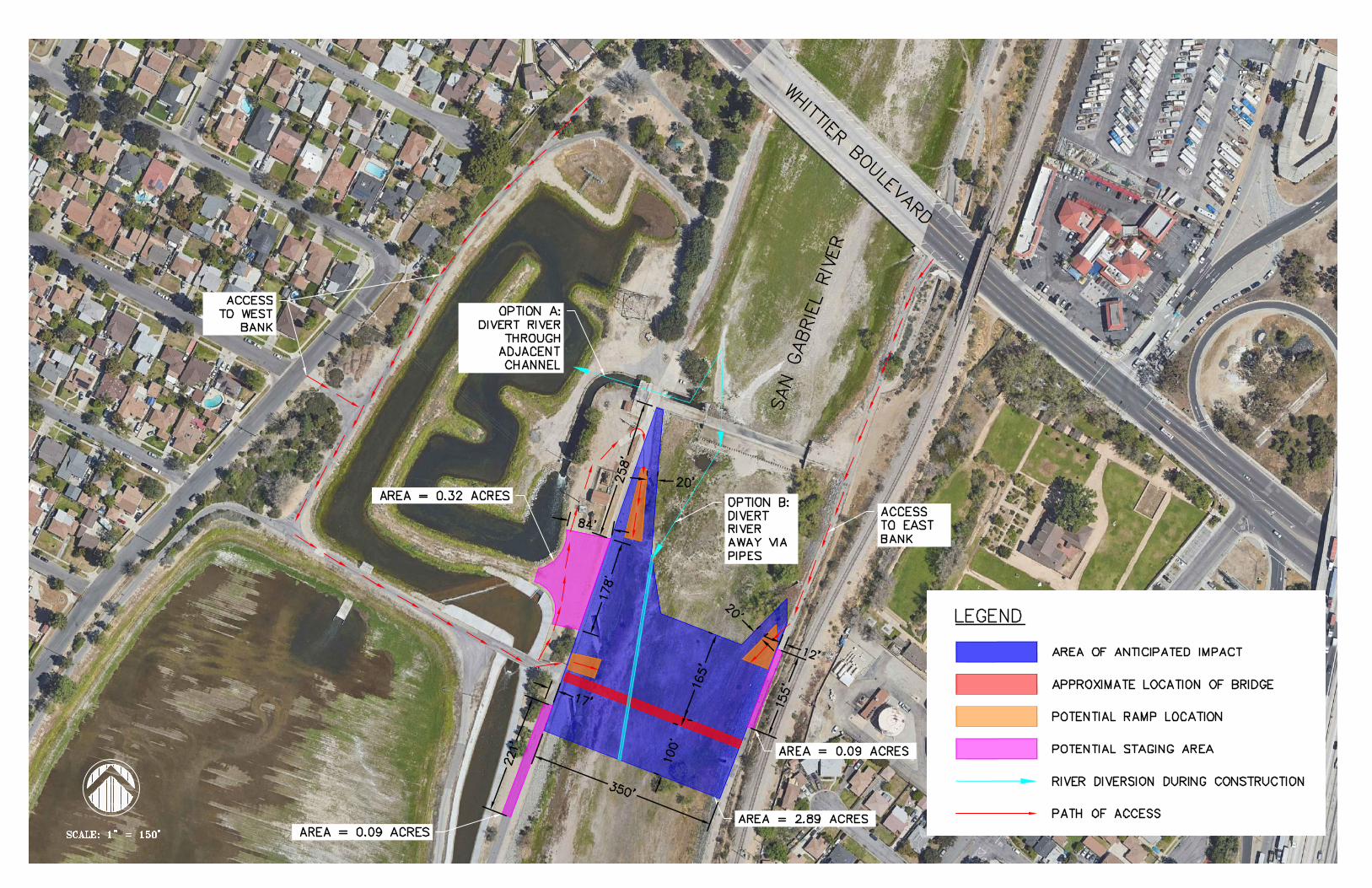
APPLICATION OF THE CRITERIA OF ADVERSE EFFECT The Pico Rivera Bikeway Project is proposing the construction of a prefabricated steel truss bridge with concrete-deck that spans approximately 353 feet, from abutment to abutment, over a segment of the San Gabriel River Channel. (See Project Plans in Attachment B) The bridge deck will be 16 feet wide, and the trestle railings will reach 16 feet tall at their highest point. The bridge will be comprised of three spans that are supported by reinforced concrete piers with foundation descending approximately 15 feet below the channel floor. The two outer spans of the bridge, that spring from abutments constructed into the rip-rap walls of the channel, will be approximately 101 feet long, and the center span will be approximately 151 feet long. While the majority of all construction work within the river channel will occur at the proposed bridge site, the APE has been extended northward to the drop structure to allow heavy construction equipment the
FNAE for Pico Rivera Regional Bikeway Project
7
room to maneuver and park, and construction equipment to be stored nearest the location of work if necessary. The general dimensions of the APE where the new bridge activities will be located are approximately 775 feet along the length of the channel, and an approximate width of 450 feet taking into account project activities outside of the river channel proper. This area will allow for the construction of Proposed excavations that have the potential to affect cultural resources will include:
(1) grading up to a depth of four feet below the present surface outside of the channel in order to create the inverted road, bike trail, and bioswales;
(2) grading and excavation into each channel wall for the construction of the bridge buttresses;
(3) access ramps for construction equipment, approximately 30 feet wide, built into the channel walls and bed of the channel;
(4) drilling with augers of two, 7-foot diameter holes, to a maximum depth of 15 feet, for the placement of two, 7-foot diameter reinforced concrete pier columns to support the new bridge spans.
The individual criteria for the San Gabriel River Channel segment are analyzed below: (i) Physical destruction of or damage to all or part of the property:
The section of the San Gabriel River Channel walls, levee tops, and channel floor in the APE will need to be disturbed in order to construct the new Pico Rivera Bikeway Bridge. The construction will require the installation of concrete bridge piers, new bridge deck, and connection to the pavement of the existing bikeway/pedestrian path on both sides of the channel. The construction work will cause temporary damage to the historic engineering design of the channel, and to the physical components (such as dirt, vegetation, grades of gravel, size of rip-rap) that is used to form the channel walls and floor, to a specific grade as needed in that section of the channel.
(ii) Alteration of a property, including restoration, rehabilitation, repair, maintenance, stabilization, hazardous material remediation and provision of handicapped access, that is not consistent with the Secretary’s Standards for the Treatment of Historic Properties (36 CFR Part 68) and applicable guidelines:
The current project plans call for the channel banks and channel geometry of the segment of the San Gabriel River Channel within the APE to be repaired, replanted, and restored to their historic dimensions, design, and materials, in accordance with the Secretary’s Standards for the Treatment of Historic Properties, or with the cooperation and assistance of the Los Angeles County Department of Public Works engineers, after the completion of the installation of the Pico Rivera Bikeway bridge.
(iii) Removal of the property from its historic location:
The segment of the San Gabriel River Channel within the APE will not be removed from its location as a result of the proposed undertaking.
(iv) Change of the character of the property’s use or of physical features within the property’s setting that contribute to its historic significance:
The construction of a bikeway bridge over the San Gabriel River Channel within the APE does not have the potential to change the physical features that contribute to the historic significance of the linear resource if the channel is repaired and restored to physically, and visually, match the existing lengths of

FNAE for Pico Rivera Regional Bikeway Project
8
channel to the north and south of the APE. The proposed project will not change the character of the channels use.
(v) Introduction of visual, atmospheric or audible elements that diminish the integrity of the property’s significant historic features:
The proposed plans currently call for the construction of a bikeway bridge over the segment of the San Gabriel River Channel within the proposed APE. Because of the size (length and width) of the channel, the new bridge is not expected to introduce a visual element (prefabricated steel trestle, concrete-deck bridge) that will alter or impinge upon the overall historic vista of the channel.
(vi) Neglect of a property which causes its deterioration, except where such neglect and deterioration are recognized qualities of a property of religious and cultural significance to an Indian tribe or Native Hawaiian organization:
There will be no neglect to the San Gabriel River Channel property.
(vii) Transfer, ease, or sale of property out of Federal ownership or control without adequate and legally enforceable restrictions or conditions to ensure long-term preservation of the property’s historic significance. Not applicable.
CONDITIONS PROPOSED Following are the Standards most relevant to the Pico Rivera Bikeway Bridge Project:
• The historic character of a property shall be retained and preserved. The removal of historic materials or alteration of features and spaces that characterize a property shall be avoided.
• New additions, exterior alterations, or related new construction shall not destroy historic materials that characterize the property.
• New additions and adjacent or related new construction shall be undertaken in such a manner that if removed in the future, the essential form and integrity of the historic property and its environment would be unimpaired.
• Distinctive materials, features, finishes, and construction techniques or examples of craftsmanship that characterize a property will be preserved.
In particular, the Standards are about taking particular care so as not to radically change, obscure, damage, or destroy character-defining materials or features associated with historic properties.
The repair, restoration, and rehabilitation, of the segment of the San Gabriel River Channel after the construction of the new Pico Rivera Bikeway Bridge will be performed in conjunction with the engineering expertise of the Los Angeles County Department of Public Works staff, and reviewed by the City of Pico Rivera, assuring Project plans are consistent with the Secretary of the Interior’s Standards based on compatibility with the character-defining features of the San Gabriel River Channel, and in terms of maintaining that the essential form and integrity of the channel segment is unimpaired.
FNAE for Pico Rivera Regional Bikeway Project
9
CONCLUSION FHWA in applying the Criteria of Adverse Effect proposes in accordance with Section 106 PA Stipulation X.B.1 (b) that the undertaking will have No Adverse Effect with No Standard Conditions on the segments of the segment of the San Gabriel River Channel within the APE. The project does not appear to have the potential to physically affect the character-defining features of the San Gabriel River Channel segment in a manner that would diminish its integrity. To avoid direct adverse effects, the repair and restoration of the channel segment after the new Pico Rivera Bikeway Bridge is installed will be carried out in a manner consistent with the Secretary of the Interior’s Standards for the Treatment of Historic Properties. This document serves only to obtain SHPO concurrence that the undertaking will have a No Adverse Effect with No Standard Conditions on the segment of the San Gabriel River Channel within the APE. Mitigation measures will not be required to resolve the effects of project activities and will be discussed in a separate consultation document along with a draft Memorandum of Agreement (MOA).

Attachment A:


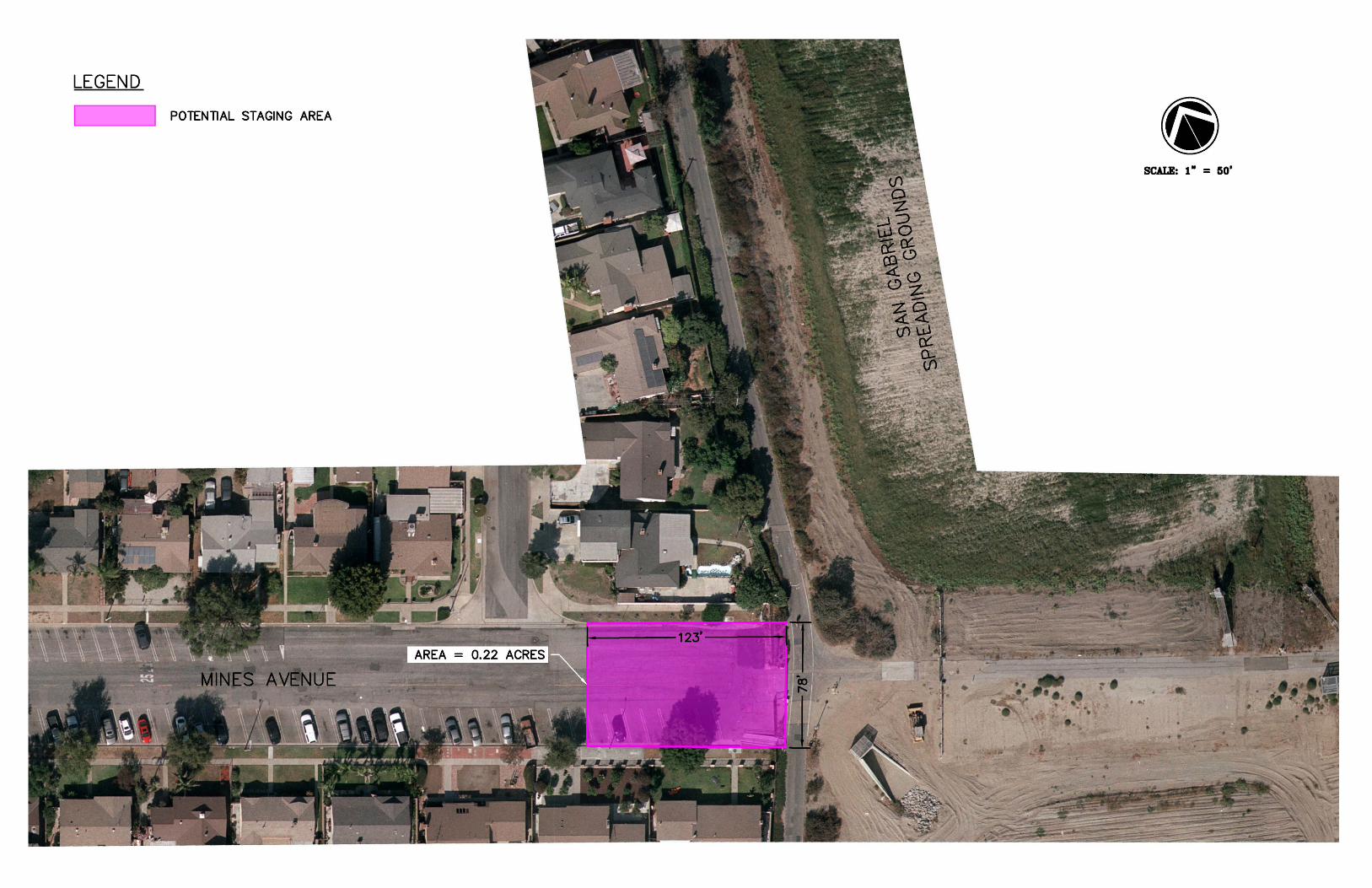
Attachment B: Project Plans in San Gabriel River corridor
AutoCAD SHX Text
OPTION A: DIVERT RIVER THROUGH ADJACENT CHANNEL
AutoCAD SHX Text
OPTION B: DIVERT RIVER AWAY VIA PIPES
AutoCAD SHX Text
ACCESS TO EAST BANK
AutoCAD SHX Text
ACCESS TO WEST BANK
AutoCAD SHX Text
AREA = 0.32 ACRES
AutoCAD SHX Text
AREA = 0.09 ACRES
AutoCAD SHX Text
AREA = 0.09 ACRES
AutoCAD SHX Text
AREA = 2.89 ACRES
AutoCAD SHX Text
AREA OF ANTICIPATED IMPACT
AutoCAD SHX Text
APPROXIMATE LOCATION OF BRIDGE
AutoCAD SHX Text
POTENTIAL RAMP LOCATION
AutoCAD SHX Text
POTENTIAL STAGING AREA
AutoCAD SHX Text
RIVER DIVERSION DURING CONSTRUCTION
AutoCAD SHX Text
PATH OF ACCESS
AutoCAD SHX Text
LEGEND
AutoCAD SHX Text
WHITTIER BOULEVARD
AutoCAD SHX Text
SAN GABRIEL RIVER
AutoCAD SHX Text
SCALE: 1" = 150'

Attachment C: Correspondence from Caltrans
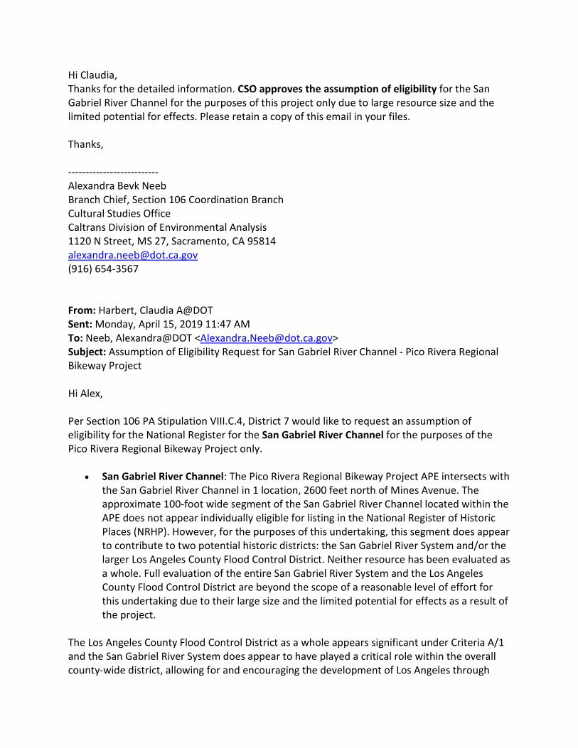
Hi Claudia, Thanks for the detailed information. CSO approves the assumption of eligibility for the San Gabriel River Channel for the purposes of this project only due to large resource size and the limited potential for effects. Please retain a copy of this email in your files. Thanks, -------------------------- Alexandra Bevk Neeb Branch Chief, Section 106 Coordination Branch Cultural Studies Office Caltrans Division of Environmental Analysis 1120 N Street, MS 27, Sacramento, CA 95814 [email protected] (916) 654-3567 From: Harbert, Claudia A@DOT Sent: Monday, April 15, 2019 11:47 AM To: Neeb, Alexandra@DOT <[email protected]> Subject: Assumption of Eligibility Request for San Gabriel River Channel - Pico Rivera Regional Bikeway Project Hi Alex, Per Section 106 PA Stipulation VIII.C.4, District 7 would like to request an assumption of eligibility for the National Register for the San Gabriel River Channel for the purposes of the Pico Rivera Regional Bikeway Project only.
• San Gabriel River Channel: The Pico Rivera Regional Bikeway Project APE intersects with the San Gabriel River Channel in 1 location, 2600 feet north of Mines Avenue. The approximate 100-foot wide segment of the San Gabriel River Channel located within the APE does not appear individually eligible for listing in the National Register of Historic Places (NRHP). However, for the purposes of this undertaking, this segment does appear to contribute to two potential historic districts: the San Gabriel River System and/or the larger Los Angeles County Flood Control District. Neither resource has been evaluated as a whole. Full evaluation of the entire San Gabriel River System and the Los Angeles County Flood Control District are beyond the scope of a reasonable level of effort for this undertaking due to their large size and the limited potential for effects as a result of the project.
The Los Angeles County Flood Control District as a whole appears significant under Criteria A/1 and the San Gabriel River System does appear to have played a critical role within the overall county-wide district, allowing for and encouraging the development of Los Angeles through
consistent, effective flood control. The San Gabriel River System, inclusive of the San Gabriel River Channel, is an integral part of the overall Los Angeles County Flood Control District, and directly resulted in the development of the flood plain adjacent to the once-unpredictable San Gabriel River. Additional research needs to be completed to determine a concise period of significance, but based on preliminary research it would span from 1936 through ca. 1960 during the primary phase of construction for the potential districts. If you have any questions or would like any additional information, please let me know. Thank you. Claudia Harbert Associate Environmental Planner PQS – Principal Architectural Historian Caltrans District 7 Project Description The Project consists of a 1.5-mile bicycle facility along Mines Avenue, a bike/pedestrian bridge over the San Gabriel River, and a bicycle facility along Dunlap Crossing Road. The Project would construct a Class IV separated bikeway along Mines Avenue from Paramount Boulevard in the west to the existing Class I bike trail along the San Gabriel River in the east. The Project also includes a new bridge structure located approximately 2,600 feet north of Mines Avenue spanning the San Gabriel River, and Class I and II bike lanes along Dunlap Crossing Road from the San Gabriel River to Norwalk Boulevard. The alignment along Dunlap Crossing Road will connect an existing publicly accessible bike path on the west side of the San Gabriel River to the San Gabriel River Mid Trail. The proposed improvements on Mines Avenue include but are not limited to: pavement reconstruction; installation of bioswales, stormwater catch basins and other improvements such as, reconfiguration of parking lanes; upgrading street lights; traffic signal modifications at Rosemead Boulevard and Mines Avenue; signage; striping; utility relocation; and landscaping. Project Location

Attachment D: Photographs of Project site

View looking from west bank of San Gabriel River Channel to the east bank in the approximate
location of the proposed bikeway bridge.
View looking north from location of bikeway bridge on west bank of the San Gabriel River
Channel.
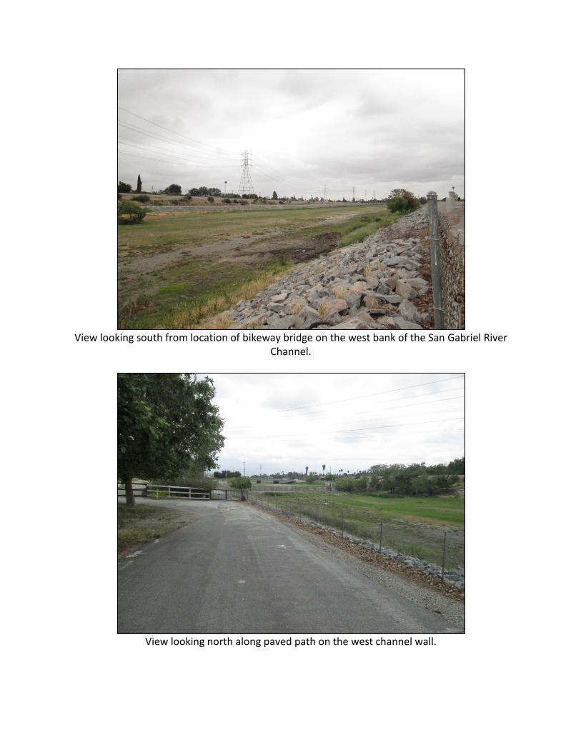
View looking south from location of bikeway bridge on the west bank of the San Gabriel River
Channel.
View looking north along paved path on the west channel wall.

Attachment E: Correspondence to Interested Parties
2242 El Capitan Drive, Riverside, California 92506
(951) 369-1366 ■ [email protected]
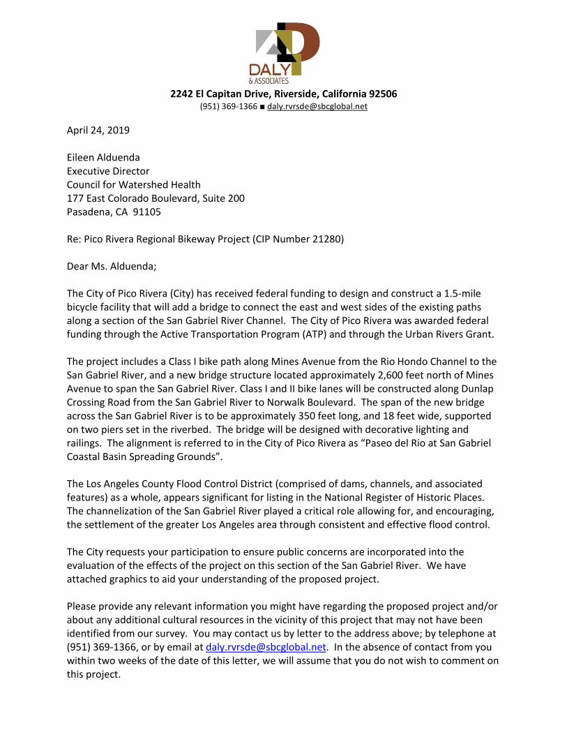
April 24, 2019 Eileen Alduenda Executive Director Council for Watershed Health 177 East Colorado Boulevard, Suite 200 Pasadena, CA 91105 Re: Pico Rivera Regional Bikeway Project (CIP Number 21280) Dear Ms. Alduenda; The City of Pico Rivera (City) has received federal funding to design and construct a 1.5-mile bicycle facility that will add a bridge to connect the east and west sides of the existing paths along a section of the San Gabriel River Channel. The City of Pico Rivera was awarded federal funding through the Active Transportation Program (ATP) and through the Urban Rivers Grant. The project includes a Class I bike path along Mines Avenue from the Rio Hondo Channel to the San Gabriel River, and a new bridge structure located approximately 2,600 feet north of Mines Avenue to span the San Gabriel River. Class I and II bike lanes will be constructed along Dunlap Crossing Road from the San Gabriel River to Norwalk Boulevard. The span of the new bridge across the San Gabriel River is to be approximately 350 feet long, and 18 feet wide, supported on two piers set in the riverbed. The bridge will be designed with decorative lighting and railings. The alignment is referred to in the City of Pico Rivera as “Paseo del Rio at San Gabriel Coastal Basin Spreading Grounds”. The Los Angeles County Flood Control District (comprised of dams, channels, and associated features) as a whole, appears significant for listing in the National Register of Historic Places. The channelization of the San Gabriel River played a critical role allowing for, and encouraging, the settlement of the greater Los Angeles area through consistent and effective flood control. The City requests your participation to ensure public concerns are incorporated into the evaluation of the effects of the project on this section of the San Gabriel River. We have attached graphics to aid your understanding of the proposed project. Please provide any relevant information you might have regarding the proposed project and/or about any additional cultural resources in the vicinity of this project that may not have been identified from our survey. You may contact us by letter to the address above; by telephone at (951) 369-1366, or by email at [email protected]. In the absence of contact from you within two weeks of the date of this letter, we will assume that you do not wish to comment on this project.

Pico Rivera Regional Bikeway Project Page 2 of 2
Sincerely, Pamela Daly, M.S.H.P. Principal, Architectural Historian Attachments: Map of project area Preliminary drawings of the proposed bridge across the San Gabriel River Proposed construction activities in the San Gabriel River
2242 El Capitan Drive, Riverside, California 92506
(951) 369-1366 ■ [email protected]
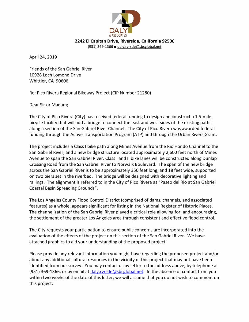
April 24, 2019 Friends of the San Gabriel River 10928 Loch Lomond Drive Whittier, CA 90606 Re: Pico Rivera Regional Bikeway Project (CIP Number 21280) Dear Sir or Madam; The City of Pico Rivera (City) has received federal funding to design and construct a 1.5-mile bicycle facility that will add a bridge to connect the east and west sides of the existing paths along a section of the San Gabriel River Channel. The City of Pico Rivera was awarded federal funding through the Active Transportation Program (ATP) and through the Urban Rivers Grant. The project includes a Class I bike path along Mines Avenue from the Rio Hondo Channel to the San Gabriel River, and a new bridge structure located approximately 2,600 feet north of Mines Avenue to span the San Gabriel River. Class I and II bike lanes will be constructed along Dunlap Crossing Road from the San Gabriel River to Norwalk Boulevard. The span of the new bridge across the San Gabriel River is to be approximately 350 feet long, and 18 feet wide, supported on two piers set in the riverbed. The bridge will be designed with decorative lighting and railings. The alignment is referred to in the City of Pico Rivera as “Paseo del Rio at San Gabriel Coastal Basin Spreading Grounds”. The Los Angeles County Flood Control District (comprised of dams, channels, and associated features) as a whole, appears significant for listing in the National Register of Historic Places. The channelization of the San Gabriel River played a critical role allowing for, and encouraging, the settlement of the greater Los Angeles area through consistent and effective flood control. The City requests your participation to ensure public concerns are incorporated into the evaluation of the effects of the project on this section of the San Gabriel River. We have attached graphics to aid your understanding of the proposed project. Please provide any relevant information you might have regarding the proposed project and/or about any additional cultural resources in the vicinity of this project that may not have been identified from our survey. You may contact us by letter to the address above; by telephone at (951) 369-1366, or by email at [email protected]. In the absence of contact from you within two weeks of the date of this letter, we will assume that you do not wish to comment on this project.

Pico Rivera Regional Bikeway Project Page 2 of 2
Sincerely, Pamela Daly, M.S.H.P. Principal, Architectural Historian Attachments: Map of project area Preliminary drawings of the proposed bridge across the San Gabriel River Proposed construction activities in the San Gabriel River
2242 El Capitan Drive, Riverside, California 92506
(951) 369-1366 ■ [email protected]
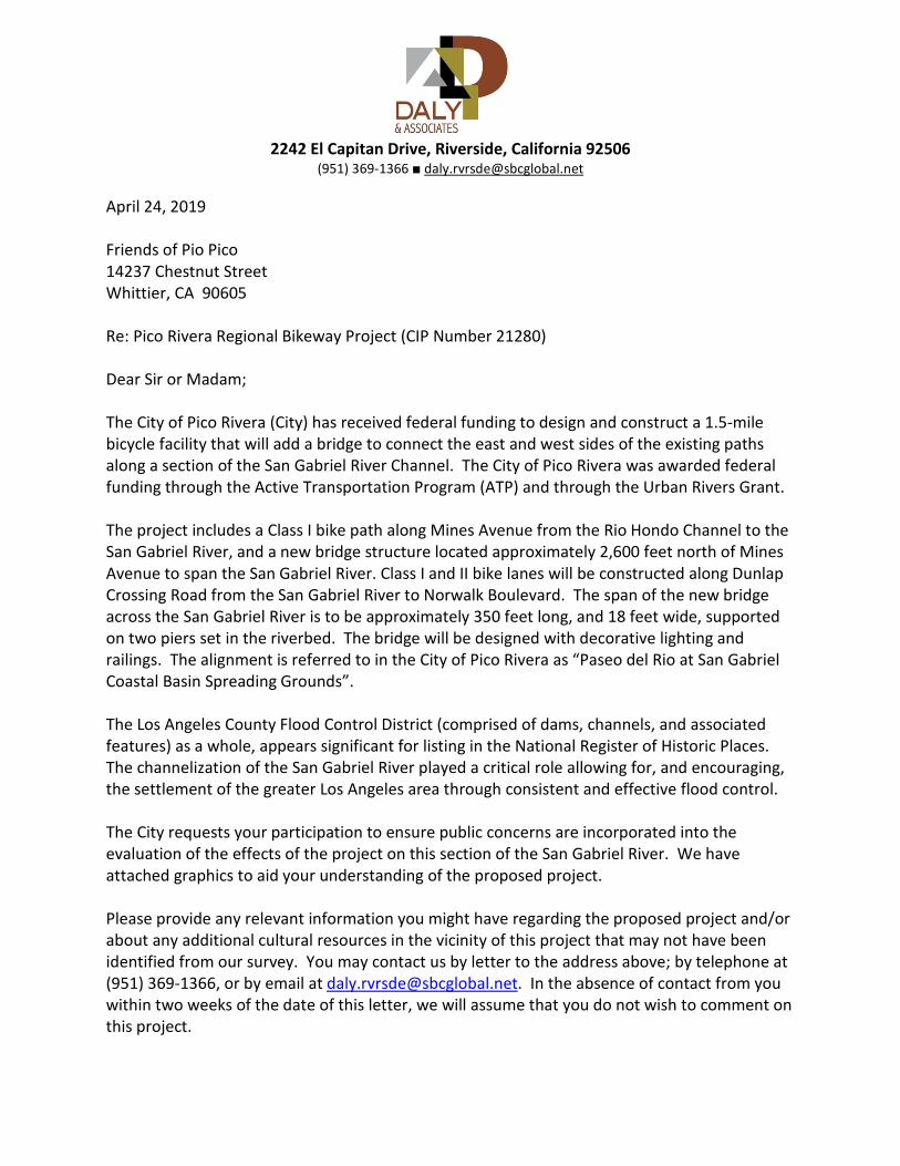
April 24, 2019 Friends of Pio Pico 14237 Chestnut Street Whittier, CA 90605 Re: Pico Rivera Regional Bikeway Project (CIP Number 21280) Dear Sir or Madam; The City of Pico Rivera (City) has received federal funding to design and construct a 1.5-mile bicycle facility that will add a bridge to connect the east and west sides of the existing paths along a section of the San Gabriel River Channel. The City of Pico Rivera was awarded federal funding through the Active Transportation Program (ATP) and through the Urban Rivers Grant. The project includes a Class I bike path along Mines Avenue from the Rio Hondo Channel to the San Gabriel River, and a new bridge structure located approximately 2,600 feet north of Mines Avenue to span the San Gabriel River. Class I and II bike lanes will be constructed along Dunlap Crossing Road from the San Gabriel River to Norwalk Boulevard. The span of the new bridge across the San Gabriel River is to be approximately 350 feet long, and 18 feet wide, supported on two piers set in the riverbed. The bridge will be designed with decorative lighting and railings. The alignment is referred to in the City of Pico Rivera as “Paseo del Rio at San Gabriel Coastal Basin Spreading Grounds”. The Los Angeles County Flood Control District (comprised of dams, channels, and associated features) as a whole, appears significant for listing in the National Register of Historic Places. The channelization of the San Gabriel River played a critical role allowing for, and encouraging, the settlement of the greater Los Angeles area through consistent and effective flood control. The City requests your participation to ensure public concerns are incorporated into the evaluation of the effects of the project on this section of the San Gabriel River. We have attached graphics to aid your understanding of the proposed project. Please provide any relevant information you might have regarding the proposed project and/or about any additional cultural resources in the vicinity of this project that may not have been identified from our survey. You may contact us by letter to the address above; by telephone at (951) 369-1366, or by email at [email protected]. In the absence of contact from you within two weeks of the date of this letter, we will assume that you do not wish to comment on this project.
Pico Rivera Regional Bikeway Project Page 2 of 2
Sincerely, Pamela Daly, M.S.H.P. Principal, Architectural Historian Attachments: Map of project area Preliminary drawings of the proposed bridge across the San Gabriel River Proposed construction activities in the San Gabriel River
2242 El Capitan Drive, Riverside, California 92506
(951) 369-1366 ■ [email protected]
April 24, 2019 Mark Stanley Executive Officer San Gabriel & Lower Los Angeles Rivers and Mountains Conservancy 100 North Old San Gabriel Canyon Road Azusa, CA 91702 Re: Pico Rivera Regional Bikeway Project (CIP Number 21280) Dear Mr. Stanley; The City of Pico Rivera (City) has received federal funding to design and construct a 1.5-mile bicycle facility that will add a bridge to connect the east and west sides of the existing paths along a section of the San Gabriel River Channel. The City of Pico Rivera was awarded federal funding through the Active Transportation Program (ATP) and through the Urban Rivers Grant. The project includes a Class I bike path along Mines Avenue from the Rio Hondo Channel to the San Gabriel River, and a new bridge structure located approximately 2,600 feet north of Mines Avenue to span the San Gabriel River. Class I and II bike lanes will be constructed along Dunlap Crossing Road from the San Gabriel River to Norwalk Boulevard. The span of the new bridge across the San Gabriel River is to be approximately 350 feet long, and 18 feet wide, supported on two piers set in the riverbed. The bridge will be designed with decorative lighting and railings. The alignment is referred to in the City of Pico Rivera as “Paseo del Rio at San Gabriel Coastal Basin Spreading Grounds”. The Los Angeles County Flood Control District (comprised of dams, channels, and associated features) as a whole, appears significant for listing in the National Register of Historic Places. The channelization of the San Gabriel River played a critical role allowing for, and encouraging, the settlement of the greater Los Angeles area through consistent and effective flood control. The City requests your participation to ensure public concerns are incorporated into the evaluation of the effects of the project on this section of the San Gabriel River. We have attached graphics to aid your understanding of the proposed project. Please provide any relevant information you might have regarding the proposed project and/or about any additional cultural resources in the vicinity of this project that may not have been identified from our survey. You may contact us by letter to the address above; by telephone at (951) 369-1366, or by email at [email protected]. In the absence of contact from you within two weeks of the date of this letter, we will assume that you do not wish to comment on this project.
Pico Rivera Regional Bikeway Project Page 2 of 2
Sincerely, Pamela Daly, M.S.H.P. Principal, Architectural Historian Attachments: Map of project area Preliminary drawings of the proposed bridge across the San Gabriel River Proposed construction activities in the San Gabriel River
Related Documents