PHASE 1a ARCHAEOLOGICAL ASSESSMENT WATER/SEWER IMPROVEMENTS AND UPGRADES VILLAGE OF SACKETS HARBOR JEFFERSON COUNTY prepared by Timothy J. Abel, PhD 33512 SR 26 Carthage, NY 13619 for WBE Architects, Engineers and Surveyors, LLP 327 Mullin St. Watertown, NY 13601 January 14, 2015

Welcome message from author
This document is posted to help you gain knowledge. Please leave a comment to let me know what you think about it! Share it to your friends and learn new things together.
Transcript
PHASE 1a ARCHAEOLOGICAL ASSESSMENT WATER/SEWER IMPROVEMENTS AND UPGRADES
VILLAGE OF SACKETS HARBOR JEFFERSON COUNTY
prepared by
Timothy J. Abel, PhD 33512 SR 26
Carthage, NY 13619
for
WBE Architects, Engineers and Surveyors, LLP 327 Mullin St.
Watertown, NY 13601
January 14, 2015
MANAGEMENT SUMMARY
PROJECT NAME/PIN: Sackets Harbor Water/Sewer Improvements PROJECT TYPE: New construction CULTURAL RESOURCE SURVEY TYPE: Phase 1a archaeological assessment LOCATION: Village of Sackets Harbor, NY (04558) SURVEY AREA: 1.8 ha (4.5 ac) U.S.G.S. QUAD NAME: Sackets Harbor, NY SENSITIVITY ASSESSMENT: Prehistoric: Low based on documented resources and scope of work Historic: High based on documented resources The APE will impact two NR districts. Based on recommendations and scope of work, the undertaking will have no adverse effect on these resources. AUTHOR: Timothy J. Abel, PhD DATE: January 14, 2015 SPONSOR: SEQRA
i
ii
TABLE OF CONTENTS
1.0 INTRODUCTION 1
1.1 Project Area Definition 2
1.2 Physical Setting 2
1.3 Occupation History 14
1.4 Development History 19
2.0 ARCHAEOLOGICAL ASSESSMENT 19
2.1 Site File Review 19
2.2 Prior Investigations 26
2.3 Site Walkover 27
3.0 IMPACTS 27
4.0 RECOMMENDATIONS 29
REFERENCES CITED 30
APPENDIX 1– OPRHP SITE FILE SEARCH
LIST OF FIGURES
Figure 1– General project location 1
Figure 2-3– Project setting 2, 14
Figure 4– Project soils 15
Figure 5– 14 Historic maps 20-26
Figure 15– Map-documented structures 28
LIST OF TABLES
Table 1– Soil types 15
Table 2– Impacts and Recommendations 27
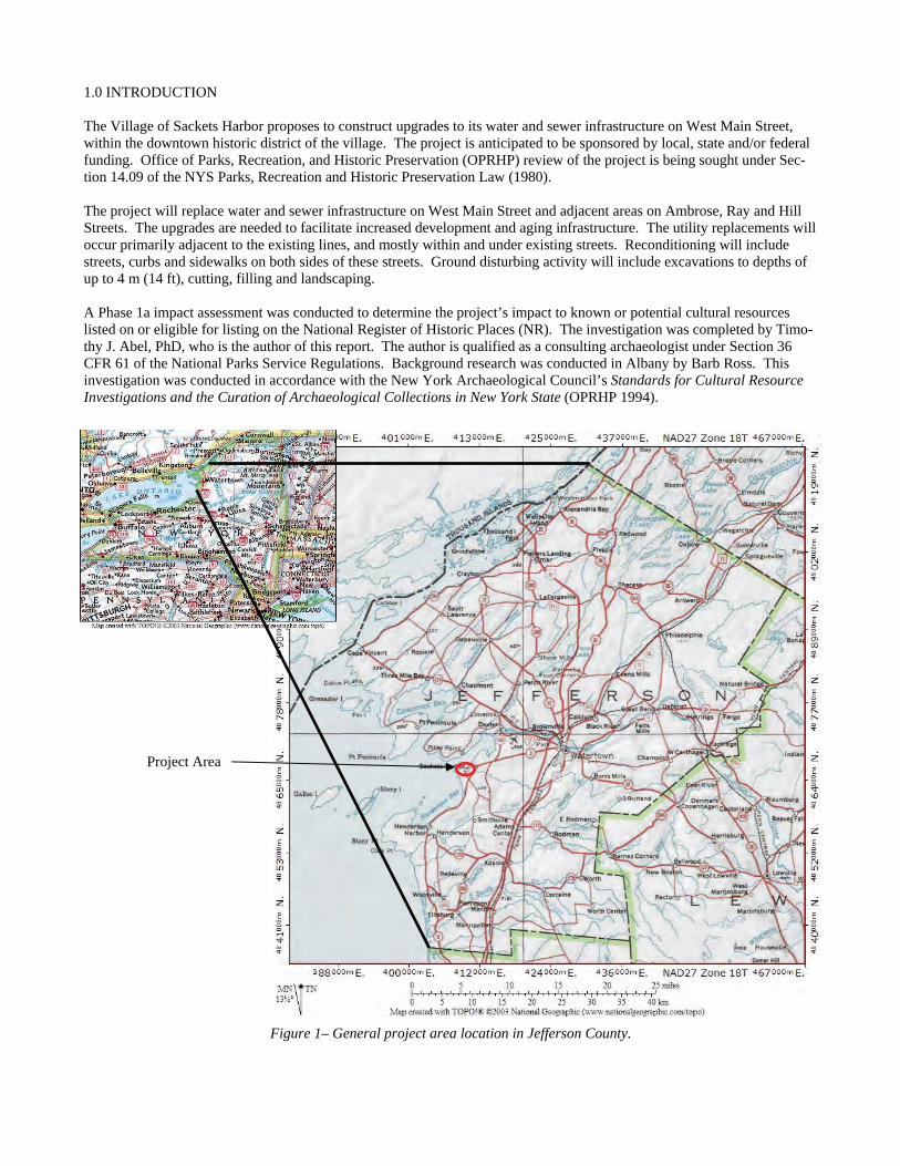
1.0 INTRODUCTION The Village of Sackets Harbor proposes to construct upgrades to its water and sewer infrastructure on West Main Street, within the downtown historic district of the village. The project is anticipated to be sponsored by local, state and/or federal funding. Office of Parks, Recreation, and Historic Preservation (OPRHP) review of the project is being sought under Sec-tion 14.09 of the NYS Parks, Recreation and Historic Preservation Law (1980). The project will replace water and sewer infrastructure on West Main Street and adjacent areas on Ambrose, Ray and Hill Streets. The upgrades are needed to facilitate increased development and aging infrastructure. The utility replacements will occur primarily adjacent to the existing lines, and mostly within and under existing streets. Reconditioning will include streets, curbs and sidewalks on both sides of these streets. Ground disturbing activity will include excavations to depths of up to 4 m (14 ft), cutting, filling and landscaping. A Phase 1a impact assessment was conducted to determine the project’s impact to known or potential cultural resources listed on or eligible for listing on the National Register of Historic Places (NR). The investigation was completed by Timo-thy J. Abel, PhD, who is the author of this report. The author is qualified as a consulting archaeologist under Section 36 CFR 61 of the National Parks Service Regulations. Background research was conducted in Albany by Barb Ross. This investigation was conducted in accordance with the New York Archaeological Council’s Standards for Cultural Resource Investigations and the Curation of Archaeological Collections in New York State (OPRHP 1994).
Figure 1– General project area location in Jefferson County.
Project Area
2
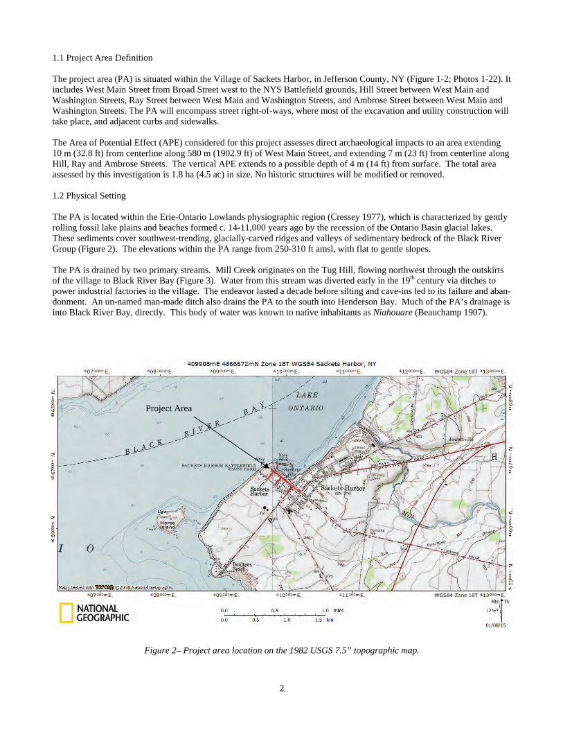
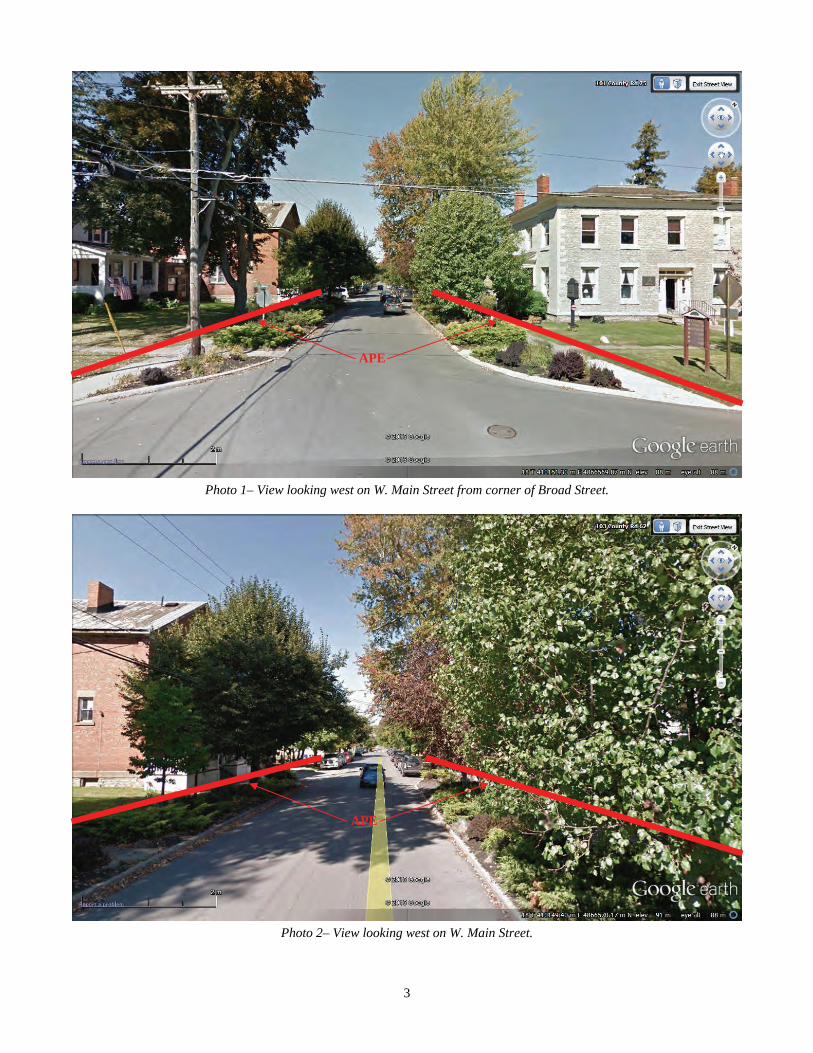
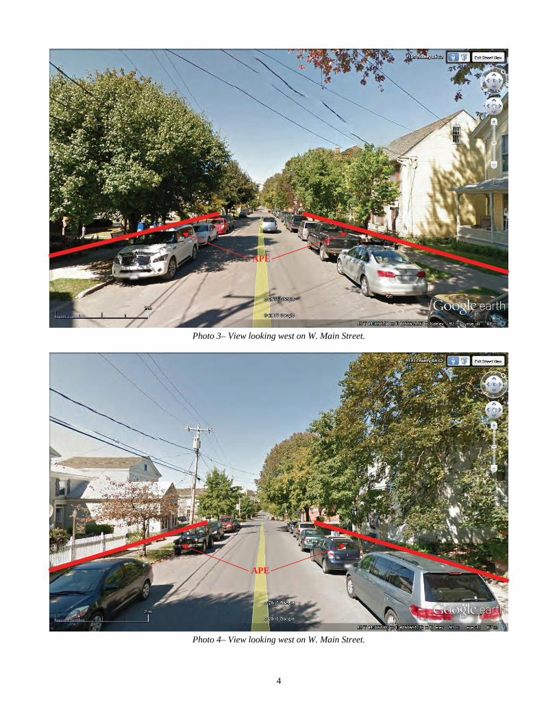
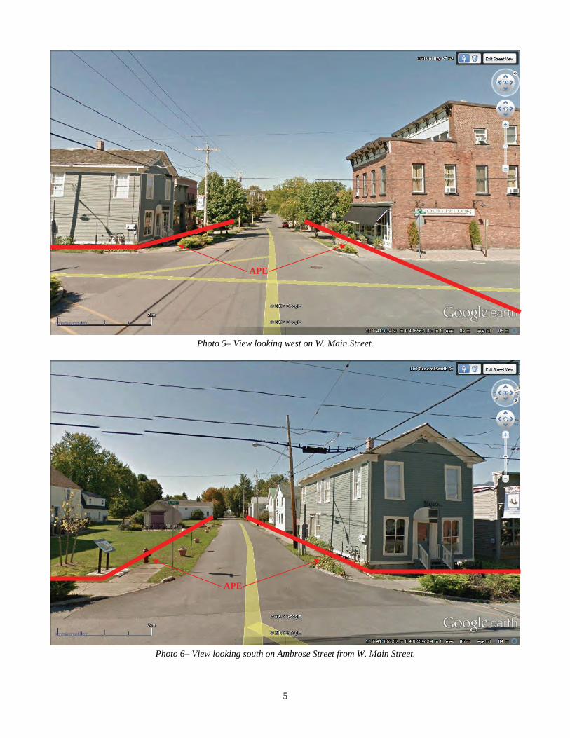
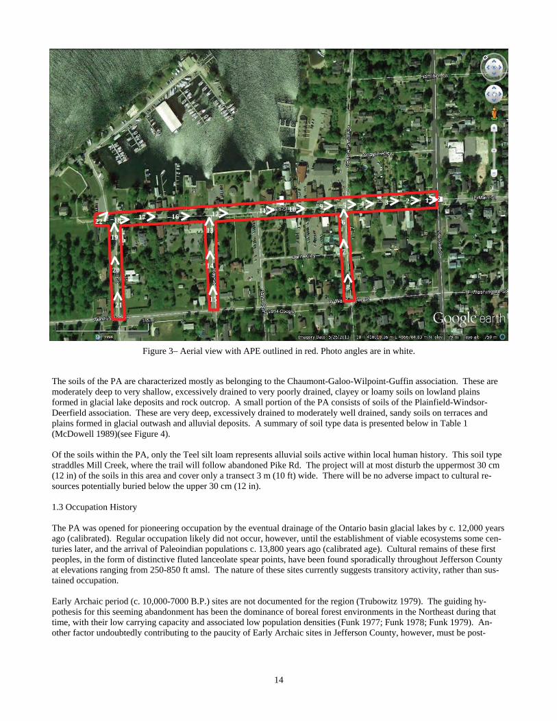
1.1 Project Area Definition The project area (PA) is situated within the Village of Sackets Harbor, in Jefferson County, NY (Figure 1-2; Photos 1-22). It includes West Main Street from Broad Street west to the NYS Battlefield grounds, Hill Street between West Main and Washington Streets, Ray Street between West Main and Washington Streets, and Ambrose Street between West Main and Washington Streets. The PA will encompass street right-of-ways, where most of the excavation and utility construction will take place, and adjacent curbs and sidewalks. The Area of Potential Effect (APE) considered for this project assesses direct archaeological impacts to an area extending 10 m (32.8 ft) from centerline along 580 m (1902.9 ft) of West Main Street, and extending 7 m (23 ft) from centerline along Hill, Ray and Ambrose Streets. The vertical APE extends to a possible depth of 4 m (14 ft) from surface. The total area assessed by this investigation is 1.8 ha (4.5 ac) in size. No historic structures will be modified or removed. 1.2 Physical Setting The PA is located within the Erie-Ontario Lowlands physiographic region (Cressey 1977), which is characterized by gently rolling fossil lake plains and beaches formed c. 14-11,000 years ago by the recession of the Ontario Basin glacial lakes. These sediments cover southwest-trending, glacially-carved ridges and valleys of sedimentary bedrock of the Black River Group (Figure 2). The elevations within the PA range from 250-310 ft amsl, with flat to gentle slopes.
The PA is drained by two primary streams. Mill Creek originates on the Tug Hill, flowing northwest through the outskirts of the village to Black River Bay (Figure 3). Water from this stream was diverted early in the 19th century via ditches to power industrial factories in the village. The endeavor lasted a decade before silting and cave-ins led to its failure and aban-donment. An un-named man-made ditch also drains the PA to the south into Henderson Bay. Much of the PA’s drainage is into Black River Bay, directly. This body of water was known to native inhabitants as Niahouare (Beauchamp 1907).
Figure 2– Project area location on the 1982 USGS 7.5” topographic map.
Project Area
3
Photo 1– View looking west on W. Main Street from corner of Broad Street.
Photo 2– View looking west on W. Main Street.
APE
APE
4
Photo 3– View looking west on W. Main Street.
Photo 4– View looking west on W. Main Street.
APE
APE
5
Photo 5– View looking west on W. Main Street.
Photo 6– View looking south on Ambrose Street from W. Main Street.
APE
APE
6
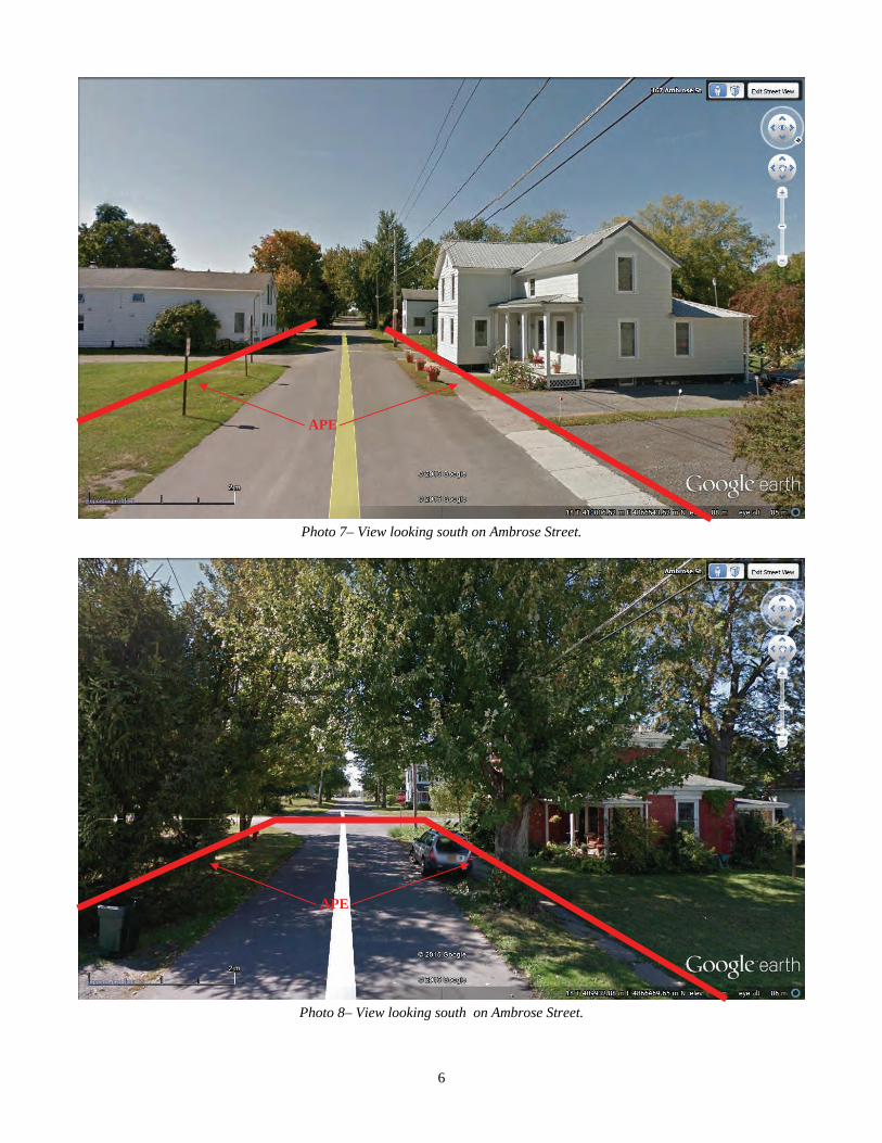
Photo 7– View looking south on Ambrose Street.
Photo 8– View looking south on Ambrose Street.
APE
APE

7
Photo 9– View looking west on W. Main Street.
Photo 10– View looking west on W. Main Street.
APE
APE

8
Photo 11– View looking west on W. Main Street.
Photo 12– View looking west on W. Main Street.
APE
APE
9
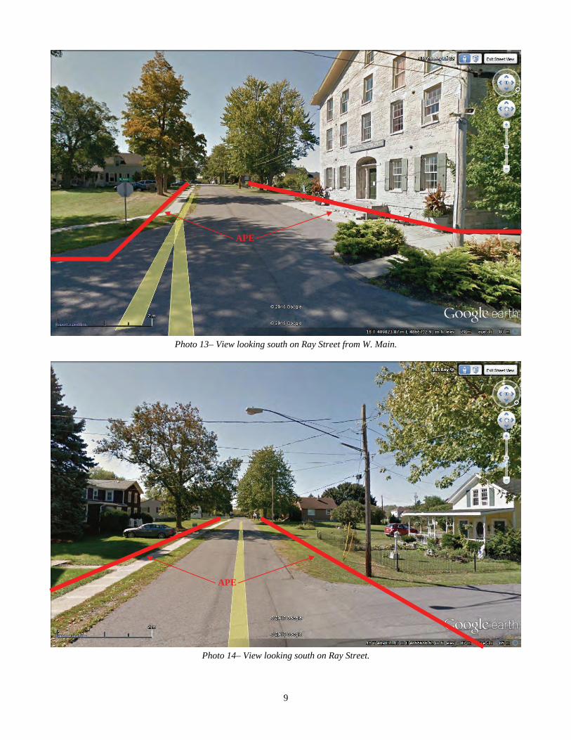
Photo 13– View looking south on Ray Street from W. Main.
Photo 14– View looking south on Ray Street.
APE
APE
10
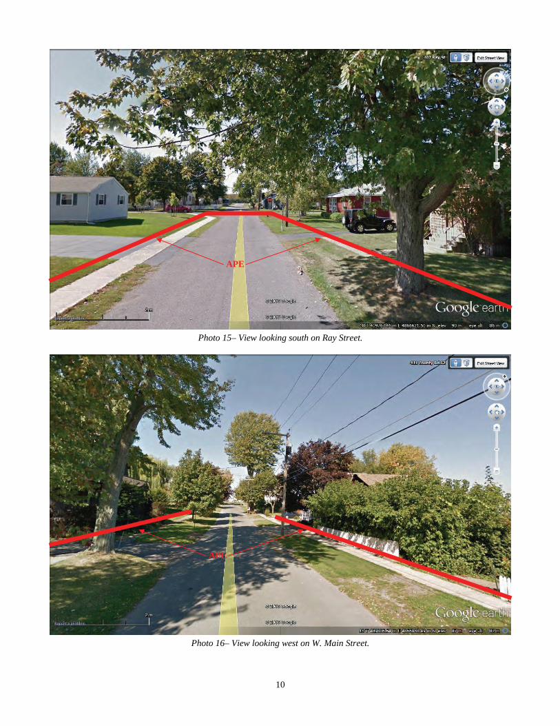
Photo 15– View looking south on Ray Street.
Photo 16– View looking west on W. Main Street.
APE
APE

11
Photo 17– View looking west on W. Main Street.
Photo 18– View looking west on W. Main Street.
APE
APE
12
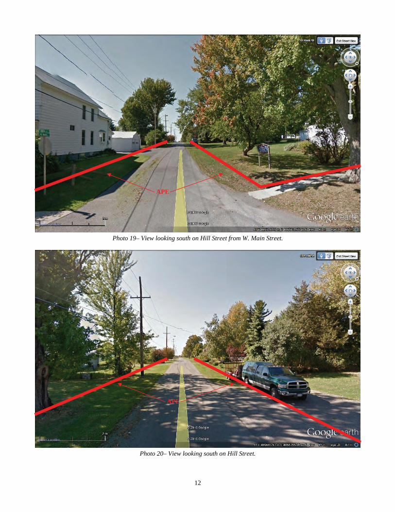
Photo 19– View looking south on Hill Street from W. Main Street.
Photo 20– View looking south on Hill Street.
APE
APE
13
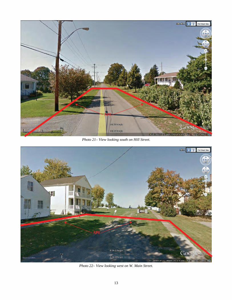
Photo 21– View looking south on Hill Street.
Photo 22– View looking west on W. Main Street.
APE
APE
14
The soils of the PA are characterized mostly as belonging to the Chaumont-Galoo-Wilpoint-Guffin association. These are moderately deep to very shallow, excessively drained to very poorly drained, clayey or loamy soils on lowland plains formed in glacial lake deposits and rock outcrop. A small portion of the PA consists of soils of the Plainfield-Windsor-Deerfield association. These are very deep, excessively drained to moderately well drained, sandy soils on terraces and plains formed in glacial outwash and alluvial deposits. A summary of soil type data is presented below in Table 1 (McDowell 1989)(see Figure 4).
Of the soils within the PA, only the Teel silt loam represents alluvial soils active within local human history. This soil type straddles Mill Creek, where the trail will follow abandoned Pike Rd. The project will at most disturb the uppermost 30 cm (12 in) of the soils in this area and cover only a transect 3 m (10 ft) wide. There will be no adverse impact to cultural re-sources potentially buried below the upper 30 cm (12 in). 1.3 Occupation History The PA was opened for pioneering occupation by the eventual drainage of the Ontario basin glacial lakes by c. 12,000 years ago (calibrated). Regular occupation likely did not occur, however, until the establishment of viable ecosystems some cen-turies later, and the arrival of Paleoindian populations c. 13,800 years ago (calibrated age). Cultural remains of these first peoples, in the form of distinctive fluted lanceolate spear points, have been found sporadically throughout Jefferson County at elevations ranging from 250-850 ft amsl. The nature of these sites currently suggests transitory activity, rather than sus-tained occupation. Early Archaic period (c. 10,000-7000 B.P.) sites are not documented for the region (Trubowitz 1979). The guiding hy-pothesis for this seeming abandonment has been the dominance of boreal forest environments in the Northeast during that time, with their low carrying capacity and associated low population densities (Funk 1977; Funk 1978; Funk 1979). An-other factor undoubtedly contributing to the paucity of Early Archaic sites in Jefferson County, however, must be post-
Figure 3– Aerial view with APE outlined in red. Photo angles are in white.
1 2 3 4 5
6
7
8
9 10 11 12
13
14
15
16 17 18
19
20
21
22
15
Figure 4– Project area soils.
Table 1– Project area soil types.
Soil Type/ Symbol
Soil Horizon Depth Color Texture Slope Drainage Landform
Farmington Loam; FaB
Ap- 0-20 cm (0-8 in) Bw1- 20-38 cm (8-15 in) Bw2-38-48 cm (15-19 in) R- 48 cm (19 in)
10YR4/3 10YR4/4 10YR4/3 bedrock
Lo Lo Lo BR
0-8% Well- Excessive Till plains
Guffin clay; Gv Ap- 0-18 cm (0-7 in) Bt- 18-48 cm (7-19 in) BCt- 48-56 cm (19-22 in) 2R- 56-66 cm (22-26 in)
10YR3/1 10YR4/2 2.5Y5/2 bedrock
Cl Cl Cl BR
0-3% Poor Depressions
Wilpoint silty clay loam; WnB
Ap-0-15 cm (0-6 in) Bt1-15-23 cm (6-9 in) Bt2-23-38 cm (9-15 in)
10YR4/2 10YR4/3 10YR4/3
SiClLo SiCl Cl
3-8% Moderately well Lake Plains
Benson-Galoo Complex; BgB
A1-0-10 cm (0-4 in) Bw-10-18 cm (4-7 in) 2R
7.5YR3/2 5YR4/3 bedrock
SiLo ChSiLo BR
0-8% Excessive Till plains
16
glacial lake levels in the Ontario basin, which were 65 ft. below present day during this time. This exposed large areas of the basin to settlement which have been since flooded (Abel and Fuerst 1999). The number of archaeological sites in the region increases again with the climax of deciduous forests in the Northeast, an event which corresponds with the Middle Archaic period (c. 7000-5000 BP). Large Middle Archaic base camp sites, not surprisingly, are riverine oriented, and point to at least a seasonally focal subsistence economy based on fishing (Starbuck and Bolian 1980). These base camps must, however, be accompanied by numerous site types that are now only poorly un-derstood (Curtin 2009). Late Archaic cultures (5000-3500 B.P.) are seen as a direct outgrowth of local Middle Archaic cultures. Little of aboriginal culture changed except for artifact forms and an intensification of optimal foraging subsistence strategies (Keene 1981; Winterhalder 1981). Spring and summer sites are riverine-oriented, and exhibit evidence of population aggregation. Fall and winter sites evince dispersal, and a diffuse winter economy carried out at interior sites (Ritchie and Funk 1973). The period between c. 1500-1000 B.C. marks the Archaic Transition, during which populations achieved more sedentism through the development of more efficient food procurement, preparation, and storage. Earlier populations obviously cached small amounts of food for short periods of time at local camps. During the Archaic Transition, however, cultures learned to fabricate stone, and later, fired clay pots, which made much more efficient storage and cooking vessels. This innovation was spurred by an intensification of harvesting strategies to produce surplus food reserves for later use, and con-sequently, longer site stays. Longer stays meant a greater accumulation of debris, and resulted in increased archaeological visibility. Repeated use of some sites has given the erroneous impression of enormous settlements along some riverine set-tings. Like earlier populations, Transitional Archaic populations were seasonally focal, but likely followed a diffuse fall and winter settlement and subsistence pattern (Ritchie and Funk 1973). Early Woodland populations (1000-400 B.C.) mastered the art of clay vessel-making. Early Woodland populations, too, lived a seasonally focal economy that in the spring and summer focused on fishing at riverine locales. They appear to have also had a diffuse fall and winter economy that included collecting and hunting (Ritchie and Funk 1973). Middle Woodland populations (400 B.C.-A.D.800) are recognized archaeologically by the Point Peninsula Tradition (Spence et al. 1990). Like their predecessors, Middle Woodland peoples lived a seasonally focal economy. Spring and summer sites were clustered around good fishing areas, while fall sites emphasized wild grain harvesting, nut collection and hunting. Middle Woodland sites are perhaps the most numerous on the landscape, some think owing to an increased popu-lation (Anderson 1991). More likely however, is the seasonal reoccupation of riverine site localities, giving the false im-pression of large riverine settlements. Between 800-1000 A.D., intensive maize cultivation began to be practiced in the Northeast (Hart 1999). There is currently no evidence of maize cultivation in Jefferson County, however, before the arrival of St, Lawrence Iroquoian populations c. 1250 A.D. This, however, is likely just a product of research bias. With intensive maize cultivation came more sedentary village settlements. Local raiding forced the movement of settlements to interior locations away from the riverine settings that for millennia formed the focus of aboriginal life. Specialized camps were utilized on a logistical basis to provide sup-plement to the maize diet (Abel 2000). About 1525 A.D., St. Lawrence Iroquoian cultures abandoned Jefferson County. There are multiple hypotheses that seek to explain this development, including climatic shift (Fitzgerald and Jamieson 1985), warfare (Jamieson 1990; Pendergast 1985), and political upheaval (Abel 2001; Engelbrecht 1995). From that time until c. 1800 in northern New York is known as the Frontier Period (Abel and Fuerst 1999). During this time, northern New York was shared and at times contested be-tween several transient aboriginal cultures including the Iroquois and Algonquians, as well as European colonial powers, including the French, and later, English. Most of the sites relating to this time period are located along the St. Lawrence River, but also the Black River/Indian River corridor, a well-worn trail system that connected the Mohawk Valley to the St. Lawrence River.
After 1800 A.D. we enter the period dominated in northern New York by Euroamerican development. Accounts of the early history of Sackets Harbor are available from several sources (Emerson 1898; Everts 1878; Haddock 1894; Hough 1854). The settlement was founded in 1801 by New York lawyer and land speculator Augustus Sacket. Within a few short years, the tiny village became both a major merchant shipping port and, because of abundant timber resources, a major ship-building center on Lake Ontario. Sackets Harbor was established as a US Customs Station in 1805. In 1807 a major blow was dealt to the Sackets Harbor economy by the imposed trade embargo with Britain. By 1809, smuggling had become
17
endemic. Frustrated, Sacket liquidated his assets in the village, moving on to other investment opportunities in Pennsyl-vania. The village remained, however, a major shipbuilding port and harbor on Lake Ontario.
When war with Britain was declared in June of 1812, the village was ill-prepared for defense. It did harbor the only U.S. military vessel on Lake Ontario, 16-gun brig Oneida (Hough 1854), but it was hardly a match for the British Provincial Marine squadron on Lake Ontario at the time. The sole land-based stand-off weapon in the village was a 32-pdr long can-non removed from the Oneida because it was too large. Mounted on a cavalier at the head of Black River Bay in July 1812, it acquired the affectionate name “Old Sow” because of its size. The only other village defense was a small rampart on its eastern boundary called Fort Volunteer. Though meant for cannon, it had none at the time, and was simply used as a picket position. The leader of the local militia, Brig. Gen. Jacob Brown, knew an invasion of Sackets Harbor from Canada was imminent. He and concerned citizens of the area pleaded to the New York State governor and to Congress for help in strengthening the harbor’s defenses, but were repeatedly told that the Nation’s resources were to be allocated elsewhere. As Brown sus-pected, they did not have to wait long. On the morning of July 19, 1812, five British warships were spotted entering the harbor. The squadron was under the com-mand of Capt. Hugh Earl, who believed it was in his best interest to capture the Oneida and whatever military stores he could find. He offered amnesty to the village in exchange for his demands, to which the village refused. The village was called to alarm, and the local militia scrambled to prepare some measure of defense. The “Old Sow” was pressed into ser-vice, even though there was no available shot on hand. Trenches were dug in an arc in front of the cannon for picket posi-tions. The Oneida, laid up in harbor by the wind, was brought to shore and tied so that her broadside could be used as a makeshift shore battery. Her remaining guns were carried off and placed on shore to support the 32-pdr. When the British flotilla came within range, they opened fire. The Americans returned fire with the “Old Sow”, using the 24-pdr. shot they had, wrapped in pieces of carpet. At the range of the British warships, the American resistance was laugh-able. The British, confident in their impending victory, closed range so that their shot began to reach the shore battery. In a stroke of luck, however, among the British guns were 32-pdr carronades. When the British fire reached land, the Americans manning the “Old Sow”, under the command of Captain William Vaughan, collected it and began firing it back at the Brit-ish. With appropriate shot, the American battery hit the British capital ship Royal George, raking it from stern to stem, and killing eleven crewmen. Suspecting they had been “sandbagged” into closing with a much stronger American defense, and losing the support of their capital ship, the British turned sail and aborted the mission. Sackets Harbor had survived its first attack of the war. The attack on Sackets Harbor was fruitful, however, in galvanizing state and federal support for its defense. Soon after the battle, the three regiments of local militia under Brig. Gen. Jacob Brown were called out and a company of federal riflemen under Cap. Benjamin Forsyth was sent to the village. They, along with volunteers, built Fort Tompkins at the head of the harbor. Fort Volunteer was also enlarged with the addition of a cantonment and additional batteries. A fleet of merchant ships was converted and fitted out for war at Sackets Harbor under the command of Commodore Isaac Chauncey. Work also began at the harbor in the summer of 1812 on the construction of navy storehouses, barracks, and a new warship. The Madison, pierced for 24 guns, was launched in November, 1812. The single gun dispatch schooner Lady of the Lake was launched in April, 1813. On May 28, 1813, another British flotilla was sighted by an American naval patrol off the eastern shore of Lake Ontario, this one clearly outfitted to attempt a landing at Sackets Harbor. The alarm was sounded and the defense, spearheaded by regular and militia troops under the command of General Brown, was readied for action. Brown’s defense was organized with militia forming picket positions in front of the main body of regular infantry. Anticipating a landing at Henderson Bay, a 6 pdr battery and a picket company of 400 local militia, under the command of Colonel Mills, were placed at the head of the bay. About 200 more militia under Colonel Tuttle were placed at the edge of a clearing to the west of Colonel Mills. Gen. Brown ordered Colonel Backus’ dismounted dragoons to assemble a line around the British right side, through the concealment of a neighboring woodlot. A force of about 100 regular infantry under Colonel Aspinwall was placed to Backus’ left flank (Wilder 1994). The British, under the command of Sir George Prevost came ashore on the far side of Horse Island, where they could be concealed from the American batteries. Once ashore, they began their march to the mainland across a small neck of ex-posed shoreline. Once on the mainland, they were greeted by a hail of fire from the pickets, and took heavy losses. When
18
they returned fire, however, the undisciplined militia was startled, and ran from their positions for the cover of the village. Colonel Mills became the first American fatality of the battle when he was killed trying to rally the retreating militia. The primary action then fell to the dragoons, who fought a retreating defense through the woodlot from which they had emerged. The militia by this time had made its way back to Fort Tompkins. Telling a frantic tale of being over-run by the British, they convinced the defenders of Fort Tompkins that all was lost. Fearing defeat, the officers set fire to the fort’s magazine, the supply houses, and the new ship General Pike. The situation was indeed grim. The American lines were defeated and they retreated inside the cantonment, where fighting continued hand-to-hand. Just as it looked like the British had won the day, the commanding British field officer, Adj. Gen. Andrew Gray, fell dead. Believing they were under attack from their right flank, Prevost ordered a full British retreat. They doubled back to Horse Island under battery fire and embarked, sail-ing away and anchoring out of range. The Americans then turned their efforts on extinguishing the fires and regrouping for a possible second attack. The magazine and storehouses were lost, but the new ship, which failed to ignite because of its green wood, was saved. The second attack never came, however. A British currier was sent ashore that afternoon under a flag of truce with the re-quest that they be allowed to recover their dead and wounded. The Americans refused. They instead took in the British wounded and treated them before incarcerating them as prisoners of war. The British dead, including Adj. Gen. Gray, Colo-nel Moody, Major Edwards, a captain, and up to 25 rank and file, were buried on the battlefield later that day. Sackets Har-bor had survived for a second time, and continued to be the source of unending harassment for the British fleet on Lake On-tario for the remainder of the war. Shortly after the second Battle of Sackets Harbor, the village defenses were again strengthened. The Basswood Cantonment was upgraded and enlarged into an enclosed square protected by two blockhouses, and renamed the Smith Cantonment after designer and builder William Smith. A picket battery named Fort Kentucky was added south of the cantonment. Trench and palisade fortifications were built encircling the entire village, beginning at Fort Kentucky and ending at Fort Pike. The trenches connected a series of regularly spaced batteries and blockhouses known as Forts Virginia, Chauncey, and Stark. Completed by the spring of 1814, they never saw action before the close of the war. They did, however, cause the British early in 1814 to abort a planned third attack on the village in favor of Oswego. The 24-gun General Pike survived the attack of 1813 and was launched later that year. After it left the blocks, work began on five more warships, including the 14-gun Sylph. She was followed by the 22-gun Jefferson and her sister ship Jones, launched in April, 1814. That fall came the 42-gun Mohawk, and 64-gun Superior, the largest American warship to see service on the lakes during the war. In January of 1815, two 106-gun ships of the line were also begun: the New Orleans at Sackets Harbor and the Chippewa at nearby Storrs Harbor. Work ceased on these vessels at the end of the war in the spring of 1815 (Gibson 2011). The end of the war brought an end to major naval construction at Sackets Harbor, but it by no means ended American suspi-cion that the British would once again attack them on their frontiers. For this reason, the two massive ships under construc-tion at Sackets and Storrs Harbors were preserved under huge shiphouses. Work was also begun shortly after the war on Madison Barracks, a permanent military garrison, to protect the naval station and its two unfinished capital ships (Heiner 1938). With the Rush-Bagot Agreement in 1817, which greatly limited the size and number of armed vessels on the Great Lakes, the threat of war with Britain had greatly diminished. The naval station at Navy Point was broken up in 1825 save for the barracks, manned only by a staff officer who did little but file endless numbers of reports on the weather and condition of the facility. One officer in particular, Master Commandant Melancthon Woolsey, had so much time on his hands he took up farming. The barracks and Fort Tompkins were dismantled by 1840, and the Navy constructed two staff houses on Navy Point in the 1850s. The New Orleans remained in good condition, however, according to an 1833 technical report (Gibson 2011:57). When Benson Lossing visited Sackets Harbor in the summer of 1860 (1868:615-617), there was little left to remind anyone that Sackets Harbor had played such a pivotal role in 1812-1815. He was able to view the remains of Fort Pike, the New Or-leans under her protective shiphouse, and the Military Cemetery at Madison Barracks. Zebulon Pike and his compatriots, who were initially buried in the magazine at Fort Tompkins, were moved to this cemetery shortly after the war. A wooden monument bearing their names on each of its four facades marked the location in the cemetery. By the time of Lossing’s
19
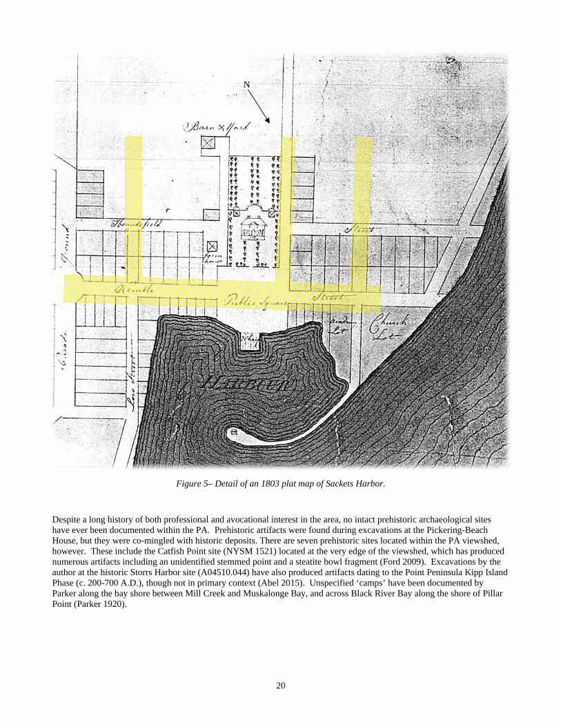
visit, however, Pike’s wooden monument was illegible. He was also able to visit Fort Virginia, a blockhouse constructed on the village perimeter defenses in 1814. It was in civilian use as a barn. The Navy abandoned Sackets Harbor in 1915, its facilities turned over to the New York Navy Militia (later the USNR). The only major military commitment to the post at Sackets Harbor remained Madison Barracks, built around what was for-merly Fort Pike. Construction of permanent stone barracks, a new hospital, and a bakery began soon after the war’s end. The post grew in size at the beginning of the Spanish-American War through World War I when it was used as a training post for infantry and artillery units. The Army outgrew the post after WWI, however, and by 1908 the troops stationed there were training at a new installation near Watertown called Pine Camp. The Army abandoned all activity to Pine Camp after World War II. Pine Camp, of course, became Camp Drum, and later Fort Drum, now home to the 10th Mountain Divi-sion (LI). Madison Barracks was officially closed in 1949, and its facilities abandoned. Following this, the village entered into a pe-riod of economic decline due to the loss of local jobs and population. By the 1970s, the village was nearly abandoned itself. What little industry there was in the village had also closed. Things began to turn around in the latter part of the decade, however. The village was designated an Urban Cultural Park in 1977. The 1980s saw a renaissance in the village led by a new influx of history-minded residents who began buying property and restoring historic structures. New businesses arose centered on tourism, which fueled expansion and increased population. 1.4 Development History The village’s growth as a social center can be traced through early maps beginning with Sackets’ plan map dated 1803 (Figure 5). Only Sacket inhabited the village at the time, but the layout of the village, including streets and locations for schools, churches and public buildings progressed quickly. The development of the village progressed from the ‘square’ outward along what would become Main St., by the 1810 census consisting of about 20 families. Side streets were added around the time of the war running south from West Main St. The war brought a halt to further development. After the war, the Village of Sackets Harbor grew again as an important shipping center and port of entry to the US. The former navy yard became a first-rate commercial shipyard, turning out several innovative designs. The first steamship on the Great Lakes, the S.S. Ontario, was completed at the village in 1816. The first commercial vessels to dock at the port of Chicago were built and sailed from Sackets Harbor (Figure 6). The lack of available water power in the village was addressed as early as 1823, when a company formed under Elisha Camp to divert water from the Black River into Mill Creek (Figure 7). Once completed in 1832, however, Camp’s Ditch was a dismal failure prone to outwashes and cave-ins. It did survive long enough to power a grist mill, two saw mills, a plaster mill, a paper mill and a furnace for about ten years, before the entire enterprise was abandoned. Following its failed attempt at industry, the village’s economy relied primarily on shipping and Madison Barracks. The first map to detail structural development within the village was the 1851 Bevan map (Figure 8). It details numerous structures along West Main, Hill, Ray and Ambrose Streets, but does not indicate their use. Comparing it to modern aerial maps suggests that many of these structures remain extant. The railroad came to Sackets Harbor in 1852, at first greatly increasing its importance as a shipping center on Lake Ontario (Figure 9). From its port, goods imported by way of the St. Lawrence River could now be shipped via the railroad to points south. Goods produced in Jefferson County could be shipped to the interior via Lake Ontario. It could not compete with the east coast, however, and its importance as a port of entry for goods thereafter declined. It remained an important port for passenger traffic until the end of the steamship era. The PA would remain virtually unchanged, save for structural dem-olitions and redevelopment, through the rest of the 19th century and 20th centuries (Figures 10-13). 2.0 ARCHAEOLOGICAL ASSESSMENT 2.1 Site File Review For purposes of this review, the site files were pulled from the entire viewshed of the PA. The viewshed was considered to be that area within 3.2 km (2 mi) of the village. The review of site files at the OPRHP was conducted by Barbara Ross. Her report is included as Appendix 2 at the end of this report, and is summarized below with commentary.
20
Figure 5– Detail of an 1803 plat map of Sackets Harbor.
N
Despite a long history of both professional and avocational interest in the area, no intact prehistoric archaeological sites have ever been documented within the PA. Prehistoric artifacts were found during excavations at the Pickering-Beach House, but they were co-mingled with historic deposits. There are seven prehistoric sites located within the PA viewshed, however. These include the Catfish Point site (NYSM 1521) located at the very edge of the viewshed, which has produced numerous artifacts including an unidentified stemmed point and a steatite bowl fragment (Ford 2009). Excavations by the author at the historic Storrs Harbor site (A04510.044) have also produced artifacts dating to the Point Peninsula Kipp Island Phase (c. 200-700 A.D.), though not in primary context (Abel 2015). Unspecified ‘camps’ have been documented by Parker along the bay shore between Mill Creek and Muskalonge Bay, and across Black River Bay along the shore of Pillar Point (Parker 1920).
21
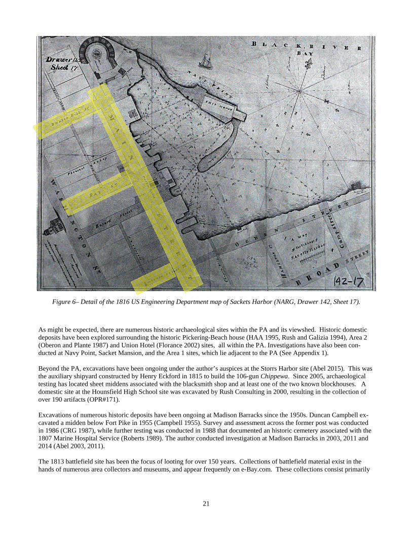
Figure 6– Detail of the 1816 US Engineering Department map of Sackets Harbor (NARG, Drawer 142, Sheet 17).
As might be expected, there are numerous historic archaeological sites within the PA and its viewshed. Historic domestic deposits have been explored surrounding the historic Pickering-Beach house (HAA 1995, Rush and Galizia 1994), Area 2 (Oberon and Plante 1987) and Union Hotel (Florance 2002) sites, all within the PA. Investigations have also been con-ducted at Navy Point, Sacket Mansion, and the Area 1 sites, which lie adjacent to the PA (See Appendix 1). Beyond the PA, excavations have been ongoing under the author’s auspices at the Storrs Harbor site (Abel 2015). This was the auxiliary shipyard constructed by Henry Eckford in 1815 to build the 106-gun Chippewa. Since 2005, archaeological testing has located sheet middens associated with the blacksmith shop and at least one of the two known blockhouses. A domestic site at the Hounsfield High School site was excavated by Rush Consulting in 2000, resulting in the collection of over 190 artifacts (OPR#171). Excavations of numerous historic deposits have been ongoing at Madison Barracks since the 1950s. Duncan Campbell ex-cavated a midden below Fort Pike in 1955 (Campbell 1955). Survey and assessment across the former post was conducted in 1986 (CRG 1987), while further testing was conducted in 1988 that documented an historic cemetery associated with the 1807 Marine Hospital Service (Roberts 1989). The author conducted investigation at Madison Barracks in 2003, 2011 and 2014 (Abel 2003, 2011). The 1813 battlefield site has been the focus of looting for over 150 years. Collections of battlefield material exist in the hands of numerous area collectors and museums, and appear frequently on e-Bay.com. These collections consist primarily

22
Fig
ure
7– D
etai
l of t
he 1
835
For
d m
ap.
23
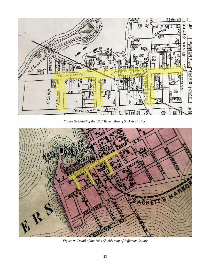
Figure 8– Detail of the 1851 Bevan Map of Sackets Harbor.
Figure 9– Detail of the 1854 Shields map of Jefferson County
24
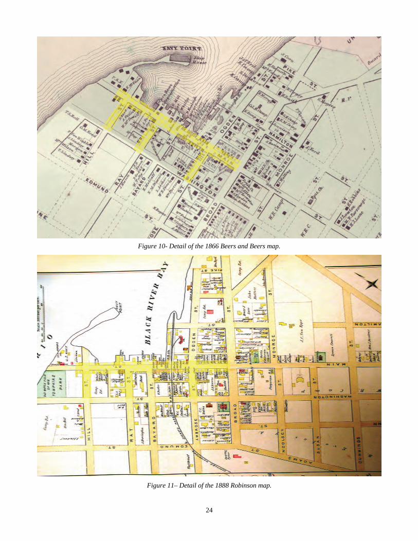
Figure 10- Detail of the 1866 Beers and Beers map.
Figure 11– Detail of the 1888 Robinson map.
25
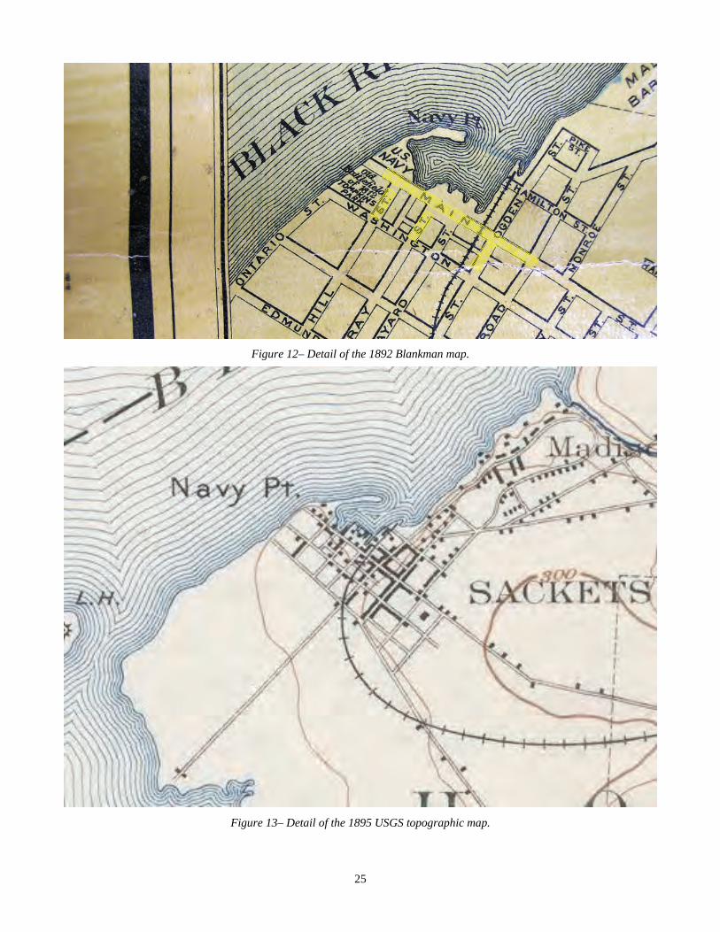
Figure 12– Detail of the 1892 Blankman map.
Figure 13– Detail of the 1895 USGS topographic map.
26
of muskets balls of various sizes, civilian and uniform buttons, musket parts and artillery shot. The first systematic profes-sional investigations were surprisingly only undertaken in 2006 (HAA 2007). There are two NR Districts (90NR01190, 90NR01188) and one NR listed property (90NR01187) within the PA for this undertaking. The Sackets Harbor Battlefield District (90NR01190) is a large area encompassing the 1813 battlefield and War of 1812 Navy Yard. The Sackets Harbor Village Historic District (90NR1188) encompasses numerous historic struc-tural resources along West Main, Ray, Bayard, Ambrose, Washington, General Smith and Broad Sts. The Union Hotel (90NR01187), built in 1817, was the site of a Masonic Lodge on the third floor. There are two NR districts and two NR listed structures within the viewshed of the PA. The Madison Barracks Historic District (90NR01189) encompasses the former US Army installation now converted to residential use as a tenant resort community. The Shore Farm Historic District (90NR01141) encompasses the former Luff farm on Black River Bay. The Samuel Guthrie House (89NR01616) was the home of early 19th century physician and inventor Samuel Guthrie. Dr. Guth-rie was one of the inventors of chloroform in 1830, and also produced a primitive forerunner to the percussion cap. The Elisha Camp House (90NR1186) was the home of Augustus Sacket’s brother-in-law and one-time partner. It has remained in the same family since it was constructed in 1814. These resources will not be impacted by the proposed undertaking. There are numerous inventoried structures within the PA. None of these will be impacted by the proposed undertaking. 2.2 Prior Investigations A summary of archaeological investigation reports for the village and surrounding areas on file with the OPRHP is pre-sented in Appendix 1. For over 150 years, Sackets Harbor has been the focus of looting by collectors of militaria. Surpris-ingly, the first systematic investigations within the village only began in the late 1960s under the NYS Bureau of Historic Sites. Some limited surveys were undertaken in the village in the 1970s under the National Historic Preservation Act (NHPA). Since the 1980 implementation of SEQRA, regular investigations have been undertaken in the village in support of proposed new development. This discussion will focus only on those investigations within the APE for this project. Subsurface testing was conducted in 1987 by Stephen Oberon and Nancy Plante immediately adjacent to the south side of West Main Street from Broad Street to the Battlefield grounds prior to gas line construction (OPR #41). One historic ar-chaeological deposit (Area 2) was identified at the SE corner of West Main and Ray Streets, but it was not inventoried due a lack of integrity. Phase 2/3 archaeological investigations were conducted in the area behind the Union Hotel by the NYS Bureau of Historic Sites (OPR #180). The tested area lies partly within the APE for this project. This property is listed on the National Regis-ter of Historic Places.
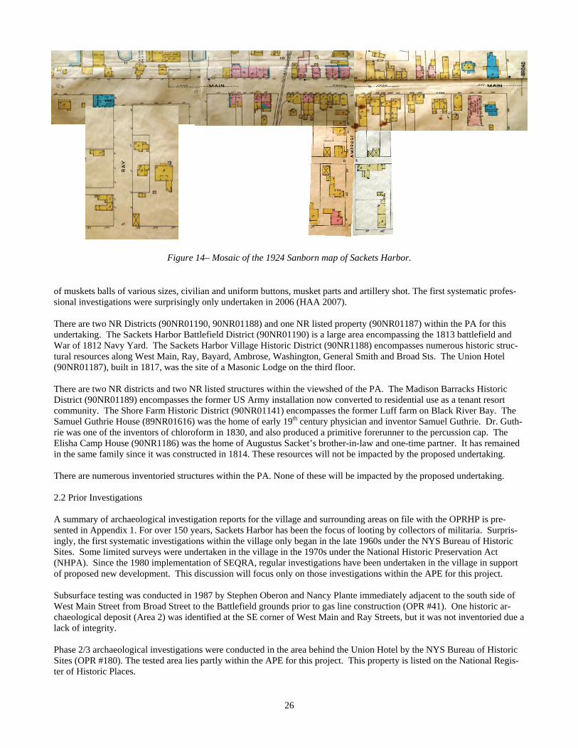
Figure 14– Mosaic of the 1924 Sanborn map of Sackets Harbor.
27
Rush Consulting conducted Phase 1 archaeological survey along Washington Street in 2009 prior to water and sewer utility upgrades, including areas immediately adjacent to the current PA (OPR #311-313). Historic archaeological deposits were documented near the SE corner of Bayard Street. The status of the deposit is undetermined. This survey touches the south terminus of the current APE. Both Rush Consulting (OPR #161) and Hartgen Archaeological Associates (OPR #162) conducted Phase 1, 2, and 3 ar-chaeological investigations of the Pickering-Beach House site. None of the excavations, however, were within the APE. A rich domestic cultural assemblage associated with the family was documented, as well as prehistoric artifacts and one iso-lated element of human remains. This property lies at the terminus of the APE on West Washington Street, adjacent to Sackets Harbor Battlefield. 2.3 Site Walkover Due to the timing of this Phase 1a investigation, a walkover survey to identify cultural resources within the APE that could be impacted by this undertaking was not performed. A comparison of historic maps and modern aerial photo indicates no less than 20 map-documented structure locations that are no longer extant (Figure 15). These locations may contain intact archaeological deposits. 3.0 IMPACTS The impacts of this undertaking to documented archaeological deposits are summarized in Table 2. The proposed undertak-ing will result in ground-disturbing activity that will indirectly impact two National Register historic districts including the Sackets Harbor Historic District (90NR01188) and the Sackets Harbor Battlefield Historic District (90NR01190). Direct impacts will occur to three previously-investigated archaeological deposits at the Pickering Beach House Museum site (not inventoried), the Union Hotel site (90NR01187, 04558.000002) and the Area 1 site (A04558.000264). Of these, the Union Hotel site and Area 1 site impacts seem to be mitigated by the documented investigations. Ground-disturbing activity within the APE for this undertaking along Hill Street and adjacent areas of W. Main Street also has a potential to directly impact areas that were part of the 1813 Battle of Sackets Harbor. Overall, little of the proposed APE has been systematically surveyed for archaeological resources. Some subsurface testing was undertaken along the south side of W. Main Street in support of a proposed gas line, but details of that testing are not reported. Regardless, the sensitivity for intact archaeological deposits adjacent to the edge of Main Street seems mitigated by disturbances from the installed gas line. Map research documents the presence of no fewer than 20 map-documented structures that may contain intact archaeological deposits (Figure 15).
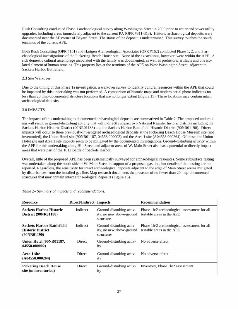
Resource Direct/Indirect Impacts Recommendation
Sackets Harbor Historic District (90NR01188)
Indirect Ground-disturbing activ-ity, no new above-ground structures
Phase 1b/2 archaeological assessment for all testable areas in the APE
Sackets Harbor Battlefield Historic District (90NR01190)
Indirect Ground-disturbing activ-ity, no new above-ground structures
Phase 1b/2 archaeological assessment for all testable areas in the APE
Union Hotel (90NR01187, 04558.000002)
Direct Ground-disturbing activ-ity
No adverse effect
Area 1 site (A04558.000264)
Direct Ground-disturbing activ-ity
No adverse effect
Pickering Beach House site (uninventoried)
Direct Ground-disturbing activ-ity
Inventory, Phase 1b/2 assessment
Table 2– Summary of impacts and recommendations.
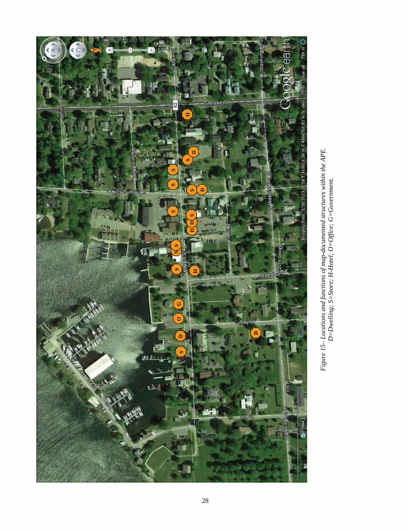
28
D
S S
S
H
S
S
D
D
D
S
S
S
S
H
O
G
D
S
D
Fig
ure
15–
Loca
tions
and
func
tions
of m
ap-d
ocum
ente
d st
ruct
ures
with
in th
e A
PE
. D
=D
wel
ling;
S=
Stor
e; H
-Hot
el;
O=
Offi
ce;
G=
Gov
ernm
ent.
29
4.0 RECOMMENDATIONS The following recommendations apply only to the APE of this project presented in Section 1.1. OPRHP should be notified of any alterations to this APE. These recommendations are subject to OPRHP review and concurrence and may not be complete. 1. Phase 1b archaeological survey is recommended for any testable areas adjacent to the sidewalks of the APE. The Phase
1b investigations should minimally follow OPRHP standards, however, Phase 1b/2 investigations consisting of 1/2 me-ter controlled test units at 7.5 m interval would be more likely to yield the kind of detailed stratigraphic information necessary to assess what are anticipated to be numerous potential archaeological deposits associated with each historic structure lot.
2. Archaeological testing is not recommended for the Union Hotel grounds on the basis that previous investigations docu-mented no significant archaeological deposits there.
3. An additional metal detector survey is recommended within the APE along Hill Street and adjacent areas of W. Main Street. These areas may contain artifacts related to the 1813 Battle of Sackets Harbor.
30
REFERENCES CITED Abel, Timothy J. 2000 The Plus Site: An Iroquoian Remote Camp in Upland Tompkins County, NY. North American Archaeologist
21:181-215. 2001 The Clayton Cluster: Cultural Dynamics of a Late Prehistoric Village Sequence in the Upper St. Lawrence Valley.
Ph.D. Dissertation, University at Albany-SUNY, UMI, Ann Arbor. 2003 Stage IA/B Archaeological Survey for Old Stone Hospital, Sackets Harbor, NY. Unpublished report of investiga-
tions submitted to the Sackets Harbor Area Cultural and Historical Preservation Foundation, Sackets Harbor, NY. 2011 Phase 1b Archaeological Reconnaissance, 1815 Rope Walk Area and Phase 2 Archaeological Assessment, E. Slo-
man Homestead Site, Village of Sackets Harbor, Jefferson County. Unpublished report of investigations submitted to Lawler Realty, LLC, Sackets Harbor, NY.
2015 Storrs Harbor: Archaeology of a War of 1812 Naval Shipyard on Lake Ontario. Bulletin of the New York State Ar-chaeological Association 129: in press.
Abel, Timothy J., and David N. Fuerst 1999 The Prehistory of the St. Lawrence Headwaters Region. Archaeology of Eastern North America 27:1-52. Anderson, David G. 1991 Examining Prehistoric Settlement Distribution in Eastern North America. Archaeology of Eastern North America
19:1-22. Beauchamp, William M. 1907 Aboriginal Place Names of New York. New York State Museum, Bulletin 108. Beers, S. N., and D. G. Beers 1864 New Topographical Atlas of Jefferson County, New York. C. K. Stone, Philadelphia. Bevan, John 1851 Map of Sackets Harbor, N.Y. John Bevan, Jersey City. Campbell, J. Duncan 1955 A War of 1812 Military Trash Pit. Military Collector & Historian 7(4):102-104. Cressey, George B. 1977 Land Forms. In Geography of New York State, edited by John H. Thompson, pp. 19-53. Syracuse University Press,
Syracuse, NY. CRG (Cultural Resource Group) 1987 Stage 1 Cultural Resource Survey of the Proposed Madison Barracks Development, Sackets Harbor, Jefferson
County, NY. Unpublished report of investigations submitted to The Jobco Organization, Great Neck, NY. Curtin, Edward V. 2009 The Trailside Site, Archaeological Visibility, and Middle Archaic Settlement Patterns. In Annual Meeting of the
New York State Archaeological Association, Rochester, NY. Emerson, Edgar 1898 Our Country and It's People: A Descriptive Work on Jefferson County New York. Boston History Company, Bos-
ton. Engelbrecht, William 1995 The Case of the Disappearing Iroquoians: Early Contact Period Superpower Politics. Northeast Anthropology
50:35-59. Everts, L.H. 1878 History of Jefferson County, New York. L.H. Everts & Co., Philadelphia. Fitzgerald, William R., and James B. Jamieson 1985 Ascent of Decline: An Alternative Interpretation of Late Iroquoian Development. Paper presented at Paper pre-
sented at the 18th Meeting of the Canadian Archaeological Association, Winnipeg. Florance, Charles 2002 The 1997 Archaeological Testing and Mitigation for the Union Hotel Addition, Sackets Harbor Battlefield Mitiga-
tion State Historic Site, Village Sackets Harbor. Unpublished report prepared for NYS Bureau of Historic Sites, Waterford, NY
Ford, Augustus 1835 Map of Sackets Harbor, New York. P.A. Mesier’s Lithography, New York City. Funk, Robert E. 1977 Early to Middle Archaic Occupations in Upstate New York. In Current Perspectives in Northeastern Archae-
ology : Essays In Honor Of William A. Ritchie., edited by Robert E. Funk and Charles F. Hayes III, pp. 21-29. New York State Archaeological Association, Rochester.
31
Funk, Robert E. 1978 Post-Pleistocene Adaptations. In Handbook of North American Indians: Volume 15, The Northeast, edited by
Bruce G. Trigger, pp. 16-27. Smithsonian Institution, Washington, D. C. Funk, Robert E. 1979 The Early and Middle Archaic in New York as seen from the Upper Susquehanna Valley. The Bulletin of the New
York State Archaeological Association 75:23-37. Gibson, Gary M. 2011 Storrs Harbor: Lake Ontario's Forgotten Naval Station. Unpublished draft report on file, Sackets Harbor Battle-
field State Historic Site. HAA (Hartgen Archaeological Associates) 1995 Archaeological Investigations at the Pickering-Beach Museum. Unpublished report of investigations submitted to
Village of Sackets Harbor, NY. 2007 Archaeological Investigation of the Sackets Harbor War of 1812 Battleground, Village of Sackets Harbor, Jeffer-
son County, New York. Unpublished report of investigations submitted to the Village of Sackets Harbor, NY. Haddock, J. A. 1894 The Growth of a Century as Illustrated in the History of Jefferson County from 1793 to 1894. Sherman and Co.
Publishing, Philadelphia. Hart, John P. 1999 Dating Roundtop's Domesticates: Implications for Northeast Late Prehistory. In Current Northeast Paleoethno-
botany, edited by John P. Hart, pp. 47-68. New York State Museum, Albany. Heiner, George G., Jr. 1938 From Saints to Red Legs. A.W. Munk & Co., Watertown. Hough, Franklin B. 1854 History of Jefferson County in the State of New York from the Earliest Period to the Present Time. Joel Munsell,
Albany. Jamieson, J. Bruce 1990 Trade and Warfare: The Disappearance of the St. Lawrence Iroquoians. Man in the Northeast 39:79-86. Keene, Arthur S. 1981 Optimal Foraging in a Nonmarginal Environment: A Model of Prehistoric Subsistence Stragtegies in Michigan. In
Hunter- Gatherer Foraging Strategies, edited by B. Winterhalder and E. Smith, pp. 171-193. University of Chi-cago Press, Chicago.
Levy, Morris 1855 Jefferson County, New York. J.B. Shields, Philadelphia. McDowell, Letember 1989 Soil Survey of Jefferson County, New York. United States Department of Agriculture, Soil Conservation Service,
Washington, D.C. NYAC 1994 Standards for Cultural Resource Investigations and the Curation of Archaeological Collections in New York State.
The New York Archaeological Council, Albany. Oberon, Stephen J. and Nancy Plante 1987 Stage 1 Cultural Resources Survey, Proposed Gas Line, Village of Sackets Harbor, Jefferson County, New York.
Unpublished report submitted to Niagara Mohawk Corporation, Syracuse, NY. Pendergast, James F. 1985 Huron- St. Lawrence Iroquois Relations in the Terminal Prehistoric Period. Ontario Archaeology 44:23-39. Roberts, William I., IV 1989 Stage IB/II Archaeological Survey of the Madison Barracks, Sackets Harbor, New York. Unpublished report of
investigations submitted to Madison Barracks Associates, Sackets Harbor, NY: Rush, Laurie and Joseph Galizia 1994 Stage IA/B Archaeologist’s Report for Pickering-Beach Restoration, Village of Sackets Harbor, Jefferson County,
NY . Unpublished report of investigations submitted to the Village of Sackets Harbor, NY Ritchie, William A., and Robert E. Funk 1973 Aboriginal Settlement Patterns in the Northeast. New York State Museum and Science Service, Albany. Spence, Michael W., Robert H. Pihl, and Carl R. Murphy 1990 Cultural Complexes of the Early and Middle Woodland Periods. In The Archaeology of Southern Ontario to A.D.
1650, edited by Chris J. Ellis and Neal Ferris, pp. 125-170. Starbuck, David R., and C. E. Bolian (editors) 1980 Early and Middle Archaic Cultures in the Northeast. Franklin Pierce College, Rindge, N.H.

32
Trubowitz, Neal T. 1979 The Early Archaic in Western New York. The Bulletin of the New York State Archaeological Asssociation 75:52-
58. Wilder, Patrick A. 1994 The Battle of Sacket's Harbour, 1813. The Nautical & Aviation Publishing Company of America, Inc., Baltimore,
MD. Winterhalder, Bruce 1981 Optimal Foraging Strategies and Hunter-Gatherer Research in Anthropology: Theory and Models. In Hunter-
Gatherer Foraging Strategies, edited by B. Winterhalder and E. A. Smith, pp. 13-35. University of Chicago Press, Chicago.

APPENDIX 1– OPRHP FILE REVIEW DATA
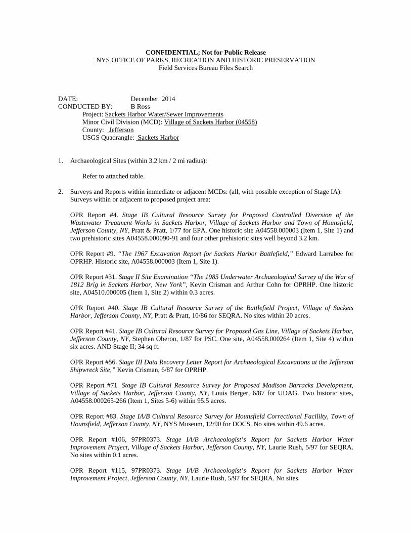
CONFIDENTIAL; Not for Public Release NYS OFFICE OF PARKS, RECREATION AND HISTORIC PRESERVATION
Field Services Bureau Files Search
DATE: December 2014 CONDUCTED BY: B Ross Project: Sackets Harbor Water/Sewer Improvements Minor Civil Division (MCD): Village of Sackets Harbor (04558) County: Jefferson USGS Quadrangle: Sackets Harbor 1. Archaeological Sites (within 3.2 km / 2 mi radius):
Refer to attached table. 2. Surveys and Reports within immediate or adjacent MCDs: (all, with possible exception of Stage IA):
Surveys within or adjacent to proposed project area:
OPR Report #4. Stage IB Cultural Resource Survey for Proposed Controlled Diversion of the Wastewater Treatment Works in Sackets Harbor, Village of Sackets Harbor and Town of Hounsfield, Jefferson County, NY, Pratt & Pratt, 1/77 for EPA. One historic site A04558.000003 (Item 1, Site 1) and two prehistoric sites A04558.000090-91 and four other prehistoric sites well beyond 3.2 km. OPR Report #9. “The 1967 Excavation Report for Sackets Harbor Battlefield,” Edward Larrabee for OPRHP. Historic site, A04558.000003 (Item 1, Site 1). OPR Report #31. Stage II Site Examination “The 1985 Underwater Archaeological Survey of the War of 1812 Brig in Sackets Harbor, New York”, Kevin Crisman and Arthur Cohn for OPRHP. One historic site, A04510.000005 (Item 1, Site 2) within 0.3 acres. OPR Report #40. Stage IB Cultural Resource Survey of the Battlefield Project, Village of Sackets Harbor, Jefferson County, NY, Pratt & Pratt, 10/86 for SEQRA. No sites within 20 acres. OPR Report #41. Stage IB Cultural Resource Survey for Proposed Gas Line, Village of Sackets Harbor, Jefferson County, NY, Stephen Oberon, 1/87 for PSC. One site, A04558.000264 (Item 1, Site 4) within six acres. AND Stage II; 34 sq ft. OPR Report #56. Stage III Data Recovery Letter Report for Archaeological Excavations at the Jefferson Shipwreck Site,” Kevin Crisman, 6/87 for OPRHP. OPR Report #71. Stage IB Cultural Resource Survey for Proposed Madison Barracks Development, Village of Sackets Harbor, Jefferson County, NY, Louis Berger, 6/87 for UDAG. Two historic sites, A04558.000265-266 (Item 1, Sites 5-6) within 95.5 acres. OPR Report #83. Stage IA/B Cultural Resource Survey for Hounsfield Correctional Facililty, Town of Hounsfield, Jefferson County, NY, NYS Museum, 12/90 for DOCS. No sites within 49.6 acres. OPR Report #106, 97PR0373. Stage IA/B Archaeologist’s Report for Sackets Harbor Water Improvement Project, Village of Sackets Harbor, Jefferson County, NY, Laurie Rush, 5/97 for SEQRA. No sites within 0.1 acres. OPR Report #115, 97PR0373. Stage IA/B Archaeologist’s Report for Sackets Harbor Water Improvement Project, Jefferson County, NY, Laurie Rush, 5/97 for SEQRA. No sites.
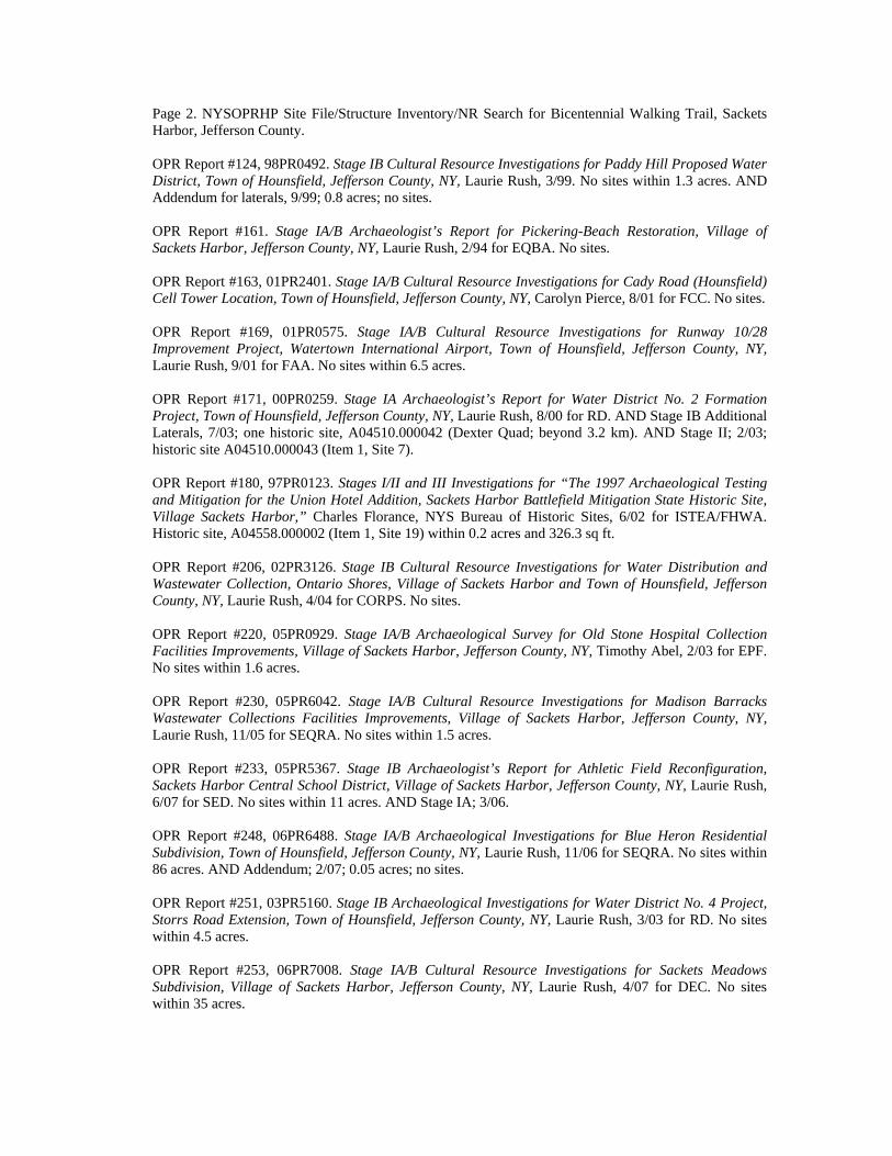
Page 2. NYSOPRHP Site File/Structure Inventory/NR Search for Bicentennial Walking Trail, Sackets Harbor, Jefferson County. OPR Report #124, 98PR0492. Stage IB Cultural Resource Investigations for Paddy Hill Proposed Water District, Town of Hounsfield, Jefferson County, NY, Laurie Rush, 3/99. No sites within 1.3 acres. AND Addendum for laterals, 9/99; 0.8 acres; no sites. OPR Report #161. Stage IA/B Archaeologist’s Report for Pickering-Beach Restoration, Village of Sackets Harbor, Jefferson County, NY, Laurie Rush, 2/94 for EQBA. No sites. OPR Report #163, 01PR2401. Stage IA/B Cultural Resource Investigations for Cady Road (Hounsfield) Cell Tower Location, Town of Hounsfield, Jefferson County, NY, Carolyn Pierce, 8/01 for FCC. No sites. OPR Report #169, 01PR0575. Stage IA/B Cultural Resource Investigations for Runway 10/28 Improvement Project, Watertown International Airport, Town of Hounsfield, Jefferson County, NY, Laurie Rush, 9/01 for FAA. No sites within 6.5 acres. OPR Report #171, 00PR0259. Stage IA Archaeologist’s Report for Water District No. 2 Formation Project, Town of Hounsfield, Jefferson County, NY, Laurie Rush, 8/00 for RD. AND Stage IB Additional Laterals, 7/03; one historic site, A04510.000042 (Dexter Quad; beyond 3.2 km). AND Stage II; 2/03; historic site A04510.000043 (Item 1, Site 7). OPR Report #180, 97PR0123. Stages I/II and III Investigations for “The 1997 Archaeological Testing and Mitigation for the Union Hotel Addition, Sackets Harbor Battlefield Mitigation State Historic Site, Village Sackets Harbor,” Charles Florance, NYS Bureau of Historic Sites, 6/02 for ISTEA/FHWA. Historic site, A04558.000002 (Item 1, Site 19) within 0.2 acres and 326.3 sq ft. OPR Report #206, 02PR3126. Stage IB Cultural Resource Investigations for Water Distribution and Wastewater Collection, Ontario Shores, Village of Sackets Harbor and Town of Hounsfield, Jefferson County, NY, Laurie Rush, 4/04 for CORPS. No sites. OPR Report #220, 05PR0929. Stage IA/B Archaeological Survey for Old Stone Hospital Collection Facilities Improvements, Village of Sackets Harbor, Jefferson County, NY, Timothy Abel, 2/03 for EPF. No sites within 1.6 acres. OPR Report #230, 05PR6042. Stage IA/B Cultural Resource Investigations for Madison Barracks Wastewater Collections Facilities Improvements, Village of Sackets Harbor, Jefferson County, NY, Laurie Rush, 11/05 for SEQRA. No sites within 1.5 acres. OPR Report #233, 05PR5367. Stage IB Archaeologist’s Report for Athletic Field Reconfiguration, Sackets Harbor Central School District, Village of Sackets Harbor, Jefferson County, NY, Laurie Rush, 6/07 for SED. No sites within 11 acres. AND Stage IA; 3/06. OPR Report #248, 06PR6488. Stage IA/B Archaeological Investigations for Blue Heron Residential Subdivision, Town of Hounsfield, Jefferson County, NY, Laurie Rush, 11/06 for SEQRA. No sites within 86 acres. AND Addendum; 2/07; 0.05 acres; no sites. OPR Report #251, 03PR5160. Stage IB Archaeological Investigations for Water District No. 4 Project, Storrs Road Extension, Town of Hounsfield, Jefferson County, NY, Laurie Rush, 3/03 for RD. No sites within 4.5 acres. OPR Report #253, 06PR7008. Stage IA/B Cultural Resource Investigations for Sackets Meadows Subdivision, Village of Sackets Harbor, Jefferson County, NY, Laurie Rush, 4/07 for DEC. No sites within 35 acres.
Page 3. NYSOPRHP Site File/Structure Inventory/NR Search for Bicentennial Walking Trail, Sackets Harbor, Jefferson County. OPR Report #262, 07PR1841. Stage IA/B Cultural Resource Investigations for Dexter Estates, Town of Hounsfield, Jefferson County, NY, Timothy Abel, 1/07 for CORPS. No sites within 2.3 acres. OPR Report #267, 07PR5211. Stage IA/B Cultural Resource Survey for Porterdale Farms EQIP Project, Town of Hounsfield, Jefferson County, NY, Birchwood, 8/07 for NRCS. No sites within 0.001 acre. OPR Report #277, 07PR1050. Stage IB Supplemental Testing for Battlefield Commons, Village of Sackets Harbor, Jefferson County, NY, Timothy Abel, 5/07 for SEQRA. One historic site, A04558.000276 (Item 1, Site 15) within five acres. OPR Report #281, 07PR6733. Stage IA Cultural Resource Investigations for Proposed Hounsfield Wind Farm, Galloo Island Project Area, Town of Hounsfield, Jefferson County, NY, Panamerican, 2/08 for CORPS/DEC/PSC. OPR Report #284, 08PR2820. Stage IA/B Archaeological Investigation for Water District No. 3 Improvements, Village of Sackets Harbor, Jefferson County, NY, Laurie Rush, 5/08 for RD/USDA. One historic site, A04510.000045 (beyond 3.2 km) within seven acres. AND Stage II; 88.77 sq ft; 9/08. OPR Report #293, 08PR4804. Stage IA/B Cultural Resource Survey for Proposed Vespa Arsenal Stone Quarry Modifications, Town of Hounsfield, Jefferson County, NY, Stephen Oberon, 8/08 for DEC. No sites within eight acres. OPR Report #294, 08PR2563. Stage IA/B Archaeological Investigations for Proposed Hounsfield Sewer Project, Village of Sackets Harbor and Town of Hounsfield, Jefferson County, NY, Laurie Rush, 5/08 for DAS. No sites within one acre. AND Addendum; 9/08; 0.3 acres; no sites. OPR Report #297, 06PR5108. Stage IA/B Archaeological Survey for Fort Pike Improvements, Village of Sackets Harbor, Jefferson County, NY, Timothy Abel, 10/08 for EPF/HAS. No sites within one acre. OPR Report #302, 09PR1599. Stage IA/B Cultural Resource Survey for Watertown International Airport Expansion, Town of Hounsfield, Jefferson County, NY, Rochester Museum, 2/09 for FAA. One historic site, A04510.000046 (beyond 3.2 km) within 104.3 acres. AND Addendum; 6/09; 29.9 acres; no sites. OPR Report #303, 07PR6733. Stage IB Cultural Resource Investigations for Proposed Hounsfield Wind Farm, Galloo Island, Town of Hounsfield, Jefferson County, NY, Panamerican, 2/09 for CORPS Permit. Four historic sites, A04510.000047-50 (Galloo Island; beyond 3.2 km) within 35.5 acres. OPR Report #306, 09PR0168. Stage IA/B Archaeological Survey for Water District No. 5, Town of Hounsfield, Jefferson County, NY, Timothy Abel, 6/09 for RD. Eight historic sites; A04510.000051-58 (Sackets Harbor; beyond 3.2 km) within 10.9 acres. OPR Report #311-315, 09PR0828. Stage IA/B Archaeological Survey for Proposed Sewer Replacement Project, Village of Sackets Harbor, Jefferson County, NY, Laurie Rush, 7/09. One historic site, A04558.000277 (Item 1, Site 12) within 2.75 acres. AND Addendum; 8/09; 24 acres; same site. AND Addendum; 10/09; 0.2 acres; historic site A04558.000278 (Item 1, Site 14). AND Addendum; 11/09 for Hill Street Force Main; one historic site; A04558.000276 (Item 1, Site 15). And Addendum for pump house; 12/09; no sites. OPR Report #316, 09PR0343. Stage IA/B Archaeological Investigations for Proposed Water Tower Replacement Project, Village of Sackets Harbor, Jefferson County, NY, Laurie Rush, 11/09 for ARRA. One historic site, A04558.000279 (Item 1, Site 13) within 0.2 acres.

OPR Report #323, 10PR0553. Phase 1a Archaeological Assessment, War of 1812 Bicentennial Trail, Village of Sackets Harbor, Jefferson County. Timothy Abel, 6/10 for ARRA. OPR Report #333, Sackets Harbor War of 1812 Battlefield Survey, Village of Sackets Harbor, Jefferson County, NY. Hartgen 2/09 for NPS. One site (A04558.000003). OPR Report #340, Phase 1b Archaeological Reconnaissance, 1815 Rope Walk Area and Phase 2 Archaeological Assessment, E. Sloman Homestead Site, Village of Sackets Harbor, Jefferson County, New York. Timothy Abel, 12/10 for SEQRA. One site (A04558.00028) in 3.1 ac.
Page 4. NYSOPRHP Site File/Structure Inventory/NR Search for Bicentennial Walking Trail, Sackets Harbor, Jefferson County.
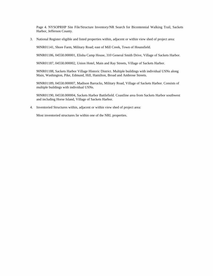
3. National Register eligible and listed properties within, adjacent or within view shed of project area:
90NR01141, Shore Farm, Military Road; east of Mill Creek, Town of Hounsfield. 90NR01186, 04558.000001, Elisha Camp House, 310 General Smith Drive, Village of Sackets Harbor. 90NR01187, 04558.000002, Union Hotel, Main and Ray Streets, Village of Sackets Harbor. 90NR01188, Sackets Harbor Village Historic District. Multiple buildings with individual USNs along Main, Washington, Pike, Edmund, Hill, Hamilton, Broad and Ambrose Streets. 90NR01189, 04558.000007, Madison Barracks, Military Road, Village of Sackets Harbor. Consists of multiple buildings with individual USNs. 90NR01190, 04558.000004, Sackets Harbor Battlefield. Coastline area from Sackets Harbor southwest and including Horse Island, Village of Sackets Harbor.
4. Inventoried Structures within, adjacent or within view shed of project area:
Most inventoried structures lie within one of the NRL properties.
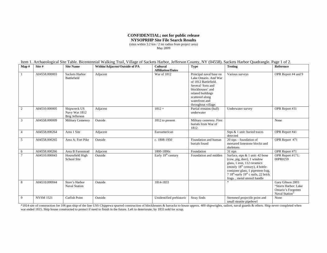
CONFIDENTIAL; not for public release NYSOPRHP Site File Search Results
(sites within 3.2 km / 2 mi radius from project area) May 2009
Item 1. Archaeological Site Table. Bicentennial Walking Trail, Village of Sackets Harbor, Jefferson County, NY (04558). Sackets Harbor Quadrangle. Page 1 of 2. Map # Site # Site Name Within/Adjacent/Outside of PA Cultural
Affiliation/Dates Type Testing Reference
1 A04558.000003 Sackets Harbor Battlefield
Adjacent War of 1812 Principal naval base on Lake Ontario. And War of 1812 Battlefield. Several ‘forts and blockhouses’ and related buildings scattered along waterfront and throughout village.
Various surveys OPR Report #4 and 9
2 A04510.000005 Shipwreck US Navy War 1812 Brig Jefferson
Adjacent 1812 + Partial remains (hull) underwater
Underwater survey OPR Report #31
3 A04558.000009 Military Cemetery Outside 1812 to present Military cemetery. First burials from War of 1812
None
4 A04558.000264 Area 1 Site Adjacent Euroamerican Stps & 1 unit: buried traces detected
OPR Report #41
5 A04558.000265 Area A; Fort Pike Outside c. 1808-1950 Foundation and human burials found
20 stps – foundation of mortared limestone blocks and skeletons
OPR Report #71
6 A04558.000266 Area B Farmstead Adjacent 1800-1890s Foundation 31 stps OPR Report #71 7 A04510.000043 Hounsfield High
School Site Outside Early 19th century Foundation and midden Surface, stps & 1 unit: 42 bone
(cow, pig, deer), 1 window glass, 1 iron, 112 ceramics (mostly 18th century), 4 bottle-container glass, 1 pipestem frag, 7 18th-early 19th c nails, 22 brick frags. , metal utensil handle
OPR Report #171; 00PR0259
8 A04510.000044 Storr’s Harbor Naval Station
Outside 1814-1833 * Gary Gibson 2003 “Storrs Harbor: Lake Ontario’s Forgotten Naval Station”
9 NYSM 1521 Catfish Point Outside Unidentified prehistoric Stray finds Stemmed projectile point and small steatite pipebowl
None
*1814 site of construction for 106 gun ship of the line USS Chippewa spurred construction of blockhouses & barracks to house approx. 400 shipwrights, sailors, naval guards & others. Ship never completed when war ended 1815. Ship house constructed to protect if need to finish in the future. Left to deteriorate; by 1833 sold for scrap.

CONFIDENTIAL; not for public release NYSOPRHP Site File Search Results
(sites within 3.2 km / 2 mi radius from project area) May 2009
Item 1. Archaeological Site Table. Bicentennial Walking Trail, Village of Sackets Harbor, Jefferson County, NY (04558). Sackets Harbor Quadrangle. Page 2 of 2. Map # Site # Site Name Within/Adjacent/Outside of PA Cultural
Affiliation/Dates Type Testing Reference
10 NYSM 1522 Muskalonge Bay site
Outside Unidentified prehistoric Stray find Narrow unfinished bone comb None
11 NYSM 3503 ACP JFSN-76 Outside Unidentified prehistoric Fishing camps No information Documented by Parker 12 A04558.000277 West Washington
Street site Adjacent Euroamerican Sheet midden Stps: kitchen bone, whiteware,
cut nails, coarse earthenware, brick, kaolin pipe stem
OPR Report #313; 09PR00828
13 A04558.000279 Outside Possible association with c. 1865 house
Midden Stps: kitchen bone, ceramics, personal (inc. military) and architectural items
OPR Report #316; 09PR00343
Henderson Bay Quadrangle 14 A04558.000278 Hill Street
Archaeological District
mid 19th to 20th century Sheet midden at house location
Stps: ceramics, kaolin pipe frags, kitchen bone, coarse earthenware drain pipe frags, container & window glass, cut & wire nails
OPR Report #313 Addendum 09PR00828
15 A05448.000276 Battlefield Commons Site
Outside
c. 1814-1817 Earthwork 3 test trenches (1.25 m wide) OPR Report #277; 07PR1050
16 NYSM 3563 ACP JFSN Outside Unidentified prehistoric Traces of occupation No information Documented by Parker 17 NYSM 3564 ACP JFSN Outside Unidentified prehistoric Camp No information Documented by Parker 18 NYSM 3570 ACP JFSN Outside Unidentified prehistoric Traces of occupation No information Documented by Parker Sackets Harbor Quadrangle 19 A04558.000002 Union Hotel Within 1904 Hotel and middens Stages I/II and III OPR Report #180;
97PR0123 20 NYSM 3562 ACP JFSN Outside Unidentified prehistoric Camp No information Documented by Parker Parker, Arthur C “History of the Archaeology of New York State,” NYS Museum Bulletins 238-239: 1920-22.
Related Documents