51 CHAPTER 4 MATERIAL CULTURE OF THE IRON AGE PERIOD RELATED TO ISRAEL, JUDAH, AND THE NEIGHBORING LANDS. 4.1 Introduction This section is an introduction to the material culture of the Iron Age Period related to Israel, Judah, and neighboring lands. The details of ancient sites mentioned in this section will be discussed in Chapter 5, dealing with the archaeological excavations and biblical interpretation of cities related to the time period covered in this dissertation. This writer found the outline prepared by Amihai Mazar in his book, Archaeology Of The Land Of The Bible, 10,000- 586 BCE to be very well organized on the subject of the material culture of the Iron Age Period. For this reason this writer has followed a similar outline such was presented in Mazar's book (Mazar 1990). There are a number of views on the inner division of the Iron Age in relationship to the archaeological periods of Israel and neighboring lands. After reading several references on this subject, the writer of this dissertation has selected to use the chronology table found in the New Encyclopedia of Archaeological Excavations In The Holy Land (Stern 1993:1529). The divisions of this chronology are: Iron Age 1A 1200-1150 BCE Iron Age 1B 1150-1000 BCE Iron Age 11A 1000-900 BCE

Welcome message from author
This document is posted to help you gain knowledge. Please leave a comment to let me know what you think about it! Share it to your friends and learn new things together.
Transcript

51
CHAPTER 4
MATERIAL CULTURE OF THE IRON AGE PERIOD RELATED TO
ISRAEL, JUDAH, AND THE NEIGHBORING LANDS.
4.1 Introduction
This section is an introduction to the material
culture of the Iron Age Period related to Israel, Judah,
and neighboring lands. The details of ancient sites
mentioned in this section will be discussed in Chapter 5,
dealing with the archaeological excavations and biblical
interpretation of cities related to the time period covered
in this dissertation.
This writer found the outline prepared by Amihai Mazar
in his book, Archaeology Of The Land Of The Bible, 10,000-
586 BCE to be very well organized on the subject of the
material culture of the Iron Age Period. For this reason
this writer has followed a similar outline such was
presented in Mazar's book (Mazar 1990).
There are a number of views on the inner division of
the Iron Age in relationship to the archaeological periods
of Israel and neighboring lands. After reading several
references on this subject, the writer of this dissertation
has selected to use the chronology table found in the New
Encyclopedia of Archaeological Excavations In The Holy Land
(Stern 1993:1529). The divisions of this chronology are:
Iron Age 1A 1200-1150 BCE
Iron Age 1B 1150-1000 BCE
Iron Age 11A 1000-900 BCE
52
Iron Age 11B 900-700 BCE
Iron Age 11C 700-586 BCE
4.2 POTTERY
4.2.1 General Introduction to Pottery
Pottery vessels played an important role in almost
every aspect of life in Canaan, ancient Israel and Judah,
and their neighboring lands. They provided a continuous
record of changes in economic conditions, technology and
social values. For those reasons, pottery, whether whole
or in fragments, serves the archaeologist as a
chronological indicator which helps us to elucidate the
history of people throughout all periods of biblical times.
Before going into the specific details of the pottery
in Iron II A-B and C that relate to the time period of this
research, 876 BCE to 721 BCE, a general summary of the
background of this topic will be provided.
Pottery Manufacturing
The clay from which pottery is produced is an aluminum
silicate mixed with various additions, such as iron oxides,
alkalis, quartz, and lime. Two kinds of clay have been
differentiated: clean clay, of pure aluminum silicate,
which is found in Israel and rich clay, consisting of
aluminum silicate mixed with iron oxides, carbon compounds,
etc. The material was prepared for use by sifting and
removing foreign matter, mixing it with water and
levigating it. If the clay was too rich and not
sufficiently plastic, it was tempered by the addition of
substances such as sand and quartz grit. The wet sift clay

53
was then wedged by hand or treaded; after it was well mixed
it was ready for shaping. The earliest pottery was
completely hand made. In the Neolithic period, pottery was
made by joining together coils of clay and then smoothing
the junction lines by hand. The pottery was shaped on a
base stand of wood, stone, or matting. A technical
innovation was shaping pottery from a ball of clay. In the
Chalcolithic and Early Bronze periods primitive potters’
wheels have been found in excavations in Israel. They
consist of two horizontal disks placed one on top of the
other. The lower disk had in its center a conical
projection upward. The upper disk had a matching
indentation. The upper disk could be rotated by hand. See
Figure 4.1-1a.
Several types of pottery were made on the wheel in the
EB Age. It was extensively used in the MB. After the pot
was shaped it was removed from its stand and set aside to
dry to leather hard consistency. Then handles, base, spout,
and projecting decorations, were applied. Various types of
ornamentation were added such as slips and burnishing,
paint, incisions, reliefs, and impressions. When the pot
was completely fashioned, it was dried a second time.
Usually in the later periods the pottery was always fired
in an open or closed kiln at about 450o to 950 o C. The best
wares were produced at the highest temperatures in which
combustible material was laid over the pottery. At a later
stage the pottery was separated from the fuel by a
perforated clay partition built above the fuel compartment.
With the invention of the closed kiln it was possible to
use an oxidizing fire, which produced pottery of a red
color. Pottery of a black color was produced in a kiln
which had an oxygen starved fire. This was accomplished by

54
partially obstructing the amount of air that entered the
kiln.
The Israelite period shows favoritism for angular
pottery shapes instead of the rounded outlines favored in
the Canaanite period. In the finish and decoration of the
exterior, there is a new approach. Little use is made of
painted decoration, and only some faint echoes remain of
the painting styles of the Late Bronze. Instead, the entire
surface of the vessel or a good part of it is covered with
a slip, mainly red, but also yellow, black, or brown, which
is expertly burnished to a high luster. See Fig.4.1-1b.
Many of these developments are due to contacts with
neighboring cultures, which served as catalysts for change
in the local culture. Reflected in the local pottery styles
are the influences of the relations with Phoenicia
(apparently of more than merely commercial nature); with
Cyprus (probably of commercial character); with the Aramean
Kingdoms and with Assyria to the north, and with Egypt to
the south (Amiran 1969:191).
Sir Flinders Petrie (b 1853 - d 1942) conducted the
first excavation of a tell in Israel, after accumulating
much knowledge and experience in ten years of digging in
Egypt. While working at Tell el-Hesy, Petrie recognized the
chronological value of potsherds in stratigraphical
excavation and established a basic scale of dated sherds.
When he worked at Tell Nagila (a site located 19 miles
East of Gaza, S.E. of Hesy), he discovered 14 strata
showing Chalcolithic to the Mameluke period. Petrie
compared these potsherds with others found at Jericho,
Megiddo, and the Judean Desert Caves.
All field work or desk-work undertaken since then has
contributed to a continuous progress in the study of
55
pottery and other aspects of archaeology as well. The main
forms of pottery used in these studies are the: Bowl,
Chalice, Goblet, Krater, Cooking-pot, Pithos, Jar,
Amphoriskos, Jug, Juglet, Pilgrim-flask, Pyxis and Lamps.
The writer of this dissertation found that among
various books reviewed on this subject, the best
determinative text was compiled by Ruth Amiran. Her book,
Ancient Pottery of the Holy Land gave a comprehensive
analysis of the pottery of the Israelite period (Amiran
1969:208-308). Her description of pottery included form,
use, style, location of finds, and cultural affinity.
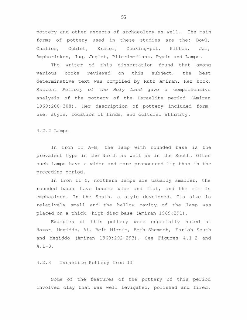
4.2.2 Lamps
In Iron II A-B, the lamp with rounded base is the
prevalent type in the North as well as in the South. Often
such lamps have a wider and more pronounced lip than in the
preceding period.
In Iron II C, northern lamps are usually smaller, the
rounded bases have become wide and flat, and the rim is
emphasized. In the South, a style developed. Its size is
relatively small and the hallow cavity of the lamp was
placed on a thick, high disc base (Amiran 1969:291).
Examples of this pottery were especially noted at
Hazor, Megiddo, Ai, Beit Mirsim, Beth-Shemesh, Far'ah South
and Megiddo (Amiran 1969:292-293). See Figures 4.1-2 and
4.1-3.
4.2.3 Israelite Pottery Iron II
Some of the features of the pottery of this period
involved clay that was well levigated, polished and fired.

56
A red burnished slip predominated. Irregular hand-
burnishing was primarily used, but in the making of bowls
and jugs the wheel-burnishing was the method most often
used. The term burnish is briefly described as smoothing
the vessel walls by polishing, so that rough particles are
driven inward and the smoother clay particles are aligned
in such a way that the surface of the vessel is shiny and
smooth. Slip, which is liquefied clay out of which coarse
particles have been strained, may be used to improve the
surface. Pottery, whether or not completely dry, can be
dipped into a slip of creamy consistency (to which color is
sometimes added); or the slip can be brushed on or trailed
on to the vessel (Microsoft Encarta Encyclopedia 2000:s.v.
“Pottery”).
4.2.3.1 Bowls: Iron II A-B North and South.
4.2.3.1.1 North
Examples of this pottery were especially noted at
Hazor, Abu Hawam, Samaria, and Megiddo (Amiran 1969:196-
197).
Description of the bowls from Iron II A-B, North
(1) Carinated bowls
These bowls are identified by the carina or kneel of
the pottery piece. In this period the walls of the bowls
are carinated fairly high up, so that the part above the
carination is relatively short. The carination is slight,
almost approaching a rounded outline.
(2) Straight-sided bowls
The straight-sided bowls combined features of the
carinated style with sides less curved and a high ring-

57
base. Megiddo and Samaria were the other sites where these
bowls were discovered.
(3) Rounded bowls
This is one of the commonest forms, which can be
subdivided into three main types:
(a) Shallow bowls with a low ring-base
(b) Round-bottomed-bowls
(c) Small, deep bowls with a small flat base. Some
of the rounded bowls are decorated with painted alternating
black and red concentric rings. These are applied without
slip and filling the entire inner surface of the bowl.
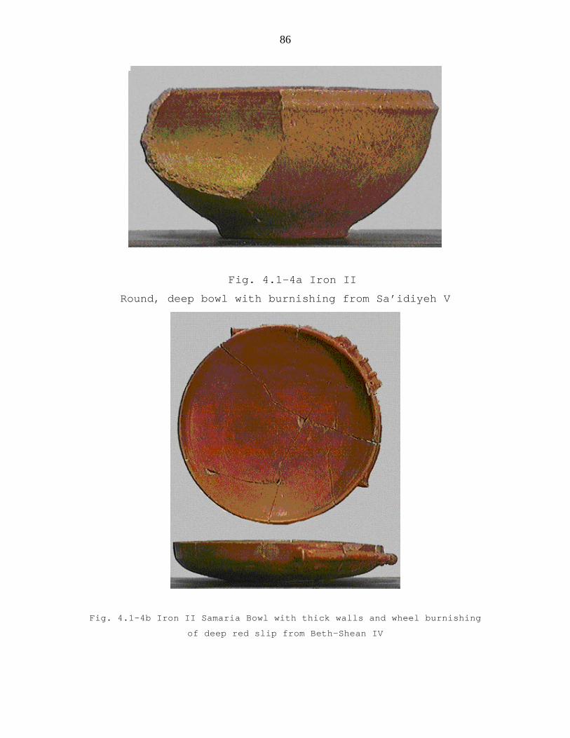
(4) Deep bowls
The first bowl has a projecting ledge-rim; the second,
a sharp, slightly inverted rim; and the third a slightly
thickened rim. See Figure 4.1-4a.
(5) Bowls with bar-handles or a ridge below the rim.
(6) Bowls on three stump legs.
These appear in this period both in the North and in
the South. They were mainly popular in Iron II C. Sometimes
the body of the vessel is perforated like a sieve.
4.2.3.1.2 South Bowls Iron II A&B
Examples of this pottery were especially noted at
Beth-Shemesh, Lachish, Far’ah(S) and Jemmeh (Amiran 1969:
198).
There were three main groups; rounded-carinated bowls;
bowls with degenerated horizontal handles; and bowls with
bar-handles. Albright defined some important features of
Iron II pottery of the south through his analysis of the
pottery found at Tell Beth Mirsim. He noted that the
pottery was hand-burnished and had an irregularly slip.
This slip was usually applied on the inside. Sometimes the

58
slip was applied on the upper part of the outside of the
bowls. This method was also used on storage jars and
kraters (Amiran 1969:106 and 199).
4.2.3.1.3 North and South Bowls of Iron II C
Examples of this pottery were from Hazor and Megiddo
(Amiran 1969:202-203).
The bowls of Iron II C are a direct continuation of
Iron II A-B forms and type. The carinated bowl becomes one
of the commonest vessels of the period. The straight-sided
bowl and the shallow bowl (platter) were frequently found.
The rounded bowl, which was so common in Iron II A-B,
appears in new variations; however, its use was starting to
decline. The large deep bowls have several different rims
which are distinguished as follows:
(1) A flat rim that is thickened outward
(2) A rim sloping inward and thickened on the outside
(3) A rim sloping outwards and thickened on the
outside, which is often grooved
(4) A turned-over rim.
The rim is highly characteristic of bowls and kraters
of various sizes made in southern Judah in Iron II C. These
bowls with different rims were also found in the North
which may mean that they were produced by potters in the
South and imported to the North.
South Iron II C Bowls
Examples of these bowls were especially noted at Beth-
Mirsim, Lachish, and Beth-Shemesh (Amiran 1969: 204-205).
These bowls have turned-over rims and are the most
frequently found during Iron II C in the South. The
predominance of this rim is seen in southern bowls of all

59
various shapes and sizes. Some of the bowls are rounded but
others are straight-sided. A strong identifiable
characteristic was a light brownish-red slip on the inside
and on the upper part of the outer wall, and regular wheel-
burnishing all over the slip on the inside and the rim. An
interesting vessel was a small bowl with a broad flattened
base, flaring walls, and a sharp rim.
The southern straight-sided bowls were shallower then
those in the North and had a wheel-burnish on the inside.
The bowls classified with bar-handles actually had two
knobs for handles with a small isolated ridge between them.
4.2.3.2 Samaria Bowls Iron II A-B and II C
Examples of this pottery were especially noted at
Samaria, Hazor, Abu Hawam, Megiddo, Beth-Shemesh, and
Qasile (Amiran 1969:207-212).
The term “Samaria Bowls” is generally used in
archaeological literature, though it still lacks exact
definition. The publications on the excavation of Samaria
itself never used the term “Samaria Bowls” in discussing
the pottery found there.
These bowls are divided into thin and thick walled
bowls and have been found in Iron II A-B and II C.
The thin bowls are eggshell-thin and are a thoroughly
baked ware. The slip is thick and continuously burnished
on the wheel and in rare incidents was hand-burnished. The
characteristics of the slip are very distinctive. It is
predominantly red inside and outside or it has a red and
yellow slip alternating in bands (See Figure 4.1-4b). At
Hazor one of the vessels had thin black lines between the
red and yellow bands.

60
The thick bowls have a form which is typical of the
wares of this period. The primary difference is the
burnished slip. One interesting characteristic is a bowl
with a high-footed base such as was found at Samaria.
Another interesting base was found in a bowl from
Jemmeh in which the base showed a stepped profile. Petrie
gave a name of “Assyrian” to this bowl because the same
style bowls were found in the palace of Kapara at Tell
Halaf, Syria( Amiran 1969:212). These bowls, especially in
Iron II C, are often decorated with bar-handles or with a
ridge under the rim, as in the plain bowls.
4.2.3.3 Chalices and Goblets North and South
Examples of this pottery were especially noted at
Megiddo, Abu Hawam, Beth-Shemesh, Far’ah(S), and Qasile
(Amiran 1969:214-215).
Iron II A-B North and South
The basic shape of the chalice is traced back to Iron
I. Two main types can be distinguished:
(1) An open, rather shallow bowl on a high foot
(2) A deep bowl on a low foot (Amiran 1969:213)
Rims and the foot profiles varied. Usually the
chalices were plain, without decoration, slip, or burnish.
Contemporary with the chalice was the goblet. It has a
spherical body, a relatively narrow neck, a low trumpet
foot and is usually decorated. In the South the chalices
were decorated with a pattern that looked like embroidery.

61
Iron II C North and South
The uses of the chalice begin to decline. Its form
changed, this was evident by a decrease in size and it took
on the appearance of a small goblet on a high stand.
4.2.5 Kraters
4.2.5.1 Introduction
Kraters during the Iron Age basically had the
characteristics of their Canaanite prototypes in form,
base, and rim. The decoration was noted often in the area
of the handles. See Figure 4.1.5 a & b.
The new features of the Iron I period which often were
carried over to Iron II A-B and C were:
(1) Multiple handles four, eight, or more
(2) Rope decoration in the handle-zone, this was
more prevalent in the North than the South.
(3) A rim thickened inwards and outwards,
forming a ledge; this rim was important and
very characteristic of this period of
Israelite pottery.
In the south there were fewer kraters found. Examples
of this pottery were especially noted at Beth-Shean,
Megiddo, Tuleil, Ai, and Beth Mirsim (Amiran 1969:218-219).
Others sites were Hazor, Samaria, and Abu Hawam (Amiran
1969:220-221). Another group was from Jemmeh, Far’ah(S),
Ajjul, and Er-Ruqeish (Amiran 1969:222). Kraters from Iron
II C in the North and South were Hazor, Megiddo, Far’ah
(N), Lachish, and Qasile (Amiran 1969:223-226).
4.2.5.2 Kraters: Iron II A-B North and South

62
Six types were identified for this period and were
classified as follows:
(1) Kraters with pronounced carination
(2) Kraters with a ridge in the area of the
handles
(3) Kraters with necks
(4) Kraters that have a ‘forked’ rim, that is, a
molded rim like a fork in profile
(5) Kraters with horizontal handles and
(6) Kraters without handles, often standing on
three loop-feet
In Iron II the rims of the kraters are usually thicker
and the multiple handles are less frequently noted. The
eight-handled kraters are drawn from the middle of the neck
towards the carination. An added form of decoration is a
reed impression.
4.2.5.3 Kraters: Iron II C North
The kraters had a slip on the outside which was
usually burnished and at times it had a red band on the
rim. They had a pronounced carination and a thick inverted
rim which was leveled off at the top. (Amiran 1969:223).
The handles were attached to the upper part of the vessel
which is separated from the rest of the body by a ridge and
forms a neck, which is often inclined inwards. This group
is identified by fine plastic decoration near the bar-
handle. The holemouth krater-bowls without the handles were
found and decorated with painted bands on the upper part,
or with a slip, plain or burnished.
4.2.5.4 Kraters: Iron II C South

63
Only five specimens from southern sites could be
collected. They were similar to each other in the following
characteristics:
(1) They had an amphora-like form
(2) The rim was usually turned-over
(3) The crater resembled the deep bowls
(4) The ones found at Tell Qasile resembled
those from the north, and
(5) There were some that were very large
with many handles such as were common
in the Iron I form (Amiran 1969:223).
4.2.6. Cooking Pots
The Iron Age cooking-pot is directly descended from
its Canaanite prototype. It developed in the North and in
the South along distinctive lines. The clay of the cooking-
pot in these periods is also easily distinguishable. It is
full of white calcite grits, which seem mostly to be
smaller than those in the Late Bronze. Examples of this
pottery were especially noted at Megiddo, Hazor, Abu Hawam,
Far’ah (N), Beth-Shemesh, Nasbeh, Ein Gedi and Ai (Amiran
1969:75-76, 228-230). See Figure 4.1-6a for cooking-pot,
Iron II, Beth Shemesh.
Iron I These pots were fairly shallow with a
carinated body and a rounded base, and generally did not
have handles. The rim is elongated and triangular in
section. In all periods, the rim was the most
distinguishable in dating the cooking pots. The elongated
rim with triangular section first appeared in Iron I in
different variations.

64
Iron II A-B The cooking pots of this period did not
change from Iron I, except for the lower carination. The
handles were more common. The more rounded shape of the pot
was becoming common in the South. The Northern material
indicates clearly that the rims are still triangular and
are generally shorter than in Iron I.
Iron II C There were changes which began to occur in
this period in the cooking-pots, both in the South and in
the North. The form has a slightly squat body, the
carination has almost disappeared, and the pots always have
two handles. The rim has become stepped or ridged and
appears in many variants.
Iron II C South The cooking-pot and its variants
follow the same lines of development as in the North. There
was a new type that developed not earlier than the 8th
century. This is a deep cooking-pot, almost as wide as it
is high, with a well-developed neck and two handles drawn
from the rim to the shoulder. The neck is often ridged all
over.
4.2.7 Pithoi
Many of the characteristics of the pithoi jar from the
Late Bronze are found in the Iron Age pithoi. Those found
at Megiddo, Bethel, and Shiloh show further development.
The neck became short and there was only a ridge at the
base. This pottery was named by Albright as “collared rim”
jars because of the ridge. Pithoi vessels were also found
in a number of other sites such as Tell Beth Mirsim, Tell
el-Ful (Gibeon), Hazor, Afula, Ai, and Tell en Nasbeh
(Amiran 1969:234-235).

65
4.2.8 Storage Jars
Examples of this pottery were especially noted at
Hazor, Megiddo, Samaria, Far’ah (S), Lachish, Beth Mirsim,
Beth-Shemesh, Gibeon, and Nasbeh (Amiran 1969:79-82 and
244-248). See Figure 4.1-6b for an example of a storage jar
of Iron II that was found at Beth-Shemesh.
Forms of the Iron II period basically developed from
Iron I. The four main ones were:
(1) Ovoid body and ridged neck
(2) Ovoid body and straight neck
(3) Jars which have a spout and occasionally
are decorated with painted bands or
metopes
(4) Multi-handled jars
4.2.8.1 Storage Jars Iron II A-B North
Besides the basic forms, new ones developed. These
included:
(1) Ovoid jar with a pronounced shoulder and
ridged neck
(2) Ovoid jars with straight necks
(3) The sausage-shape jar with pronounced
shoulder
(4) Painted jars of various forms, with straight,
relatively high necks: the decoration
usually consists of red painted bands in the
handle-zone. Sometimes a single ornament
appears between the bands, a highly stylized
tree or zigzag pattern.
(5) Holemouth jars begin to appear.

66
4.2.8.2 Storage Jars: Iron II A-B South
In the South the jars were divided into three groups:
(1) Ovoid jars with pronounced shoulders
(2) High-necked jars with a ridge in the middle
of the neck, from which two or three
handles, are drawn to the shoulder. The jar
has a burnished red slip.
(3) High-necked jars with the handles extending
directly from the rim.
4.2.8.3 Storage Jars: Iron II C North
In the North five main groups were found:
(1) Ovoid jars with a ridged neck
(2) Sausage-shaped jars with a pronounced shoulder
The neck is so short that it often is only a
rim. Rims vary from straight, concave or
lightly ridged. The difference between these
two groups (Ovoid and Sausage-shaped) is the
quality of the clay. Jars in Group 1 are
characteristic of brown-grey, gritty, and
medium-baked clay. The jars of Group 2 are
well levigated and well-baked therefore giving
off a metallic sound. They are yellowish-pink
in color.
(3) The jars are ovoid in shape, but they have
straight necks and rill-like rims. They were
often painted with red bands on the neck,
shoulder, and body.
(4) Holemouth jars with variation in the rims, some
were grooved or inverted.
(5) Jars with three handles and spout. The mouth of
the spout served as a seat for a dipper-

67
juglet, in order to catch and return to the
vessel any liquid dripping from the juglet
after use. These were sometimes called pillar-
handle. The jars came in two types of clay and
decoration. The ones that had a metallic
sounding were decorated with grooves on the
shoulder. The other jars were of "fatty" ware
with red slip or red painted bands. A jar like
this was found at Gibeon. What was especially
interesting about it was the Hebrew
inscription on the handle which was the name
of its location, “Gibeon.”
(Amiran 1969:241).
4.2.8.4 Storage Jars: Iron II C South
The following jars were found in the South:
(1) Ovoid jars with a wide, rounded shoulder,
generally four handles, a relatively high,
tapering neck, and a thickened rim
(2) Ovoid jars with ridged necks were uncommon
(3) Holemouth jars, constitute the second widely
distributed group in the South, and appear in
extremely numerous variations, especially as to
the rims.
(4) Sausage-shaped jars; these were not as common
as those in the North, the jars are shorter,
rims are shorter, and they have a pointed base.
(5) Jars with three handles and spout, those in the
South formed a more narrow neck and rim
(6) Jars with narrow, ridged necks and two handles
drawn from the ridge to the shoulder
(Amiran 1969:242).
68
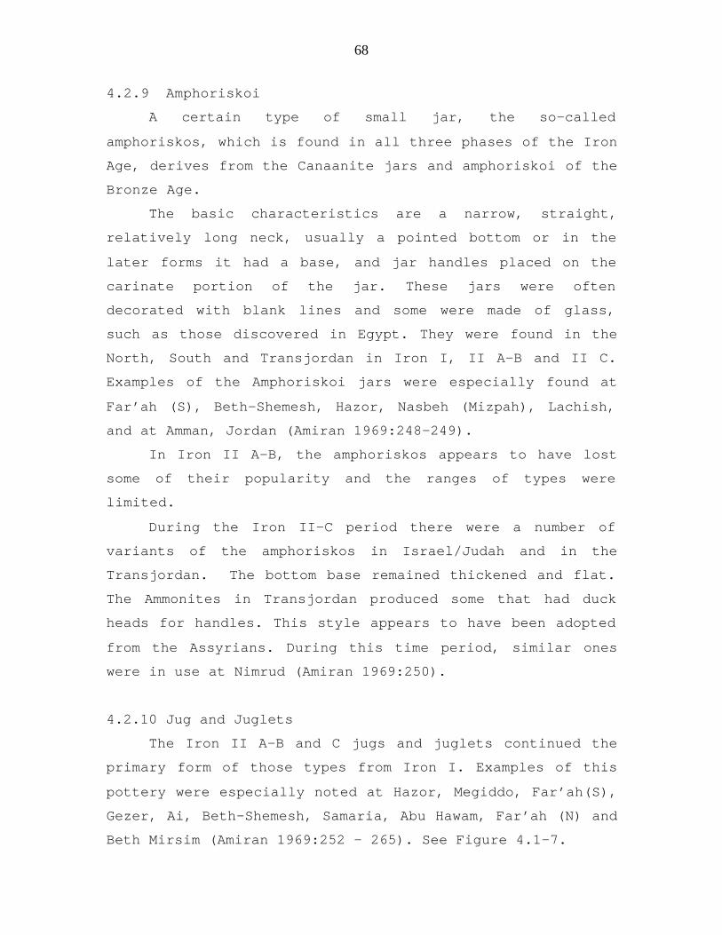
4.2.9 Amphoriskoi
A certain type of small jar, the so-called
amphoriskos, which is found in all three phases of the Iron
Age, derives from the Canaanite jars and amphoriskoi of the
Bronze Age.
The basic characteristics are a narrow, straight,
relatively long neck, usually a pointed bottom or in the
later forms it had a base, and jar handles placed on the
carinate portion of the jar. These jars were often
decorated with blank lines and some were made of glass,
such as those discovered in Egypt. They were found in the
North, South and Transjordan in Iron I, II A-B and II C.
Examples of the Amphoriskoi jars were especially found at
Far’ah (S), Beth-Shemesh, Hazor, Nasbeh (Mizpah), Lachish,
and at Amman, Jordan (Amiran 1969:248-249).
In Iron II A-B, the amphoriskos appears to have lost
some of their popularity and the ranges of types were
limited.
During the Iron II-C period there were a number of
variants of the amphoriskos in Israel/Judah and in the
Transjordan. The bottom base remained thickened and flat.
The Ammonites in Transjordan produced some that had duck
heads for handles. This style appears to have been adopted
from the Assyrians. During this time period, similar ones
were in use at Nimrud (Amiran 1969:250).
4.2.10 Jug and Juglets
The Iron II A-B and C jugs and juglets continued the
primary form of those types from Iron I. Examples of this
pottery were especially noted at Hazor, Megiddo, Far’ah(S),
Gezer, Ai, Beth-Shemesh, Samaria, Abu Hawam, Far’ah (N) and
Beth Mirsim (Amiran 1969:252 – 265). See Figure 4.1-7.

69
4.2.10.1 Basic Characteristics of Jugs and Juglets
in Iron II A-B and II C North and South
Jugs:
(1) Large jugs with short, wide necks, trefoil
mouth, and handles drawn from rim to shoulder,
often with a red slip.
(2) Large jugs with high, cylindrical neck, and
handle drawn from rim to shoulder.
(3) Jugs with bi-conical body, rim diameter equal to
base diameter, without neck, and handle drawn
from rim to shoulder; this type goes back to the
bi-conical jugs of the Late Bronze Age.
(4) Another jug has a long neck and a handle from the
center of the neck to the shoulder; the body is
generally piriform (pear shaped), and most of the
specimens are decorated or have a slip; the types
appear in many variants and derive from a certain
type of “grey juglet” of the Late Bronze Age.
(5) Jug with metope decorations, again traced back to
Late Bronze Age.
(6) Jugs with trough-like strainer-spouts. The
handles of these are usually at right angles to
the spout. They are painted with black and red
metopes. It is interesting because this style
was like that of the pilgrim flasks and jugs that
had bichrome decorations.
Juglets
Most of the juglets have a trefoil mouth, an
ovoid body, and a slightly pointed base. However, the

70
juglet with cylindrical body and wide base often had a
blunt point. See Figure 4.1-7.
4.2.10.2 Additional information about Jugs in the South
from Iron II A-B and C
Examples of this pottery were especially noted at
Far’ah (S), Ai, Gezer, and Beth-Shemesh (Amiran 1969:254-
255). There were some different types. This analysis came
from the comparison of material found in tombs excavated at
Tell el-Far’ah and Gezer. Jugs from the Philistine area of
this time period will be covered in a separate section.
Jugs: South Iron II A-B
(1) Piriform body, straight or slightly concave
neck, often a trefoil mouth, ring-base, and
handle drawn from rim to shoulder.
(2) These jugs have a thickened button-shaped
base characteristic mainly of contemporary
storage-jars.
(3) Squat jugs with globular body, ring-base,
wide neck, and handle drawn from rim to
shoulder; this type became popular during
the late Iron Age, especially in the South.
(4) Painted jugs were of two types, the Cypriot
bilbil and North style.
(5) Jugs with trough-like strainer-spouts. These
had basket handles, painted on the bodies
and the handles were classified with the
Philistine ware.

71
Jugs South II C
The examples of this pottery were found at Lachish and
Beth Mirsim (Amiran 1969:264-265).
The jugs had a wide neck and trefoil mouth, they were
globular, squat, shot necked, and handles drawn from rim to
shoulder, red slip was predominate. The decanter style was
also found like the one in the north.
4.2.10.3 Additional information about Jugs in the North
from Iron II C
Examples of this pottery were especially noted at
Megiddo, Hazor, and Far’ah (N). (Amiran 1969:260-261).
This material was classified by the following:
(1) One of the most distinctive forms was the
decanter which was seen in the North and South.
The shape of the body and the generally ridged
neck, with the handle drawn from the ridge, are
common to all the members of this group. What is
important is the fact that there were differences
between the north and south (Amiran 1969:259).
The main features of the northern decanters are
the double, deeply grooved rim, splayed like a
funnel, the metallic well-baked ware, and the
frequently found group of grooves on the
shoulder. There are also some decanters of
‘fatty’ ware, which is not well-baked, with a red
slip (Amiran 1969:259).
(2) Some jugs were bichrome with a ridged neck.
(3) Jugs with trefoil mouths, plain neck, painted
with red or black bands on the body.
(4) Jugs with short trough-like strainer-spouts.

72
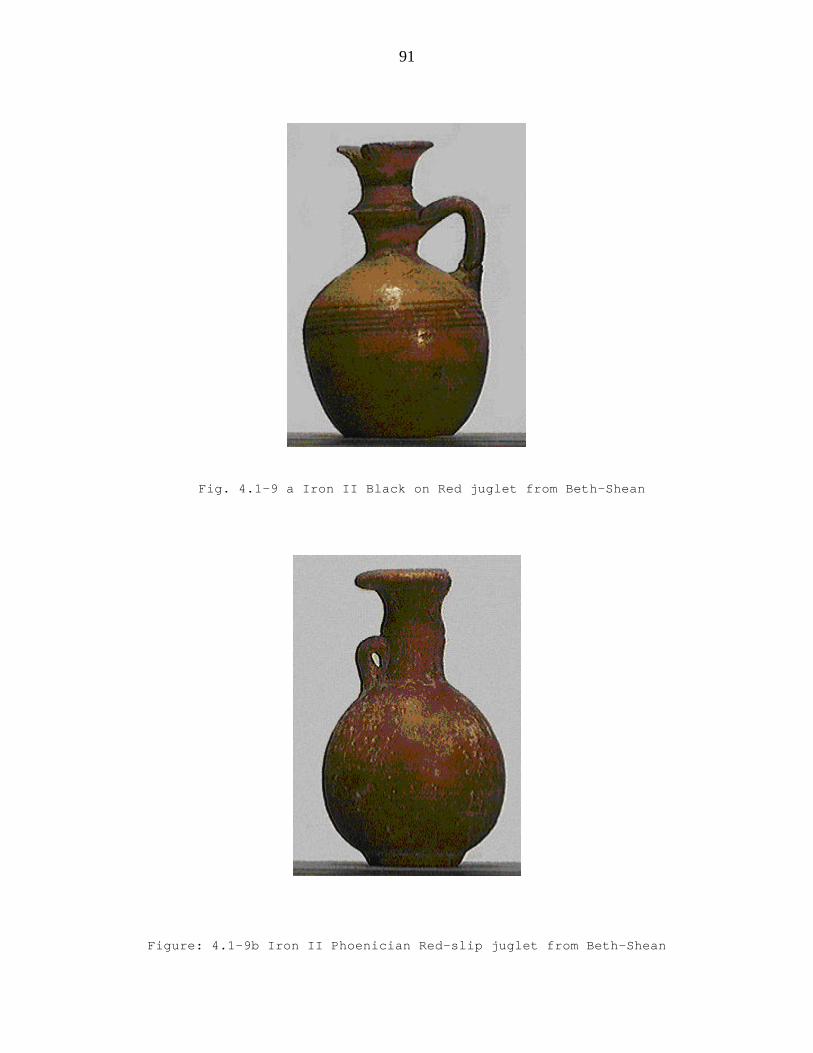
(5) Jugs with trefoil necks and red slip that
resemble the Phoenician-Israelite pottery. See
Figure 4.1-9 a & b.
(6) Jugs with narrow necks and thick rims.
(7) Jugs with inverted rims, globular bodies, short
necks, and round base (Amiran 1969:259).
4.2.10.4 Additional information about Juglets Iron A-B
North and South
North: The primary forms as described above
continued. The “black” juglets started to appear in Iron
II. They were usually grey with a burnished black slip,
sometimes the clay was pinkish-brown and the burnished slip
was light in color. These juglets usually had a long
narrow neck (Amiran 1969:256). Examples of this pottery
were especially noted at Hazor, Megiddo, Samaria, Abu
Hawam, Megiddo, and Sa’idiyeh (Amiran 1969: 257). See
Figure 4.1-8a.
South: The “black” juglet was found. Examples of this
pottery were especially noted at Far’ah(S), Beth-Shemesh,
and Lachish (Amiran 1969:258). Some juglets were the
common dipper juglet. See Figure 4.1.8-b
4.2.10.5 Additional information about Juglets North and
South Iron II C
North: The juglets were dipper juglets with ovoid and
cylindrical forms. They had a basket handle and a spout.
The black juglet and more of the tiny amphoriskos were
found.

73
South: The types of juglets found were piriform
bodies, narrow necks, handles drawn from the rim, and black
juglets. Like the north they had a spout and basket handle.
4.2.11 Philistine Pottery
4.2.11.1 Introduction to the Philistines and Philistine
Pottery
Philistines were part of a maritime group known as the
Sea People. They had a strong political and cultural
influence on the people of the Near East during the second
millennium BCE. By the end of the Bronze Age they had
gained control of most regions in the eastern
Mediterranean. They established new cities and remained
powerful during the early Iron Age and their power
continued into the Iron II period (Blaiklock and Harrison
1983:361-362). An interesting and descriptive Egyptian
source that told about the Philistines was a record from
the eleventh-century BCE titled, “The Journey of Wen-Amon
to Phoenicia” (Pritchard 1973:16-24). This papyrus is
currently in the Moscow Museum. It is from el-Hibeh in
Middle Egypt and dates to the early Twenty-first Dynasty,
shortly after the events it relates.
Philistine pottery is a complex specialized study that
has drawn the attention of archaeologists, scholars and
historians of the ancient Near East for years. The origin
of Philistine pottery in Palestine was actually identified
by archaeologists who had worked with Cretan-Aegean
archaeology; among these were Dr. F. B. Welch and a Dr.
Mackenzie. Dr. Welch wrote about this subject in 1900, in
his article titled, “The Influence of the Aegean
Civilization on South Palestine.”
74
During 1911-1912, Dr. Mackenzie determined the
stratigraphic relationship of the pottery found at Beth-
Shemesh with the Philistines and related the pottery style
to the Aegean world (Amiran 1969:266). Since that time, one
archaeologist who stands out for her work on the
Philistines and their culture is Dr. Trude Dothan. She has
written numbers articles and books on the Philistine
culture.
4.2.11.2 Some locations where Philistine pottery was found
in Canaan, Ancient Israel and Judah
Philistine Pottery was found at a number of sites
primarily in the areas of ancient Philistia and Judah. The
following is a list of some of these primary sites: Gaza,
Jemmeh, Tell el-Far’ah (S), Ashkelon, Ashdod, Tel Qasile,
Joppa, Gezer, Ekron, Timnah, Beth Shemesh and Gath. Other
places included Gerar, Beth-Shean, Taanach, Megiddo, Afula,
Dor, and Hazor in the north.
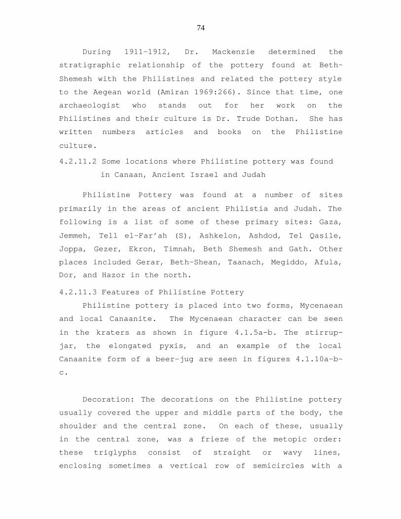
4.2.11.3 Features of Philistine Pottery
Philistine pottery is placed into two forms, Mycenaean
and local Canaanite. The Mycenaean character can be seen
in the kraters as shown in figure 4.1.5a-b. The stirrup-
jar, the elongated pyxis, and an example of the local
Canaanite form of a beer-jug are seen in figures 4.1.10a-b-
c.
Decoration: The decorations on the Philistine pottery
usually covered the upper and middle parts of the body, the
shoulder and the central zone. On each of these, usually
in the central zone, was a frieze of the metopic order:
these triglyphs consist of straight or wavy lines,
enclosing sometimes a vertical row of semicircles with a

75
dot in each. The metopes may contain a geometric pattern,
like spirals, concentric circles enclosing a cross,
checkerboards, lozenges, or a bird-motif. These were very
characteristic of Philistine pottery. The bird was shown in
two positions, generally the head is turned backwards, with
the beak thrust under the wing-feathers and the other was
showing the bird looking straight ahead. Generally this
decoration was in black and red on a white slip, but it
also occurs in one color, with or without the slip. These
styles of decoration occur on all types of Philistine
pottery (Amiran 1969:266-267).
More examples of styles and types of Philistine
pottery are shown on Plates 90 and 91 from Amiran, pages
268 and 269. These examples came from Gezer, Beth-Shemesh,
Ashkelon, Far’ah (S), Hazor, Abu Hawam (located by modern
Haifa), and Carmel.
4.2.12 Phoenician Pottery
The term Phoenician Pottery came to be used in
describing the pottery that was excavated primarily from
the excavation of Akhziv which was within the border of the
Northern Kingdom of Israel. The focus for the description
of this pottery and its relationship to other areas of
ancient Israel and Judah where it was found will be used in
describing this pottery.
Iron II A-B The main characteristic was a vessel
that was highly burnished and had a thick dark-red slip.
The walls were thick and heavy. An example of an Iron Age
II Phoenician Red-slip juglet is from Beth-Shean. See
Figure 4.1-9b.

76
Iron II C showed vessels that were similar to those of
Iron II A-B. The necks of the vessels were more conical in
shape and they had a broad, mushroom-like rim. Examples of
this pottery, in addition to Akhziv, were also found at
Hazor, Megiddo, Samaria, and Lachish (Amiran 1969:274-275).
4.2.13 Cypriot and Cypro-Phoenician Wares
4.2.13.1 Introduction to Cypriot Pottery
The Iron Age pottery of Cyprus, unlike the pottery of
the Cypriot Bronze Age, was mass produced in standard
shapes and wares. The mass production lead to poorer
quality and the finished products were more flawed.
Regardless, the Iron Age Cypriot pottery was still very
colorful and often elaborately painted with geometric or
figural motifs. Commonly seen were the concentric circles
which were painted onto jars, juglets, bowls and kraters.
Finer wares like plates, bowls and jugs were made on the
fast wheel. Larger forms like amphorae, amphoroid kraters
and pithoi were made with a combination of techniques:
wheel throwing, hand coiling or molding (Mertens 2000a:1-
2).
4.2.13.2 Description of the Primary Types of Cypriot
Pottery
Cypriot pottery is described by Mertens (Mertens
2000a:1-3).
Fig. 4.1-11a. The style on this jug is an example of
what is called, “Free-field Style”. It is characterized by
large, elaborate pictures of humans and animals on light
backgrounds. Highlights were often painted on in red. This

77
type is unique to Cyprus. This particular jug uses the
swastika as a decoration. At that time, swastikas were
generally considered to be good luck symbols representing
sun, fire, or continuing creation. They were found in
Egypt, Greece, and China. The swastikas are shaped like a
Greek cross with ends bent at a 90-degree angle. Other
decorations on this pottery included multiple chevrons
(figure pattern having the shape of a V or inverted V), and
prophylactic eyes on the trefoil rim. This jug also has a
series of dark lines on its side. These are an impression
from the paint of another pot which was placed near or
against this one in the kiln. This became an example of the
mass production that occurred in Iron Age II. The paint
smudged off, leaving a “shadow” mark.
Fig. 4.1-11b. The type of decoration on this
amphoriskos is known as Black on Red Ware. This ware, as
mentioned above, is usually associated with Phoenicia,
however it was more widely produced on Cyprus. It contains
small sets of concentric circles. The vessel has a shiny
surface, as it was burnished after it was fired.
Fig. 4.1-11c. This amphoroid krater has an
interesting decoration in terms of form. Underneath the
wavy band, dots, and straight bands, there appears to be
another decoration. It is possible that the vessel was
supposed to have been Bichrome Red with red, black, and
white decorations, which misfired and burned and to sell it
the potter then decorated it to sell it.
Fig. 4.1-11d. This small amphoroid krater is an
example of White Painted Ware, with the typical diamond and

78
net patterns and series of bands. The pot shows evidence of
collapsing before or during firing as the rim is uneven.
The painted decoration on the base and pedestal date it to
the early Iron Age (about 950 BCE).
Fig. 4.1-11e. This Bichrome jug is decorated with red
and black paint designs over a light base coat (slip). The
jug was originally made in Phoenicia and was brought to
Cyprus where it was reproduced and popular. It is barreled
shaped and it contains the circular decoration that was
done with a single brush which probably was applied while
spinning the pot on the wheel.
4.2.13.3 Imported Cypriot and Cypro-Phoenician Wares.
The term “Cypro-Phoenician” pottery was developed in
Palestinian archaeology and is not used in Cyprus. Various
forms of Cypriot pottery have been found in excavations in
Israel and it appears that it was imported into Israel and
Judah and not reproduced by local potters. Examples of
these wares were found at Megiddo, Far’ah (S), Abu Hawam,
Jemmeh, Carmel, and Lachish (Amiran 1969:288-290).
4.2.14 Ammonite Pottery
Ammonite pottery has distinguishing elements
associated with ceramic types of Judah, Israel, Phoenicia
and Assyria. The pottery, however, maintained certain
unique characteristics related to the Ammonites. The
analysis of this pottery came primarily from seven tombs
excavated in Amman and vicinity which were dated to the
Iron II C period due to the forms of the pottery.

79
Some of the pottery included: Bowls that were Judean
type, Assyrian and a few bowls of Samaria Ware. They were
decorated with the Ammonite pattern, a band made up of
stepped red painted triangles. Chalices resembled the ones
from northern Israel. The jug forms were like those from
Israel and Judah. They were decorated with black on a
burnished red background. Decanters were Judean in style,
especially around the rims. Juglets were typical of Iron
II C juglets that were found in Israel and Judah. Jars and
amphoriskoi were more like those found in the South (Judah)
and some were Phoenician in style. Cooking pots were the
dominant type in Israel and Judah. Bottles resembled
Assyrian imports and some were Bottle-Amphoriskos which
were zoomorphic in character. Most of these had a trough-
like spout, resembling the jug spouts.
4.2.15 Egyptian Pottery
Through each archaeological time-period, there has
been very little Egyptian pottery discovered in ancient
Canaan/Israel & Judah and this was particularly true of the
Iron Age. What was the reason? The first inclination is to
consider the tense political relations between these
countries. However, Israel & Judah had strained political
relationships at various times with all countries and
regions around them, yet the appearance of pottery from
these as has been discussed, was found throughout the land.
The reason then for the scarcity of Egyptian imported
wares in Israel/Judah especially during the Iron Age is
found by looking at the international market and the
quality of the pottery. During the Iron II period,
Egyptian exports on the international market did not

80
include goods which were transported in large pottery
containers, such as oil, wine, and grains. Egyptian
craftsmen, then as always, preferred using costlier
materials instead of pottery. They reached a high artistic
level in the manufacture of objects for daily use. These
could include decorative boxes, stone goblets, faience and
alabaster vases. Excavations at places such as Megiddo and
Lachish uncovered some of these items.
4.2.16 Assyrian Ware
Assyrian pottery was distinctively different from
local ware. Petrie was the first to recognize bowls as
Assyrian, during his excavations at Tell Jemmeh (Gerar).
Since then, such pottery has been found at Samaria, Tell
el-Far’ah (N) and Hazor. In all excavations, it appears in
strata of the period following the Assyrian conquest of
Samaria, after 721 BCE. Commercial relations between
Israel-Judah and Assyria were the consequences of Assyrian
rule over the Northern Kingdom. It is also important to
note that pottery from Iron II B-C was also found in Nimrud
(Kalhu) in the 7th century BCE (Amiran 1969:291). Examples
of Assyrian ware were especially noted at Samaria, Jemmeh,
Hazor, and Far’ah (N) (Amiran 1969:292).
4.2.17 Concluding Comments on Pottery
Pottery items are some of the most enduring kind of
material to survive from ancient times. The typological
study of pottery from Iron Age II has played an important
role in presenting a continuous dating witness which is
“non-textual.” It provided a source that brought
understanding to several major factors that related to the
economic, religious, political and cultural aspects of the
lives of the people as presented in the Hebrew text. More

81
precisely it gave a method to determine important points
such as: the dating of the destruction of cities in
relationship to attackers like the Assyrians; knowledge of
the type of vessels used in religious rituals and burials;
the status of people (rich and poor); the cultural
identification of other people who occupied the lands of
Israel and Judah; the identification of the trading that
occurred between Israel and Judah and other lands; the
similarities and differences between the Israelites and
Judahites in relationship to their locations and most
important it provided the ability to determine occupation
levels of the time period when sites were occupied.
Without the knowledge of ceramic typology, the ability to
elucidate the history of this time period presented in this
dissertation would have been confusing, unreliable and
vague. One of the main factors used by archaeologists in
giving their reports on the sites is their analysis of the
ceramic finds. Its importance cannot be stressed enough.
There were a number of places in the Hebrew Text where
the pottery was used as a symbol to illustrate to Israel
important lessons related to historic events that would
change their lives. One of these was through the prophet
Isaiah at a time in Israel’s history when many of the
people did not believe that God would punish them as a
nation for its sins, iniquities and transgressions. To
illustrate God’s warning to Israel at that time, Isaiah
spoke the following words as recorded in Isaiah 41:25b,
“And he will come upon rulers as upon mortar, Even as the
potter treads clay.”

82

83
Fig.4.1-1a Potter’s Wheel
Fig. 4.1-1b Iron Age II Pottery

84
Fig. 4.1-2a Iron Age II North (1000-721 BCE)
Fig. 4.1-2b Iron Age II North (1000-721 BCE)
These lamps featured a pinched spout, flared rim and a low
flat base.

85
Fig. 4.1-3a Iron II South (1000-587 BCE)
Fig.4.1-3b Iron II South 1000-587 BCE)
This lamp style incorporated a thick base or pedestal and was developed
and used exclusively in southern Israel during the Divided Kingdom. The
example in the picture is filled with solid sediment that may have
accumulated from water dripping from the roof of the tomb for more than
1000 years?
86
Fig. 4.1-4a Iron II
Round, deep bowl with burnishing from Sa’idiyeh V
Fig. 4.1-4b Iron II Samaria Bowl with thick walls and wheel burnishing
of deep red slip from Beth-Shean IV

87
Figure 4.1-5a
Iron I Large bell-shaped krater with spiral design
Beth Shemesh Stratum III
Figure 4.1-5 b
Iron I Fragment of large bell-shaped krater
with spiral design
Beth Shemesh Stratum III

88
Fig. 4.1-6a Iron II Cooking Pot Beth-Shemesh Stratum II
Fig. 4.1-6 b Iron II Pottery from Beth Shemesh

89
Figure 4.1-7 Iron II Collection of Juglets

90
Figure 4.1-8a Iron II Black Juglet from Sa’idiyeh V
Fig. 4.1-8a Iron II Dipper Juglet from Beth-Shean
91
Fig. 4.1-9 a Iron II Black on Red juglet from Beth-Shean
Figure: 4.1-9b Iron II Phoenician Red-slip juglet from Beth-Shean

92
Figure 4.1-10a Iron I Philistine Pottery, Beth Shemesh, stratum III
Fig. 4.1-10b Iron Age I Philistine Pottery, Beer-mug, Beth Shemesh stratum III
Fig. 4.1-10c Iron I Philistine
Horn-shaped Pyxis with red line design Beth Shemesh Stratum III

93
a. b.
Figure 4.1-11
Cypriot Pottery
Iron Age
a. Jug:“Free-field” Style
b. Amphora
Black on Red Ware
c. Amphoroid Krater
d. Amphoroid Krater c.
e. Bichrome Jug
d. e.

94

95
4.3 City Planning
4.3.1 Introduction To City Planning
The main factors of the Iron Age Israelite towns are:
the fortification system; the city gate; a piazza near the
gate; the street network; public structures of various
types (palaces, store buildings, cult places); royal
stables; drainage and water supply systems; dwellings; and
various industrial installations.
4.3.2 Categorization of Cities
Israelite cities can be divided into several
categories: capitals of the kingdoms, district
administration centers, and country towns.
The capitals of Judah and Israel (Jerusalem and
Samaria) as well as those of neighboring city-states in
Philistia (Ekron and Ashdod) were very large. They
comprised several dozen or even hundreds of acres in area
and their populations must have surpassed ten thousand.
They included massive fortifications, a royal acropolis,
buildings, markets, and residential quarters.
The second category included cities which served as
regional administrative and military centers. These cities
included Hazor, Megiddo, Lachish, and Beersheba. Most of
them averaged 20 acres (except Beersheba, which was much
smaller) and their population numbered approximately two
thousand to three thousand. Significant areas of these
cities were set apart for public edifices such as palaces,
administration buildings, storehouses, and stables. These
were usually separated from the rest of the town by walls
and gates such as those found at Hazor, Megiddo and
Lachish. See Figure 4.3-1. Other cities also had specific

96
public buildings, such as the large religious center at
Dan.
The third category was composed of country towns,
which were usually not more than 5-7 acres; their
population can be estimated as having been about five
hundred to a thousand. They were fortified, and they
contained mainly dwelling quarters (Mazar 1990:463-465).
4.3.3 Orthogonal and Peripheral City Planning
Orthogonal City planning is known only at Tell el-
Far'ah (N). Streets and houses were constructed in well-
defined units based on streets intersecting at right
angles. In Judah, "peripheral" planning has been traced at
several towns such as at Tel Beersheba, Tell Beit Mirsim,
Tell en-Nasbeh, and Beth-Shemesh. In this town plan, a
tract of houses were built along the circumference of the
town and along the city wall. A circular street separated
the outer tract from the center of the city, which included
dwellings and other buildings arranged along radial streets
and lanes (Mazar 1990:462).
4.3.4 Fortifications of City
Many of the fortification lines built in the Bronze
Age continued into the Iron Age especially at sites in the
lowlands. In the Philistine plain, several cities,
including Ashdod and Ekron, were surrounded by newly
constructed solid brick walls. In the hill country, which
was sparsely populated in the Bronze Age, most newly
established villages (Ai, Bethel, Tell Beit Mirsim, Arad,
Tell Malhata, and Tell Masos) were unfortified throughout
Iron I. Some sites, however, do have houses built around

97
the perimeter, thus creating a flimsy form of protection
(Mazar 1990:465-467).
Probably the most famous of such forts was Tell el-Ful
(possibly ancient Gibeah). It was excavated by W.F.
Albright and was also the royal residence of Saul (1 Sam.
11:4; 15:34; 22:6; 23:19). Another interesting fort was
found in Arad. It showed continuous occupation and
modification in design throughout Iron II. See Figure 4.3-
2. Some of the cities like Gath, had moats around them for
extra fortification. See Figure 4.3-2.
4.3.5 Walls: Casemate and Solid
Casemate is a military term designating a chamber in a
fort. The word is derived from the Greek chasma (chasm or
hollow). Casemate fortification was introduced in the
Middle Bronze period, and developed principally under the
Hittite Empire in the Late Bronze period (fourteenth and
thirteenth centuries).
A very good example of this Late Bronze fortification
was seen at Hattusas Boghazkoy, capital of the Hittites in
Anatolia (Turkey). This site had a citadel, upper and lower
city complexes, all with walls, and provides a classic
casemate design. Rectangular bastions or towers were built
at frequent intervals on the outer surface of the walls
(Blaiklock and Harrison 1983: 121).
The casemate wall construction comprises two parallel
walls, built with an average space between them of 1.5 to
2.1 m (5 to 7 feet). The outer wall was the thickest
(average 1.5 m or 5 feet) and the inner wall somewhat
thinner (average 1.1 m or 3 1/2 ft). The two walls were
joined at intervals by cross walls, creating in effect a
kind of series of rigid box-like chambers or “casemates.”

98
The thinner walls had doorways into the city. In peace
time, the rooms or chambers were used for storage or as
family residences. In times when there was threat of enemy
attack, the most vulnerable casemates were packed with
rubble. This made the outer wall more difficult to breach.
Its design provided strength with the least expenditure of
labor and material. Casemate walls continued to be used
through late Iron II.
Some examples of the casemate walls in Israel can be
seen at: Tell en-Nasbeh (Mizpah); Tell Beit Mirsim (Debir);
Beth Shemesh; Gezer; Hazor; Megiddo; Tell Qasile; and a
number of isolated citadels in the Negev. The distinctive
casemate system used by the Hebrews was fundamentally
different from the single massive Canaanite structures of
rough stones. See Figure 4.3-3.
Casemate walls became very rare after the tenth
century BCE. They were used in royal enclosures such as
those found at Samaria and Ramat Rahel. Fortresses at
Kadesh-Barnea and Tell el Kheleifeh (Ezion-Geber) used
casemate walls. At Tel Beersheba and Tell el-Ful they were
built as the town's fortification. In the case of Tell Beit
Mirsim, the tenth-century casemate wall was employed until
the town's final destruction. At several Judean cities the
casemates served also as the inner broad rooms of houses
attached to the wall. These were found at Tell Beit Mirsim,
Beersheba Strata III-II and the earlier stage at Tell en
Nasbeh (Blaiklock and Harrison 1983:121).
Solid walls became a prevalent type of city wall in
the ninth century BCE onward. They were found in almost all
the cities excavated in the northern kingdom: Hazor; Dan;
Tel Kinrot; Megiddo; Yoqneam; Tell el-Far'ah (north);
Gezer; and Khirbet Marjamah. Solid walls were also found

99
in many Judean cities: Lachish; Tell en-Nasbeh; Ramat
Rahel; Timnah; Khirbet Rabud [Debir]; Beersheba [Strata V-
VI]; Tel Ira (Aroer); Arad; Kadesh-Barnea earlier phase;
and Tell el-Kheleifeh later phase. Such solid city walls
are also found at those independent city-states of
Philistia which were excavated (Ekron and Ashdod).
The walls had a solid stone or brick superstructure on
a stone foundation; their width averaged between 2 and 7 m.
The details of construction and planning varied. The walls
were sometimes strengthened with outside "saw teeth"
offsets or were constructed with "offsets and insets" (as
at Megiddo). A unique double wall was found at Yoqneam.
Solid rectangular or slightly rounded towers defended weak
points in the cities defense system.
The upper part of the walls can be reconstructed from
Assyrian reliefs which show protruding balconies that
enabled enfilade and vertical fire on the attackers. The
city wall was usually constructed on the upper slope of the
mound. In several cases (Lachish, Timnah, and Tel Halif) an
outer retaining wall was constructed farther down the
slope, creating a double defense line and serving as an
additional obstacle for siege equipment and troops (Mazar
1990:469).
The steep inclination of mounds susceptible to
erosion endangered the foundations of the walls. The
problem was overcome at several Judean sites by the
construction of earth glacis resembling those of the Middle
Bronze Age. Such earthworks are known from Tel Beersheba,
Tel Malhata, and Tel Halif in the southern part of the
country, from Ashdod-Yam (on the coastline west of Ashdod),
and possibly also from Timnah.
100
Y. Yadin suggested that the shift from casemate to
solid walls was the answer to the Assyrian battering ram
and other siege techniques, which appeared in the region
from the mid-ninth century BCE. This provided greater
resistance to attacks by siege machines. Thus, the 7 meter
wide solid stone wall of Jerusalem was perhaps the main
obstacle in the path of Sennacherib's battering rams.
However, even the solid walls failed to fend off the
Assyrian siege machines. The 6 meter wide city wall at
Lachish is just one example of a wall breached by the
Assyrians.
There are few exceptions to the typological
development of city walls suggested by Yadin. Among these
exceptions are the few appearances of solid walls during
the tenth century (such as Tel Kinrot) and a casemate wall
at Beersheba in the ninth and eighth centuries BCE (Mazar
1990:467).
4.3.6 Gate Complexes
The gate complex is one of the most imposing features
of Israelite cities. It was usually planned as a combined
system creating an indirect approach to the city. Leading
up to the outer gate was a ramp built approximately
parallel to the outer wall and was supported by a retaining
wall. Entry was made between the outer gate located on the
lower part of the slope of the mound and an inner gate
situated a little further up slope on the mound. Such gate
complexes are known at Dan, Megiddo, Tirzah, Gezer, Timnah,
Lachish, and Beersheba. See Figures 4.3-4.
During the Solomonic era and shortly after, the six-
chamber inner gates (with or without an outer gate) were
common. These were found at Gezer, Hazor, Megiddo, Lachish,

101
and Ashdod. Later examples of the six-chamber gates were
found at Tel Batash (Timnah) Stratum III of the eighth
century BCE and at Tel Ira in the seventh century BCE.
Four-chamber gates started to appear in the early tenth
century outside Israel (at Ashdod) and at the beginning of
the ninth century BCE at Tel Beersheba. They became the
most common gate type, appearing at: Megiddo Stratum IVA;
Dan (where two gates of this type were found); Dor; Timnah
Stratum II; Tel Beersheba; and Tell el-Kheleifeh. Such
four-chamber gates were also the most common form in
northern Syria during these centuries. It appears that the
simpler versions were more common in the later part of the
Iron Age. These gates had only one guard chamber. Several
of the gates were defended by enormous solid towers.
Examples of these were found at Lachish, Tell en-Nasbeh,
and Timnah (Mazar 1990:469). In addition to their defensive
function, in peace time the gates also played an important
role in the daily life of the city: as a market (2 Kings
7:1); a place of judgment by the elders (Deuteronomy 21:19,
22:15; Amos 5:12); and a general assembly area where rulers
made appearances and prophets spoke (1 Kings 22:10; Isaiah
29:21; Amos 5:10; Jeremiah 39:7; 2 Chronicles 32:6).
Cult practices were also carried out at the city
gates. At Dan, an ashlar installation had a canopy
supported on four stone column bases; the bases were
ornamented in a style that was like Neo-Hittite
architecture in north Syria (Biran 1993:329). This
installation could have been a focal point for cult
practices.
The civil activities could take place on a piazza just
inside the city gate or in a small piazza between the outer

102
and inner gates. Other activities, such as trading could
have taken place inside the guard chambers in the gate.
This is suggested because of the benches and water troughs
found in some chambers.
The main use of the 6 and 4 chamber gates were for
defense against military conquest. When viewed from outside
the city, the external entry ramps were most often to the
left of the gate. Enemy solders coming up the ramp would
see the city wall to their left. Apparently in ancient
times, most soldiers were right handed. Their weapons would
be in their right hands and not easily usable against
soldiers on the wall to their left. If the attackers
stopped their advance up the ramp in order to face the
enemy on the wall, they themselves were more vulnerable. At
the top of the ramp, a 90-degree turn to the left would be
necessary in order to face the outer gate. A rapid assault
with a battering ram would not be possible because of the
necessity to stop at the top of the ramp and to turn left
in front of the gate. Both the outer and inner gates of the
city would be closed tightly with heavy wooden doors. The
inner chambers could be occupied by defending soldiers. At
some sites, there is some evidence that additional
defensive doors were put between some of the chambers.
Soldiers would be on top of the city walls, on the gates,
and especially on top of the massive stone dividers (the
“teeth”) which separated the chambers. If attackers gained
entrance through the outside gate, soldiers on top of the
dividers could certainly kill attackers who were trapped in
the central passage way and the chambers below. All of
these factors combined to make such ancient city gates very
effective.

103
4.3.7 Water Supply Projects
4.3.7.1 Introduction:
The water supply projects in Israelite cities are one
of the most impressive achievements of the period. They are
evidence of great skill in engineering and practical hydro-
geology as well as of astute ability in organizing large
labor gangs for public works. Such projects have been found
throughout the country: at Hazor, Megiddo, Yoqneam,
Yible’am (Ibleam), Tell es-Sa'idiyeh, Gezer, Gibeon,
Jerusalem, Beersheba, Arad, and Kadesh-Barnea.
The water projects varied according to the principles
of their planner. The details of planning at the sites were
highly dependant on the local conditions.
4.3.7.2 Gibeon Water System
The first system at Gibeon included a feeder tunnel
that was cut from the spring into the subterranean water-
bearing stratum (the aquifer) to increase the water flow.
This is the only known Iron Age example of such a feeder
tunnel, which became well known in the Judean Hills in
later periods.
The second water system at Gibeon starts with a great
circular shaft, 11.3 m in diameter, cut into the bedrock
with spiral steps. At a depth of 10.8 m, it ends in a
spiral-stepped tunnel descending a further 13.6 m to the
subterranean water level. This system was probably
constructed later than the nearby stepped tunnel, which led
directly to the spring. See Figure 4.3-6.

104
4.3.7.3 Hazor Water System
The total depth of this system is 40 m. It consists
of: an entrance structure with descending ramps, a vertical
square shaft, approximately 13 x 16 m in size, which is 19
m deep, with a wide, sloping stepped tunnel, 25 m long and
11 m deep, ending in an underground water room. The spiral
steps hewn into the sides of the shaft were wide and
shallow to enable descent by pack animals. The Hazor
system, dated to the ninth century BCE was probably the
work of King Ahab, who carried out the extensive rebuilding
of this city.
4.3.7.4 Gezer and Beersheba Water Systems
The Gezer water project probably followed a principle
similar to that at Hazor and Gibeon. The sloping tunnel
here was some 41 m long and was approached from a 7 m deep
shaft. The system terminated in an enormous, 38 m long
underground cavity, but the bottom of the latter was not
reached by the excavator. It is thought that it was an
underground vertical shaft leading to the water level. The
water project at Tel Beersheba was probably also planned
according to the same idea. A large, square shaft with wide
spiral steps was hewn at the corner of the town in order to
reach the water level 25 m below, near the Beersheba Brook.
4.3.7.5 Jerusalem Water System
4.3.7.5.1 Gihon Spring and Introduction to The Water System
in Jerusalem.

105
The Gihon Spring is a year round supply of water
apparently named after the river that is mentioned in
Genesis 2:13. The spring is in the Kidron Valley near the
bottom east side of the slope of the City of David in
Jerusalem.
An early water project related to this was the Siloam
Canal and Hezekiah's Tunnel. The first is an aqueduct canal
along the outside slope of the City of David, conducting
water from the Gihon Spring into a large reservoir at the
lowest part of the Tyropoeon Valley. Openings in the canal
allowed irrigation of fields along the Kidron. The canal
may be identified with the “Shiloah” mentioned by Isaiah
during the reign of King Ahaz (Isaiah 8:6). Hezekiah's
Tunnel led all the water of the Gihon spring through an
underground tunnel to the Tyropoeon, on the other side of
the hill of the City of David. At this time the Tyropoeon
was already included inside the fortified city. The tunnel
is referred to in the biblical narrative as one of
Hezekiah's major achievements. It is said to have brought
water into the city, namely into the newly fortified area,
west of the City of David (2 Kings 20:20; 2 Chronicles
32:3-4). The tunnel was discovered by E. Robinson in 1838
and later explored by Charles Warren in 1867 and Pere H.
Vincent. See Figure 4.3-7
4.3.7.5.2 Warren’s Shaft
“Warren’s Shaft” was named after Charles Warren, the
prominent nineteenth-century explorer of Jerusalem, who
discovered the shaft in 1867. It is similar to the Megiddo
106
system which is discussed in this dissertation in Chapter 5
under “Megiddo”.
In Jerusalem, the ancient engineers made use of a
vertical fissure in the bedrock. They reached the top of
this natural shaft by hewing into the steep slope of the
hill and digging a steep bending underground passage from
inside the city wall. A lower short horizontal tunnel led
the water of the Gihon fountain to the bottom of the
vertical shaft.
Water could then be raised in containers by ropes, as
at Megiddo. Warren’s Shaft is dated to before the time of
Hezekiah, who made use of the lower horizontal gallery to
begin his own long horizontal tunnel. Additional
information on Warren’s Shaft is discussed in this
dissertation in Chapter 5 under “Jerusalem”. See Figure
4.3-8.
4.3.7.5.3 Hezekiah’s Tunnel
This tunnel is 1,750 feet (one third of a mile)
through the bedrock beneath Ophel Hill. It is 2 to 3 feet
wide and varies in height from 16 feet at the south end to
4 feet 6 inches at the lowest point, near the middle. The
tunnel differs from the other known water systems in
ancient Palestine, all of which were cut to allow people to
descend from the higher ground of their city to the water
source at a lower level. This tunnel slopes downward
slightly away from the water source to allow water from the
Gihon Springs to flow through it to a pool at a lower level
at the southern end of the hill. The pool was inside the
city wall when the tunnel was dug. Such a tunnel made

107
engineering sense in Jerusalem because of the ancient
city's unique topography.
This tunnel is undoubtedly the project described by
the Biblical historian as part of Hezekiah's preparations
against an Assyrian siege. In 701 BCE,
Sennacherib king of Assyria came and invaded andencamped against the fortified cities, thinking to winthem for himself. And when Hezekiah saw that Sennacheribhad come and intended to fight against Jerusalem, heplanned with his officers and his mighty men to stop thewater of the springs that were outside the city...Thissame Hezekiah closed the upper outlet of the waters ofGihon and directed them down to the west side of thecity of David.
(2 Chronicles 32:1-3, 30; cf. also 11 Kings 20:20). See
Figure 4.3-9.
Hezekiah’s Tunnel: Place of the Joining
It is clear from the direction of pick marks on the
walls of Hezekiah's Tunnel that the conduit was cut by two
teams working towards each other from the spring end and
the pool end. Their task was complicated by the fact that
neither segment was cut in a straight line. It is
interesting to note that if these teams had not changed
their cutting directions sharply to the left as they came
parallel, they would have passed each other without
meeting. But they did change their directions several times
as they groped their way through the last 100 feet of
bedrock that separated them, guided by the sound of the
other team's pick blows. See Figure 4.3-10.
There was an inscription found in 1880 carved in the
east wall of Hezekiah's tunnel about 20 feet from its end
at the Siloam Pool. It vividly describes the drama of the
108
last moments before the two cutting teams met deep within
the hill beneath their city:
and this is the story of the piercing through. While[the stone-cutters were swinging their] axes, eachtowards his fellow, and while there were yet threecubits to be pierced through, [there was heard] thevoice of a man calling to his fellow, for there was acrevice on the right...and on the day of the piercingthrough, the stone cutters struck through each to meethis fellow, axe against axe. Then ran the water from thespring to the pool for twelve hundred cubits, and ahundred cubits was the height of the rock above the headof the stone-cutters.
This inscription has provided an important specimen
of Hebrew script datable to the end of the 8th century BCE,
because the tunnel-cutting operation can be dated almost
certainly to shortly before Sennacherib's invasion of 701
BCE.
After the inscription was discovered, it was cut away
from the tunnel wall. Eventually it was acquired by the
Ottoman government then controlling Palestine and was
placed in the Istanbul Archaeological Museum, where it
still resides (Shiloh 1993a:710-712). See Figure 4.3-10.
4.3.7.6 Megiddo Water System
There are two springs adjacent to Megiddo: the
northern spring, "Ain el-Qubi and the spring at the
southwestern corner of the mound, to which the city's water
system was connected. The investigation of another water
installation adjacent to the city gate in the north began
in 1967 (Yadin 1978:854). The 1960-1967 excavations also
clarified the problematic chronology of the city's water

109
system. The two main elements in question were gallery
(629) and the subterranean water system.
On the southwest side of the mound, the American
expedition uncovered a curious structure which they called
gallery (629). This gallery was a narrow passageway,
slightly more than 1 meter wide, leading down the southwest
slope of the mound to a spring flowing from a cave at the
foot of the mound. The walls of the passageway were built
of ashlars laid in courses of headers and stretcher. The
American excavators correctly assumed that this passage was
part of the city's water system. Stratigraphically the
passageway lay beneath the offset-inset wall (325), which
the American excavators attributed to Solomon. Therefore,
they assumed that the gallery was built before Solomon.
They could not, however, attribute this imposing structure
to the levels immediately beneath the offset-inset wall,
because of the poor quality of the building remains. The
excavators thus assigned the gallery to stratum VII-A, the
time of Ramses III (1184-1153 BCE).
The subterranean water system consists of a vertical
shaft (925) and a nearly horizontal tunnel (1000) cut
underground. The upper section of the shaft was dug through
the debris of previous settlements and was faced with a
stone wall. The lower section of the shaft was cut into
bedrock. The tunnel was cut from the bottom of the shaft,
through bedrock to the cave containing the spring at the
foot of the mound, the same spring to which the gallery
descended from the outside. This huge engineering
achievement served to convey water from the spring through
the tunnel to the shaft inside the city wall. Thus in times
of siege the inhabitants could safely draw water from
inside the city. As a finishing touch to this great

110
project, a stone wall was built to block the mouth of the
cave. The water supply was thus accessible only from within
the city, and a besieging enemy was prevented from
poisoning or otherwise contaminating it.
On the basis of the early dating of the gallery, the
dates of the later strata through which the upper part of
the shaft was dug, and some ceramic remains within the cave
(the latest of which were sherds ascribed to stratum VII-
A), the American excavators reached the conclusion that the
shaft could not have been dug before the thirteenth century
BCE. After finally dating the construction of the shaft and
tunnel to the twelfth century, the excavators then ascribed
the gallery to a period prior to the completion of the
subterranean system. This was based on the assumption that
the gallery was rendered obsolete once the tunnel began
functioning.
The 1960 excavation however showed that the offset-
inset wall (325) clearly dates to post-Solomonic times and
that the gallery could be attributed to the Solomonic
period. A sounding made during the 1966 excavation
revealed:
1. The foundation trench of the gallery, which was dug
into the debris of previous strata, cut through houses of
strata VI-A and V-B.
2. One of the stones of the gallery bore a mason’s
mark identical with those of the Solomonic buildings. The
gallery can therefore be dated prior to the construction of
the offset-inset wall but following stratum VI-A and V-B,
to Solomonic times V-A and IV-B.
The construction of the subterranean system can be
dated approximately to the period of the Israelite
Monarchy. It is definitely post-Solomonic, but probably no
111
later than the Omrid Dynasty (stratum IV-A, the stables and
the offset-inset wall). The subsequent discovery of a
similar water system of Hazor from the time of Ahab is
further support for this conclusion. Stratum IV-A was thus
built during the period of Omrid rule, the second quarter
of the ninth century BCE (Shiloh 1993b:1021).
Summary: The stages of the northern water system of
Megiddo as compiled by the investigators of the expeditions
were as follows:
(1) The spring was located beyond the fortified area
and served as a source of water at the base of the
mound.
(2) The earliest water system, Gallery 629, was
constructed by fine ashlar masonry and was
integrated into the city fortifications of Strata
VA-IVB. From its passage through the defenses, it
continued along a stairway to the spring. This
system was unsatisfactory for securing the water
source in time of war.
(3) The major change in the planning of the water system
of Megiddo came about in Stratum IVA. In this
stratum, Gallery (629) was blocked by the
construction of a inset-and-offset wall (325),
which was built above and inside it. At the same
time a square shaft was cut through the rock in the
city’s fortified area: steps descend along its
sides to a stepped tunnel that gradually developed
into a horizontal tunnel, approximately 80 meters
long. This tunnel goes on to reach the spring,
which flows some 35 meters below the surface of the
mount. The original entrance to the spring from

112
the outside was blocked by a thick wall. Some
changes were made in the water system in strata
IVA-III, but it continued to function throughout
the Iron Age.
(4) At this stage the water system was further improved:
the level of the tunnel at the end was lowered and
the stepped section was removed up to the base of
the shaft. Now the water could flow freely from the
spring inward to the very base of the shaft where
it could be drawn up directly by the inhabitants
rather than having to be hauled up through the long
tunnel, as in stage 3.
(5) This phase reverted to the original method of stage
3. Steps were built down to the base of the shift
on a new fill.
(6) It can be assumed that the water system served the
royal Israelite center at Megiddo up to the
destruction of the Northern Kingdom by the
Assyrians in the eighth century B.C.
The Water System and the City Plan: Gallery 629 was
well integrated into the new town plan of Strata VA-IVB. It
was integrated into the casemate wall like the other public
structures built in the peripheral belt of the mound,
Palaces 6000 and 1729 and Gate 2156, were made of ashlar
construction (Shiloh 1993b: 1022-1023).
The principal water system of Megiddo is one of the
new components in the overall planning of Megiddo in
Stratum IVA. Its construction necessitated the confiscation
of considerable private dwelling areas for public use, as
did construction of the northern and southern stables
(Shiloh 1993b:1023). See Figure 4.3-11.

113
4.3.8 Industrial Structures
Excavators have identified a number of other types of
structures as evidence of industrial activities: iron
smelting and processing (Arad and Ezion Geber); dye and
tanning (Tell Beit Mirsim); oil pressing (Ekron and
Timnah); viticulture (Gibeon); weaving (Tell es-Sa'idiyeh)
and pottery manufacture (Sarepta in Phoenicia). Some of
these activities appear to be local cottage industries
(Tell es-Sa'idiyeh), although others seem to be truly
industrial parks (Sarepta's kilns and Gibeon's winery).
4.3.9 Wells and Cisterns
In addition to the one at Arad, deep stone-lined
wells are known also from Lachish and Tel Beersheba. The
well at the latter is located on the eastern slope of the
mound, where remains of Iron Age I houses were revealed.
Influenced by B. Mazar's theory concerning the possible
Iron Age I background of the patriarchal stories, Y.
Aharoni suggested identifying this well with that mentioned
in the patriarchal narratives (Genesis 21:22-33). However,
the date of the well cannot be clearly determined.
4.3.10 Concluding Comments on City Planning
The planning and construction of the infrastructure of
a city were usually designed by the ruler of the city.
Information in the Hebrew Scriptures and other texts, such
as from Assyria and Egypt, mentioned many population
centers in Israel and Judah. Historical texts indicate that
several important military events took place in and around
cities.

114
The excavations of cities have provided us with one of
the key sources illuminating the history of the Iron II
period. From the various texts it is hard to accurately
categorize some population centers as capitol cities,
trading centers or towns. However, systematic excavation
and careful studies of dozens of sites have provided us
with much detailed information.
Population centers in Israel and elsewhere can be divided
into various categories: capitals of kingdoms, district
administration centers and country towns.
Very important features of the cities from this time
period were the city walls. Whereas the ancient texts often
mentioned the walls, the dimensions and different types of
construction were not usually given. Excavations have
filled in many details of the extent to which concerned
rulers and inhabitants would go to in order to fortify
their cities from their enemies. Jeremiah 34:7 indicated
that a city with a wall was fortified. Walls varied in
type. Some of the walls sloped from bottom to top, with
bases up to twenty-six feet in thickness. Some were
casemate walls and others were double walls. In Jerusalem,
a seven meter wide wall dating from the eighth century BCE
was uncovered. This is probably the very wall referred to
by Isaiah in his words to King Hezekiah, “. . . You broke
down the houses to fortify the wall” (Isaiah 22:10). To
increase protection the glacis was developed and the wall
was erected on top of the glacis. As techniques of siege
warfare advanced, casemate walls had to be replaced by
solid walls, normally by filling them with rubble. Systems
of salients and recesses were built into the walls, and
towers provided for defense. Now after studying the reports
115
of excavations, we can more easily and accurately picture
how King Uzziah in Jerusalem, “. . . placed skillful men
who had invented engines of war to be on the towers and on
the corners, for the purpose of shooting arrows and great
stones” (2 Chronicles 26:15).
Fortified cities which have been excavated include:
Hazor, Megiddo, Lachish, and Beersheba. Most of them
averaged 20 acres (except Beersheba, which was much
smaller) and their population numbered approximately two
thousand to three thousand.
City planners and residents realized that the gate of
a city not only provided defense, but it played an
important role in the daily life of the city. Excavations
have revealed the shapes and sizes of various gates.
The gate served as a convenient market area where the
maximum number of potential buyers would pass by. It also
was a general assembly area where rulers made appearances
and prophets spoke. Jeremiah preached about the sanctity of
the Sabbath to the king and the people of Jerusalem at the
city gates (17:19-27). Amos referred to the gate as a place
of judgment by the elders when he stated, “. . . You who
distress the righteous and accept bribes, And turn aside
the poor in the gate” (5:12). We can now better visualize
such activities at the gates.
Because the city gate of Samaria has been found, we
can picture the royal event when king Ahab of Israel and
king Jehoshaphat of Judah sat nearby in their fine robes at
a threshing floor to hear from various prophets (1 Kings
22:10).

116
Although the various texts give very little
information about the actual designs of gates, the
excavations from major fortified cities have attested to
several types of gates. These include those made with two,
four, and six chambers. Solomon is noted as having
fortified Hazor, Megiddo and Gezer (1 Kings 9:15).
Excavations have uncovered the six chamber style gates
which are now considered to be indicative of Solomonic
construction.
Significant areas of these cities were set apart for
public edifices such as palaces, administration buildings,
storehouses and stables. These were usually separated from
the rest of the town by inside walls and gates such as
those found at Hazor, Megiddo and Lachish. The Scripture
related the significance of Ahab’s ivory house (1 Kings
22:39). The buildings in Samaria and in Megiddo dated to
the time period of this dissertation. The excavators refer
to the remarkable layout of the town of Megiddo. Evidence
of the planning and prosperity found at Megiddo was shown
by the uncovering of a great public grain-storage pit. Its
capacity was more than twelve thousand bushels. Megiddo was
on a main route used by Egyptian and Assyrian armies.
It is, however, the town of Tirzah that gives what is
perhaps the best picture of the times. Here the great gate
into the city led at once into a massive structure which
was evidently the palace of the local governor. Close to
this were two large buildings with fine-stone foundations.
The rest of the town had very ragged style buildings which
indicated poverty.

117
Water provisions were a major factor for a city to be
developed. It was also necessary if a city was to
withstand a siege. In Megiddo and Hazor, huge pits were
dug that went down to the water level inside the city. Then
a tunnel was built out to the source of the water beyond
the city walls. The water system at Hazor dated to the time
of Ahab.
In Jerusalem, Hezekiah's Tunnel led the water of the
Gihon spring through an underground tunnel into the City of
David. This tunnel is undoubtedly the project described by
the Biblical historian as part of Hezekiah's preparations
against an Assyrian siege (2 Kings 20:20; 2 Chronicles
32:3-4). Cisterns and pools also provided water publicly in
towns such as Samaria (1 Kings 22:38).

118
a. Lachish Approach Ramp: The city was surrounded by two wallsincluding a lower retaining wall. The approach ramp led to the outergatehouse which in turn led to the inner triple-chambered gatehouse.
b. Lachish Siege Ramp: The only siege ramp excavated in the ancientNear East is this one constructed by the forces of Sennacherib in his701 BCE invasion of Judah. More than 1000 iron arrowheads were foundin the ramp as well as a chain for catching the battering rams. Thisramp is depicted in Sennacherib's siege reliefs with five batteringrams ascending it.
Figure 4.3-1

119
a. Arad Border Fortress: In the Iron Age, a major fortress was erectedon the summit of the site to protect Israel's southeastern border. While Amalekites and other nomadic peoples could be troublemakers,Judah's chief enemy in this direction was Edom. This fortress wasdestroyed by the Edomites at least once.
b. City Moat at Gath: Recent excavations uncovered a 1.5 mile long moatthat surrounded the city on three sides. This moat dates to the 9thcentury BCE, and was apparently built by Hazael and his Aramean armywhen they were besieging the city in 811 BCE A brief notice of thisbattle is given in 2 Kings 12:17. The Philistine city of Gath waslocated near Israelite territory at the end of the Elah Valley.
Figure 4.3-2
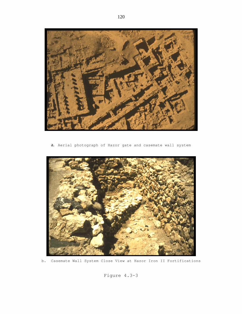
120
a. Aerial photograph of Hazor gate and casemate wall system
b. Casemate Wall System Close View at Hazor Iron II Fortifications
Figure 4.3-3

121
a. Iron Age Gate: On the northern frontier of the kingdom, Dan wasparticularly well fortified. This gatehouse was built in the ninthcentury BCE probably by Ahab, and is part of a series of gatewaysdiscovered. In the foreground of this picture is the area of thediscovery of the Dan Inscription which mentions the “House of David.”
b. Dan Podium for Ruler: This may have been a place for the ruler nextto the gate or a place for an idol to be set up. 2 Sam 18:4, "So theking stood beside the gate while all the men marched out in units ofhundreds and of thousands." 2 Ki 23:8, "He broke down the shrines atthe gates."
Figure 4.3-4

122
a. Iron II Gate at Megiddo
b. Solomonic Gate at Gezer: This monumental gateway is similar to thoseat Hazor and Megiddo. The date of this gate is confirmed by thepresence of a destruction level underneath it (from the unnamed pharaohwho gave the city to Solomon) and a destruction level not long afterits construction (by Shishak in 925 BCE). Biblical history isdramatically confirmed by these archaeological findings.
Figure 4.3-5

123
a. Steps leading to the pool at Gibeon Iron II
b. Iron Age Reservoir Gibeon
Israeli archaeologists uncovered the largest Iron Age reservoir known inIsrael. With a capacity of 7500 cubic feet, this reservoir could have suppliedthe town's inhabitants with water to survive a three-month siege. Thisunderground storage basin is composed of two long rooms in the shape of a crossand according to the excavators is "one of the finest examples of waterengineering and management in the kingdom of Judah."
Figure 4.3-6

124
a. The Pool Tower was one of two towers built by the Canaanite peopleliving in Jebus/Jerusalem about 1800 BCE. These two massive towersfortified the city's water system and allowed the Jebusites to safelyaccess fresh water in times of siege. The Pool Tower guarded a pool(see below) which received water from a feeder tunnel from the GihonSpring. Citizens would apparently retrieve water from a platformconnected to this tower.
b. Onlypartiallyexcavated
because of abuilding
structure inthe way,this poolwas a
storagebasin for
waterbrought fromthe nearby
GihonSpring. The Pool Tower, pool, and Spring Tower were all discoveredduring work in preparation for the construction of a visitor's center.
Figure 4.3-7

125
a. Warren’s Shaft: Discovered by Charles Warren in his investigationsof the city in the 1860s, this underground tunnel system has becomeknown as "Warren's Shaft." The system by this name consists of fourparts: the stepped tunnel, the horizontal curved tunnel, the 14 metervertical shaft and the feeding tunnel. Scholars have long debated thedate and function of this system. What is clear is that this systemwas used to access the city's supply of water (the Gihon Spring) frominside the safety of the city walls. Excavations in the 1980s seem toindicate that the system was post-Davidic, but more recent workestablishes its Middle Bronze date (c. 1800 BCE).
b. Warren’s Shaft: Vertical View
Figure 4.3-8

126
a. The City of David was very narrow; about 80-100 m wide. The east side has
a steep slope of about 60 degrees. Though smaller, steeper and more difficult
for construction than the Western Hill, the City of David was chosen because of
its water source, the Gihon Spring.
b. Hezekiah’s Tunnel A 1750-foot (530m) tunnel carved during thereign of Hezekiah to bring water from one side of the city to the otherside. Had it followed a straight line, the length would have been 1070ft. (335m) or 40% shorter.
2 Kings 20:20 "As for the other events of Hezekiah’s reign, all hisachievements and how he made the pool and the tunnel by which hebrought water into the city..." 2 Chron. 32:30 "It was Hezekiah whoblocked the upper outlet of the Gihon spring and channeled the waterdown to the west side of the City of David."
Figure 4.3-9

127
a. Discovered in modern times by Edward Robinson (1838), cleared by MontagueParker's team (1909-11), work continues on the Tunnel and related passagewaysunder the direction of Ronny Reich (1995). The tunnel was S-shaped and thisphotos shows where the workers meet as they dug from each side. R.A.Macalister said the tunnel was a “pathetically helpless piece of engineering.”Henry Sulley in 1929 first suggested that Hezekiah’s tunnel followed a naturalcrack in the rock. Dan Gill argues that the two crews of digger followed anatural karsti dissolution channel.
b. The Location of the Siloam Inscription “[...when] (the tunnel) was driventhrough. And this was the way in which it was cut through: While [...] (were)still [...] axe(s), each man toward his fellow, and while there were stillthree cubits to be cut through, [there was heard] the voice of a man calling tohis fellows, for there was an overlap in the rock on the right [and on theleft]. And when the tunnel was driven through, the quarrymen hewed (the rock),each man toward his fellow, axe against axe; and the water flowed from thespring toward the reservoir for 1200 cubits, and the height of the rock abovethe head(s) of the quarrymen was 100 cubits.”
Figure 4.3-10

128
a. Iron Age Watersystem at Meggido needing secure access to its watersupply, Megiddo utilized different watersystems over its history. Inthe 9th c. BCE, Ahab constructed a massive system with a 30 meter deepshaft and a 70 meter long tunnel. This continued in use until the endof the Iron Age.
b. Megiddo Tunnel: This Iron Age tunnel connected the bottom of Ahab'sshaft to the spring. Before its construction, Megiddo residents had toleave the city walls in order to get water from the spring. This tunnelwas hewn from both ends at the same time (like Hezekiah's Tunnel) andits builders were only one foot off when meeting in the middle.
Figure 4.3-11
4.4 ARCHITECTURE

129
4.4.1 Royal Architecture and Ashlar Masonry
The primary royal buildings of the Iron Age were in
Jerusalem, Ramat Rahel, Samaria, Megiddo, Hazor, and
Lachish. The city of Samaria was about 6.5 acres in area
while Lachish was 3.5 acres. Both of these cities were
build on artificial fills, the fills were leveled and a
high retaining wall was put around them. The great podium
at Lachish illustrates the effort taken to raise the city
and especially the palace above the surrounding
countryside, giving a symbolic emphasize to the strength of
the ruler. Lachish is unique in its fortress/residence and
this large, monumental structure shows continual rebuilding
through most of Iron II (Mazar 1990:471). See Figure 4.4-1.
Spacious, lime-paved courtyards were a common feature
in the Israelite royal compounds, providing space for
military maneuvers, chariot and cavalry movement, public
appearances of the rulers, and other convocations.
Storage space was provided in casemates or elongated
storage rooms located at the periphery of these complexes.
The individual structures inside the royal enclosures
seem to comprise several contemporary traditions.
(1) “Bit hilani” is an Akkadian term apparently based
on the Hittite reference to palaces having a colonnaded
entrance porch.
(2) One of the descriptions of Solomon's palace in 1
Kings 7:1-11 is “hall of pillars." In palaces of this type,
the porch gave access to the throne room which was a broad
hall in which the throne stood at one of the narrow ends.
Behind the throne room there were dwelling rooms, sometimes

130
arranged around an inner courtyard like the “other court"
of Solomon's palace.
This feature is paralleled in the pillared halls of
the kingdom of Urartu in eastern Anatolia dated to ninth
century BCE.
The "four-room" principle, characteristic of many
private dwellings of this time, formed the nucleus of the
inner planning of royal citadels at Hazor, Shechem and the
central building at Tell el-Kheleifeh.
Israelite royal buildings starting in the tenth
century BCE until the collapse of the kingdom of Judah were
typified by ashlar masonry, Proto-Aeolic capitals, carved
windows, and stone cut crenellations on the upper part of
the structure’s walls.
Three different types of ashlar walls have been
identified:
(1) Those comprising ashlars (square-dressed stones)
laid in "headers and stretchers," the stones smoothly
dressed; this technique was utilized in the facades of
buildings and in palace walls which were seen from public
courtyards.
(2) The technique was the same as (1). The stones,
however were marginally dressed and an unworked boss was
left at the center; this technique was utilized in
foundation courses and retaining walls.
(3) Walls consisting of ashlar piers separated by a
fill of field stones; this technique was utilized in walls
of lesser importance such as fences of courtyards and walls
of certain dwellings.
Ashlar masonry was used extensively in the main
palaces that were located at Samaria, Jerusalem and Ramat
Rahel. It was also used in some provincial royal

131
residencies (example was the tenth century BCE building at
Megiddo); the royal ritual centers (such as that at Dan);
and to some extent in other official buildings (such as at
the gate to the citadel at Hazor). In contrast, however,
there were not any ashlars found at the palace of Lachish,
this seems to be because of the economic situation (Mazar
1990:472-475). See Figure 4.4-1
Ashlar masonry is also found outside Israel. At
Ekron, Ashdod, and Tel Sera in Philistia it was used for
strengthening certain parts of mud-brick structures. In
Moab, a royal citadel or a palace at the site of Medeibiyeh
had a gate built of ashlars and decorated with Proto-Aeolic
capitals identical to those of Jerusalem and Ramat Rahel.
In Phoenicia ashlar masonry was employed in a few
structures and tombs at Sarepta, Tyre, and Achzib. The
extensive excavation and good preservation of Israelite
sites has made this masonry well known in Israel.
The fact that the earliest examples of this masonry
are preserved in the Israelite Solomonic and Omride
architecture tempts us to assume that Phoenician artisans
and architects were responsible for its introduction to
Israel, as these Israelite kings are known to have had
close connections with Tyre. The fact that all the examples
of ashlar masonry outside Israel are later to the time of
Solomon and Ahab, led Y. Shiloh to suggest that it and the
related Proto-Aeolic capitals, were original Israelite
innovations. Unfortunately, no Phoenician royal
architecture is known for comparison. Ashlar masonry was a
common Phoenician architectural feature in the late Iron
Age; it was also common in the succeeding period in Cyprus,
Phoenicia, and in the Phoenician Mediterranean colonies.
This could be because more excavations have taken place in

132
Israel than in the ancient Phoenician sites (Mazar 1990:
474).
The numbers of Proto-Aeolic capitals that have been
found are: Megiddo (thirteen examples, including
fragmentary ones); Samaria (seven); Hazor (two); Ramat
Rahel (ten); Jerusalem (one); and Medeibiyeh in Moab
(several). These were comprehensively discussed by Y.
Shiloh. He differentiated between those found in the
Kingdom of Israel from the tenth and ninth centuries BCE
and the group of later capitals (eighth and seventh
centuries BCE) of almost identical shape found at
Jerusalem, Ramat Rahel, and Medeibiyeh.
The volutes (spiral ornamentation) decorating these
capitals are a stylized form of the palmetto, one of the
best-known motifs in Canaanite and Phoenician art.
Representations of similar patterns also appear on several
Iron Age miniature works of art (ivory, stone, and metal).
The stone balustrade (small pillars that support a
hand rail) from Ramat Rahel is practically identical to
depictions of window balustrade on Phoenician ivories,
indicating a clear connection between ashlar masonry and
Phoenician formal architecture.
The wide-scale use of ashlar masonry and Proto-Aeolic
capitals in Israel and Judah expresses the integration of
their regnal dynasties in the general cultural environment
of their time. It also illustrates their wealth and efforts
to exploit the best available artistic achievements of the
time (Mazar 1990:471).
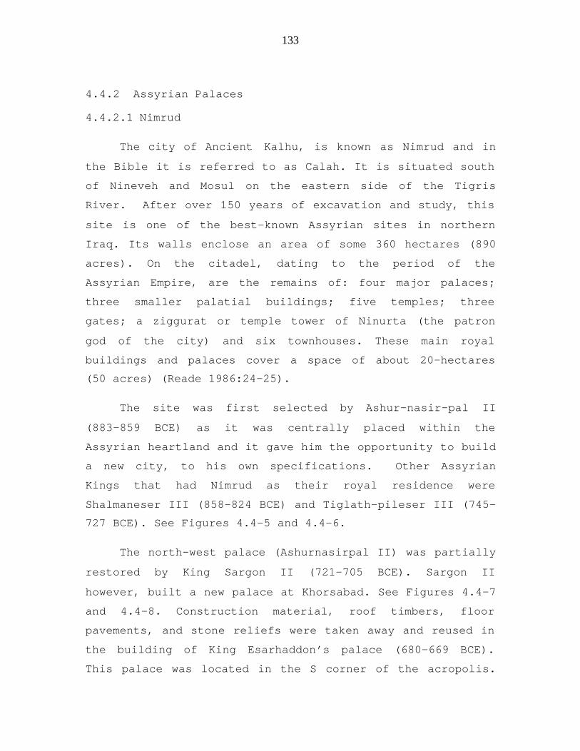
133
4.4.2 Assyrian Palaces
4.4.2.1 Nimrud
The city of Ancient Kalhu, is known as Nimrud and in
the Bible it is referred to as Calah. It is situated south
of Nineveh and Mosul on the eastern side of the Tigris
River. After over 150 years of excavation and study, this
site is one of the best-known Assyrian sites in northern
Iraq. Its walls enclose an area of some 360 hectares (890
acres). On the citadel, dating to the period of the
Assyrian Empire, are the remains of: four major palaces;
three smaller palatial buildings; five temples; three
gates; a ziggurat or temple tower of Ninurta (the patron
god of the city) and six townhouses. These main royal
buildings and palaces cover a space of about 20-hectares
(50 acres) (Reade 1986:24-25).
The site was first selected by Ashur-nasir-pal II
(883-859 BCE) as it was centrally placed within the
Assyrian heartland and it gave him the opportunity to build
a new city, to his own specifications. Other Assyrian
Kings that had Nimrud as their royal residence were
Shalmaneser III (858-824 BCE) and Tiglath-pileser III (745-
727 BCE). See Figures 4.4-5 and 4.4-6.
The north-west palace (Ashurnasirpal II) was partially
restored by King Sargon II (721-705 BCE). Sargon II
however, built a new palace at Khorsabad. See Figures 4.4-7
and 4.4-8. Construction material, roof timbers, floor
pavements, and stone reliefs were taken away and reused in
the building of King Esarhaddon’s palace (680-669 BCE).
This palace was located in the S corner of the acropolis.

134
This salvaging of materials from the original North West
Palace is what eventually caused its collapsed and
destruction. The excavations have explored only about 40%
of the total area; however remains from the Assyrian Kings
that ruled there have all been discovered(Reade 1986:6).
4.4.2.2 History of the excavation at Nimrud
Austen Layard discovered the Palace of Ashur-nasir-pal
II on the citadel of Nimrud during his stay in Mesopotamia
between 1847-1851. Using local workmen, Layard excavated
stone bas-reliefs found in the debris of the mud brick
walls of the public rooms of the Palace. William Loftus and
Boutcher worked at Nimrud from 1854-55 on behalf of the
British Museum and the Assyrian Excavation Fund. George
Smith worked there in 1874-75 and Hormuzd Rassam from 1878-
1881. These excavations did not concentrate on the
Northwest Palace. For nearly half-a-century, except for
private visits and excavations by Iraqi families nothing
more was done with the excavation. Fragments and some
antiquities were found and sold to antiquities dealers.
No work by trained archaeologists was done again at
Nimrud and the Northwest Palace until 1949, when, a century
after Layard, Max Mallowan, on behalf of the British School
of Archaeology in Iraq and the British Museum, re-opened
the site and paid attention to this monument of Ashur-
nasir-pal II's reign (Reade 1986:7).
In summary, after the Second World War, the Iraqis
worked alone and with British (Mallowan 1966); Polish
(Meuszynski 1976; Sobolewski 1982) and Italian
(unpublished) teams. The most recent Iraqi field director
is Muzahim Mahmud Hussein. The Iraqis continued to work at
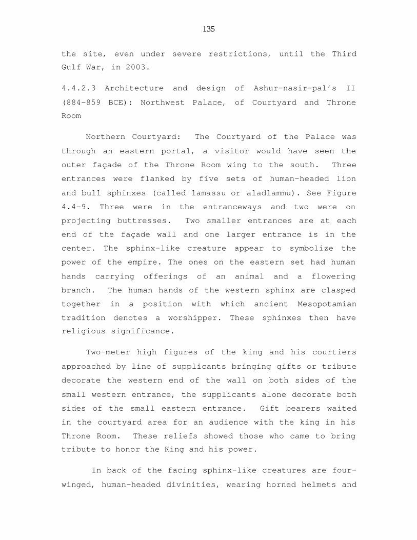
135
the site, even under severe restrictions, until the Third
Gulf War, in 2003.
4.4.2.3 Architecture and design of Ashur-nasir-pal’s II
(884-859 BCE): Northwest Palace, of Courtyard and Throne
Room
Northern Courtyard: The Courtyard of the Palace was
through an eastern portal, a visitor would have seen the
outer façade of the Throne Room wing to the south. Three
entrances were flanked by five sets of human-headed lion
and bull sphinxes (called lamassu or aladlammu). See Figure
4.4-9. Three were in the entranceways and two were on
projecting buttresses. Two smaller entrances are at each
end of the façade wall and one larger entrance is in the
center. The sphinx-like creature appear to symbolize the
power of the empire. The ones on the eastern set had human
hands carrying offerings of an animal and a flowering
branch. The human hands of the western sphinx are clasped
together in a position with which ancient Mesopotamian
tradition denotes a worshipper. These sphinxes then have
religious significance.
Two-meter high figures of the king and his courtiers
approached by line of supplicants bringing gifts or tribute
decorate the western end of the wall on both sides of the
small western entrance, the supplicants alone decorate both
sides of the small eastern entrance. Gift bearers waited
in the courtyard area for an audience with the king in his
Throne Room. These reliefs showed those who came to bring
tribute to honor the King and his power.
In back of the facing sphinx-like creatures are four-
winged, human-headed divinities, wearing horned helmets and

136
carrying a cone shaped object (mullilu) in their raised
hand and a bucket (banduddu) in their lower hand. The four-
winged deities are protective: they belong to a family of
deities which have been loosely identified by some scholars
with the apkallu, the seven ancient sage figures who lived
before The Flood (Reade 1986: 6-7 and 24-25). See Figures
4.4-10
Some scholars speculated that the small western
entrance may have been the way the throne room was entered
when court was in session and the small eastern entrance
the exit, while the great central entrance was probably
used only for special occasions and for the king himself to
enter. (Paley, Samuel, and Sobolewski 1992: 331-35).
Throne Room of Ashur-nasir-pal II
The Throne Room measured about 9.8 X 45.7 meters. All
its walls were lined with bas-relief decoration and
probably had painted plaster and brick decorating the upper
parts of walls. See Figure 4.4-11. The Throne Room was
entered from the Northern Courtyard by the western portal.
The whole room could be viewed. Both sides were decorated
with bas-reliefs. The scenes depicted the king at war,
engaged in a lion and bull hunt, and two sets of religious
scenes in which the king was with divine servants attending
the Assyrian “Sacred Tree”. The religious scenes were
placed directly behind the throne and almost filled the
entire eastern wall; another was directly opposite the main
entranceway. The king is portrayed caring a long staff in
his right hand, a symbol in ancient Near Easter iconography
that is associated with the shepherd’s staff indicating
rulership. It seems to indicate that the King is showing

137
that he became king because the gods had selected him, this
was symbolized by the “Sacred Tree” ceremony. These scenes
are higher than the other ones on the walls. The war
scenes included the King’s victory in Urartu, Carchemish,
and other places (Reade 1986:24-29).
4.4.2.4 Nineveh: The Walls and Palaces of the Assyrian
Kings at Nineveh.
Nineveh, the capital of ancient Assyria, lies on the
left bank of the Tigris River opposite present-day Mosul,
Iraq. The remains of the palaces found at Nineveh include:
Sargon II (721-705 BCE); Sennacherib (705-681 BCE);
Esarhaddon (681-668 BCE) whose palace lies under the hill
called Nabi Yûnis; and Ashur-bani-pal (681-626 BCE), his
palace is under the mound which is known locally as, Tell
al-‘Armushiyah. These two great mounds lie close to the
remains of the great west wall of Nineveh, which in the
time of the last Assyrian Empire was washed by the waters
of the river Tigris. At some unknown period the course of
the river changed, and it is now more than a mile distant
from the city wall. The river Khausur, or Khoser, divides
the area of Nineveh into two parts and passing close to the
southern end of Kuyunjik empties itself into the Tigris.
The ruins of the walls of Nineveh show that the east wall
was 16,000 feet long; the north wall 7,000 feet long; the
west wall 13,600 feet; and the south wall 3,000 feet. Its
circuit was about 13,200 yards or 7 1/2 miles. In the
summer of 612 BCE, Nineveh fell to the combined forces of
the Medes and Babylonians. Occupation continued, for
another one thousand years through the Seleucid and
Parthian periods until medieval times (Reade 1986:9).

138
High Points of the Excavation History: of Nineveh and
Khorsabad
Nineveh was first surveyed in 1820; intermittent
excavation by various expeditions took place from 1842 to
1931. In 1842, Paul Botta began excavating the Kuyunjik
mound without finding what he felt was anything
significant. He shifted his work from Nineveh to Khorsabad
(Dur Sharrukin) ten miles north in 1843. He found Sargon
II’s palace almost immediately. Layard excavated at Nineveh
in 1849-50 and his work revealed the palace of Sennacherib
along with annals of the king. In 1850, Layard and Hormuzd
Rassam uncovered the library of Ashurbanipal which
contained over 20,000 tablets written in Akkadian and
Sumerian. Dr. Victor Place from the Louvre in Paris
continued the excavation from 1851-1855. Edward Chiera of
the Oriental Institute of the University of Chicago
continued the work in 1929. In the ruins of the palace a
prism was found listing the rule of the Assyrian dynasties
(Reade 1986:10-12).
In the last half of the nineteenth century several
British excavators worked on the site. One of these was
George Smith, who studied cuneiform and eventually was able
to decipher a number of the tablets including the Gilgamesh
story and Enuma Elish which he published in 1876. The
subjects on these tablets included religion, literature,
and administration. Many of the tablets were in the form of
letters. Branches of learning included mathematics, botany,
chemistry, and lexicology (McCarter 1996: 19-21).
Between 1927-32, Nineveh was excavated by R.
Campbell Thompson and others. They were able to uncover

139
the archaeological evidence that can be traced back to
4,500 BCE. More recent work, including some restoration,
has been undertaken by the Iraq Department of Antiquities.
4.4.2.5 Nineveh and the Southwest Palace built by King
Sennacherib.
In the later second millennium BCE, Nineveh was an
important city with a prestigious temple of the goddess
Ishtar. Sennacherib chose it as his capital and laid out a
city surrounded by walls approximately twelve kilometers in
circumference. See Figure 4.4-12. The old tell formed the
main citadel and was where, at the beginning of the seventh
century BCE, Sennacherib built the so-called Southwest
Palace, decorating it with carved stone reliefs.
Sennacherib's city wall, more than 12 km (7.5 miles)
long, enclosed an area of about 700 hectares (1730 acres);
it was pierced by 15 great gates, five of which have been
excavated. The northern Nergal Gate, with its original
flanking bull colossuses, has been restored. Canals
provided water to the city and to municipal gardens that
were stocked with unusual plants and animals. Sections of
an aqueduct built by Sennacherib still stand at Jerwan, 40
km (25 mi) away. The palaces of Sennacherib and his
grandson Ashurbanipal stand at Kuyunjik, the citadel of the
site. Their walls and doorways were lined with sculptured
reliefs, many of which are now in the Louvre, Paris, and
the British Museum, London.
Sennacherib's palace, named the southwest palace,
comprised at least 80 rooms; the throne room suite, now
partially restored, still contains some of its bas-reliefs
depicting scenes of conquest. See Figure 4.4-13. One of

140
these conquest was the Judean city of Lachish. Details on
these bas-reliefs have been discussed in chapter 4.8 of
this dissertation, titled, Weapons and Warfare.
Ashurbanipal built a second palace on Tell Kuyunjik, the
North Palace, which contained the famous lion hunt reliefs
(Reade 1986: 36-43; 56-60). See Figure 4.4-14
Archives of cuneiform tablets were found in both
palaces, but the library of Ashurbanipal forms an unrivaled
epigraphic source for current knowledge of Mesopotamian
history. It contained more than 20,000 tablets and
fragments, many of which are copies of ancient Mesopotamian
texts such as the Sumerian Epic of Gilgamesh and the
Babylonian Flood story; its subjects range from literature
to religion, the sciences, and lexicography (Douglas
1998:143).
The E-mashmash Temple, dedicated to the goddess
Ishtar, also stood on Kuyunjik; its series of superimposed
structures, dating back to the 3rd millennium BCE, were
maintained by successive rulers of Assyria and survived
until at least AD 200. The imperial arsenal, built by
Sennacherib's successor, Esarhaddon (r. 680-669 BCE),
stands largely unexcavated at Nebi Yunus, a mound on the
city wall 1.6 km (1 mi) south of Kuyunjik. It is still
covered by modern buildings, among them a mosque reputed to
contain the tomb of the Prophet Jonah (Schoville 1978:198-
200).
4.4.2.6 Other Sources Regarding the Assyrian Kings

141
More detailed information about the Assyrian Kings and
material uncovered from their palaces can be found in the
following sections of this dissertation: 4.5 Literacy and
Inscriptions(under Assyrian Inscriptions); details about
the campaigns of the Assyrian kings are found in 4.8
Weapons and Warfare and 4.3 Town Planning; The Banquet of
Ashurnasirpal II is found in Food Preparation, 4.11; and
information on the Assyrian gods and temples are found in
4.6, titled Temples, Gods, and Cult Objects. Biblical
references are given when they apply to these specific
categories.
4.4.3 Stables and Store Buildings
A common type of Israelite public building was a
rectangular, elongated structure divided internally by two
rows of stone pillars into a central passage and two
flanking aisles. Such units began to appear on the coastal
plain during the eleventh century BCE at Tell Qasile and
Tell Abu Hawam. They became common at Israelite sites from
the ninth century BCE onward.
At Hazor, one such building was constructed in the
ninth century BCE. At Megiddo there were seventeen examples
grouped in two clusters. At Lachish two buildings stood at
the southern side of the royal enclosure; and at both Tell
el-Hesi and Tel Beersheba three adjoining public edifices
of this type were discovered. At Beersheba they were next
to the city gate. The dimensions of the structure varied
from 16 to 18 m in length and 10 to 12.5 m in width. In
each row there were ten to fourteen pillars, usually
consisting of solid monoliths with a square section. In
most cases, the aisles were paved with cobblestones and the
central passage with beaten earth. The buildings are

142
thought to have had a higher roof in their central part
with windows rising higher than adjacent outside structures
to provide light and air for the interior.
The largest group of such public buildings was
discovered at Megiddo Stratum IVA(see Megiddo under sites).
Five were located on the southern side of the mound, at the
back of a large square courtyard surrounded by a wall. The
other twelve were in the northern part of the mound
arranged in three groups around a rectangular courtyard.
The features of these structures that contributed to their
identification as stables included: their general layout
plan; stone troughs found between the pillars; holes in the
pillars for tying; and the dimensions of the aisles. The
large fenced courtyard in front of the southern complex was
explained as a training area. It has been estimated that
the Megiddo stables could have accommodated about 450
horses. Horses were very important at this time. Solomon is
said to have erected "cavalry cities" and "chariot cities,"
and to have fourteen hundred chariots and twelve thousand
cavalry men (1 Kings 9:19 and 10:26-29). Ahab is mentioned
in the Assyrian description of the battle of Qarqar as
having had twelve hundred battle chariots, the largest
number among the allied forces in this battle. The valuable
battle horses and chariots had to be well maintained in
appropriate structures, such as those at Megiddo. (1990
Mazar: 476). See Figure 4.4-2.
Other pillared buildings of a public nature were
explained by their excavators as public storehouses that
were built to store grain, oil, and wine (2 Chronicles
32:28). The public storehouses found at Beersheba and Hazor
were expected as these cities were regional administrative

143
centers where food was stored and then distributed to army
units.
The function of these rectangular pillared buildings,
however, has been a matter of controversy for several
years. J.B. Pritchard, followed by Y. Aharoni and Z.
Herzog, suggested that the Megiddo buildings were royal
store buildings. This view was strongly opposed by Y. Yadin
and J. S. Holladay; Holladay even suggested that all
pillared buildings of this type should be identified as
stables (Mazar, 1990:477-78).
In addition to the pillared buildings, public storage
space was also located in casemates of citadels and royal
enclosures; at Hazor, Samaria, Jerusalem (the Ophel site),
and Lachish, specially designed elongated storage rooms
were discovered.
4.4.4 Four-room Pillared Houses
The four-room house with rows of pillars is a
defining trait of the Iron Age and found both in the hill
country and on the Philistine plain. By Iron II this house
design was almost the standard type used in domestic
architecture. See Figure 4.4-3.
The pillared four-room houses had several important
characteristics. They were built in a variety of sizes and
plans. The structures were divided by one or two rows of
pillars into several rectangular units. These pillars were
usually monolithic stones with a square section and were 1-
1.5 m in height. In areas, like the northern Negev where
large rocks were often unavailable, the pillars were made
by piling up large stones. Stone lintels preserved in
several cases show that the passageways between the pillars
were low, suitable for domestic animals such as sheep. The

144
area behind the pillars was usually paved with
cobblestones. Rooms at the side of the central unit or at
its rear were usually elongated, rectangular spaces.
The walls of houses were often made using field stones
for the lower portions, up to about 1 m high. The upper
portions were often made of mud-brick. The lower stones
withstood the surface water flow and gave stability. Water
could also drain out of an enclosure by passing between the
lower rocks if sealant was not placed between the rocks.
Rock walls could be made quite resilient by pounding
smaller rocks in between larger ones in the wall. This was
continued with rocks and stones of decreasing size, thus
effectively immobilizing the larger rocks. On top of the
rocks, the mud-bricks could be set securely and could be
repaired after the rainy season if needed. Roofs were
often made starting with small logs or strong tree
branches. Successively smaller branches and even ones with
leaves still attached would be laid on top. Finally a
topping of mud would be put on top to give a generally
water resistant seal.
The existence of a second story can be inferred
from stone steps preserved in several cases as well as from
the massiveness of the stone pillars on the ground floor.
Where stone steps did not exist, access to the second floor
could be gained by a wooden ladder. In the Biblical Hebrew,
a second story of a dwelling is the “aliyah” (2 Kings
4:10). This is the same word used today of Jewish
immigrants moving (up) to Israel.
The central unit of these houses is usually
interpreted as an open air courtyard. The pillars are
thought to have supported a roofed area alongside the
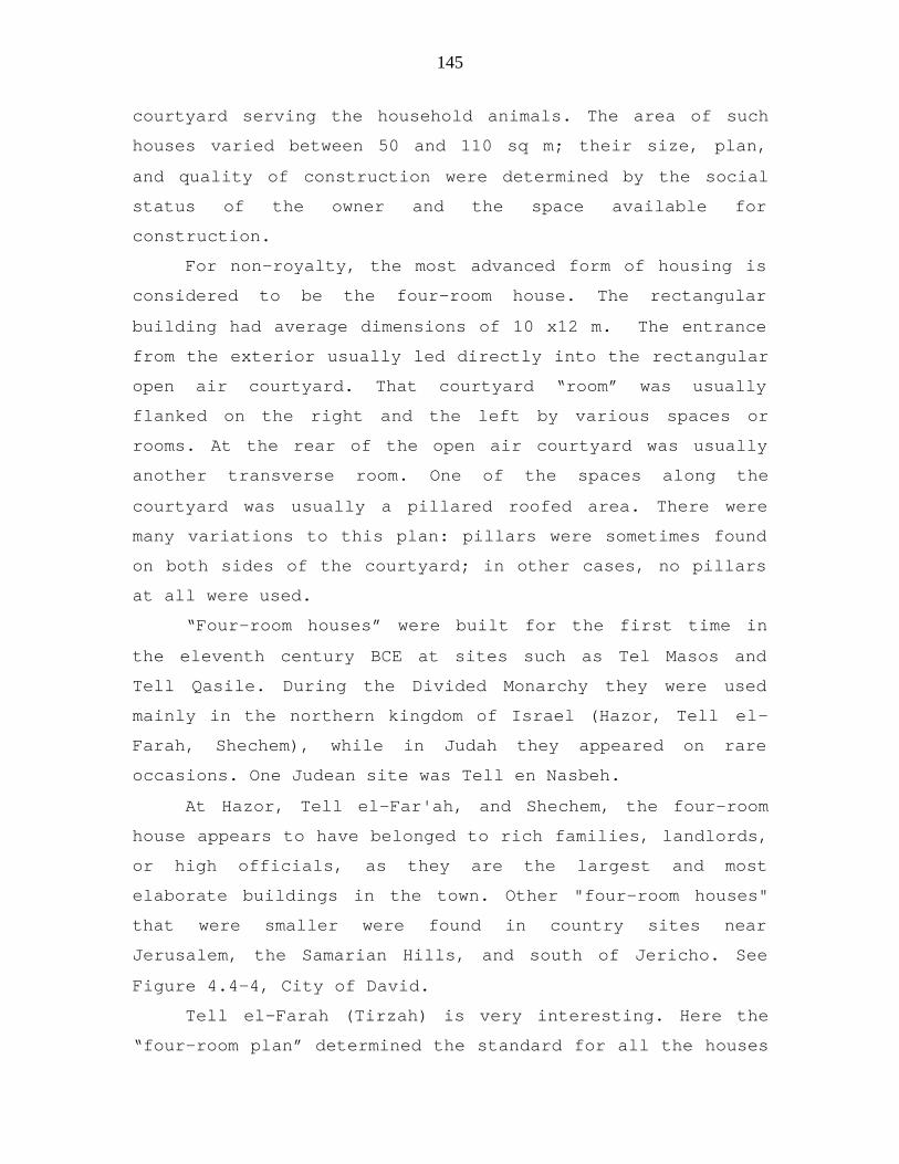
145
courtyard serving the household animals. The area of such
houses varied between 50 and 110 sq m; their size, plan,
and quality of construction were determined by the social
status of the owner and the space available for
construction.
For non-royalty, the most advanced form of housing is
considered to be the four-room house. The rectangular
building had average dimensions of 10 x12 m. The entrance
from the exterior usually led directly into the rectangular
open air courtyard. That courtyard “room” was usually
flanked on the right and the left by various spaces or
rooms. At the rear of the open air courtyard was usually
another transverse room. One of the spaces along the
courtyard was usually a pillared roofed area. There were
many variations to this plan: pillars were sometimes found
on both sides of the courtyard; in other cases, no pillars
at all were used.
“Four-room houses” were built for the first time in
the eleventh century BCE at sites such as Tel Masos and
Tell Qasile. During the Divided Monarchy they were used
mainly in the northern kingdom of Israel (Hazor, Tell el-
Farah, Shechem), while in Judah they appeared on rare
occasions. One Judean site was Tell en Nasbeh.
At Hazor, Tell el-Far'ah, and Shechem, the four-room
house appears to have belonged to rich families, landlords,
or high officials, as they are the largest and most
elaborate buildings in the town. Other "four-room houses"
that were smaller were found in country sites near
Jerusalem, the Samarian Hills, and south of Jericho. See
Figure 4.4-4, City of David.
Tell el-Farah (Tirzah) is very interesting. Here the
“four-room plan” determined the standard for all the houses

146
in several occupation levels. In the tenth century BCE
(Stratum VIIb), the structures there were of almost
identical size and plan. However, in the ninth and eighth
centuries they varied in area, perhaps reflecting
increasing social differentiation (Mazar 1990:486).
Strata VII-V at Tell es-Sa'idiyeh provided excellent
examples of the variety of house structures in the Jordan
Valley. The houses of Stratum VII dated to the ninth
century. They are small rectangular structures with two
rooms except for one in which there were three rooms. These
houses open onto a narrow street with a drainage ditch in
the center. In the next level, the houses are rectangular
one room structures, a style more characteristics of the
Transjordan. In Stratum V, the pillared house is the
exclusive type of house structure. See Figure 4.4-3. A
complete block of houses, constructed of mud-brick and with
earthen and stone floors, ovens, and storage bins between
pillars, could be entered from the narrow streets
surrounding the block. Pritchard uncovered considerable
evidence of burning with fragments of roof timbers, layer
of gray ash and scorched bricks and artifacts. He
hypothesized that the level was destroyed at the end of the
seventh century when the Assyrian kings destroyed most of
the other cities in the kingdom of Israel (Shiloh 1970:
180-190).
It is interesting to see that at Beersheba and Tell
Beit Mirsim, the back room of the house was part of a
casemate wall surrounding the town. The house courtyard was
utilized for conducting various household duties (Mazar
1990:488). Baking ovens were often located in the
courtyard. In some places the ovens were outside the house

147
in an open area or in a special small chamber. Cereals were
ground in the courtyard on grinding stones usually made of
basalt or other hard stone. These house courtyards also had
stone or plastered vats with attached working surfaces that
may have functioned as simple wine presses. Olive presses
of specific forms are also often found as well as other
built-in installations which represent specific activities.
Rock-cut cisterns have been located only at
places where the rock was suitable for cutting and easily
accessible, such as Tell en-Nasbeh. In general, however,
the daily water supply was taken from nearby springs,
wells, or public water projects.
The number of people who lived in each housing
unit has been estimated to be a "nuclear family" of five to
seven persons. Larger houses could accommodate up to
approximately ten or eleven people in all. The amount of
pottery vessels found in a house provides some indication
of the number of its occupants. Houses at Timnah (Tel
Batash) contained an astonishingly large quantity of
pottery vessels. In one small dwelling, comprising a
courtyard and two square rooms, there were thirty bowls,
eight kraters, eleven cooking pots, fourteen storage jars,
twelve jugs, eight dipper juglets, and several other
vessels. The number of tenants in this unit must have been
relatively high (Mazar 1990:487-488).
4.4.5 Concluding Comments on Architecture
The primary royal buildings of the Iron Age II that
have been identified are in Ramat Rahel, Samaria, Megiddo,
Hazor, and Lachish. Starting in the tenth century BCE until
the collapse of the kingdom of Judah, Israelite royal
buildings were typified by ashlar masonry, Proto-Aeolic
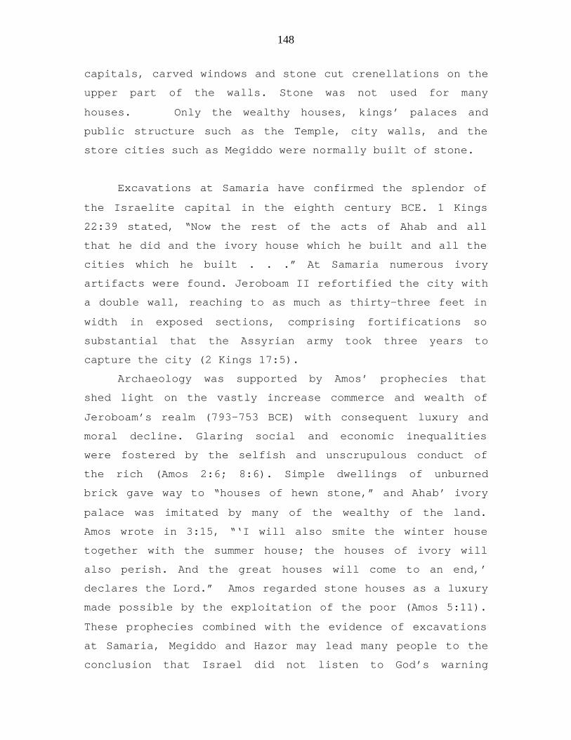
148
capitals, carved windows and stone cut crenellations on the
upper part of the walls. Stone was not used for many
houses. Only the wealthy houses, kings’ palaces and
public structure such as the Temple, city walls, and the
store cities such as Megiddo were normally built of stone.
Excavations at Samaria have confirmed the splendor of
the Israelite capital in the eighth century BCE. 1 Kings
22:39 stated, “Now the rest of the acts of Ahab and all
that he did and the ivory house which he built and all the
cities which he built . . .” At Samaria numerous ivory
artifacts were found. Jeroboam II refortified the city with
a double wall, reaching to as much as thirty-three feet in
width in exposed sections, comprising fortifications so
substantial that the Assyrian army took three years to
capture the city (2 Kings 17:5).
Archaeology was supported by Amos’ prophecies that
shed light on the vastly increase commerce and wealth of
Jeroboam’s realm (793-753 BCE) with consequent luxury and
moral decline. Glaring social and economic inequalities
were fostered by the selfish and unscrupulous conduct of
the rich (Amos 2:6; 8:6). Simple dwellings of unburned
brick gave way to “houses of hewn stone,” and Ahab’ ivory
palace was imitated by many of the wealthy of the land.
Amos wrote in 3:15, “‘I will also smite the winter house
together with the summer house; the houses of ivory will
also perish. And the great houses will come to an end,’
declares the Lord.” Amos regarded stone houses as a luxury
made possible by the exploitation of the poor (Amos 5:11).
These prophecies combined with the evidence of excavations
at Samaria, Megiddo and Hazor may lead many people to the
conclusion that Israel did not listen to God’s warning

149
through the prophets and eventually they were taken by the
Assyrians.
The excavations of the Assyrian kings’ palaces
provided not only vivid awareness of their impressive
architecture but records left on their walls of historic
events that affected Israel and Judah. At least ten of the
kings of Israel and Judah were named on their walls. These
reliefs along with other inscribed monuments were
especially valuable in documenting military action against
Israel and their neighbors. The prophet Isaiah describes
the Assyrians as a rod (Isa.10.5), a flood (Isa.8:7, 8) and
a razor (Isa. 7:20). The Assyrian kings’ palaces were
uncovered at Nimrud, Nineveh and Khorsabad. The main kings
were Ashurnasirpal II, Shalmaneser III, Tiglath-Pileser
III, Sargon II and Sennacherib. More will be discussed
about these under closing comments related to Inscriptions
and Warfare.
In Israel and Judah pillared buildings of a public
nature were explained by their excavators as public
storehouses that were built to store grain, oil, and wine
(2 Chronicles 32:28). The public storehouses found at
Beersheba and Hazor were expected as these cities were
regional administrative centers where food was stored and
then distributed to army units.
In addition to the pillared buildings, public storage
space was also located in casemates of citadels and royal
enclosures. At Hazor, Samaria, Jerusalem (the Ophel site),
and Lachish, specially designed elongated storage rooms
were discovered.
The four-room house with rows of pillars is a defining
trait of the Iron Age and found both in the hill country
150
and on the Philistine plain. By Iron II this house design
was almost the standard type used in domestic architecture.
In chapter 42:3, Isaiah talked about the rod (reed) and the
lighting of the houses to express what God was telling the
people, “A bruised reed He will not break, And a dimly
burning wick He will not extinguish . . .”
Excavations of the 4-room houses and other houses of
this time period indicated that their roofs were
constructed of wood beams (usually sycamore) in which
branches were laid across that were bound together by mud.
The roofs were sometime green because the seeds in the mud
sprouted. Isaiah’s indicated that green sprouts could
rapidly be scorched by God, “They were as the vegetation of
the field and as the green herb, as grass on the housetops
is scorched before it is grown up” (2 Kings Chapter 19:26).

151
Lachish (Tell ed-Duweir) Palace Fort. Looking towards thepodium of the palace fort, from the main street. At theend of the Judean monarchy, this governor's residence washalf an acre in size. It is the largest Iron Age structureknown in Israel. Built on the summit of the tell, thispalace was built in three discernible phases which helparchaeologists to understand the length of the cubit in theearlier and later periods. Evidence for the stabling ofhorses in the courtyard has been found.
Figure 4.4-1

152
a. Beersheba, house: Better known as an Israelite pillared building,this typical structure has been found around the country throughout theIron Age (1200-600 BCE). Subdivided by pillars into smaller rooms,these houses were often built against the city wall, with the house'sback wall forming a portion of the city's casemate wall.
b. Three tripartite pillared buildings were revealed in theexcavations. The archaeologists believe that these are storehouses inpart because of the large quantity of vessels found inside. Otherscholars regard this building design as characteristic of stablesevidence suggests this is a more accurate identification.
Figure 4.4-2

153
Tell es-Sa'idiyeh pillared houses
Figure 4.4-3
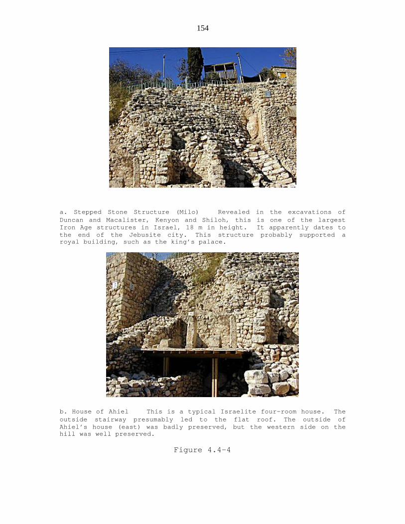
154
a. Stepped Stone Structure (Milo) Revealed in the excavations ofDuncan and Macalister, Kenyon and Shiloh, this is one of the largestIron Age structures in Israel, 18 m in height. It apparently dates tothe end of the Jebusite city. This structure probably supported aroyal building, such as the king’s palace.
b. House of Ahiel This is a typical Israelite four-room house. Theoutside stairway presumably led to the flat roof. The outside ofAhiel’s house (east) was badly preserved, but the western side on thehill was well preserved.
Figure 4.4-4

155
a. View of the Central Palace Excavation of Tiglath-Pileser
III
b. Polish Excavation Team of Tiglath-Pileser’s III
Palace at Nimrud 1976
Figure 4.4-5

156
a. West Area I: cache of reliefs from Central Palace,
Tiglath Pileser III
b. West Area I: cache of reliefs from Central Palace,
Tiglath Pileser III
Figure 4.4-6

157
Winged Assyrian Bull from Khorsabad, palace of Sargon of
Assyria
721-705 BCE Gypseous alabaster H 4.40 m
King Sargon II built his palace in the citadel of the new townthat he founded near Nineveh, which was discovered by Paul-EmileBotta in 1843. The gates were guarded by bulls with human heads.These benevolent spirits, called "lamassou", were the guardiansof the foundations of the world; in the same way they assuredthose of the palace. They are sculpted in the round for theforeparts and in high relief for the remainder of the body. Theyare shown with five legs. Seen from the front they aremotionless, but seen from the side they walk. The inscriptionbetween the legs includes the titles of Sargon. Then it relatesthe construction of his town, called Dur-Sharrukîn, i.e. FortSargon.
Figure 4.4-7
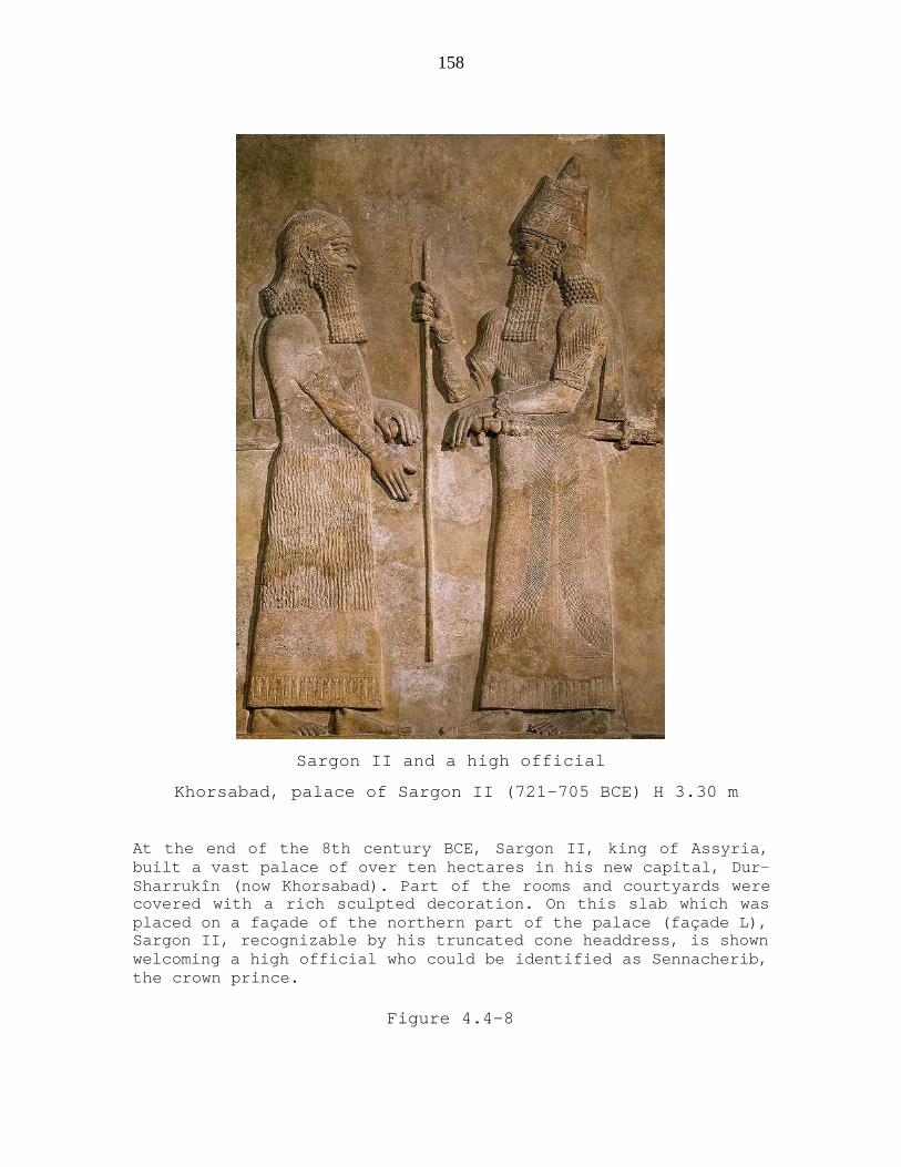
158
Sargon II and a high official
Khorsabad, palace of Sargon II (721-705 BCE) H 3.30 m
At the end of the 8th century BCE, Sargon II, king of Assyria,built a vast palace of over ten hectares in his new capital, Dur-Sharrukîn (now Khorsabad). Part of the rooms and courtyards werecovered with a rich sculpted decoration. On this slab which wasplaced on a façade of the northern part of the palace (façade L),Sargon II, recognizable by his truncated cone headdress, is shownwelcoming a high official who could be identified as Sennacherib,the crown prince.
Figure 4.4-8

159
Restoration of Ashurnasipal II
(Northwest) Palace at Nimrud
Work done by the British School of Archaeology
Figure 4.4-9

160
a. Two carved figures of Ashurnasirpal II, facing a stylizedAssyrian sacred tree from the Northwest palace at Nimrud on theeastern wall. This shows what the original bas-relief would havelooked like. This relief was placed directly behind the throne ofthe King.
b. Ashurnasirpal II, Throne Room, Nimrud. This in situ photo wastaken in May,2003. The heads of the king and the divine attendantwere removed by Layard in the 19th century and are now in thePrince of Wales Museum, Bombay. Recent looting resulted in theremoval of the tree top and the god in the winged disk.Meuszynski 1981, plate 2:1.
Figure 4.4-10

161
.
Pictures showing what was on the in-situ Bas-Relief (top) fromAshurpanipal II Palace(photo of I-9 taken in the early 1970s forMeuszynski's records). The drawing (bottom) shows a sacred treewith genie’s standing by it in an attitude of adoration such aswas on the original Bas-relief.
Figure 4.4-11

162
a. Ancient Nineveh now known as Tell Kuyunjik. A deep excavationat the site, carried out by Max Mallowan, established achronology against which many of the other sites in northMesopotamia are compared.
b. Ancient Nineveh: The city is marked by two large mounds,Kuyunjik and Nebi Yunus. The remains of the city walls. Thisariel view shows the mounds, the ancient city walls, and theTigres and Khosr rivers. It is located opposite the modern cityof Mosul, N. Iraq.
Figure 4.4-12

163
a. Tell Kuyunjik, Sennacherib Palace Site Museum at Nineveh. Adeep excavation at the site, carried out by Mazx Mallowan,established a chronology against which many of the other sites inNorth Mesopotamia are compared.
b. Sennecherib’s Throne Room V with sculptures still in place.
Figure 4.4-13

164
Ashurbanipal built a second palace on Tell Kuyunjik, the
North Palace, which contained the famous lion hunt reliefs.
In the summer of 612 BCE, Nineveh fell to the combined
forces of the Medes and Babylonians. Occupation continued,
however, for a further 1000 years before Nineveh was
eclipsed by the city of Mosul, on the other side of the
river
Figure 4.4-14
Related Documents