. 31 1. Mass wasting plays an important roll in eroding the Earth's surface Diagrammatic sketch of a landslide by David J. Varnes (1978) Scarp

Pg. 31 1. Mass wasting plays an important rollMass wasting in eroding the Earth's surface Diagrammatic sketch of a landslide by David J. Varnes (1978)
Dec 15, 2015
Welcome message from author
This document is posted to help you gain knowledge. Please leave a comment to let me know what you think about it! Share it to your friends and learn new things together.
Transcript

pg. 31 1. Mass wasting plays an important rollin eroding the Earth's surface
Diagrammatic sketch of a landslide by David J. Varnes (1978)
Scarp
Pg.31 Mass wasting events can be geologic hazards
*normal geologic processes that affect humanlife or property
A. $1.5 billion damage per year ~ 25 fatalitiesB. Predictability is poor to goodC. Mitigation - numerous methods depending on
the hazard
Mass wasting - downslope movement of rock andunconsolidated material in response to gravity

4. Types of mass wasting are classified by 3 criteriaND pg. 245 fig. 9.16
A. type of material - solid rock or unconsolidatedmaterial (soil-dirt)
B. type of movementa. Fall - material free falls down a cliff b. Slides - mass of material remains
coherent and moves along awell-defined surface
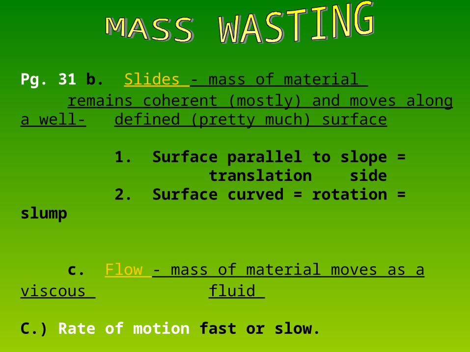
Pg. 31 b. Slides - mass of material remains coherent (mostly) and moves along a well-defined (pretty much) surface
1. Surface parallel to slope = translation side
2. Surface curved = rotation = slump
c. Flow - mass of material moves as a viscous fluid
C.) Rate of motion fast or slow.

SLOW FAST
MOVEMENT Less than 1 cm/yr
1 mm/day to
1 km/hr
1 to
5 km /hr
Greater than 5 km/hr
FLOW Creep Earthflow Mudflow(water saturated
Debris AvalancheRock Avalanche
(wet or dry)
SLIDE Debris SlideRockslide
Debris SlideRock Slide
Debris SlideRock Slide
FALL Debris FallRockFall
LANDSLIDE LANDSLIDE LANDSLIDE
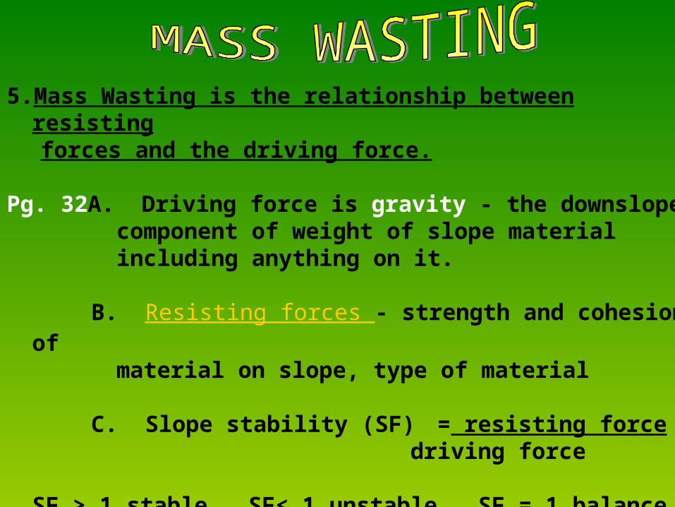
5.Mass Wasting is the relationship between resistingforces and the driving force.
Pg. 32A. Driving force is gravity - the downslopecomponent of weight of slope material including anything on it.
B. Resisting forces - strength and cohesion ofmaterial on slope, type of material
C. Slope stability (SF) = resisting force driving force
SF > 1 stable, SF< 1 unstable, SF = 1 balance
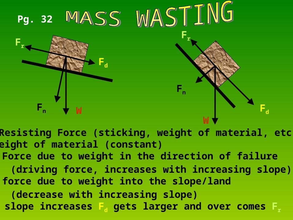
Fn W
Fr
Fn
Fd
Fd
Fr=Resisting Force (sticking, weight of material, etc.)W=Weight of material (constant)Fd= Force due to weight in the direction of failure
(driving force, increases with increasing slope)Fn= force due to weight into the slope/land
(decrease with increasing slope)*as slope increases Fd gets larger and over comes Fr
W
Fr
Pg. 32

pg. 32 D.) A slope will become unstable if reduce
resisting force and/or increase thedriving force
HOW DO WE DO THAT???
GENERAL IDEAND pg. 238 Fig. 9.7

6. Factors that affect resisting force and driving forceA Water –angle of reposeB little water OKC too much water reduces cohesion
by removing cements-lubricant
HOW DOES WATER INCREASE or DECREASE Fr?

pg.32D.) clay minerals are weakened by water:may absorb water and spread grains,or absorb water and expand
a.) water also adds weight – increase drivingforce downslope (bigger Fd)
b.) water can remove materials – piping-cave formationc.) increases pressure between pores
H2O comes in andincreases pressure
Pressure pushes particles apartWeakens material
Flat platey clay particle

Flat platey Clay Particle
O
(-)
HH(+)
O
(-)
HH(+)
O
(-)
HH(+)
- to +Attract
Flat platey Clay Particle
-to - Repel
Pg. 37d.) ADD The charge on water pushes negative clays apart

Pg. 32 B. Type of material and features
a. strength of material; 1.) mudstone vs. granite
(particles) (interlocking crystals)
2.) poorly cemented etc.
b. features of material; angle of bedding orfractures, ancient faults, ancient slide surfaces
ALL can be surface of weakness especially if inclinedparallel to the ground surface- daylighted beddingND pg. 242 Fig. 9.13
Pg. 33 C. Angle of slope/topographya. steep or vertical vs. flat
b. Over steepened slope
D. Climate – precipitation – sudden rains
E. Vegetation - roots hold material how change Fr?
Pg. 33 SLOPE STABILITY INDICATORS1. HISTORY OF LANDSLIDES
2.SOIL TYPE - SILT, CLAY, VOLCANIC ASHThis stuff is “slippery when wet”.
3. ORIENTATION OF PLANES OF WEAKNESS-parallel to surface slopeA) BEDDING-rock layer alignmentB) FOLIATION-mineral alignment

Pg. 33 4. UNDERCUTTING SLOPEAnother linkAnd anotherA) STREAMB) SHORELINEC) ROAD CUT
Pg. 33 7. Types of mass wastingA. Rockfall – Yosemite 1996
B. Slump - moves along curved planeEnsenada 1976
B(oops). Rockslide – slow to rapid slide of bedrockPt. Fermin 1929-block slideGros Ventre 1925 ND pg. 251/fig. 9.27
C. Debris flow – may move down a channelfluid like behaviour dry to sloppy wetup to 175 mphTurtle Mountains 1903
Pg. 34 D.Earth flow
low gradient hillsidesmoist-saturatedslow motion – Portuguese Bend 1950s
ND pg. 254 Fig. 9.31
E. Creep – very slow How it works
F. Fluidized Rock FlowsHighly fluid and low viscosityTravel long wayssturzstroms-longrunout debris flowsNevados Huascaran 1962, no perceptible triggerND pg. 259 fig. 9.37

Pg. 34
8.) How can humans make a hillside morevulnerable to mass wasting?How can these hazards be mitigated?
9. Subsidence- settling of land changing slope.
A.) Slow – oil or groundwater
withdrawl B.) Catastrophic – sinkhole collapse
How it happens- Mechanics

Pg. 3410. Triggers of mass wasting events
A. EarthquakeB. Remove support/modify slope
a. Roadcut1.) steepening slope2.) undercutting
b. stream undercut slopec. ocean undercut cliff
ND pg. 238 Fig. 9.7 againd. devegetate by fire
C. Sudden and heavy rain-recall what type of material this especially
influences?

Mass Wasting CASE HISTORIES
Pg. 35
1) QUAKE LAKE-slide A) 1959B) Earthquake inducedC) Foliation/bedding parallels slope

Pg. 35
2) TURTLE MOUNTAIN/FRANK SLIDEA) 1903B) joints/cracks parallel to slopeC) mining weaken toe?D) 90 million tonsE) raced 2 mi. across valleyF) 400ft up other sideG) buried south end of town H) killed 70I) Sturzstrom -long runout debris flow
sturz=“fall” strom= “stream or storm”viscosity?
ND pg. 256 fig. 9.33
CASE HISTORIES

Pg. 35
3) GROS VENTURE-slideA) 1925B) Sed rocks dip parallel to slope
daylight beddingC) water and clayD) Blocked Gros Ventre RiverE) 3 weeks it was 60meters deepF) May 1927 lots of rain lake roseG) Town of Kelly evacuated-
some died when dam failed
ND pg. 251 Fig. 9.27
CASE HISTORIES
CASE HISTORIESPg. 354) Portuguese Bend, CA-earthflow
A) bentonite clay and waterB) rocks dip seawardC) ocean undercuts toeD) ancient slide surface - reactivated in 1950s
ND pg. 253 Fig. 9.30

CASE HISTORIESPg. 35
5) Pt. Fermin, CA-blockslideA) 1929B) bedding dip seaward-daylighted beddingC) toe undercut by ocean wavesD) clay layerE) ½ mile long block of land
ND pg. 248 Fig. 9.22And ND pg. 249 Fig 9.23

CASE HISTORIESPg. 35
6) Wasatch Front
A) 1970sB) fire-how decrease slope stability?C) built debris basin- can’t stop so
hopefully can divert
7.) ADD Wastach Fronta.) Cedar Hills near American Forkb.) Recativated slip surfacec.) debris flow

Pg. 36MITIGATION OF MASS WASTING
1. MAP AREAS - SLOPE STABILITYLANDSLIDE/FALL POTENTIAL
2. ZONE AGAINST BUILDING
3. REDUCE SLOPE ANGLEOR AMOUNT OF MATERIAL ON SLOPERemember Fr, W, etc. all those variables?Unload the driving forceOver/up load the resisting forceTerrace the slope

4. DRAIN FLUIDS -not too much though
5. RETAINING WALLS
6. CATCH BASINS -try to route material into specified areas.
7.) Use bolts to “stitch” unstable ground together and to solid/stable layers deeper
Images courtesy of California Coastal Commission
8.) Re-vegitation
9.) Use large netscatch-nets-stop/redirect flows and
fallsstabilization nets
Pg. 36MITIGATION OF MASS WASTING

ADD Can we predict mass wasting?
Like most natural disasters….
KINDA
1.) Measure pore pressure- as pore pressure increases???
2.) Measure movement of land-extensiometers
3.) Precipitation- how does this effect pore pressure??
4.) Geophone-measure “rumbling” of movement similarto small earthquake -enough time?
Related Documents