PFMD.DBO.SCENIC_OVERLOOKS Metadata also available as Metadata: • Identification_Information • Data_Quality_Information • Spatial_Data_Organization_Information • Spatial_Reference_Information • Entity_and_Attribute_Information • Distribution_Information • Metadata_Reference_Information Identification_Information: Citation: Citation_Information: Originator: United States Department of the Interior, National Park Service, Great Smoky Mountains National Park Publication_Date: 20150718 Title: PFMD.DBO.SCENIC_OVERLOOKS Geospatial_Data_Presentation_Form: vector digital data Description: Abstract: WITHIN the compass of this heading is included a wide range of structures, the common denominator of all being the provision of means for negotiating a view. Lookouts may eventuate from the practical requirement of forest fire detection, or from determination on the part of designing technician or wilful band of park users, hyper-view conscious, for something bigger and better and more distant in views than Nature unaided could achieve.Between the grimly functional lookout of the ranger and the utmost in aesthetic structural elevation contrived by the view-for- view's-sakers is greater distance than any park vista will ever provide. When it has been essayed to superimpose the too conscious aspirations of the aesthetic, on the structurally sufficient skeleton of the fire detection tower, the literally "crowning" error in park development has been committed. Probably a frank rendering of either extreme, free of gesture toward the other, is better than any hybrid produced by crossing the two irreconcilables.Examination of existing timber-framed trestle- type lookout towers for aesthetic values will prove disheartening. In general, the oil derrick as their inspirational source is painfully undisguised. This conclusion Page 1 of 42 PFMD.DBO.SCENIC_OVERLOOKS 11/21/2015 file:///X:/GIS_Final/data/basedata/basemap/Maps/ArcGIS/ARCGIS_SERVER/GRSM_O...

Welcome message from author
This document is posted to help you gain knowledge. Please leave a comment to let me know what you think about it! Share it to your friends and learn new things together.
Transcript

PFMD.DBO.SCENIC_OVERLOOKSMetadata also available as
Metadata:• Identification_Information• Data_Quality_Information• Spatial_Data_Organization_Information• Spatial_Reference_Information• Entity_and_Attribute_Information• Distribution_Information• Metadata_Reference_Information
Identification_Information:
Citation:
Citation_Information:
Originator:United States Department of the Interior, National Park Service, Great Smoky Mountains National Park
Publication_Date: 20150718Title: PFMD.DBO.SCENIC_OVERLOOKSGeospatial_Data_Presentation_Form: vector digital data
Description:
Abstract:WITHIN the compass of this heading is included a wide range of structures, the common denominator of all being the provision of means for negotiating a view. Lookouts may eventuate from the practical requirement of forest fire detection, or from determination on the part of designing technician or wilful band of park users, hyper-view conscious, for something bigger and better and more distant in views than Nature unaided could achieve.Between the grimly functional lookout of the ranger and the utmost in aesthetic structural elevation contrived by the view-for-view's-sakers is greater distance than any park vista will ever provide. When it has been essayed to superimpose the too conscious aspirations of the aesthetic, on the structurally sufficient skeleton of the fire detection tower, the literally "crowning" error in park development has been committed. Probably a frank rendering of either extreme, free of gesture toward the other, is better than any hybrid produced by crossing the two irreconcilables.Examination of existing timber-framed trestle-type lookout towers for aesthetic values will prove disheartening. In general, the oil derrick as their inspirational source is painfully undisguised. This conclusion
Page 1 of 42PFMD.DBO.SCENIC_OVERLOOKS
11/21/2015file:///X:/GIS_Final/data/basedata/basemap/Maps/ArcGIS/ARCGIS_SERVER/GRSM_O...

cannot be held in disparagement of the designers, if it be honestly admitted that they have valiantly sought to solve the unsolvable. There is such admirable show of there-is-no-such-word-as-can't in every new attempt! It seems heartless to venture a restraining word, but the accumulation in our parks of harrowing skeletons commemorative of past ill-advised best intentions in this direction admits no choice of action.There are other than purely aesthetic reasons for discouraging the building of high wooden structures for use as observation towers. It is very difficult, if not impossible, to fabricate a timber-braced structure with bolted or spiked joints that will hold up under the attack of the elements for any considerable length of time without constant maintenance. Immediately after construction the wood members shrink and the joints loosen. Decay will proceed rapidly at the joints where water seeps in between the members and finally into the bolt and spike holes. The structure is weakened at its most vulnerable point. With the slightest loosening of the joints the tremendous wind pressures cause movements which increase the stresses in the entire structure. The safety of the people using the towers cannot be assured, when it depends entirely on inspection and maintenance that cannot be guaranteed into the future.Because the wood-framed lookout tower is so utterly unappealing, and so potentially a hazard, it is strange that but few stone towers have been built. The stone lookout is not foredoomed to failure, aesthetic and structural, as is the open wood tower, but on the contrary offers opportunity for picturesqueness, satisfying design and great permanence. Particularly does it appear that the possibilities for a stone tower of modest height springing from a rock-crowned summit have not been widely sensed, certainly not widely embraced.It is held by many that the birth rate for lookout towers in parks is currently too high, and that some measure of control should be instituted. It can be argued that the perching of a lookout on the high elevation of a park area is disfiguring to the natural sky line, that it is sometimes better to remove the trees that crown the high summit, and are the very obstructions to view that make necessary the building of a structural lookout. The bald crown of the eminence is held to be a lesser, certainly no greater, blemish than the structural tower rearing itself above trees. There are undoubtedly locations where this solution would be an acceptable alternative to a lookout tower. But it can hardly be urged for universal application. Rather should it be given thoughtful consideration as a possibility, to be weighed in the light of consideration of characteristics of hill or mountain top contours and prevalence of forest cover.There is another less blatant type of lookout, without aspirations to become a tower of Babel, often termed an overlook, trail lookout or lookout shelter and usually strategically located at a prospect point of an upland, where the hiker is offered rest and shelter and a view. These little structures are notable for their general lack of pretentious character, and several successful examples of such are illustrated by photographs and drawings on succeeding pages. It must be admitted that these might as logically have been included within the shelter section. Perhaps the reader will withhold censure of this straining in classification and wink at this subterfuge as pardonable in the circumstances. The "batting average" for lookout towers without the beneficial rating of overlooks is such that it stands in need of any advantage that can be fairly given it.
Purpose: Great Smoky Mountains National Park Scenic OverlooksSupplemental_Information:
Page 2 of 42PFMD.DBO.SCENIC_OVERLOOKS
11/21/2015file:///X:/GIS_Final/data/basedata/basemap/Maps/ArcGIS/ARCGIS_SERVER/GRSM_O...
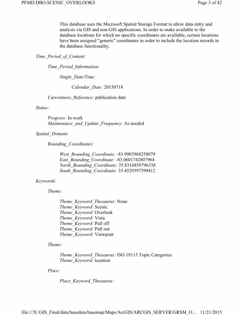
This database uses the Microsoft Spatial Storage Format to allow data entry and analysis via GIS and non-GIS applications. In order to make available to the database locations for which no specific coordinates are available, certain locations have been assigned "generic" coordinates in order to include the location records in the database functionality.
Time_Period_of_Content:
Time_Period_Information:
Single_Date/Time:
Calendar_Date: 20150718
Currentness_Reference: publication date
Status:
Progress: In workMaintenance_and_Update_Frequency: As needed
Spatial_Domain:
Bounding_Coordinates:
West_Bounding_Coordinate: -83.9903968258079East_Bounding_Coordinate: -83.0601742807964North_Bounding_Coordinate: 35.8316859796338South_Bounding_Coordinate: 35.4529397399412
Keywords:
Theme:
Theme_Keyword_Thesaurus: NoneTheme_Keyword: ScenicTheme_Keyword: OverlookTheme_Keyword: VistaTheme_Keyword: Pull offTheme_Keyword: Pull outTheme_Keyword: Viewpont
Theme:
Theme_Keyword_Thesaurus: ISO 19115 Topic CategoriesTheme_Keyword: location
Place:
Place_Keyword_Thesaurus:
Page 3 of 42PFMD.DBO.SCENIC_OVERLOOKS
11/21/2015file:///X:/GIS_Final/data/basedata/basemap/Maps/ArcGIS/ARCGIS_SERVER/GRSM_O...

U.S. Department of Commerce, 1995, Countries, dependencies, areas of special sovereignty, and their principal administrative divisions, Federal Information Processing Standard 10-4,): Washington, D.C., National Institute of Standards and Technology
Place_Keyword: USPlace_Keyword: U.S.Place_Keyword: United StatesPlace_Keyword: USA
Place:
Place_Keyword_Thesaurus: USGS Topographic Map Names Data BasePlace_Keyword: BLOCKHOUSEPlace_Keyword: TUSKEEGEEPlace_Keyword: FINES CREEKPlace_Keyword: PIGEON FORGEPlace_Keyword: MOUNT GUYOTPlace_Keyword: NOLAND CREEKPlace_Keyword: BRYSON CITYPlace_Keyword: BUNCHES BALDPlace_Keyword: SILERS BALDPlace_Keyword: WEAR COVEPlace_Keyword: MOUNT LE CONTEPlace_Keyword: TAPOCOPlace_Keyword: SMOKEMONTPlace_Keyword: CADES COVEPlace_Keyword: LUFTEE KNOBPlace_Keyword: TALLASSEEPlace_Keyword: WATERVILLEPlace_Keyword: CALDERWOODPlace_Keyword: THUNDERHEAD MOUNTAINPlace_Keyword: DELLWOODPlace_Keyword: RICHARDSON COVEPlace_Keyword: GATLINBURGPlace_Keyword: HARTFORDPlace_Keyword: CLINGMANS DOMEPlace_Keyword: COVE CREEK GAPPlace_Keyword: FONTANA DAMPlace_Keyword: KINZEL SPRINGSPlace_Keyword: JONES COVEPlace_Keyword: WHITTIER
Place:
Place_Keyword_Thesaurus:U.S. Department of Commerce, 1987, Codes for the identification of the States, the District of Columbia and the outlying areas of the United States, and associated areas (Federal Information Processing Standard 5-2): Washington, D.C., National Institute of Standards and Technology
Place_Keyword: NC
Page 4 of 42PFMD.DBO.SCENIC_OVERLOOKS
11/21/2015file:///X:/GIS_Final/data/basedata/basemap/Maps/ArcGIS/ARCGIS_SERVER/GRSM_O...

Place_Keyword: TN
Place:
Place_Keyword_Thesaurus: National Park System Unit Name ThesaurusPlace_Keyword: Natural Resource Inventory and Monitoring ProgramPlace_Keyword: Great Smoky Mountains National ParkPlace_Keyword: Southeast RegionPlace_Keyword: National Park ServicePlace_Keyword: Appalachian Highlands Network
Place:
Place_Keyword_Thesaurus: National Park System Unit Code ThesaurusPlace_Keyword: NRIMPlace_Keyword: APHNPlace_Keyword: SEROPlace_Keyword: NPSPlace_Keyword: GRSM
Place:
Place_Keyword_Thesaurus:Counties and County Equivalents of the States of the United States and the District of Columbia (FIPS Pub 6-3)
Place_Keyword: Haywood County North CarolinaPlace_Keyword: Swain County North CarolinaPlace_Keyword: Cocke County TennesseePlace_Keyword: Sevier County TennesseePlace_Keyword: Blount County TennesseePlace_Keyword: Graham County North Carolina
Place:
Place_Keyword_Thesaurus: Geographic Names Information SystemPlace_Keyword: TennesseePlace_Keyword: North Carolina
Temporal:
Temporal_Keyword_Thesaurus: NoneTemporal_Keyword: Current
Access_Constraints: NoneUse_Constraints:
The National Park Service shall not be held liable for improper or incorrect use of the data described and/or contained herein. These data and related graphics (i.e. GIF or JPG format files) are not legal documents and are not intended to be used as such. The information contained in these data is dynamic and may change over time. The data are not better than the original sources from which they were derived. It is the responsibility of the data user to use the data appropriately and consistent within the limitations of
Page 5 of 42PFMD.DBO.SCENIC_OVERLOOKS
11/21/2015file:///X:/GIS_Final/data/basedata/basemap/Maps/ArcGIS/ARCGIS_SERVER/GRSM_O...

geospatial data in general and these data in particular. The related graphics are intended to aid the data user in acquiring relevant data; it is not appropriate to use the related graphics as data. The National Park Service gives no warranty, expressed or implied, as to the accuracy, reliability, or completeness of these data. It is strongly recommended that these data are directly acquired from an NPS server and not indirectly through other sources which may have changed the data in some way. Although these data have been processed successfully on computer systems at the National Park Service, no warranty expressed or implied is made regarding the utility of the data on other systems for general or scientific purposes, nor shall the act of distribution constitute any such warranty. This disclaimer applies both to individual use of the data and aggregate use with other data.
Point_of_Contact:
Contact_Information:
Contact_Organization_Primary:
Contact_Organization: National Park ServiceContact_Person: Thomas Colson
Contact_Position: GIS SpecialistContact_Address:
Address_Type: mailing and physicalAddress: 107 Park Headquarters RoadCity: GatlinburgState_or_Province: TennesseePostal_Code: 37738Country: US
Contact_Voice_Telephone: (865)436-1701Contact_Electronic_Mail_Address: [email protected]_of_Service: 0800-1730
Data_Set_Credit: Great Smoky Mountains National ParkNative_Data_Set_Environment:
Microsoft Windows 7 Version 6.1 (Build 7601) Service Pack 1; Esri ArcGIS 10.3.1.4959
Data_Quality_Information:
Attribute_Accuracy:
Attribute_Accuracy_Report:Attribute accuracy is tested by manual comparison of the source with hard copy plots and/or symbolized display of the map data on an interactive computer graphic system. Selected attributes that cannot be visually verified on plots or on screen are interactively queried and verified on screen. In addition, the attributes are tested against a master set of valid attributes. All attribute data conform to the attribute codes in the signed classification and correlation document and amendment(s).
Quantitative_Attribute_Accuracy_Assessment:
Page 6 of 42PFMD.DBO.SCENIC_OVERLOOKS
11/21/2015file:///X:/GIS_Final/data/basedata/basemap/Maps/ArcGIS/ARCGIS_SERVER/GRSM_O...

Attribute_Accuracy_Value: None GivenAttribute_Accuracy_Explanation: None Given
Logical_Consistency_Report:No duplicate features exist nor duplicate points in a data string. Point data are represented by two sets of coordinate pairs, each with the same coordinate values, contained in the "Shape" Column, and "X_COORD, Y_COORD" Columns. Database engine scripts automatically populate many of the possible "List of Values" for those columns that derive their attrtibute from other source data (see Entity Attribute Section of this document for details), thereby enforcing Attribute Accuracy. Database engine scripts also prevent the entry of duplication location coordinates, ensure the consistency and format of binary data representing geographic coordinates, and spatial and attribute index integrity.
Completeness_Report:Data completeness for these data reflect content of the source data. Features may have been eliminated or generalized on the source data due to scale and legibility constraints. For information on collection and inclusion criteria, see U.S. Geological Survey, 1994, Standards for 1:24,000-Scale Digital Line Graphs and Quadrangle Maps: National Mapping Program Technical Instructions and U.S. Geological Survey, 1994, Standards for Digital Line Graphs: National Mapping Program Technical Instructions.
Positional_Accuracy:
Horizontal_Positional_Accuracy:
Horizontal_Positional_Accuracy_Report:These data contain location values from numerous resource research, inventory, and monitoring projects spanning over many decades. The National Park Service is unable to asses the positional accuracy of many locations, citing lack of reliable data. When known, estimated horizontal precision is given as a range of possible values. Statements of horizontal positional accuracy are based on accuracy statements made for U.S. Geological Survey topographic quadrangle maps. These maps were compiled to meet National Map Accuracy Standards. For horizontal accuracy, this standard is met if at least 90 percent of points tested are within 0.02 inch (at map scale) of the true position. Additional offsets to positions may have been introduced where feature density is high to improve the legibility of map symbols. In addition, the digitizing of maps is estimated to contain a horizontal positional error of less than or equal to 0.003 inch standard error (at map scale) in the two component directions relative to the source maps. Visual comparison between the map graphic (including digital scans of the graphic) and plots or digital displays of points, lines, and areas, is used as control to assess the positional accuracy of digital data. Digital map elements along the adjoining edges of data sets are aligned if they are within a 0.02 inch tolerance (at map scale). Features with like dimensionality (for example, features that all are delineated with lines), with or without like characteristics, that are within the tolerance are aligned by moving the features equally to a common point. Features outside the tolerance are not moved; instead, a feature of type connector is added to join the features.
Quantitative_Horizontal_Positional_Accuracy_Assessment:
Page 7 of 42PFMD.DBO.SCENIC_OVERLOOKS
11/21/2015file:///X:/GIS_Final/data/basedata/basemap/Maps/ArcGIS/ARCGIS_SERVER/GRSM_O...

Horizontal_Positional_Accuracy_Value: metersHorizontal_Positional_Accuracy_Explanation:
Horizontal accuracy is expressed through use of a picklist-domain that indicates a range of confidence of CEP of the location of a single location.
Vertical_Positional_Accuracy:
Vertical_Positional_Accuracy_Report:Statements of vertical positional accuracy for elevation of these points are based on accuracy statements made for U.S. Geological Survey topographic quadrangle maps. These maps were compiled to meet National Map Accuracy Standards. For vertical accuracy, this standard is met if at least 90 percent of well-defined points tested are within one-half contour interval of the correct value. Elevations of points printed on the published map meet this standard; the contour intervals of the maps vary. These elevations were transcribed into the digital data; the accuracy of this transcription was checked by visual comparison between the data and the map. This statement is generally true for the most common sources of these data. Other sources and methods may have been used to create or update these data. In some cases, additional information may be found in the feature-level metadata report.
Quantitative_Vertical_Positional_Accuracy_Assessment:
Vertical_Positional_Accuracy_Value: metersVertical_Positional_Accuracy_Explanation:
Vertical accuracy is expressed through use of a picklist-domain that indicates a range of confidence of CEP of the location of a single location.
Lineage:
Process_Step:
Process_Description: Data was loadedProcess_Date: 20150905
Spatial_Data_Organization_Information:
Direct_Spatial_Reference_Method: VectorPoint_and_Vector_Object_Information:
SDTS_Terms_Description:
SDTS_Point_and_Vector_Object_Type: Entity pointPoint_and_Vector_Object_Count: 138
Spatial_Reference_Information:
Page 8 of 42PFMD.DBO.SCENIC_OVERLOOKS
11/21/2015file:///X:/GIS_Final/data/basedata/basemap/Maps/ArcGIS/ARCGIS_SERVER/GRSM_O...

Horizontal_Coordinate_System_Definition:
Planar:
Map_Projection:
Map_Projection_Name: NAD 1983 UTM Zone 17NTransverse_Mercator:
Scale_Factor_at_Central_Meridian: 0.9996Longitude_of_Central_Meridian: -81.0Latitude_of_Projection_Origin: 0.0False_Easting: 500000.0False_Northing: 0.0
Planar_Coordinate_Information:
Planar_Coordinate_Encoding_Method: coordinate pairCoordinate_Representation:
Abscissa_Resolution: 0.0001Ordinate_Resolution: 0.0001
Planar_Distance_Units: meter
Geodetic_Model:
Horizontal_Datum_Name: D North American 1983Ellipsoid_Name: GRS 1980Semi-major_Axis: 6378137.0Denominator_of_Flattening_Ratio: 298.257222101
Entity_and_Attribute_Information:
Detailed_Description:
Entity_Type:
Entity_Type_Label: SCENIC_OVERLOOKSEntity_Type_Definition:
Discrete coordinate pairs representing point locations with associated point/location attribute data.
Entity_Type_Definition_Source: Great Smoky Mountains National Park
Attribute:
Attribute_Label: ObjectIDAttribute_Definition: Internal feature number.Attribute_Definition_Source: EsriAttribute_Domain_Values:
Page 9 of 42PFMD.DBO.SCENIC_OVERLOOKS
11/21/2015file:///X:/GIS_Final/data/basedata/basemap/Maps/ArcGIS/ARCGIS_SERVER/GRSM_O...

Unrepresentable_Domain:Sequential unique whole numbers that are automatically generated.
Attribute:
Attribute_Label: ShapeAttribute_Definition:
Feature geometry. Calculated automatically upon insert and update. Attribute_Definition_Source: ESRIAttribute_Domain_Values:
Unrepresentable_Domain: Coordinates defining the features in SQL Geography Format.
Attribute:
Attribute_Label: MAPMETHODAttribute_Definition:
REQUIRED: Description of how original point location was derived. This pick list of Map Methods is derived from NPS standards for depicting source of geospatial data. Legacy values were migrated to the new GIS standard. Original ATBI field was "Source of Coordinates". Cross-walk of legal values is ATBI List, GRSM MapDatabase, Interpolated, Label, Label--presumably GPS, Literature, MapDatabase, Map Database, NPS Fisheries = Derived/Calculated; Field GPS Unit, GPS = Autonomous GPS; from topo, GPS/topo, TOPO, Topo Map, TopoZone = Heads-up Digitized; unspecified = Unknown; The Enumerated Domain Value refers to the value that is written to the database, the Enumerated Domain Value Definition refers to the text equivalent that is displayed to the user within GIS mapping software applications. Data stewards are required to populate this value.
Attribute_Definition_Source: National Park Service Generic Enterprise Database Standards.Attribute_Domain_Values:
Enumerated_Domain:
Enumerated_Domain_Value: AGPSEnumerated_Domain_Value_Definition: Autonomous GPSEnumerated_Domain_Value_Definition_Source: National Park Service Generic Enterprise Database Standards.
Enumerated_Domain:
Enumerated_Domain_Value: DERVEnumerated_Domain_Value_Definition: Derived/CalculatedEnumerated_Domain_Value_Definition_Source: National Park Service Generic Enterprise Database Standards.
Enumerated_Domain:
Enumerated_Domain_Value: DGPS
Page 10 of 42PFMD.DBO.SCENIC_OVERLOOKS
11/21/2015file:///X:/GIS_Final/data/basedata/basemap/Maps/ArcGIS/ARCGIS_SERVER/GRSM_O...

Enumerated_Domain_Value_Definition: Differential GPSEnumerated_Domain_Value_Definition_Source: National Park Service Generic Enterprise Database Standards.
Enumerated_Domain:
Enumerated_Domain_Value: HDIGEnumerated_Domain_Value_Definition: Heads-up DigitizedEnumerated_Domain_Value_Definition_Source: National Park Service Generic Enterprise Database Standards.
Enumerated_Domain:
Enumerated_Domain_Value: TDIGEnumerated_Domain_Value_Definition: Tablet DigitizedEnumerated_Domain_Value_Definition_Source: National Park Service Generic Enterprise Database Standards.
Enumerated_Domain:
Enumerated_Domain_Value: UNKNEnumerated_Domain_Value_Definition: UnknownEnumerated_Domain_Value_Definition_Source: National Park Service Generic Enterprise Database Standards.
Enumerated_Domain:
Enumerated_Domain_Value: LITEnumerated_Domain_Value_Definition: LiteratureEnumerated_Domain_Value_Definition_Source: Great Smoky Mountains National Park.
Enumerated_Domain:
Enumerated_Domain_Value: LABLEnumerated_Domain_Value_Definition: LabelEnumerated_Domain_Value_Definition_Source: Great Smoky Mountains National Park.
Enumerated_Domain:
Enumerated_Domain_Value: ATBIEnumerated_Domain_Value_Definition: ATBI ListEnumerated_Domain_Value_Definition_Source: Great Smoky Mountains National Park.
Attribute:
Attribute_Label: HERRORAttribute_Definition:
Page 11 of 42PFMD.DBO.SCENIC_OVERLOOKS
11/21/2015file:///X:/GIS_Final/data/basedata/basemap/Maps/ArcGIS/ARCGIS_SERVER/GRSM_O...
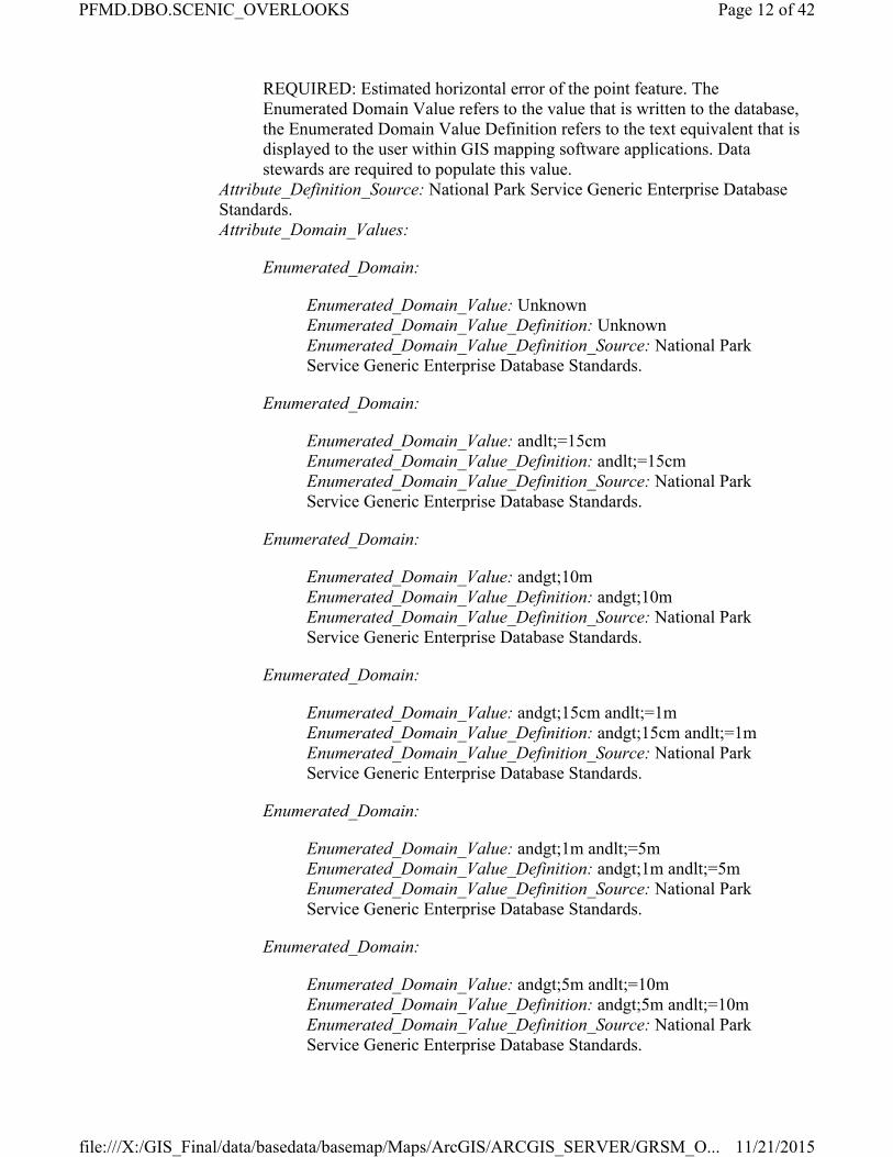
REQUIRED: Estimated horizontal error of the point feature. The Enumerated Domain Value refers to the value that is written to the database, the Enumerated Domain Value Definition refers to the text equivalent that is displayed to the user within GIS mapping software applications. Data stewards are required to populate this value.
Attribute_Definition_Source: National Park Service Generic Enterprise Database Standards.Attribute_Domain_Values:
Enumerated_Domain:
Enumerated_Domain_Value: UnknownEnumerated_Domain_Value_Definition: UnknownEnumerated_Domain_Value_Definition_Source: National Park Service Generic Enterprise Database Standards.
Enumerated_Domain:
Enumerated_Domain_Value: andlt;=15cmEnumerated_Domain_Value_Definition: andlt;=15cmEnumerated_Domain_Value_Definition_Source: National Park Service Generic Enterprise Database Standards.
Enumerated_Domain:
Enumerated_Domain_Value: andgt;10mEnumerated_Domain_Value_Definition: andgt;10mEnumerated_Domain_Value_Definition_Source: National Park Service Generic Enterprise Database Standards.
Enumerated_Domain:
Enumerated_Domain_Value: andgt;15cm andlt;=1mEnumerated_Domain_Value_Definition: andgt;15cm andlt;=1mEnumerated_Domain_Value_Definition_Source: National Park Service Generic Enterprise Database Standards.
Enumerated_Domain:
Enumerated_Domain_Value: andgt;1m andlt;=5mEnumerated_Domain_Value_Definition: andgt;1m andlt;=5mEnumerated_Domain_Value_Definition_Source: National Park Service Generic Enterprise Database Standards.
Enumerated_Domain:
Enumerated_Domain_Value: andgt;5m andlt;=10mEnumerated_Domain_Value_Definition: andgt;5m andlt;=10mEnumerated_Domain_Value_Definition_Source: National Park Service Generic Enterprise Database Standards.
Page 12 of 42PFMD.DBO.SCENIC_OVERLOOKS
11/21/2015file:///X:/GIS_Final/data/basedata/basemap/Maps/ArcGIS/ARCGIS_SERVER/GRSM_O...

Enumerated_Domain:
Enumerated_Domain_Value: andgt;10m andlt;=100mEnumerated_Domain_Value_Definition: andgt;10m andlt;=100mEnumerated_Domain_Value_Definition_Source: National Park Service Generic Enterprise Database Standards.
Enumerated_Domain:
Enumerated_Domain_Value: andgt;100m andlt;=500mEnumerated_Domain_Value_Definition: andgt;100m andlt;=500mEnumerated_Domain_Value_Definition_Source: National Park Service Generic Enterprise Database Standards.
Enumerated_Domain:
Enumerated_Domain_Value: andgt;500m andlt;=10000mEnumerated_Domain_Value_Definition: andgt;500m andlt;=10000mEnumerated_Domain_Value_Definition_Source: National Park Service Generic Enterprise Database Standards.
Enumerated_Domain:
Enumerated_Domain_Value: andgt;1000m andlt;=50000mEnumerated_Domain_Value_Definition: andgt;1000m andlt;=50000mEnumerated_Domain_Value_Definition_Source: National Park Service Generic Enterprise Database Standards.
Enumerated_Domain:
Enumerated_Domain_Value: andgt;5000mEnumerated_Domain_Value_Definition: andgt;5000mEnumerated_Domain_Value_Definition_Source: National Park Service Generic Enterprise Database Standards.
Enumerated_Domain:
Enumerated_Domain_Value: UnknownEnumerated_Domain_Value_Definition: UnknownEnumerated_Domain_Value_Definition_Source: National Park Service Generic Enterprise Database Standards.
Attribute:
Attribute_Label: EDITDATEAttribute_Definition:
Date the location information was edited. Calculated automatically upon insert and update.
Attribute_Definition_Source: National Park Service Generic Enterprise Database Standards.Attribute_Domain_Values:
Page 13 of 42PFMD.DBO.SCENIC_OVERLOOKS
11/21/2015file:///X:/GIS_Final/data/basedata/basemap/Maps/ArcGIS/ARCGIS_SERVER/GRSM_O...

Unrepresentable_Domain:This is a free-text field and no geodatabase-enforced domain or "pick-list" values are provided.
Attribute:
Attribute_Label: NOTESAttribute_Definition:
Free text notes or comments that pertain to this location that do not apply to other free-text fields.
Attribute_Definition_Source: National Park Service Generic Enterprise Database Standards.Attribute_Domain_Values:
Unrepresentable_Domain:This is a free-text field and no geodatabase-enforced domain or "pick-list" values are provided.
Attribute:
Attribute_Label: FACILITYTYPE
Attribute:
Attribute_Label: ASSETCODE
Attribute:
Attribute_Label: X_COORDAttribute_Definition: X (Easting) coordinate of point in meters.Attribute_Definition_Source: National Park Service Generic Enterprise Database Standards.Attribute_Domain_Values:
Range_Domain:
Range_Domain_Minimum: 226810.131751Range_Domain_Maximum: 319132.131751Attribute_Units_of_Measure: meters
Attribute:
Attribute_Label: Y_COORDAttribute_Definition: Y (Northing) coordinate of point in meters.Attribute_Definition_Source: National Park Service Generic Enterprise Database Standards.Attribute_Domain_Values:
Range_Domain:
Range_Domain_Minimum: 3923599.200028
Page 14 of 42PFMD.DBO.SCENIC_OVERLOOKS
11/21/2015file:///X:/GIS_Final/data/basedata/basemap/Maps/ArcGIS/ARCGIS_SERVER/GRSM_O...
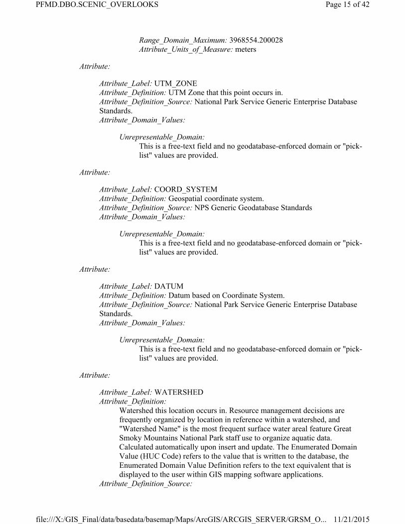
Range_Domain_Maximum: 3968554.200028Attribute_Units_of_Measure: meters
Attribute:
Attribute_Label: UTM_ZONEAttribute_Definition: UTM Zone that this point occurs in.Attribute_Definition_Source: National Park Service Generic Enterprise Database Standards.Attribute_Domain_Values:
Unrepresentable_Domain:This is a free-text field and no geodatabase-enforced domain or "pick-list" values are provided.
Attribute:
Attribute_Label: COORD_SYSTEMAttribute_Definition: Geospatial coordinate system.Attribute_Definition_Source: NPS Generic Geodatabase StandardsAttribute_Domain_Values:
Unrepresentable_Domain:This is a free-text field and no geodatabase-enforced domain or "pick-list" values are provided.
Attribute:
Attribute_Label: DATUMAttribute_Definition: Datum based on Coordinate System.Attribute_Definition_Source: National Park Service Generic Enterprise Database Standards.Attribute_Domain_Values:
Unrepresentable_Domain:This is a free-text field and no geodatabase-enforced domain or "pick-list" values are provided.
Attribute:
Attribute_Label: WATERSHEDAttribute_Definition:
Watershed this location occurs in. Resource management decisions are frequently organized by location in reference within a watershed, and "Watershed Name" is the most frequent surface water areal feature Great Smoky Mountains National Park staff use to organize aquatic data. Calculated automatically upon insert and update. The Enumerated Domain Value (HUC Code) refers to the value that is written to the database, the Enumerated Domain Value Definition refers to the text equivalent that is displayed to the user within GIS mapping software applications.
Attribute_Definition_Source:
Page 15 of 42PFMD.DBO.SCENIC_OVERLOOKS
11/21/2015file:///X:/GIS_Final/data/basedata/basemap/Maps/ArcGIS/ARCGIS_SERVER/GRSM_O...

USGS 12-digit HUC watershed names from NHD Watershed Boundary Dataset.
Attribute_Domain_Values:
Enumerated_Domain:
Enumerated_Domain_Value: 060101070301Enumerated_Domain_Value_Definition: Porters CreekEnumerated_Domain_Value_Definition_Source: USGS Watershed Boundary Database
Enumerated_Domain:
Enumerated_Domain_Value: 060101060203Enumerated_Domain_Value_Definition: Upper Johnathans CreekEnumerated_Domain_Value_Definition_Source: USGS Watershed Boundary Database
Enumerated_Domain:
Enumerated_Domain_Value: 060102030404Enumerated_Domain_Value_Definition: Forney CreekEnumerated_Domain_Value_Definition_Source: USGS Watershed Boundary Database
Enumerated_Domain:
Enumerated_Domain_Value: 060102040202Enumerated_Domain_Value_Definition: Lower Abrams CreekEnumerated_Domain_Value_Definition_Source: USGS Watershed Boundary Database
Enumerated_Domain:
Enumerated_Domain_Value: 060101060401Enumerated_Domain_Value_Definition: Cosby CreekEnumerated_Domain_Value_Definition_Source: USGS Watershed Boundary Database
Enumerated_Domain:
Enumerated_Domain_Value: 060102040405Enumerated_Domain_Value_Definition: Ninemile CreekEnumerated_Domain_Value_Definition_Source: USGS Watershed Boundary Database
Enumerated_Domain:
Enumerated_Domain_Value: 060102040403Enumerated_Domain_Value_Definition: Chilhowee Lake-Little Tennessee River
Page 16 of 42PFMD.DBO.SCENIC_OVERLOOKS
11/21/2015file:///X:/GIS_Final/data/basedata/basemap/Maps/ArcGIS/ARCGIS_SERVER/GRSM_O...
Enumerated_Domain_Value_Definition_Source: USGS Watershed Boundary Database
Enumerated_Domain:
Enumerated_Domain_Value: 060102020504Enumerated_Domain_Value_Definition: Eagle CreekEnumerated_Domain_Value_Definition_Source: USGS Watershed Boundary Database
Enumerated_Domain:
Enumerated_Domain_Value: 060102010103Enumerated_Domain_Value_Definition: Rudd Branch-Little RiverEnumerated_Domain_Value_Definition_Source: USGS Watershed Boundary Database
Enumerated_Domain:
Enumerated_Domain_Value: 060102030202Enumerated_Domain_Value_Definition: Upper Raven ForkEnumerated_Domain_Value_Definition_Source: USGS Watershed Boundary Database
Enumerated_Domain:
Enumerated_Domain_Value: 060102030201Enumerated_Domain_Value_Definition: Straight Fork Raven ForkEnumerated_Domain_Value_Definition_Source: USGS Watershed Boundary Database
Enumerated_Domain:
Enumerated_Domain_Value: 060101060305Enumerated_Domain_Value_Definition: Cold Springs Creek-Pigeon RiverEnumerated_Domain_Value_Definition_Source: USGS Watershed Boundary Database
Enumerated_Domain:
Enumerated_Domain_Value: 060101070205Enumerated_Domain_Value_Definition: Waldens CreekEnumerated_Domain_Value_Definition_Source: USGS Watershed Boundary Database
Enumerated_Domain:
Enumerated_Domain_Value: 060102030207Enumerated_Domain_Value_Definition: Lower Oconaluftee River
Page 17 of 42PFMD.DBO.SCENIC_OVERLOOKS
11/21/2015file:///X:/GIS_Final/data/basedata/basemap/Maps/ArcGIS/ARCGIS_SERVER/GRSM_O...
Enumerated_Domain_Value_Definition_Source: USGS Watershed Boundary Database
Enumerated_Domain:
Enumerated_Domain_Value: 060102030205Enumerated_Domain_Value_Definition: Lower Raven ForkEnumerated_Domain_Value_Definition_Source: USGS Watershed Boundary Database
Enumerated_Domain:
Enumerated_Domain_Value: 060101070202Enumerated_Domain_Value_Definition: Baskins CreekEnumerated_Domain_Value_Definition_Source: USGS Watershed Boundary Database
Enumerated_Domain:
Enumerated_Domain_Value: 060101070303Enumerated_Domain_Value_Definition: Webb CreekEnumerated_Domain_Value_Definition_Source: USGS Watershed Boundary Database
Enumerated_Domain:
Enumerated_Domain_Value: 060101060301Enumerated_Domain_Value_Definition: Palmer CreekEnumerated_Domain_Value_Definition_Source: USGS Watershed Boundary Database
Enumerated_Domain:
Enumerated_Domain_Value: 060101060204Enumerated_Domain_Value_Definition: Lower Johnathans CreekEnumerated_Domain_Value_Definition_Source: USGS Watershed Boundary Database
Enumerated_Domain:
Enumerated_Domain_Value: 060102010106Enumerated_Domain_Value_Definition: Crooked Creek-Little RiverEnumerated_Domain_Value_Definition_Source: USGS Watershed Boundary Database
Enumerated_Domain:
Enumerated_Domain_Value: 060102010102Enumerated_Domain_Value_Definition: Goshen Prong-Little RiverEnumerated_Domain_Value_Definition_Source: USGS Watershed Boundary Database
Page 18 of 42PFMD.DBO.SCENIC_OVERLOOKS
11/21/2015file:///X:/GIS_Final/data/basedata/basemap/Maps/ArcGIS/ARCGIS_SERVER/GRSM_O...
Enumerated_Domain:
Enumerated_Domain_Value: 060101070203Enumerated_Domain_Value_Definition: Roaring ForkEnumerated_Domain_Value_Definition_Source: USGS Watershed Boundary Database
Enumerated_Domain:
Enumerated_Domain_Value: 060101070204Enumerated_Domain_Value_Definition: Dudley CreekEnumerated_Domain_Value_Definition_Source: USGS Watershed Boundary Database
Enumerated_Domain:
Enumerated_Domain_Value: 060102010104Enumerated_Domain_Value_Definition: Hesse Creek-Little RiverEnumerated_Domain_Value_Definition_Source: USGS Watershed Boundary Database
Enumerated_Domain:
Enumerated_Domain_Value: 060102030405Enumerated_Domain_Value_Definition: Fontana Lake-Tuckasegee RiverEnumerated_Domain_Value_Definition_Source: USGS Watershed Boundary Database
Enumerated_Domain:
Enumerated_Domain_Value: 060101070305Enumerated_Domain_Value_Definition: Upper Little Pigeon RiverEnumerated_Domain_Value_Definition_Source: USGS Watershed Boundary Database
Enumerated_Domain:
Enumerated_Domain_Value: 060101070304Enumerated_Domain_Value_Definition: Bird CreekEnumerated_Domain_Value_Definition_Source: USGS Watershed Boundary Database
Enumerated_Domain:
Enumerated_Domain_Value: 060102030204Enumerated_Domain_Value_Definition: Upper Oconaluftee RiverEnumerated_Domain_Value_Definition_Source: USGS Watershed Boundary Database
Enumerated_Domain:
Page 19 of 42PFMD.DBO.SCENIC_OVERLOOKS
11/21/2015file:///X:/GIS_Final/data/basedata/basemap/Maps/ArcGIS/ARCGIS_SERVER/GRSM_O...
Enumerated_Domain_Value: 060101070306Enumerated_Domain_Value_Definition: East Fork Little Pigeon RiverEnumerated_Domain_Value_Definition_Source: USGS Watershed Boundary Database
Enumerated_Domain:
Enumerated_Domain_Value: 060101060402Enumerated_Domain_Value_Definition: Cripple Creek-Pigeon RiverEnumerated_Domain_Value_Definition_Source: USGS Watershed Boundary Database
Enumerated_Domain:
Enumerated_Domain_Value: 060101060304Enumerated_Domain_Value_Definition: Big CreekEnumerated_Domain_Value_Definition_Source: USGS Watershed Boundary Database
Enumerated_Domain:
Enumerated_Domain_Value: 060101060303Enumerated_Domain_Value_Definition: Walters Lake-Pigeon RiverEnumerated_Domain_Value_Definition_Source: USGS Watershed Boundary Database
Enumerated_Domain:
Enumerated_Domain_Value: 060102040201Enumerated_Domain_Value_Definition: Upper Abrams CreekEnumerated_Domain_Value_Definition_Source: USGS Watershed Boundary Database
Enumerated_Domain:
Enumerated_Domain_Value: 060102010105Enumerated_Domain_Value_Definition: Ellejoy Creek-Little RiverEnumerated_Domain_Value_Definition_Source: USGS Watershed Boundary Database
Enumerated_Domain:
Enumerated_Domain_Value: 060102020503Enumerated_Domain_Value_Definition: Hazel CreekEnumerated_Domain_Value_Definition_Source: USGS Watershed Boundary Database
Enumerated_Domain:
Enumerated_Domain_Value: 060102030403Enumerated_Domain_Value_Definition: Noland Creek
Page 20 of 42PFMD.DBO.SCENIC_OVERLOOKS
11/21/2015file:///X:/GIS_Final/data/basedata/basemap/Maps/ArcGIS/ARCGIS_SERVER/GRSM_O...
Enumerated_Domain_Value_Definition_Source: USGS Watershed Boundary Database
Enumerated_Domain:
Enumerated_Domain_Value: 060102030402Enumerated_Domain_Value_Definition: Kirkland Creek-Tuckasegee RiverEnumerated_Domain_Value_Definition_Source: USGS Watershed Boundary Database
Enumerated_Domain:
Enumerated_Domain_Value: 060102030203Enumerated_Domain_Value_Definition: Bradley ForkEnumerated_Domain_Value_Definition_Source: USGS Watershed Boundary Database
Enumerated_Domain:
Enumerated_Domain_Value: 060101060302Enumerated_Domain_Value_Definition: Cataloochee CreekEnumerated_Domain_Value_Definition_Source: USGS Watershed Boundary Database
Enumerated_Domain:
Enumerated_Domain_Value: 060102040401Enumerated_Domain_Value_Definition: Lake Cheoah-Little Tennessee RiverEnumerated_Domain_Value_Definition_Source: USGS Watershed Boundary Database
Enumerated_Domain:
Enumerated_Domain_Value: 060102020505Enumerated_Domain_Value_Definition: Lower Fontana Lake-Little Tennessee RiverEnumerated_Domain_Value_Definition_Source: USGS Watershed Boundary Database
Enumerated_Domain:
Enumerated_Domain_Value: 060101070201Enumerated_Domain_Value_Definition: Le Conte CreekEnumerated_Domain_Value_Definition_Source: USGS Watershed Boundary Database
Enumerated_Domain:
Enumerated_Domain_Value: 060101070302
Page 21 of 42PFMD.DBO.SCENIC_OVERLOOKS
11/21/2015file:///X:/GIS_Final/data/basedata/basemap/Maps/ArcGIS/ARCGIS_SERVER/GRSM_O...

Enumerated_Domain_Value_Definition:Middle Prong Little Pigeon RiverEnumerated_Domain_Value_Definition_Source: USGS Watershed Boundary Database
Enumerated_Domain:
Enumerated_Domain_Value: 060102010101Enumerated_Domain_Value_Definition: West Prog Little RiverEnumerated_Domain_Value_Definition_Source: USGS Watershed Boundary Database
Enumerated_Domain:
Enumerated_Domain_Value: 060101070206Enumerated_Domain_Value_Definition: Upper West Prong Little Pigeon RiverEnumerated_Domain_Value_Definition_Source: USGS Watershed Boundary Database
Enumerated_Domain:
Enumerated_Domain_Value: 060102030401Enumerated_Domain_Value_Definition: Deep CreekEnumerated_Domain_Value_Definition_Source: USGS Watershed Boundary Database
Attribute:
Attribute_Label: MANAGEMENTZONEAttribute_Definition: Park General Management Planning ZoneAttribute_Definition_Source: GRSM General Management PlanAttribute_Domain_Values:
Enumerated_Domain:
Enumerated_Domain_Value: NE1Enumerated_Domain_Value_Definition: Natural Environment Type IEnumerated_Domain_Value_Definition_Source: Park General Management Planning Zone
Enumerated_Domain:
Enumerated_Domain_Value: NE 2Enumerated_Domain_Value_Definition: Natural Environment Type IIEnumerated_Domain_Value_Definition_Source: Park General Management Planning Zone
Enumerated_Domain:
Enumerated_Domain_Value: ER
Page 22 of 42PFMD.DBO.SCENIC_OVERLOOKS
11/21/2015file:///X:/GIS_Final/data/basedata/basemap/Maps/ArcGIS/ARCGIS_SERVER/GRSM_O...

Enumerated_Domain_Value_Definition: Experimental ResearchEnumerated_Domain_Value_Definition_Source: Park General Management Planning Zone
Enumerated_Domain:
Enumerated_Domain_Value: PNEnumerated_Domain_Value_Definition: Protected NaturalEnumerated_Domain_Value_Definition_Source: Park General Management Planning Zone
Enumerated_Domain:
Enumerated_Domain_Value: HPEnumerated_Domain_Value_Definition: Historic PreservationEnumerated_Domain_Value_Definition_Source: Park General Management Planning Zone
Enumerated_Domain:
Enumerated_Domain_Value: LMEnumerated_Domain_Value_Definition: Landscape ManagementEnumerated_Domain_Value_Definition_Source: Park General Management Planning Zone
Enumerated_Domain:
Enumerated_Domain_Value: GPDEnumerated_Domain_Value_Definition: General Park DevelopmentEnumerated_Domain_Value_Definition_Source: Park General Management Planning Zone
Enumerated_Domain:
Enumerated_Domain_Value: TEnumerated_Domain_Value_Definition: TransportationEnumerated_Domain_Value_Definition_Source: Park General Management Planning Zone
Enumerated_Domain:
Enumerated_Domain_Value: PUEnumerated_Domain_Value_Definition: Park UtilitiesEnumerated_Domain_Value_Definition_Source: Park General Management Planning Zone
Enumerated_Domain:
Enumerated_Domain_Value: REnumerated_Domain_Value_Definition: Reservoir
Page 23 of 42PFMD.DBO.SCENIC_OVERLOOKS
11/21/2015file:///X:/GIS_Final/data/basedata/basemap/Maps/ArcGIS/ARCGIS_SERVER/GRSM_O...
Enumerated_Domain_Value_Definition_Source: Park General Management Planning Zone
Enumerated_Domain:
Enumerated_Domain_Value: NPUEnumerated_Domain_Value_Definition: Non-park UtilitiesEnumerated_Domain_Value_Definition_Source: Park General Management Planning Zone
Enumerated_Domain:
Enumerated_Domain_Value: PEnumerated_Domain_Value_Definition: Private ManagementEnumerated_Domain_Value_Definition_Source: Park General Management Planning Zone
Enumerated_Domain:
Enumerated_Domain_Value: RREnumerated_Domain_Value_Definition: Reserved RightsEnumerated_Domain_Value_Definition_Source: Park General Management Planning Zone
Attribute:
Attribute_Label: PARKDISTRICTAttribute_Definition: Park maintenance and ranger district.Attribute_Definition_Source: GRSMAttribute_Domain_Values:
Enumerated_Domain:
Enumerated_Domain_Value: Cades Cove DistrictEnumerated_Domain_Value_Definition: Cades Cove DistrictEnumerated_Domain_Value_Definition_Source: GRSM
Enumerated_Domain:
Enumerated_Domain_Value: Little River DistrictEnumerated_Domain_Value_Definition: Little River DistrictEnumerated_Domain_Value_Definition_Source: GRSM
Enumerated_Domain:
Enumerated_Domain_Value: Cosby DistrictEnumerated_Domain_Value_Definition: Cosby DistrictEnumerated_Domain_Value_Definition_Source: GRSM
Enumerated_Domain:
Page 24 of 42PFMD.DBO.SCENIC_OVERLOOKS
11/21/2015file:///X:/GIS_Final/data/basedata/basemap/Maps/ArcGIS/ARCGIS_SERVER/GRSM_O...

Enumerated_Domain_Value: Deep Creek DistrictEnumerated_Domain_Value_Definition: Deep Creek DistrictEnumerated_Domain_Value_Definition_Source: GRSM
Enumerated_Domain:
Enumerated_Domain_Value: Oconaluftee DistrictEnumerated_Domain_Value_Definition: Oconaluftee DistrictEnumerated_Domain_Value_Definition_Source: GRSM
Enumerated_Domain:
Enumerated_Domain_Value: Cataloochee DistrictEnumerated_Domain_Value_Definition: Cataloochee DistrictEnumerated_Domain_Value_Definition_Source: GRSM
Attribute:
Attribute_Label: LONAttribute_Definition:
Longitude (X, Easting) of location in decimal degrees. Calculated automatically upon insert and update.
Attribute_Definition_Source: National Park Service Generic Enterprise Database Standards.Attribute_Domain_Values:
Range_Domain:
Range_Domain_Minimum: -84.041031Range_Domain_Maximum: -82.949572Attribute_Units_of_Measure: Decimal Degrees
Attribute:
Attribute_Label: LATAttribute_Definition:
Latitude (Y, Northing) of location in decimal degrees. Calculated automatically upon insert and update.
Attribute_Definition_Source: National Park Service Generic Enterprise Database Standards.Attribute_Domain_Values:
Range_Domain:
Range_Domain_Minimum: 35.319885Range_Domain_Maximum: 35.913085Attribute_Units_of_Measure: Decimal Degrees
Attribute:
Attribute_Label: VERROR
Page 25 of 42PFMD.DBO.SCENIC_OVERLOOKS
11/21/2015file:///X:/GIS_Final/data/basedata/basemap/Maps/ArcGIS/ARCGIS_SERVER/GRSM_O...

Attribute_Definition:Estimated vertical error of the point feature. The Enumerated Domain Value refers to the value that is written to the database, the Enumerated Domain Value Definition refers to the text equivalent that is displayed to the user within GIS mapping software applications.
Attribute_Definition_Source: National Park Service Generic Enterprise Database Standards.Attribute_Domain_Values:
Enumerated_Domain:
Enumerated_Domain_Value: andlt;=15cmEnumerated_Domain_Value_Definition: andlt;=15cmEnumerated_Domain_Value_Definition_Source: National Park Service Generic Enterprise Database Standards.
Enumerated_Domain:
Enumerated_Domain_Value: andgt;10mEnumerated_Domain_Value_Definition: andgt;10mEnumerated_Domain_Value_Definition_Source: National Park Service Generic Enterprise Database Standards.
Enumerated_Domain:
Enumerated_Domain_Value: andgt;15cm andlt;=1mEnumerated_Domain_Value_Definition: andgt;15cm andlt;=1mEnumerated_Domain_Value_Definition_Source: National Park Service Generic Enterprise Database Standards.
Enumerated_Domain:
Enumerated_Domain_Value: andgt;1m andlt;=5mEnumerated_Domain_Value_Definition: andgt;1m andlt;=5mEnumerated_Domain_Value_Definition_Source: National Park Service Generic Enterprise Database Standards.
Enumerated_Domain:
Enumerated_Domain_Value: andgt;5m andlt;=10mEnumerated_Domain_Value_Definition: andgt;5m andlt;=10mEnumerated_Domain_Value_Definition_Source: National Park Service Generic Enterprise Database Standards.
Enumerated_Domain:
Enumerated_Domain_Value: andgt;10m andlt;=100mEnumerated_Domain_Value_Definition: andgt;10m andlt;=100mEnumerated_Domain_Value_Definition_Source: National Park Service Generic Enterprise Database Standards.
Page 26 of 42PFMD.DBO.SCENIC_OVERLOOKS
11/21/2015file:///X:/GIS_Final/data/basedata/basemap/Maps/ArcGIS/ARCGIS_SERVER/GRSM_O...
Enumerated_Domain:
Enumerated_Domain_Value: andgt;100m andlt;=500mEnumerated_Domain_Value_Definition: andgt;100m andlt;=500mEnumerated_Domain_Value_Definition_Source: National Park Service Generic Enterprise Database Standards.
Enumerated_Domain:
Enumerated_Domain_Value: andgt;500m andlt;=10000mEnumerated_Domain_Value_Definition: andgt;500m andlt;=10000mEnumerated_Domain_Value_Definition_Source: National Park Service Generic Enterprise Database Standards.
Enumerated_Domain:
Enumerated_Domain_Value: andgt;1000m andlt;=50000mEnumerated_Domain_Value_Definition: andgt;1000m andlt;=50000mEnumerated_Domain_Value_Definition_Source: National Park Service Generic Enterprise Database Standards.
Enumerated_Domain:
Enumerated_Domain_Value: andgt;5000mEnumerated_Domain_Value_Definition: andgt;5000mEnumerated_Domain_Value_Definition_Source: National Park Service Generic Enterprise Database Standards.
Enumerated_Domain:
Enumerated_Domain_Value: UnknownEnumerated_Domain_Value_Definition: UnknownEnumerated_Domain_Value_Definition_Source: National Park Service Generic Enterprise Database Standards.
Attribute:
Attribute_Label: RESTRICTIONAttribute_Definition:
REQUIRED: Indicates if this specific location and related data can be released. Data stewards are required to populate this value.
Attribute_Definition_Source: Generic GIS Database StandardsAttribute_Domain_Values:
Enumerated_Domain:
Enumerated_Domain_Value: UNREnumerated_Domain_Value_Definition: UnrestrictedEnumerated_Domain_Value_Definition_Source: Generic GIS Database Standards
Page 27 of 42PFMD.DBO.SCENIC_OVERLOOKS
11/21/2015file:///X:/GIS_Final/data/basedata/basemap/Maps/ArcGIS/ARCGIS_SERVER/GRSM_O...
Enumerated_Domain:
Enumerated_Domain_Value: RNDEnumerated_Domain_Value_Definition: Restricted - NoThird Party ReleaseEnumerated_Domain_Value_Definition_Source: Generic GIS Database Standards
Enumerated_Domain:
Enumerated_Domain_Value: RACEnumerated_Domain_Value_Definition: Restricted - Originating Agency ConcurrenceEnumerated_Domain_Value_Definition_Source: Generic GIS Database Standards
Enumerated_Domain:
Enumerated_Domain_Value: REXEnumerated_Domain_Value_Definition: Restricted - No ReleaseEnumerated_Domain_Value_Definition_Source: Generic GIS Database Standards
Enumerated_Domain:
Enumerated_Domain_Value: UNKEnumerated_Domain_Value_Definition: UnknownEnumerated_Domain_Value_Definition_Source: Generic GIS Database Standards
Enumerated_Domain:
Enumerated_Domain_Value: RCCEnumerated_Domain_Value_Definition: Restricted - Affected Program ConcurrenceEnumerated_Domain_Value_Definition_Source: Generic GIS Database Standards
Attribute:
Attribute_Label: COUNTYAttribute_Definition:
Name of County this location occurs in. Calculated automatically upon insert and update. The Enumerated Domain Value refers to the value that is written to the database, the Enumerated Domain Value Definition refers to the text equivalent that is displayed to the user within GIS mapping software applications.
Attribute_Definition_Source:Counties and County Equivalents of the States of the United States and the District of Columbia (FIPS Pub 6-3)
Attribute_Domain_Values:
Page 28 of 42PFMD.DBO.SCENIC_OVERLOOKS
11/21/2015file:///X:/GIS_Final/data/basedata/basemap/Maps/ArcGIS/ARCGIS_SERVER/GRSM_O...

Enumerated_Domain:
Enumerated_Domain_Value: SwainEnumerated_Domain_Value_Definition: SwainEnumerated_Domain_Value_Definition_Source:
Counties and County Equivalents of the States of the United States and the District of Columbia (FIPS Pub 6-3)
Enumerated_Domain:
Enumerated_Domain_Value: BlountEnumerated_Domain_Value_Definition: BlountEnumerated_Domain_Value_Definition_Source:
Counties and County Equivalents of the States of the United States and the District of Columbia (FIPS Pub 6-3)
Enumerated_Domain:
Enumerated_Domain_Value: SevierEnumerated_Domain_Value_Definition: SevierEnumerated_Domain_Value_Definition_Source:
Counties and County Equivalents of the States of the United States and the District of Columbia (FIPS Pub 6-3)
Enumerated_Domain:
Enumerated_Domain_Value: CockeEnumerated_Domain_Value_Definition: CockeEnumerated_Domain_Value_Definition_Source:
Counties and County Equivalents of the States of the United States and the District of Columbia (FIPS Pub 6-3)
Enumerated_Domain:
Enumerated_Domain_Value: HaywoodEnumerated_Domain_Value_Definition: HaywoodEnumerated_Domain_Value_Definition_Source:
Counties and County Equivalents of the States of the United States and the District of Columbia (FIPS Pub 6-3)
Enumerated_Domain:
Enumerated_Domain_Value: GrahamEnumerated_Domain_Value_Definition: GrahamEnumerated_Domain_Value_Definition_Source:
Counties and County Equivalents of the States of the United States and the District of Columbia (FIPS Pub 6-3)
Enumerated_Domain:
Enumerated_Domain_Value: Monroe
Page 29 of 42PFMD.DBO.SCENIC_OVERLOOKS
11/21/2015file:///X:/GIS_Final/data/basedata/basemap/Maps/ArcGIS/ARCGIS_SERVER/GRSM_O...
Enumerated_Domain_Value_Definition:MonroeEnumerated_Domain_Value_Definition_Source:
Counties and County Equivalents of the States of the United States and the District of Columbia (FIPS Pub 6-3)
Enumerated_Domain:
Enumerated_Domain_Value: Blount/SevierEnumerated_Domain_Value_Definition: Blount/SevierEnumerated_Domain_Value_Definition_Source:
Legacy: Hybrid description of county name when proximity to legal boundary is unclear.
Enumerated_Domain:
Enumerated_Domain_Value: Blount/SwainEnumerated_Domain_Value_Definition: Blount/SwainEnumerated_Domain_Value_Definition_Source:
Legacy: Hybrid description of county name when proximity to legal boundary is unclear.
Enumerated_Domain:
Enumerated_Domain_Value: Cocke/HaywoodEnumerated_Domain_Value_Definition: Cocke/HaywoodEnumerated_Domain_Value_Definition_Source:
Legacy: Hybrid description of county name when proximity to legal boundary is unclear.
Enumerated_Domain:
Enumerated_Domain_Value: Cocke/SevierEnumerated_Domain_Value_Definition: Cocke/SevierEnumerated_Domain_Value_Definition_Source:
Legacy: Hybrid description of county name when proximity to legal boundary is unclear.
Enumerated_Domain:
Enumerated_Domain_Value: Haywood/SevierEnumerated_Domain_Value_Definition: Haywood/SevierEnumerated_Domain_Value_Definition_Source:
Legacy: Hybrid description of county name when proximity to legal boundary is unclear.
Enumerated_Domain:
Enumerated_Domain_Value: Haywood/SwainEnumerated_Domain_Value_Definition: Haywood/SwainEnumerated_Domain_Value_Definition_Source:
Page 30 of 42PFMD.DBO.SCENIC_OVERLOOKS
11/21/2015file:///X:/GIS_Final/data/basedata/basemap/Maps/ArcGIS/ARCGIS_SERVER/GRSM_O...

Legacy: Hybrid description of county name when proximity to legal boundary is unclear.
Enumerated_Domain:
Enumerated_Domain_Value: Sevier/SwainEnumerated_Domain_Value_Definition: Sevier/SwainEnumerated_Domain_Value_Definition_Source:
Legacy: Hybrid description of county name when proximity to legal boundary is unclear.
Attribute:
Attribute_Label: QUADNAMEAttribute_Definition:
Name of USGS 1:24k Topographic Map this location occurs in. Calculated automatically upon insert and update. The Enumerated Domain Value refers to the value that is written to the database, the Enumerated Domain Value Definition refers to the text equivalent that is displayed to the user within GIS mapping software applications.
Attribute_Definition_Source:U.S. Department of the Interior, USGS Topographic Map Names Data Base
Attribute_Domain_Values:
Enumerated_Domain:
Enumerated_Domain_Value: BLOCKHOUSEEnumerated_Domain_Value_Definition: BLOCKHOUSEEnumerated_Domain_Value_Definition_Source:
U.S. Department of the Interior, USGS Topographic Map Names Data Base
Enumerated_Domain:
Enumerated_Domain_Value: BRYSON CITYEnumerated_Domain_Value_Definition: BRYSON CITYEnumerated_Domain_Value_Definition_Source:
U.S. Department of the Interior, USGS Topographic Map Names Data Base
Enumerated_Domain:
Enumerated_Domain_Value: BUNCHES BALDEnumerated_Domain_Value_Definition: BUNCHES BALDEnumerated_Domain_Value_Definition_Source:
U.S. Department of the Interior, USGS Topographic Map Names Data Base
Enumerated_Domain:
Enumerated_Domain_Value: CADES COVE
Page 31 of 42PFMD.DBO.SCENIC_OVERLOOKS
11/21/2015file:///X:/GIS_Final/data/basedata/basemap/Maps/ArcGIS/ARCGIS_SERVER/GRSM_O...
Enumerated_Domain_Value_Definition: CADES COVEEnumerated_Domain_Value_Definition_Source:
U.S. Department of the Interior, USGS Topographic Map Names Data Base
Enumerated_Domain:
Enumerated_Domain_Value: CALDERWOODEnumerated_Domain_Value_Definition: CALDERWOODEnumerated_Domain_Value_Definition_Source:
U.S. Department of the Interior, USGS Topographic Map Names Data Base
Enumerated_Domain:
Enumerated_Domain_Value: CLINGMANS DOMEEnumerated_Domain_Value_Definition: CLINGMANS DOMEEnumerated_Domain_Value_Definition_Source:
U.S. Department of the Interior, USGS Topographic Map Names Data Base
Enumerated_Domain:
Enumerated_Domain_Value: COVE CREEK GAPEnumerated_Domain_Value_Definition: COVE CREEK GAPEnumerated_Domain_Value_Definition_Source:
U.S. Department of the Interior, USGS Topographic Map Names Data Base
Enumerated_Domain:
Enumerated_Domain_Value: DELLWOODEnumerated_Domain_Value_Definition: DELLWOODEnumerated_Domain_Value_Definition_Source:
U.S. Department of the Interior, USGS Topographic Map Names Data Base
Enumerated_Domain:
Enumerated_Domain_Value: FINES CREEKEnumerated_Domain_Value_Definition: FINES CREEKEnumerated_Domain_Value_Definition_Source:
U.S. Department of the Interior, USGS Topographic Map Names Data Base
Enumerated_Domain:
Enumerated_Domain_Value: FONTANA DAMEnumerated_Domain_Value_Definition: FONTANA DAMEnumerated_Domain_Value_Definition_Source:
Page 32 of 42PFMD.DBO.SCENIC_OVERLOOKS
11/21/2015file:///X:/GIS_Final/data/basedata/basemap/Maps/ArcGIS/ARCGIS_SERVER/GRSM_O...
U.S. Department of the Interior, USGS Topographic Map Names Data Base
Enumerated_Domain:
Enumerated_Domain_Value: GATLINBURGEnumerated_Domain_Value_Definition: GATLINBURGEnumerated_Domain_Value_Definition_Source:
U.S. Department of the Interior, USGS Topographic Map Names Data Base
Enumerated_Domain:
Enumerated_Domain_Value: HARTFORDEnumerated_Domain_Value_Definition: HARTFORDEnumerated_Domain_Value_Definition_Source:
U.S. Department of the Interior, USGS Topographic Map Names Data Base
Enumerated_Domain:
Enumerated_Domain_Value: JONES COVEEnumerated_Domain_Value_Definition: JONES COVEEnumerated_Domain_Value_Definition_Source:
U.S. Department of the Interior, USGS Topographic Map Names Data Base
Enumerated_Domain:
Enumerated_Domain_Value: KINZEL SPRINGSEnumerated_Domain_Value_Definition: KINZEL SPRINGSEnumerated_Domain_Value_Definition_Source:
U.S. Department of the Interior, USGS Topographic Map Names Data Base
Enumerated_Domain:
Enumerated_Domain_Value: LUFTEE KNOBEnumerated_Domain_Value_Definition: LUFTEE KNOBEnumerated_Domain_Value_Definition_Source:
U.S. Department of the Interior, USGS Topographic Map Names Data Base
Enumerated_Domain:
Enumerated_Domain_Value: MOUNT GUYOTEnumerated_Domain_Value_Definition: MOUNT GUYOTEnumerated_Domain_Value_Definition_Source:
U.S. Department of the Interior, USGS Topographic Map Names Data Base
Page 33 of 42PFMD.DBO.SCENIC_OVERLOOKS
11/21/2015file:///X:/GIS_Final/data/basedata/basemap/Maps/ArcGIS/ARCGIS_SERVER/GRSM_O...

Enumerated_Domain:
Enumerated_Domain_Value: MOUNT LE CONTEEnumerated_Domain_Value_Definition: MOUNT LE CONTEEnumerated_Domain_Value_Definition_Source:
U.S. Department of the Interior, USGS Topographic Map Names Data Base
Enumerated_Domain:
Enumerated_Domain_Value: NOLAND CREEKEnumerated_Domain_Value_Definition: NOLAND CREEKEnumerated_Domain_Value_Definition_Source:
U.S. Department of the Interior, USGS Topographic Map Names Data Base
Enumerated_Domain:
Enumerated_Domain_Value: PIGEON FORGEEnumerated_Domain_Value_Definition: PIGEON FORGEEnumerated_Domain_Value_Definition_Source:
U.S. Department of the Interior, USGS Topographic Map Names Data Base
Enumerated_Domain:
Enumerated_Domain_Value: RICHARDSON COVEEnumerated_Domain_Value_Definition: RICHARDSON COVEEnumerated_Domain_Value_Definition_Source:
U.S. Department of the Interior, USGS Topographic Map Names Data Base
Enumerated_Domain:
Enumerated_Domain_Value: SILERS BALDEnumerated_Domain_Value_Definition: SILERS BALDEnumerated_Domain_Value_Definition_Source:
U.S. Department of the Interior, USGS Topographic Map Names Data Base
Enumerated_Domain:
Enumerated_Domain_Value: SMOKEMONTEnumerated_Domain_Value_Definition: SMOKEMONTEnumerated_Domain_Value_Definition_Source:
U.S. Department of the Interior, USGS Topographic Map Names Data Base
Enumerated_Domain:
Enumerated_Domain_Value: TALLASSEE
Page 34 of 42PFMD.DBO.SCENIC_OVERLOOKS
11/21/2015file:///X:/GIS_Final/data/basedata/basemap/Maps/ArcGIS/ARCGIS_SERVER/GRSM_O...

Enumerated_Domain_Value_Definition: TALLASSEEEnumerated_Domain_Value_Definition_Source:
U.S. Department of the Interior, USGS Topographic Map Names Data Base
Enumerated_Domain:
Enumerated_Domain_Value: TAPOCOEnumerated_Domain_Value_Definition: TAPOCOEnumerated_Domain_Value_Definition_Source:
U.S. Department of the Interior, USGS Topographic Map Names Data Base
Enumerated_Domain:
Enumerated_Domain_Value: THUNDERHEAD MOUNTAINEnumerated_Domain_Value_Definition: THUNDERHEAD MOUNTAINEnumerated_Domain_Value_Definition_Source:
U.S. Department of the Interior, USGS Topographic Map Names Data Base
Enumerated_Domain:
Enumerated_Domain_Value: TUSKEEGEEEnumerated_Domain_Value_Definition: TUSKEEGEEEnumerated_Domain_Value_Definition_Source:
U.S. Department of the Interior, USGS Topographic Map Names Data Base
Enumerated_Domain:
Enumerated_Domain_Value: WATERVILLEEnumerated_Domain_Value_Definition: WATERVILLEEnumerated_Domain_Value_Definition_Source:
U.S. Department of the Interior, USGS Topographic Map Names Data Base
Enumerated_Domain:
Enumerated_Domain_Value: WEAR COVEEnumerated_Domain_Value_Definition: WEAR COVEEnumerated_Domain_Value_Definition_Source:
U.S. Department of the Interior, USGS Topographic Map Names Data Base
Enumerated_Domain:
Enumerated_Domain_Value: WHITTIEREnumerated_Domain_Value_Definition: WHITTIEREnumerated_Domain_Value_Definition_Source:
Page 35 of 42PFMD.DBO.SCENIC_OVERLOOKS
11/21/2015file:///X:/GIS_Final/data/basedata/basemap/Maps/ArcGIS/ARCGIS_SERVER/GRSM_O...

U.S. Department of the Interior, USGS Topographic Map Names Data Base
Attribute:
Attribute_Label: STATEAttribute_Definition:
Name of State this location occurs in. Calculated automatically upon insert and update. The Enumerated Domain Value refers to the value that is written to the database, the Enumerated Domain Value Definition refers to the text equivalent that is displayed to the user within GIS mapping software applications.
Attribute_Definition_Source:Counties and County Equivalents of the States of the United States and the District of Columbia (FIPS Pub 6-3)
Attribute_Domain_Values:
Enumerated_Domain:
Enumerated_Domain_Value: NCEnumerated_Domain_Value_Definition: North CarolinaEnumerated_Domain_Value_Definition_Source:
Counties and County Equivalents of the States of the United States and the District of Columbia (FIPS Pub 6-3)
Enumerated_Domain:
Enumerated_Domain_Value: TNEnumerated_Domain_Value_Definition: TennesseeEnumerated_Domain_Value_Definition_Source:
Counties and County Equivalents of the States of the United States and the District of Columbia (FIPS Pub 6-3)
Enumerated_Domain:
Enumerated_Domain_Value: NC/TNEnumerated_Domain_Value_Definition: Legacy: North Carolina/TennesseeEnumerated_Domain_Value_Definition_Source:
Counties and County Equivalents of the States of the United States and the District of Columbia (FIPS Pub 6-3)
Attribute:
Attribute_Label: EDITBYAttribute_Definition:
User name editing the location information. Calculated automatically upon insert and update.
Attribute_Definition_Source: National Park Service Generic Enterprise Database Standards.
Page 36 of 42PFMD.DBO.SCENIC_OVERLOOKS
11/21/2015file:///X:/GIS_Final/data/basedata/basemap/Maps/ArcGIS/ARCGIS_SERVER/GRSM_O...

Attribute_Domain_Values:
Unrepresentable_Domain:This is a free-text field and no geodatabase-enforced domain or "pick-list" values are provided.
Attribute:
Attribute_Label: CREATEBYAttribute_Definition:
User name creating the location information. Calculated automatically upon insert and update.
Attribute_Definition_Source: National Park Service Generic Enterprise Database Standards.Attribute_Domain_Values:
Unrepresentable_Domain:This is a free-text field and no geodatabase-enforced domain or "pick-list" values are provided.
Attribute:
Attribute_Label: CREATEDATEAttribute_Definition:
Date the location information was created. Calculated automatically upon insert and update.
Attribute_Definition_Source: National Park Service Generic Enterprise Database Standards.Attribute_Domain_Values:
Unrepresentable_Domain:This is a free-text field and no geodatabase-enforced domain or "pick-list" values are provided.
Attribute:
Attribute_Label: GEOMETRYID
Attribute:
Attribute_Label: UNITCODEAttribute_Definition: Four-digit park unit code.Attribute_Definition_Source: National Park Service Generic Enterprise Database Standards.Attribute_Domain_Values:
Unrepresentable_Domain:This is a free-text field and no geodatabase-enforced domain or "pick-list" values are provided.
Attribute:
Page 37 of 42PFMD.DBO.SCENIC_OVERLOOKS
11/21/2015file:///X:/GIS_Final/data/basedata/basemap/Maps/ArcGIS/ARCGIS_SERVER/GRSM_O...

Attribute_Label: FMSS_LOC
Attribute:
Attribute_Label: FMSS_ASSET
Attribute:
Attribute_Label: LANDFORMAttribute_Definition: Landform this feature occurs in.Attribute_Definition_Source: Great Smoky Mountains National Park.Attribute_Domain_Values:
Enumerated_Domain:
Enumerated_Domain_Value: 1Enumerated_Domain_Value_Definition: Canyons, deeply incised streamsEnumerated_Domain_Value_Definition_Source: U.S. Department of the Interior, National Park Service
Enumerated_Domain:
Enumerated_Domain_Value: 2Enumerated_Domain_Value_Definition: Midslope drainages, shallow valleysEnumerated_Domain_Value_Definition_Source: U.S. Department of the Interior, National Park Service
Enumerated_Domain:
Enumerated_Domain_Value: 3Enumerated_Domain_Value_Definition: Upland drainages, headwatersEnumerated_Domain_Value_Definition_Source: U.S. Department of the Interior, National Park Service
Enumerated_Domain:
Enumerated_Domain_Value: 4Enumerated_Domain_Value_Definition: U-shaped valleysEnumerated_Domain_Value_Definition_Source: U.S. Department of the Interior, National Park Service
Enumerated_Domain:
Enumerated_Domain_Value: 5Enumerated_Domain_Value_Definition: PlainsEnumerated_Domain_Value_Definition_Source: U.S. Department of the Interior, National Park Service
Page 38 of 42PFMD.DBO.SCENIC_OVERLOOKS
11/21/2015file:///X:/GIS_Final/data/basedata/basemap/Maps/ArcGIS/ARCGIS_SERVER/GRSM_O...

Enumerated_Domain:
Enumerated_Domain_Value: 6Enumerated_Domain_Value_Definition: Open slopesEnumerated_Domain_Value_Definition_Source: U.S. Department of the Interior, National Park Service
Enumerated_Domain:
Enumerated_Domain_Value: 7Enumerated_Domain_Value_Definition: Upper slopes, mesasEnumerated_Domain_Value_Definition_Source: U.S. Department of the Interior, National Park Service
Enumerated_Domain:
Enumerated_Domain_Value: 8Enumerated_Domain_Value_Definition: Local ridges, hills in valleysEnumerated_Domain_Value_Definition_Source: U.S. Department of the Interior, National Park Service
Enumerated_Domain:
Enumerated_Domain_Value: 9Enumerated_Domain_Value_Definition: Midslope ridges, small hills in plainsEnumerated_Domain_Value_Definition_Source: U.S. Department of the Interior, National Park Service
Enumerated_Domain:
Enumerated_Domain_Value: 10Enumerated_Domain_Value_Definition: Mountain tops,high ridgesEnumerated_Domain_Value_Definition_Source: U.S. Department of the Interior, National Park Service
Attribute:
Attribute_Label: LOC_NAMEAttribute_Definition:
REQUIRED: A unique, user supplied "Name" based on NRDT template. Data stewards are required to populate this value.
Attribute_Definition_Source: Great Smoky Mountains National ParkAttribute_Domain_Values:
Unrepresentable_Domain:This is a free-text field and no geodatabase-enforced domain or "pick-list" values are provided.
Attribute:
Page 39 of 42PFMD.DBO.SCENIC_OVERLOOKS
11/21/2015file:///X:/GIS_Final/data/basedata/basemap/Maps/ArcGIS/ARCGIS_SERVER/GRSM_O...
Attribute_Label: DMSLAT
Attribute:
Attribute_Label: DMSLON
Attribute:
Attribute_Label: DDMLAT
Attribute:
Attribute_Label: DDMLON
Attribute:
Attribute_Label: ELEVATION
Attribute:
Attribute_Label: NEARTRAIL
Attribute:
Attribute_Label: NEARROAD
Overview_Description:
Entity_and_Attribute_Overview:Where possible entity attribute population is completed automatically by the GIS/SQL database software. Enclosed herein are Attribute Domains and lists of legal values (LOV) where attributes are populated by "Picklists".
Distribution_Information:
Distributor:
Contact_Information:
Contact_Organization_Primary:
Contact_Organization: National Park ServiceContact_Person: Thomas Colson
Contact_Position: GIS SpecialistContact_Address:
Address_Type: mailing and physicalAddress: 107 Park Headquarters Rd.City: GatlinburgState_or_Province: Tennessee
Page 40 of 42PFMD.DBO.SCENIC_OVERLOOKS
11/21/2015file:///X:/GIS_Final/data/basedata/basemap/Maps/ArcGIS/ARCGIS_SERVER/GRSM_O...

Postal_Code: 37738Country: US
Contact_Voice_Telephone: (865)436-1701Contact_Electronic_Mail_Address: [email protected]_of_Service: 0800-1730 EST
Distribution_Liability:The National Park Service shall not be held liable for improper or incorrect use of the data described and/or contained herein. These data and related graphics (i.e. GIF or JPG format files) are not legal documents and are not intended to be used as such. The information contained in these data is dynamic and may change over time. The data are not better than the original sources from which they were derived. It is the responsibility of the data user to use the data appropriately and consistent within the limitations of geospatial data in general and these data in particular. The related graphics are intended to aid the data user in acquiring relevant data; it is not appropriate to use the related graphics as data. The National Park Service gives no warranty, expressed or implied, as to the accuracy, reliability, or completeness of these data. It is strongly recommended that these data are directly acquired from an NPS server and not indirectly through other sources which may have changed the data in some way. Although these data have been processed successfully on computer systems at the National Park Service, no warranty expressed or implied is made regarding the utility of the data on other systems for general or scientific purposes, nor shall the act of distribution constitute any such warranty. This disclaimer applies both to individual use of the data and aggregate use with other data.
Standard_Order_Process:
Fees: None
Available_Time_Period:
Time_Period_Information:
Single_Date/Time:
Calendar_Date: 20150711
Metadata_Reference_Information:
Metadata_Date: 20151121Metadata_Future_Review_Date: 20150905Metadata_Contact:
Contact_Information:
Contact_Organization_Primary:
Contact_Organization: National Park ServiceContact_Person: Thomas Colson
Contact_Position: GIS Specialist
Page 41 of 42PFMD.DBO.SCENIC_OVERLOOKS
11/21/2015file:///X:/GIS_Final/data/basedata/basemap/Maps/ArcGIS/ARCGIS_SERVER/GRSM_O...

Contact_Address:
Address_Type: mailing and physicalAddress: 107 Park Headquarters RoadCity: GatlinburgState_or_Province: TennesseePostal_Code: 37738Country: US
Contact_Voice_Telephone: (865)436-1701Contact_Electronic_Mail_Address: [email protected]_of_Service: 0800-1730 EST
Metadata_Standard_Name: FGDC Content Standard for Digital Geospatial MetadataMetadata_Standard_Version: FGDC-STD-001-1998Metadata_Time_Convention: local timeMetadata_Use_Constraints:
The National Park Service shall not be held liable for improper or incorrect use of the data described and/or contained herein. These data and related graphics (i.e. GIF or JPG format files) are not legal documents and are not intended to be used as such. The information contained in these data is dynamic and may change over time. The data are not better than the original sources from which they were derived. It is the responsibility of the data user to use the data appropriately and consistent within the limitations of geospatial data in general and these data in particular. The related graphics are intended to aid the data user in acquiring relevant data; it is not appropriate to use the related graphics as data. The National Park Service gives no warranty, expressed or implied, as to the accuracy, reliability, or completeness of these data. It is strongly recommended that these data are directly acquired from an NPS server and not indirectly through other sources which may have changed the data in some way. Although these data have been processed successfully on computer systems at the National Park Service, no warranty expressed or implied is made regarding the utility of the data on other systems for general or scientific purposes, nor shall the act of distribution constitute any such warranty. This disclaimer applies both to individual use of the data and aggregate use with other data.
Generated by mp version 2.9.12 on Sat Nov 21 12:22:49 2015
Page 42 of 42PFMD.DBO.SCENIC_OVERLOOKS
11/21/2015file:///X:/GIS_Final/data/basedata/basemap/Maps/ArcGIS/ARCGIS_SERVER/GRSM_O...
Related Documents